

⚠️ Hiking and scrambling are inherently dangerous activities. Please read my Disclaimer. ⚠️
Myself, my son Joel, and his friend, Deric, headed to the Crowsnest Pass to climb Sentry Mountain using Kane’s route up the west ridge. Though not a large mountain, Sentry offered a fabulous ridge walk with plenty of opportunities for hands-on scrambling and impressive views of the Pass. There are some places of exposure along the ridge, especially the section betweeen the false summit and the summit, so I’d advise choosing as calm a day as is possible in the Crowsnest Pass. Sentry is located on the south side of Highway 3 across from Crowsnest Lake. We accessed it by driving up Coal Road about 1km west of Crowsnest Bible Camp. It ended up being a super fun way to spend a fall day!

It was a rainy day to begin with, but by the time we made it out of the trees, the rain had stopped. Joel (left) and his friend Deric.

It was a great day to hike up a mountain. Island Lake is in the background and Mount Erickson is partially covered by clouds.

The leaves are beginning to change on Island Ridge.

Joel has an eye for finding fossils and he found plenty on the slopes of Sentry.

Just after we passed the tree line, the clouds rolled in beneath us.

Another fossil.

And another fossil.

Mount Tecumseh, Phillipps Peak, and Crowsnest Ridge (foreground) are behind Joel.

Joel on the ridge heading to the high point.

This type of terrain is standard fare along the ridge.

There are lots of ups and downs and a few places of exposure.

Joel on the ridge before the high point.

Clouds sweeping in from the east over the col between Sentry’s summit and an unnamed peak. What made it fascinating to watch, was how the clouds hugged the mountain and rolled down into the cirque like a waterfall.
Joel and Deric on more typical terrain for the ridge – one of my favourite pics.

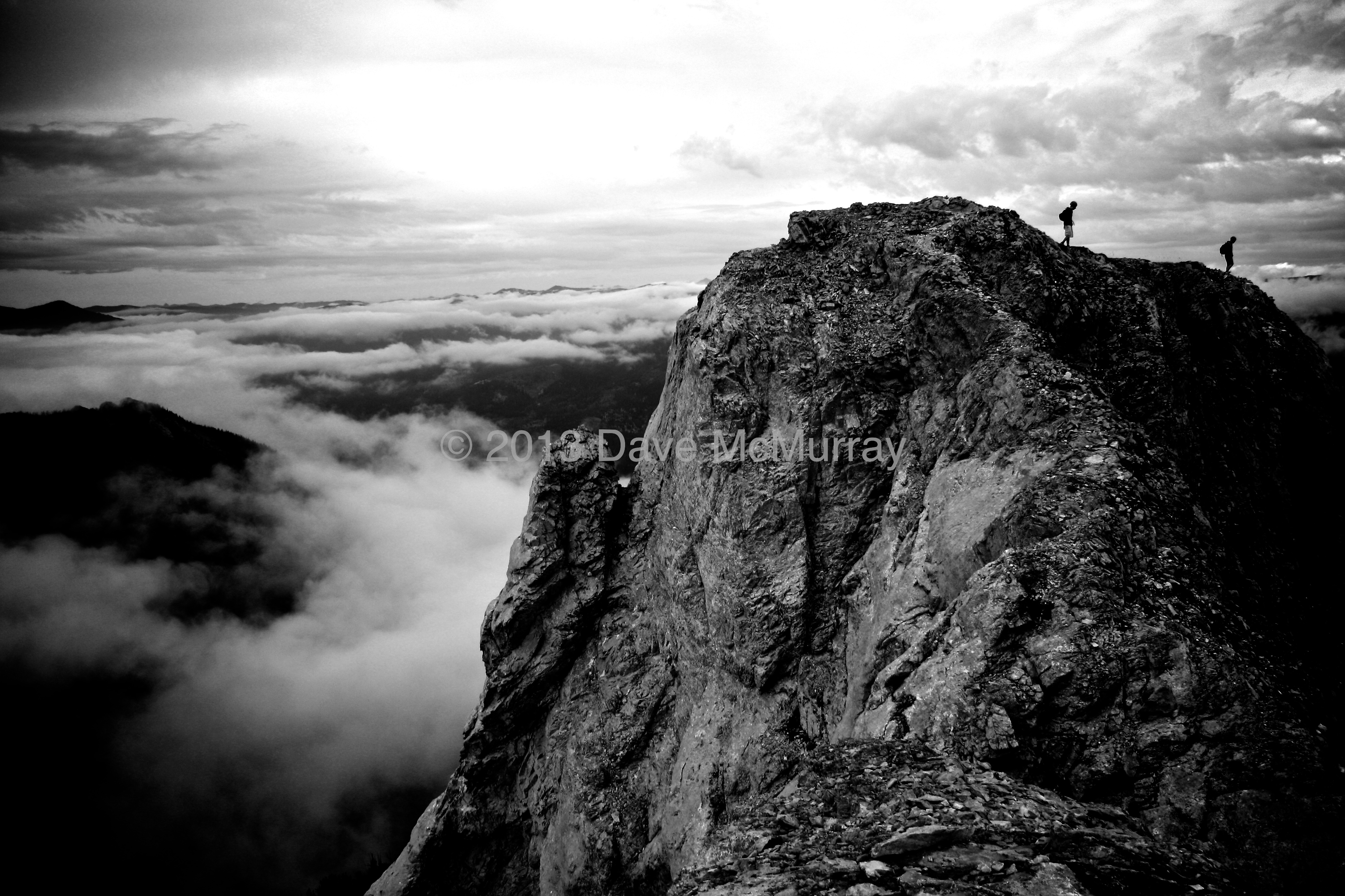
This is one of those places on the ridge where you don’t want to stray too far to either side while walking.

Looking back along the ridge as the boys make their way up.

Joel on the ridge.

We encountered more of the up and down terrain as we drew closer to the high point along the ridge. This was a fun mountain that involved lots of scrambling.
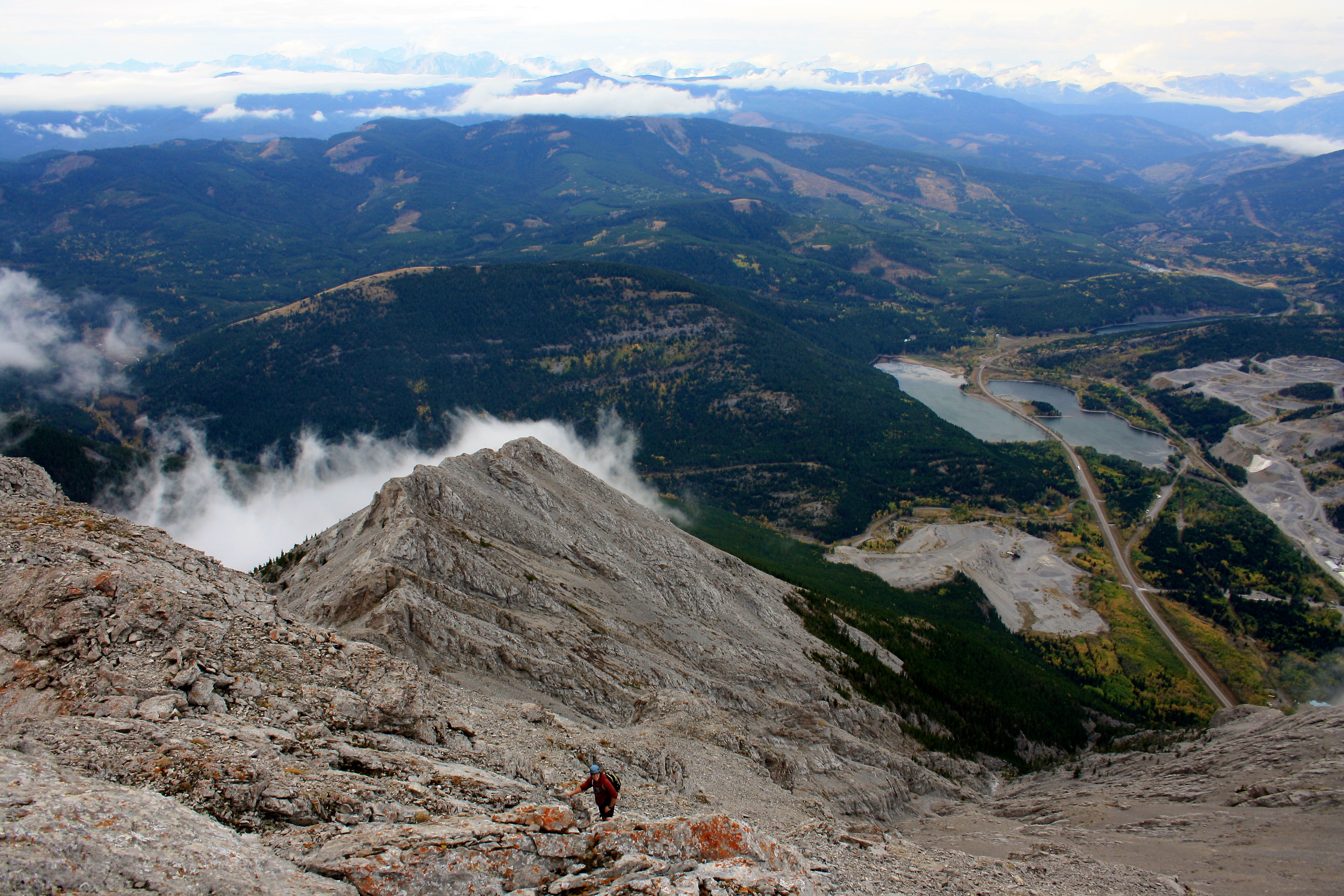
Deric working up to the high point of the ridge. Island Ridge and Loop Ridge are in the background.
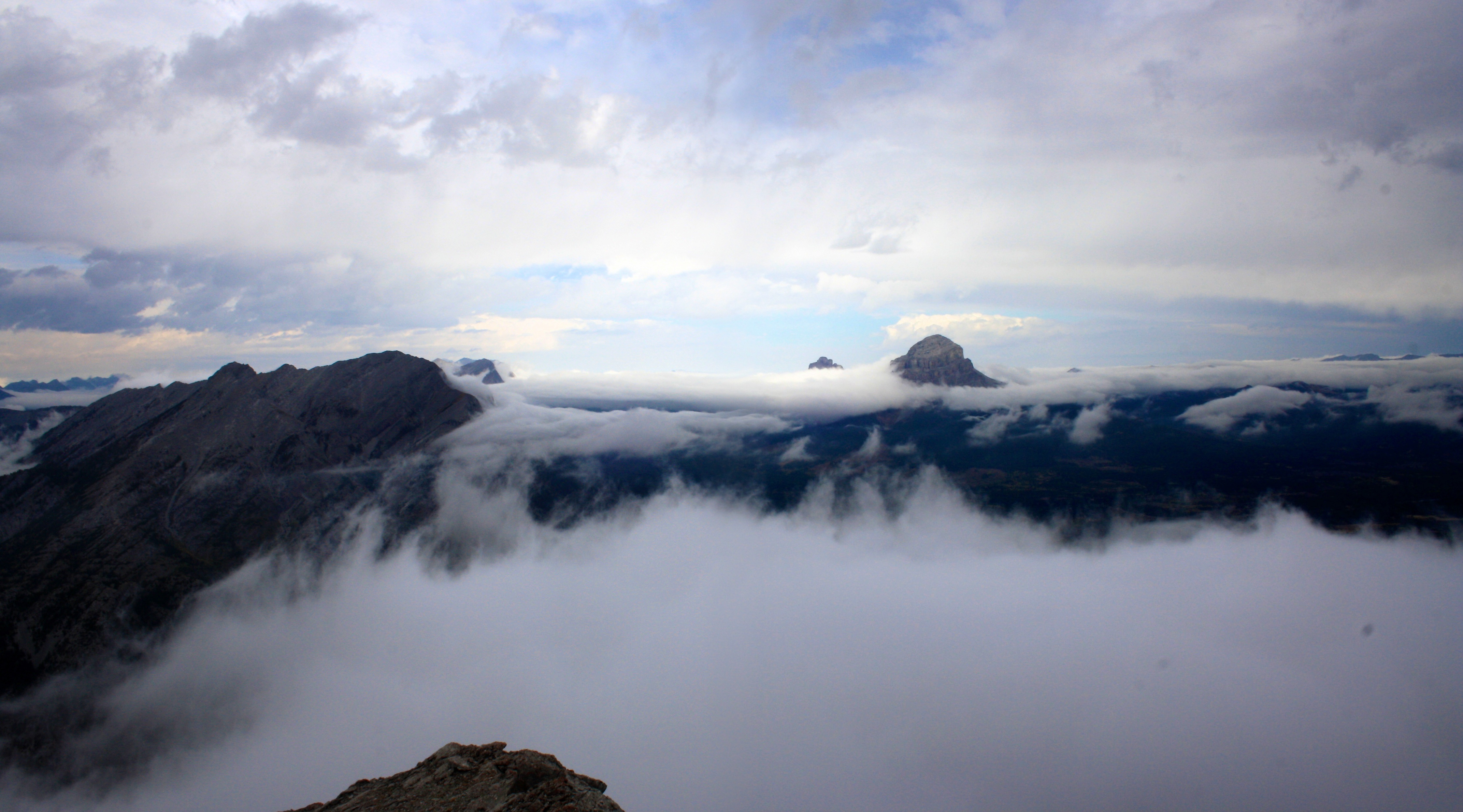
The peak of Crowsnest Mountain pokes through the clouds. Phillipps Peak, Mount Tecumseh and “Deadman Peak” are on the left.

The summit finally comes into view (left) and from here, it was easy to get to. However, the ridge between the false summit and the point where I took this picture was the most difficult scrambling that we encountered. There were a few places of pretty decent exposure and I would not want to be on them during high winds. Chinook Peak is in the middle.

Joel and Deric relax on the summit.

360 Panorama from the summit. It was cloudy in Alberta and sunny in BC.
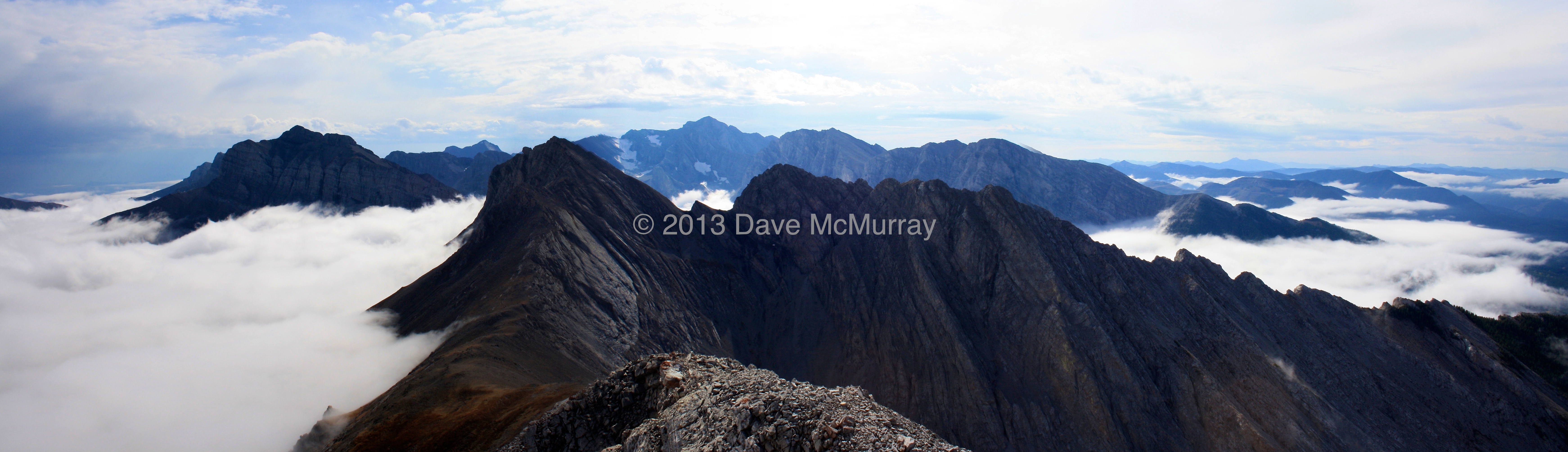
Looking south from the summit. Mount Ptolemy is the tallest peak in the middle and the three peaks that make up the North Ridge of Ptolemy are to its right. Chinook Peak is on the left.

Joel and I on the summit. Mount Erickson is in the background.

Joel on the summit looking south. I think you could walk along the ridge and reach the next peak if you wanted to.

Standing on the summit cairn looking out towards Crowsnest Mountain.

Looking down at Crowsnest Lake with Phillipps Peak and Mount Tecumseh just behind it. Crowsnest Mountain is off in the distance. Ma Butte and McGillivray Ridge are to the right of Crowsnest Mountain.

Looking west into BC.

After enjoying our time on the summit, it was time to head home.

However, going down also meant going up in several places.

One of the hardest parts of the day was trying to cross Crowsnest Creek. The rocks were super slippery and the water was cold.

Sentry Mountain from the northeast at the end of the day. The skyline ridge on the right is what we followed to the summit using Kane’s route. This was yet another enjoyable day spent in the Crowsnest Pass!
Just csme back from that summit.Incedible hike. Weather was superb,no wind.Thanx for shsring your experience!
Great to hear Edwardo and congrats on reaching the summit! That’s a fun scramble!