
⚠️ Hiking and scrambling are inherently dangerous activities. Please read my Disclaimer. ⚠️
While the Castle is known for its variety of fun scrambles, it also offers a number of less intense hikes to interesting destinations. These are the trips that I love to do in the winter, early spring, and late fall. In the Carbondale River / Adanac Road area there are 7 named summits to choose from (Carbondale Hill, Cherry Hill, Maverick Hill, Poker Peak, Clubs Peak, Spades Peak, and Ginger Hill), and an energetic hiker could realistically ascend several of these mini mountains in one day.
My original plan was to knock off Maverick Hill and then walk north along the Adanac Ridge to revisit Poker Peak. From there I would descend to the Adanac Road and use my bike to reach nearby Clubs Peak and Spades Peak on Hastings Ridge. This is a really viable route to ascend 4 peaks in one shot, but my plan was thwarted by snow (and the presence of a rather large animal) while I was on my way over to Clubs Peak. Fortunately, there was a backup plan and that was Cherry Hill – so I still walked away from the day with 3 summits under my belt.
Edit 1 November 2016: I finally returned to complete both Clubs Peak and Spades Peak.
Joining me on the trip up Maverick Hill (or more correctly, I was joining them) was my friend Brad, his wife Raquel, and their daughter, Maria. Also with us was my friend Charlie, who had recently moved to Lethbridge. Charlie’s an avid hiker too, and he took a detour from his planned trip to Calgary to join us for this short excursion – and we’re glad he did!

Maverick Hill, Poker Peak, Clubs Peak, and Spades Peak are readily accessed from the Adanac Road (which is Canada spelled backwards). Not knowing if the road would be free of snow from the Hillcrest side, we decided to approach it from the east using Township Road 64A. From Lethbridge we drove west on Highway 3 until we came to Highway 507. Here we turned left and headed south towards Beaver Mines for ~8.8km until we came to Township Road 64A, where we turned right. We followed this scenic, gravel road for ~14.1km until we came to the Adanac Road junction. This is where we turned right onto Adanac Road and followed it north for ~2.8km until we came to the trailhead.
Since I was the only one who planned to continue on from Maverick Hill to Poker Peak, I drove another ~2.4km past the trailhead and stashed my bike in the trees beneath Poker Peak. My plan was to then bike to Clubs Peak and Spades Peak and return downhill to my vehicle.
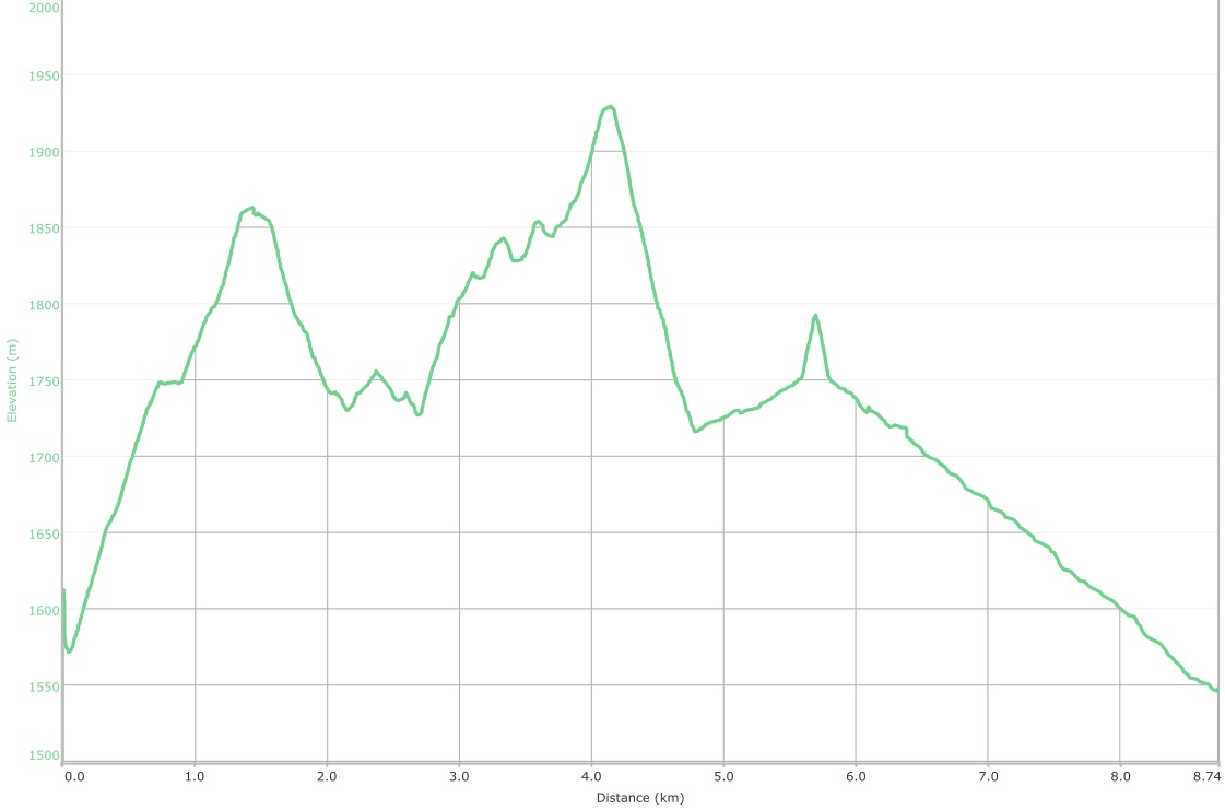
It took us only 44 minutes to hike the ~1.4km to summit of Maverick Hill. My solo trip along the ridge to Poker Peak (1935m) was ~2.7km in length and took me 1 hour and 6 minutes. Including my brief excursion to try and reach Clubs Peak, my combined time was 2 hours and 52 minutes with a distance was 8.7km. If I include my third summit of the day, Cherry Hill (not shown on the graph), my total hiking distance for the day was 14.3km with total elevation gains of 1052m, and a total time of 5 hours and 23 minutes.

A topo map of the area. The northwestern slopes of Ginger Hill can be reached from the Castle PLUZ, however the summit lies on a crown lease and the areas directly to the west and to the east are all on private land. Permission should be sought from the lease holder prior to ascending as there are numerous ‘No Trespassing’ signs along Township Road 64A.

Our little group starts out from our parking spot on Adanac Road. Charlie also brought his dog, Hailey.

A faint trail leads up from the road through the opening in trees in the centre.
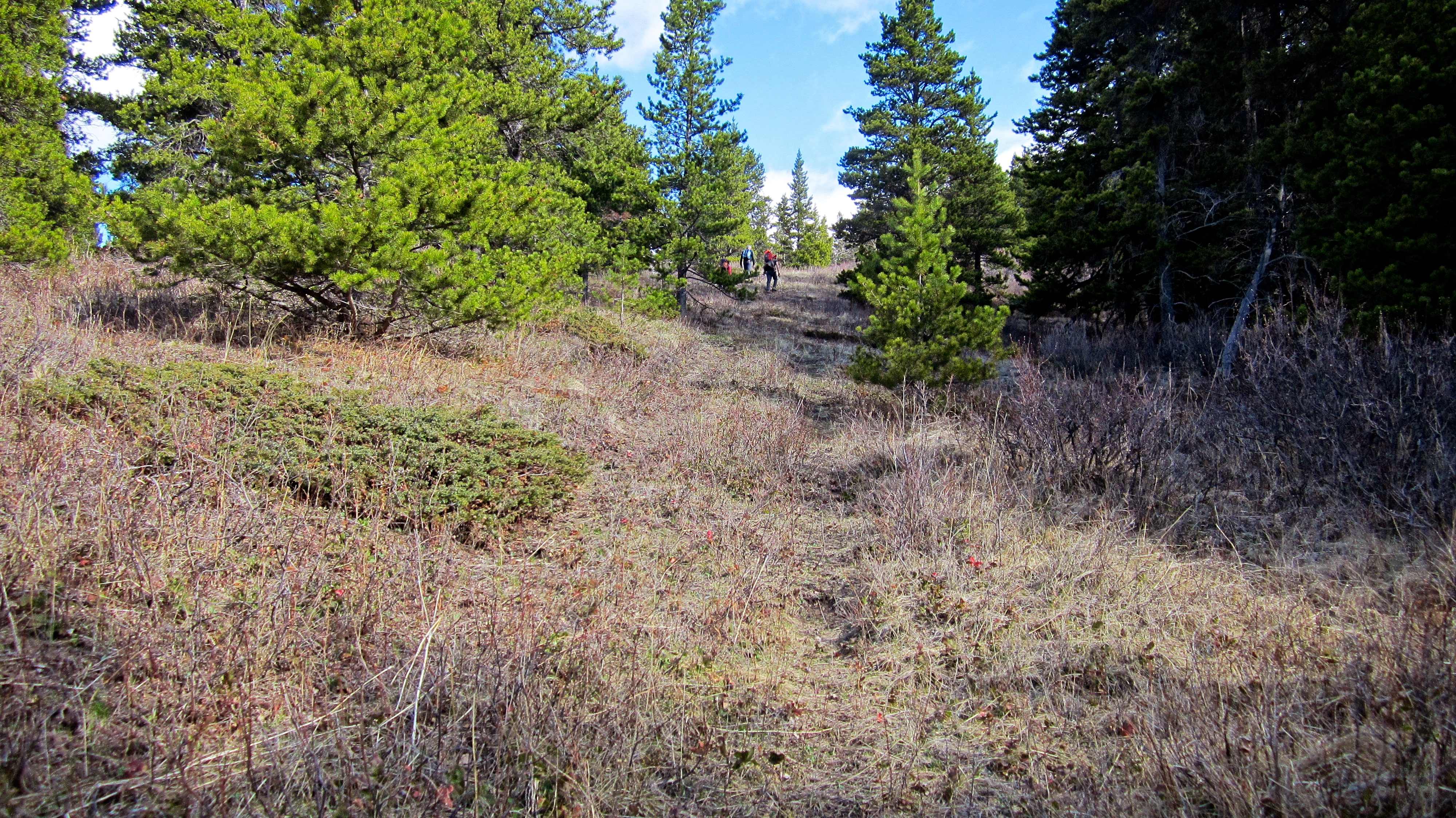
The trail became more defined once we were in the trees.

We followed the trail across open meadows. The trail would disappear once we reached the trees in the distance, but numerous animal trails provided easy access to the ridge crest.
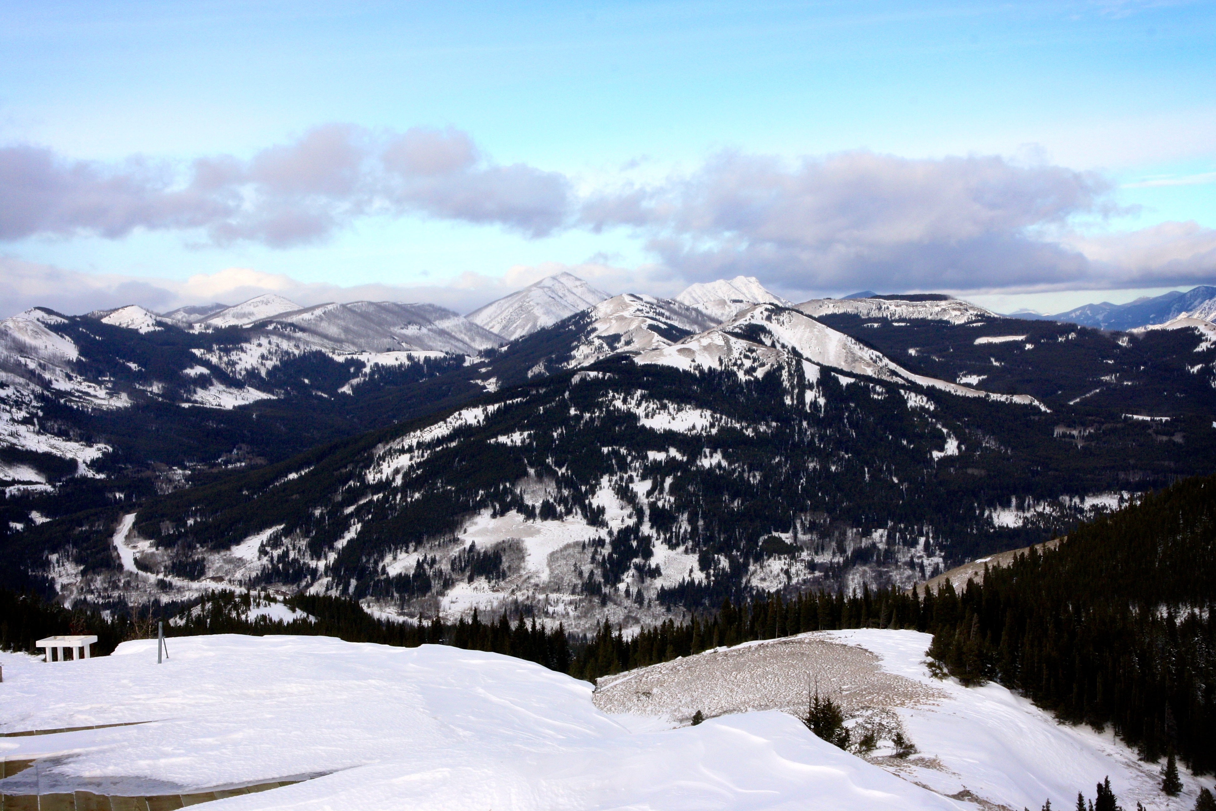
The meadows offered some nice views to the southwest. From left to right: Southfork Mountain, Mount Haig, Gravenstafel Ridge, Syncline Mountain, and Mount McCarty.

Charlie hikes towards the crest of the ridge. The summit of Maverick Hill is in the distance.
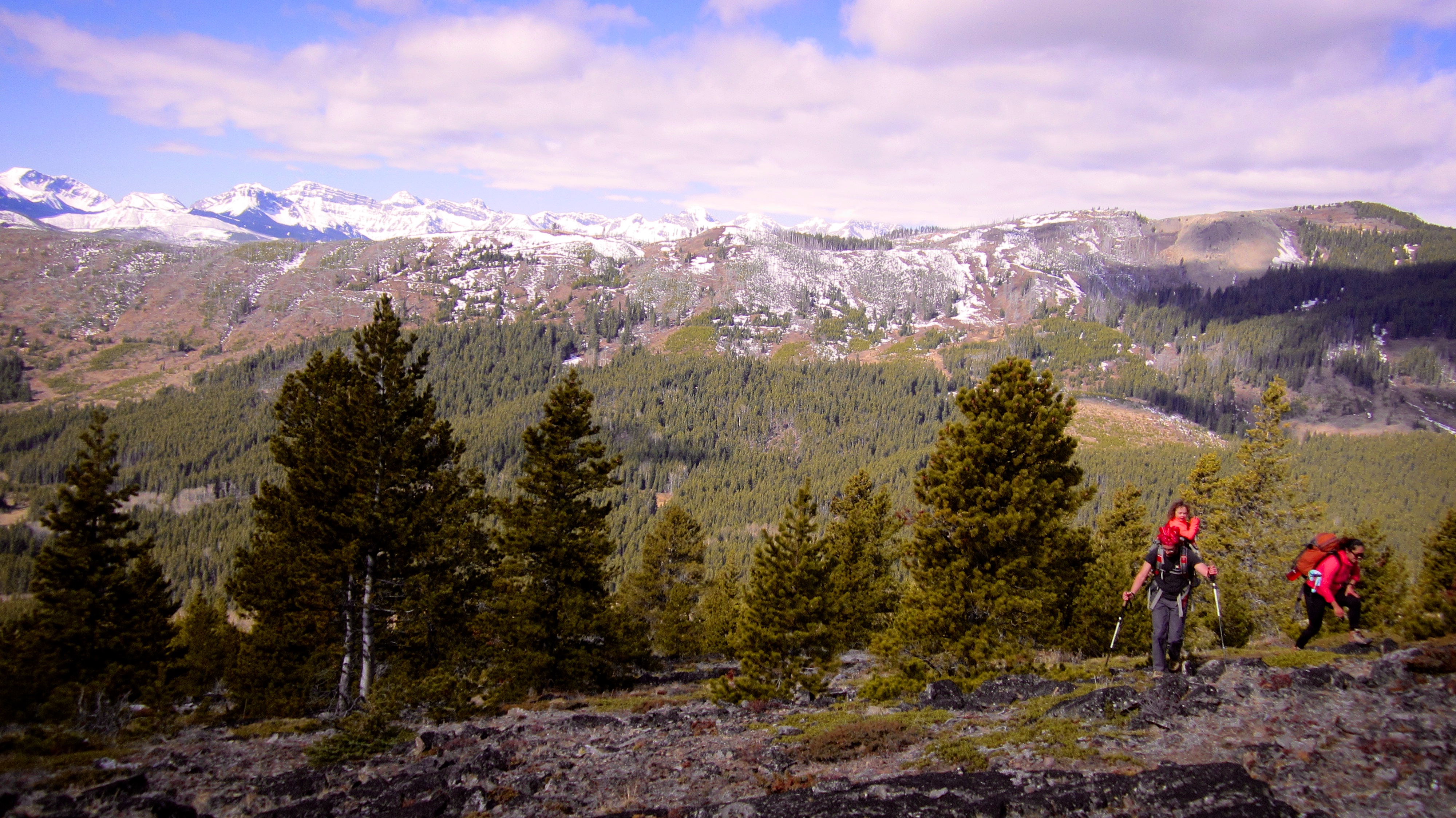
Hastings Ridge rises behind Brad, Raquel, and Maria as they make their way onto Adanac Ridge.
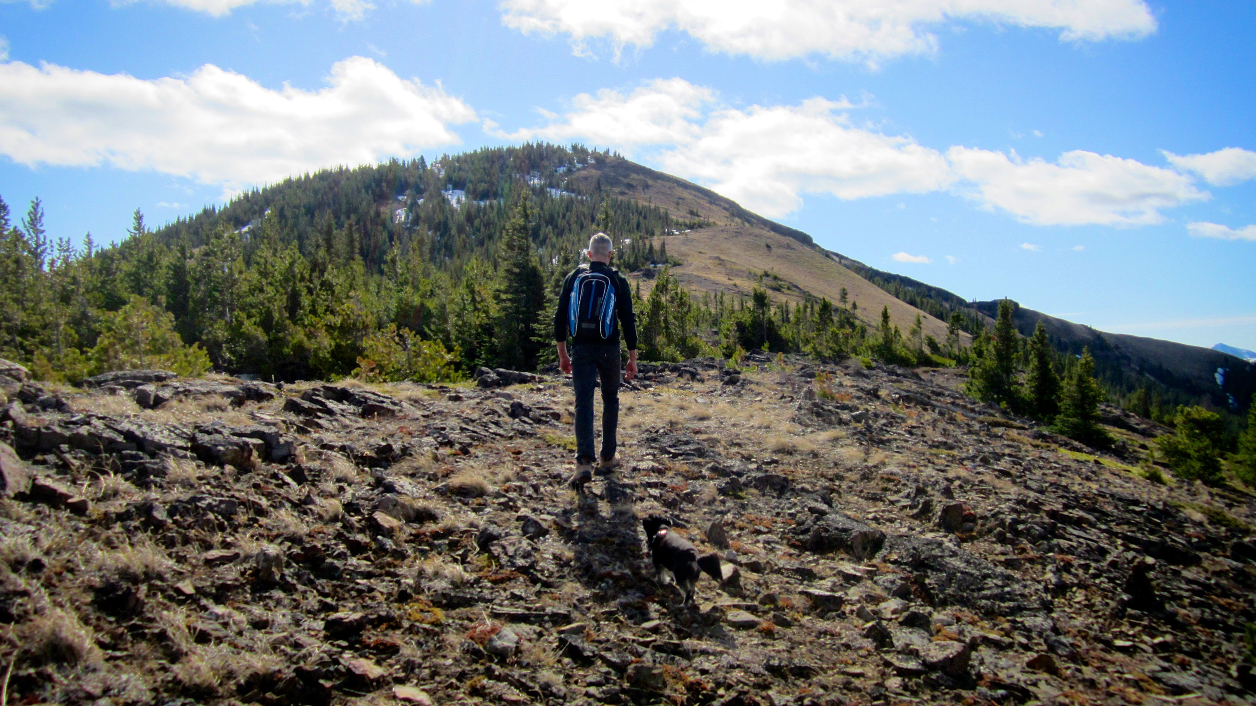
On the ridge and heading towards the summit.

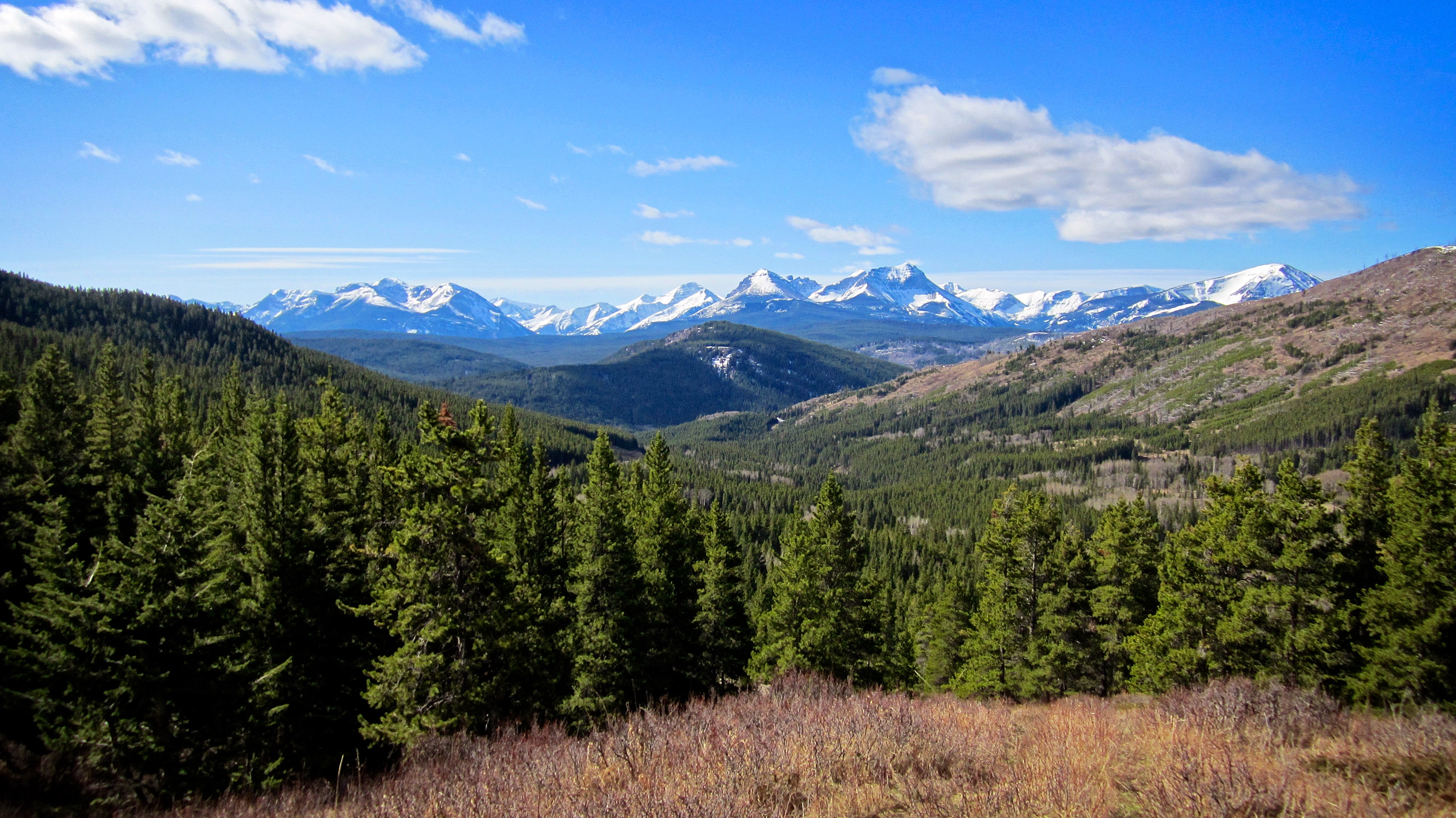
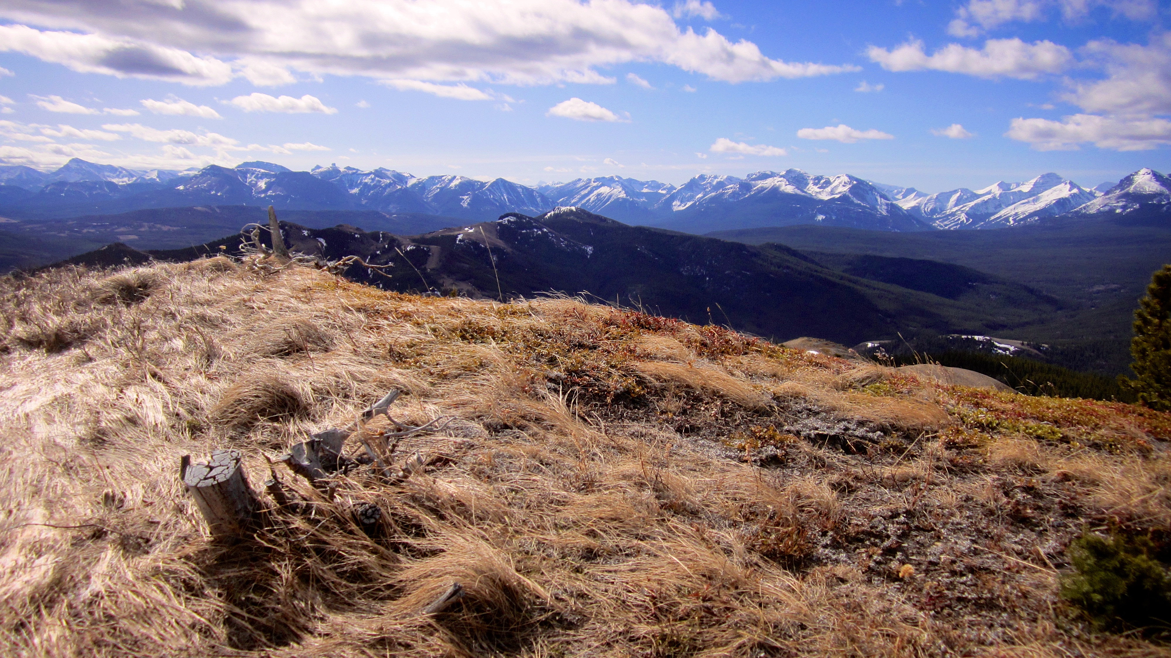
A pano of the Flathead Range from the ridge.

Open slopes made for easy travel. Most people carry gear, clothes, and food in their backpacks – Brad carries humans.

Poker Peak provides the backdrop as Charlie, Brad, Raquel, and Maria hike towards the summit.
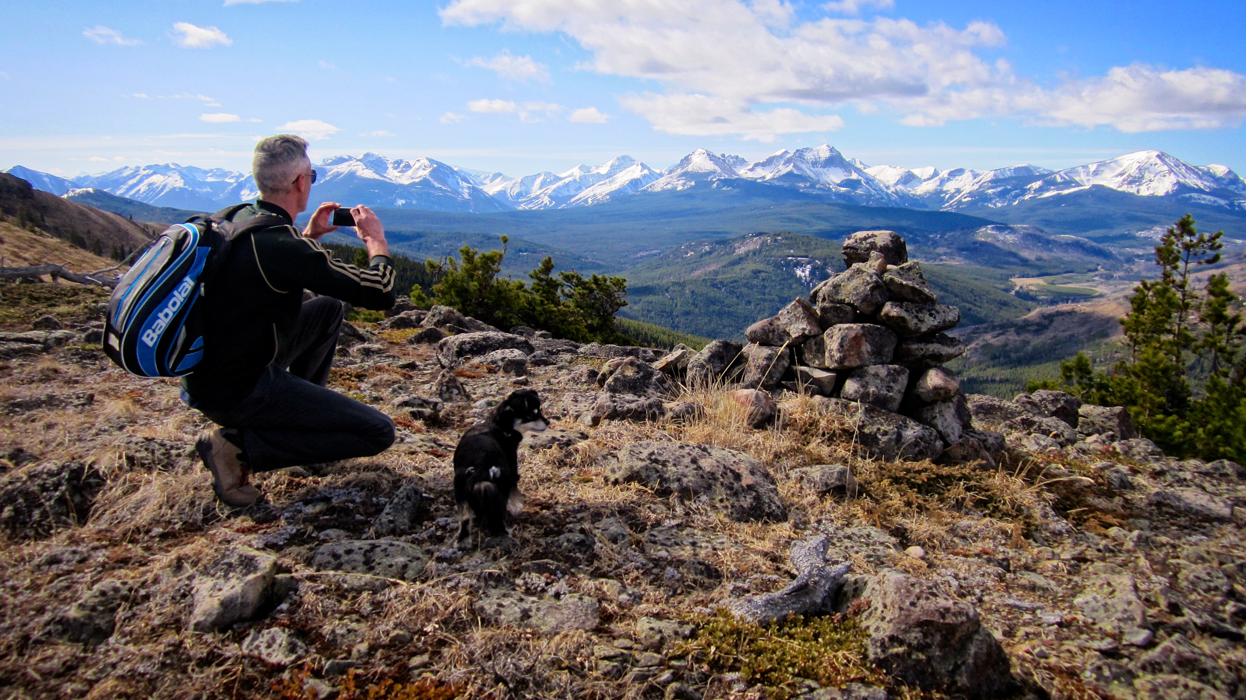
Charlie (and Hailey) pause to take a picture of a cairn located along the ridge.

Clubs Peak is in the background on the right.
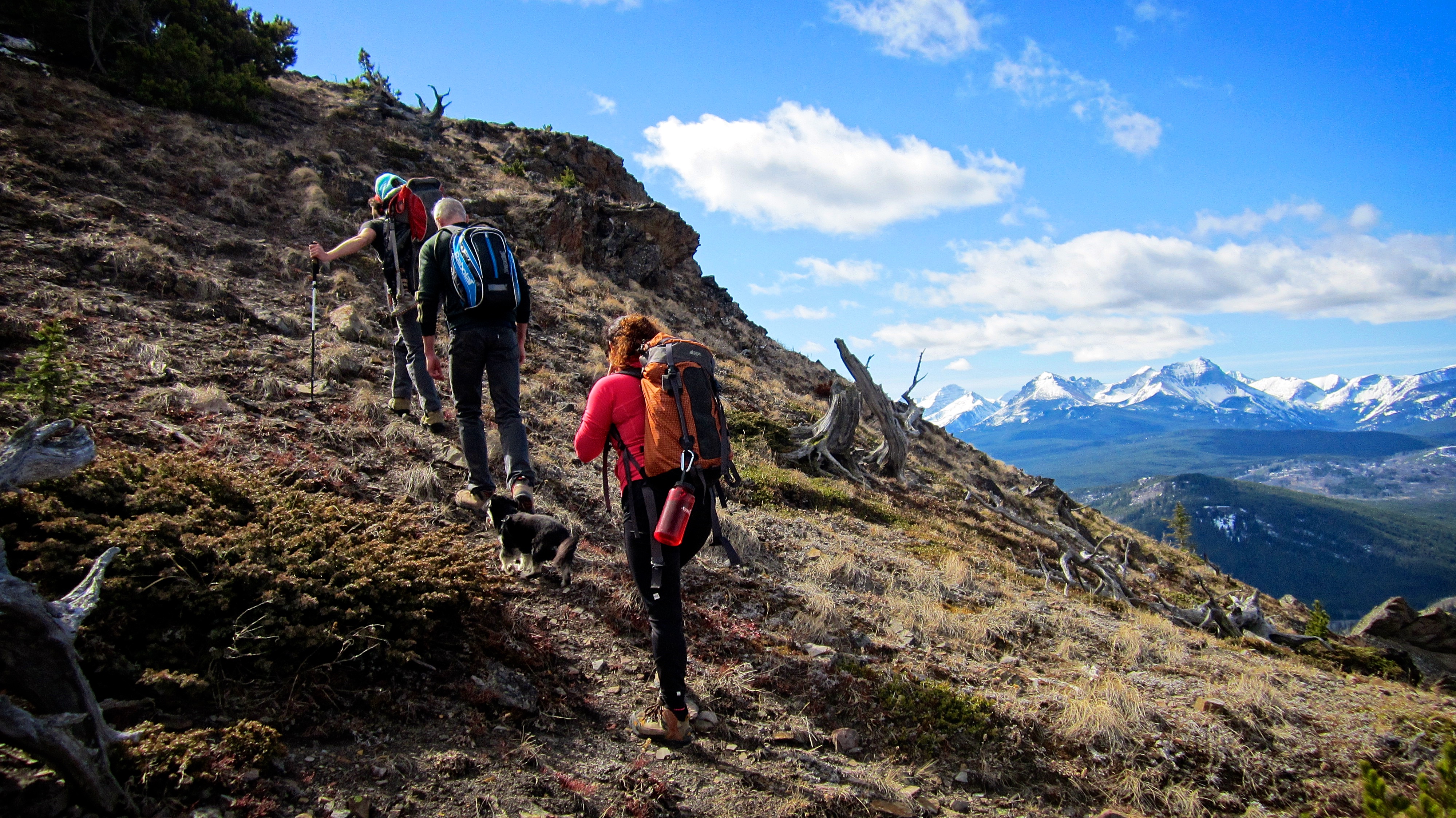
We found a trail that bypassed the bluffs beneath the summit.
The summit of Maverick Hill (1875m).

A summit pano to the west highlights the Flathead Range.

A pano to the south shows off the front range mountains of the Castle.

Looking north at my next destination for the day, Poker Peak (1935m).

Charlie and Hailey admire the views.

A telephoto of Syncline Mountain.

A telephoto of Mount McCarty.

Southfork Mountain (left), Mount Haig, and Gravenstafel Ridge.

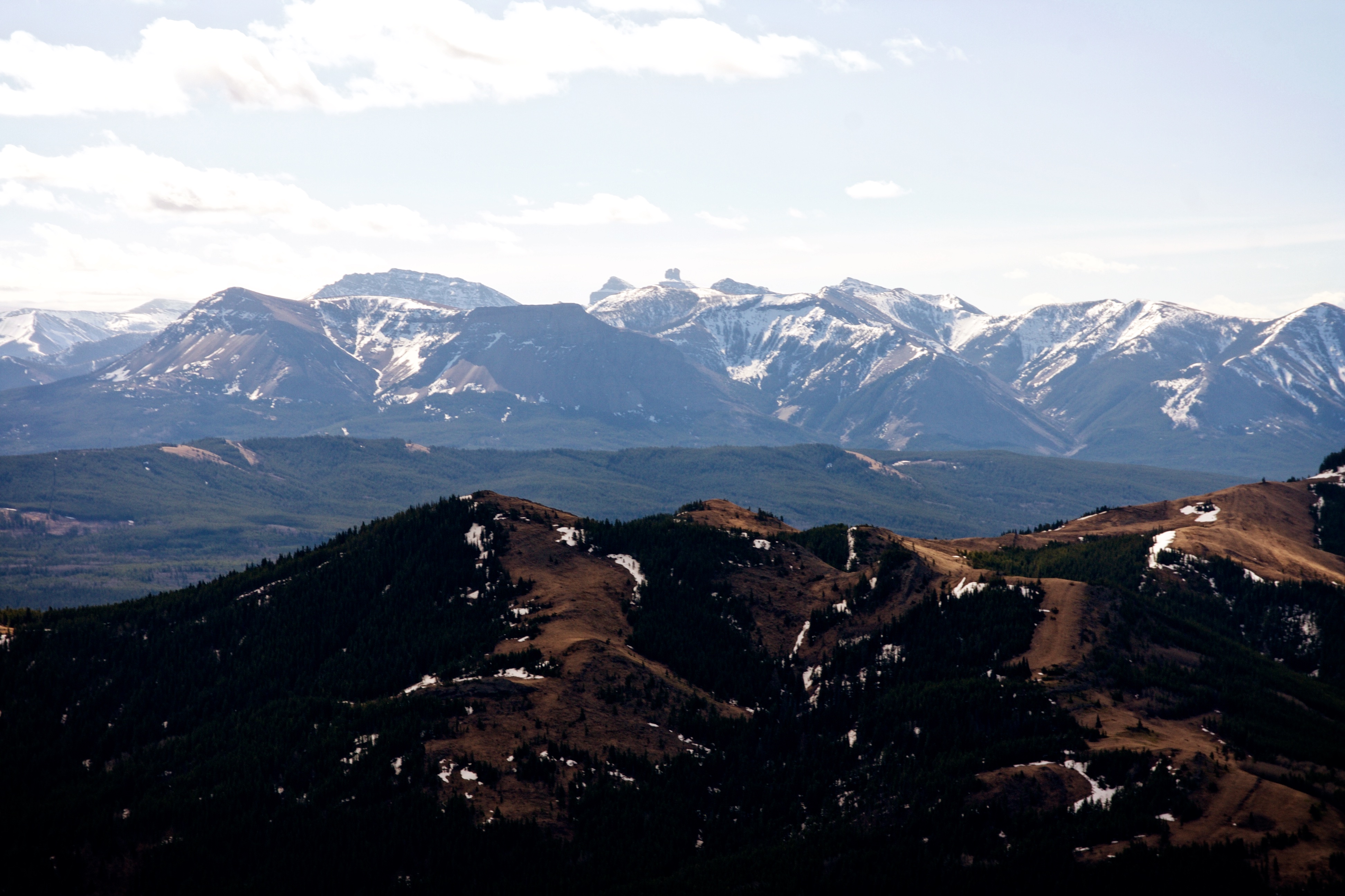
The fire lookout on the summit of Carbondale Hill can be seen in the foreground. In the distance to the left of centre is Whistler Mountain and to the right of centre is Lys Ridge.

Looking east from the summit. From left to right: Mount Baldy, Mount Albert, Mount Backus, and Prairie Bluff Mountain.

Looking southeast at the front range of the Castle. From left to right: Prairie Bluff, Pincher Ridge, Victoria Peak, and Table Mountain.
The view south includes Table Mountain, Mount Gladstone, Windsor Mountain, Castle Peak, ‘Table Top’, ‘Eagle Peak’, Whistler Mountain, and the Whistler Fire Lookout.
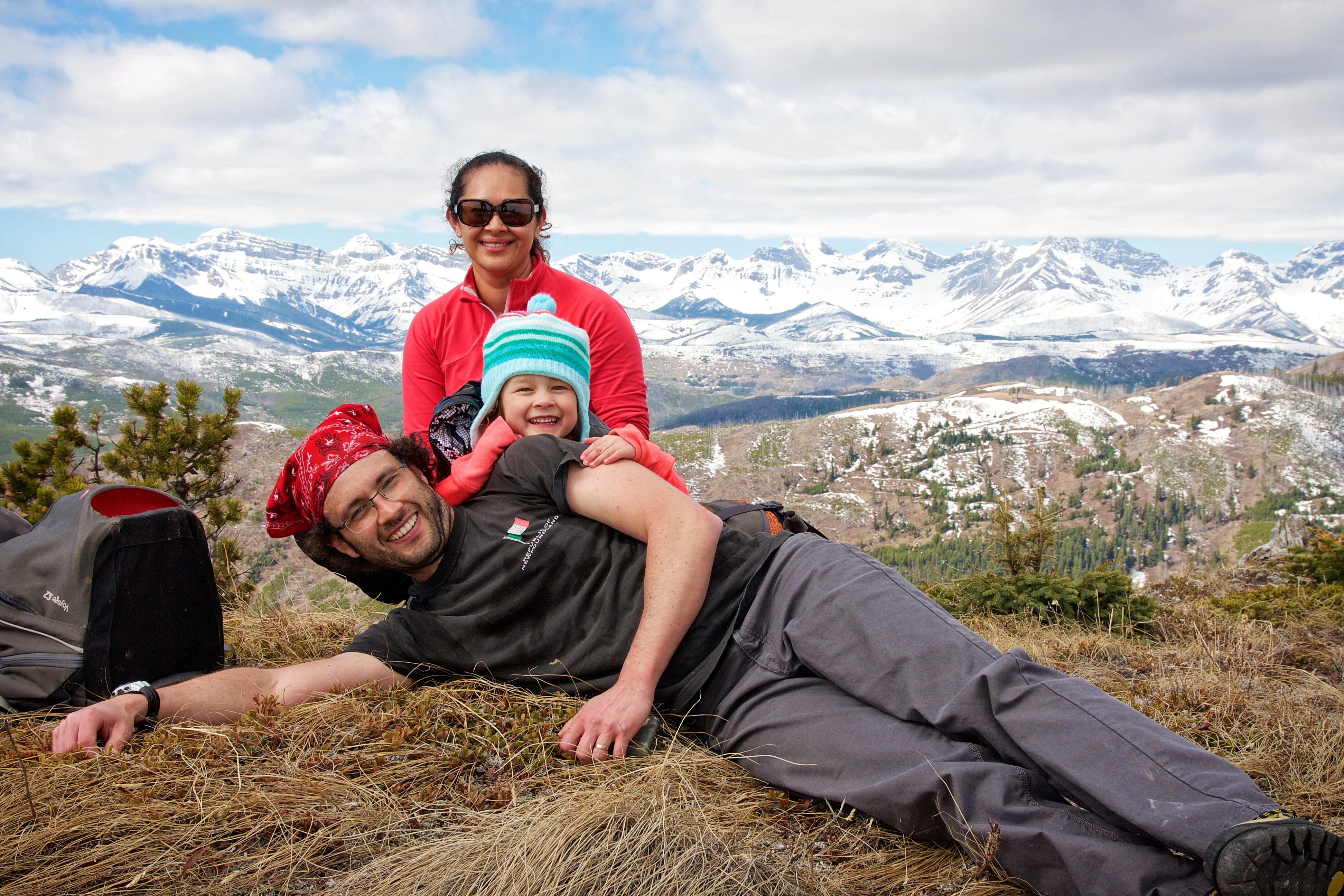
Raquel, Maria, and Brad on the summit of Maverick Hill. This is the 12th summit that little Maria has been on! She loves to hike with mom and dad.
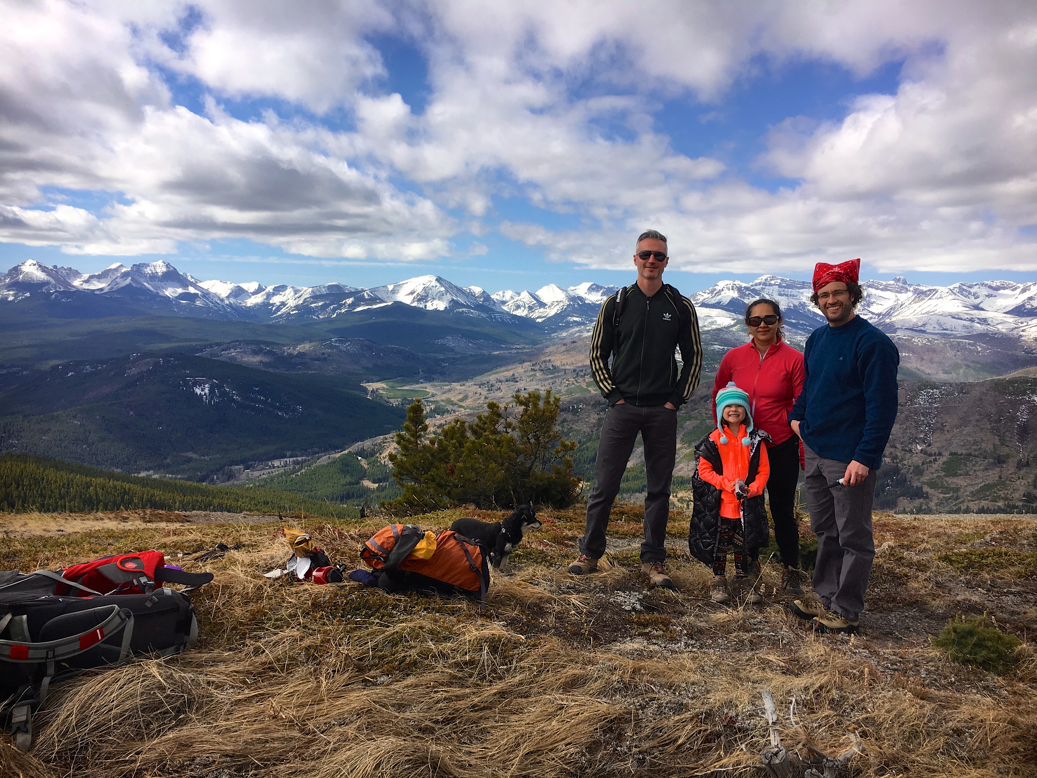
Another group shot on the summit.
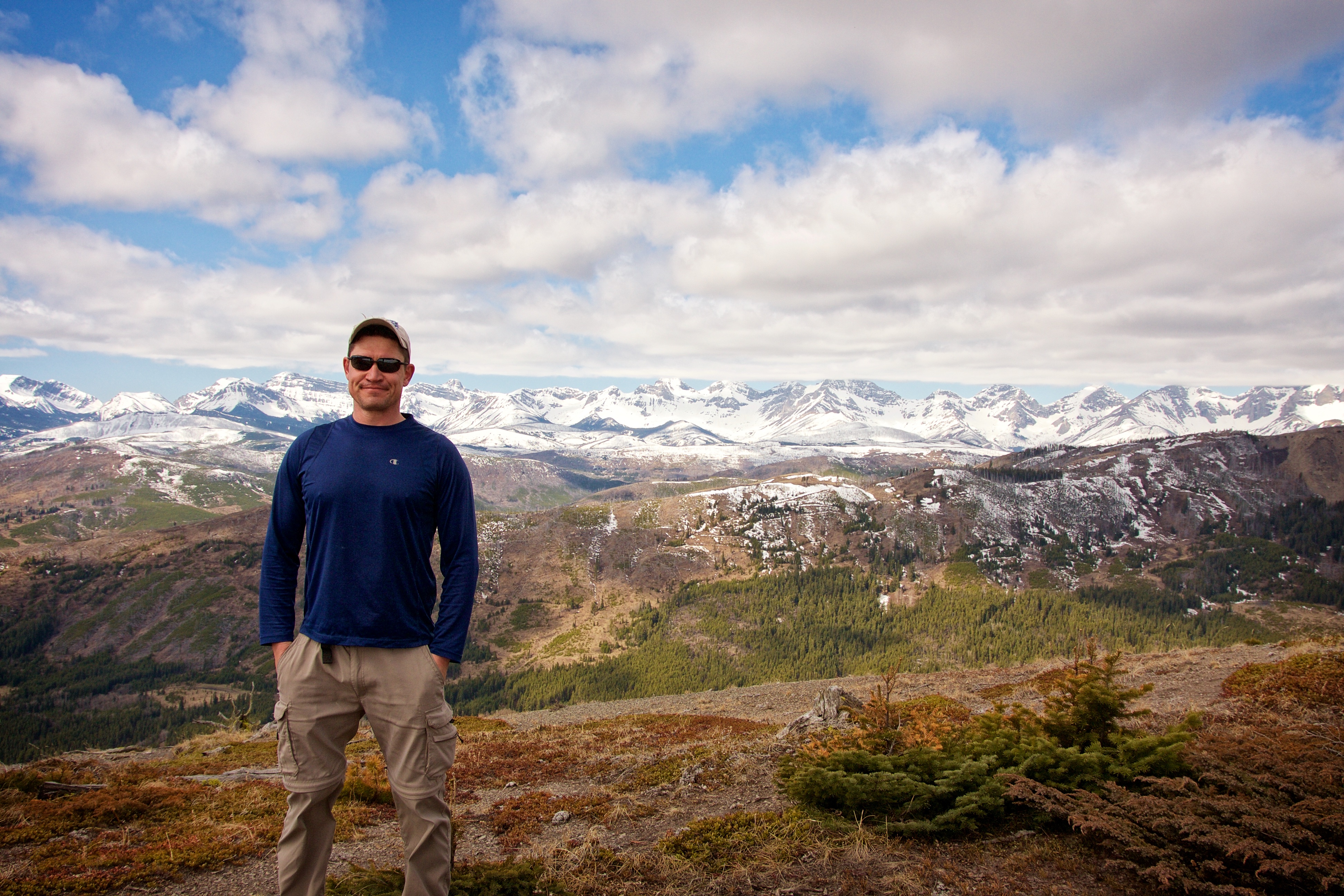
Me on the summit of Maverick Hill. It was a beautiful day for a hike!

One final pano to the west. Cherry Hill is barely discernible in the centre.

This is where I said goodbye to the group and continued on by myself to once again tag Poker Peak. Charlie had to drive to Calgary to visit a friend and Brad, Raquel, and Maria would descend to enjoy a leisurely lunch. I would rejoin them later in the day to climb Cherry Hill. Click to see my trip report for Poker Peak.
Great entry Dave! You really captured the day.
Thanks Charlie! Glad you could join us. The first of many more.