
⚠️ Hiking and scrambling are inherently dangerous activities. Please read my Disclaimer. ⚠️
After summiting West Castle, Andrew Nugara, Jollin Charest, and I continued our traverse of Lys Ridge with the goal of reaching the summit which lay 6.3km to the south (note: Rick Collier referred to it as Lys Peak in Bivouac). Not being sure if the yellow peak we were standing on was actually the summit of West Castle, we enjoyed a moderate scramble to the top of a peak ~470m to the south, where we briefly celebrated thinking that because of its proximity and because it was ~7m higher, it might be the summit of West Castle. After rechecking the topo map, we concluded that the yellow peak was indeed West Castle, but no worries, we had knocked them both off. On my GPS, I ended up calling this little peak “West Castle 2”, but that’s just for information purposes and not because I’m trying to claim another summit.
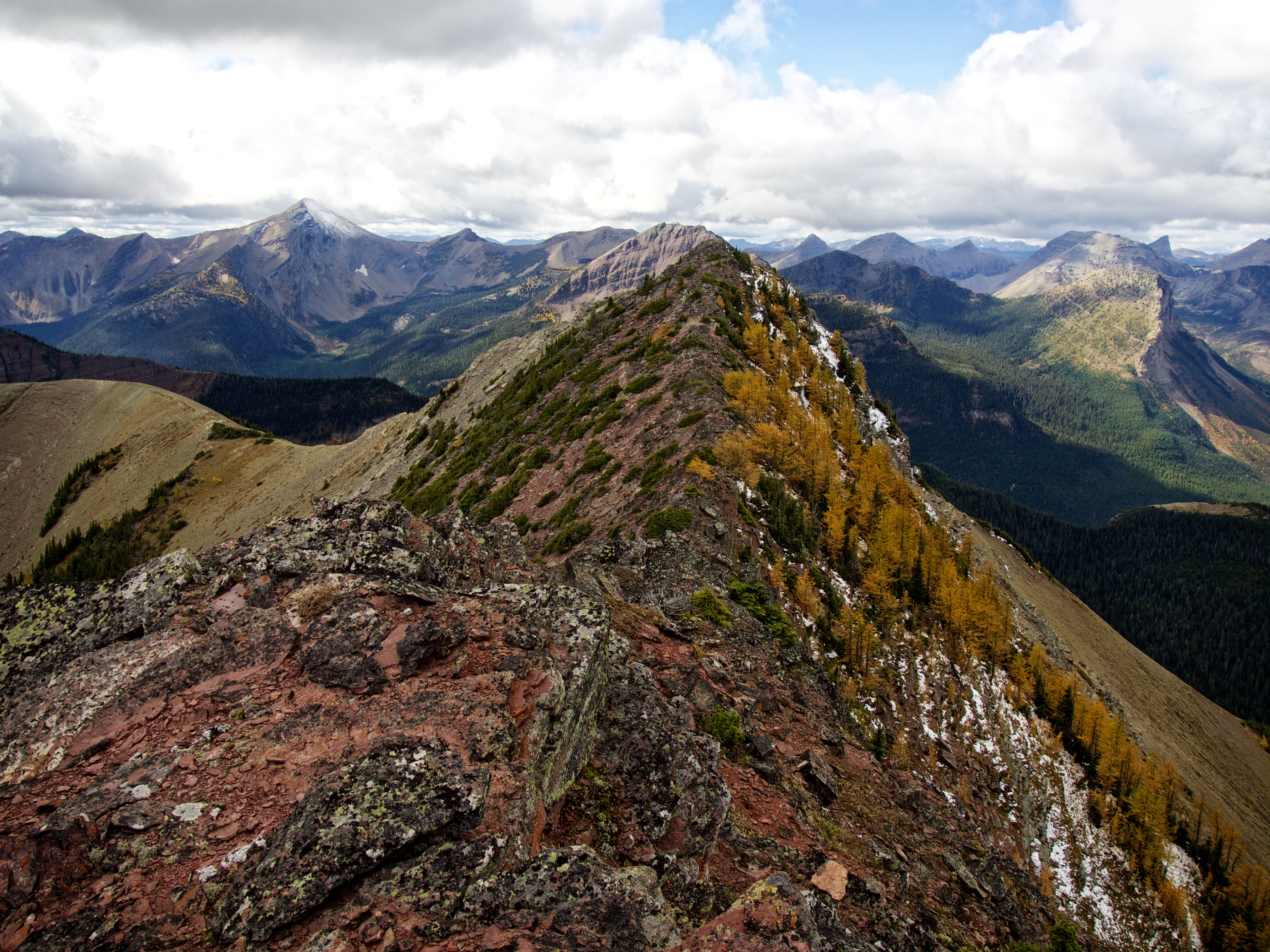
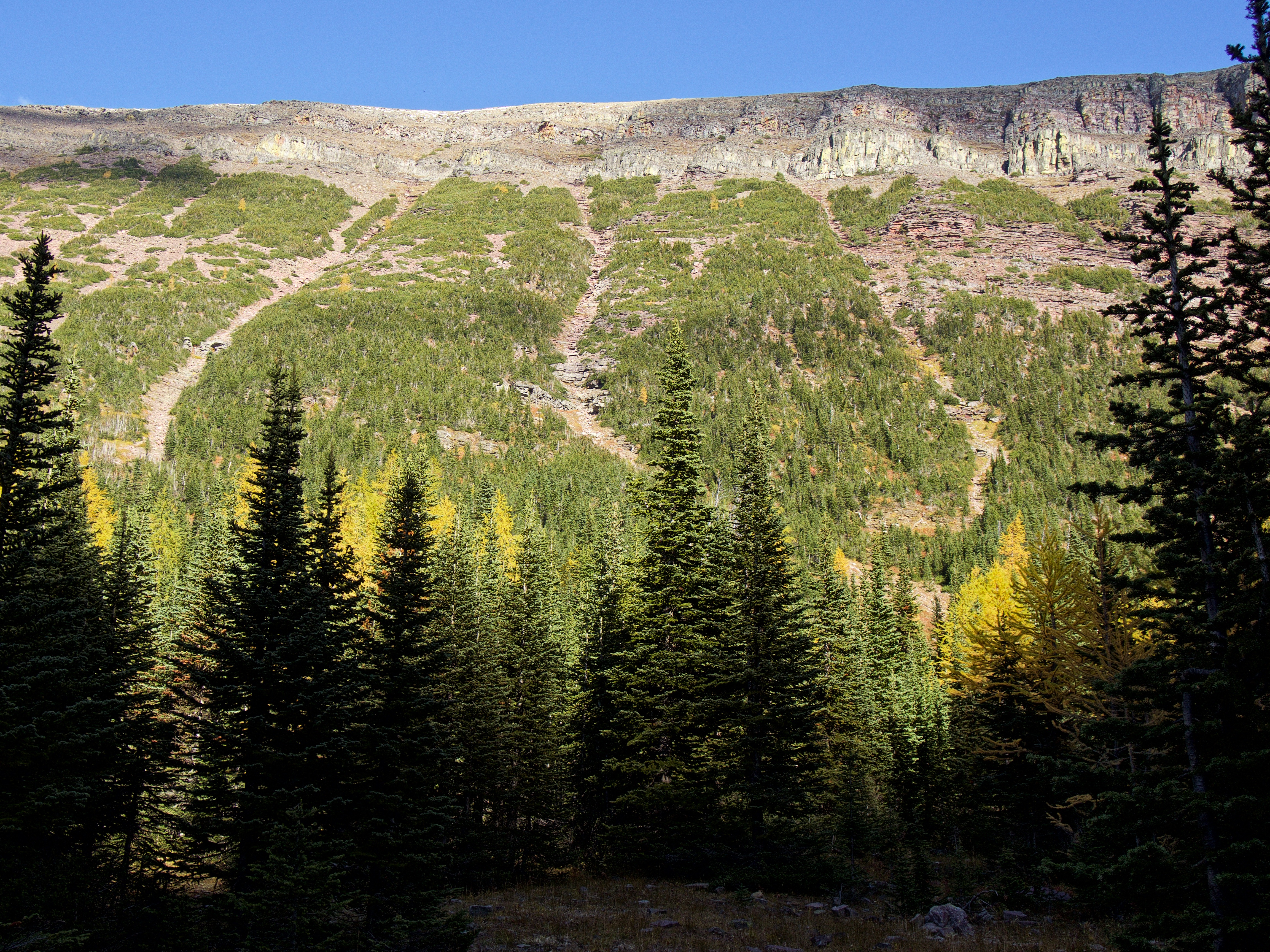
As I mentioned in the West Castle post, this is an incredible ridge walk. Indeed, Andrew said it was perhaps the best one that he’d ever been on in southern Alberta, including anything in Waterton. The varied terrain combined with fantastic scenery definitely kept our attention throughout the day. Despite its length, I really think that the best time of year to do this trip is in the fall after the larches have turned yellow. They just added so much extra colour to an already vibrant landscape. It really was an immersive experience.
All three of us wondered how Lys Ridge got its name and Jollin speculated that perhaps it came from Fluor de Lys which made sense given the shape of its southern end. However, after doing some searching I discovered that it was named in 1917 after the Lys River which flows through the town of Armentieres in France. It was in the Armentieres sector in early 1915, that members of the 1st Canadian Division took over a section of the front line after a brief training in trench warfare by British troops. As noted by Veterans Affairs Canada, it was here when “faced with the realities of dirt, disease and death, their illusions of military glory quickly disappeared.” Thus, like other peaks in the area (e.g. Gravenstafel Ridge, Jutland, and St. Eloi), Lys Ridge is a memorial to Canada’s participation in WW1.
Click to read Andrew’s trip report

As wonderful of a ridge walk as it is, make no mistake, this is a long trip. From our vehicle to the summit of Lys Ridge, it was 11km. Then our descent from Lys Ridge to Ruby Lake and then out the Grizzly Lake/ Ruby Lake trail was another 17km. Rick Collier had previously ascended Lys Ridge from Ruby Lake using a red argillite gully. This is what we would use as our descent route and it worked really well. After spending a few moments admiring the shoreline of Ruby Lake, we picked up the trail and followed it all the way back to the South Castle Road. Whoever maintains this trail has my thanks because it is in amazing condition. After reaching the South Castle Road, we still had to walk another 2km to reach Andrew’s car.

The trip from West Castle to the summit of Lys Ridge is ~6.3km in length and requires moderate scrambling in some sections. Most notable is the section between West Castle and “West Castle 2” as well as the section on the north side of the saddle that is found prior to the reaching the summit plateau. It was here that our progress along the ridge crest was halted by an impassable cliff band. We were forced to descend to the southeast and search for a weakness that we could exploit. We ended up downclimbing a section of rock that I would rate as difficult, however, by continuing to descend further to the southeast, it looked like we could have found a much easier route though the rock but it would have required losing more elevation.

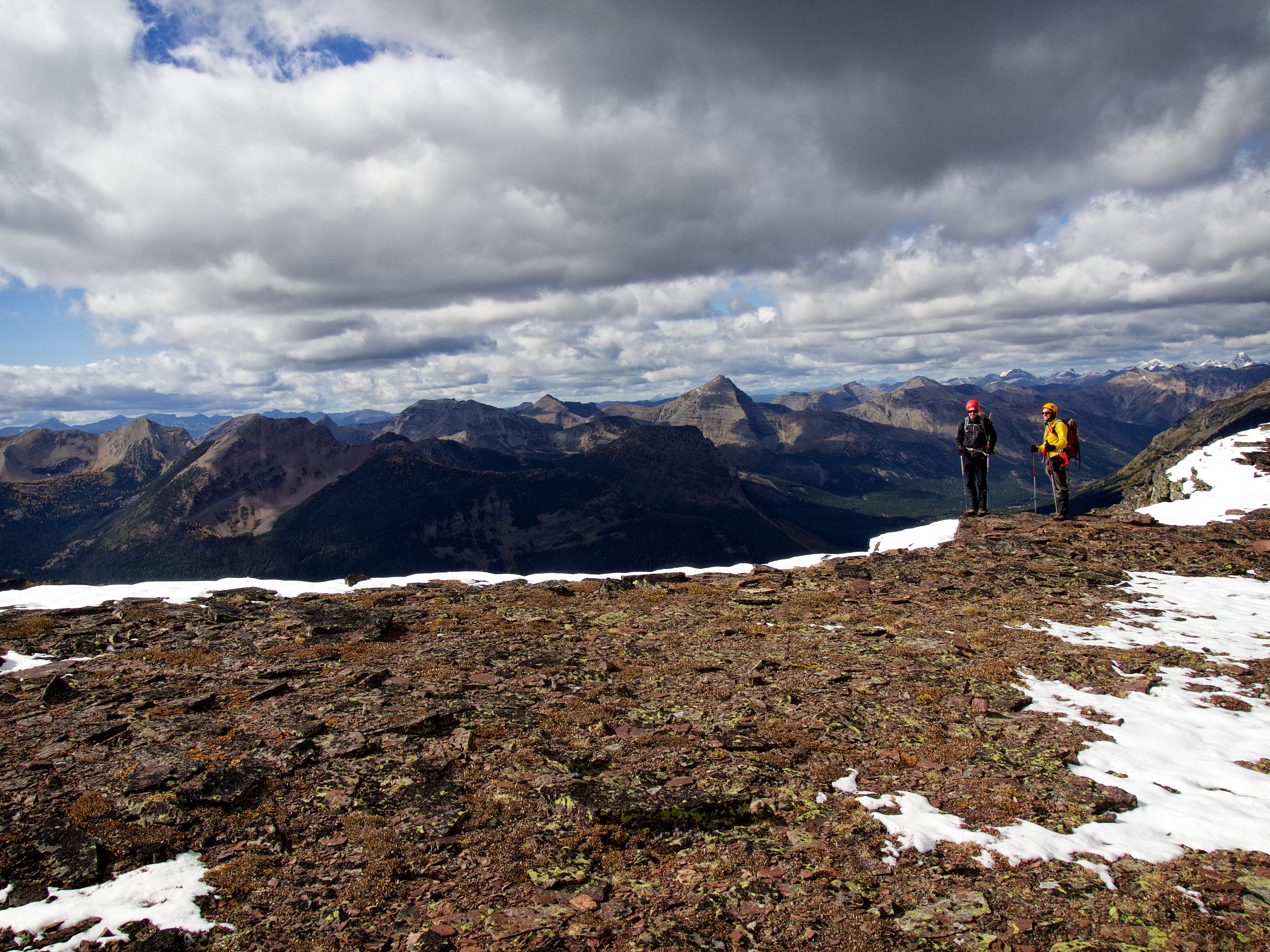
About ~2km before the summit, the ridge becomes more like a plateau, and it was here that we were treated to awesome views of Grizzly Lake, Ruby Lake, Lys Lake, and North Scarpe Lake. We could even see South Scarpe Lake which is nestled beneath the summit of nearby Jutland Mountain.
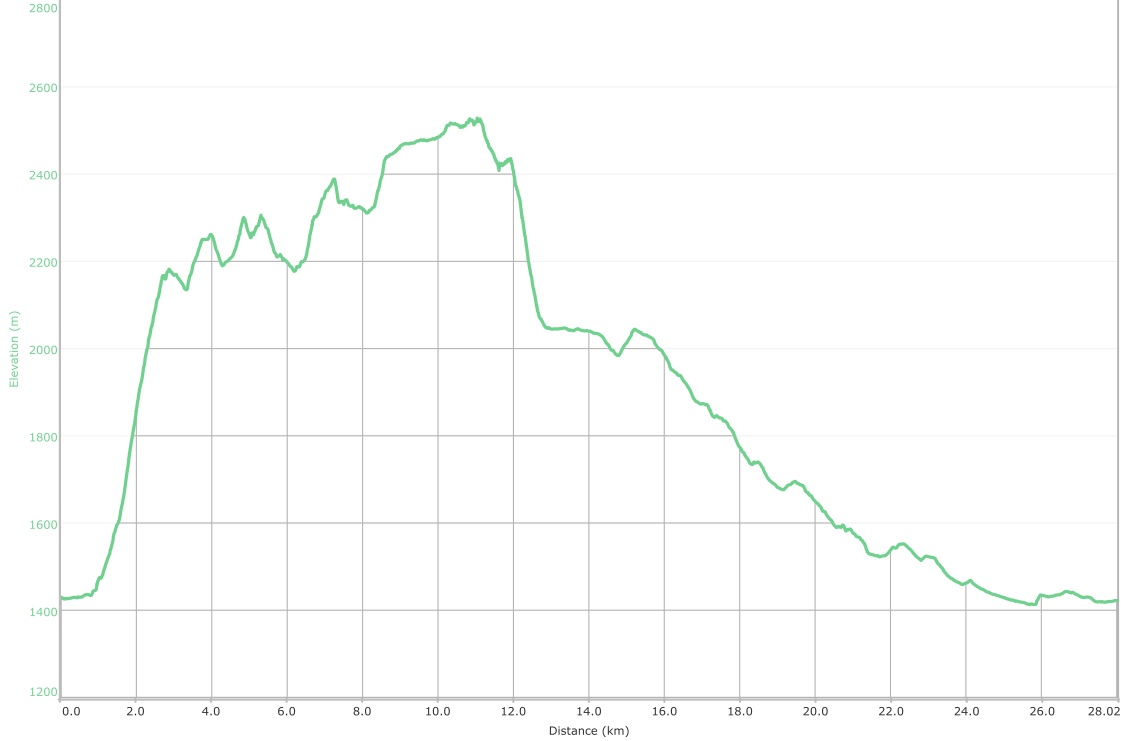
A graph of our entire traverse of Lys Ridge. West Castle is identified as the 1st of twin points at about the 5km mark. The summit of Lys Ridge is the highest point on the graph at the 11km mark. Our distance travelled for the entire trip was 28km with a total time of 12 hours and 26 minutes. Total ascent elevation came in at 1764m.
Edit 24 October 2016: Vern Dewit from explor8ion.com recently completed this trip using our route and came back with different GPS readings. His total trip length was 24km with total elevation gains of 1500M. He also completed the trip in 11 hours. When we made the trip, all 3 of us had wildly different GPS readings throughout the day and the only measure of agreement between the 3 devices occurred on the summit of Lys Peak. So it is entirely possible that my GPS was playing games so please go and read Vern’s report.
Edit 3 July 2017: Edit (3 July 2017): After recently traversing from Southfork Mountain to Grizzly Lake, I believe that it would be possible to combine Lys Ridge and Barnaby Ridge as part of a scenic multi-day loop. Due to the scrambling section on the south end of Barnaby Ridge, I would recommend that it be done from south to north, starting with Lys Ridge and then ending at Southfork Mountain.
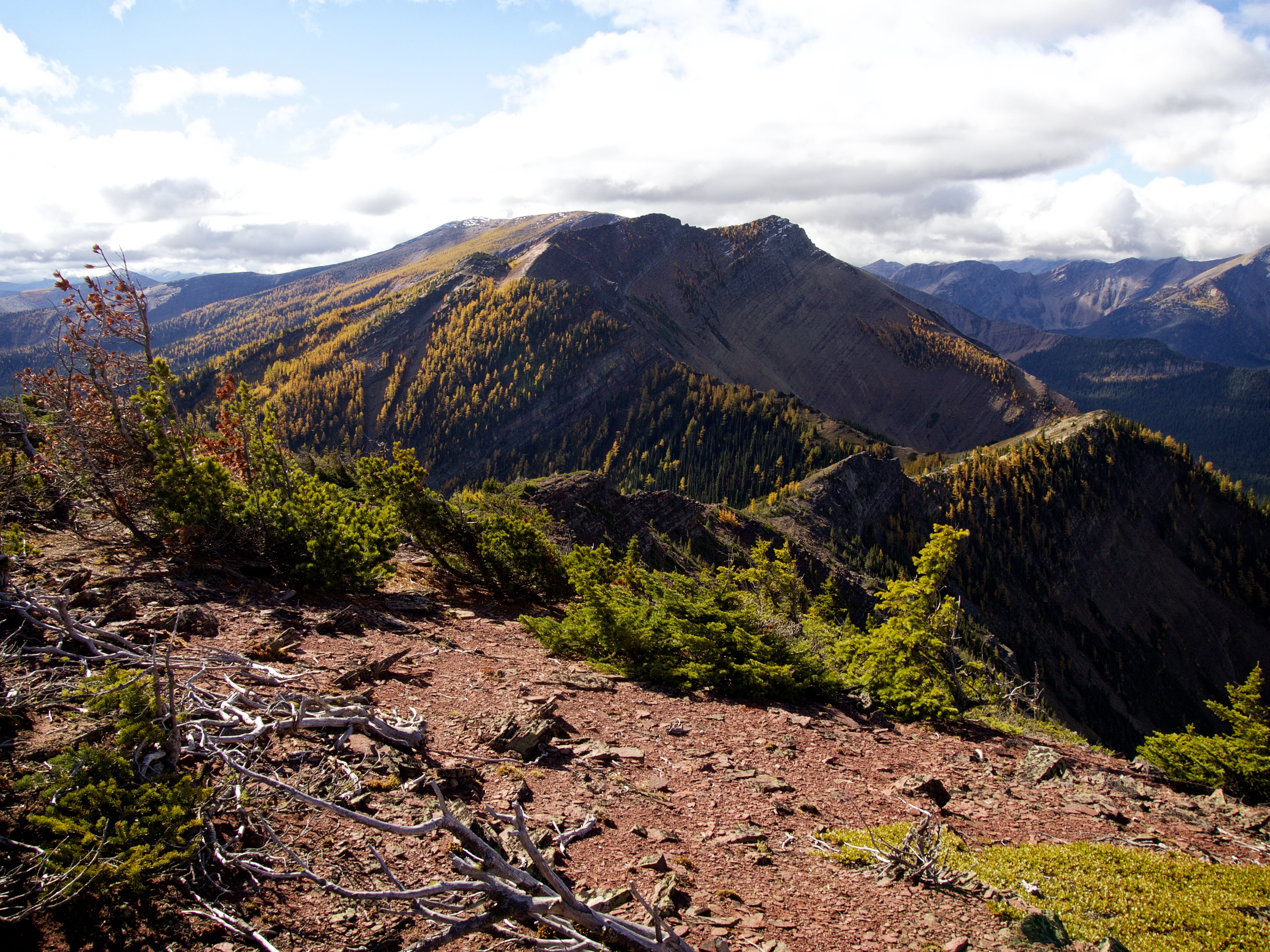
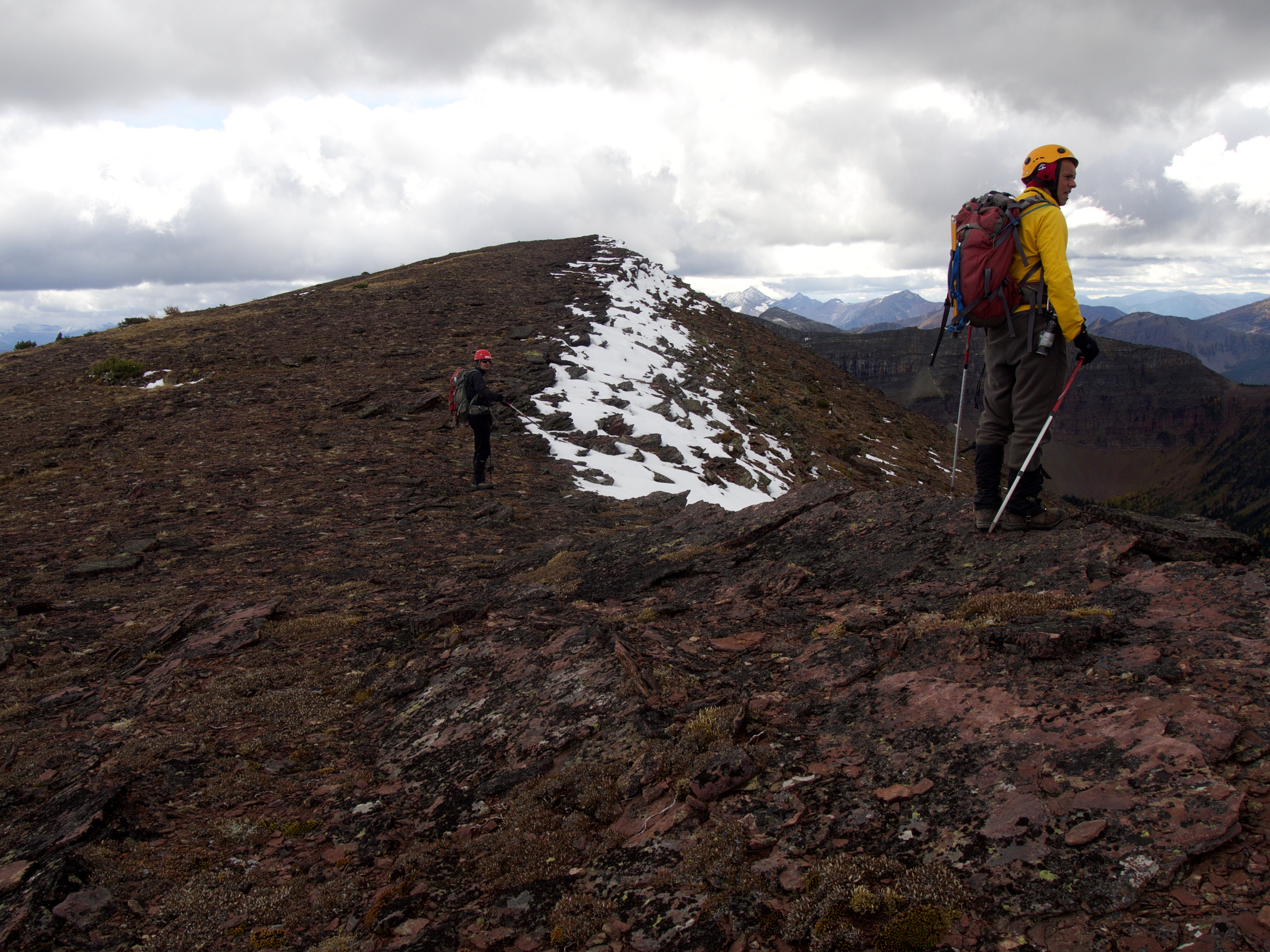
The view south along the ridge from “West Castle 2”. The summit of Lys Ridge is in the distance to the left of centre.

Jollin and Andrew discuss potential routes up what looked to be a fairly tricky set of cliff bands.

However, once we got closer it became apparent that it looked worse than it actually was. In fact, it was a fairly easy scramble to the reach the crest.

The view back at West Castle from above the cliff bands. (Photo by Andrew Nugara)

Ever so slightly, Andrew and Jollin exaggerate the amount of exposure along the ridge. 😉

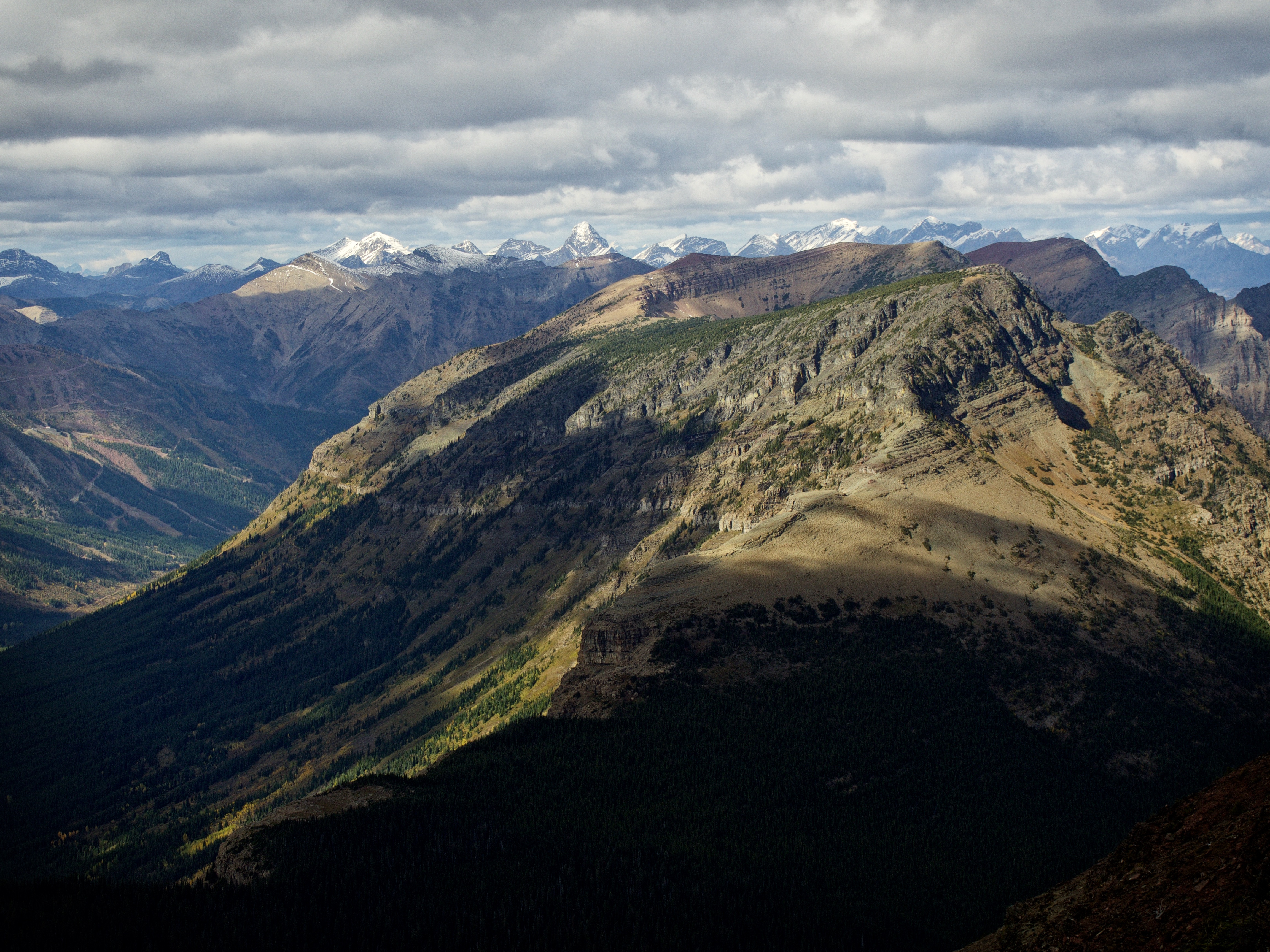
The angle of the afternoon sun combined with overhead clouds provided a wonderful view as we looked back. West Castle is in the centre.

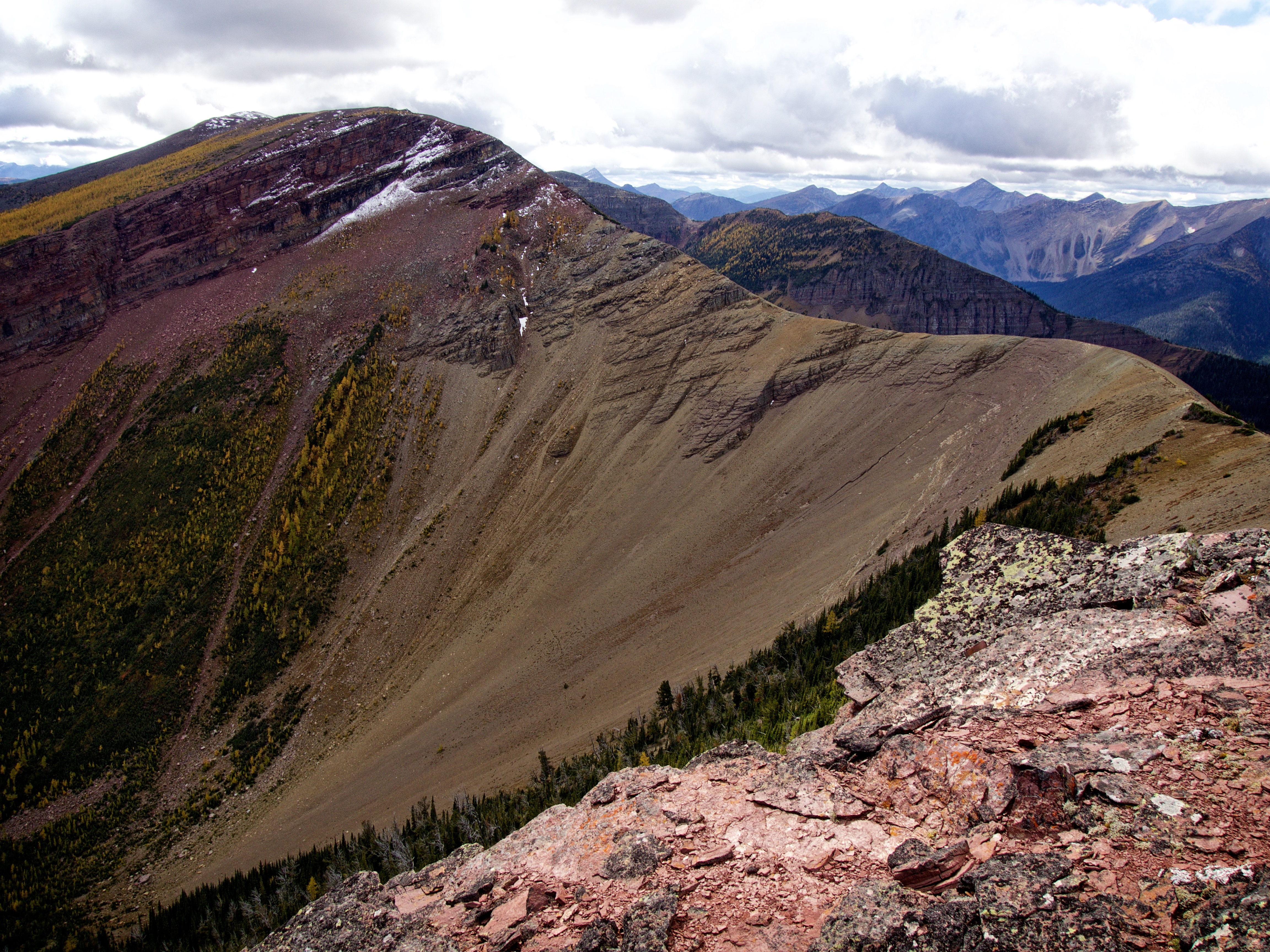
More stunning colours could be found further to the south.
One last saddle to cross before reaching a plateau and then the summit.
However, between this point and the bump in the foreground, we encountered an impassable cliff band that would force us to descend to the southeast as we searched for a weakness.

Jollin searches for a way through the cliff band.
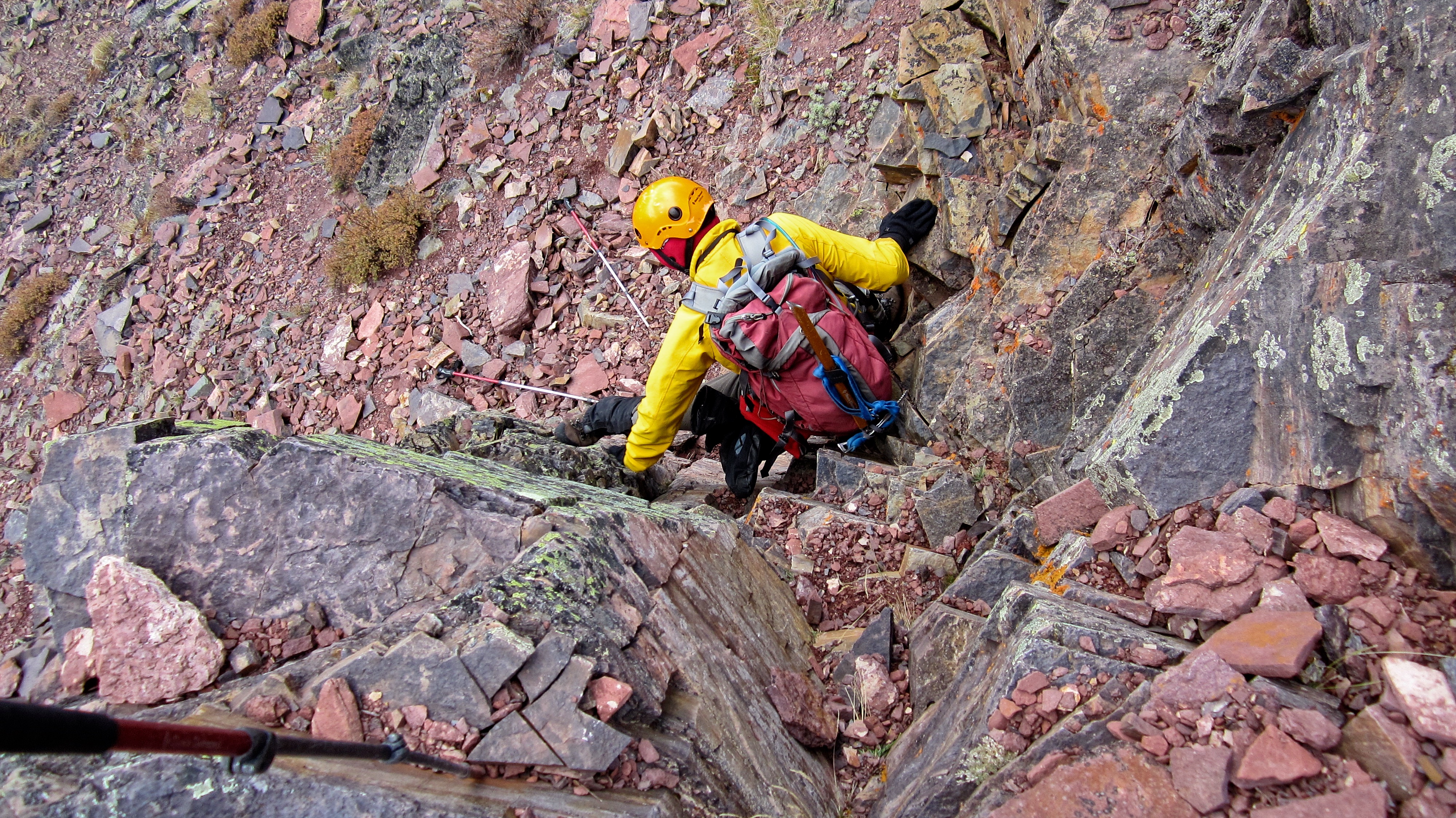
Thanks to Jollin, we found a weakness that we could downclimb. We determined that had we continued following the cliff band, we would have found an easier way, but we would have also lost a lot more elevation.

A better view of the weakness we exploited – though really there are two ‘weaknesses’ shown in this picture. 😉 (Photo by Andrew Nugara)
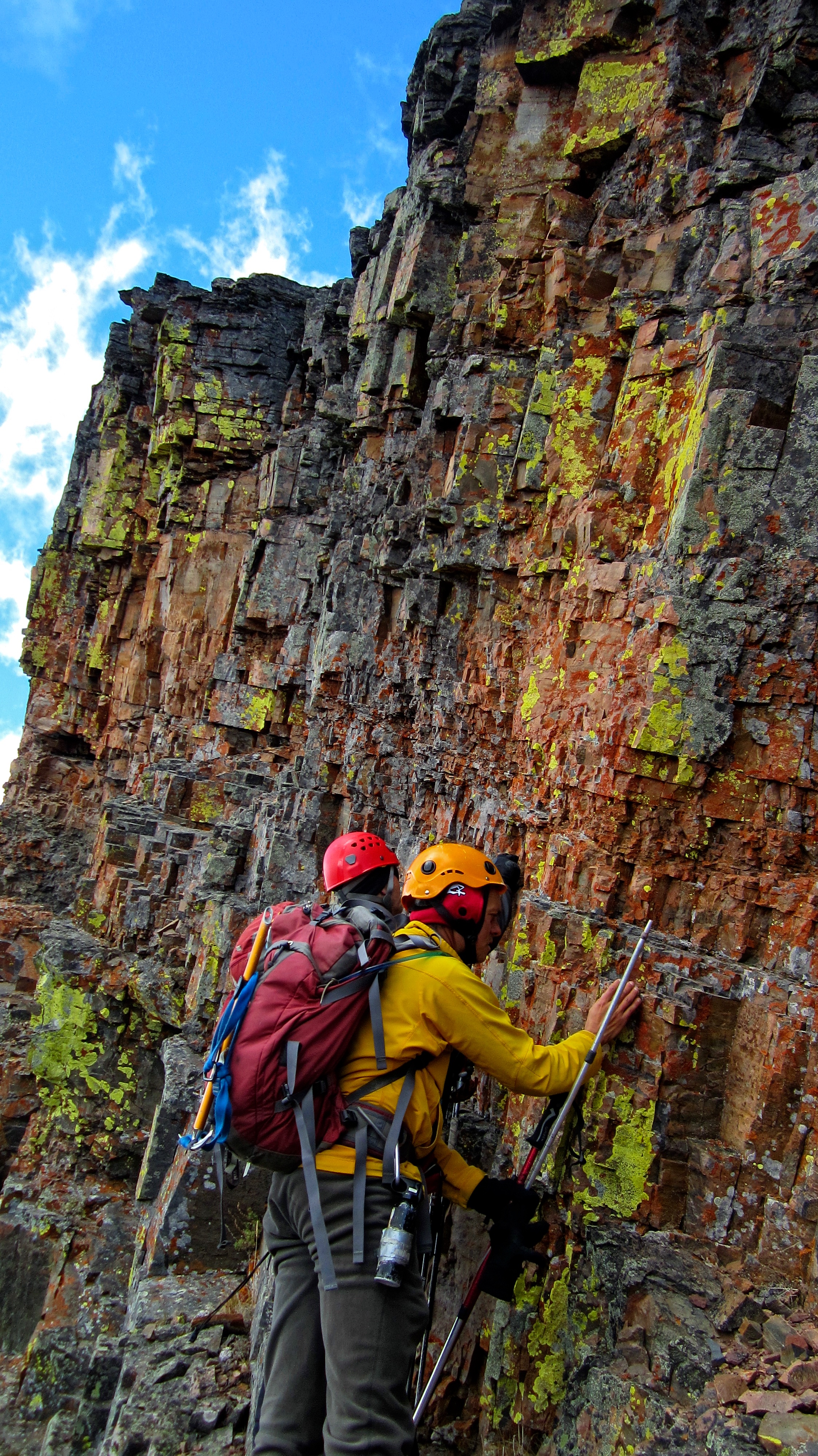
Andrew and Jollin take a closer look at the memorizing colours of the lichen-covered rock. It really was an incredible sight – and look how colour coordinated Jollin and Andrew were! They truly had become one with the mountain. 😉

In the background is the cliff band that prevented us from following the crest of the ridge. We descended through a weakness in the centre of the picture, but directly behind Jollin and myself, is an even easier way. (Photo by Andrew Nugara)

Enjoying an easy walk across the saddle.

Reaching the plateau from the saddle was not difficult.

The view back along the ridge as we hike to the plateau. It would have be pointless to regain the second bump on the crest (centre) because it also featured an impassable set of cliffs.

Finally on the plateau – from this point we still had another 2km to go before reaching the summit of Lys Ridge.
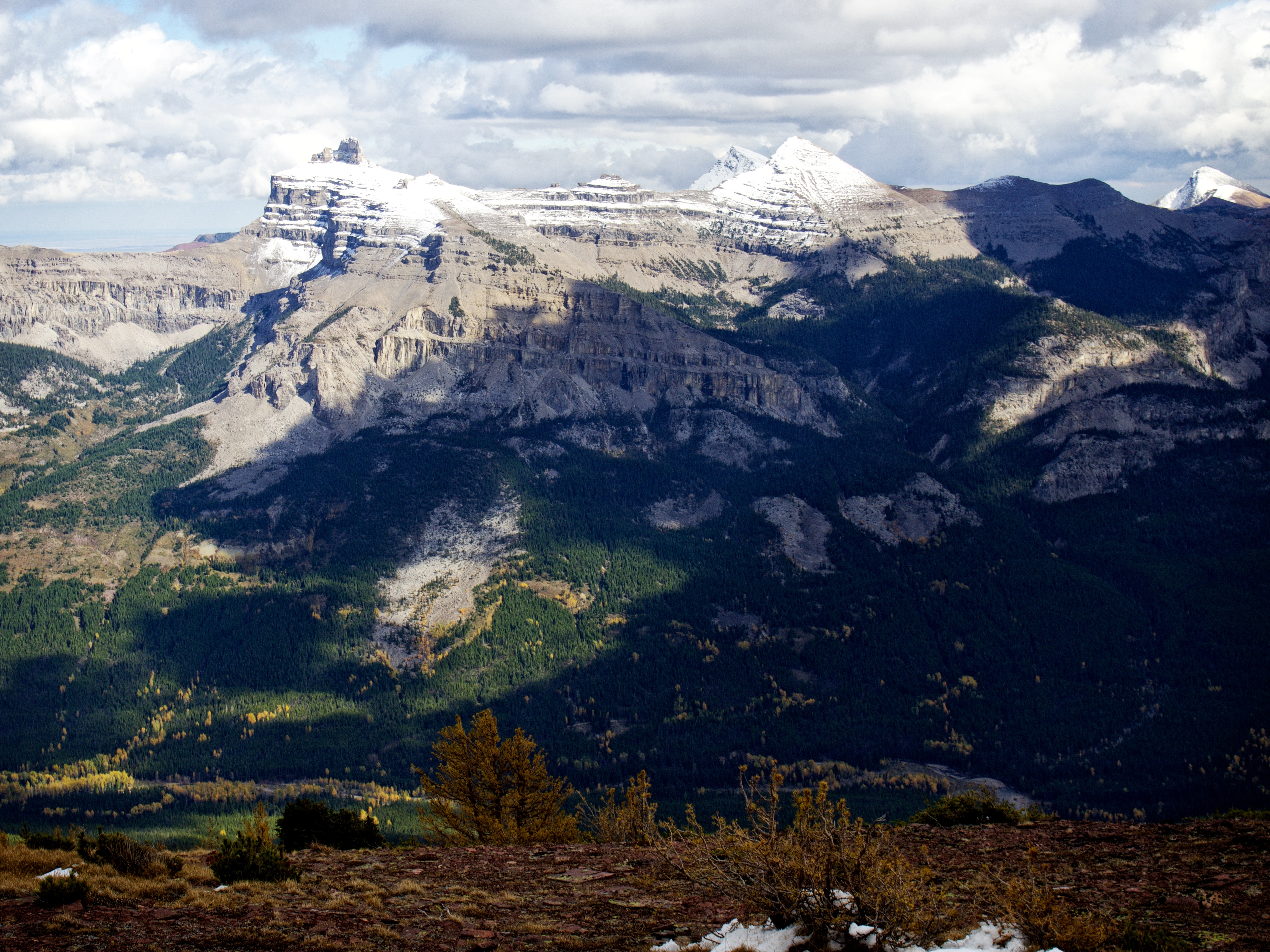
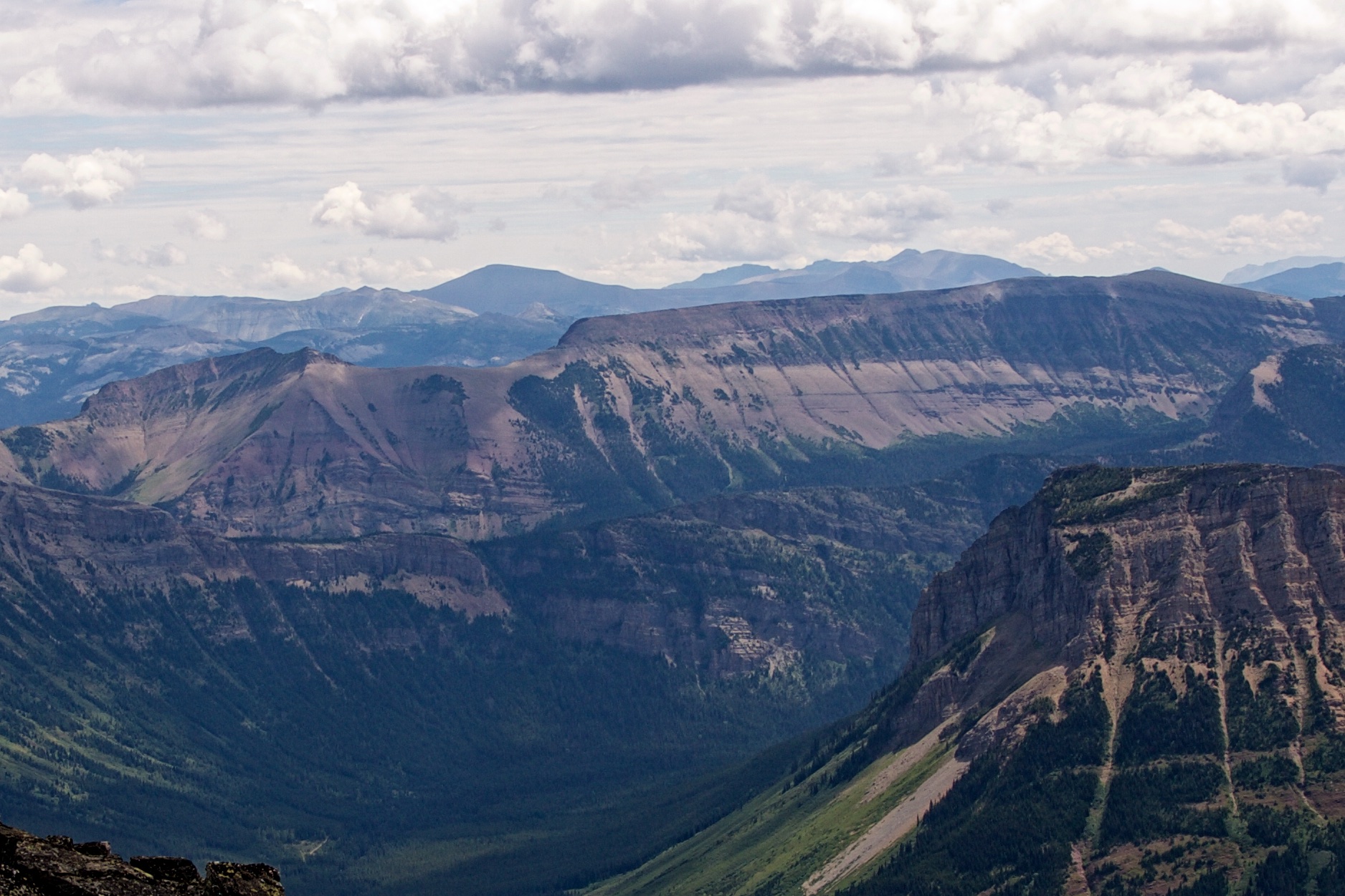
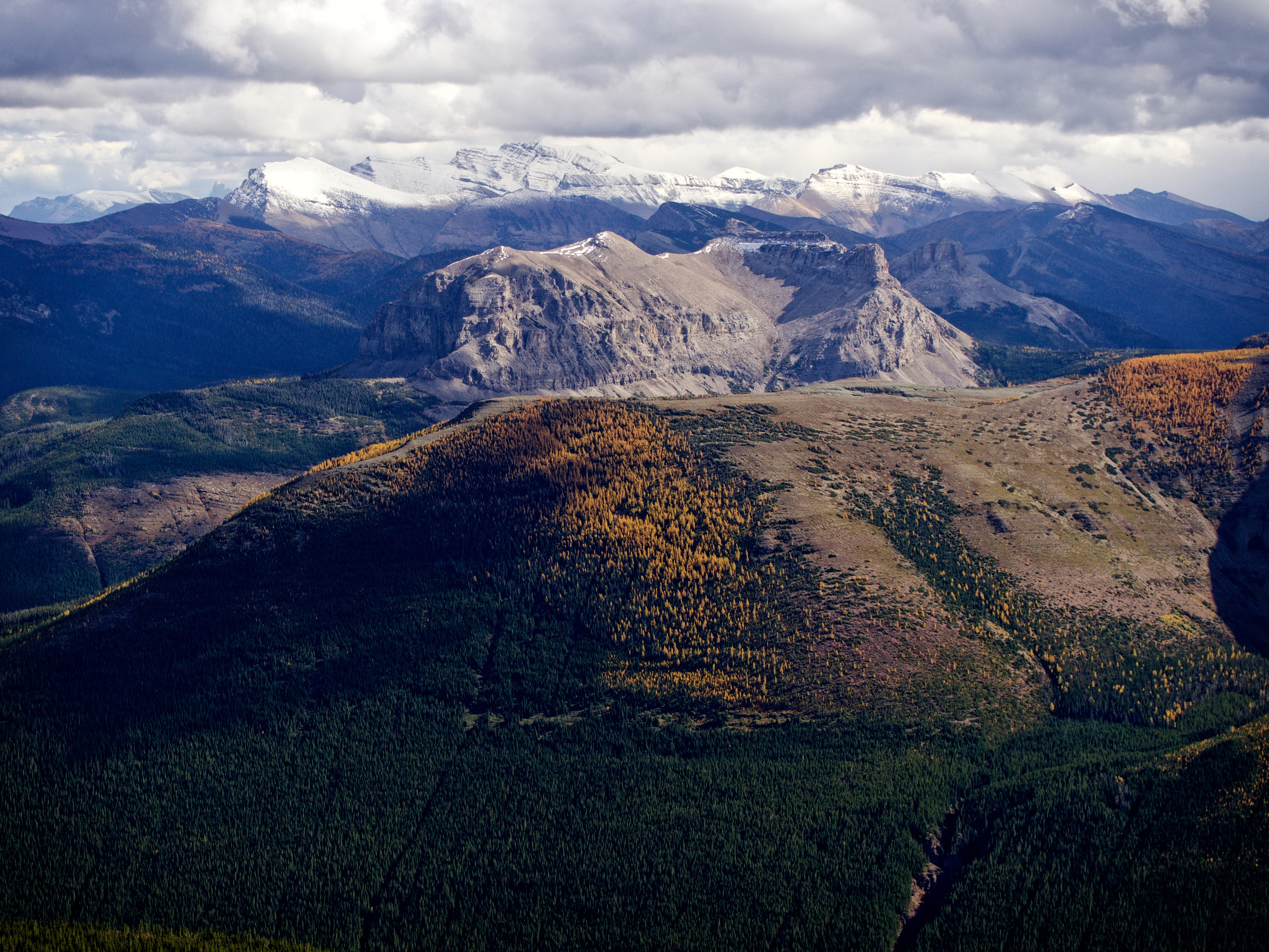
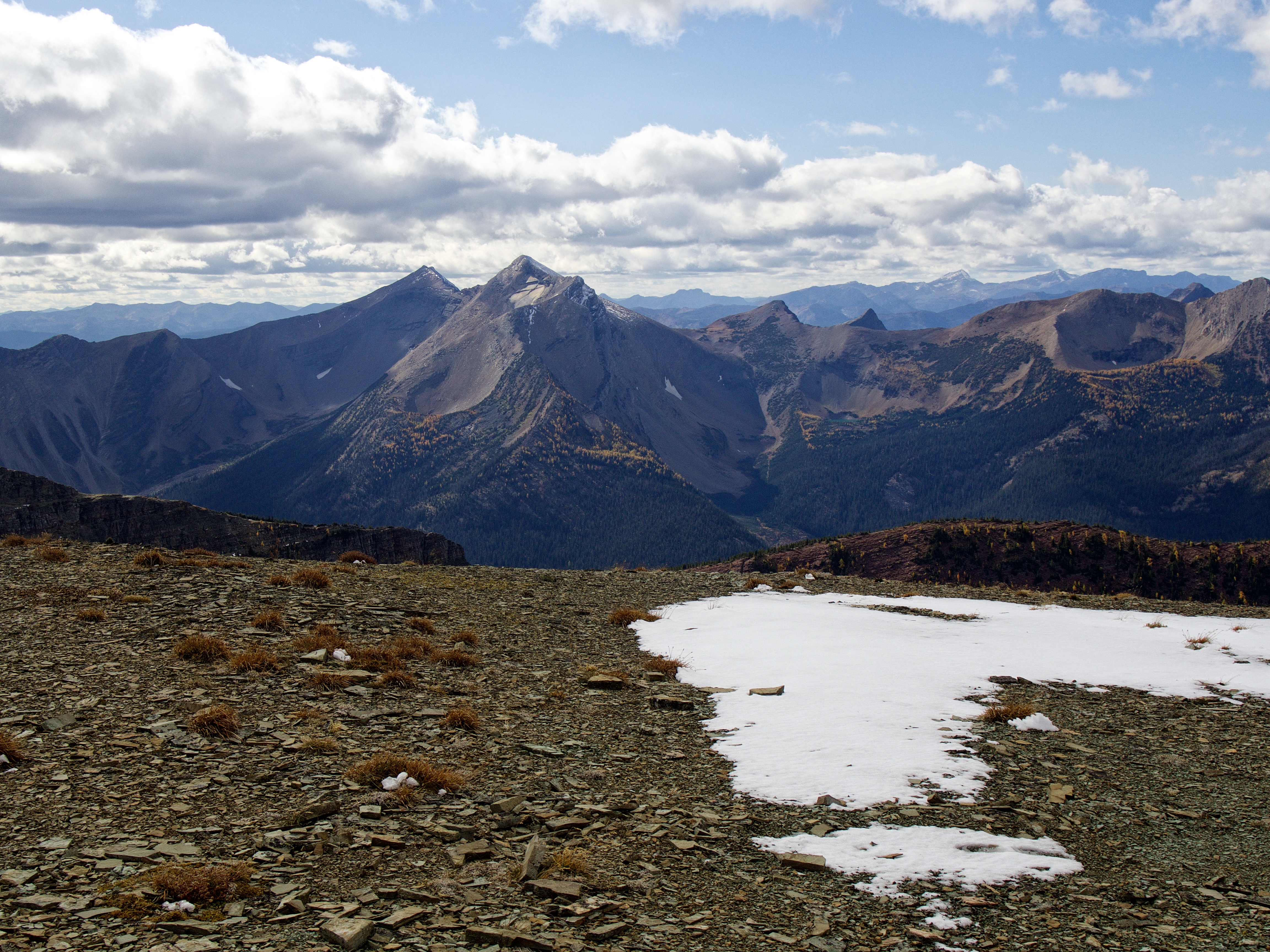
Throughout the day, our one constant view to the east was Castle Peak and Windsor Mountain. The summit of Victoria Peak can be seen just to the left of Windsor Mountain and on the far right is the summit of Pincher Ridge.
The views on either side of the plateau were awesome, but it meant that we had to keep zig zagging from one side to the other, just to take them all in.

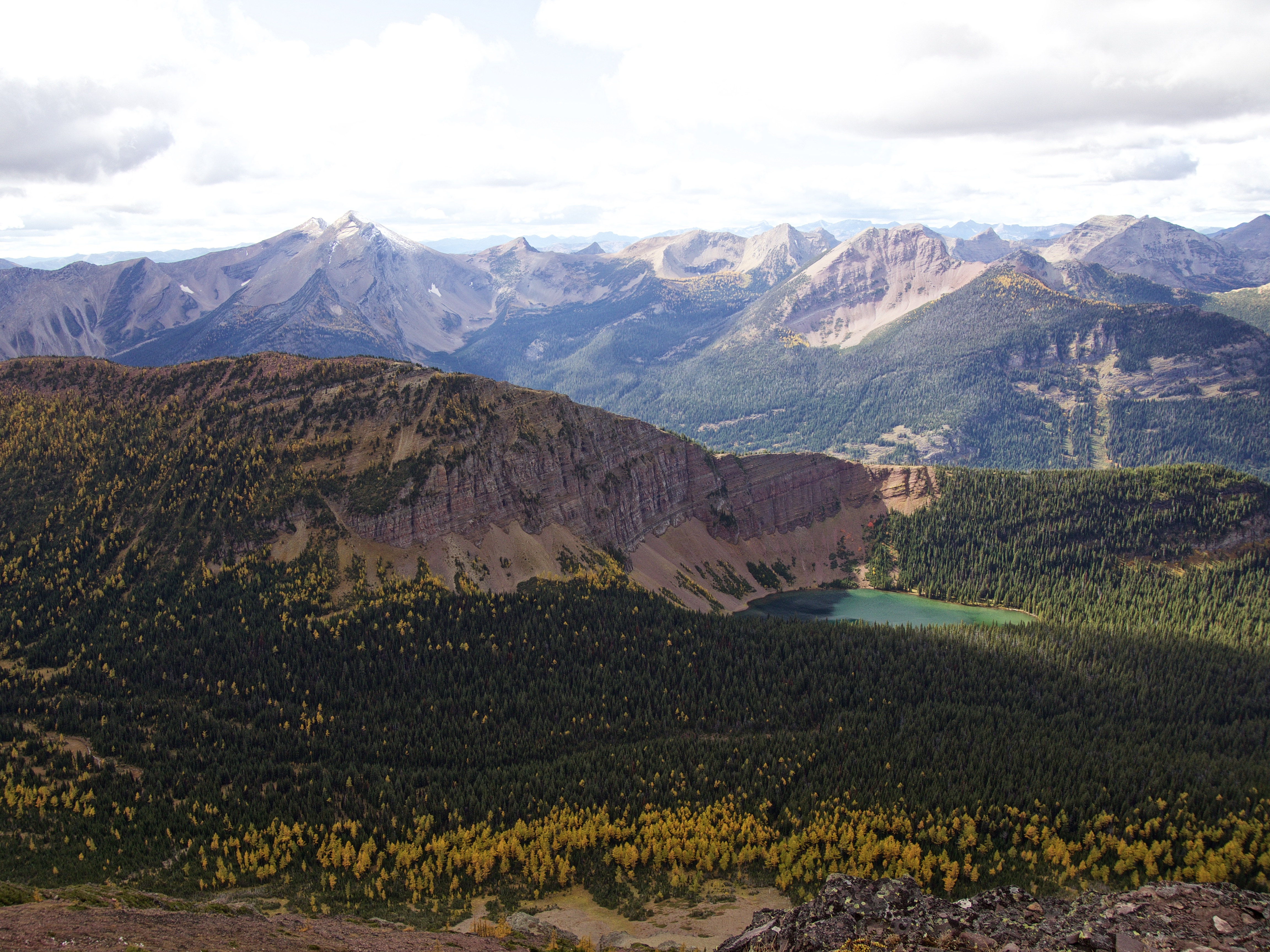
A pano to the southwest. In the centre is “Jake Smith Peak” and immediately behind it is Scarpe Mountain. To the right of centre are Three Lakes Ridge, Rainy Ridge, Tombstone Mountain, and Mount Haig. In the foreground is Grizzly Lake.

A partial pano to the northwest. In the centre is Mount Haig and Gravenstafel Ridge and on the right is Barnaby Ridge.
A telephoto to the northwest shows the snow-covered Flathead Range with Mount Darrah in the centre. On the far right is Mount Coulthard.

Looking down the valley towards Ruby Lake.
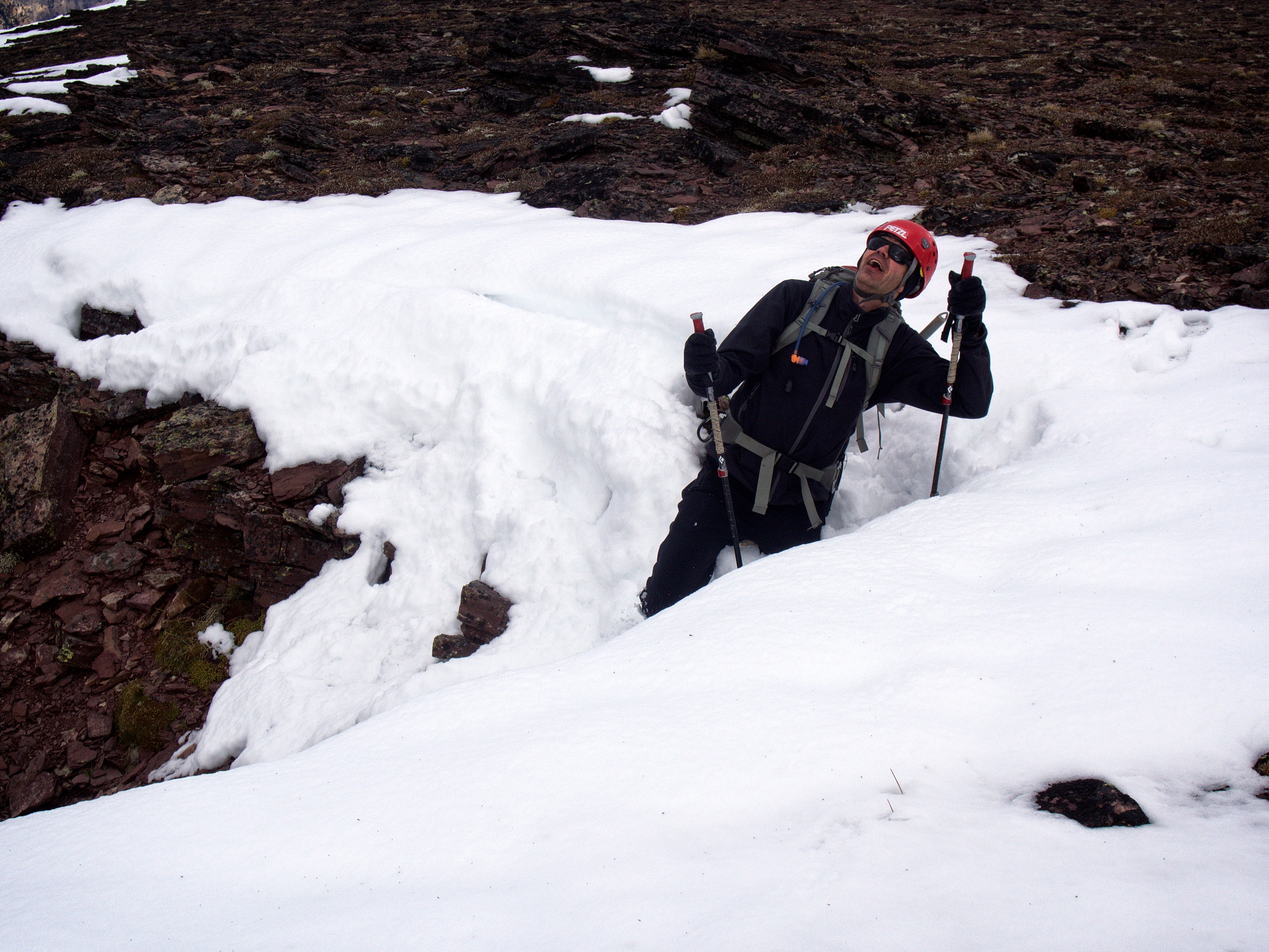
Oh no! Jollin has fallen and he can’t get up! If only we would’ve stopped to put our crampons on…

The front range mountains had quite a bit of snow on them but Lys did not. Just in case we packed our axes and crampons, so when we encountered our first bit of snow, Jollin couldn’t resist hamming it up for the camera.
Looking west at Grizzly lake from further along the plateau.

A telephoto of Grizzly Lake. Edit (3 July 2017): After recently traversing from Southfork Mountain to Grizzly Lake, I believe that it would be possible to combine Lys Ridge and Barnaby Ridge as part of a scenic multi-day loop. Due to the scrambling section on the south end of Barnaby Ridge, I would recommend that it be done from south to north, starting with Lys Ridge and then ending at Southfork Mountain.

So many larches and aspens… On the left are North Castle and Mount Gladstone.

The Castle River can be seen in the valley to the east.

As we got closer to the summit we could finally see Ruby Lake.
Mount Haig is the prominent peak to the right of centre.

Looking southeast at beautiful Lys Lake. Snow-covered Loaf Mountain and Spionkop Ridge are in the distance to the right of centre.

The summit of Lys Ridge finally comes into view.
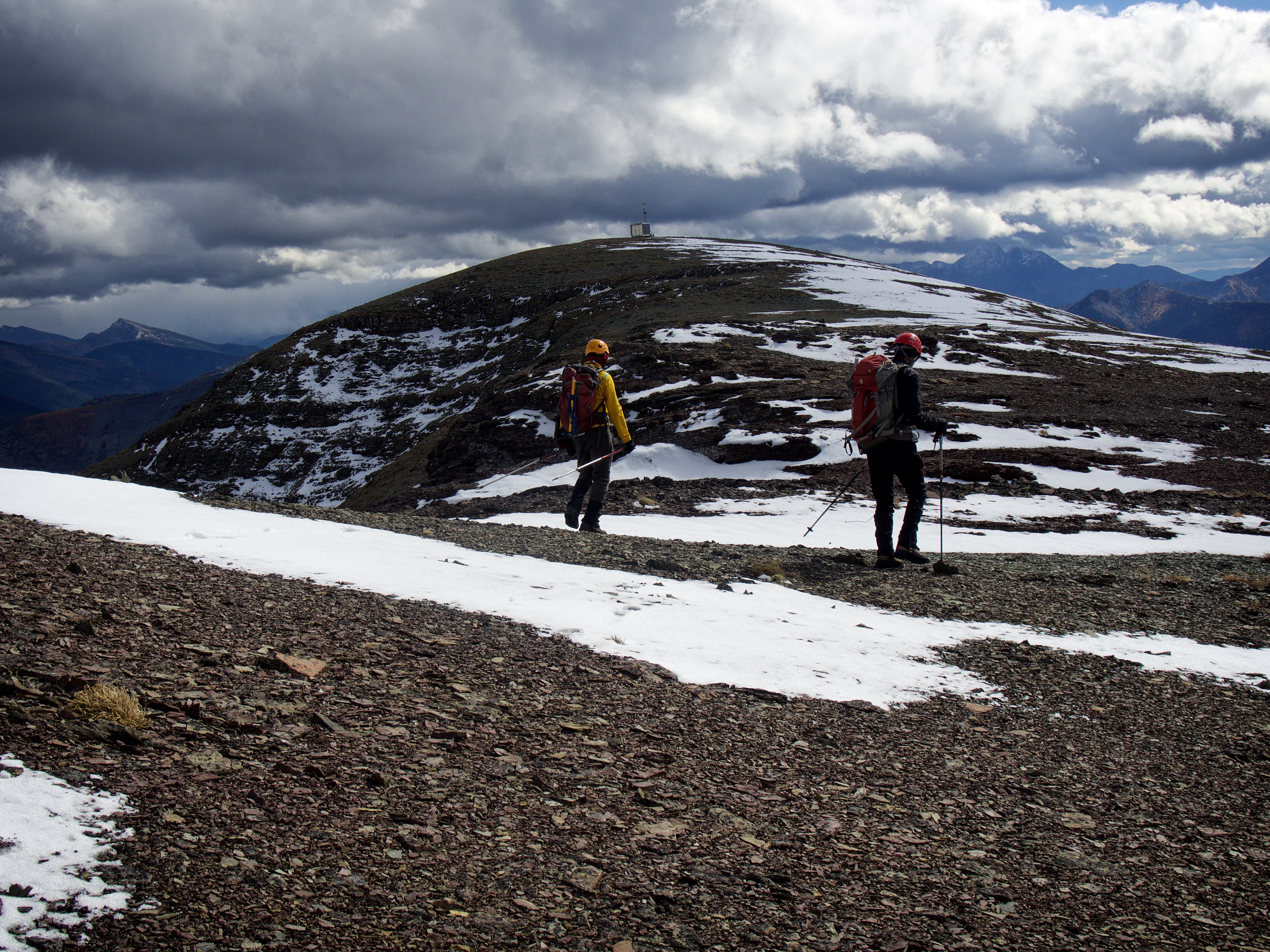
A weather monitoring or repeater station sits on the summit.

Sunlight illuminates Victoria Peak.

A CCTV camera looks down on us from on top of the station. I’d like to think that somewhere, a person was sitting at his or her desk watching us on a monitor. Too bad I didn’t bring the gorilla suit…
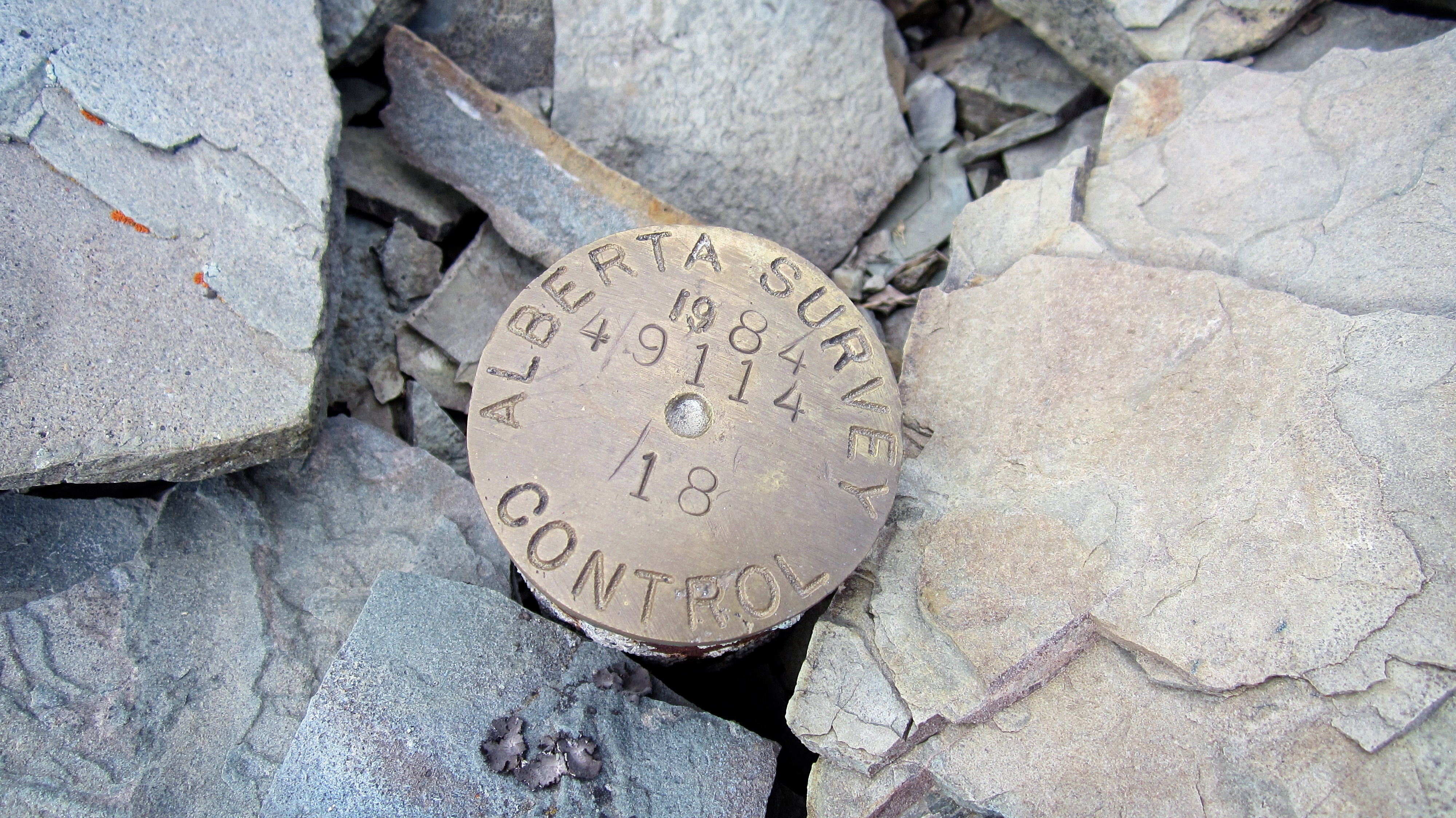
The survey marker on the summit of Lys Ridge (2522m).

Jollin and Andrew on the summit of Lys Ridge.

Jollin and I recreate the famous handshake between Carl Weathers and Arnold Schwarzenegger at the beginning of Predator (language warning). You can decide who is who.

Three GPS units and three different elevations. On the summit of West Castle, all three units had wildly different readings.

A pano to the east from the summit.

A pano to the north.

A pano to the west.

Immediately to the south of Lys Ridge is Jutland Mountain. From the summit you can not only see North Scarpe Lake (foreground right), but also South Scarpe Lake which is nestled beneath the summit of Jutland. Thus, while you get great views of four lakes from Lys Ridge, you really can see a total of five.

Lys Lake from the summit. In the background is Castle Peak, Windsor Mountain, Victoria Peak, Pincher Ridge, Drywood Mountain, and Victoria Ridge.

Lys Lake is a gorgeous gem.
A telephoto to the southeast of Mount Matkin. In the distance are several peaks in Waterton National Park. From left to right: Anderson Peak, Piinaquiium / Ahkoinimahstakoo (Mount Blakiston), Mount Bauerman, Mount Lineham, Mount Hawkins, and Lone Mountain.
Looking slightly southwest at Scarpe Mountain and “Jake Smith Peak”.

The landscape to the west. From left to right: Three Lakes Ridge, “Mount Miles”, Rainy Ridge, “Middle Kootenay Mountain”, and Mount Haig. “Mount Miles” was unofficially named by Andrew in honour of his good friend, Miles Krowicki, who passed away a few years ago. He also named a neighbouring peak (not shown) as Krowicki Peak. You can read Andrew’s trip report for Mount Miles and Krowicki Peak here.

The view northwest encompasses Mount Haig, Gravenstafel Ridge, St. Eloi, Syncline Mountain, and Barnaby Ridge.

Ruby Lake from just beneath the summit of Lys Peak.

From the summit we hiked as far south along the ridge as we could in search of our descent route.

We then realized that we had to backtrack further to the north to locate the argillite gully that Rick Collier had used for his ascent.

To get to the gully we had to find a weakness in the cliff bands that guarded the western slopes beneath the summit.

The weakness that we used is in the centre.

Again, like everything else on this mountain, this cliff band was also bursting with colour.

Descending towards Ruby Lake.

The red argillite gully was easy to descend.

Andrew downclimbs a short section of rock inside the gully.
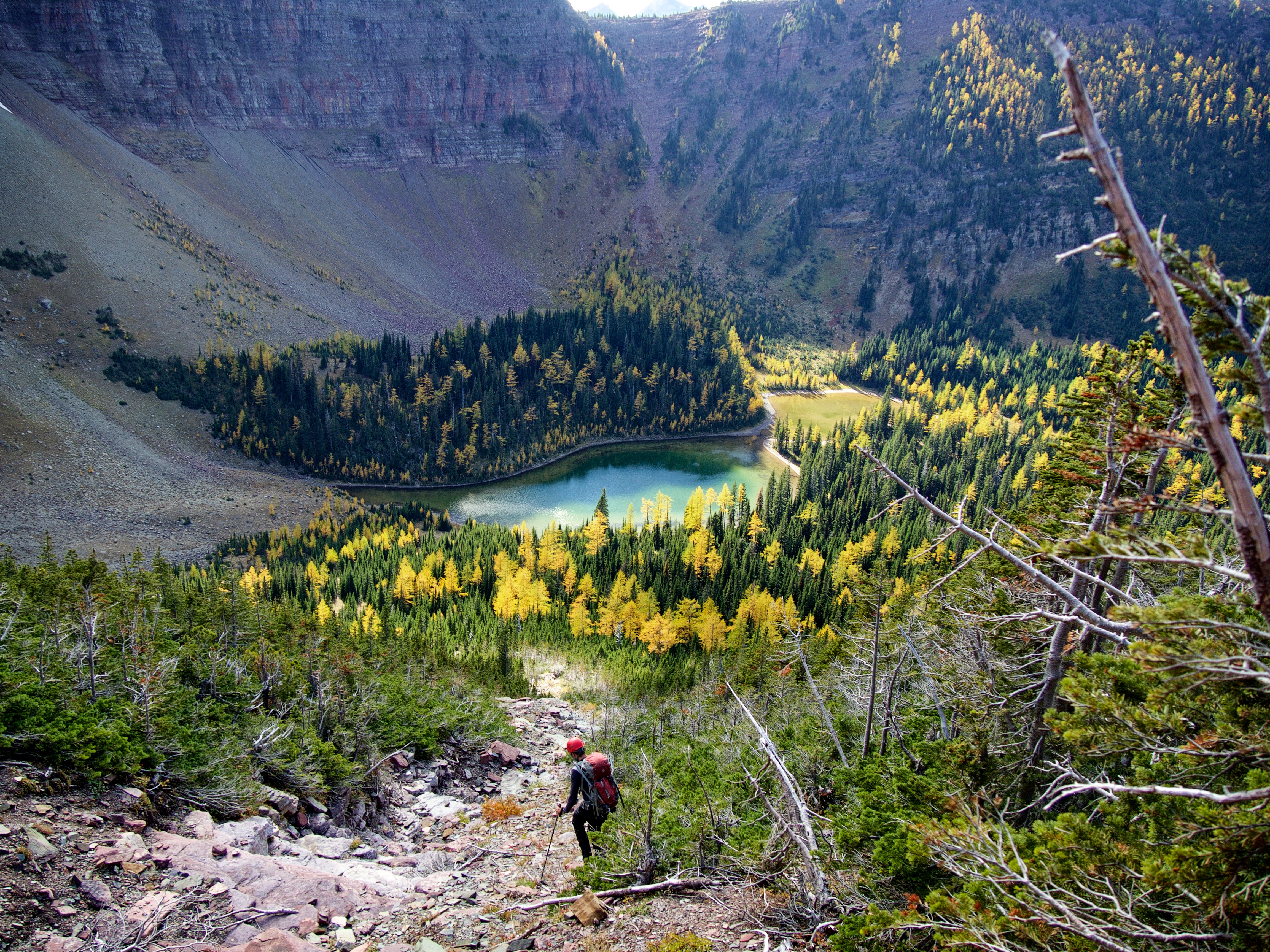
The gully led almost to the shoreline of Ruby Lake.
Looking back. This trip could be done in reverse by using this gully to ascend just as Rick Collier did.

From this angle we could see that it would be very hard to descend through the cliff bands at the southern end of the ridge.

We encountered some huge larches on this trip.
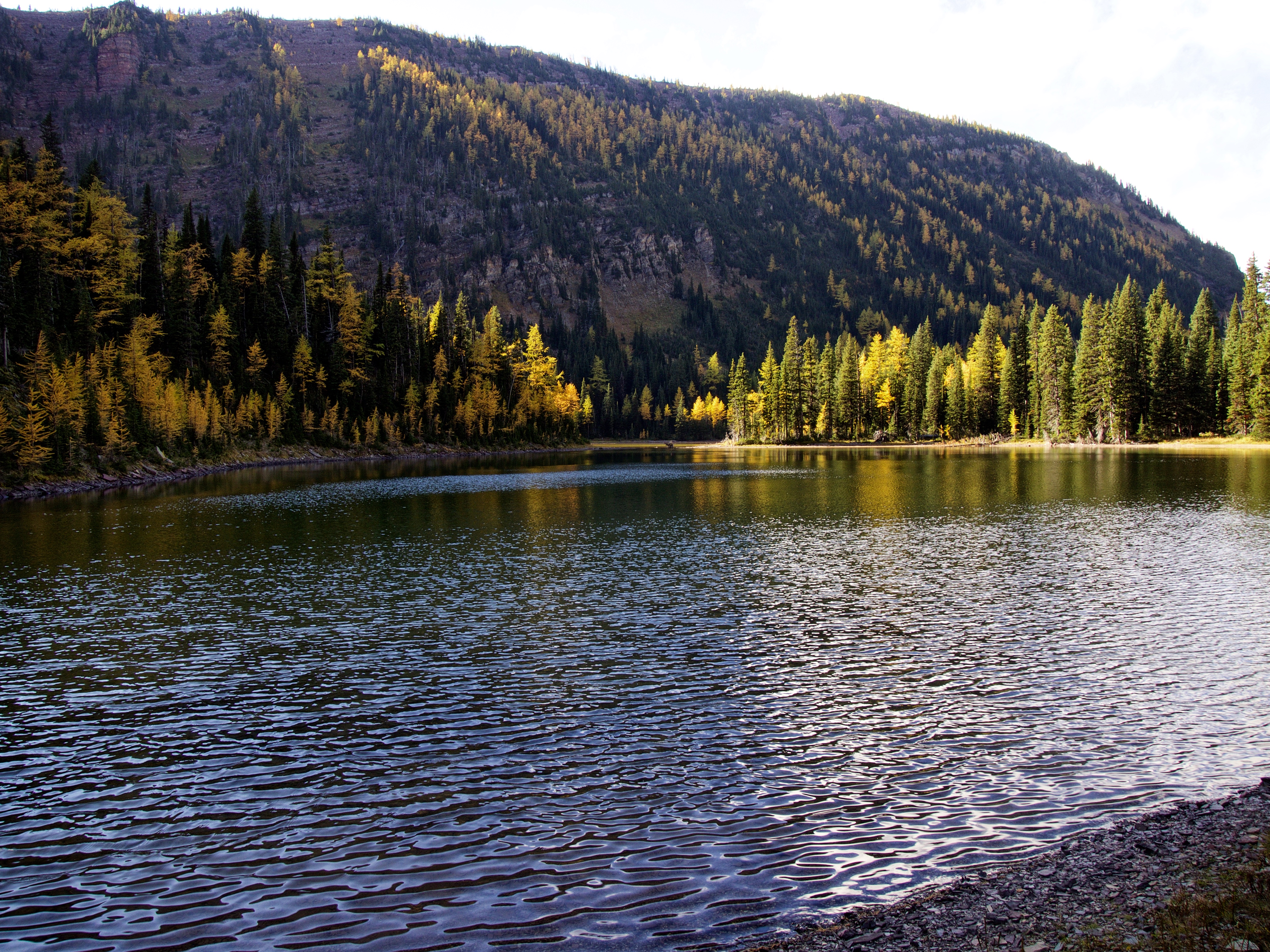
On the shore of Ruby Lake.
Our descent gully (centre) from Ruby Lake.

What a spectacular place!
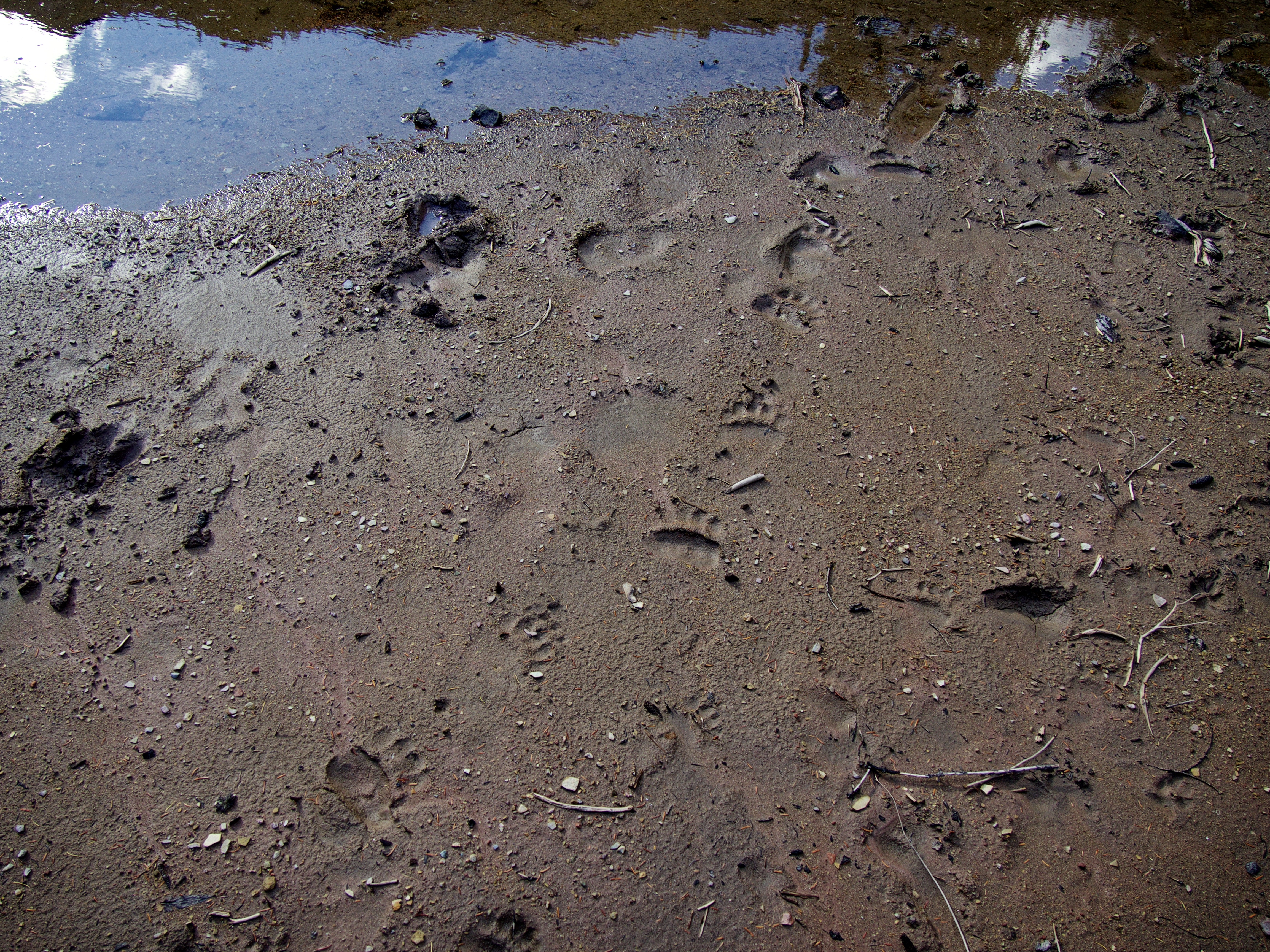
A little black bear and an elk decided to go for a walk together…

Jollin and I on the shore of Ruby Lake. (Photo by Andrew Nugara)

Inspecting the backcountry campsite which is located next to the lake.

Time to put our heads down and make up time as it was late in the day and we still had to cover ~15km to get back to the car.

The trail was excellent.

Huge thanks to whoever maintains the Grizzly Lake/Ruby Lake trail because it would take a ton of work to keep it so nice. Thank you!

The north end of Barnaby Ridge seems so far away…
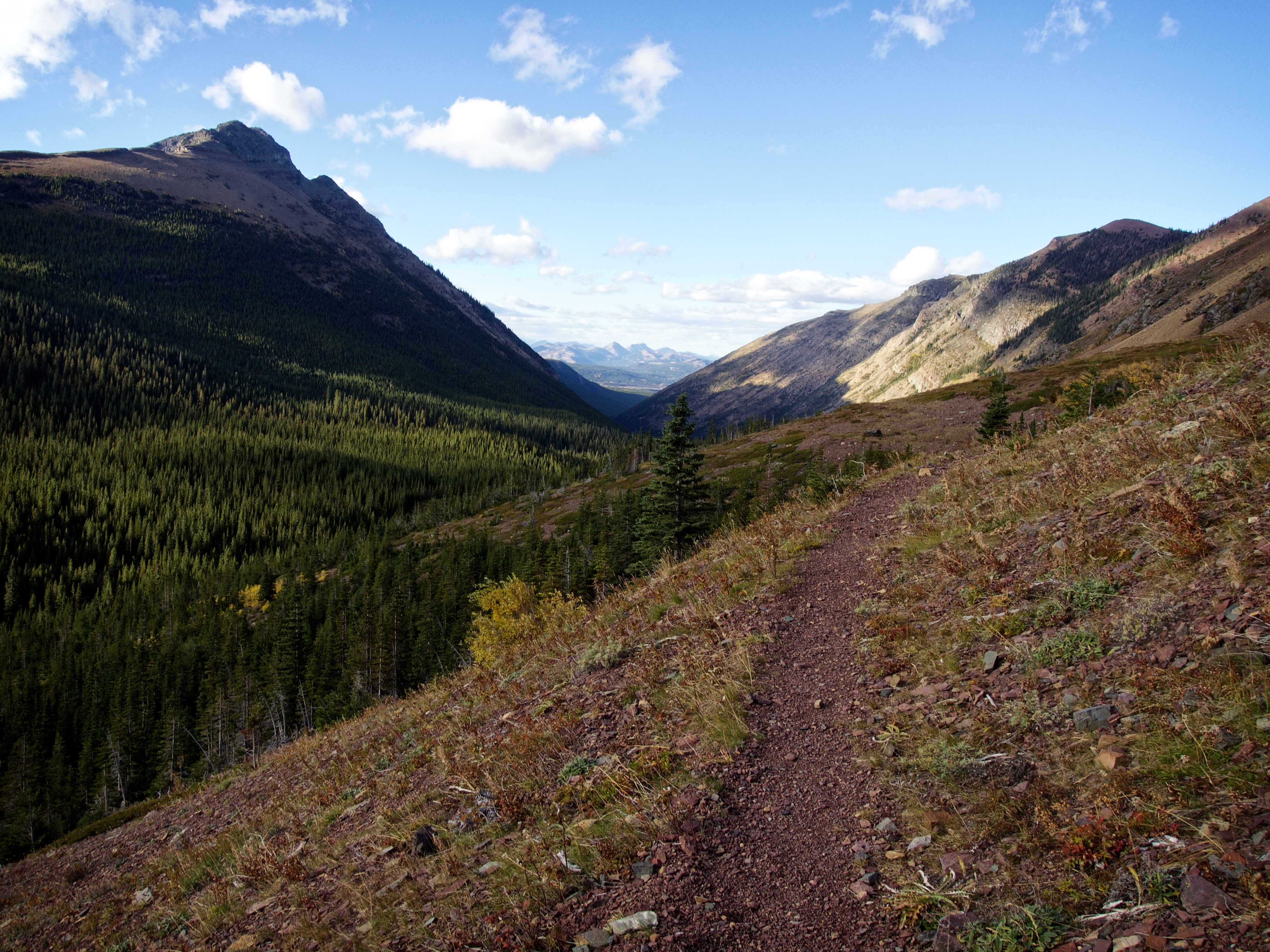
The trail continues down the valley between Barnaby Ridge and Lys Ridge.

Jollin and Andrew have their game faces on as we power through kilometre after kilometre.

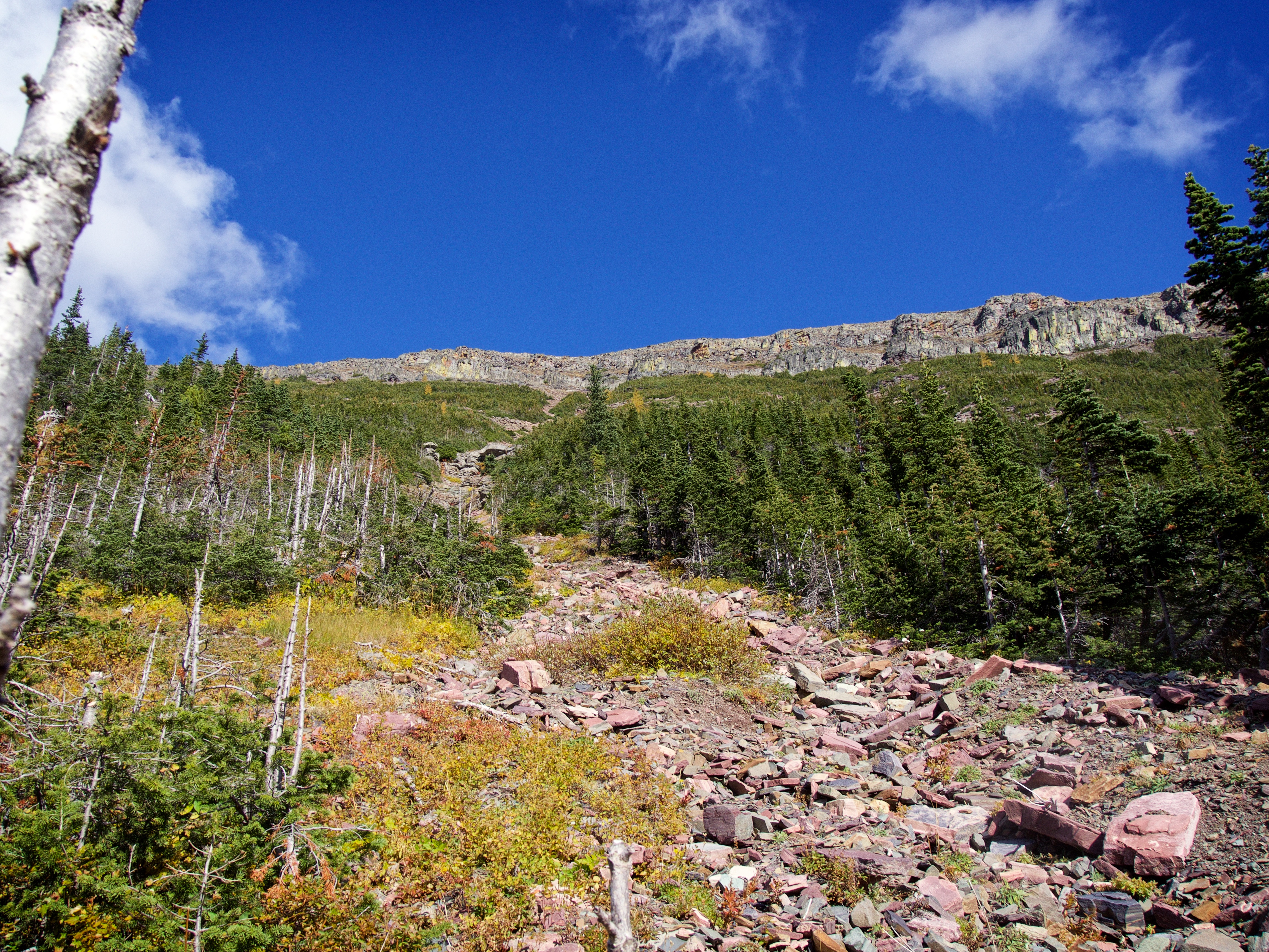
The north end of Lys Ridge from the Grizzly Lake trail. This was our alternate ascent route and is more gradual than the boulder field we used. However, it would also require some bushwhacking to reach the open slopes – but it’s still a viable option. Also, once the trail reaches this point it begins to disappear at times in the rocks, so keep an eye out for trail markers in the trees.
At the point where the trail crosses the Castle River. In the distance is our actual ascent route next to the cliff band.

Jollin crosses the Castle River. Edit 24 October 2016: When Vern Dewit tried this trip a few weeks after us, he found the Castle River much more difficult to cross than we did. Our second crossing (pictured above) was ankle to calf deep. When Vern crossed the river, he found it to be crotch deep with an extremely fast current which proved especially difficult to manage in the dark. So be warned that depending on the time of year, or depending on snowmelt or rainfall, crossing the Castle river using this route may be tricky! I should also note, that before reaching the Castle River, we had to cross Grizzly Creek twice and three feeder creeks that didn’t have bridges over them. When we crossed, they were only trickles and we could step on stones to cross without difficulty so I didn’t take much note of them at the time. However, Vern had to wade across all of them on his trip so be prepared for the possibility of five unbridged stream crossings on this trip.

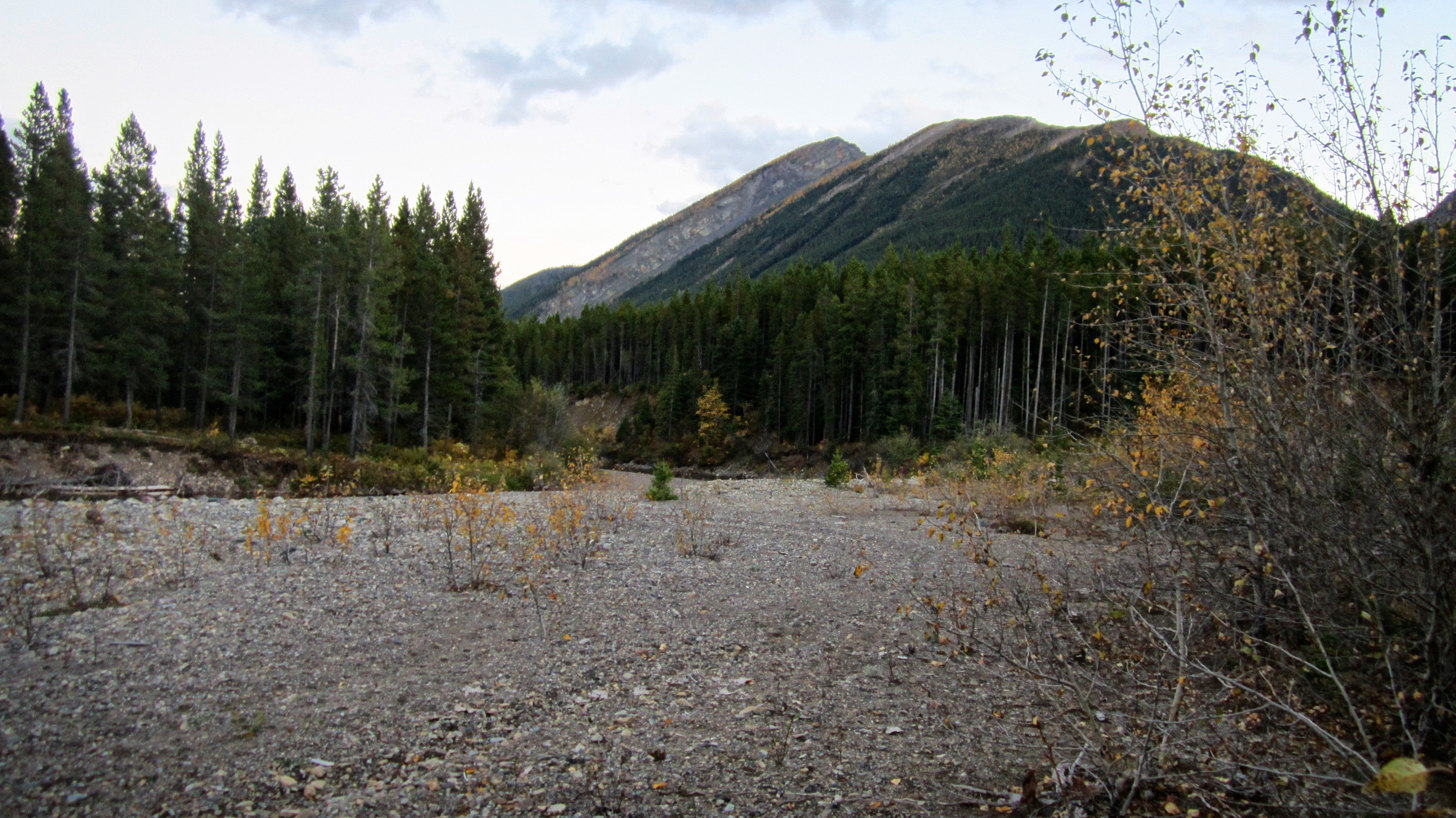
Back on the South Castle Road as daylight fades away. The trailhead actually emerges next to the road about 800m to the north of the trailhead sign and is identified by small, white sign on the side of the road. Following the route from the sign in the picture will also get you to the trail, but will be more circuitous and is geared more for horses. To reach Andrew’s car we still had to walk another ~1.2km down the road.
Lys Ridge is an incredible ridge walk that is bursting with colour. During our 28km trip we tagged two peaks, had great views of four alpine lakes (including a fifth that we could see in the distance), and enjoyed a variety of terrain that ranged from moderate scrambling to easy walking. The trip out from Ruby Lake exposed us to a picturesque valley which in and of itself was breathtaking.
It did however, take us 12.5 hours to complete this trip. Our route traversed the entire ridge from north to south, however, there are lots of other options that one could try instead. For example, ascending through the trees on the north end or doing the route in reverse. West Castle and Lys Peak could also be done as single destinations as well. However, I really loved our ascent route even if it did add on a couple extra kilometres at the end. I would also recommend that fall is the best time to do this trip as it will maximize the colours. It was also a highlight to spend the day with Andrew and Jollin as they were super companions who added immeasurably to my overall experience.
Looks like a great trip – thanks for sharing!
Thanks Vern. Lot’s of great Castle scenery on this one.