

⚠️ Hiking and scrambling are inherently dangerous activities. Please read my Disclaimer. ⚠️
A month ago, Brad and I, tried reaching the Porcupine Fire Lookout from the summit of Sand Bluff, but decided to turn back after encountering deep snow. Wanting to finish what we started, I returned today with the hope of being able to drive up the West Sharples Creek Road and use the short approach described by Mike Potter in, Fire Lookout Hikes in the Canadian Rockies (2nd edition). After negotiating a few snowy patches along the road, I finally reached an impassable section just prior to its junction with the Skyline Road – a little over a kilometre from the cutline described by Potter. I parked my 4Runner and made the easy hike to start of the cutline. Here, I donned my snowshoes and was surprised at how deep the snow was, sinking almost to my hips when I post-holed.
Reaching the top, I met Cathi, who is the new Porcupine Lookout Observer. With over 30 years of experience working at fire lookouts around the province, Cathi had flown in by helicopter only 2 days prior to my arrival. She told me that the Lookout had opened almost a month later than it did last year because of all the snow. As I seem to visit fire lookouts in the winter or in shoulder seasons, Cathi was the first observer that I have ever met. Knowing that the Lookout was also home to her and others, I didn’t want to intrude and asked permission to look around. Not only did she let me, she was a gracious host. Thanks Cathi!
According to Potter, the Porcupine Lookout was originally named, Skyline Lookout, and the earliest tower was made from wood. (29) A steel structure replaced it in 1970, and the current iteration is a replacement. (29) As most of the lookouts that I have visited are lower buildings perched atop prominent summits, I found the multi-story tower fascinating. I can only imagine what it would be like up there on a windy day or in a lightning storm!
The Porcupine Lookout is also the site of a terrible tragedy. On the night of June 9, 1977, a US F-106 Delta Dart was flying from Cold Lake Alberta to Montana as part of a NORAD training exercise. Flying alongside two other F-106s and carrying 4 live sidewinder missiles, the pilot, 28 year-old Lt. David L. Denning, received instructions “to attack a mock enemy plane flying at 6,000 feet”. (“U.S. military hold ceremony for jet crash”, Nanton News, 21 June, 2011 / ‘Top Story’ Nanton News, 23 June 2011) Something went wrong and the plane crashed less than 100m (Potter says less than 50m) from the Lookout tower. Lt. Denning was killed on impact and the area was cordoned off by the US military for several weeks. In 2011, local rancher, Reid Moynihan, received a Montana National Guard Patriot Medal for his efforts to locate the family of Lt. Denning and keep his memory alive. (“U.S. military to honour Nanton-area rancher”, Calgary Herald, 20 June, 2011)
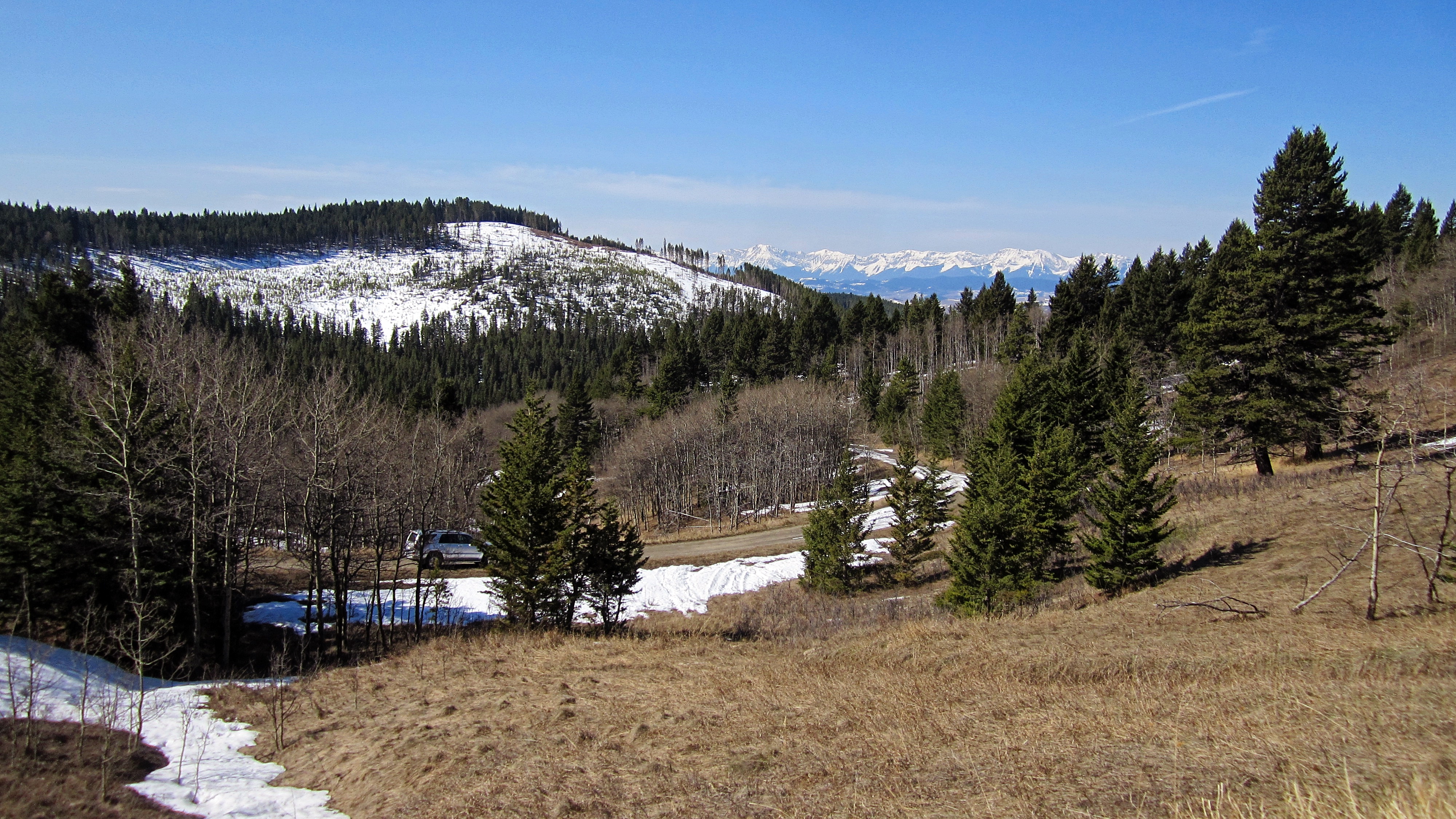
Though the Porcupine Fire Lookout is not situated in a panoramic locale, it still offers some nice views of the Livingstone Range and the front range of the Castle. It took me a bit longer to reach, as I had to hike in an extra kilometre and snowshoe through deep snow along the cutline, but I’m glad that I had the chance to see it up close and meet Cathi. Hopefully, we won’t experience the extreme fire conditions that we did last year, but if we do, I’m glad that there are good people who are keeping watch.
Update: On 21 November 2018, John Kinnear from the Crowsnest Pass Herald published, “Disaster at Porcupine Lookout” in his Looking Back column. This is an excellent contribution and provides even more details regarding this unfortunate tragedy. I’d encourage anyone interested in this – and in the history of the Crowsnest Pass – to read John’s column.

To get to the Porcupine Fire Lookout, I drove west from Lethbridge on Highway 3 until I came to the junction with Highway 22, just past the hamlet of Lundbreck. I then turned onto Highway 22 and drove north for ~24 km until I came to the bridge over the Oldman River. Immediately after crossing the bridge, I turned right (east) onto Township Road 101 (Waldron Flats) and followed it for ~4.3 km to where it forms a T-intersection with the West Sharples Creek Road. Turning north (left) onto the Road, I followed it for 13.3km until I came to the beginning of some switchbacks just prior to reaching the Skyline Road. Here, I encountered an impassable section of snow and so I parked my 4 Runner and hiked the remaining ~800m to the Skyline Road. I then followed the Skyline Road for ~550m until I came to the base of the Lookout. From here, I followed the short route up the cutline described by Mike Potter in, Fire Lookout Hikes in the Canadian Rockies (2nd edition). I returned the same way. This trip could be easily combined with a trip up nearby Sand Bluff.

The Lookout sits at 1820m, which I believe, makes it the highest point in Ky-es-kaghd-oghsuyiss (the Porcupine Hills).

My total roundtrip distance was 4.5km with total elevation gains of 231m. Including a long stay on the summit, my total roundtrip time was 3 hours even.

I had to drive through some lingering patches of snow on the West Sharples Creek Road.

The lookout tower can be seen from the road.

Arriving at the impassable section of snow just prior to the switchbacks.

A better look at my starting point, which was ~800m from the Skyline Road junction.
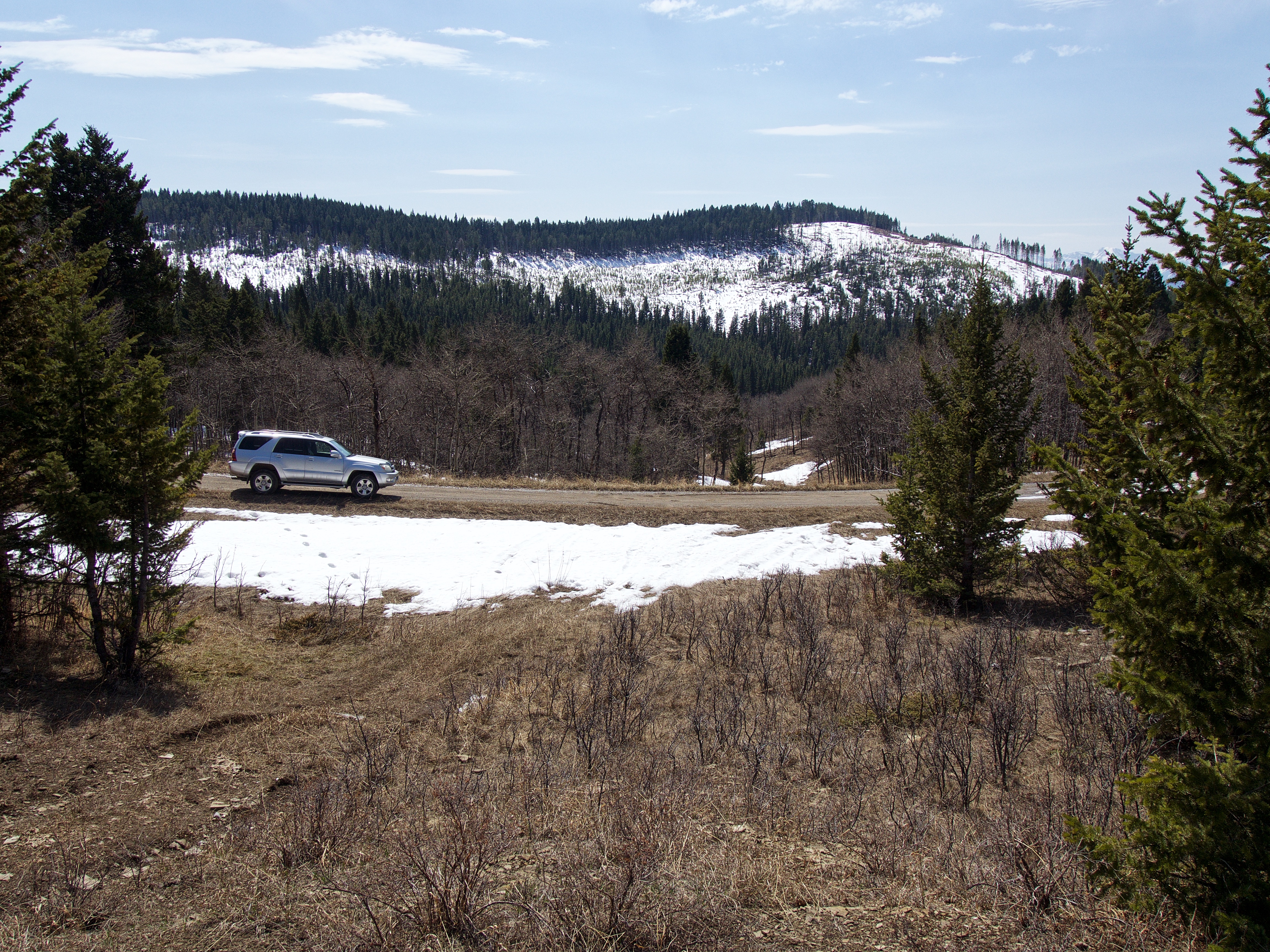
Glancing back towards my 4Runner shortly after starting. It was a beautiful day!

The edges of the road were bare, so I had no need for snowshoes.

Arriving at the Skyline Road.

Easy travelling along the Skyline Road.

After crossing the cattle guard in the foreground, I angled left (east) through the trees to reach the cutline (not shown).

I didn’t find anything to snack on… 😉

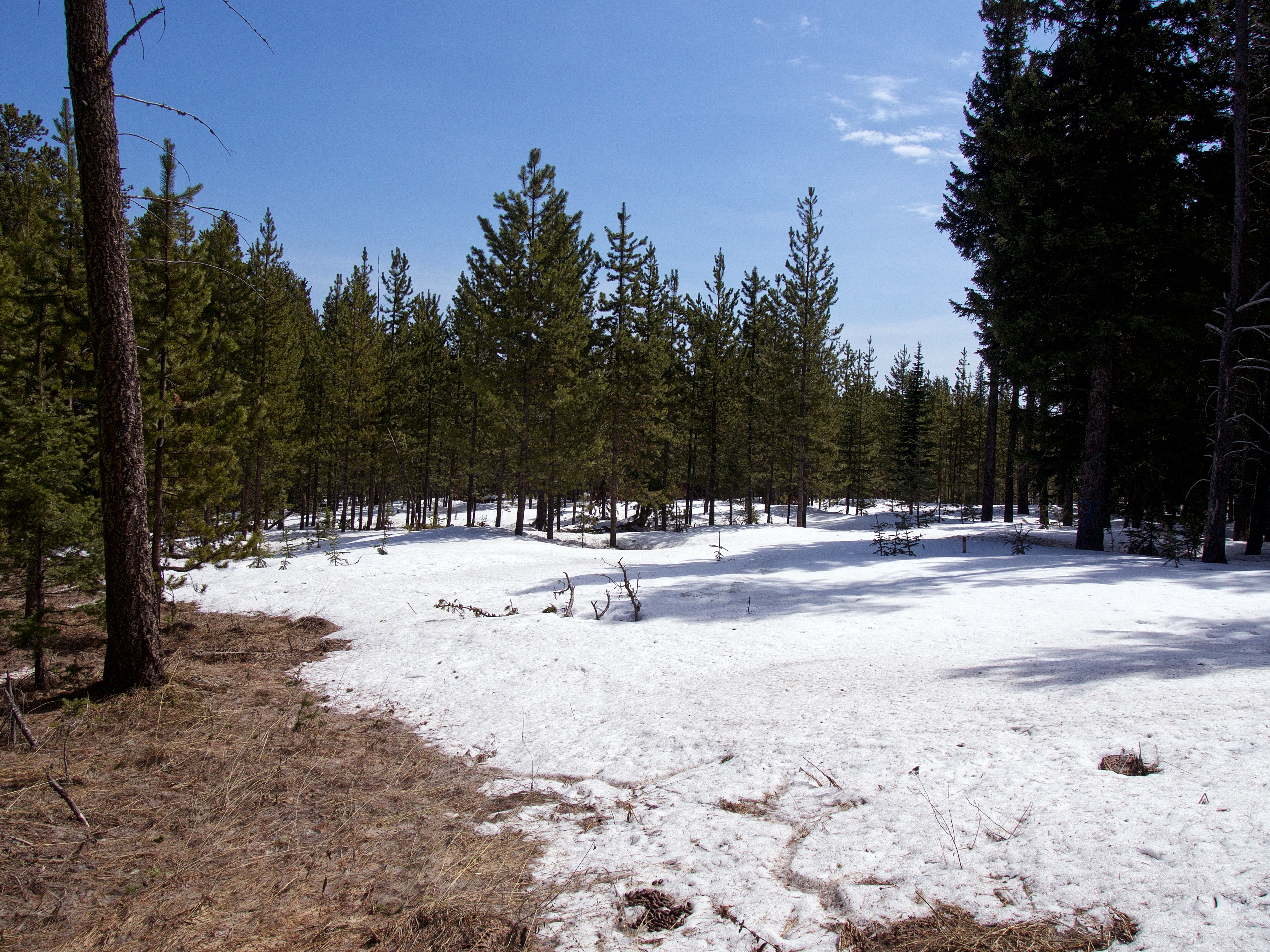
Looking up the cutline from the near the base. Here’s where I definitely needed my snowshoes!

The view back shortly after starting up the cutline. The snow was surprisingly deep and when I post-holed, I sunk almost to my hips.

Just prior to reaching the tower, the trail weaves its way past some large boulders. These boulders provide a great location to take in the views.

The Porcupine Fire Lookout (1820m). I’m assuming that the observation platform sits slightly off centre to facilitate a better angle for the ladder and to prevent the access hole from opening in the middle of the floor.

Looking up from the base.

That’s quite the trek to and from work everyday!

When I arrived on the summit, I met Cathi, who is the new Porcupine Lookout Observer. With over 30 years of experience working at fire lookouts around the province, Cathi had flown in by helicopter only 2 days prior to my arrival – which makes me the first official visitor of the year! 😉 She told me that the Lookout had opened almost a month later than last year because of all of the snow. As I seem to visit fire lookouts in the winter or in shoulder seasons, Cathi is the first observer that I’ve met. Knowing that the Lookout was also home to her and others, I didn’t want to intrude and asked permission to look around. Not only did she let me, she was a gracious host. Thanks Cathi!
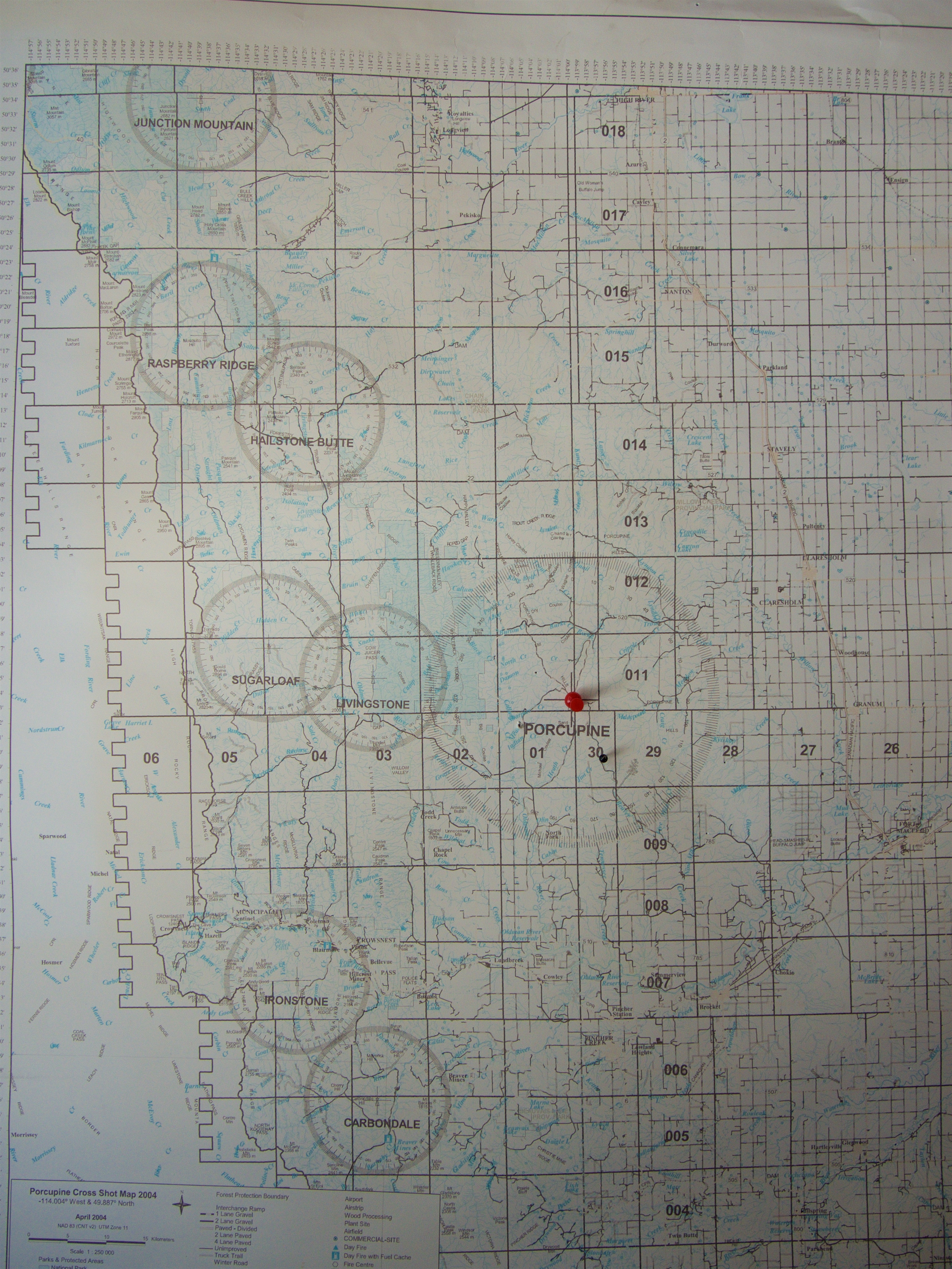
While signing the guest book, I asked permission to take a picture of this map which shows the sight range of all the lookouts south of High River. Porcupine has by far, the largest range. You can also see how the lookouts are grouped together to cover specific areas.

Cathi graciously snapped a picture of me on the summit. She told me that when the fire hazard is considered extreme, an observer could spend 12 consecutive hours a day atop the tower.

Even though the summit is mostly treed – hence the giant tower – there are still places to take in a decent view. This is looking to the southwest at the Livingstone Range. On the far left is the South Peak followed by Caudron Peak and Centre Peak to the left of centre. “Lightning Peak” is to the right of centre.

Gazing west at “Lightning Peak” (far left), Thunder Mountain (centre), and Thrift Peak (long ridge on the far right) which is home to the Livingstone Fire Lookout. The taller peaks on the right are Mount Erris and Gould Dome.

A telephoto slightly to the northwest. Thrift Peak is the long ridge in the distance centre. Behind it in the centre are Gould Dome and Funnel Peak. The tallest peak to the right of centre is Tornado Mountain which sits at 3099m. Mount Erris is the tall peak on the left.

Another telephoto to the northwest. Coffin Mountain, Sheep Mountain and Mount Livingstone are in the centre. Saddle Mountain sits slightly to the right of centre. Black Mountain is the long, low treed ridge that extends out from the far left in the centre of the picture. Behind it is the Whaleback ridge.

An older sign affixed to the tower states that the elevation is 1783m…

…however, a newer sign located to the south, says it’s 1820m. Apparently the summit is still growing. 😉 My GPS gave me a summit reading of 1825m.

In addition to the observation tower, there are also two transmission towers on the summit. The one in the foreground is significantly taller than the observation tower.

A small helicopter pad (note the wind sock on the left) sits to the south.

Sand Bluff is located ~3.5km to the southwest. A month ago, Brad and I tried to reach the Lookout from the summit of Sand Bluff , but were thwarted by deep snow.

On a non-hazy day, the front range of the Castle can be clearly seen to the south. Victoria Peak is the tallest mountain to the left of centre and Windsor Mountain, Castle Peak, and Mount Gladstone are in the centre. In the foreground is Sand Bluff.

A large clearing sits to the south of the Lookout. The small trees in the distant centre are part of the F-106 crash site.

I believe this screen shot from Google Earth reveals the extent – and violence – of the crash. It also shows how close the plane came to striking the Porcupine Lookout.
This is the north end of the crash site that begins just behind the observation tower. In 2011, the Denning family placed a headstone somewhere near here, but I did not come across it. It’s shocking to think that the family only recently learned the location of the crash site – all thanks to the work of local rancher, Reid Moynihan, who was only a child when the accident happened. (“U.S. military to honour Nanton-area rancher”, Calgary Herald, 20 June, 2011)

Some fire-scarred trees still remain. In, Fire Lookout Hikes in the Canadian Rockies (2nd edition), Mike Potter notes that, “The crash caused a fire, but apparently military security at the site precluded crews from going in to attack it.” (30)

A burned stump.

After reflecting for a bit at the crash site, it was time for me to leave. Before heading home, I asked Cathi if I could take this picture from beneath the tower.

One last look to the southwest.

Heading down the cutline.

One of the few sections where the snow was firm enough to prevent me from post-holing.

There wasn’t much snow to the east.

Back on the Skyline Road.

Starting down the West Sharples Creek Road.
Arriving back at my 4Runner under sunny skies and a temperature of 22c – what a difference from a month ago when it was -17c! I’m glad that I made the quick trip up to the Porcupine Fire Lookout. Not only did I complete what Brad and I started on Sand Bluff a month ago, but I enjoyed learning about the life of a lookout observer. It’s nice to know that there are good people watching over our forests!
Hi Dave, What a great hiking blog you write. Interesting and sad history!
Best regards, Elaine
Elaine Sulima Real Estate Agent Real Estate Professionals Inc. cel: 403-540-5222 office: 403-253-5305 fax: 403-246-3639 email: sulimae@shaw.ca Website: http://www.elainesulima.com Making Great Neighbours!
>
Thanks!!
I still remember that day, we were the first Military unit on site only 10 of us. We flew in from CFB Calgary in a CH 147 Chinook that landed at the base of the mountain then hiked up the road to the top.. RCMP provided security as we entered the fiery crash site alone. A few hrs later US officials arrived and we were briefed to find NATO code books and other classified material first before recovering the pilot.
Wow! First of all, thank you so much for your service to our country Mak. It is much appreciated. My best friend growing up, Jason, served two tours in Cypress and one in Bosnia. This May it will be 4 years since he passed… Secondly, thank you so much for sharing your experience as one of the first people on the scene. I can’t even imagine what that would’ve been like. The priority on finding the code books I can intellectually understand, but having to do so before recovering the pilot must have been emotionally difficult. Again, thank you so much for sharing. This story should not be forgotten.