

⚠️ Hiking and scrambling are inherently dangerous activities. Please read my Disclaimer. ⚠️
With the summit of “Mill Creek Peak” (MCP) under our feet and the bulk of the day’s elevation gains behind us, Andrew and I set off on what would turn out to be a very scenic ~1.3km ridge walk to the summit of “Mill Creek Mountain” (MCM). Indeed, MCM is the nickname that I’ve given to the little massif that sits immediately to the southeast of Mount Gladstone and directly to the north of Windsor Mountain and Castle Peak. While some might eschew such destinations, I’m fortunate to have friends and family who share my enthusiasm for exploring these unnamed, obscure corners of the Crowsnest Pass and the Castle. I use nicknames for these places if I don’t already know of a common or local name and I try to keep them somewhat descriptive as possible, hence, MCM and MCP.
While MCM looks rather insignificant from its much larger neighbours, in actuality, it’s only ~8m lower than Prairie Bluff. Moreover, it’s diminutive size coupled with its unique geographical location, allows it to off excellent immersive views of the surrounding landscape. Both Andrew and I agreed that during larch season, the short ridge walk between MCM and MCP would be incredibly scenic.
There are also multiple routes to the summit that could be combined into different loops. To me, the easiest route would use the south ridge that begins at the foot of Castle Peak. This would bring you to the summit of MCM in a more benign manner, though it would also involve a much longer hike and considerably more bushwhacking along the small tributary that flows between MCM and Mount Gladstone. The route that Mark and I used in 2015 and the one that Andrew and I used today, are more direct, but are also more labour intensive as they incorporate steep ascents up drainages and scree slopes. Whatever the route, I think that both MCM and MCP are fascinating little peaks and are worth visiting. Then again, I haven’t met too many mountains in the Castle that I haven’t enjoyed! 😉
Be sure to read Andrew’s trip report for MCP and MCM.

For a complete description of our route see my trip report for MCP.
From the summit of MCP, it’s an easy ~1.3km ridge walk across the col to MCM. A quick scramble up the front of the summit block brings you onto the summit. For descent, we dropped down the northeast slopes of MCM and into the bowl. We descended using the third drainage, but be warned that the section that bypasses the waterfall (skier’s right or climber’s left) is very steep. Once in the tributary we retraced our approach route, though we did try and find the trail that leads to Mount Gladstone, but were unsuccessful.

When viewed from the larger, surrounding mountains, these two peaks come across as rather insignificant, especially MCP. However, this couldn’t be further from the truth. The east face of MCP is particularly impressive and the ridge walk between the two is highly enjoyable. At 2165m, MCP is 85m shorter than the actual summit of MCM. As previously mentioned, the most benign way to reach both summits would be via the south ridge at the foot of Castle Peak.

Our total roundtrip distance was 14.7km with total elevation gains of 1014m. The steep slog up to the north ridge of MCP does however, make the elevation gain seem higher. Our total roundtrip time was 8 hour and 12 minutes.

After summiting MCP, we began the easy ~1.3km ridge walk to the summit of MCM (right).
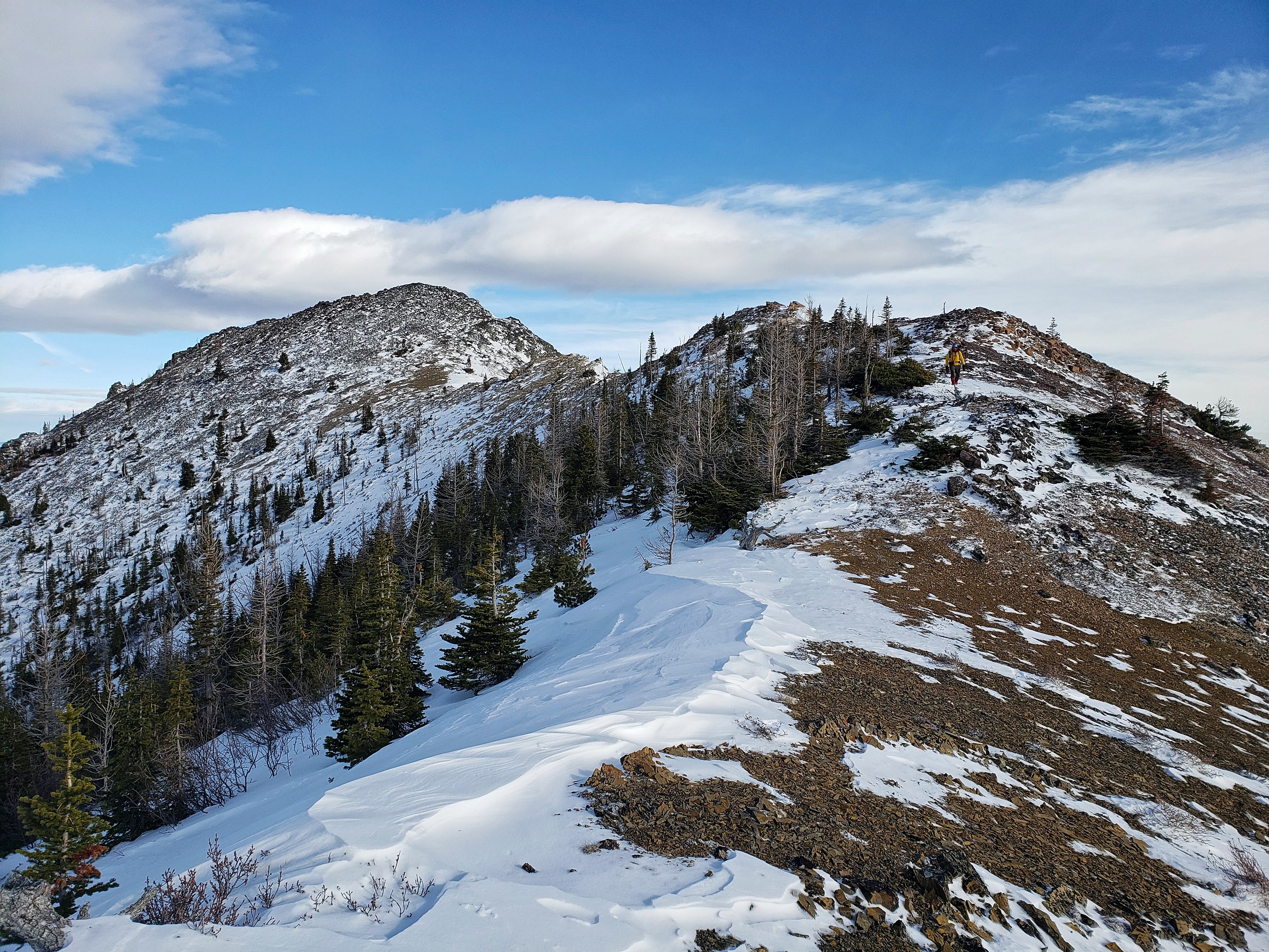
The trip from MCP (left) to the col is quick and uncomplicated and the two high points behind Andrew are easily bypassed.

Another view of the previous picture, though with Victoria Peak in the background.

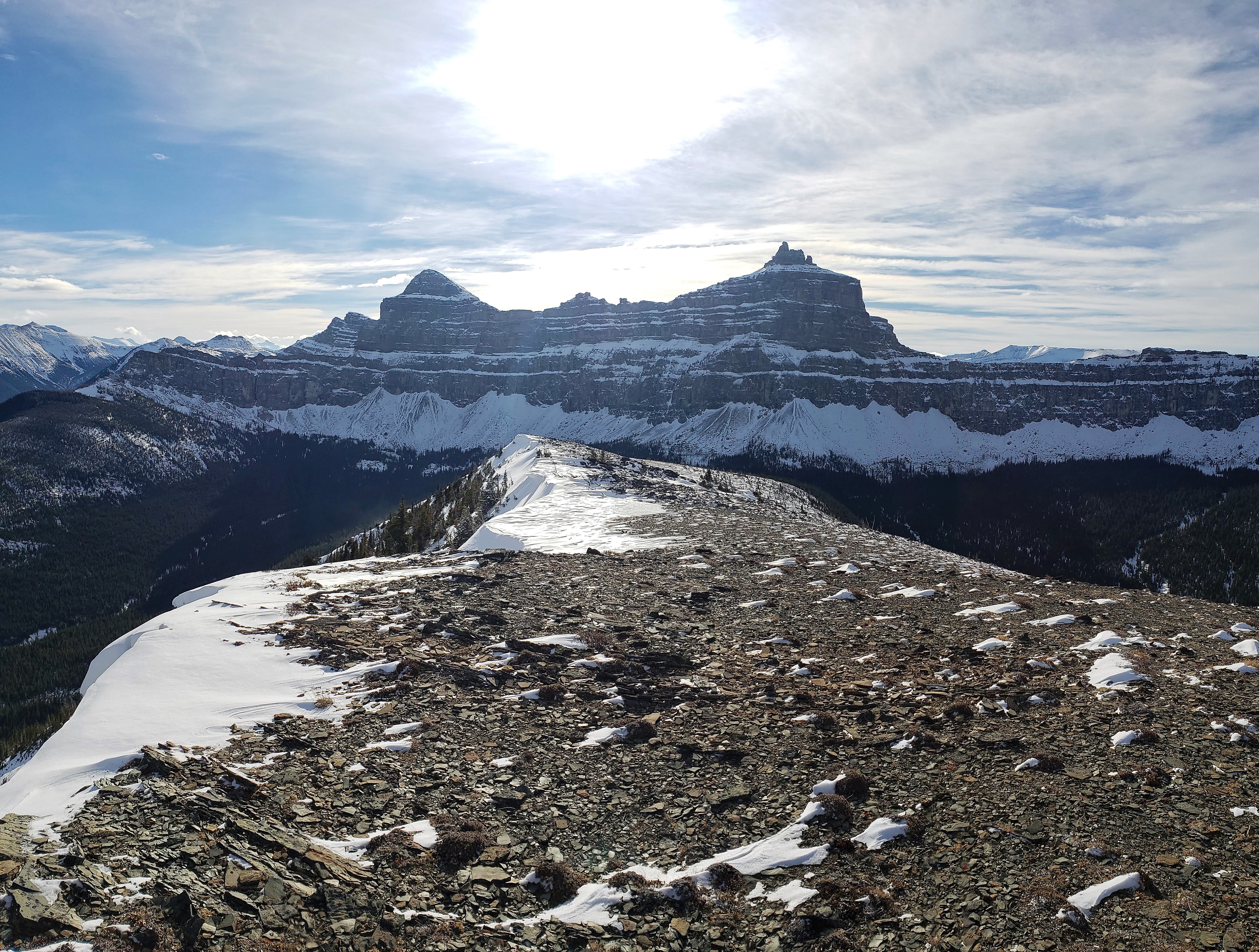
From the col, the summit looked like it might prove challenging to reach. In the background are Windsor Mountain (right) and Castle Peak.

Nope this isn’t staged at all! 😉 Looking at Mount Gladstone from the col.

Still thinking that the summit block looks challenging… (Photo by Andrew Nugara)

The bowl between MCM and MCP is full of larches and in the fall, this would be an incredibly scenic ridge walk.

A neat looking cornice on the summit ridge. There are two small bumps between here and the summit block that require some easy scrambling to overcome.

Our route would go up the left side of the summit block and then straight over the nose.

Heading up the left side.

A closer look at the upper section of the summit block.

Scrambling the summit block section from the previous picture. There is exposure on both sides, but it is also wide enough that it did not feel airy. (Photo by Andrew Nugara)

Andrew follows me up.

The summit of “Mill Creek Mountain” (2250m). Someone had already built a little cairn but I bet they didn’t name it… so, I’m going to call it ‘Scott’ because MCM is also the beginning of some very Scottish names… like ‘McMurray’ for instance. 🙂

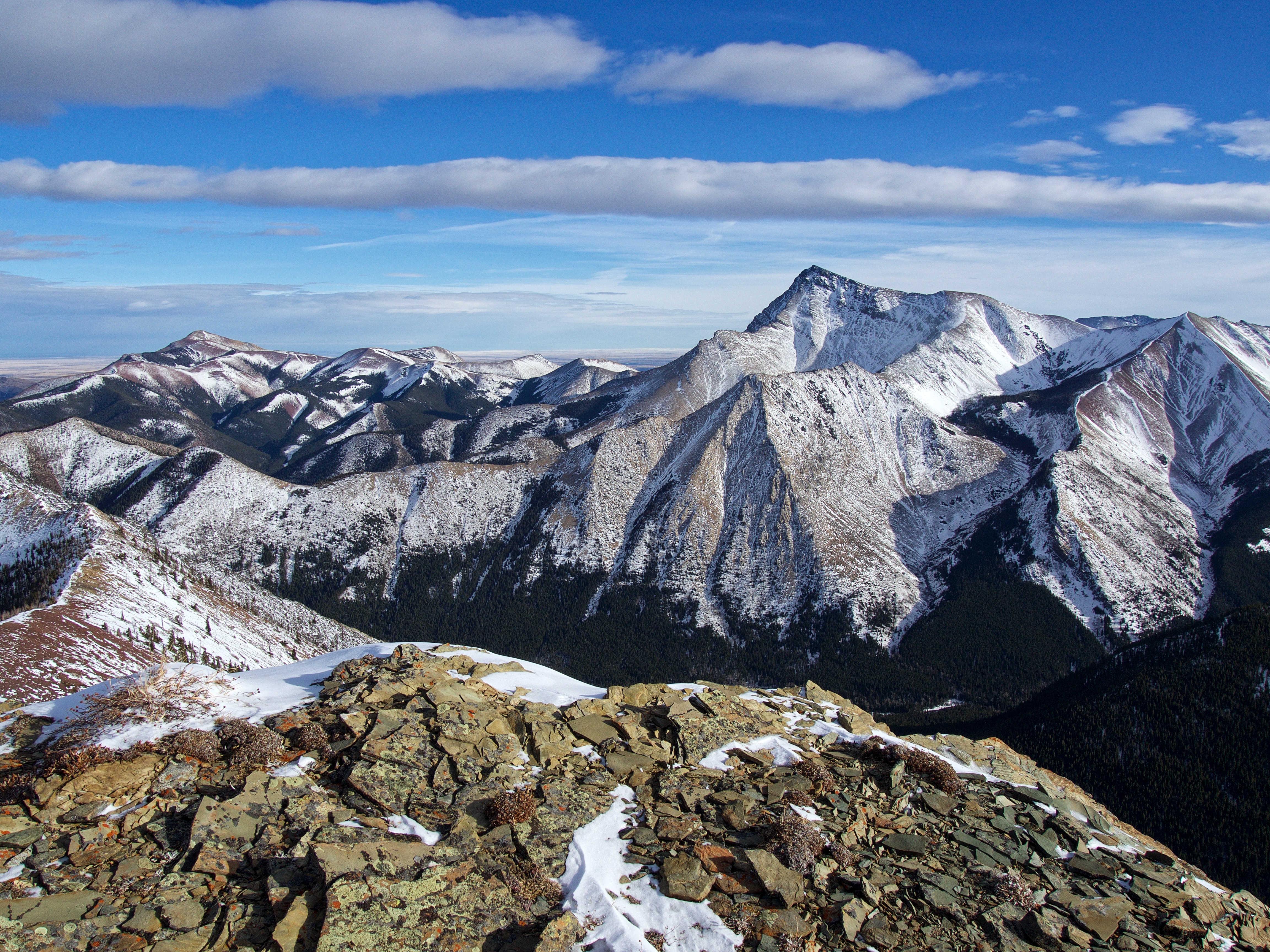
Of course, this is the main reason why this is such a cool destination: a telephoto of Windsor Mountain (left) and Castle Peak.

A telephoto to the southeast of Victoria Ridge (centre). Loaf Mountain is in the distance on the left.
Gazing east at Victoria Peak (right) and Prairie Bluff (left). MCM is only ~8m lower than Prairie Bluff!

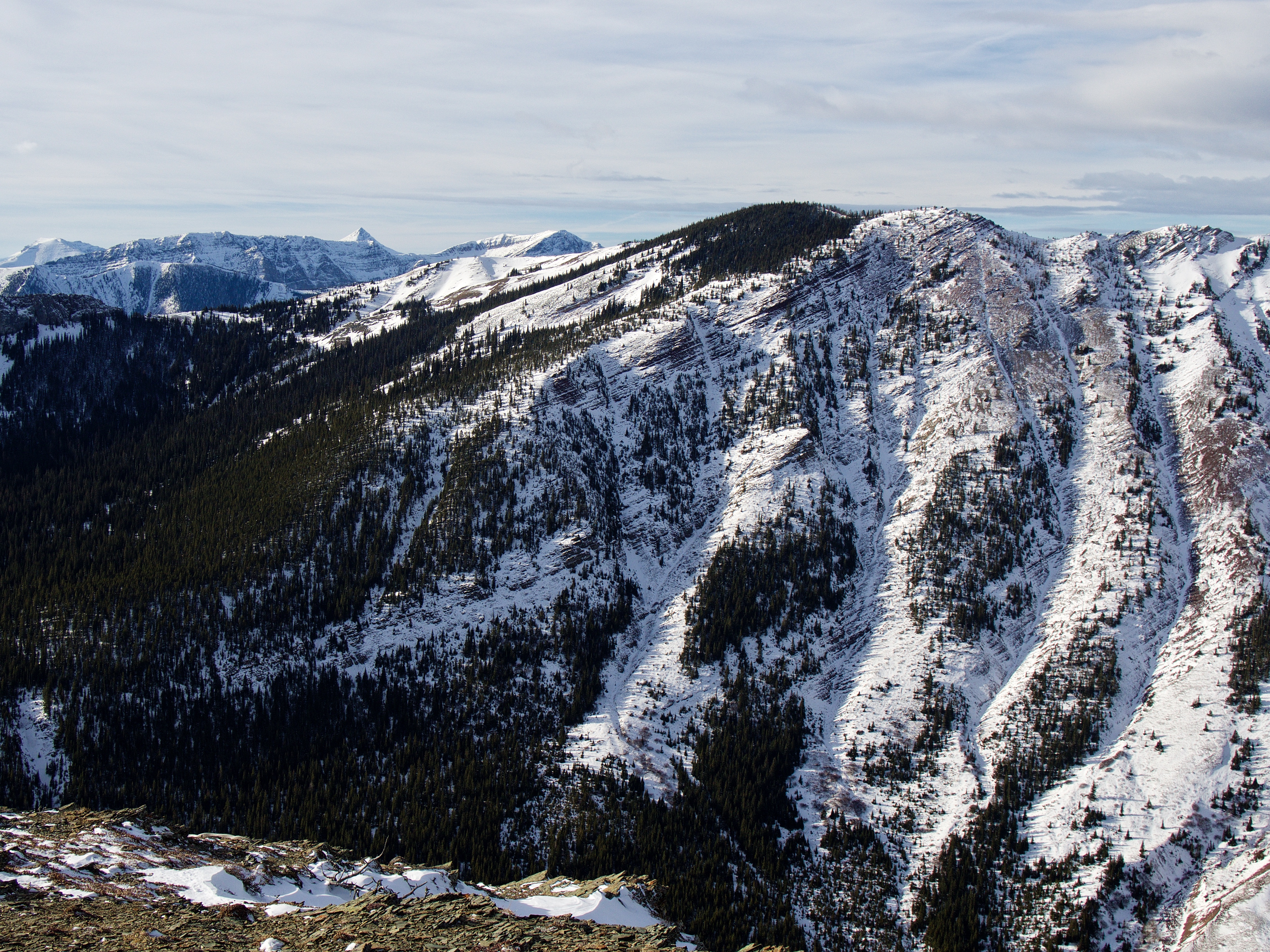
The view north features “Whitney Creek Mountain” (left) and Prairie Bluff (right). MCP is in the foreground centre, though from this vantage, it simply blends into the surrounding landscape.

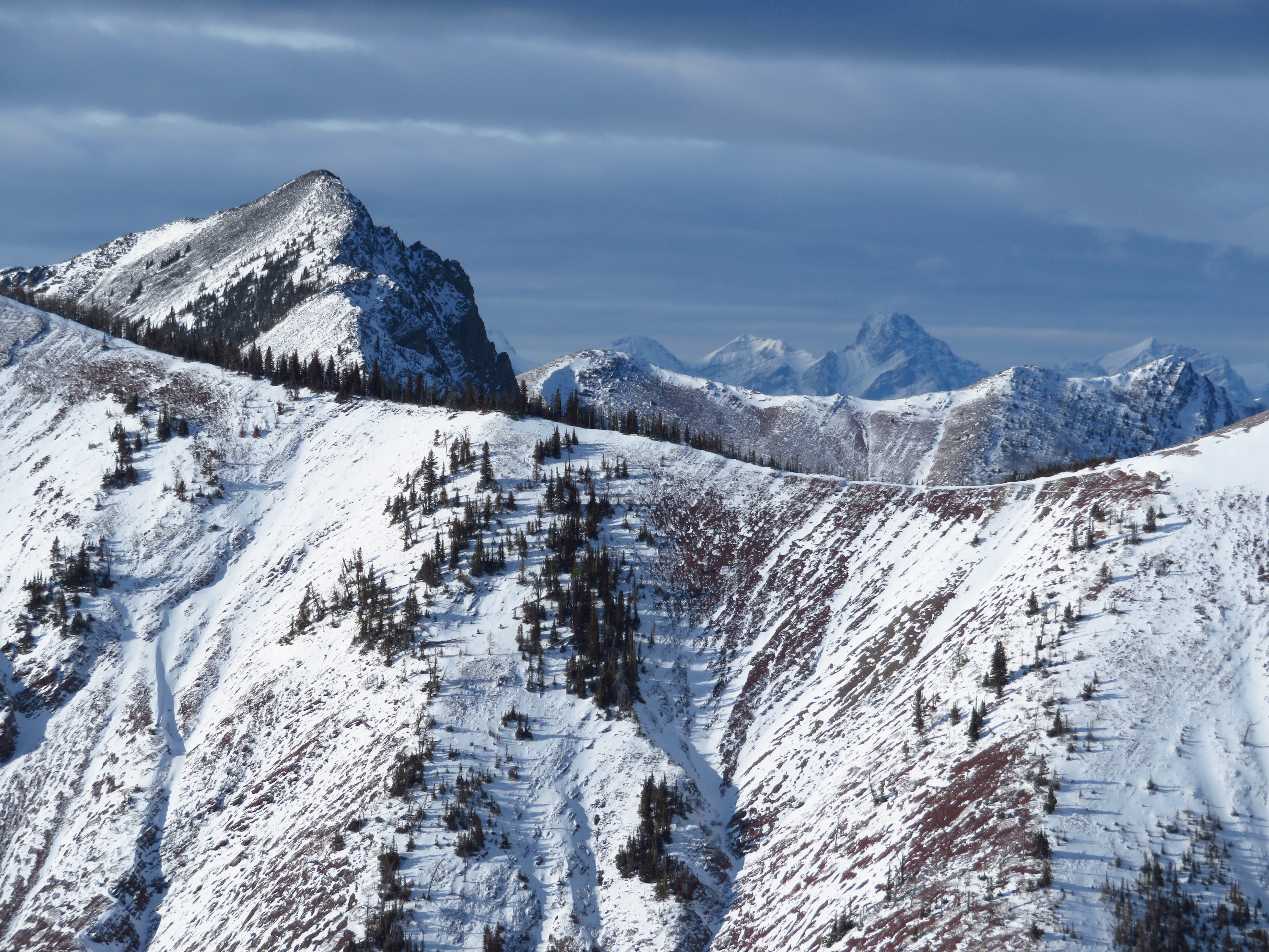
North Castle (left) and Mount Gladstone sit across the valley to the northwest.

A closer look at Mount Gladstone and the valley below. We considered descending the slopes in the foreground. The elusive trail can also be seen above the tributary. (Photo by Andrew Nugara)
A telephoto of the col between Gladstone and North Castle. “Larry Mountain” is on the left with “Frankie Peak” just behind it. “Eagle Peak”, “Whistable 1” and “Table Top” are the notable features on the ridge behind the col and in the distant centre is Mount Darrah. (Photo by Andrew Nugara)
A telephoto to the west of North Castle. The pointy peak in the distance is Mount Haig with Barnaby Ridge just to the right of Haig.

A telephoto to the southwest of Castle Peak. In the distant centre is Lys Ridge.

Andrew on the summit of MCM.
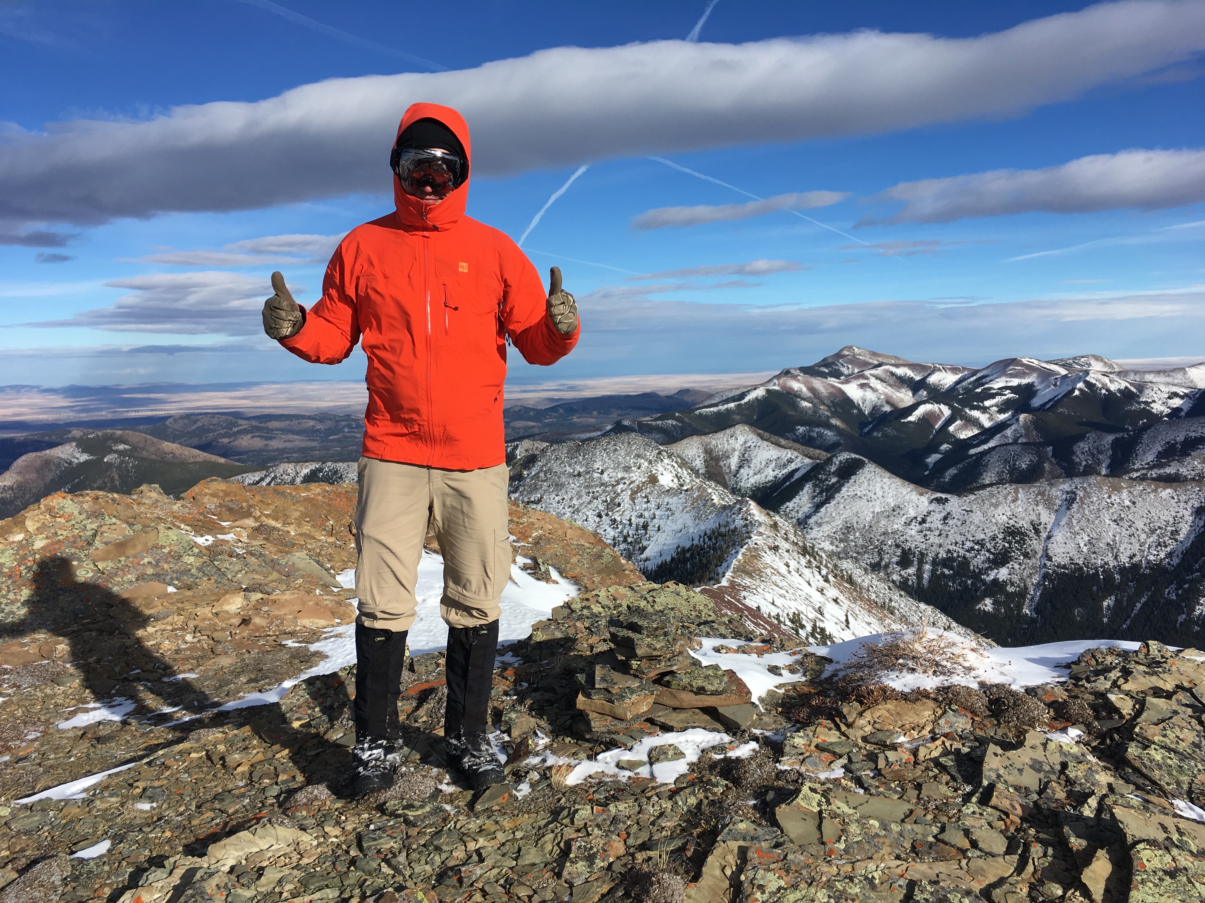
With our brightly coloured coats, Andrew and I could be mistaken for Teletubbies. 😉

A final look at Victoria Peak and Prairie Bluff.
An encore for the stars of the show!

Andrew holds up four fingers, two thumbs, and a rounded mitten to symbolize his seven ascents of Prairie Bluff (right). His latest one was just the day before.

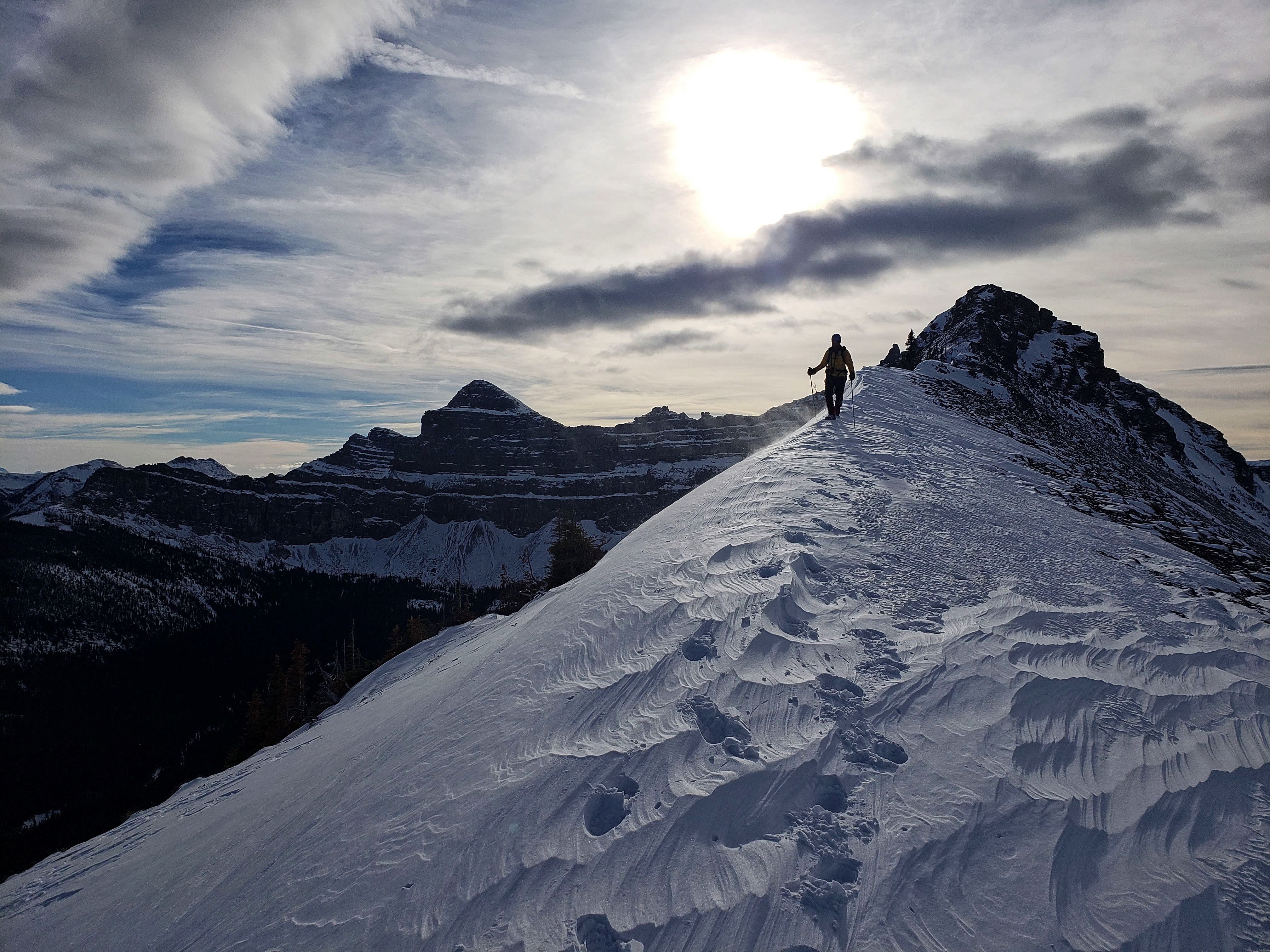
Leaving the summit. We would take the ridge on the left before descending into the bowl.

The snow made the steep terrain that much trickier. (Photo by Andrew Nugara)

Andrew climbs through a small gap on one of two bumps along the summit ridge.

The ridge may be short, but there are great views in all directions. (Photo by Andrew Nugara)

The bowl between MCM and MCP. During larch season, this would be super colourful!
If it weren’t for the intense wind, we would have taken even more time to enjoy the views.
This is where the full compression of the wind hit and more than once, it staggered me. (Photo by Andrew Nugara)

Andrew follows me down toward the bowl. The summit of MCM is on the right.

Still not out of the wind…

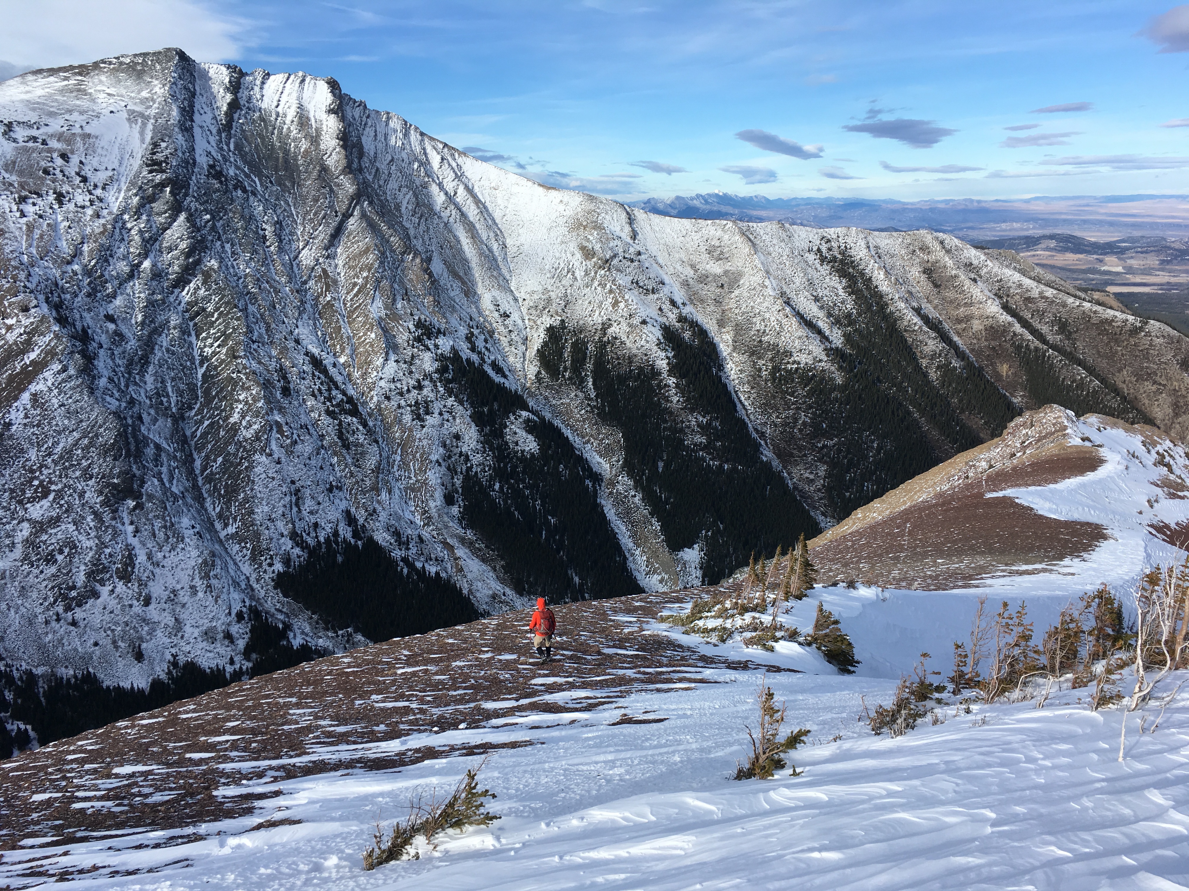
We followed a small gully to the main drainage. Our ascent slope up the northwest face of MCP is to the left of centre.

The entrance to the bowl is marked by a narrow gap. The drainage still had water in it, so I had to skirt by on the side. (Photo by Andrew Nugara)

Andrew follows me through the gap, though on the other side of the stream.

Following the drainage. In my 2015 trip, we glissaded down some of these upper sections. That was not an option this time around as there was not enough snow.

Still a ways to go…

Andrew stops to look at our route up MCP which is to the left of the gully in the centre.

The impressive section of waterfalls in the third drainage. Bypassing this either on the way up or down requires navigating very steep slopes.

Arriving back at the tributary to Mill Creek.

Gazing back up the drainage. A scramble route to MCM may exist through the rocks on the upper right.

On the other side of the tributary with a more comprehensive view of the third drainage. The top of the second drainage that we used on ascent can be seen to the upper left.
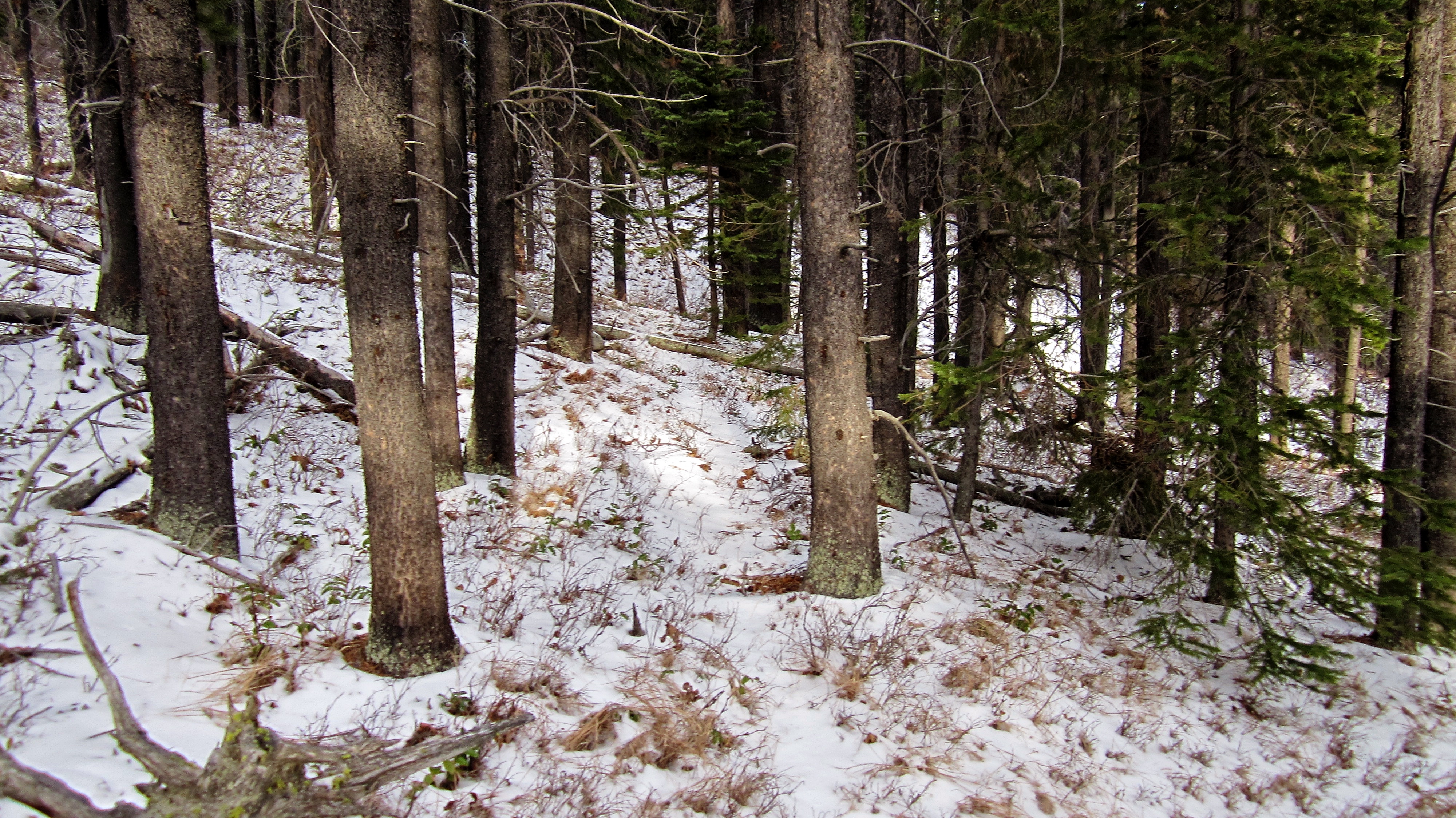
To avoid bushwhacking and rock hopping along the tributary, we spent a long time gaining and losing elevation to find the trail. This small game trail and others like it, were all we found.

High above the tributary and still no trail…

Near its junction with Mill Creek, we decided to give up and descend to the tributary.

I found it interesting that while Mill Creek was mostly dry, the tributary had plenty of flowing water.

Glad to be back on level ground and retracing our steps back to the main trail.

On the trail and enjoying the ~2.4km hike back to my vehicle.

Arriving back at my 4Runner after another excellent day in the mountains! MCM and MCP were definitely worth our time though I wish that the wind had been more cooperative. Any route that utilizes the drainages on the northwest face of MCP will be steep though it looks like there could be a much easier route to the summit of MCM via the south ridge. As crazy as it sounds, I may return to MCM and MCP (for a 3rd time) to try a different route and loop. If I do, it will definitely be during the fall when the larches have turned yellow because the colours combined with the immersive views would be intense. Again, and as always, it was a pleasure to spend the day with Andrew “7-time Prairie Bluff Champion” Nugara. 😉 Seriously though, Andrew is an awesome person and is one of my favourite people to spend a day in the mountains with. Thanks Andrew for another great trip!