


⚠️ Hiking and scrambling are inherently dangerous activities. Please read my Disclaimer. ⚠️
It feels like forever since I’ve been able to get to the mountains. A combination of home renos, bad weather, and a general state of busyness meant that today was my first trip in three months. Yikes! Thankfully, the best way to shake off the cobwebs is to pick one of your favourite mountain routes and then invite two great friends to join you for a little mountaineering adventure. 🙂
This was my seventh trip up Prairie Bluff (PB) and my second using a winter route pioneered by Brad Wolcott and Dave Fuller up the Northeast face (Andy also did it as a summer scramble in 2021). PB is cool in that there are multiple ways to the top. You can simply follow an easy trail or you can choose a variety of scramble routes. If you want something even more involved, then you can choose to head up a variety of steep couloirs on the northeast face, preferably in the winter so you can take advantage of the snow. This was our choice for today and it’s become one of my favourite winter routes, especially if the wind is howling.
As I’ve described everything in detail in my November 2022 trip report, I don’t really have much more to say. We chose the same route again today, except that we avoided the last – and steepest couloir – due to poor snow. Instead, we veered slightly to climber’s right where we found an easy scramble onto the summit.
Again, this is one of my favourite winter routes but it’s not for the inexperienced or the unprepared. Bringing some technical gear is a must even if you don’t use it. In 2022, we didn’t have to use it but today we did. It would definitely suck to find yourself halfway up the mountain and in need of a short rope.
Again, a huge thanks to Brad and Andy for a fantastic day! 🙂
Be sure to read Andy’s awesome report as well!


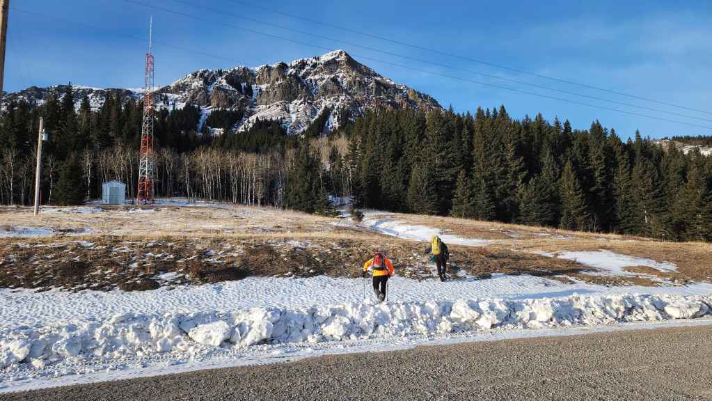
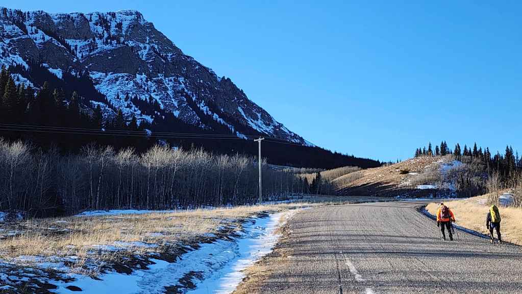
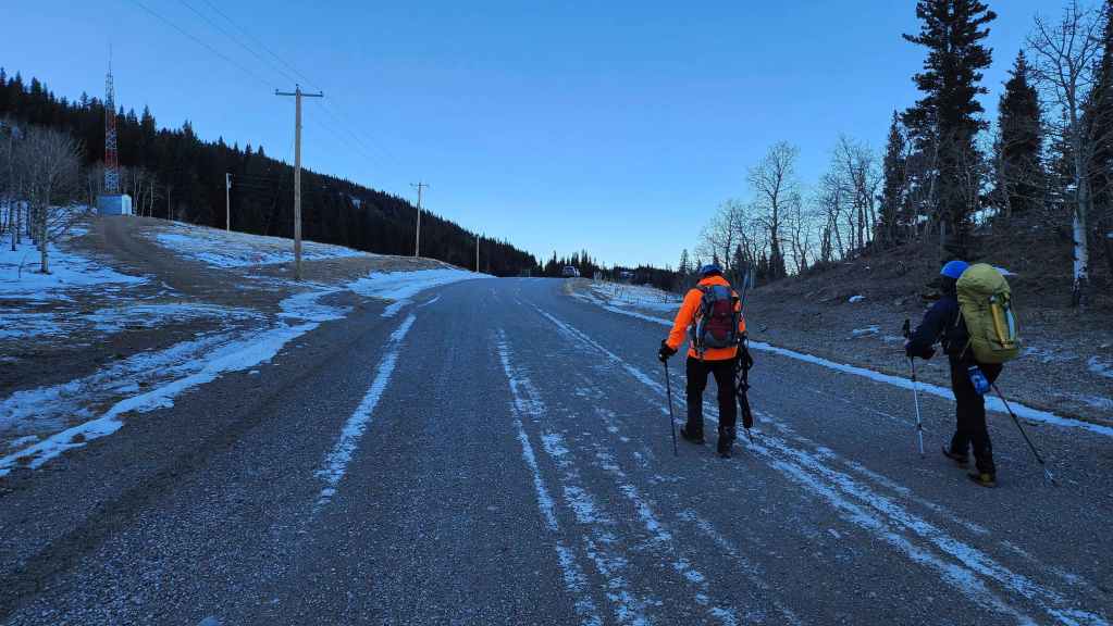
To get to the northeast face of Prairie Bluff, we drove south from Pincher Creek on Highway 6 until we reached the Shell Waterton Complex Road (Township Rd. 43A). We then turned onto this road and drove west for ~9.1 km until we came to a junction with a gravel road near to the entrance of the plant. Here, we turned left and onto the gravel road where we continued straight for ~3.9 km until we came to Butcher Lake. We continued straight for another ~1.5 km, until we arrived a Shell pumping house which is the original Windsor Ridge trailhead. We kept following the road as it curved to the right, continuing along it for another ~3.8 km until we arrived at a small radio tower located on the left side of the road. This was our starting point.
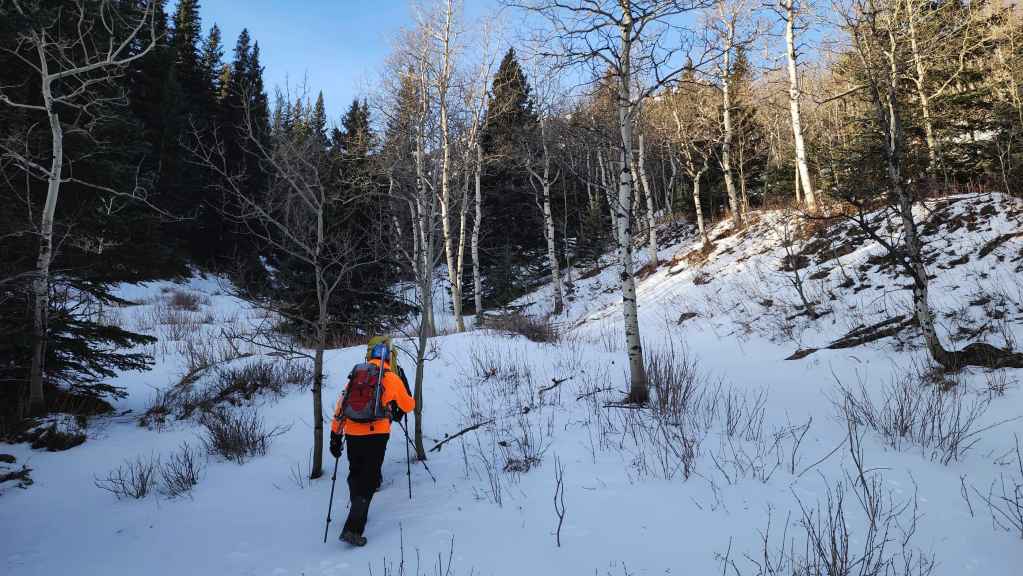
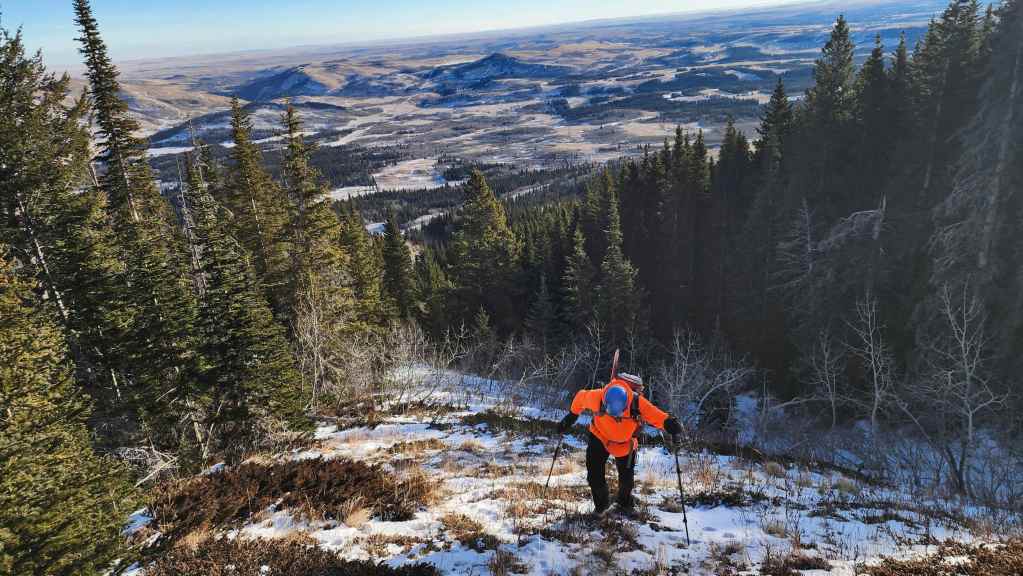
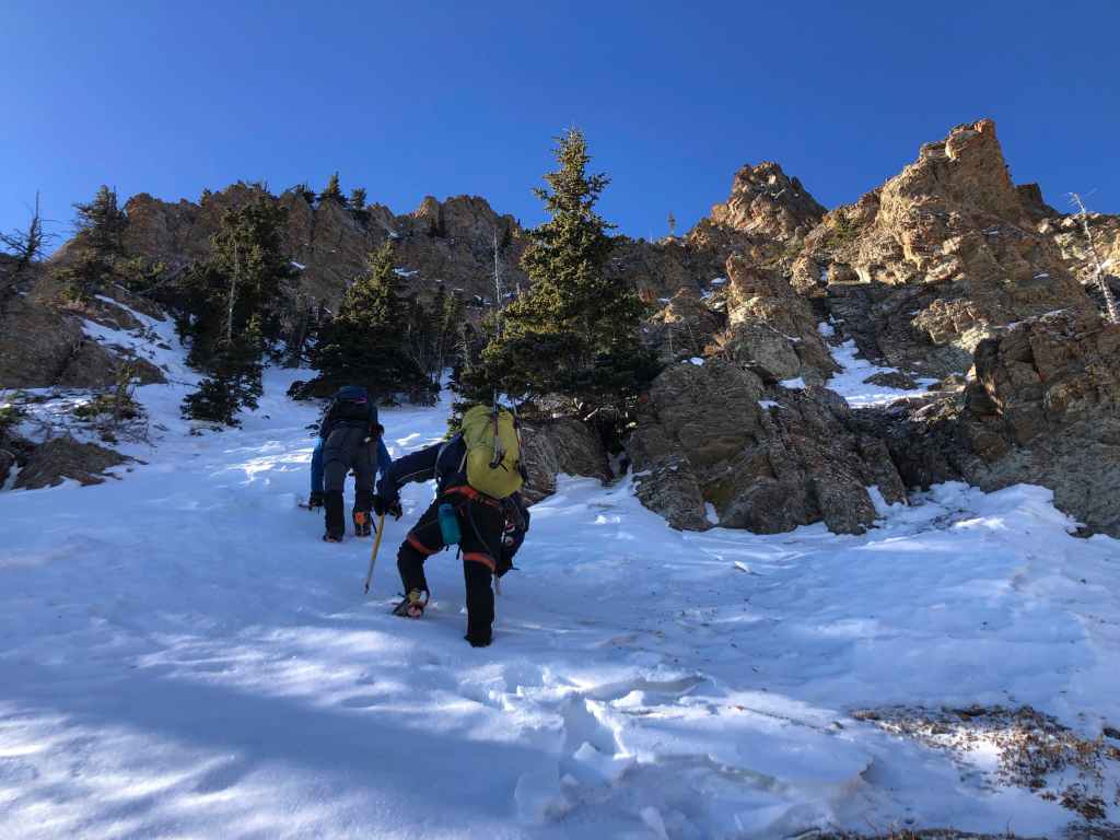
From the road, we followed a small ridge above an obvious drainage for approximately 45 minutes or so (~1 km) until we were almost at the base of the mountain. We then headed to climber’s right and onto the start a parallel drainage located immediately to the northwest. This was the start of the lower couloir.
We followed the lower couloir for ~170 m until it ended in an open area beneath an imposing set of cliffs. The upper section of the couloir presented a small crux where the snow had come free, exposing bare rock slabs. Once past this, we could see the start of the second couloir which was approximately 50 m away. The second couloir is actually part of a larger couloir that eventually connects to the drainage that crosses the road where we parked.
Once inside the second couloir and at the base of the cliffs, we were presented with a fork. Using prior knowledge, we chose the one to climber’s left and made our way up its steep and narrow confines. There were two steps that we had to overcome which comprised the crux to this point. When we used this route in 2022, these steps were covered in ice, but today they were mostly bare.
Approximately 50 metres later, we emerged at the top of the second couloir and onto another open section. After skirting a small section of trees, we came to the third and steepest couloir. In 2022, we followed this directly onto the summit, but very sugary snow caused us to head to climber’s right where we found a relatively easy bypass route.
Blasted by the wind on the summit, we immediately dropped into a drainage located to the south between PB and “Prairie Fire”. From here we worked our way around the southeast end of the mountain and eventually back to the road. A short ~1.7 km hike brought us back to Brad’s car.
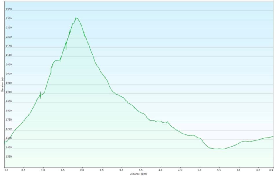

Our total roundtrip distance was 7 km with a total elevation gain of 680 m. Our total roundtrip time was 6 hours and 30 minutes.


Brad and Andy check out the route from our starting point.
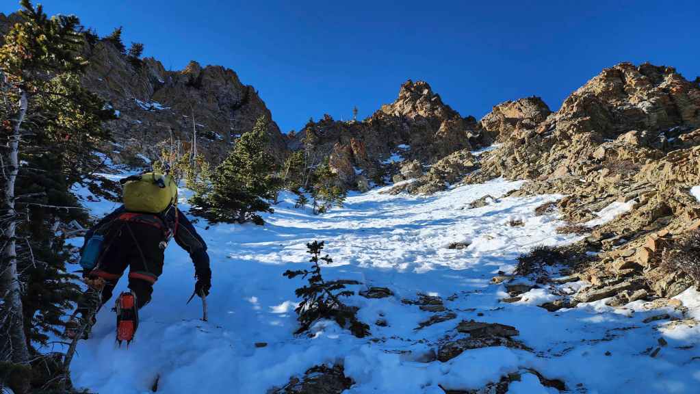
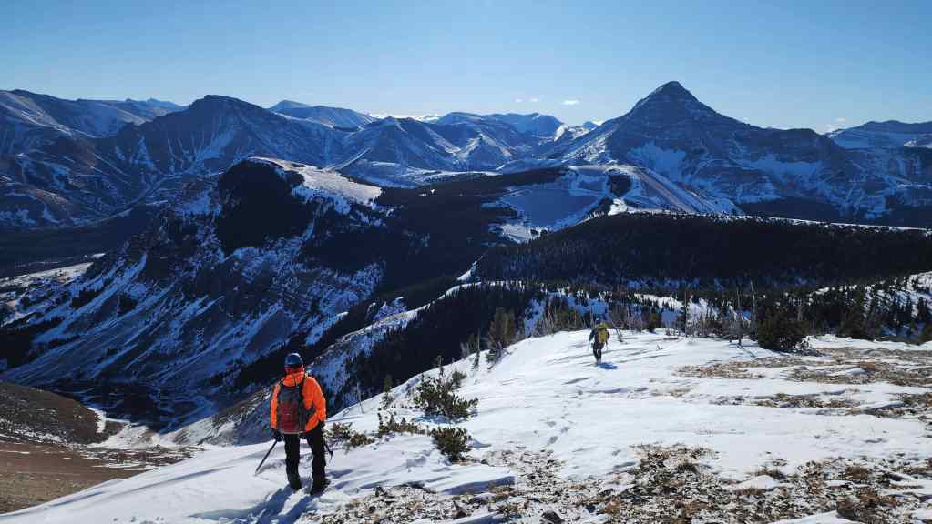
Starting up the drainage.
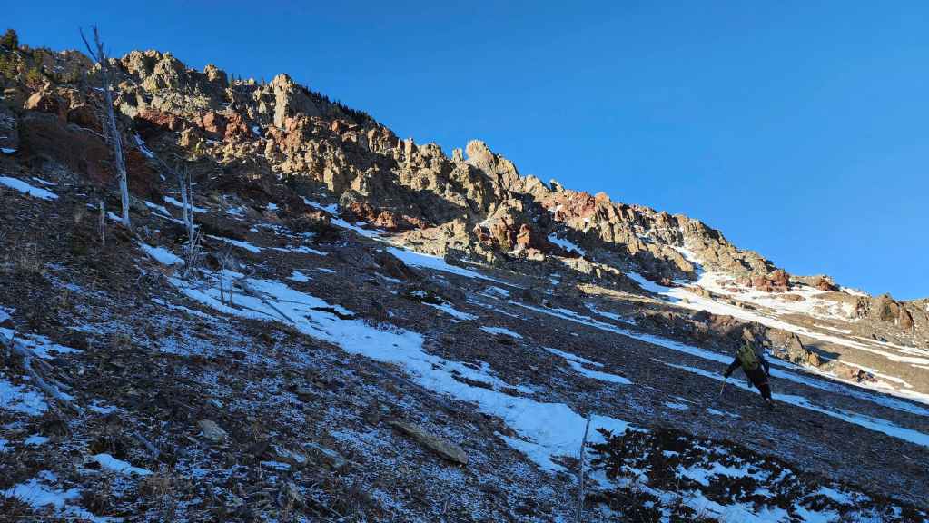
Following the drainage, though we will soon leave it to gain the ridge on our right.

Nearing the upper section of the ridge. (Photo by Andrew Nugara)
Looking back from the same vantage as the previous photo. Don’t let Andy’s new coat blind you! 😂
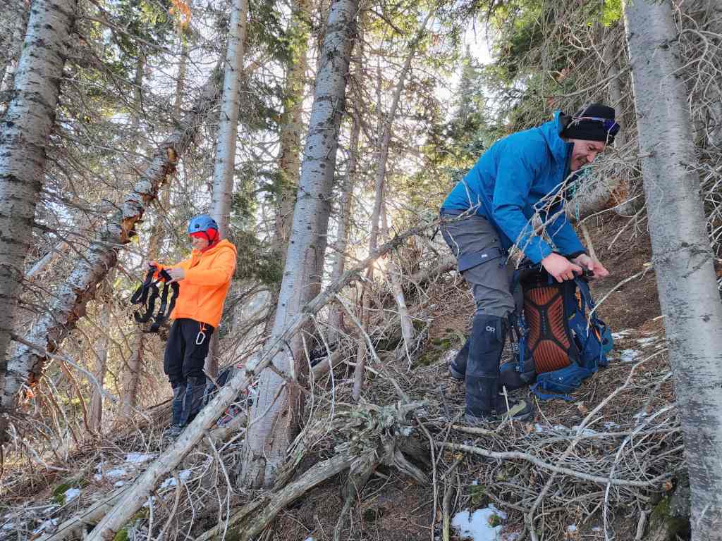
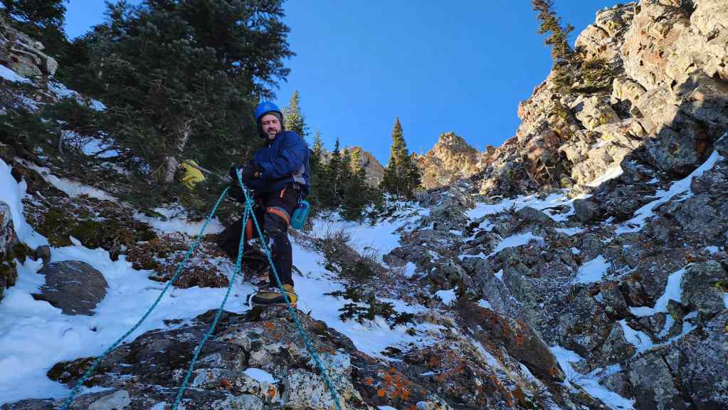
We decided to gear up in the trees so we’d be out of the wind. (Photo by Brad Wolcott)
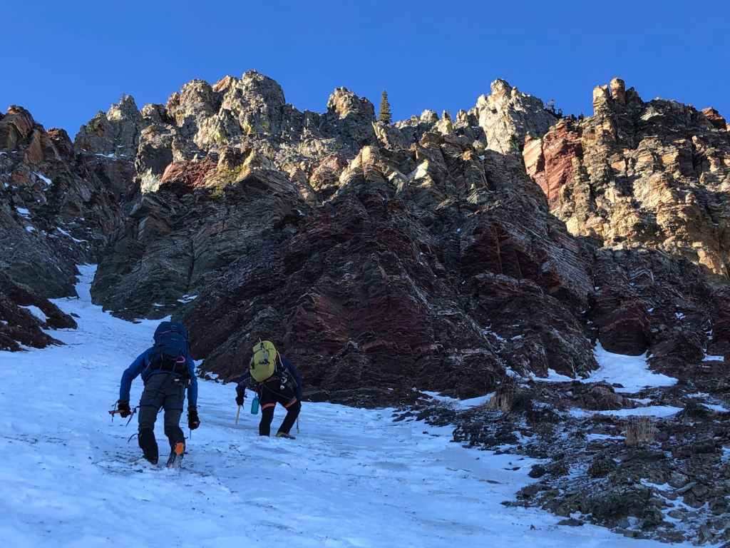
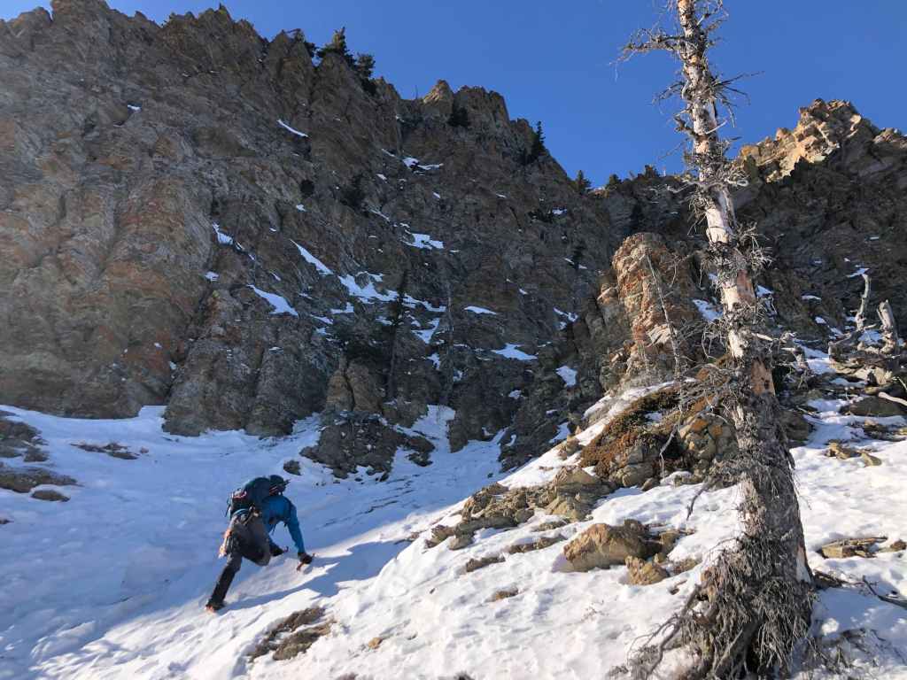
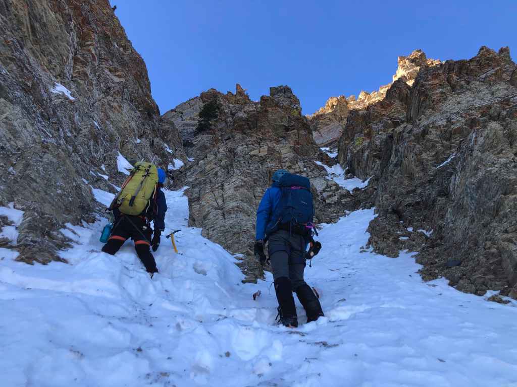
Brad leads us over to the start of the lower couloir.
My view back to Andy.
Starting up the couloir. (Photo by Andrew Nugara)
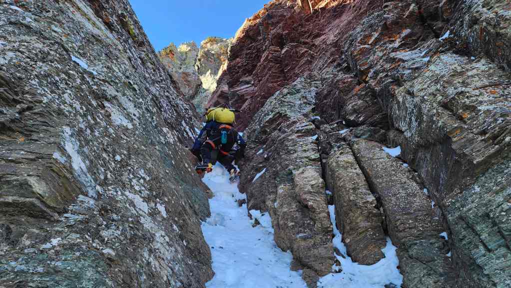
This couloir is an argillite wonderland. (Photo by Andrew Nugara)
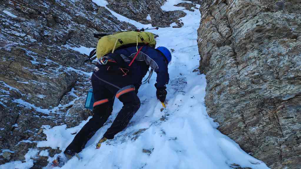
Heading up. (Photo by Andrew Nugara)
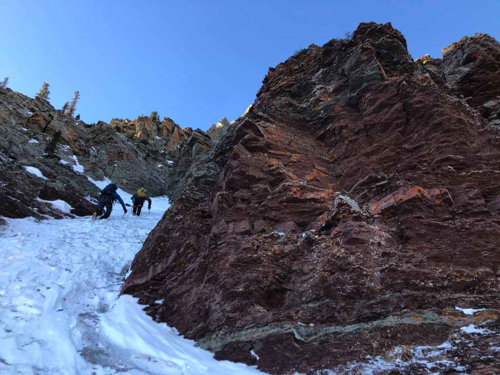
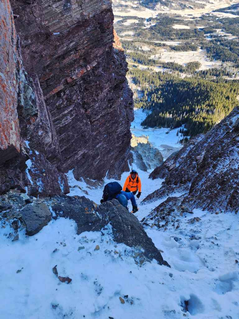
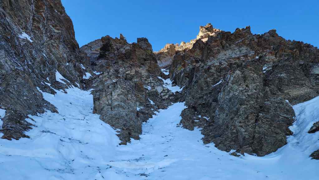
The couloir soon becomes a canyon.
My view back shortly after entering the couloir. The ridge we followed to the base is in the top right.
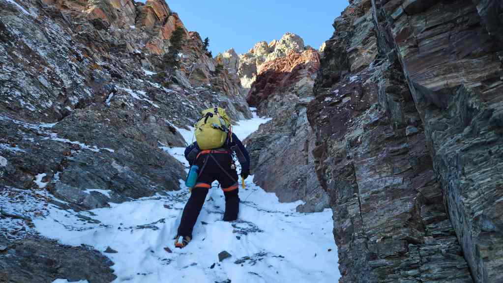
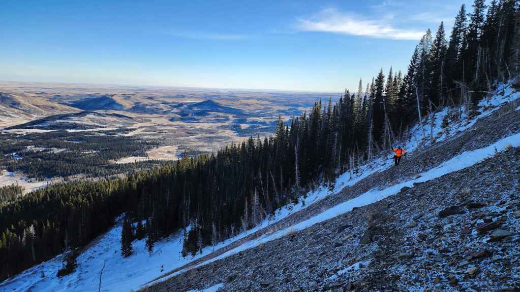
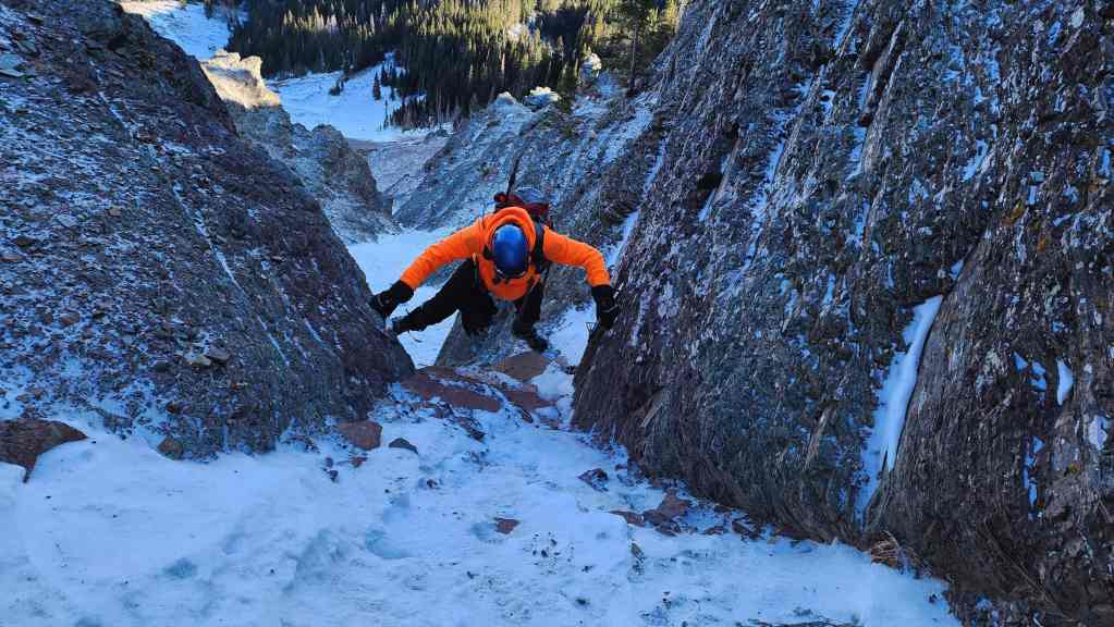
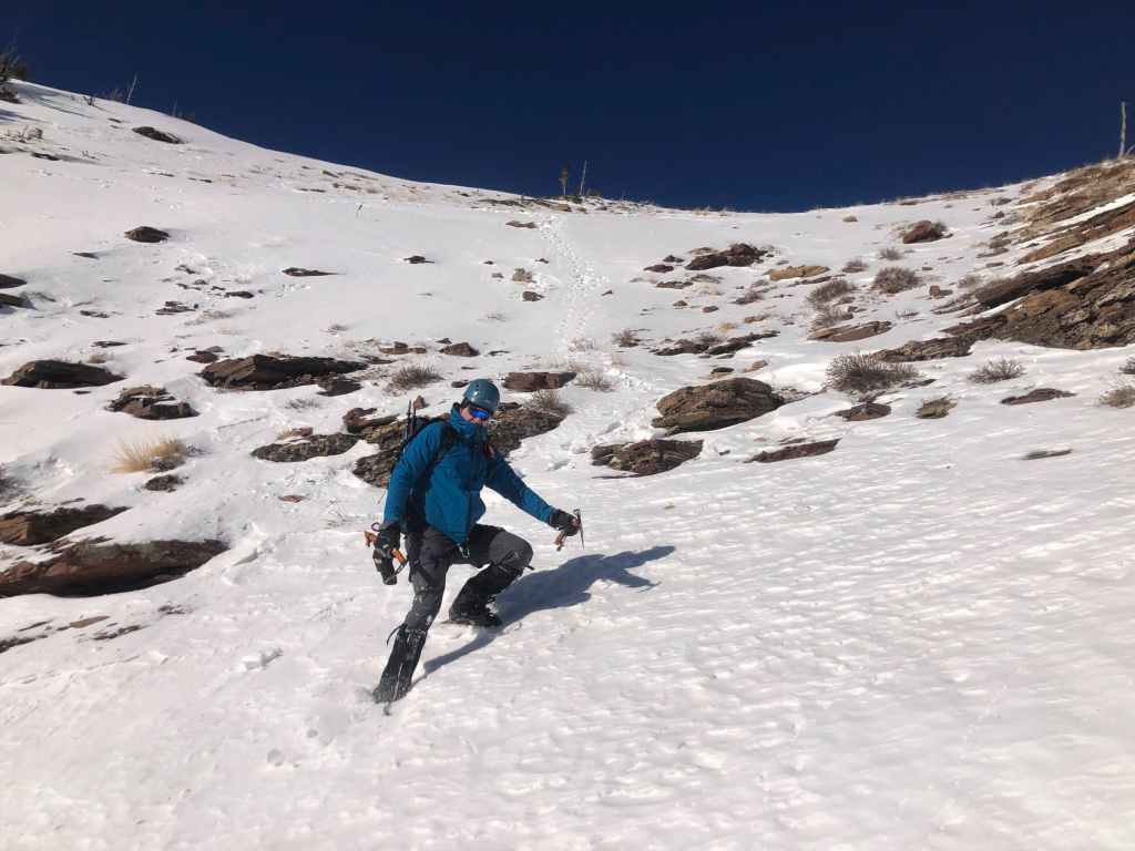
FYI, things are much steeper than they look from the photos. 😯
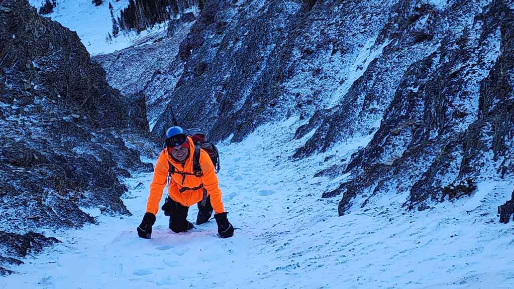
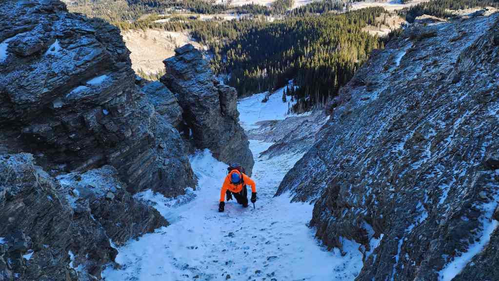
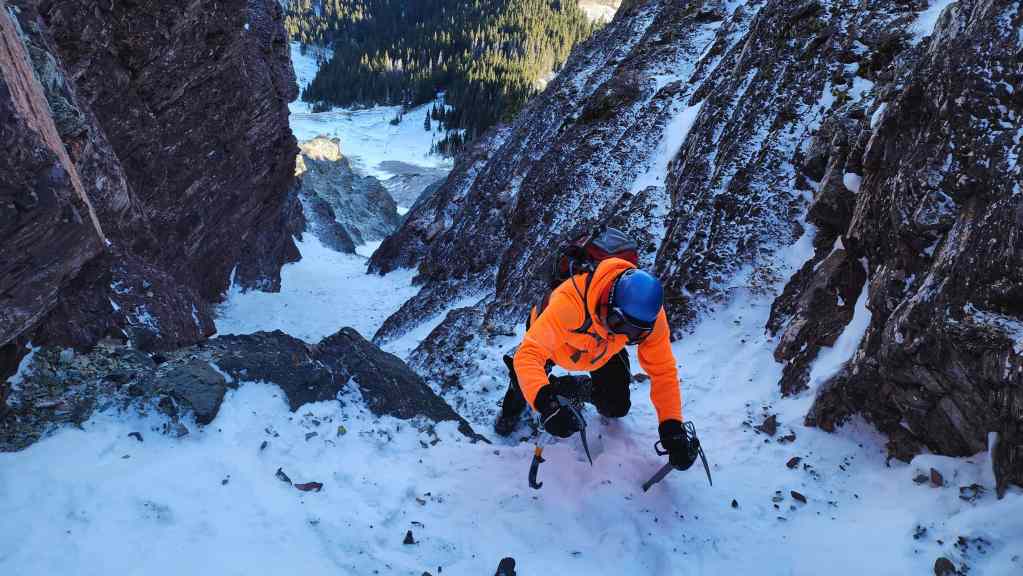
Mr. Fluorescent climbs a mountain. This is what happens when you drink too much Orange Crush. 😂
Brad approaches the first step…
And expertly climbs over it.
I’m next… (Photo by Brad Wolcott)
Followed by Andy who flexes a sweet move.
Approaching the next step.
My view back. Orange you glad you came with us? 😂

Brad tackles the second step.

Again, followed by me… (Photo by Brad Wolcott)
And then Andy.

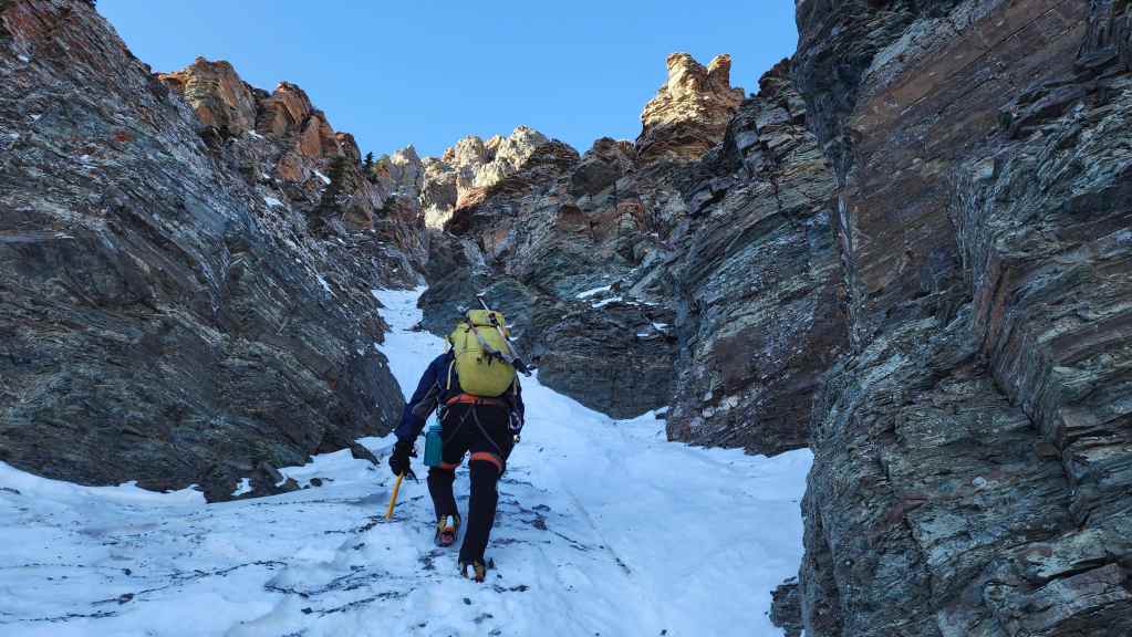
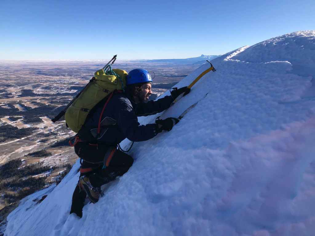
Entering the upper section of the couloir. (Photo by Andrew Nugara)
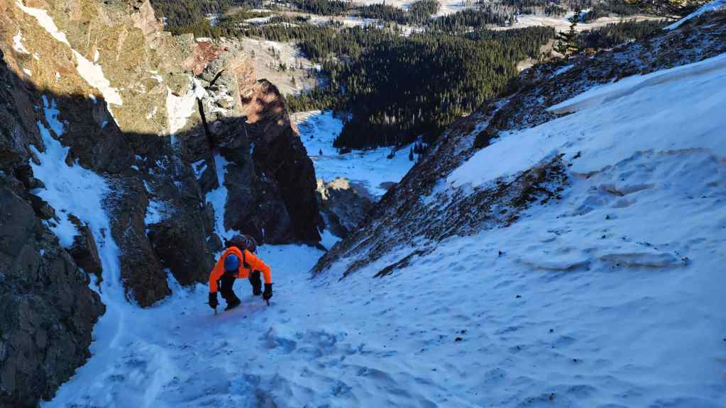
Another view back.
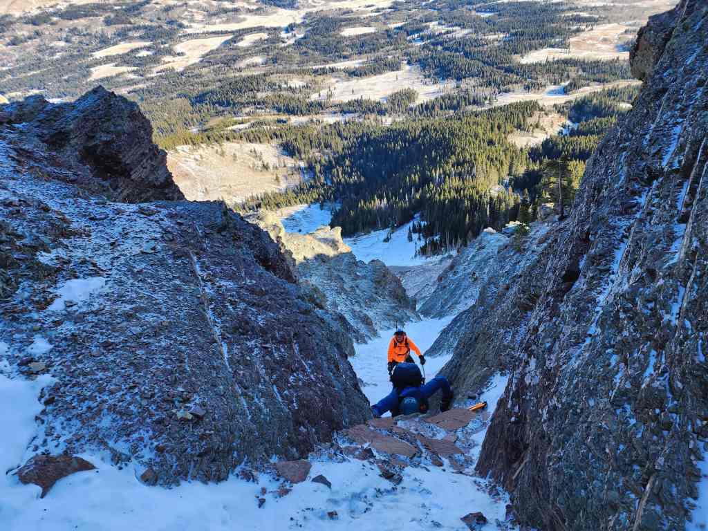
Brad’s view back after negotiating a section of slippery slabs. (Photo by Brad Wolcott)

My view down to the slabs – our first crux of the day. The snow that Brad and I took advantage of, had broken off by the time Andy reached the slabs. This made things a bit treacherous.
Brad sets up a belay for Andy to get past the slabs.

Again, things are much steeper than it appears.
Andy expertly makes his way above the first crux.

Brad removes the anchor.
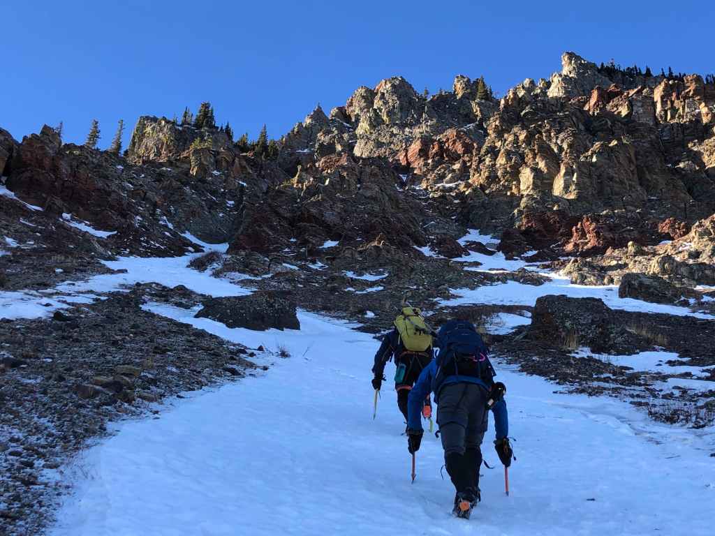
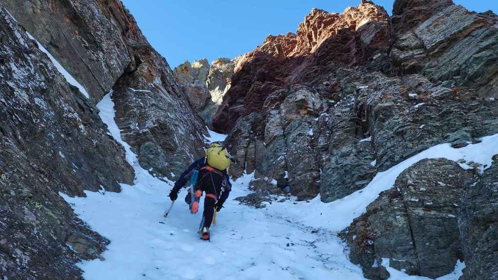
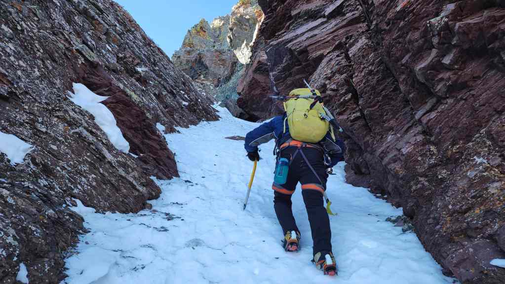
Leaving the lower couloir.
Heading up to the second couloir which is located beneath the rock outcrop just to the right of centre. (Photo by Andrew Nugara)
The snow was in great shape today. The only exception would be the final couloir – which is also the steepest – where the snow was sugar.
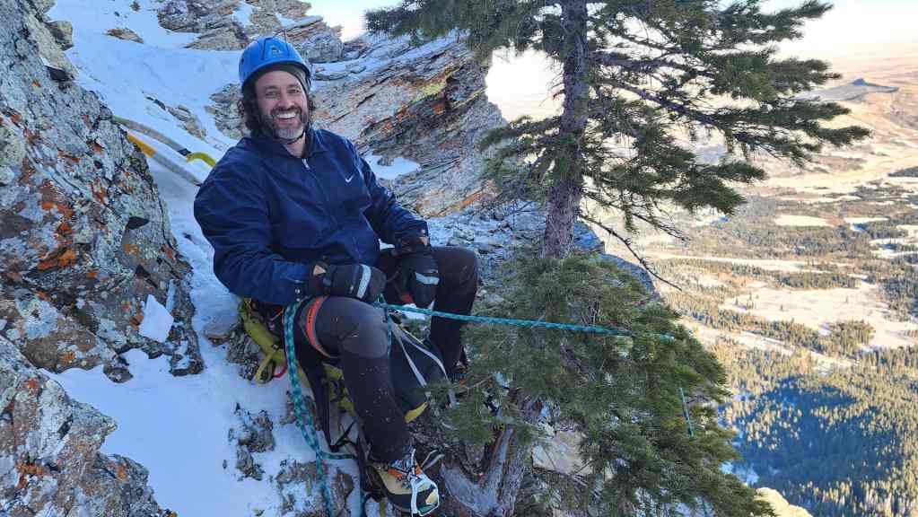
Stopping for lunch while we were in the sun and out of the wind. 🙂 The couloir on the right leads directly down to the drainage by our vehicles. An interesting alternate route would be to follow this all the way up from the bottom. 🤔
Entering the upper section of the couloir from the previous photo. (Photo by Andrew Nugara)

Looking up the middle couloir.

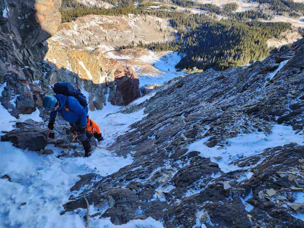
Andy follows me over a small step.
The point where the couloir bifurcates. Our route takes the branch to climber’s left, but it would be interesting to see where the one on the right goes.
Brad leads as we head up the small couloir. (Photo by Andrew Nugara)
This couloir is steeper than the first one.

Andy enters the small couloir.

Brad climbs over the first of two cruxes inside the couloir.

My view down to Andy. Again, the snow deteriorated after Brad and I climbed over the step, making it treacherous.
Brad sets up another belay.
Brad belays Andy as he climbs over the first crux.

Almost there!

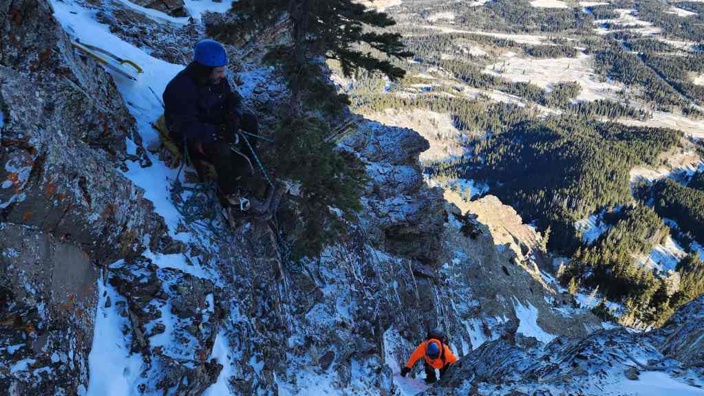
We decided to keep the rope out for the second crux (centre) which comes right after the first.

I wait while Brad sets up some anchors. It’s very easy to knock rocks down while ascending this section, so we had to be careful. (Photo by Andrew Nugara)
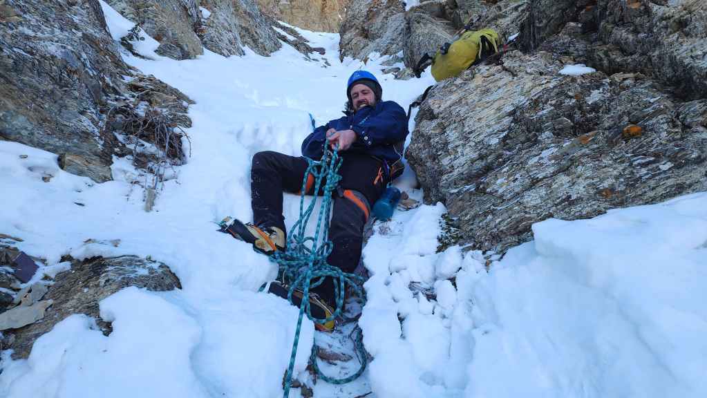
Using both axes as anchor points, Brad body belayed both myself and Andy.
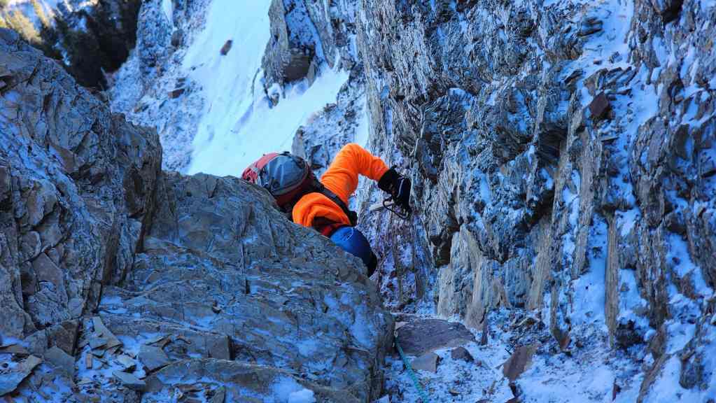
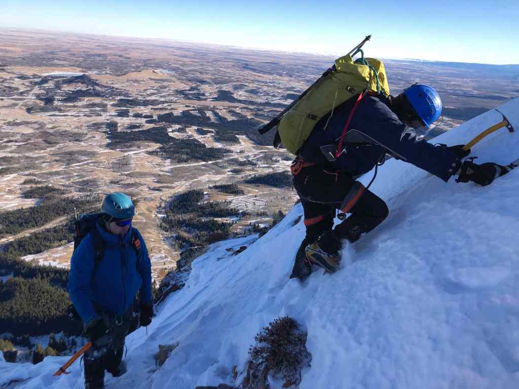
Andy climbs up the second crux.

Nearing the top.

Brad removes his axes after we pass the crux. (Photo by Andrew Nugara)
Andy’s view up to me… (Photo by Andrew Nugara)

My view back to Andy…

My view down to Brad…

And Brad’s view over to Andy. 🙂 (Photo by Brad Wolcott)

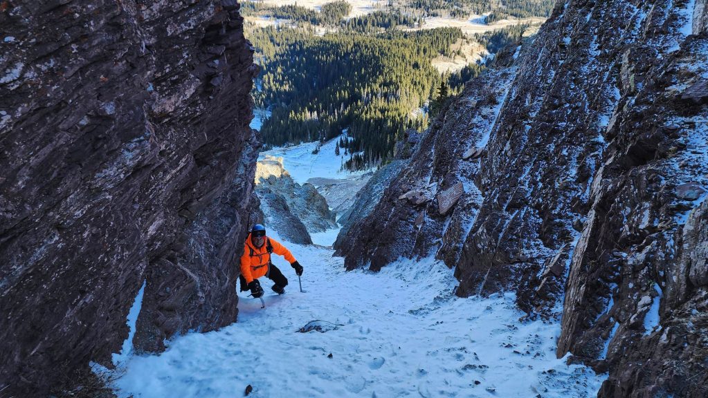
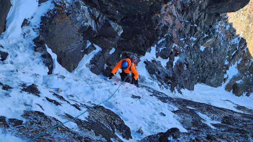
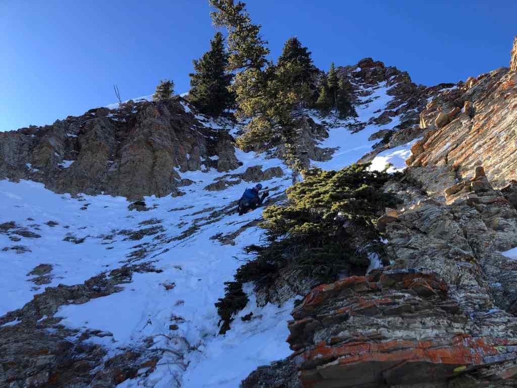
Heading up to the final couloir that sits directly beneath the summit. (Photo by Andrew Nugara)

The final couloir is on the left. This is what we used in November 2022, but the snow today was not optimal for a safe ascent.
Looking for a bypass by heading to climber’s right.

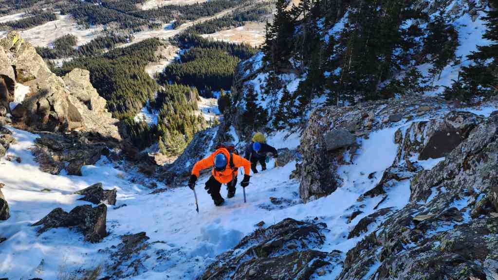
We hadn’t gone far before we found an easy route.

Easy scrambling.

At the top and looking down the couloir we avoided.
Brad makes a super intense push onto the summit…. (Photo by Andrew Nugara)
Or not! 😂 (Photo by Andrew Nugara)
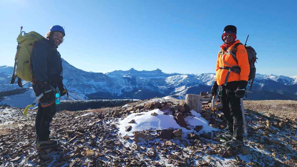
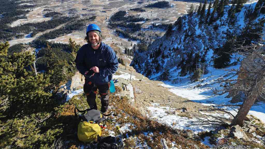
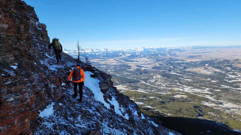
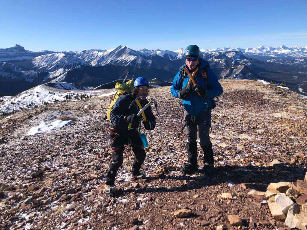
The beautiful thing about this route, is that you pop out directly onto the summit. This was Andy’s 19th time on the summit which makes him the all-time Prairie Bluff champ. 👏 This was also Brad 4th winter ascent of the northeast face, so that makes him the all-time Prairie Bluff mountaineering champ. 👏


As I’ve been here six times before, I’ll just leave you with a few quick panos. This is looking to the southeast.
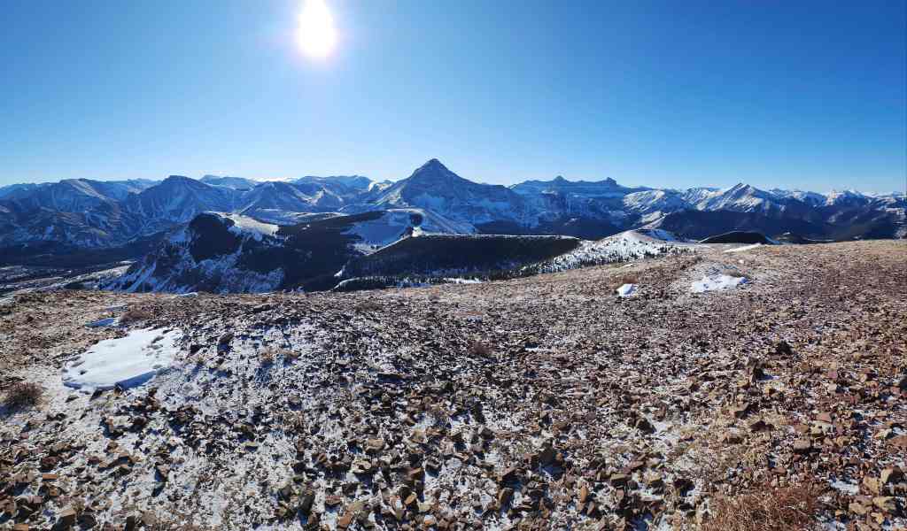

And now one to the southwest….
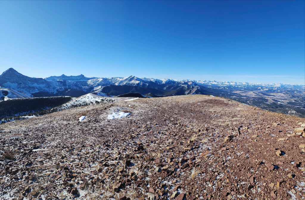

Then to the west….
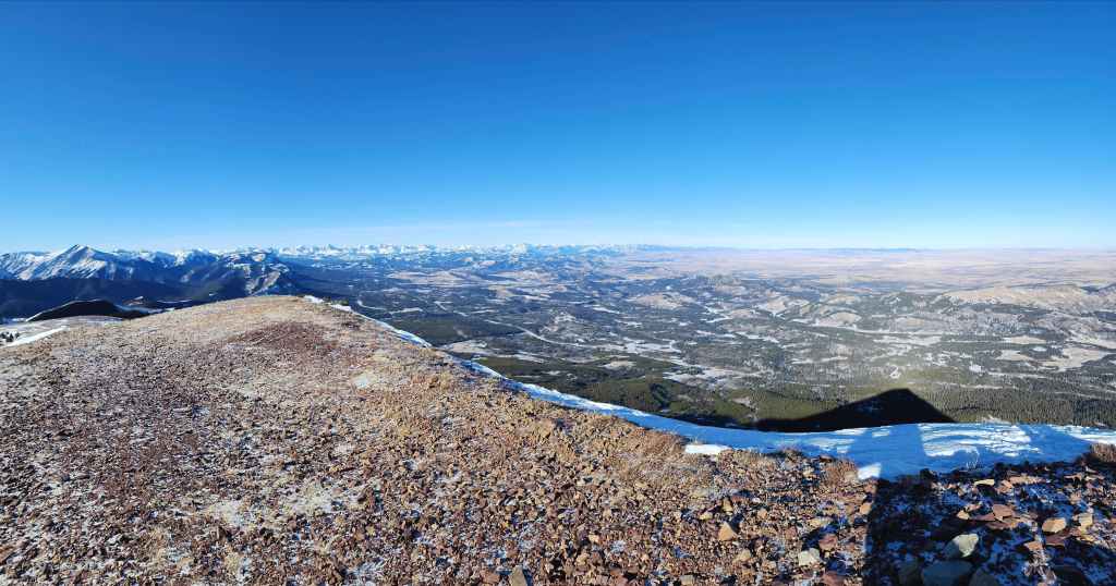

Then to the northwest.


Finally, one to the east.
X marks the spot! (Photo by Andrew Nugara)
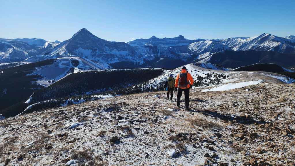
It was cold and windy, so we decided to head back using the south slope.
Making a hasty retreat.
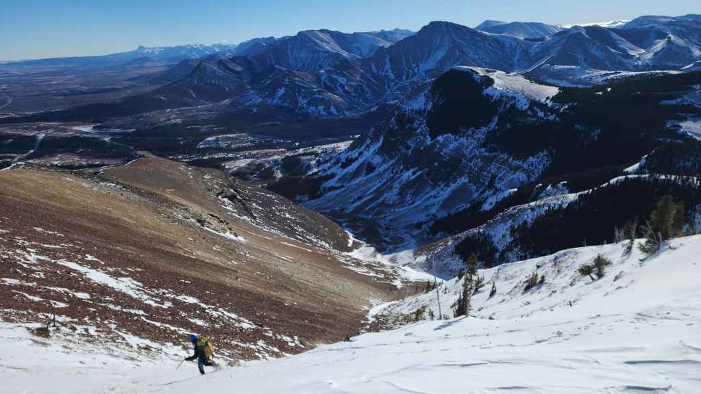
After descending the south slope, we’ll follow the drainage to the southeast end of the mountain.

The last photo Andy took before dropping his phone. We would watch in horror as it slide down the mountain. (Photo by Andrew Nugara)
The first photo that Andy took to see if his phone still worked. 🙂 Thankfully, even after sliding down the entirety of slope behind me, the phone wasn’t damaged. (Photo by Andrew Nugara)

Brad enjoys a short glissade.

Looking down the valley. Note the orange man on the left.

While Andy stayed higher up on the slope, Brad and I stayed on the snow all the way down to the drainage. (Photo by Andrew Nugara)
Brad and I in the drainage. (Photo by Andrew Nugara)

Out of the wind and enjoying our descent.

Brad enjoys another glissade.

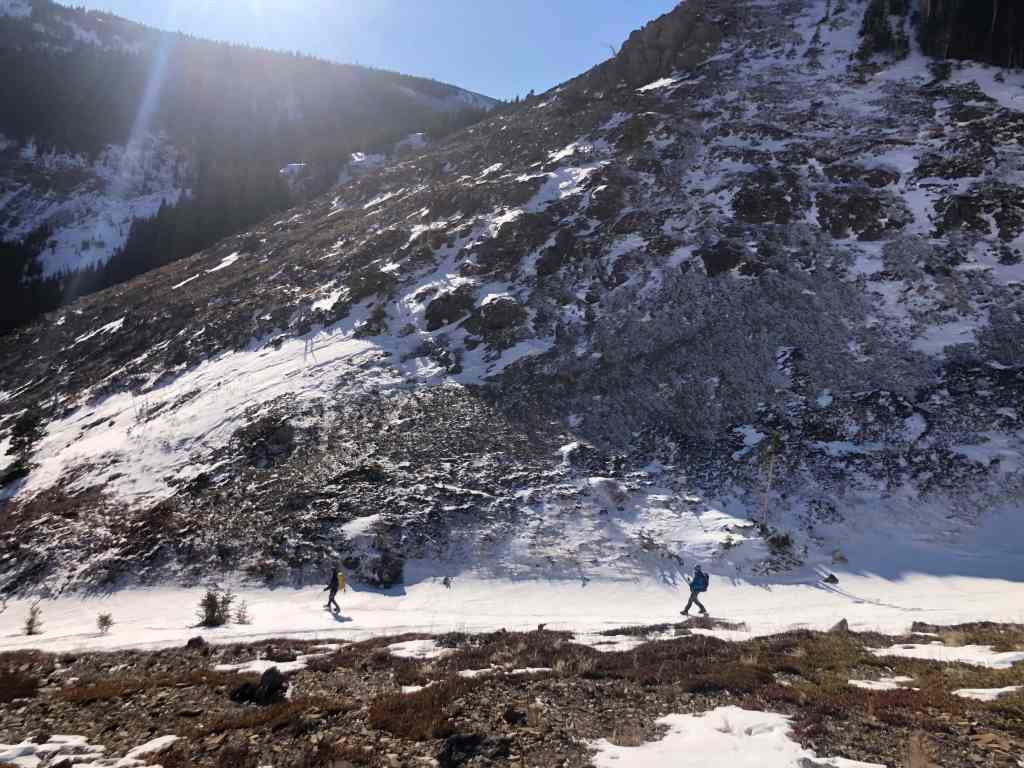
Looking back after leaving the drainage.
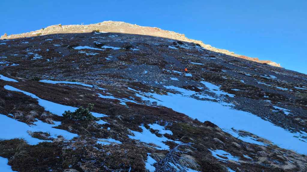
Let’s play spot the orange man…
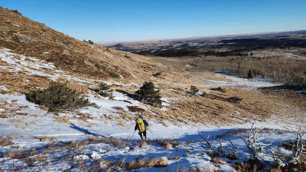
Circling the southeast end of the mountain.
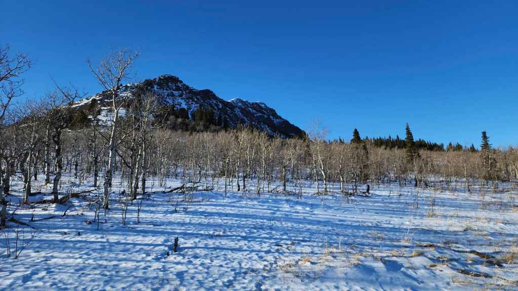
Looking over at PB as we near the road.
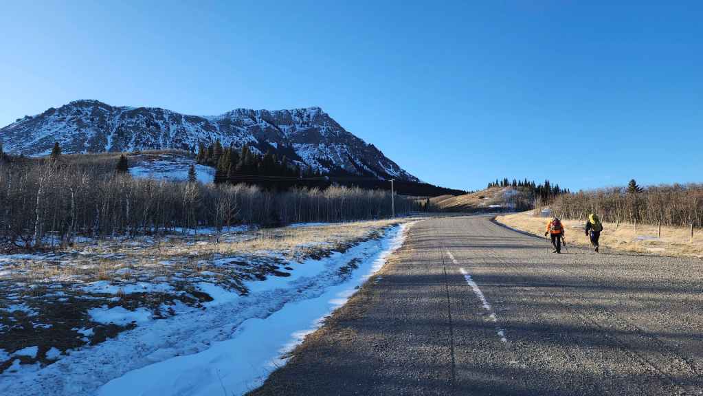
Back on the road and heading back to the vehicles.
Walking past the northeast face.
Arriving back at our vehicles after 6 hours and 30 minutes. Even though it it had been a while since my last trip, today’s trip was just the ticket to regain my mountain legs. This is an exceptionally fun winter route that’s made even better when done in the company of good friends. 🙂