


![]()
![]()

After enjoying the views from the summit of the SW Summit of Drywood, our next destination for the day was “North Drywood Ridge” (NDR). Towering above North Drywood Falls (hence the nickname), this diminutive but prominent outlier of Drywood Mountain is connected to the SW Summit by a gentle ridge that makes for an easy and scenic descent.
Brad and I had snowshoed NDR back in February 2023, and were surprised at what a great winter objective it turned out to be. As Andy wasn’t able to join us at the time, descending via the ridge would also add a third destination for the day.
Our hope was, that we could make a loop with our approach route by descending NDR using our 2023 snowshoe route, crossing the drainage, and then regaining the trail we’d previously found in the forest. The wildcard in all this would be where we would cross the drainage, as it would not be where Brad and I had crossed on our previous trip, nor would it be where the trail had crossed the creek earlier in the day. Instead, our plan was to descend directly across the drainage to the trail.
Everything unfolded exactly as expected, at least until we descended to the drainage. The trip from the SW Summit to the summit of NDR was delightful and after picking our way down the couloir that Brad and I had used in 2023, we headed into the trees.
As the crow flies, the trail was only a few hundred metres away; however, the nasty bushwhacking to reach the drainage slowed us down. Bloodied and bruised, we finally emerged onto the creek at the base of an amazing waterfall.
Pouring over a narrow opening in the cliff above, the churning white-water fell into a small turquoise pool that was easily 3 to 4 m deep. Unfortunately, we couldn’t appreciate the full splendour of the scene because not only did we have to find a way across the creek, we then had to make the steep bushwhack up the other side to the trail.
Fortunately, an overhanging rock at the tail end of the pool produced enough of a gap, that we could cautiously step over the creek. After using a series of alders to pull ourselves step-by-step up the bank, we eventually reached the trail. Our loop was complete, but man, that was a hard fought horizontal distance to cover. 😳 The waterfall though, was definitely something to see.
Once back on the trail, it was an easy hike to reach the upper meadow at the entrance to the valley. Determined to see where the trail led beyond the meadow, we followed it through a man-made gap in a stand of trees and that was it. It completely disappeared on the other side.
This meant we had to descend through the trees alongside the tiered cliffs used for sport climbing. We finally found the climbers’ descent route and from there, made our way back to the approach trail to “The Cave”.
On our way back, we were surprised to see two climbers inside “The Cave” who were just beginning to tackle the 5.12c route, “Jugular” (see p. 164 of the legendary Chris Goble’s, Rock Climbers Guide to Southern Alberta). Duly impressed by their skill, we wished them a great day and continued along the trail to our bikes and then back to the trailhead.
For my first trip back since getting the all clear after hernia surgery, this was a great test. Despite the bushwhack from NDR to the trail, everything else was highly enjoyable – with the canyon above “Redwood Falls” being one of the highlights. Thanks again to Brad and Andy for yet another great day in the mountains. 🙂
Be sure to read Andy’s most excellent trip report! [link coming]
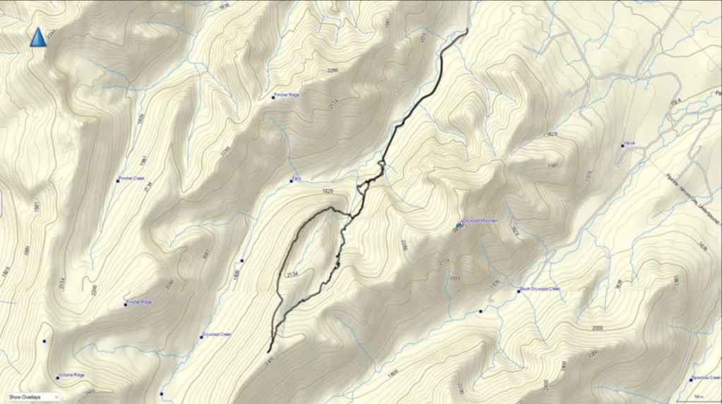

To get to “Redwood Falls”, the Southwest Summit of Drywood, and “North Drywood Ridge”, we drove south from Pincher Creek on Highway 6 until we reached the Shell Waterton Complex Road (Township Rd. 43A). We then turned onto the road and drove west for ~9.1 km until we came to a junction with a gravel road near to the entrance of the plant. Here, we turned left and onto the gravel road where we continued for ~3.9 km until we reached Butcher Lake. We then turned left and onto another gravel road immediately prior to the Lake, following this road for ~1.4 km until we came to a junction where we could either turn left or keep going straight. We kept going straight for another ~610 m and arrived at a locked gate and a parking area. This is the trailhead for North Drywood Falls and our starting point.
After biking for ~1.9 km, we came to a fork in the trail. We took the left fork while the main branch continued to the right. From the left fork we rode and pushed our bikes along the singletrack trail for ~750 m until we had a clear view of “The Gasser” waterfall / ice climb. We then set our bikes aside and hiked the remainder of the trail to “The Cave”.
From “The Cave” we continued to follow the trail along the base of the cliff until the cliff ended and we could find a clear way to hike up to the meadow that overlooked the valley. In the meadow we found a small path that we began to follow. Once it entered the trees it became larger and we followed it for ~700 m until it crossed the creek and disappeared.
An easy hike along the creek brought us to the entrance to a small canyon downstream of “Redwood Falls”. From here we had to gain elevation to reach the falls and the headwall. In total, from where the trail crossed the creek to the headwall and “Redwood Falls” it was ~750 m. The trip from the top of the falls and through the canyon to the start of the bowl beneath the SW Summit was ~400 m. From the start of the bowl to the SW Summit it was ~1.4 km with an elevation gain of 328 m.
After enjoying the views, we made the very easy ~1.2 km (287 m elevation loss) descent to “North Drywood Ridge”. We then followed NDR until we came to its northeast end where we descended its east slopes until we were at treeline. From here we then made a heinous bushwhack of several under metres until we reached the creek and another large waterfall. We crossed the creek and ascended the steep bank for ~107 m until we reached the trail that we used earlier in the day. From here we followed our route back to the trailhead.
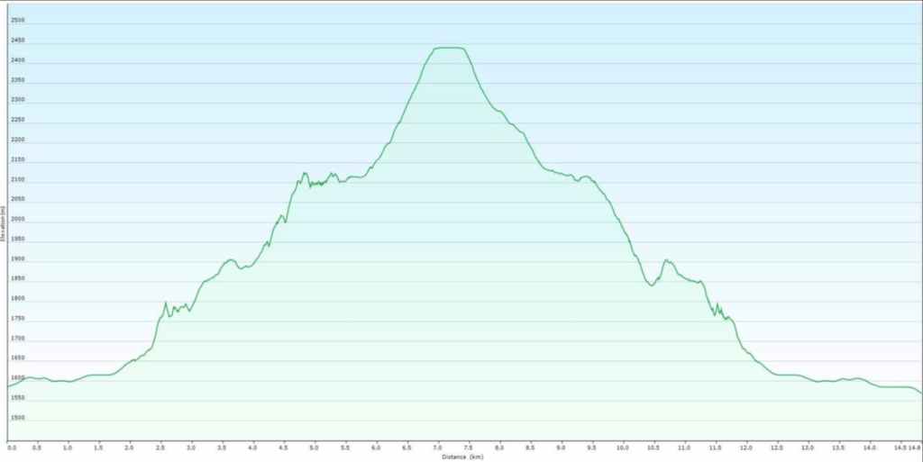

Our total roundtrip distance was 14.8 km and our total roundtrip time was 9 hours. Out total elevation gain was 1149 m.

Making the easy and very scenic ~1.2 km (287 m elevation loss) descent to NDR.
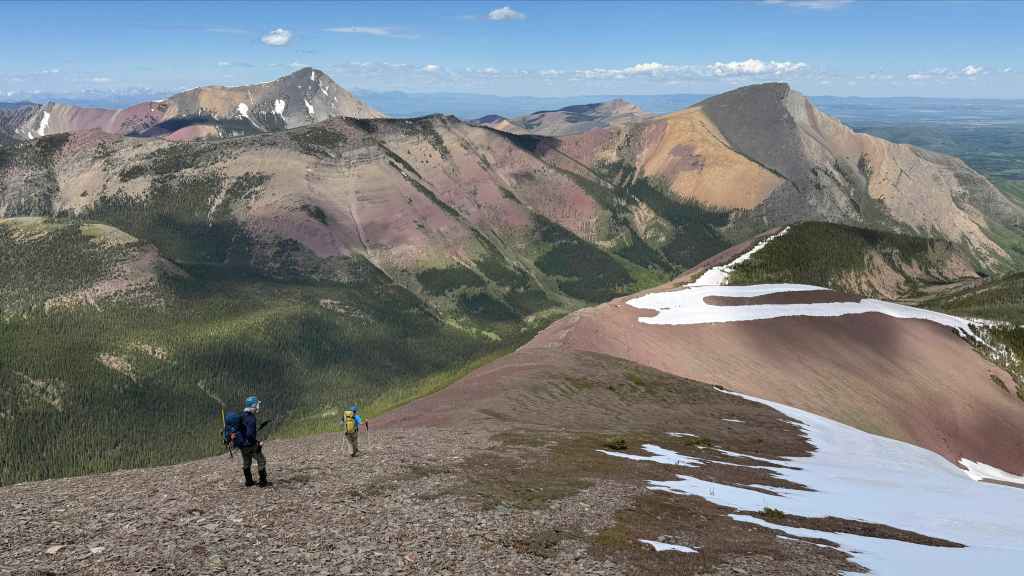
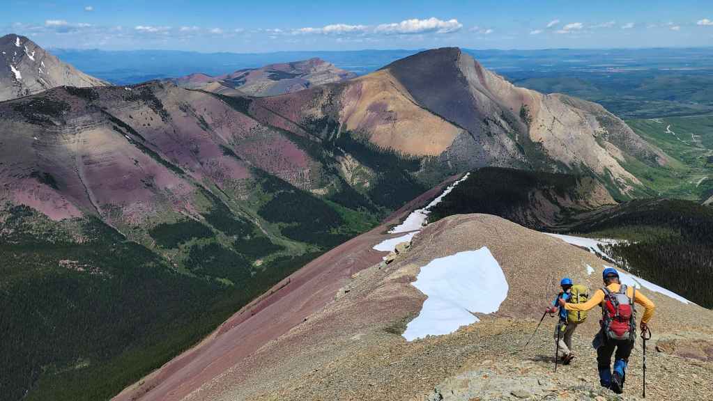
So much colour! Pincher Ridge (right) has to be one of the most colourful peaks in the area. Victoria Peak (upper left), Prairie Bluff (distant centre), and Pincher’s Centre Peak (left of centre) are all visible as we make our descent. (Photo by Andrew Nugara)
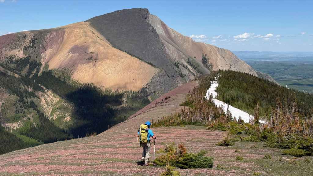
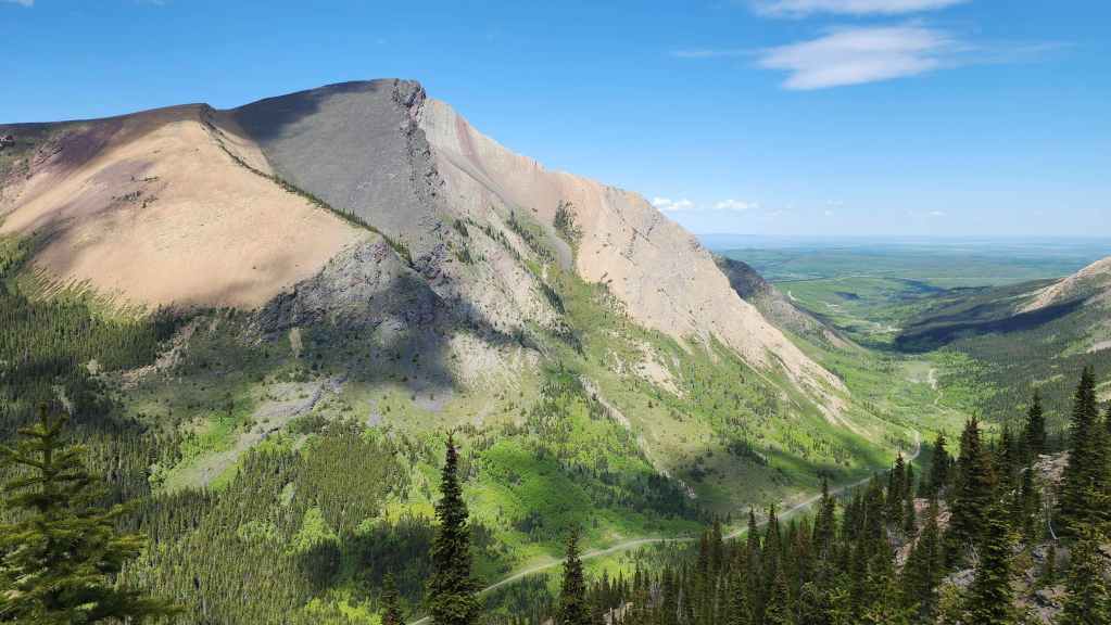
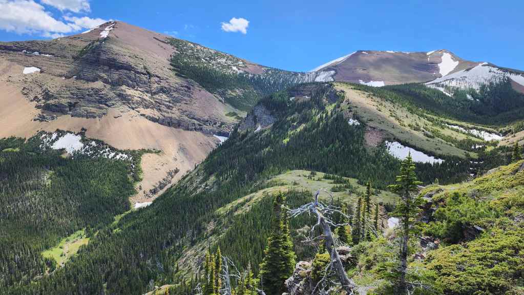
A great view of our approach to the SW Summit along the drainage (centre). The summit of Drywood Mountain is on the right.

The view back to the summit. (Photo by Andrew Nugara)
Brad expedites his descent by using the snow.


Brad’s view back from the previous photo. (Photo by Brad Wolcott)
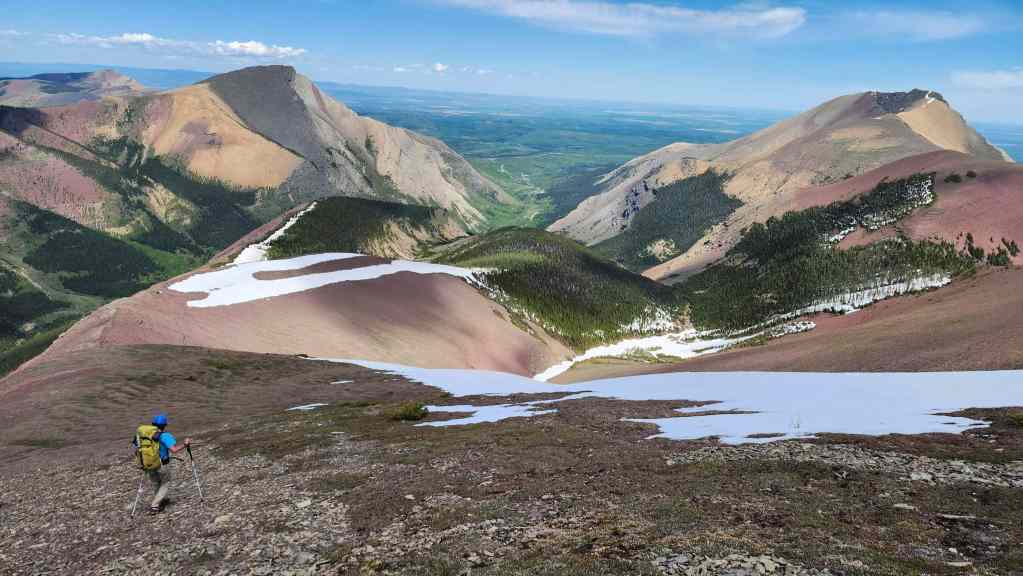
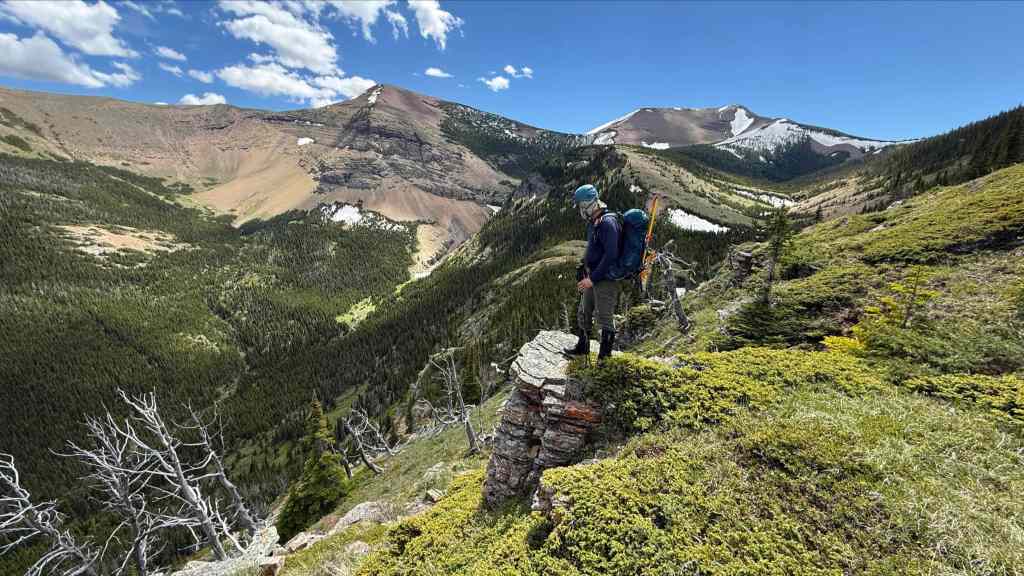
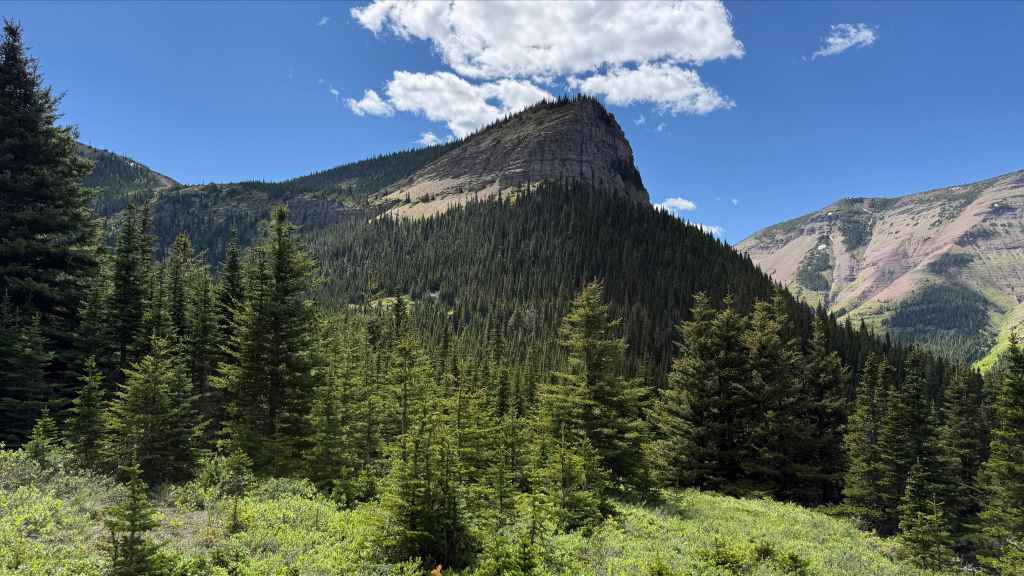
The summit of diminutive NDR (right) is not far off.

Brad and Andy check out the view towards Pincher’s South Peak.
Pincher Ridge is super cool from this vantage.
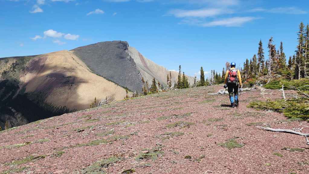
Arriving on the summit of NDR (2138 m).
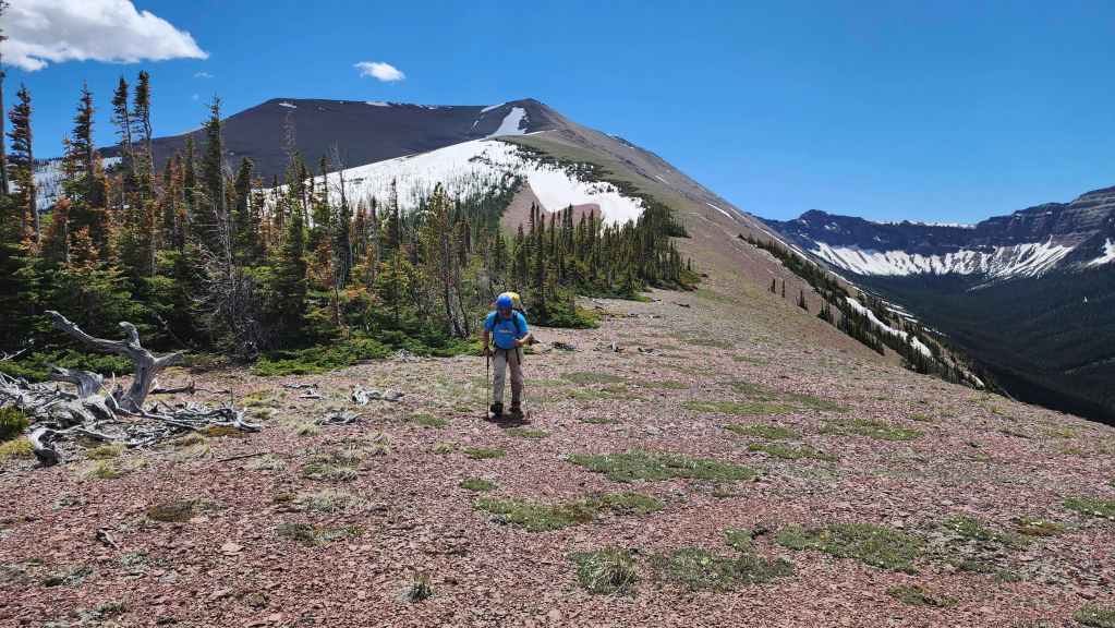
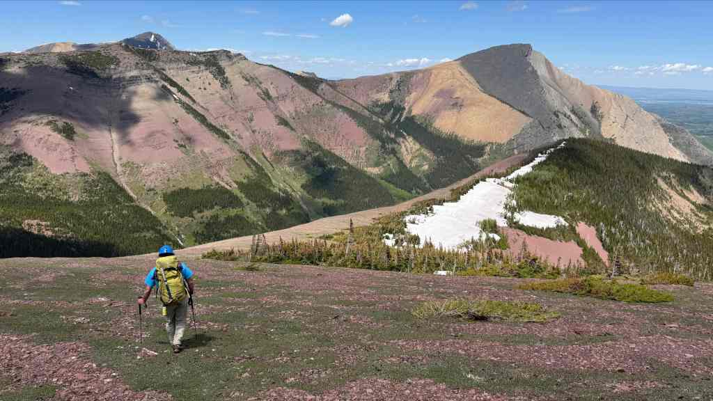
Our view back to the SW Summit of Drywood.
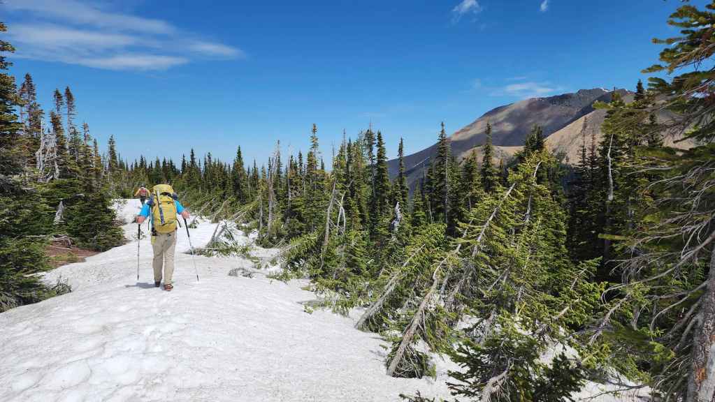
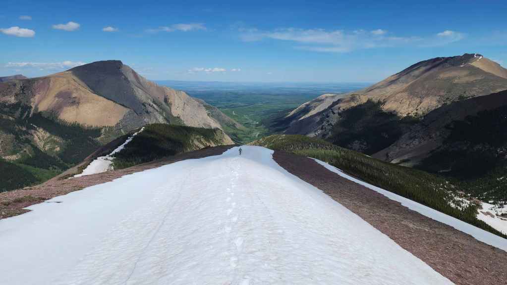
The snow was still firm enough to make travel along the ridge easy.
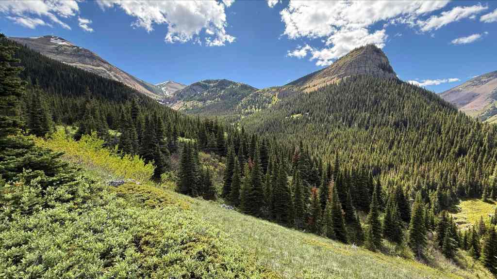
NDR offers up some great views of Pincher Ridge.
Nearing NDR’s north end.
Another great view of our route up the drainage to the SW Summit (right). (Photo by Andrew Nugara)
My view from the previous photo shows “Redwood Falls” (centre).
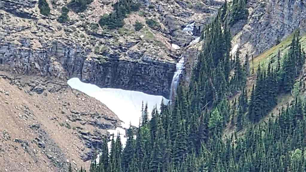
Zooming in on “Redwood Falls”. This was one of the last photos I took before my battery died.
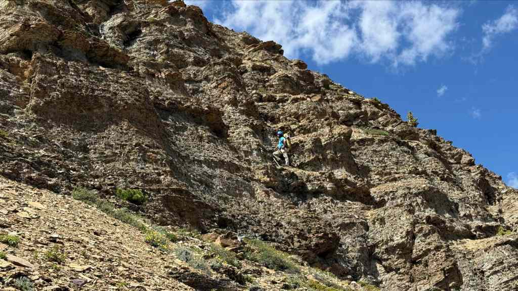
Brad descends the couloir that we had used on our 2023 snowshoe trip. (Photo by Andrew Nugara)

Heading down and into the trees. (Photo by Andrew Nugara)

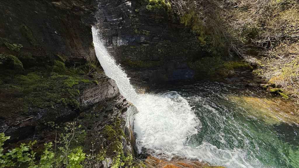
After a hundred metres of so of intense bushwhacking, we emerged above a canyon that featured this waterfall. (Photo by Andrew Nugara)
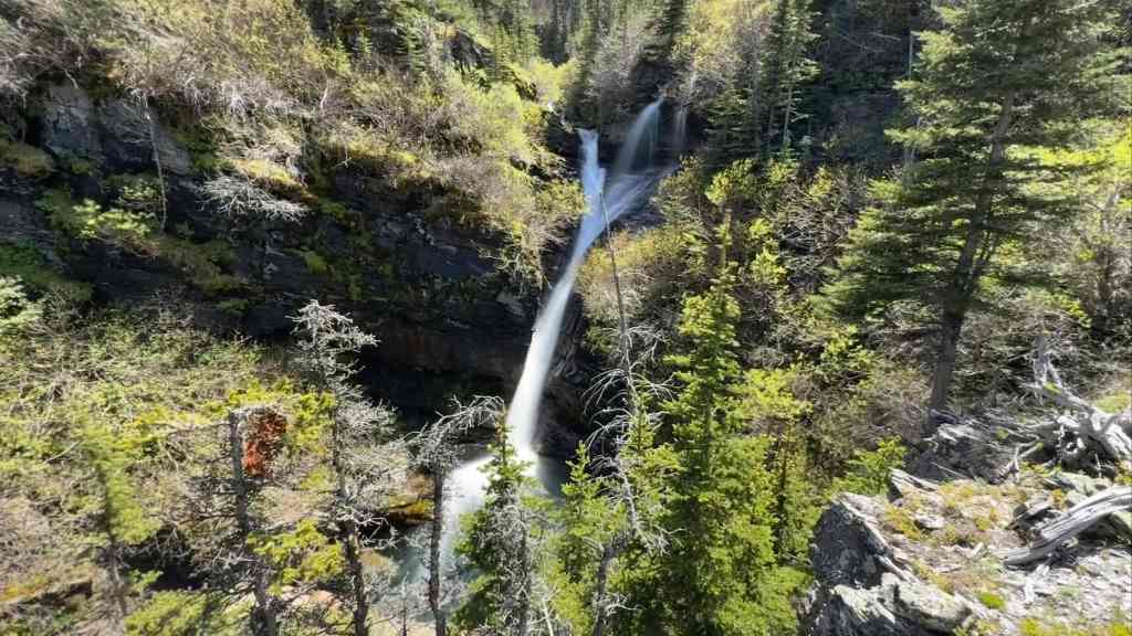
A cool long exposure photo of the waterfall. (Photo by Andrew Nugara)
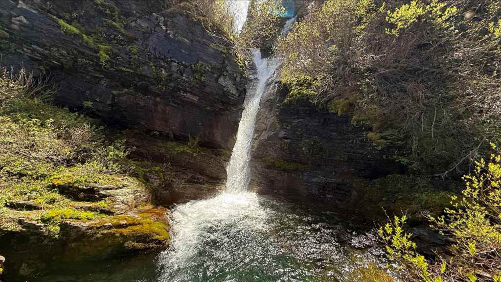
The waterfall emptied into a small pool that was incredibly deep for its size. (Photo by Andrew Nugara)
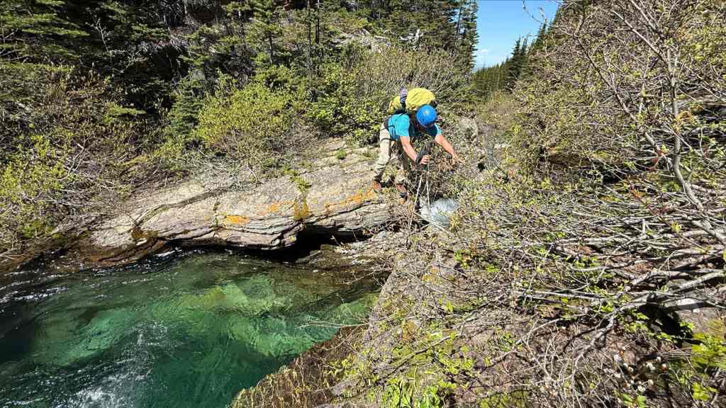
Thankfully, we could step across a gap at the tail end of the pool. (Photo by Andrew Nugara)

A closer look at the very deep pool. It was a good 3 to 4 metres deep. (Photo by Andrew Nugara)
A final look at the waterfall as we bushwhack our way up the opposite bank. This whole trip was just full of great waterfall scenery! 🙂 (Photo by Andrew Nugara)

Finally back on the trail we had used earlier in the day. (Photo by Andrew Nugara)
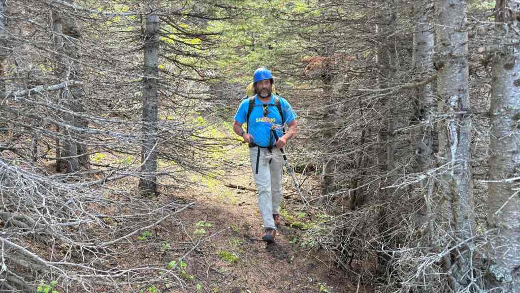
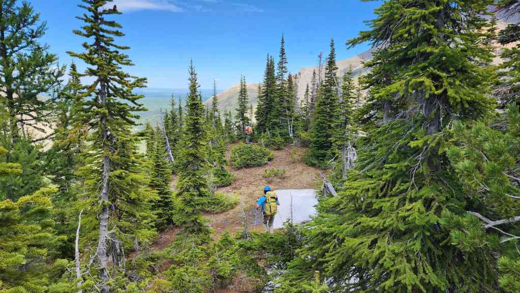
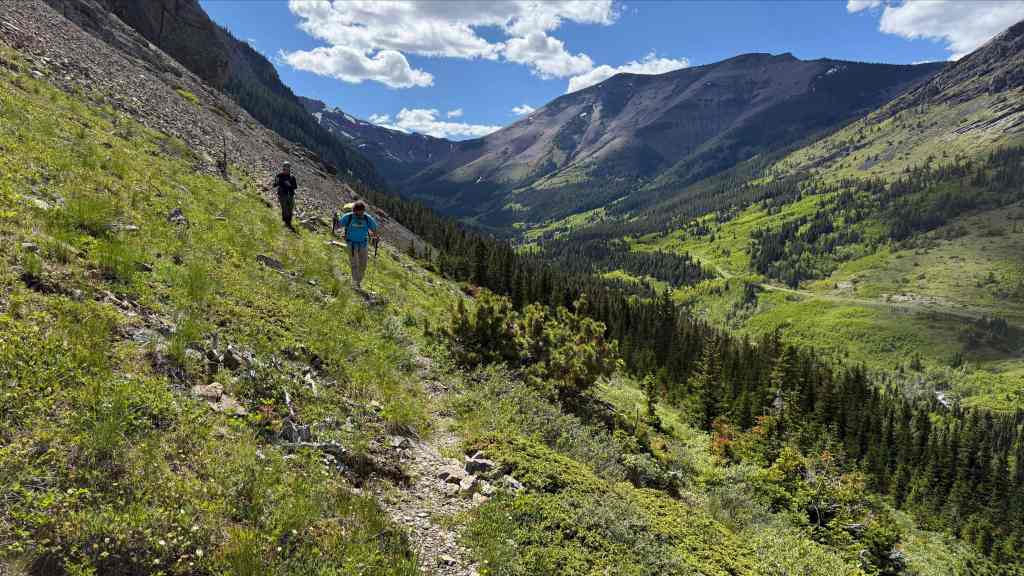
After the bushwhacking that we’d just endured, the trail was heaven to walk on.

Emerging from the trees and onto the meadow. Pincher Ridge is in front of me. (Photo by Andrew Nugara)
NDR from the meadow. (Photo by Andrew Nugara)

A closer look at the summit of Pincher Ridge. (Photo by Andrew Nugara)
A final look back and along the drainage. This was a stellar trip and all thanks go to Andy for suggesting it! (Photo by Andrew Nugara)

Returning along the trail that follows the lower tier of sport climbs. (Photo by Andrew Nugara)

We were surprised to see a couple of sport climbers in “The Cave”. The guy in the blue jacket is demonstrating to us how good the holds are on the 5.12c “Jugular” route. (Photo by Andrew Nugara)
Following the trail back to our bikes. (Photo by Andrew Nugara)

One more look at “The Gasser” (centre) and “The Cave” (right) from where we left our bikes. (Photo by Andrew Nugara)

Enjoying the very quick trip back to the trailhead. (Photo by Andrew Nugara)

Arriving back at the trailhead after 9 hours and ~14.8 km of fun. After being sidelined for 6 weeks following hernia surgery, this was a great test to see if my guts would reman inside my body. 😂 A huge thanks to Brad and Andy for another awesome day in the mountains!