

⚠️ Hiking and scrambling are inherently dangerous activities. Please read my Disclaimer. ⚠️
As this is my mountain confessional, I will admit that Victoria Ridge has been a sin of omission for me – and I’ve felt guilty for many years about not visiting it. It’s one of those ‘must visit’ gems of the Castle, and I’ve kept stating that I should visit, but I’ve never taken action to actually get here until today. Indeed, this was one of the great motivators for me to continue on from the South Peak of Pincher Ridge. There was simply no way that we were going to get this close, with all of the conditions perfectly aligned, and not take advantage of it – and boy, was it worth it!
We had almost perfect weather on the summit and in a rarity for these parts, very little wind. I was quite surprised at the range of views and was thankful that it allowed me to get a closer look at some of my ‘To Do’ list destinations in the South Castle. Victoria Ridge itself was quite unique and as Brad commented, sections of its material composition reminded us of the coulees in Lethbridge.
Our stay on the summit was brief because we knew from Spotwx, that at some point within the next two hours, strong thunderstorms were possible – and up to this point, its forecast had been incredibly accurate. Once again, we carefully studied the valley floor as we contemplated dropping down from the col between the South Peak and Victoria Ridge. The level of snow was such that it was not worth the risk, and so we went back to our previously chosen descent route beneath the Centre Peak.
In what turned out to be a wise move, we skirted around the South Peak and avoided unnecessary elevation and distance, making a beeline for the col on the northeast side of the mountain. We had just about reached the high point on the ridge, when we heard our first clap of thunder. Dark clouds were rapidly pouring in from the west and had already overtaken Victoria Ridge. It was now imperative that we get off the mountain and down our chosen slope before our metal hiking poles and ice axes turned us into a science experiment. Thankfully we reached the tree line before the valley was engulfed, and even more so, that the deluge didn’t start until we were on our bikes and could coast most of the way back.
Now that I’ve been absolved and have filled in my huge experience gap for the area, I will conclude by noting that while great weather, amazing scenery and tagging four peaks is awesome, it is only half the equation for a memorable trip. The other half of course, is being in good company – even when that person flips you the bird in your summit video! 😂

To get to Pincher Ridge via the south ridge, drive ~19.5 km south from Pincher Creek on Highway 6 until you reach the Shell Waterton Complex Road (Township Rd. 43A). Turn onto it and drive west for ~9.1 km until you come to a junction with a gravel road near to the entrance of the plant. Turn left and onto the gravel road and continue for ~3.9 km until you reach Butcher Lake. Turn left and onto another gravel road immediately prior to the Lake and follow this road for ~1.4 km until you come to a junction where you can either turn left or keep going straight. Keep going straight for another ~610 m and you will arrive at a locked gate and a parking area. This is the trailhead for North Drywood Falls and the starting point.
Following Andrew’s directions, we rode our bikes for ~3.2 km until we came to a drainage coming off the south side of Pincher Ridge. We then hiked up the right side of the drainage to check out the waterfall he describes. We continued past the waterfall, along the base of the south ridge until we came to an obvious weakness in the cliffs (from the ridge, it looks like there could be more than one to choose from). We then scrambled up and onto the south ridge. The next ~700 m provided a few more options for scrambling should we so choose, or just a hike. The total elevation gain from the trail to the summit was ~770 m.
From the summit of Pincher, the route to the other peaks is clear, with the Centre Peak being a colourful ~2.2 km hike (plus a short scramble) away. The elevation loss from Pincher Ridge to the col is ~226 m followed by a ~122 m gain to the summit. From the end of the Centre Peak it was another ~3.1 km hike to reach the summit of the South Peak with a ~160 m elevation loss followed by a gain of ~282 m. From there, it was another ~3 km to Victoria Ridge with an elevation loss of ~124 m to the col and a ~196 m gain to the summit. It should be noted that once we were past the Centre Peak, no scrambling was required.
If it had been the summer, I suspect that we would’ve descended into the valley beneath Victoria Ridge and followed the trail back. However, from the ridge, it looked like there was still too much snow to chance it. Instead, we returned to the southwest base of the Centre Peak and descended to the trail from there.

Our total roundtrip distance was 26.7 km with total elevation gains of 1747 m. Our total time came in at 10 hours even.

Approaching the col between the South Peak and Victoria Ridge.

Gazing down at the headwaters of Pincher Creek. The trail for Victoria Ridge runs through this valley.

Our day’s route is laid out nicely in the background.

Some small rock bands near the top of the ridge. This section is steeper than it looks, but poses little challenge.

Enjoying the easy, but scenic walk to the summit.

Terrific views to the west start to appear.

Victoria Ridge boasts a unique landscape. In places, the composition reminded us of the coulees in Lethbridge.

Patches of moss campion greet us beneath the summit.

It’s long overdue, but I finally arrive on the summit of Victoria Ridge. (Photo by Brad Wolcott)

The views from the top are outstanding in all directions. This is looking southeast and into Waterton. In the foreground is Spionkop Ridge with “Newman Senior” behind it.

One of my ‘To Do’ items: Sage Mountain. Edit: Done! 🙂

Another couple that have been on my ‘To Do’ list for several years: Mount Matkin (foreground centre) and Font Mountain (foreground left). Edit: Done and done! Behind it are Kenow Mountain (left) and Langemarck Mountain (right).

Jutland Mountain (centre) and La Coulette Ridge and Peak are also on that rather large ‘To Do’ list of mine. EDIT: Jutland is done! 😁

Lys Ridge (middle distance) is another super awesome ridge walk! The taller peak to the left of centre is Mount Haig.

The size of Windsor Ridge comes into perspective while Windsor Mountain and Castle Peak appear to merge into one

Gazing to the northwest at North Castle (left of centre), Mount Gladstone (centre), “Mill Creek Mountain” (centre) and “Mill Creek Peak” (right).

A sweet view to the north shows the breadth of Victoria Ridge and its connection to Victoria Peak.

And of course, let’s not forget venerable, Prairie Bluff.

Our entire route for the day. I really like Brad’s nickname of “Bullseye Peak” instead of the generic (and directionally wrong) nickname, South Peak.

To the east sits Drywood Mountain and its Southwest Summit – which could also use a proper name.

And so as not to become ‘stale’ in my descriptions, Loaf Mountain (left).

Finally, a telephoto of Spread Eagle Mountain.
This should help pull everything together and highlight the wonderful panoramic views from the summit.

“Ew, David!” – Alexis Rose, Schitt’s Creek (Photo by Brad ” I Take Really Odd Photos” Wolcott)

I’ve just given up on trying to have a non-awkward summit pic. I call this pose, the Dr. Zaius. 😂 (Photo by Brad Wolcott)

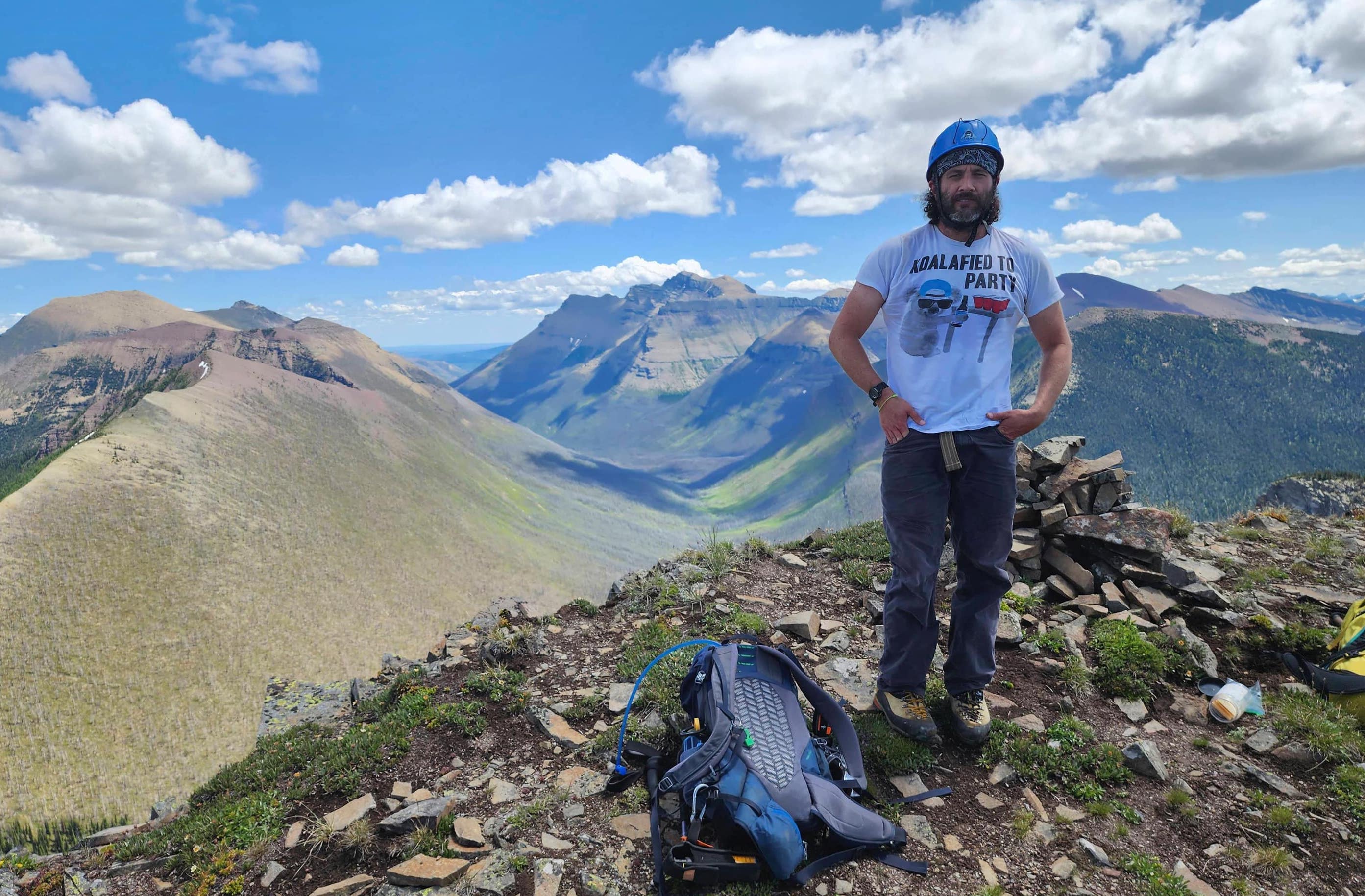
And yet another summit where Brad wants to show off his shirt.

After a quick bite to eat and tons of photos, we knew it was time to leave in order to beat the weather.

Brad the half-man.

This is the material on the ridge that reminded us of the coulees in Lethbridge.

It was tempting to just drop down from the col, but we didn’t want to risk having to post-hole through deep snow.

Looking back to the summit.

On the way back, we bypassed the South Peak by following the tree line leading up from the col. This saved us both time and elevation.

Following the tree line.

This is about as easy as side-sloping gets.

The only hurdle that we encountered was a large, steep snow field that we bypassed by down-climbing some small cliffs. This was quicker than gaining the elevation to avoid it – and more fun.

The snow created its own mini mountain range! We should’ve strung a Nalgene bottle to a pole and then held it up to the sun to see where the Ark of the Covenant is buried. 😂

Looking up at the summit of the South Peak.

The sun had begun to soften the snow, but it was still walkable. Notice the clouds forming in the background.

We chose to descend using what we had identified on the way over – the red slope in the foreground on the left. In the distant centre, you can see the larger section of the trail near North Drywood Falls.

I can’t get enough of the colours on this ridge!

Carefully skirting some cornices.

I have to say, the South Peak looks way cooler from this angle.

Looking up to the high point (left) and the Centre Peak from the col.

Notice the clouds now? This is where we heard our first clap of thunder. When I looked at my watch, it was within the timeframe that Spotwx had predicted.

On the high point and watching the storm move in fast.

Despite the incoming storm, I had to stop for one more colourful picture.

Arriving at the Centre Peak. We would drop down near the base.

Descending at an angle to reach a drainage.

The drainage that we descended into from the slope.

The storm is getting closer…

A quick view up to the Centre Peak and Pincher Ridge – where we started the day.

A neat little stream inside the drainage.

Looking up to the Centre Peak from further down.

Instead of heading directly into the trees, we skirted the tree line until we found an easy route to reach the trail.

Run Forest! Run! The storm keeps building.

Delicate phacelia sericea.

The aftermath of my boot-ski-turned-bum-slide. 😂

Brad follows an old, but distinctly human-made trail.

We dropped down to the trail by following this colourful stream.

Looking down from the start of the creek to North Drywood Creek.

The creek turned into a cool waterfall.

The ‘dead centre’ of the mountain. 😏

On the trail and looking back to the South Peak. From this point on, the thunder was constant.

Enjoying quick travel along the trail.

Some tight quarters, but as it had started to lightly rain, we didn’t mind.

Let’s play spot the Western Toad! Can you see it?

Brad follows the trail past North Drywood Creek Falls (centre). Our route along the tree line is also obvious in the background.

One last look back to the South Peak as the rain becomes more intense.

Thankfully, this is when the deluge began. It was a wet, but mercifully quick ~3.2 km ride back to our vehicles.

Arriving back at the trailhead after an amazing 10 hour, 26.7 km day! This will definitely be one of those trips that I remember for years to come – where everything unfolded perfectly to create an unexpected traverse that was chock full of colour and fantastic scenery. Now that my I’ve filled in my experience gap for the area, I can now think about filling in the gap in my smile… or not! 😁


Leave a Reply