

⚠️ Hiking and scrambling are inherently dangerous activities. Please read my Disclaimer. ⚠️
After an enjoyable and speedy ascent of Pincher Ridge via Andrew’s south ridge route, we noticed that the weather was continuing to improve just as Spotwx had forecast. This was good news because tagging this peak was one of my main objectives for the day. That the sun began to shine while we made our way across the col, made it all the more special because we could now see the vibrant colours and patterns of the rock. In the fall when the larches have changed, this would be a spectacular place to be!

To get to Pincher Ridge via the south ridge, drive ~19.5 km south from Pincher Creek on Highway 6 until you reach the Shell Waterton Complex Road (Township Rd. 43A). Turn onto it and drive west for ~9.1 km until you come to a junction with a gravel road near to the entrance of the plant. Turn left and onto the gravel road and continue for ~3.9 km until you reach Butcher Lake. Turn left and onto another gravel road immediately prior to the Lake and follow this road for ~1.4 km until you come to a junction where you can either turn left or keep going straight. Keep going straight for another ~610 m and you will arrive at a locked gate and a parking area. This is the trailhead for North Drywood Falls and the starting point.
Following Andrew’s directions, we rode our bikes for ~3.2 km until we came to a drainage coming off the south side of Pincher Ridge. We then hiked up the right side of the drainage to check out the waterfall he describes. We continued past the waterfall, along the base of the south ridge until we came to an obvious weakness in the cliffs (from the ridge, it looks like there could be more than one to choose from). We then scrambled up and onto the south ridge. The next ~700 m provided a few more options for scrambling should we so choose, or just a hike. The total elevation gain from the trail to the summit was ~770 m.
From the summit of Pincher, the route to the other peaks is clear, with the Centre Peak being a colourful ~2.2 km hike (plus a short scramble) away. The elevation loss from Pincher Ridge to the col is ~226 m followed by a ~122 m gain to the summit. From the end of the Centre Peak it was another ~3.1 km hike to reach the summit of the South Peak with a ~160 m elevation loss followed by a gain of ~282 m. From there, it was another ~3 km to Victoria Ridge with an elevation loss of ~124 m to the col and a ~196 m gain to the summit. It should be noted that once we were past the Centre Peak, no scrambling was required.
If it had been the summer, I suspect that we would’ve descended into the valley beneath Victoria Ridge and followed the trail back. However, from the ridge, it looked like there was still too much snow to chance it. Instead, we returned to the southwest base of the Centre Peak and descended to the trail from there.

Our total roundtrip distance was 26.7 km with total elevation gains of 1747 m. Our total time came in at 10 hours even.

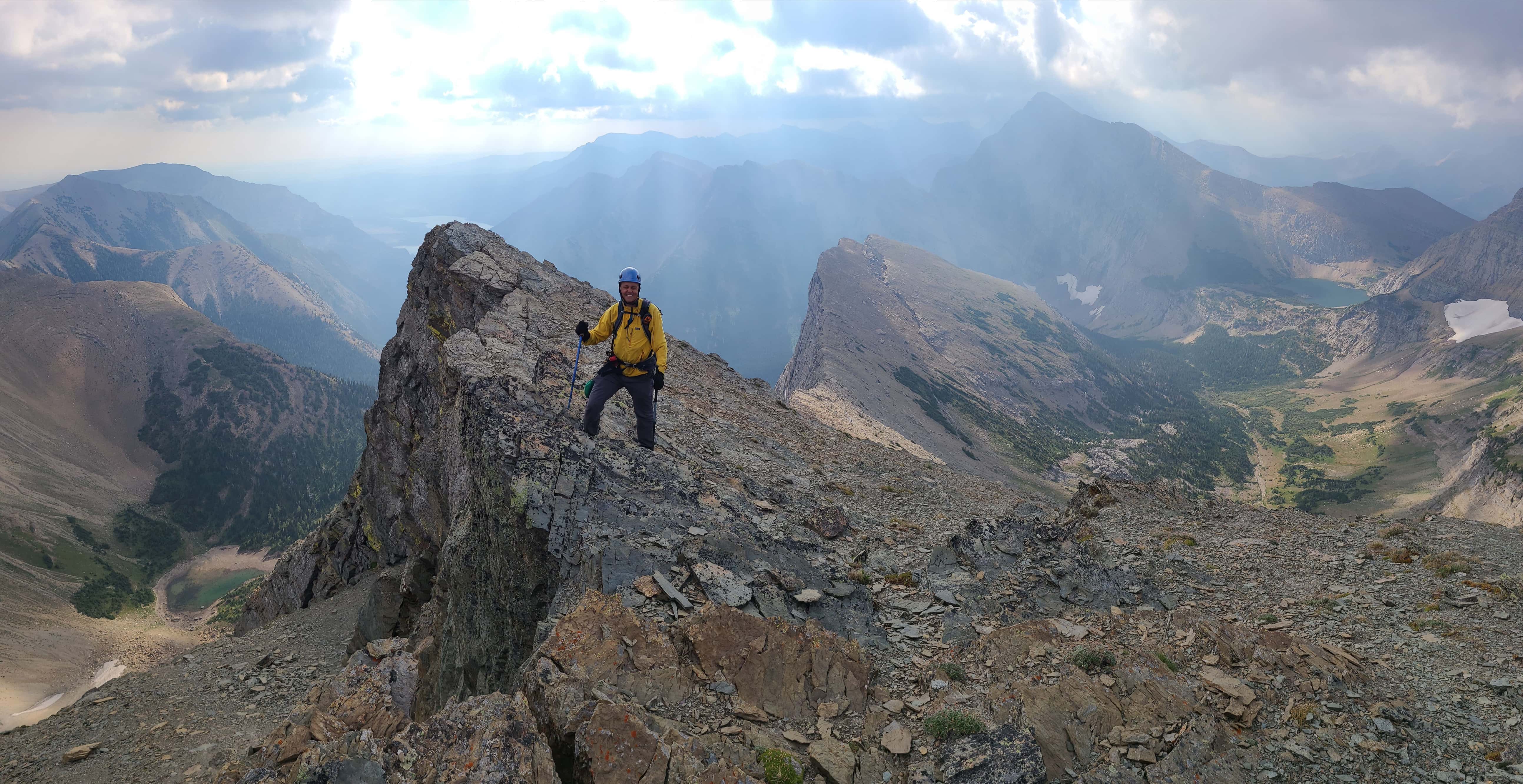
Amidst an emerging blue sky and a backdrop punctuated by Windsor Mountain, Castle Peak, and Victoria Peak, Brad and I begin to make the enjoyable ~2.2 km hike over to the Centre Peak.

Although we didn’t know it yet, the entire day’s route is laid out before us, with the South Peak and Victoria Ridge sitting temptingly beyond the Centre Peak (foreground).

Here come those Castle colours!

That ridge needs a bit more sun to pop…

Looking back to the summit of Pincher Ridge.

There’s the sun!

Thankfully, most of the snow we encountered was still hard-packed…

Except for the occasional spot! 😂

Approaching the short section of scrambling. The snow actually expedited our trip.

Brad makes his way up to the cliff band.

Millions of years ago when this was a sea, the dinosaurs left behind their diving board. 😂 Brad is heading to the the weakness immediately to the left of the old tree.

Neither of us thought that the quick scramble was difficult. (Photo by Brad Wolcott)

Looking back and seeing even more colour.

The view over to Victoria Peak and Prairie Bluff is amazing! That hanging valley on the right was our descent route on my 2013 trip and the colourful ridge leads to the top of the outlier that we ascended. In Brad’s personal mountain journal, he nicknamed the outlier, “Mount Lacombe”.

Almost at the summit.

Such grace and precision! 😂

Brad follows me up and onto the summit.

The summit of the Centre Peak (2352 m) is quite large and features twin points. Brad nicknamed it, “White Bird Peak” in his journal.

While the sky was clearing to the west, clouds still remained over Drywood Mountain and “Bakery Peak” (right).

A telephoto looking to the southeast at “Bakery Peak” (left). That peak is such a fun scramble!

The view south and across the valley to the Southwest Summit of Drywood (right).

Windsor Mountain and Castle Peak were a constant throughout the day…

As was Victoria Peak.

Chilling for a few minutes on the summit – serious minutes by the look of it. 😉

Only a slightly awkward pose for the Centre Peak. Apparently, I was struggling to find my ‘centre’ of gravity. 😂 (Photo by Brad Wolcott)

Heading to the other end of the summit. It had only taken us 40 minutes to get here from the summit of Pincher Ridge, so we had time to spare.

We could tell already that this would be a great ridge walk if we were to keep going.

Old trees covered in bright lichen generally tempt me into stopping.

Gazing down the ridge at the South Peak (foreground left) and Victoria Ridge (centre). We were still debating at this point whether or not to keep going, but ultimately, we knew we’d regret it if we didn’t.

A decision was finally made to make a final decision on the top of the next high point along the ridge (right). 😁 Click to continue towards the South Peak of Pincher Ridge.


Leave a Reply