

⚠️ Hiking and scrambling are inherently dangerous activities. Please read my Disclaimer. ⚠️
Anxious to get out for my first hike of the year after a very busy winter, I chose as my objective, an unnamed highpoint at the southernmost end of the Livingstone Range in the Crowsnest Pass. Not wanting to get too creative, because I’m sure that a local name probably exists, but for the purposes of identification, I will refer to it as the ‘South Peak of the Livingstone’. Joining me on this day was my son, Joel, and his friend, Mike. Our secondary objective on this trip was to tag the Piitaistakis Eagle Watch Site that I had read about only a month before – and hopefully see a golden eagle or two as this was their migration season.
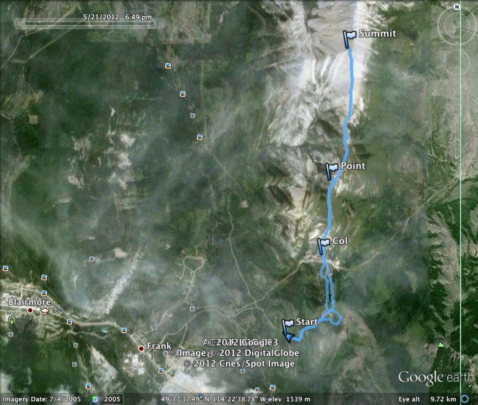
This was my first ever trip using a GPS, so pardon the messiness of things! Our route to the South Peak began behind the Frank Slide Interpretive Centre, where instead of turning right into the parking lot, I proceed across the cattle guard and followed a gravel road for several kilometres until I came to washed-out section of road. From here we crossed a clearing – full of shotgun shell casings and broken clay pigeons – and proceeded up the slopes towards the Eagle Watch Site. From the Site, we then followed the ridge for several kilometres to the summit of the South Peak.
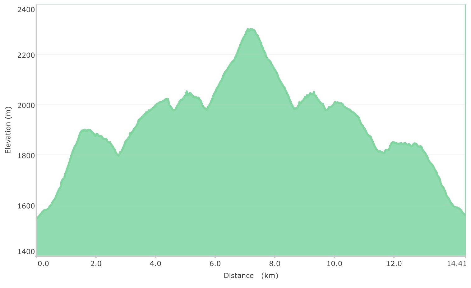
Our total trip was 14.4 km and took 5 hours & 28 minutes. We could have taken a shorter route by bypassing the Piitaistakis Eagle Watch Site. The total elavation gain from the vehicle to the summit was 1163m. The summit of the South Peak was 2300m.
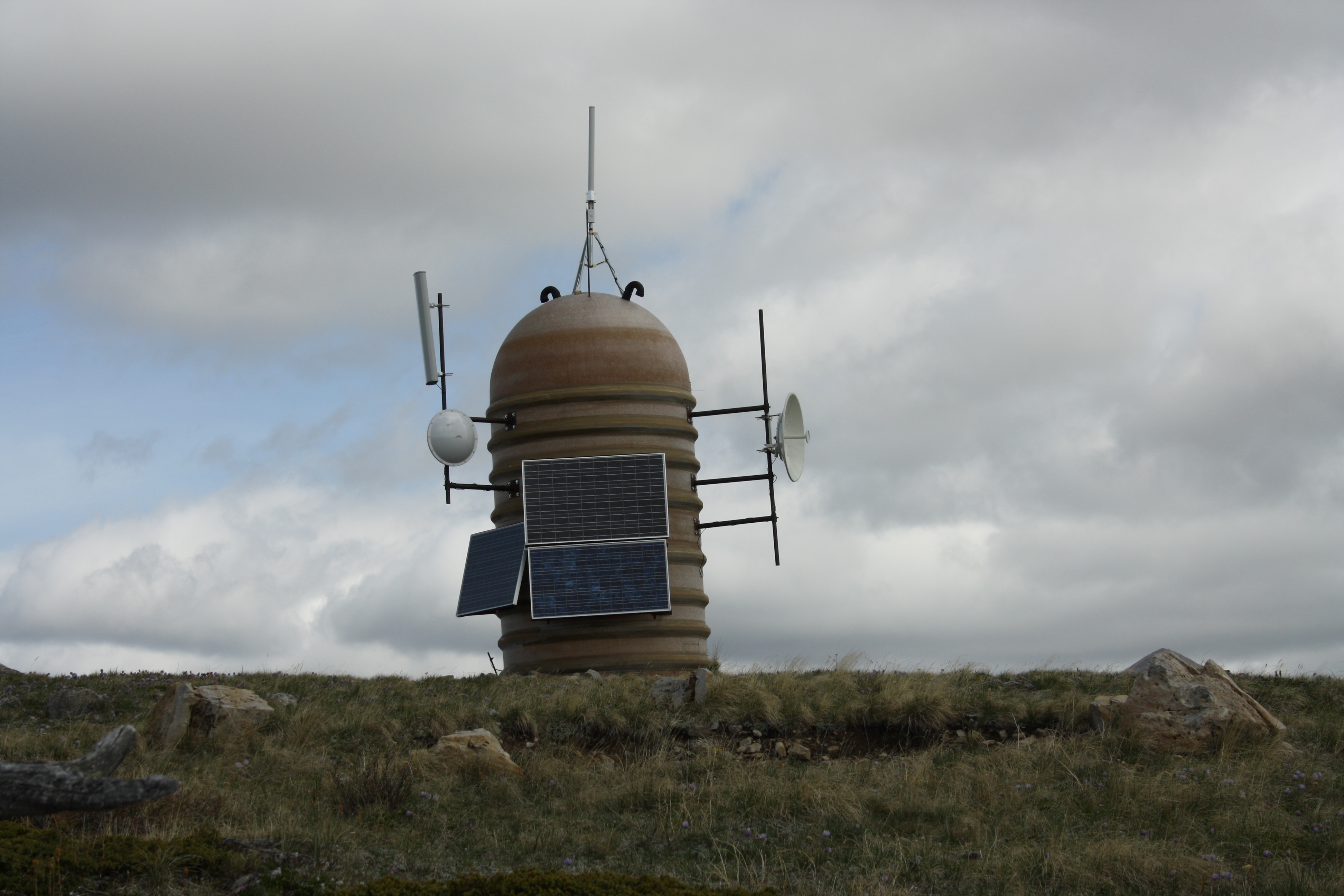
Aww, a cute robot was there to greet us as we arrived on the summit of the Piitaistakis Eagle Watch Site.

From the top of the Piitaistakis Eagle Watch Site we can finally see our objective – the far peak on the right. In the foreground is the peak known locally in the CNP as “The Dog”.
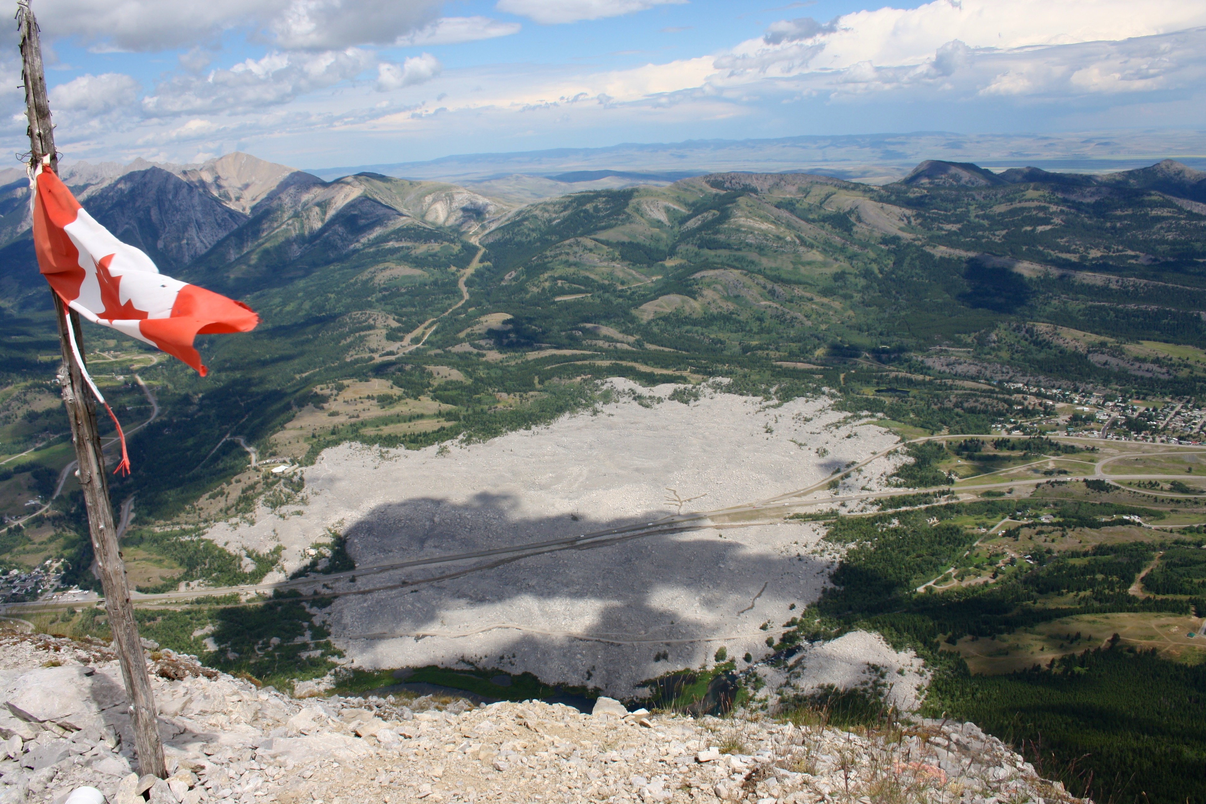
Turtle Mountain from the top of the Piitaistakis Eagle Watch Site. There was still plenty of snow on the Flathead Range.
A reverse of the previous picture. The South Peak of the Livingstone Range (top left) and the Piitaistakis Eagle Watch Site (centre) as viewed from the summit of Turtle Mountain in 2010.

Our robot-looking friend pointed the way. From here we had to descend into a col before heading up the slopes on the east side of “The Dog”. The next time that I do this peak, I will probably park and follow the road that leads overtop of the col.

Geo cache cairn on top of the Piitaistakis Eagle Watch Site – looking east.

Outside of being a weather monitor, we thought that this could also be an eagle zapper (much like a bug zapper) or a high tech porta-potty.

Lunch break with Turtle Mountain in the background.

Looking back on the Piitaistakis Eagle Watch Site (the point in the middle) from the east side of “The Dog”. Just behind the Eagle Watch Site is Two Mine Ridge.

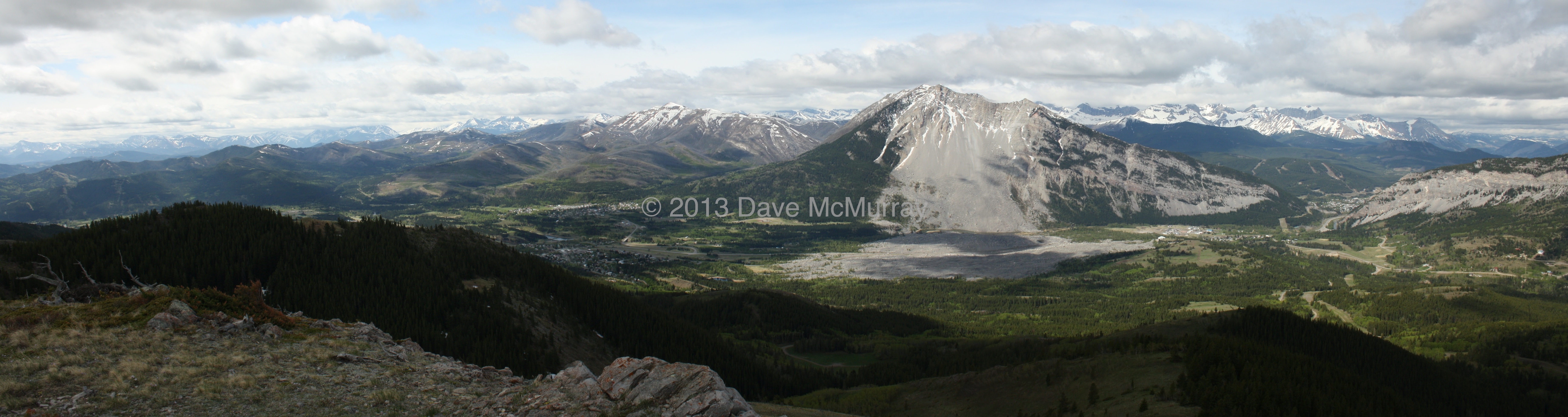
The South Peak on the far right and Crowsnest Mountain and the Seven Sisters in the distance on the left. In the centre is Morin Peak. The summit of Crownest Mountain was hidden by clouds all day.

At some point the kids lagged behind and I waited for them to catch up. Unfortunately, they were too slow and I summited the mountain without them. I met them again on my way back down while they were on their way up.

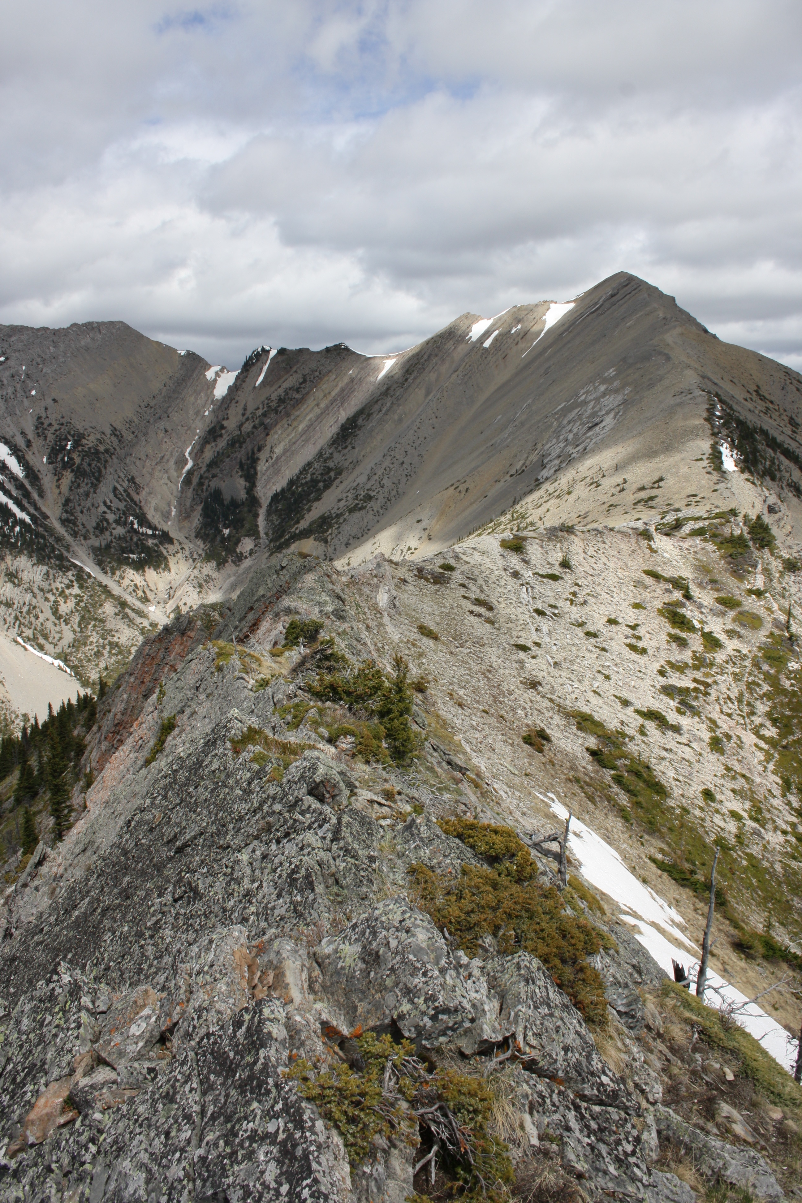
The walk along the ridge was not difficult although there were a few obstacles to hike over and around. I had an easy climb down on the left while Joel chose the more difficult middle section.

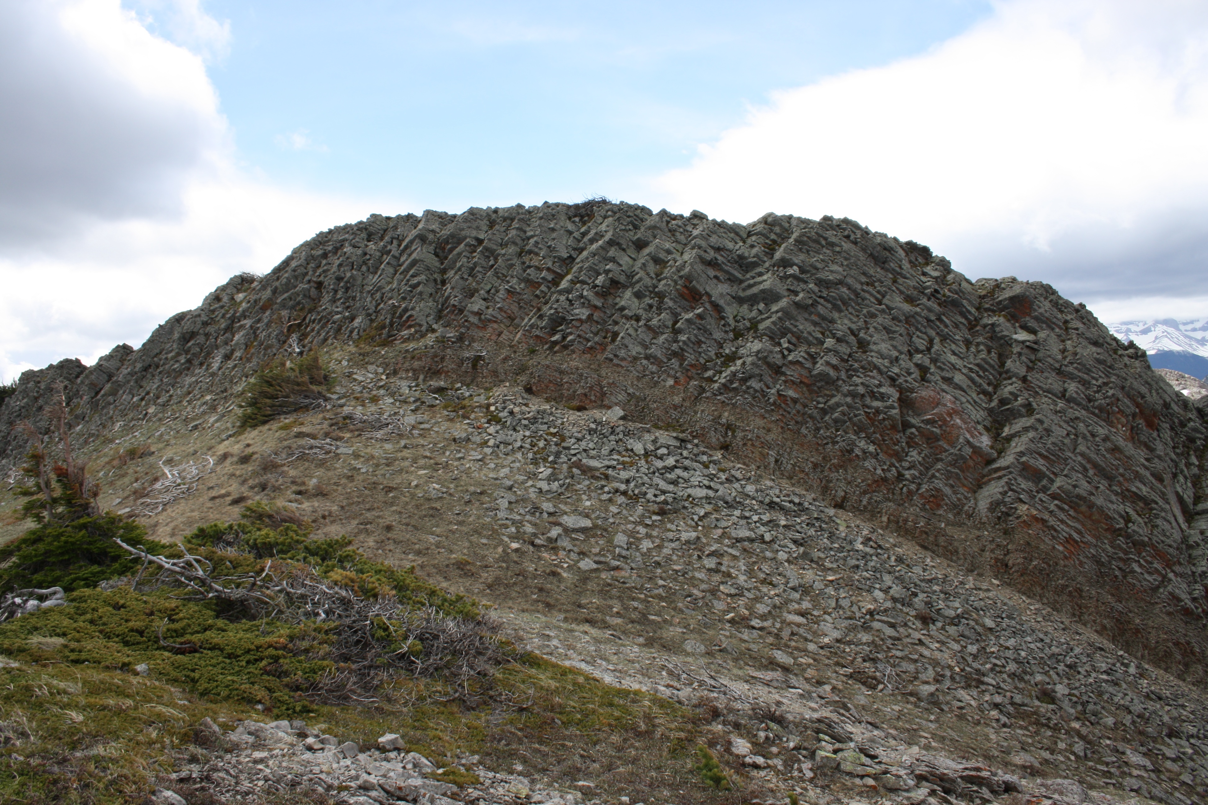
Some very cool looking fractured rock.

Life finds a way…

Orange lichen contrasted with the darker colours of Morin Peak.
Just before reaching the scree slope that would lead me to the summit of the South Peak, I came to a small dragon’s back.
Another obstacle easily passed on the far left through a weakness in the rock.
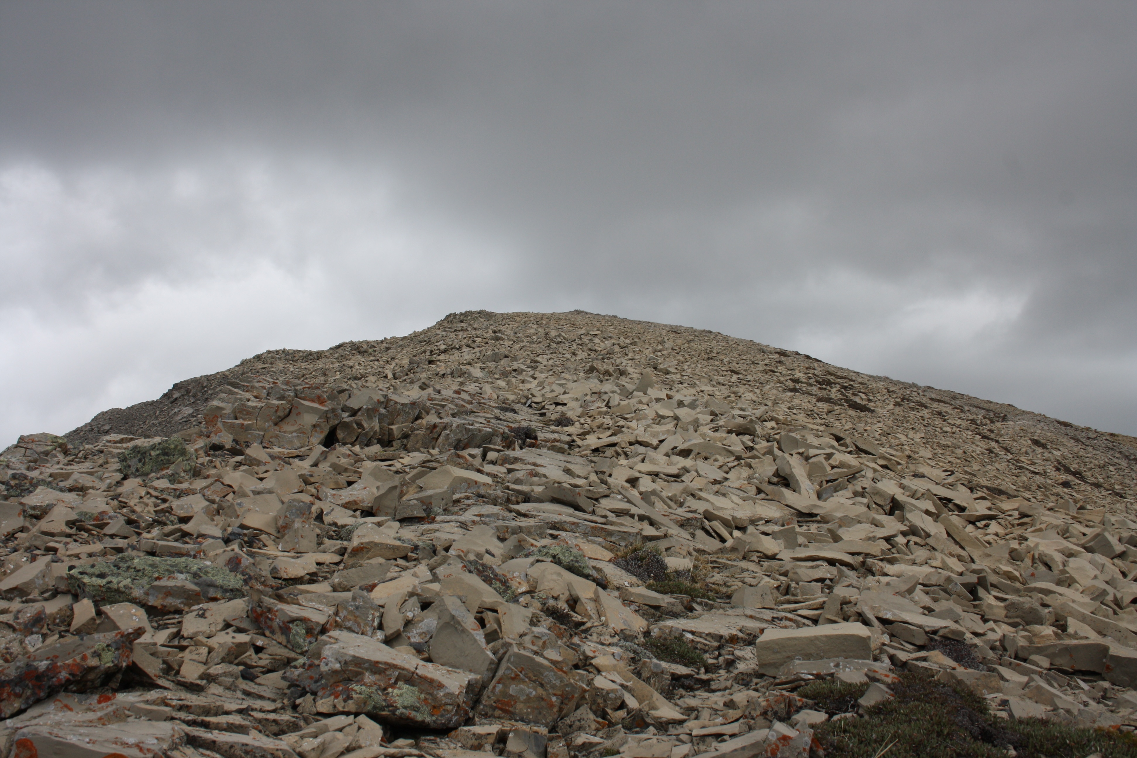
From here, it was simply a scree hike to the summit.
Getting closer to the summit. Two large golden eagles passed directly over the summit shortly after I took this picture.

A panorama from the summit looking west. North is on the right and south is on the left. Turtle Mountain is on the left and Bluff Mountain is in the distant centre. Morin Peak is in the centre foreground and “The Dog” is foreground left.
A panorama looking looking east. North is on the left & south on the right. You can just barely make out Prairie Bluff Mountain in the distance on the far right. The Old Man Reservoir is in the distant centre.

The summit registery. The last entry was from May 2011 – one year ago, so I guess this peak isn’t too popular even though it’s not that hard to reach.

My best eagle impersonation. Caudron Peak and Centre Peak are in the background.
Heading back into some rain. “The Dog” is in front of me.

I think this is a crokus.

The chert quarries in this area have been used for thousands of years by various First Nations groups to make arrowheads and tools. Joel gives it a try…

Spring has come.
The melting snow pack left behind interesting patterns in the dirt – that or there are giant man eating worms.

Glacier Lillies.

On the way back we encountered an abandoned mining facility that was eerily similar to something you would find in a low budget horror movie. This may be one of the mines for which Two Mine Ridge is named.

Looking out from inside the ruins.

I wasn’t sure how safe it was to go inside, so I made Joel go first (kidding!). The holes led to another level below.

Flowers carpeted the forest floor.

Almost back to our vehicle.

Loading up to head home after a great day.

Tick season! Here’s one of two hitch hikers that we found on our way home. The South Peak was a good warmup hike and my only regret was that it was cloudy. I think I will return on a nicer day and maybe include “The Dog” (Edit: done!) as part of the trip.