Happy New Year! With a busy December, my first trip of 2024 was also my first trip in over a month, which in my mind, is far too long of a break. 🙂 The unseasonably warm weather combined with a general lack of precipitation is a significant concern for our region, especially since agriculture is the major economic driver. Though multiple weeks of t-shirt weather is nice, it’s not the norm for this time of year and with the reservoirs empty since mid-summer, my new year’s wish is for a healthy snowpack to form combined with an overall, slow melt in the spring. In fact, a nice wet spring would be nice.
One thing that hasn’t changed however, is the wind. From years of experience, I’ve learned that when SpotWx says 35 km+ wind gusts at 120 m for a mountain, it usually means 100 km+ wind on top. In fact, think of most of the weather services’ wind forecasts like costing out a home renovation. If it says 60 km wind in Waterton, you can probably double that once you’re on the mountain and once you begin to factor in compression. I’ve watched a wind gust pick up Brad, with a full pack on and in full stride, and move him 1 m through the air. The wind here can quickly move from super annoying to super dangerous depending on the terrain.
So, knowing the wind was going to limit our choices for the day, Andrew and I began our usual text conversation of what options were available. Also joining us today, were Doug Robson and Scott Mills, two accomplished scramblers from Calgary and all-round great guys. They were open to anything we suggested, and that’s when I proposed, “The Horn”, which is a very distinctive outlier located immediately to the west of Pincher Ridge.
I first tackled “The Horn” back in 2013 as part of an ascent of Pincher Ridge. Bruce, Jeff, and I enjoyed a terrific scramble up a pronounced gully on “The Horn’s” west face, emerging onto the summit inside a notable notch. We then proceeded to make the long, but easy hike to summit of Pincher. However, given today’s fierce winds, we quickly concluded that the most sheltered approach would be through the intervening valley between the summit of Pincher and “The Horn”.
Why have I nicknamed it “The Horn”? Simply because it fits with the area’s theme. The name Pincher Creek comes from the discovery of “a pair of pincers (a tool used to trim horses’ hooves)” along its banks. Thus, I decided to avoid ‘bucking’ the horse tack theme and ‘saunter’ along with, “The [Saddle] Horn”, “Cinch Hill”, “Bridle Peak”, and “The Stirrup”. That it looks like a saddle horn from the east also plays nicely into the name, but at the end of the day, it’s only a nickname, and anyone can call it (or not call it) whatever they like. 🙂
As for our trip? “The Horn” ended up being the right choice for a windy day. Not only was our approach relatively sheltered, but we also utilized an amazing trail that I’ve never hiked before. We then enjoyed a short but fun scramble onto the summit where we were promptly hammered by the wind, which forced us to forego any thought of continuing on towards Pincher’s Centre Peak. Interestingly though, were the amazing cloud formations that formed above us throughout the day, with the coolest being a large lenticular cloud that hovered above the summit.
Finally, a huge thank you to Andrew, Doug, and Scott for making this into such a fun trip! 😀 Happy New Year everyone!

To get to “The Horn” we drove south from Pincher Creek on Highway 6 until we reached the Shell Waterton Complex Road (Township Rd. 43A). We then turned onto the road and drove west for ~9.1 km until we came to a junction with a gravel road near to the entrance of the plant. Here, we turned left and onto the gravel road where we continued for ~4.8 km until we came to a junction with a gas road on our left, just past Butcher Lake. We then turned left and followed the road upwards for ~300 m until we arrived at a well site. Here is where we parked and where the trailhead began.
A short walk from the trailhead brought us to a cutline and a clear path. We followed this to our right and arrived at two barbed-wire fence gates. As the gate leading into the open pasture is private land, we used the gate on the left and then followed the fence line for ~50 m until the trail turned left and made its way through the trees. Once on the trail, we followed it for ~4 km until we were almost beneath “The Horn’s” summit. From here, we hiked the steep slope (396 m elevation gain) until we were on the ridge and standing at the base of a short, but large gully. We scrambled the gully to the top and then made our way to the summit. For reference, from the trailhead to the summit it was ~6.3 km with a 676 m elevation gain.
To return, we hiked ~675 m to the col with Pincher Ridge and then descended down the trail back to the valley. We then followed our route back to the trailhead. Easy peasy!
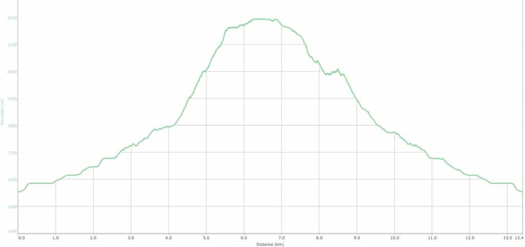
Our total roundtrip distance was 13 km over a total time of 5 hours even. My GPS decided that it didn’t want to track total elevation gains, but from the trailhead to the summit we gained 675 m in elevation.

Starting off with, “The Horn”, directly in front of us.

Arriving at the gates. We will use the gate on our left as the gate in the centre leads onto private property.
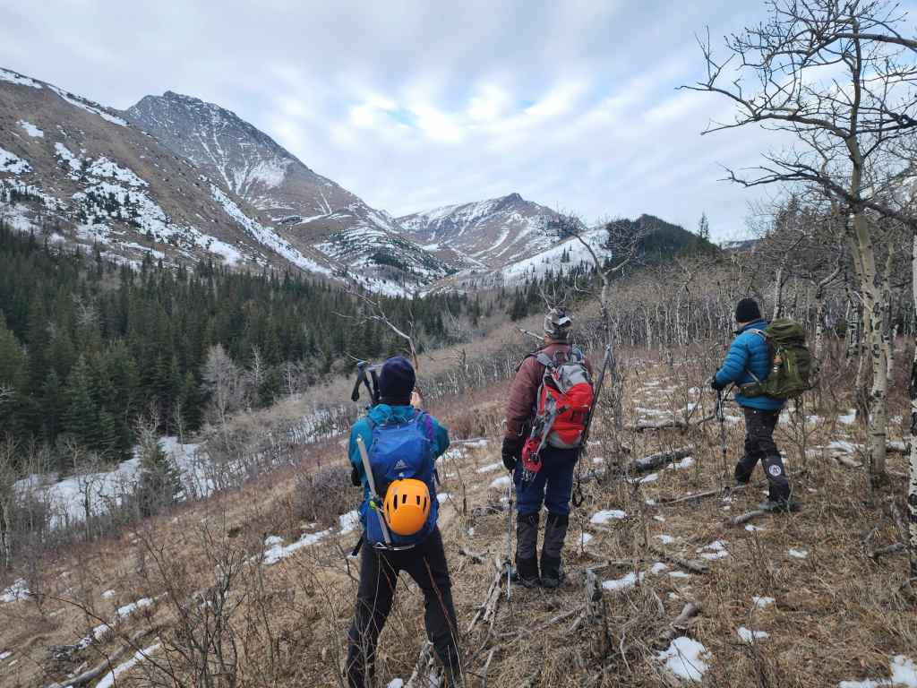
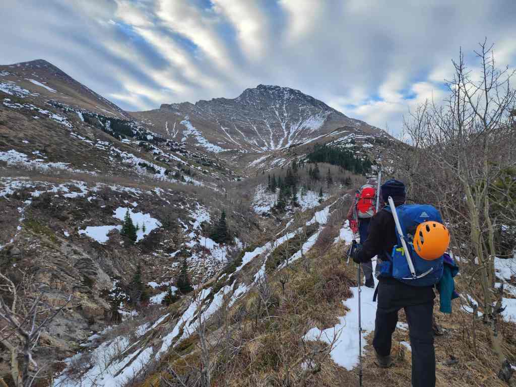
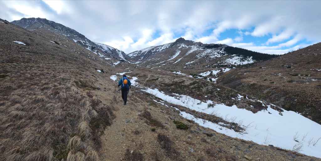
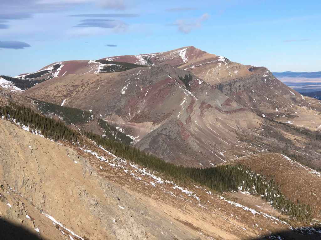
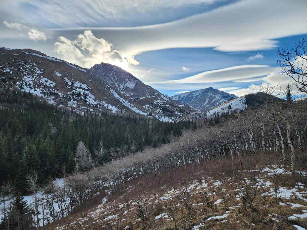
After following the trail from the fence line, we soon had a good look at our upcoming approach through the valley. Pincher Ridge is on the left and “The Horn” is in the centre. I’d never hiked this trail before, so I was excited to explore it.

Andrew leads as we follow the trail into the valley.

Looking back at Scott and the striking cirrocumulus clouds above us.
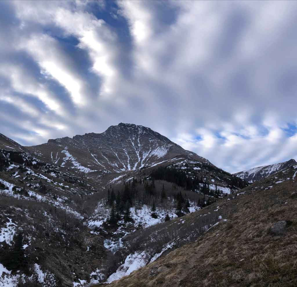
Following the trail with “Bridle Peak” on the left and Pincher Ridge in the centre.
Another look at the amazing cirrocumulus clouds. (Photo by Andrew Nugara)
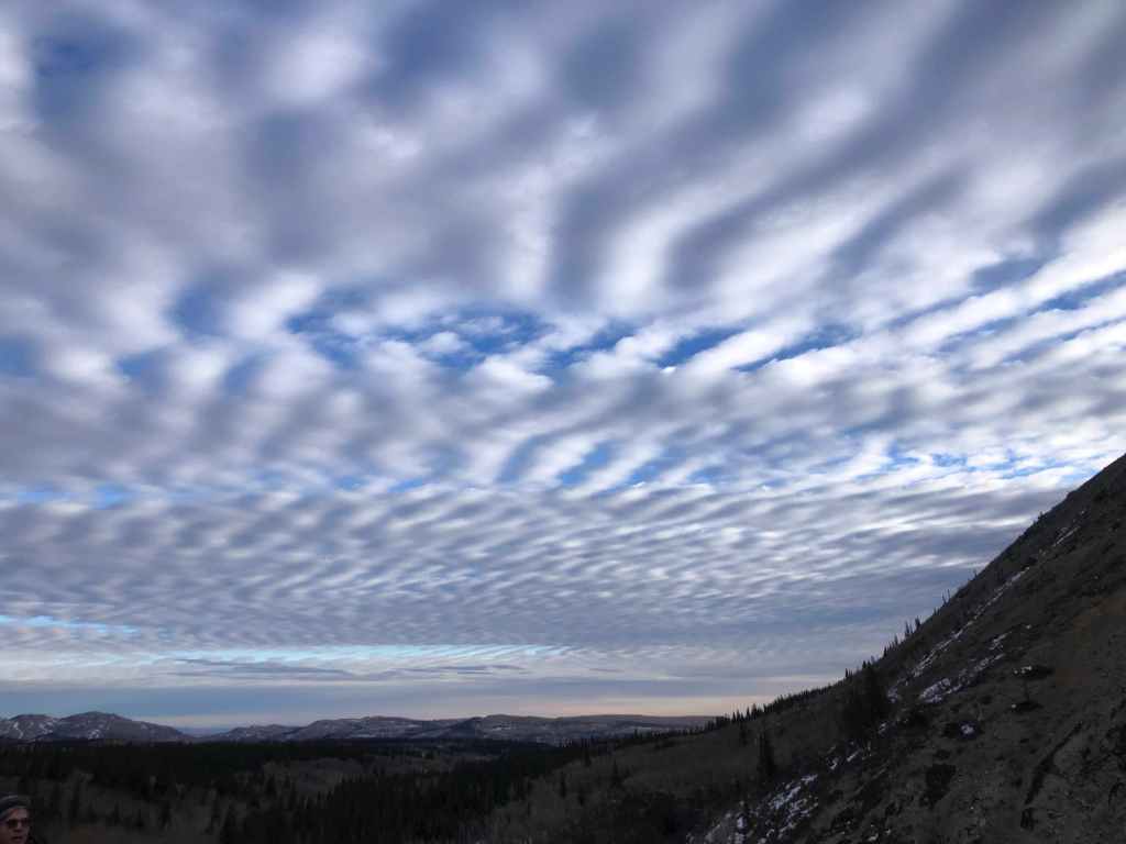
Still more cloud gazing. (Photo by Andrew Nugara)

The trail will soon lead us across a small stream.

More of that amazing sky.
On the other side of the stream and heading towards “The Horn” (centre).
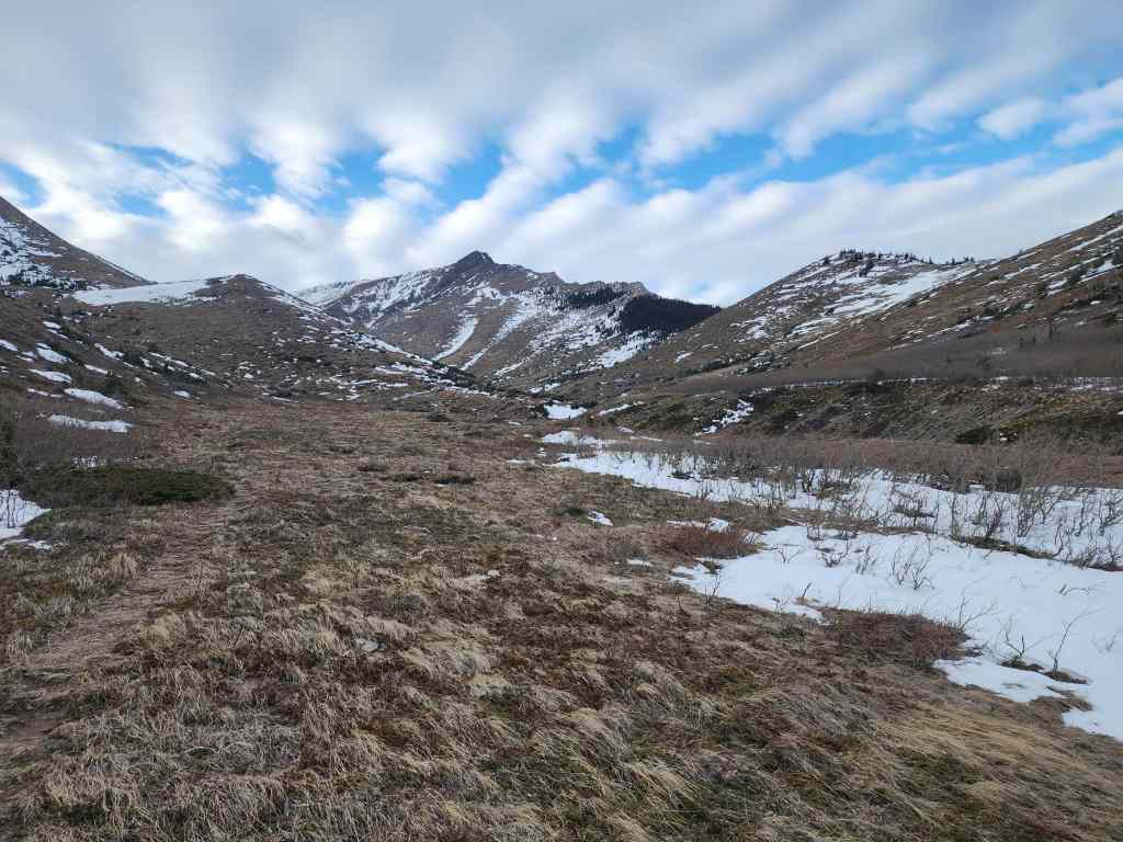
A wider view from a little further along the trail.
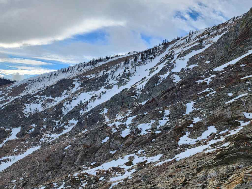
The trail will lead onto the col (centre) between Pincher Ridge and “The Horn”. This is how we will return at the end of the day and I’ll say, that this trail is probably the easiest way to get onto Pincher Ridge that I know of; though it’s much longer.
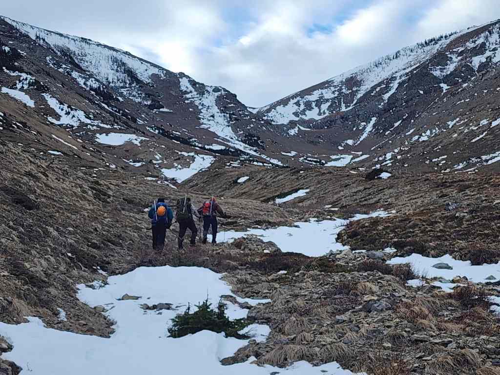
We will start our ascent beside the snow gully on the far left.
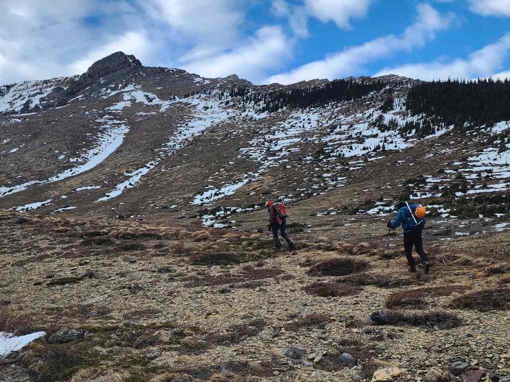
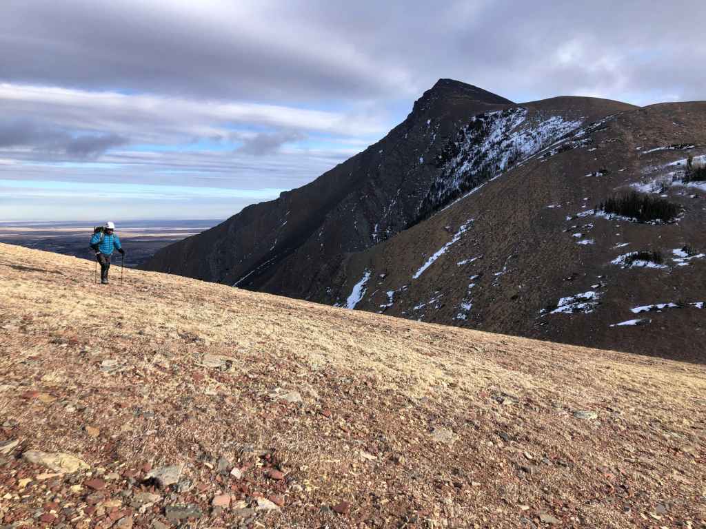
The slope is much steeper – and foreshortened – than it looks. From the valley to the summit ridge, it was a 396 m elevation gain. (Photo by Andrew Nugara)

Scott leans into the steep slope.

Gazing back at our route through the valley. We chose to follow the valley over the ridge because of the intense wind.

Andrew’s view over to Doug. (Photo by Andrew Nugara)
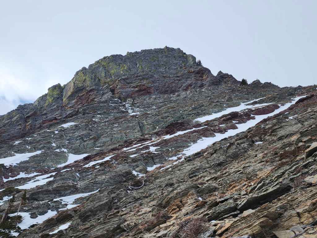
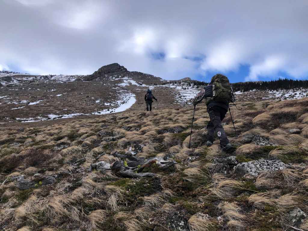
Looking up to the summit block.
That snow-filled couloir in the centre looked inviting… 🤔
Looking over at Prairie Bluff, “Prairie Sky”, and “Prairie Oyster”.

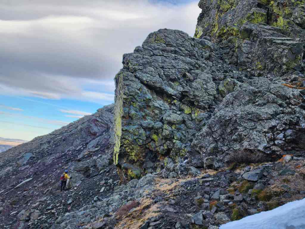
Arriving at the base of the gully.
Looking back at Scott.

Andrew’s view of the summit block from further along the ridge. (Photo by Andrew Nugara)
There’s barely any snow on Victoria Peak. (Photo by Andrew Nugara)
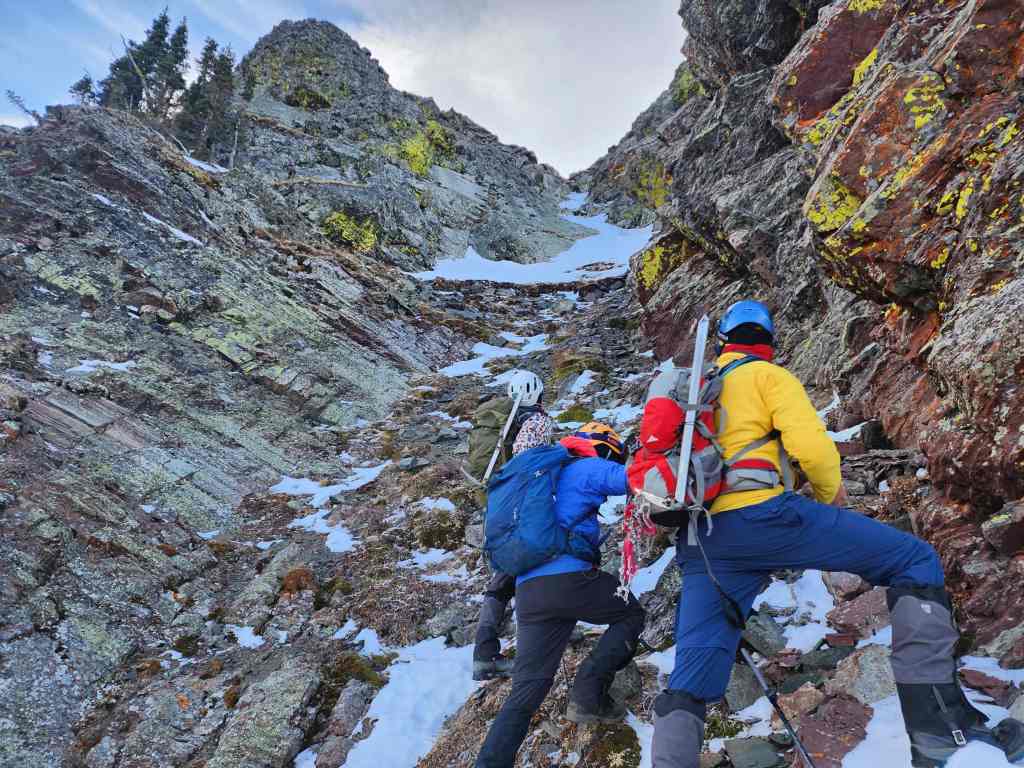
At the base of the gully.

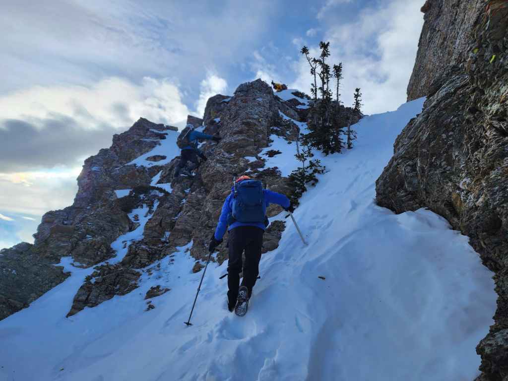
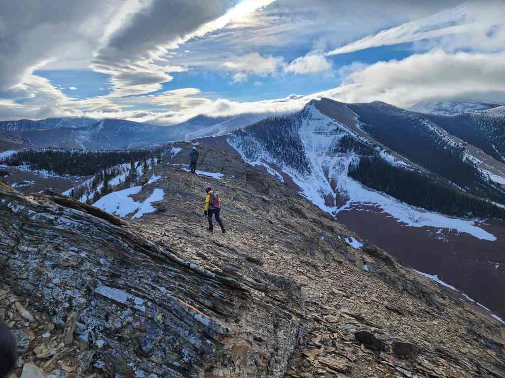
Heading up.
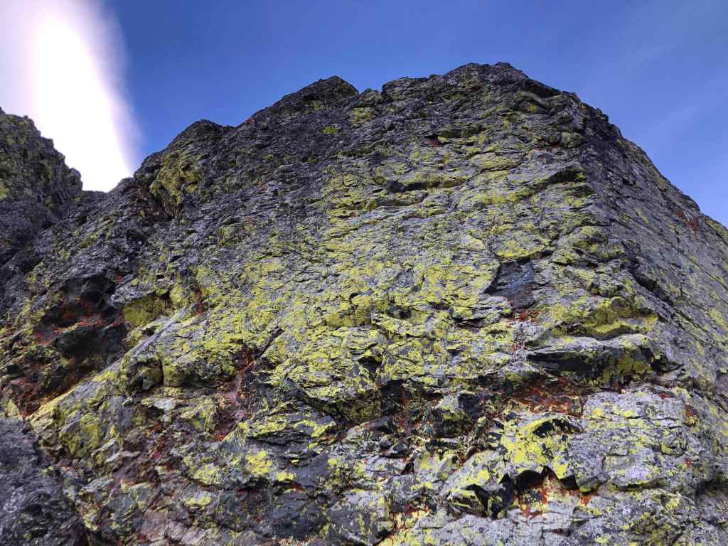
Doug passes a colourful pinnacle.
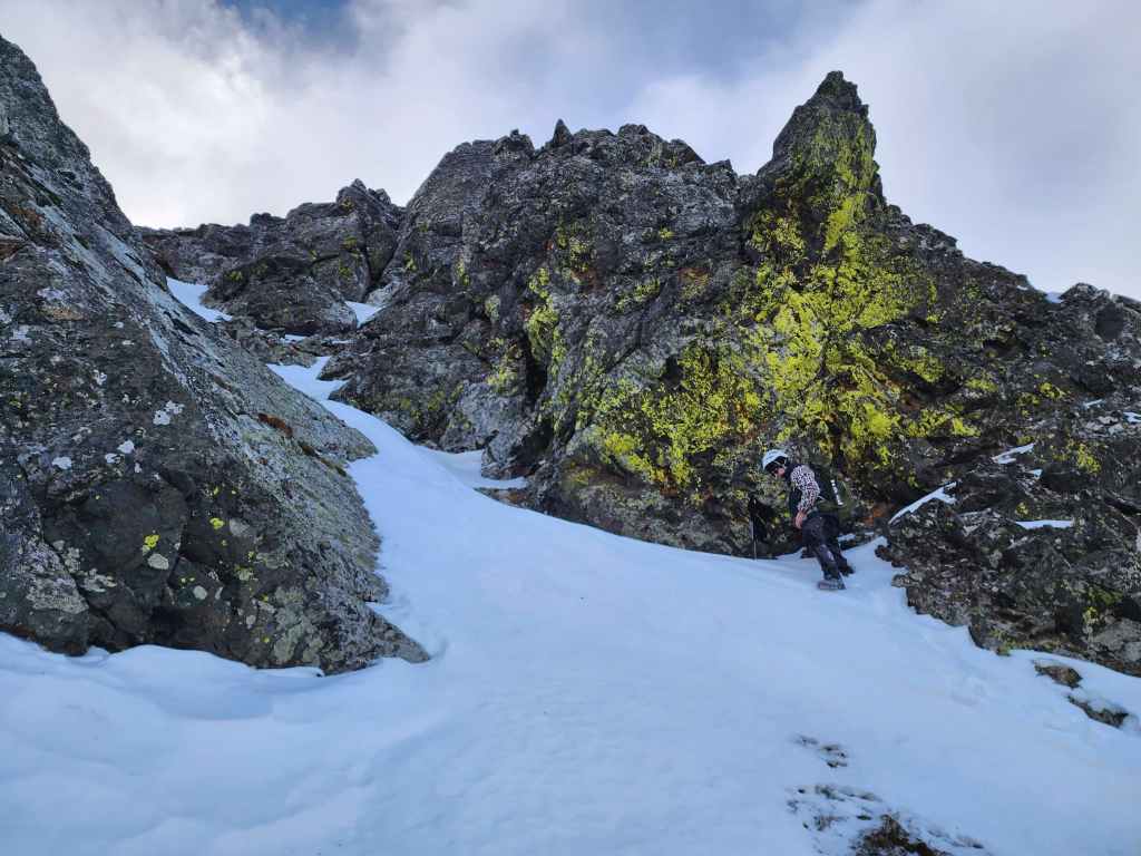
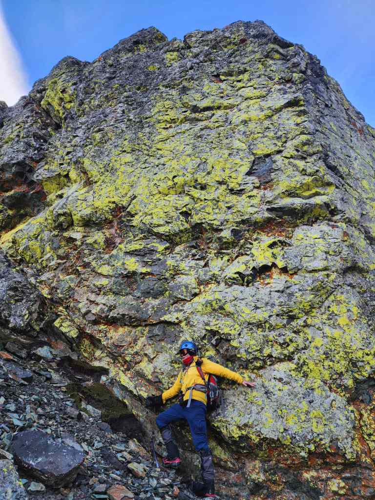
Scott’s enjoying the short scramble. 🙂
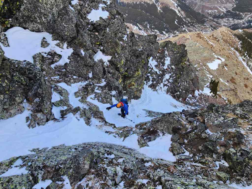
A wider view as Scott climbs higher…
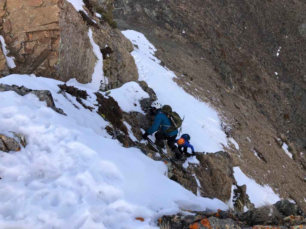
Before arriving at a short, but icy step.
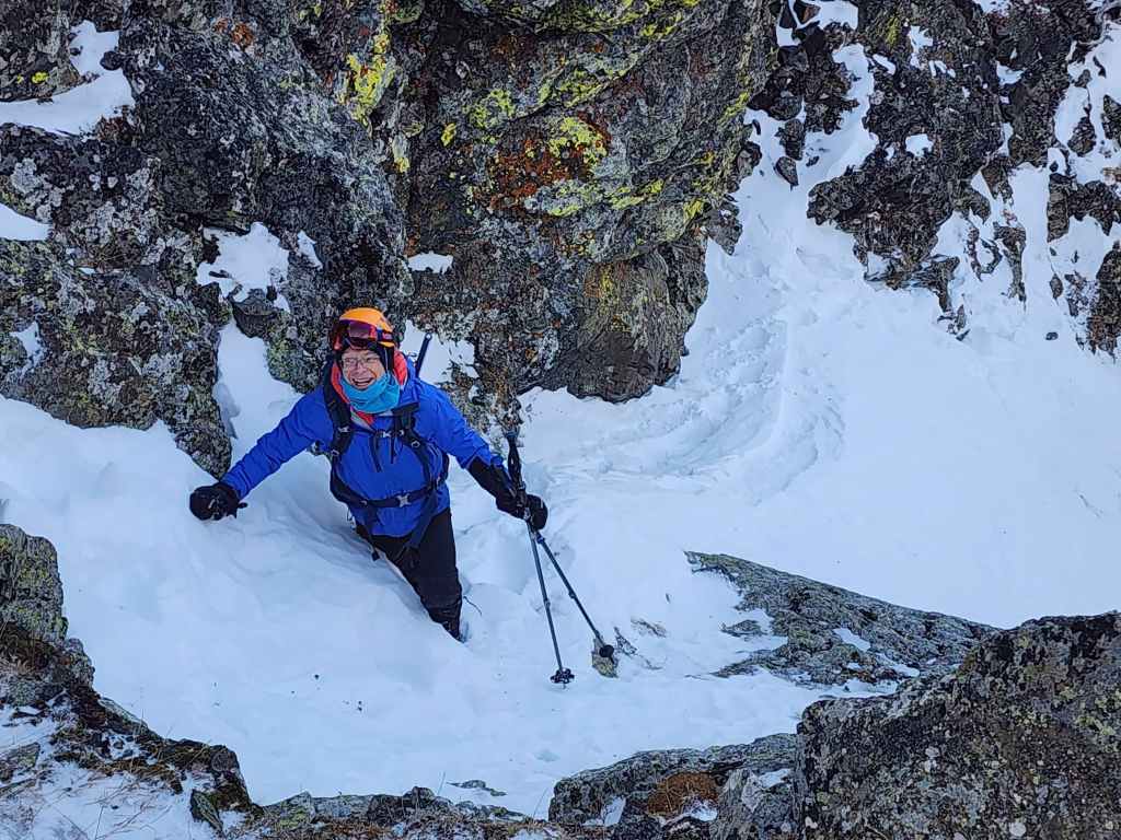
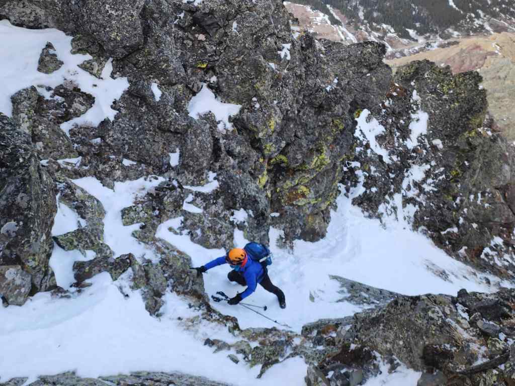
Andrew follows behind Scott…

And then tackles the icy step.

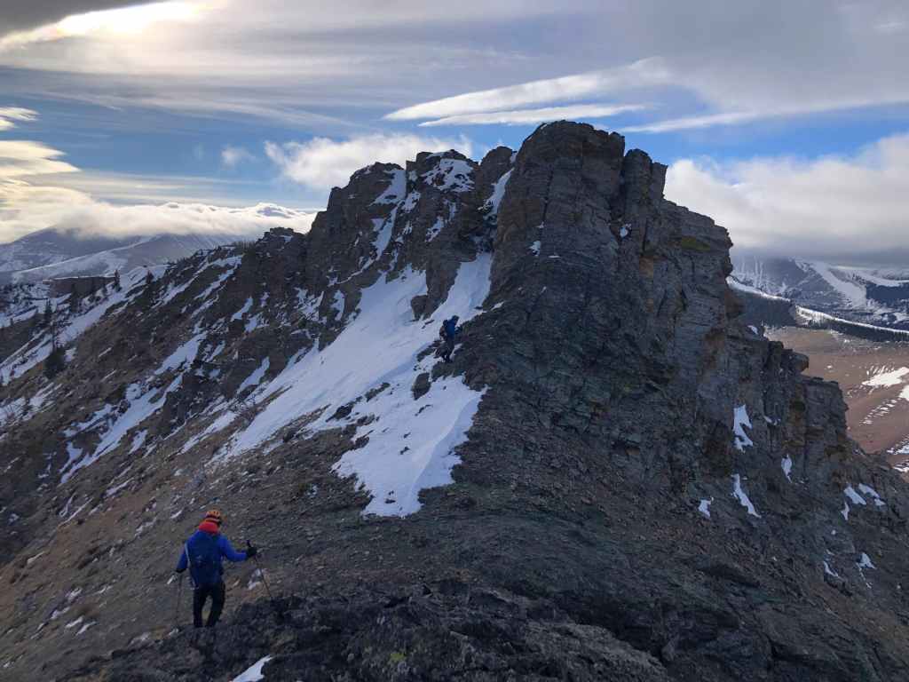
Emerging onto the summit ridge and being blasted by the wind.

Looking over at Pincher Ridge.

Heading towards the summit (left).
The summit sits on the other side of a notch. This is where we emerged back in 2013 after scrambling up an excellent gully on the west face. (Photo by Andrew Nugara)

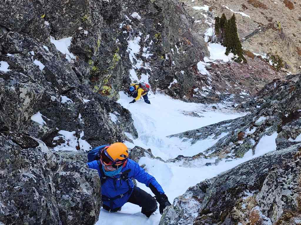
Doug and Scott follow Andrew as he scrambles onto the summit.
Doug’s turn to climb up.
Andrew’s view down to them. (Photo by Andrew Nugara)
Doug arrives on the summit.

A quick look over to the Prairie Bluff family of peaks. (Photo by Andrew Nugara)

Doug admires Victoria Peak. (Photo by Andrew Nugara)
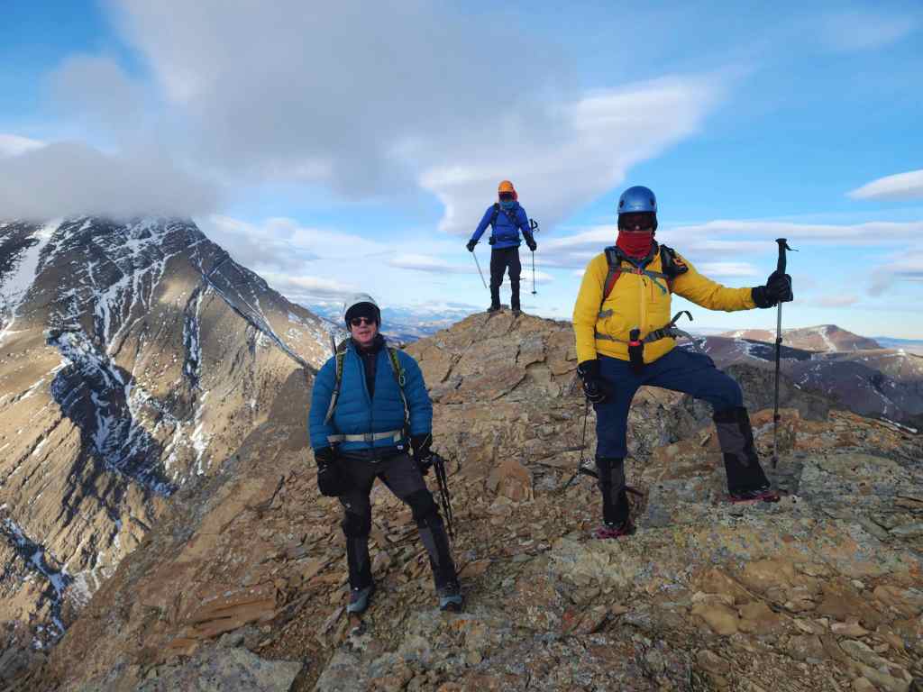
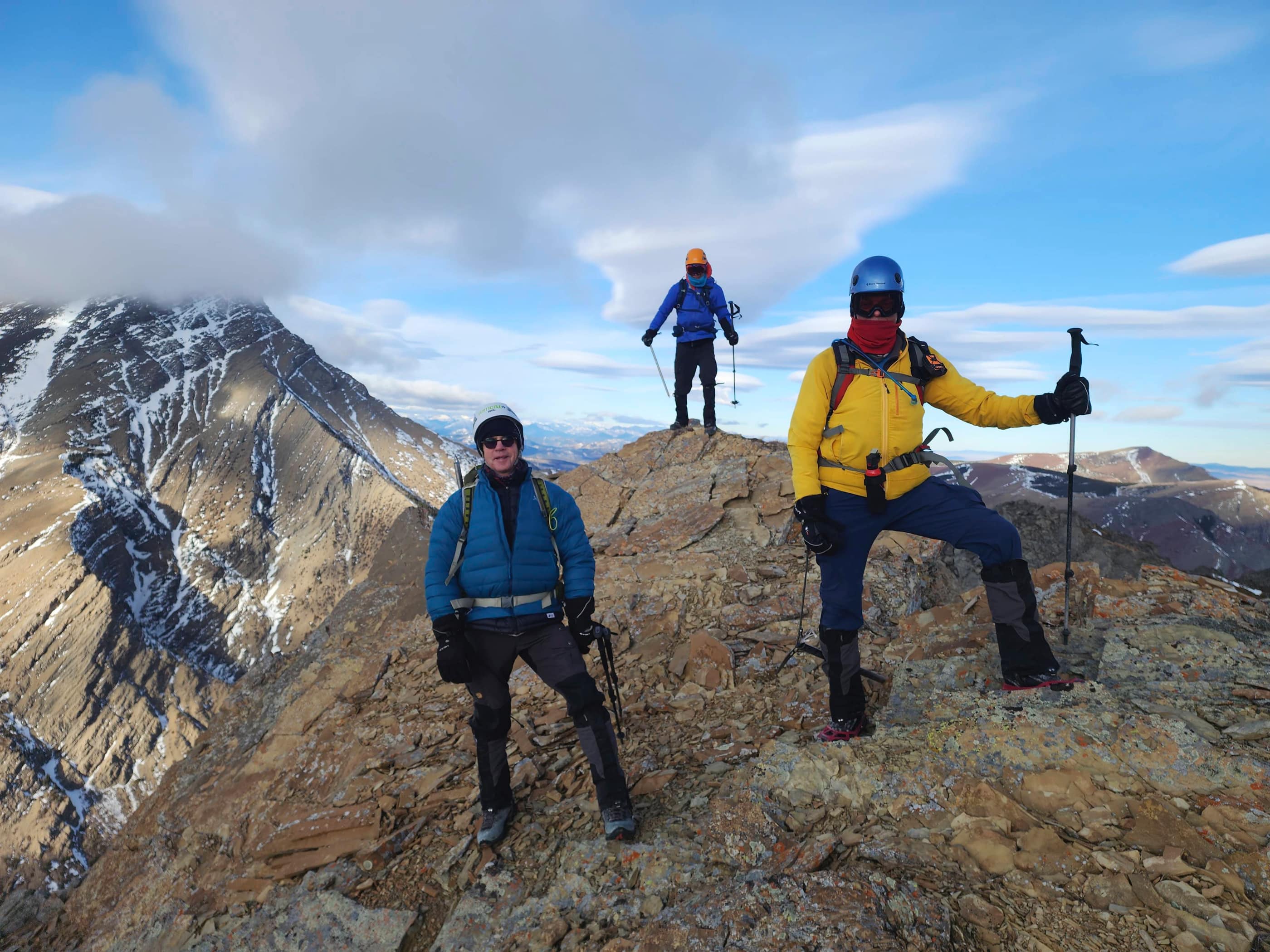
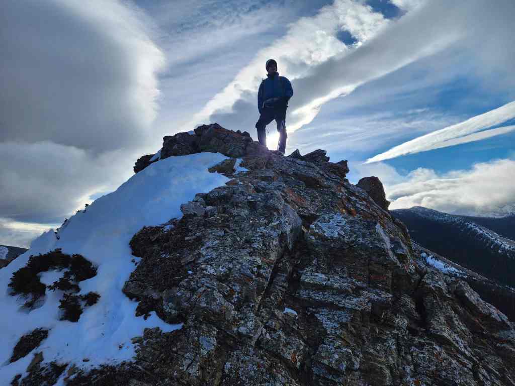
Doug, Andrew, and Scott on the summit of “The Horn” (2180 m).
Making a hasty retreat.

Scott fights against the wind.

Scott and I leaving the summit. (Photo by Andrew Nugara)

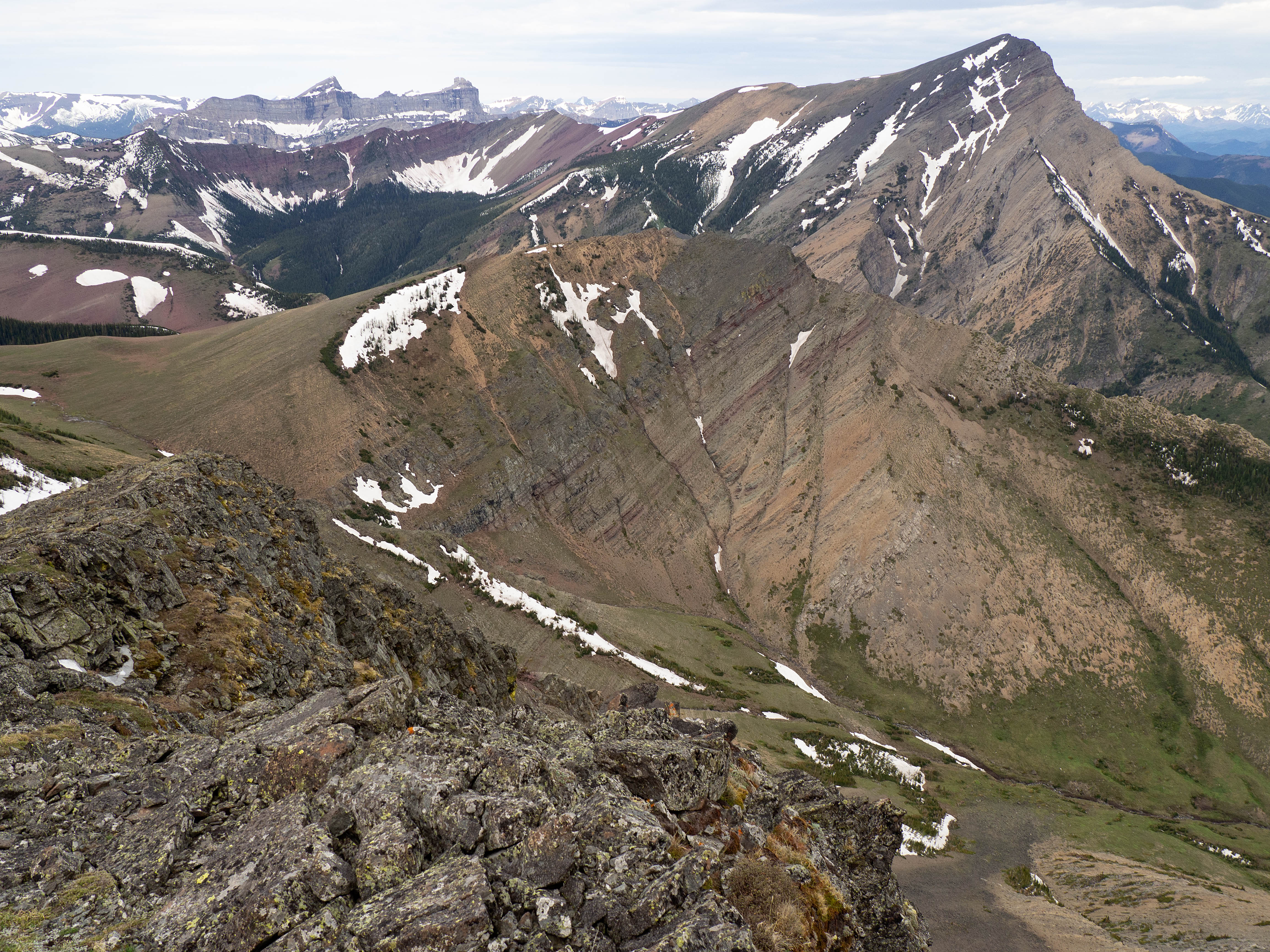
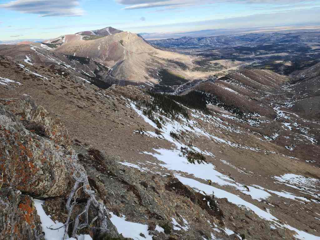
The easy connecting ridge with Pincher’s Centre Peak (right).

Pincher Ridge (left) and its Centre Peak (right) are easy to reach from “The Horn”.
Doug heads toward the col. (Photo by Andrew Nugara)
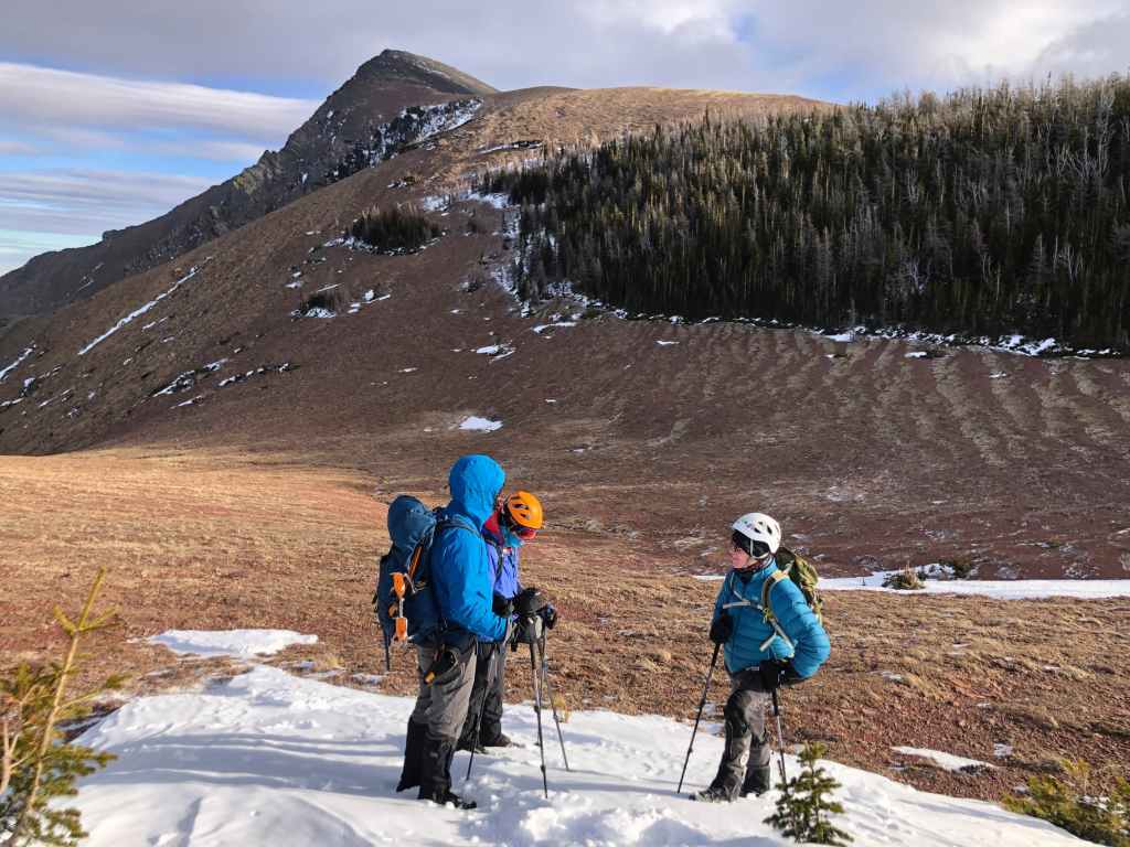
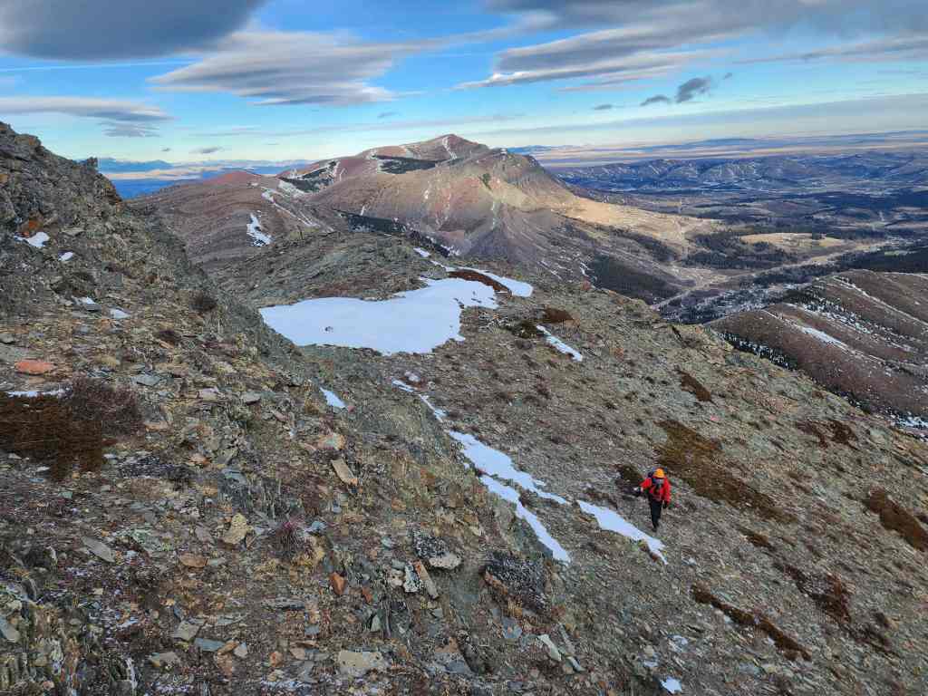
Finding a bit of shelter, we discuss whether or not to continue on to Pincher’s Centre Peak. (Photo by Andrew Nugara)

It looked so tempting, but the wind was too insane to continue. (Photo by Andrew Nugara)

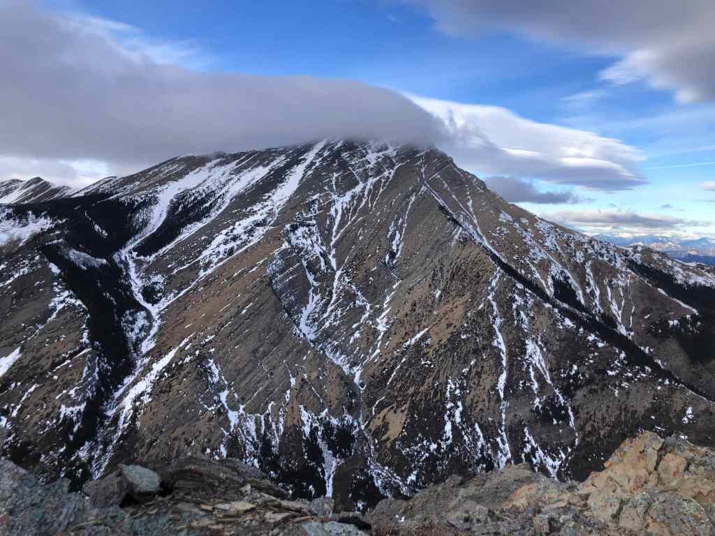
A cool lenticular cloud settles over “The Horn”. (Photo by Andrew Nugara)

Retreating down the col.
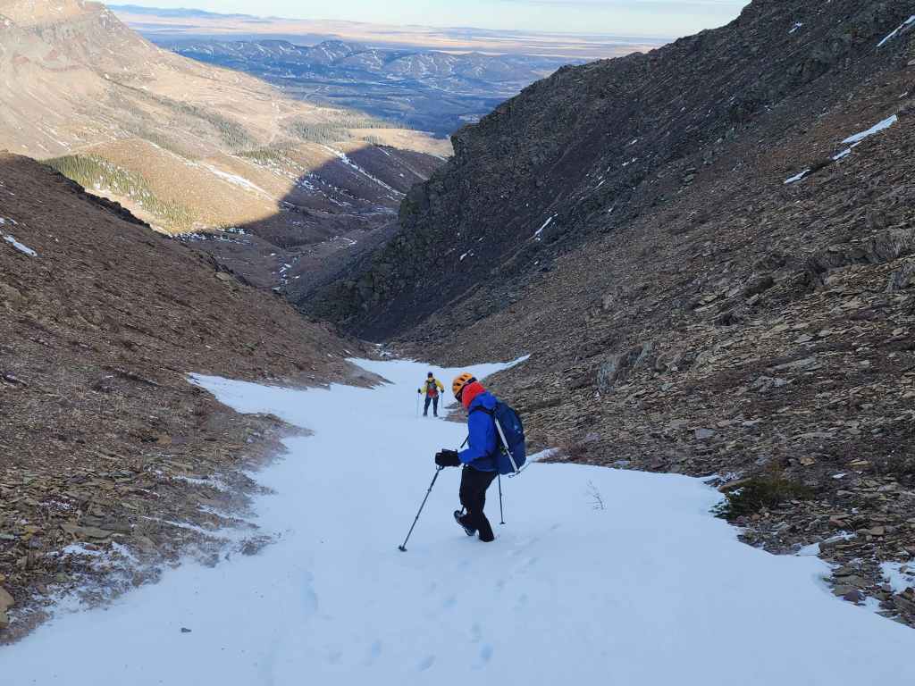
It’s relatively easy to reach the valley from the col and vice versa.

Glancing back.

Looking across to where we scrambled onto “The Horn”. (Photo by Andrew Nugara)
Another look at Prairie Bluff (centre) and “Prairie Fire” (foreground centre). (Photo by Andrew Nugara)
Andrew stops to photograph some colourful rock.
The photo he took. (Photo by Andrew Nugara)

Super cool rock.
Practicing the art of camouflage. 😂
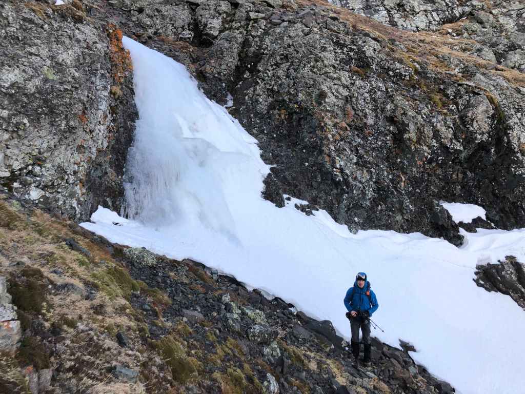
That’s me in front of a small waterfall. (Photo by Andrew Nugara)

Looking back.

Arriving back in the valley. It will be an easy hike back from here.

One more look back to the col…

And then back to “The Horn” (right).

Following the trail back through the trees.
More interesting clouds.

Following the fence.

Andrew and Scott pass through the gate.

Arriving back at our vehicles almost exactly 5 hours and 13 km after starting. Despite being limited by the wind, this was a fun trip that featured some amazing cloud formations and fantastic companions. In fact, it was a pleasure to meet Doug and Scott and hopefully, all four of us can team up for more trips in the future. Finally, here’s hoping that over the next number of months, there are some serious dumps of snow, otherwise, it will be a very hard year for southern Alberta.


Leave a Reply