
⚠️ Hiking and scrambling are inherently dangerous activities. Please read my Disclaimer. ⚠️
It seems lately, that when I write a trip report and mention that we need a lot more snow in the mountains, someone upstairs takes note, and it snows shortly thereafter. Coincidence? Or merely the divine reach of WordPress? 😂 This happened again between last week’s hike and today’s trip, so I’m simply going to state right off the bat: we need a whole lot more snow to fall in the mountains. I’ll also say thank you in advance for making this happen. 🙂
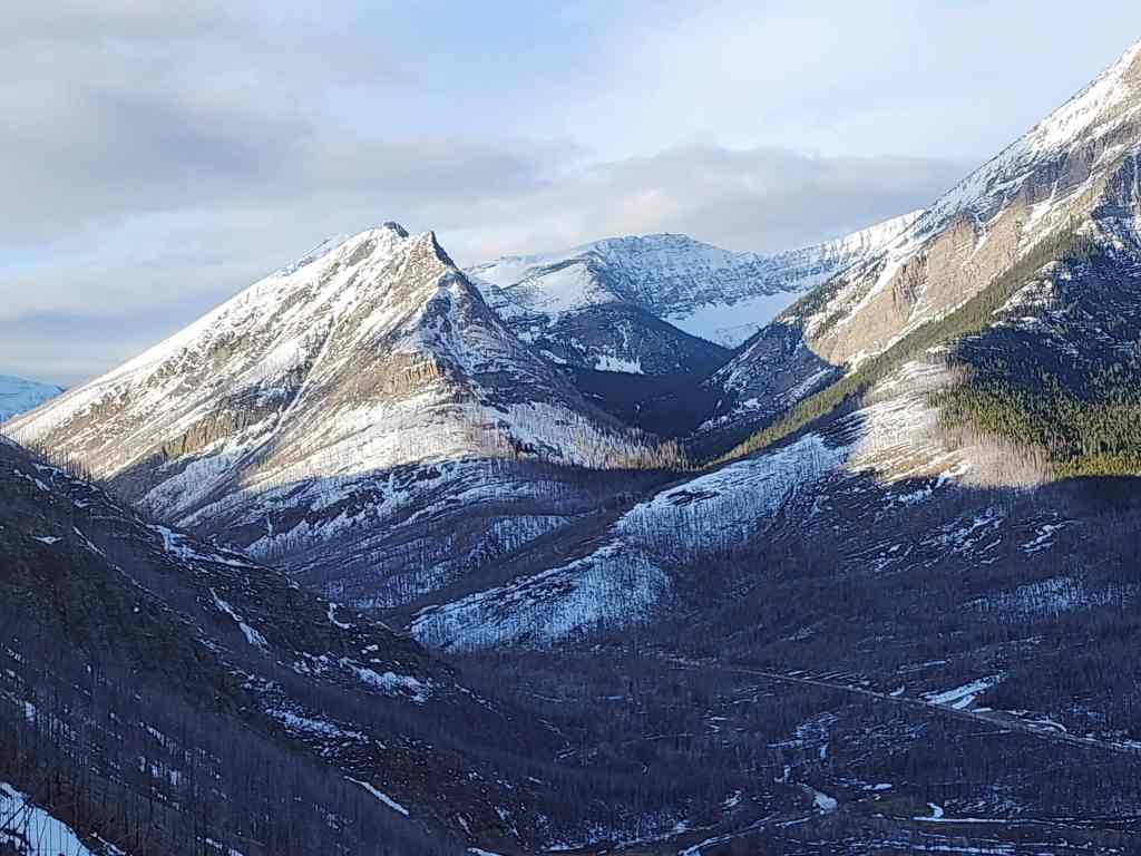
With a forecast calling for overcast skies and scattered flurries, Brad and I decided to try our luck with a Nugara special. 😀 Having had a couple hours to stare across the valley at Rowe East last week and knowing that Andrew had recently re-ascended it two times (December 2023 & February 2024), Brad and I decided that this prominent outlier of Mount Rowe would fit the bill.
What we were not expecting, were the great views from the summit. Even though the area was mostly beclouded, we discovered that at minimum, you can see five lakes from the top: Lower Rowe Lake; the two Upper Rowe Lakes; Little Akamina, and of course, Cameron Lake. We also speculated that on a clear day, you may be able to see Forum Lake and potentially, Summit Lake. If true, that would be seven lakes that are visible from the top of this unique little peak. Wow!
The other cool thing about Rowe East – so named by Andrew because it sits directly to the east of Mount Rowe – is its abruptness. While driving in along the Akamina Parkway, it’s hard not to notice its east face, which rises dramatically into a spire. Then, while on the summit, you are decidedly conscious of the extreme drop that marks its north face. One slip here and its game over.
All in all, this was a great excursion that I want to visit again on a clear day. A huge thanks to Brad for the fireball cinnamon whiskey and the great company! 😁

To get to Rowe East, we left the Waterton townsite and drove ~13 km along the Akamina Parkway until we came to the parking lot located at the seasonal gate for Cameron Lake. This is the staging area for winter access into the area. This was also our starting point.
From the gate, we walked along the road for ~130 m until we came a set of large boulders that have been placed on the righthand side of the road to prevent cars from driving into a small drainage. Here is where we left the road and we followed the drainage for ~315 m until we came to our ascent slope alongside where the drainage comes off the mountain.
From here, we climbed the initial steep slopes and followed the drainage for ~215 m until we came to the start of the obvious ridge to climber’s right, that led to the summit. We then hiked up this for ~2.3 km (639 m elevation gain) until we reached the summit.
Once on the summit, we continued east and along the ridge, before returning to the summit. To descend, we saved some time by dropping more or less, directly back to the drainage and ending up higher in the valley (we avoided the bowl due to potential avalanche danger).
We then followed the drainage back to where we had left it and then continued to follow it back to the road and our vehicle.

Our total distance travelled was 6.7 km with total elevation gains of 690 m. Our total roundtrip time was 4.5 hours, which included several leisurely stops. For reference it was 2.7 km from the parking lot to the summit over a time of 2 hours and 16 minutes.

Starting off at the seasonal gate on the Akamina Parkway.

Brad makes sure to obey the speed limit. 😂

Approximately 130 m from the gate, we left the road to follow a small drainage.

Arriving at the base of the mountain. The ridge we will follow to the summit is on the right.

Brad climbs over a small rock band. The lower slope is quite steep.

Looking back as we continue to follow the drainage.

Almost at the point where we will leave the drainage to follow the ridge (right).

Looking over at Buchanan Ridge (centre) and “The Senator” (left).

There should be a lot more snow, but at least there’s more than there was last week.

Things get steeper as we start up the ridge.

Taking advantage of a rare break in the clouds to look over at Mount Carthew (centre) and Buchanan Ridge (left).

The ridge will head east for a while before swinging to the north.

Another look back.

Our first glimpse of the summit (right of centre).

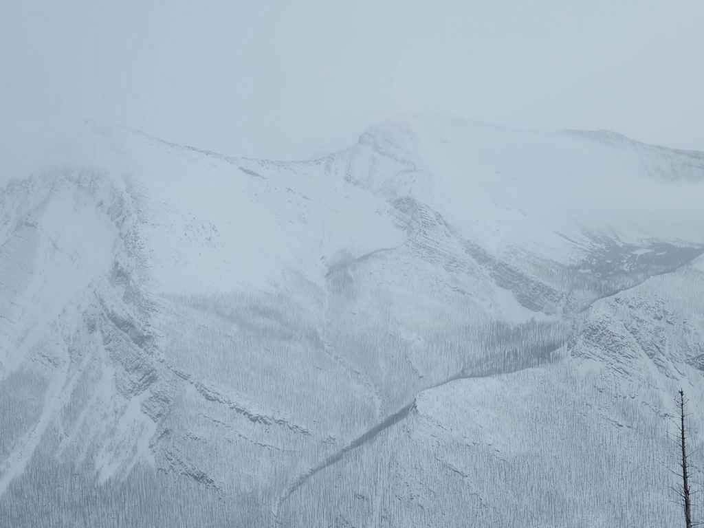
The weather wasn’t ideal, but it was still turning into a great little trip! 🙂

The lower half of the mountain was nearly windless, but that changed the higher we went.

Still heading up.

Getting closer…

And closer.

The summit of Rowe East (2330 m).

Brad joins me on the summit. Mount Rowe is in the background.

Gazing down at the Upper Rowe Lakes (top) and Lower Rowe Lake.

Now looking over at Cameron Lake and Little Akamina Lake (left). That’s five lakes from the summit.

It’s hard to tell, but maybe its possible to see Forum Lake (centre) from here…?

It might also be possible to see Summit Lake in the centre, but I can’t tell for sure.
Buchanan Ridge (left) and Mount Carthew (centre).

Brad on the summit…

And then me. (Photo by Brad Wolcott)

Brad leads the way as we head over to the east end of the ridge.

Bypassing a section of rock.

Brad’s view back to me. (Photo by Brad Wolcott)

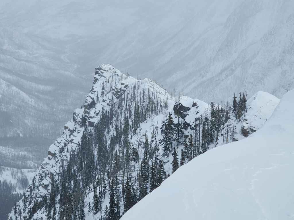
The ridge narrows.

A wider view of the previous photo.

Brad bypasses another obstacle.

I down-climb the same obstacle on the other side. (Photo by Brad Wolcott)

This was a fun little ridge walk! (Photo by Brad Wolcott)

My view back to Brad.

The north face is pretty much a straight drop. 😳

Nearing the end of the ridge.

The clouds cleared enough to see Mount Lineham.

Brad closes in on the end of the ridge.

Brad checks out the spire (left) that is so prominent from the Parkway.

A pano of the previous photo.

Thanks Andrew for the heads-up on this fun little peak! 🙂

Brad’s view back to me. (Photo by Brad Wolcott)
A closer look at the spire.

Fireball time!

Looking over at Ruby Ridge.

We couldn’t see much, but the clouds cleared enough to see “Igneous Peak” (centre).

Where I was a week ago: Buchanan Northeast. Thankfully and unlike last week, there’s now snow on the mountain.

We contemplated heading over to the spire, but concluded that climbing onto it might be tricky in the snow. If you want to see a what it looked like 10 days ago versus today, read Andrew’s trip report. He has a good closeup of the spire.

Looking down at the parking lot and our starting point.

Some impressive cornices!

A slightly wider angle of the previous photo…

And then a pano.

Surprisingly, there was very little wind on top of the mountain.

Heading back to the summit.

More cool cornices.

Our clearest view of Mount Rowe (centre).

Another pano.

Brad climbs over an obstacle.

Admiring the small rock face.

Another look at Mount Lineham.

Gazing back from the summit.

Time to head back.

To descend, we followed our route a short distance back along the ridge…

Before heading straight down to the drainage. It was a very quick trip.

Time for a pipe and some fireball whiskey.

Descending the drainage.

Down-climbing a small rock band.

Almost at the bottom.

Back on even ground.

Now on the road and looking at Rowe East.

Arriving back 4.5 hours after starting. This was an excellent winter trip! A huge thanks to Andrew for the recommendation and for his December 2023 trip report. Likewise, a huge thanks to Brad for the great conversation and great day. I definitely plan on returning when the weather is clear! 😁


Leave a Reply