
⚠️ Hiking and scrambling are inherently dangerous activities. Please read my Disclaimer. ⚠️
Wow! What a stellar trip! For a last-minute decision on what can simply be described as a perfect weather day, this exploration of the northeast end of Loaf Mountain was an incredible mix of scenery, mountaineering, and fantastic company. 🙂
The day began with Brad, Andrew, and I deciding to try something on the front range of Tatsiki-Miistáki (Castle). As the three of us scramble and hike that area so frequently, I’m always amazed when we stumble on something new; be it a different route up a familiar peak or an outlier that we’ve overlooked in the past – and this is exactly what happened today.
After deciding to try something on the north side of the northeast end of Loaf, we began walking down the road from the Bovin Lake trailhead while scanning the terrain below “Bakery Peak”. That’s when a Brad pointed out a prominent outlier that marked the start of an adjoining ridge with “Pastry Peak”. He noted that the route to the top would go above a series of ice climbs that he’d done in the past, and which are outlined in Joe Josephson’s Waterfall Ice Climbs in the Canadian Rockies (61).
Observing that the gully on the north side of “Bakery” ended beneath a series of gnarly cliffs, we wisely opted to follow Brad over to the ice climbing area. As none of us had ever been in the massive bowl above the waterfalls, nor had any of us been on the outlier or the subsequent ridge, this would be entirely new terrain for us. 😀
At this point, I’m simply going to repeat myself and say, ‘Wow! What an incredible decision this was!’ The windless day, the deep blue sky, and a fresh dump of snow created a veritable mountain paradise. I should also mention that Loaf Mountain is huge, and every time I’m on it, I’m reminded of this, but never more than today. This is huge terrain that feels incredibly remote even though it’s not.
Our hike into the bowl beneath the ice climbs was stunning. This was followed by a delicate traverse to reach the expansive bowl above them – which was way bigger than we thought! Once in the bowl, we eyed up two large pinnacles along the ridge that were divided by an inviting snow-filled couloir. First though, we wanted to tag the top of the outlier that marked the start of the connecting ridge to “Pastry Peak”.
Much to Brad’s (and probably everyone else’s) chagrin, I nickname things in a way that relates to geography. Hence, on Loaf Mountain, there is “The Muffin”, “The Croissant”, “Bakery Peak”, and “Pastry Peak”. In keeping with my plan to make Brad mad, I dubbed the outlier, “Ciabatta” and the pinnacles, “The Breadsticks”, which I think is a much better name – but not funnier than, “Fertilized Spinach Dip”, which is what Brad wanted to call it. 😂 Now to be fair, Brad did follow my lead when he nicknamed the huge upper bowl, “The Bread Bowl”.
After tagging the top of “Ciabatta”, we then made our way along the ridge towards “The Breadsticks”. The climb up the couloir was superb, and the views from the first and smallest breadstick were abrupt to say the least. From there, Brad led us onto the top of the second, but higher pinnacle, which turned into the continuation of the ridge towards “Pastry Peak”. However, a very large step presented itself as the obstacle onto “Pastry” and since it had taken us five hours to reach the top of the second “Breadstick”, there was no way that we were going to try and scale our way up, especially if it meant down-climbing it.
Returning to the bowl and then cautiously making our traverse and descent to the lower bowl was quick, but in no way did the scenery or the conversation grow mundane. This is a spectacular area! Wow! Once back on the road, we kept looking back as we made the long walk out. Loaf Mountain and all its tasty treats never ceasea to surprise me. Wow! 🙂
Be sure to check out Andrew’s awesome trip report!
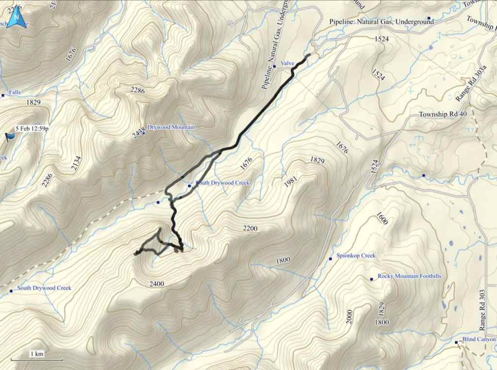
To get to the northeast end of Loaf, we drove ~19.5 km south from Pincher Creek on Highway 6 until we reached the Shell Waterton Plant Road (Township Rd. 43A). We then turned onto it and drove west for ~9.1 km until we came to a junction with a gravel road near to the entrance of the plant. Here, we turned left and onto a gravel road where we continued for ~3.9 km until we reached Butcher Lake. We then turned left and onto another gravel road immediately prior to the Lake and followed this road for ~1.4 km until we come to the junction with another road on our left. We turned here and followed it for ~5 km until we arrived at a T-intersection. Here, we turned right and ~230 m later, arrived at the Bovin Lake trailhead.
From the trailhead, we walked for ~2.7 km until we came to fork immediately after passing a building. Here, we turned left and followed the road for ~780 m to where it ended at a gas well. From the well, we kept walking for a few metres, until we could see a trail on the other side of a small, barbed wire fence. We followed this trail for ~700 m until we came to the drainage that leads to the bowl below the waterfalls. We then ascended the drainage for ~900 m until we were below the waterfall that Josephson calls, “Tearful Symmetry”.
We ascended to climber’s left of ‘Tearful Symmetry” and then made a cautious traverse across steep terrain to reach the “Bread Bowl”. We then ascended steep slopes to reach the top of “Ciabatta” (2050 m) and from there, followed the ridge for another ~650 m to reach the base of the couloir leading up “The Breadsticks”. An enjoyable ascent brought us to the top of Breadstick #1 (2199 m) and then a quick scramble brought us to the top of #2 (2236 m ).
To descend, we headed directly from the base of the couloir into the bowl. We then made our way back to our entry point and the start of the traverse. From here, we followed our route back to the lower bowl and then along the drainage to where it intersected with the trail.
However, instead of following the trail back, we elected to continue a short distance along the drainage to South Drywood Creek, where we crossed it and after a short hike through the trees, emerged at another gas well. From here it was an easy ~4.5 km walk back to the trailhead.
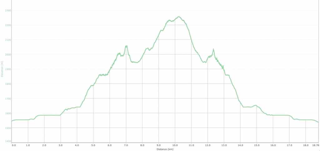
Our total roundtrip distance was 19 km with total elevation gains of 808 m. Our total roundtrip time was 8 hours.

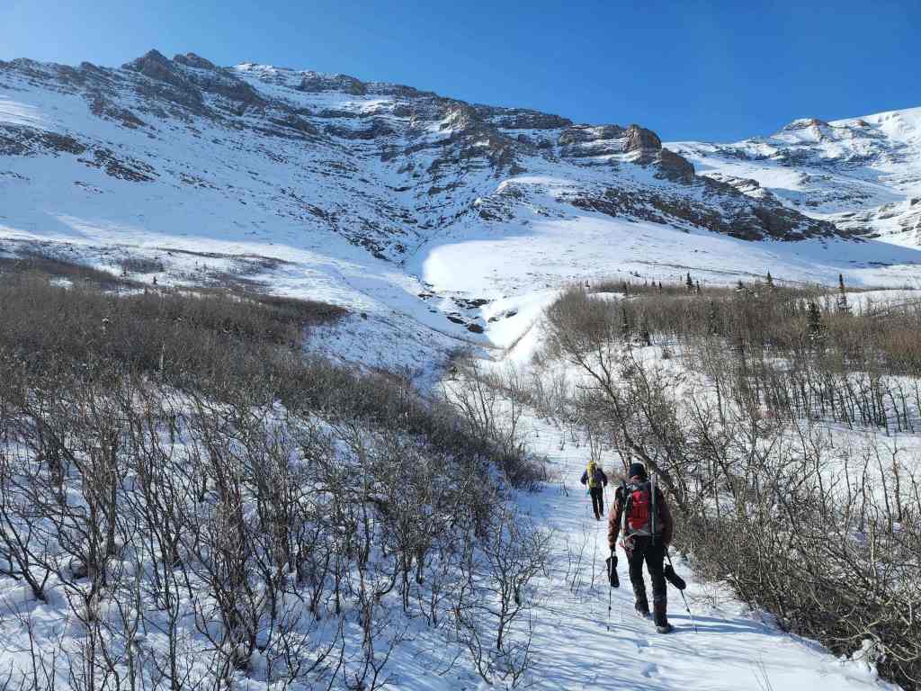
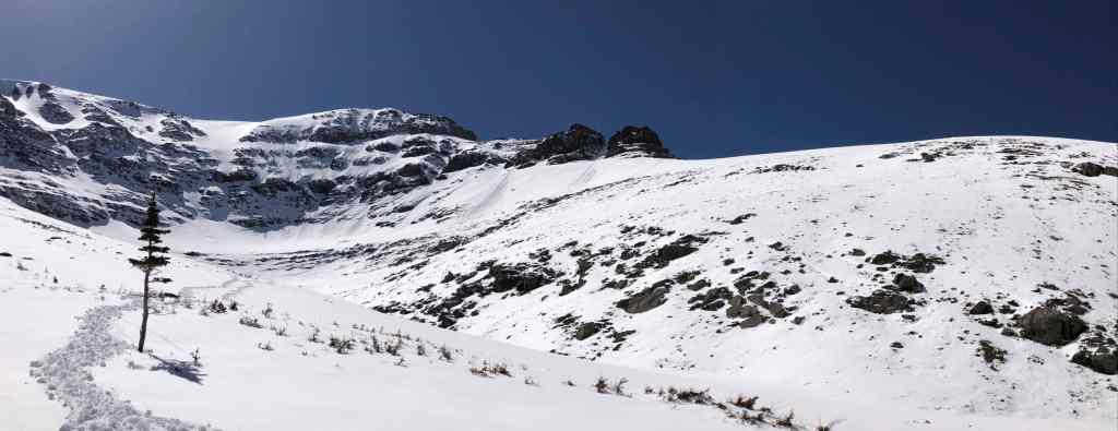
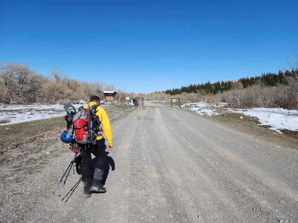
Starting off at the Bovin Lake trailhead. At this point, we still hadn’t picked a destination.

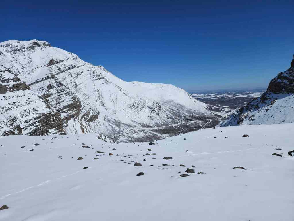
Approximately 2.7 km from the trailhead, we decided to zero in on a gully on the north side of “Bakery Peak” or alternately, the outlier “Ciabatta” (left). This meant that we would leave the main road by following a secondary one to our left. At the end of the day however, we’d follow the main road in its entirety.
After following the road for ~780 m to its conclusion at a gas well, we then began to follow a trail towards the inviting gully (centre) on “Bakery”. Unfortunately, once we had a better look, the upper reaches of the gully weren’t so inviting. That’s when we decided to follow Brad’s lead and head to “Ciabatta”.

This was an outstanding weather day, with no wind and sunny skies. 🙂 On the left is “Bakery Peak” and on the right is “Ciabatta”. The large bowl and ice climbs beneath “Ciabatta” are in the centre.

After deciding on “Ciabatta” (right), we began our ascent where its drainage intersected the trail. For reference, this was ~700 m from the gas well.

Nearing the base of “Ciabatta”. (Photo by Andrew Nugara)

Following the drainage up and towards the lower bowl. (Photo by Andrew Nugara)

My view as we near the lower bowl. This is where the scenery really began to pop. 😀
Drywood Mountain provided a stunning backdrop throughout the day.

Our first look at the ice-climb, ‘Flesh For Fantasy’ (right of centre). (Photo by Andrew Nugara)

A closer look at ‘Flesh For Fantasy’. Billy Idol would be proud! 🤪
Another look back.

Arriving in the lower bowl. The ice-climb, ‘Flash for Fantasy’ is directly above me. (Photo by Andrew Nugara)
A closer look at ‘Flash for Fantasy’…
Followed by, ‘Flesh for Fantasy’.

All three of us were impressed at the size of the terrain (that’s what she said). It also felt more remote than what it was. (Photo by Andrew Nugara)

Yet another look back. 🙂

We kept hiking until we reached the far end of the bowl.

Amazing! 😁 (Photo by Andrew Nugara)

“Bakery Peak” (left) towers above. Brad had previously ascended “Bakery” from the lower bowl. I think I’ll come back and try that route later. 🤔
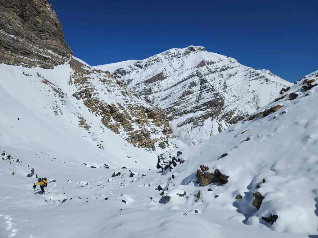
Glancing back as we keep ascending through the lower bowl.

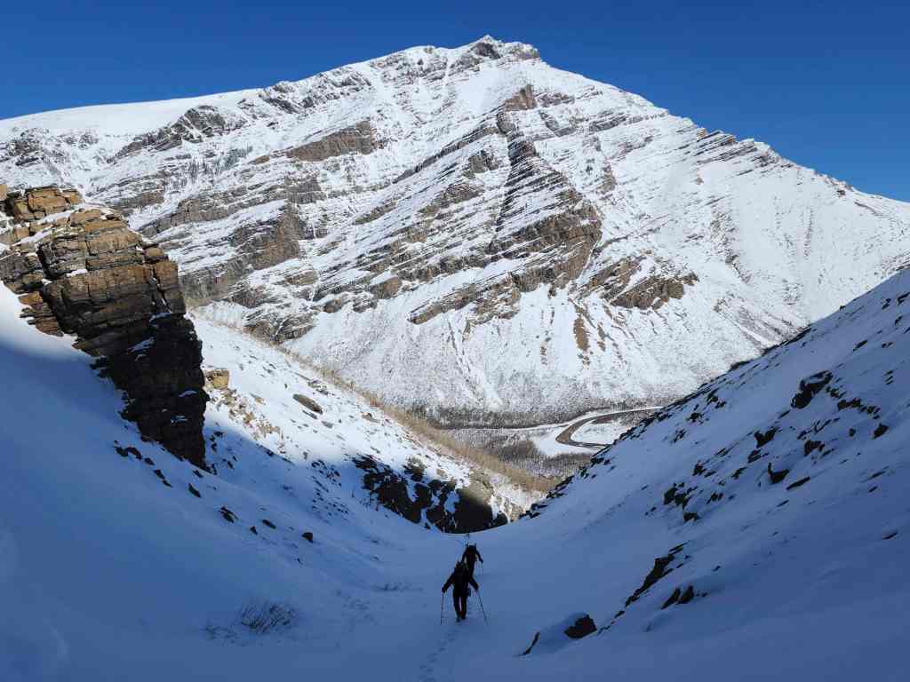
We will soon reach, “Tearful Symmetry”, which is the ice climb in the distance on the right.

It was impossible to stop taking photos! 😀 (Photo by Andrew Nugara)

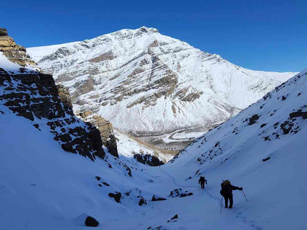
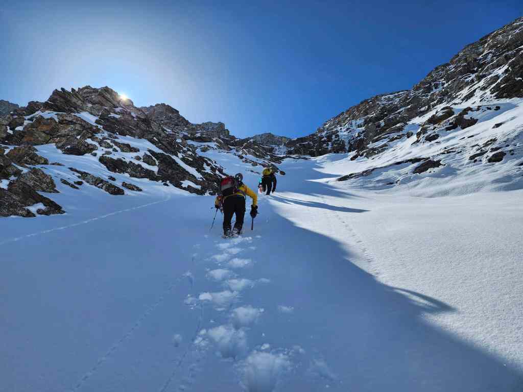
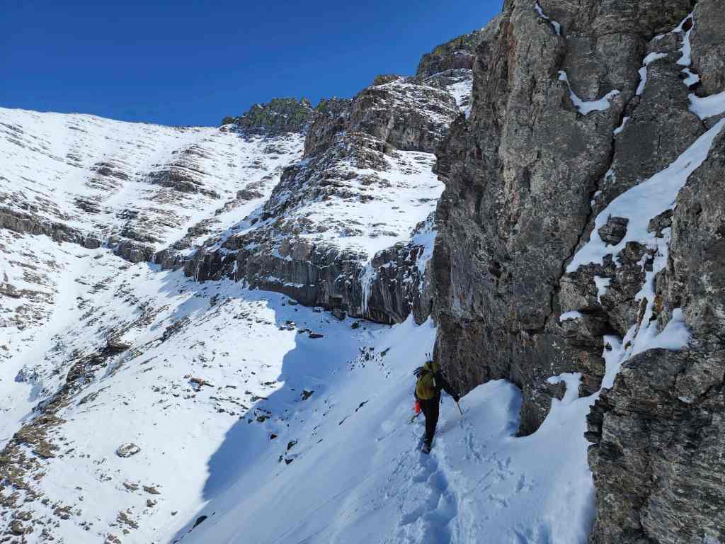
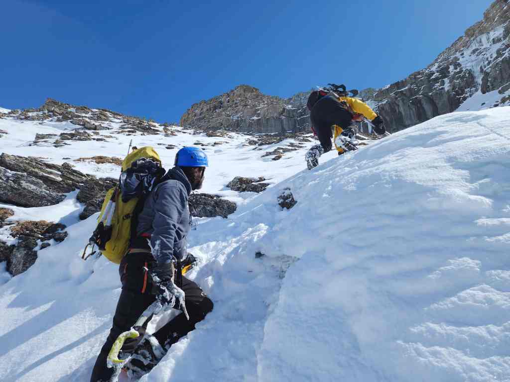
Brad leads us up from the bowl towards “Tearful Symmetry”. The terrain is much steeper than it looks!

A good view of our route into and up from the lower bowl. (Photo by Andrew Nugara)
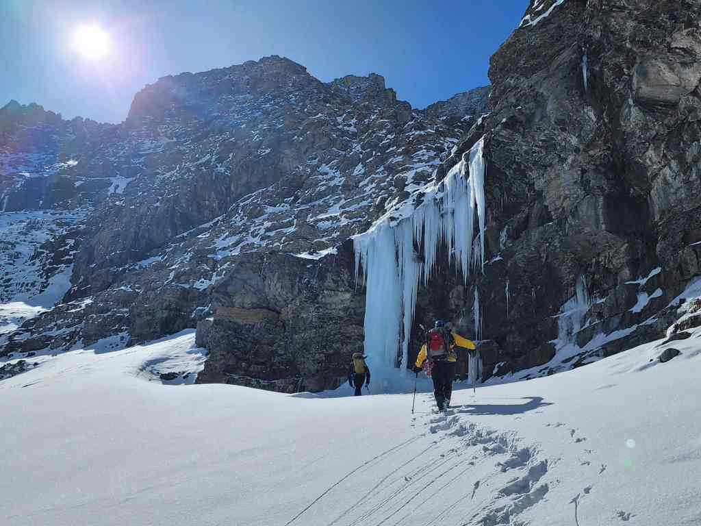
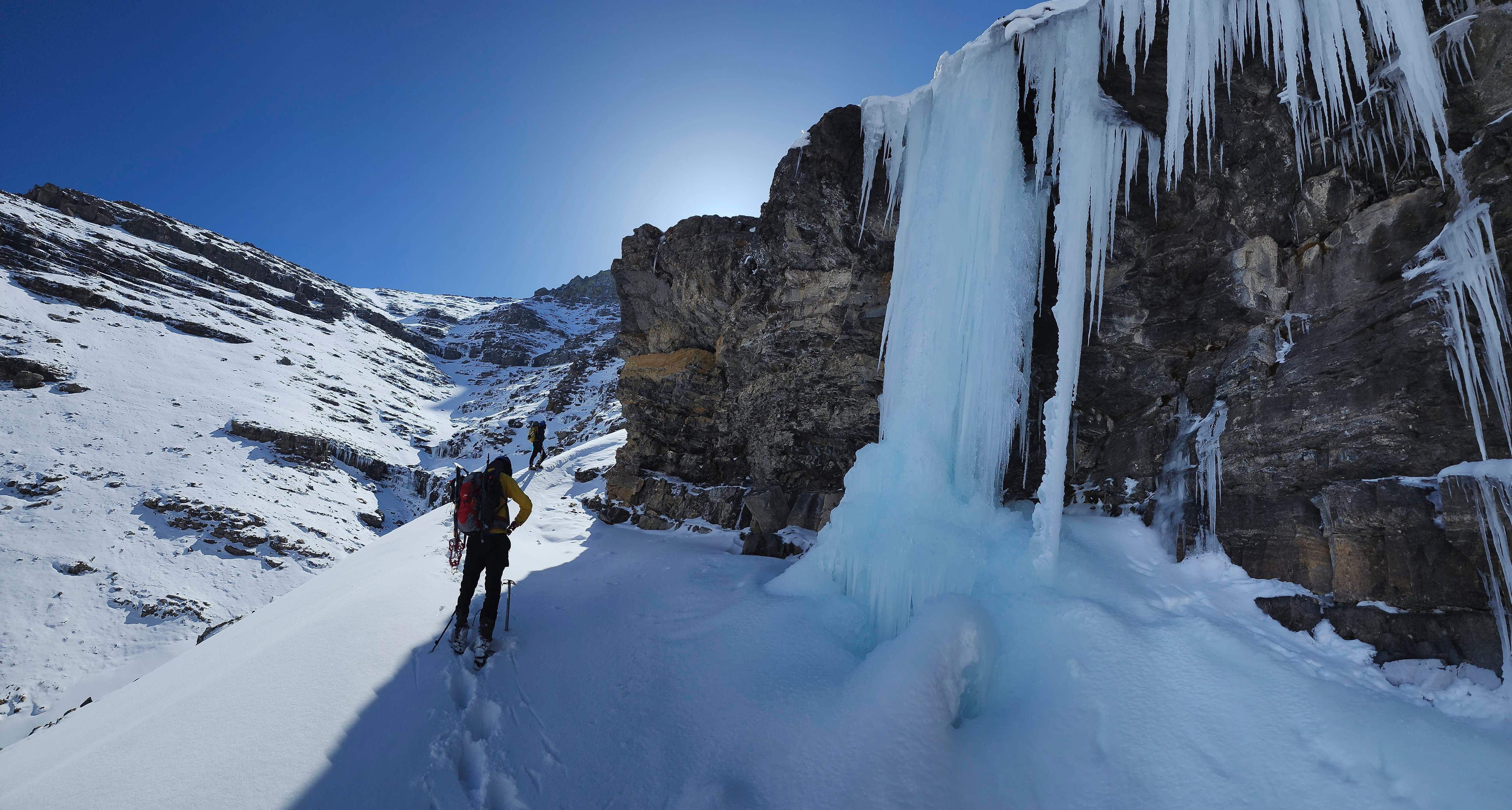
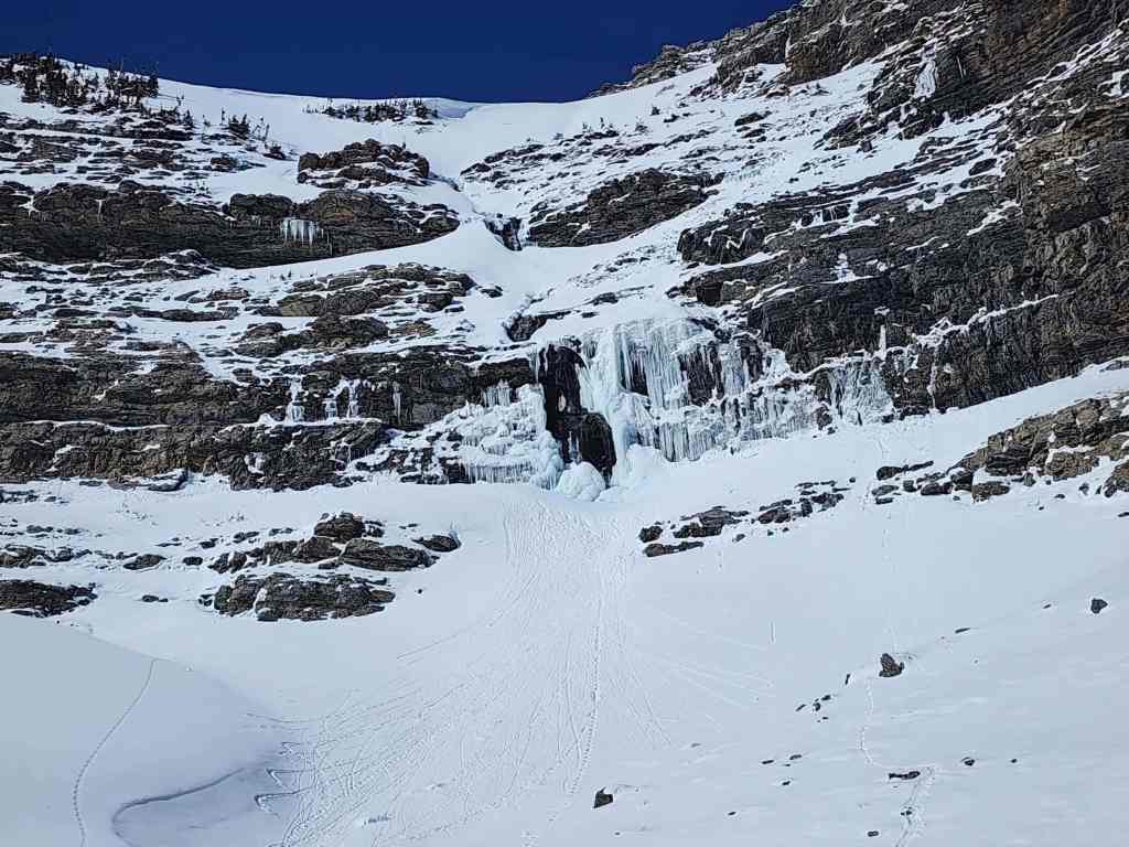
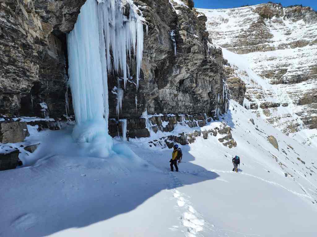
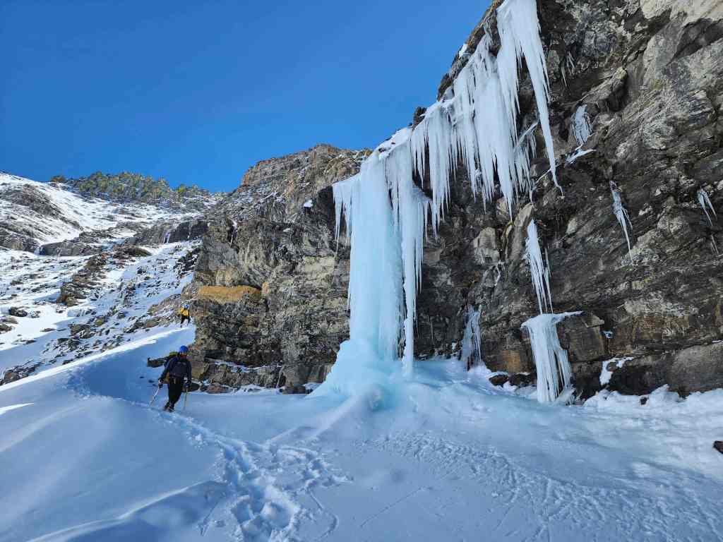
Arriving at, “Tearful Symmetry”.
Brad’s view back. (Photo by Brad Wolcott)

It won’t be long until this melts, but in the meantime, it’s still really impressive.

Super cool! Imagine what this looks like when it’s massive wall of ice!
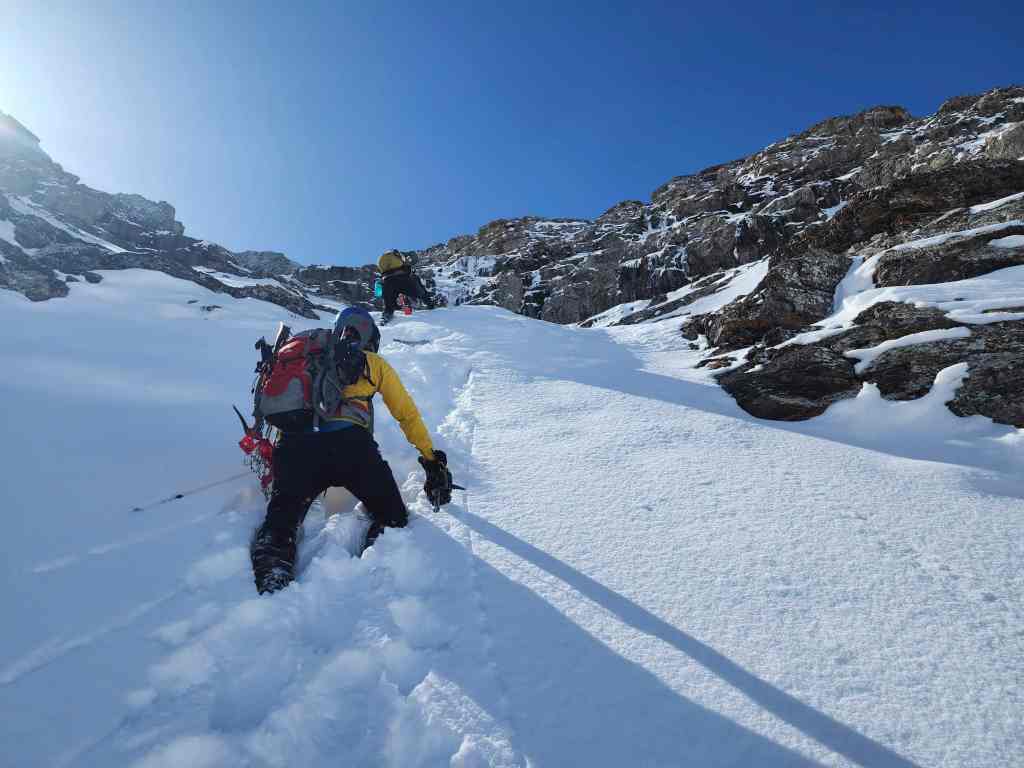
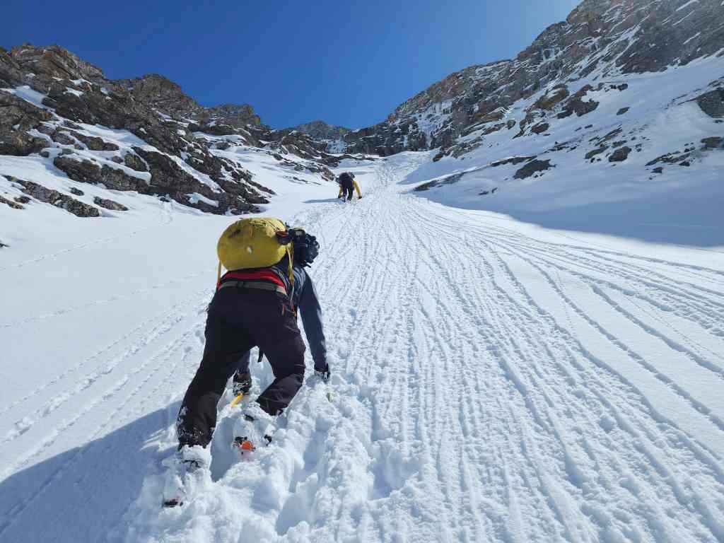
Brad leads us past “Tearful Symmetry”. We’ll continue our ascent through a weakness in the cliff band that’s located a short distance away.

Heading up the ice climb descent route.
The terrain gets even steeper.
Brad expertly makes his way over an icy step.

Followed by Andrew and I – though with much less skill and poise. 😂 (Photo by Brad Wolcott)

Starting our traverse.

We definitely didn’t want to slip here! 😂 (Photo by Brad Wolcott)

Making our way along a cliff band.
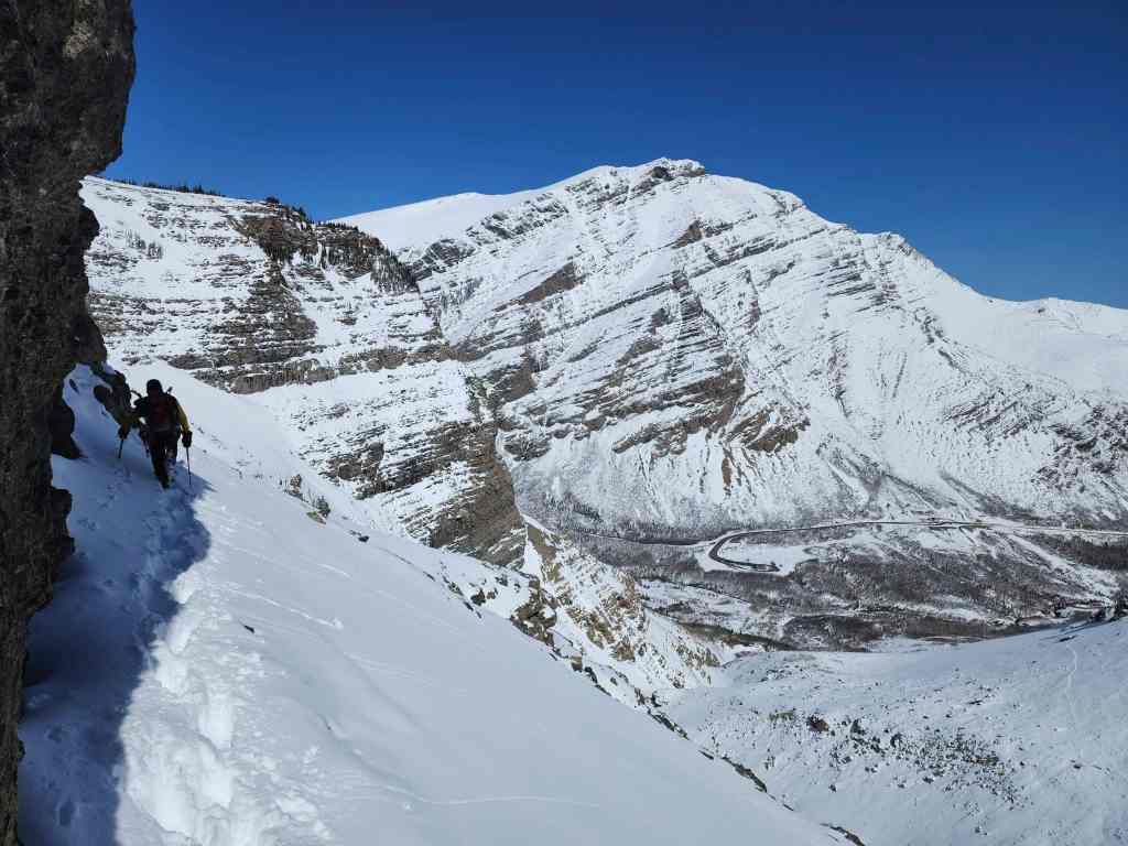
More of the same.
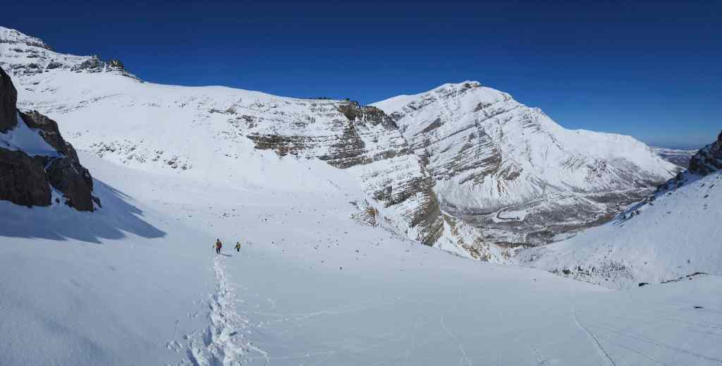
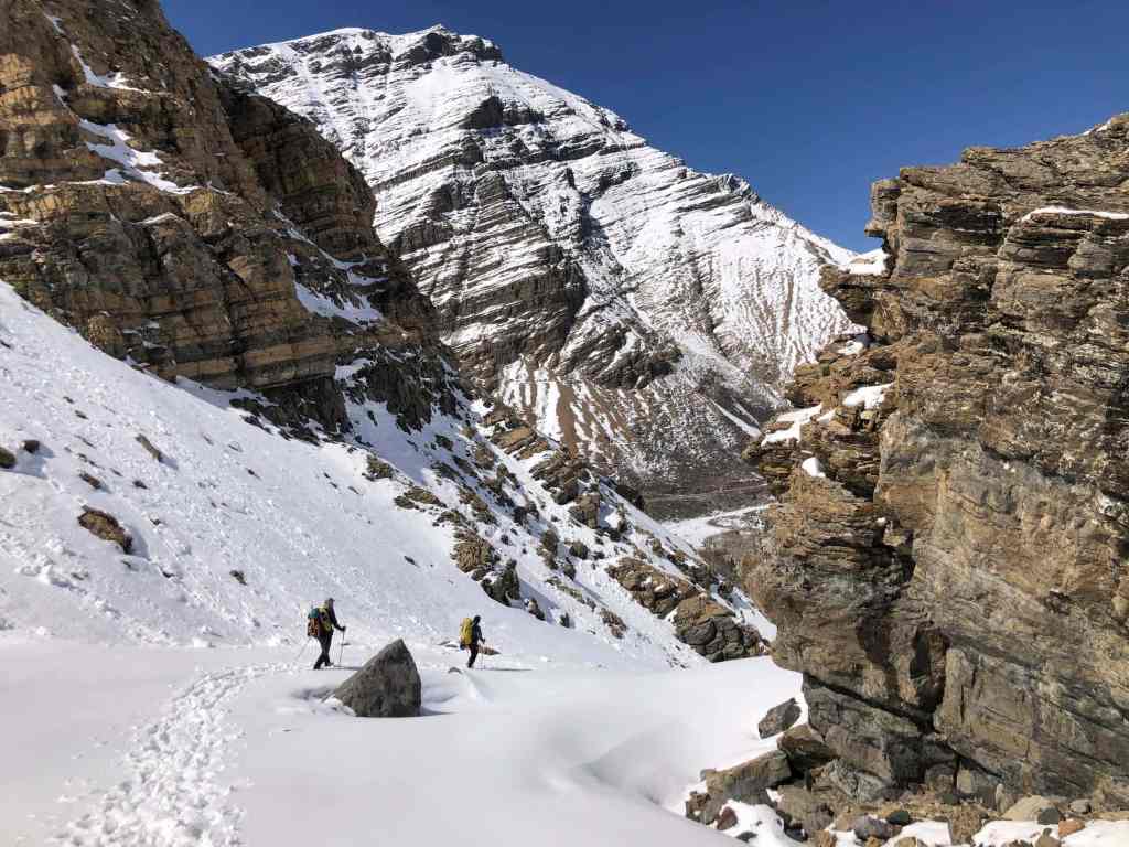
Descending into the “Bread Bowl”. The immensity of the terrain was apparent.

A different angle of the previous photo. “Ciabatta” is in the centre.
The view down the valley.

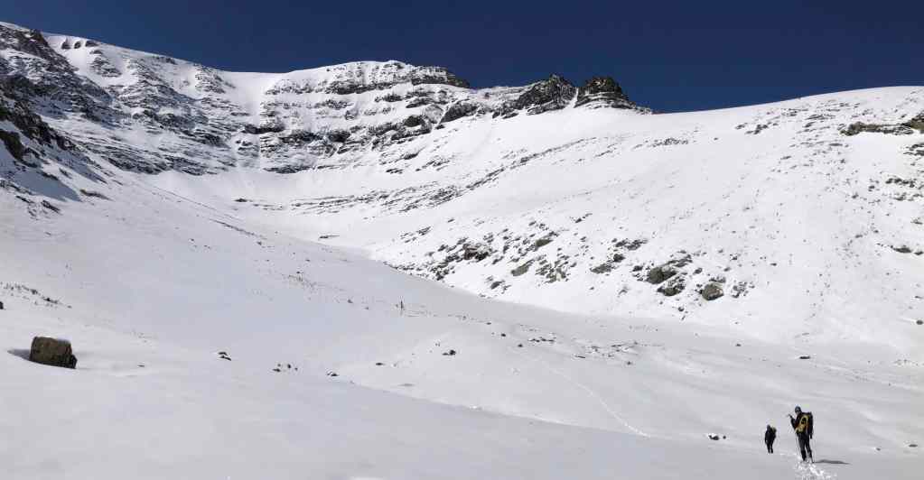
The perfect place for a break. “The Breadsticks” are in the background to the right of centre. Note the inviting snow-filled couloir.

This is big country.
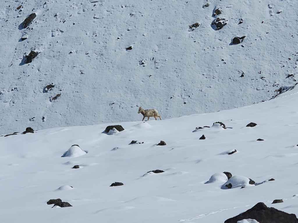
A sheep wondering what the heck we were doing up here.

More sheep.
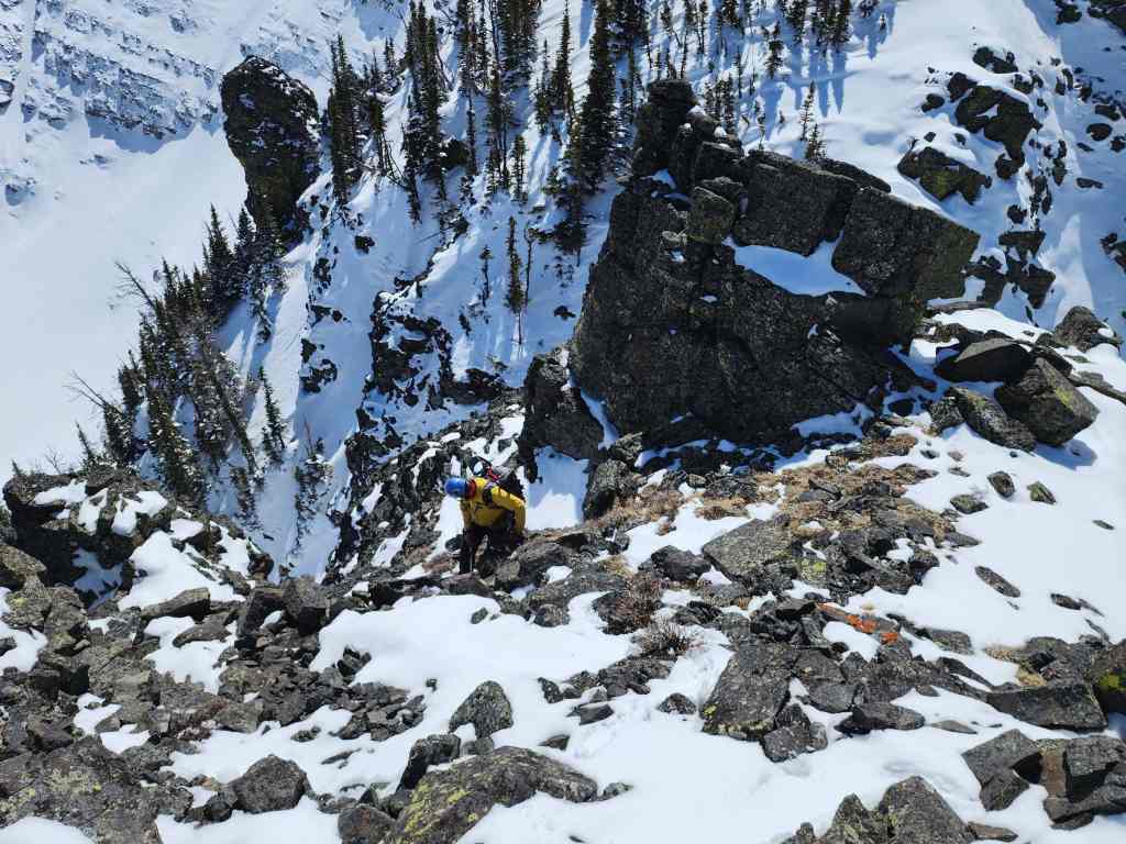
Heading to “Ciabatta”(right). (Photo by Andrew Nugara)

Andrew leads us up.

That sky!

Brad’s view back with “Pastry Peak” (far right) in the background. (Photo by Brad Wolcott)

Ready for some tasty ciabatta bread. 😂

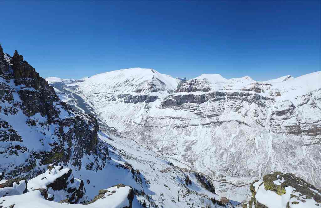
The summit view from “Ciabatta” (2050 m).

Our approach through the valley is obvious. The small trail from the gas well to the drainage is noticeable in the lower centre.

Gazing across to “Bakery Peak” – one of my all-time favourite scrambles in the area. I’m looking forward to coming back to try an ascent using the slope in the centre.
Looking down at the lower bowl and our traverse above the cliffs. (Photo by Brad Wolcott)

“Ciabatta” Brad. 😂

Andrew takes a moment to check-in that he’s still alive.

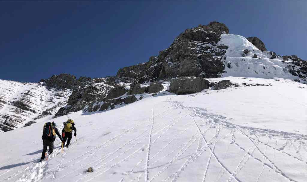
Starting towards “The Breadsticks” which sit ~650 m away.

“Pastry Peak” is on the left. What an amazing day! 😁

More of the same. (Photo by Andrew Nugara)

Nearing “The Breadsticks”. Getting hungry yet?

“Bakery Peak” on the right.

I’m still amazed at the expansive views.

These breadsticks are definitely not stale. 😂

Arriving at the base.

Heading over to the start of the couloir.
Drywood Mountain is looking good!
The view back to “Ciabatta” (centre) from the base of the sticks. (Photo by Andrew Nugara)

There are several small and interesting pinnacles visible from the base. (Photo by Andrew Nugara)

Arriving at the couloir.

Heading up. (Photo by Andrew Nugara)

This was a fun ascent!
Nearing the top. (Photo by Brad Wolcott)

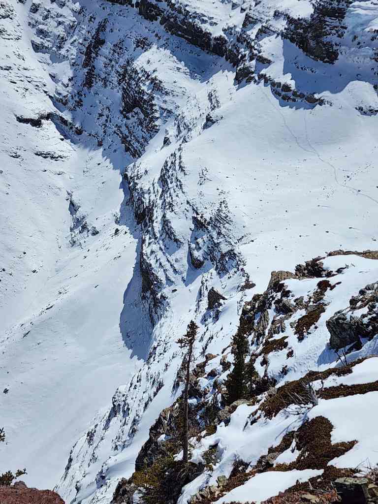
The Southwest Summit of Drywood from the top of the couloir. We had to be extremely careful because there was little solid ground before the couloir plunged down the other side.
Andrew nears the top.

The view down the other side of the couloir. (Photo by Andrew Nugara)

Following Brad as he scrambles to the top of Breadstick #1.

The summit of Breadstick #1 (2199 m).
Andrew follows close behind.
Gazing to the west…

And then to the north.

Finally, the view to the east.

Breadstick #2 is much higher.

Brad and I on the summit. (Photo by Andrew Nugara)

Now it’s Andrew’s turn.

Leaving the summit…

And heading over to Breadstick #2.

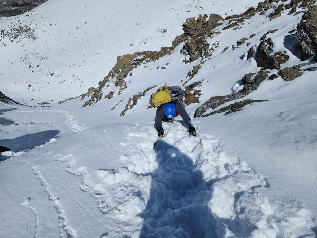
Brad tackles a short, but steep section.

Then he forges a trail through knee-deep snow. The man is a machine!

Nearing the summit.

Looking back at Breadstick #1 – and Andrew. 😂

Almost there!

The summit of Breadstick #2 (2236 m). We were disappointed that it was so anticlimactic; however, it did take us five hours to reach, so we’re still going to celebrate.

Brad and Andrew check out the imposing step that leads onto “Pastry Peak”. Given the time, we decided not to continue in case we ran into significant down-climbing on the way back. I’m pretty sure that we’d have found a weakness, but in the moment, the weakness that I was most concerned with, were my legs. 😂

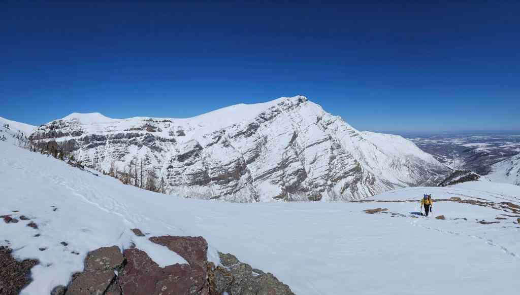
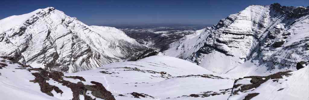
A pano to the west…
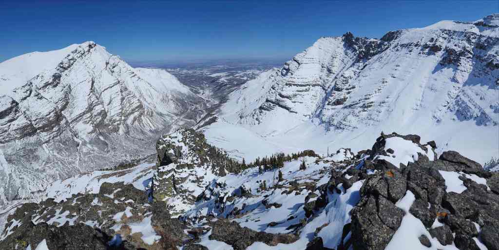
And then to the northeast.

Finally, a pano to the south.

The actual summit of Loaf Mountain. Like I said, this is a huge massif.

Gazing along the valley towards Bovin Lake (centre).

The Southwest Summit of Drywood.

Victoria Peak on the left with Pincher Ridge on the right.

Zooming in on Windsor Mountain (left) and Castle Peak (right).

One of my favourite front range scrambles, “Bakery Peak”. 😁

Lots of snow across the bowl. Hopefully we have a wet spring to go along with the recent snow.

Looking down at Breadstick #1.

A dough boy on Breadstick #2. 😂 (Photo by Andrew Nugara)

Time to head back.

Easy does it.

Nearing the couloir.

Down-climbing the couloir.

Brad’s view up to me… (Photo by Brad Wolcott)

And then my view down to Brad.

Still enjoying the fantastic weather! (Photo by Andrew Nugara)

A cool shot of Brad. (Photo by Andrew Nugara)

We decided to head straight down from the base of the couloir.

I walk while Brad attempts to glissade. (Photo by Andrew Nugara)

A semi-successful glissade.

Looking up at “The Breadsticks”.

Back in the “The Bread Bowl”. (Photo by Andrew Nugara)
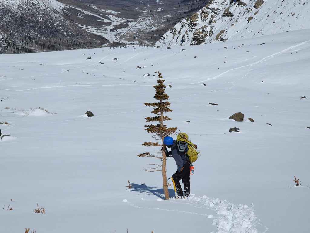
Brad kisses a lone tree. 😂

That tree really is all alone. I’m glad Brad showed it some love. 😂
One more pano from inside the bowl. (Photo by Andrew Nugara)

Heading back.

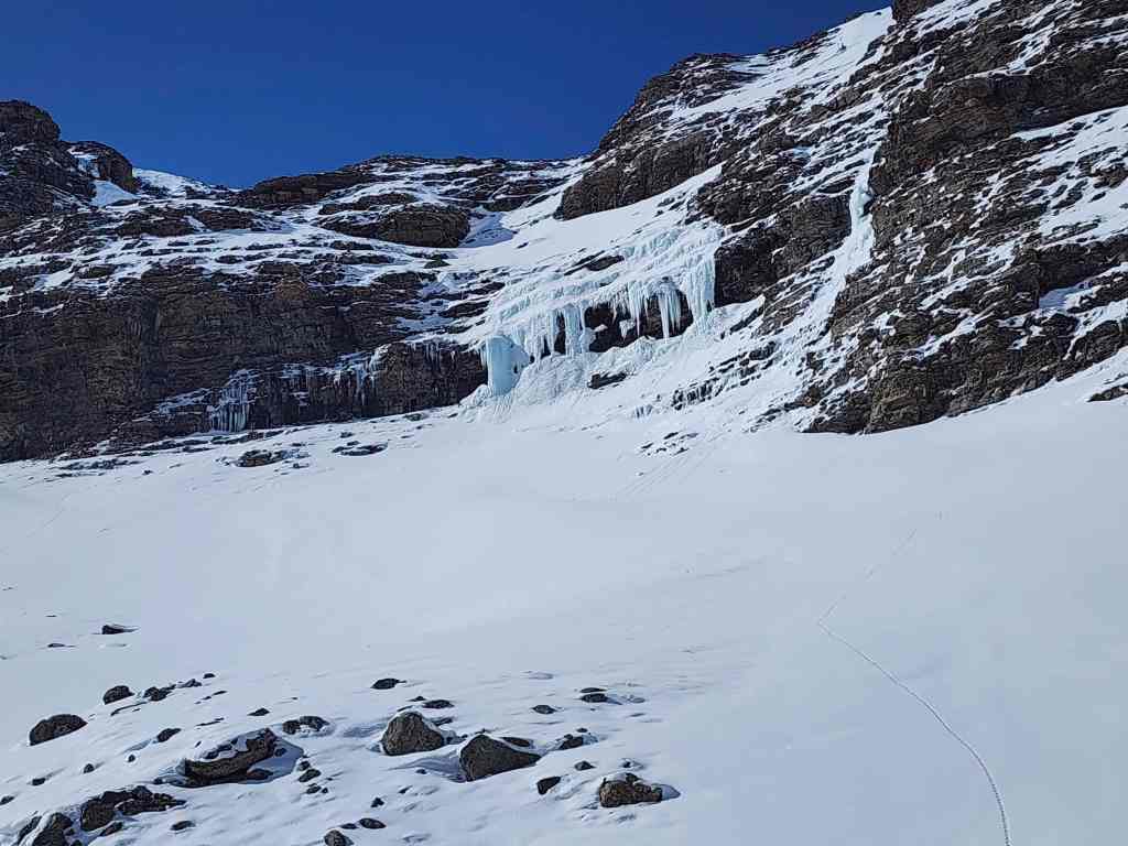
The ice climb Josephson calls, “Arctic Cream”.
Retracing our route back to our traverse. “Arctic Cream” is on the right.

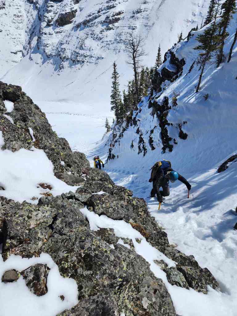
Beginning the short, but delicate traverse.
Brad continues to lead the way.

Taking our time. (Photo by Andrew Nugara)

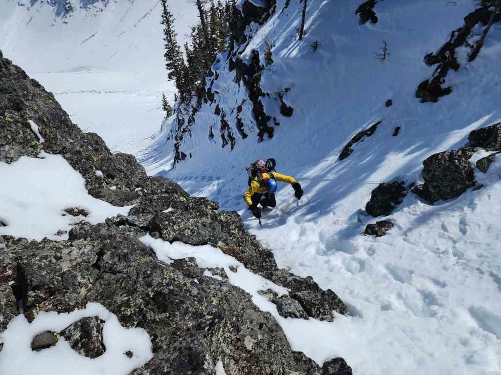
Brad down-climbs a short section.

And this is why we were so cautious! 😯 (Photo by Andrew Nugara)
Brad down-climbs the icy step.
Now it’s Andrew’s turn.
Again, this is steeper than it looks.

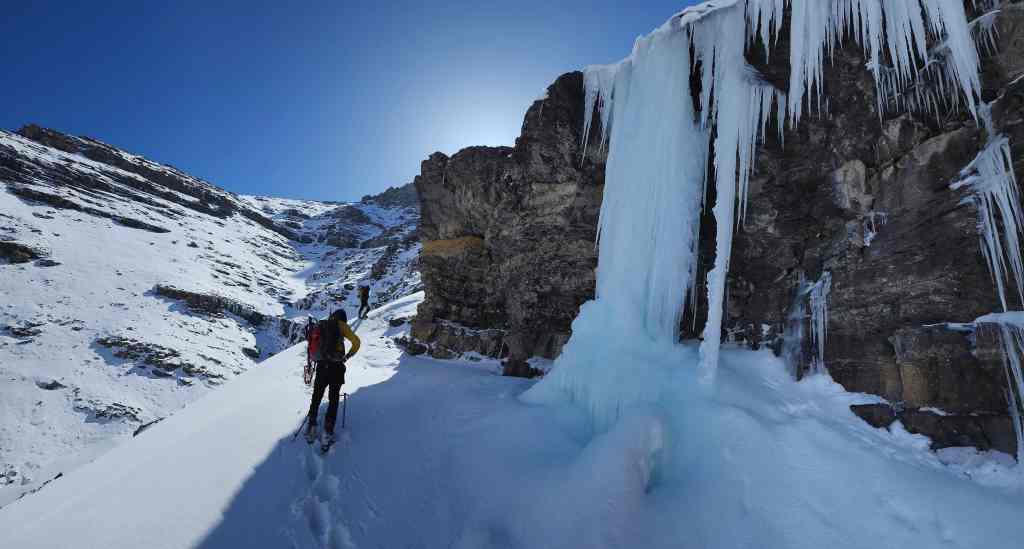
Back at “Tearful Symmetry”. (Photo by Andrew Nugara)
One more look at “Tearful Symmetry”. As I said before, this would be an impressive wall when it’s fully formed.

Andrew’s view from the previous photo. (Photo by Andrew Nugara)

Descending into the lower bowl.

It will be an easy hike out from here.

One more look back. This was such a cool place!
Making quick time. (Photo by Andrew Nugara)

Nearing the lower section of the drainage.

Instead of retracing our steps along the trail, we decided to keep following the drainage to the creek, where we’d cross it and then make the short walk up to a gas well.

Thankfully South Drywood Creek wasn’t in runoff mode.

Crossing the creek. (Photo by Andrew Nugara)

Arriving at the gas well.

“Ciabatta and The Breadsticks” from the road.
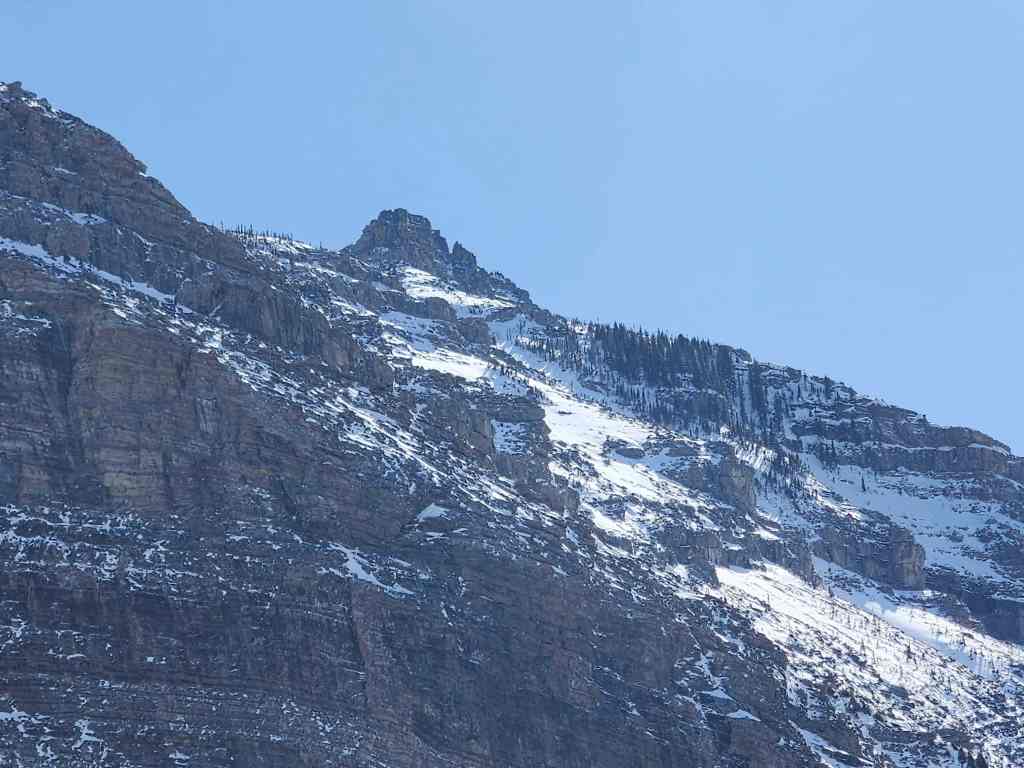
“The Breadsticks”

“Flesh For Fantasy” (centre).
A pano of the area. (Photo by Andrew Nugara)

Settling in for the ~4.5 km walk back to the trailhead.
Arriving back at the trailhead, 19 km and and 8 hours later. This was simply a fantastic outing! From the weather, to the scenery, to the company, the last minute decision to explore new terrain on the north side of Loaf Mountain was perfectly timed. This is why I love hiking in the area, as there is always something new to try. Finally, a HUGE thank you to Brad and Andrew! 😁


Leave a Reply