
⚠️ Hiking and scrambling are inherently dangerous activities. Please read my Disclaimer. ⚠️
Happy New Year! After a wonderful Christmas spent with family, it was time to head to the mountains. This was the first time that I’d been able to get out since mid-November as my work schedule has been very busy and two weeks before Christmas, I was walloped with a nasty cold / flu that I’m still feeling the effects of. Coupled with this, recent windstorms in southwestern Alberta made even finding a reasonable day over the past week, an exercise in frustration.
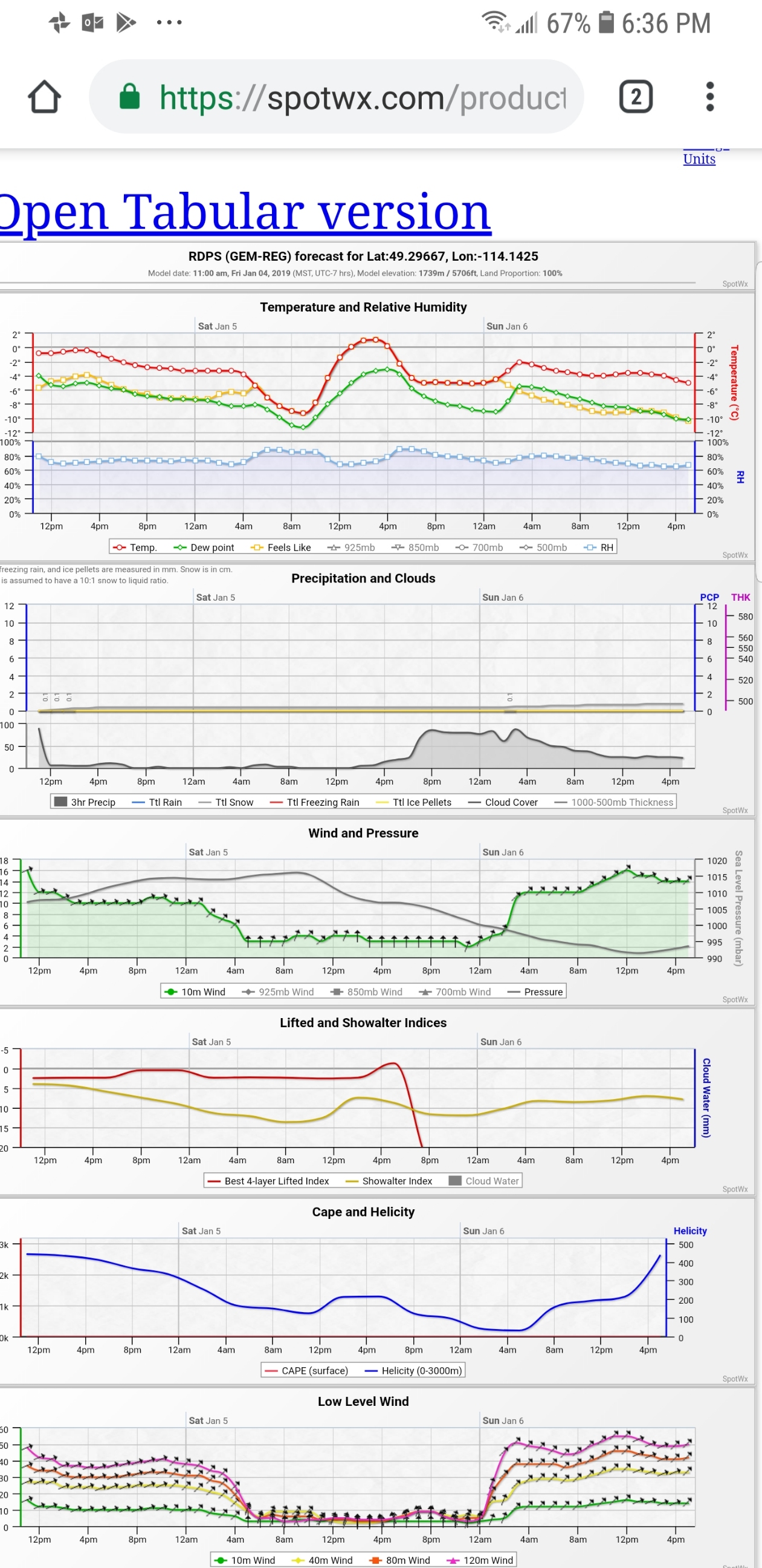
Fortunately, SpotWx provided the answer. A look at the forecast for Saturday, January 5th showed that there would be a brief reprieve from the wind (bottom graph) in the area encompassing the front range of the Castle. A quick series of texts between Andrew and I on Friday night set the following day in motion.
In a weird coincidence that I will chock up as a case of “great minds think alike” ;), I had earlier in the week suggested to Andrew that we climb the prominent foothill at the extreme northeast end of Loaf Mountain that I had nicknamed, “The Muffin”, in keeping with the theme of bread. Andrew then let me know that he had been out that very morning and had climbed “The Muffin” and its neighbouring highpoint, “The Croissant” as a solo trip. Aptly describing them as the “Northeast End of the Northeast End of Loaf Mountain” in his December 31st trip report, Andrew graciously offered to make a return trip so that I too, could muffin top. 😉
Choosing a different route this time around, we enjoyed some good scrambling and awesome Castle colours on the way to the top. In fact, I think we took WAY longer to reach the summit than needed, simply because we both love to stop and check out unusual rock formations, old trees, waterfalls, and lichen-covered argillite. At the top of “The Croissant”, Andrew suggested that we continue on to try the ridge leading to the 2400m+ summit that was situated only ~2 km to the southwest. Andrew had previously ascended it in 2006 via a different route, and with the windless – and largely snowless terrain, it looked doable.
Still feeling depleted of energy from the flu, I agreed, though warned Andrew that I might slow him down. Always enthusiastic and encouraging, Andrew spurred me on and graciously took the lead whenever there was post-holing to be done. What we encountered was an amazing section of scrambling on the connecting ridge between “The Croissant” and the summit. Indeed, we were able to come within ~100 vertical metres of the summit before wisely making the choice to turn around due to steep, ice-covered terrain that required more equipment than just ice axes and crampons. If it had been in the summer, I doubt that we would have had much difficulty. Both of us agreed that we will return to complete job as soon as we possibly can.
As usual, a day in mountains with Andrew is full of humour, laughter, and engaging conversation – in short, it is simply awesome! Also, as I’m unaware of any specific local or Indigenous name for the 2400m+ summit, I’ve chosen to refer to it as “Bakery Peak” just to get a rise. 😉
Finally, be sure to read Andrew’s excellent trip report as well!
Update: On 11 May 2019, Andrew and I returned and completed the scramble up “Bakery Peak”. Read about it here.
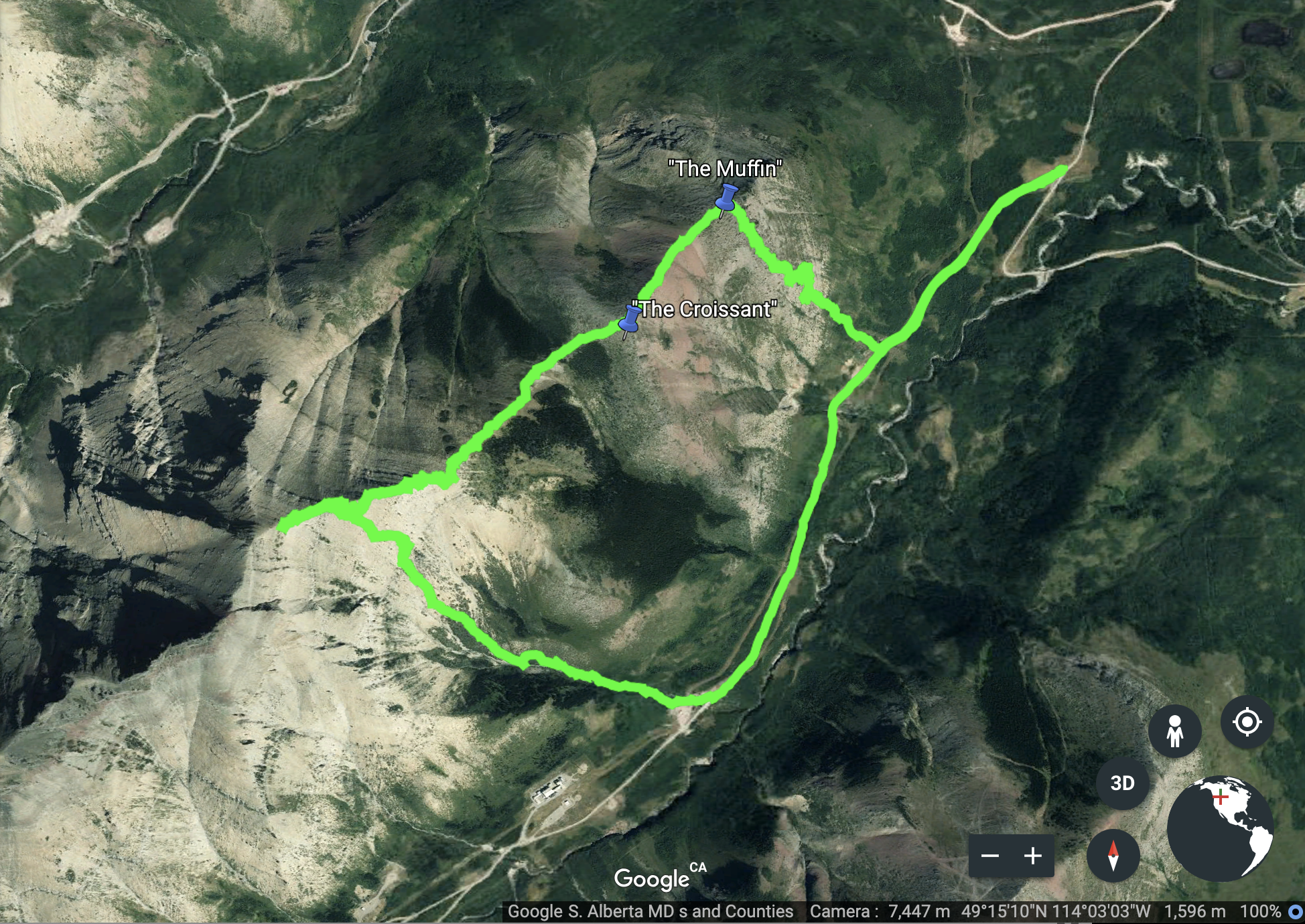
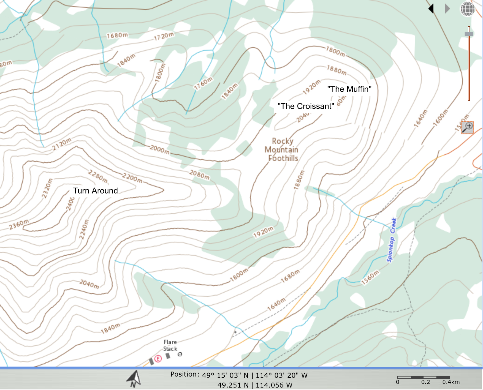
To get to the northeast end of Loaf, drive ~19.5 km south from Pincher Creek on Highway 6 until you reach the Shell Waterton Plant Road (Township Rd. 43A). Turn onto it and drive west for ~9.1 km until you come to a junction with a gravel road near to the entrance of the plant. Turn left and onto the gravel road and continue for ~3.9 km until you reach Butcher Lake. Turn left and onto another gravel road immediately prior to the Lake and follow this road for ~1.4 km until you come to the junction with another road on your left. Turn here and follow it for ~5 km until you arrive at a T-intersection. Turn left again and proceed for 700m until you see a hairpin curve on your right. Follow the curve and drive for ~3.5 km until you reach yet another T-intersection. Turn right and drive for ~800m until you reach a fork in the road. To the right is the gate for the road that leads up the Spionkop Valley. This is the trailhead.
From the gate we walked along the road for ~1 km until before leaving it to hike up open slopes to the base of “The Muffin’s” east face. There are several possible routes up the east face with some perhaps longer and steeper than others. It took us ~1.3 km coupled with a 428 m elevation gain to reach the summit. From “The Muffin” it was an easy 660m hike over to “The Croissant”. After an 83m elevation loss to the col between “The Croissant” and “Bakery Peak”, we began the steep hike up to the ridge. The really fun route finding and scrambling begins approximately 700m from the col (230m elevation gain) where the grade eases somewhat. Unable to reach the peak due to winter conditions, we turned around at 2333m and descended the southeast slopes of “Bakery Peak” to a small gully that we followed for ~940m back to the road. A ~2.6 km hike brought us back to the trailhead.
My GPS pegged “The Muffin” at 2000m, “The Croissant” at 2037m, and our turn around point at 2333m on “Bakery Peak”. There may also be local or Indigenous names for these peaks that I am unaware of, so please take any nicknames that I use with a grain of salt.

Our total distance travelled was 10 km with total elevation gains of 970m. Our total roundtrip time was 7 hours and 11 minutes.

Like fresh baking on a window sill, “The Muffin” looks appealing from our starting point at the gate on the Spionkop Valley road.

From the road, Andrew describes the route that he used only a few days before.
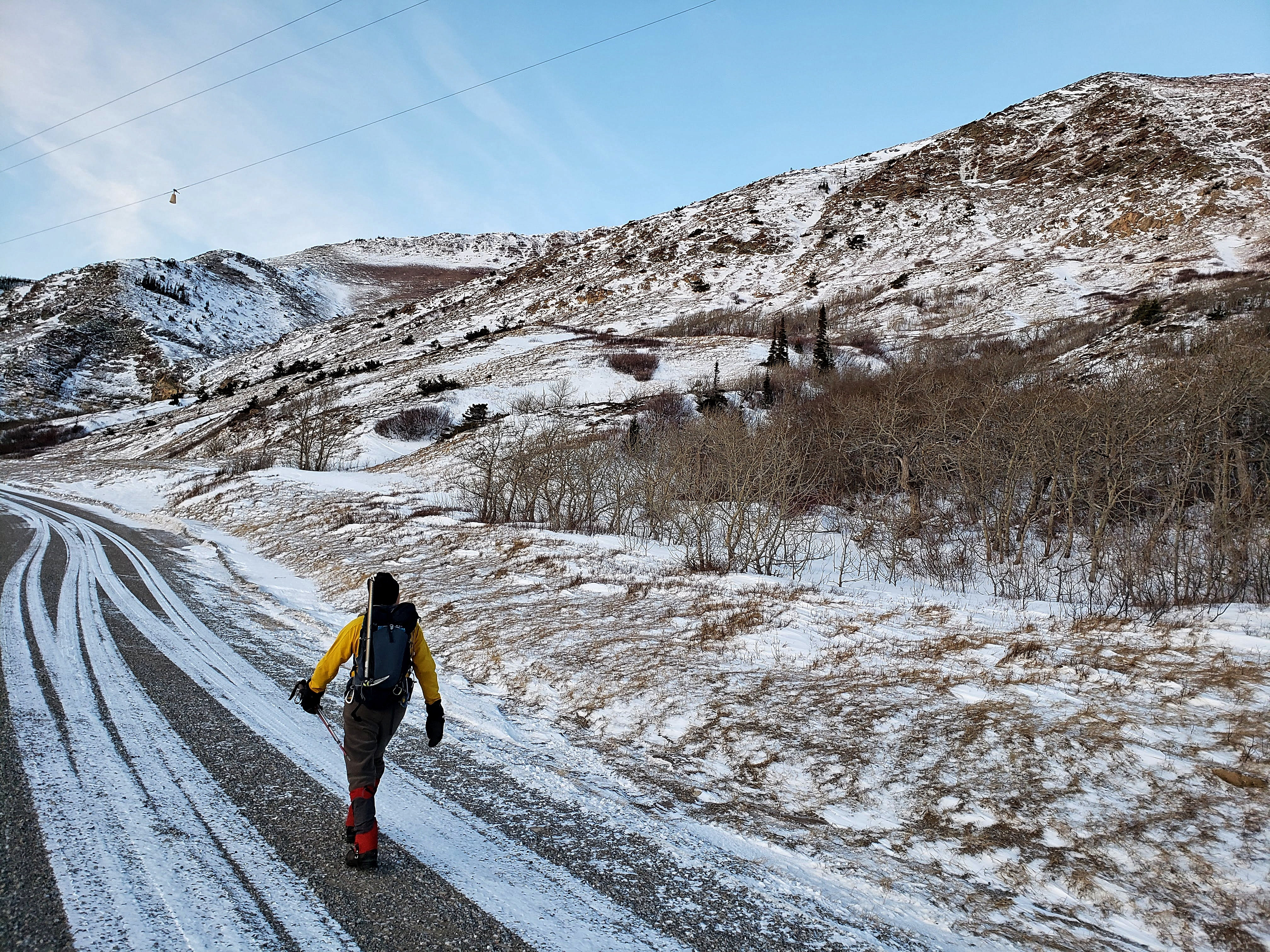
After a short ~1 km walk, we arrived at the east face of “The Muffin” (right).

The view shortly after leaving the road. Our approximate route is marked in red ‘frosting’ though the summit is not visible. I should mention that the picture makes the grade look fairly benign; however, it is much steeper than it looks!
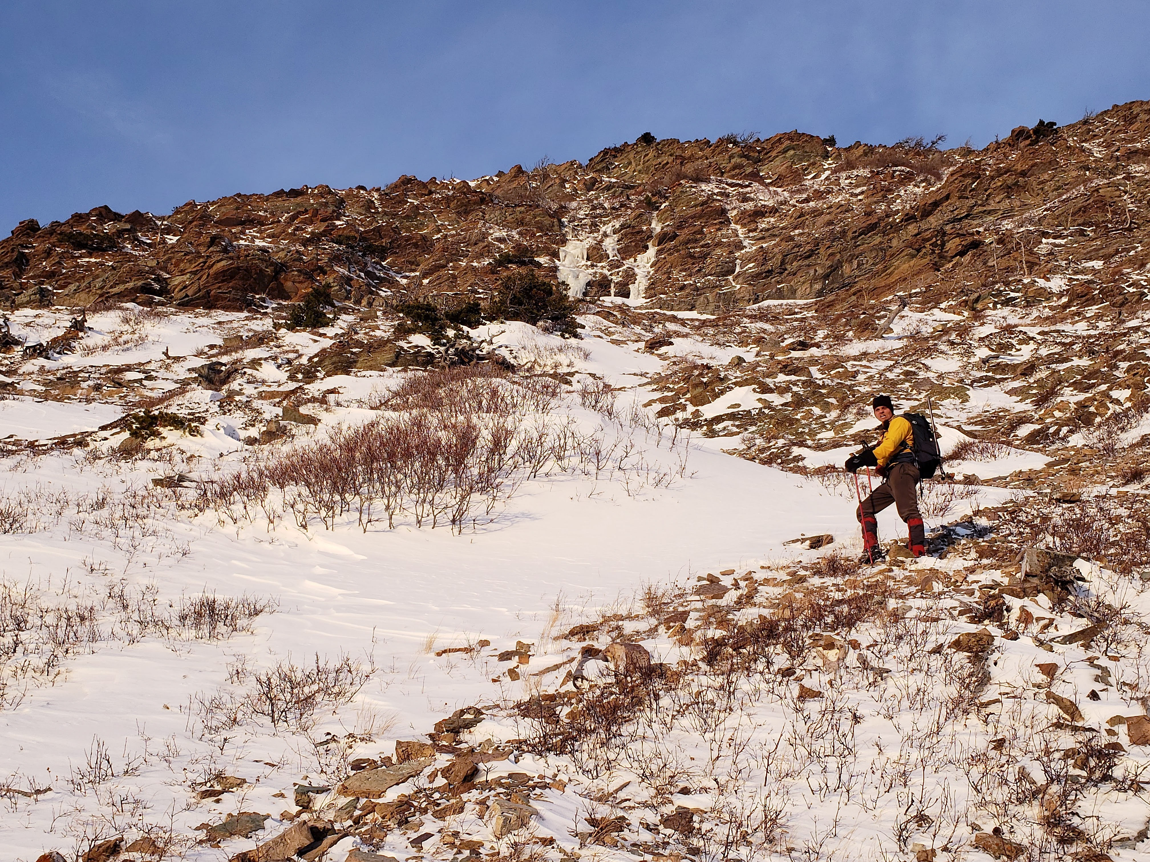
Andrew and I are suckers for anything interesting or unusual on a mountain, and so we made sure that our route went past the frozen waterfall in the background.

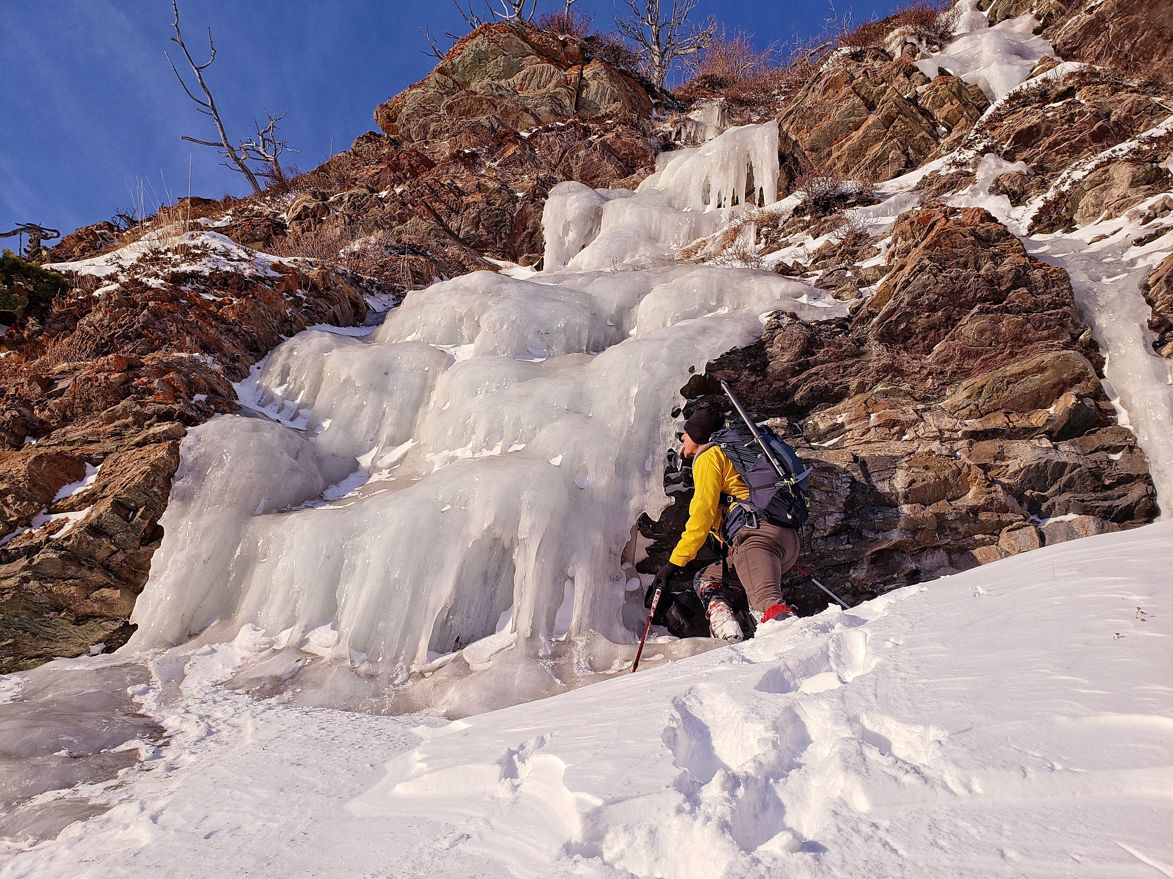
Approaching the waterfall just as the morning sun begins to illuminate it. (Photo by Andrew Nugara)
Hmmm, this must be a jelly-filled muffin… 😉
Andrew tastes “The Muffin”. Why? Because you simply don’t let fresh baking sit around to go stale! 😉
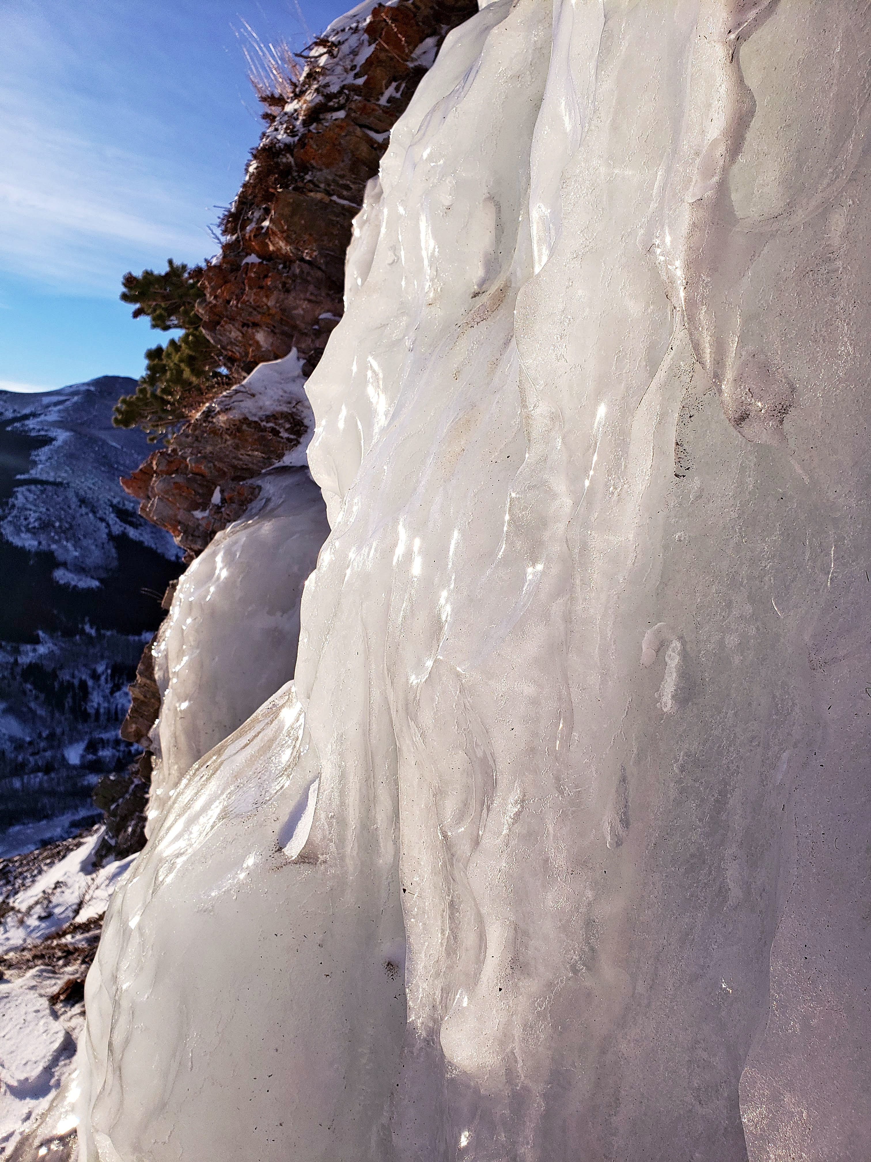
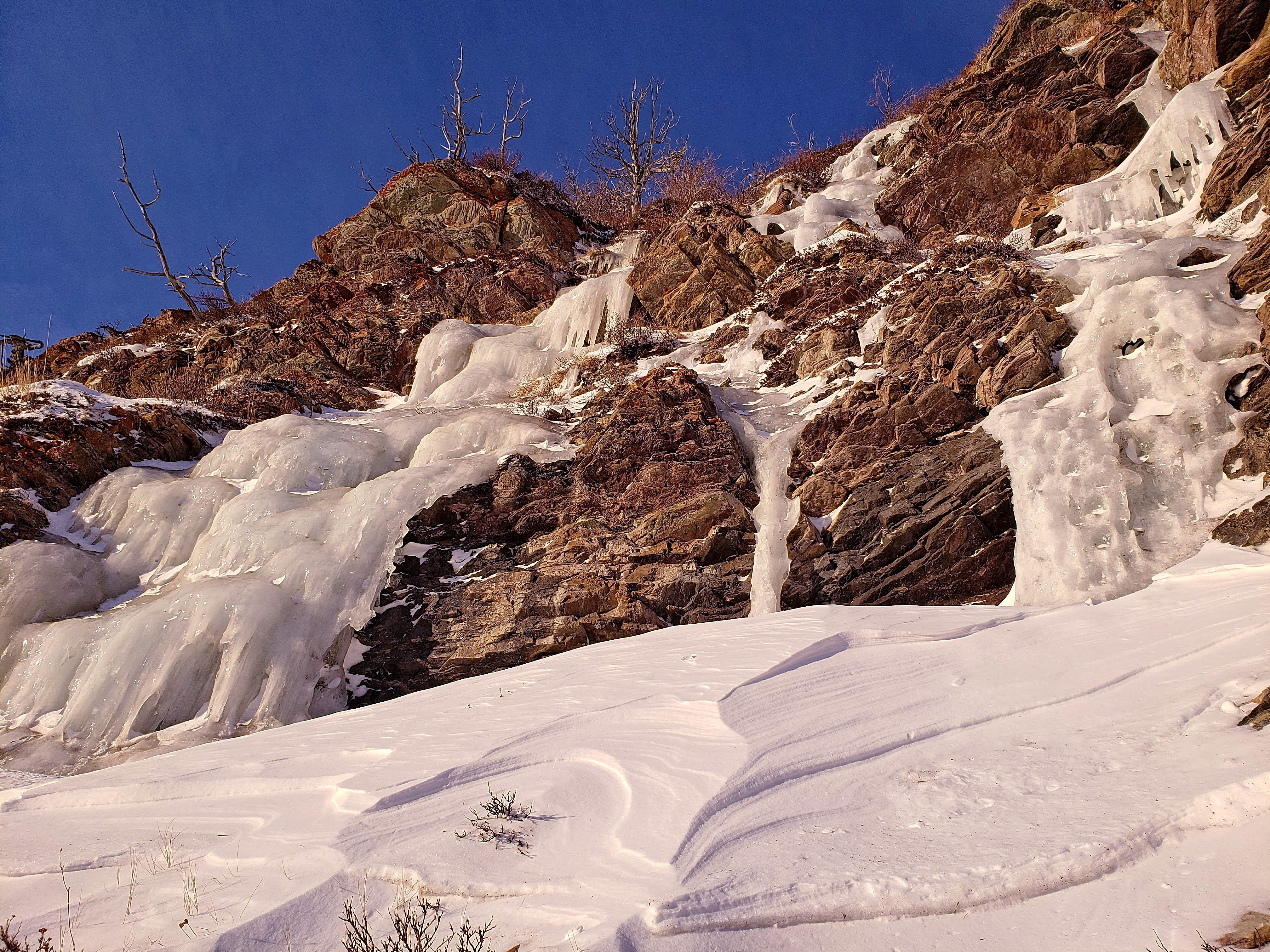
The low angle of the morning sun gave the waterfall some definite sparkle.

Looking over to Andrew as he inspects some colourful rock. We bypassed the waterfall by using the narrow, snow-covered ramp in the background.

Gazing back towards the waterfall as Andrew (bottom left) passes in front of it. In the background is Spread Eagle Mountain.
“Do you know the Muffin Man?” 😉

Near the top of the ramp, we could have continued straight and onto easier terrain, but we chose to tackle a small band of rock immediately above us.

Andrew uses rocks and the trunk of a tree to scramble up and over the small rock band.

We trended climber’s right (pictured) above the rock band to reach more moderate terrain. Once there, we then trended climber’s left to regain our original course. (Photo by Andrew Nugara)

Andrew snaps some pictures of a section of cliffs above the waterfall.

Again, we could have avoided the scrambling, but it was too hard to pass up. 😉 . (Photo by Andrew Nugara)
On top of the previously pictured section of cliffs and looking at all the options for ascent. Our route would traverse the patch of snow on the far upper left. All of this is much steeper than it looks!

Andrew (lower right) stops to take more pictures of the colourful rock as he arrives at the top of the cliff band. The point where we left the road can be seen on the valley floor behind him.

The colourful outcrop of rock that Andrew stopped to photograph in the previous picture. (Photo by Andrew Nugara)

Route finding is one of my favourite things to do. Now, why I can’t translate this into finding things around the house is a huge mystery to both me and my wife. 😉 (Photo by Andrew Nugara)
The trailhead is in the centre where the road forks.

Once above the cliffs, it became an easy hike along Drury Lane to the summit. 😉

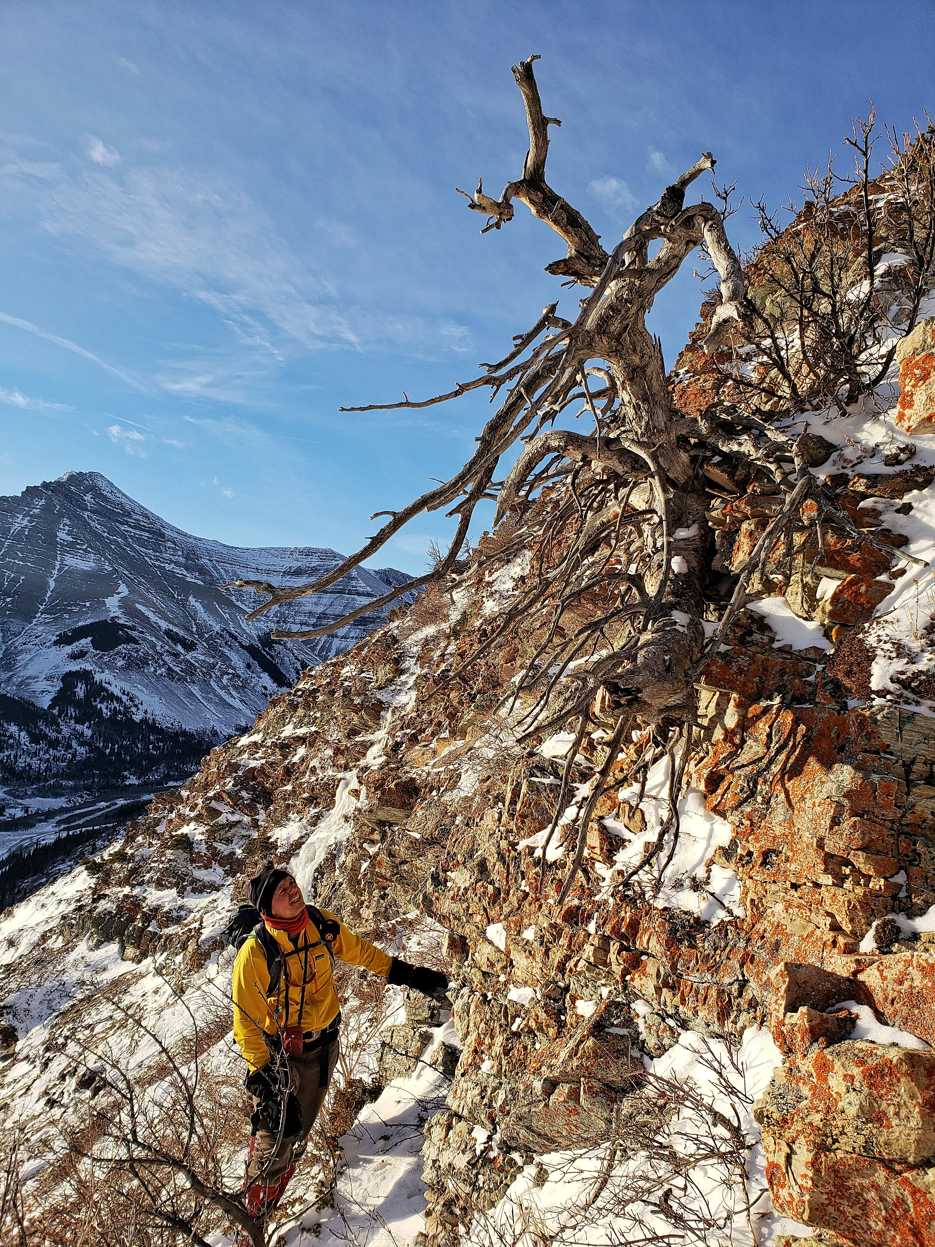
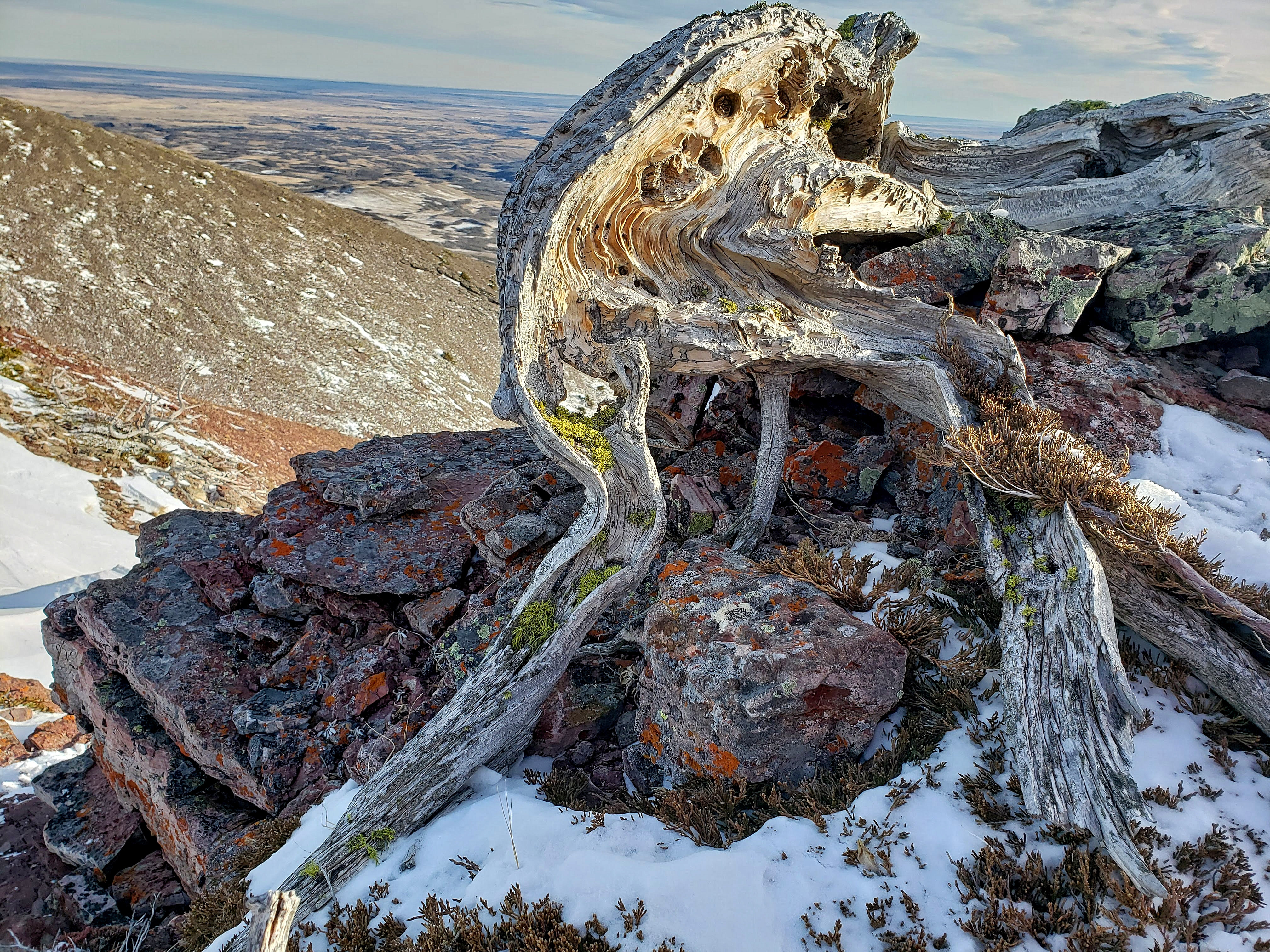
A very cool lichen-covered tree.

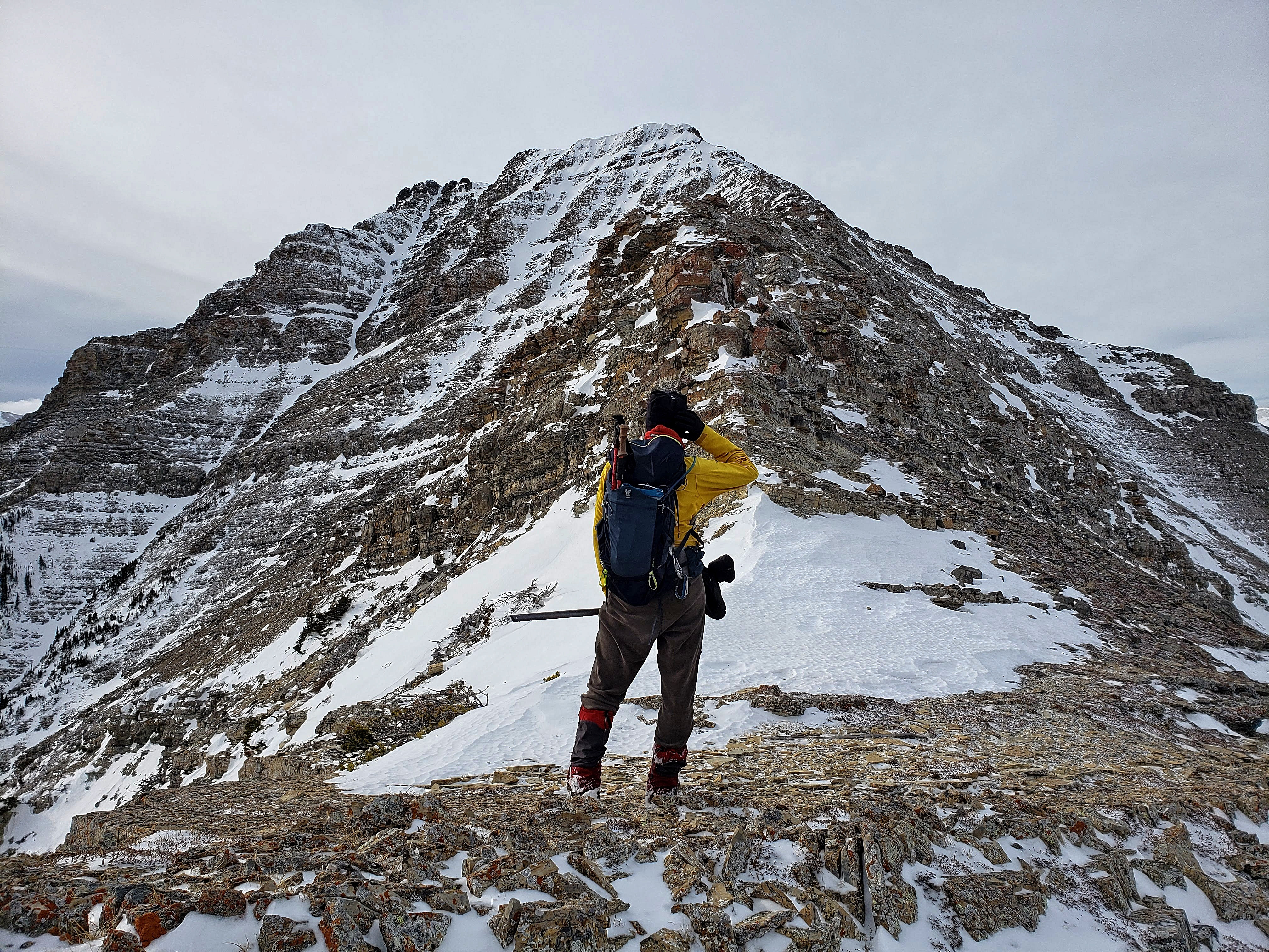
Our first look at the impressive summit at the northeast end of Loaf Mountain, that I’ve informally dubbed, “Bakery Peak”. At this point, we had not included it as part of the day’s festivities.

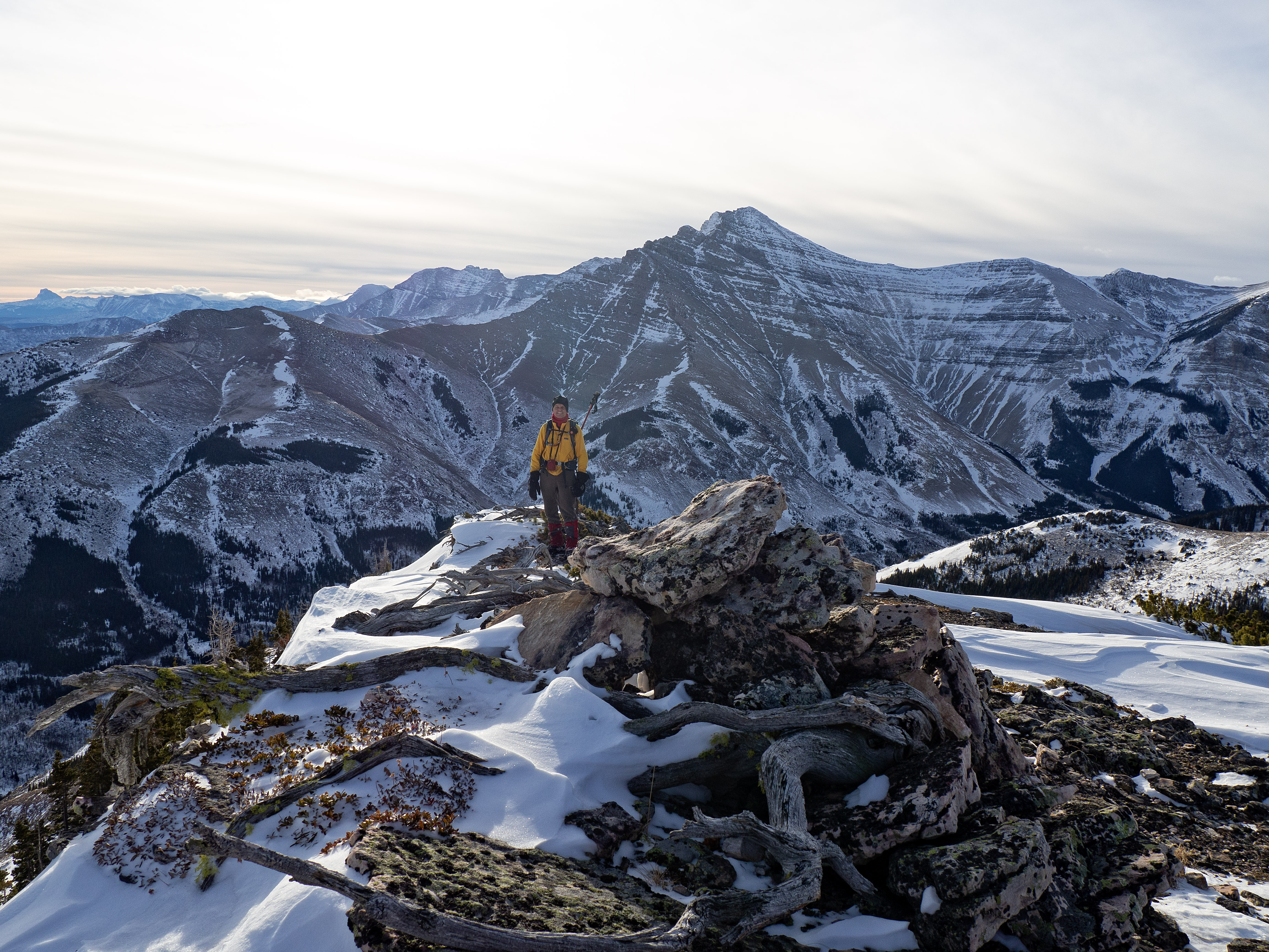
Muffin topping! Two very large cairns – or are those chocolate chips? – sit on the summit (2000m; my GPS). Whoever built these must have added protein powder to their muffin recipe because some of those rocks are heavy!

Looking southwest from the summit towards “The Croissant” (foreground) and “Bakery Peak”. An unnamed high point on Spionkop Ridge is in the background.

To the northwest sits Drywood Mountain (left) and Prairie Bluff (right of centre).
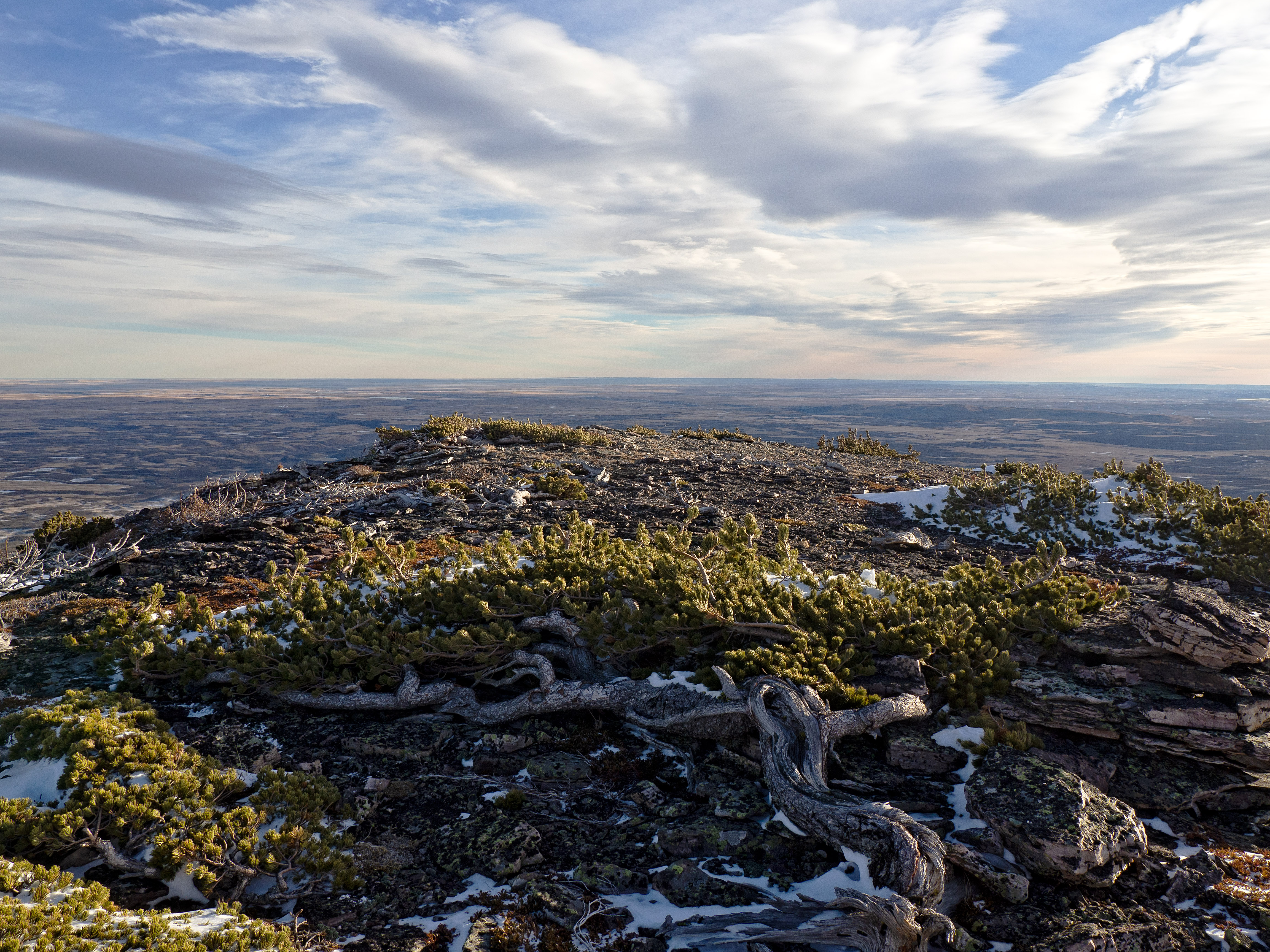
Looking northeast and onto the prairies.

Ninastako (Chief Mountain) stands out in the distance to the southeast. In the foreground are, “The Eaglet” (left), “Raptor Peak” (centre) and Spread Eagle Mountain (right).
The view slightly to the southwest with Spread Eagle Mountain on the right, an unnamed summit on Spionkop Ridge in the centre, and “Bakery Peak”. In the foreground is “The Croissant”.

A pano highlights “The Muffin’s” tantalizing views.
“Yes, I know the Muffin Man!” 😉 The Southwest Summit of Drywood is behind Andrew.

Feeling kind of crappy, but still thankful to be on a mountain. Perhaps, Sour Dough Man is a fitting name? (Photo by Andrew Nugara)

After feasting on the views, it was time to make the easy ~660m hike over to the “The Croissant”.

Starting up from the col. “The Croissant” is ~37m higher than “The Muffin” but has fewer calories. 😉

Happy New Year! (Photo by Andrew Nugara)

Even from here, the ridge leading to “Bakery Peak” caught our eye.
Andrew soaks in the views.

Some sweet, sweet Castle colours!
The other side of the previous picture. Nature can also do surrealist art.
Easy travel on hard-packed snow.

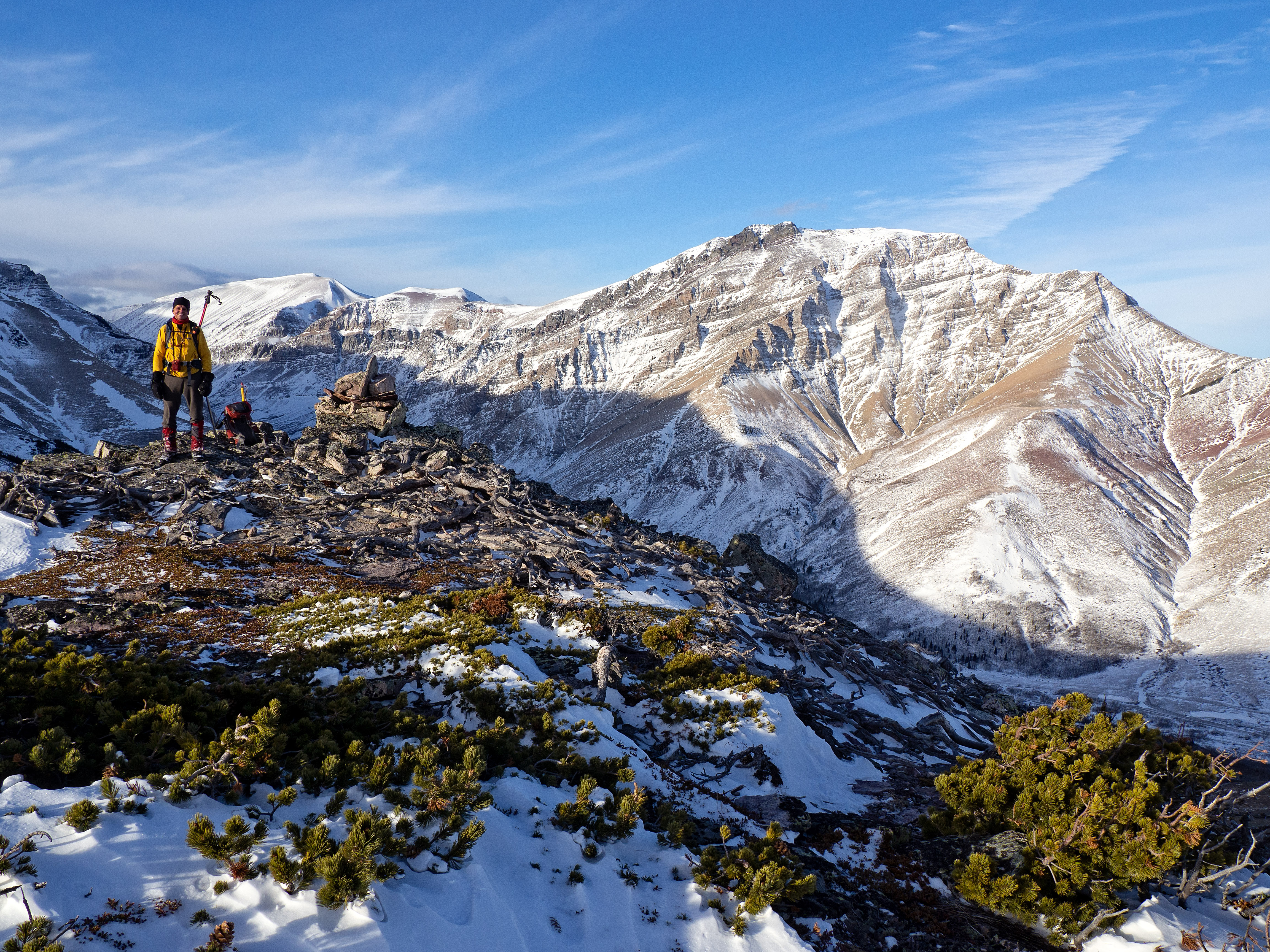
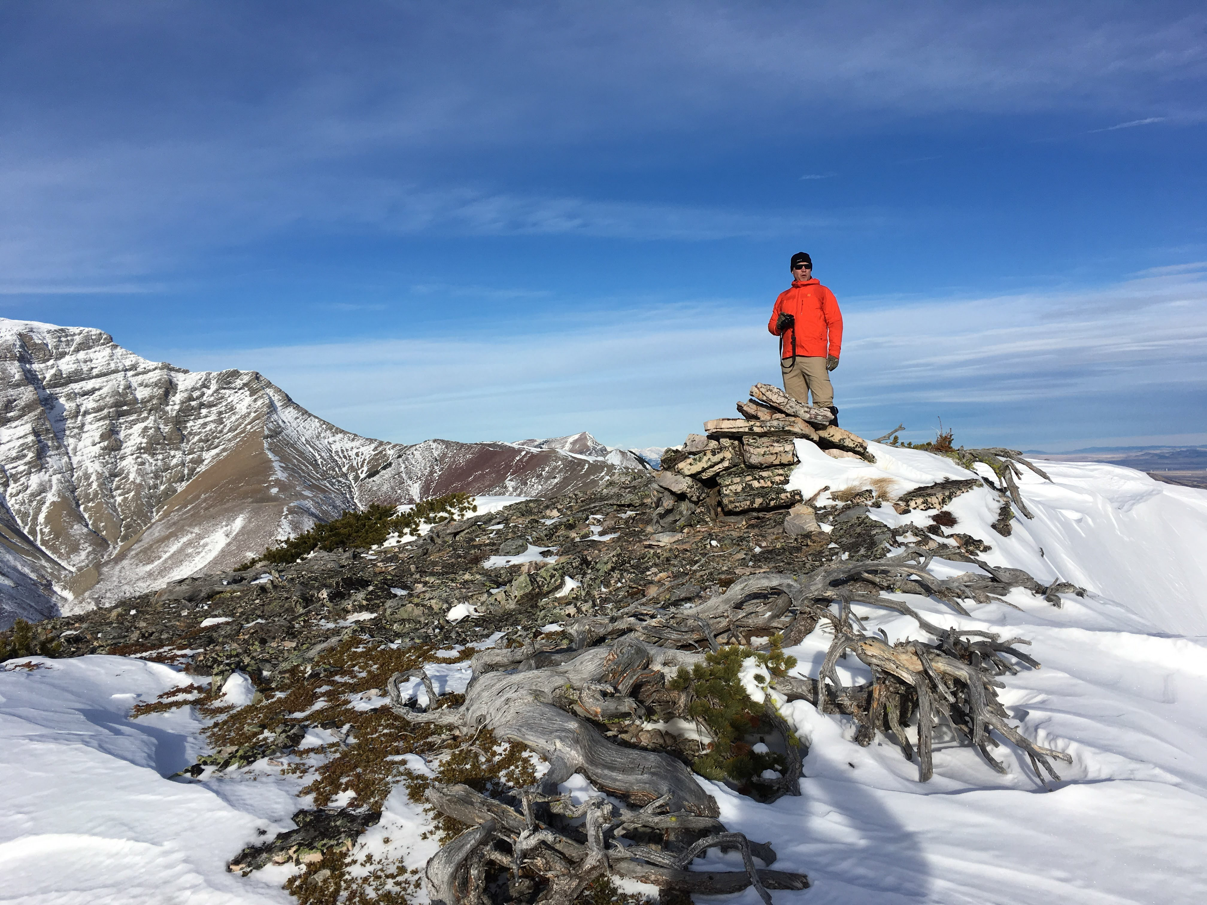
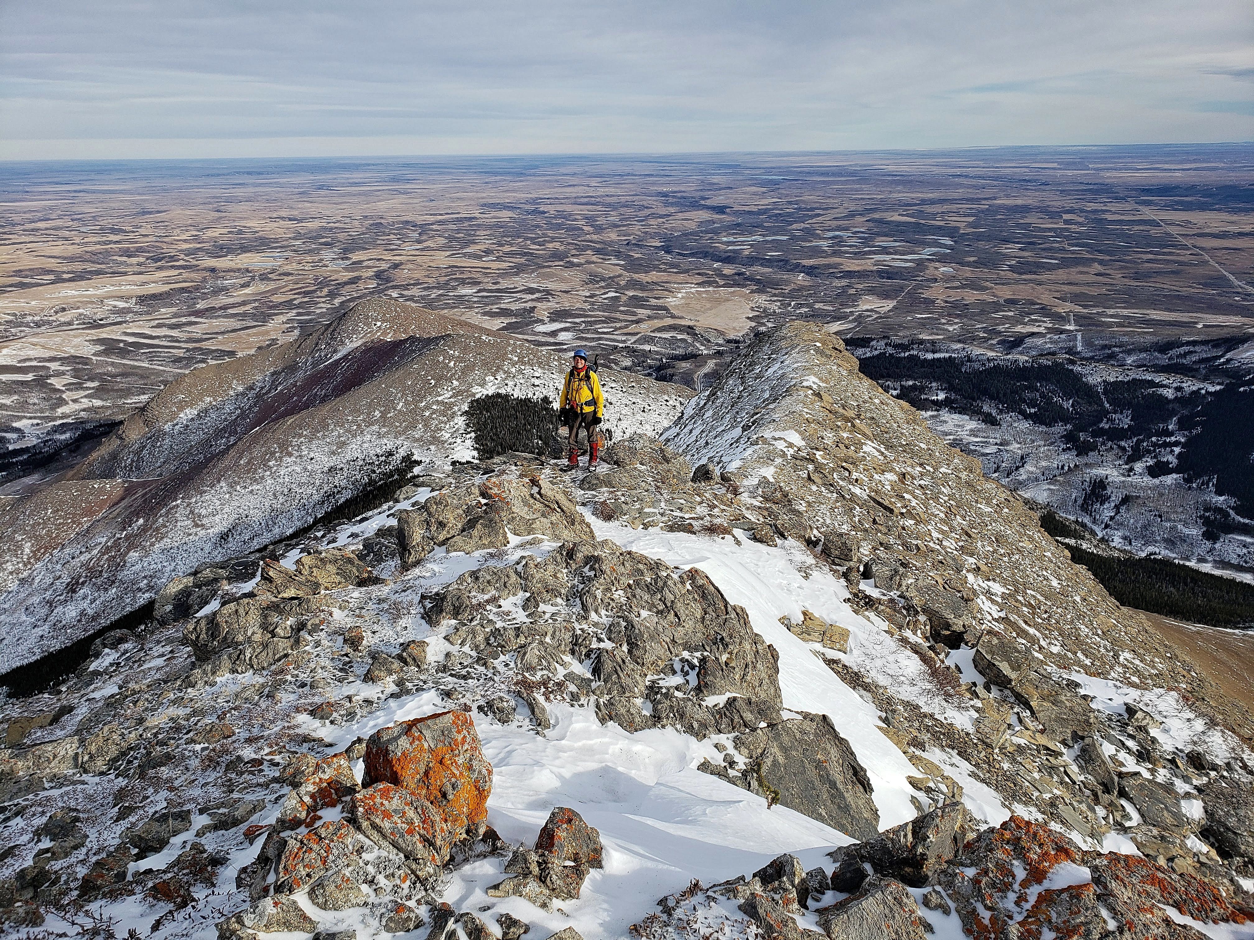
There’s nothing flaky about the summit of “The Croissant” (2037m; my GPS)! Looking south at Spread Eagle Mountain and the unnamed high point on Spionkop Ridge. I believe it’s called Spread Eagle because the two peaks are the tips of the eagle’s wings with the head in the centre.

Looking back to the northeast. “The Muffin” is to the right of centre while The Muffin Man is to the left. 😉

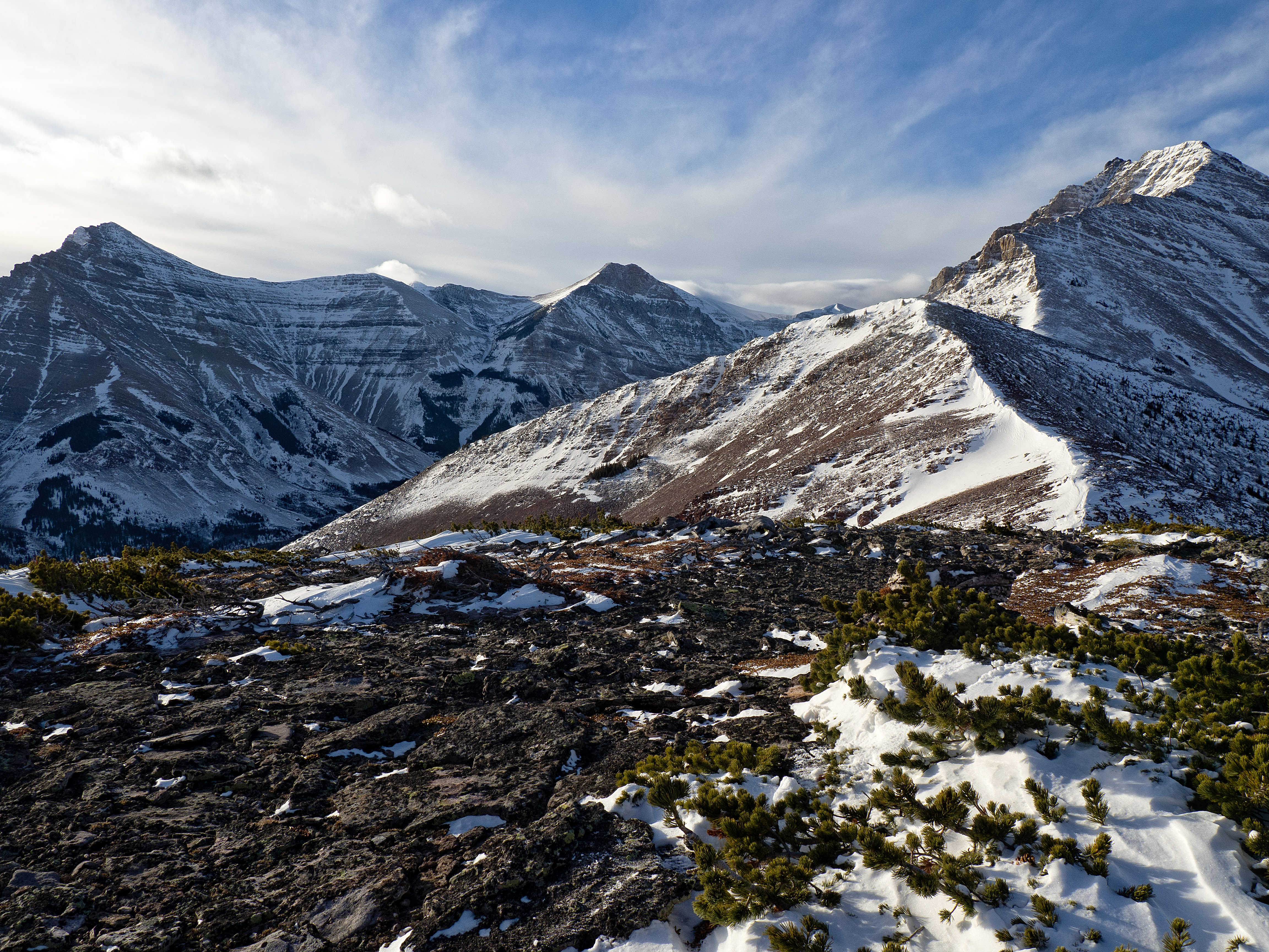
“Bakery Peak” and the Southwest Summit of Drywood (right).

Gazing west across the valley to Drywood Mountain.
A telephoto to the northwest of Centre Peak, “Lightning Peak”, and Thunder Mountain on the snow-capped Livingstone Range. Christie Mine Ridge, which sits on private land, is in the foreground to the right. The summit of Prairie Bluff is on the far left.
A telephoto to the north of Christie Mine Ridge and in the distance, Ky-es-kaghd-oghsuyiss (the Porcupine Hills).

“The Croissant” definitely ‘rose’ to the challenge!
This was Andrew’s second time on the summit this week – I mean really, who can just have one croissant?
Fighting the pastry sweats. 😉
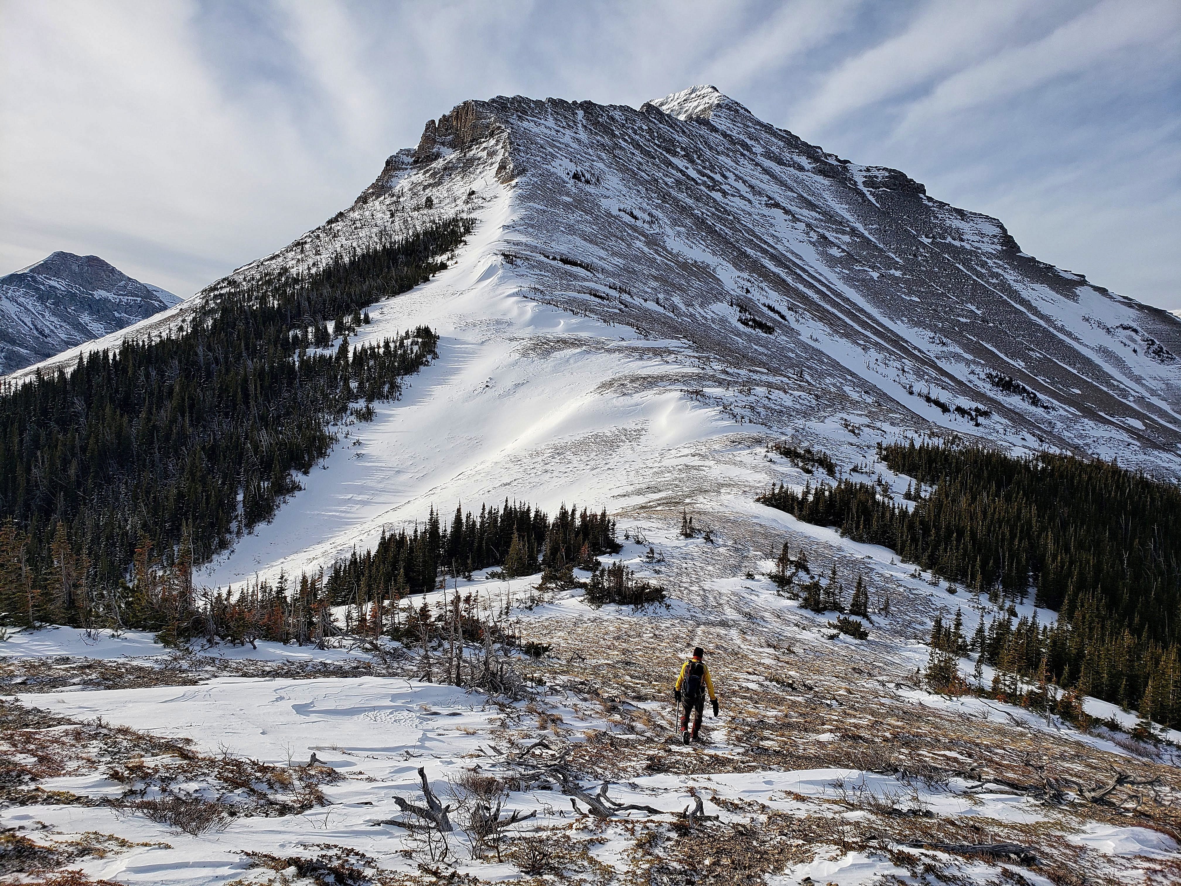
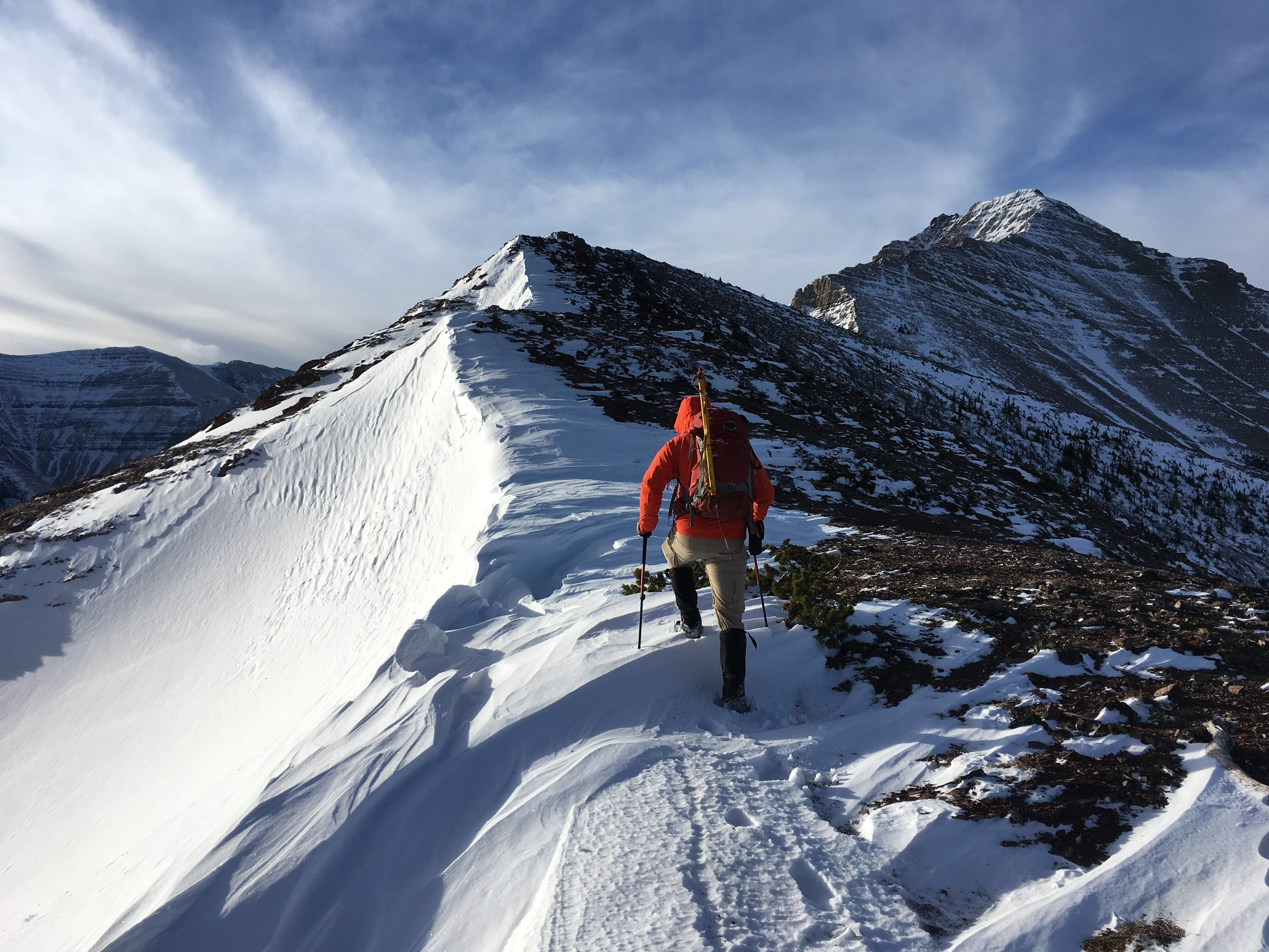
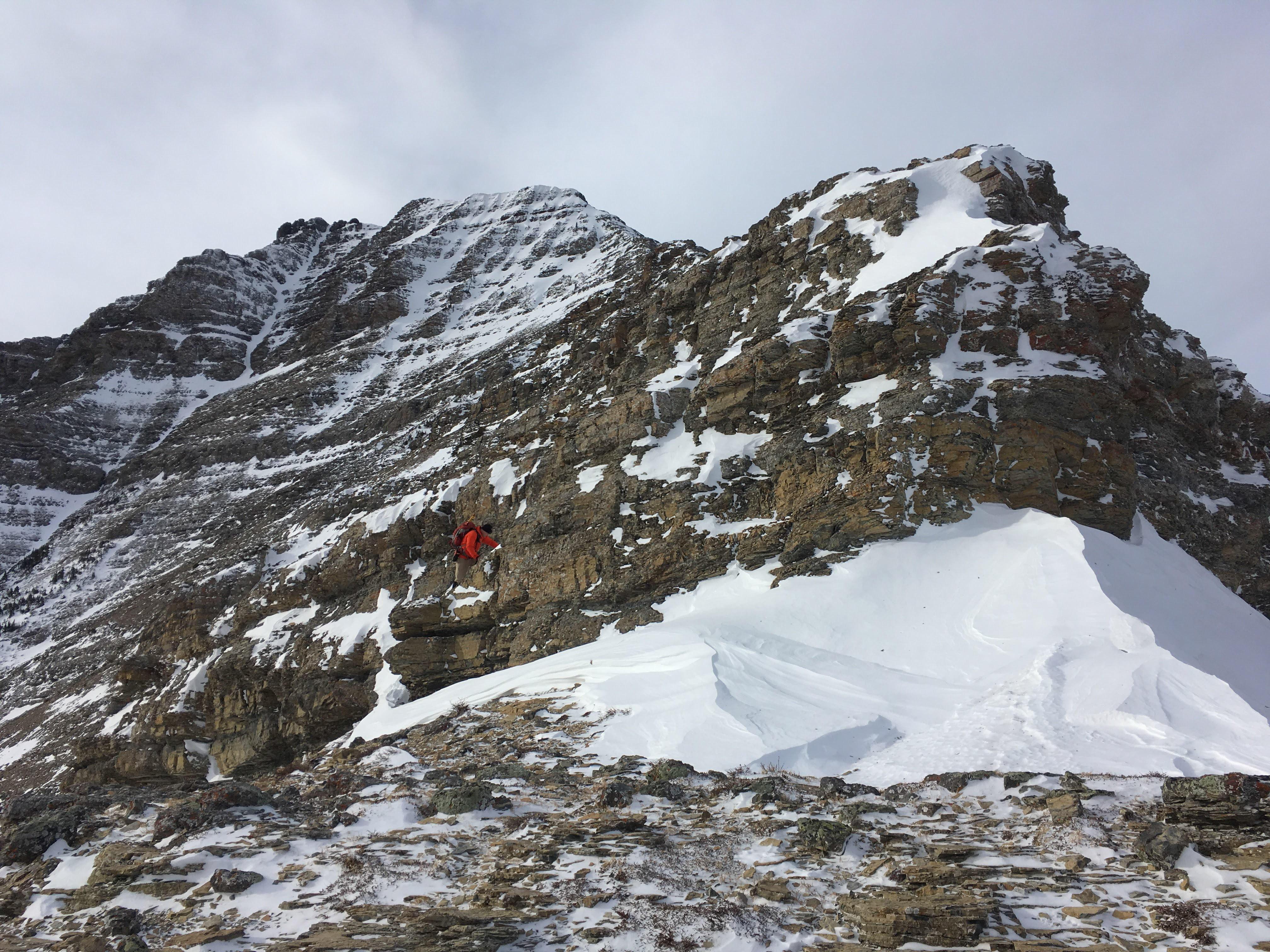
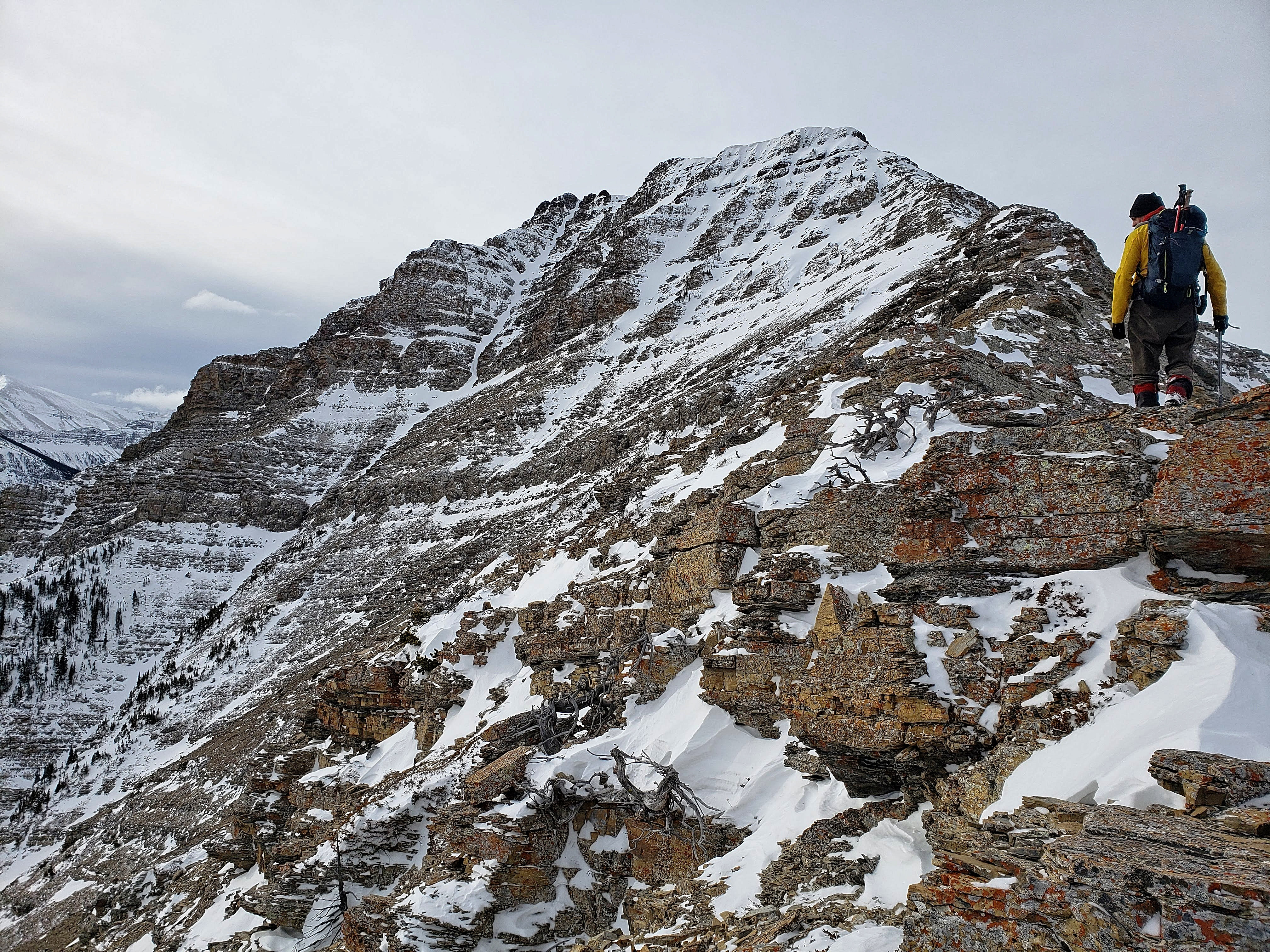
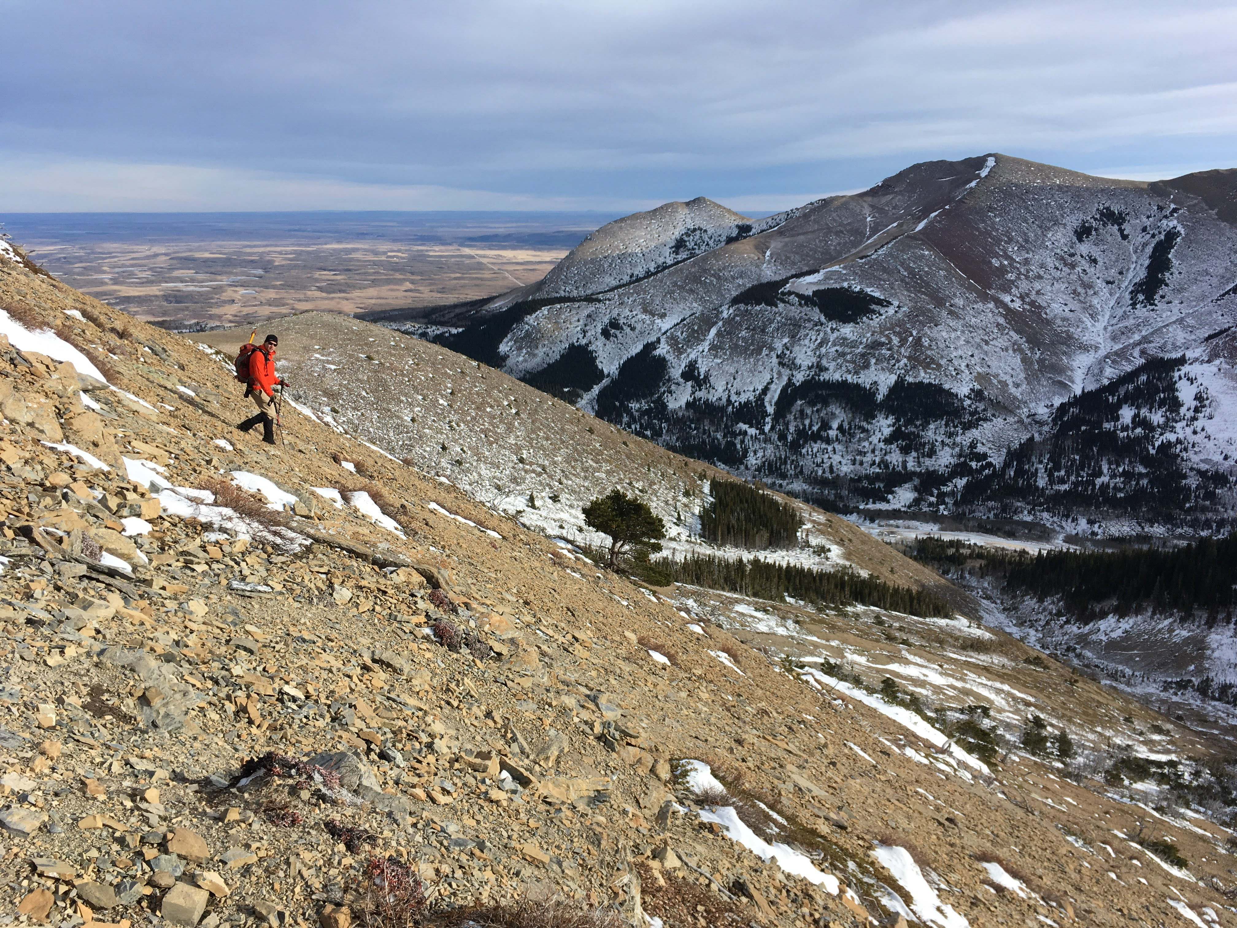
Andrew takes the lead as we begin the ~2 km trip to the summit of “Bakery Peak”. It’s an 83m elevation loss to the col and then a ~230m elevation gain to reach the ridge.

Heading up from the col and not knowing what to expect on the ridge.
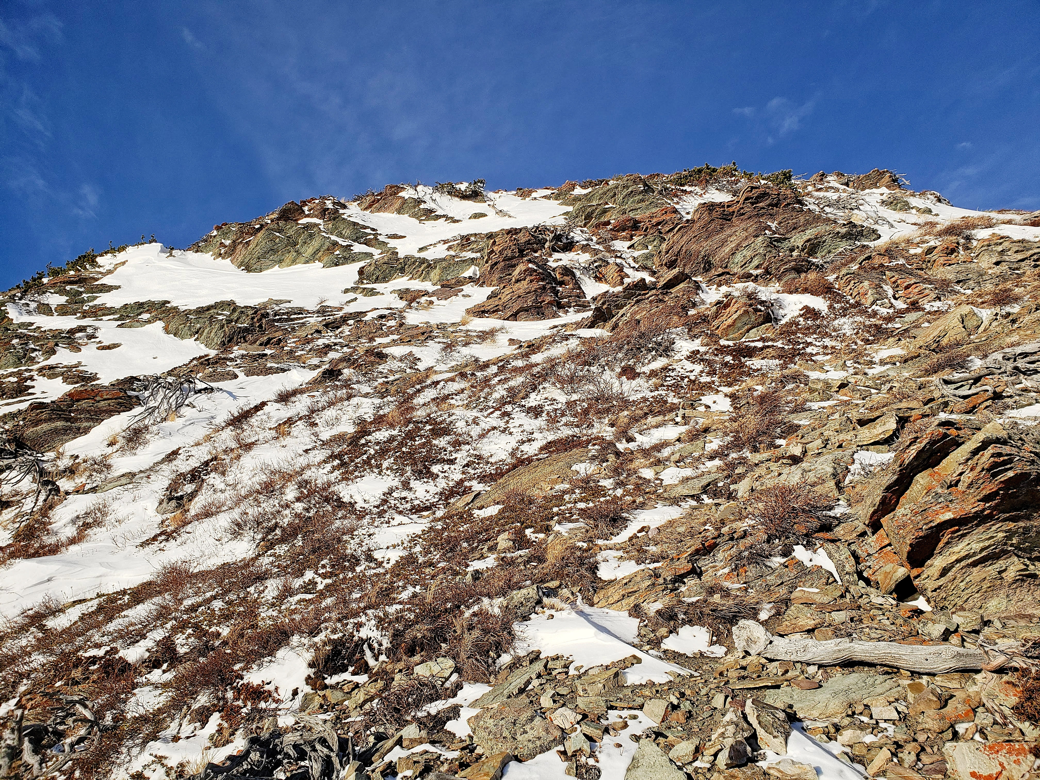
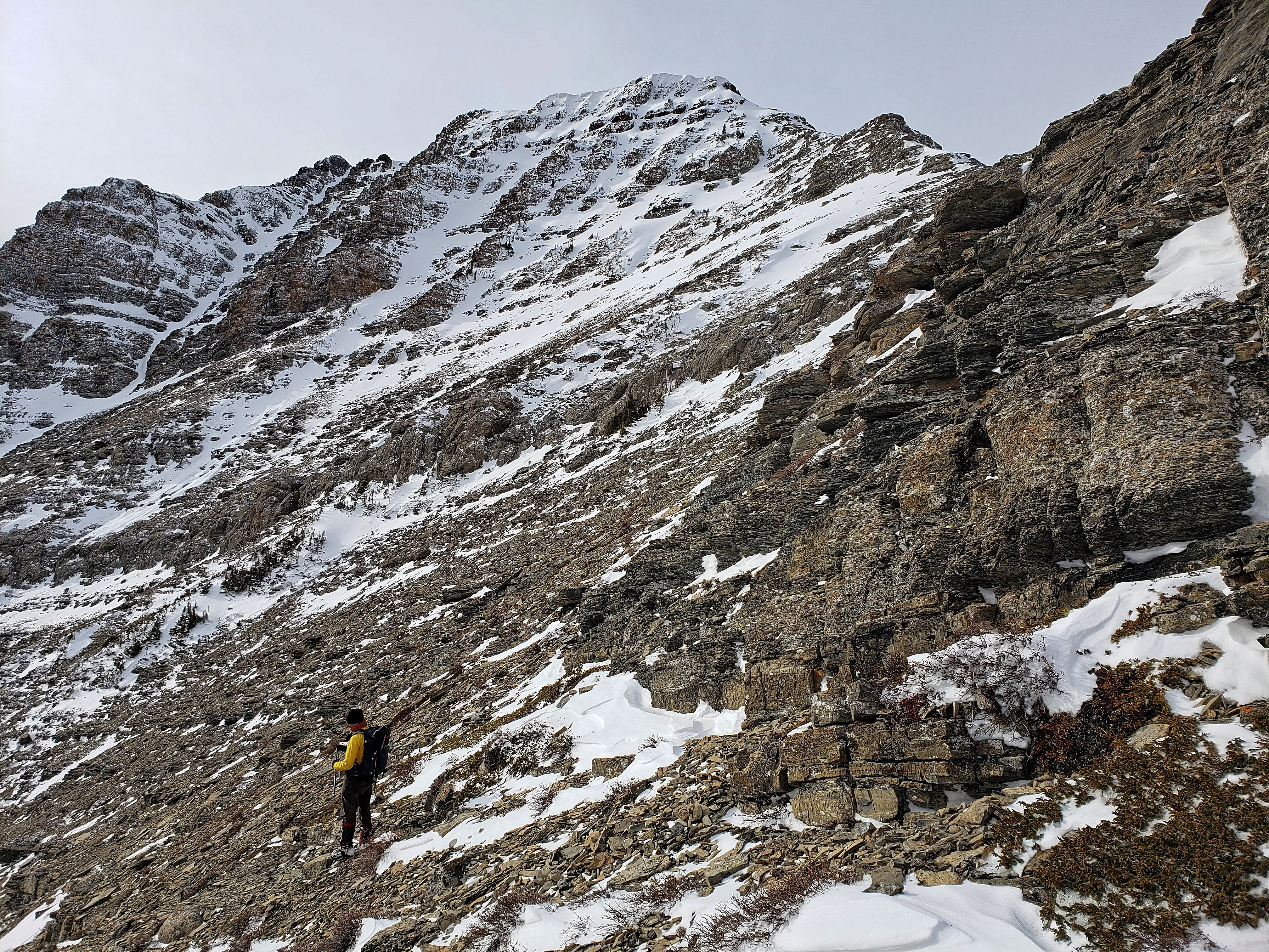
The east face is impressive!

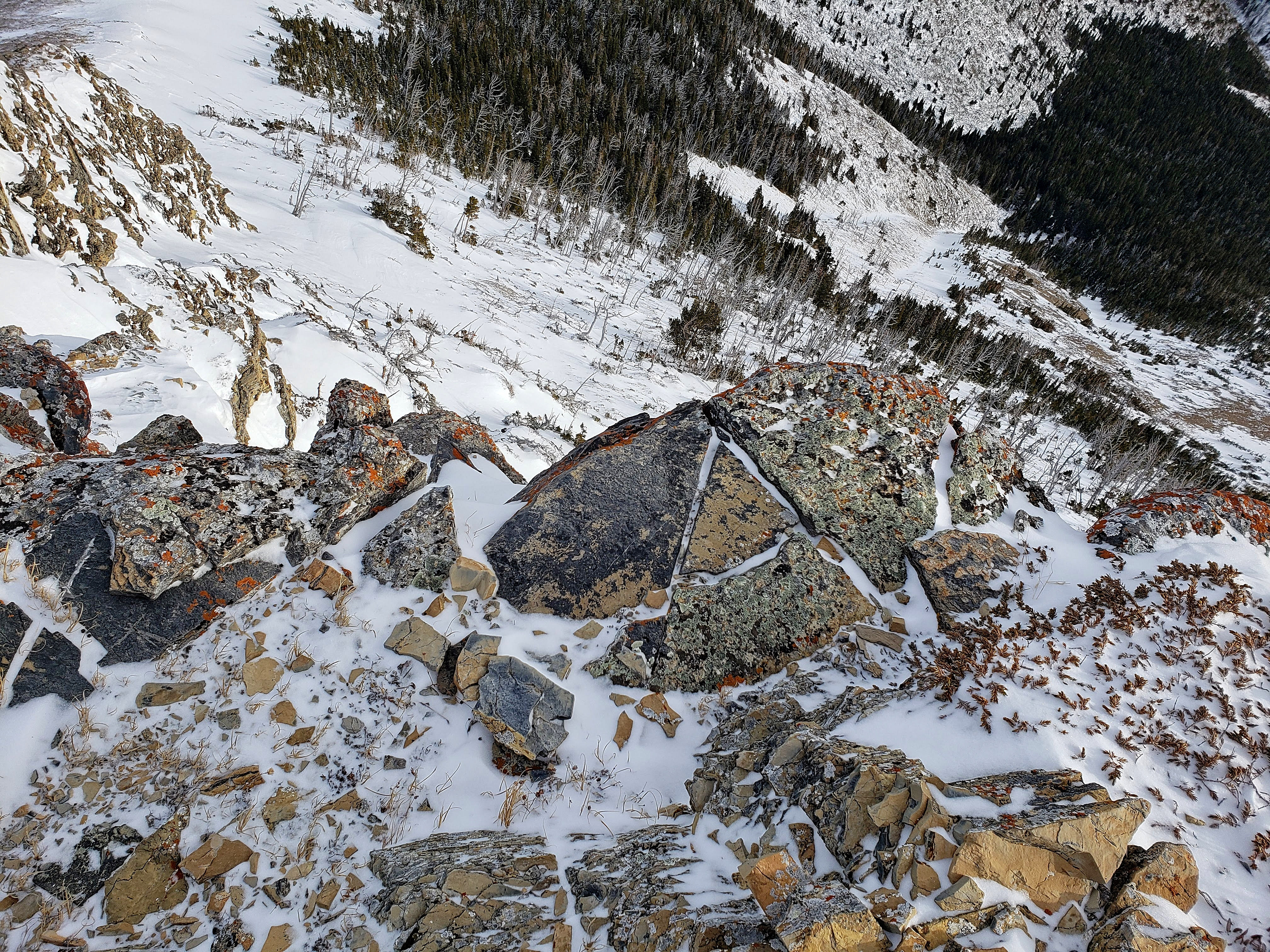
Lichen on argillite – a tried and true Castle recipe!

More Castle baking! (Photo by Andrew Nugara)

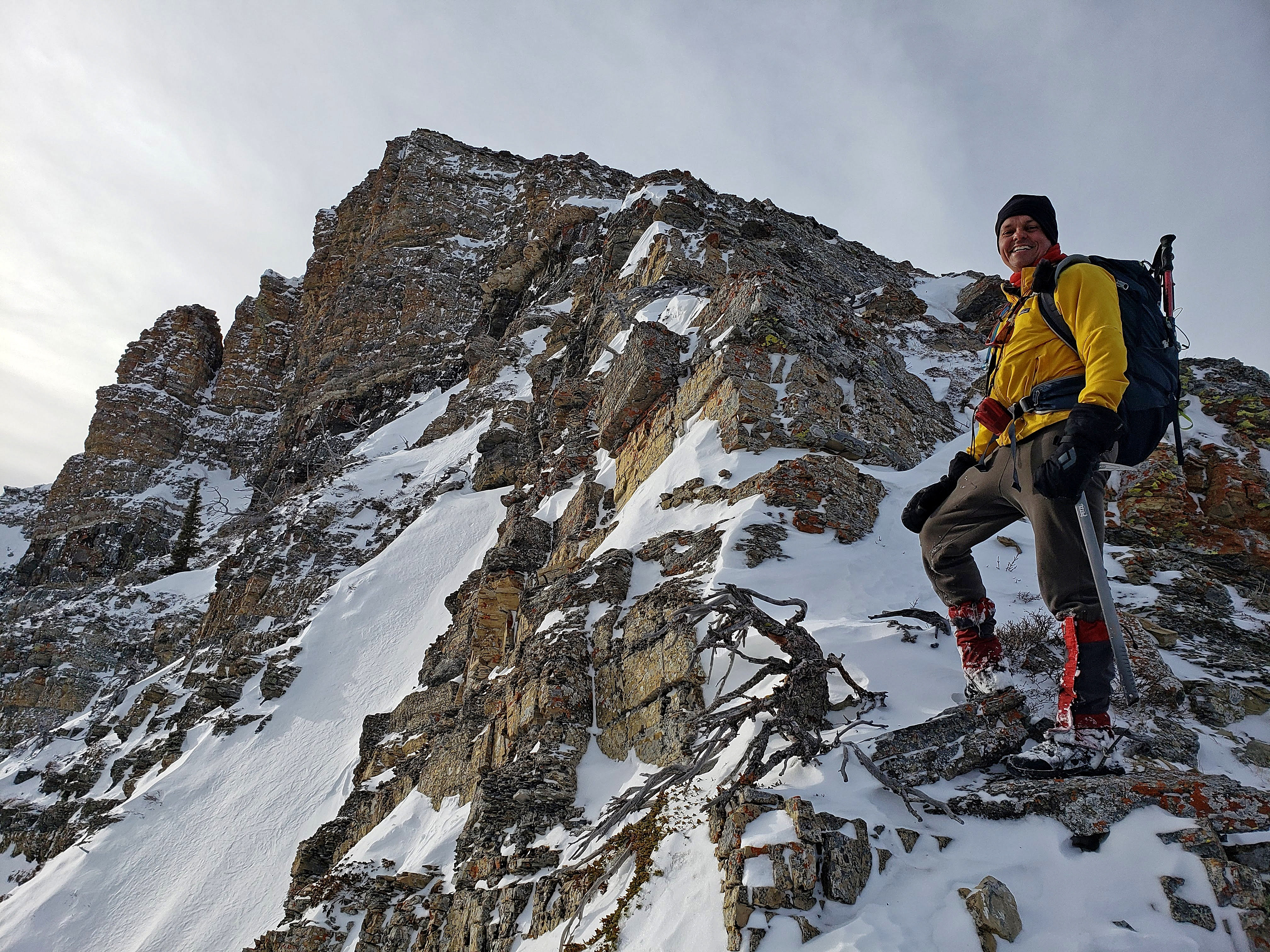
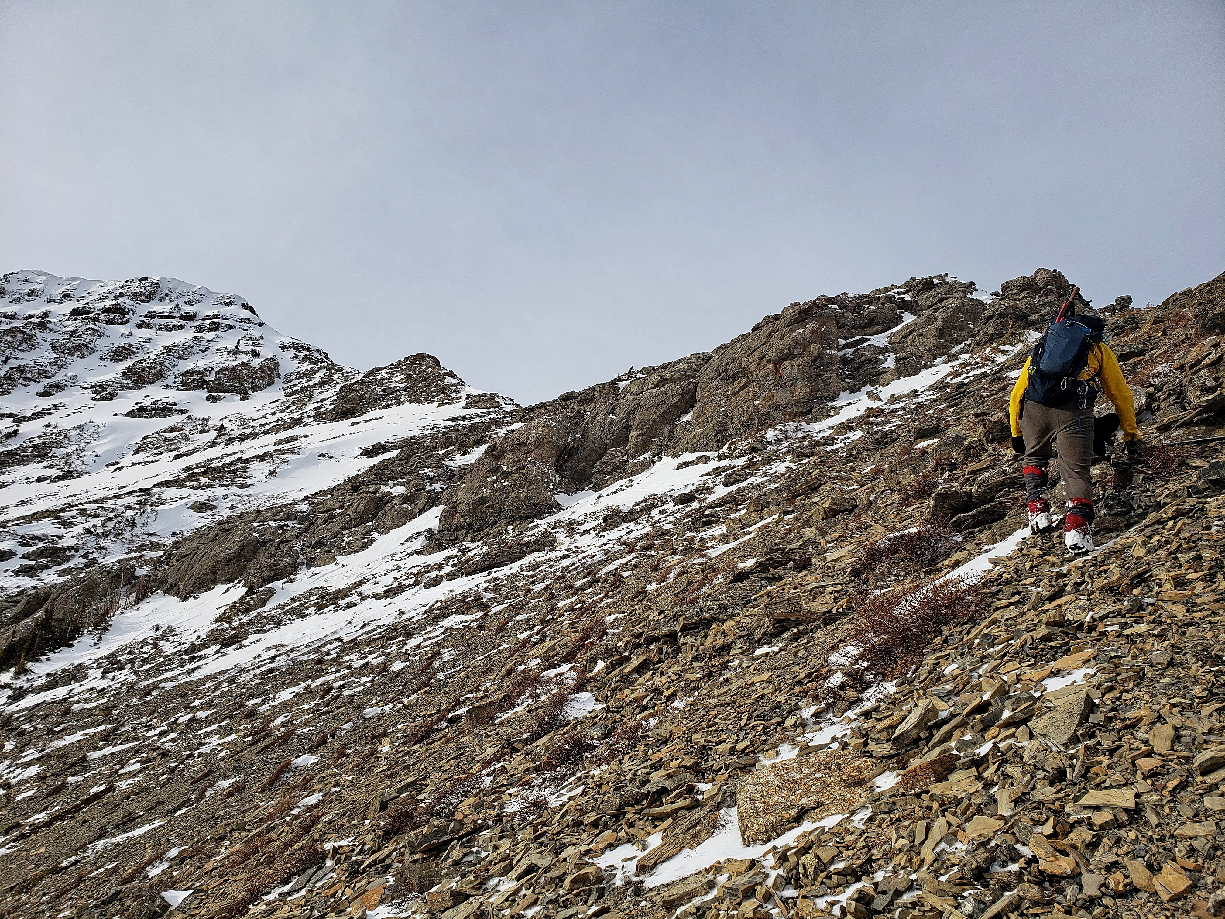
Approaching the start of the real scrambling.
Andrew’s climbed so many mountains that they now come pre-branded with his initial!

Now that’s a crust! What an awesome shot by Andrew! (Photo by Andrew Nugara)

Gazing back to “The Muffin” and “The Croissant” from the top of the cliff.
I test out a small gully as we begin to tackle the first of several large steps along the ridge. There was lots of route finding required, especially with all of the snow and ice. (Photo by Andrew Nugara)

Andrew follows me up the gully from the previous picture.

Andrew approaches the another step…
…and makes short work of it.

Climbing over an obstacle by using the snow. Graceful, aren’t I? 😉 (Photo by Andrew Nugara)
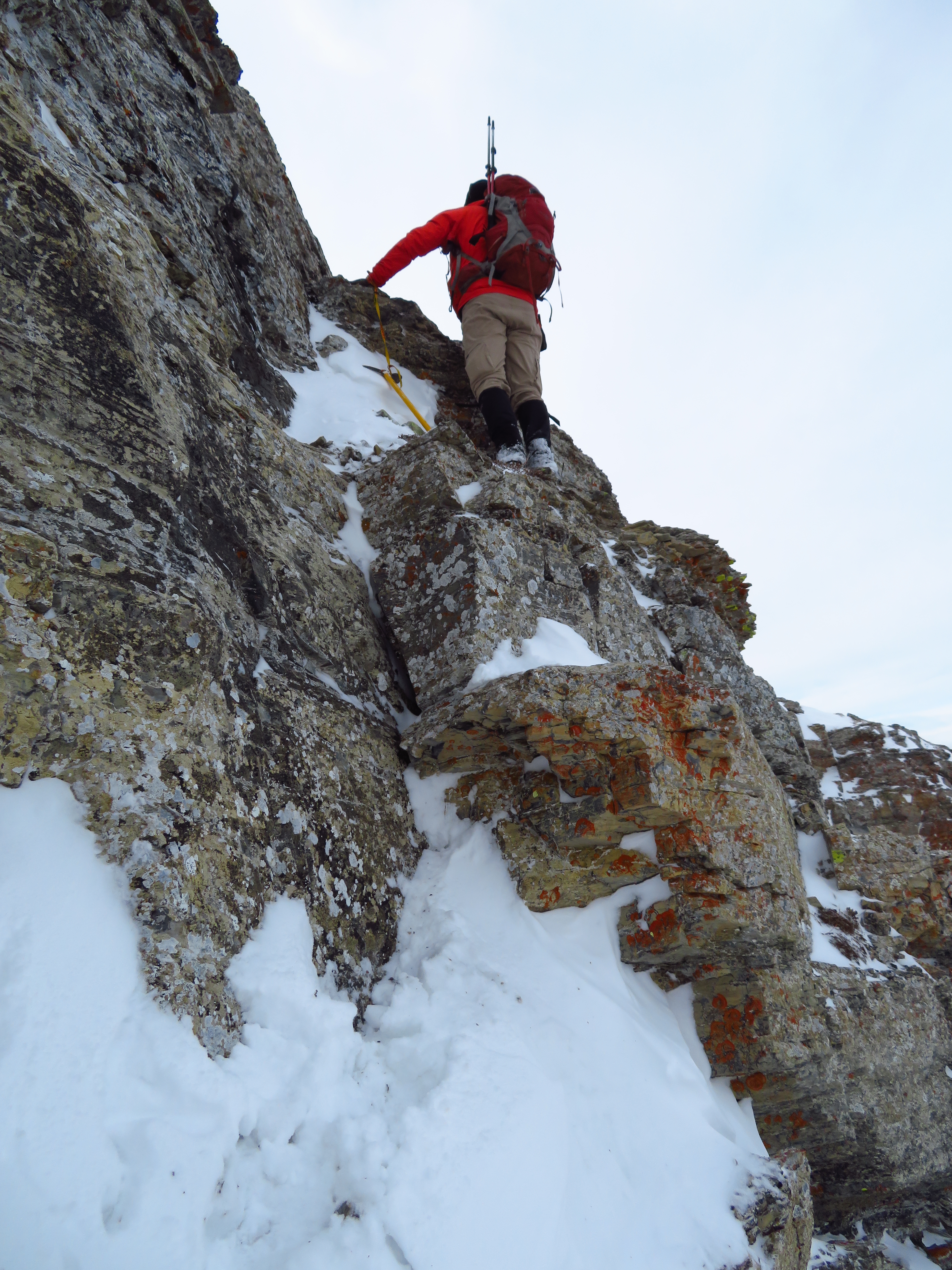
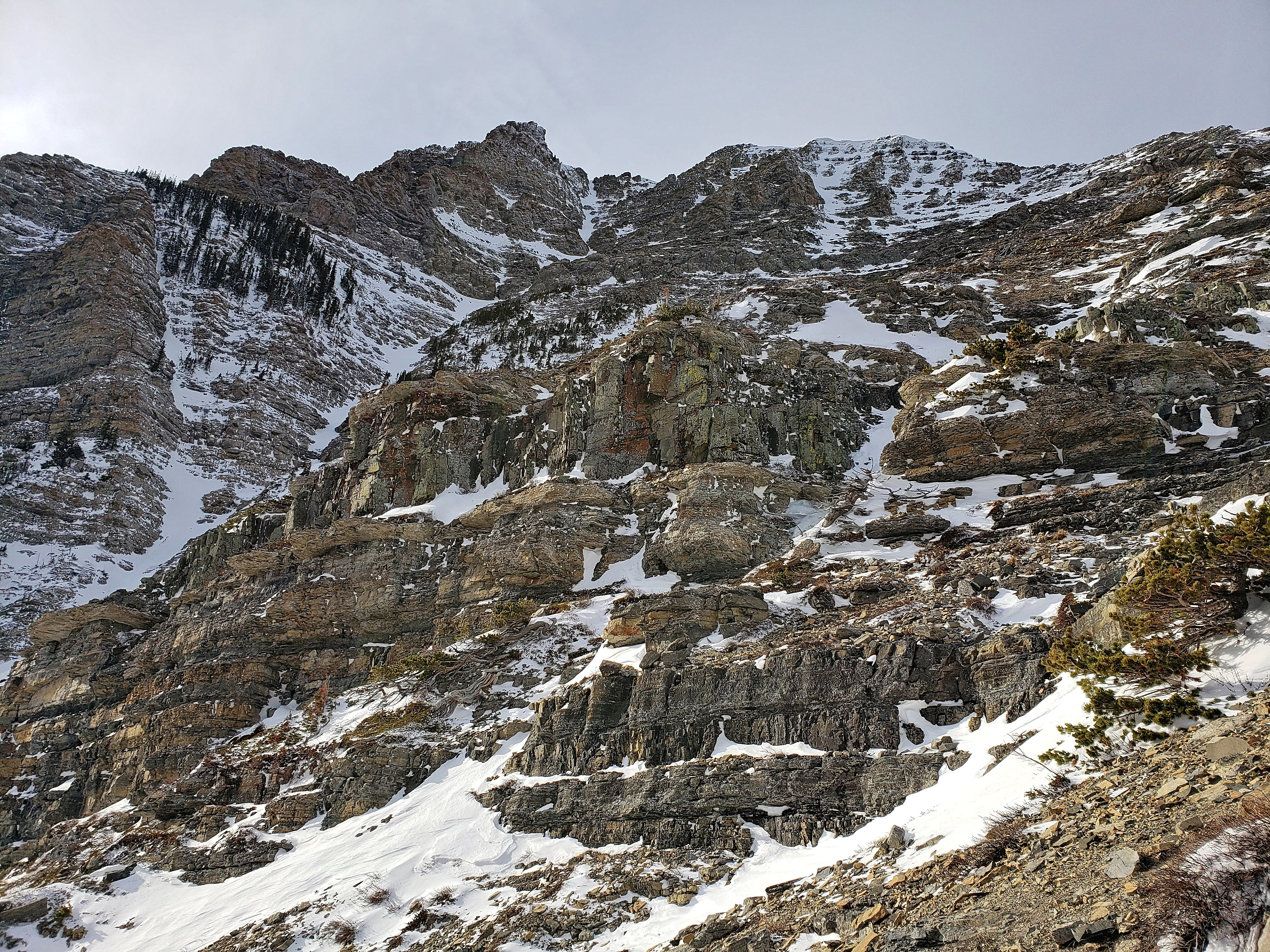
Andrew checks out another large step, which was too difficult to ascend head-on. The terrain is much steeper than it looks!

Searching for a route up. We bypassed the front (left) by heading climber’s right across some ice-covered ledges.

Andrew checks for a way up a steep couloir. Meanwhile, I would attempt to scramble up the small snow-covered weakness on the far left.
Success! Though I wasn’t keen on the thought of down-climbing this on the way back. (Photo by Andrew Nugara)

Andrew follows me up…

And then I follow him up. (photo by Andrew Nugara)
Approaching yet another formidable step.

Gorgeous views accompanied us all the way up!
Given the past two winters, it was awesome to be scrambling this high up in January!

In the summer, it may be possible to tackle this massive step head-on, but not today. We avoided it by descending to climber’s left.
Bypassing on good terrain.
Regaining the ridge.

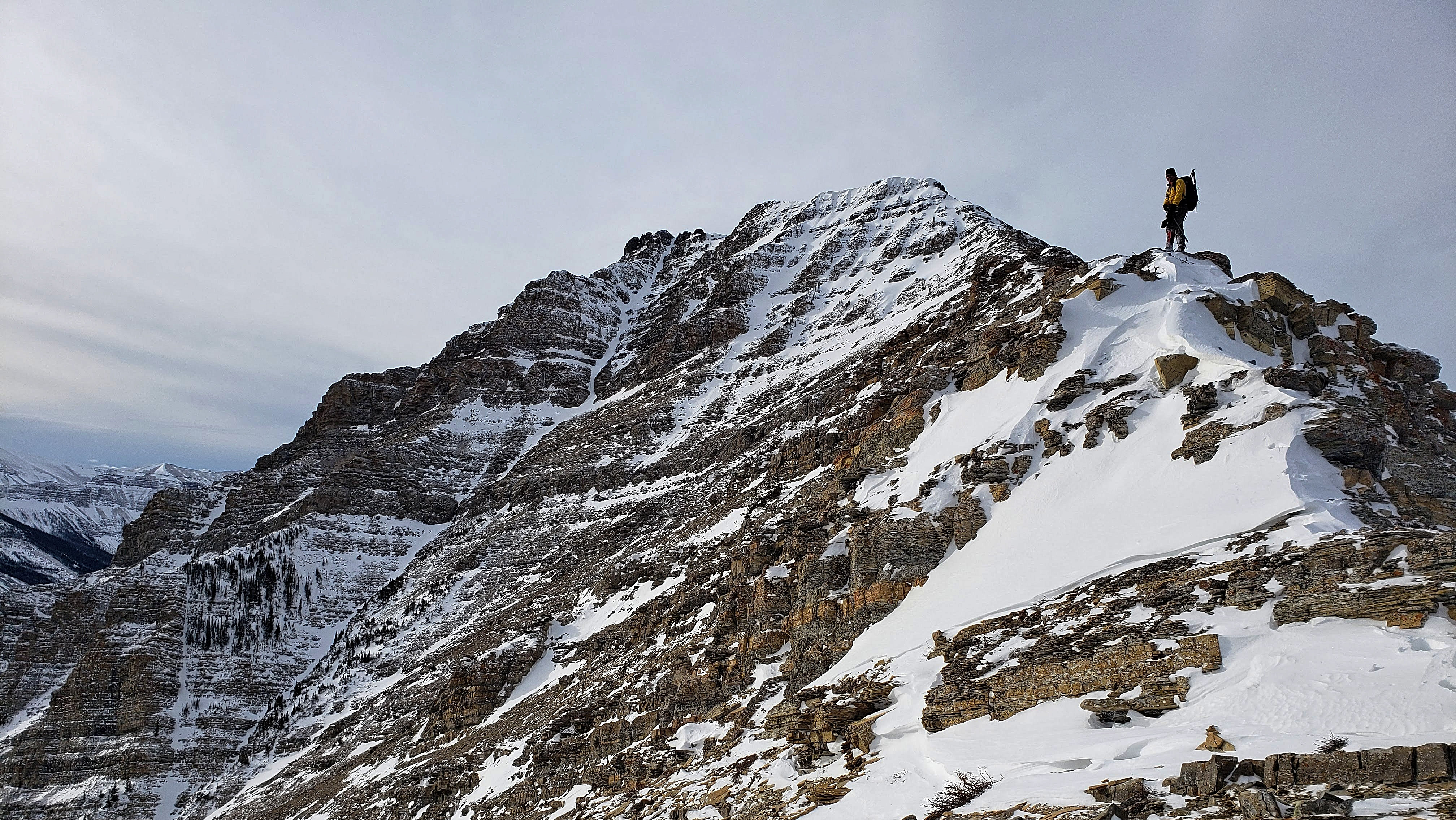
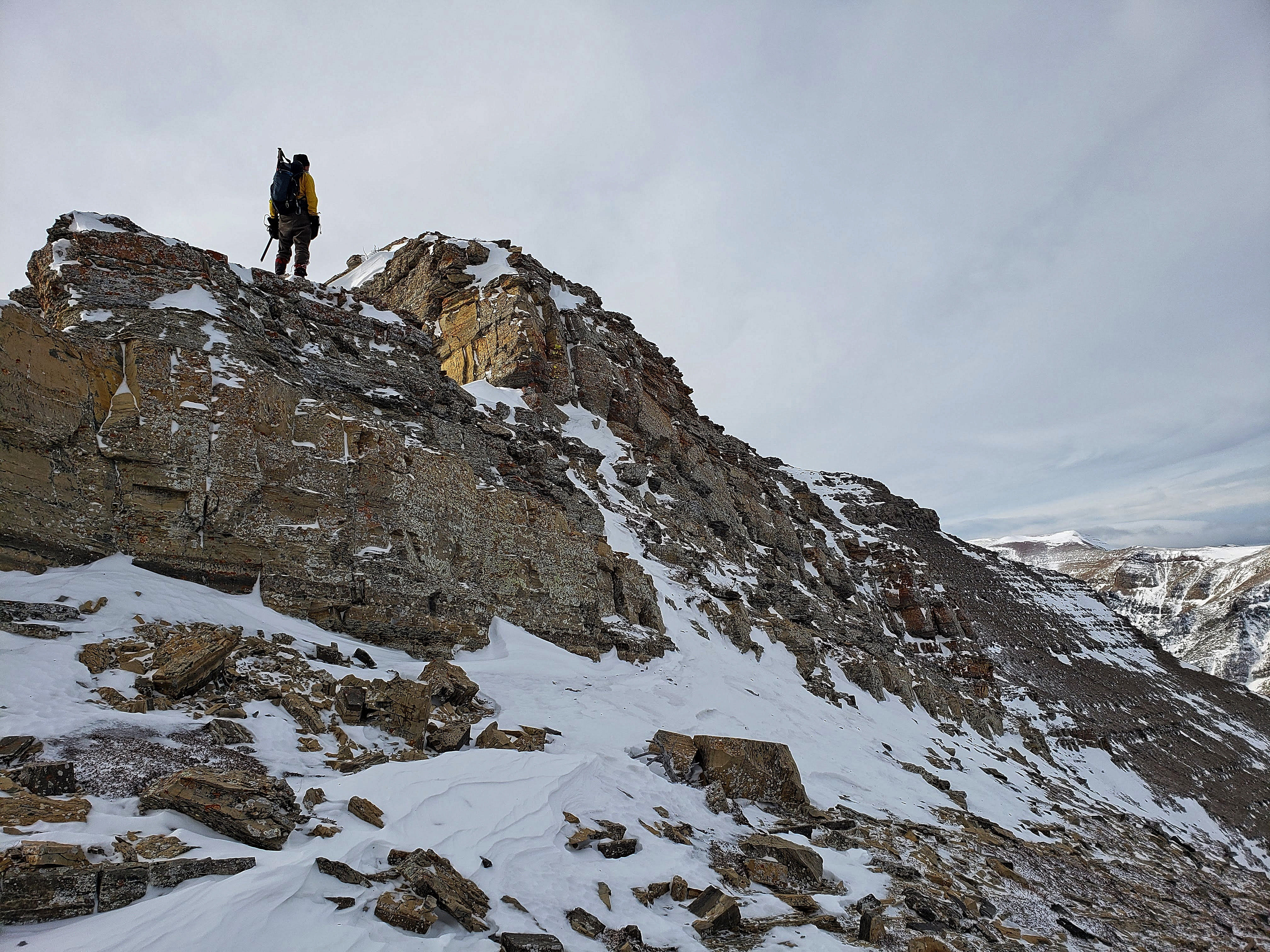
Andrew (right) skillfully navigates some exposure on one of the final steps before the summit ridge. We avoided down-climbing this on the way back by using a small gully in the centre that is hidden from view.
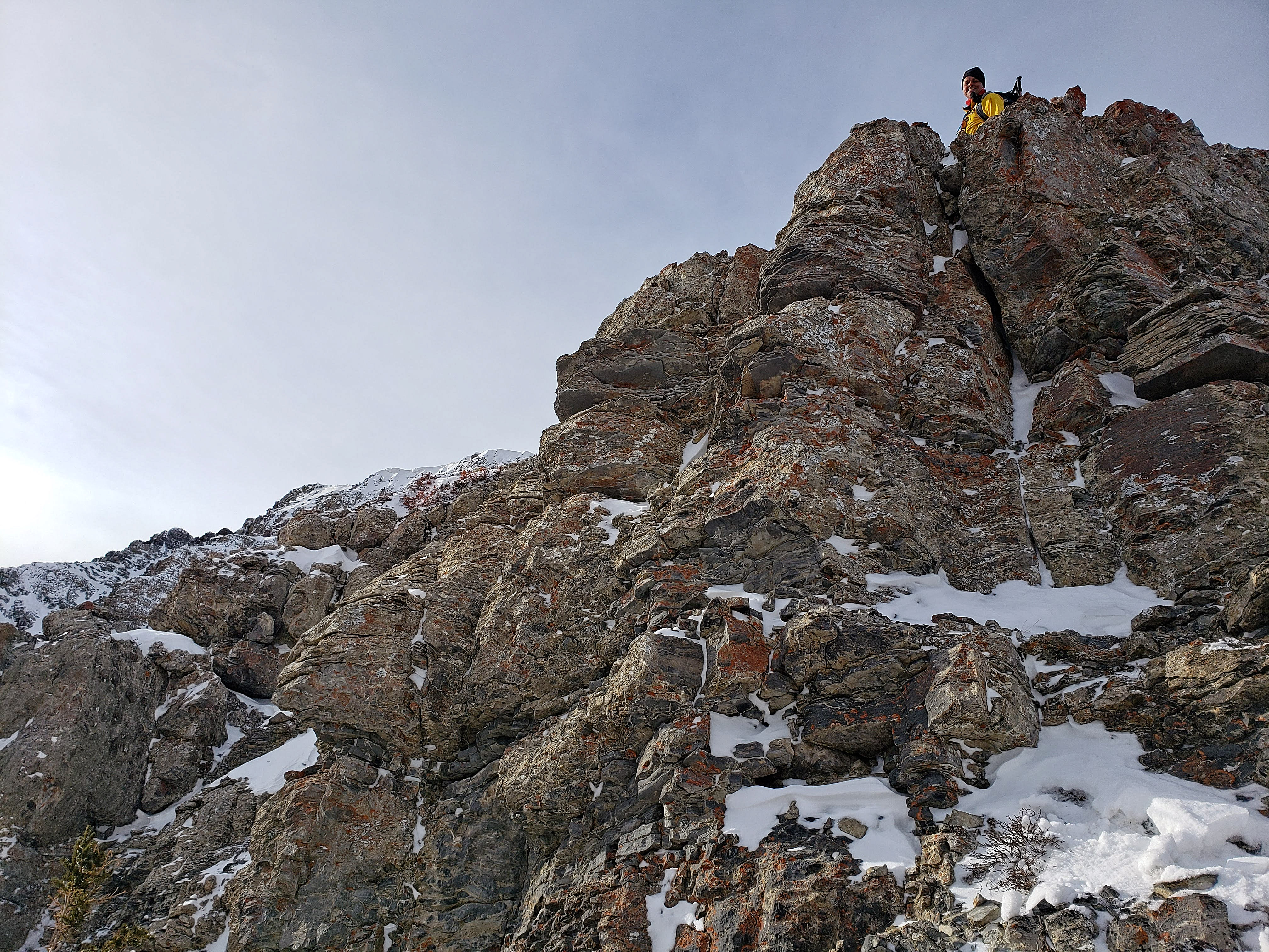
Andrew’s all smiles after reaching the top of the step.

Preparing to follow his route up. (Photo by Andrew Nugara)

Here’s where the snow became as hard as rock.
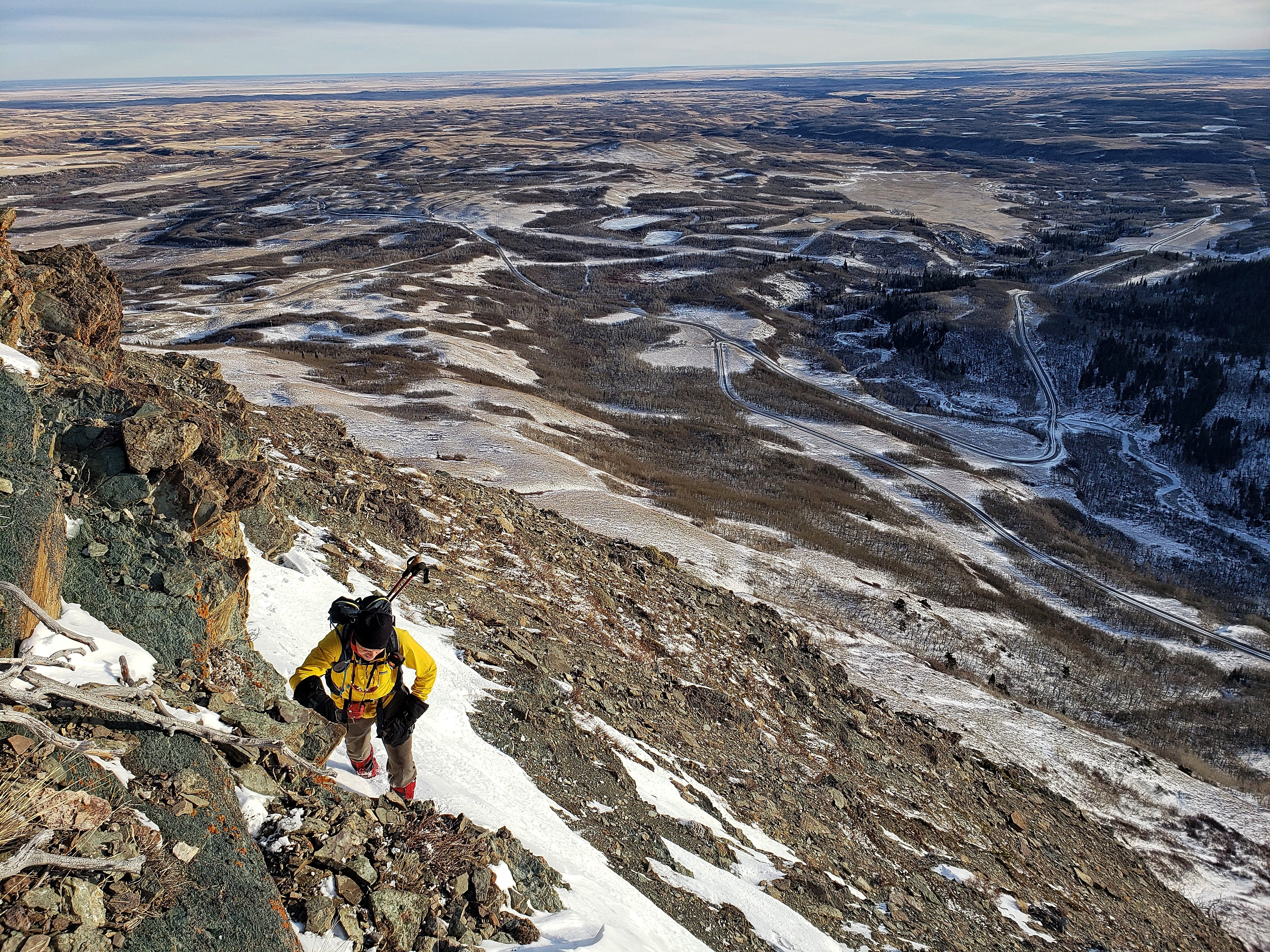
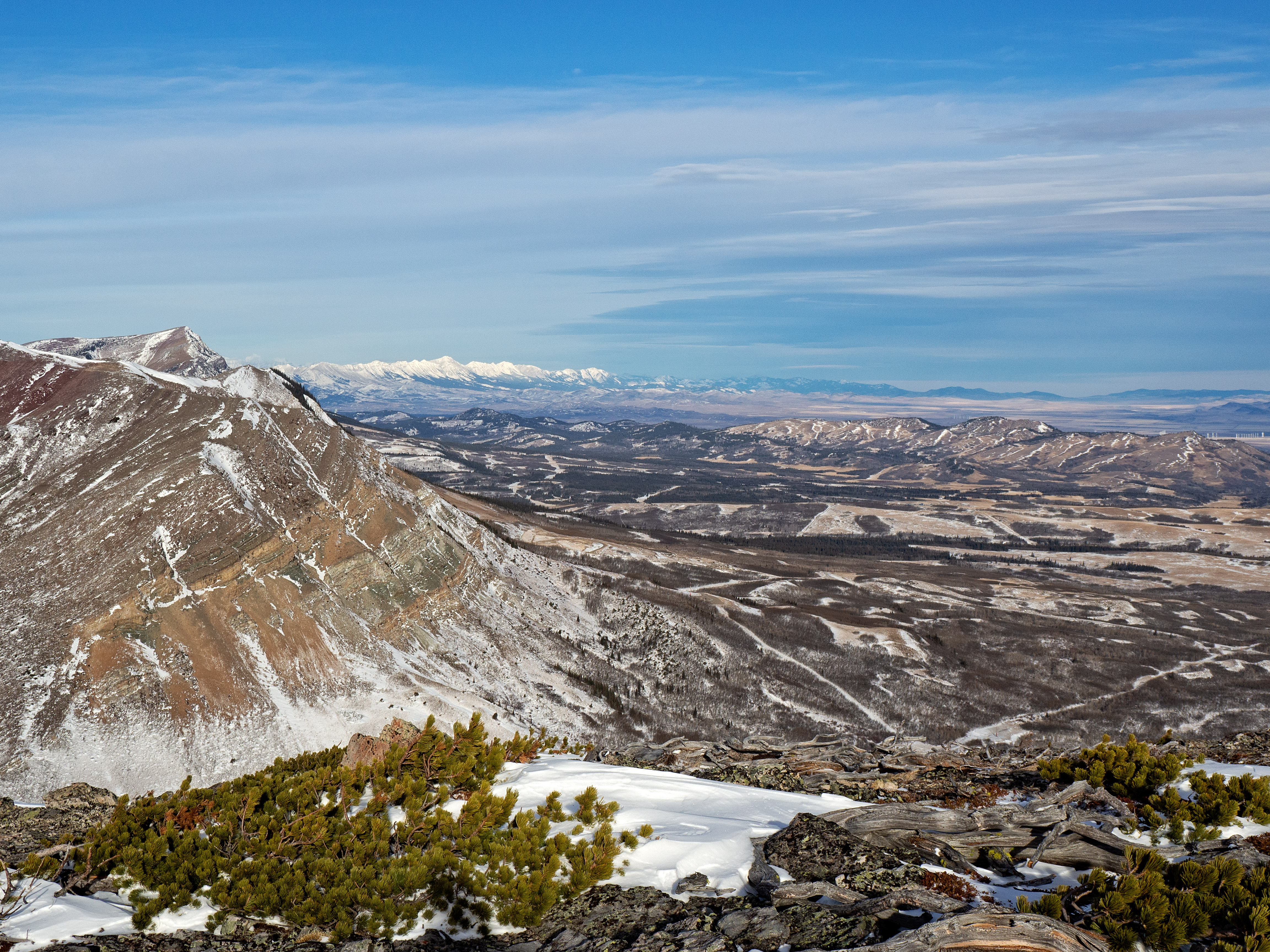
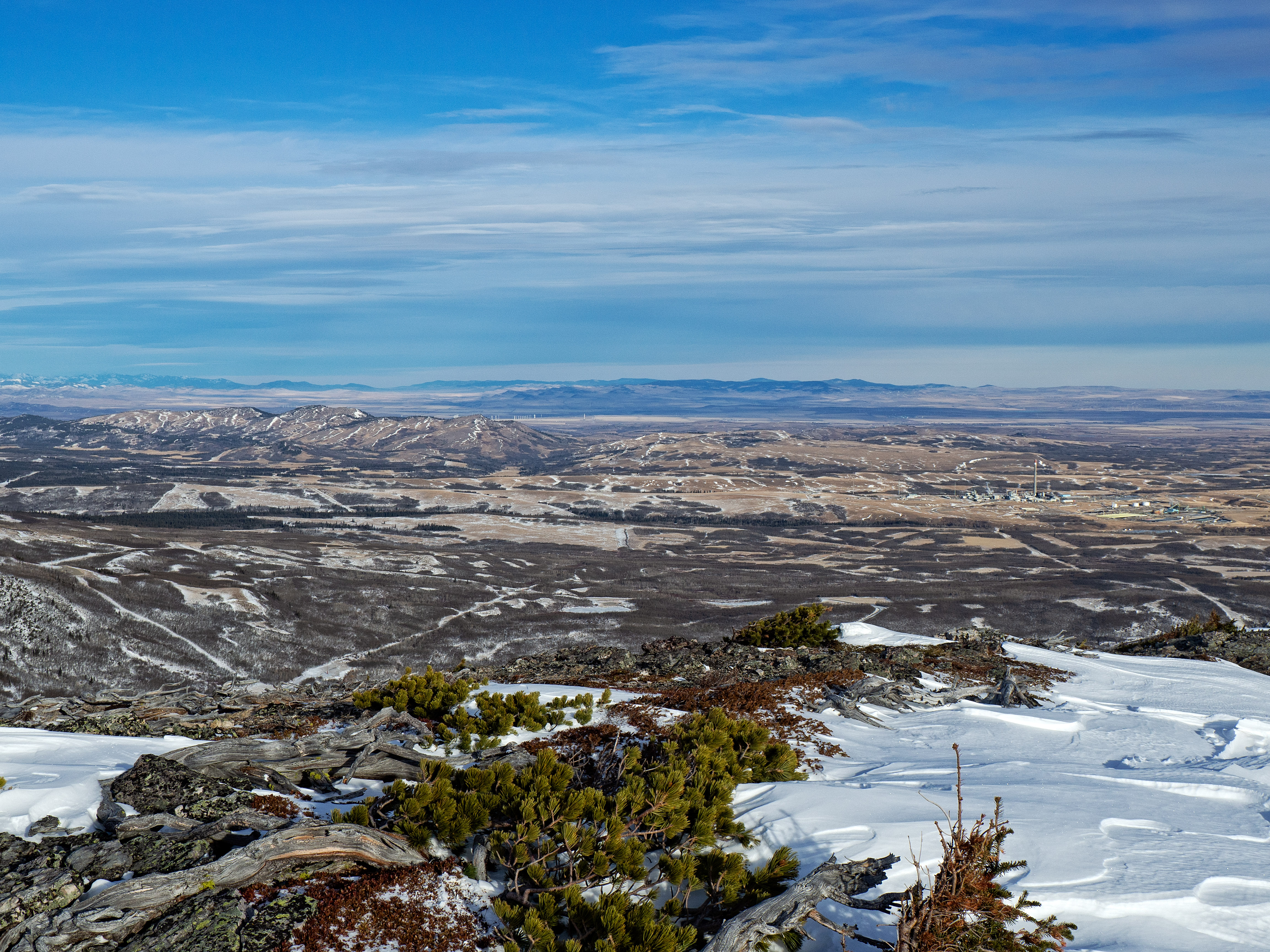
Looking back at the open expanse of prairie.

Andrew chips some foot holds into the ice. However, when it became evident that this section was part of a baker’s dozen, it was time to put on the crampons.
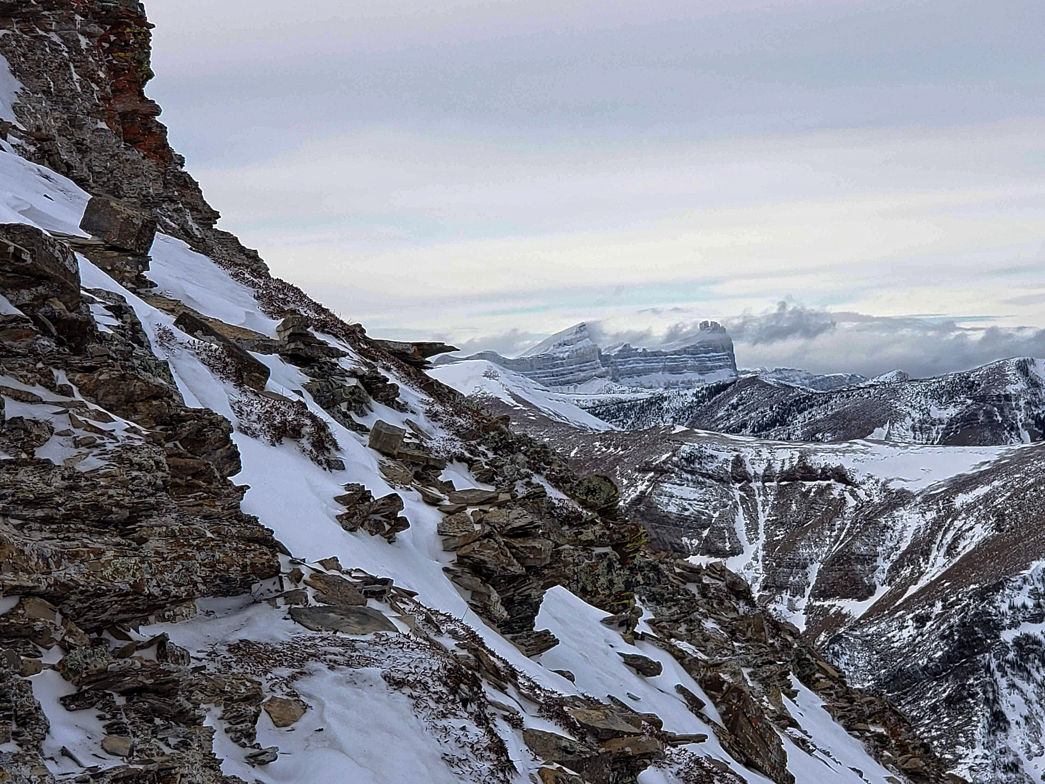
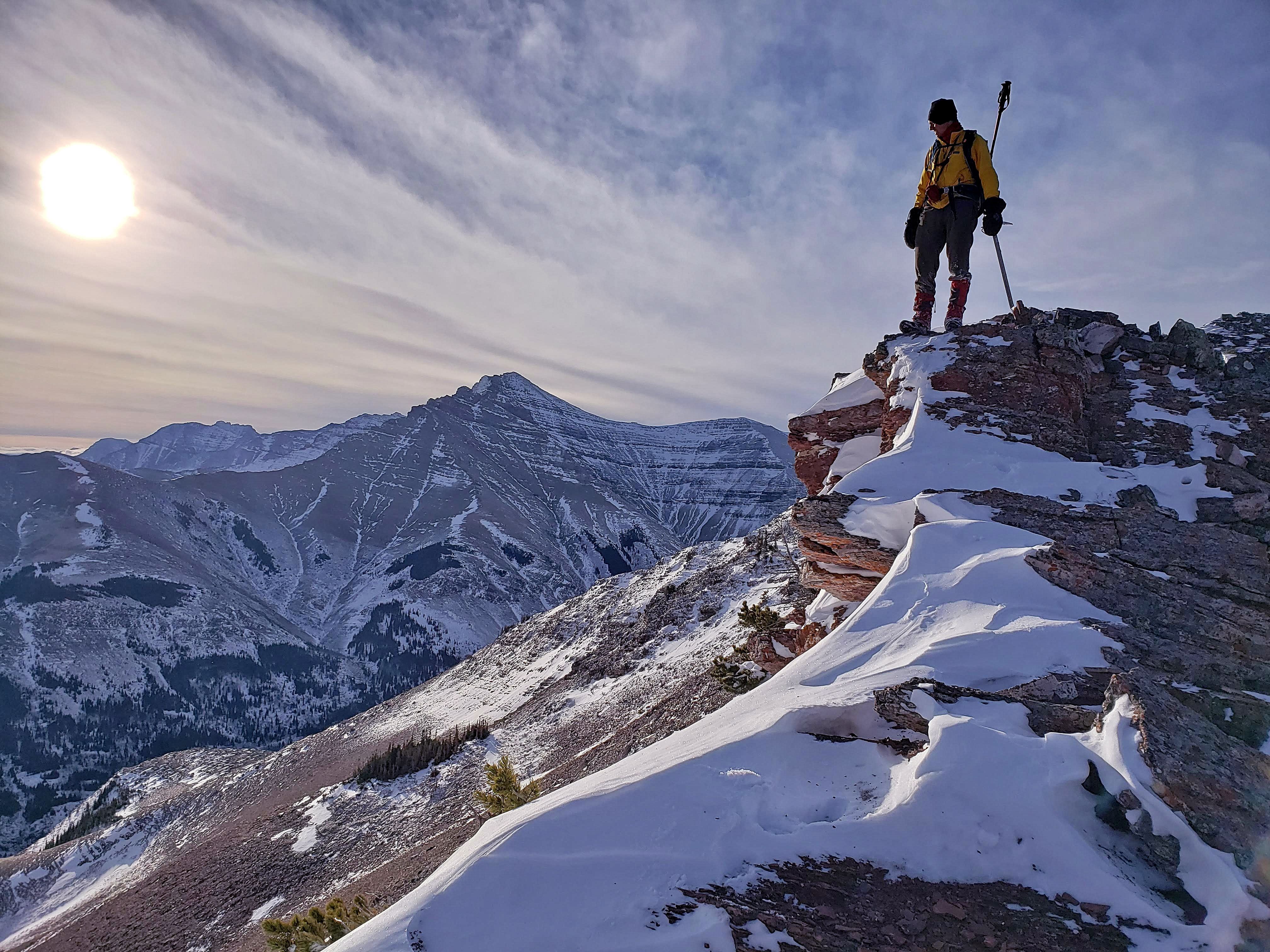
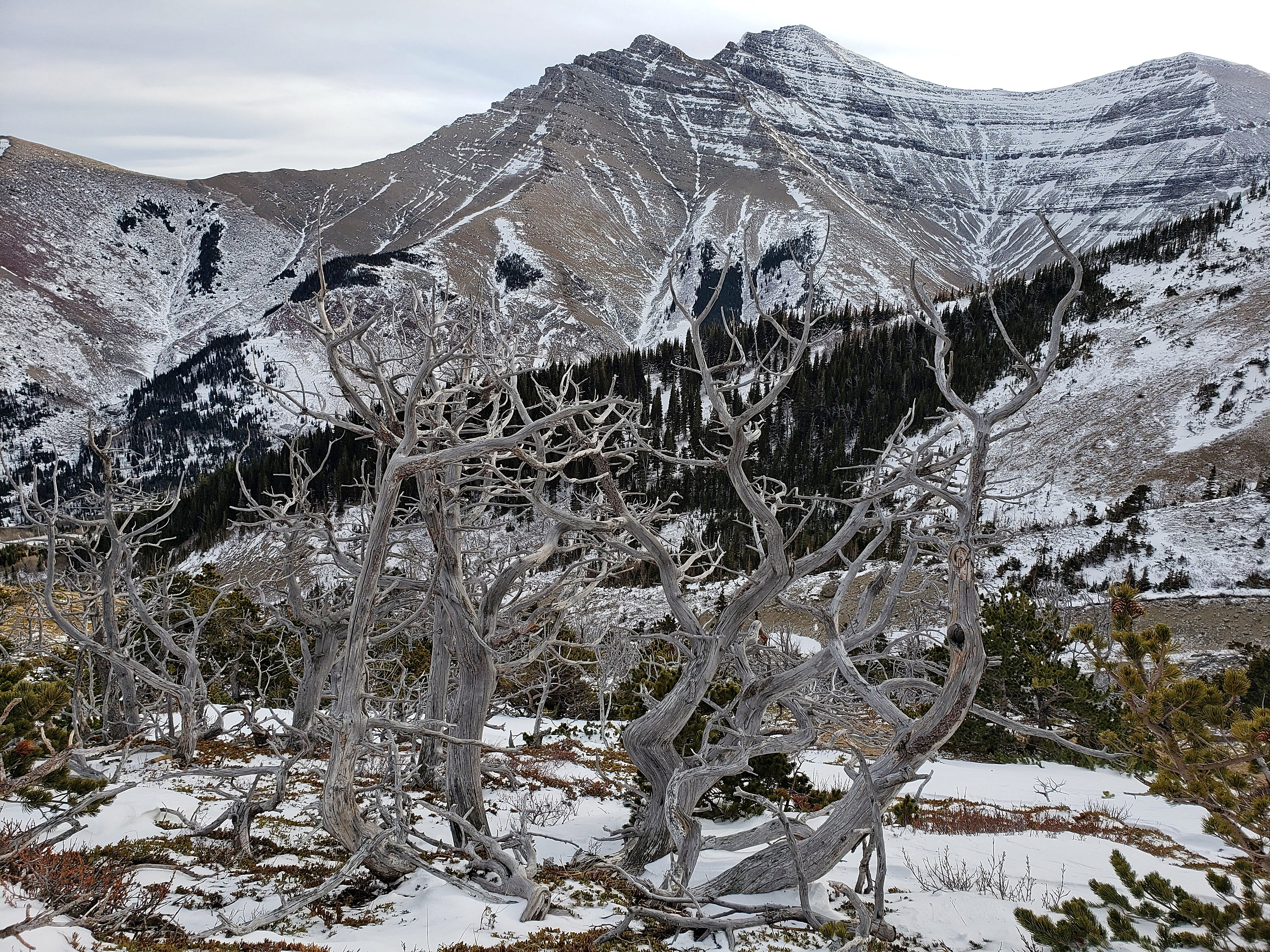
A beclouded Windsor Mountain and Castle Peak lie to the west.

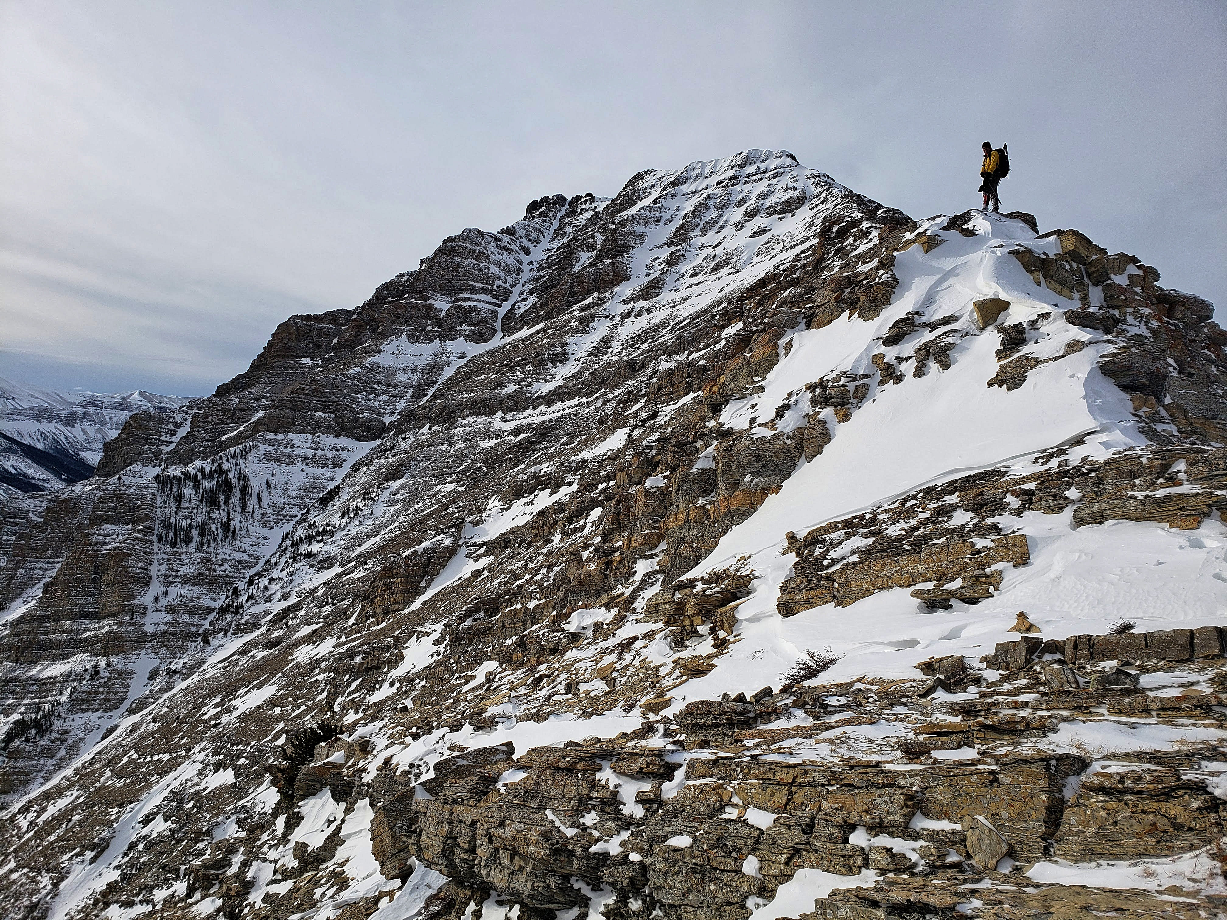
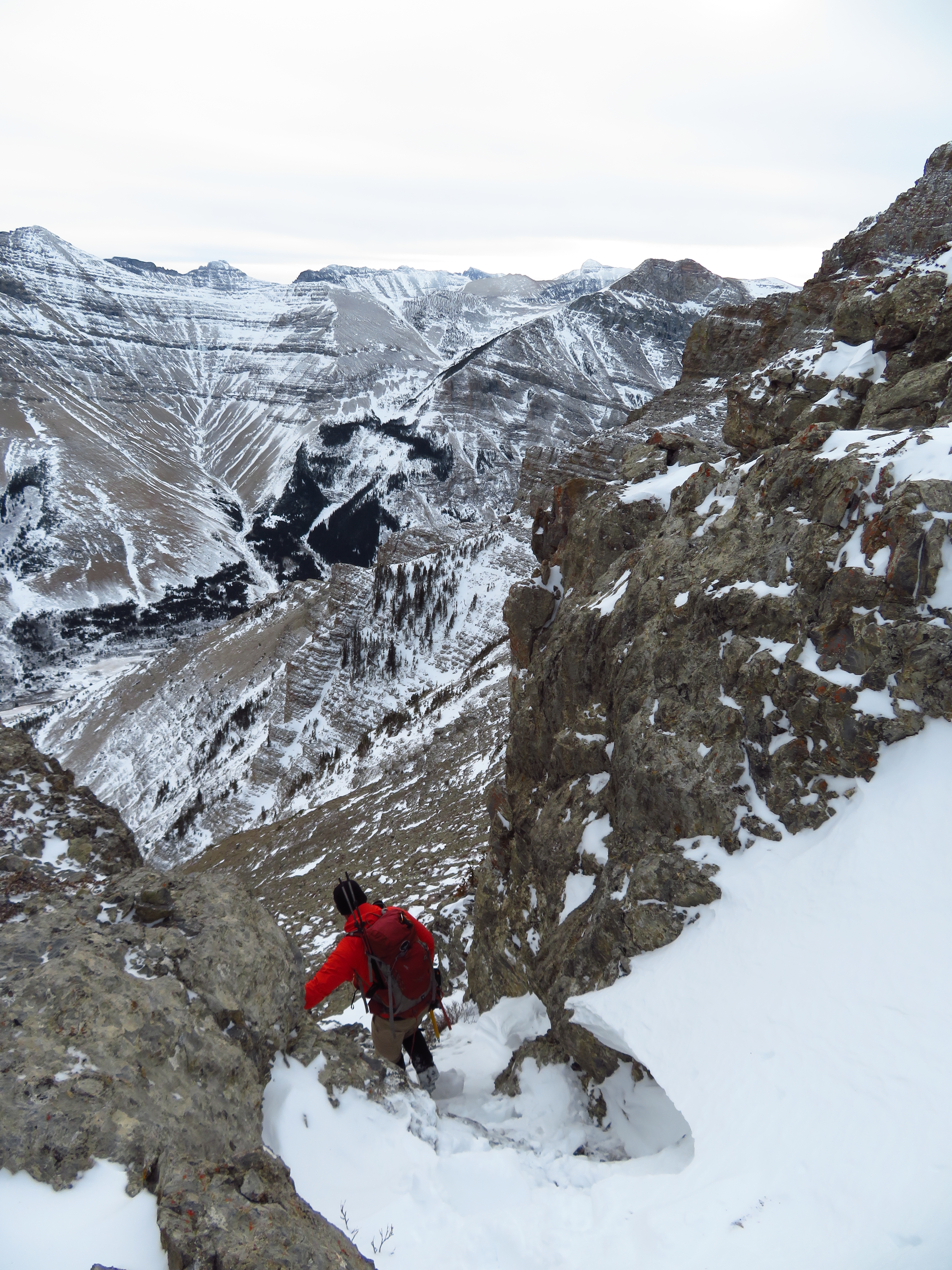
Arriving at the last step prior to the base of the summit ridge.

At 2333m – more or less than 100 vertical metres from the summit and only ~100 m or so from the summit ridge – we pulled the plug. Unfortunately, hard-packed snow, ice, and increasingly steep terrain became too much for just crampons and ice axes. No worries though! We got farther than we had expected, and because this is such a fun route, we’ll definitely return under more favourable conditions to complete the job.

The view to the southeast from the highest point we reached. Spread Eagle Mountain is in the centre.

Looking to the northwest at Drywood Mountain.

Wanting to avoid as much down-climbing as possible on the way back, we opted to try and descend the southeast slopes (left) of “Bakery Peak” and then use the small drainage (centre) to reach the road.

Andrew carefully descends slippery, rock-hard snow.
A hidden gully allowed us to to avoid down-climbing an exposed section that we had used on the way up. (Photo by Andrew Nugara)

After emerging from the gully (hidden from view), Andrew follows a natural seam between a snow drift and a wall of rock. Our ascent route is on the right.

Beginning our descent down the southeast slopes and hoping that we wouldn’t cliff-out. Fortunately, the drainage had eroded the surrounding rock enough that we had no trouble making our way down.
Enjoying a quick descent on skiable bread crumbs… er, scree. (Photo by Andrew Nugara)
The east face has sections of really interesting terrain.
Near the bottom, we encountered a fascinating patch of dead trees.

Heading towards the drainage – and eventually the road.

Looking back just before we were forced to enter the drainage.
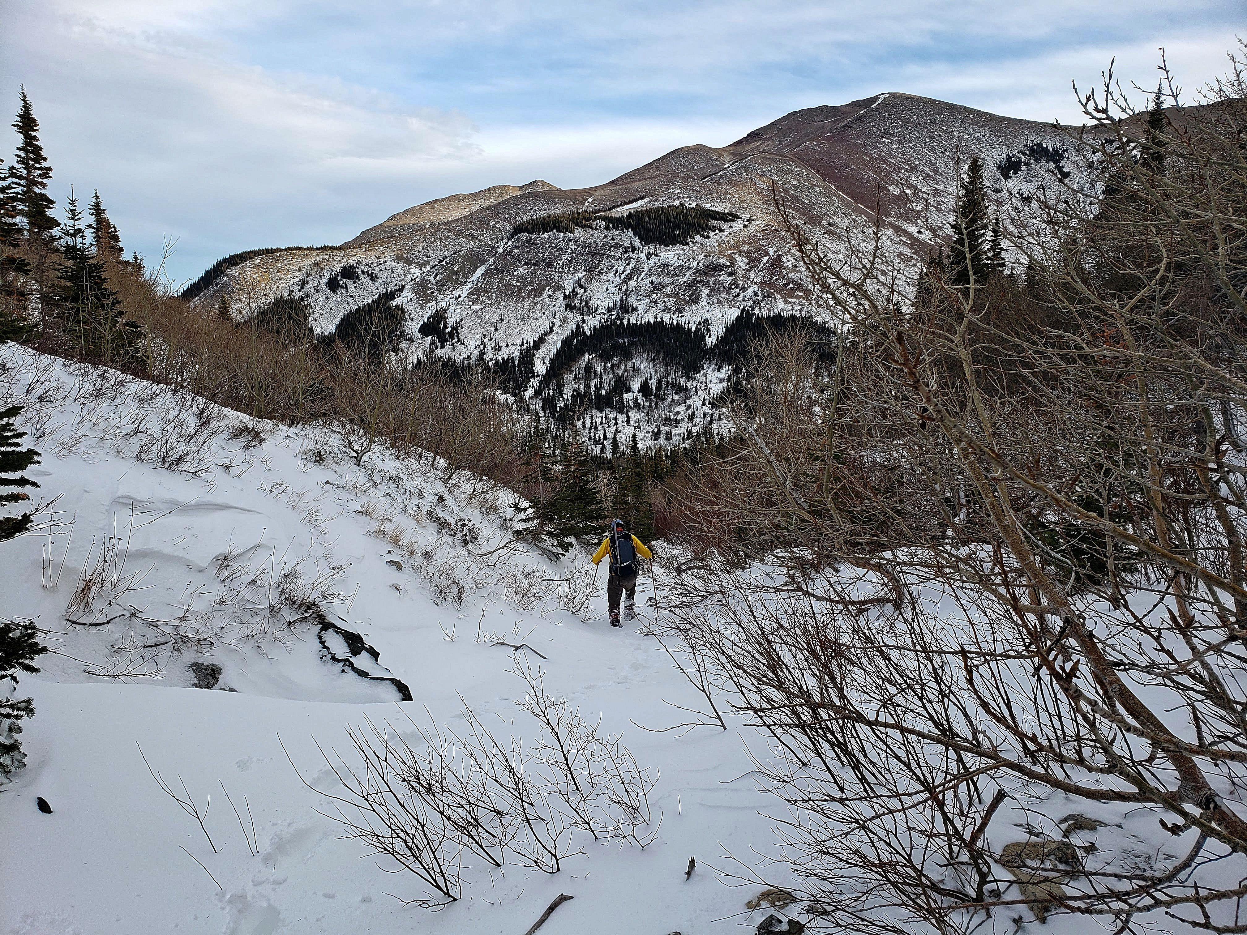
Andrew post-holes a route down the drainage. Thanks Andrew!!
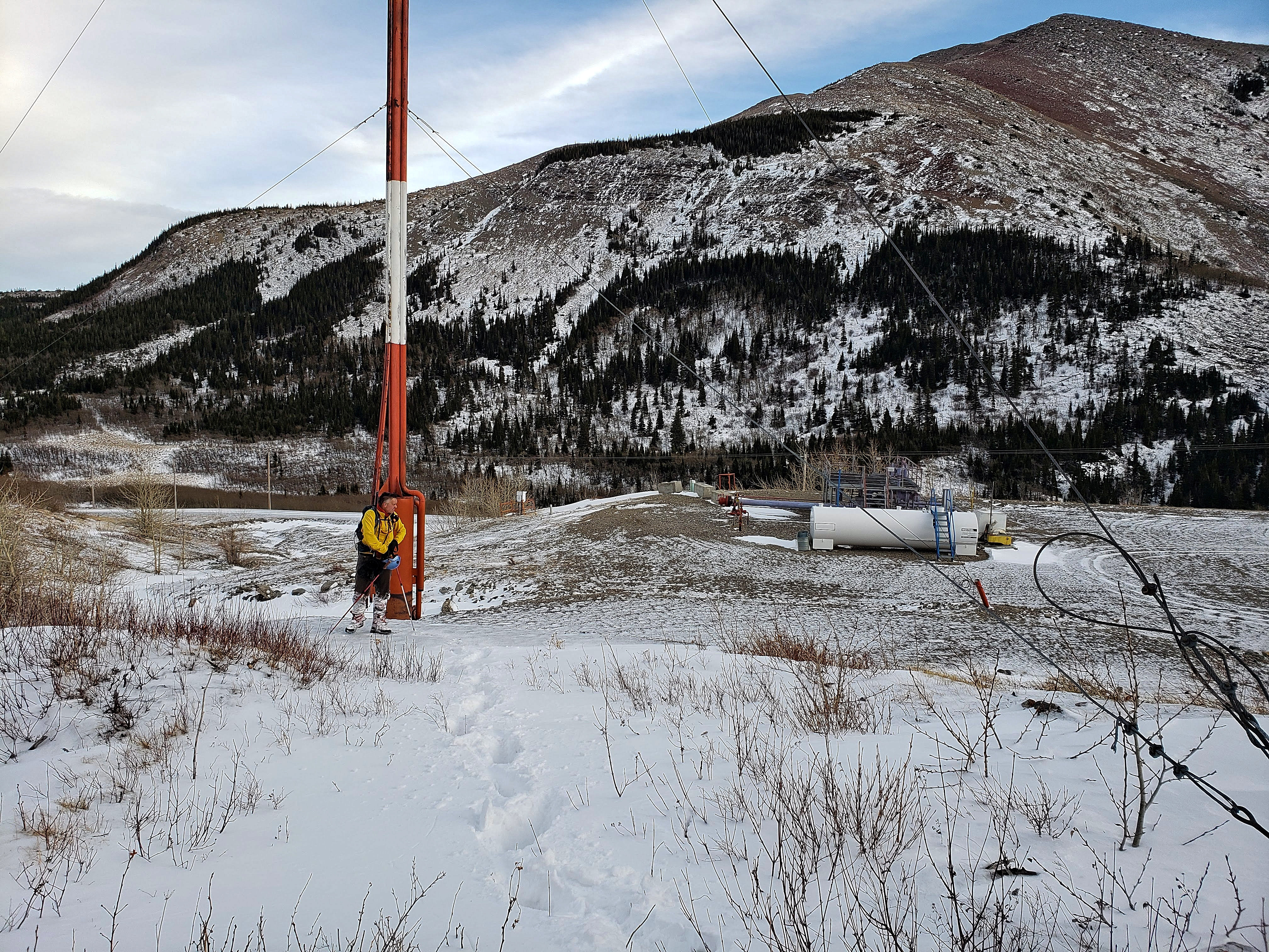
We emerged from the forest at the foot of a flare stack.

Another look at the east face of “The Muffin” as we walk back along the road.

The frozen waterfall that Andrew had explored on his previous trip up “The Muffin”.

Arriving back at the trailhead after yet another awesome day in the mountains with Andrew. Despite feeling under the weather, I’m so glad that we attempted “Bakery Peak”. The scrambling was outstanding and was definitely not something that I was expecting to be able to do in January. As for “The Muffin” and “The Croissant”, these were also fun destinations and the scramble up the east face of “The Muffin” was a blast. I’m really looking forward to returning and will definitely be adding this recipe to my cookbook!