


⚠️ Hiking and scrambling are inherently dangerous activities. Please read my Disclaimer. ⚠️
Heading out following a few days of snow in the mountains, Brad and I were unsure about an objective. Unlike the past few years, this year seems to be moving away from the drought cycle with snow falling more often, especially on the front range peaks. However, while the snow pillow data is within range for the southernmost part of the province, data north of the Crowsnest Pass is below normal; though a few big dumps could change this.
As we were driving and discussing where to go, we finally settled on the front range of the Tatsiki-Miistáki (Castle) which glistened temptingly under the morning sun. Ambivalent about engaging in a long snowshoe, our conversation turned toward taking advantage of the white stuff in the more immediate sense. What about finding a couloir? 🤔
After bouncing around several ideas, we ended up settling on two options: attempting a new route on the northeast face of Prairie Bluff; or attempting a very inviting couloir on the steep northeast face of “Prairie Fire”. Note that I use ‘face’ to describe both due to the extremely steep grade that in the winter, demands that you bring technical gear. Heck, it might even be a good idea to bring it for a summer ascent, just in case.
For us, both routes were appealing, but “Prairie Fire” held a level of mystery because we couldn’t see from the road if there was a clear route to the top. In fact, it looked like there might be an imposing cliff part way up, but as the saying goes, “you don’t know what it’s like until you put your nose in it.” So, off we went to explore “Prairie Fire”.
Knowing from many previous trips that the northeast face of “Prairie Fire” is covered in cliffs and frozen waterfalls, we discussed alternate scramble routes on the east side if our targeted couloir was a ‘no go’. Even as we made the easy hike to the base of the mountain, we were unsure if our chosen route would work. In fact, it took us arriving at the base of the couloir to make the decision to proceed.
Sometimes a route looks impossibly steep and then when you get closer, it lays back and it’s not as bad as you thought. This route fell somewhere in between. At first it looks incredibly steep, and then from the base it appears to lay back, but once you commit, you quickly realize that it’s much steeper than you thought. Indeed, even the upper section appears to lay back, but it never actually does.
In short, this ended up being an incredibly fun route with the lower section of the couloir requiring three belays while the upper section required forging a path through the trees – often in waist-deep snow. Indeed, even until the very end, this little mountain never gave up the fight, requiring us to make a steep climb up and over a large cornice to reach the summit.
Again, Brad was a machine. Not only did he expertly climb lead, he channelled his inner Ronnie Coleman yelling, “Lightweight baby!” as he fought through deep snow on the upper section of the mountain. I of course, was more than happy to follow as it made my ascent ten times easier than his. Thanks Brad! 😀
As with the northeast face of Prairie Bluff, this route was a short, but fun mountaineering adventure. Both of us agreed that it was steeper and more advanced than the northeast face of Prairie Bluff, but the fantastic rock within the couloir provided anchor points that if required, could have been used to rappel.
Finally, these small peaks on the front range have so many options to get to the top – including fun technical routes such as what we did today. If anyone wonders why I keep posting about the front range peaks, this is why. The absolute variety of routes within a short distance of Lethbridge, makes this an almost infinite playground to explore. 🤪


To get to “Prairie Fire” we drove north from Waterton National Park on Highway 6 until we reached the Shell Waterton Complex Road (Township Rd. 43A). We then turned onto the road and drove west for ~9.1 km until we came to a junction with a gravel road near to the entrance of the plant. Here, we turned left and onto the gravel road where we continued for ~7.2 km until we came to a large pullout with a gate on the left side of the road. This is where we parked and where the trailhead began.
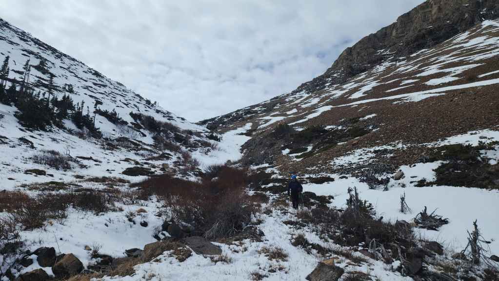
From the trailhead, it was merely a matter of heading straight towards “Prairie Fire”. At first, we followed an old road for a short distance before leaving it to head overland; keeping the mountain directly in front of us. Eventually, we came to fence and a gate that led to a trail that ran directly between “Prairie Fire” and Prairie Bluff. The start of the couloir was not far from here and for reference, it was ~2.1 km from the trailhead to the entrance of the couloir.
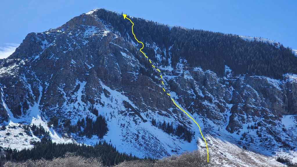
The couloir was steeper than it appeared and from the entrance to the summit, it would gain 340 m in elevation over ~650 m of distance. The lower part of the couloir had two ice steps and required three belays. The upper section consisted of waist-deep snow that required us to skirt to climber’s right and ascend through trees located next to it. For reference, it was ~2.75 km from the trailhead to the summit with an elevation gain of 615 m.
From the summit we descended to a drainage located to the southwest and then proceeded to follow it to a second drainage than ran between “Prairie Fire” and “Prairie Sky”. We then circled the base of the mountain until we were back on our approach route. For reference, from the summit back to the trailhead, it was a ~4.2 km hike over 1 hour and 40 minutes.
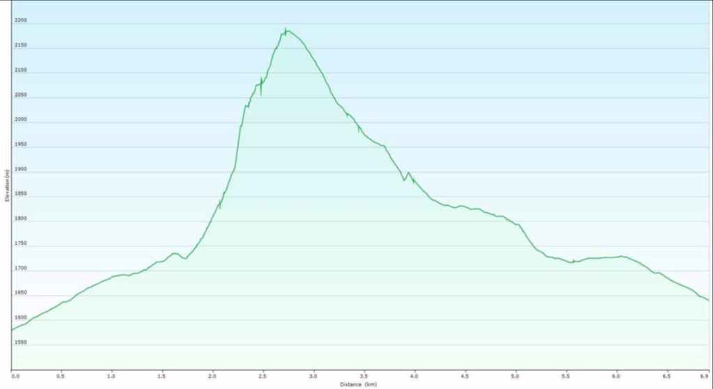
Our total roundtrip distance was ~6.9 km over a time of 6 hours and 40 minutes. Total elevation gains came in at 644 m. For reference, it took us 1 hour and 50 minutes to climb the lower section of the couloir followed by an additional 2 hours to reach the summit.
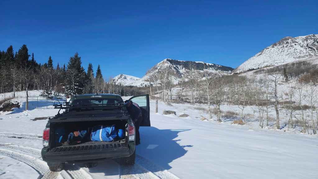
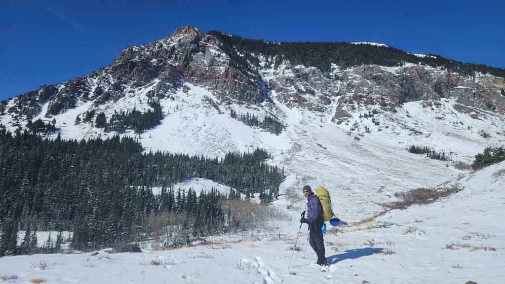
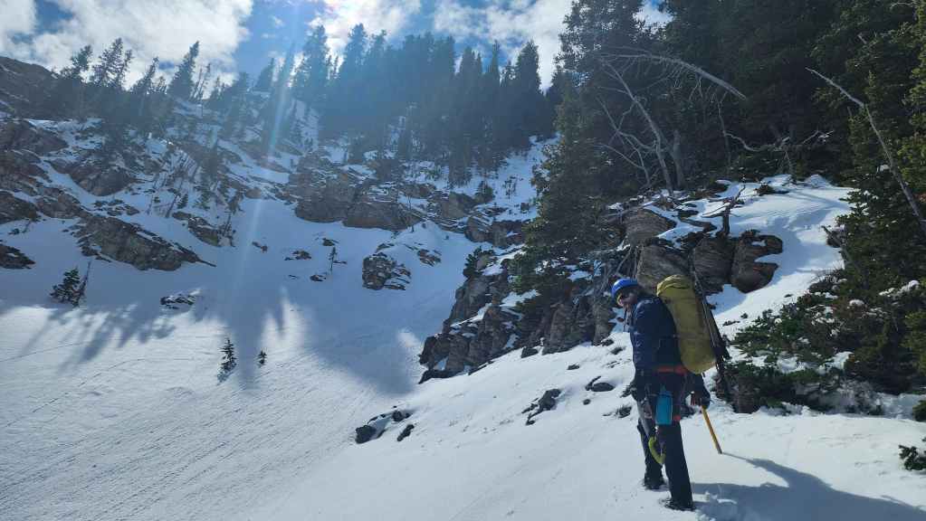
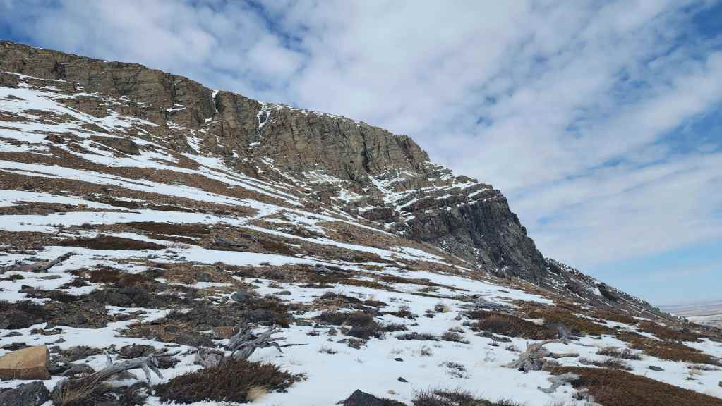
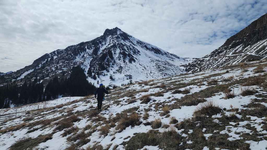
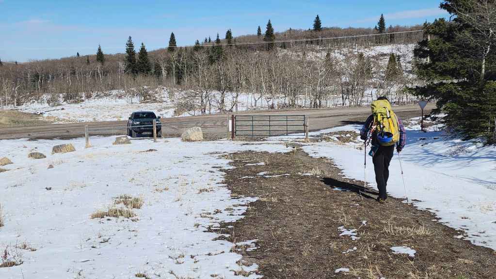
Gearing up at the trailhead. The northeast face of “Prairie Fire” is to the right of centre.

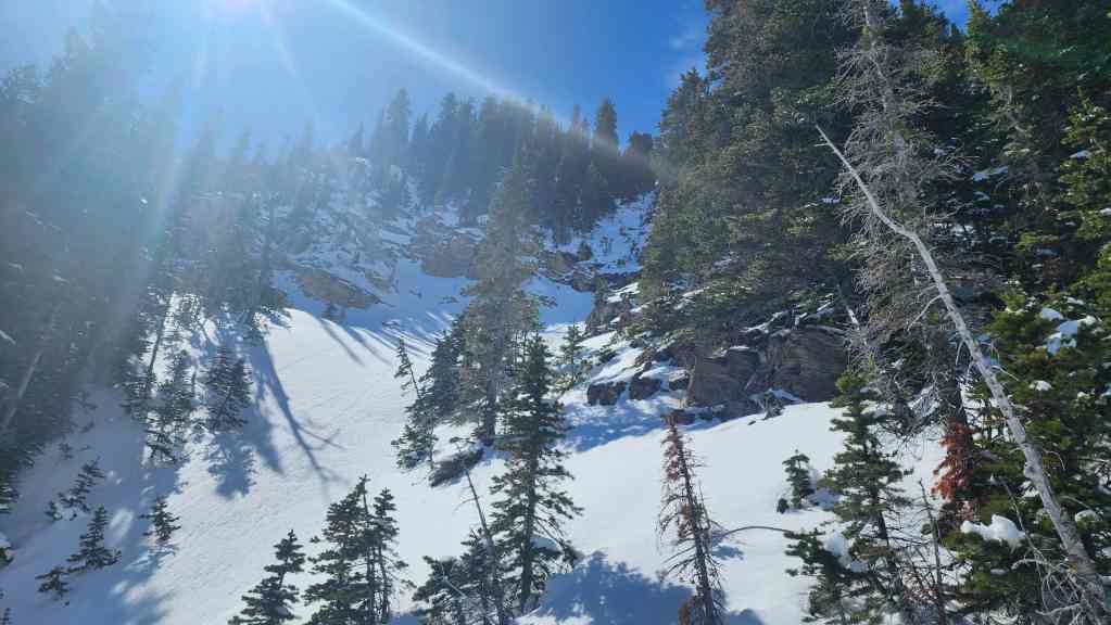
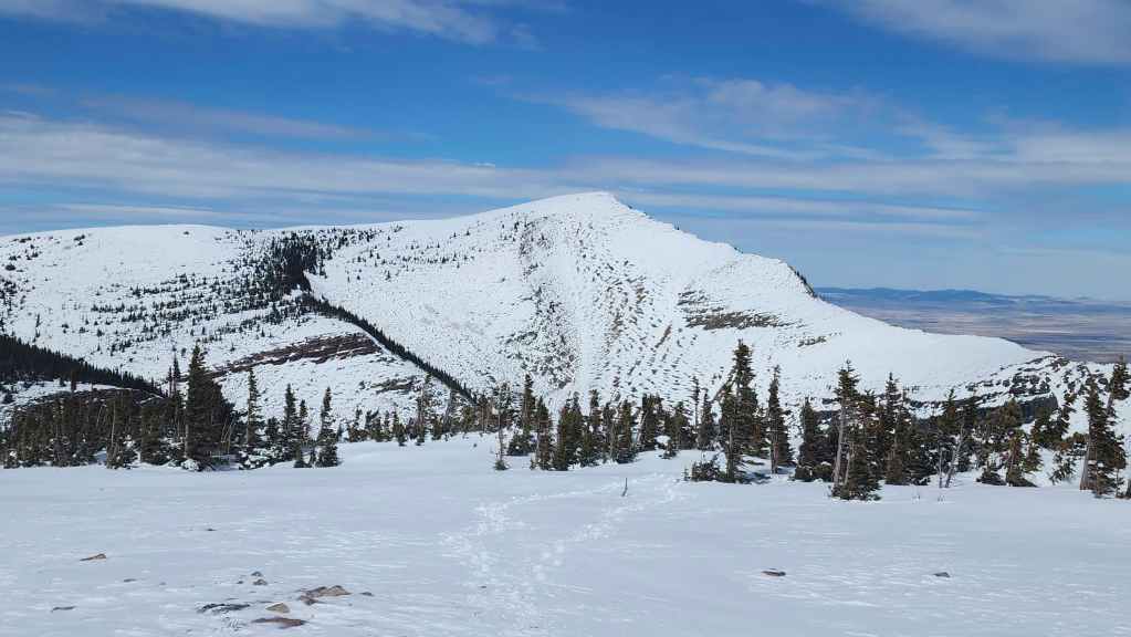
A closer look at the northeast face and the mystery couloir. From the trailhead, we couldn’t determine if it would go, but we were willing to try! 🙂
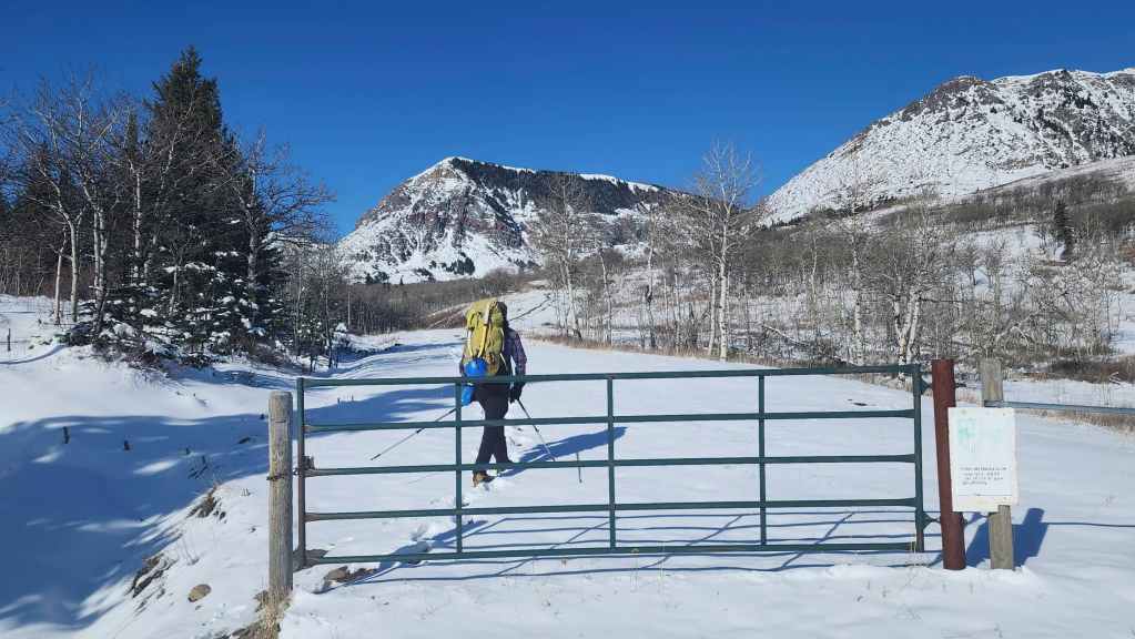
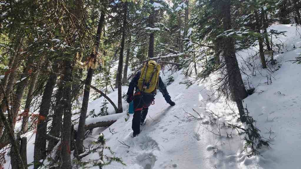
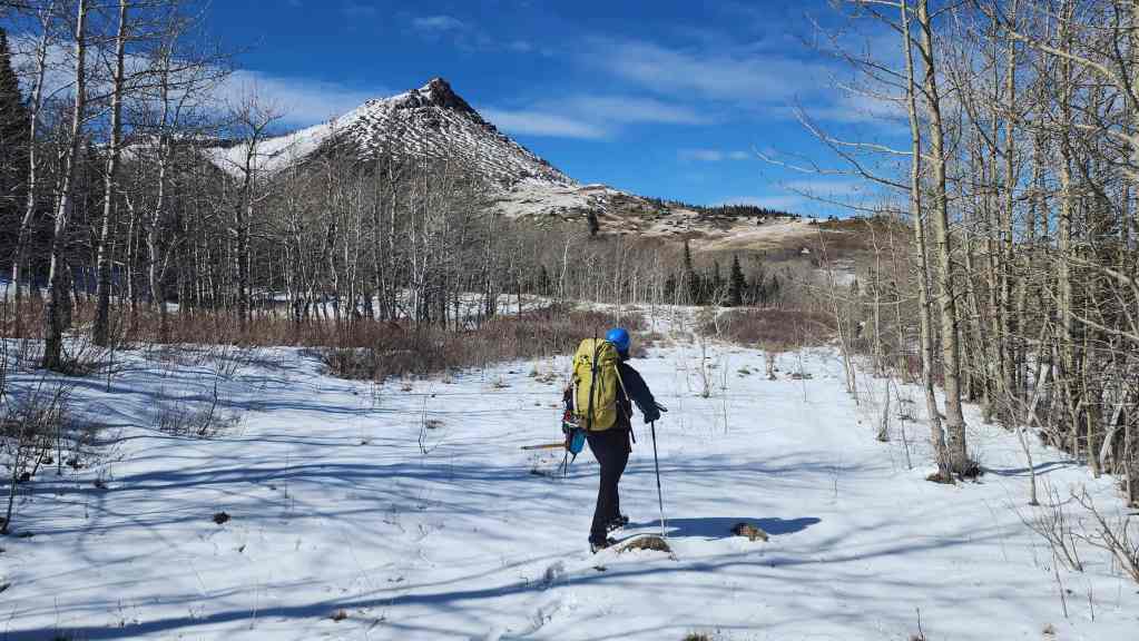
Starting out along an old road.
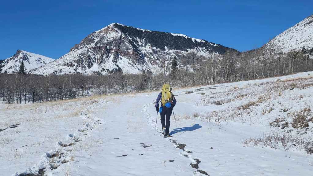
We’d follow the road for a short distance before leaving it to continue in a straight line towards the mountain.

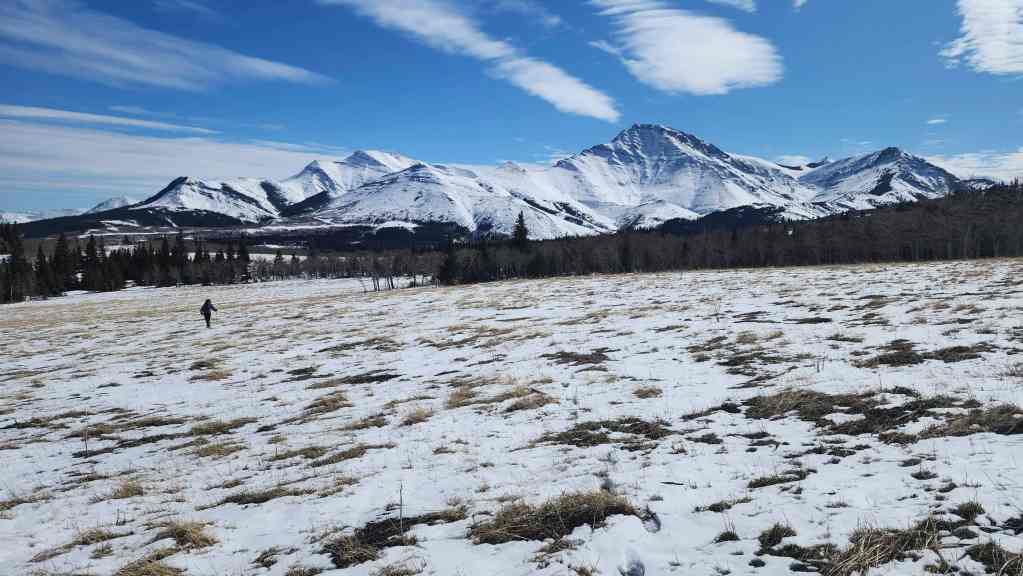
It was an absolutely gorgeous morning!
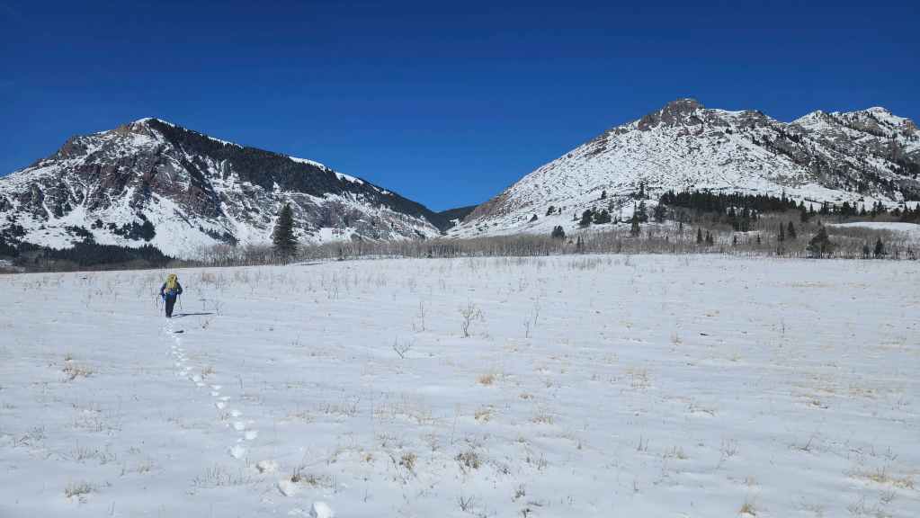
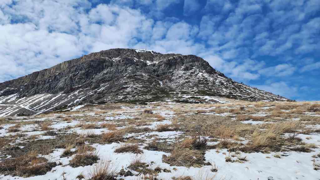
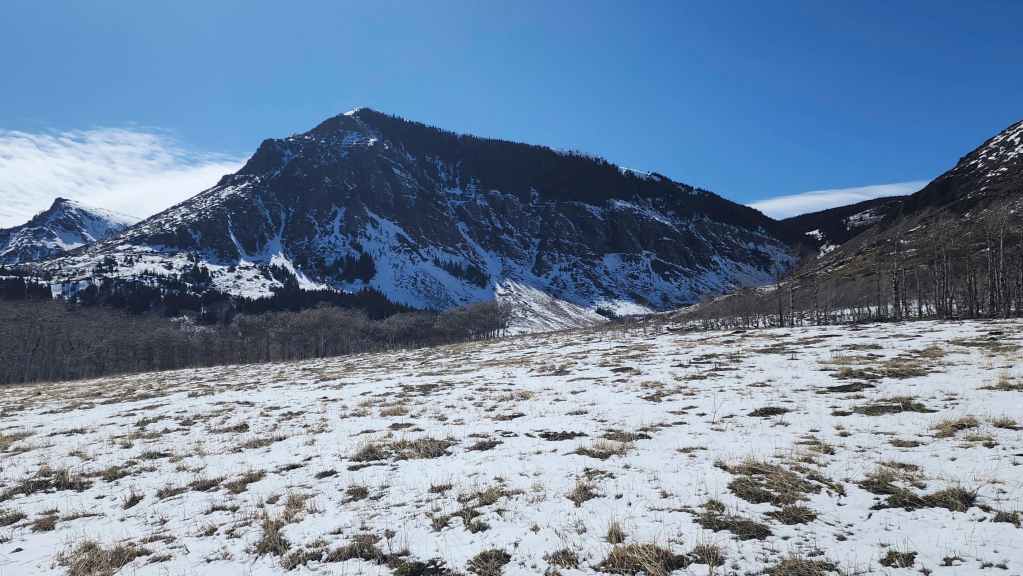
“Prairie Fire” on the left with Prairie Bluff on the right. We’d considered attempting a new couloir on the northeast face of Prairie Bluff, but the one on “Prairie Fire” was too tempting to pass up.
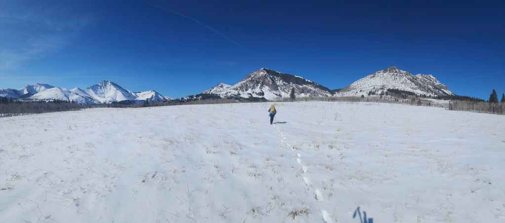
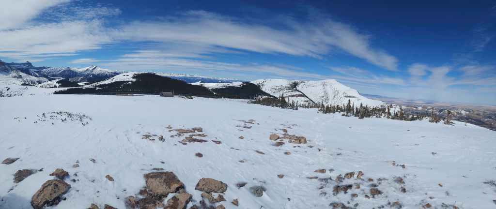
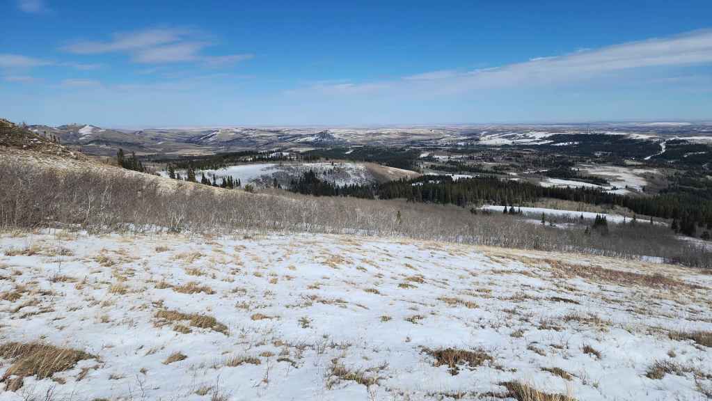
It’s not often that snow covers – and then sticks around on the front range peaks. In the background is Drywood Mountain (left) with “Cinch Hill” and “Bridle Peak” directly in front of it. Pincher Ridge is in the centre with “the Horn” on the right.

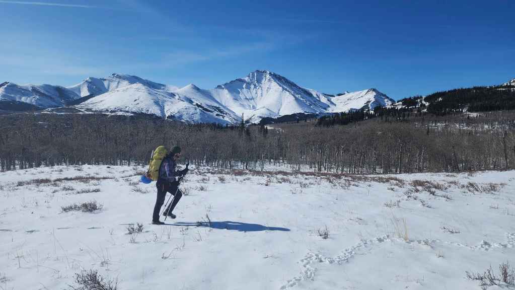
Approaching the northeast face.
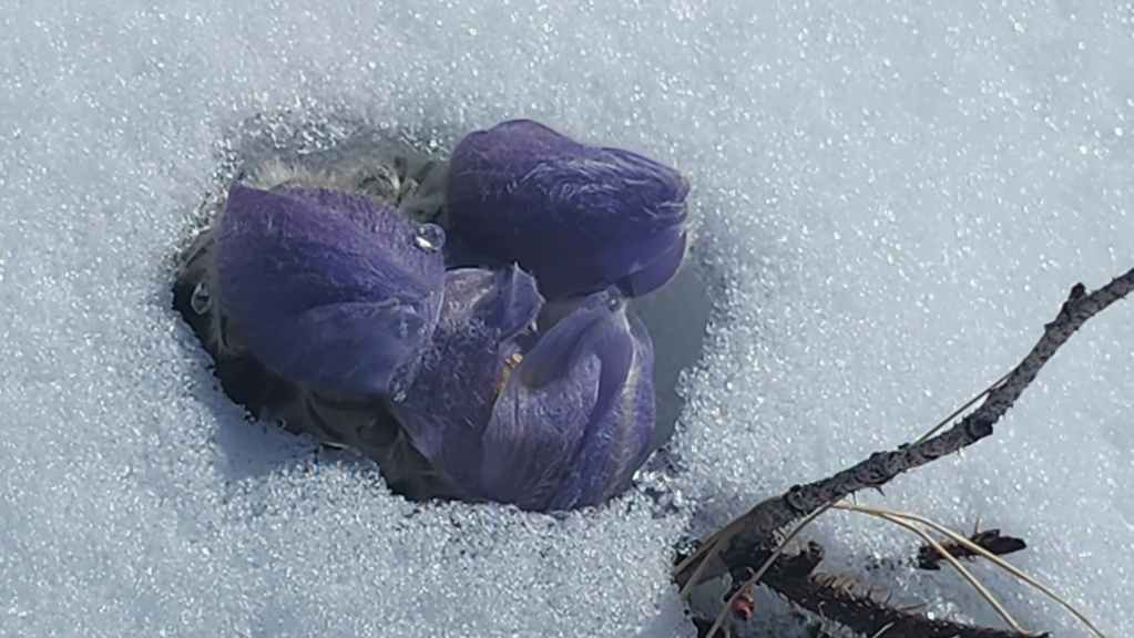
A pasqueflower emerges through the snow. Spring is coming!
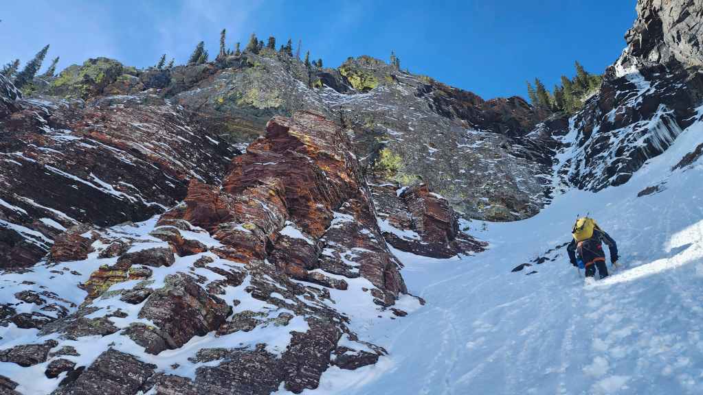
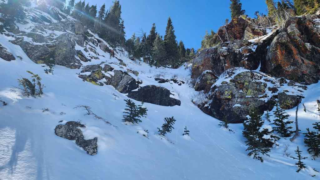
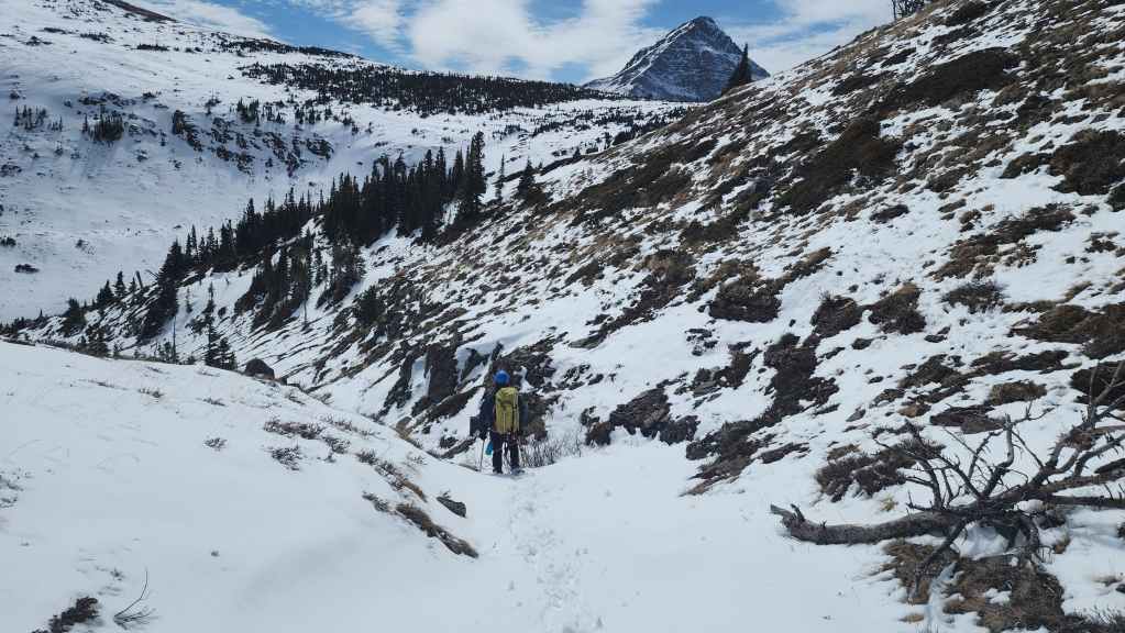
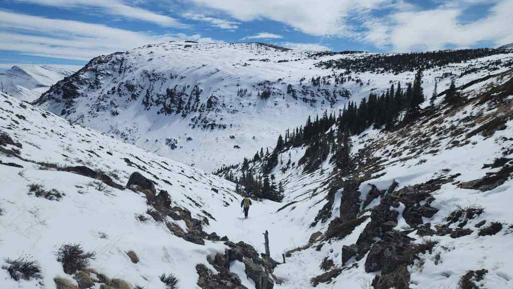
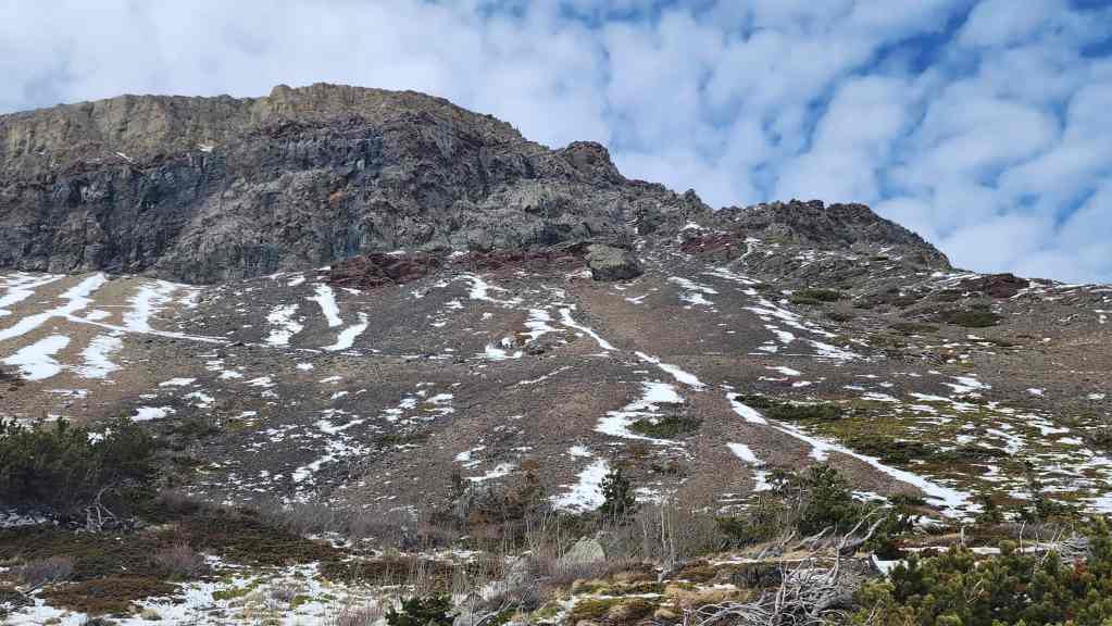
At this point we began to discuss other options in case the couloir (centre) didn’t work. These included using one of several couloirs on the left to reach the east side of the mountain.

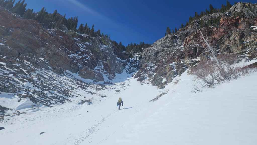
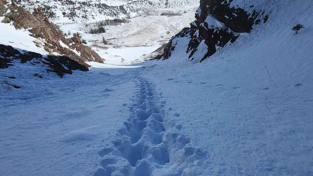
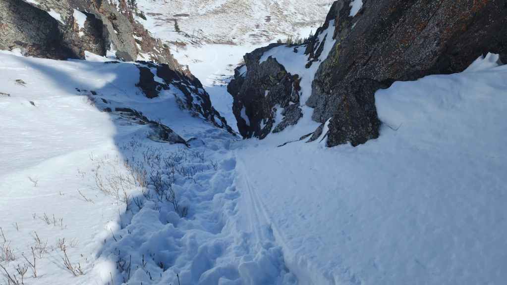
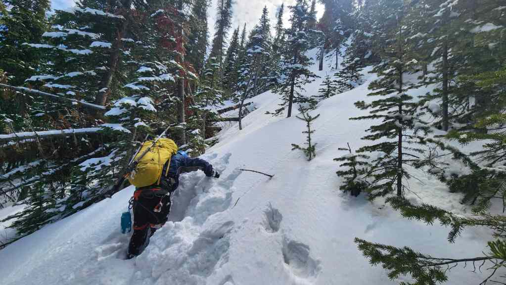
Looking back as we head up to the entrance to the couloir.

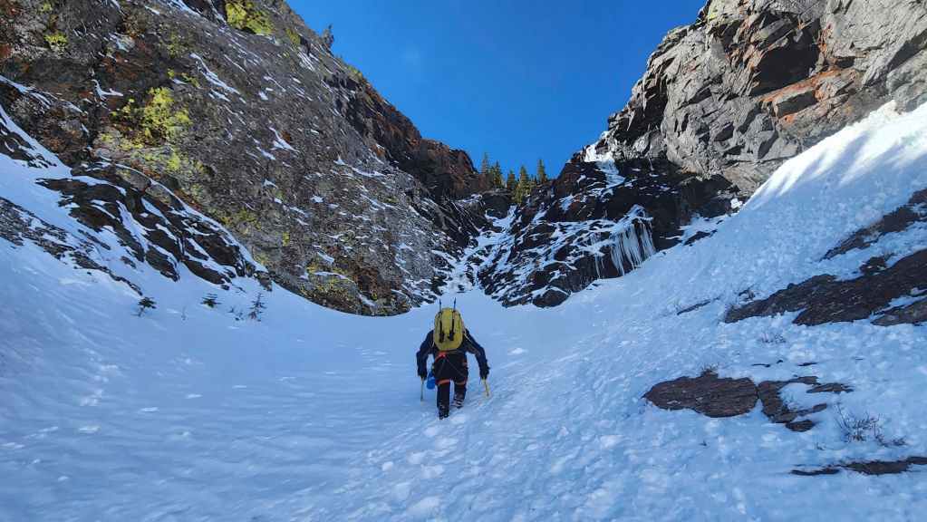
A closer look at the couloir. From here it started to look like it would lay back – and it did, but not as much as we thought it would. In fact from this angle, the upper section through the trees looks quite tame, but it too is incredibly steep.
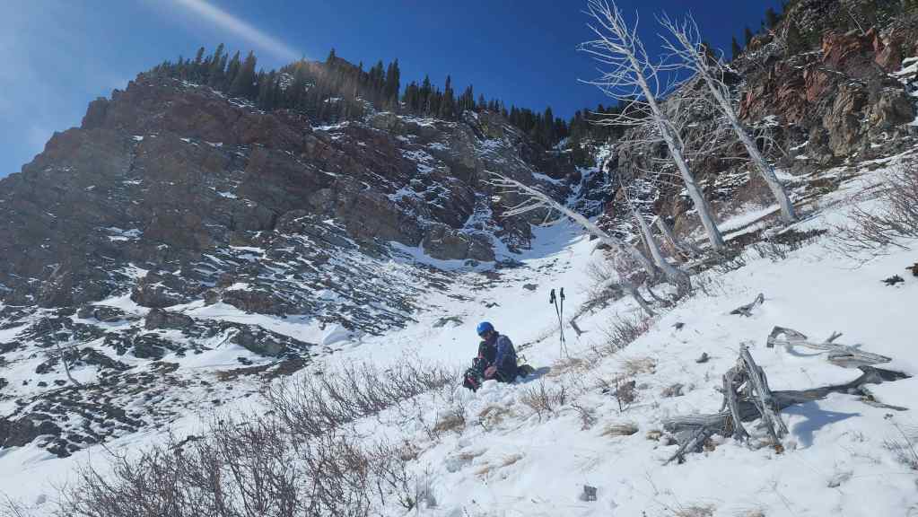
Gearing up at the entrance to the couloir.
As he did throughout the day, Brad leads the way.

A telephoto of the previous image.
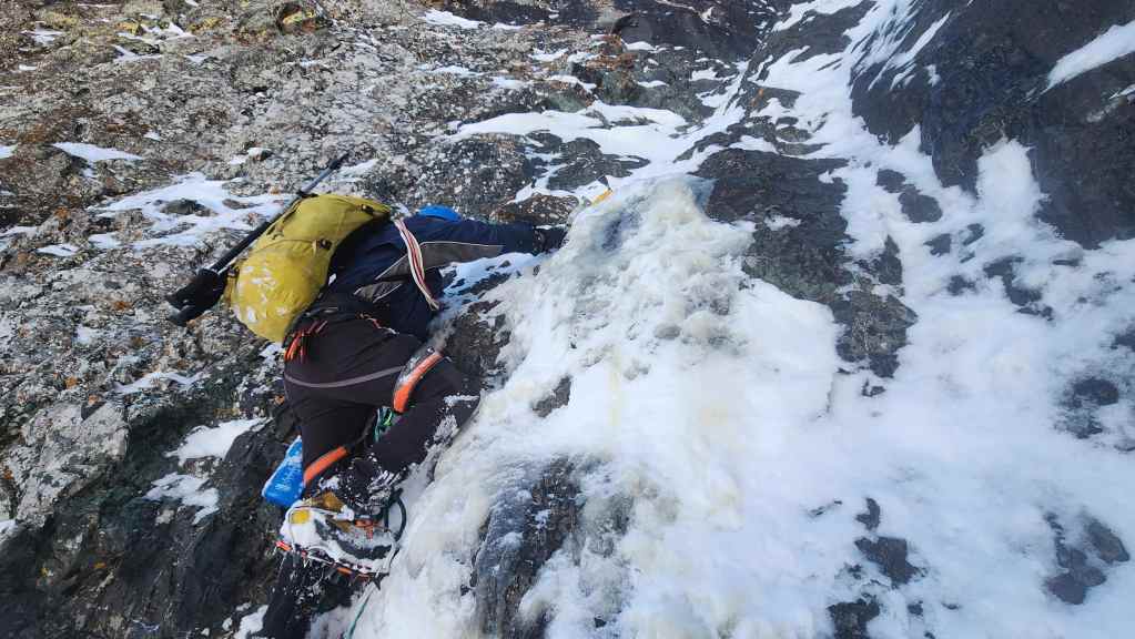
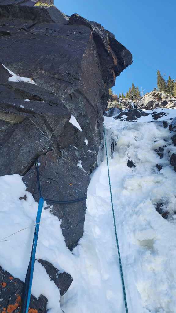
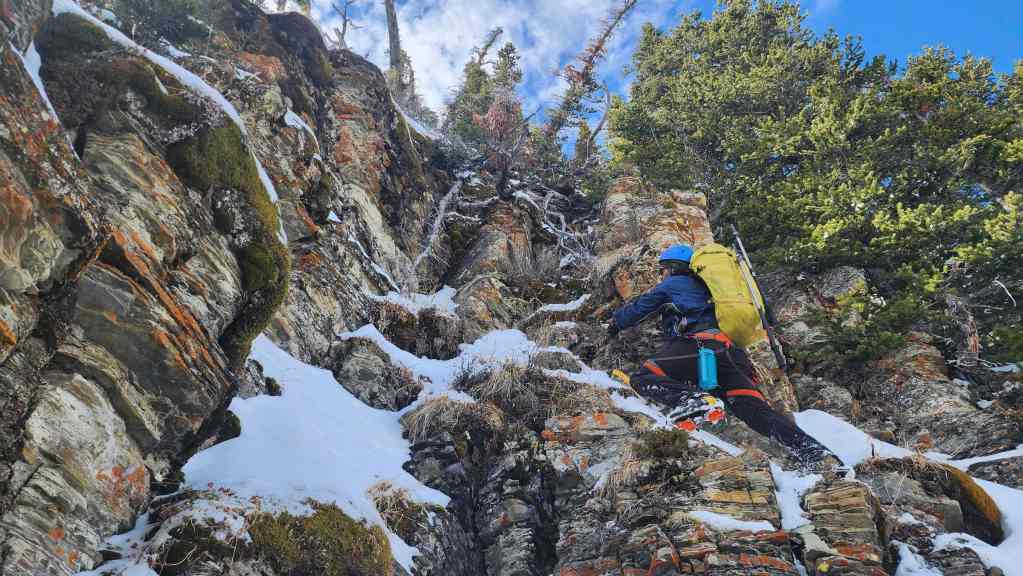
This photo shows how steep the terrain really was. It also highlights some of the stunning rock that surrounded us inside the couloir.
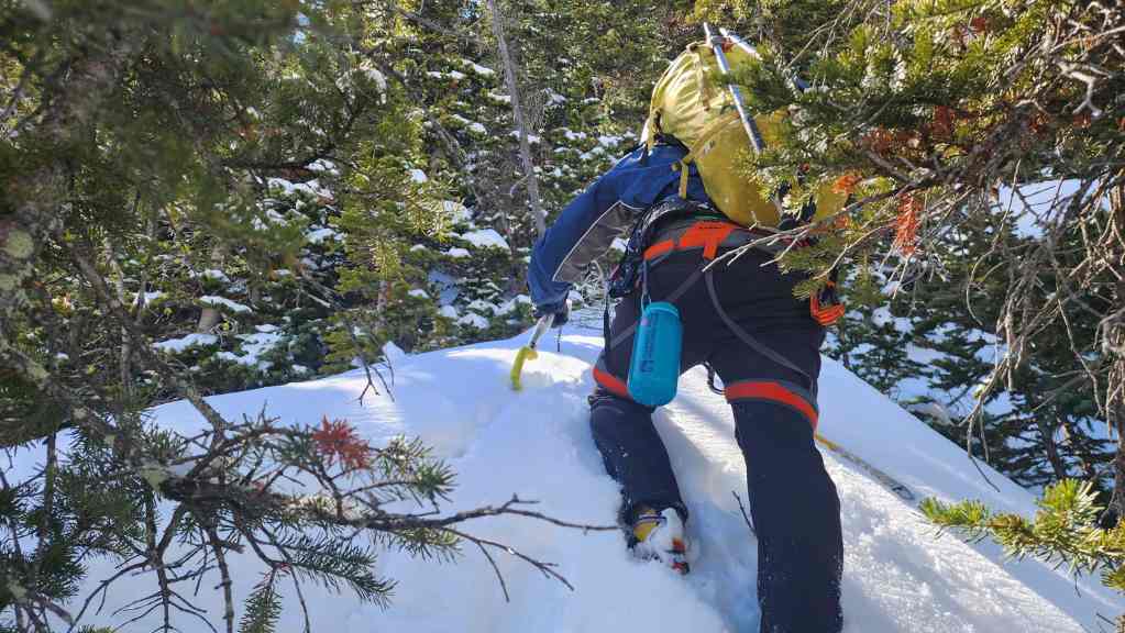
Approaching the start of our technical ascent.
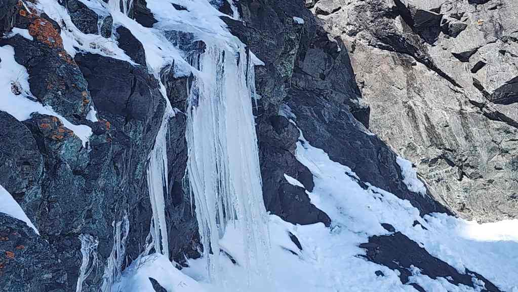
A cool collection of icicles.
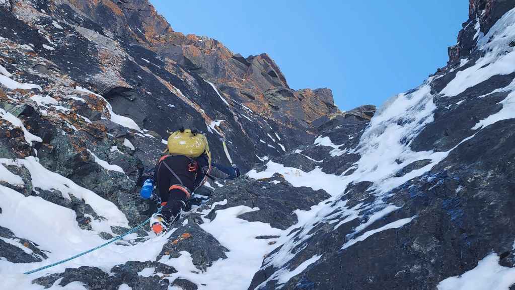
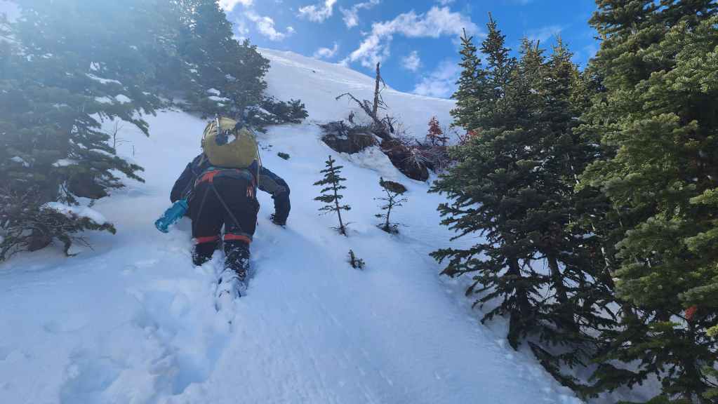
Wading through deep snow to get to the first of two separate ice steps.
A quick look back.
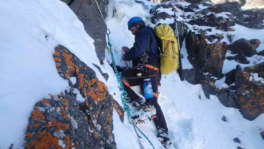
Brad tests the ice and assesses the possibilities.
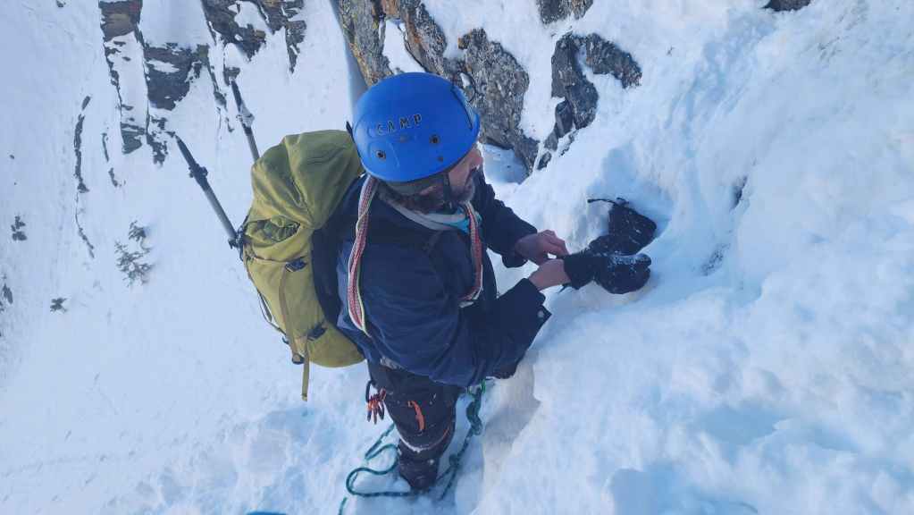
Getting ready to start the climb.
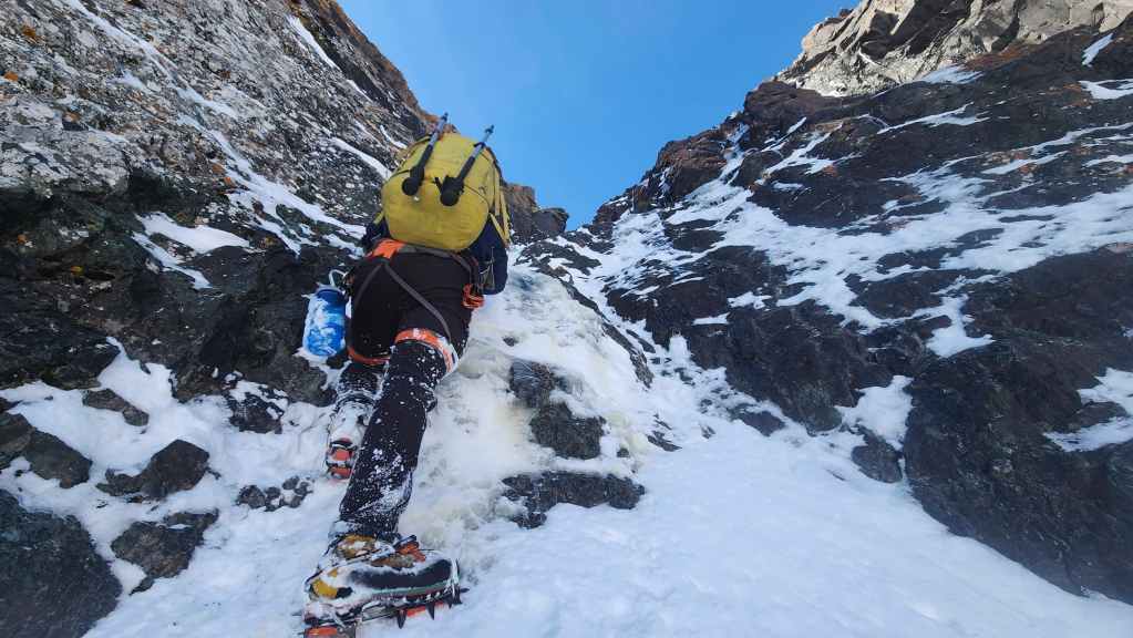
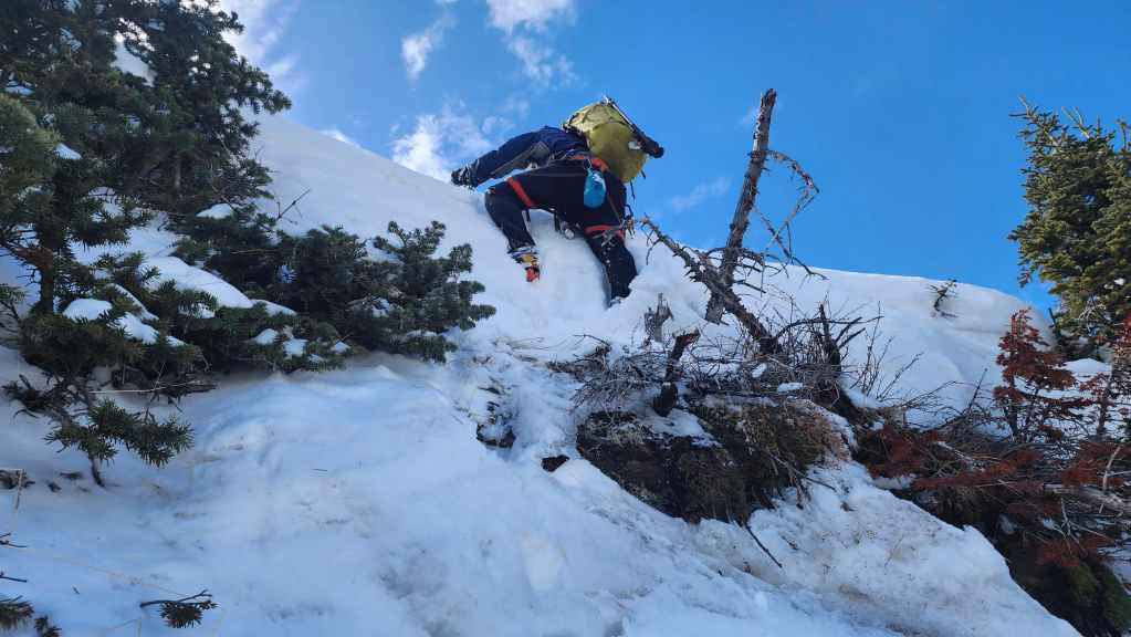
Brad expertly climbs the step.

Still going. Again, it was steeper than it appears.

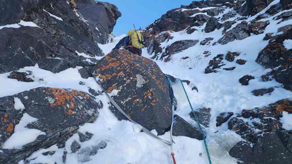
Brad searches for place to set the first anchor.
Still looking…
My view as I prepare to climb. Brad is anchored in and ready to belay. 🙂

Brad’s view as I climb toward him. (Photo by Brad Wolcott)

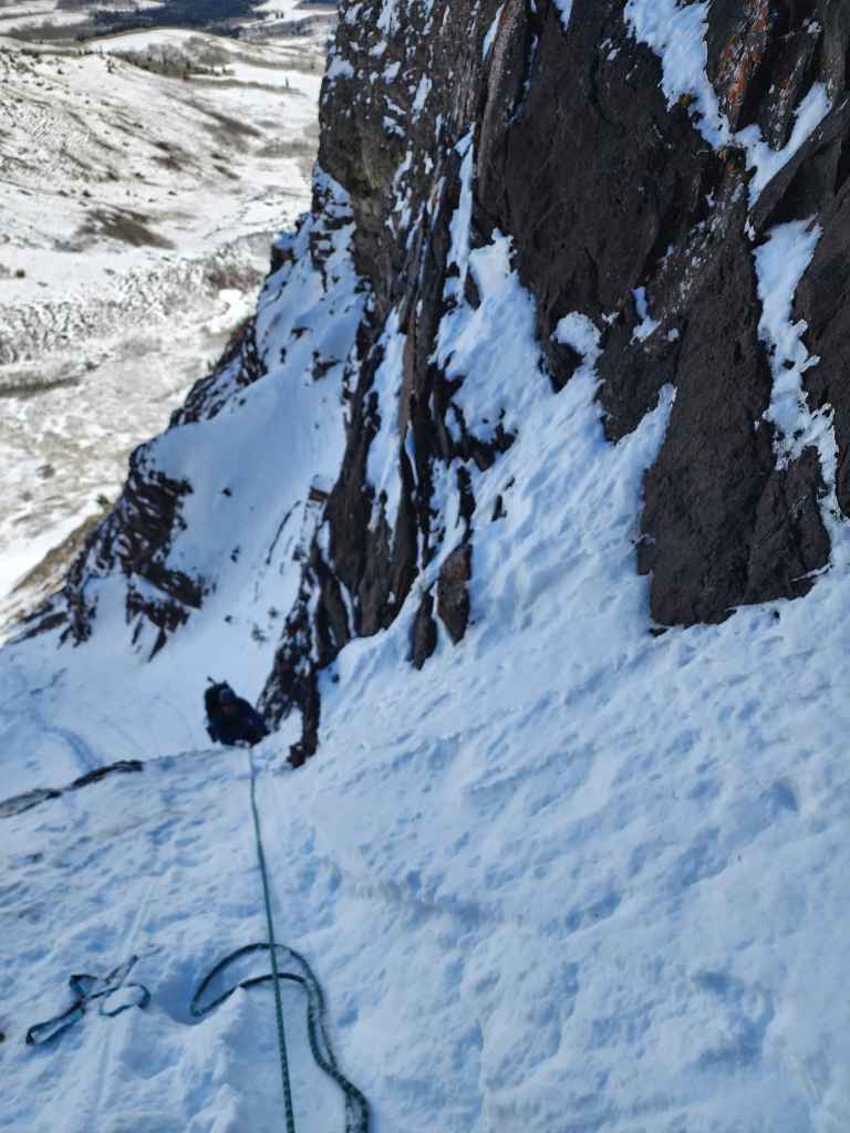
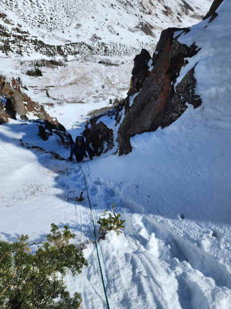
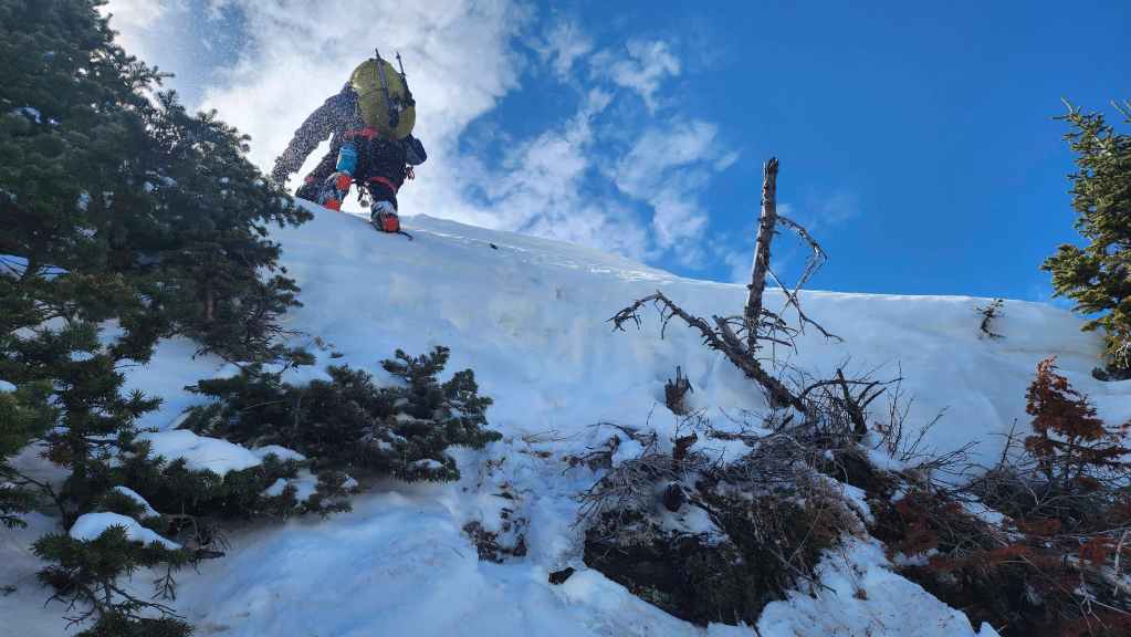
I arrive at the first belay. Again, this photo accurately shows the grade of the terrain.
I belay as Brad heads up to find another anchor point.
After belaying me to the second anchor, Brad prepares to climb over the second ice step.

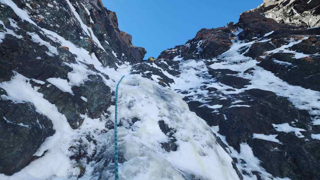
My view over the second ice step after belaying Brad to the third anchor.
Brad’s view as I reach the top of the ice step. (Photo by Brad Wolcott)
My view up to Brad after clearing the step.
Another view down to me. (Photo by Brad Wolcott)
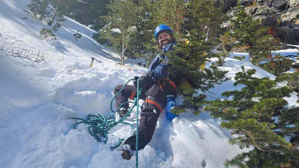
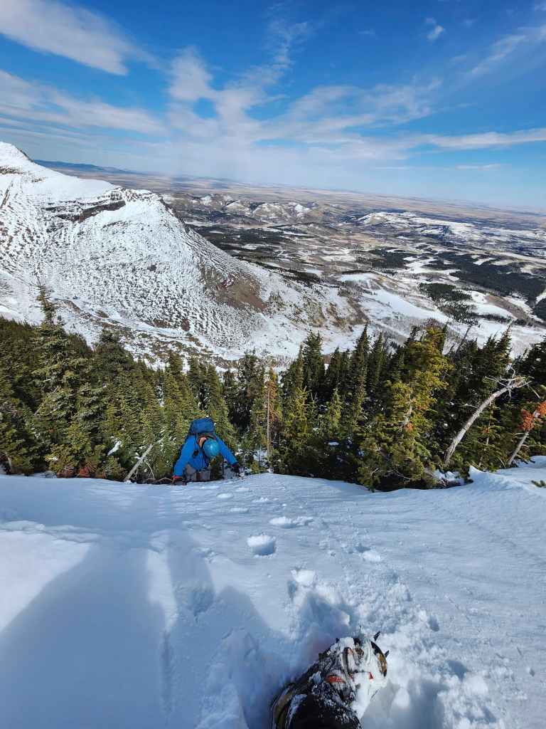
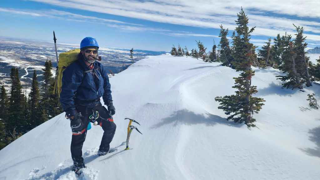
A man completely in his element! 🙂 After entering the couloir, it took us 1 hour and 50 minutes to get to this point.
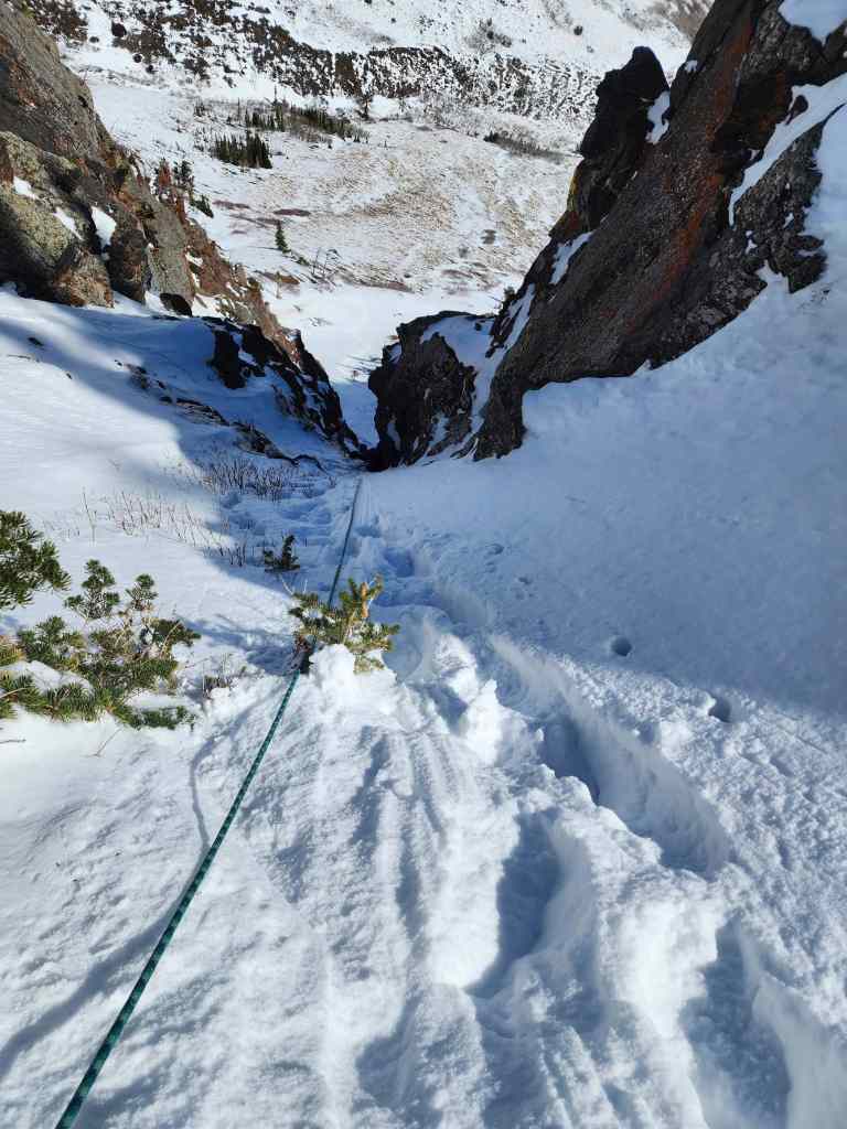
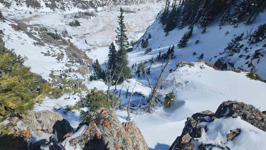
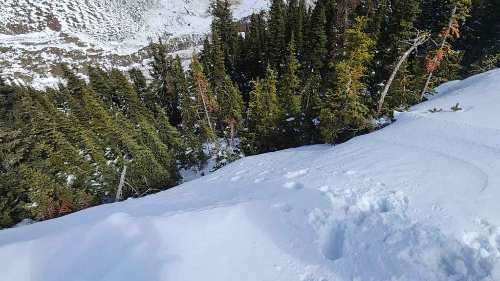
One more look back. The lower section of the couloir is steep enough, that you can’t see any of it from above.
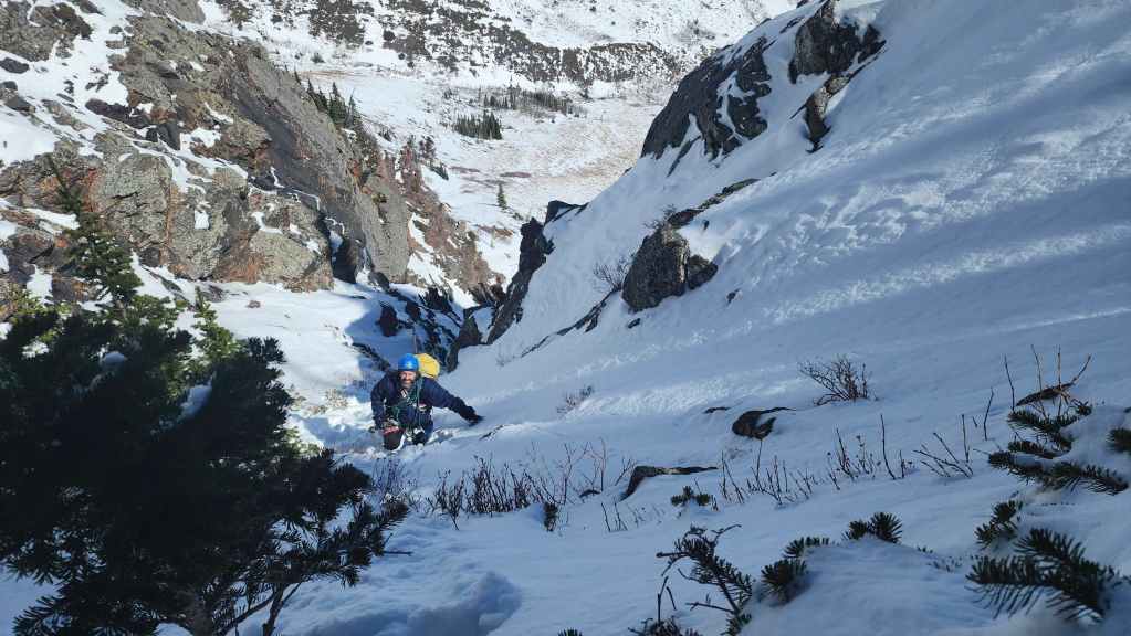
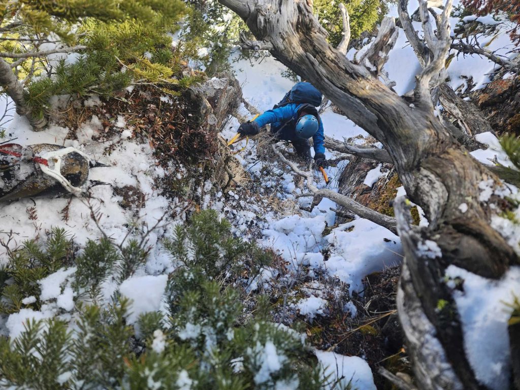
At this point, we thought the hard part was done. However, the upper section did not lay back as we thought it would. Coupled with the steep grade the couloir was also full of waist-deep snow.
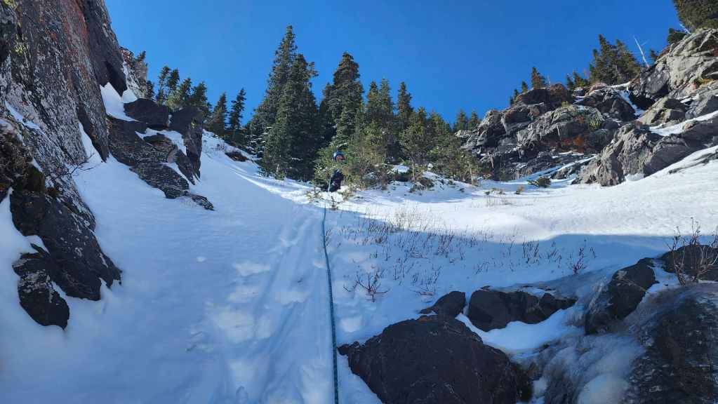
Looking up as we continue along the couloir. It will take an additional 2 hours to reach the summit from here.
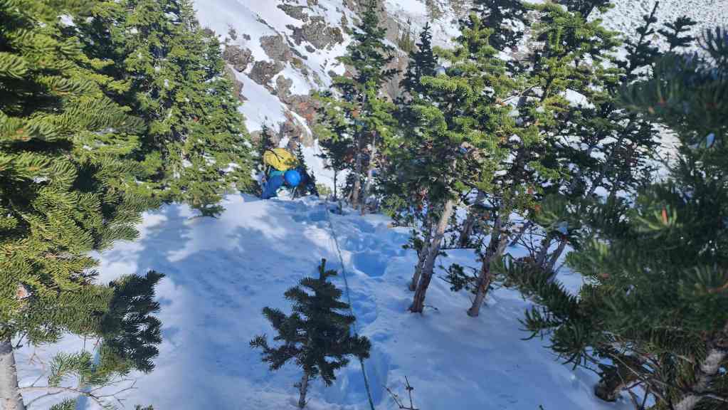
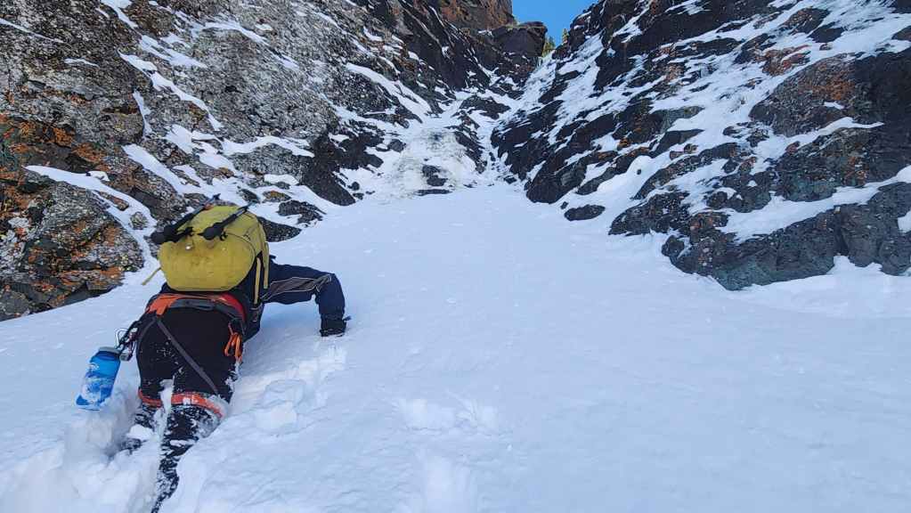
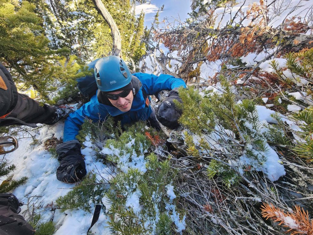
Swimming from tree to tree.
The snow was so deep, that it was almost impossible to make headway by staying inside the couloir. Here, I use a patch of vegetation to try and gain some footing. (Photo by Brad Wolcott)
We finally came to a natural traverse that could lead us to the east side of the mountain. However, given how deep the snow was, it seemed like the better choice was to keep to climber’s right of the couloir.
Gazing down while enjoying lunch in the sun…
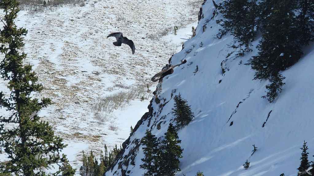
Suddenly, we saw (and heard) a raven attacking a bird of prey – quite possibly an owl, though it was hard to tell.
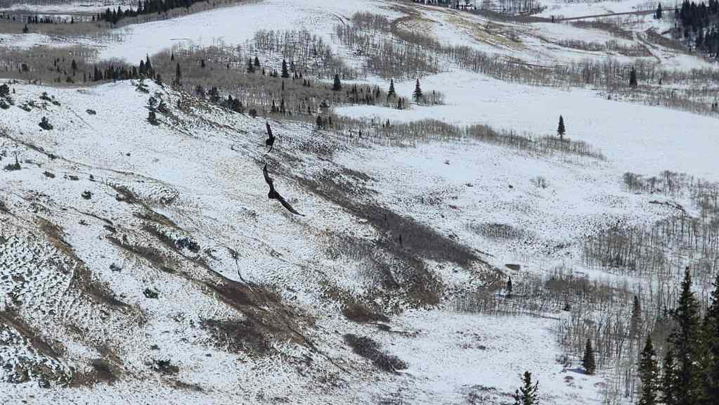
The two continued their battle until they were no longer in sight. I wonder ‘who’ won? 😂

Looking east from our lunchtime vantage. (Photo by Brad Wolcott)
Still considering whether we should make the traverse to the east. However, the thought of slogging through waist-deep snow made sticking to the trees beside the couloir more appealing.

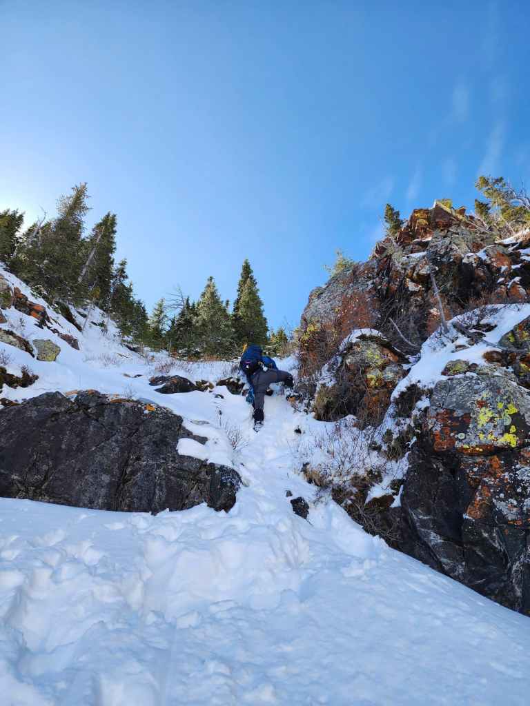
Approaching a small cliff band that we ascended to climber’s right.
Brad scrambles up the cliff. He will have to remove his pack and squeeze underneath a tree to make it to the top.
I follow close behind… (Photo by Brad Wolcott)
And somehow manage to make the squeeze while wearing my pack. (Photo by Brad Wolcott)
Brad continues to lead as we head through the trees.

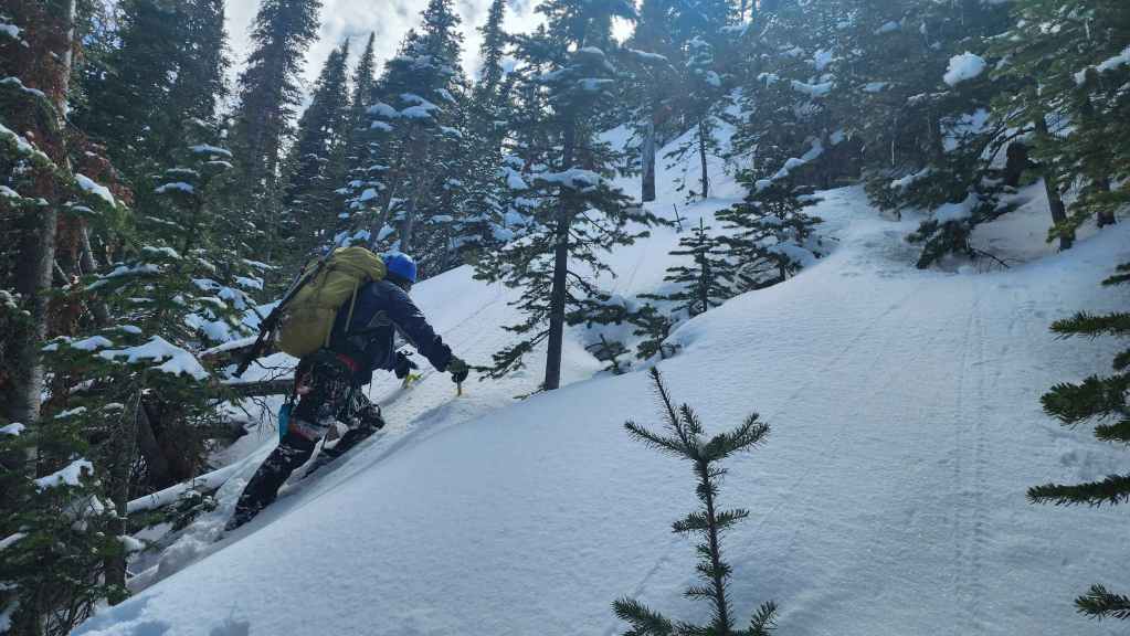
Every time that it looked like the terrain would ease – it didn’t. It was damn steep the entire way.
Traversing towards the final section of the couloir…
Where Brad continued his Herculean trailblazing.
Getting close…
With one final push needed to reach the summit.
Finding a way above the cornice took some effort…
But Brad finally does it!
As with most of the day, all I had to do was follow his steps. 🙂 (Photo by Brad Wolcott)
Looking back from the cornice.
What an amazing climb! All thanks to Brad’s expert lead. 👏
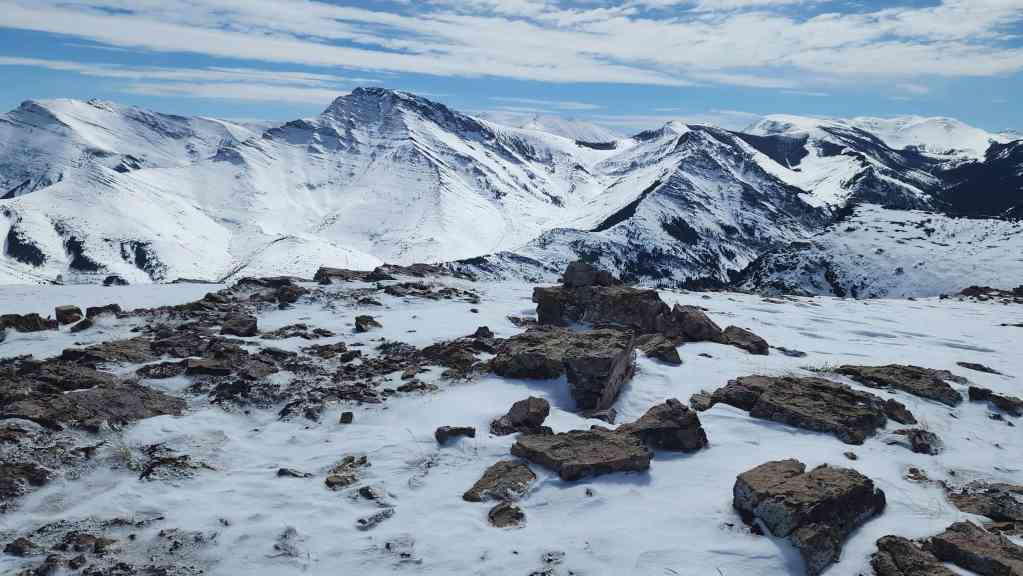
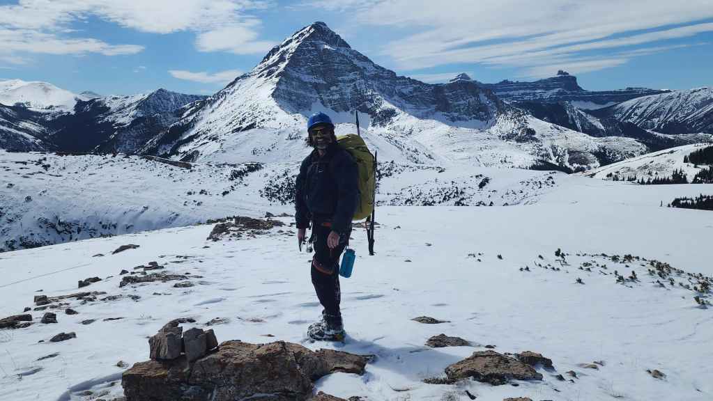
A small cairn sits on the summit of “Prairie Fire” (2131 m)

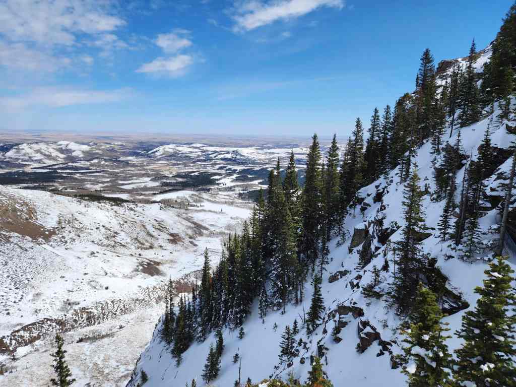
A pano to the southeast…


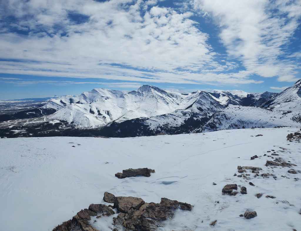
And then one to the southwest.

Finally, a pano to the west.
The view over to Prairie Bluff.

A closer look at Pincher Ridge.
“The Horn” is foreground left with the Centre Peak of Pincher Ridge behind it. The South Peak of Pincher Ridge is in the centre with Victoria Ridge on the right.
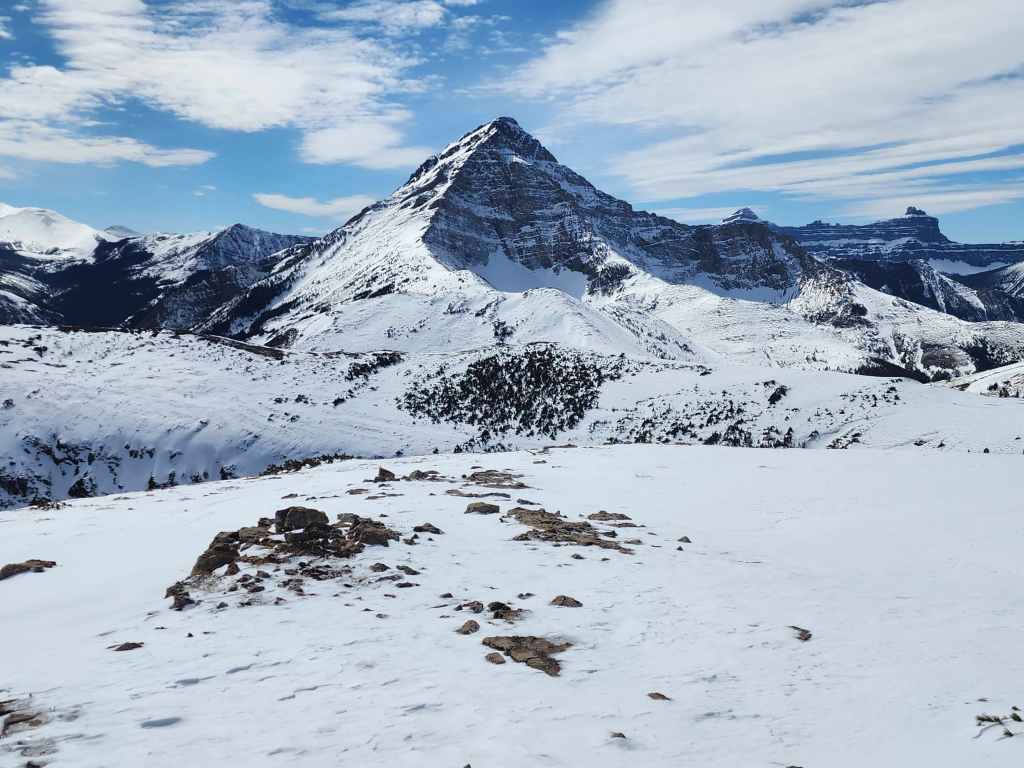
The summit offers an outstanding view of Victoria Peak (centre). Windsor Mountain and Castle Peak are on the right. (Photo by Brad Wolcott)
The often overlooked, “Prairie Oyster”. 😂

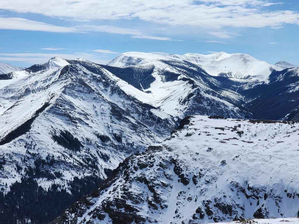
Gazing over to “Mill Creek Peak” (centre), “Mill Creek Mountain” (left of centre), and North Castle (distant centre).
The man. The myth. The legend.

This was my third time on the summit of “Prairie Fire”. (Photo by Brad Wolcott)

Beginning our easy descent. “Prairie Storm” is the small peak directly in front of Victoria.

One more look at Victoria Peak. (Photo by Brad Wolcott)
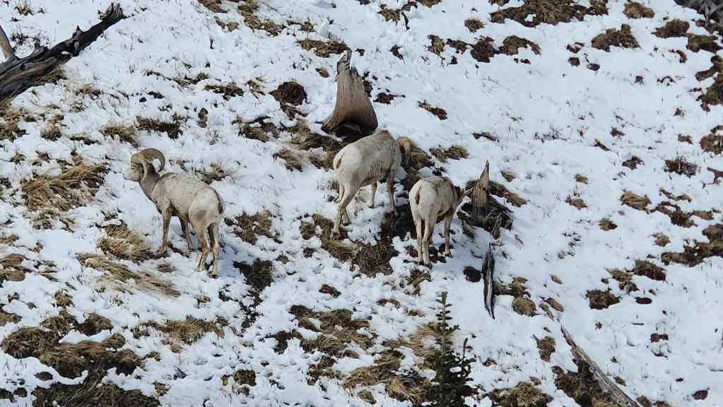
We encountered a herd of sheep, including a large ram (centre) wearing a tracking collar.
Descending the drainage.

More sheep.
Continuing along the drainage towards “Prairie Sky” (centre).
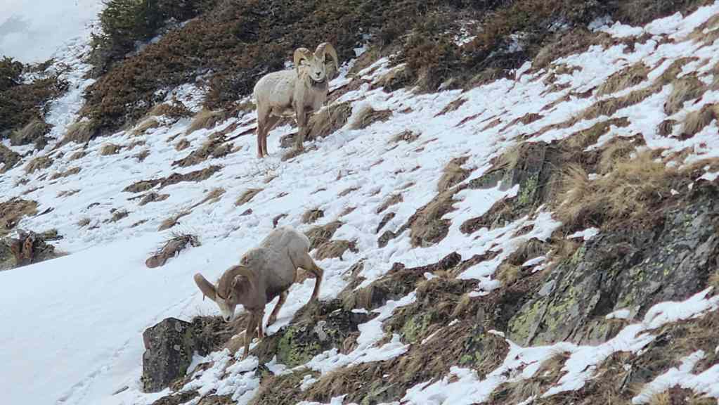
Though we had to pass close by, the sheep paid zero attention to us.
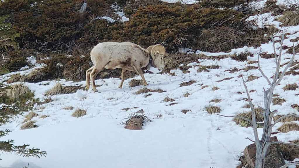
Another ram with a tracking collar. Hmmm, maybe the sheep use GPS to navigate their way around the mountains… 😂
Nearing the second drainage that runs between “Prairie Fire” and “Prairie Sky”.

More easy travel.
Looking up at the south end of “Prairie Fire”.
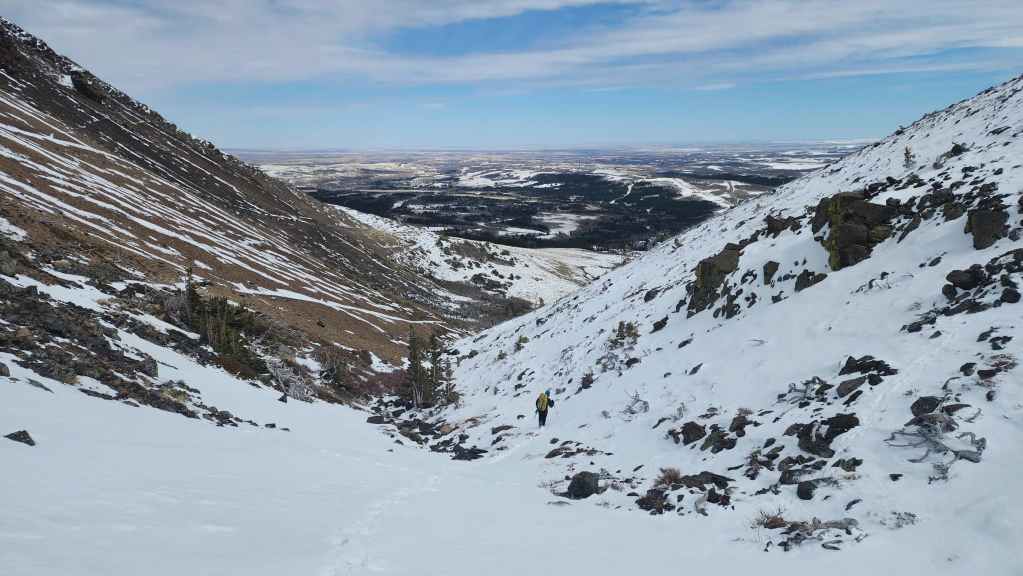
Continuing our descent along the second drainage.

Brad makes a short glissade.
Looking back.
Now looking at the southeast side of “Prairie Fire” as we circle the mountain.
The view back to “Prairie Sky”. Believe me, both of us noted that very tempting couloir. 🙂
The east side of “Prairie Fire” holds numerous scrambling opportunities.
From here, it will be easy hiking back to my truck.

More big views on this fabulous weather day.
Following a good trail.

Rounding the corner on the northeast end of “Prairie Fire”.
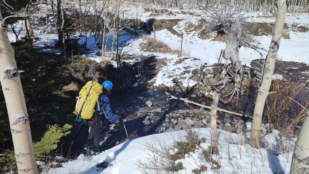
Crossing a small stream.
The snow definitely supercharges the views! Moreover, with the forecast calling for close to 30 cm over the next few days, the front range is going to look like it sits on the Divide. Better get out and enjoy the fun before it melts!
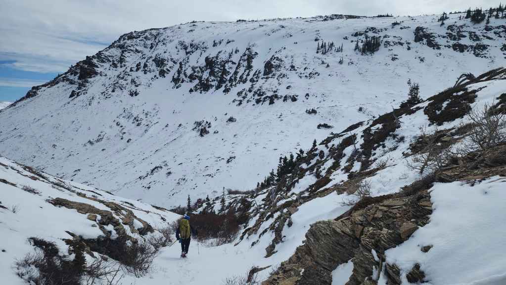
Back on our approach route and taking in our final view of the northeast face.
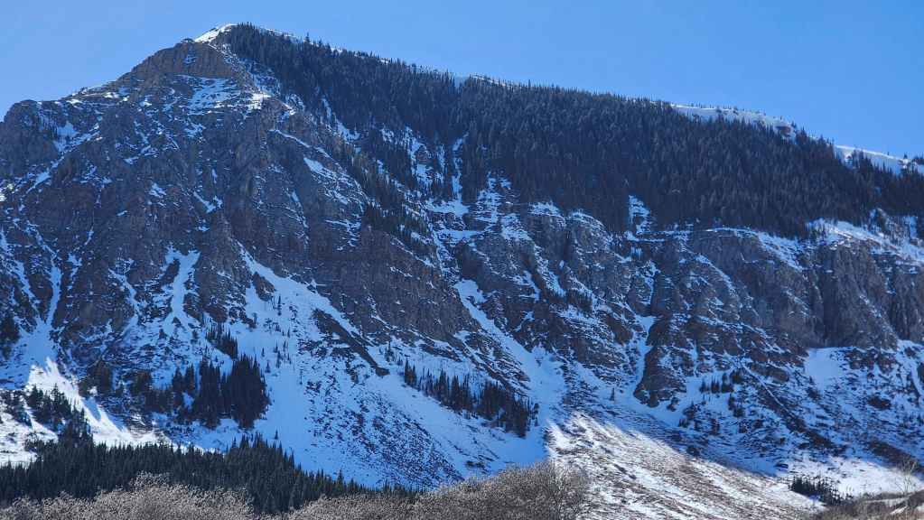
A closer look at the couloir (centre) and our route to the top.

It was hard to stop taking photos!
Arriving back at my truck after a total trip of ~6.9 km over 6 hours and 40 minutes. Our gamble on the couloir paid huge dividends and thanks to Brad’s expert lead, we had an amazing ascent. 🙂 As I noted in the intro, if anyone wonders why I keep posting about the front range peaks, this is why. The absolute variety of routes within a short distance of Lethbridge, makes this an almost infinite playground to explore.