

Windsor Ridge is a strikingly beautiful massif located in the Castle region in southwestern Alberta. It, and nearby Victoria Peak, are familiar landmarks on the drive between Lethbridge and Pincher Creek, aligning at times with the centre of Highway 3 to form an inspiring horizon. In particular, the highest of Windsor’s dual summits, Castle Peak, is most conspicuous due to its fortress-like appearance that understandably, has made it an iconic symbol for the region. Indeed, when Thomas Blakiston of the Palliser Expedition first saw it in August of 1858, he named it ‘Castle Mountain’ because it reminded him of an English castle. Coincidently however, just two days prior to Blackiston’s act of colonial bestowal, his fellow Expedition member, Dr. James Hector, had come across a mountain near Banff that had also reminded him of an English castle, and so he too, gave the designation of Castle Mountain. (Naming Canada: Stories About Canadian Place Names by Alan Rayburn, pp. 86-87)
For 57 years, from 1858 until 1915, there were two mountains officially named Castle Mountain in southern Alberta. To mitigate confusion, the name of the southernmost mountain was officially changed in 1915 (I’m assuming by the Dominion Land Survey) to reflect the entire massif’s resemblance to Windsor Castle. The northernmost peak was called, Castle Peak, and the slightly lower southern peak, Windsor Mountain. The entire massif then became known as Windsor Ridge. (Peaks of the Canadian Rockies) From an historian’s perspective, the entire naming process provides a fine example of the British colonial practice of culturally appropriating landscape through naming and mapping. In other words, if you name it, you own it and control it.
Comprised of Paleozoic limestone, Windsor Ridge is a geologic youngster compared to nearby Victoria Peak and the rest of the front range mountains that dominate Waterton National Park and the Castle. These mountains are part of the Lewis Thrust and feature some of the oldest preserved pre-Cambrian rock on the planet. (Peaks of the Canadian Rockies) Thus, Windsor Ridge, much like Crowsnest Mountain (which is a klippe), is a geological anomaly given its locale. Fitting I think for two such emblematic landmarks of southwestern Alberta.
So after all that preamble, how did I come to be on the mountain itself? I would think that I’m in the majority of hikers who frequent the area and who look longingly at Windsor Ridge, imagining that it would be a feather in one’s cap to stand on such a unique mountain. Then last week, I happened to read Clay Geddert’s fantastic, Collieresque-style report of his technical ascent of Castle Peak – which I believe is one of only a handful of successful attempts – and I began to map out my own plans to reach its less technical sibling.
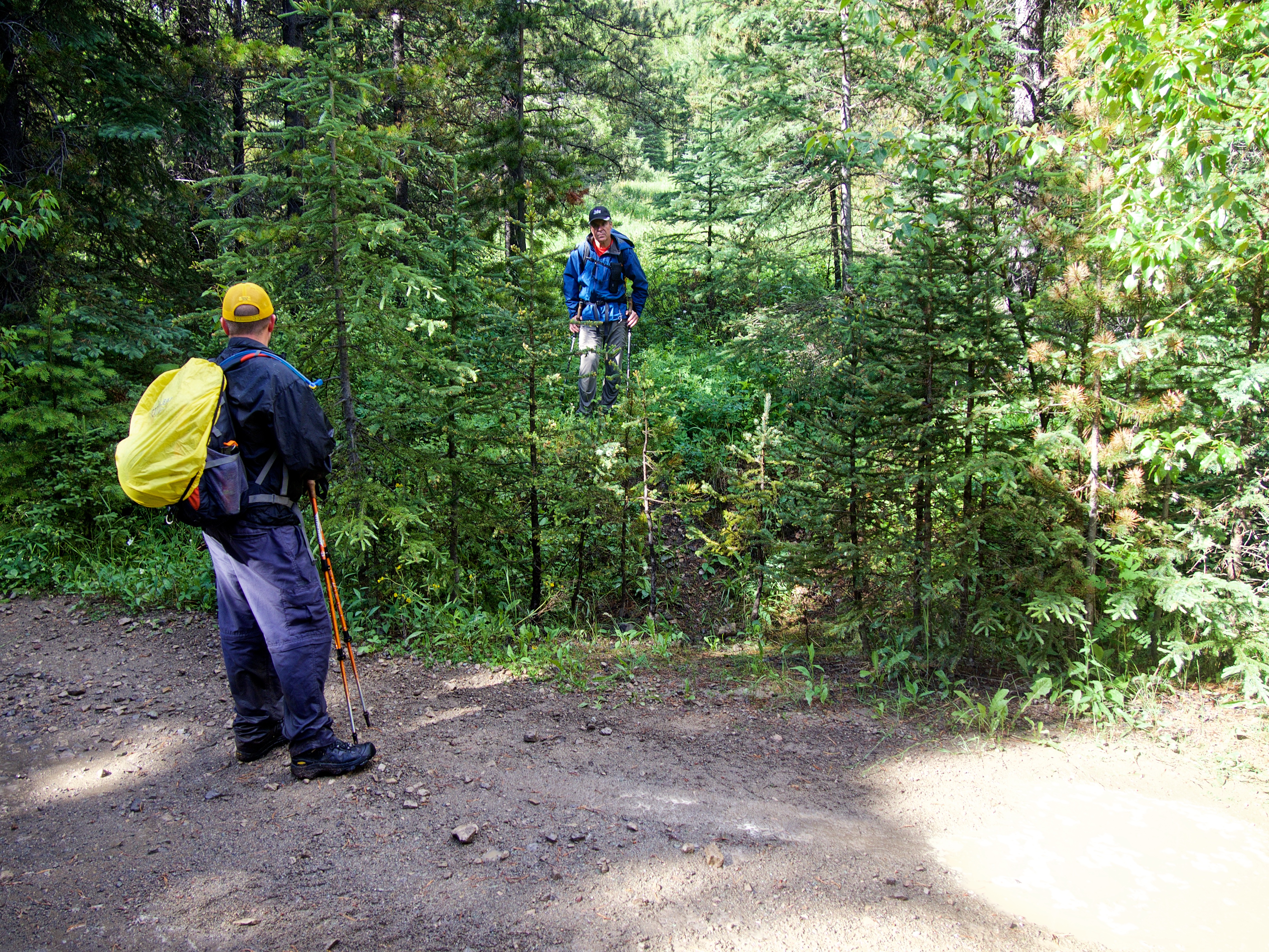
Shortly thereafter, Brad Hagen, Chair of the Southern Alberta Section of the Alpine Club of Canada, posted on Facebook that the ACC was planning a trip up Windsor Mountain for July 9 and that was all the encouragement that I (and my nephew, Jeff) needed to sign up. We’d be going up there at some point anyway, so why not take the opportunity to connect with a group and finally experience an official ACC trip? And what an amazing trio we met! Brad was joined by his wife, Lisa, and by their friend, Alan Wiley. It was our great privilege to share the day with them. I would highly recommend future trips with the Southern Alberta ACC.

Windsor Mountain is not a difficult ascent, but it does require a commitment of time as the approach via the South Castle Road is long. To reach our starting point, we headed south from the hamlet of Beaver Mines along Highway 774 until we came to the turnoff for Beaver Mines Lake. Here we turned left and followed the gravel road for ~3.7km until we came to the South Castle Road, which was located on our right. We followed the road for ~600m before arriving at a couple of information signs for the Castle Special Management Area. Also in the immediate vicinity were numerous random camping spots.
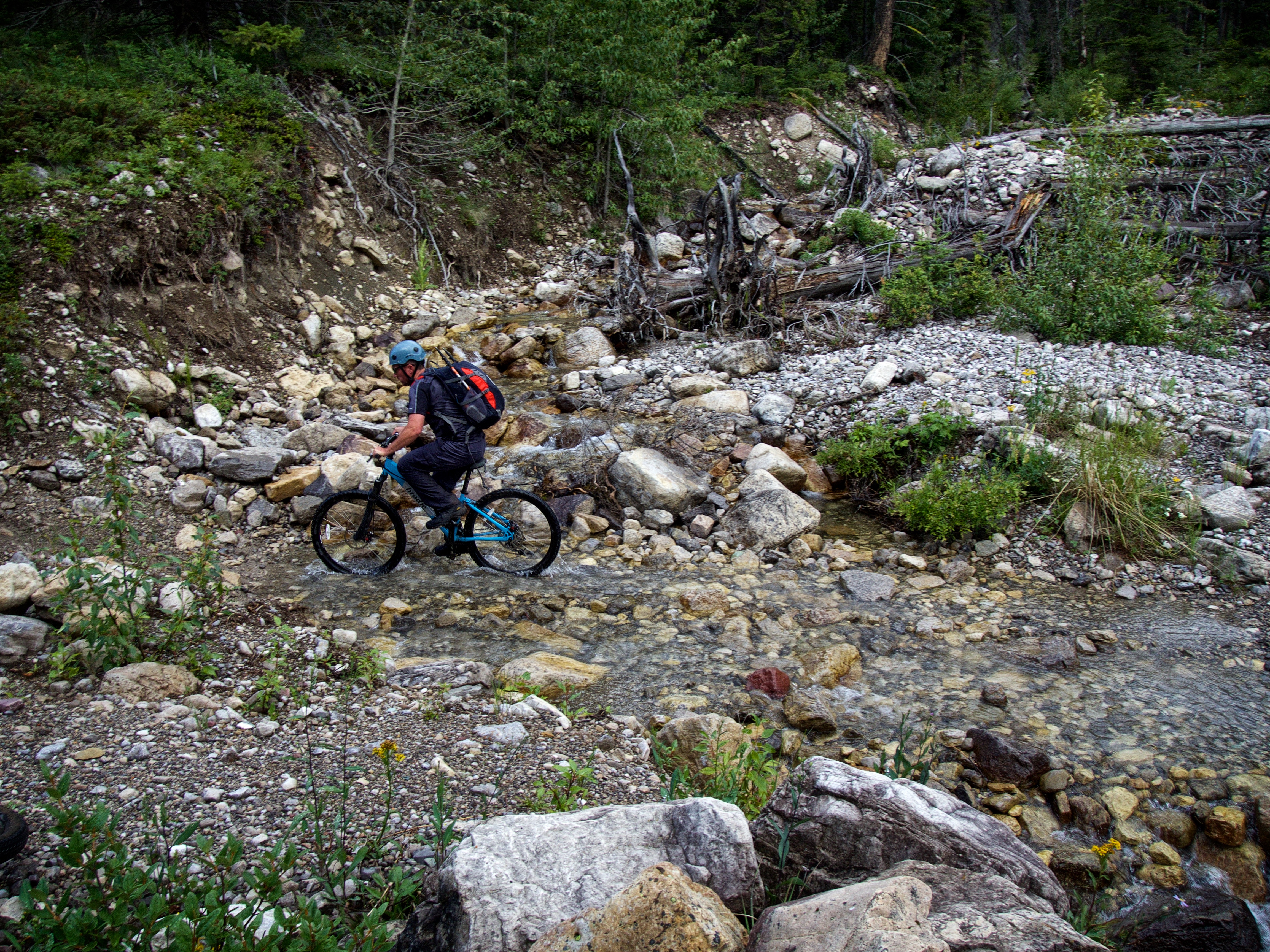
Here is where things get interesting and unless you have a 4×4 or some type of high clearance vehicle, you will need to park your car and get out your bike. Fortunately, Brad had his Nissan Titan and I had my trusty 4Runner, so we followed the road across the dry creek bed and proceeded another 6.9km down what at times, was a rough road, until we came to a washed out section just beyond a well marked camping site next to the Castle River. Here is where we parked and mounted our bikes to cover an additional 7.2km on the road to reach our ascent drainage, gaining a total of 104m in elevation along the way.

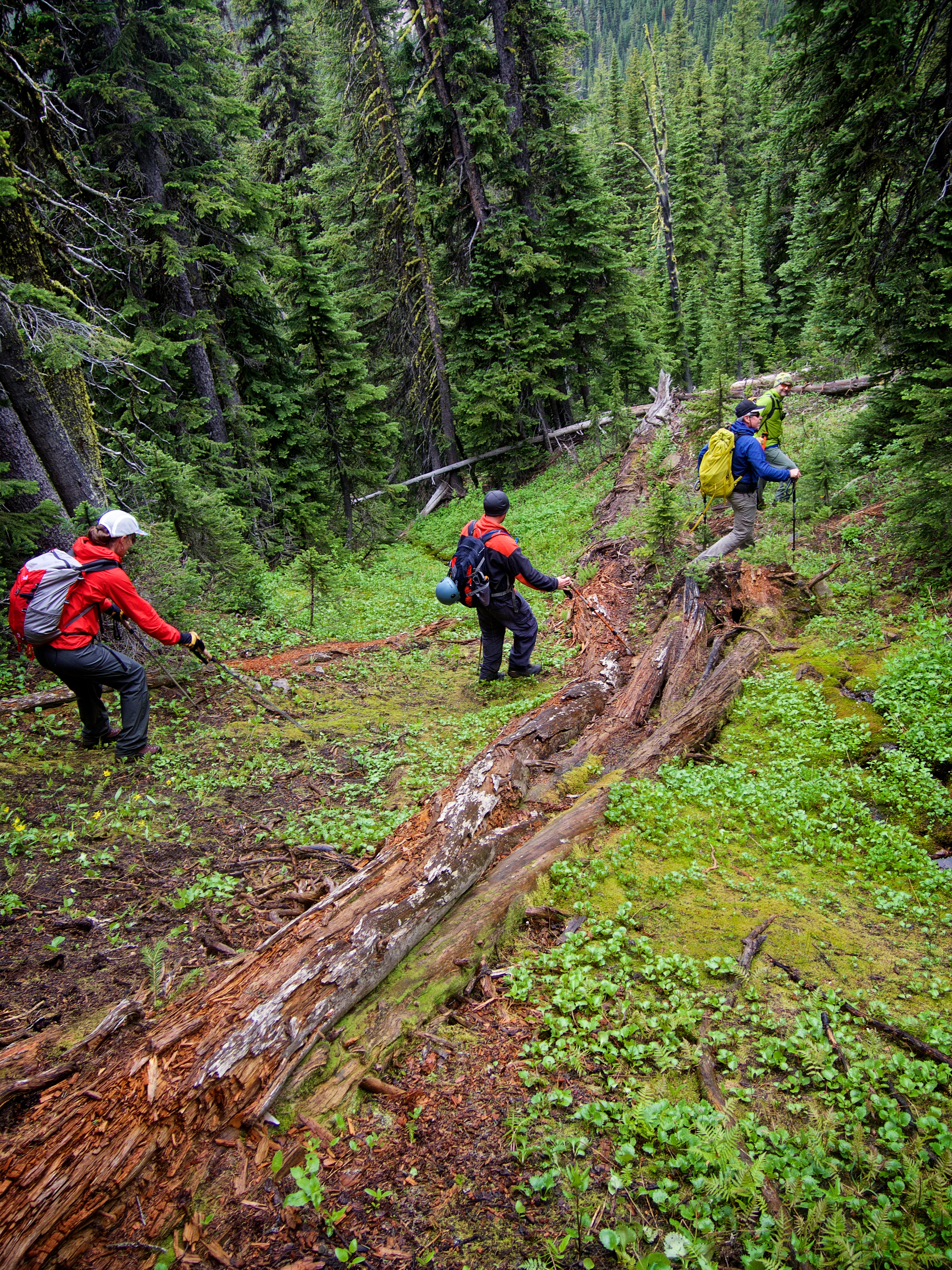
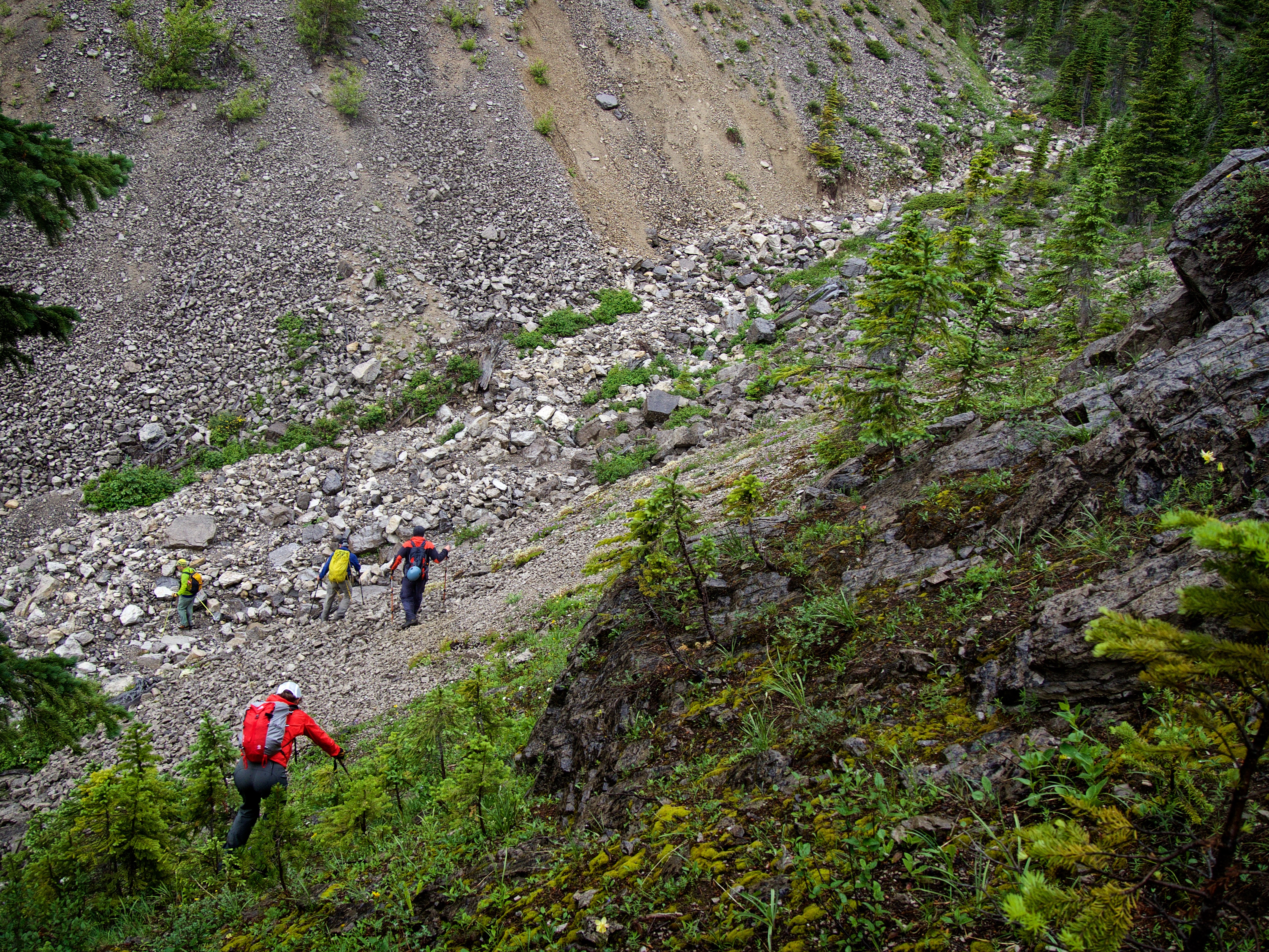
After stashing our bikes, we hiked up a pronounced drainage immediately to the west of the summit and immediately to the north of Windsor Mountain’s west ridge. Brad had used Clays’ trip report as a guide and was looking for the horse trail that Clay and his friend, James, had discovered. After hiking for ~300m in the drainage, we crossed to the left (north) bank and climbed the slope. Fortunately, the bushwhacking was light and we continued to follow the drainage along the crest of the slope for ~800m until we suddenly emerged onto the horse trail. We followed the easy trail for another ~300m as it descended back into the drainage.
At this point, we debated leaving the trail and following the drainage east until we were directly beneath the summit, but the allure of easy travel along the trail convinced us to continue on, even though it took on a decidedly southward course. We followed the trail for another ~1km, passing by an impressive cliff face which guarded the upper section of Windsor’s western ridge. Shortly after the trail began to lose elevation as it descended into another, more southerly drainage, we left it to try and gain the crest of the west ridge. Now past the cliff, we backtracked northwards up the ridge for ~640m to reach the crest. We then followed the crest for another ~750m to a small saddle located at the base of the summit (this would be a wonderful spot to camp!). From here, it was mostly a steep hike to gain the ~400m in elevation to reach the summit (~800m distance).
On descent, Brad suggested dropping north from the saddle into our initial drainage. This was a good idea as there was minimal bushwhacking to reach the drainage, though travel over the rain-slick boulders did considerably slow our progress. We followed the drainage back to the point where the horse trail crossed and from here, followed the entirety of the trail back to its origin on the South Castle Road – a mere 260m to the north from our original starting point! The lower portion of the trail becomes vague in several places and where it joins the road, it is almost completely obfuscated. I didn’t have any flagging tape to mark it, but did affix some white athletic tape (which should last about a week or two lol!) to a small tree on the side of the road. There was also a lack of rocks to make a suitable cairn. However, in case you are wondering, the trailhead is roughly 6.9 km from where we parked our vehicles, or ~13.8km from the government signs we passed near the start of the road. A further point of reference is the presence of a small side road which branches off to the right from main road just before reaching the main drainage. If you come to this road, backtrack ~140m and look for the trailhead.
On the ride back to our vehicles, we discussed the merits of both our ascent and descent routes. Should we have followed the drainage and ascended straight up to the summit from there? It would have been a shorter distance compared to the more circuitous horse trail, but the ease of travel along the trail coupled with more gradual elevation gains may have compensated for its length. At any rate, gaining the trail at the road would have greatly expedited the entire process.
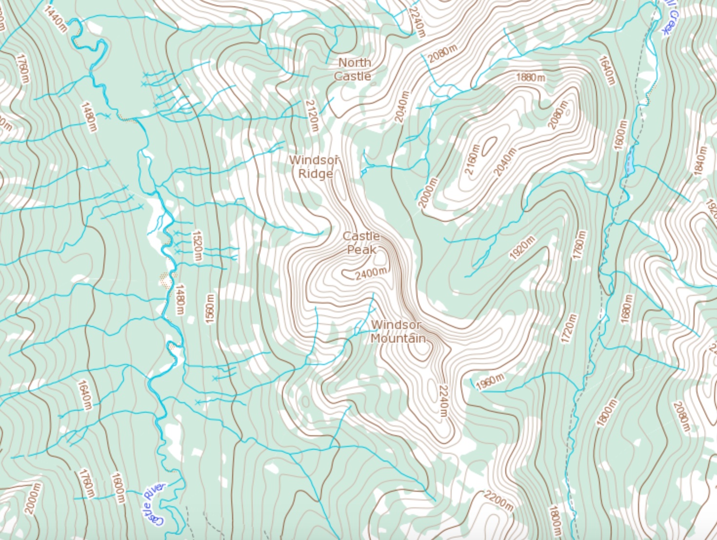
For further reference, I’ve also included a topo map.
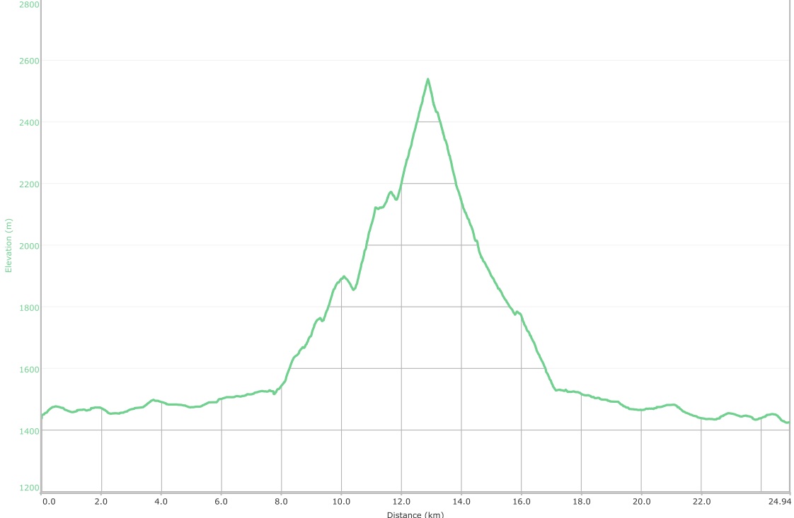
Our total roundtrip distance (biking and hiking) was 24.9km with total elevation gains of 1367m. The entire trip took us 9 hours and 26 minutes, though that does not include the time it took to 4×4 our way in and out.

This is the point where you will want to leave your car and start biking if you don’t have a 4×4 or high clearance vehicle. The continuation of the South Castle Road can be seen beyond the dry creek bed in the foreground.

Parts of the road were actually quite smooth, but don’t be fooled. In the background is the east side of Southfork Mountain.

At the 5km mark we reached the trailhead for Grizzly Lake (it can also be accessed more directly ~800m further to the north next to a small white sign on the side of the road). We would continue past this for another 1.9km.

Brad manoeuvres his truck across a dry creek bed that was located just beyond the Grizzly Lake sign. Rain would turn the entire road into a greasy mess for our drive out.

Our parking spot just before the washout. On the right is a well used campsite and in the background is a cutline leading to the crest of the north end of Lys Ridge.

Alan and Lisa gear up.

Alan sets the pace as we begin our 7.2km trek to the base of Windsor Mountain. (Photo by Brad Hagen)

We eventually reached a clearing that provided us with a wonderful view of Castle Peak. Alan is explaining the route that Clay and James used to reach its summit just a week prior.

Lys Ridge is over 8km long and includes two summits, West Castle and Lys Ridge. This is an excellent ridge walk and should be done in the fall when the larches have changed colour.

Finally at the ascent drainage. We would stash our bikes in the trees to the left of the road.

A pano of the entrance to the drainage.

Lisa and Jeff hike alongside a scenic little creek.

This is where, approximately 300m from our starting point, we left the drainage to ascend the north slope (climber’s left).

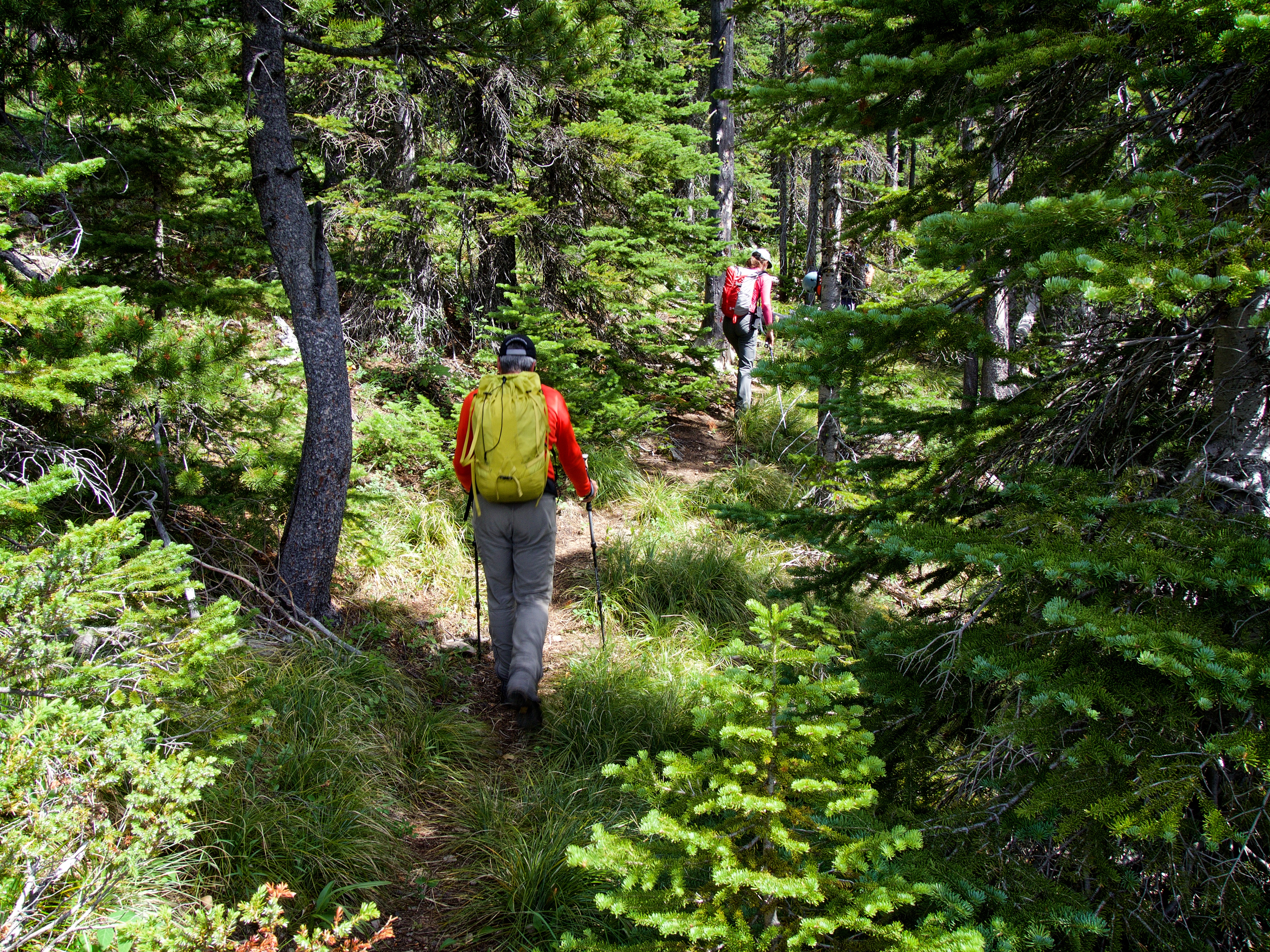
Travel through the forest was quick and easy. (Photo by Jeff Lang)
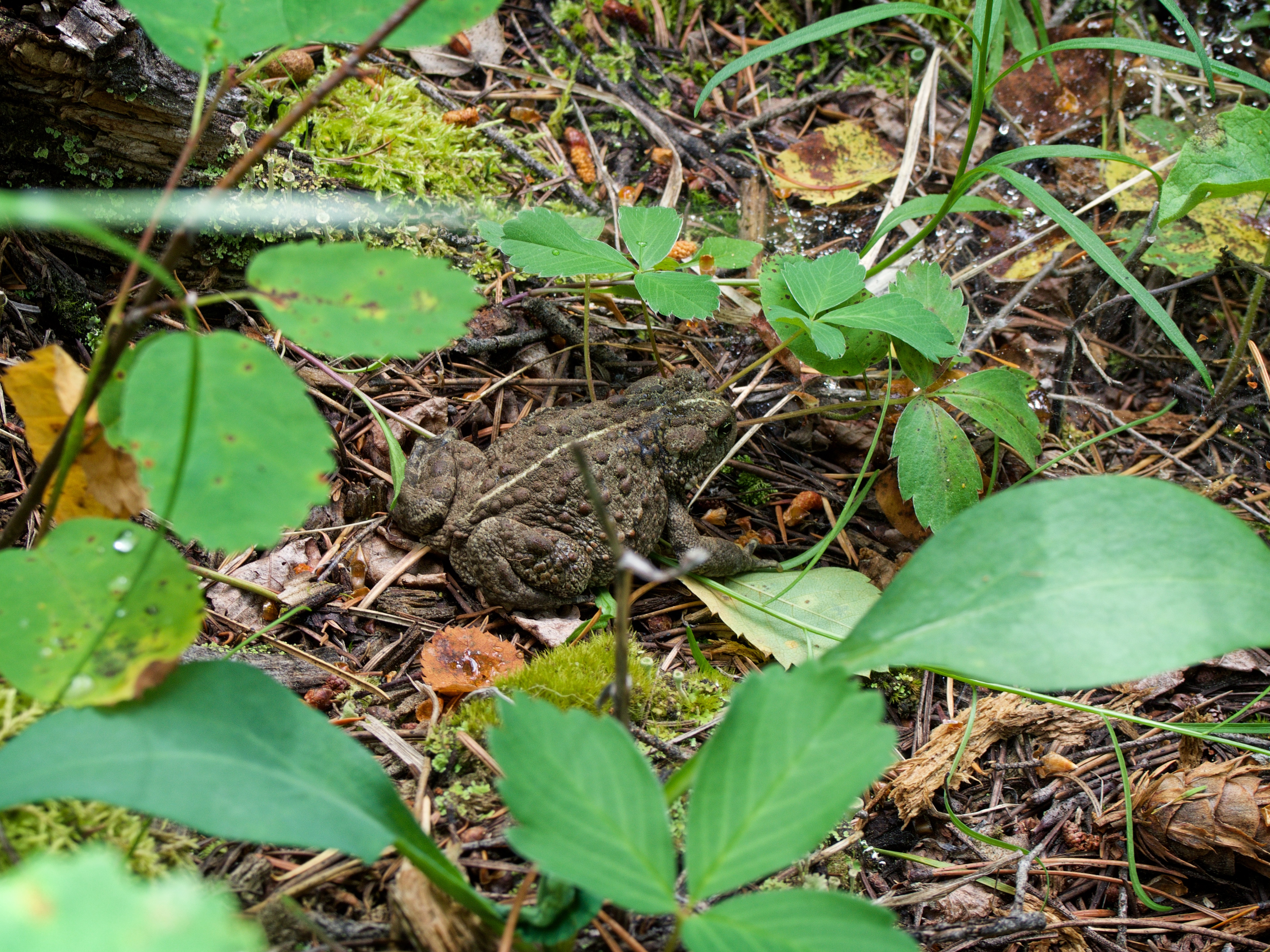
We came across a Western Toad which is classified as a sensitive species in the Status of Alberta Wildlife Report. It is distinguished from Alberta’s two other toad species (Canadian Toad and the Great Plains Toad) by the lack of a cranial crest between its eyes. That and it didn’t turn into a prince when Jeff kissed it 😉
After hiking for ~800m through the trees, we emerged onto a well defined horse trail. The ubiquitous presence of chainsawed logs indicated that this was indeed, a human engineered trail. Edit 24 September 2016: Local information traces this trail back to a gentleman by the name of Otis, who constructed the trail many years ago to provide easier access to Windsor Mountain.

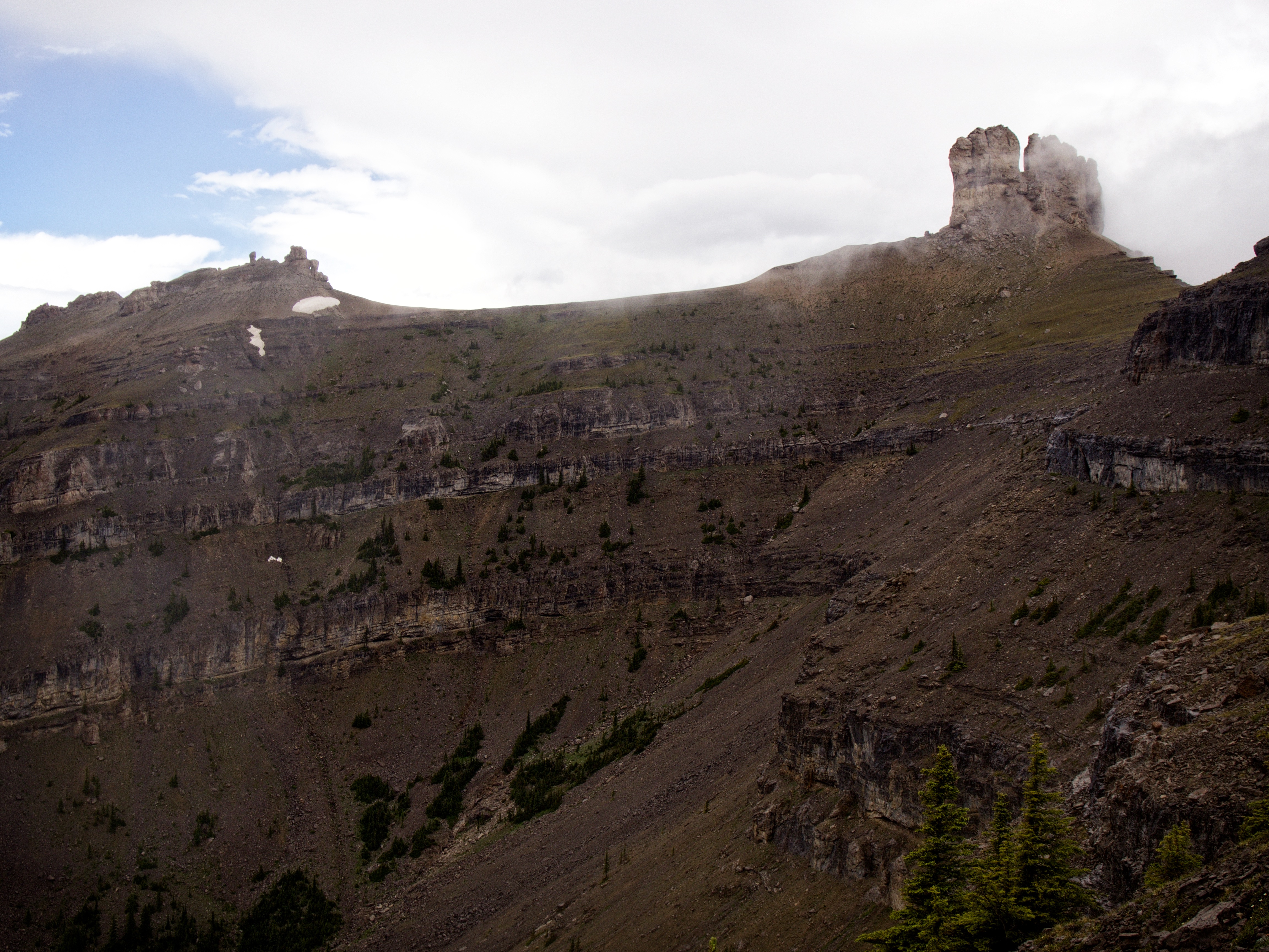
The western ridge of Windsor Mountain sports a series of impressive cliff bands. The trail will soon cross the drainage and pass beneath the cliff face on the far left.

Finding such a well-made trail put us in good spirits. In the background is Lys Peak, and from this vantage point, we could see the weather / repeater station on top.

Our first real view of the summit came where the trail crossed the drainage. We could have continued up the drainage from this point to just beneath the summit. Instead, we chose the more gradual elevations gains offered by the trail – though it would end up being a much longer route.

Brad and Lisa enjoy a quick lunch next to the drainage while Alan examines some wildflowers. Alan’s knowledge of botany was an immense gift to our trip. We would soon follow the trail behind Lisa onto the western ridge.
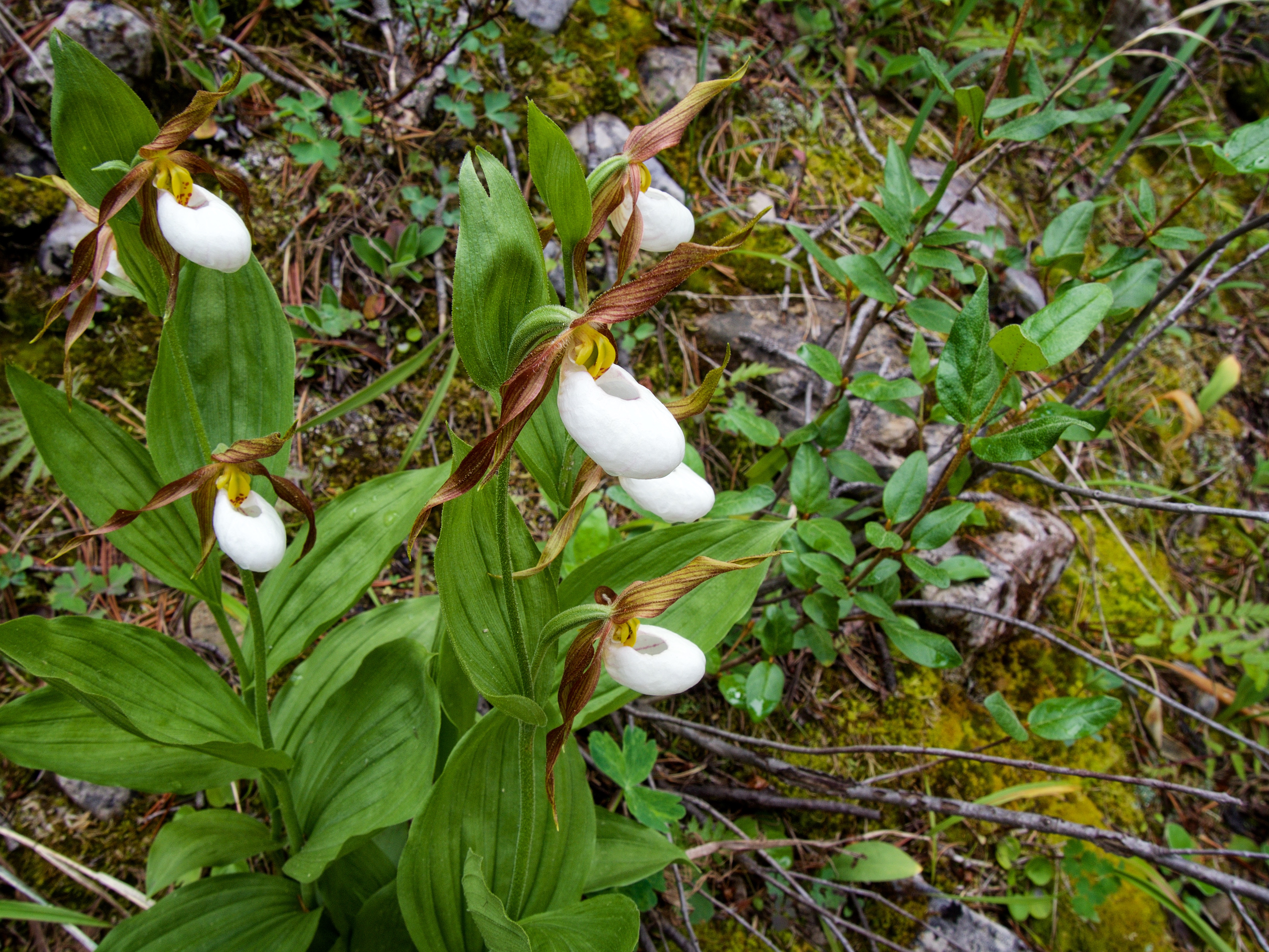
If it weren’t for Alan, I wouldn’t have noticed the delicate beauty of these Lady’s Slippers.

A closeup shows why they are aptly named.

Yellow Columbine.

Yellow Cinquefoil.
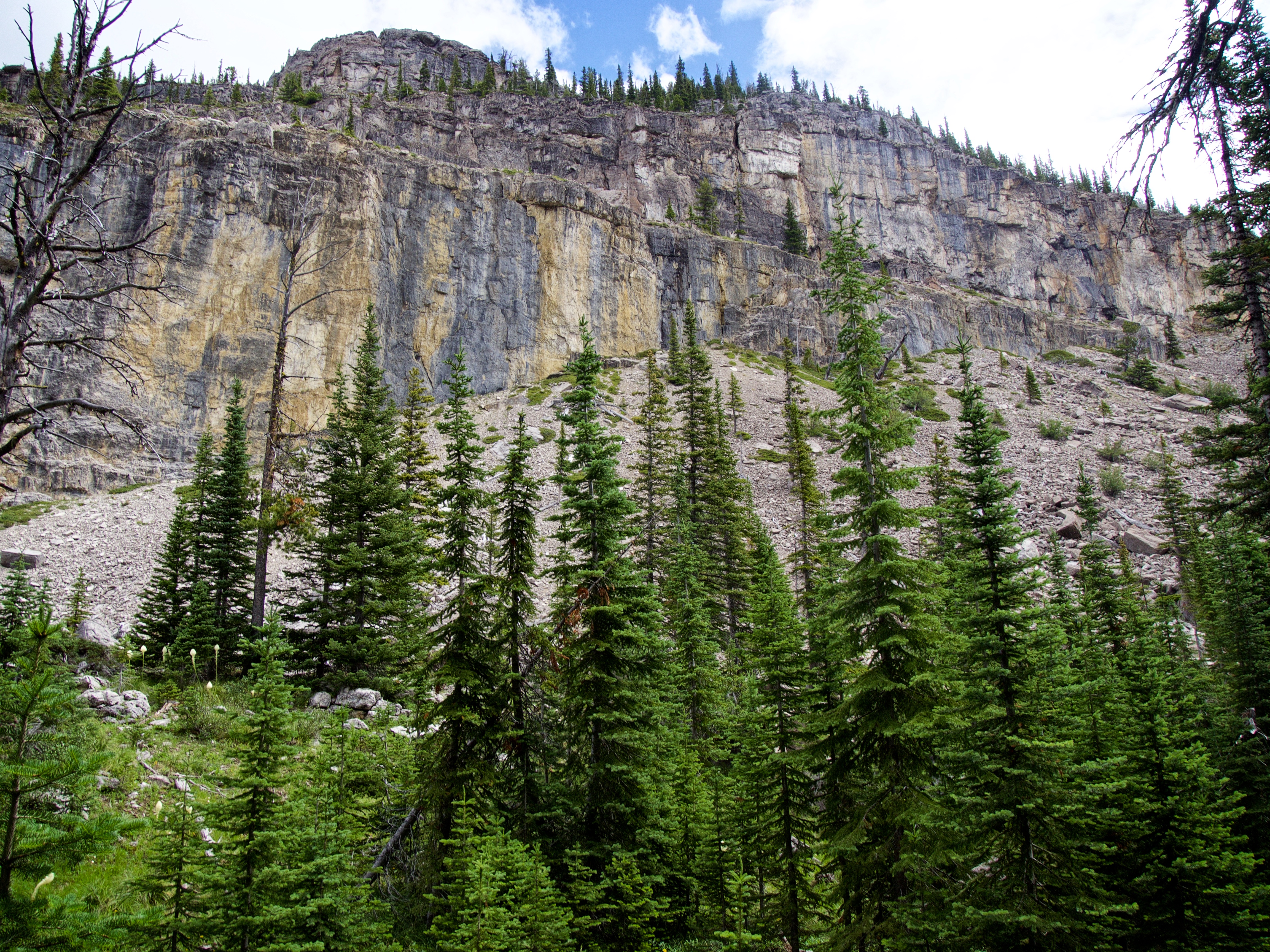
Not long after crossing the drainage, the trail passed beneath this impressive cliff face.

I may have ruined Jeff’s shot of this Bear Grass….

Yup, I did. (Photo by Jeff Lang. Ruined by Dave McMurray)

Shortly after crossing this meadow, the trail began to lose elevation as it descended into another drainage. We would soon leave it to follow the cliff base a little further to the south in an attempt to circumvent it.

Some more Bear Grass.

Off the trail and heading towards a weakness in the cliff face.

The south end of the cliff band offered a chance to get above it by backtracking to the north. It also offered a clear view of the summit and the abutment of west ridge.

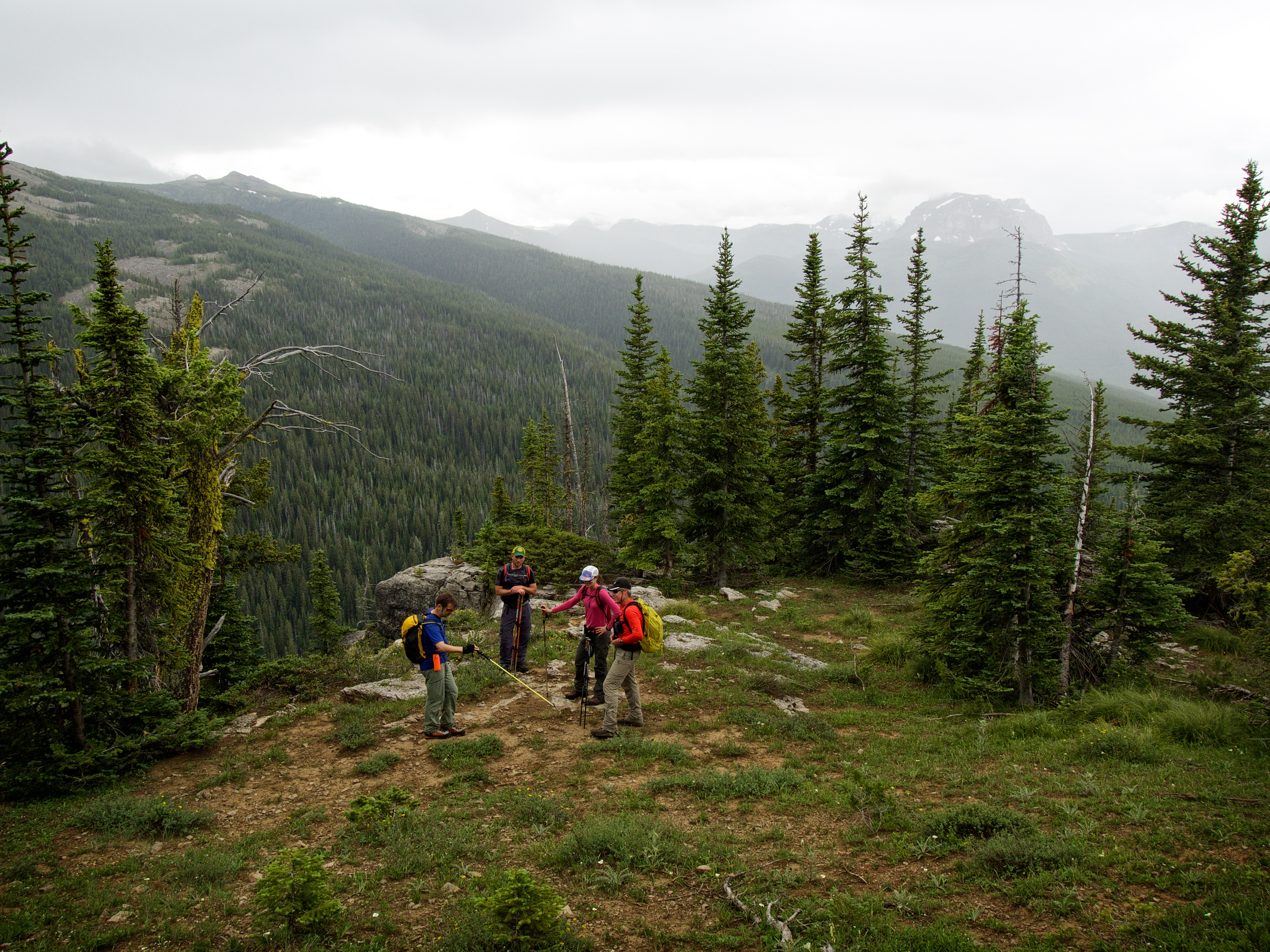
Brad checks his GPS.
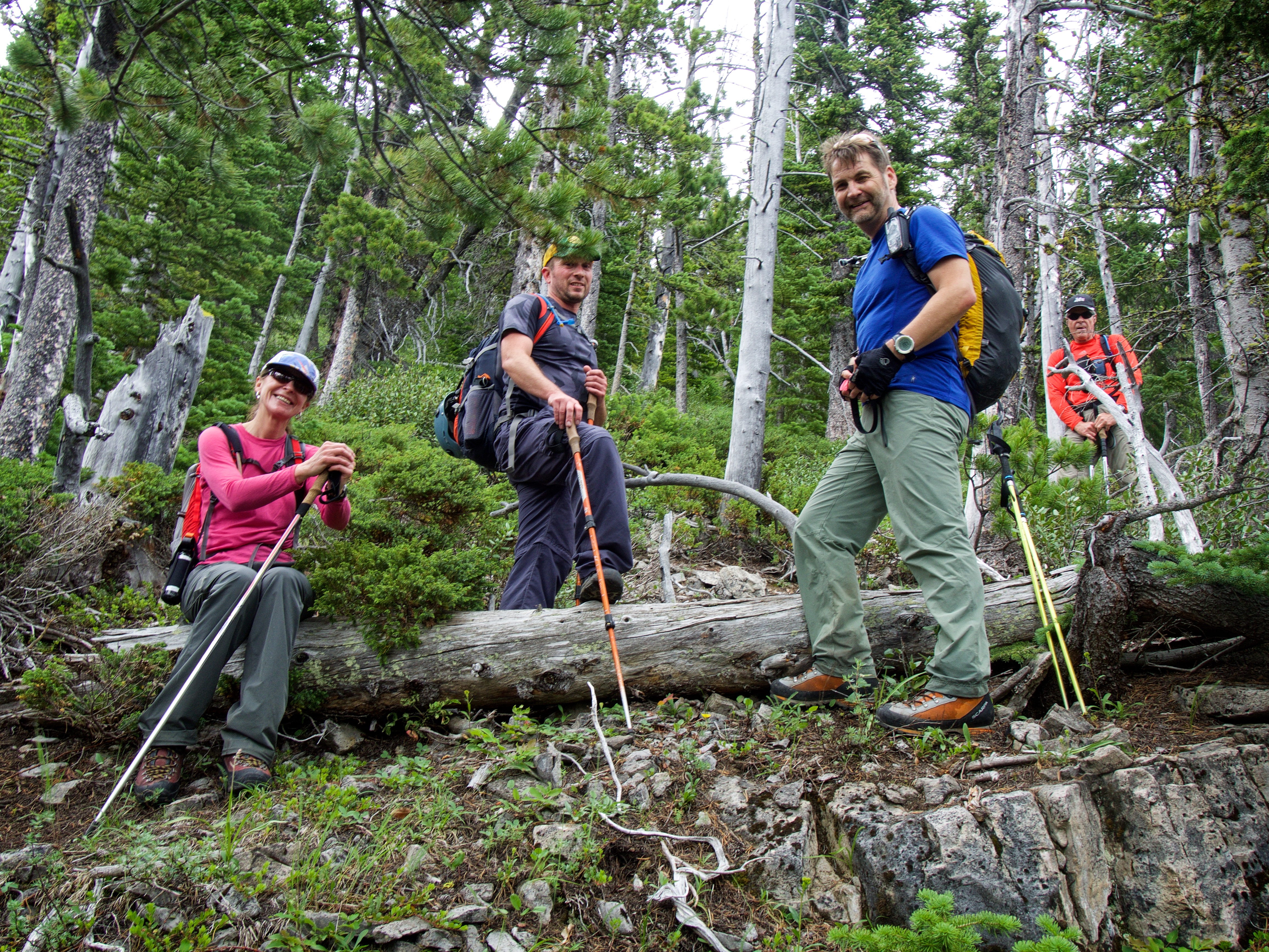
From left to right: Lisa, Jeff, Brad, and Alan.

The trip from the base of the cliff to the crest of the ridge was full of interesting terrain.
Mount Makin is partially beclouded by incoming rain. From this point on, we would endure at least three progressively intense rain storms.

Brad hikes toward the summit along the crest of the western ridge.

Looking north up the south Castle River valley. In the foreground left is Lys Ridge, followed by Barnaby Ridge and Southfork Mountain. The Flathead Range, highlighted by Mount Darrah, can be seen on the distant right.

A telephoto of Font Mountain (left) and Mount Matkin (centre).

A small saddle marks the abutment point of the west ridge to the summit slope. Here we found an old hearth and several small tent pads. This would definitely be a scenic place to camp!

The group pauses for one last break before tackling the ~400m elevation gain to the summit. In the background, partially obscured by cloud, is Castle Peak.

Looking back at the saddle and down our ascent/descent drainage. In the background on the far left is Jutland Mountain and La Coulotte Peak. In the centre is the summit of Lys Ridge.

Castle Peak was shy on this day, rarely revealing itself from underneath cloud cover. Whenever, it would look like it was about to clear, we’d hurry to try and take some pictures. This is a great shot of Brad and Lisa if I do say so myself.

Alan and Jeff are smiling now, but those dark clouds will soon dampen the mood.

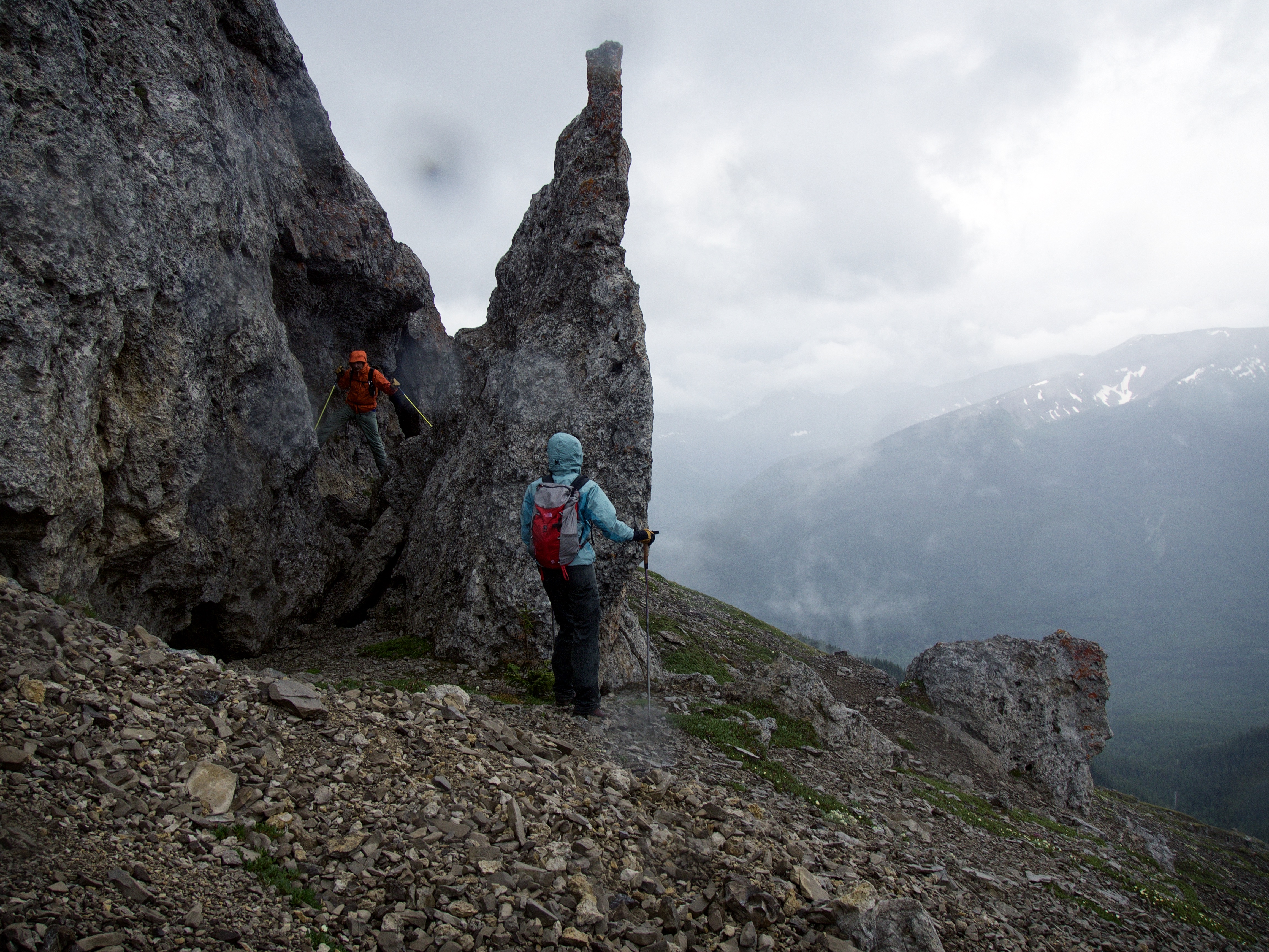
This small band of rock was easily surmounted. The climb from the saddle to the summit is mostly just a steep hike, with only a couple spots of minor scrambling.

Castle Peak is completely beclouded but the intervening point between Windsor Mountain and Castle Peak, relished its chance to step into the limelight.

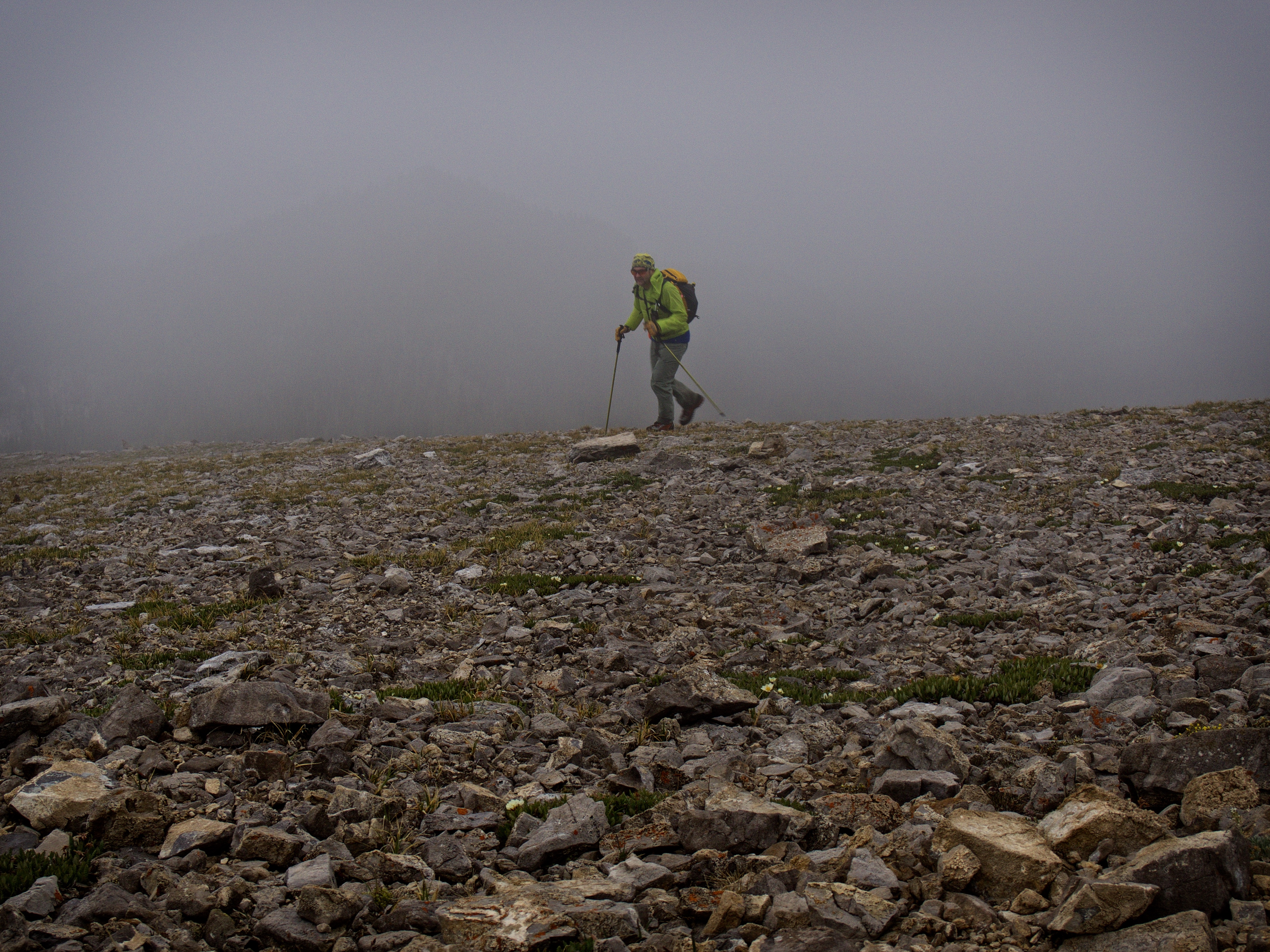
Brad heads towards the summit as the sky grows increasingly dark.

This is a great shot of me by Brad. Unfortunately, Castle Peak was still playing shy. (Photo by Brad Hagen)

Moisture-laden clouds provided some neat atmospherics for this shot of Castle Peak and Mount Gladstone. The difference in geology between Windsor Ridge and Mount Gladstone is clearly evident. This would be as close to a summit view as we would get. North Castle is the small bump in the centre and “Mill Creek Mountain” is foreground right.

“Rain drops keep fallin’ on my head…”

The summit of Windsor Mountain (2544m).

All I could manage before being pummelled by rain was a fleeting shot of Victoria Peak. Had we timed reaching the summit 30 minutes before or after, we probably would have had more of a view.

Jeff was the only one who was able to walk away with a summit picture. My little Olympus OMD E-M10 handled the rain like a champ though.
Brad nears the summit. We would all tag the cairn and then make a hasty retreat.

Lisa and Alan approach the summit through intense rain.
As we retreated off of the summit, Brad found time to play on a small pinnacle.

We walked through a cloud as we continued our descent in the rain.

Jeff pauses briefly to pose in front of Castle Peak.

A telephoto of Castle Peak.
A small window can be seen in the pinnacles on the far left.

Since we were denied a summit view, I’ll include one more picture of the ridge between Windsor Mountain and Castle Peak. I wish the weather had been more cooperative, perhaps allowing us a chance to explore the intervening ridge.

Descending from the saddle into the drainage.

On the way down, Alan treated us to a snack of fresh Glacier Lillies 🙂

Jeff enjoys a Glacier Lilly.
I found this decomposing tree a fascinating sight.
We reached the drainage after losing ~203m in elevation over a distance of ~700m.

Our descent through the drainage was encumbered by slippery boulders.

A gorgeous little waterfall.

The rain paused briefly just before we reached the trail.

I found this lone, red tree amidst a sea of fir and pine green. It was actually a very striking sight. Does anyone know what species this is? It almost looks like a red larch. Maybe it’s just a sick fir tree?

Approximately ~1km from where we entered the drainage beneath the saddle, we arrived back at the trail.

We were able to make good time once we were back on the trail.

Brad wanted to see where the trail emerged onto South Castle Road which was a great idea. However, once we reached the lower slopes, several sections of the trail became obfuscated, forcing us to stop and search for it.

Following the trail through a patch of rather wet Thimble Berries.
The distance between where the trail crosses the drainage and where it meets the road is ~1.3km. This is a picture of the trailhead on South Castle Road. As you can see, it would be hard to find without a careful search. However, the trailhead is roughly 6.9 km from where we parked our vehicles, or ~13.8km from the government signs we passed at the start of the road.

Another shot of the trailhead from the north.
I didn’t have any flagging tape so I attached a piece of athletic tape to the tree next to the trail. Unfortunately, this will probably only last a couple of weeks. There weren’t many rocks to build a cairn either. Edit 28 September 2016: I have found out that the trailhead has now been more clearly identified with blue flagging tape.

A further point of reference to find the trailhead is the presence of a small side road which branches off to the right from main road just before the main drainage. If you come to this road, backtrack ~140m and look for the trailhead.

The sun finally came out for good once we reached the bikes. Go figure!
Jeff enjoys a fun ride back to the vehicle.

One last look at Lys Ridge as we ride by.

Evening sunlight accentuates the beauty of Castle Peak. (Photo by Jeff Lang)

Back at our vehicles, we were greeted by some campers who had moved in while we were away. Unfortunately, they did not have dinner ready for us 😉

The rain had turned much of the road into a greasy mess, but we had no trouble getting back. (Photo by Jeff Lang)
Though Windsor Mountain was a long day, it was not a difficult ascent. Being able to share the experience with Brad, Lisa, and Alan was definitely a highlight and I would highly recommend Southern Alberta ACC trips to anyone else. I would also recommend that you read Clay Geddert’s trip report for Castle Peak because this peak has seen so few successful attempts. My only regret for the day was the inclement weather that we experienced on the summit. I was looking forward to some spectacular views, but on this day, that was not in the cards. If the weather had been nice, I think we may have also been able to explore some of the ridge between Windsor Mountain and Castle Peak. All in all though, it definitely was a feather in the cap to stand on the summit of this iconic mountain.


Leave a Reply