


⚠️ Hiking and scrambling are inherently dangerous activities. Please read my Disclaimer. ⚠️
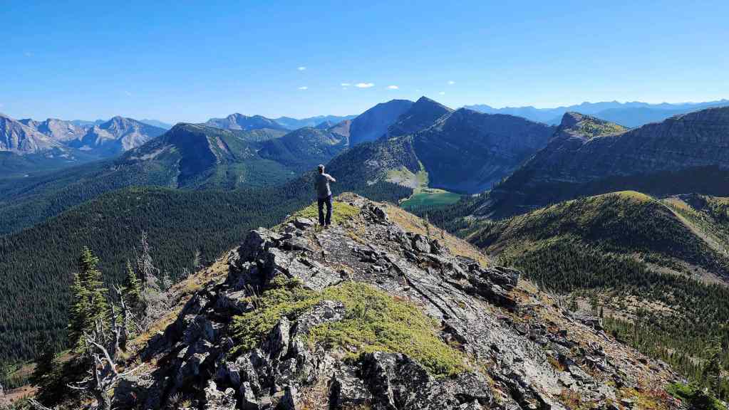
Other than the name, the weirdest thing about Michel Head is that the official summit (2297 m) sits a stone’s throw away from a larger (by 30 m) and more prominent peak that constitutes the unofficial high point (2327 m) of Michel Ridge, a massif which stretches from Mount Taylor to Limestone Ridge. As such, I think you could reasonably argue that you’ve tagged two distinct peaks by summiting Michel Head and then making the short hike over to the summit of Michel Ridge. This is what the Rocky Mountain Ramblers noted in their trip from Mount Taylor to Michel Head, where they include the summit of Michel Ridge as a separate peak. It feels weird to do so given their close proximity, but there’s a legitimate case to be made. Michel Ridge is definitely the highest point of the entire massif.
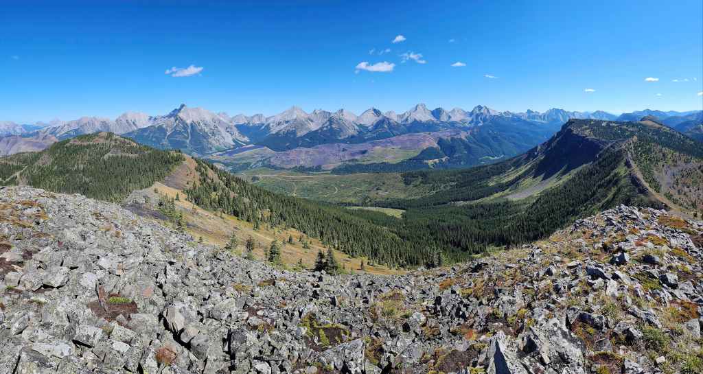
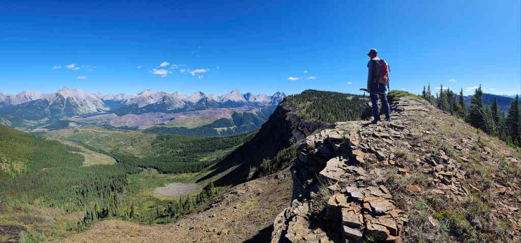
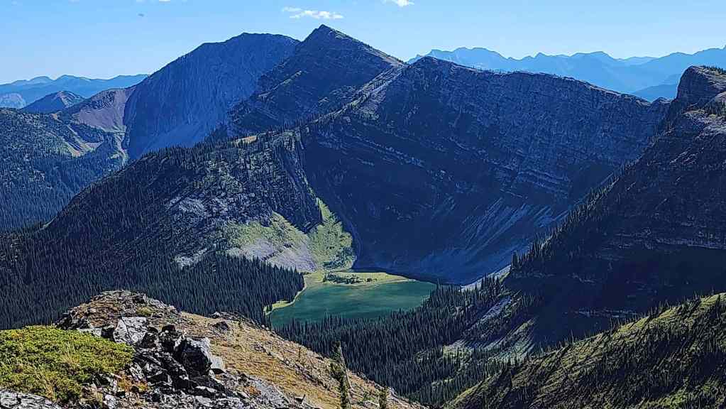
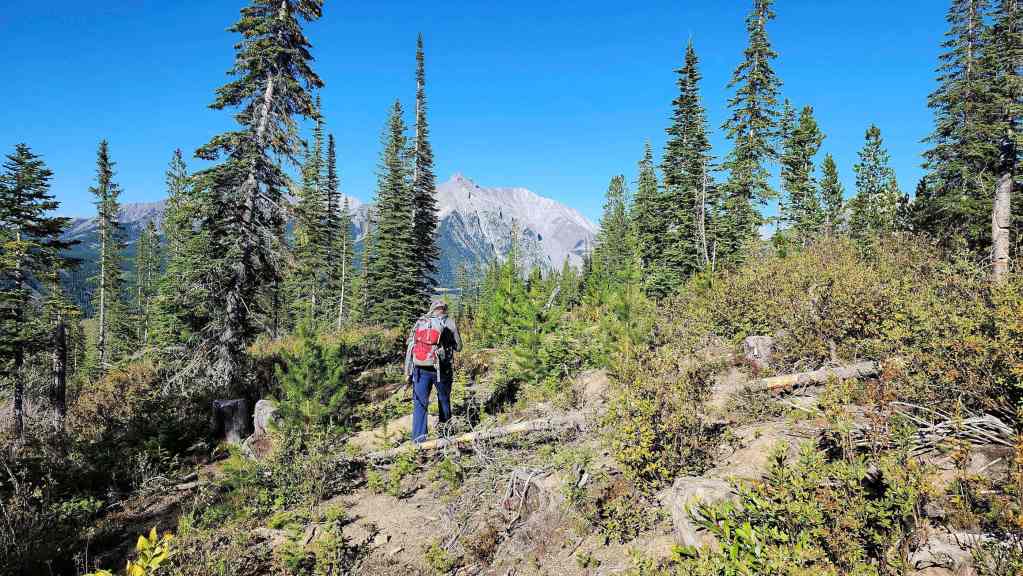
As Andy and I made it partway from Mount Taylor to Michel Head back in October of 2017, we were somewhat familiar with the terrain to the northeast. However, as we stood on the summit of Michel Ridge looking to the southeast, we could see the loop we had posited earlier in the day, except we could now see a slightly higher peak that marked the end the ridge. As it was located across from Limestone Ridge, we figured that it might offer a view of Elliot Lake.
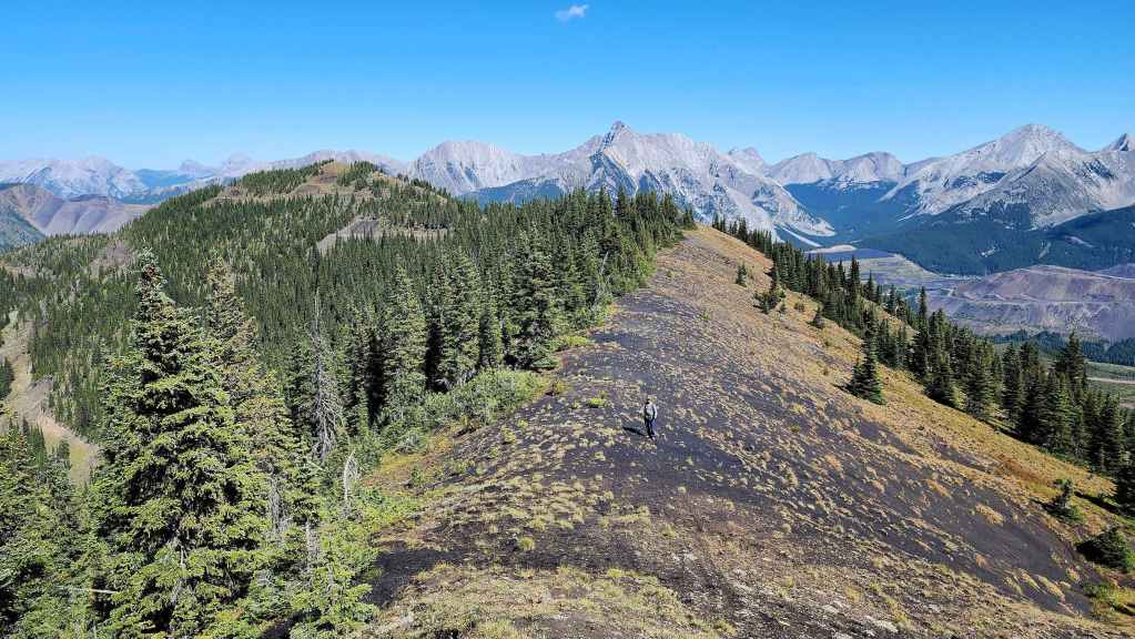
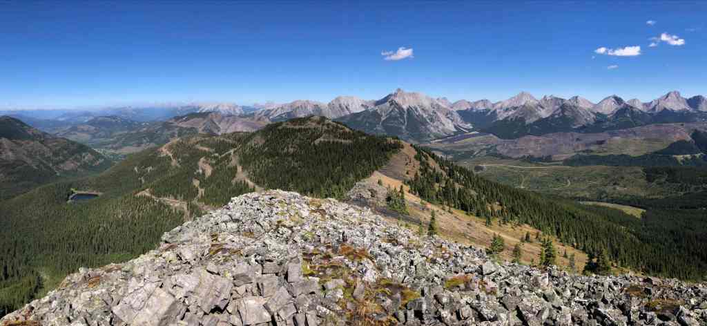
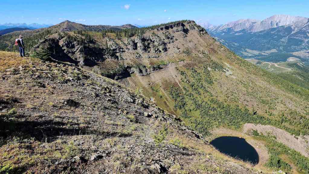
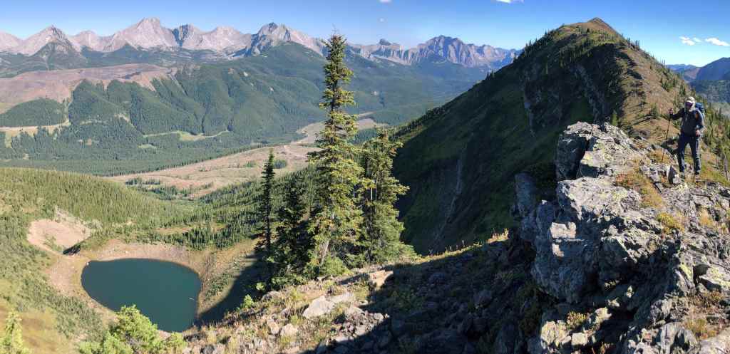
What we weren’t expecting, was the uniquely colourful ~1.95 km ridge walk that awaited us between the summit of Michel Ridge and the first high point (2284 m). When coupled with a consistent panorama of the Flatheads, it easily became the highlight of our day. Once we were on the summit of the first high point, we could clearly see the prominent peak at the end of the ridge, and unexpectedly beneath it, a small tarn.
This provided even more motivation to continue and after another ~1.2 km of easy hiking, we were standing on the southeast summit (2292 m) of Michel Ridge and enjoying views of Elliot Lake and the Flatheads. All in all, we ended up stumbling onto a very fun loop, minus the short stretch of bushwhacking back to our bikes.
Perhaps including a traverse of either the northeast or southeast (or both) sections of Michel Ridge, makes you feel like you’ve earned the easiness of tagging the summits of Michel Head and Michel Ridge? 🤔 At any rate, this section of Michel Ridge was well worth exploring. Thanks again to Andy for yet another awesome day in the mountains!
Be sure to read Andrew’s awesome trip report!
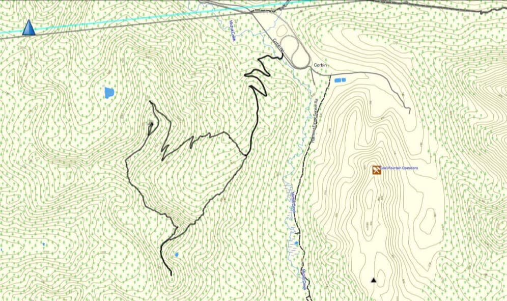

To get to Michel Head and Michel Ridge, we drove west of Summit Lake in the Crowsnest Pass for ~7 km until we came to the junction with the Corbin Road on our left. We then followed this road for ~21.5 km until we came to the entrance to a logging road on our right. This was where we began.
After carefully noting the ambiguous warning signs about accessing the road, we made the decision to continue and took our first left past the open gate which was located ~400 m from the Corbin Road. We then proceeded to follow the road for another ~3.7 km (305 m elevation gain) until we were at the base of a small ridge that led up to a high point on Michel Ridge and immediately across a small valley from Michel Head. This is where we left our bikes. Again, I do not recommend that others use this road unless they have confirmation it is okay.
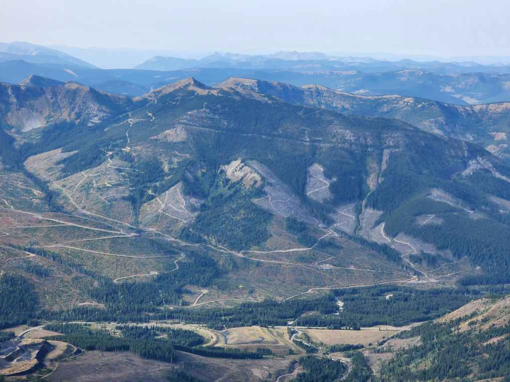
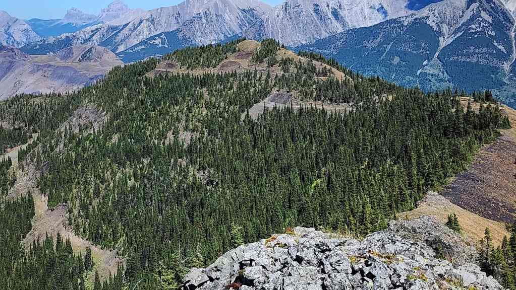
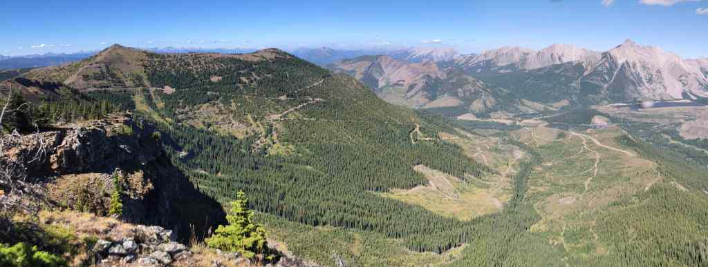
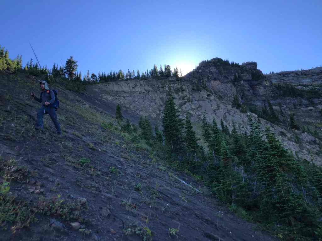
From the road we descended into the intervening valley (~600 m and a 120 m elevation loss to the creek) and then we simply followed a series of logging roads and switchbacks all the way to the summit of Michel Head. We could have tackled the summit in a more direct manner; however, we decided to keep gaining easy elevation using the roads and we were curious how far up the mountain they went. It turned out they went right to the top. For reference, from our starting point on the Corbin Road, it was ~9.7 km to the summit with a 905 m elevation gain (including the 120 m loss and gain while crossing the valley).
From the summit, we then made the easy ~960 m hike (64 m elevation gain) over to the unofficial high point of Michel Ridge. After enjoying the views, we then began our traverse of Michel Ridge, beginning with a ~1.95 km ridge walk (162 m total elevation gain) over to the high point that connected with the small ridge back to our bikes.
We then continued along the ridge for ~1.2 km (69 m elevation gain) until we were on the summit of the prominent southeast peak that marked the end (or start) of Michel Ridge. To return, we retraced our steps towards the previous high point, but to avoid descending through cliffs, we began our descent prior to reaching the summit; traversing our way around the mountain until we were on the small ridge that led directly back to our bikes.
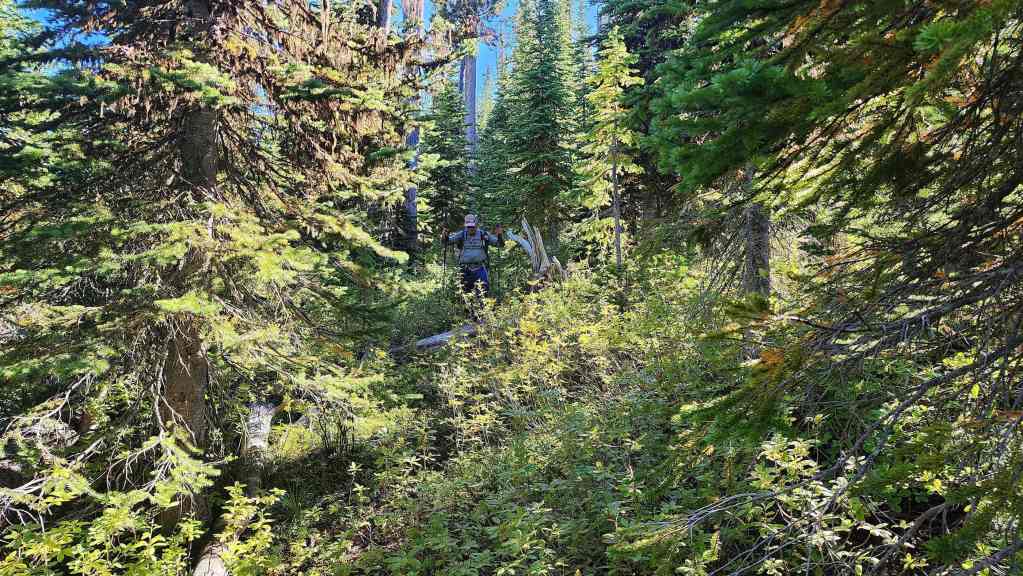
Heavy to moderate bushwhacking awaited us along the ridge, until things opened up closer to the road. Once back on our bikes, it took us less than 15 minutes to make the ~4 km trip back to the Corbin Road.
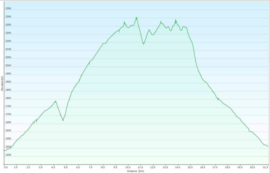

Our total roundtrip distance was 22.3 km with a total elevation gain of 1251 m. Our total roundtrip time was 7 hours and 22 minutes.


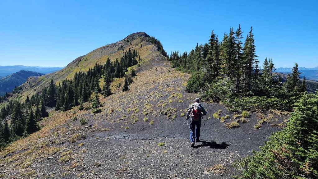
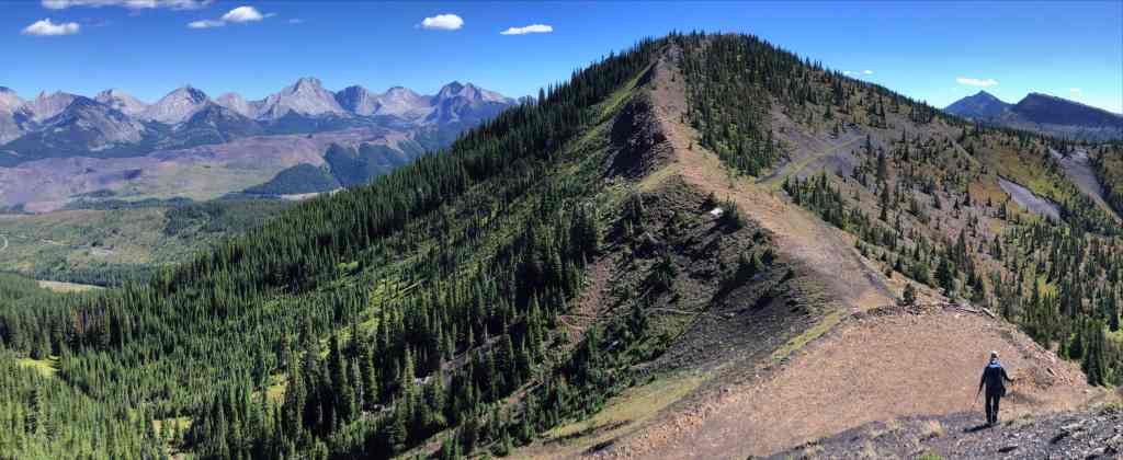
The summit of Michel Ridge (right) is an easy ~960 m hike from the summit of Michel Head.

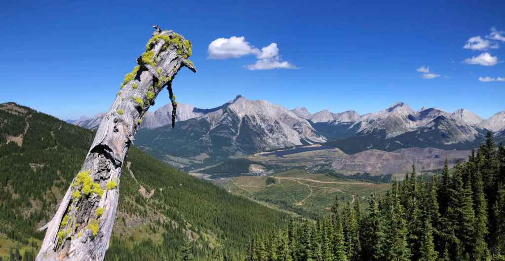
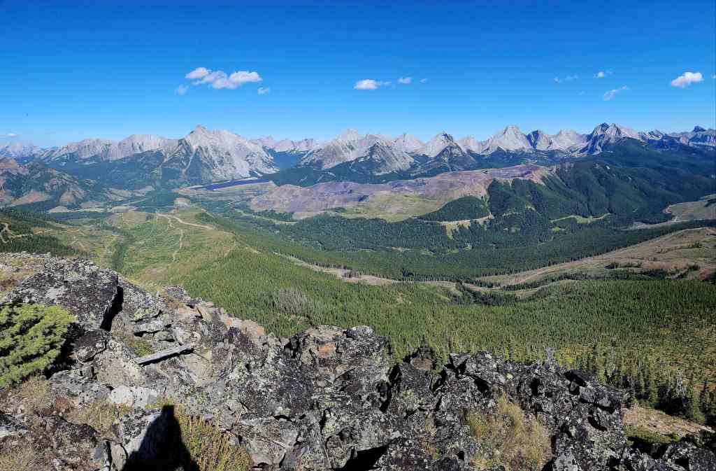
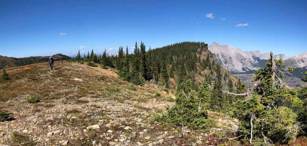
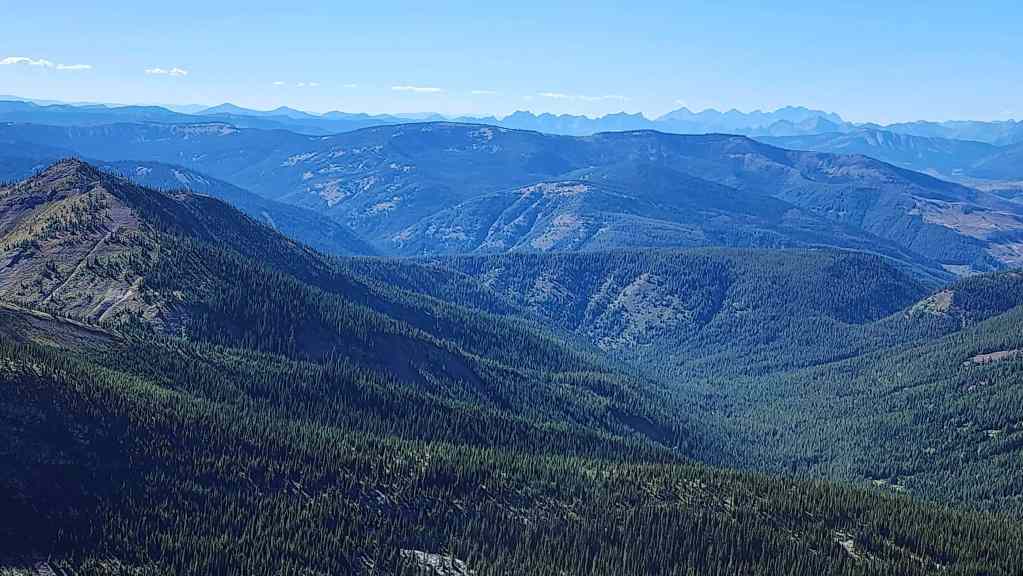
Stopping to admire the Flatheads…

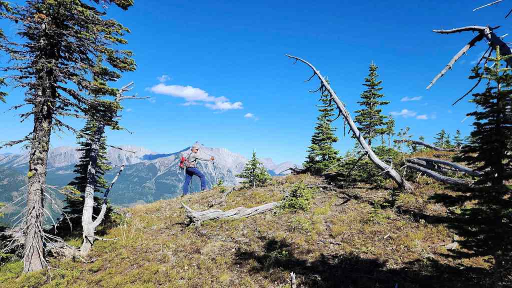
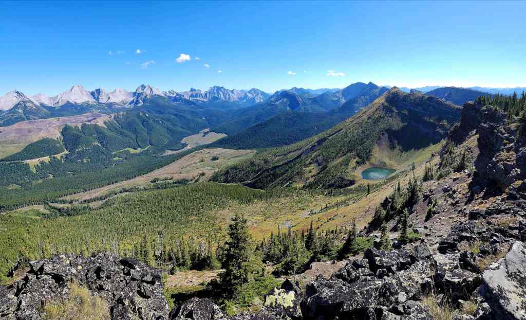
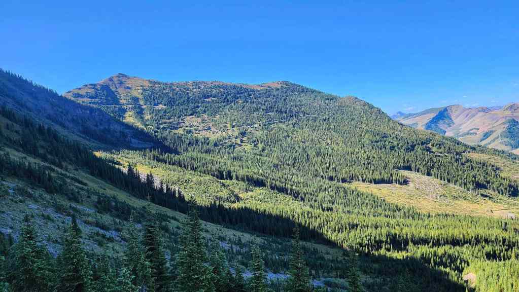
Before scoping out our upcoming route.
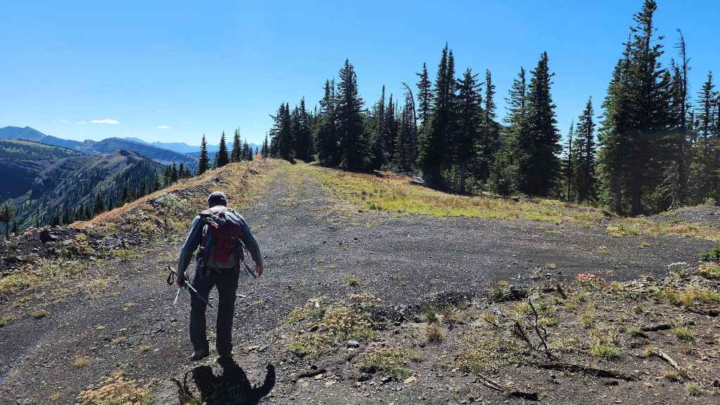
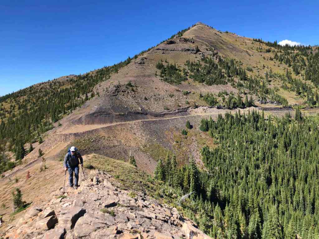
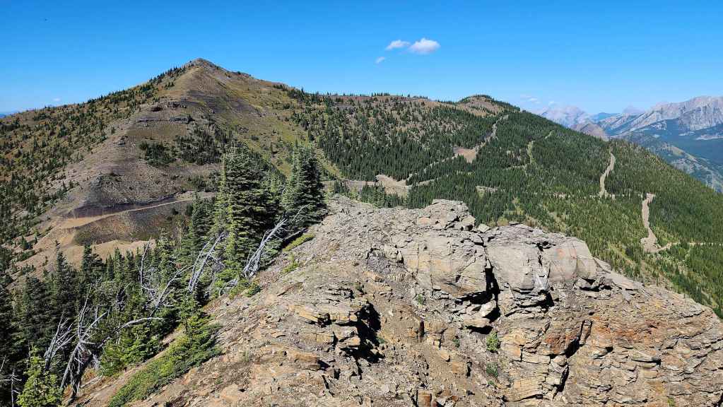
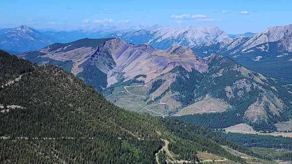
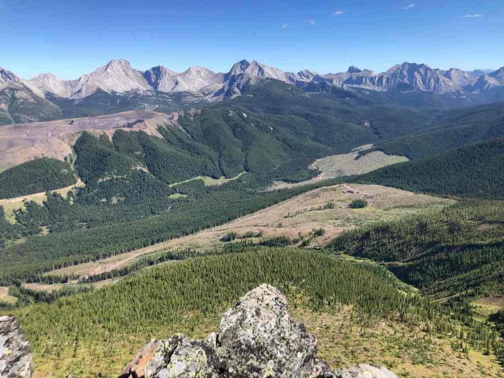
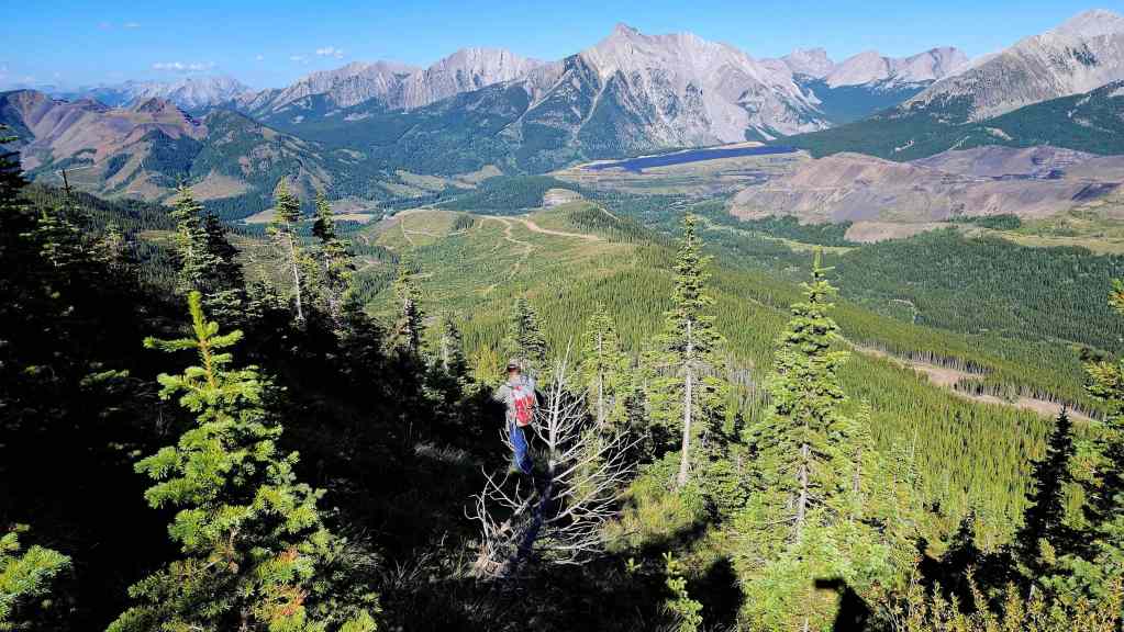
Of course there’s a road that leads towards the summit…
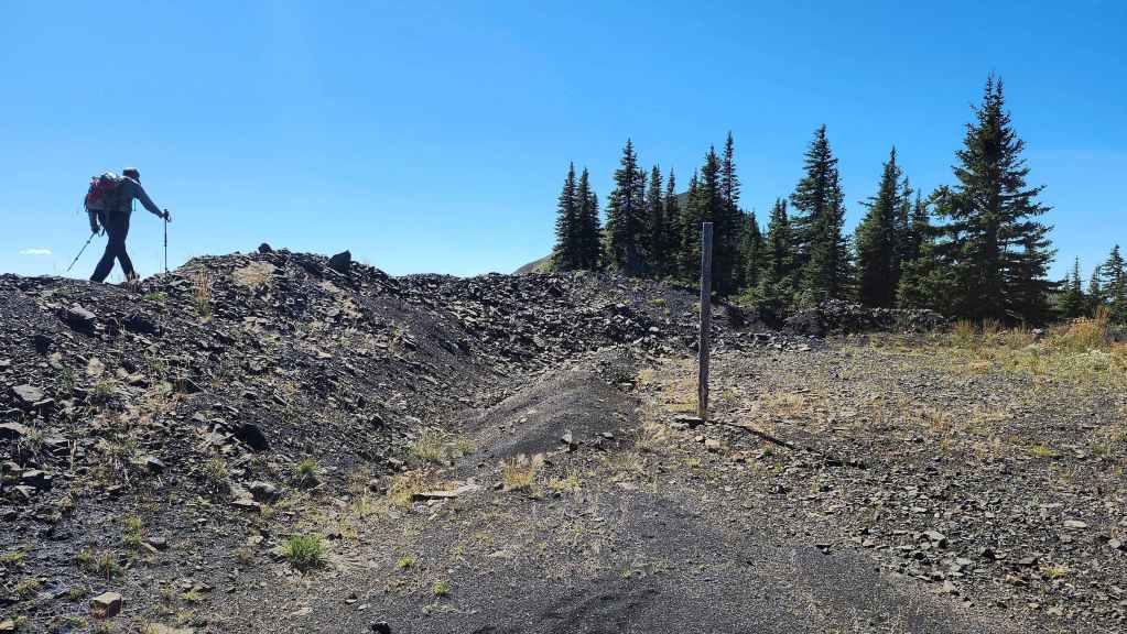
Except unlike Michel Head, this road ends before reaching the summit.
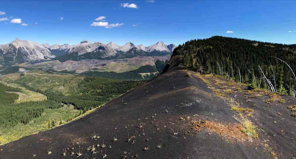
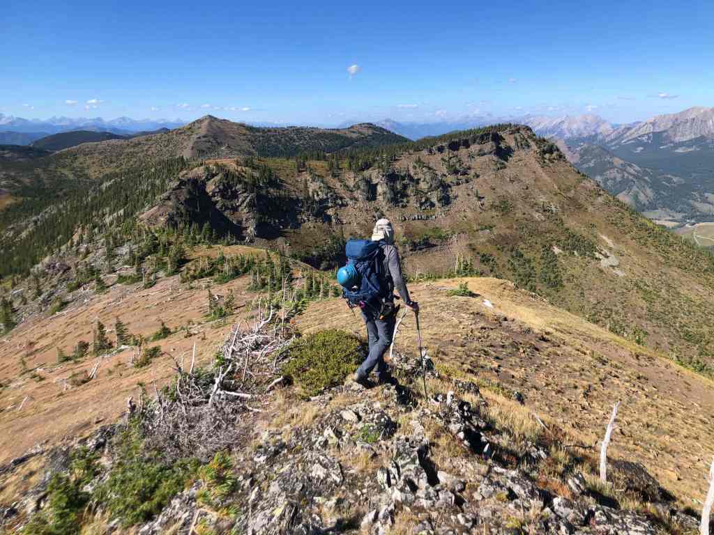
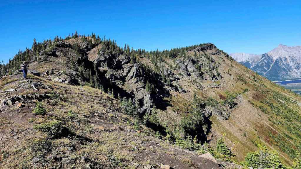
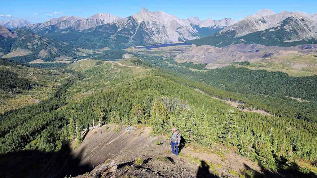
There’s nothing difficult here. It is however, where we’ll get our first taste of the colour variations to come.
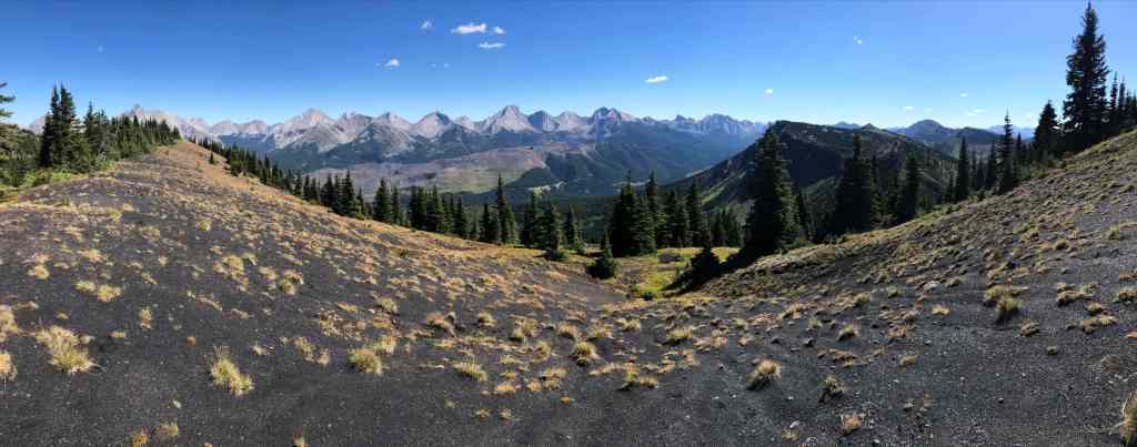

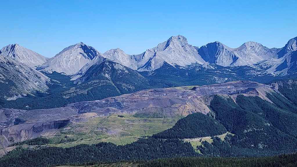
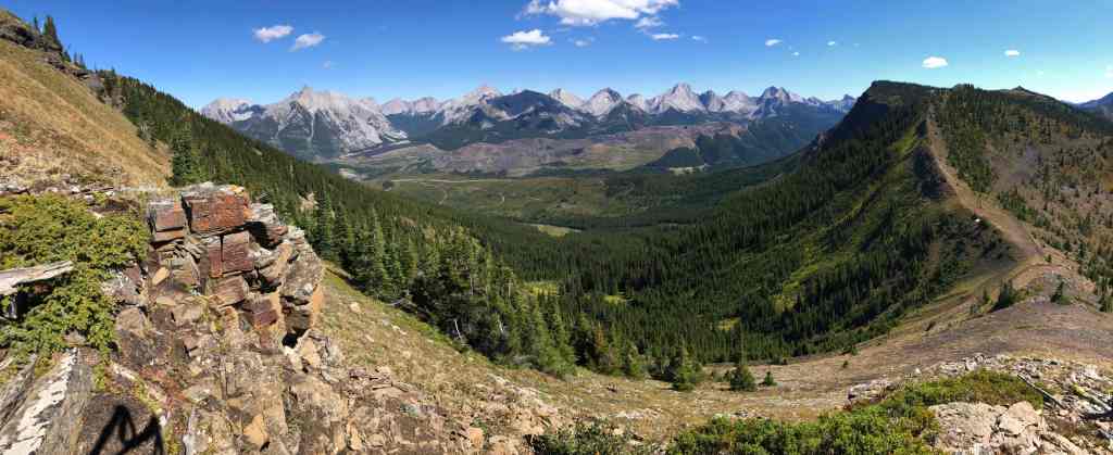
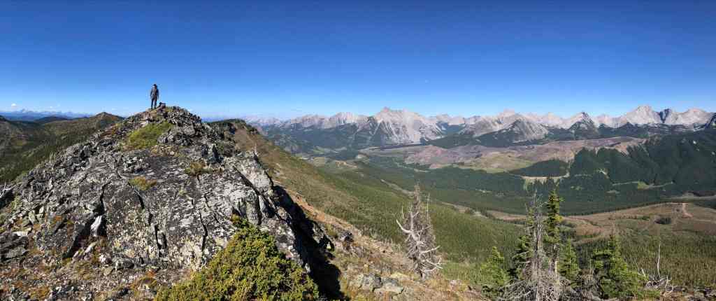
A coal… er, I mean cool pano from the ridge. (Photo by Andy Nugara)
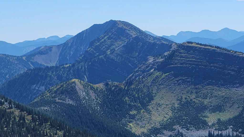
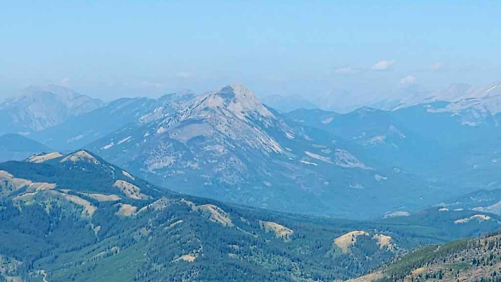
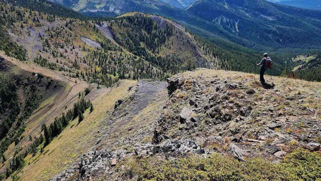
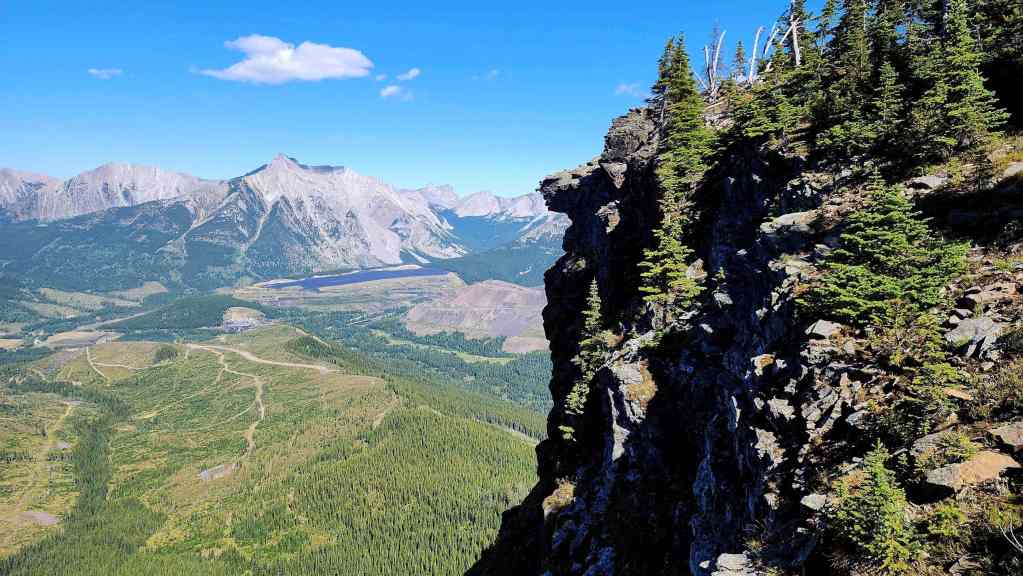
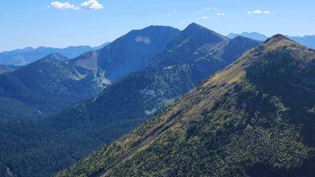
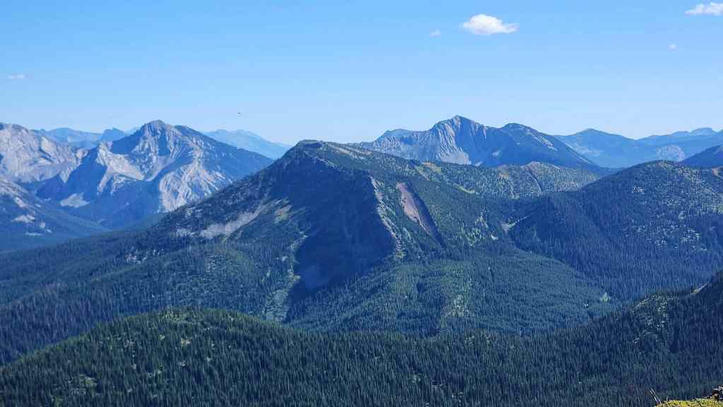
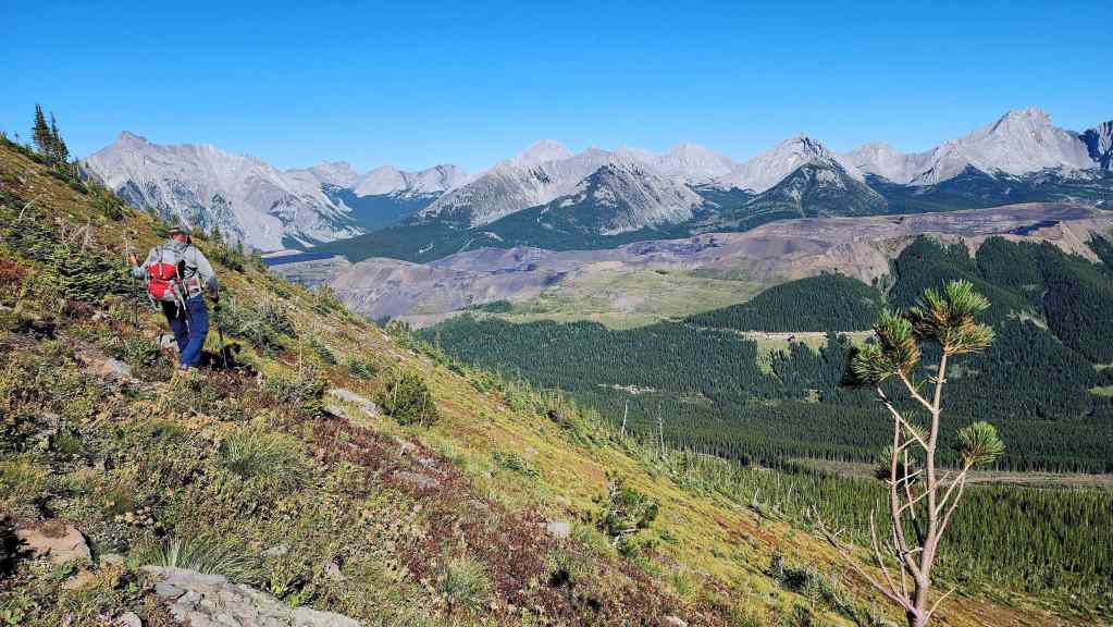
Looking back at the summit of Michel Head (left) as we gain elevation.


It was easy to tell that we were going to get much better views from this peak. (Photo by Andrew Nugara)

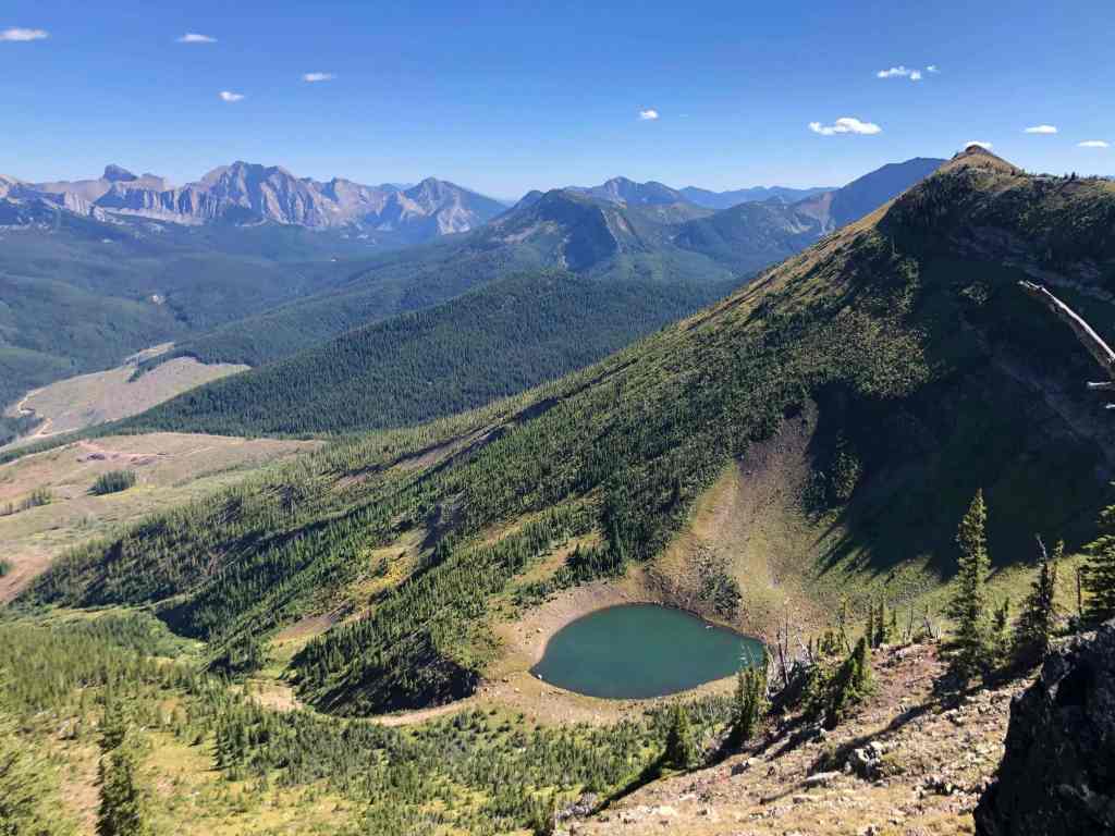
Looking across the valley at Mount Taylor (centre) and the first of three lakes that we would see today.

An easily negotiated rock band. (Photo by Andrew Nugara)

A bent survey marker sits above the rock band.
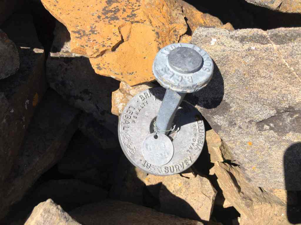
A closer look at the marker. (Photo by Andrew Nugara)

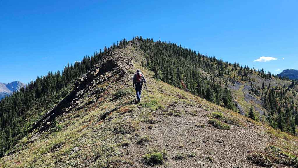
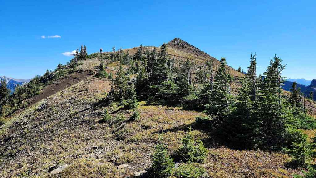
Approaching the summit. (Photo by Andrew Nugara)

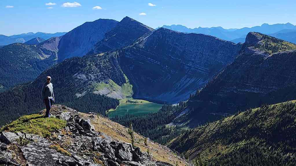
The summit of Michel Ridge (2327 m).

A small pin marks the summit.
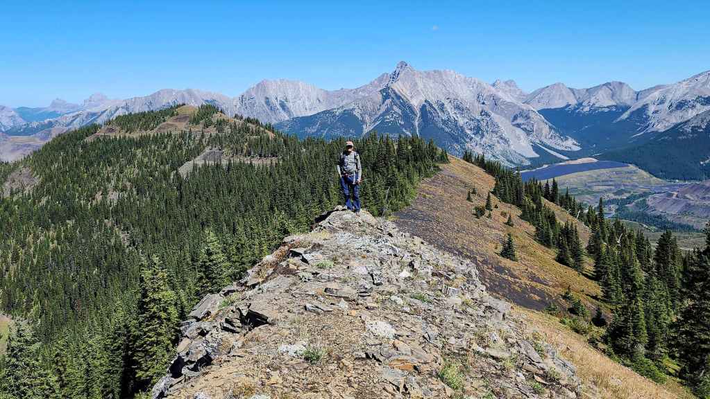
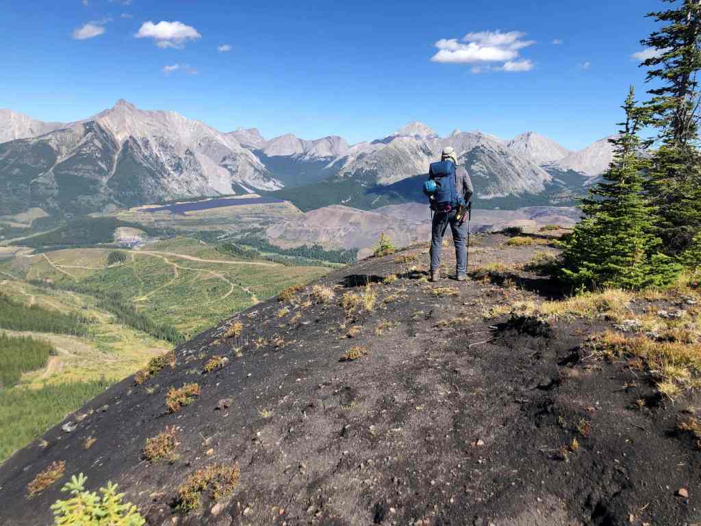
Looking back as Andy joins me on the summit. Michel Ridge is 30 m higher than Michel Head.
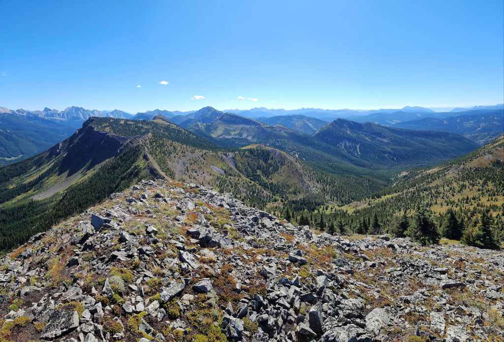

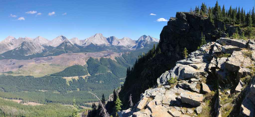
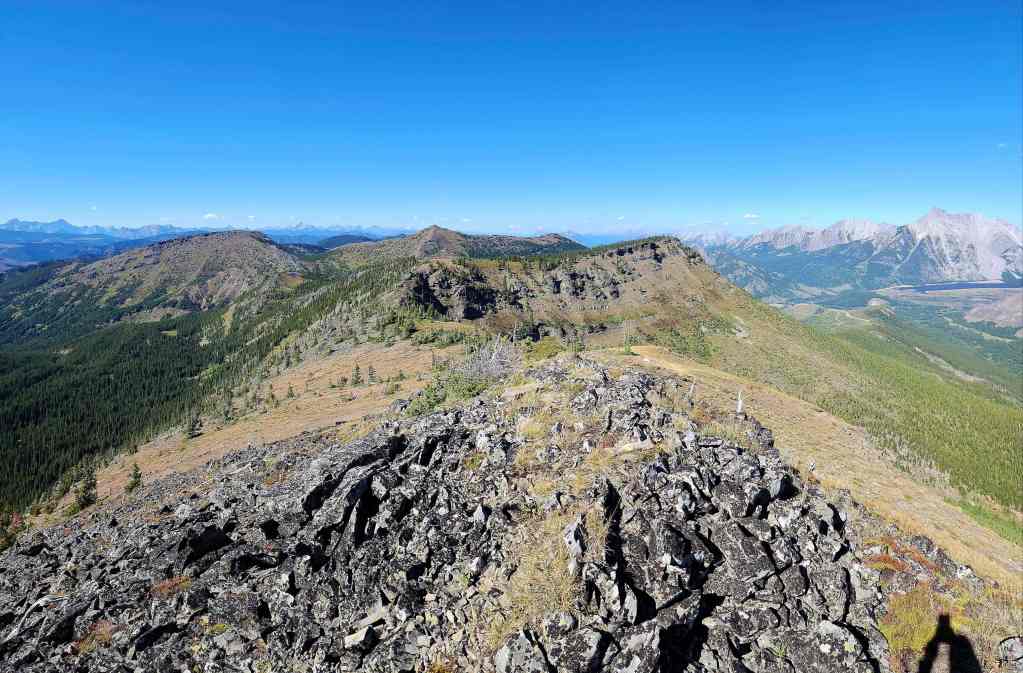
A pano along the southeast section of Michel Ridge…

And then along the northeast section.


Looking to the north…

And then to the east.
Glancing over at Michel Head.
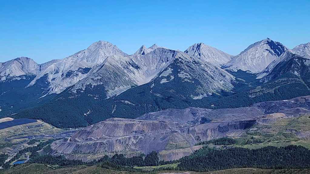
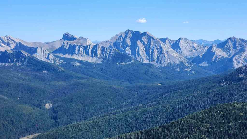
Mount Ptolemy (left), Mount Coulthard (left of centre), Sunglass Mountain (centre), Peak 34 (right of centre), and Ptolemy SE5 (far right)
Ptolemy SE5 (left), Mount McGladrey (centre), Mount Pengelly (right of centre), and Darrah N2 (right)
Darrah N2 (left), Darah N1 (left of centre), Mount Darrah (right of centre), Darrah SW1 (right), and Darrah S1 (far right).
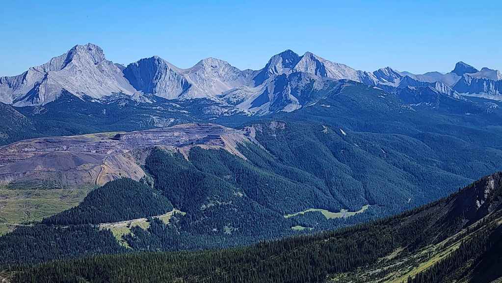
Mount Darrah (left), Darrah SW1 (left of centre), Darrah S1 (centre), Darrah S2 (right of centre), Darrah S3 (right), and Centre N1 (far right)

A closer look at Centre N1 (centre).

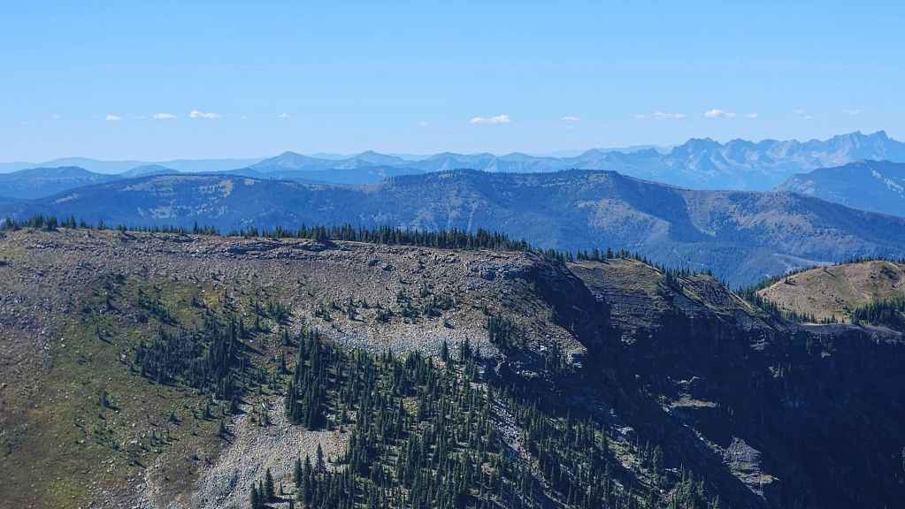
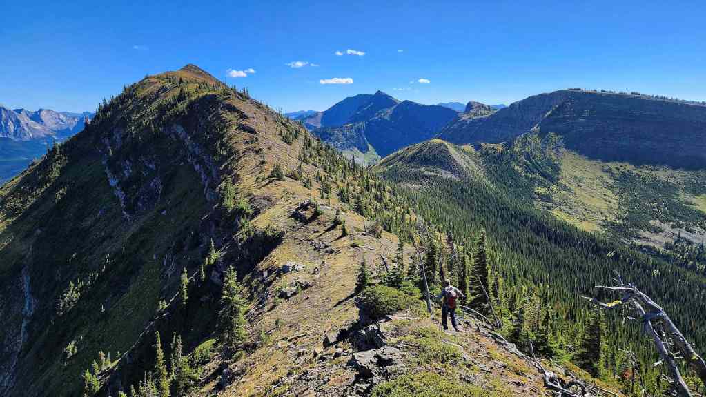
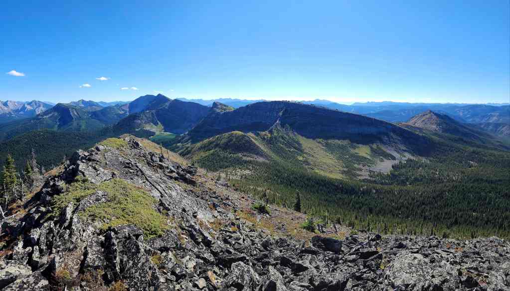
Looking along the entirety of the southeast section of Michel Ridge.
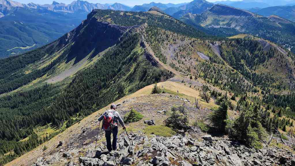
Zooming in on the high point that we could see on approach. The ridge on the left is what we will use to descend back to our bikes.
Now zooming in on the southeast peak. In the background is Mount Corrigan.
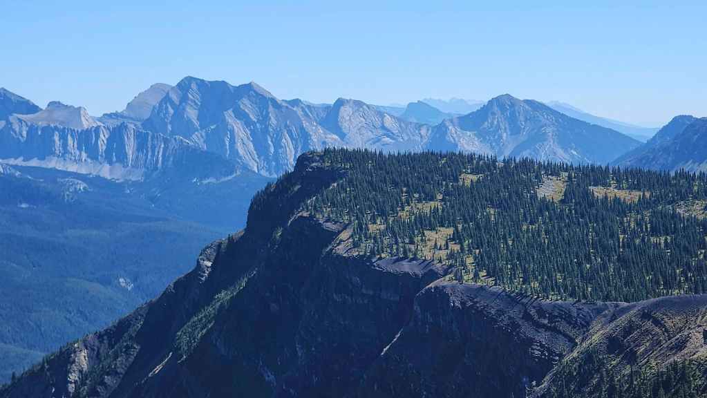
A closer look at Barnes Peak and Limestone Ridge.
Leach Ridge (middle distance) stretches across the entire photo, with its summit being the grassy area on the left.
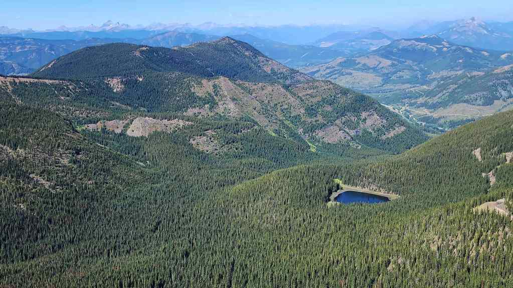
Another view over to Mount Taylor and the first little lake.
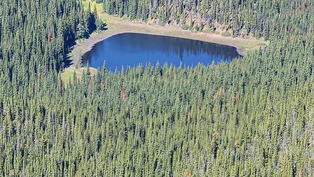
Another look at the first lake.
Gazing to the north at Mount Erickson.

Omahkai’stoo (Crowsnest Mountain) (centre) and the Seven Sisters (left).

One more pano back to Michel Head. (Photo by Andrew Nugara)


Suck in that gut, Dave! 😂 (Photo by Andrew Nugara)
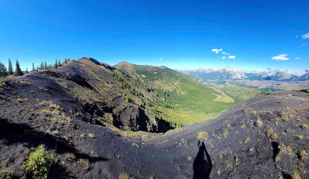
Descending to the col.

The first of many scenic photos. 🙂 (Photo by Andrew Nugara)
It was an easy hike to reach the col.

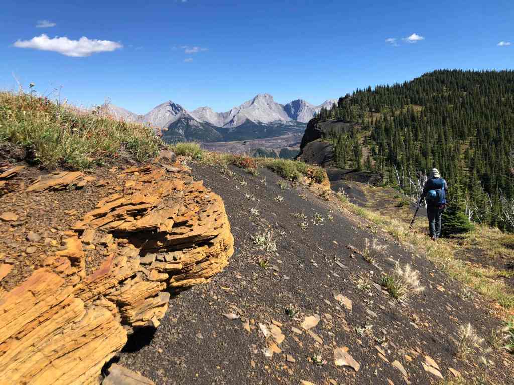
Red rock! Cue Andy’s excitement… (Photo by Andrew Nugara)
An interesting contrast of black coal and white rock. (Photo by Andrew Nugara)
More of the same. (Photo by Andrew Nugara)

More great scenery! (Photo by Andrew Nugara)


And more colours. (Photo by Andrew Nugara)
Heading up from the col.
Looking back at the summit of Michel Ridge. (Photo by Andrew Nugara)

The same as the previous photo with the addition of Michel Head on the far right.
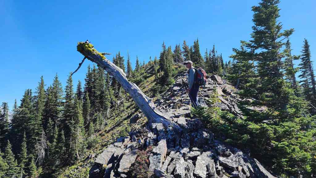
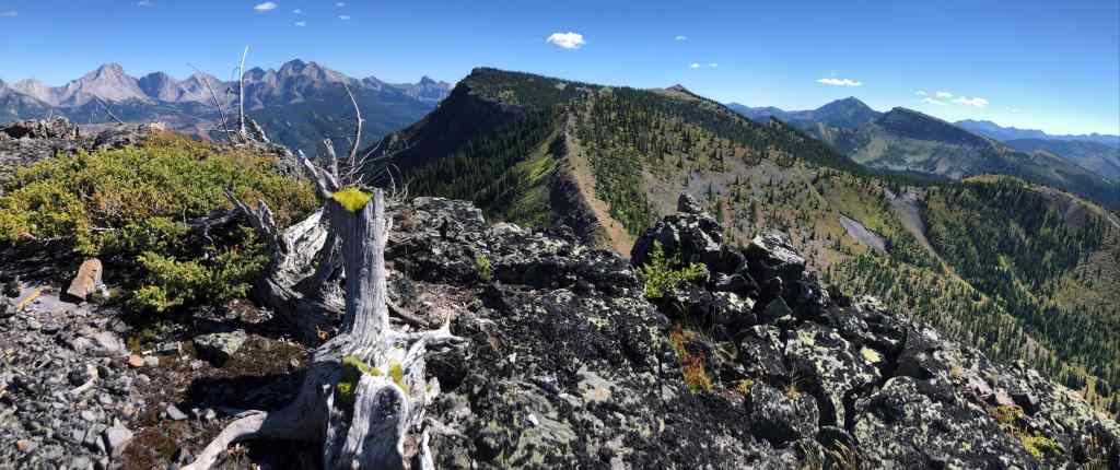
Andy checks out an interesting tree.

His view from the previous photo. (Photo by Andrew Nugara)
Another look back to Michel Ridge and Michel Head as we gain elevation.


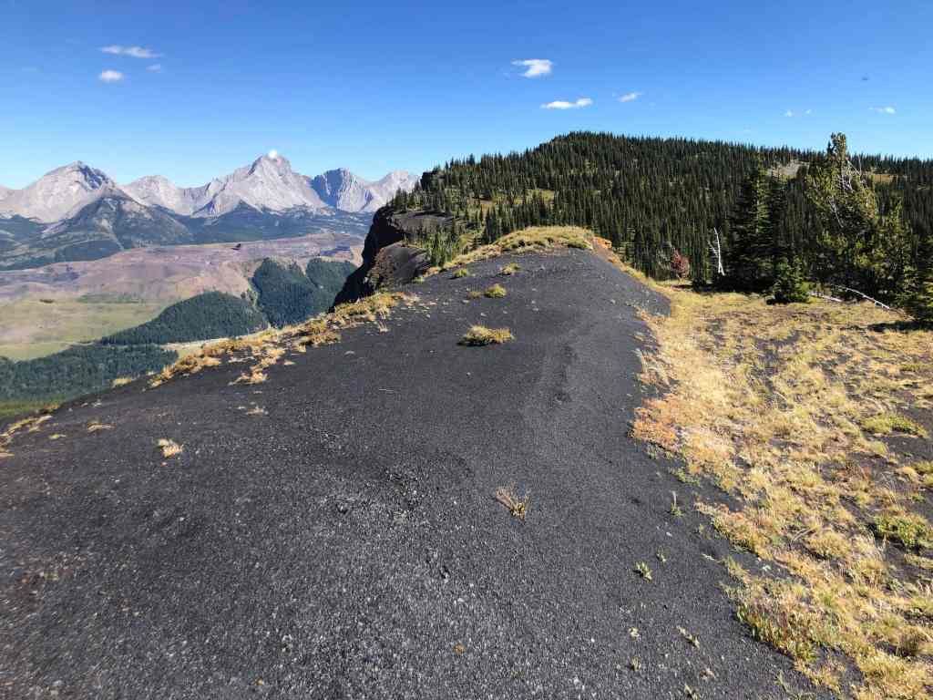
This is where the ridge walk began to impress!
The southeast peak of Michel Ridge.

Get ready…

Boom! How cool is this?
This black band of coal was captivating. (Photo by Andrew Nugara)
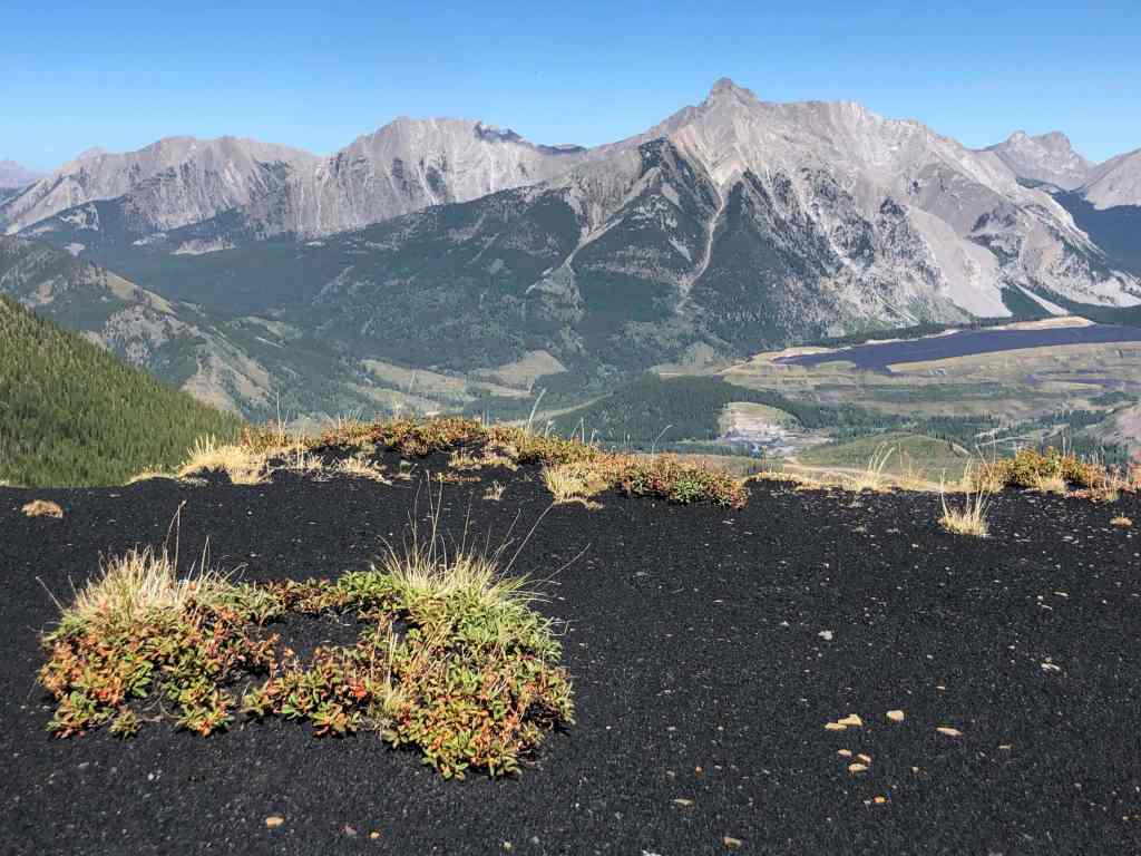
A tussock grows out of the coal. (Photo by Andrew Nugara)
More colour. (Photo by Andrew Nugara)
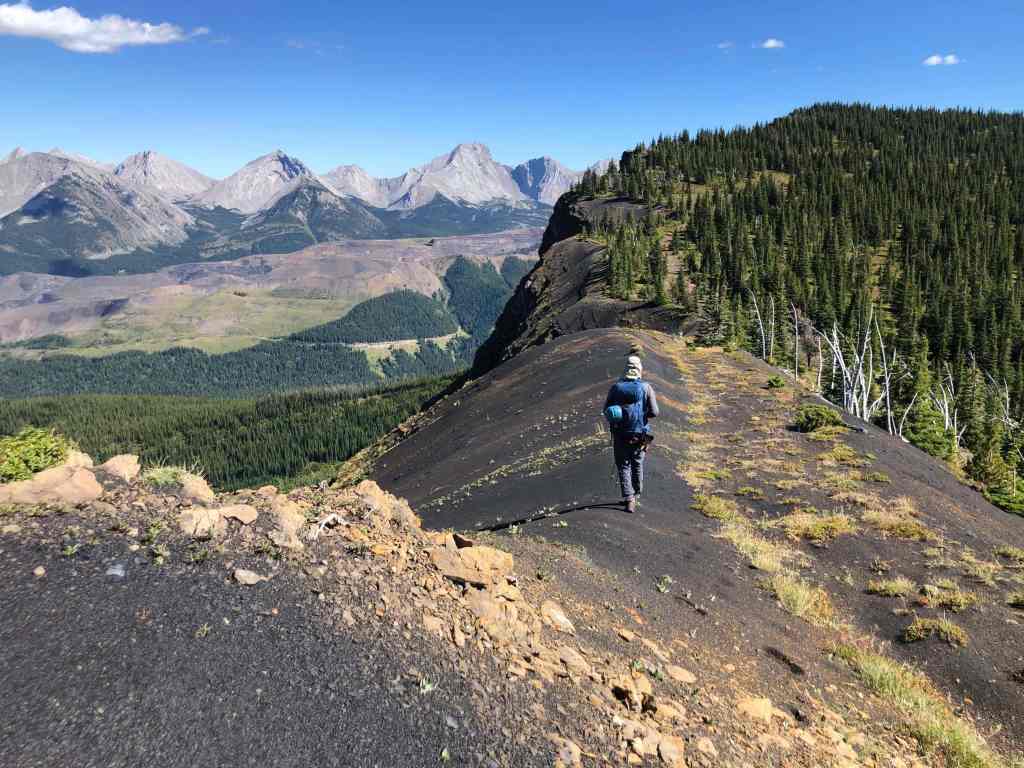
Walking beside an old road. (Photo by Andrew Nugara)

Yet another look at this unique ridge. (Photo by Andrew Nugara)

Looking back.
Both of us agreed that this was a unique section to traverse.
Still enjoying our views of the Flatheads. (Photo by Andrew Nugara)
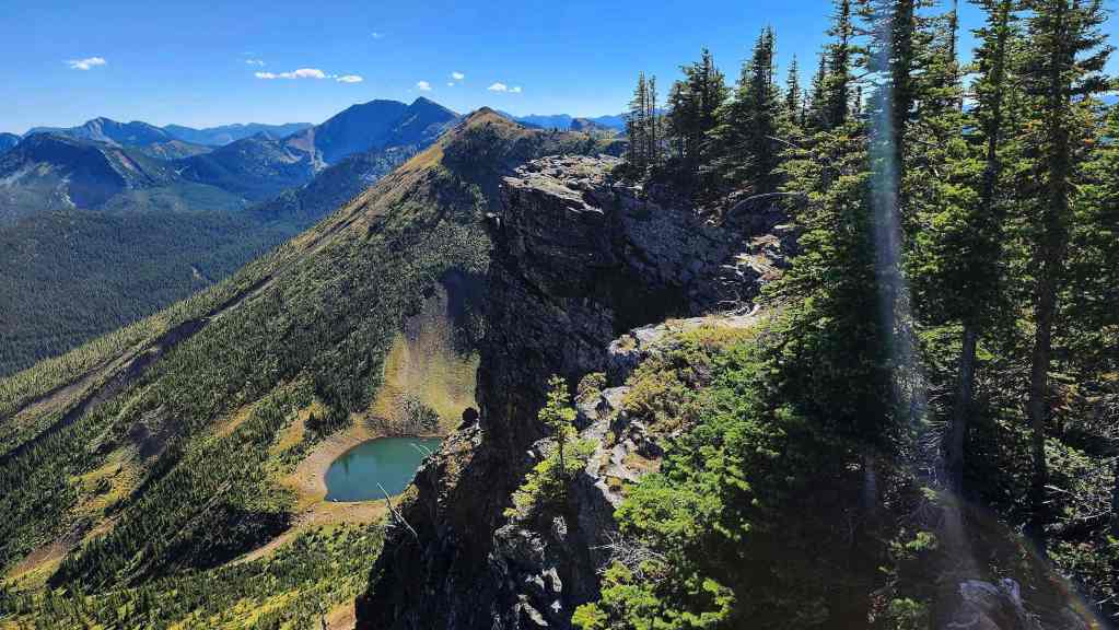
The cliffs off the first high point are impressive.
A wider view of the previous photo. (Photo by Andrew Nugara)
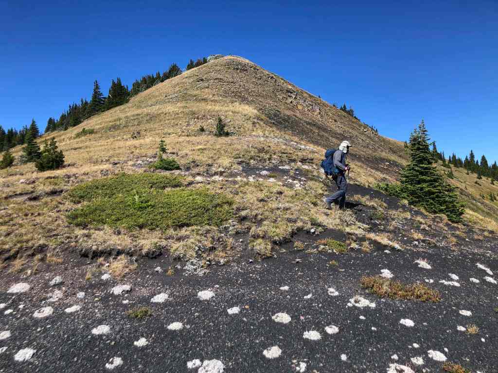
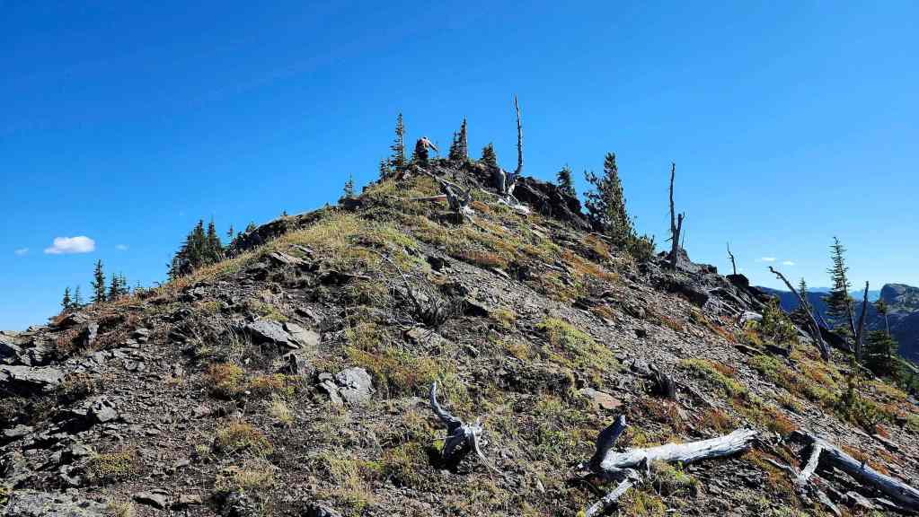
Approaching the top of the high point.

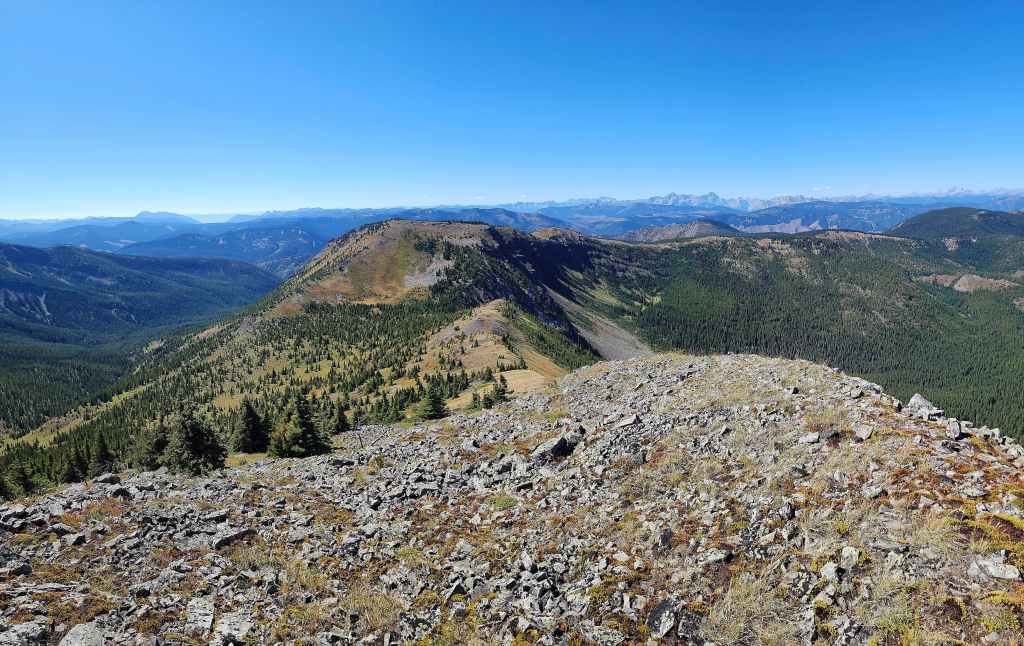
The summit of the first high point (2284 m).

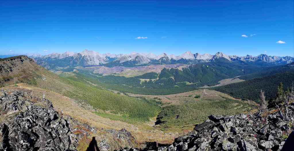
A pano to the north…

And then to the east.

Finally, a pano to the southeast.
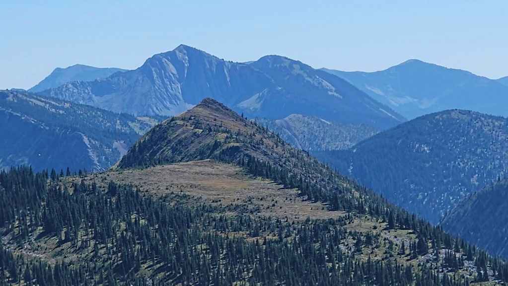
A closer look at Tent Mountain.
Our first good look at Mount Coulthard (left) along with Sunglass Mountain (centre), and Peak 34 (right of centre).
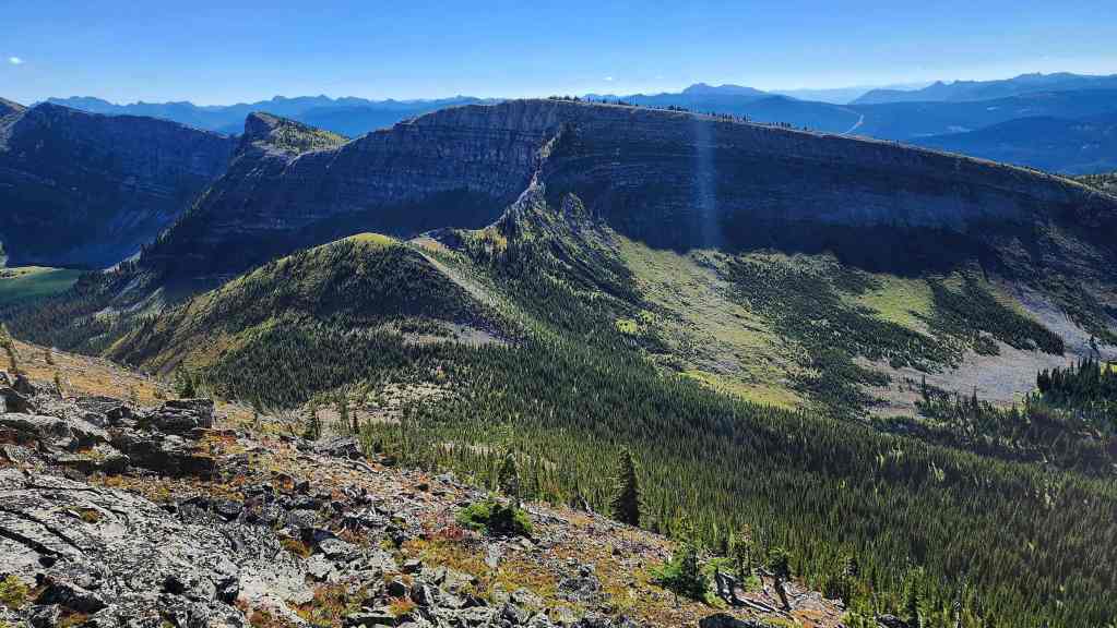
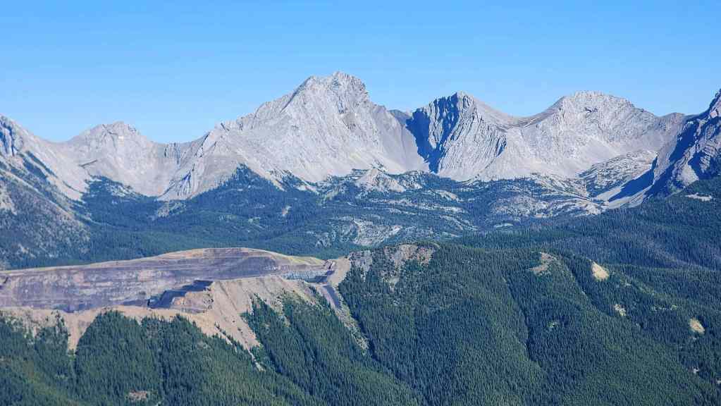
Speaking of ridge walks, Barnes Peak (centre) and Limestone Ridge is an outstanding trip! In the foreground on the right is the southeast peak of Michel Ridge.
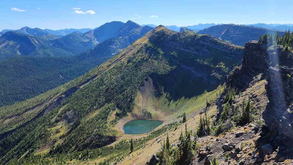
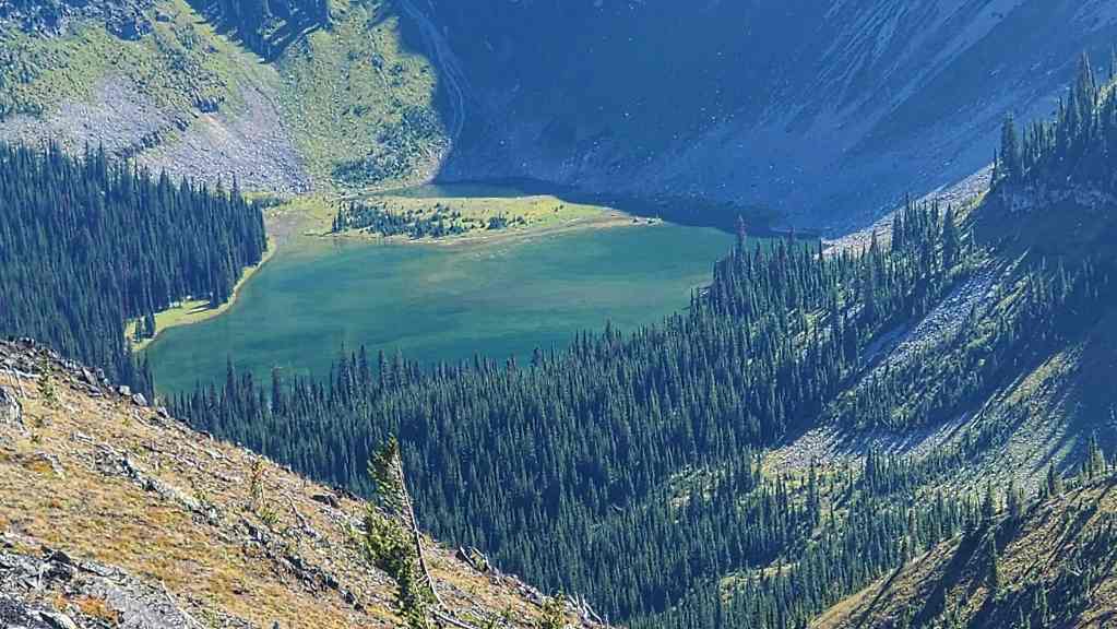
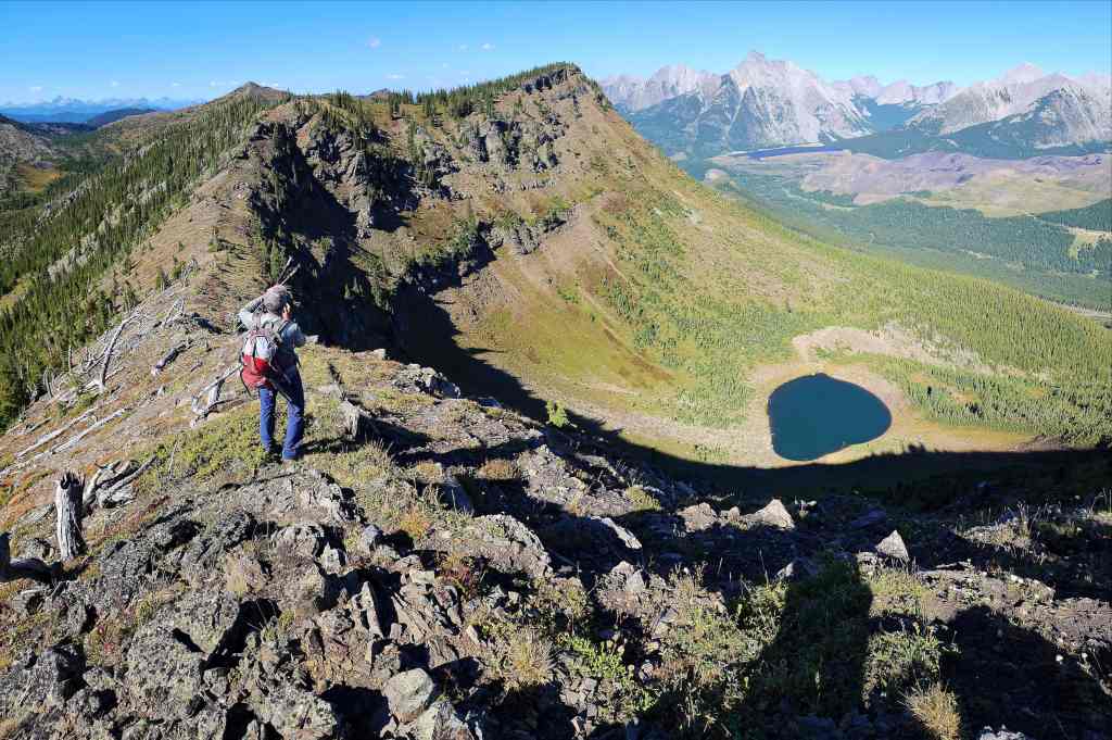
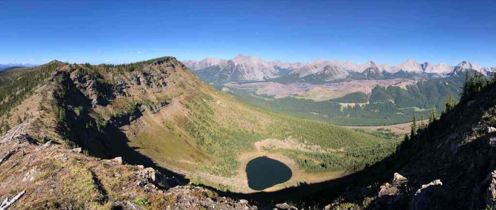
We were surprised to see a pretty tarn tucked beneath the southeast peak. This would be lake two of three for the day. 🙂
Heading over to the southeast peak.
Another look at the tarn…

And then another. (Photo by Andrew Nugara)
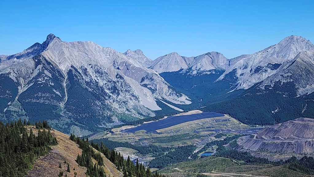
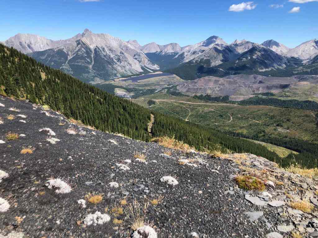
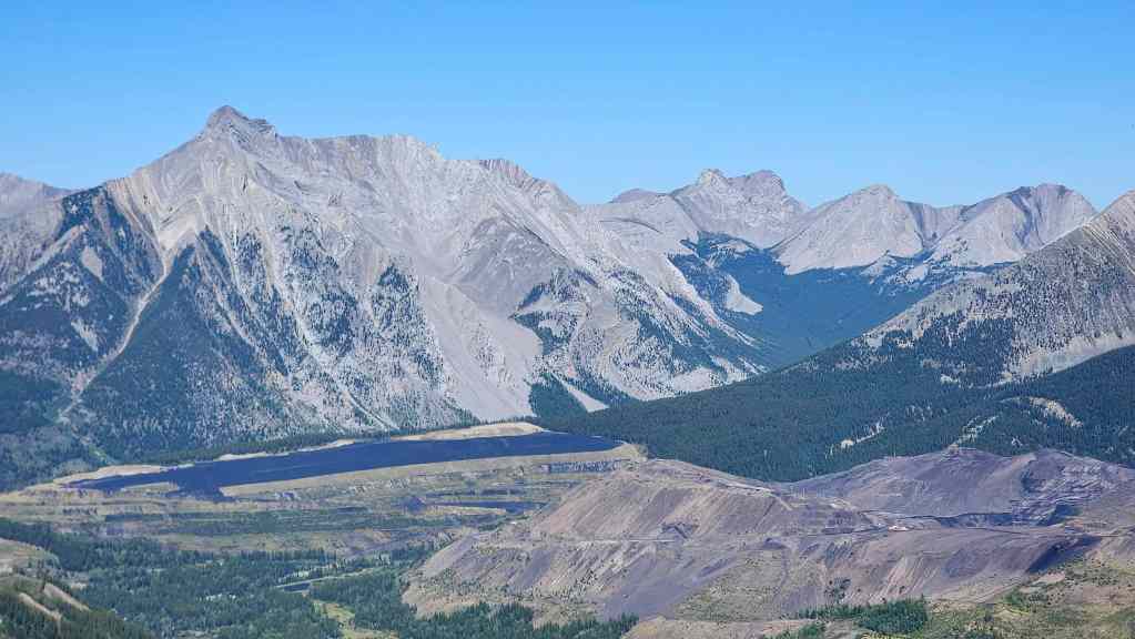
The active work / exploration site and the continuation of the road from where we left our bikes is in the foreground to the right of centre.
And yet another photo of the lake… 🙂
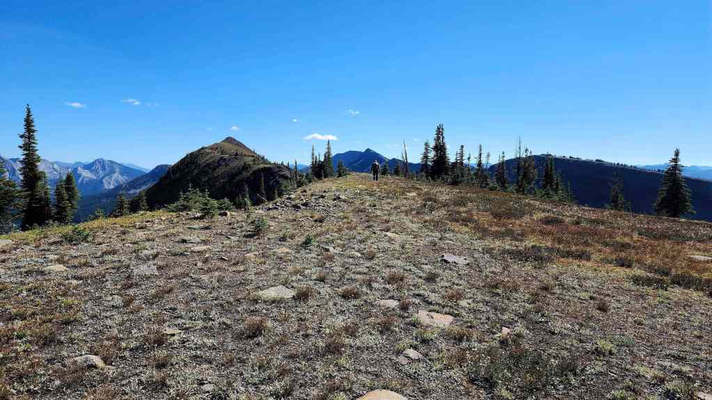
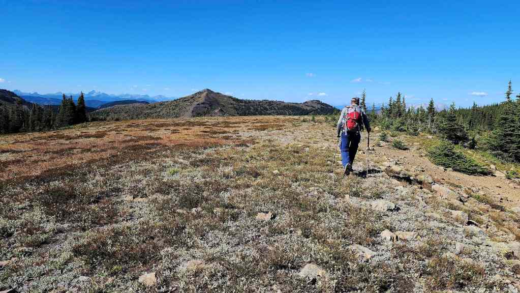
Heading across a broad plateau.
Looking back and across the plateau.

Andy’s view back to the first high point. (Photo by Andrew Nugara)

The southeast peak of Michel Ridge. (Photo by Andrew Nugara)
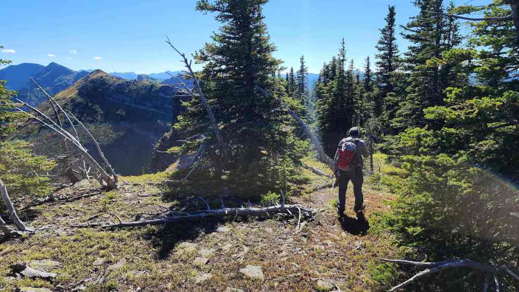
Andrew leads the way.

Another lake photo… (Photo by Andrew Nugara)
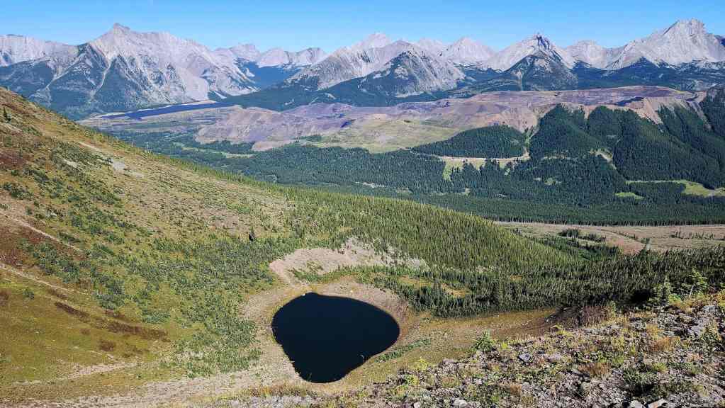
And then another…


The view back from the col. (Photo by Andrew Nugara)
Heading up.
Again, there was nothing difficult about this trip. The only crux would be the bushwhacking back to our bikes at the end of the day.


The view back to the first high point… again.
On the summit of the southeast peak (2292 m).

A pano to the east…
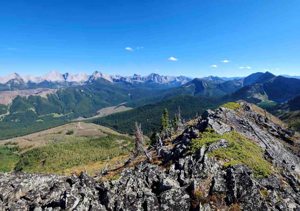

And then to the southeast.

Now looking to the south.
There it is! Elliot Lake is the third lake we’ve seen today! The ridge in the centre is what Andy and I used to get onto Limestone Ridge and Barnes Peak a few years ago.
A closer look at Elliot Lake.
The end of Limestone Ridge sits directly across from the southeast end of Michel Ridge. The narrow connecting ridge does not look friendly for hikers looking for a shortcut between the two.

A closer look at the summit of Leach Ridge (centre)…
Followed by a look at the entire ridge.

The view back to the summits of Michel Ridge, Michel Head, and the first high point.
Mount Ptolemy (left), Mount Coulthard (centre), Sunglass Mountain (right), and Peak 34 (far right).
Another look at Mount Darrah (centre).

Darrah S2 (right of centre) and Darrah S3 (right).
Centre N1 (left) and Centre Mountain (centre).
Mount Borsato (left) and Mount Corrigan (right)
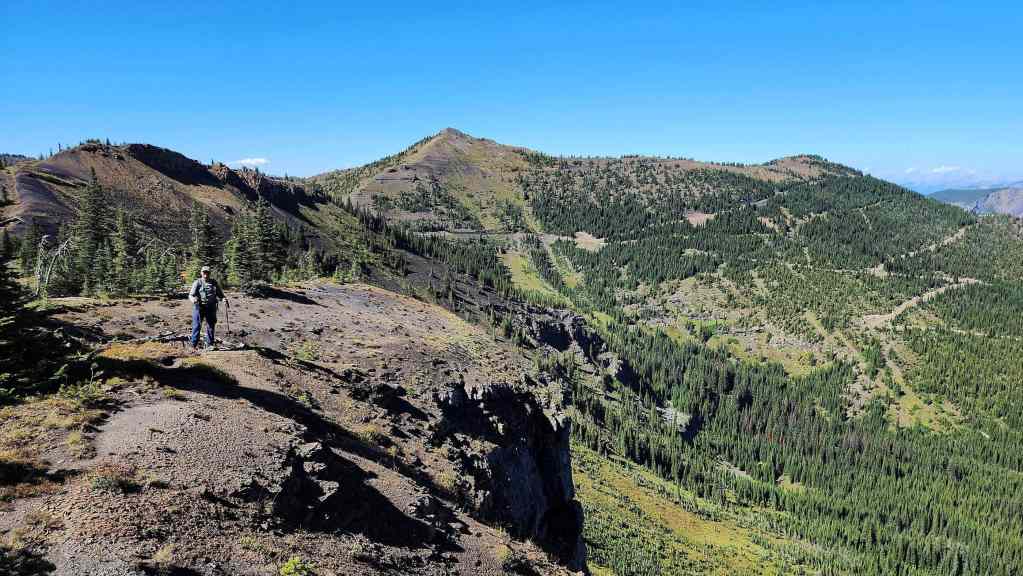
Andrew takes in the views.

Another look at Elliot Lake. (Photo by Andrew Nugara)

And another close-up. You could reach Elliot Lake by continuing to hike down the remainder of the ridge. (Photo by Andrew Nugara)
Andy on the summit.
And then me on the summit. (Photo by Andrew Nugara)
Heading back. (Photo by Andrew Nugara)
We will descend just prior to the cliffs near the summit.

It was an unexpected three lake day.
Andy pano from the previous photo. (Photo by Andrew Nugara)
It won’t take long to reach the cliffs.

Looking back at the southeast peak. (Photo by Andrew Nugara)
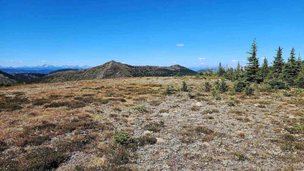
Crossing the plateau.

Once we were on the slopes beneath the cliffs, we would begin traversing to our descent ridge.
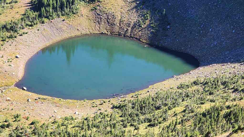
One last photo of the tarn… I promise! 🙂
It was an easy traverse.
Starting down the ridge. Our bikes are located next to the road in the centre.

A taste of what was to come.
A brief reprieve.
Looking over at the summits of Michel Ridge (left) and Michel Head.
Skirting a section of undergrowth. (Photo by Andrew Nugara)

Entering the heaviest section of bushwhacking.

But not before getting one more look at the Flatheads. (Photo by Andrew Nugara)
This section was the crux of the trip.
However, the lower section was much easier.
Almost there.

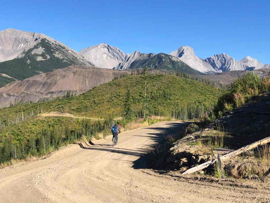
Arriving back at our bikes..

From here it will take less than 15 minutes to reach the Corbin Road.
Yet another great day in the mountains! (Photo by Andrew Nugara) After waiting several years to get to the top of Michel Head, the real highlight ended up being our traverse of Michel Ridge. That it happened on an absolutely perfect weather day, was the cherry on top. My only reservation concerns the short section of road that we used for access. As we gambled on the semantics of a sign I can’t recommend using our loop. However, there are other ways to access Michel Head from the Corbin Road if you don’t mind wading across Michel Creek. In fact, this might be a quicker way to access the start of the old roads.