⚠️ Hiking and scrambling are inherently dangerous activities. Please read my Disclaimer. ⚠️
A few years ago, Andrew Nugara started telling me about, Devan Peterson, a young man who was putting up some insane solo distances and times in the mountains. A few weeks ago, Andy sent me Peterson’s Sunglass Mountain to Ptolemy SE5 loop that Peterson completed in an astonishing, 10 hours and 21 minutes. 😯 Though I knew where these mountains are and have had Ptolemy SE5 on my ‘To Do’ list for a couple of years, I didn’t know that Sunglass Mountain and Peak 34 actually had names. I had just assumed that they were unnamed as they aren’t listed on any map that I’ve seen. That’s when Andy did some digging and discovered that the names come from Peakery and though they aren’t official, they are nicknames of unknown origin that I’m happy to roll with. 🙂
As for Peterson, I have no idea how he moves so fast – especially on the crappy rock of the Flatheads – but it definitely makes me feel more old and slow than I already am. 😂 Anyway, after looking at his route, Brad and I thought Sunglass Mountain and Peak 34 looked like cool destinations with the added bonus of the lake nestled beneath. Moreover, neither of us had followed the trail to the headwaters of Andy Good Creek before, so it would be new terrain to for us to explore. That the forecast promised the area to be cooler than the scorching temperatures elsewhere in southern Alberta, made this the ideal choice for today.
Unfortunately, Andy couldn’t join us but Dave and his brother James could, so the four of us piled into my truck very early in the morning and made the drive to the trailhead. I was expecting to park where we did for our trip up Mount Ptolemy in 2022, but the road had changed a bit, and we couldn’t find the side road that we had used to get to the parking area. With Brad applying peer pressure, I kept driving up the main road until I grew increasingly uncomfortable with sound of branches scraping the side of my truck. That’s when I decided not to go any further and park next to the road; though according to both Brad and Dave, I could’ve kept going – something they kept reminding me throughout the day. 😂 To be fair, had I not cared about the paint on my truck, we could have gone at least another kilometre, but since I will probably need a full bottle of ScratchX 2.0 to buff out the pinstripes I just acquired, another kilometre would’ve meant a full-on trip to the body shop. 😂
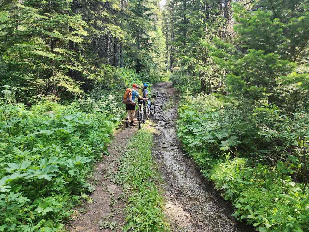
Once on our bikes, the first five kilometres of the trail gained elevation somewhat gradually as it followed alongside Andy Good Creek. Brad quickly emerged as the smart one because he wore river shoes for the multiple creek crossings while the rest of us tried to avoid getting our boots wet. As we all had human-powered bikes, this meant we also spent a lot of time pushing and soon after the trail steepened considerably between the 5 to 6 km mark, we ditched our bikes.
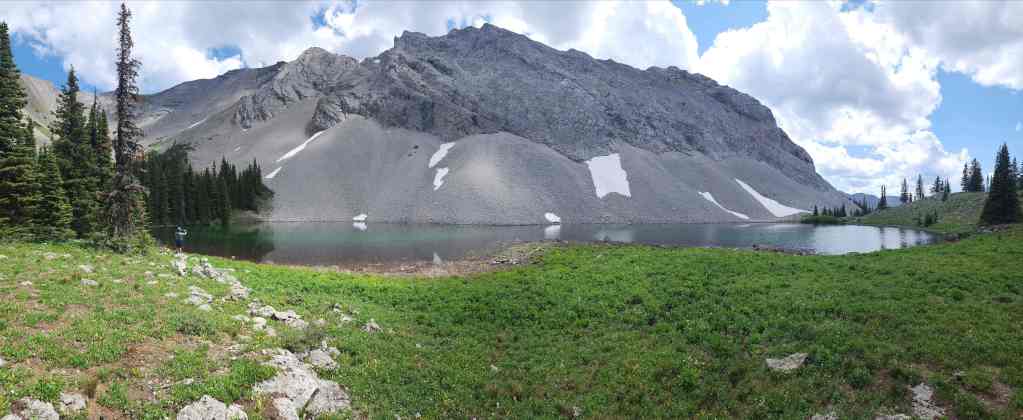
As we gained elevation, the views opened up and the scenery was impressive. The immensity of the bowl beneath Andy Good Peak and Mount Coulthard was captivating but nothing compared to the views of the Andy Good Plateau as we ascended the north slope of Sunglass Mountain. Well, that is, until we descended to the unnamed lake (‘Sunglass Lake’?) that sits beneath Sunglass Mountain and Peak 34. This was simply a gorgeous place that would be an incredible place to camp, as evidenced by several hearths along the shoreline.
Though we didn’t end up traversing to Peak 34 due to several sketchy patches of snow, I’d have no problem coming back again. There may even be a way up from the lake to the col between Sunglass and Peak 34… 🤔 Thanks again to Brad, Dave, and James for yet another fantastic day in the mountains! The pinstripes were worth it! 😂

To get to Sunglass Mountain, we drove west of Summit Lake in the Crowsnest Pass for ~7 km until we came to the junction with the Corbin Road on our left. We then followed this road for ~20.5 km until we came to a small dirt road on our left just prior to a set of railroad tracks and subsequently, Andy Good Creek. This is the start of the access road to Mount Ptolemy, the Ptolemy Pass trail, and the headwaters of Andy Good Creek including, Sunglass Mountain.
As the area has recently been logged, the road has been altered somewhat from previous maps and descriptions. In fact, since we were last down this road in 2022, we had a difficult time finding the side road to our parking spot for Mount Ptolemy. After backtracking to a larger parking area approximately 500 m from the highway, I turned around and drove straight along the main logging road (past the ‘Private Road Not Maintained / Use At Your Own Risk’ sign) for another ~1.5 km until my truck had become sufficiently pinstriped from vegetation. It was possible to keep driving for another kilometre or so, but not if I wanted to avoid permanent marks on my paint. 😯
Since the road is a popular ATV and hiking route and the only ‘No Trespassing’ sign that we saw was at the entrance to two small cabins, we didn’t worry about the small ‘Private Road’ sign since the land is public. It probably means that a resource company still holds the rights.
From our parking spot, we then biked along the road (pushing in many places) for a few kilometres until we came to the first of several creek crossings. After wading across the first and second crossings in quick succession, we discovered that the next two crossings had bypass routes off to biker’s left. However, we came to a point where the trail became the creek for a short distance and getting wet was almost unavoidable. There were also many places alongside the creek that were unridable due to the rocky terrain.
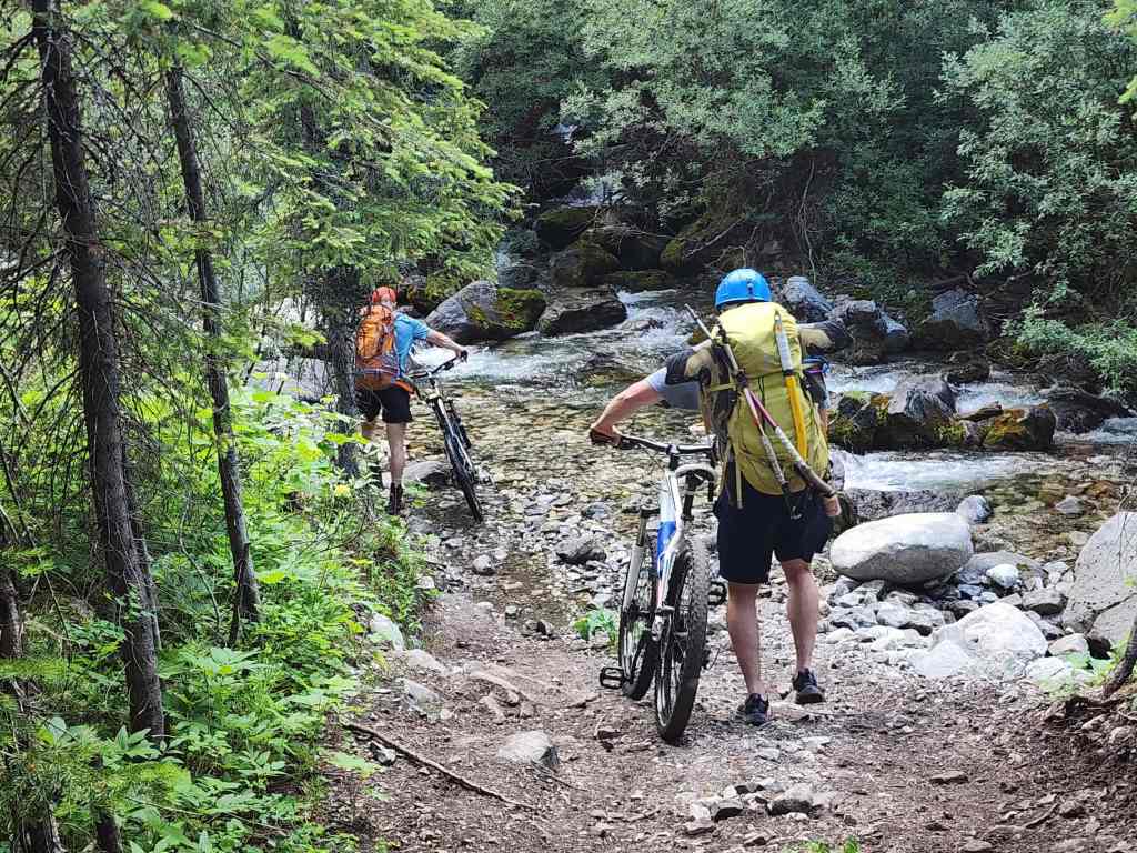
Approximately 6 km (242 m elevation gain) after starting, we ditched our bikes after the trail steepened considerably for the final 1.6 km (262 m elevation gain) before reaching the bowl beneath Andy Good Peak and Mount Coulthard. For reference, it was ~7.6 km from our vehicle to the bowl with a 504 m elevation gain. From the Corbin Road, the bowl would be a ~9.6 km trip and from the larger parking area, it would be an ~8.1 km trip.
After admiring the gorgeous scenery in the bowl, we followed a trail off to hiker’s right that led to a large meadow and fire pit. From here, we followed a trail that we assumed led to the lake (we confirmed this on the way back) for a couple hundred metres before leaving it to bushwhack a short distance up to the bowl between Sunglass Mountain and Mount Coulthard. We then took advantage of a line of vegetation that led from the bowl up to the summit ridge on Sunglass’s north slope. This allowed us to avoid what would otherwise have been miserable slog over treadmill scree.
Once on the ridge, it was a quick walk to the summit of Sunglass Mountain. For reference, from the fire pit, it was a ~1.6 km trip with a 472 m elevation gain to reach the summit. From my truck to the summit, it was ~9.4 km trip with a 971 m elevation gain. After admiring the views, we contemplated continuing to Peak 34, but having to cross some very sketchy sections of snow to reach the col, made a direct descent to the lake more appealing.
From the summit, we picked our way down the mountain for ~1 km (383 m elevation loss) until we arrived at the gorgeous unnamed lake. After spending an hour relaxing beside it, we then followed a nice trail for ~1.4 km (78 m elevation loss) back to the fire pit where we then retraced our route back to my truck.

Our total roundtrip time was 8 hours and 30 minutes including a leisurely, one hour break beside the lake. For reference, it took us exactly 4 hours and 30 minutes to reach the summit after starting. Total elevation gains came in at 1174 m and our total distance was just under 20 km.
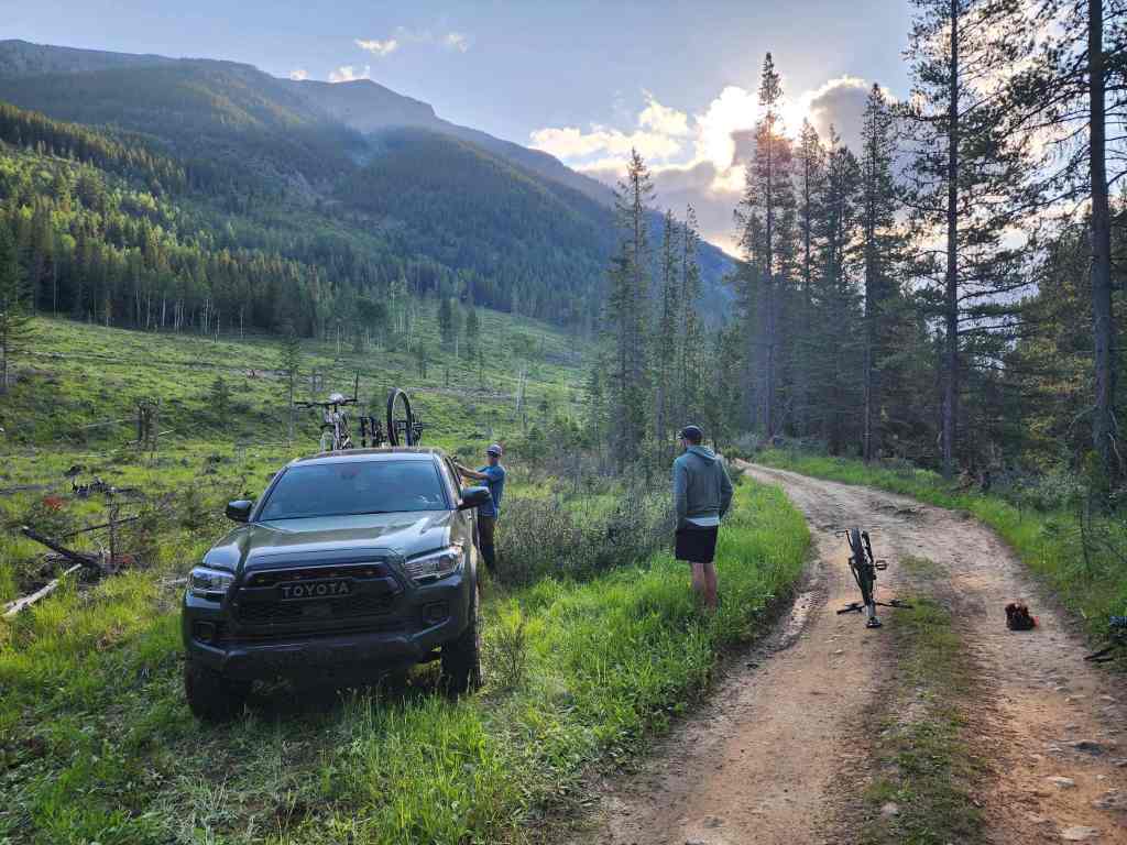
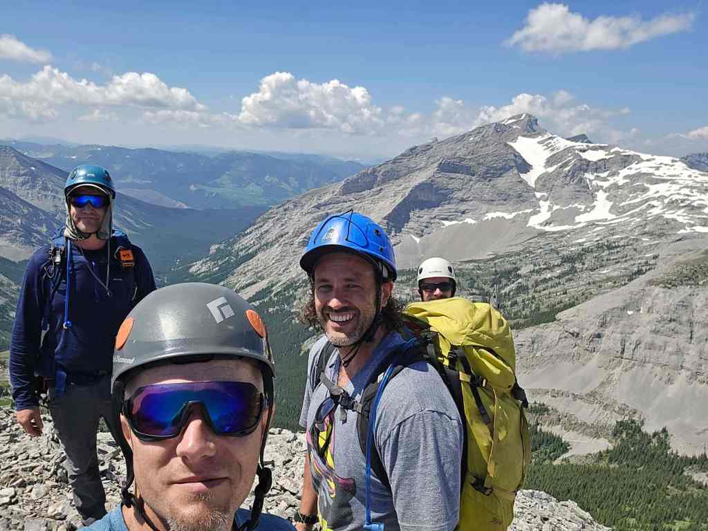
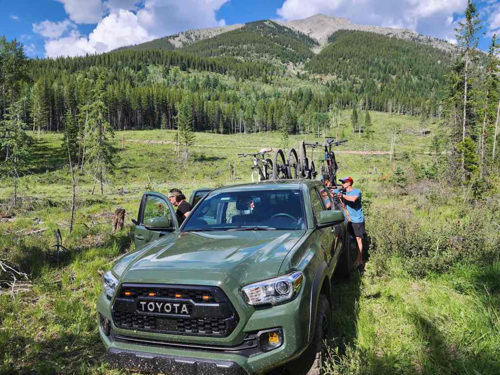
Gearing up at our parking spot approximately ~2 km from where the trail connects with the Corbin Road. In the background is the false summit of Mount Ptolemy.
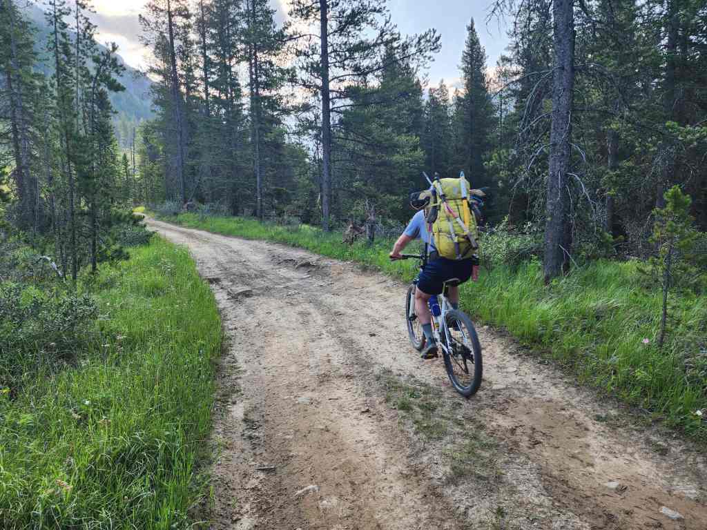
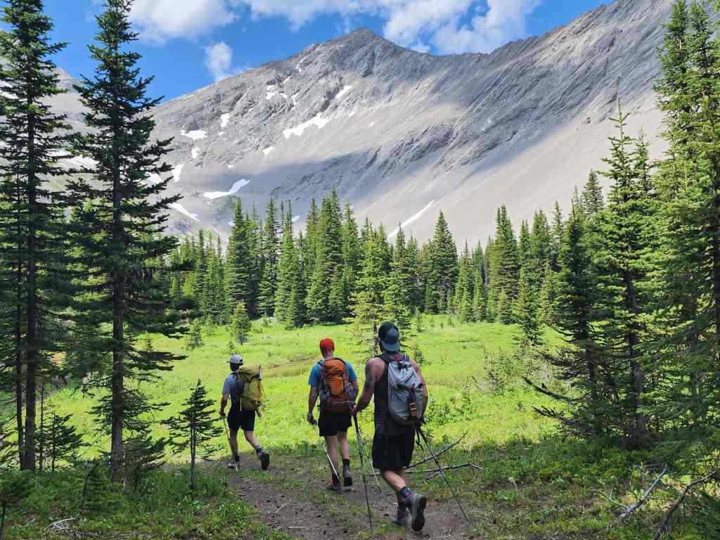
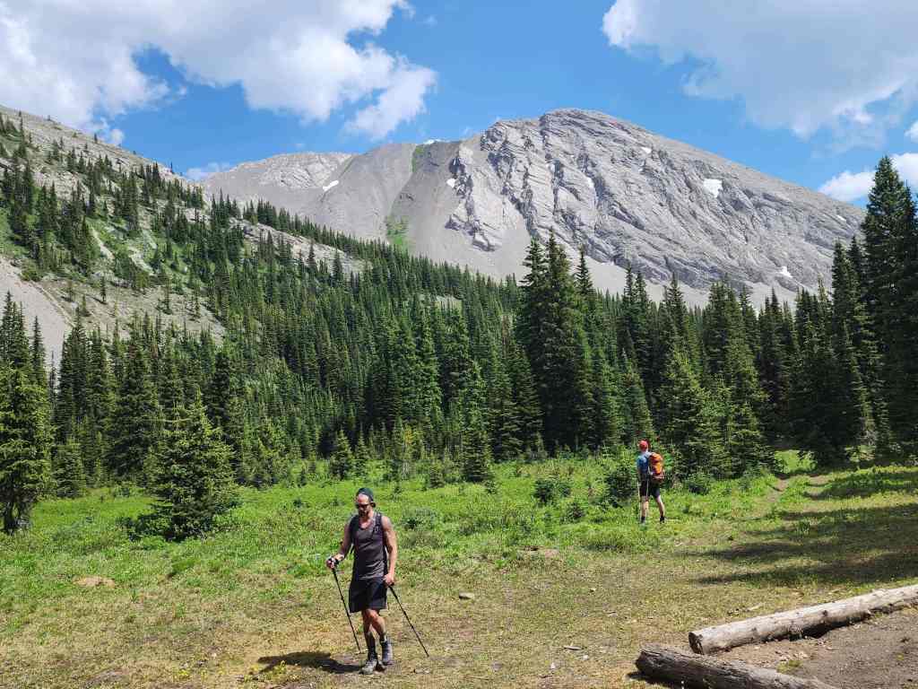
Starting off.

The first of many sections where we’d end up pushing our bikes. Coming back is where all this hard work would pay off. 🙂
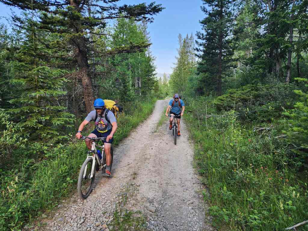
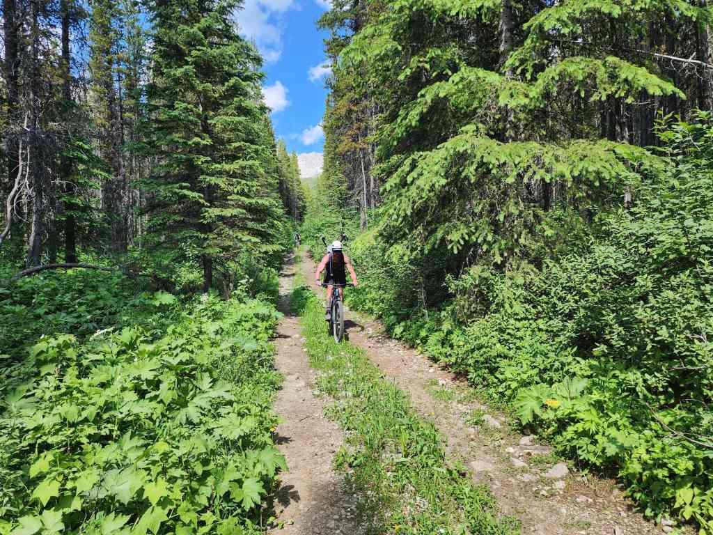
Back to riding…

And now back to pushing.
Early morning clouds cover the Flatheads. These would soon dissipate.
Looking to biker’s left from the previous photo and up a massive gully on Mount Ptolemy.

Losing elevation as we descend to Andy Good Creek.

James tries not to get wet as we navigate the first of many creek crossings.
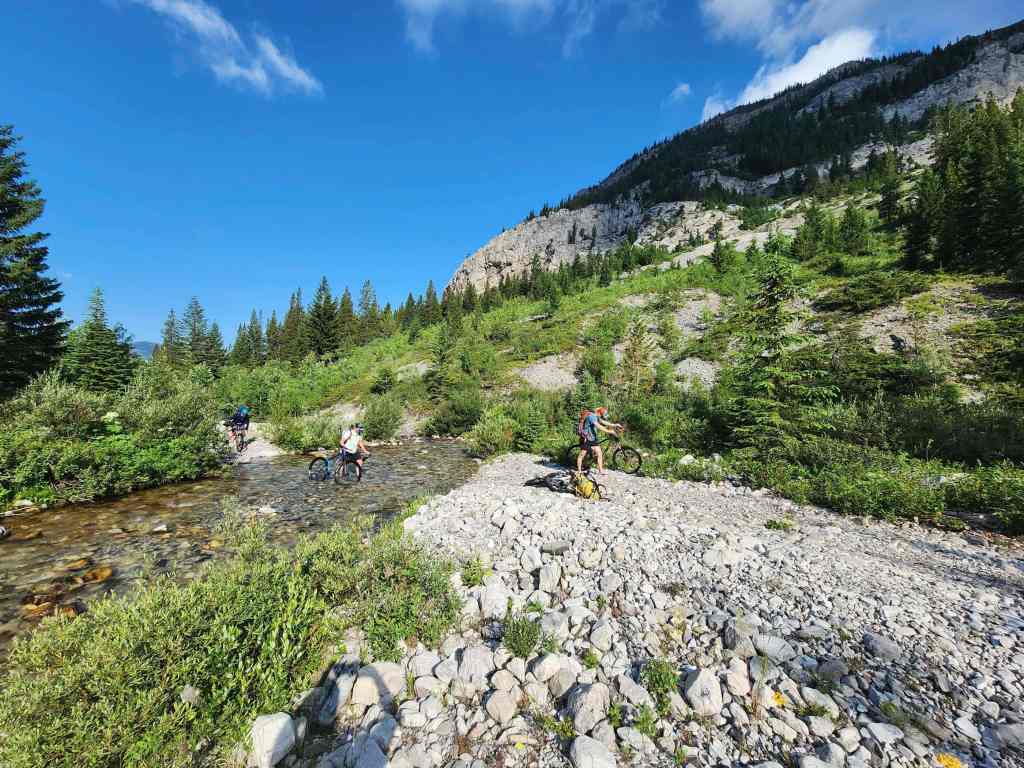
The second crossing came immediately after the first. Brad was the smart one because he started off with approach shoes that he could wear in the creek. (Photo by Brad Wolcott)

At the next crossing, Dave, James, and I found a bypass to biker’s left while Brad tackled the creek head-on.
Back on the main trail after the bypass.

In one section, the trail became the creek.

Back to riding.
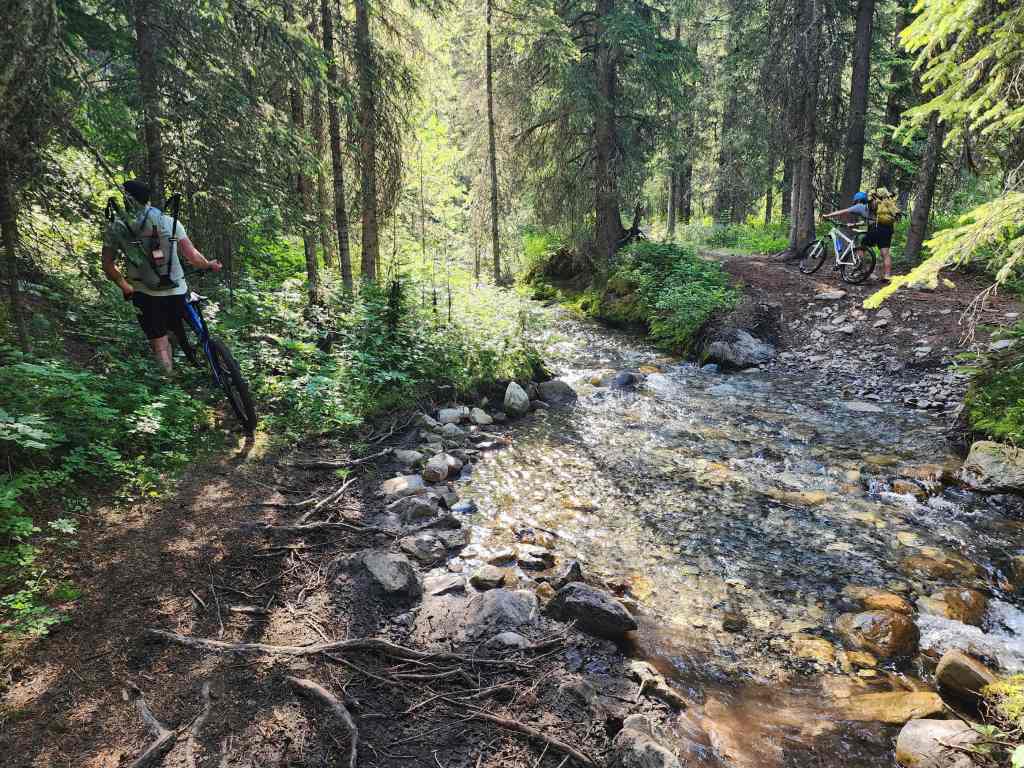
While Brad once again tackles the creek, Dave, James, and I find another bypass to biker’s left.
Another section where the creek and trail merged.

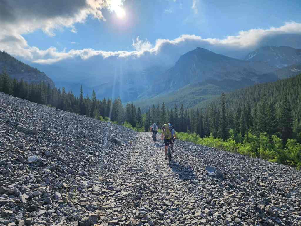
Back to pushing…

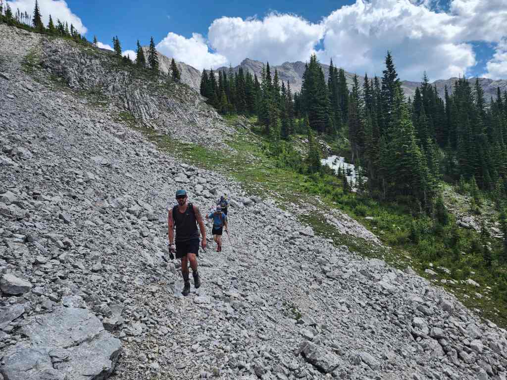
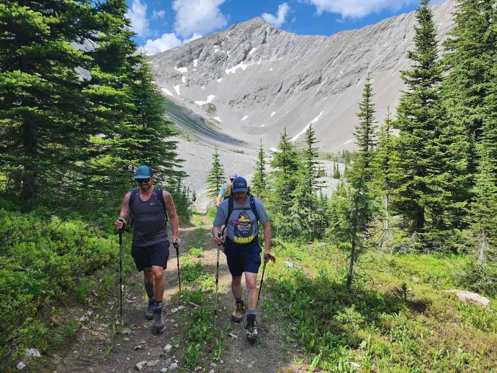
From here on, the trail became very steep.

After pushing up this section, we wisely decided to ditch our bikes.

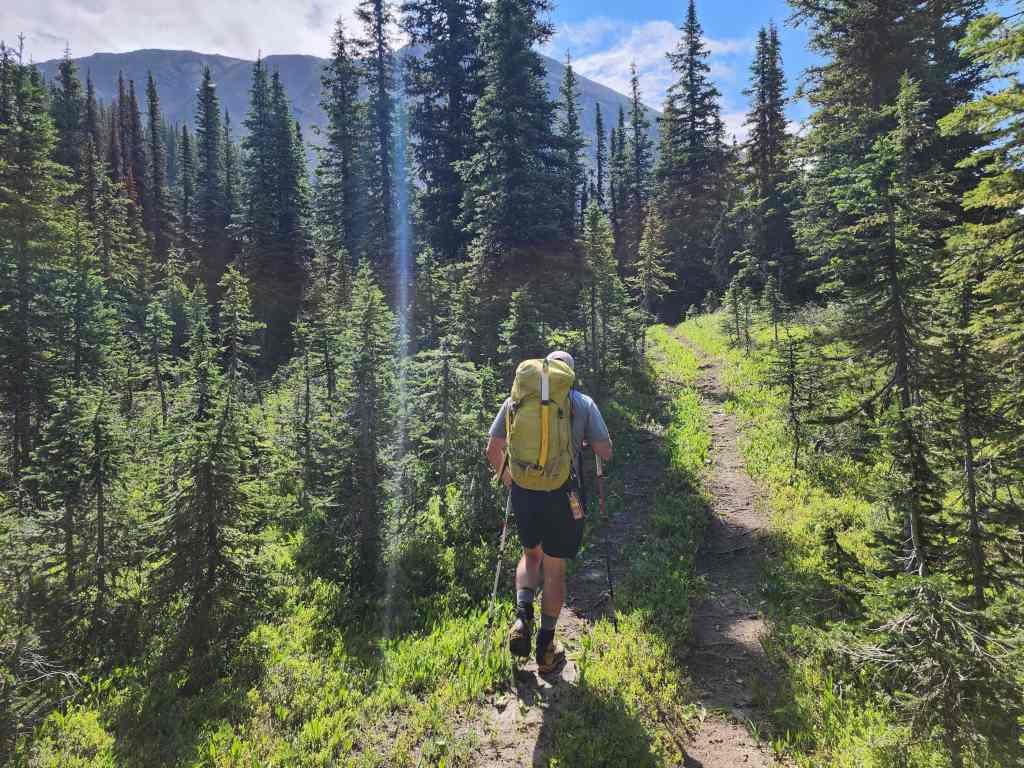
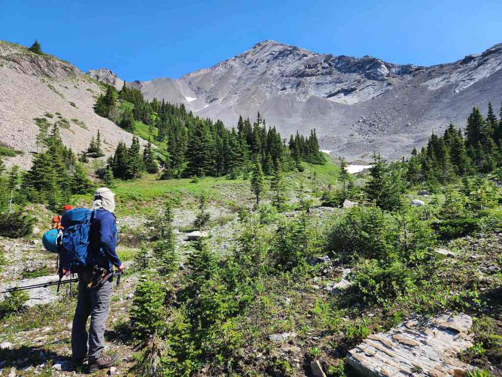
Approximately 6 km from my truck, we stashed our bikes in the bushes and set off on foot. The final 1.6 km of trail only got steeper from here.

Several caves on the side of Mount Ptolemy.
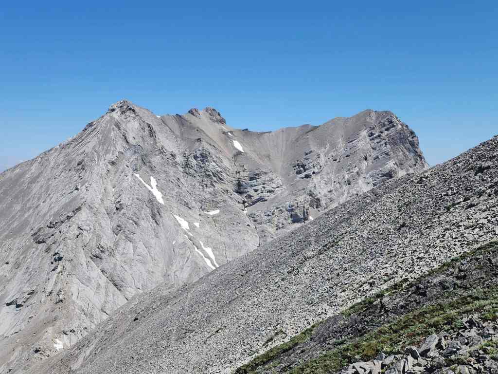
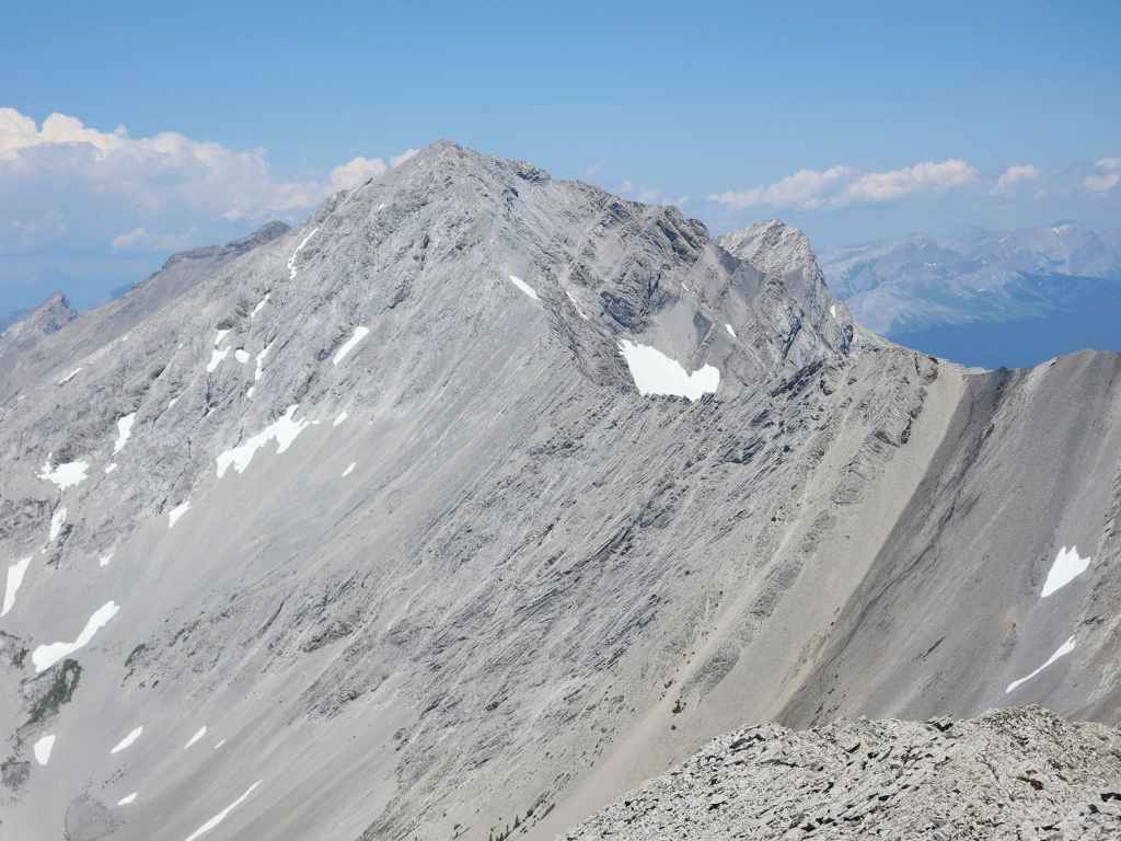
Our first good look at Sunglass Mountain (left).

We spent several minutes watching this cloud dance and swirl as it dissipated over Ptolemy SE5.
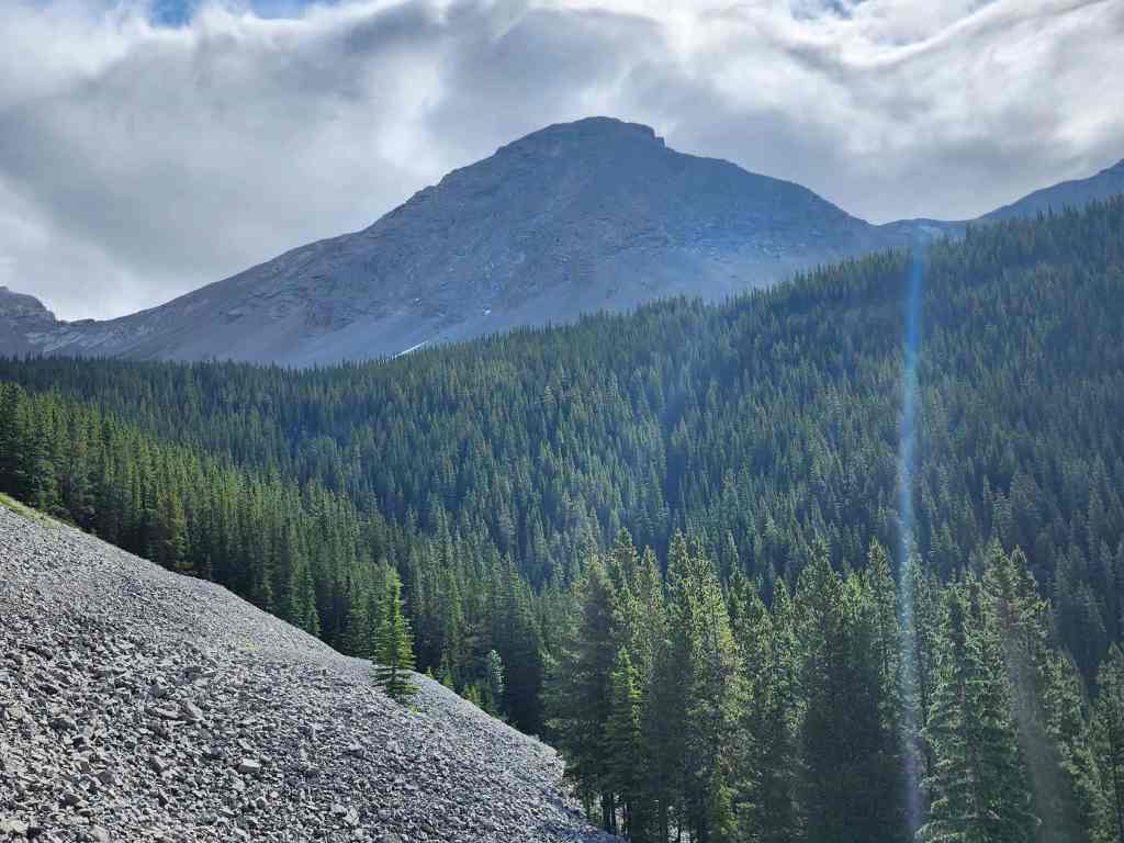
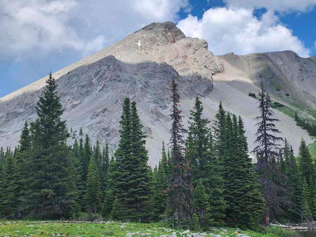
A better look at Sunglass Mountain.

Mount Coulthard sits immediately to the north of Sunglass Mountain.

When that one guy misses the moment. 😂 (Photo by Dave Fuller)

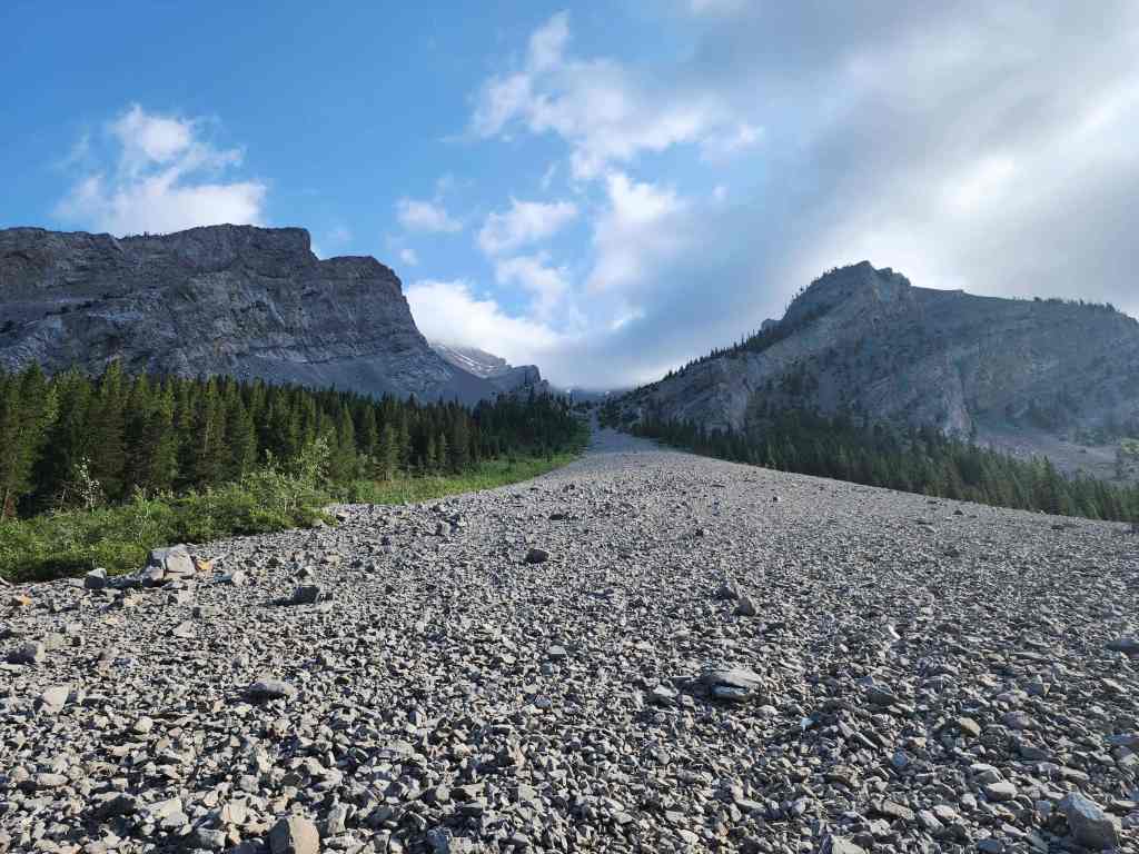
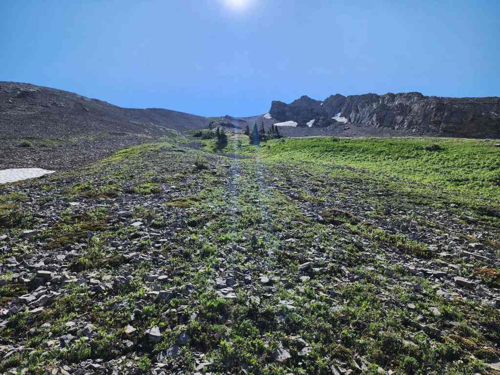
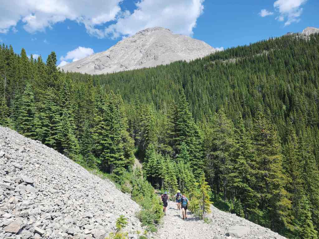
Nearing the end of the trail.
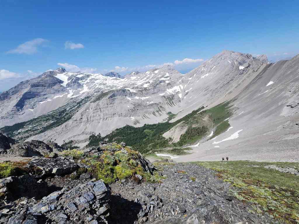
Arriving in the bowl beneath Andy Good Peak (centre) and Mount Coulthard.

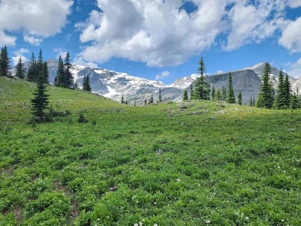
Wow! This is a huge place!

A wider view of the previous photo.
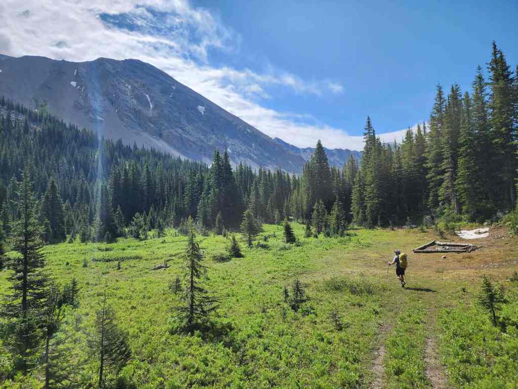
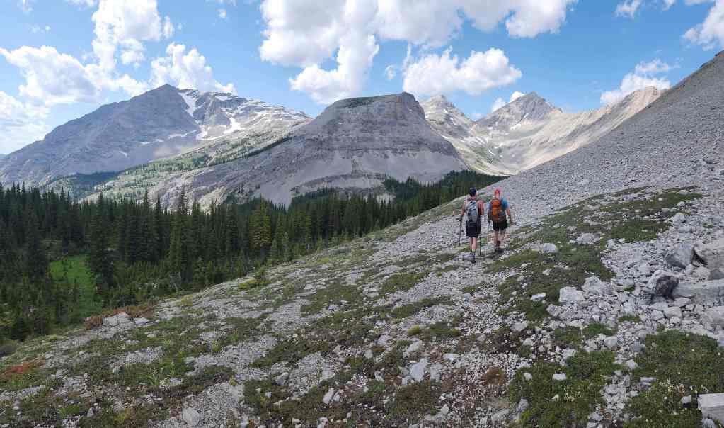
From the end of the trail, we followed another trail to hiker’s right that led us to this broad meadow where we found a large fire pit. Sunglass Mountain is on the left.

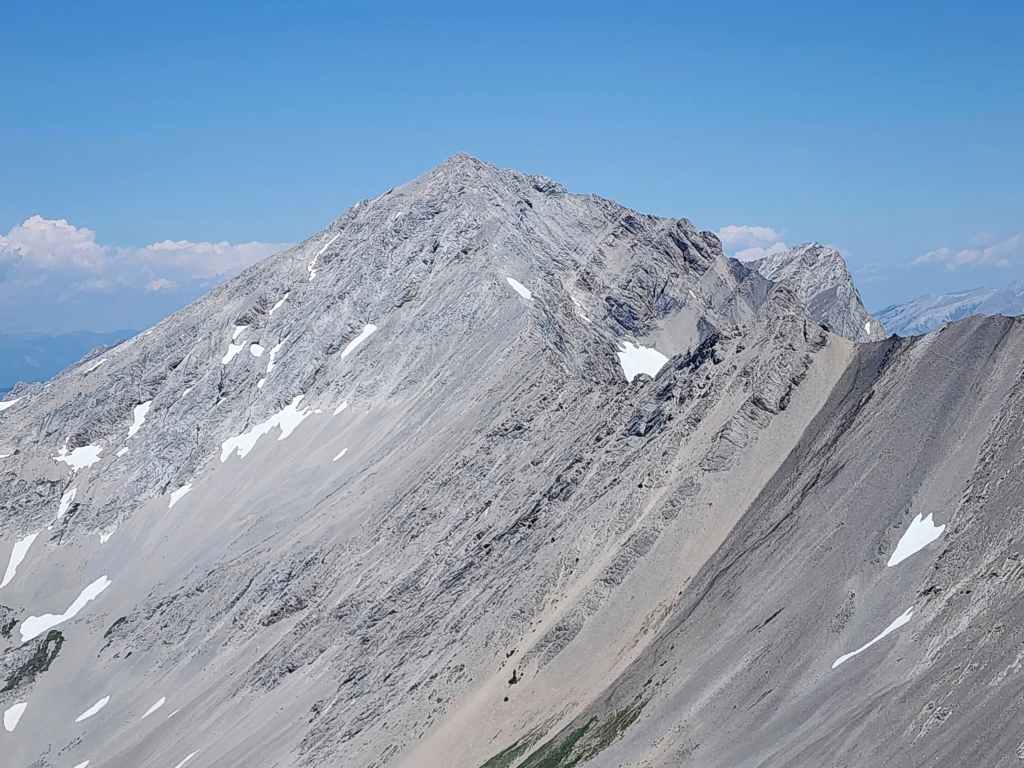
A better look at Sunglass from the same vantage as the previous photo.

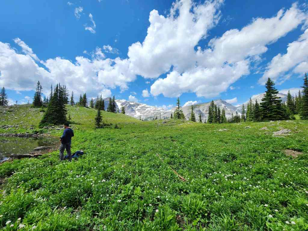
From the fire pit, the trail continued across a small creek and towards Sunglass Mountain. We surmised that it led to the lake and would confirm this on the way back.

The Fuller boys. (Photo by Dave Fuller)
Brad leads the way.

A few hundred metres from the fire pit, we decided to leave the trail and head for the base of Sunglass.

A short section of steep bushwhacking brought us onto easy slopes. (Photo by Dave Fuller)
Arriving in the bowl between Mount Coulthard (centre) and Sunglass Mountain. (Photo by Dave Fuller)

James shows off his talent for being in two places at once. This is an awesome panorama hack! 😂😂 (Photo by Dave Fuller)

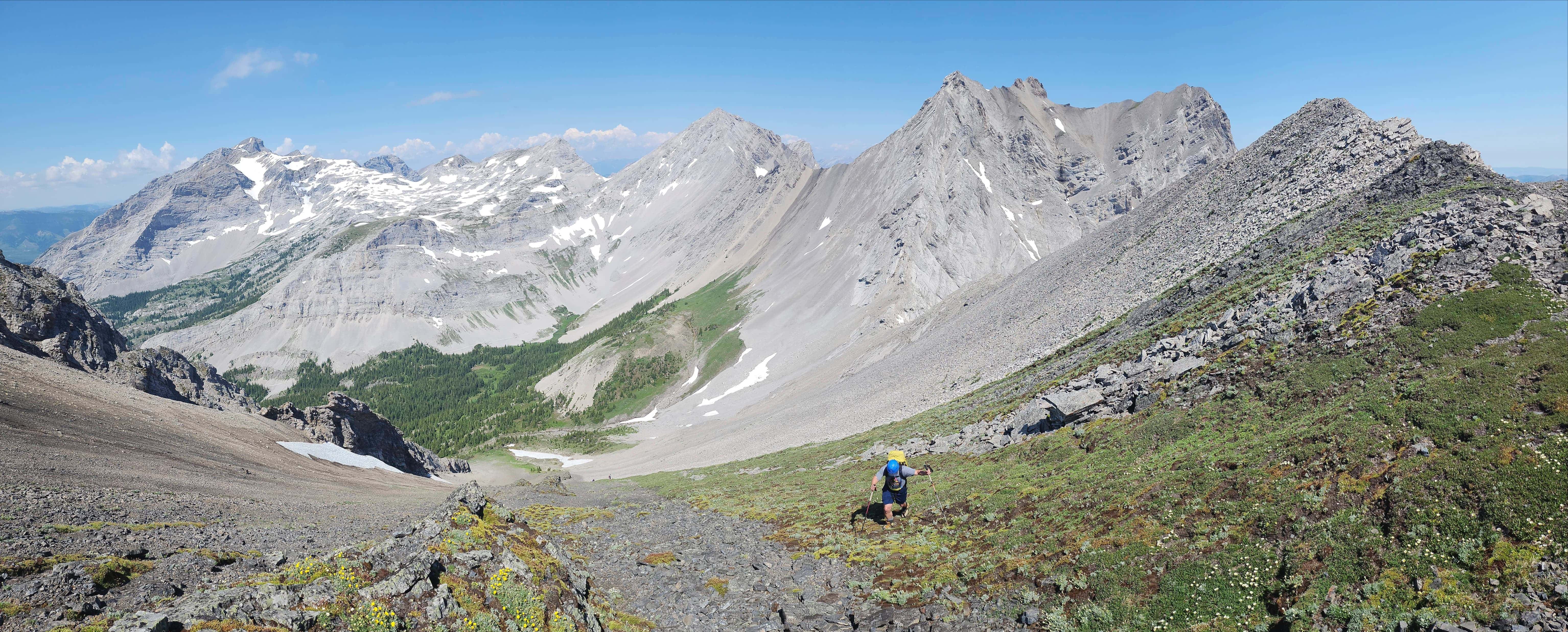
After enjoying a relaxed and fully-clothed lunch break 😂, we started up the north slope of Sunglass.
We would follow this line of vegetation all the way to the summit ridge.
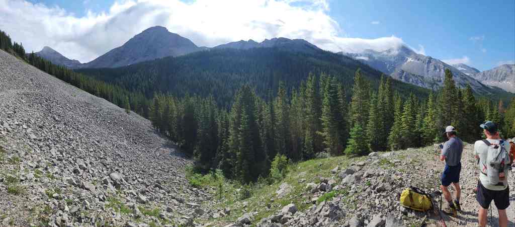
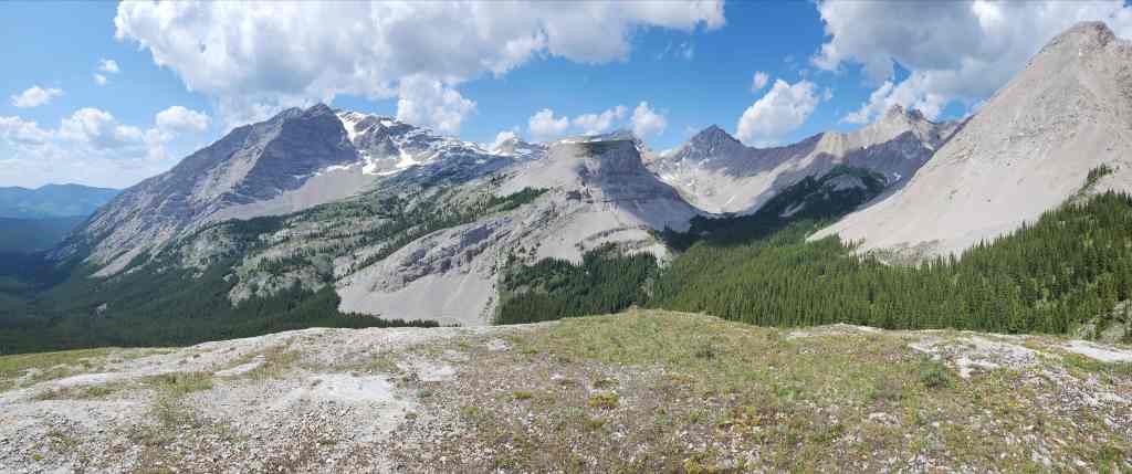
The first of many photos of Mount Ptolemy (left) and the Andy Good Plateau (centre). The views were incredible!

A wide angle of the same. (Photo by Dave Fuller)

If the vegetation wasn’t there, it would have been a miserable slog up the steep slope.
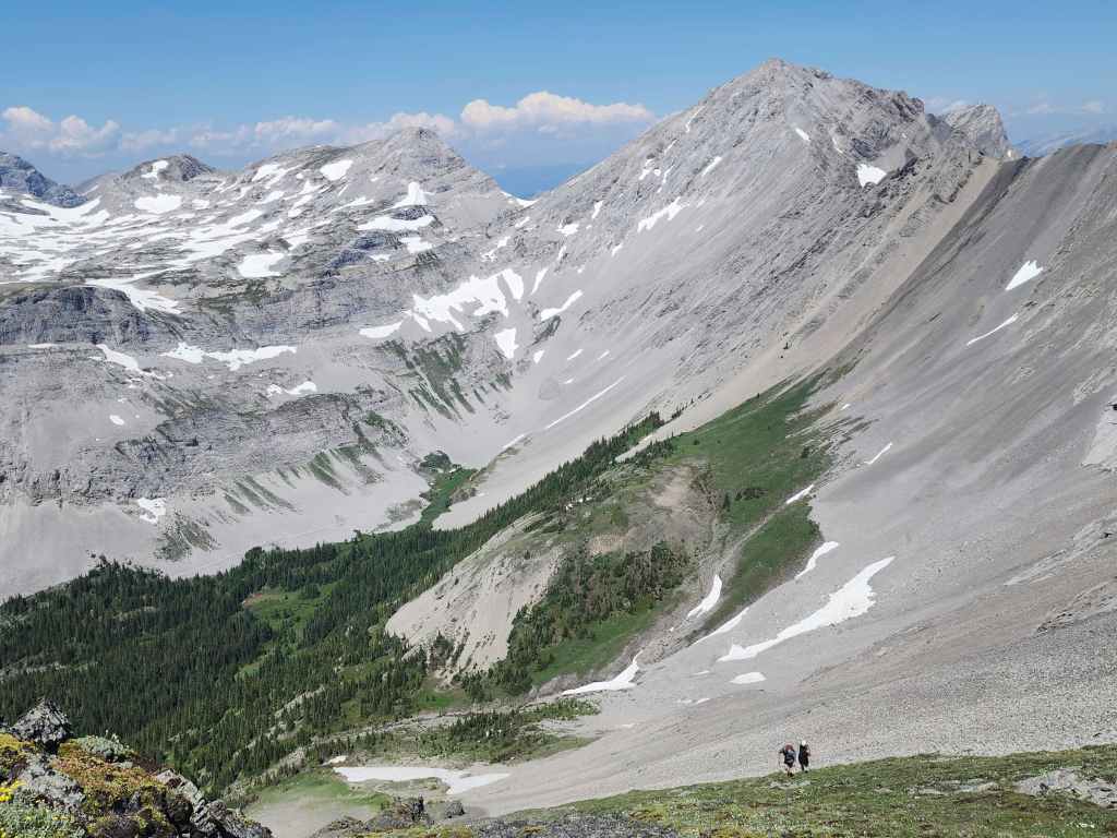
Another look back at Mount Ptolemy (left), Andy Good Peak (centre), and Mount Coulthard (right).
A closer look at Mount Coulthard.
Andy Good Peak (centre) with the summit of Mount Parrish on the right. Dave and Brad climbed Parrish last year and Brad has graciously offered to go back with me and climb it again.

Mount Ptolemy is a massive mountain.

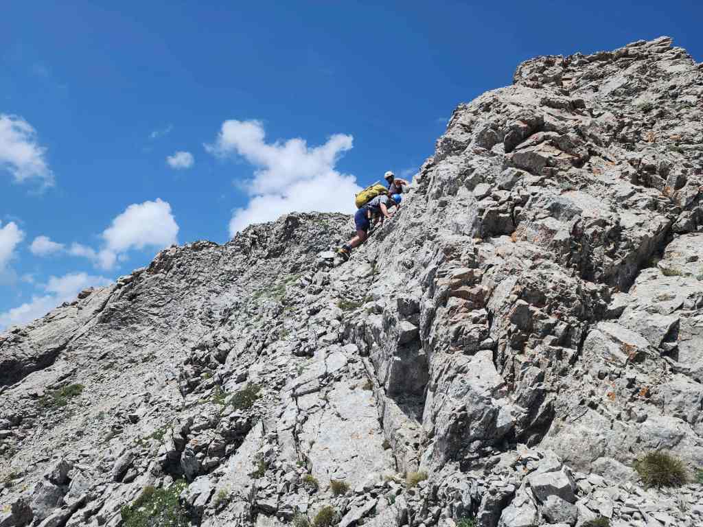
Yet another look back as I near the summit ridge.

Brad joins me on the summit ridge.

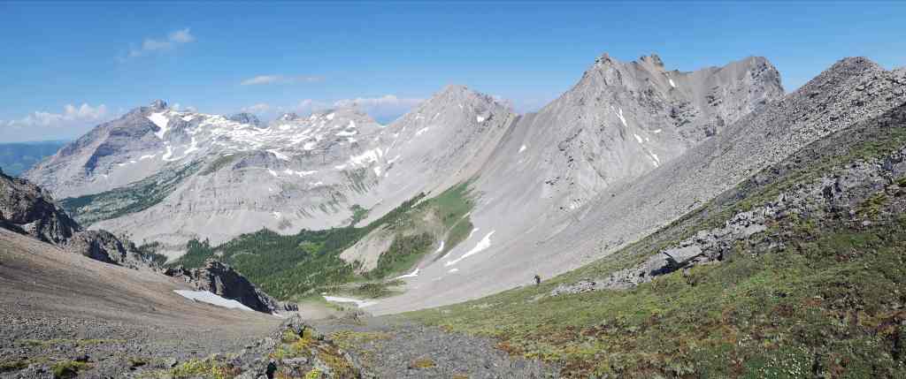
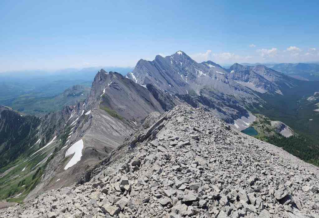
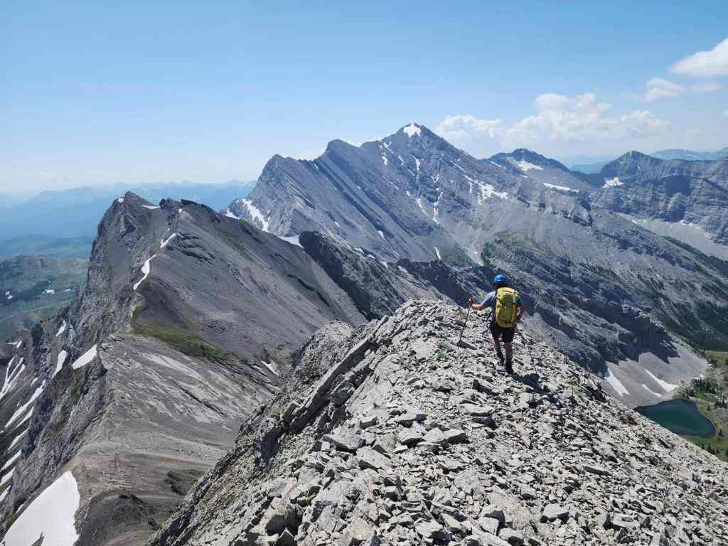
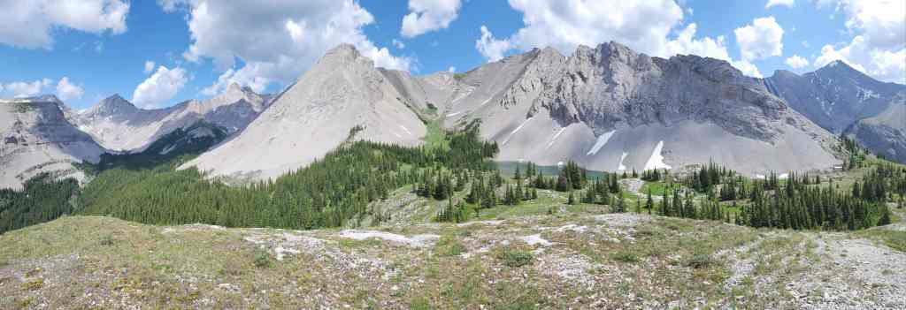
Looking southeast from the ridge. The summit of Sunglass Mountain is on the right.

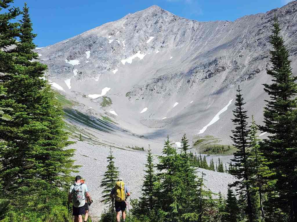
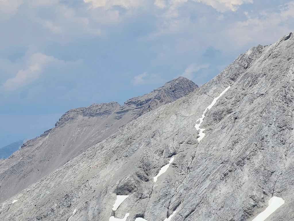
A closer look at the summits of Peak 34 (left) and Sunglass (centre). To get to Peak 34, we’d have to traverse the snow in the foreground; however, it was in no condition to risk crossing, so we decided to leave Peak 34 for another day. As the saying goes, ‘There are old climbers and there are bold climbers, but there are no old bold climbers.’ I drilled this into my kids when they were growing up and I will do the same for my grandkids. 🙂

That view!!!
More of the same as Dave and James join us on the ridge.
The same as the previous photo.

It will be an easy hike to the summit from here.

Glancing over and along the connecting ridge with Mount Coulthard.

Still looking back.

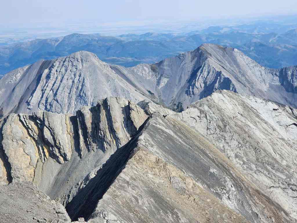
The summit of Sunglass Mountain (2524 m). My GPS came in at 2491 m but Peakery lists it as 2524 m so I’m using that. For reference, it took us 4 hours and 30 minutes over ~9.4 km with a 971 m elevation gain to get here.
Looking south…

And then southwest.

The view to the west…

And then to the north.

Finally, the view to the east.

Zooming in on Peak 34.

Ptolemy SE5 has been on my list for a couple of years. After this trip, I think I’ll get around to it sooner rather than later. 🙂 How Peterson went from here and along the ridge over to SE5 in such a short period of time is mind boggling.

Looking to the southwest at one of my favourite trips in the area: Barnes Peak and Limestone Ridge (distant centre).

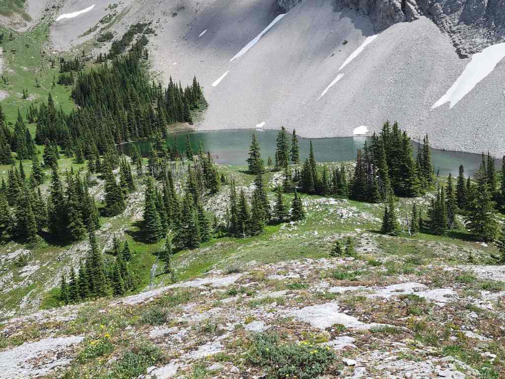
Gazing down at that gorgeous little lake.
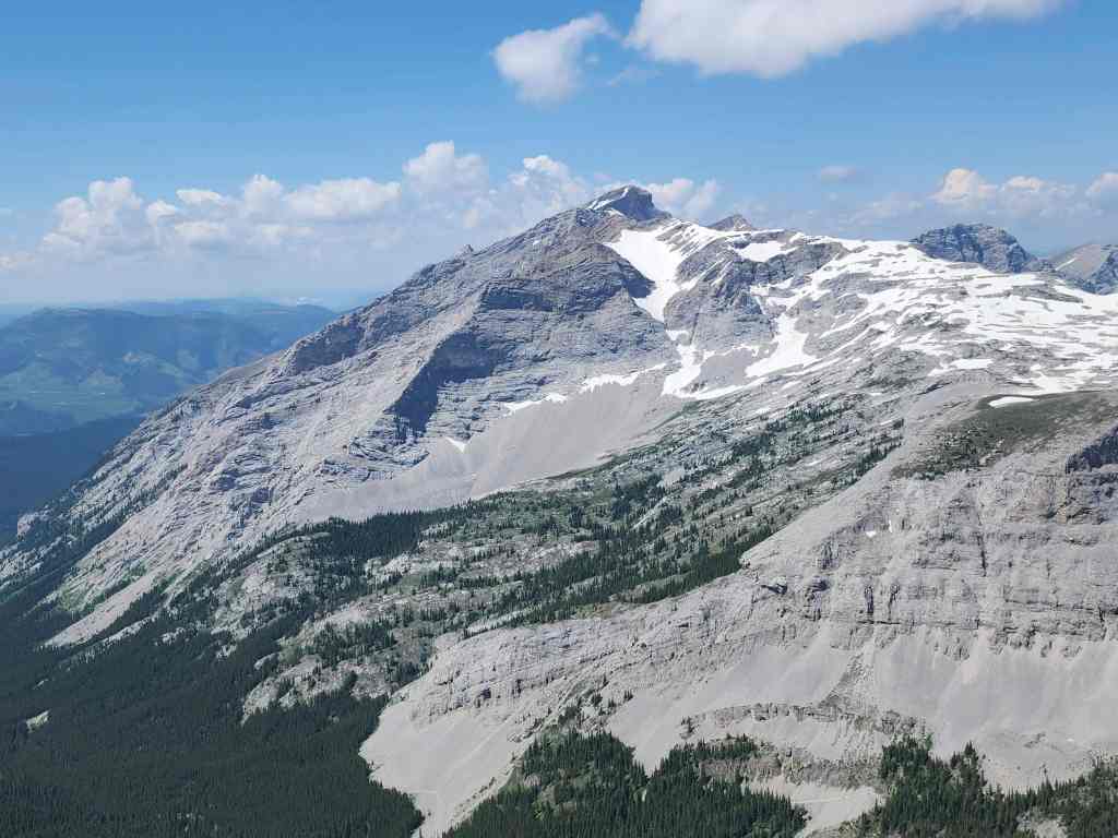
Mount Ptolemy is the highest peak in the area.

In the foreground is the Andy Good Plateau and behind it are “Pharaoh’s Peak” (left), “Anubis Peak (centre), and “Mummy Mountain (right of centre) that comprise the Northwest Ridge of Ptolemy.
The summit of Chinook Peak pokes out from behind Andy Good Peak.
Andy Good Peak with the summit of Mount Parrish on the right.

The old hippo itself, Mount Coulthard.

Dave is well-loved. 😂
Brad carries a mini version of James in his pack. 😂 (Photo by Dave Fuller)
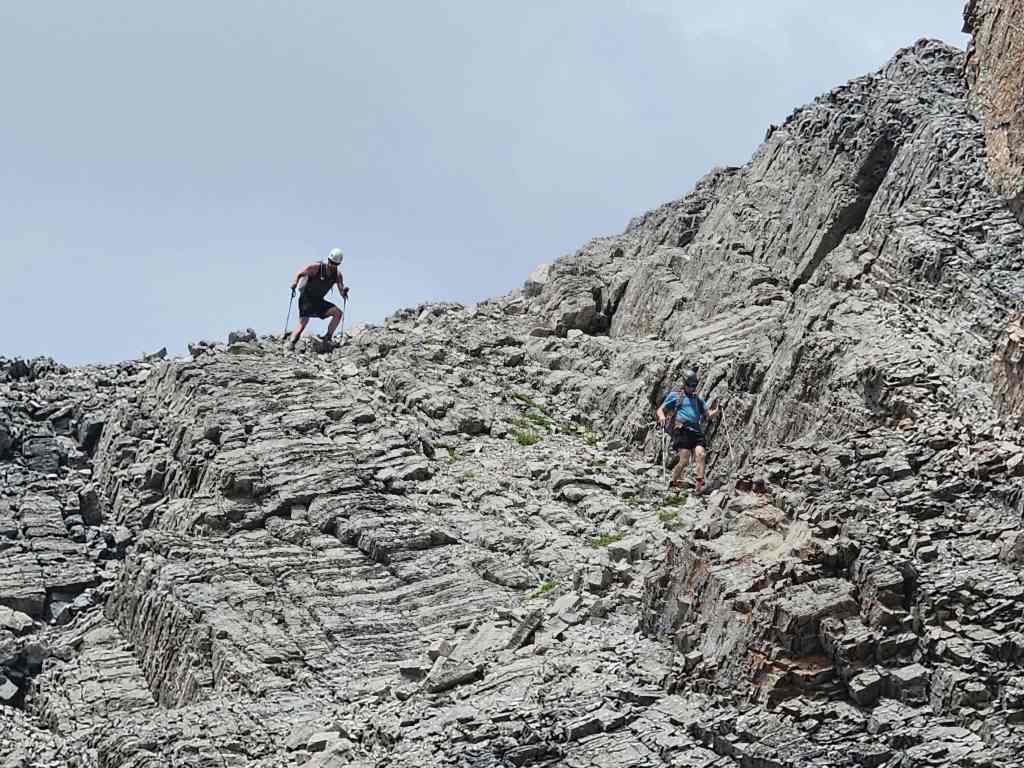
As we couldn’t get to the col with Peak 34 from the east side of the summit, we decided to see if we could find a way by descending to the south.
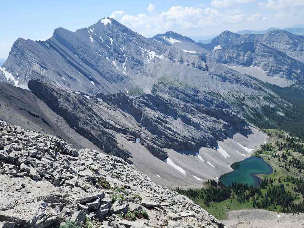
Getting a better look at the lake.

Wow! We could tell already that visiting the lake was going to be a wise decision.

We searched for a connecting route over to the col with Peak 34, but never found one. Instead, we focussed on getting down to the lake.

Getting off the lower section would require a bit of route finding.
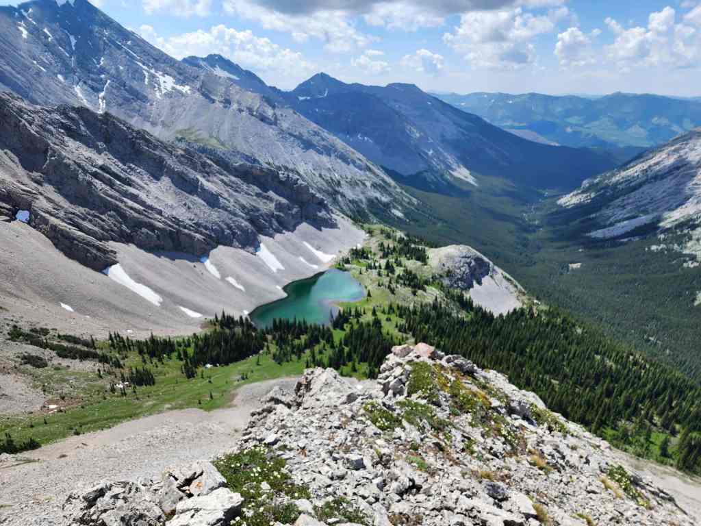
The lake sits high above our route through the valley.
Brad and James do some down-climbing.

At least James is enjoying the route finding. (Photo by Dave Fuller)
Dave and James carefully pick their way down.
We all ended up taking slightly different routes to reach the bottom.

Looking back at lower section that slowed our descent.
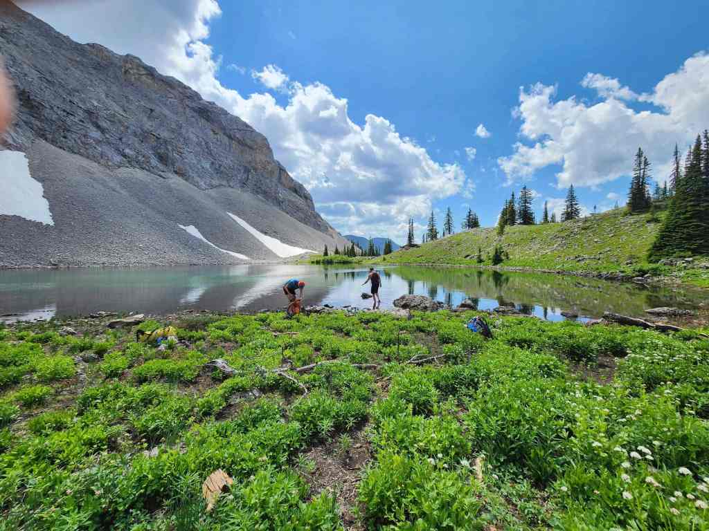
Arriving at the lake.

Brad doesn’t waste any time.
The stellar view from the shoreline. This would be a great place to camp and judging by the presence of several hearths, others think so too.
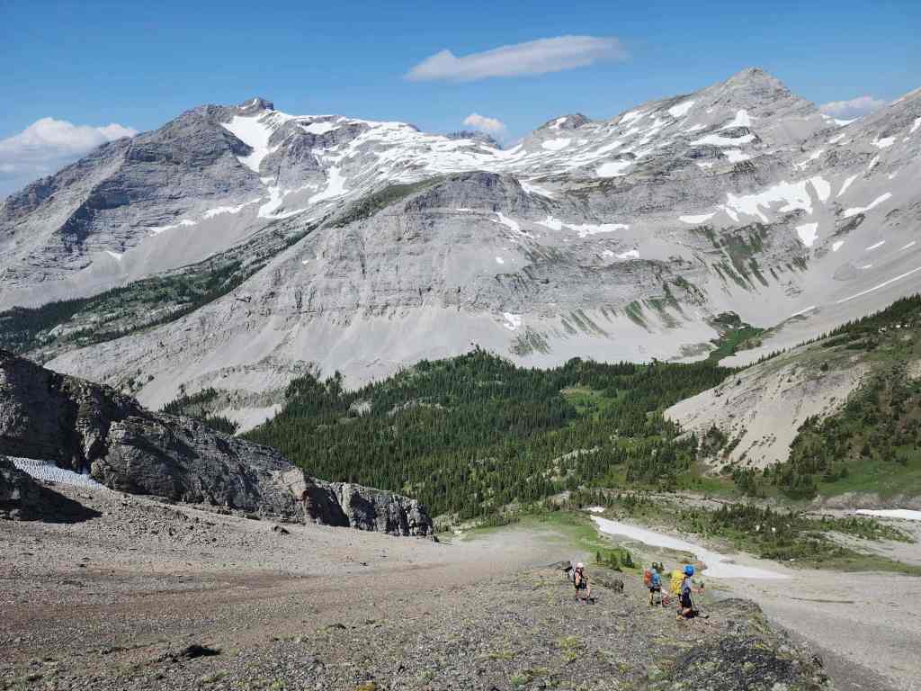
A better look at Sunglass Mountain and our route down to the lake.
We’d spend a restful hour at the lake. (Photo by Dave Fuller)
What a gorgeous place! (Photo by Brad Wolcott)

More of the same.

A better look at the lake.

There may be a way up to the col between Sunglass and Peak 34 from the lake…🤔

While the others chilled beside the lake, I climbed a small knoll to get a better view of the area.
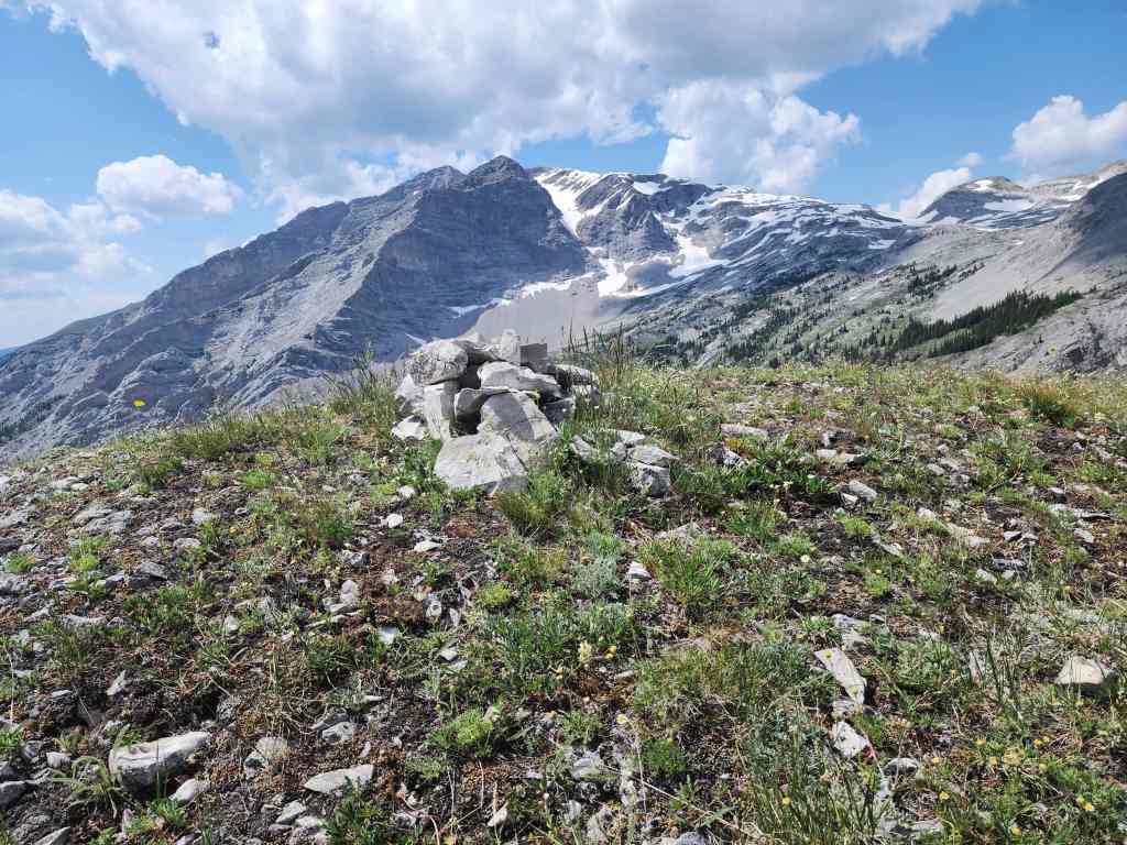
Someone had placed a tiny cairn on top.

Gazing down the valley.
Looking over to Mount Ptolemy (left), the Andy Good Plateau (centre), Andy Good Peak (right of centre), and Mount Coulthard (right).
The view back to Sunglass Mountain (left of centre).

Another view of the area around the lake…
And then of the lake itself.

I will definitely be back for Ptolemy SE5.
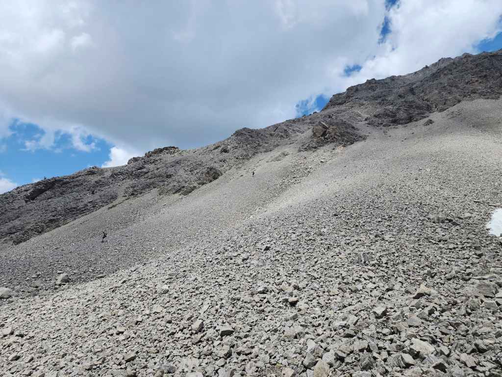
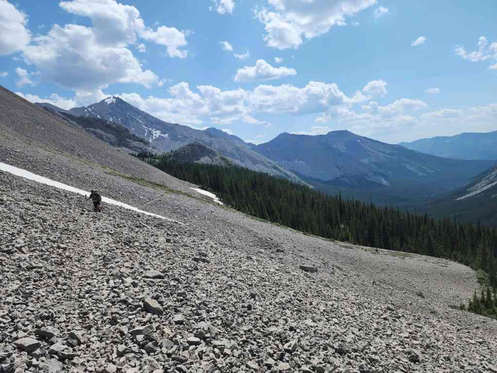
Leaving the lake along a good trail.
The trail will take us back to the large meadow and fire pit that we started from.
Looking back towards the lake. The knoll that I climbed is to the left of centre.

The trail transitions off the scree and into the woods.
Arriving back in the large meadow. It was only a ~1.4 km hike (78 m elevation loss) from the lake to here.
Sunglass Mountain from the fire pit. Our route went up the patch of green in the centre.
Leaving the bowl.

One more look at Ptolemy SE5…
And then a final look at Sunglass Mountain.
Back on our bikes and ripping down the trail.

On the way back we didn’t bother bypassing the creek.

Arriving back at my truck. Once we were on our bikes, it only took us 50 minutes to cover the remaining 6 km of trail.
A better look at the false summit of Mount Ptolemy as we get ready to leave. This was an outstanding trip that included fantastic scenery and great company. I would not hesitate to head back into this area again, only this time I would wear river shoes for the bike approach and I might ditch my bike sooner. A HUGE thanks to Brad, Dave, and James for the super fun day. The panorama photo hack was definitely an important skill to learn! 😂


Leave a Reply