
⚠️ Hiking and scrambling are inherently dangerous activities. Please read my Disclaimer. ⚠️
Not many dads have the privilege of walking their daughter down the aisle twice… in two months… to the same great guy – but that was my experience this summer. 😊 Why did this happen? Like most disruptions over the past 18 months, the blame falls entirely on COVID-19. After the third wave of this hideous pandemic forced my daughter to change her wedding plans to a small elopement in June, we were anxiously hopeful that we could have the full ceremony and celebration with family and friends in August.
Well, thanks to double vaccinations, not only were we able to have the wedding Janelle had dreamed about, but it was an altogether perfect day. Finally seeing those dear to us, face-to-face for the first time since the pandemic began, was a huge gift amidst so much uncertainty. Watching Janelle and Jacob revel in the joy of the occasion made all of the work that went into the day, more than worth it. Congratulations once again Janelle and Jacob!!
Indeed, with wedding preparations taking priority over the past month, today’s trip was my first since Andrew and I headed up Buchanan Ridge at the beginning of August. As I’ve focussed primarily on Waterton this year, it was good to deviate back to the Flatheads, where I’ve spent considerable time over the past few years. In fact, after getting a great look at Centre Mountain from the summits of “South Flathead Peak” and Mount Borsato last August, visiting this blandly-named objective became a priority. However, as getting to it requires significant time and effort, it is best left for a day with an open agenda and clear blues skies – and until today, neither had aligned in my favour.
Thus, when Sonny Bou and Zosia Zgolak invited myself, Andrew, Raff, Raff’s friend Brad, and their friends Andrea and Shaun to join them for an ascent, I was naturally excited because not only was I free all day and evening, but for the first time in months, the wildfire smoke was forecast to be minimal. Unfortunately, while Sonny, Zosia, Shaun, and Andrea planned to spend several days camped in the area, the rest of us had to make do with a day trip. So, with that reality, we ended up with a rough plan that saw Sonny’s crew approach Centre from the south and their camping spot at Lower Harvey Creek, while Andrew, Raff, Brad, and I approached from the north via Corbin.
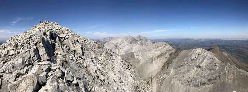
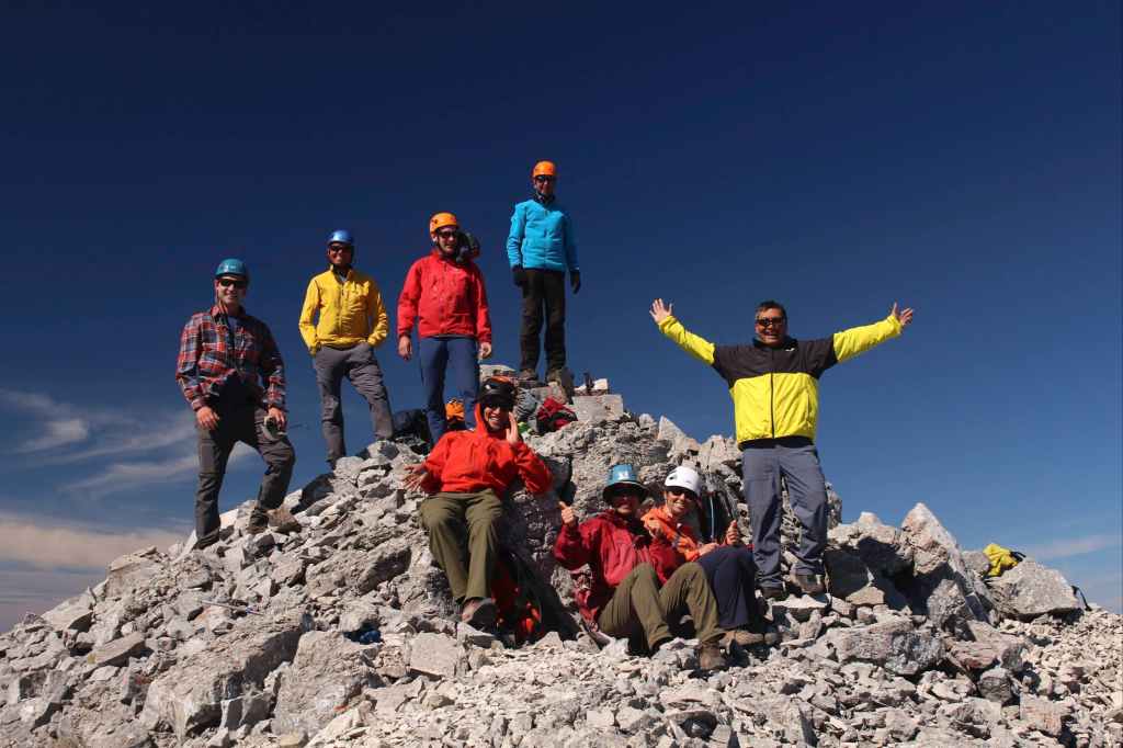
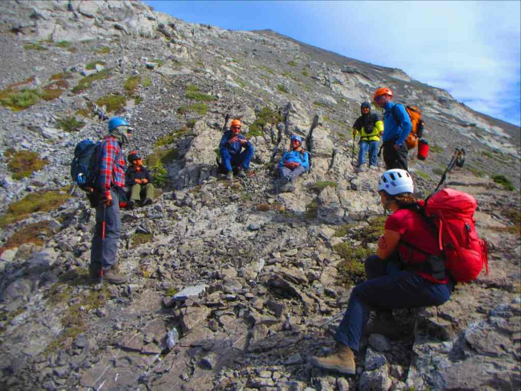
Though we weren’t able to finalize our arrival time due to a lack of cell service, we nonetheless ended up joining together near the start of Centre’s long summit ridge, ensuring that our party of 8 arrived together on the summit – which I’m sure is one of the largest groups to stand on that summit in quite some time! An ‘octotag’ if you will… 🤔
Centre Mountain is not well documented despite Rick Collier’s 1996 trip report; Dave Jones’ brief description in Rockies South; and a verbal description given to Raff by James Yearous. Indeed, we were most confused as to the location of a supposedly significant down-climb mentioned by Jones and Yearous but omitted entirely by Collier. Moreover, these scant reports seemed to indicate alternate descent routes were used instead of retracing the initial approach along Centre’s summit ridge.
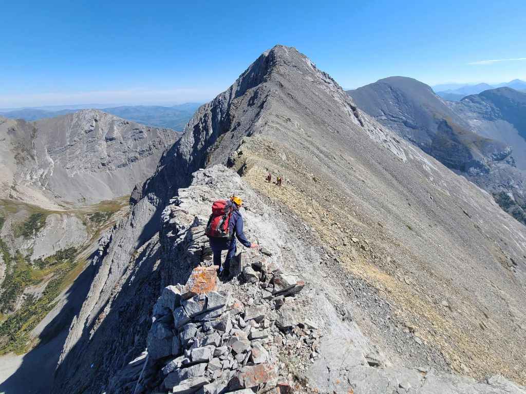
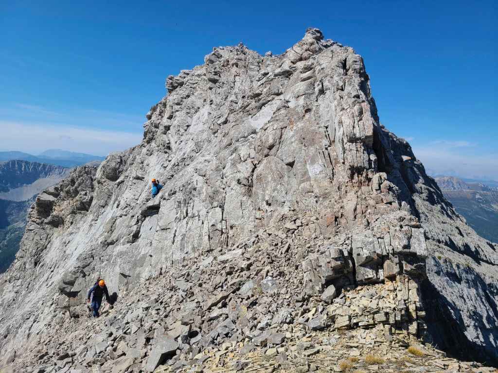
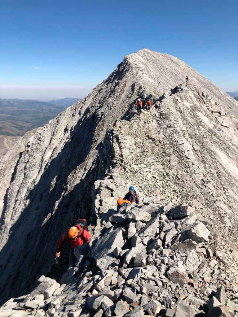
No matter! 😁 Armed with enough information to be dangerous, we ventured up the massively foreshortened west ridge of Centre. Upon arriving at a second false summit – the point where the ridge pivots to become the summit ridge – we encountered the first of two difficult down-climbs. The first, which is most definitely the crux, occurs shortly after the summit ridge begins, while the second is located off of an intervening high point just prior to the summit.
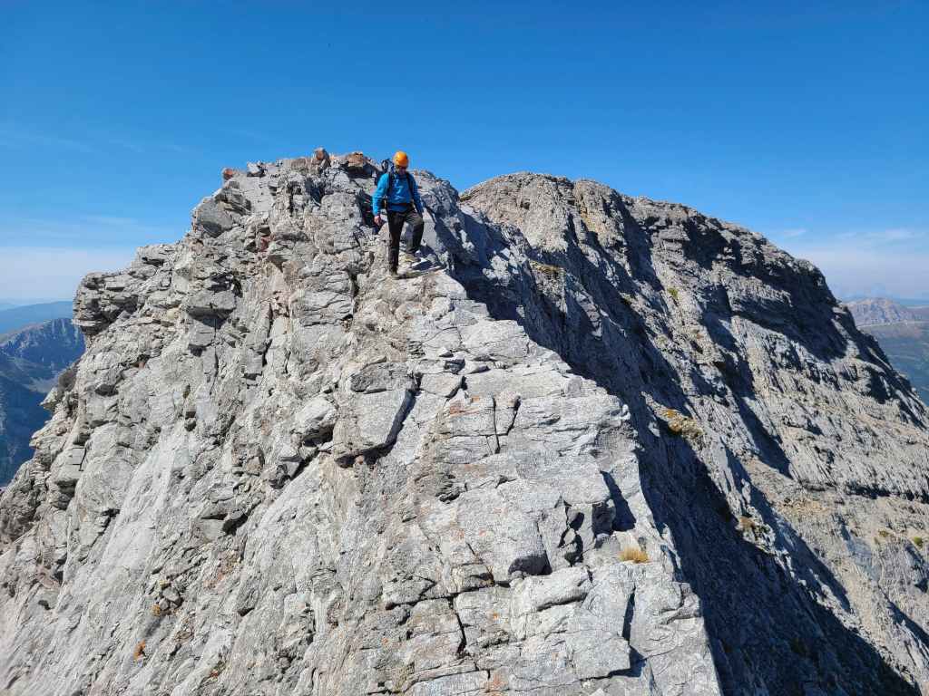
We all agreed that the crux – which consists of an extremely narrow and exposed section of ridge – was 4th class terrain. While the group chose to forego crossing the exposed ridge in favour of descending to, and then traversing across a tricky section of scree-on-slab, I stuck to the narrow ridge for its entirety, discovering that despite the exposure, it was perhaps the most effective means of negotiation. On the way back, everyone tackled this section head-on, thus avoiding the potentially treacherous, scree-on-slab.
The second down-climb was shorter and less demanding, though it too required careful thought. While most of the group opted for a line to climber’s right, Sonny and I chose a highly exposed, but easier line to climber’s left. Once past this obstacle, it was a simple hike to the summit where we lingered for close to an hour, enjoying the views and some lively conversation.
While I’m always grateful to be on a mountain, I’m even more thankful when I get to share it with friends – both old and new. Though I’ve had the pleasure of hiking with Andrew, Raff, Sonny, and Zosia before, I’d never met Brad, Andrea, or Shaun. I quickly discovered that all three are wonderful people – not to mention adept scramblers – and I really enjoyed getting to know them. For me, the mountain made for a great trip but it was my companions who made it into a fantastic outing. Thanks everyone!!
Be sure to read Andrew’s trip report [link coming] as well as Sonny’s trip report!
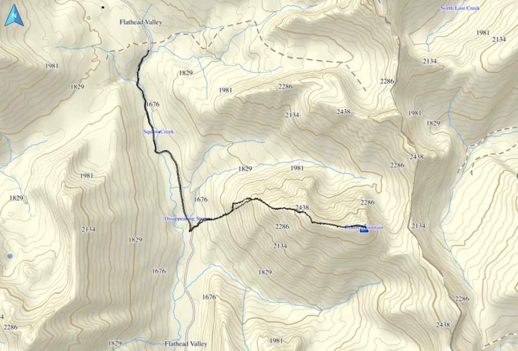
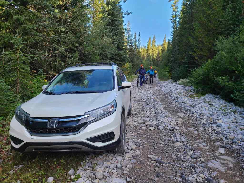
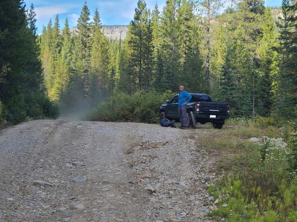
To get to Centre Mountain, we drove west of Summit Lake in the Crowsnest Pass for ~7 km until we came to the junction with the Corbin Road on our left. We then followed this road for ~24 km until we arrived in the tiny hamlet. The entrance to the Flathead Forest Service Road (FFSR) begins at the mine entrance and travel requires a high clearance 4×4.
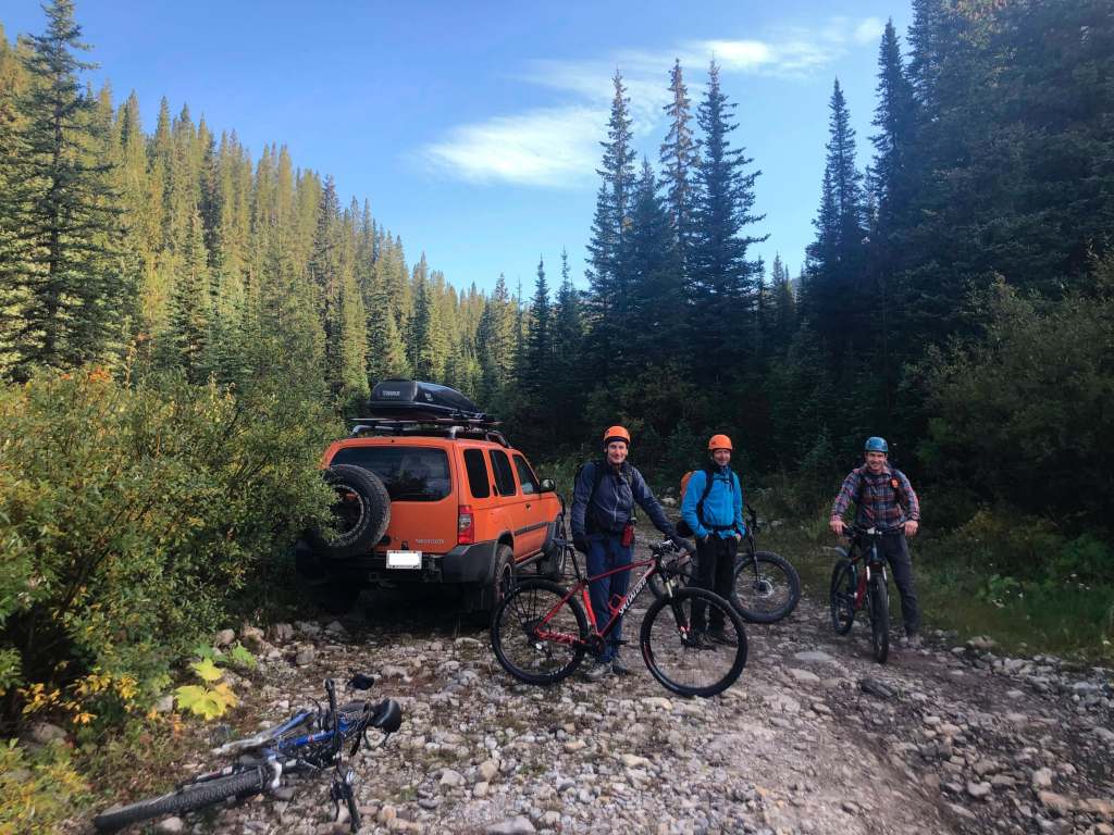
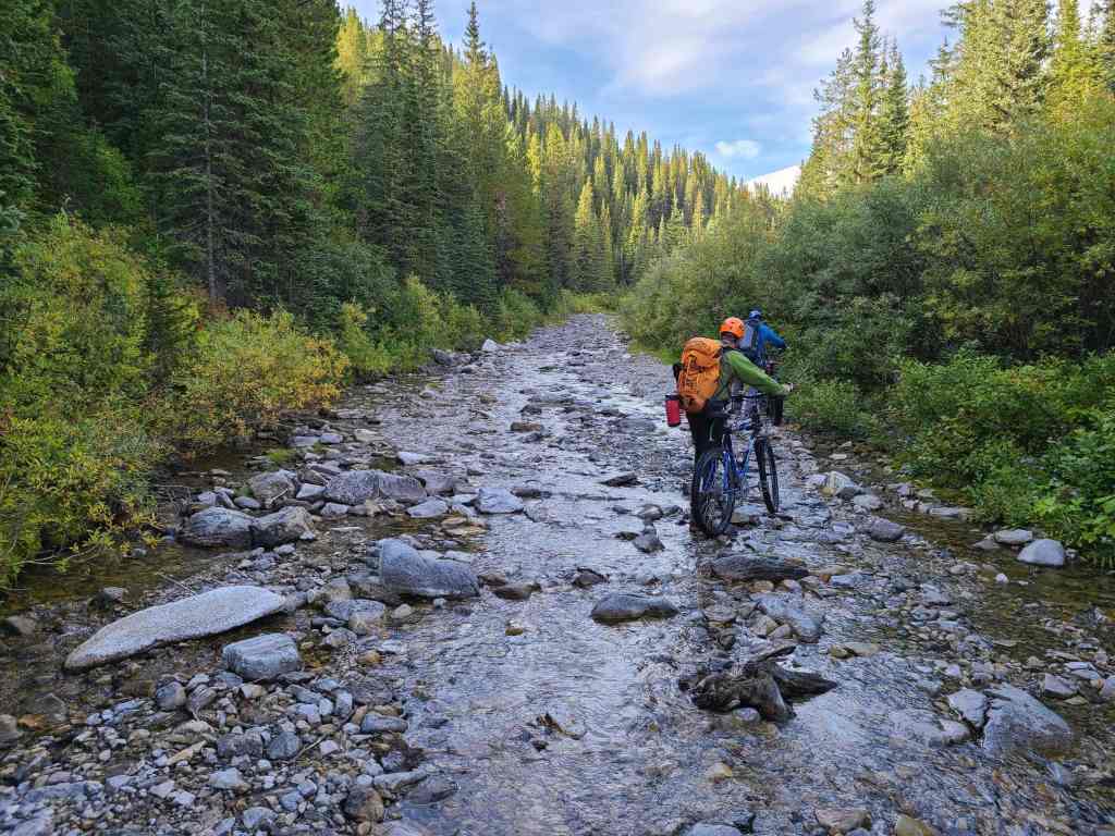
We knew that the FFSR was washed out just beyond Flathead Valley Pass, so we brought bikes to cover the remaining distance. While Brad and Raff parked at the point where the road turns into a creek – literally – Andrew and I parked about ~200 m beforehand or ~10 km from the bridge at the start of the road.
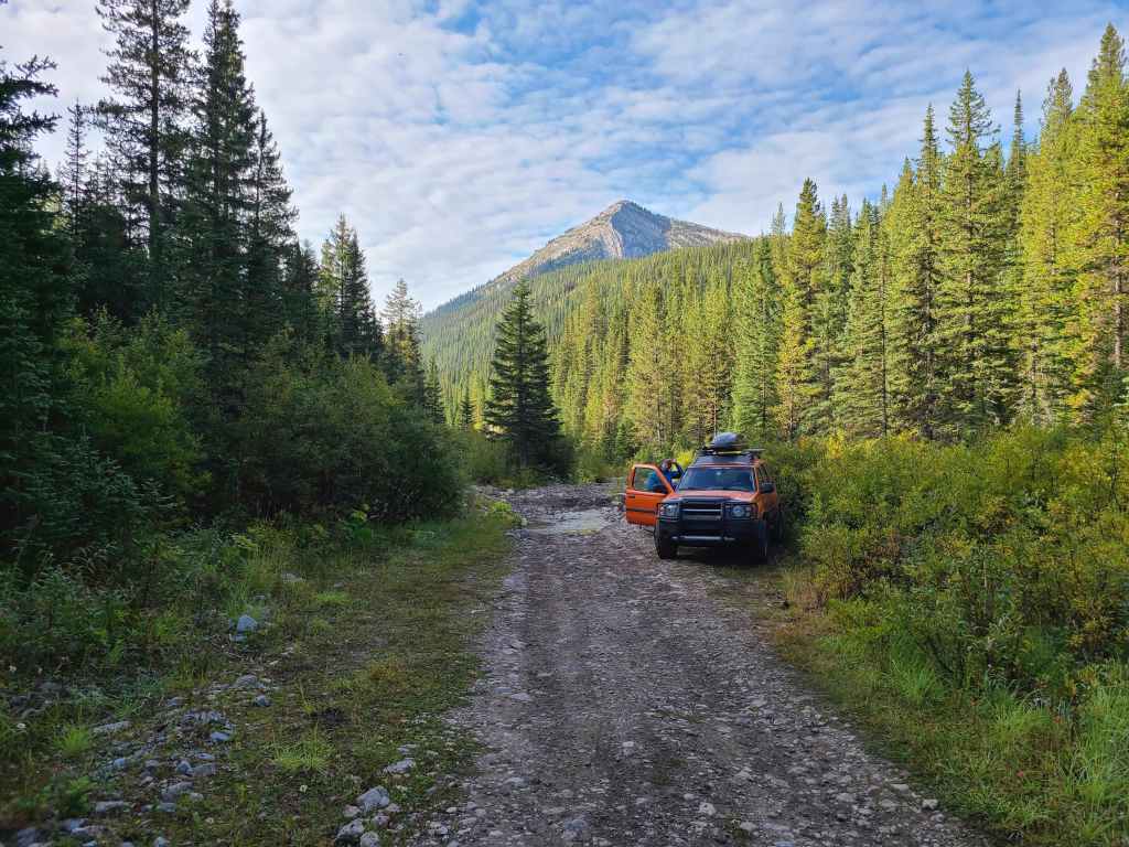
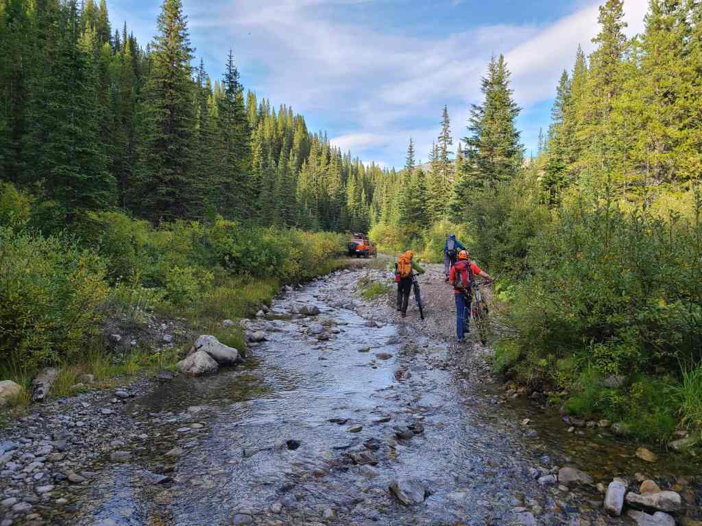
From my vehicle, we biked ~3.2 km until we came to a second dilapidated bridge that crossed the drainage immediately to the north of Centre Mountain. We noted that Sonny had parked his vehicle a further 100 m down the road.
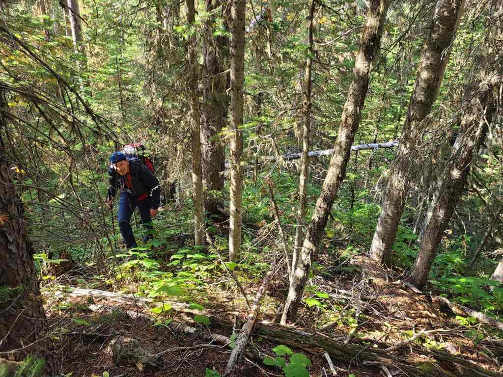
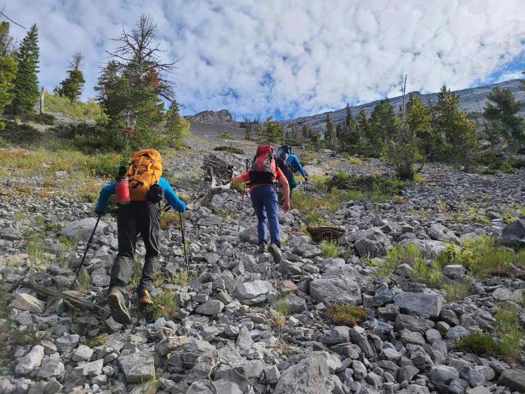
The drainage is where Rick Collier began his ascent in 1996 and it is where Sonny’s party also started. However, we decided to start off through the bush and up the slope immediately across from Sonny’s car. After approximately 30 to 40 minutes of moderate bushwhacking, we found ourselves on increasingly open terrain, paralleling a small drainage located to climber’s right. As the scree increasingly turned to treadmill, we trended climber’s left to gain the crest of Centre’s west ridge, which from the road, represented an elevation gain of ~380 m.
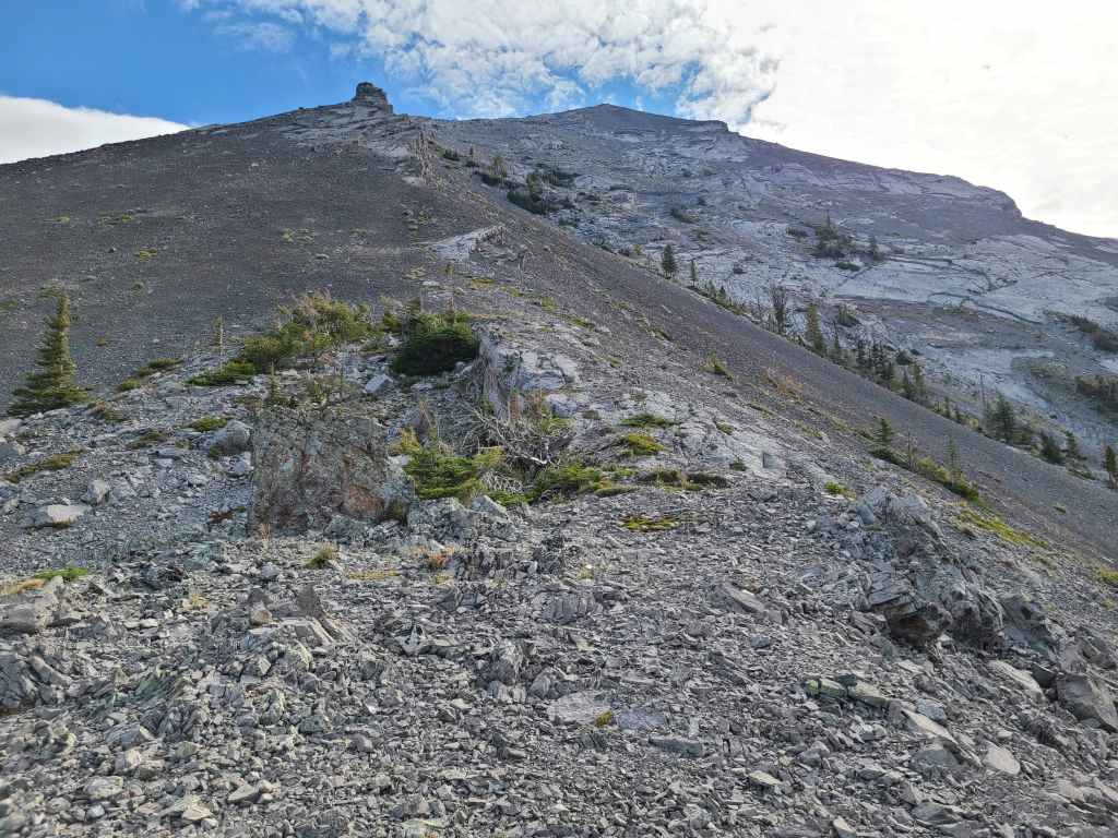
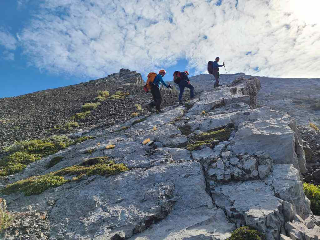
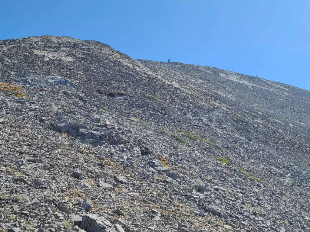
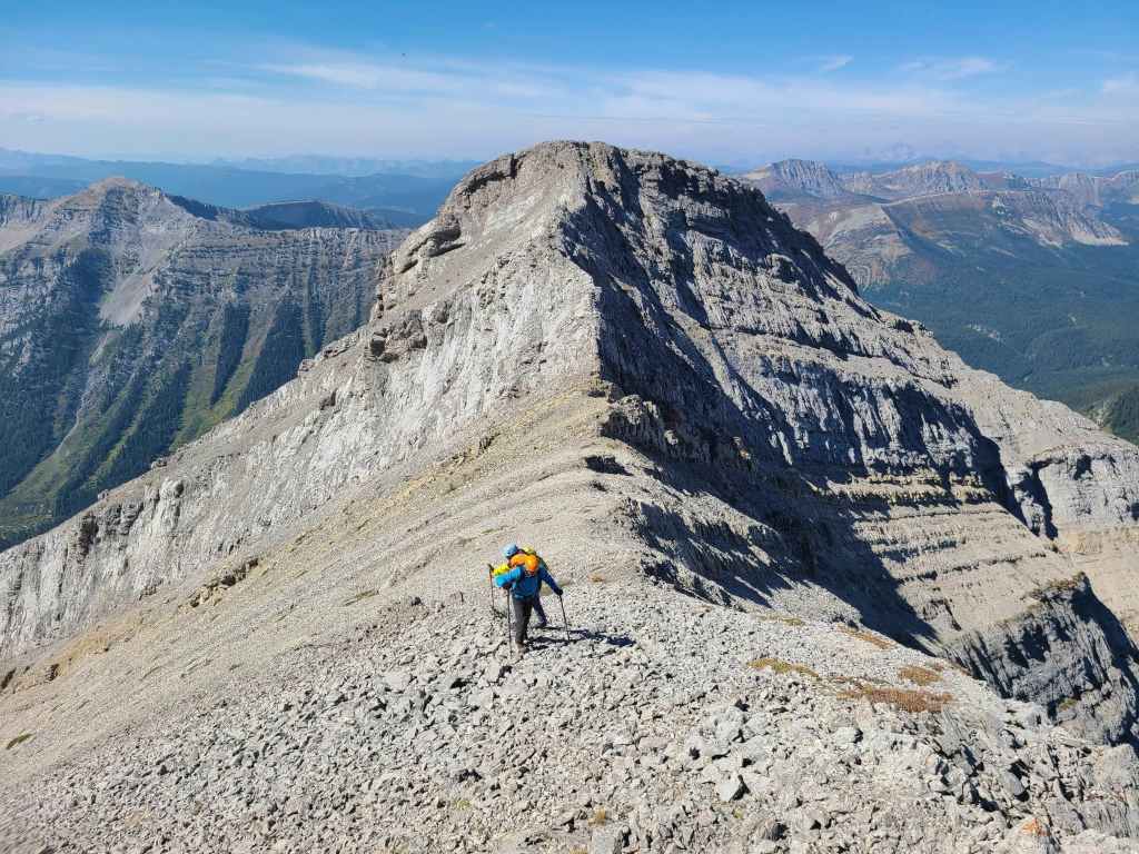
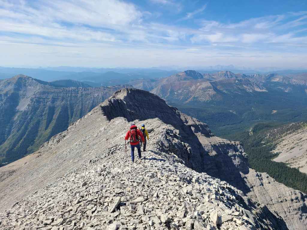
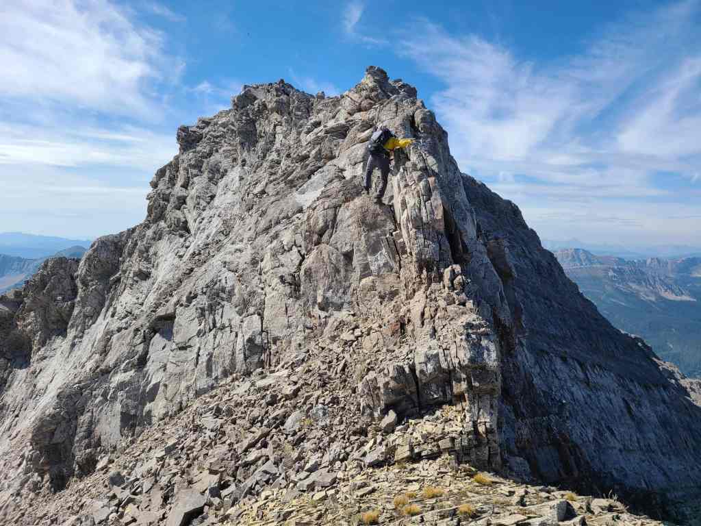
Once on the crest, the second false summit – the point where the west ridge turns into the summit ridge – looked to be relatively close; however, this was not the case as it was incredibly foreshortened. Additionally, there were a couple sections where the ridge narrowed and care was required, most notably after passing the cairn on the first false summit.
From the road, it ended up being a ~905 m elevation gain over ~3.4 km to reach the start of the summit ridge. It was then another ~1 km (including two difficult down-climbs) to reach the summit with an additional ~57 m of elevation gain,
After enjoying the views, we returned the way we came.
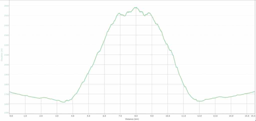
Our total roundtrip time was 8 hours even with a total distance of 15.5 km. Total elevation gains came in at 1152 m. The kicker is the additional time that it takes to drive in along the FFSR and then back to Highway 3. This makes the total trip much longer than simply 8 hours.
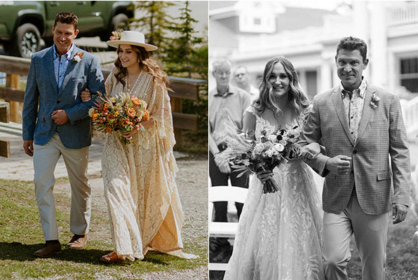
Before I dive into talking about Centre Mountain, here I am walking Janelle down the aisle for her elopement in June (left) and then again in August when we could finally have the full wedding ceremony and reception. Being able to do this twice in two months was an incredible honour for me. (Photos by Havilah Heger)
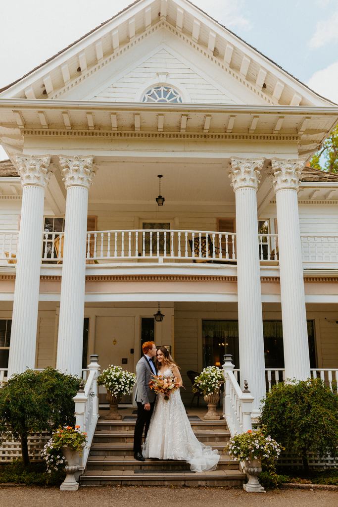
The happy couple! Congratulations Janelle and Jacob! Now back to our regularly scheduled programming… (Photo by Havilah Heger)
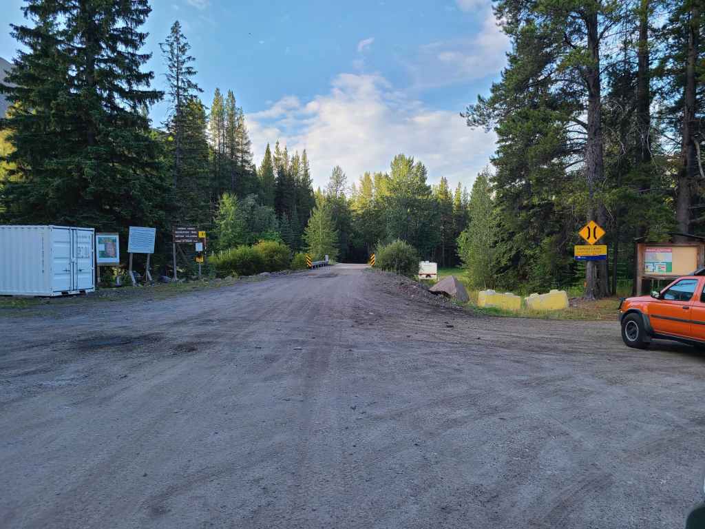
The entrance to the FFSR in Corbin. The road requires a high clearance 4×4 as there are deep ruts and sizeable mud holes. After reaching the Barnes Peak trailhead (~4.4 km from Corbin), the road narrows and care must be taken, especially when it comes to an eroded section just prior to Flathead Pass. Looking out your window and straight down to a creek several hundred metres below, definitely gets the pre-hike heart pumping. 😂
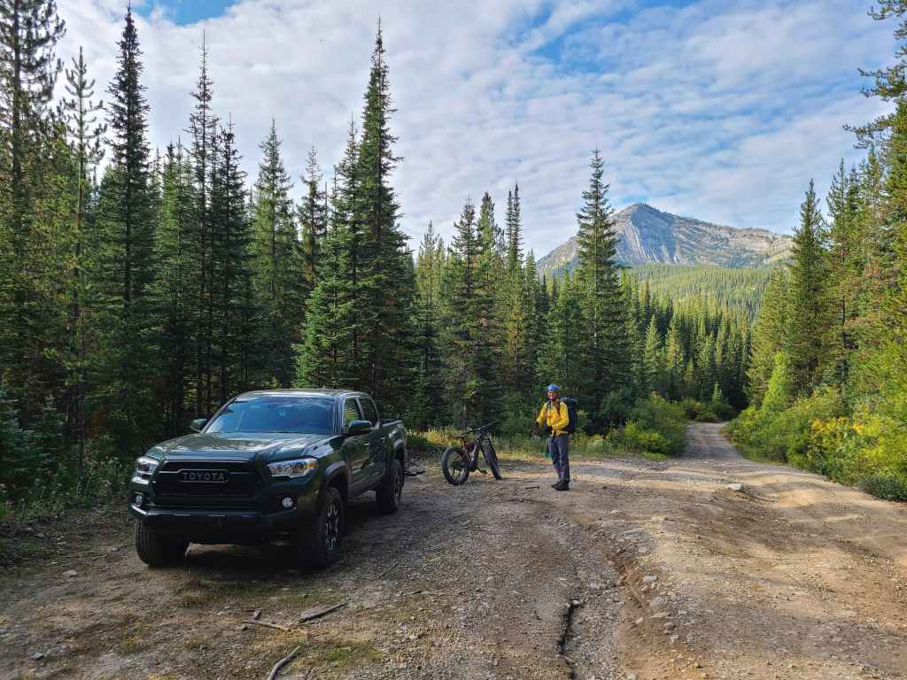
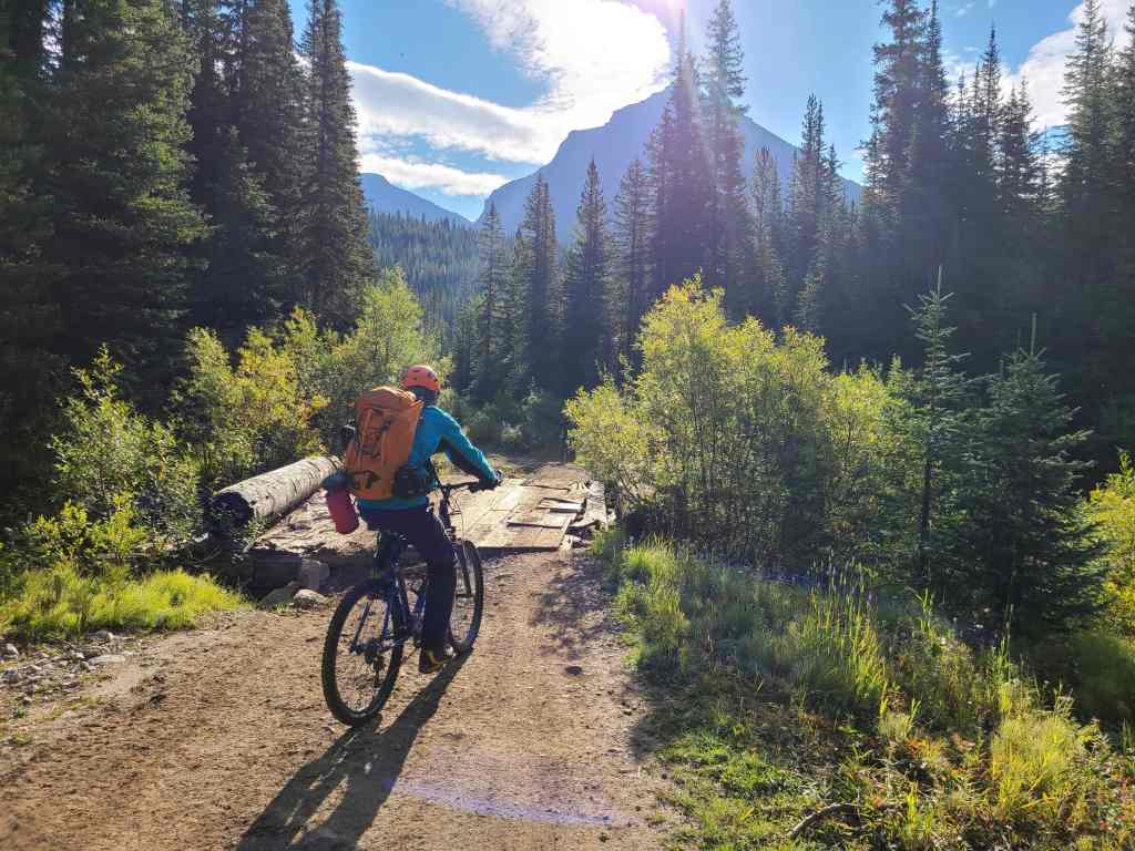
Our starting point just beyond Flathead Pass and approximately 10 km from Corbin. From here it was a 3.2 km ride to Centre Mountain.
Brad and Raff parked ~200 m further away – at the point where the road turns into a creek. 😳
It was awesome to get to know yet another Brad! (Photo by Andrew Nugara)
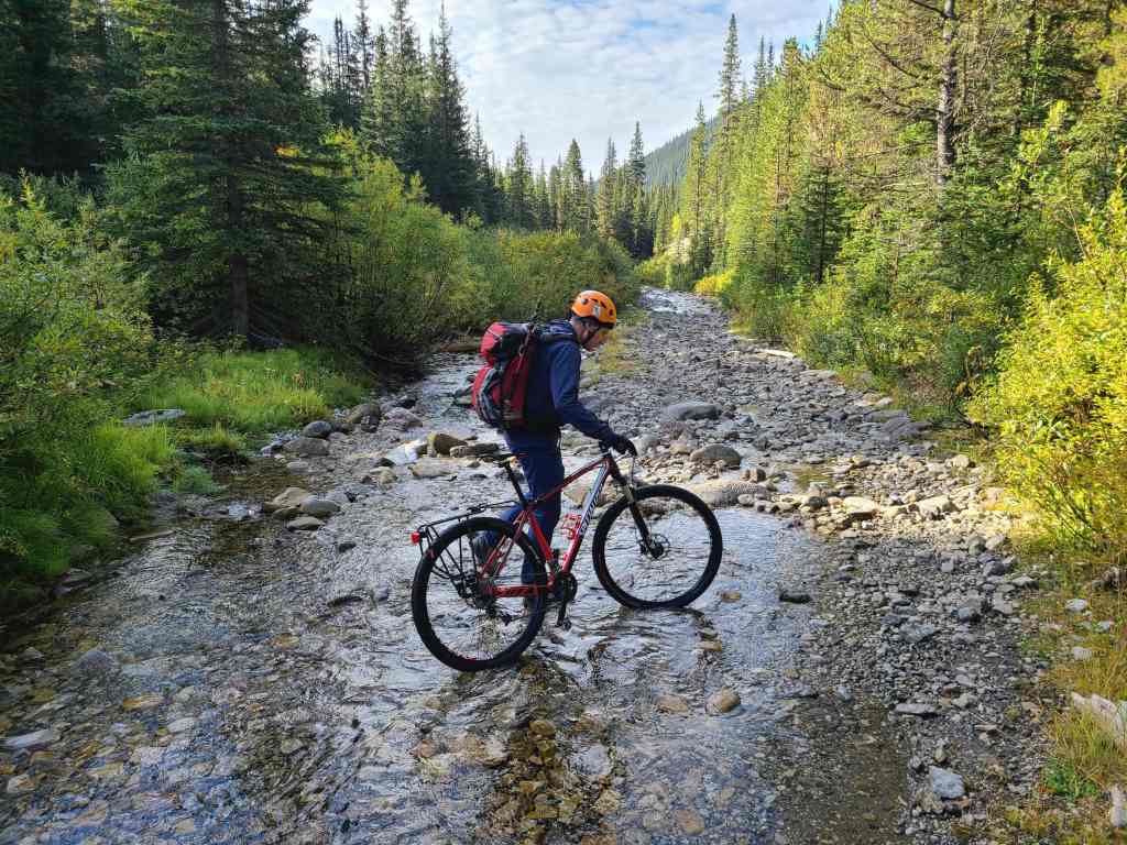
Brad pushes his bike along the road, er… creek. 🤔
This section of road was completely unrideable.
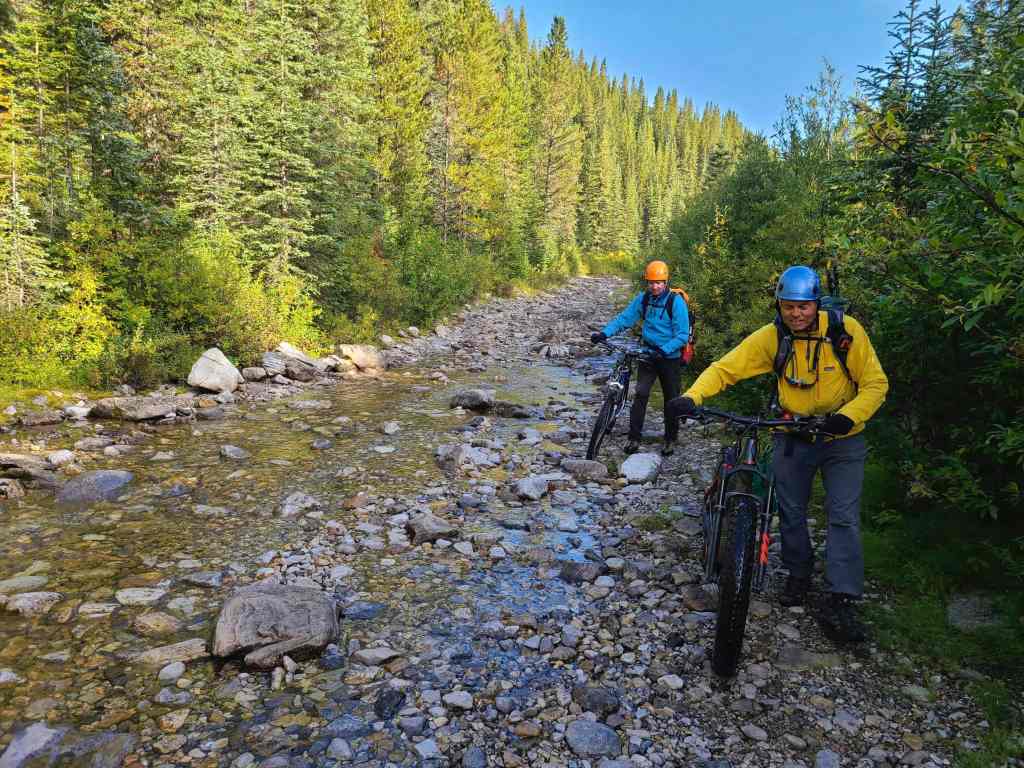
However, it soon became rough but rideable.
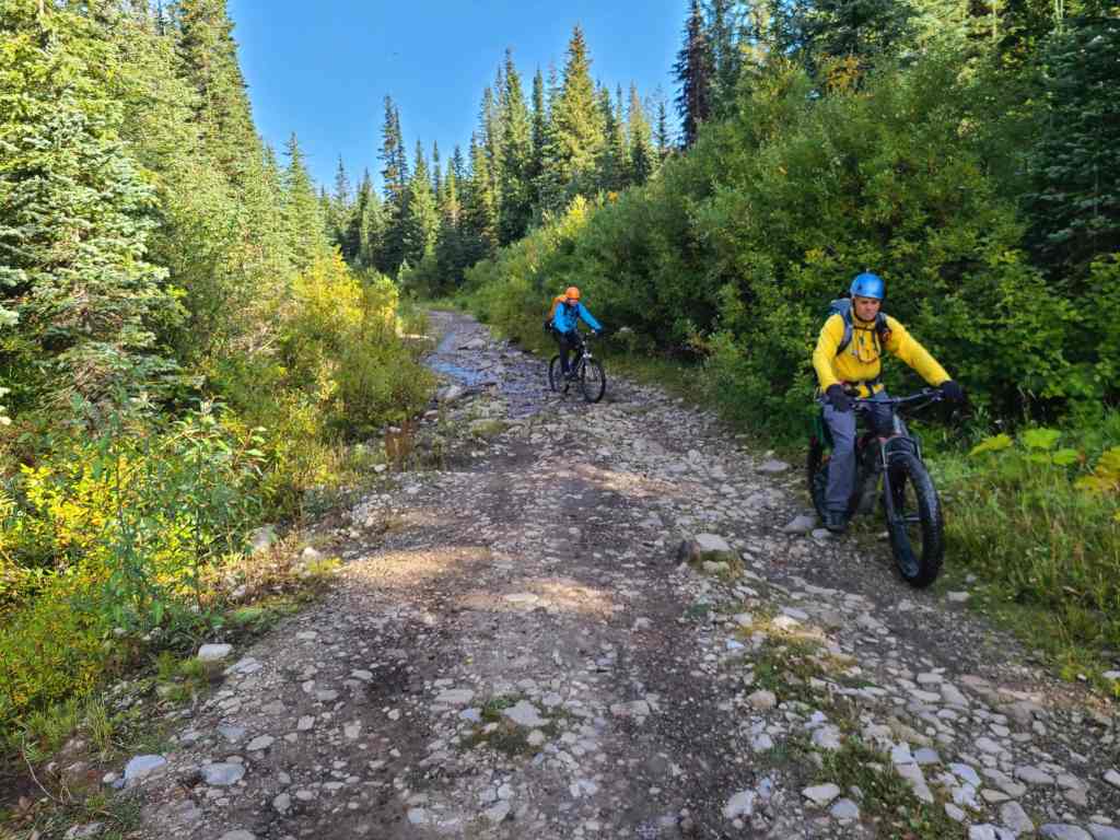
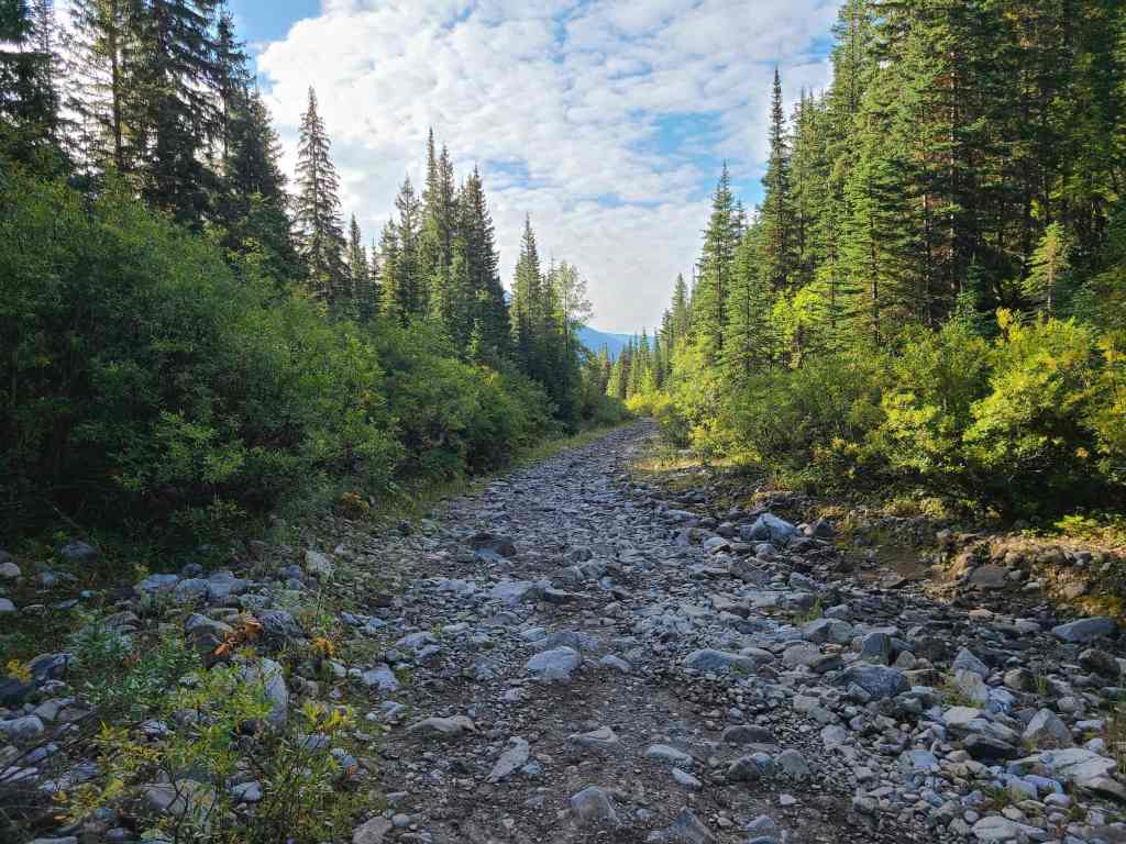
The road begins to improve!
Raff crosses the first of two dilapidated bridges.

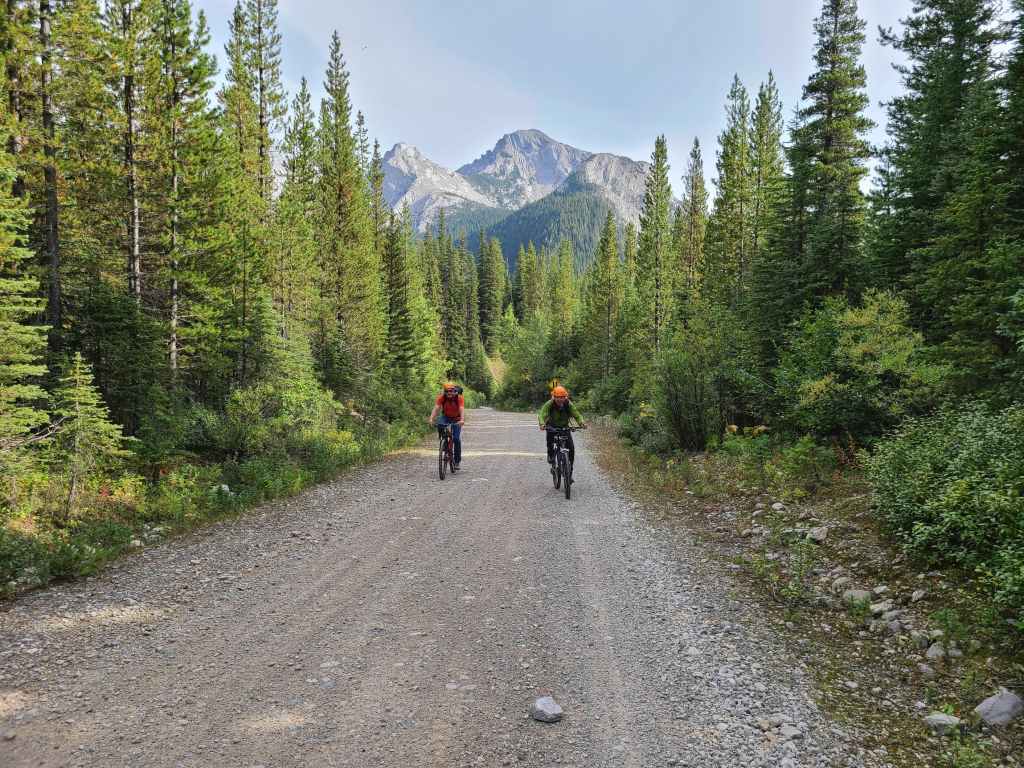
Brad and Andrew stop to check out Mount Borsato (centre). By this point, the road had become remarkably good for long stretches at a time, making our approach much quicker.
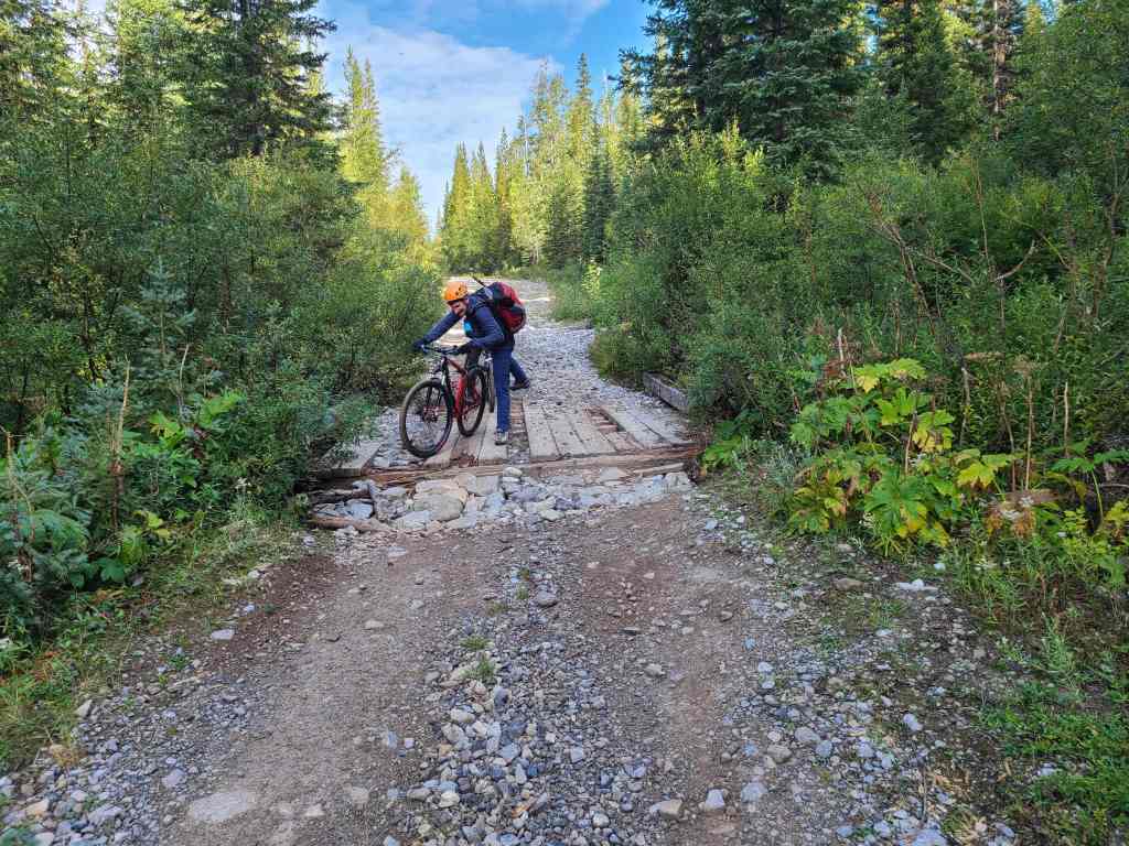
Raff crosses a second dilapidated bridge just prior to the access drainage that Sonny, Zosia, Shaun, and Andrea used to reach Centre.
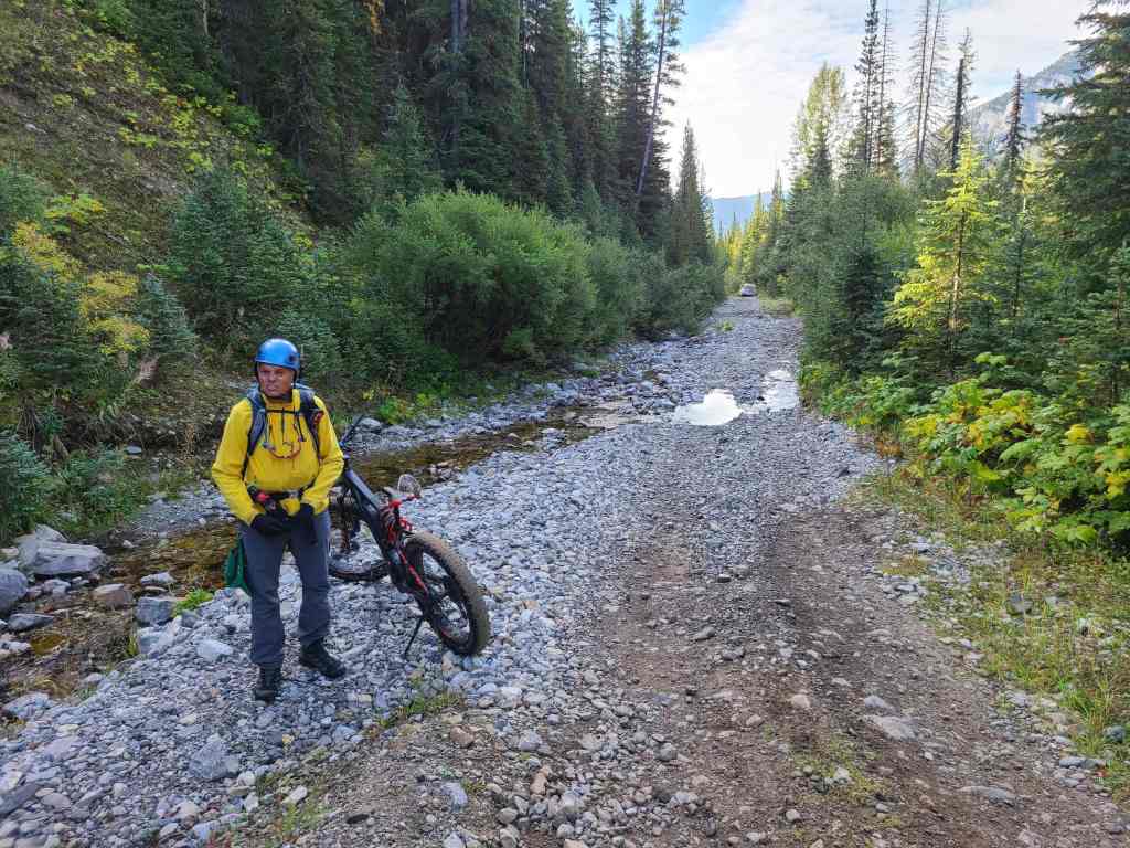
Andrew inspects the access drainage after noting that Sonny’s car was parked further down the road. We assumed that his crew went up the drainage, but decided to ride down to his car just in case.
Zosia, Sonny, Andrea, and Shaun had spent the previous night at the Lower Harvey Creek Recreation Site and had approached Centre Mountain from the south.
After stashing our bikes next to Sonny’s car, we decided to forego the drainage and head straight towards the mountain from the road.
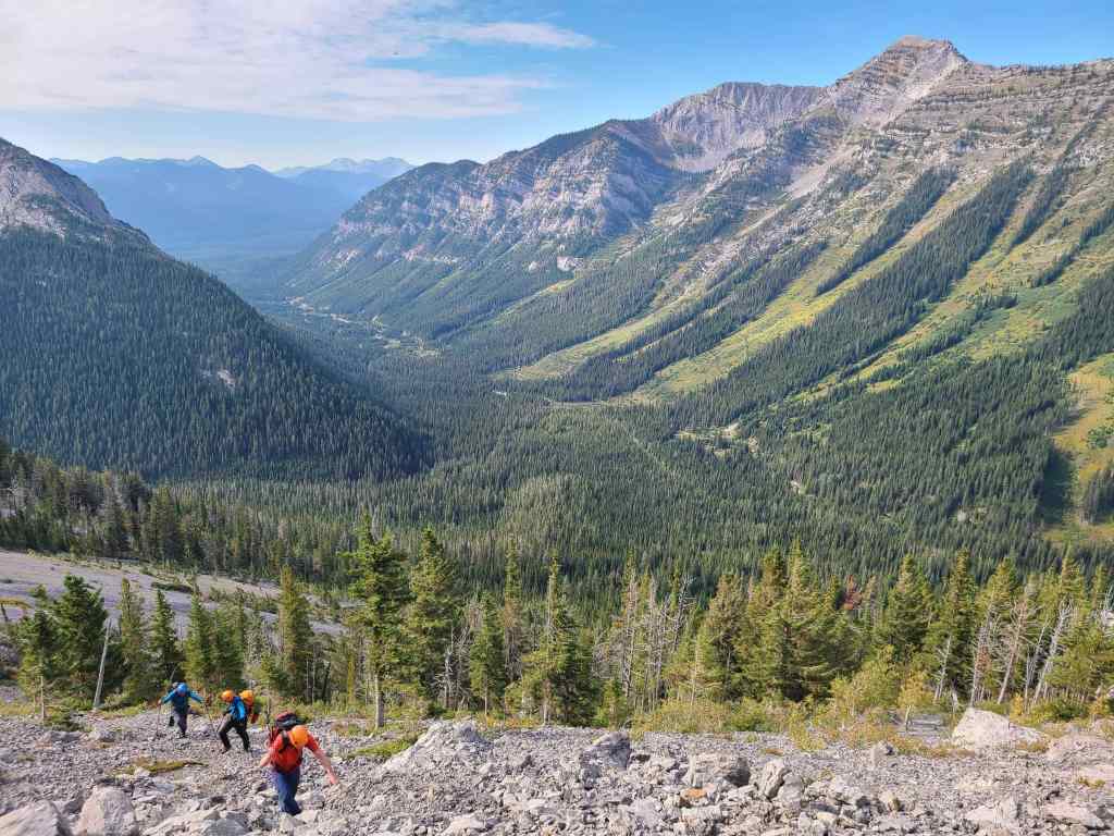
After bushwhacking our way up a small knoll that was located next to the road, we could see the first of two false summits on Centre. From here, our route more or less went in a straight line towards the large rock formation (left of centre) on the west ridge.
The worst of the bushwhacking occurred over the first ~400 m.
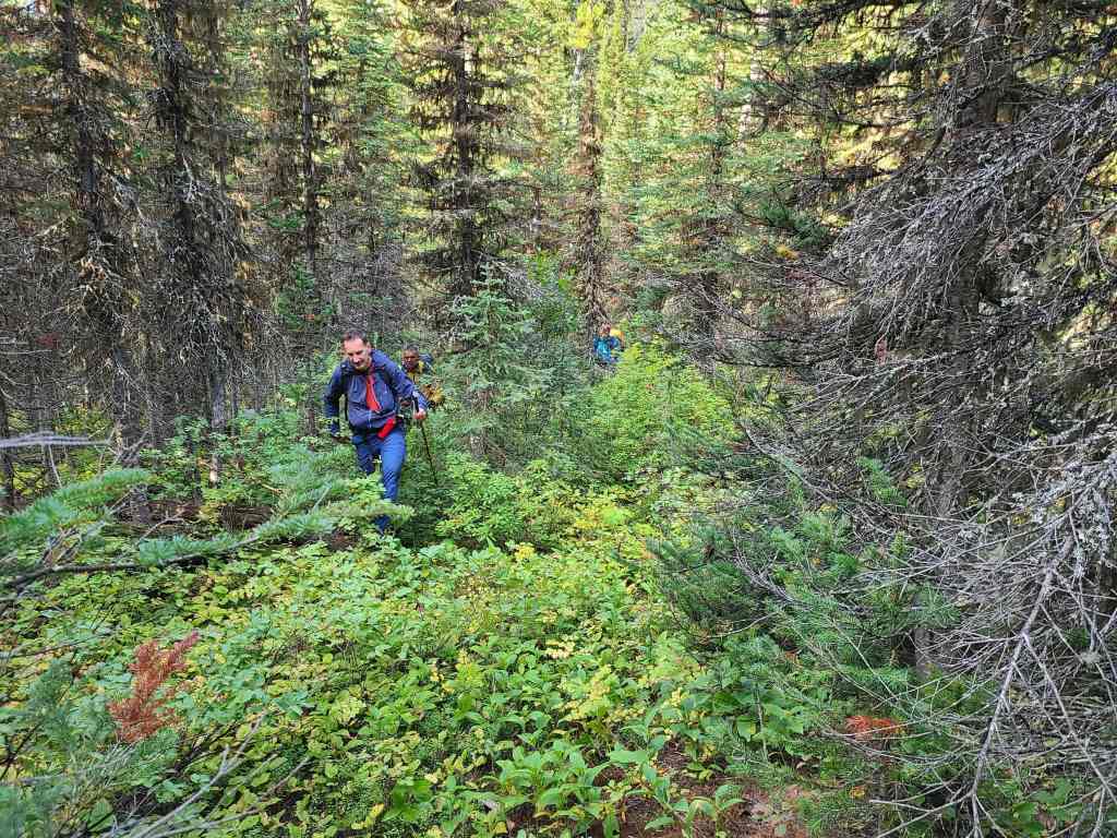
Brad emerges onto more open terrain.
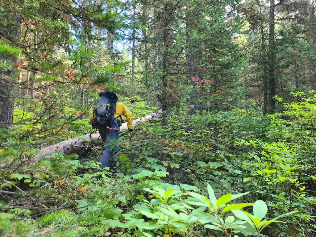
Andrew leads us through the decreasing undergrowth.
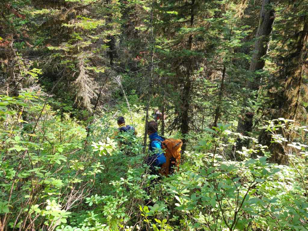
Now hiking through light forest.
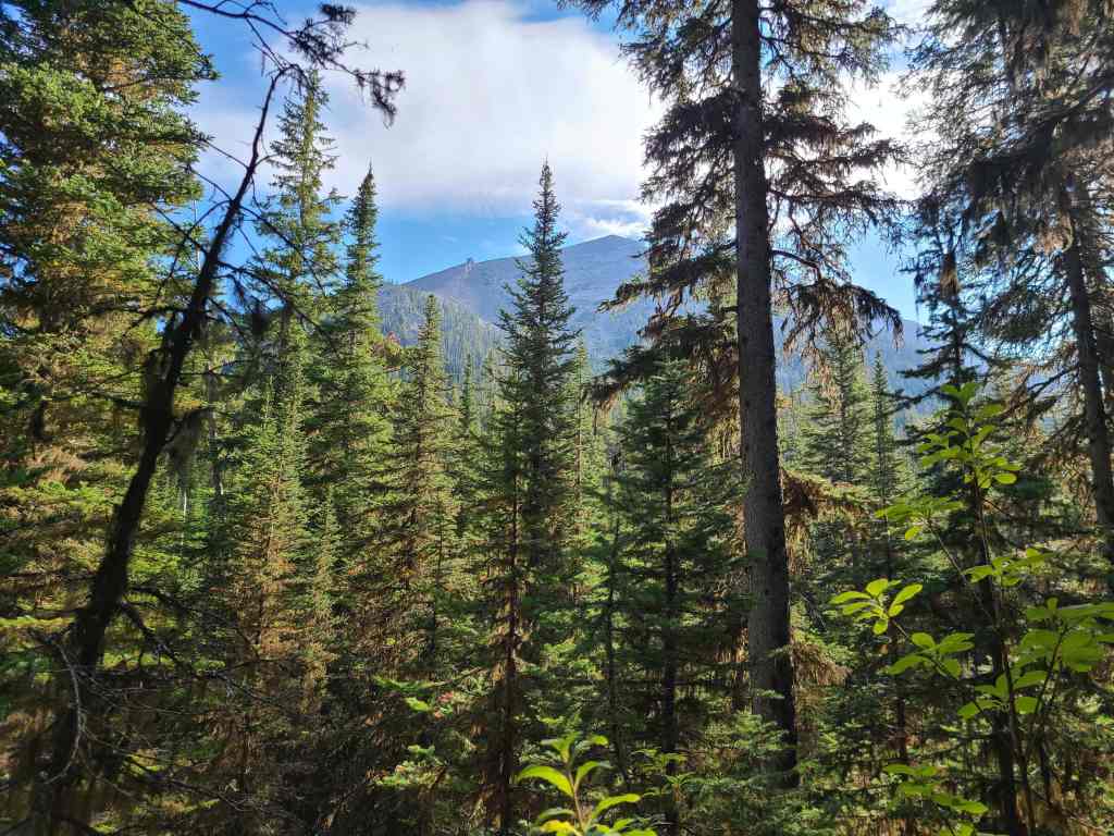
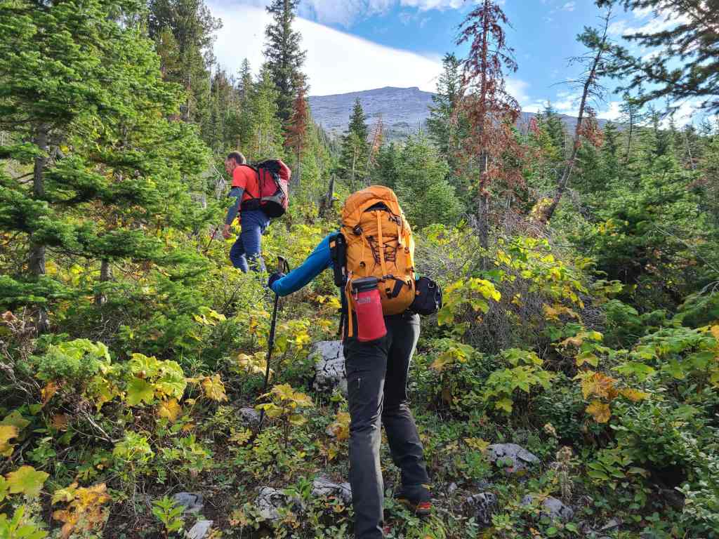
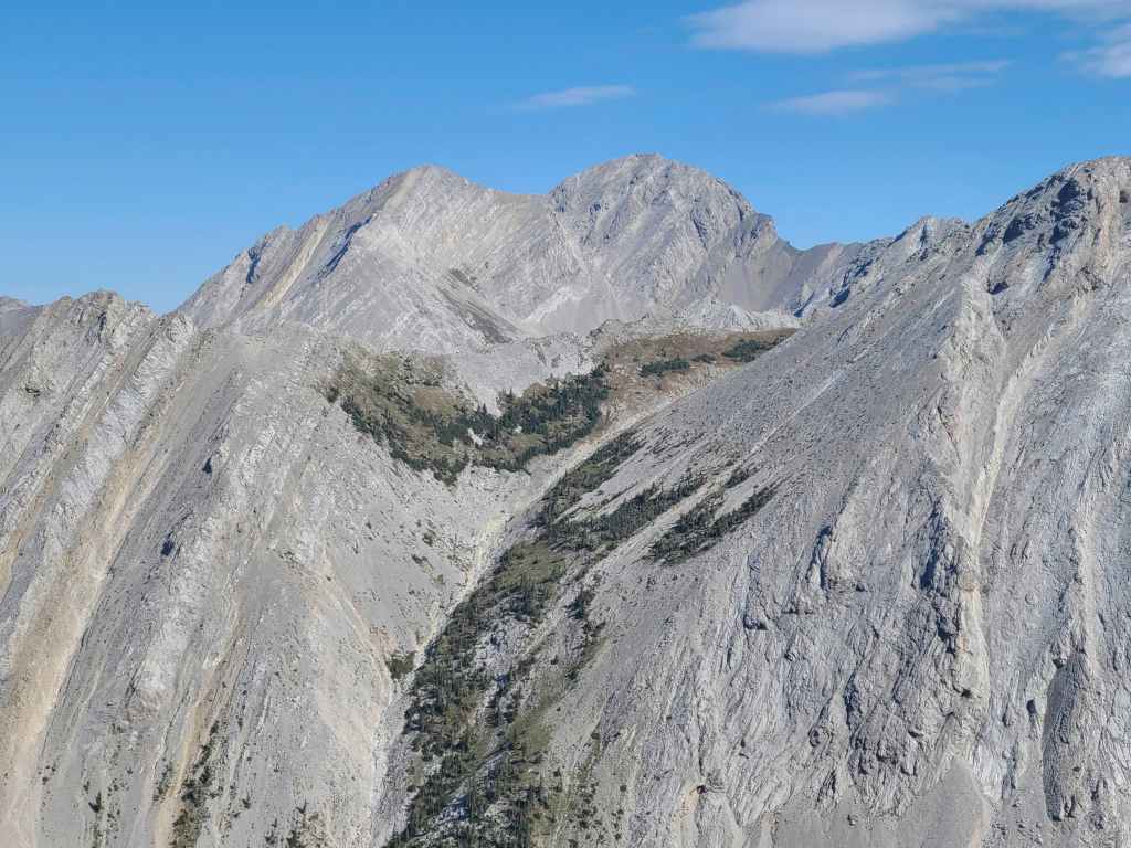
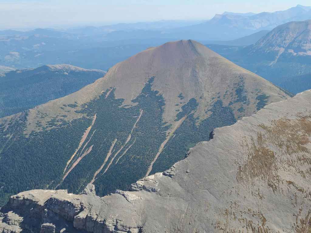
Gazing over to Mount Corrigan after gaining some elevation.
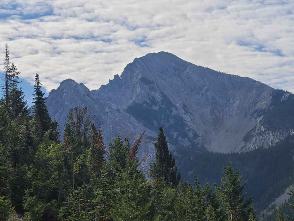
Looking south and towards Mount Borsato from the same location. Both mountains are named after local men who were killed-in-action during WWII.
Our route paralleled a small drainage located to climber’s right.
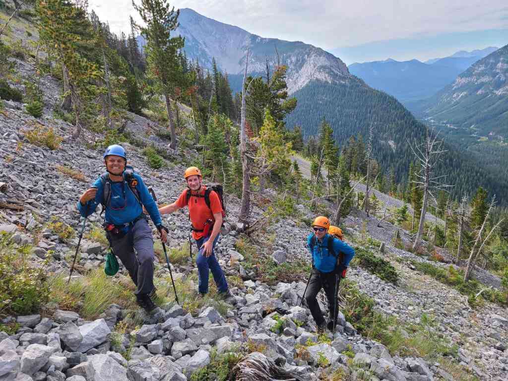
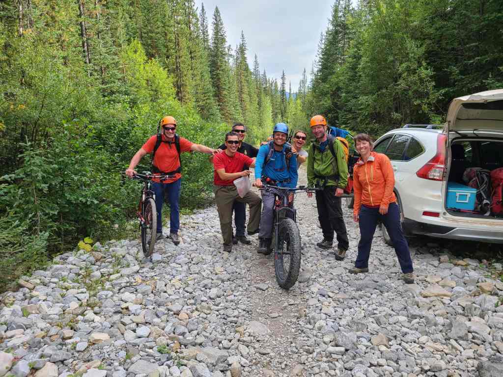
A great group of guys!
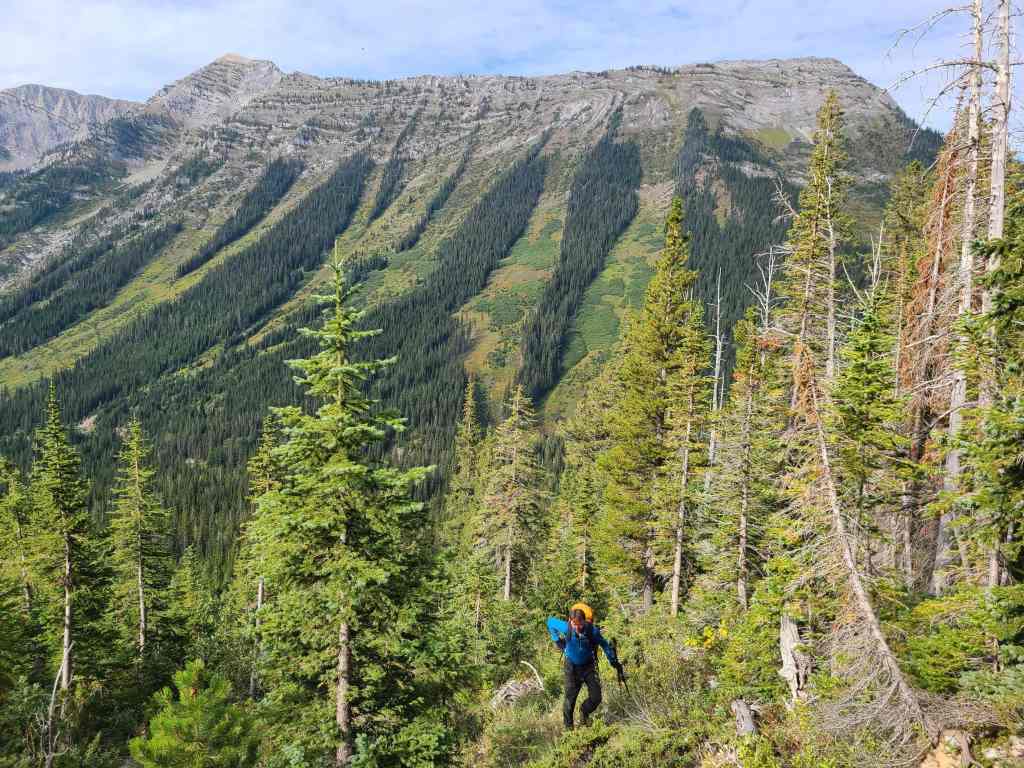
After encountering treadmill scree, we trended climber’s left to gain the west ridge. The rock formation that we could see from the knoll is in front of me and the first false summit is to the right of centre. For reference, it took us 1 hour and 30 minutes to reach this point from our vehicles.
The view south and along the Flathead Valley.
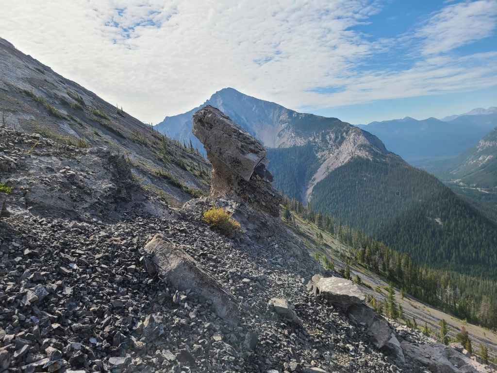
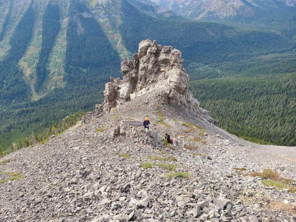
I thought this rock formation looked like a sheep’s head and as such, I affectionately named it, ‘Sheep Stuck in Scree’. 😂
We ascended to climber’s left of the formation to take advantage of the footing. On the way down, we would utilize the scree found on the opposite side.

Drawing closer to the top of the formation.
Raff takes in some great views of Mount Corrigan.
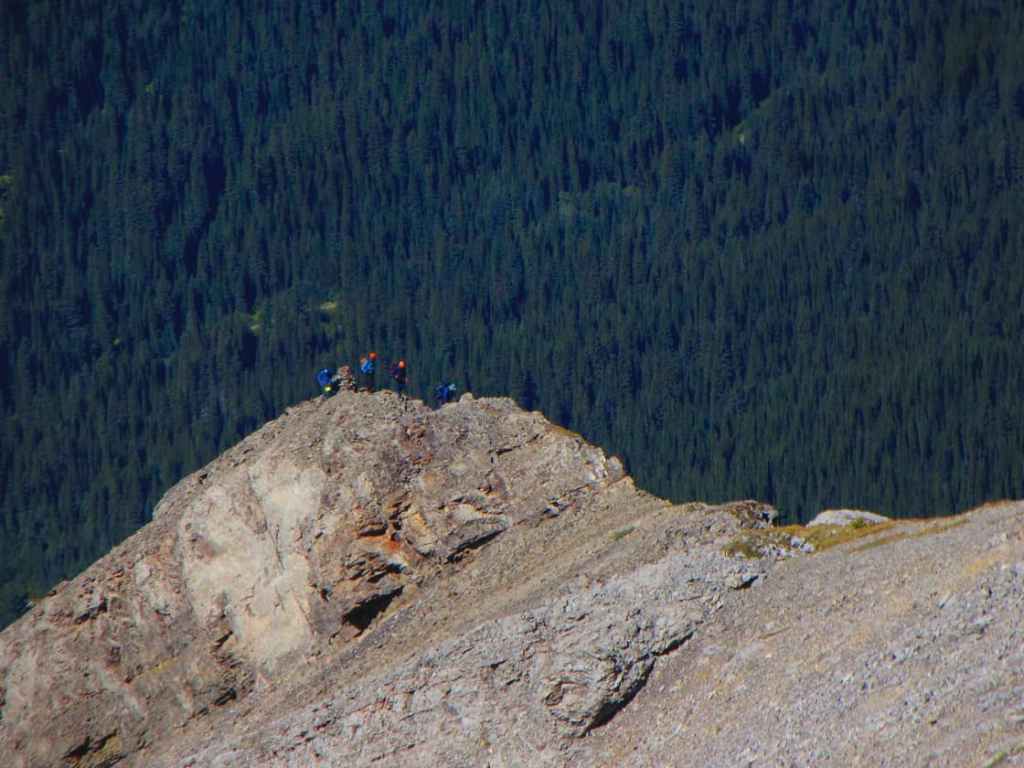
The entire time we kept wondering if, and when we’d run into Sonny, Zosia, Shaun, and Andrea. As soon as we rounded the corner of the rock formation, we caught our first glimpse of them. Unfortunately, like the rest of the ridge, they appeared much closer than they actually were and we would not join together after the crux on the summit ridge. (Photo by Andrew Nugara)
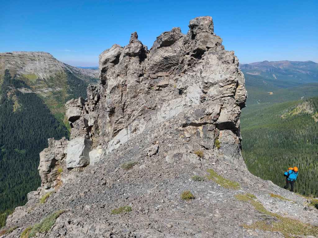
The top of the interesting formation that had guided us to this point.
Enjoying a short break. We would stop here again on the way down.
Glancing back as we make our way towards the first false summit. Again, this whole section is quite foreshortened.
Looking over to our old friend, Darrah S2, with diminutive, Darrah S3, poking up on the right.
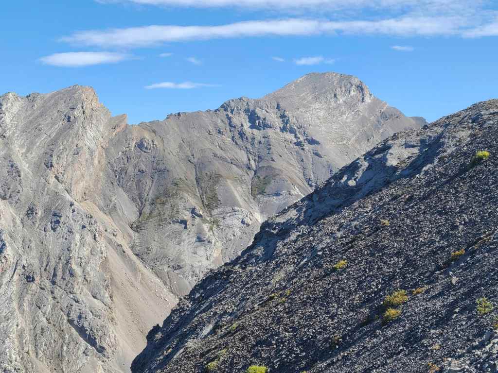
Centre N1 is high on my ‘To Do’ list.
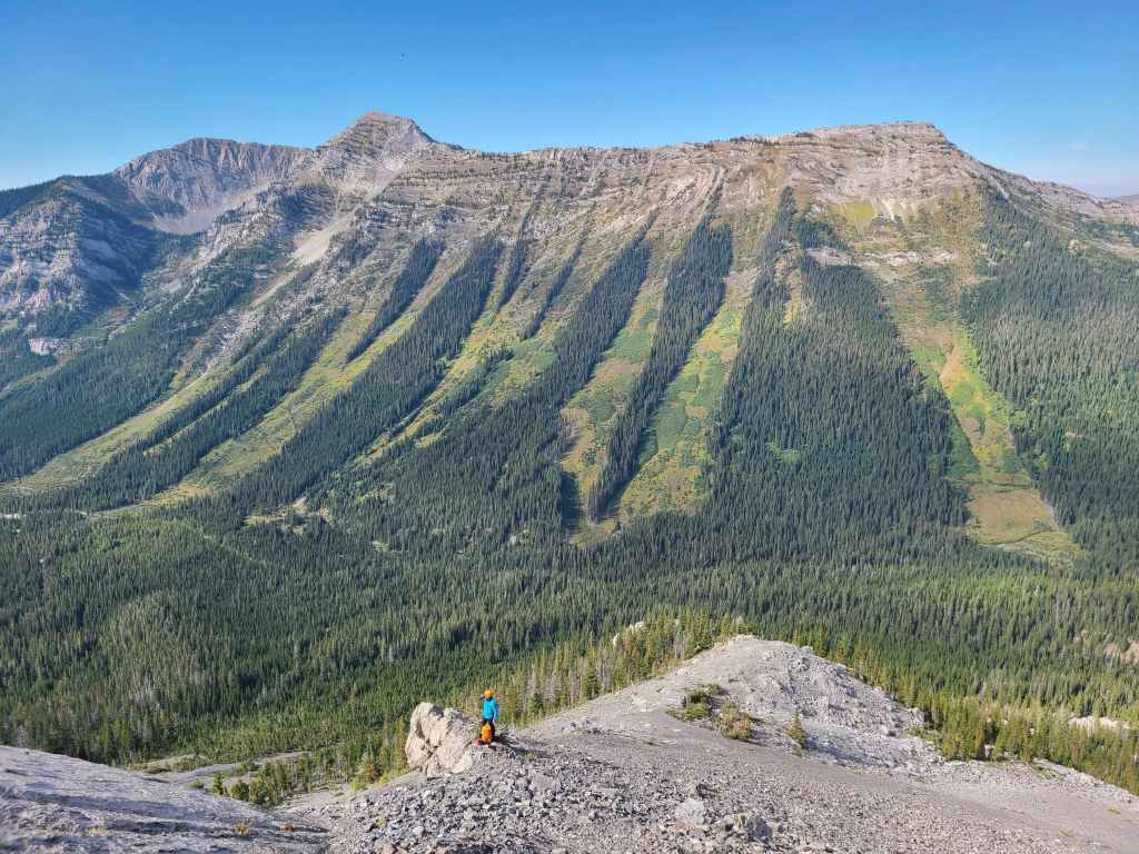
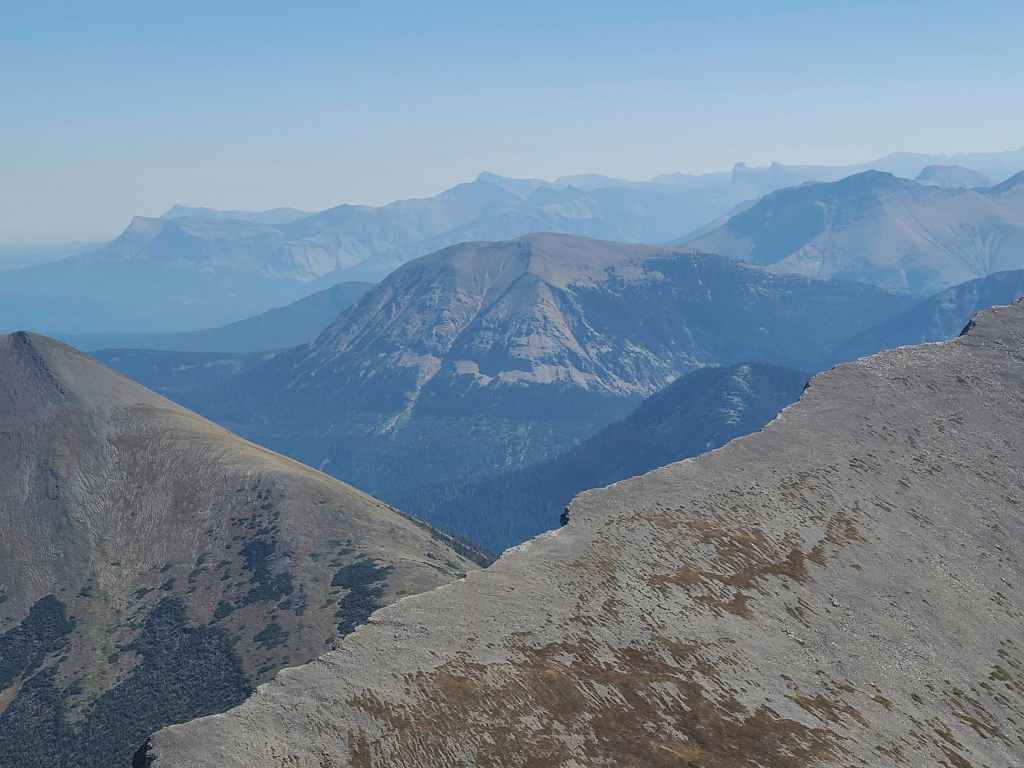
Gazing across to Barnes Peak (centre) which is the highest point on Limestone Ridge.

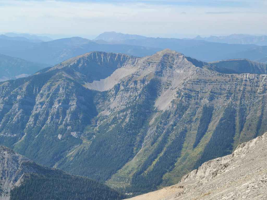
A closer look at the double summits on Mount Corrigan. Rick Collier refers to each as having its own name, with Francis being one peak and Corrigan being the other. Hence, the name of the fallen soldier, Francis Corrigan. As I’ve noted before, both are on my ‘To Do’ list.
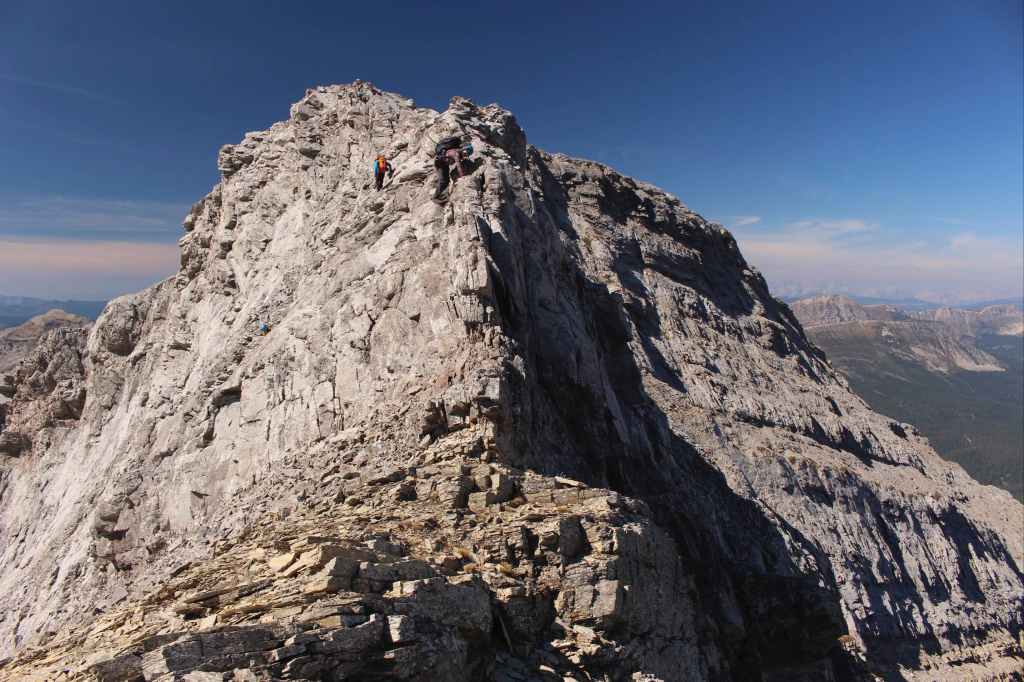
A large cairn marks the top of the first false summit while the second false summit sits off in the distance (far right).
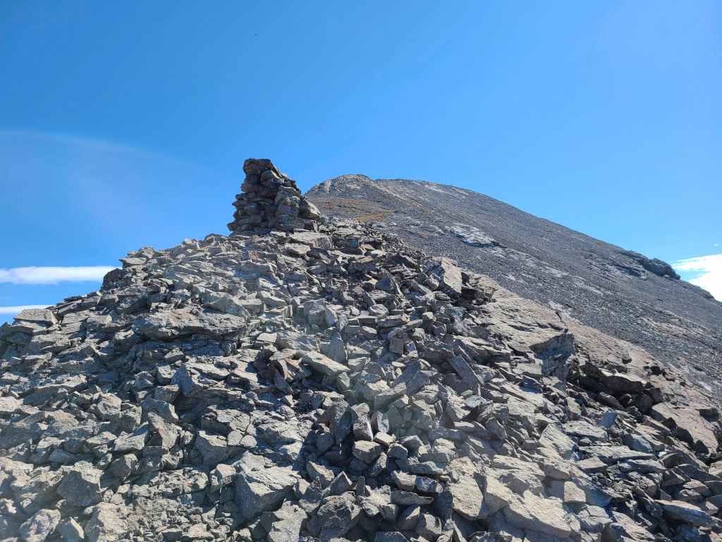
I can’t prove it, but I think this cairn is a triangulation point or photogrammetry station for the Boundary Survey led by A.O Wheeler at the turn of the 20th century. It is well constructed, but serves no purpose unless you begin to look at its views of the surrounding peaks. If this is indeed the case, this cairn was placed circa 1914.
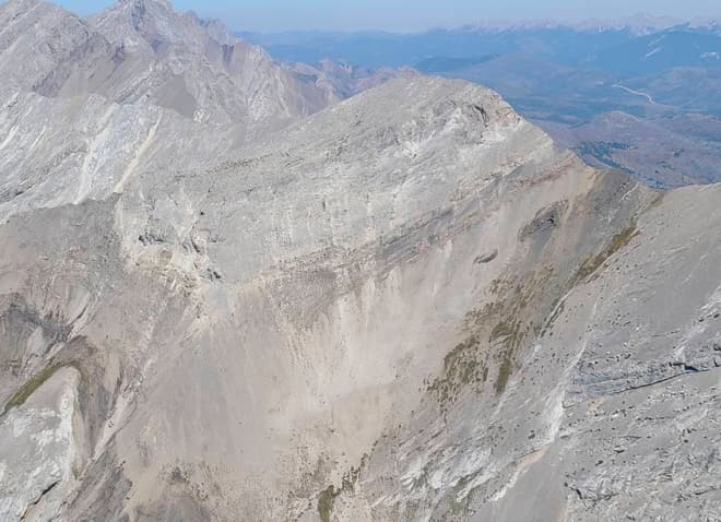
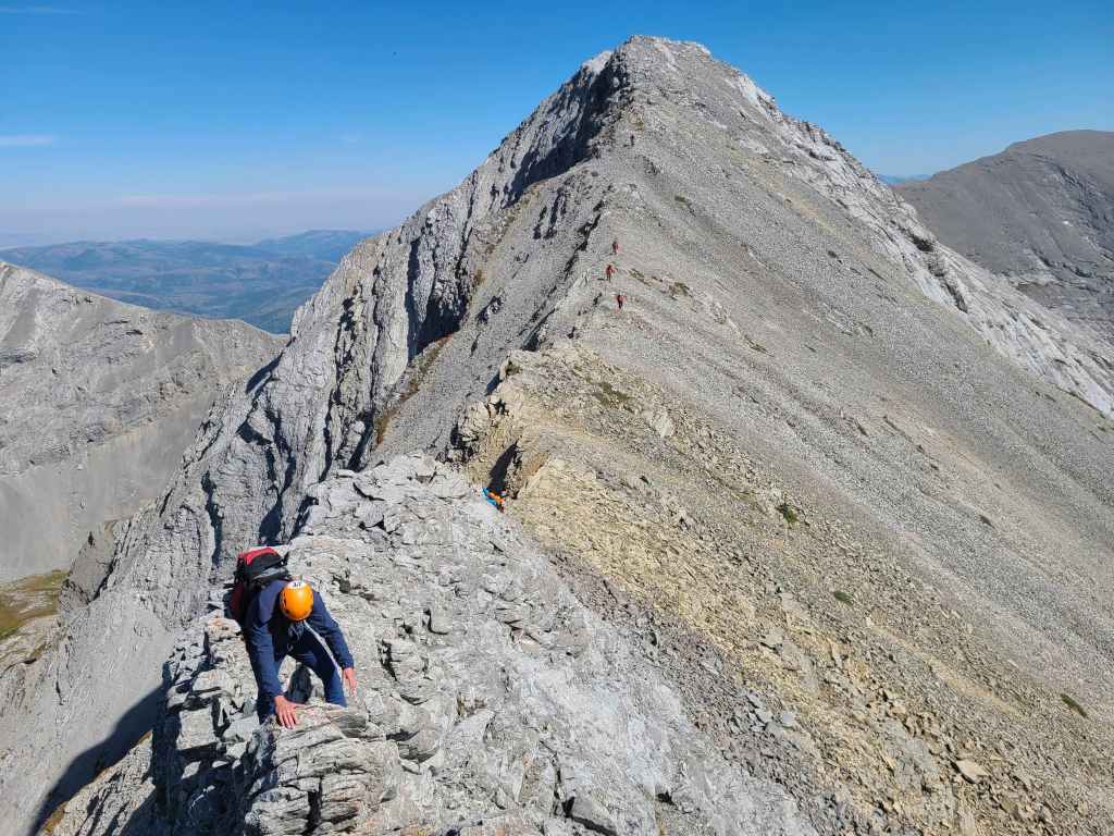
Shortly beyond the cairn, the ridge abruptly narrows as it skirts around a fissure.
My view back to the cairn from the other side…
Accompanied by a simultaneous photo taken by Raff. (Photo by Rafal Kazmierczak)
We could see Sonny (centre) and Zosia (right) far above as they approached the second false summit…
And they could see us! In fact, Zosia almost captured a third simultaneous photo of Brad traversing the edge of the fissure. (Photo by Zosia Zgolak)
Raff enjoying the views.
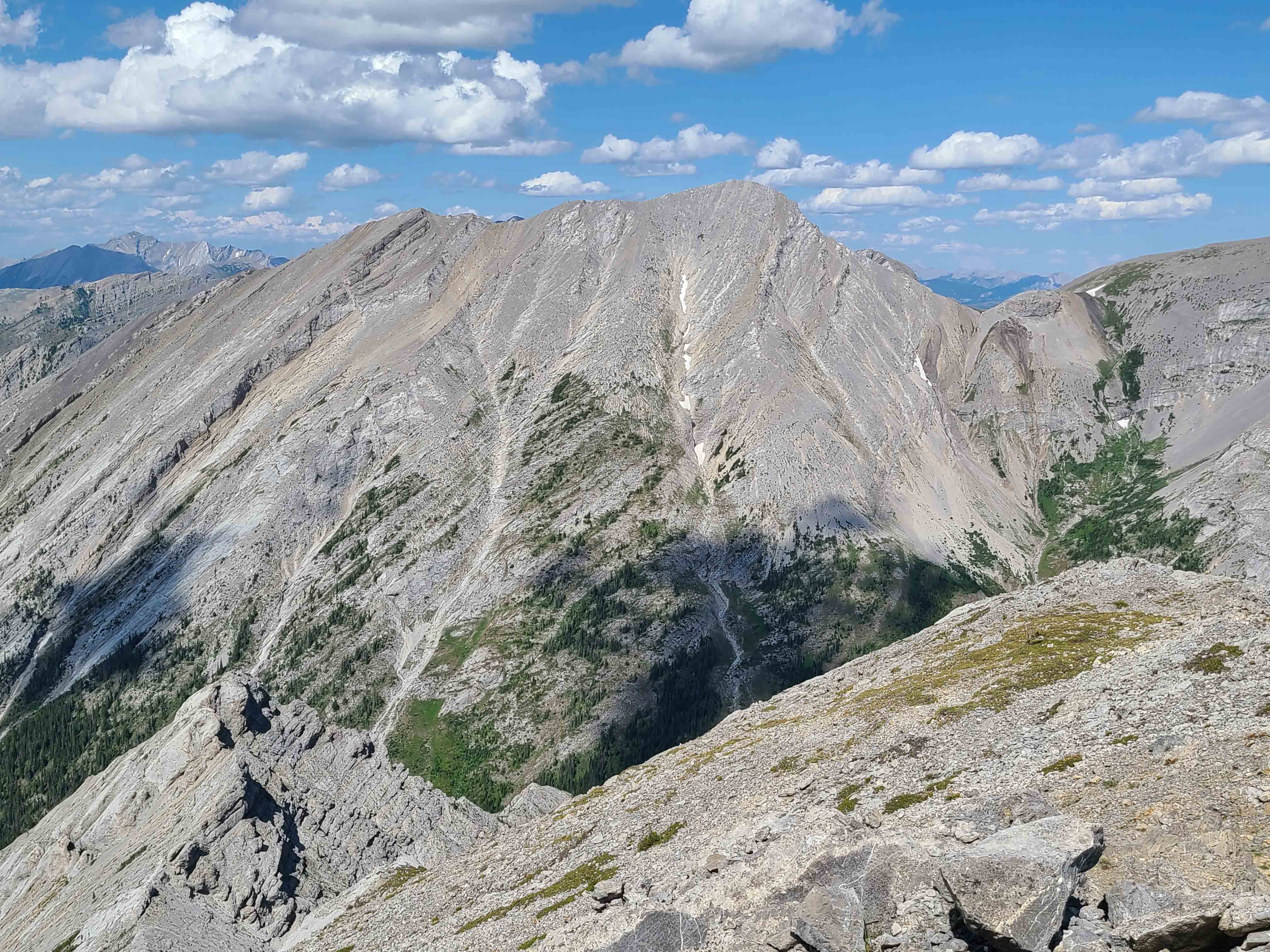
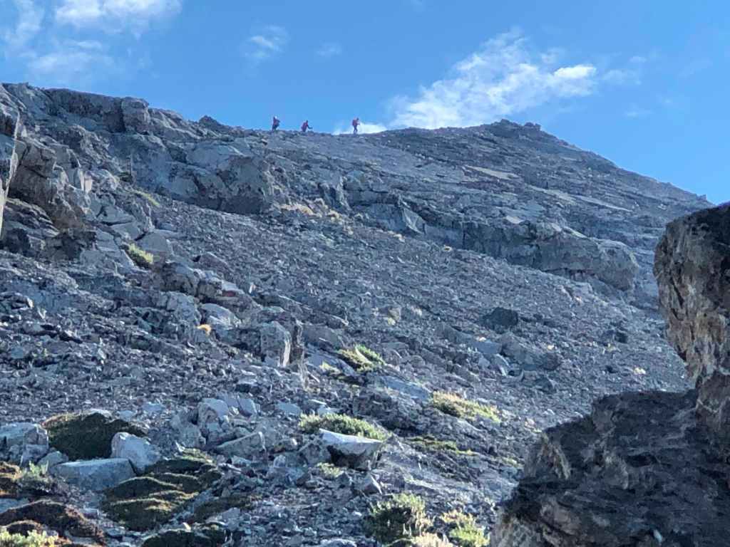
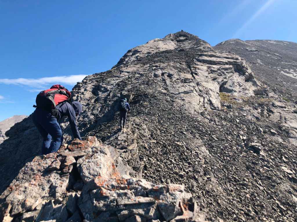
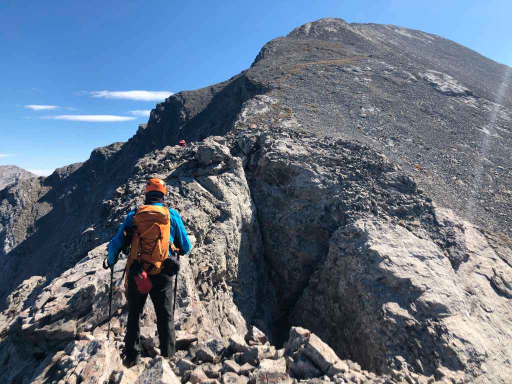
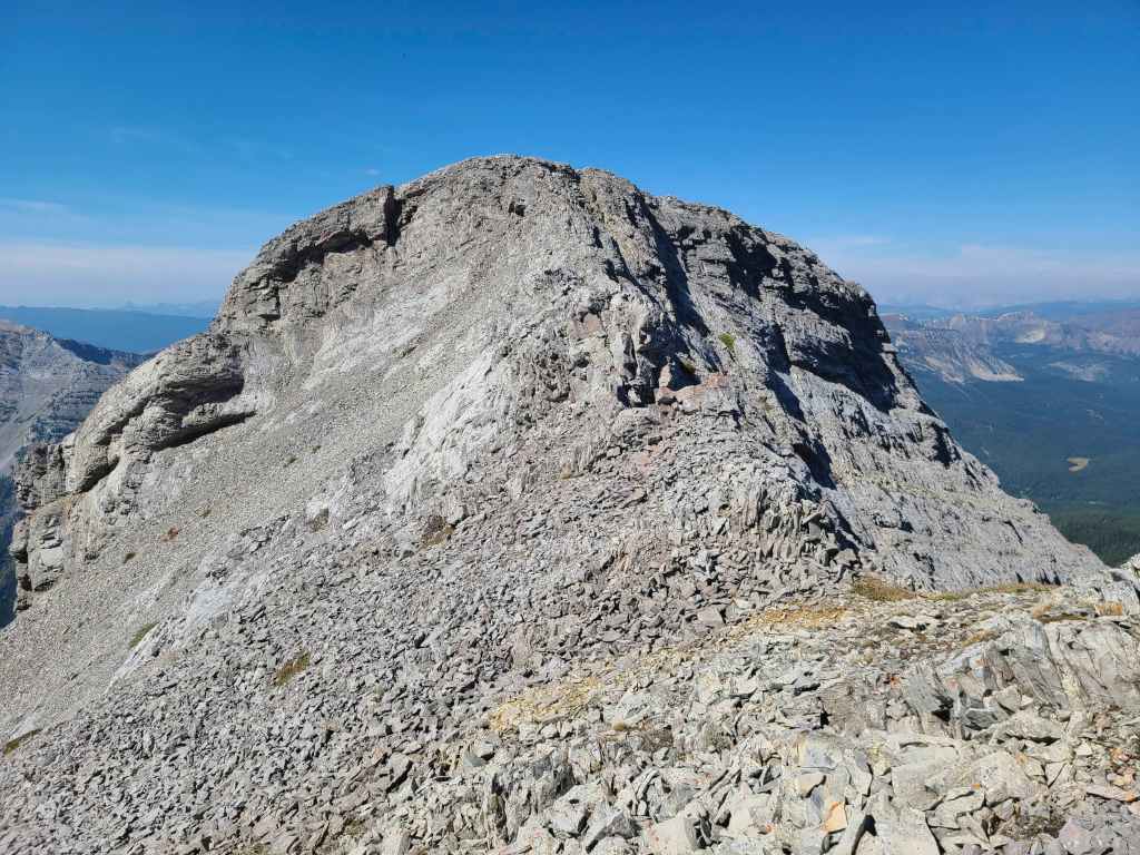
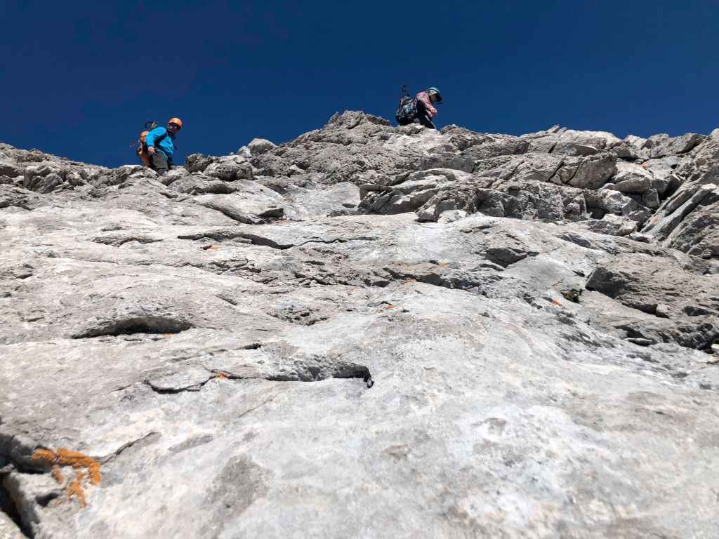
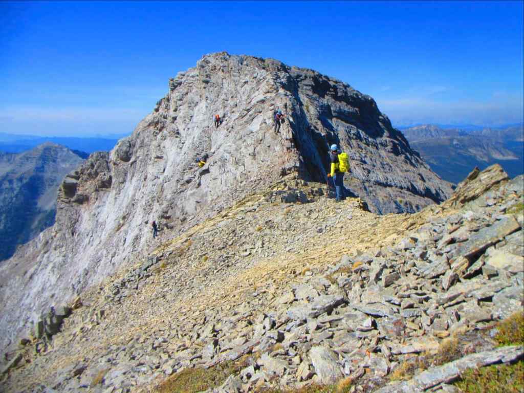
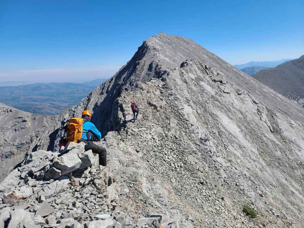
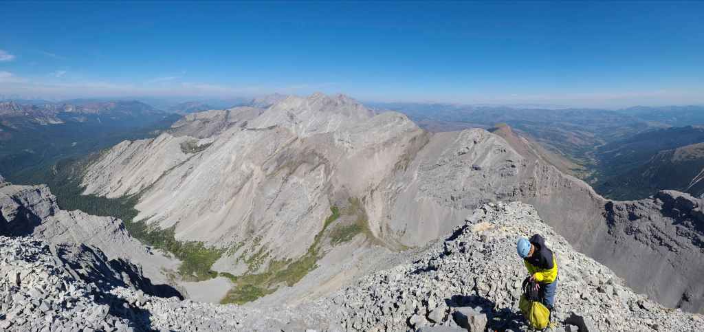
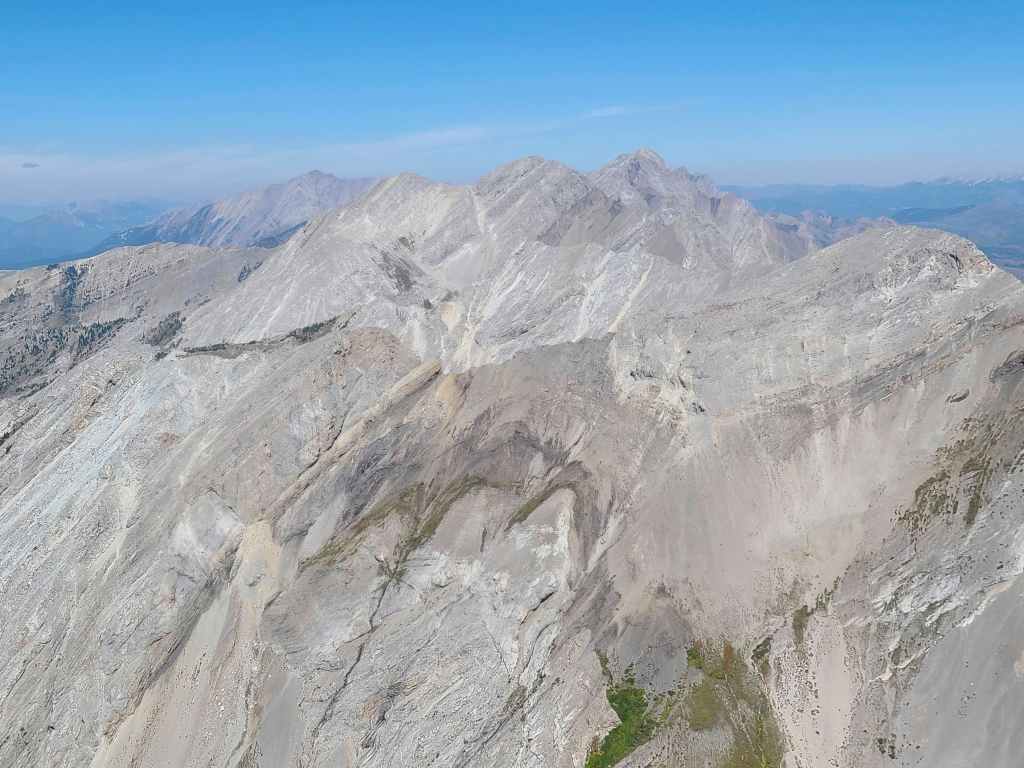
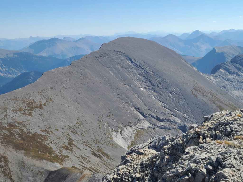
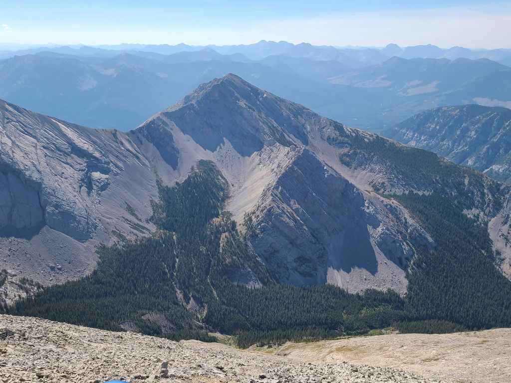
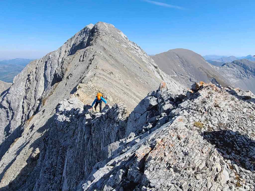
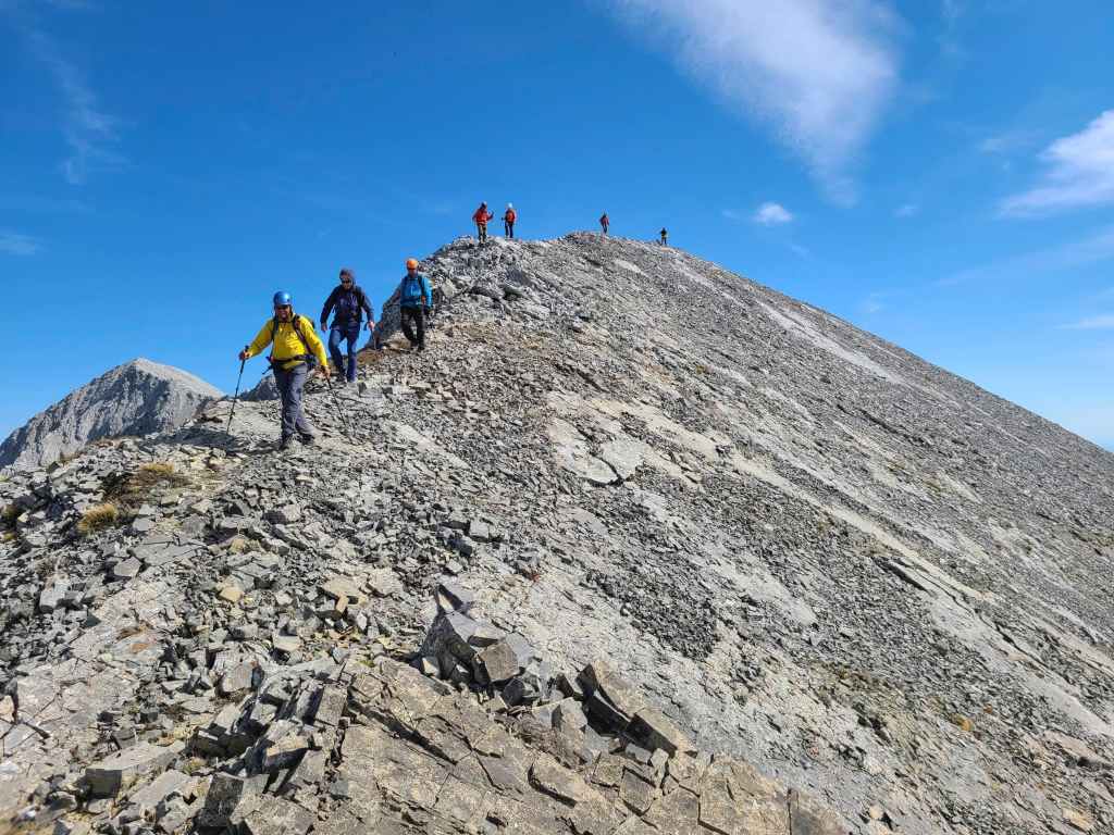
Our first look at the summit (left) and the two major down-climbs along the ridge. The crux is in the centre while Sonny (right) can be seen standing at the start of the very narrow ridge. The second down-climb is immediately on the other side of the intervening high point to the left of centre. (Photo by Rafal Kazmierczak)
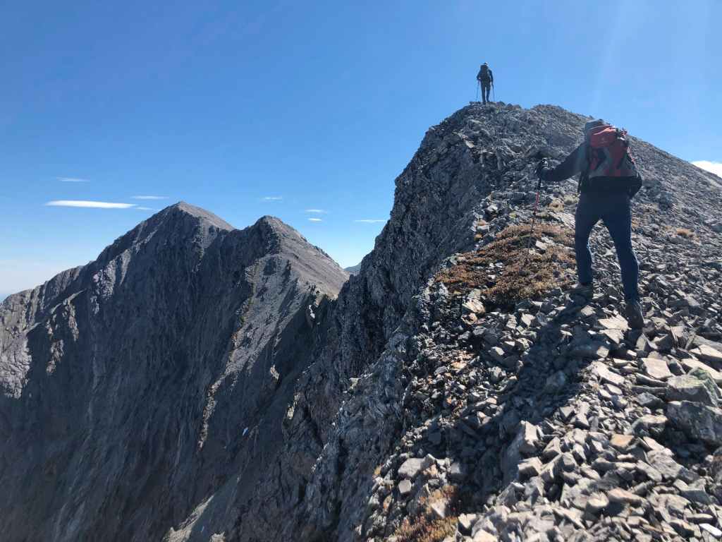
I arrive on top of the second false summit – which is also the start of the summit ridge. (Photo by Andrew Nugara)
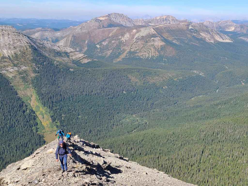
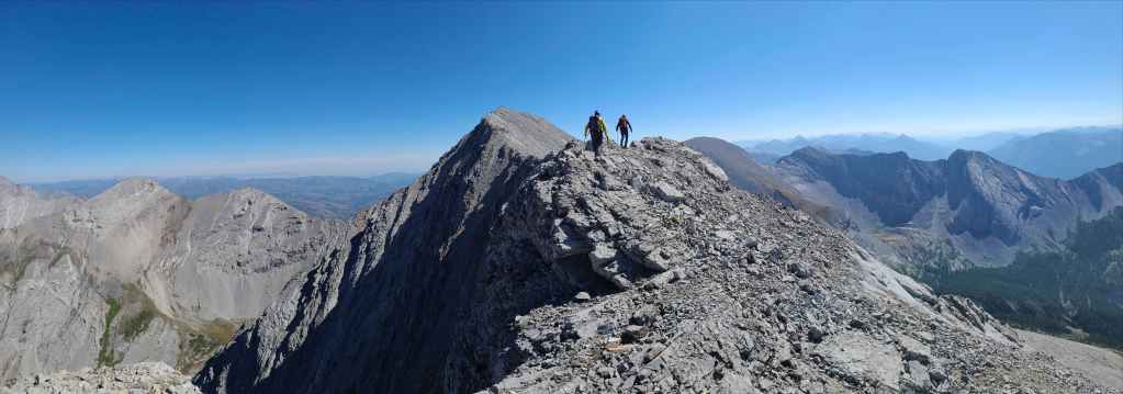
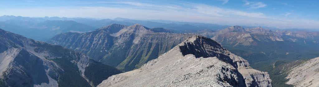
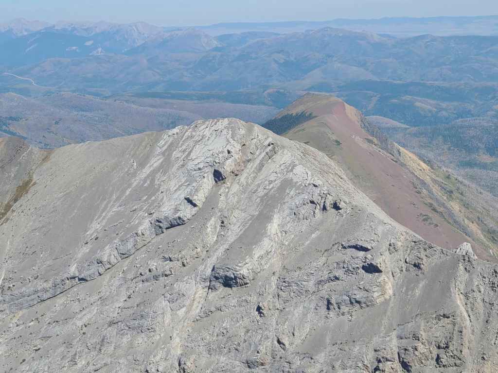
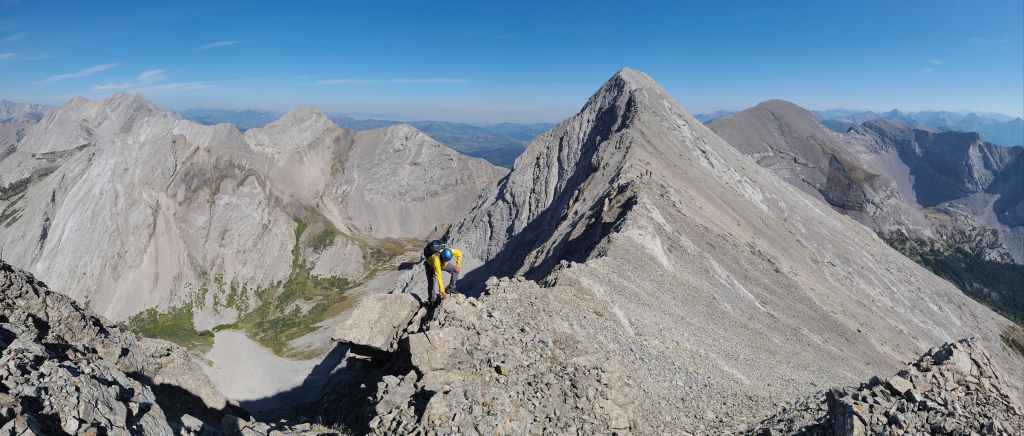
The summit is still ~1 km away…
Brad leads us down from the false summit. (Photo by Rafal Kazmierczak)
Raff and Andrew scramble towards the crux, which is marked by the slabs in the centre.
The view back to the false summit.
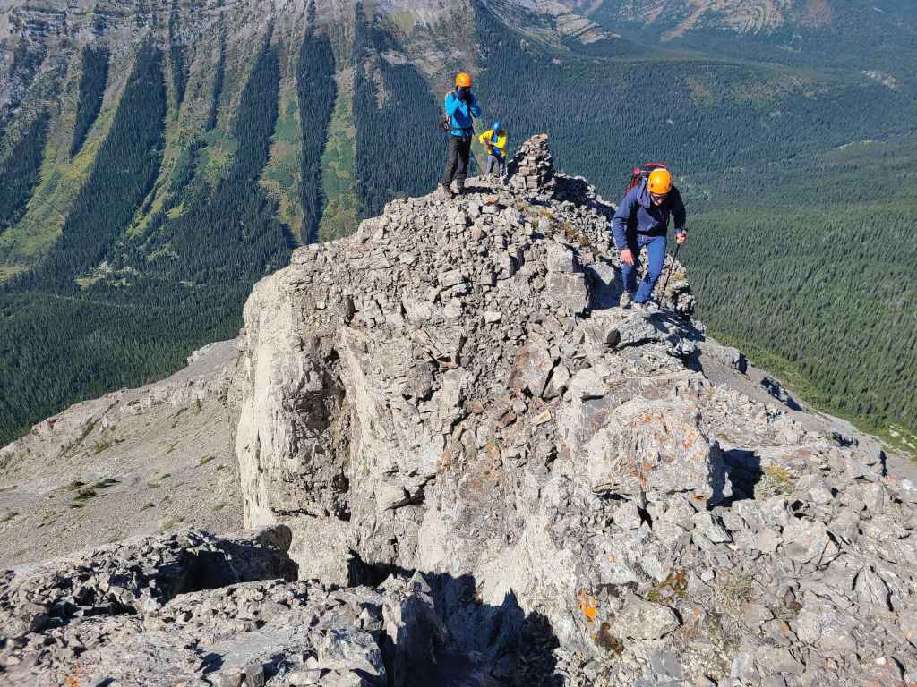
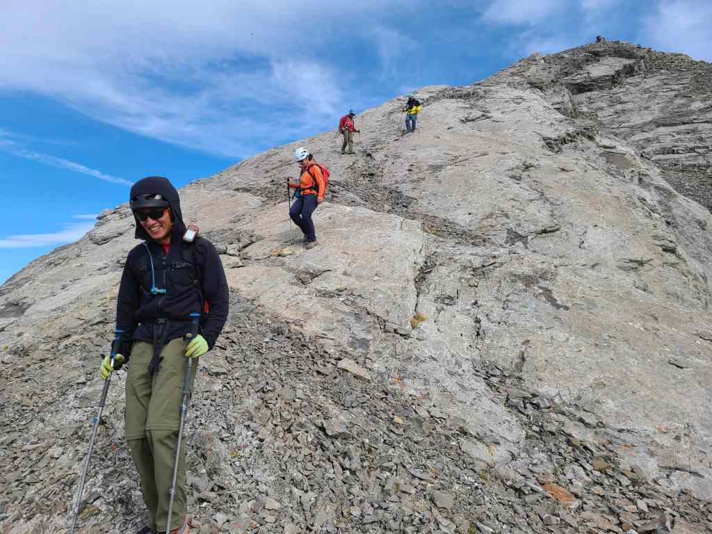
Brad ventures onto the narrow and exposed ridge while Sonny, Zosia, Andrea, and Shaun watch from below.
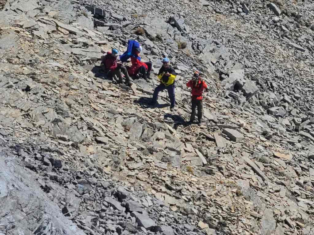
Sonny’s crew enjoy a well-deserved break after tackling the crux.
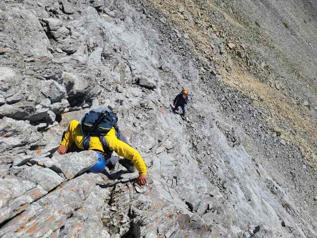
Andrew and Brad climb down from the ridge and onto a tricky section of scree-on-slab.
Andrew’s view up to Raff and I. While Raff decided to follow Andrew and Brad, I chose to remain on the ridge. (Photo by Andrew Nugara)
My view back to Raff. There was no shortage of exposure! 😳
Zosia’s view highlights the two different routes that we used to tackle the crux. In the centre, I am down-climbing off of the ridge and on the left, Raff, Brad, and Andrew make their way down and across the tricky slabs. On the way back, all of us would use the route along the ridge. (Photo by Zosia Zgolak)
Sonny’s view from his vantage in the previous photo. The exposure is notable. (Photo by Sonny Bou)
A closer look at the crux after I was back on solid ground.
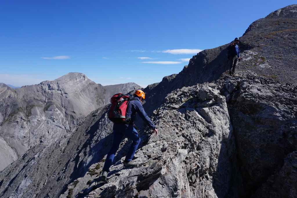
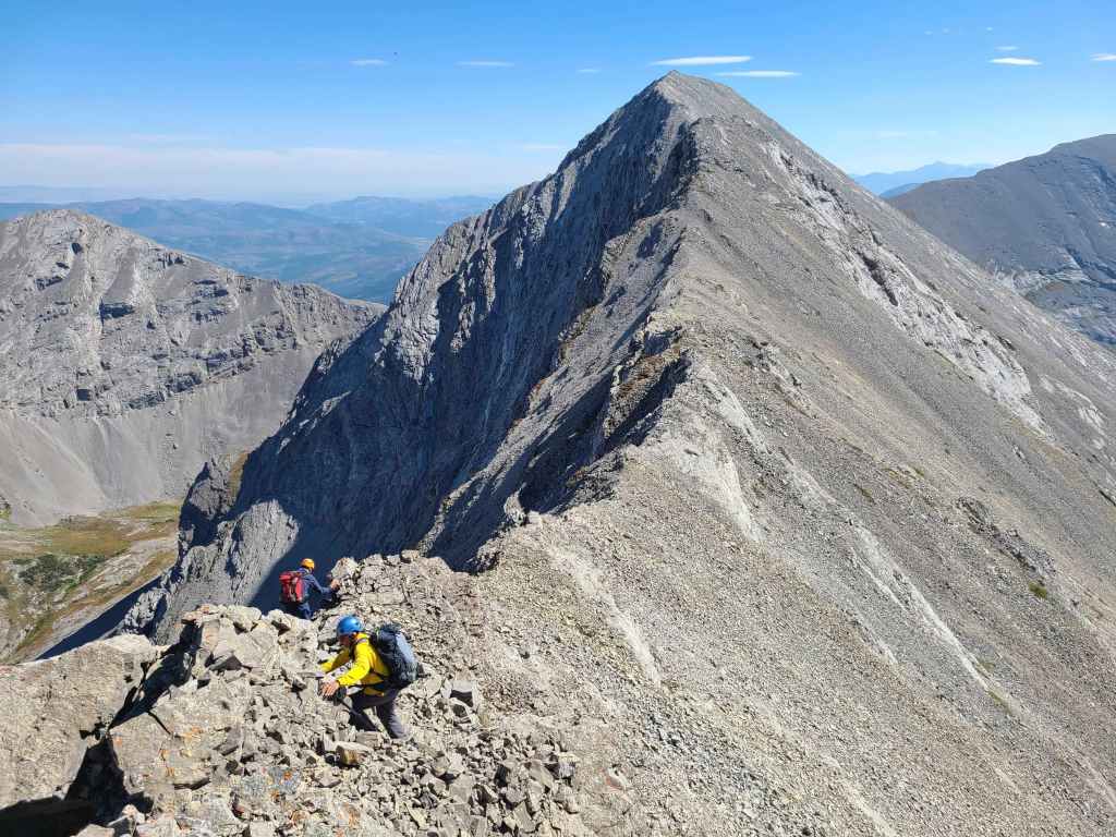
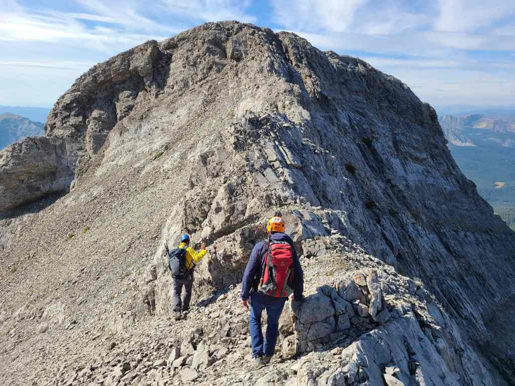
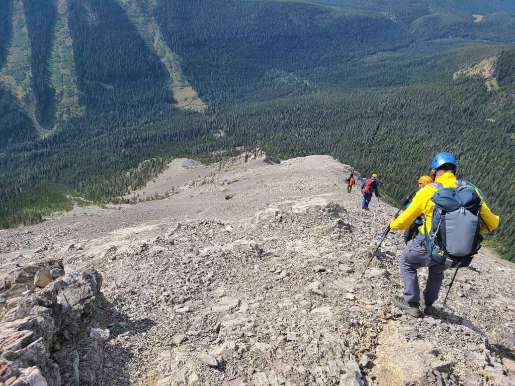
Glancing back as we head towards the intervening high point.
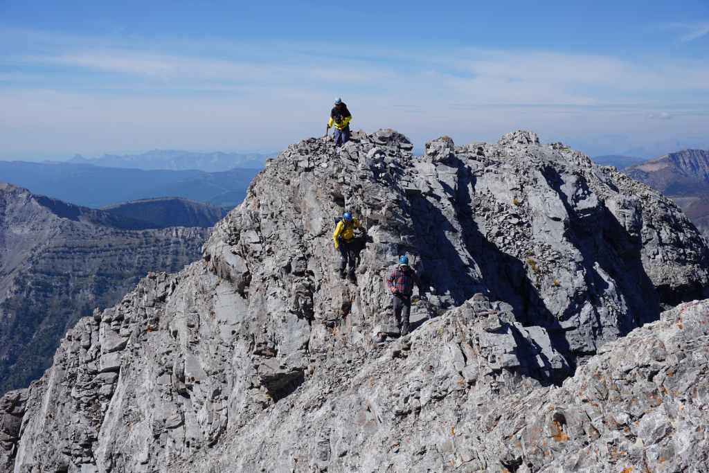
Arriving on top of the high point.
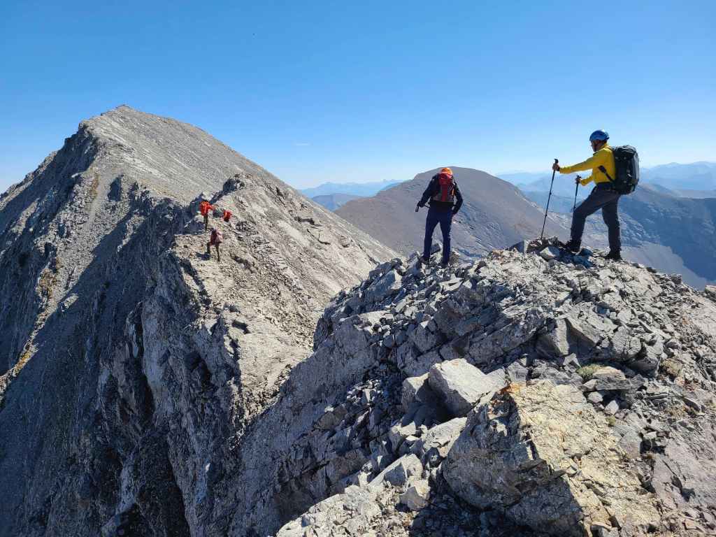
Shaun and Andrea look back as Brad and Andrew start the short, but tricky down-climb.
Raff handles the exposure with care – like a cowboy riding a horse. 😂
Looking back at the second down-climb. While Andrew is using the way of the others… (Photo by Rafal Kazmierczak)
Sonny and I chose a highly exposed, but less difficult route on the other side.
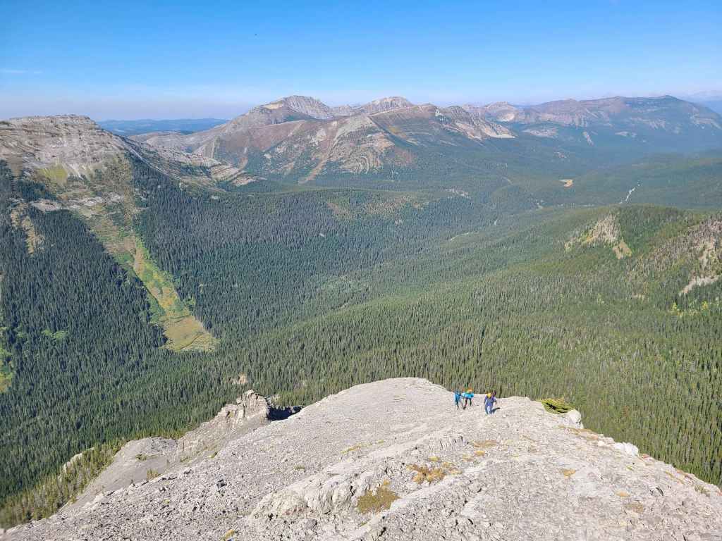
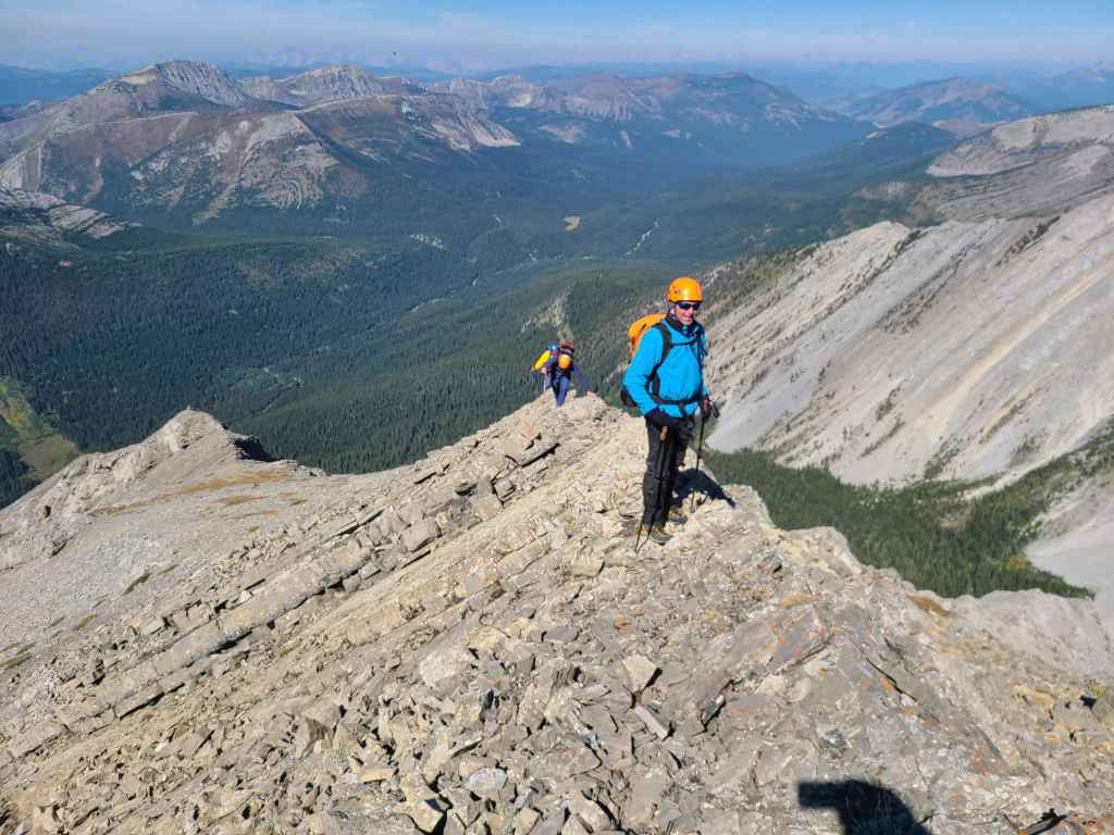
From here, it was an easy hike to the summit. (Photo by Andrew Nugara)

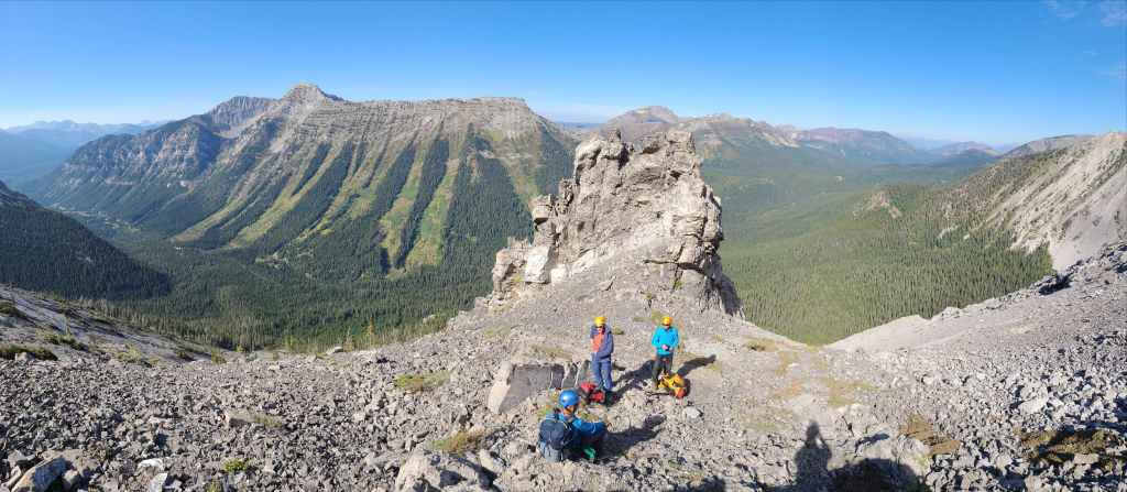
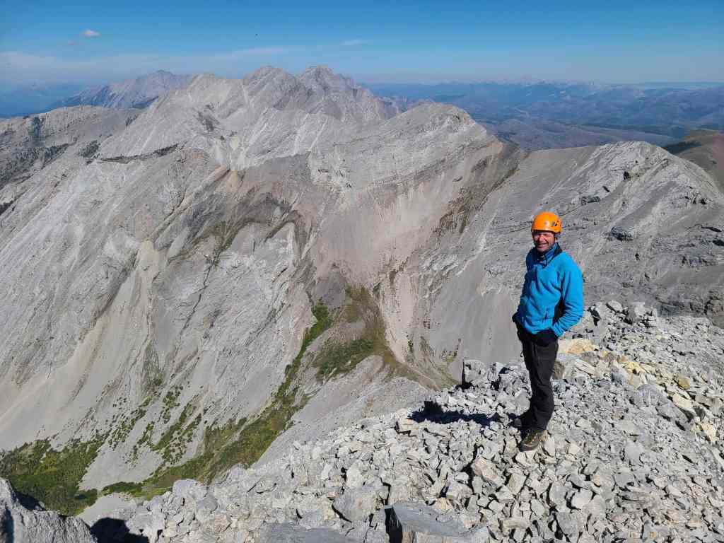
The summit of Centre Mountain (2604 m). I’ve searched for a history of the name and I’ve yet to discover why it is called Centre. My guess is that Wheeler et al, decided that its location between two wings of the ridge – with Centre N1 to the north and Mount Borsato to the south – made it into a geographical centrepiece, hence the terrible name. (Photo by Rafal Kazmierczak)
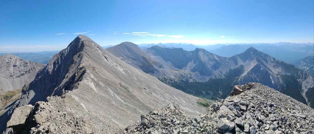
A pano to the north…

And to the east.
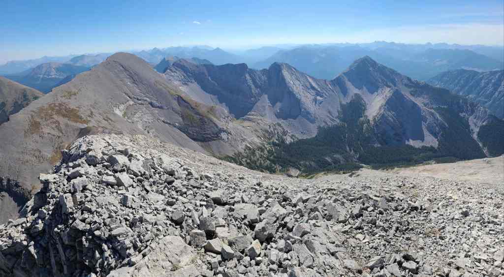
Looking to the south…
And now to the west.
Finally, a pano to the north that includes the summit. (Photo by Andrew Nugara)
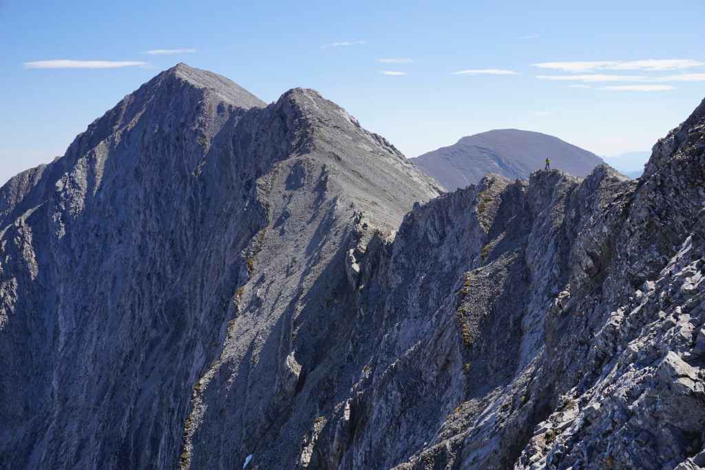
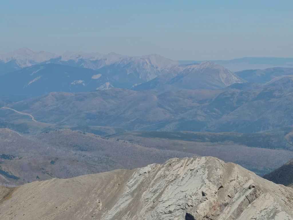
Looking north along the Flatheads. Mount Darrah is the tall peak on the right with Darrah S2 in the centre. In front of S2 is Darrah S3, and Darrah S4. Centre N1 is in the foreground on the right.

Zooming in on Mount Ptolemy (left of centre) with Darrah S2 on the far right.
A better look at Centre N1.
The contrast in rock between the Flatheads and the Lewis Thrust is exemplified by colourful, Darrah SE4, which sits across the intervening ridge to the east.
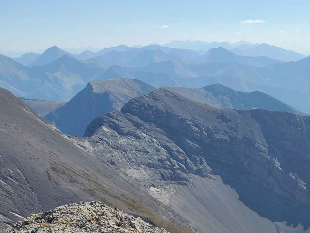
A telephoto towards the Livingstone Range.
Centre E3 – or as I call it, “North Kootenay Mountain” because of its proximity to North Kootenay Pass – sits directly to the east.
Looking onto some fine peaks in the Castle, with Mount McCarty front and centre.
We tried to reach Centre SE1 last year from the col with “South Flathead Peak”, but the presence of large cliff bands dissuaded us. From this side however, it looks to be uncomplicated and I will definitely be back to try for both it and Centre N1.
Gazing across the valley at “South Flathead Peak” (foreground), and behind it, Hollebeke Mountain.

Packhorse Peak (centre) will be tomorrow’s destination for Zosia, Sonny, Andrea, and Shaun. Follow in their footsteps by reading Sonny’ trip report. 😁 [link coming]
Also across the valley sits Mount Borsato, where last year’s ascent almost turned into an epic… 😳
A closer look at Mount Corrigan.
Barnes Peak and Limestone Ridge is a surprisingly fun and scenic loop.
Lowly Michel Head with Mount Taylor (left of centre) behind it. Recent logging activity has made accessing Michel Head difficult, with perhaps the only way via the Barnes Lake trail or along the connecting ridge with Taylor. Edit: Done!
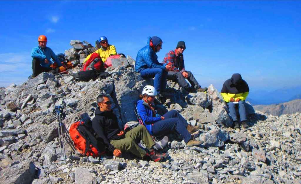
There was no register, so I made one using a Gatorade bottle. It more than likely won’t last, but after paying for Janelle’s wedding, I’m no longer in the financial position to donate another Nalgene bottle to a mountain. 😂 That being said… could Sonny be writing a limerick to put in the new register? 🤔 (Photo by Zosia Zgolak)
Raff stands in front of his past accomplishments on the Flatheads, a list that includes Mount Darrah (centre) and Mount Ptolemy (left).
My companions made a great trip into a fantastic trip! Thanks everyone! (Photo by Sonny Bou)
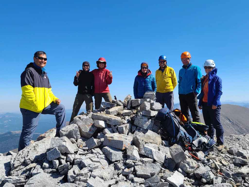
One more group shot before hitting the road…
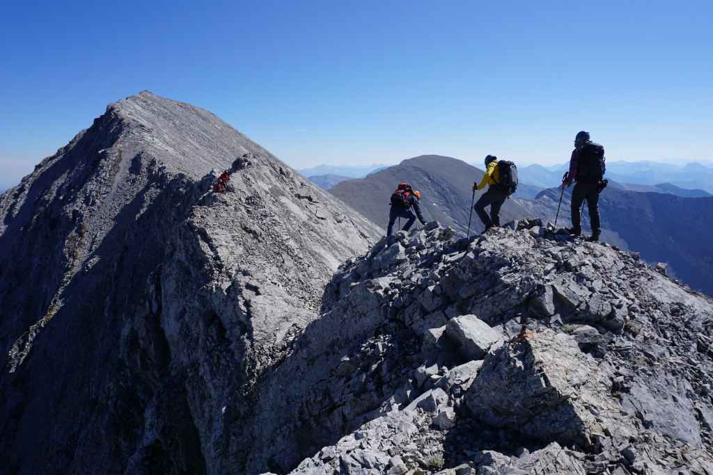
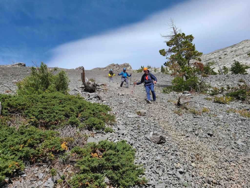
Andrew and Shaun lead us back the way we came.

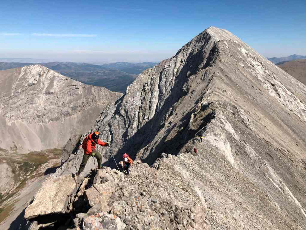
Ascending the second down-climb.
Andrew’s view from the top reveals the exposure of the second down-climb. (Photo by Andrew Nugara)
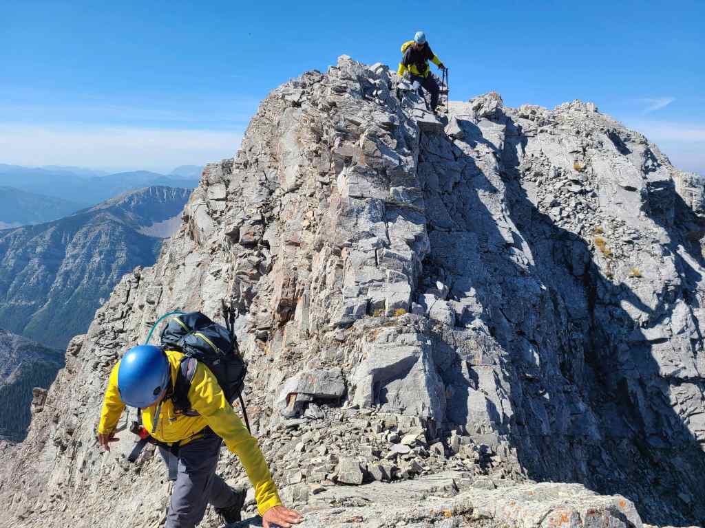
Andrew tackles the crux head-on.
Brad follows me across the crux.
Raff’s turn…

Followed by Andrea and Shaun – both of whom look remarkably composed given the exposure and the wind.
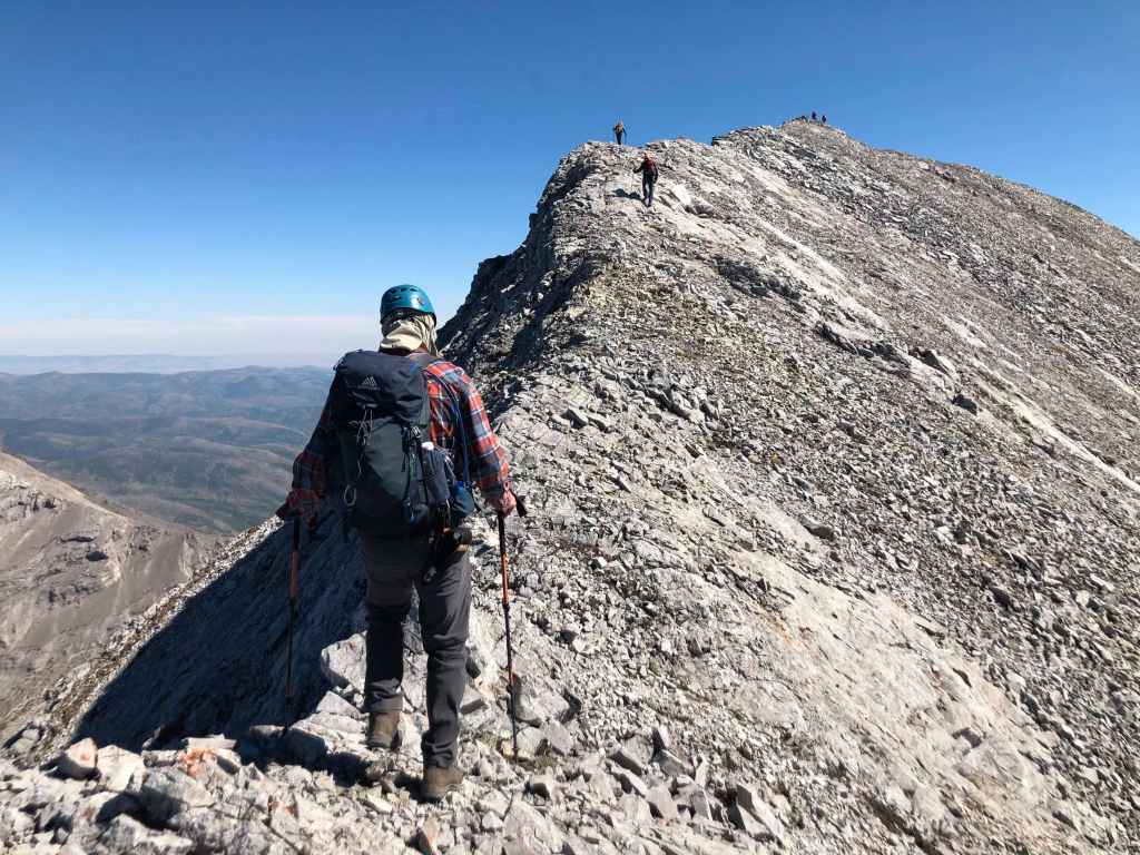
Heading towards the false summit.
Andrew scrambles the final section before reaching the top…
Shaun makes it look easy. 😳 (Photo by Rafal Kazmierczak)
Leaving the false summit.

Negotiating the ridge prior to the first false summit.
Slabs can be helpful when going up, but they can be tricky to descend.
Approaching the unique formation that we passed earlier in the day.
Brad and Shaun wait patiently for us.
Enjoying a quick break – that, or Raff and I are about to engage in mortal combat. 😂 (Photo by Zosia Zgolak)
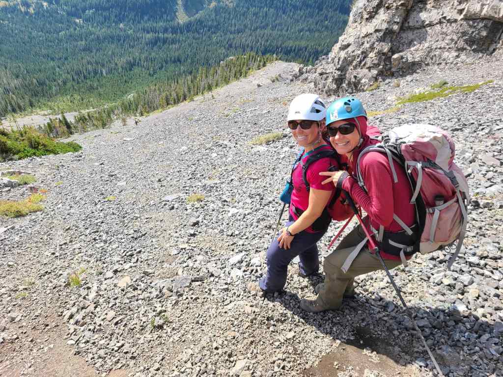
Andrea and Zosia – two incredible scramblers.
Brad, Andrew, and Sonny make a quick descent.
We followed our ascent route all the way back to Sonny’s car.
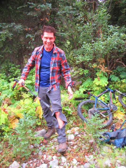
My pants ended up being the only casualty of the day. 😂 (Photo by Zofia Zgolak)
Drawing energy from Andrew’s e-bike. 😂
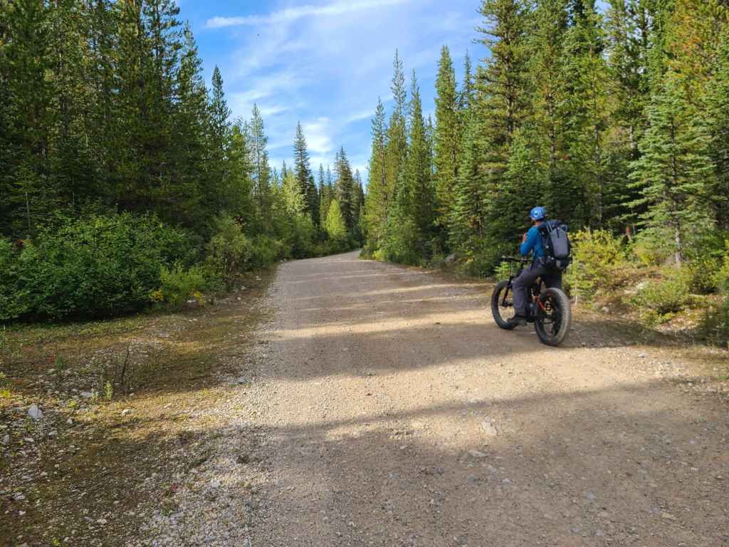
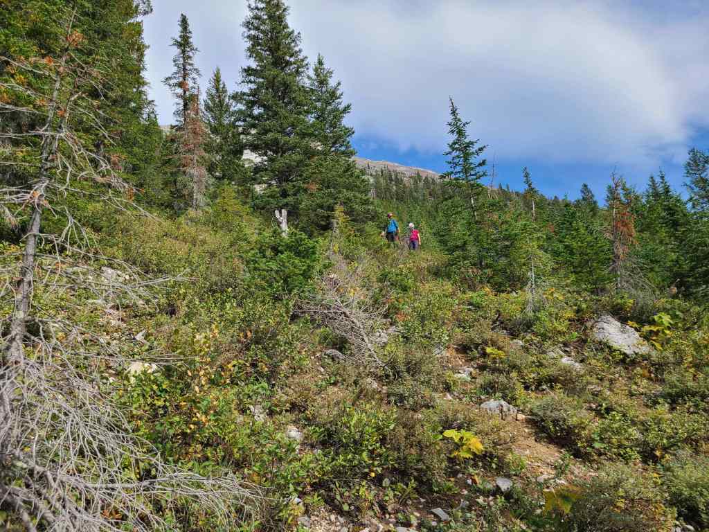
After saying goodbye to the others, Andrew leads us back along the Flathead Forest Service Road…
While the rest of us plebs without e-bikes, are forced to keep up. 😂
At least dust isn’t problem on this part of the road… 😂
Arriving back at Brad’s vehicle…
And. shortly thereafter, my truck. This was a day well-spent, due in large part to my great companions and the exhilarating terrain on the summit ridge. It was nice to deviate back to the Flatheads after spending so much time this summer in Waterton, and I look forward to continuing my exploration of the area in the near future.


Leave a Reply