
⚠️ Hiking and scrambling are inherently dangerous activities. Please read my Disclaimer. ⚠️
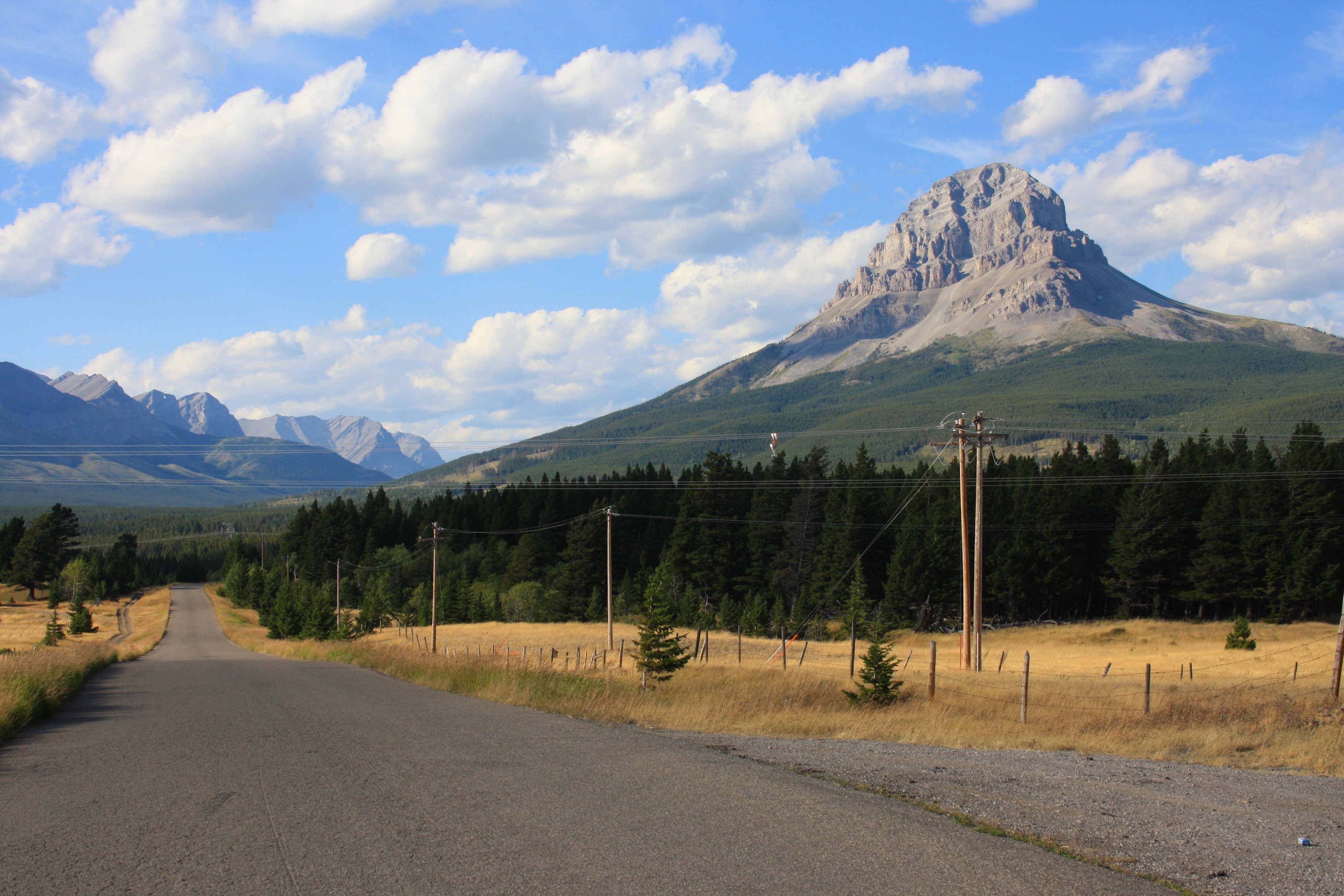
Omahkai’stoo (Crowsnest Mountain) is an iconic symbol of the Crowsnest Pass. It stands alone and higher than the surrounding peaks of the High Rock Range. It is a formidable looking mountain from many angles and is perhaps one of the most photographed aspects of the landscape. For all of these reasons and more, it is a very popular and enjoyable scramble, offering spectacular views in all directions. Myself, my son Joel, and his friend, Mike, set out on a beautiful August day in 2011 to experience all of this for ourselves, and we weren’t disappointed.

Killer marmots!

The contrails from a passenger jet as it passes above the adjoining Seven Sisters.

Looking up to the Seven Sisters. It was a beautiful day for a hike – not too hot and next to no wind.

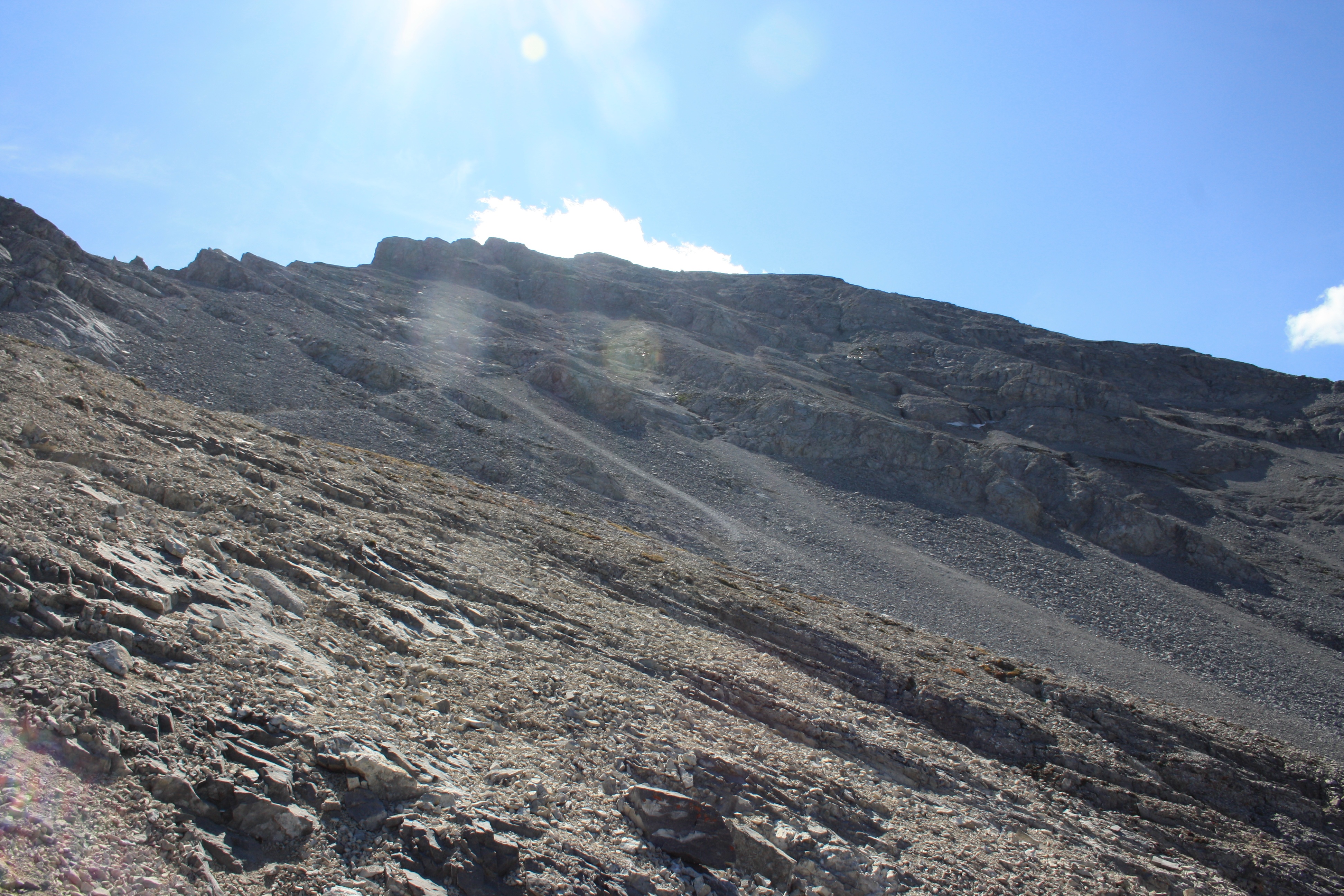
Looking up to a peak on the lower slopes of Crow. At this point we were just emerging from the trees and onto scree slopes.

The route is marked, but it is still possible to stray off course.

Leaving the trees far behind.

We almost made a mistake and climbed a gully to the left of this rockband. We did this because we were following behind a party of 4 climbers who went up this gully. Fortunately, I checked my bearings and corrected our route. We ran into this party again later in the day while we were on our way down from the mountain. Unfortunately, they were still on their way up. Their detour and trying to correct that mistake had cost them a couple of hours. The correct route for Crowsnest Mountain goes to the right and then up to the next section of black rock. The real ascent gully is to the left of that.

Joel seldom passes up a chance to climb on something, even if it is off the route.

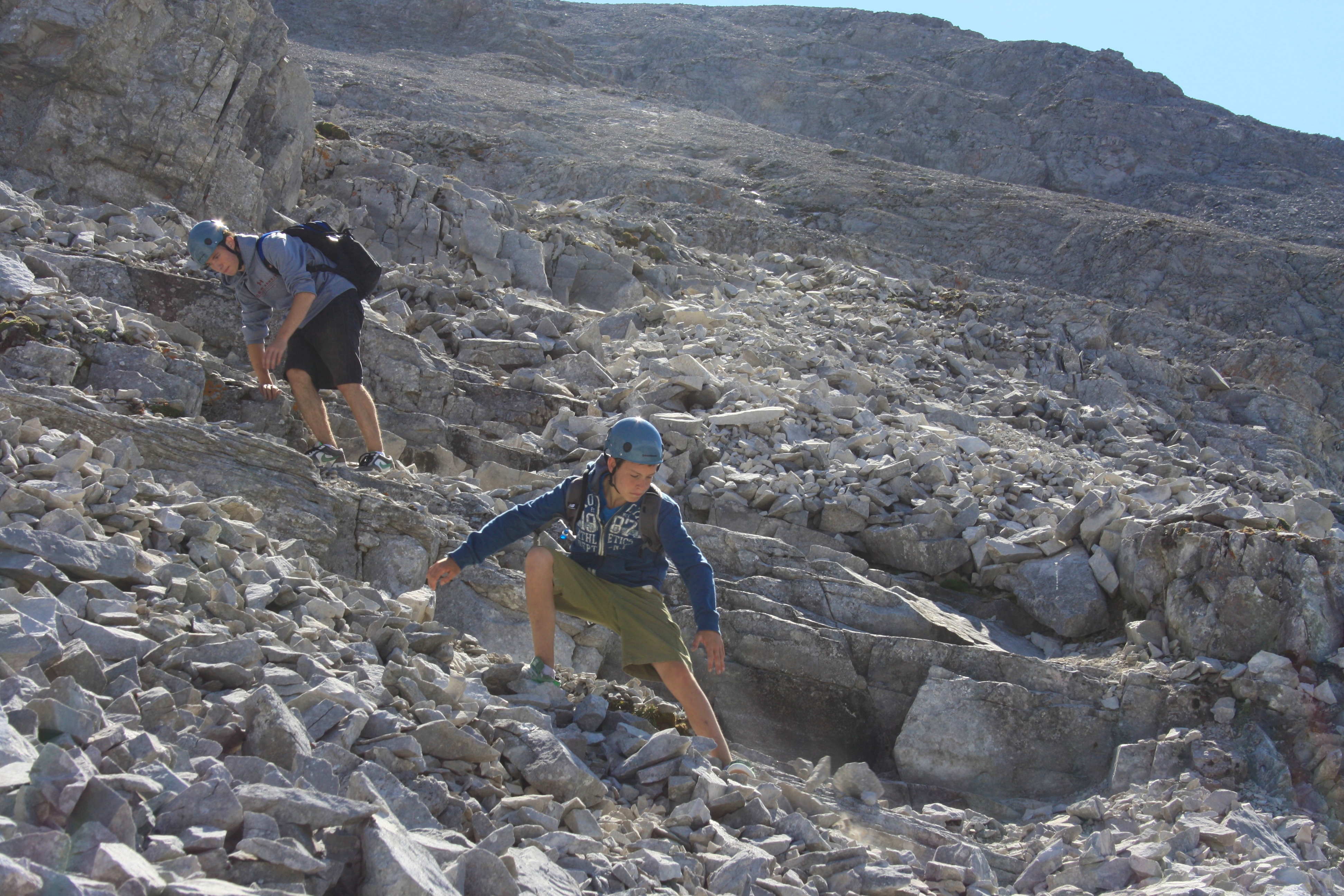
The route to the gully provided many opportunities for scrambling.

Joel at the halfway point. Window Mountain, Mount Ward, and Racehorse Mountain are in the background.

I swear this goat was stalking us….

Joel and my other son, Nathan, are the only people I know that can climb mountains while wearing skate shoes (and yes they do own hiking boots).
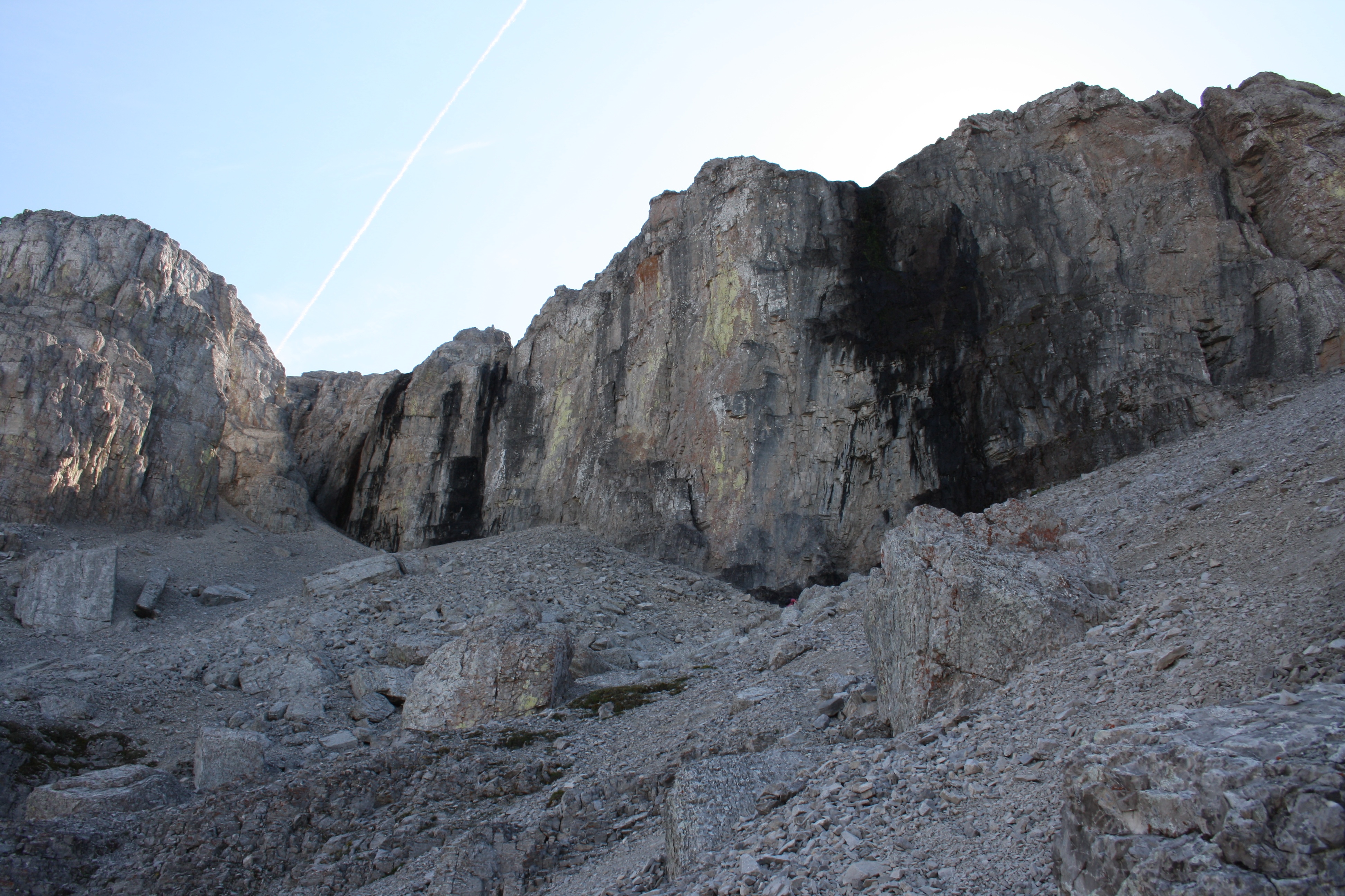
These are the correct black rock bands to aim for. They are the second set you will encounter. The ascent gully is directly below the contrail of the passing jet.
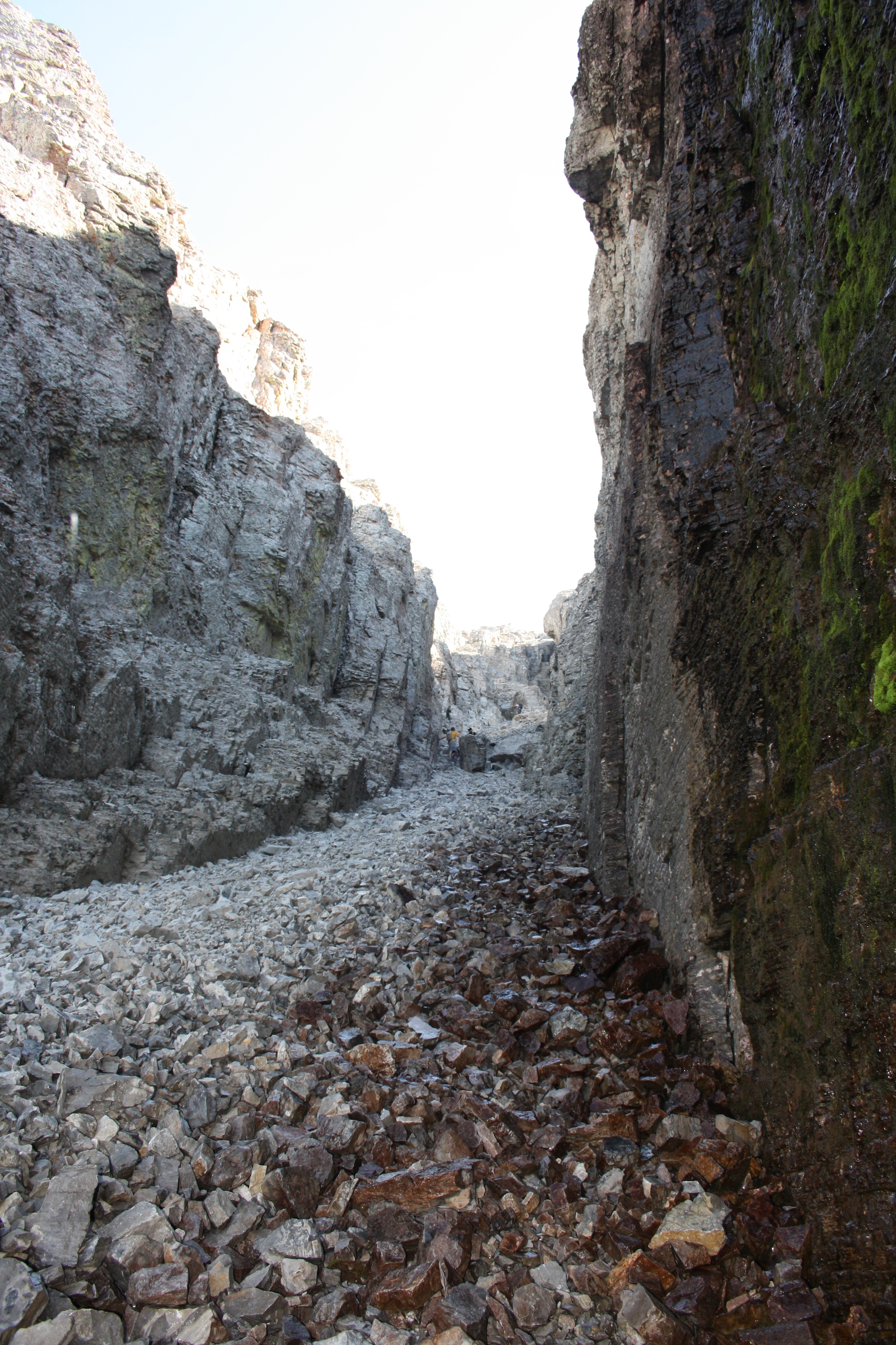
Looking up the gully at another party that is descending. We waited for them to make it all the way past us because there are plenty of loose rocks that become dislodged when ascending or descending.

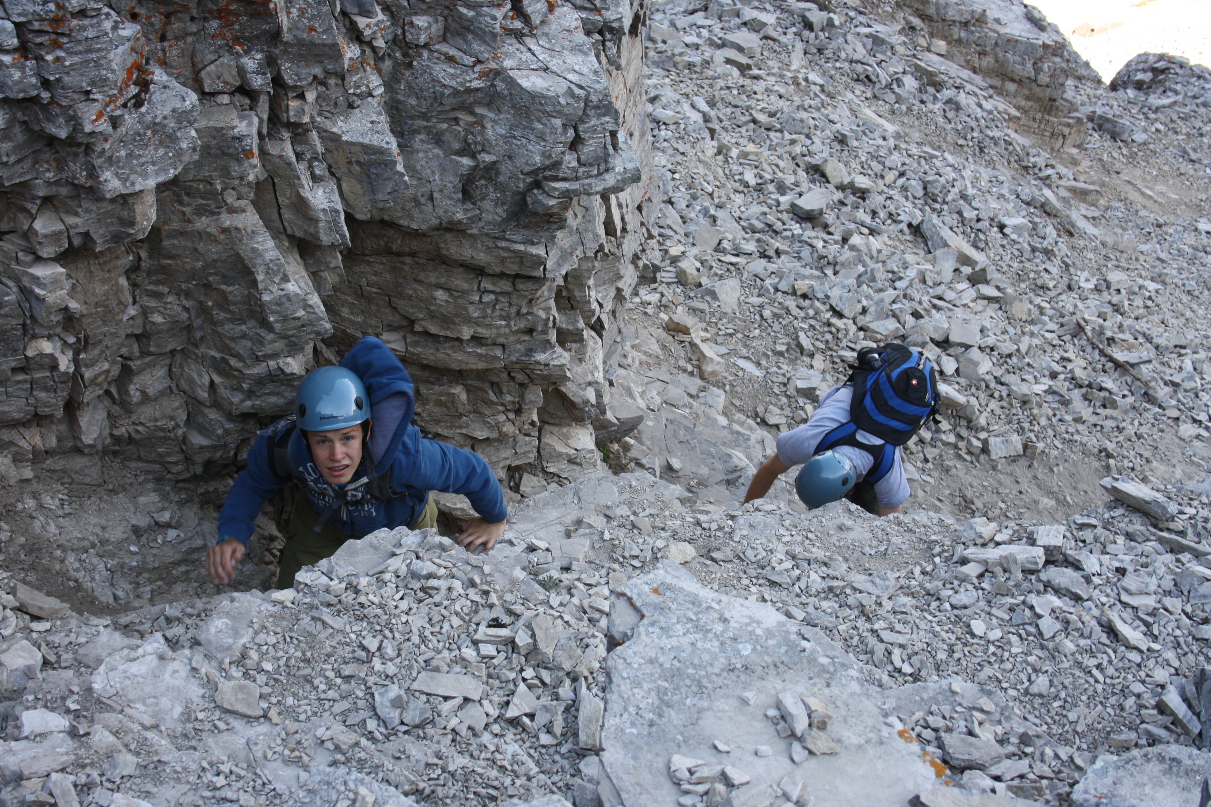
Joel and Mike climbing the gully.

There is a chain at the end of the gully to assist your ascent and descent.

Mike tests the chain as he gets ready to come up.

Topping out of the gully.

Past the gully and on open scree slopes. Looking back at the Seven Sisters. Window Mountain, Mount Ward, and Racehorse Mountain are in the background.
Looking up at the route towards the summit.

Joel and Mike follow one of numerous paths that are etched into the scree as they head toward the summit.

Almost there….

The summit cairn of Crowsnest Mountain. Mount Tecumseh, Phillipps Peak, “Shooting Star Peak” and “Alexander Creek Mountain” are in the background.

The view from summit to the south east. Bluff Mountain is on the left. Turtle Mountain, Hillcrest Mountain, Willoughby Ridge, and The Saddle are in the centre. Saskatoon Mountain and Wedge Mountain are in the foreground left. Mount McLaren and Mount Coulthard are on the right.

The view from summit to the south. Mount Coulthard, Mount McLaren, Andy Good Peak, Mount Parrish, Chinook Peak, and Mount Ptolemy (highest peak) are all visible in the centre. Peak 3 of the Northwest Ridge of Ptolemy is right of centre. Sentry Mountain, Island Ridge, Tent Mountain, and Crowsnest Ridge are on the right.

The view from summit to the south west. Sentry Mountain is on the left and Mount Tecumseh and Phillipps Peak are in the centre. Loop Ridge is in the distance behind Tecumseh and “Shooting Star Peak” is in the foreground to the right of centre.

The view from summit to the west. From left to right: “Shooting Star Peak”, “Alexander Creek Mountain”, “Deadman Peak”, Window Mountain, Mount Ward, Racehorse Mountain, and Allison Peak are visible. Mount Erickson is visible in the distance on the left.

A 360 panorama view from the summit.

Joel stands on the summit cairn.

There wasn’t a summit register but instead, there was a Canadian flag to sign.
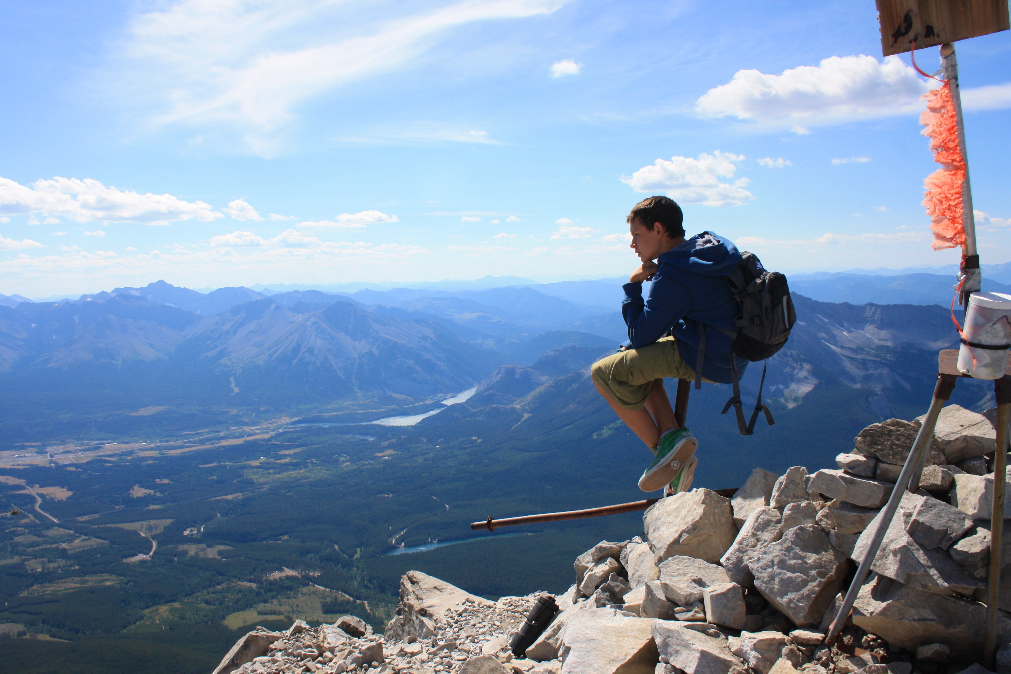
The levitating thinker.

Joel, Mike, and myself on the summit.

I couldn’t figure out why Joel kept saying, “Just back up a little bit more…”

Getting ready to leave the summit.
Heading home down the upper slopes of Crowsnest Mountain.

Joel coming down the gully. An important rule about scrambling: it is harder to downclimb than upclimb, so if it is tough going up, it will be even tougher coming back down. I would not recommend putting all of your weight on the chain as Joel is doing in this picture….

Taking the quick way down.

Looking back at the summit from the trail.

One last look back at Crowsnest Mountain from the Atlas access road. Crowsnest Mountain is one of those ‘must do’ peaks in the Crowsnest Pass.


Leave a Reply