

⚠️ Hiking and scrambling are inherently dangerous activities. Please read my Disclaimer. ⚠️
I took this picture of Loaf Mountain (centre) and Spionkop (just to the left of Loaf) from the summit of Drywood Mountain in July 2012. Loaf is one of the higher summits in the area at 2630m and is so named because it supposedly looks like a rising loaf of bread. Spionkop is named after the Battle of Spion Kop in the Second Boer War in South Africa in 1900. The views from the summit of Spionkop are simply spectactular. Joining me on this awesome day of adventure was my nephew, Jeff.

We started by hiking up the South Drywood Creek Valley on the Bovin Lake Trail. After hiking for around 3km, we left the trail and ascended a drainage up the slopes of Loaf Mountain (Nugara’s route). From there we followed the ridge and summited Loaf, then dropped back down and followed a ridge over to Spionkop. Loaf was mostly a hike with a bit of scrambling in the drainage while Spionkop was a fun, but moderate scramble with some exposure.

Our total elevation gains and distance travelled. 21.6km made for a long, but very worthwhile day. The route back through the Bovin Lake trail was beautiful. We could have also parked a second vehicle in Waterton and hiked the short distance from Spionkop to Newman peak / Avion Ridge and out.

It was a wet start to the day and we could see snow on the summit of Loaf. Fortunately, by the time we reached it, the weather had begun to clear.

Hiking up the valley. Drywood Mountain is on the right and an outlier of Loaf is on the left.

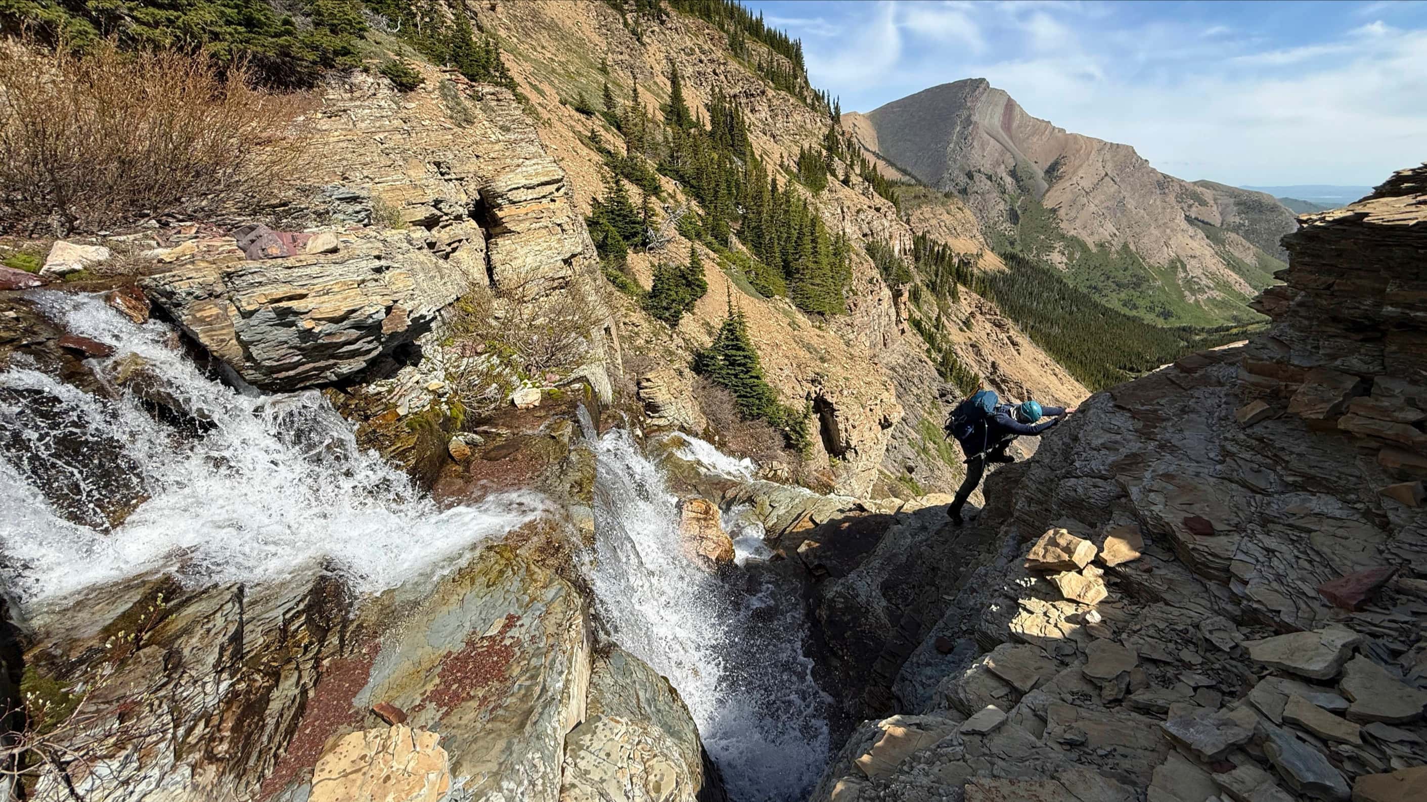
A waterfall on South Drywood Creek. We left the trail and crossed the creek to the ascent drainage a short distance beyond these falls.

This is the drainage that led from the creek and up the slopes of Loaf Mountain. Going up the drainage was definitely better than bushwacking through wet vegetation.

A loaf shaped rock on Loaf Mountain. It seemed very communion-like.

Higher up, the drainage offered a chance for some scrambling.

Looking back down the drainage to the Bovin Lake trail below.

Leaving the drainage to gain the ridge. It was raining pretty hard at this point and soon some ice pellets would start falling. The summit of Drywood Mountain is behind Jeff.

Finally on the ridge, Jeff begins the long hike to the summit of Loaf (centre).

There are some impressive views to take in from along the ridge!

Looking south from the ridge toward Spread Eagle Mountain (Mount Roche).

Jeff with the summit of Loaf in the background.

Hiking though snow on our way to the summit. Drywood Mountain is in the background.

The final 100m to the summit.

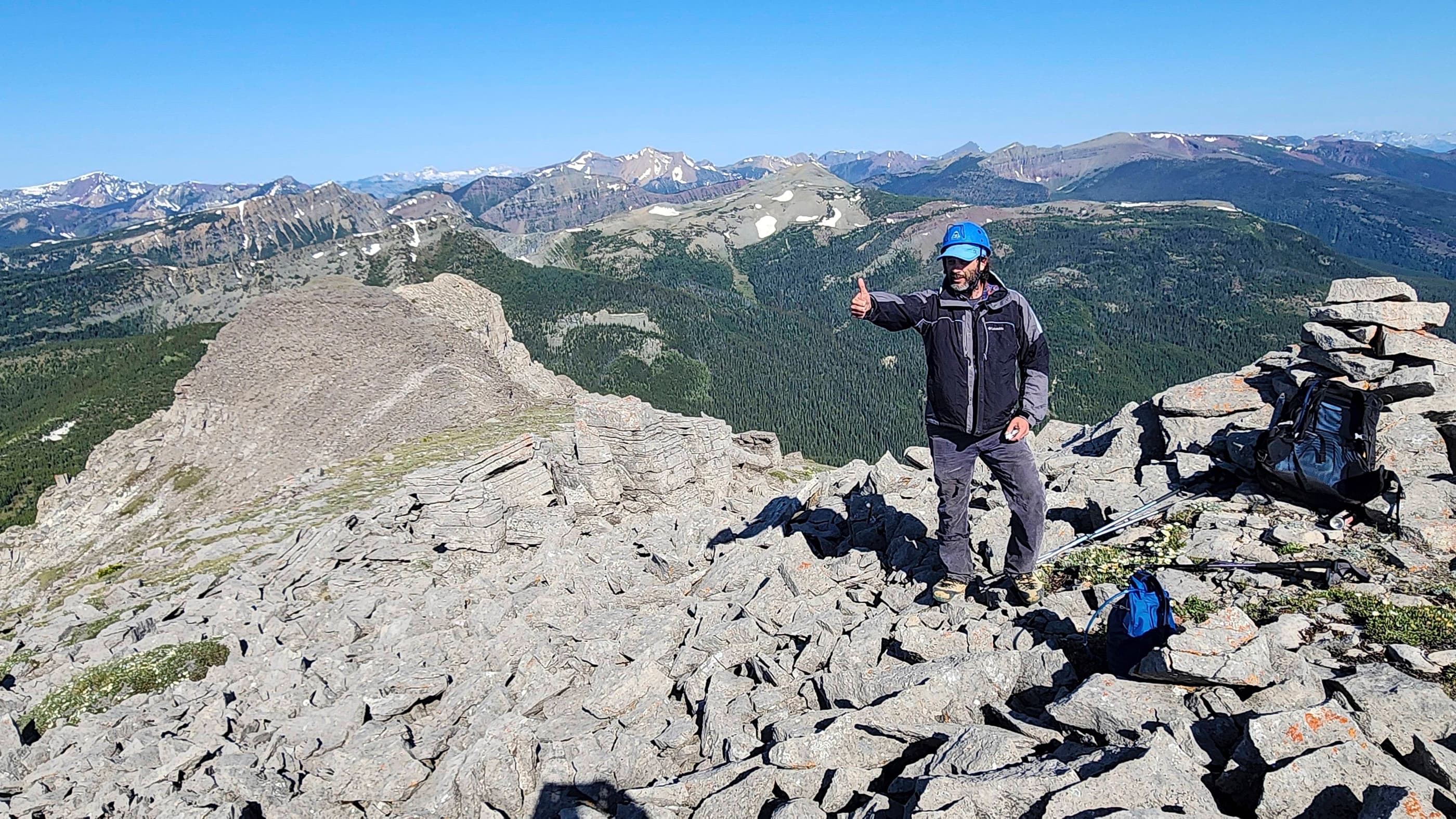
The summit of Loaf Mountain! Now if only the sun would come out…

Jeff on the summit of Loaf Mountain.

Looking east from the summit along the ridge we hiked. Drywood Mountain is on the left and Spread Eagle Mountain is on the right.

Looking north. From right to left: Drywood Mountain, Pincher Ridge, Prairie Bluff, and Victoria Peak. In the foreground is the Southwest Summit of Drywood.

Looking west and northwest. Victoria ridge is to the right of centre.

Looking south into Waterton from the summit.

I found a cool chain-link rock on the summit.

Looking down at Bovin Lake. This is the route that we took on our way back after summiting Spionkop Ridge. “Little Bo-Peak” is just to the left of centre above the lake.

Looking along the east ridge of Loaf as the sun finally starts to poke through the clouds. The red argillite rock makes the Castle a place of unique beauty.

The reading from my GPS on the summit. I still can’t figure out how to change the distance measurement to metric on the display. If you know, let me know…

That’s me on the summit just before I learned that I can’t fly.

A view from the western slopes of Loaf along the connecting ridge to Spionkop (distant left). This was our next destination….

Leave a Reply