
⚠️ Hiking and scrambling are inherently dangerous activities. Please read my Disclaimer. ⚠️
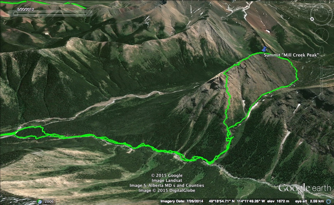
Sometimes executive decisions need to be made. After making a ~5 km approach to the base of Mount Gladstone, we could finally see the ascent slopes clearly enough to become hesitant in thought and pace. With another kilometre to go to reach our starting point, Mark and I paused for a long period of time while we studied the snow pack on Mount Gladstone. We could see a couple of routes that were relatively clear of snow almost to the top, but it was the snow hanging above these routes that made us nervous. One route just to the west of the summit looked tempting, but it passed partially beneath a large pack of snow that from our vantage point along the creek bed, was indeterminately deep or stable. The route was definitely doable, but what was the risk? The other factor in play was the knowledge that the weather was due to change late in the afternoon with over 5cm of snow expected by the evening (the storm would go on to dump over 25cm in the next 24hrs). We could make it up and down Mt. Gladstone in time if we charged ahead, and we almost did, but I still had a nagging doubt about the mass of snow located partially above our chosen route.
Our major point of hesitation happened to occur at the base of a drainage off of an unnamed lower mountain next to Mt. Gladstone. The eastern most peak had caught my attention during our approach along Mill Creek due to its shape and rugged upper ridge. After finally reaching the point where a decision had to be made one way or the other, I decided to err on the side of caution and forgo Gladstone in favour of the much smaller, unnamed peak immediately above us. Though initially an uninspiring slog up slippery, loose scree, once we were on the summit ridge, the little peak provided us with plenty of hands on scrambling all the way to the summit. We reached the summit just as a snowstorm engulfed us. If this hadn’t of happened, we would have continued on towards the second, slightly higher peak that was located ~1.3km to the west. Instead, we dropped down into a bowl where we were able to experience one of the highlights of the day, a long glissade down the upper reaches of the drainage. I doubt if many have climbed or will climb, “Mill Creek Peak” or it’s companion peak to the west (which I’ve nicknamed, “Mill Creek Mountain”), but it did salvage the day for us and gave us a chance to gain some early season elevation above 2000m – which in Mark’s mind, is the minimum requirement for something to be considered a mountain.

Looking south at our route which began at the gas well beside Mill Creek. Andrew Nugara gives directions to reach this location in, More Scrambles in the Canadian Rockies, but just in case: turn onto the Gladstone Valley Road off of Highway 507 west of Pincher Creek. Follow the road for 13.3km keeping left, and in the process, you will cross two bridges over Mill Creek. At ~13.3 km from Hwy 507 or .6km from the 2nd bridge, turn right. Follow this road for 1.4km and then make another right turn. Follow this road for 1.4km to reach the gas well next to Mill Creek.
After parking, follow Mill Creek south for about ~200m to find the trail. There was a cairn that clearly marked the trailhead when we were there. Follow the well maintained and easy to travel trail for ~2.4km until you reach a tributary entering Mill Creek. Leave the trail and follow this tributary for another ~1.7km to reach the base of “Mill Creek Peak” or ~3km for Mt. Gladstone.
We chose a direct route to the summit ridge and left the drainage at the first waterfall we encountered. An easier way to the summit would be to follow the drainage all the way to the back bowl and then up the slopes. This would be our descent route. To reach the higher second peak, you could trend right out of the drainage or follow the connecting ridge at the back of the bowl. The 2nd peak is about ~1.3km from “Mill Creek Peak” – but again, I’m not really expecting anyone to ever venture up here when Mt. Gladstone is next door…

Our total distance travelled was 12.2km with total elevation gains of 759m. Our total time was 5 hours and 34 minutes.

The trail begins on the other side of this gas well. “Mill Creek Peak” (2165m) is visible on the left and the much higher Mt. Gladstone (2458m) can be seen poking over the trees on the right.

We immediately crossed and then walked up Mill Creek for about 200m before we came to the trailhead.
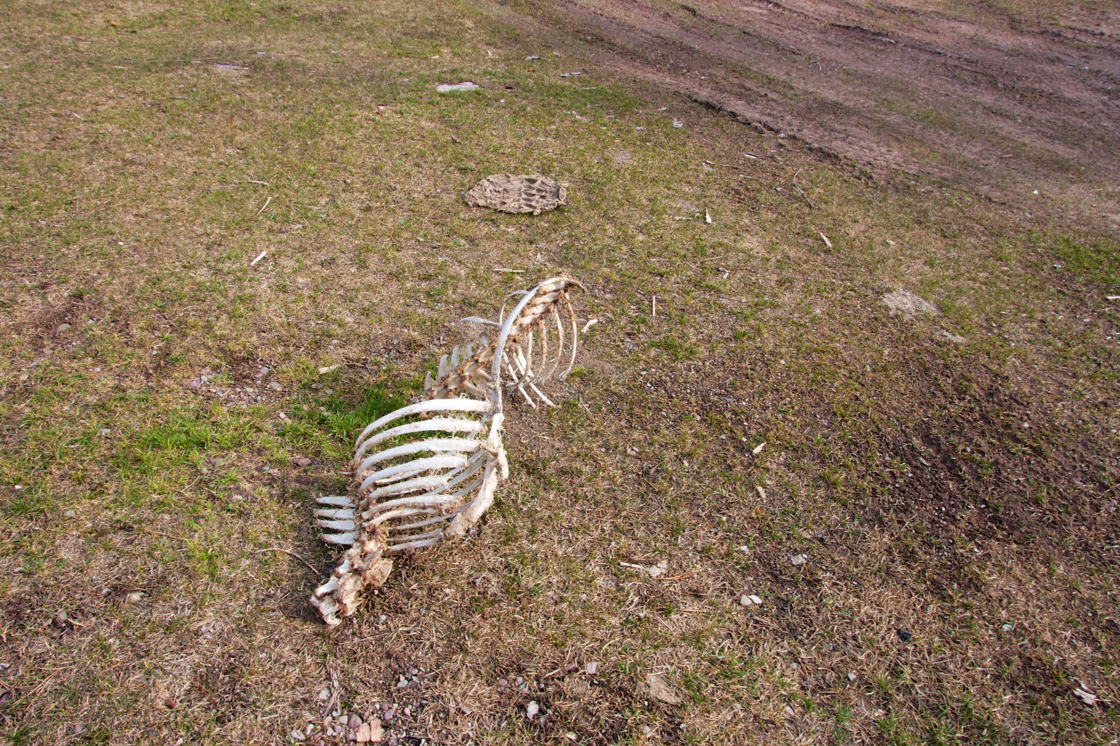
The remnants of a carcass in the parking area. Always a good sign to start the day…

The trailhead is marked by a large cairn and the trail itself begins on the other side of the creek.
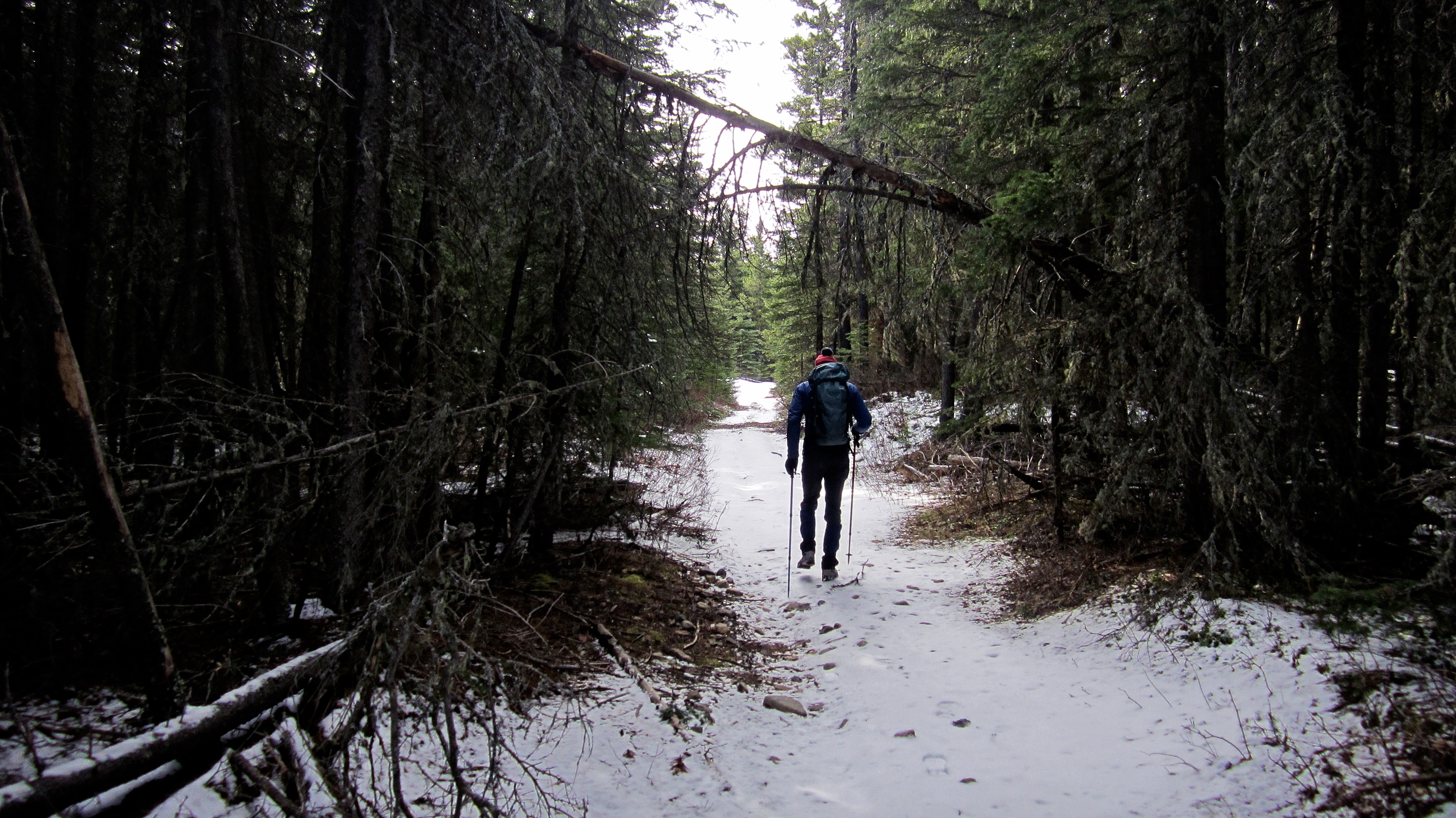
The trail is well maintained and easy to travel.

It would appear that winter hibernation is over. We had travelled only about a kilometre along the trail before we came across these large grizzly tracks. We also came across some black bear tracks which confirms to me that spring is alive and well in the Castle Crown (unless of course you are the prey).

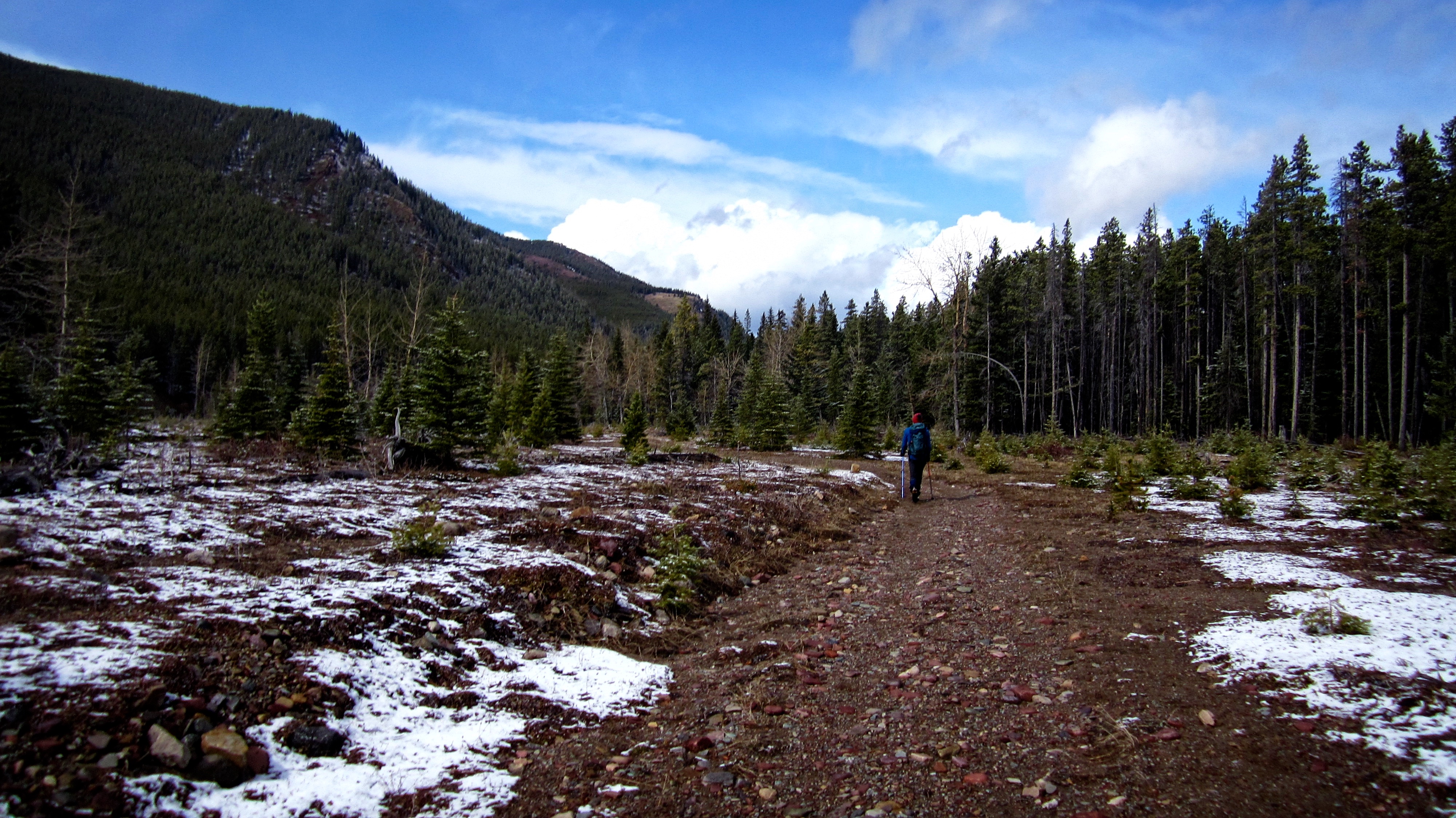
“Mill Creek Peak” is visible in the background as Mark hikes along the trail. The slightly higher second peak, “Mill Creek Mountain” is visible in the distant centre.

One of several stream crossings along the way.

After following the trail for ~2.4km, we left it to follow this tributary to the base of Mt. Gladstone and “Mill Creek Peak”.

After working our way up the tributary, we finally were able to see the southern slopes of Mount Gladstone – our original destination.

Travel up the tributary was scenic…

…but slow at times due to deadfall and snow covered boulders.

A very serene scene at the mouth of a small canyon.

Part way up the drainage on “Mill Creek Peak”, we encountered a waterfall. From here we would leave the drainage and ascend the slopes on the left. We would descend down the entire length of this drainage on our return. An easier way to summit both peaks would be to use our descent route as both the ascent and descent route – but then you’d miss the scrambling.

Mark makes his way up from the drainage. Mount Gladstone is in the background.

The trek from the drainage to the summit ridge was a steep slog up slippery orange scree (now just for fun, say that last part over again tens times fast).

Looking down on Mark (lower right) as we closed in on the ridge. On our way back, we were able to glissade down a large stretch of the drainage below.

Mark is glad to finally see the end of the scree. A ridge leading to “Mill Creek Mountain” from the drainage is in the background. There is a more gradual connecting ridge between the two peaks further to the south at the back of the bowl.

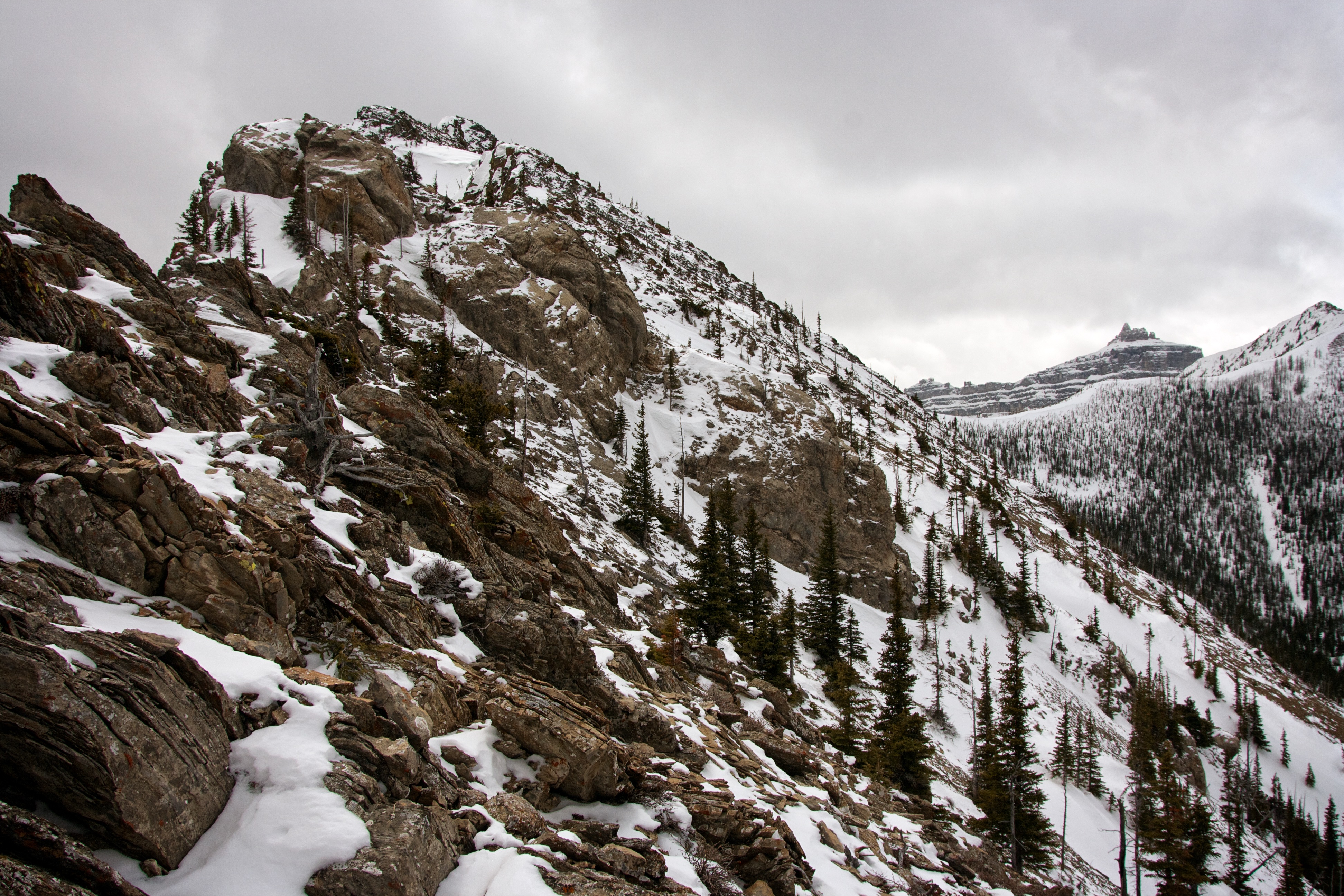
Once on the ridge, the scrambling began. Our possible routes up Mount Gladstone are visible in the background as are the hanging packs of snow. It was only after I had gained this perspective, that I realized that a route on the far left could probably have been done. Oh well, too late now. Besides, “Mill Creek Peak” was a nice consolation. Lord willing, I will return later this year and finish Gladstone.

We tried to tackle every obstacle along the ridge head-on. This was one of many snow covered bumps.
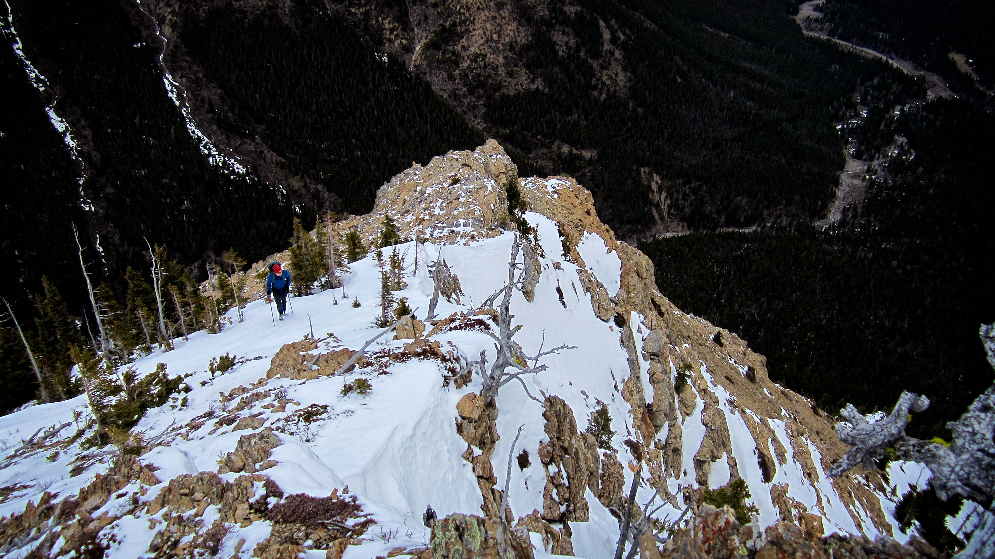
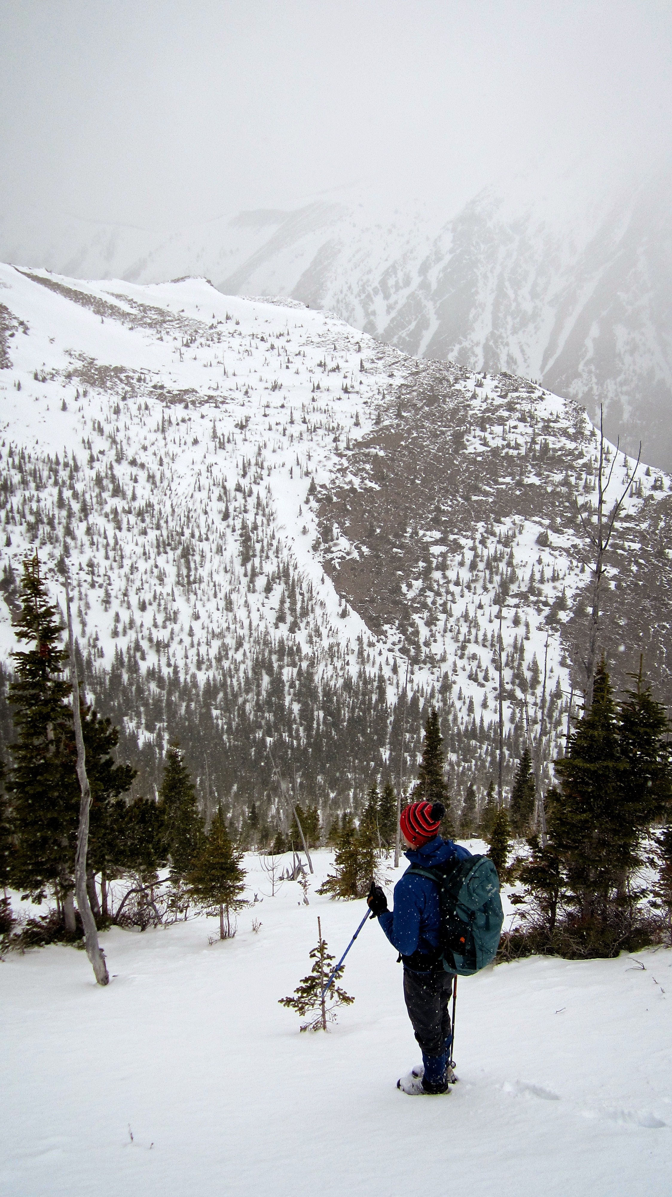
Looking back from the other side of the previous picture. Our access route is visible in the valley below.

Looking down the valley towards our starting point. The rapidly approaching storm is also visible behind the northern end of Mt. Gladstone a.k.a “Gladstone’s Toe”.
The summit is not yet visible, but this was typical of the terrain along the ridge. Castle Peak is visible in the distance.

The ridge offered nice views of nearby Victoria Peak.

I was fooled several times into thinking that I was looking at the summit.

Finally the summit came into view.

Looking east at Windsor Mountain and Castle Peak. The slightly higher, second peak that I call, “Mill Creek Mountain” is on the right. Had we not been engulfed in a snowstorm that would go on to dump over 25cm of snow over the next 24 hours, we would have made the ~1.3km hike to visit it. Instead, we got off of the mountain as quickly as we could.

Looking east from the summit at Prairie Bluff Mountain (left) and Victoria Peak.

A telephoto of Prairie Bluff Mountain.

Victoria Peak and Victoria Ridge (far right) from the summit.

Looking across the valley at an obscured Mount Gladstone.

Looking back at our route along the summit ridge. The valley and our access route are no longer visible.

Shortly after this picture was taken, I pushed Mark off of the mountain… 😉 Actually, the snow was coming in so fast that we only had enough time to snap a few pictures and composing a proper summit photo was the last thing I was thinking of. Windsor Mountain is in the background.

Mark heads down (lower right) to the bowl beneath the summit as the sky grows increasingly dark.
The consistency of the snow was perfect for a quick descent.

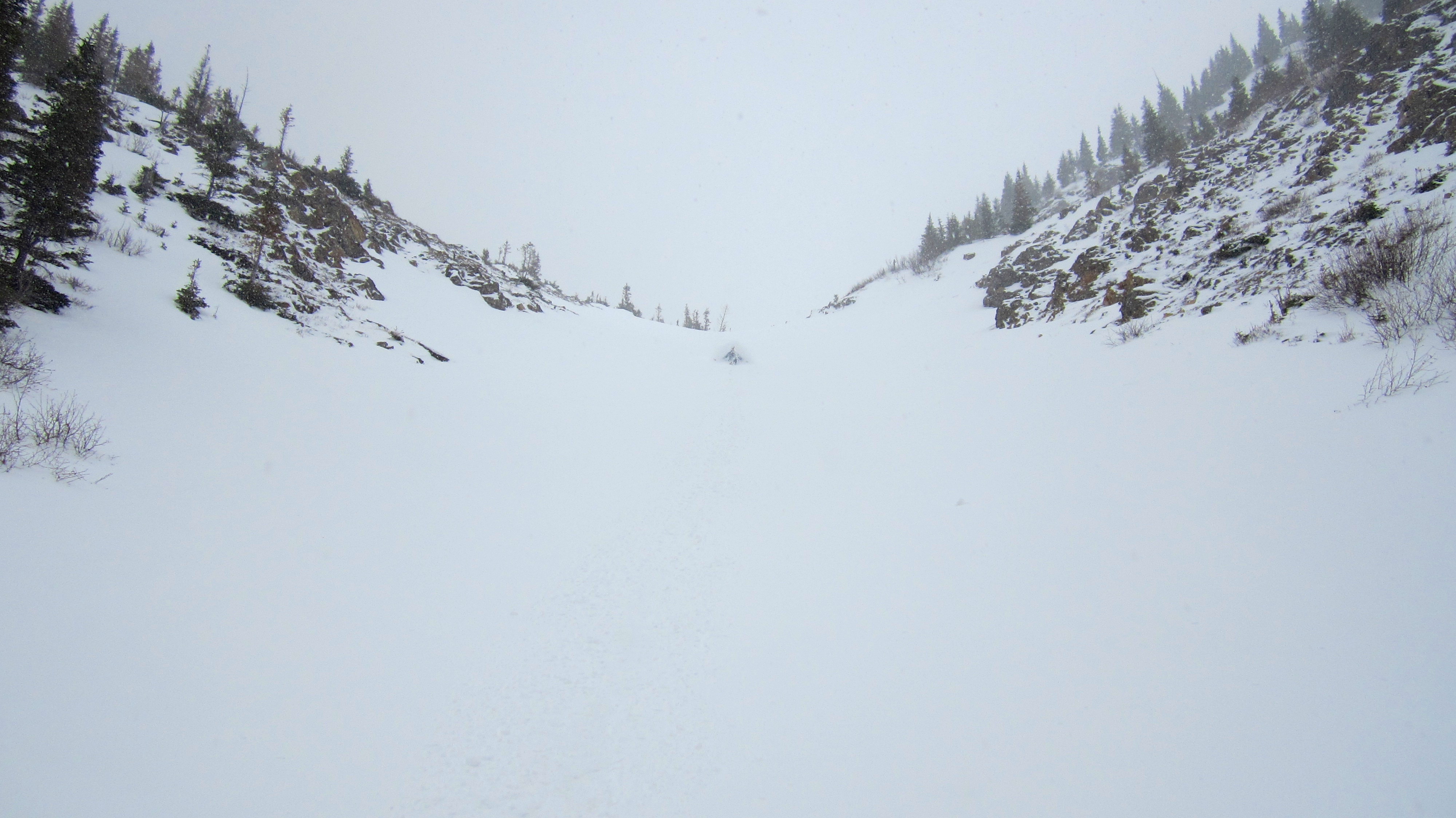
Walking along the upper portion of the drainage.
Mark glissades down a long stretch of the drainage.

The lack of hazards and the angle of the slope made this an ideal place for a speedy and safe descent.

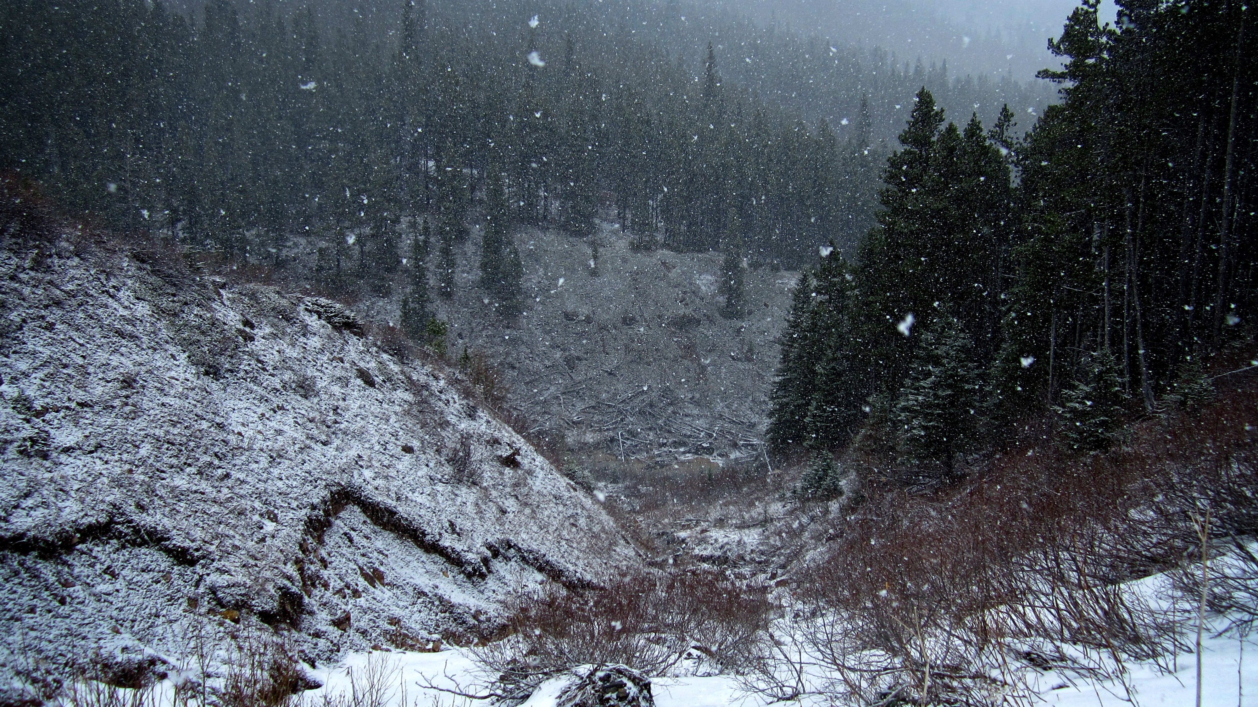
Our fun ended after we began to encounter waterfalls, boulders, and debris inside the drainage.

Forced to descend next to the drainage, the fresh snow made the rocks very slippery. Here, Mark carefully picks his way down.

Me standing next to the waterfall that we first encountered on our ascent.
Finally back at the bottom of the drainage.

Making our way back along the tributary towards Mill Creek and the trail.
The skies cleared for a brief period of time after we had reached the trail.
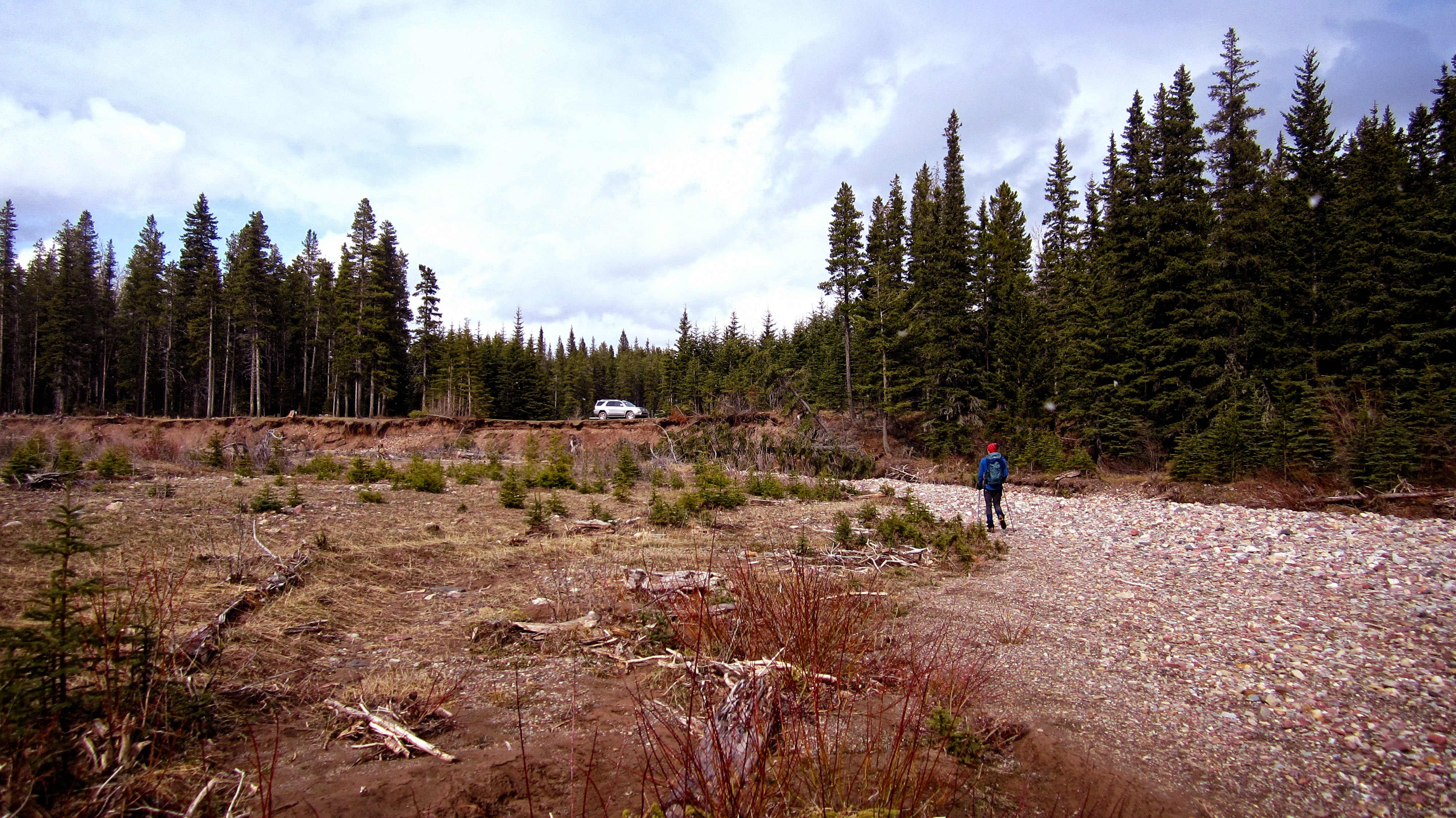
After 12.2km and 5 hours and 34 minutes, we arrived back at the vehicle. Though not accomplishing what we had originally set out to achieve, “Mill Creek Peak” was a decent backup plan that made for a fun day. The scenery of the valley itself is definitely worth a return trip to summit Mount Gladstone. Edit 30 October 2017: I finally returned to complete Mount Gladstone, though this time via North Castle. It was well worth the wait!


Leave a Reply