
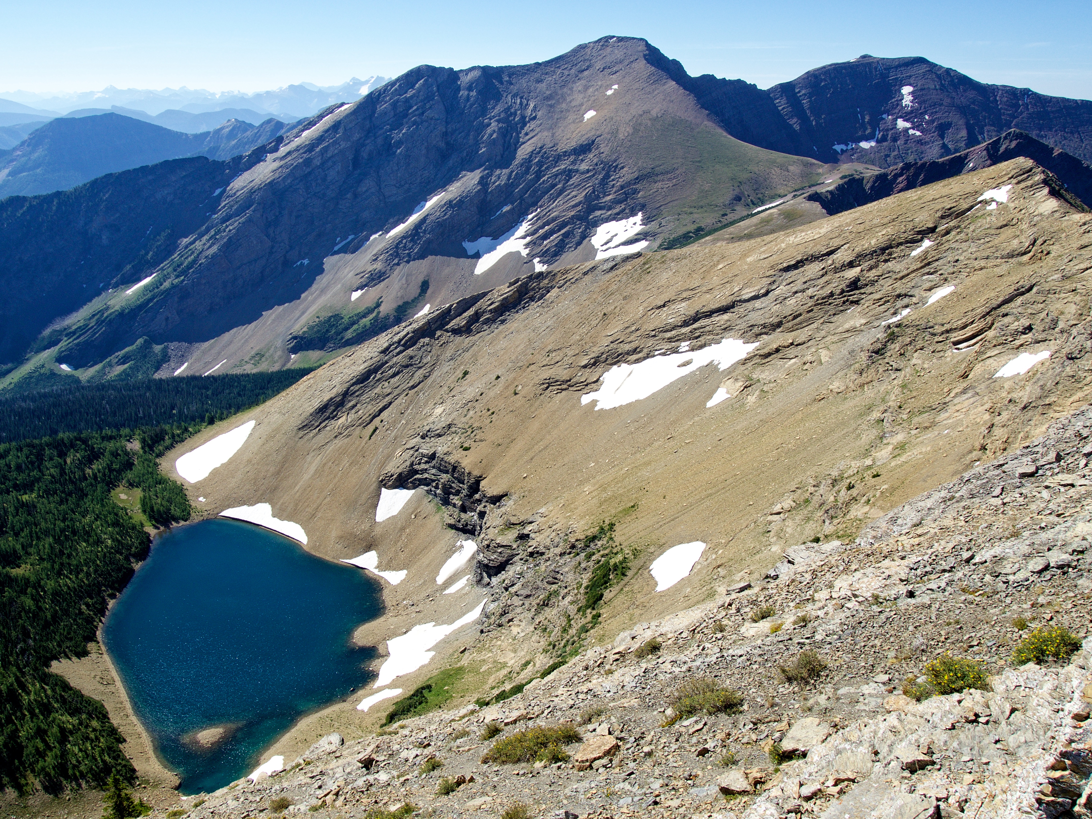
 Hiking and scrambling are inherently dangerous activities. Please read my Disclaimer.
Inspired by Brad and Mark’s early June attempt to reach “Jake Smith Peak” (JSP; 2630 m) via Jake Smith Lake, Andy and I decided to try a slightly different route to JSP using the trail to the Rainy Lakes. Of course, Andy had previously documented a route to JSP (and also “Red Argillite Peak”) via Three Lakes Ridge in, More Scrambles In The Canadian Rockies (3rd Edition, 166-67), but the chance to combine it with a visit to South Rainy Lake was intriguing.
Described by our friend, Joey Ambrosi, in, Hiking the Southern Rockies (1999, 86-87), the Rainy Lakes trail (which is also Joey’s route to Three Lakes Ridge) is still viable even though it has been twenty-seven years since his book was released. That said, I’m not sure the trail is used much these days if at all. Large sections are overgrown with the trail becoming completely obfuscated for a ~450 m stretch about halfway up – and by “completely obfuscated” I mean blindly navigating through dense alders and thick foliage.
However, on our way back, we were able to follow the trail through this section and determine that on approach, we had chosen to cross a makeshift bridge after arriving in a small clearing where the trail completely disappeared. Like a foreign disinformation campaign encouraging a province to secede from a country, the little bridge was a ruse that we fell hook, line, and sinker for.
The real trail actually continued a few dozen metres to hiker’s right where it entered the trees. Knowing this from the beginning would have saved us from the day’s most intense bushwhacking. That said, the real trail is still tricky to follow throughout this section, but at least it’s somewhat discernable. Thankfully, it becomes clearly demarcated again after crossing a small creek and remains that way for the final ~1.8 km to South Rainy Lake.
From the small ridge above South Rainy Lake – sorry angler friends, both lakes are devoid of fish 🙁 – the ~1.6 km (544 m elevation gain) to the summit of JSP is little more than a steep slog. Thankfully the views are good and get better the higher you go, with the summit offering a fantastic panorama of the entire area. Indeed, at 2630 m, JSP is one of the highest peaks in the Castle; though from the summit register, it looks like only one or two parties visit each year, so it’s not a popular destination.
Outside of the great summit views, perhaps the coolest thing about JSP is the unique rock feature that sits on its east face a short distance from the summit. We made the short ~500 m trip to JSP’s northeast outliers and from there, had an excellent view of what I think is a Precambrian thrust sheet. 🤔 At any rate, it was worth the short trip just to get a closer look as it’s not something you see every day.
As Andy nicknamed JSP after officially named, Jake Smith Lake, I was curious who Jake Smith was. Unfortunately, I wasn’t able to find a clear historical line to the naming of the lake but can reasonably speculate that it was in reference to Jake Smith of Pincher Creek. According to Farley Wuth’s blog, Shootin’ The Breeze, Jake Smith was one of the local contractors who worked on the 1946 renovation of L.H. Allison’s store in Pincher Creek. Smith was obviously a well known member of the community, as he is mentioned as a notable regular of the Morgan’s Pincher Motors garage. I’m sure that an afternoon or two in some local archives would reveal much more about Jake Smith, but at least it’s something to go on.
Anyway, after enjoying JSP’s outliers we then made the easy ~1 km trip over to JSP’s col with “Red Argillite Peak” (RA), and from there the short ~590 m (101 m elevation gain) hike to the summit. Again, the rock scenery here is exquisite as are the views.
Following a brief summit stay, we then descended directly (~1.2 km; 392 m elevation loss) to the shores of South Rainy Lake. After a brief recharge, we then returned to the trail and made our way back to our bikes and then enjoyed the mostly downhill ride back to the West Castle trailhead.
All in all, this was a fantastic day in the mountains. For those who don’t want to attempt “Jake Smith” via Three Lakes Ridge or via the sketchy ridge from Scarpe Mountain, the South Rainy Lake route offers a more benign alternative with the only difficulty being the overgrown middle section of the trail. Once again, a HUGE thanks to Andy for another awesome day and to Brad and Mark for providing the inspiration.
Be sure to read Andy’s awesome trip report! [link coming]

To get to South Rainy Lake, “Jake Smith Peak” (JSP), and “Red Argillite Peak” (RA), we drove to Castle Mountain Ski Resort and parked at the far south end of the lot. The West Castle Valley trailhead is located a couple hundred metres to the east where it starts at a pedestrian bridge over the West Castle River.
After biking for ~2.3 km, we came to a fork where the West Castle Valley trail continues to hiker’s left. From here, we biked for another ~7.5 km to the Rainy Lakes trailhead (~9.8 km in total from the West Castle Trailhead with a 204 m elevation gain). As I was on a human-powered bike, it took us 1.5 hours to reach the Rainy Lakes trailhead.
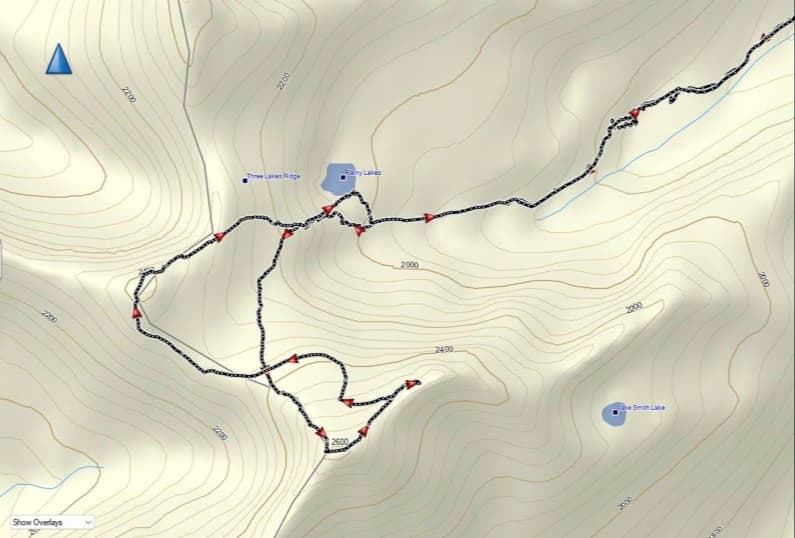
Leaving our bikes at the junction, we began hiking the Rainy Lakes trail which was quite overgrown in sections and also involved 5 or 6 small creek crossings. At approximately the ~2.1 km mark, the trail emerged onto small meadow where it completely disappeared. We made the mistake of thinking that it began on the other side of a makeshift bridge, but it really continued to hiker’s right of the bridge and inside the trees. The next ~450 m involved playing ‘Find the Trail’ as until we finally located it on the other side of a steep, fast moving creek.
The remaining ~1.8 km to the bowl beneath JSP was uneventful as the trail was easier to define. A short but steep hike from the entrance to the bowl brought us onto the small ridge above South Rainy Lake. For reference, it took us 2 hours to make the ~4.3 km (509 m elevation gain) hike to the small ridge from the Rainy Lakes trailhead.
From the ridge, we hiked a short distance before traversing towards the steep north slopes of JSP. The ~1.6 km (544 m elevation gain) slog to the summit from the ridge seemed to take forever, but the increasing views made up for it. For reference, from the West Castle trailhead to the summit of JSP, it was a ~15.7 km (1257 m elevation gain) trip that took us 5 hours and 30 minutes.
After enjoying the summit views, we made the short ~500m hike from JSP’s summit to its outliers. We then descended the north slopes of JSP to the col with RA (~1 km). A quick and easy hike of ~590 m (101 m elevation gain) brought us onto the summit of RA.
From the summit, we descended ~1.2 km (392 m elevation loss) directly to the shores of South Rainy Lake. After a quick rest, we descended back to the Rainy Lakes trail and returned the way we came – except we were able to trace the actual trail through the overgrown middle section. Once back our bikes it was an easy 1 hour ride back to the West Castle trailhead and our vehicles.
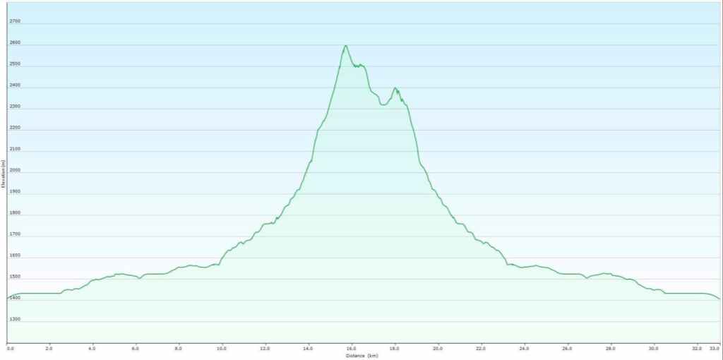
Our total roundtrip distance was 33 km with total elevation gains of 1421 m. Our total roundtrip time was 11 hours and 11 minutes.
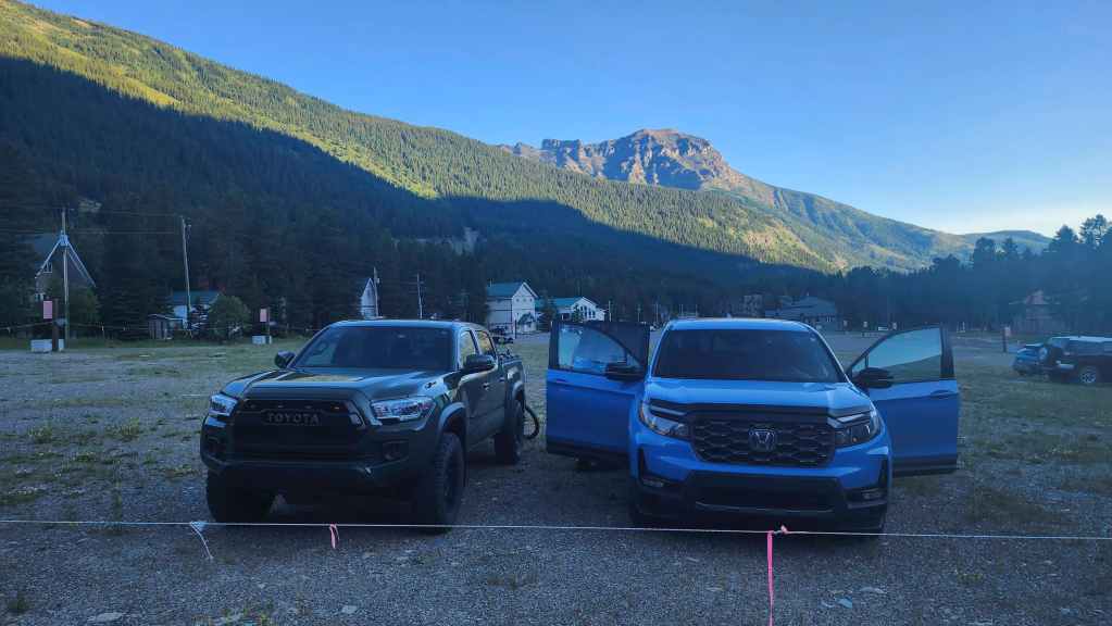
Gearing up at the south end of the Castle Mountain parking lot. Syncline Mountain is in the background.
A quick ride of ~2.3 km brought us to a fork where the West Castle Valley trail continues to hiker’s left. If you want to head to Middle Kootenay Pass, you would keep to hiker’s right.

A wet month of June had left plenty of water on the trail.

Our ride in was pleasant, though I was working hard on my human-powered bike to keep up to Andy and his precious e-bike. 😂

Fish spotting as I cross the West Castle River. (Photo by Andrew Nugara)

Shortly beyond the bridge, we encountered some fallen trees.

The Rainy Lakes trailhead is located roughly 100 m beyond this metal gate.

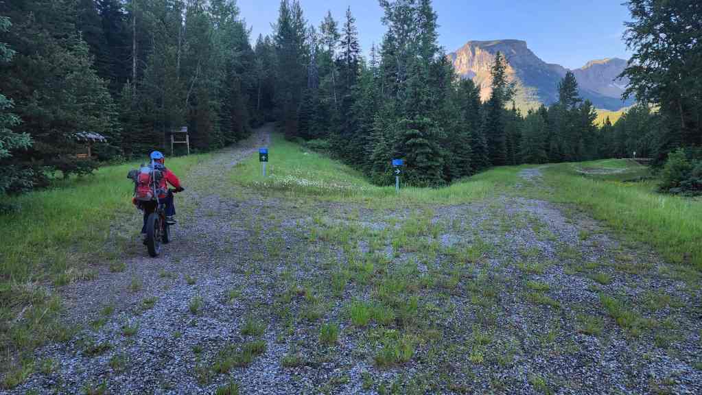
Approximately 9.8 km (204 m elevation gain) from the trailhead, we arrived at the trailhead for the Rainy Lakes (right). For reference, because I’m old and don’t have an e-bike, it took us 1.5 hours to reach this location. Of course, the new fangled breed of ultra distance runners who eschew all extraneous weight such as clothing and dental fillings could probably run it in under 10 minutes. 😂 Seeing what people are capable of these days is quite amazing – I just hope they have enough gear to care for themselves or others if they ‘run’ into trouble.
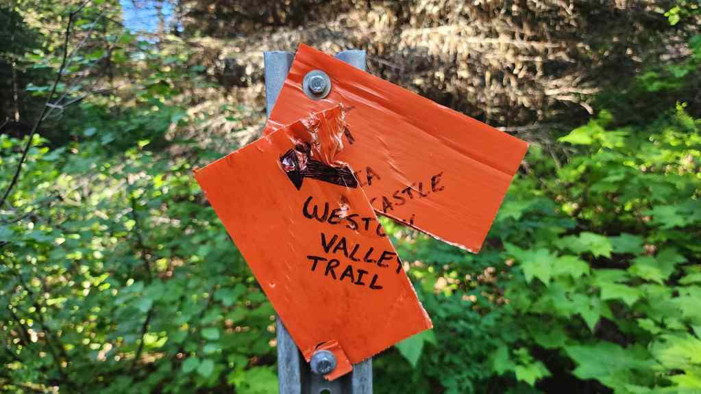
The beat up sign that tells hikers to keep left to stay on the West Castle Valley trail.

After leaving our bikes at the trailhead, we set off along the Rainy Lakes trail.
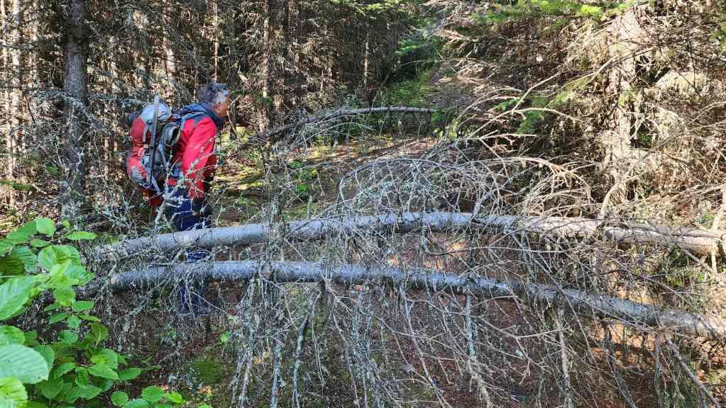
Some sections are full of deadfall…
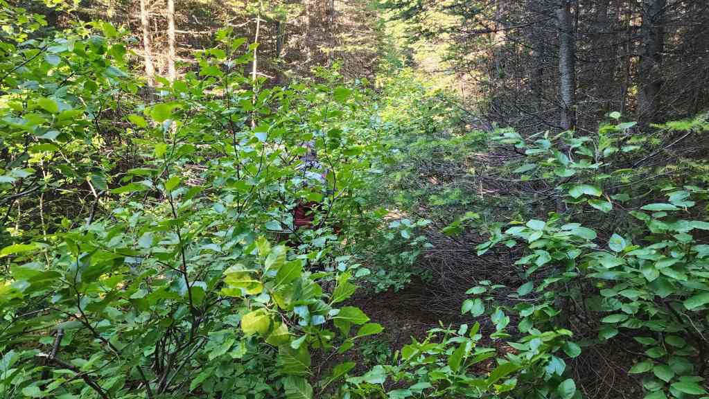
And other sections are overgrown with alders. That’s Andy only a couple of metres in front of me – or it’s a bear… 😂

Yet despite the inconveniences, the first half of the trail is generally straightforward.

Oh yeah, the trail also became a stream in one spot. In fact, there were at least 5 or 6 small creek crossings on the lower half.

For example, here’s me steping across a small creek… (Photo by Andrew Nugara)

And now here’s Andy crossing another.

When the trail was good, it was a really easy hike.
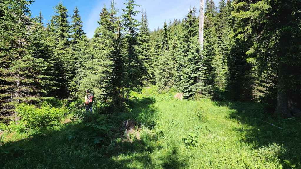
Okay, so here’s where things get interesting. Approximately 2.1 km from the trailhead, we came to this small clearing where the trail completely disappeared. I mean it literally vanished. As we would discover on the way back, it continues to hiker’s right – hidden just beside that standing dead tree on the right side of the photo. However, we kept to hiker’s left…

Where we came to this rickety old bridge. Thinking it was part of the trail, we crossed it.
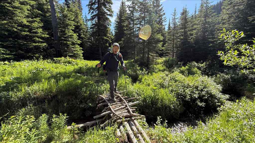
I take my chances with the troll who lives under the bridge. 😂 (Photo by Andrew Nugara)

Searching for the trail on the other side of the bridge. As there was an old horse hitching post in the clearing, I think the little bridge may have led to where the riders camped. (Photo by Andrew Nugara)

My view from the previous photo highlights our first good look at JSP’s northeast outliers.

Playing “Find The Trail”. 😂 Note the sawn log in the centre. A helpful way to find – and stay on the trail in this section is to look for old saw marks… (Photo by Andrew Nugara)
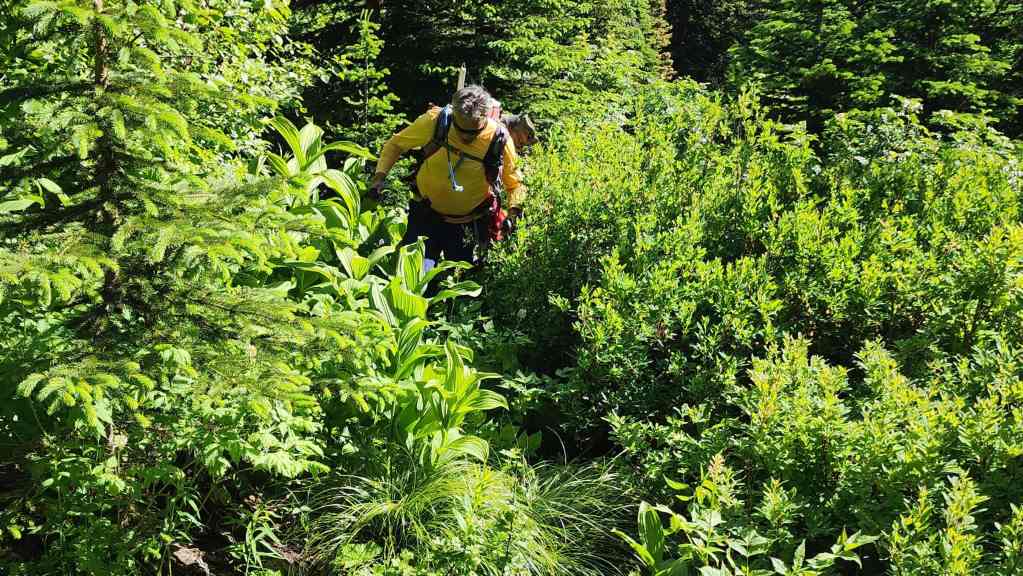
However, when there aren’t saw marks, you’re on your own. 😂 We are well off the trail at this point.

At least the bear grass was pretty.
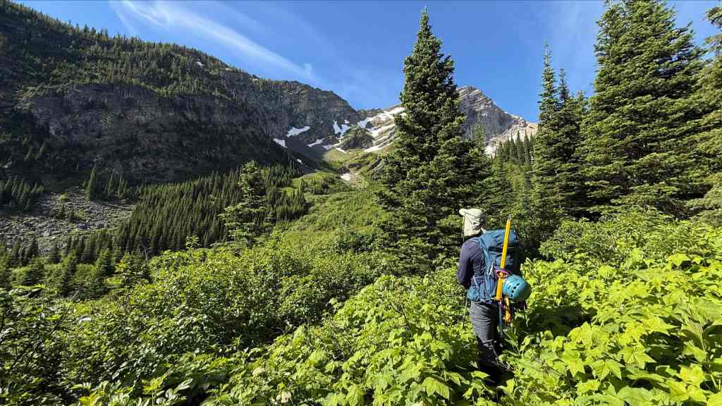
Still searching for the trail. (Photo by Andrew Nugara)

Okay, here’s another clue. When playing “Find The Trail”, if you can’t find saw marks, look for old snowmobile belts. 😂

We’ve lost the trail again but are approaching a raging little stream that is hidden in the alders in front of Andy. Not able to cross, we headed to hiker’s right to find a way past it.

As luck would have it, we stumbled onto the trail where it was clearly demarcated on the other side of the creek.
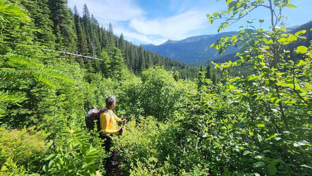
Believe it or not, we’re on the trail again.

Having won “Find The Trail”, we were now able to enjoy the hike… (Photo by Andrew Nugara)
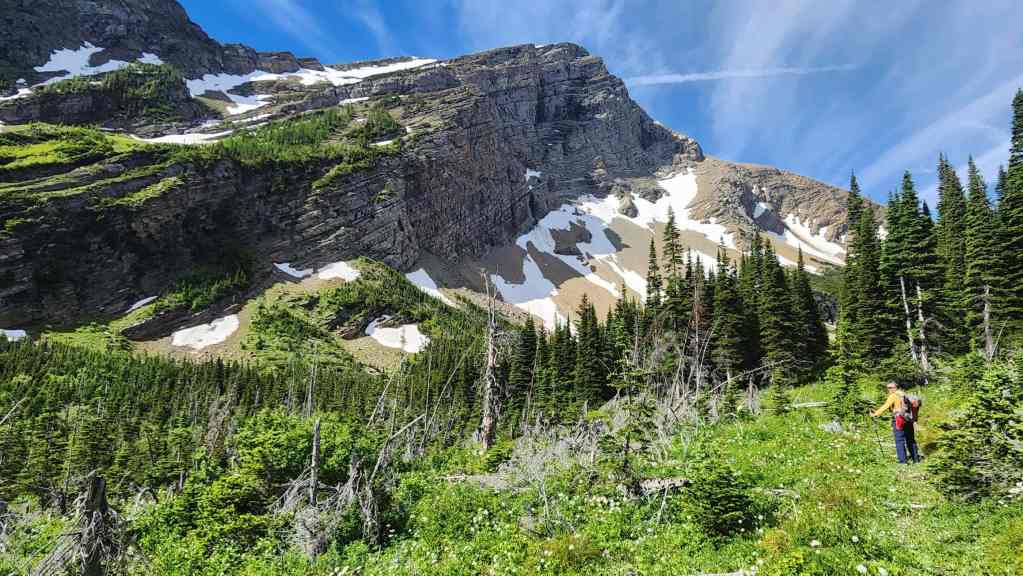
And the scenery!
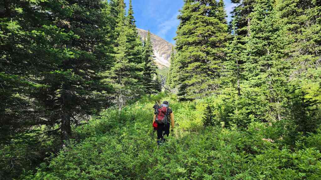
The upper section of trail follows an obvious cutline.

Still following the cutline, but this time, with less bushwhacking.

Entering a scenic alpine meadow with JSP’s northeast outliers on the left.

Looking back as we near the end of the trail. Lys Ridge is in the background. (Photo by Andrew Nugara)

Entering the bowl beneath JSP.

Starting up the little ridge that sits between the trail and South Rainy Lake.

Andy’ view back from the previous photo. (Photo by Andrew Nugara)
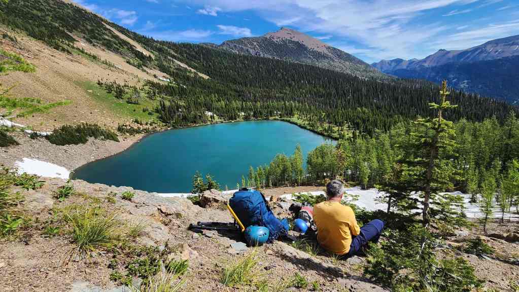
Enjoying a well-earned break above South Rainy Lake with the summit of Rainy Ridge (centre) in the background. North Rainy Lake is not visible as it sits above the ridge in the centre; however, we’ll visit South Rainy Lake on our way back. For reference, from the Rainy Lakes trailhead, it took us 2 hours to make the ~4.3 km (509 m elevation gain) hike to reach this point.

Heading up the ridge. From here it will be a ~1.6 km (544 m elevation gain) hike to reach the summit of JSP.

A look back as we gain elevation. The trail is to the right of centre.
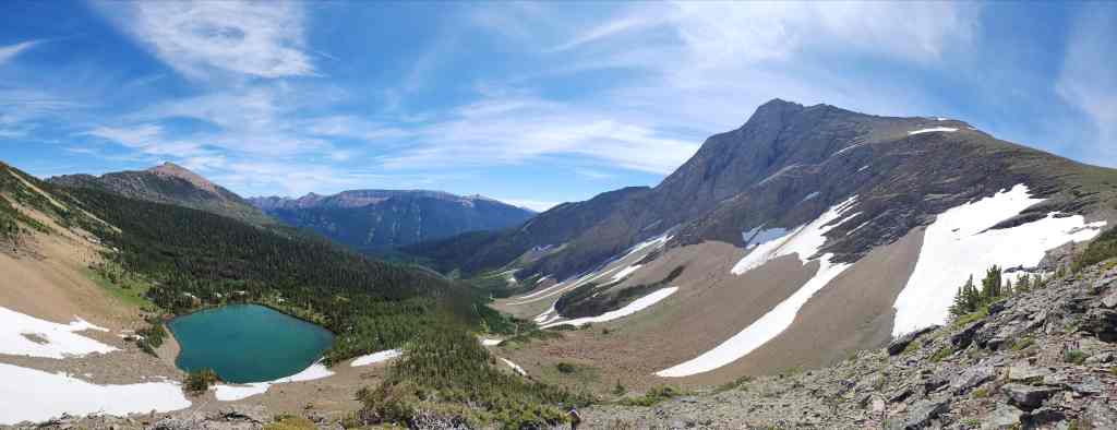
A wider angle of the previous photo with the summit of JSP on the far right.
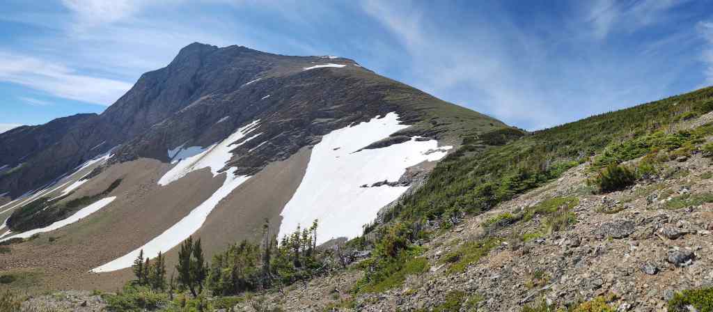
A better look at the summit of JSP (centre) and its northeast outliers (left of centre).
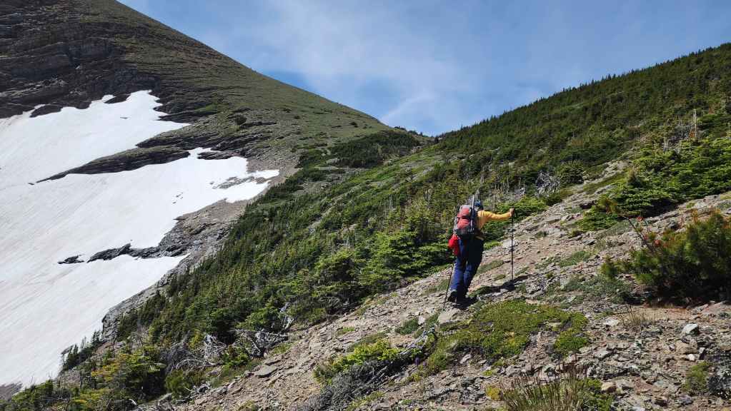
Making the traverse over to JSP’s north slope.

Following a small drainage,

Nearing the point where we’ll leave the drainage for JSP. (Photo by Andrew Nugara)

Starting the long slog to the summit (centre). (Photo by Andrew Nugara)
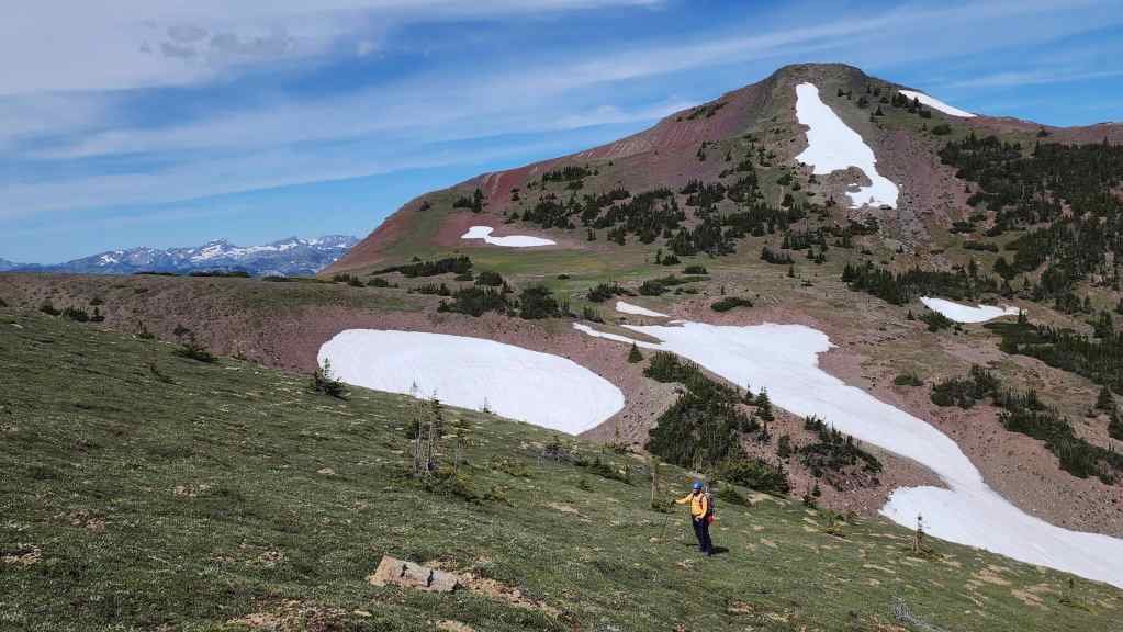
The view over to “Red Argillite Peak” (RA) which we’ll visit later in the day.
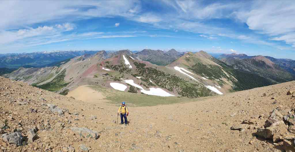
Did I mention that it was a long steep slog? 😂

Looking west and over to Scarpe Mountain (centre).

Andy’s view from the previous photo. (Photo by Andrew Nugara)

Nearing the summit ridge. (Photo by Andrew Nugara)
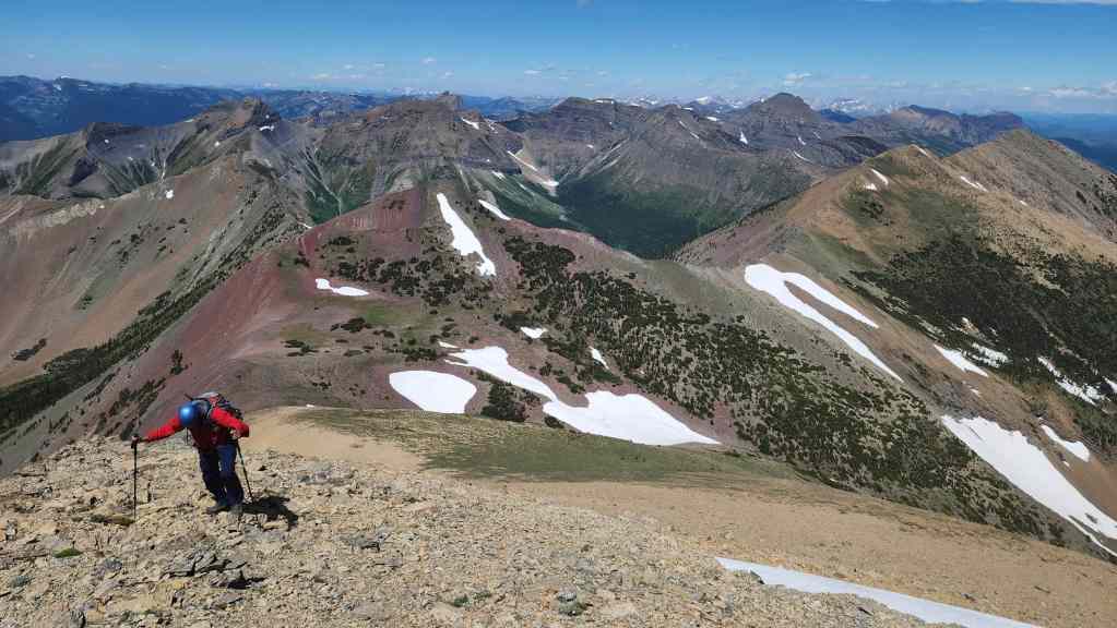
Another look back.
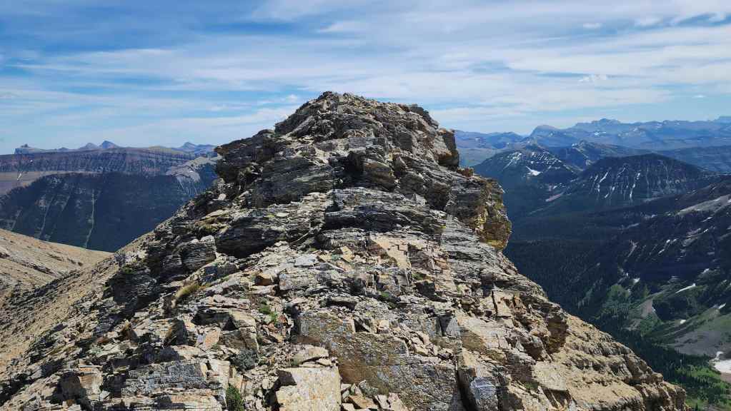
Finally on the summit ridge.
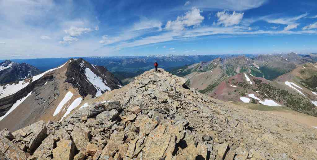
Making our way along the ridge.

The summit of JSP (2630 m). For reference, from the West Castle trailhead to the summit of JSP, it was a ~15.7 km (1257 m elevation gain) trip that took us 5 hours and 30 minutes.
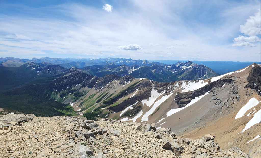
As it’s one of the highest peaks in the area, JSP offers fantastic 360 degree views. This is a pano to the south…

And now one to the southwest.
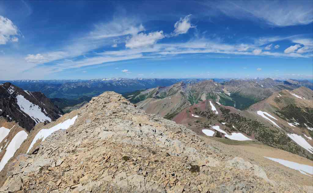
The view to the west…

And now to the north.
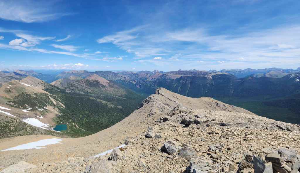
Looking northeast…

And finally to the southeast.
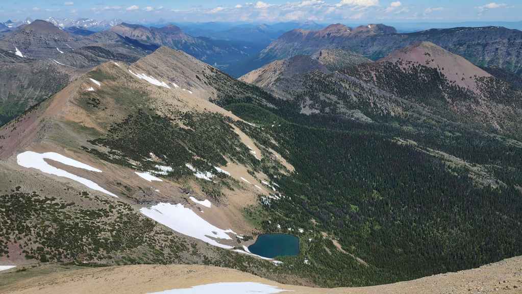
Another look to the north.
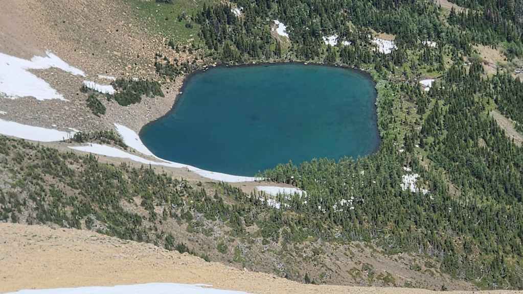
Gazing down at South Rainy Lake.

The hazardous connecting ridge with Scarpe Mountain. I’ll have to come back one day – probably via La Coulotte Peak – and tag Scarpe Mountain. Or maybe, there is a way from Jake Smith Lake…🤔

It’s easy to see why Andy called it “Red Argillite Peak” in, More Scrambles in the Canadian Rockies.

All three peaks of Syncline Mountain.

Looking to the north at Mount Haig.

“Mount Miles” (right of centre) and “Krowicki Peak” (left) are two peaks that I still need to get to. As is Tombstone Mountain, where its summit can be seen poking up behind “Mount Miles”.
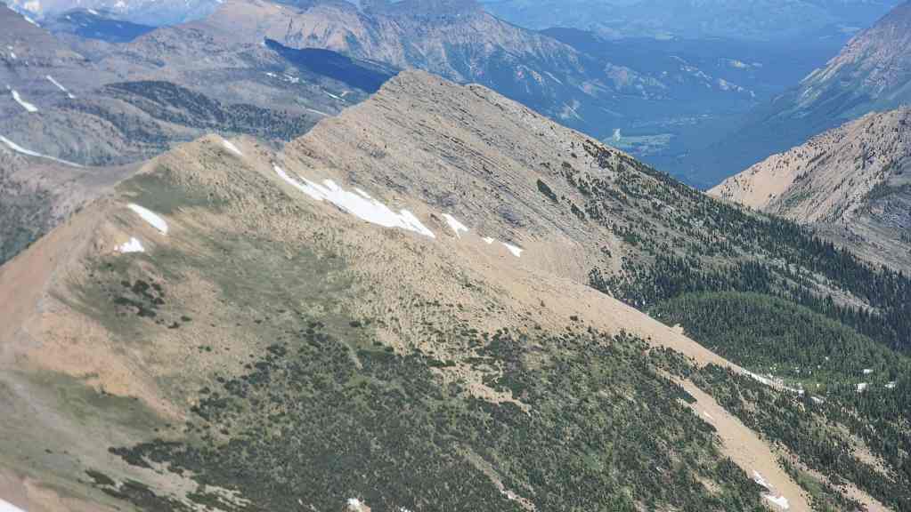
The view over to Three Lakes Ridge.

Looking across the valley at Rainy Ridge.

A telephoto of Southfork Mountain (far left), “The Amoeba” (centre), and the summit of Barnaby Ridge (right of centre).

Colourful Mount Gladstone (centre).
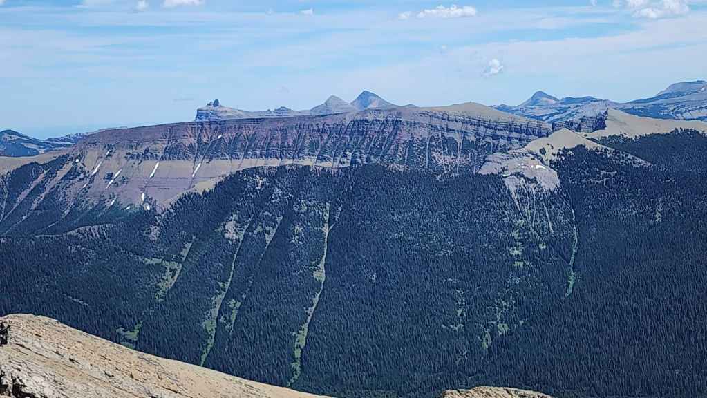
The view across the West Castle Valley to Lys Ridge.

Zooming in and across Lys Ridge to Castle Peak (left), Windsor Mountain (right of centre), and Victoria Peak (right).
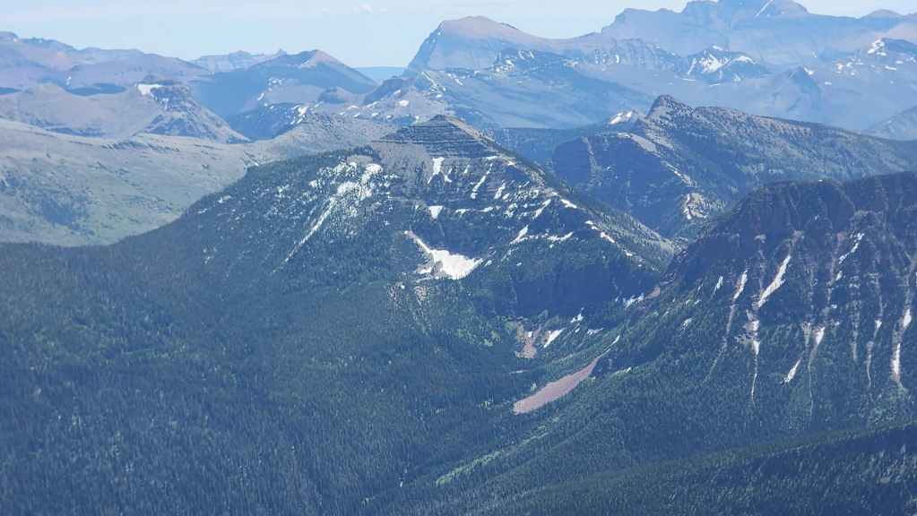
La Coulotte Peak (centre) and La Coulotte Ridge (right) are two more peaks on my ‘To Do’ list.
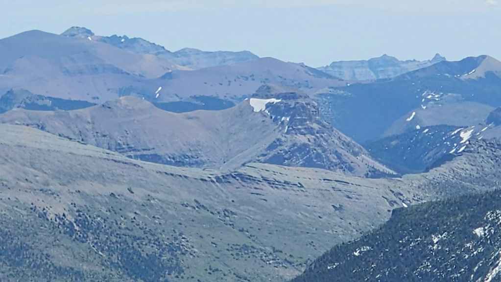
A grainy telephoto of Mount Matkin (centre).
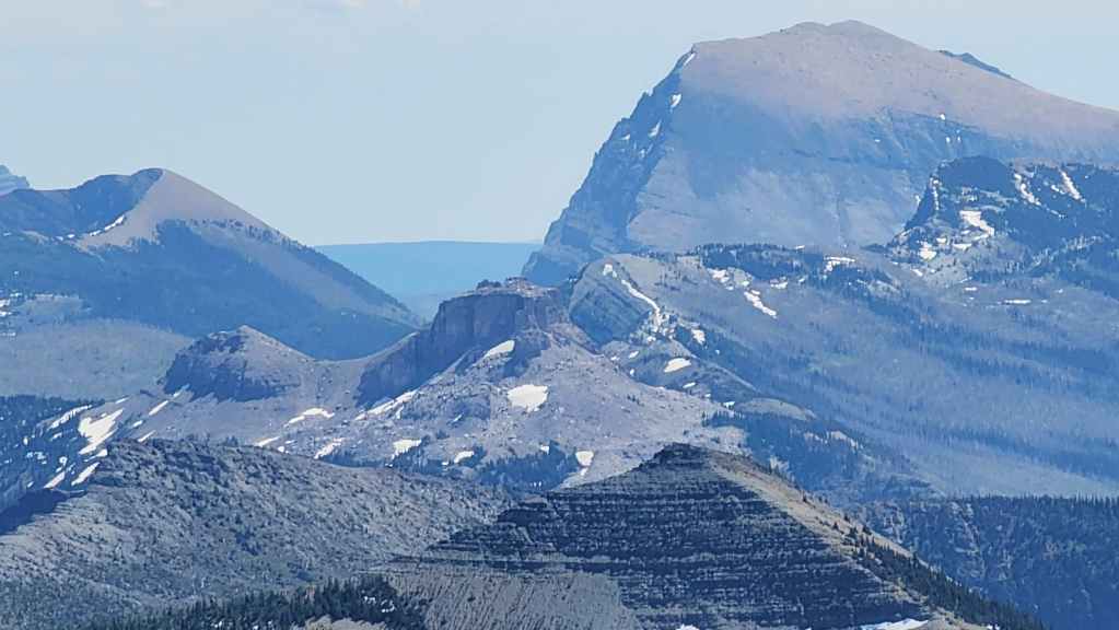
Avion Ridge (far left) along with Font Mountain (centre), Anderson Peak (right), and “Sage Senior” (far right).
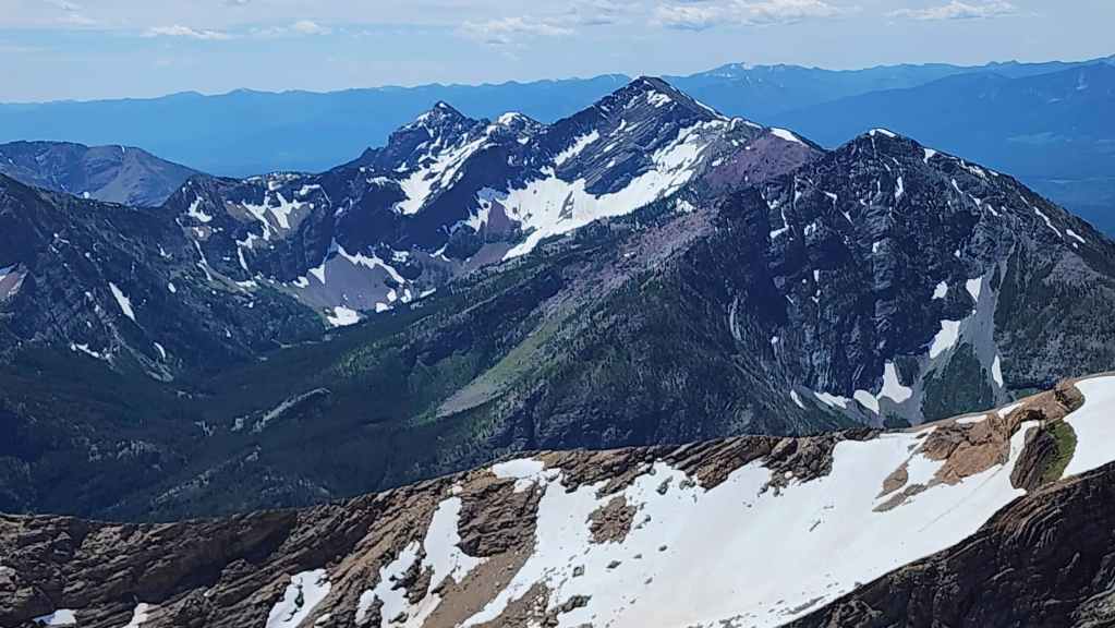
I’ve heard nothing but good things about Commerce Peak (centre) – unless of course, you don’t include the backcountry roads you have to drive in on… 😳
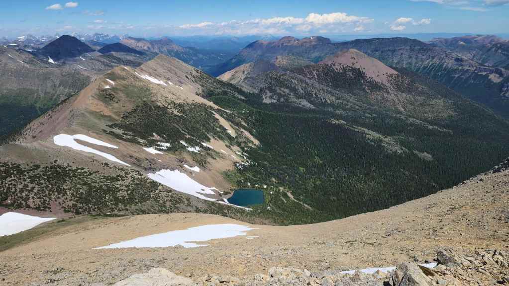
Another look at our ascent route from South Rainy Lake.
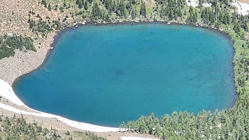
A closer look at South Rainy Lake.
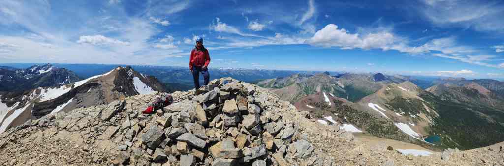
Andy’s triumphant return to JSP.

Andy’s comedic sidekick. 😂 (Photo by Andrew Nugara)
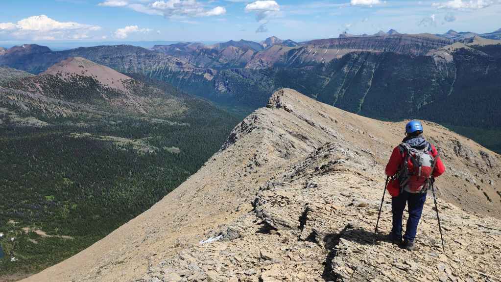
After enjoying the views, we headed over to JSP’s northeast outliers.

The Precambrian thrust sheet soon comes into view. (Photo by Andrew Nugara)
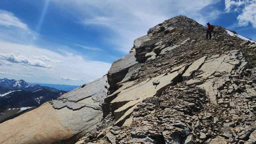
My view back to the summit.

The thrust sheet – again, I think this is what it is, but I could be wrong… at any rate, it’s super cool!
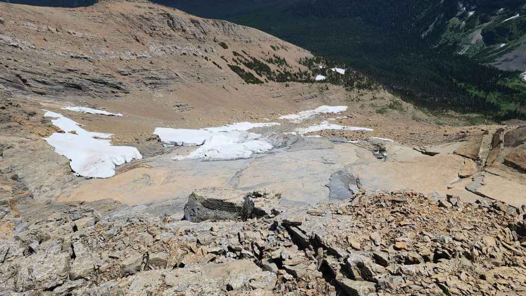
Seeing the sheet was definitely worth the short trip from the summit.

Another look at the summit and the thrust sheet.

More of the same… (Photo by Andrew Nugara)
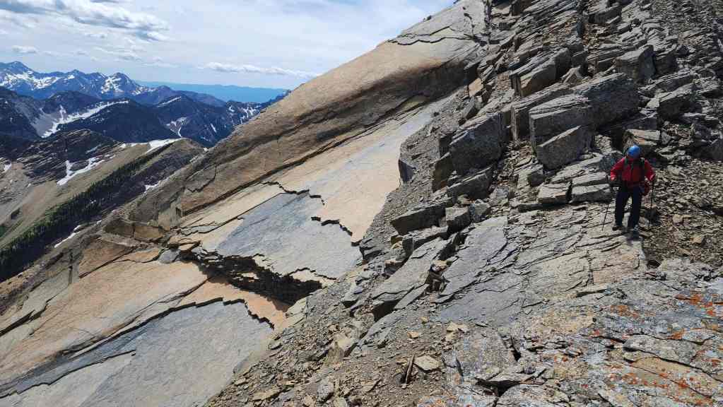
And still more.

I crawl through a small opening as we scramble along the ridge. (Photo by Andrew Nugara)
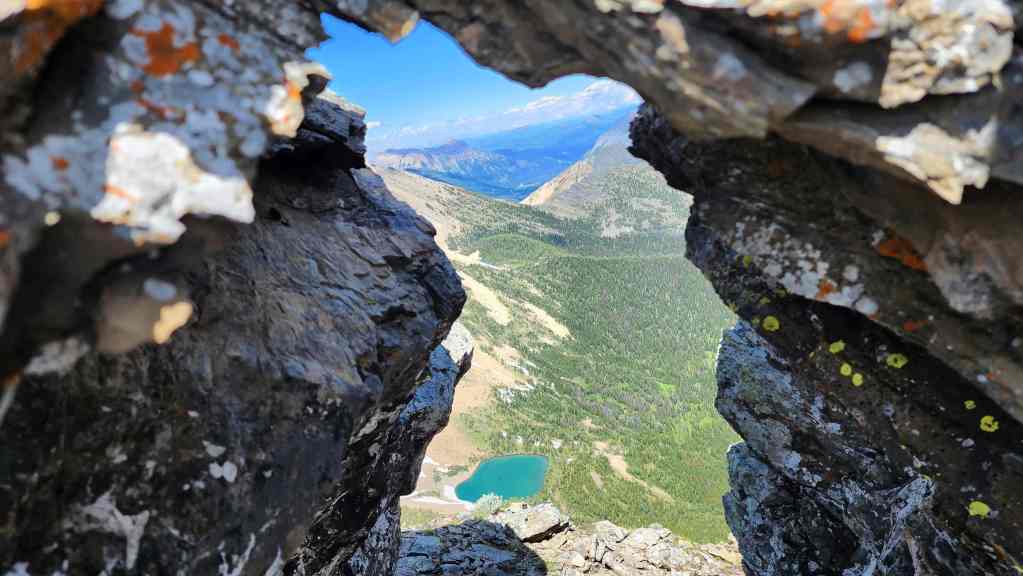
South Rainy Lake from inside the opening.

Andy scrambles the ridge.

Getting to the closest outlier was easy, but the second one was tricky.

Looking north from the top of the first outlier…
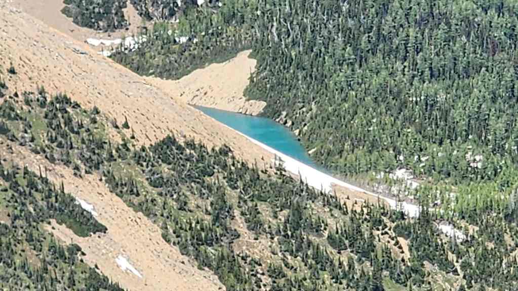
Where we can now see a glimpse of North Rainy Lake.

Approaching the second outlier. (Photo by Andrew Nugara)
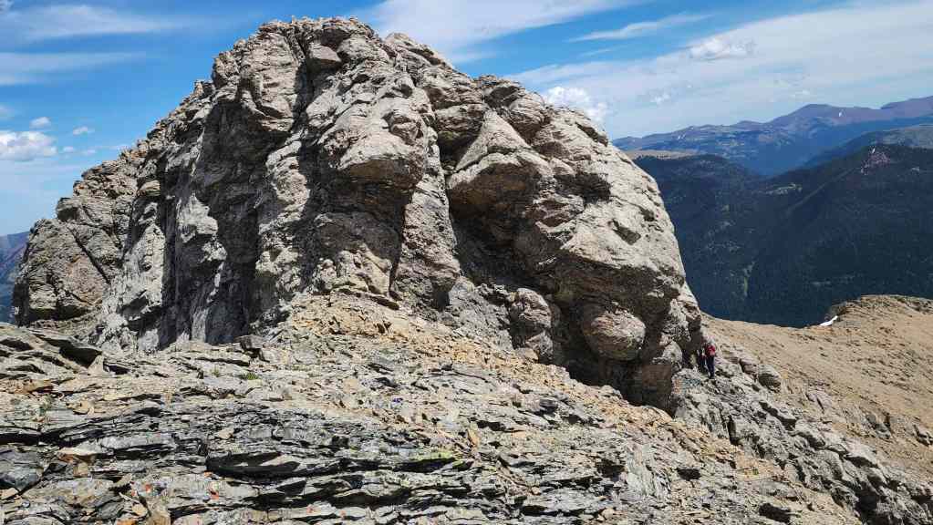
Andy (lower right) searches for a way up.
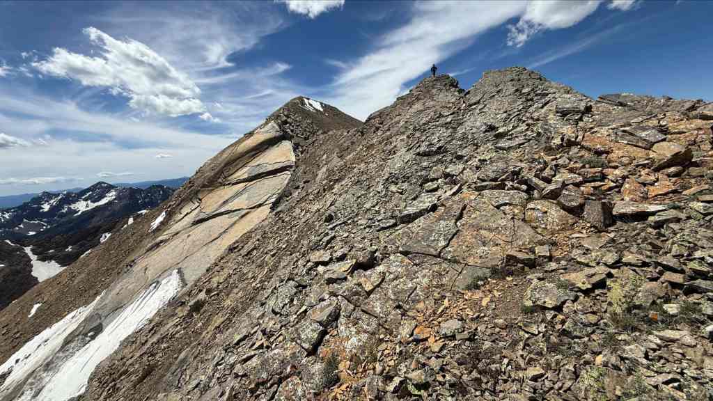
Andy’s view back to me. (Photo by Andrew Nugara)

I balk at the exposed ledge that Andy used to gain access to the slopes of the second outlier. Had I dropped my pack, I might have felt better about continuing, but I decided to pass on following him to the top. (Photo by Andrew Nugara)

Now back on the first outlier, I watch as Andy (upper right) scrambles to the summit.
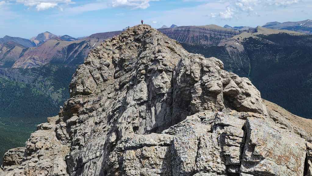
He did it! 🙂

A wider view of the previous photo.
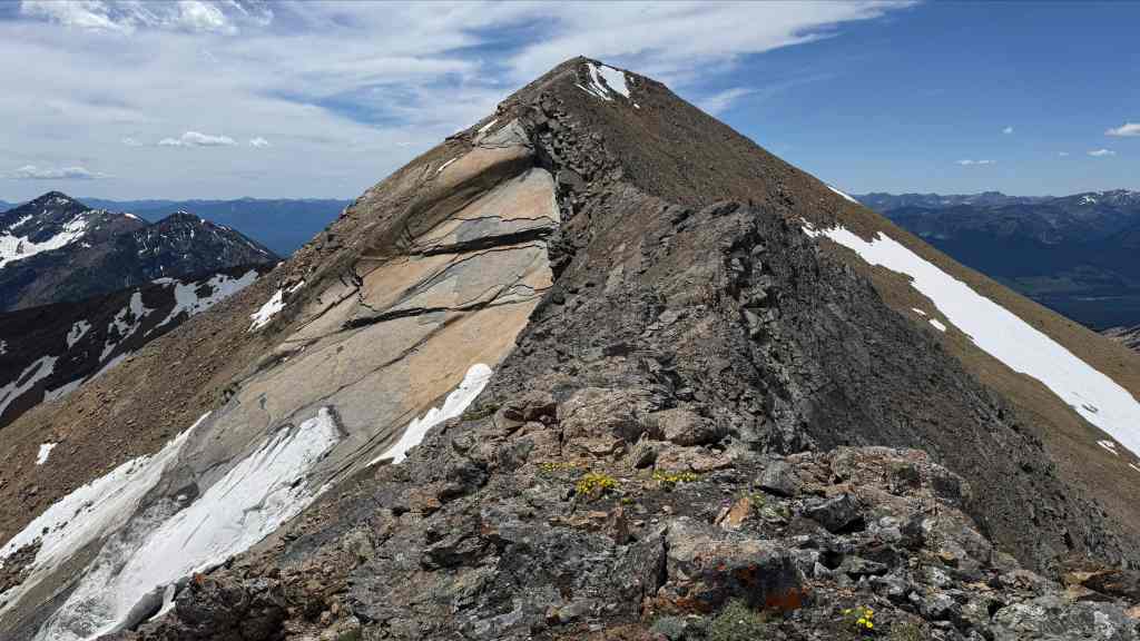
Andy’s view back to me. (Photo by Andrew Nugara)
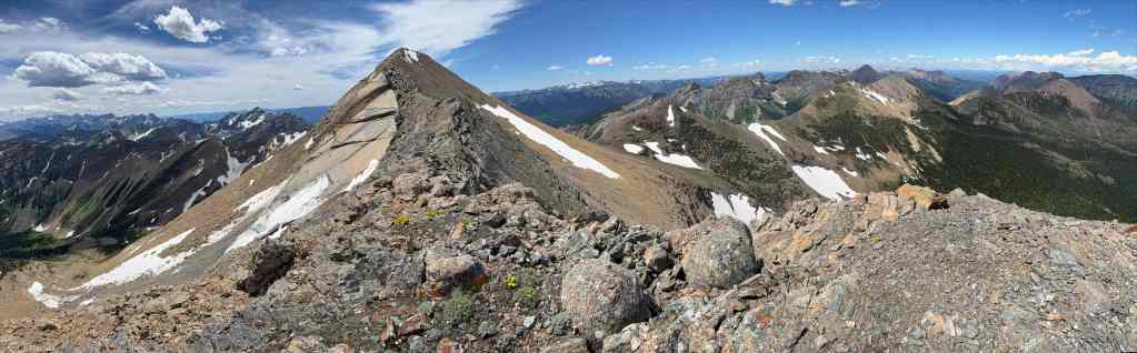
A pano from the second outlier. (Photo by Andrew Nugara)
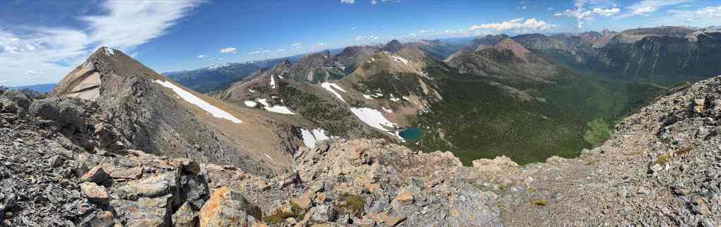
More of the same. I now wish that I’d dropped my pack and joined Andy. (Photo by Andrew Nugara)

North Rainy Lake from the second outlier. (Photo by Andrew Nugara)

To descend the outlier, Andy had to lose quite a bit of elevation… (Photo by Andrew Nugara)

And then regain it. I guess this makes up for his relaxing e-bike approach earlier in the day. 😂 (Photo by Andrew Nugara)

Another look at the thrust sheet. (Photo by Andrew Nugara)

Almost back where he started. (Photo by Andrew Nugara)
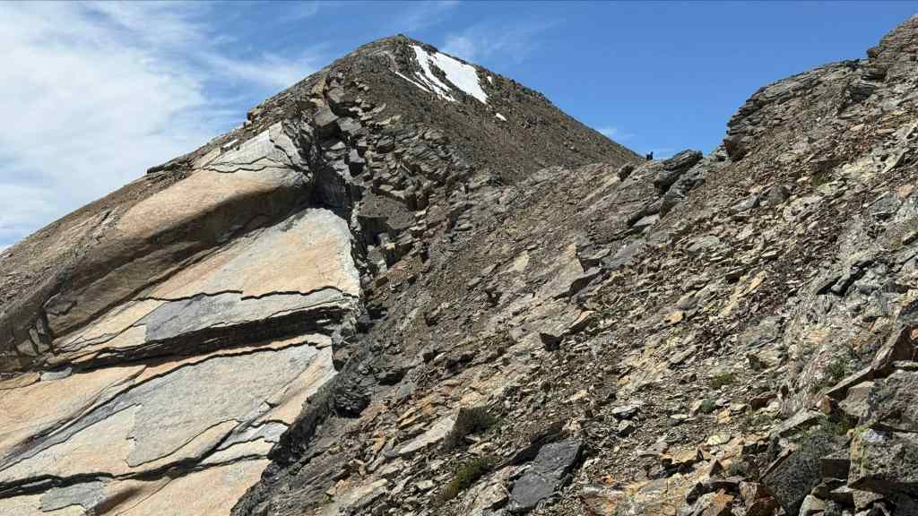
Heading back to where I was waiting for him. (Photo by Andrew Nugara)

A thunder cloud forms above Mount Gladstone.
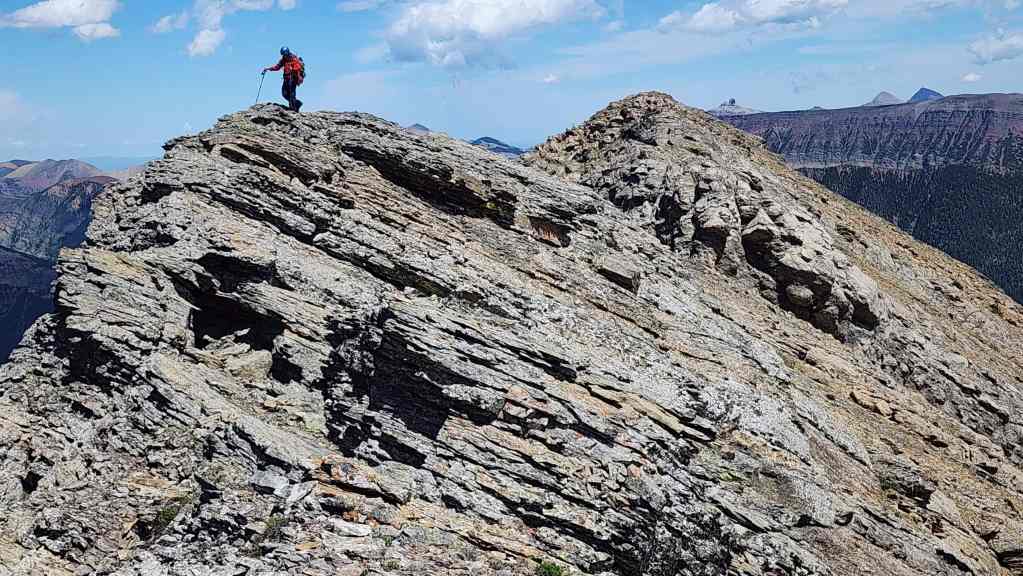
The first and second outliers.
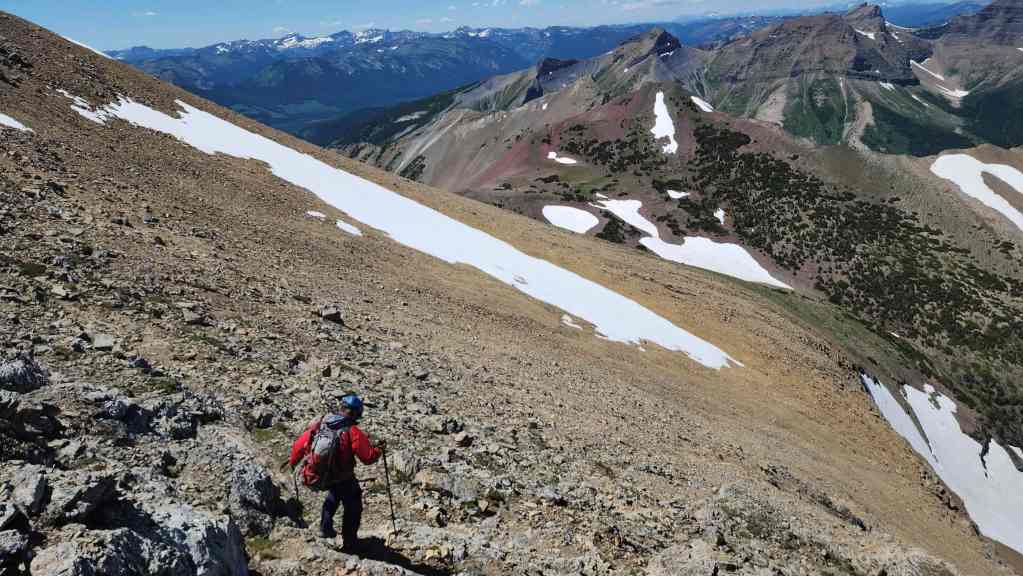
Descending towards “RA Peak”. Click to follow us there.


Leave a Reply