

⚠️ Hiking and scrambling are inherently dangerous activities. Please read my Disclaimer. ⚠️
Quite simply, this is an incredible ridge walk. In fact, as I look back through my pictures I’m still trying to soak it all in. Those colours! From the rocks, from the trees, from the lakes – everything on or near this this mountain exudes colour. Then there’s the scrambling and the constantly changing terrain which keeps you busy route finding or moving from one side of the ridge to the other just to take in a new view. Tack on two summits plus a hike through a picturesque valley and a trip up Lys Ridge in the Castle Wilderness is the ideal way to spend a fall day – and by day I mean from sun up to sun down.
Yup, this one’s a biggie. Our traverse of Lys Ridge coupled with our return route along the Grizzly Lake trail saw myself, Andrew Nugara, and Jollin Charest cover 28km in just under 12.5 hours. We started hiking shortly after sunrise and we returned just after sunset. Yet, I’m not complaining because this trip was worth every single minute. For when a guy like Andrew, who has summited over 700 mountains, says that this was one of the best ridge walks that he’s ever been on in southern Alberta – including Waterton – then you know you’ve stumbled onto something special. However, I do owe an apology to my family who I had told to expect me to be later than usual, but who weren’t expecting me to be as late as I was.
Due to the length of the trip, I’ve decided to break this report into two separate posts: one for West Castle, and one for the summit of Lys Ridge (note: Rick Collier referred to it as Lys Peak in Bivouac). Indeed, we had become so focused on Lys Ridge that it wasn’t until a few days prior to the trip, when I was zooming in on NRCAN’s online topo map, that I noticed that West Castle was listed as a separate summit on Lys Ridge. I sent a quick email to Andrew who in turn, carefully scanned Rick Collier’s trip report on Bivouac – which happened to be the only one that he could find. Sure enough, just like when you unexpectedly find $20 in the pocket of the pants that you haven’t worn in months – we confirmed that this was going to be a two peak trip.
Click to read Andrew’s trip report.

Andrew and I had been planning this trip for a couple of weeks but had never hiked together until today – though I did meet him back in January when I almost ran him over while he was snowshoeing down Coal Road in the Crowsnest Pass (see my Tent Mountain post). He is of course, author of More Scrambles in the Canadian Rockies, Snowshoeing in the Canadian Rockies, and A Beginner’s Guide to Snowshoeing in the Canadian Rockies. I had met Jollin only two days prior at the home of our mutual friend, Mark, who had organized a craft beer exchange that both Jollin and I were a part of. Jollin’s friendly demeanour and his lengthy mountaineering experience made it easy for me to invite him along – and I’m glad I did as both these guys are simply fantastic people!
I had scoped out a possible route up the north end of Lys Ridge a few years ago from the summit of Whistler Mountain but had parked it in the back of my mind. Then, on our Windsor Mountain trip this past July, I had the chance to check out the northeast face from our parking spot along the Castle River. I quickly surmised that while the north end of Lys Ridge had a more gradual contour, it would require an unknown amount of bushwhacking to reach open slopes. Instead, I saw a large boulder field that ran almost from the river all the way up the northeast face to the crest of the ridge. Outside of crossing the river, it appeared that it would take minimal effort to reach it from the vehicle.
When I was discussing the trip with Andrew, he mentioned that he too had been eyeing Lys Ridge for a possible trip. He noted that Rick Collier had used a red argillite gully to ascend Lys Peak from Ruby Lake. Collier then traversed the ridge from the summit of Lys Ridge to West Castle before dropping back down to the the Grizzly Lake trail beneath the summit of West Castle (and not without some difficulty). Andrew even did a solo hike up the Grizzly Lake trail last year to try this route but was stymied by bad weather.
Together we proposed a traverse of the entire ridge from north to south followed by a descent of the gully that Rick Collier had used to ascend. We would then hike back along the Grizzly Lake trail to our vehicle. The only big question was where we should gain the ridge – use the northeast boulder field that was close to a parking spot, or park at the Grizzly Lake trailhead and then bushwhack our way up the more gradual north end? Even though it added an extra ~2km of walking along the South Castle Road at the end of the day, we chose to ascend the northeast slope because of its lack of bushwhacking. I think this was a great choice because it made for an extremely enjoyable ascent.

To reach our starting point, we headed south from the hamlet of Beaver Mines along Highway 774 until we came to the turnoff for Beaver Mines Lake. Here we turned left and followed the gravel road for ~3.7km until we came to the South Castle Road, which was located on our right. We followed the road for ~600m before arriving at a couple of information signs for the Castle Special Management Area. Also in the immediate vicinity were numerous random camping spots.
Here is where things get interesting and unless you have a 4×4 or some type of high clearance vehicle, you will need to park your car and get out your bike. Fortunately, Andrew had his CRV so we followed the road across the dry creek bed and proceeded another 6.9km down what at times, was a rough road, until we came to a washed out section just beyond a well marked camping site next to the Castle River. This is where we parked.
From here we waded across the river and picked up a nice little trail on the opposite bank. We followed this trail south along the river for ~630m until we were roughly beneath the boulder field. We then left the trail and ascended through light forest for ~530m until we reached the boulder field. Our ascent was highly enjoyable but the route is definitely foreshortened when looking up at it from the bottom. Indeed, from the base to the crest it was ~900m in distance with a ~500m elevation gain. Thus, in total it was ~1.43km from the river to the ridge crest with a ~633m elevation gain.
Once on the crest we enjoyed a quick but moderate scramble up the first cliff band to reach the next section of the ridge. From here we traversed the ridge for ~2km until we came to the yellow peak of West Castle.

As I mentioned before, we didn’t realize this traverse would include two peaks until a few days prior to our trip. Rick Collier wondered why West Castle even had a name because there is nothing unique about it. In fact, there is a slightly higher (~7m) twin peak that is located ~470m to the south that we thought might be the true summit – it isn’t, but because of its proximity, I marked it on my GPS as “West Castle 2”. The reason it is called West Castle is because it is almost exactly to the west of Castle Peak. There is also a North Castle that is located directly to the north of Castle Peak.
After engaging in some moderate scrambling to reach the top of “West Castle 2”, we then continued our traverse towards the summit of Lys Ridge which lay 5.7km to the south. It is of course possible to ascend the ridge to reach West Castle and then turn around, but that would mean you would miss out on so much scenery…
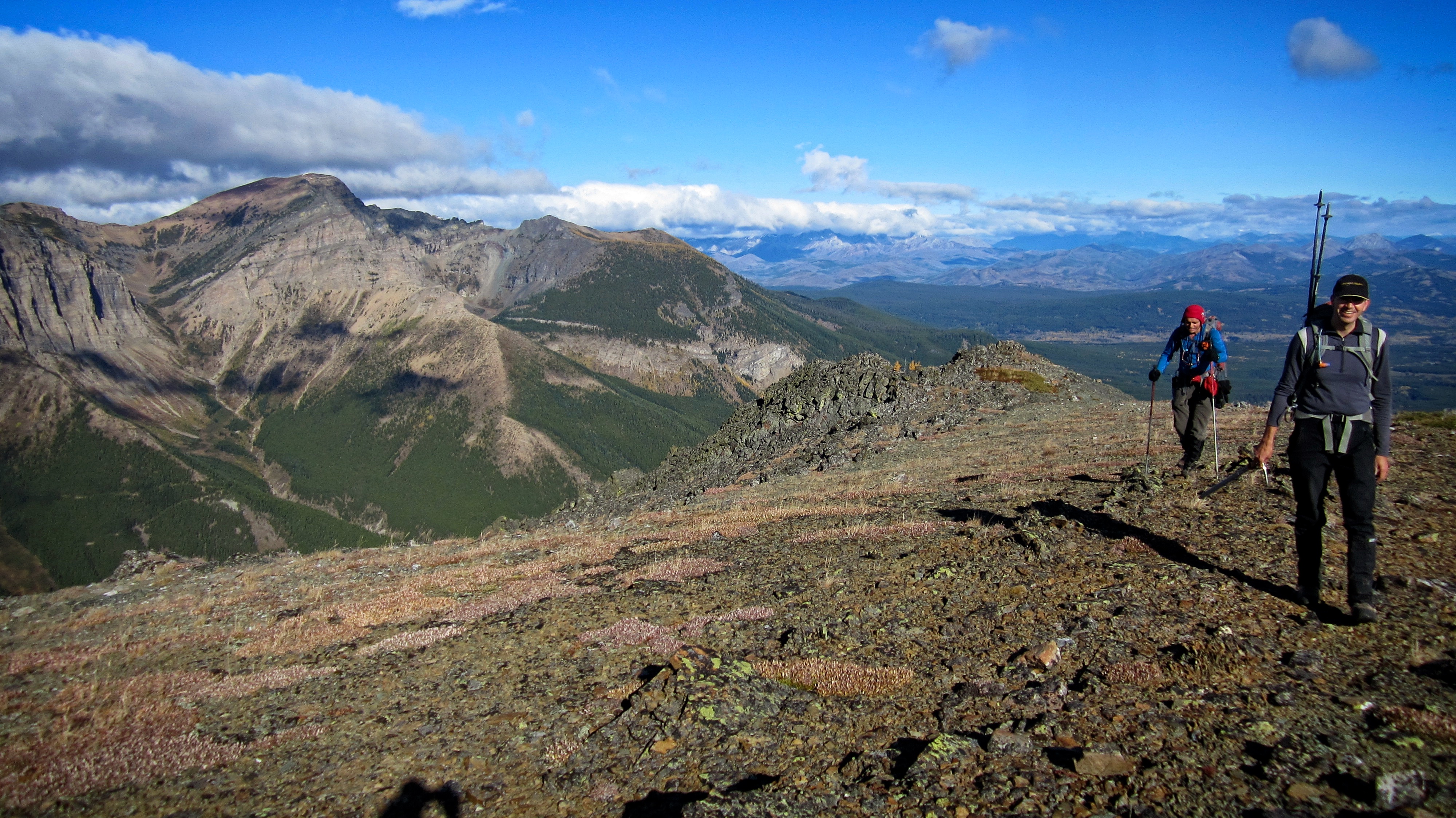
A graph of our entire traverse of Lys Ridge. West Castle is identified as the 1st of twin points at about the 5km mark. The summit of Lys Ridge is the highest point on the graph at the 11km mark. Our distance travelled for the entire trip was 28km with a total time of 12 hours and 26 minutes. Total elevation gains came in at 1764m.
Edit 24 October 2016: Vern Dewit from explor8ion.com recently completed this trip using our route and came back with different GPS readings. His total trip length was 24km with total elevation gains of 1500M. He also completed the trip in 11 hours. When we made the trip, all 3 of us had wildly different GPS readings throughout the day and the only measure of agreement between the 3 devices occurred on the summit of Lys Peak. So it is entirely possible that my GPS was playing games so please go and read Vern’s report.

The north end of Lys Ridge from the South Castle Road. Jollin and Andrew discuss the pros and cons of ascending the forested but more gradual north slope (centre) or the boulder field that can be seen on the far left. Even though it added on a couple of kilometres at the end of the day, we chose the boulder field due to ease of access. It also turned out to be very enjoyable ascent.

Our parking spot next to the river. The boulder field can be clearly seen on the left.

Early morning sunlight casts a beautiful glow onto an outlier of Barnaby Ridge.
Edit 24 October 2016: When Vern Dewit tried this trip a few weeks after us, he found the Castle River much more difficult to cross than we did. Our first crossing (pictured above) was knee deep with a current that was easily managed. On our way back, we crossed the river using the Grizzly Creek Trail and found it to be only ankle to calf deep. When Vern crossed the river, he found it to be crotch deep with an extremely fast current which proved especially difficult to manage in the dark. So be warned that depending on the time of year, or depending on snowmelt or rainfall, crossing the Castle river using this route may be tricky! I should also note, that before reaching the Castle River on the way back, we had to cross Grizzly Creek twice and three feeder creeks that didn’t have bridges over them. When we crossed, they were only trickles and we could step on stones to cross without difficulty so I didn’t take much note of them at the time. However, Vern had to wade across all of them on his trip so be prepared for the possibility of five unbridged stream crossings on this trip.

After crossing the river, we followed a trail on the opposite bank south for ~630m until we were roughly beneath the boulder field. We then left the trail and ascended lightly forested slopes (pictured above) for ~530m until we reached the base.

A foreshortened view from the base of the boulder field. It was possible to ascend the slope to the climber’s right, but hiking up the boulders was far more enjoyable. The slope on the right would be better suited for descent.

The view across the valley from the base of the boulder field. On the left is the old Whistler Fire Lookout, in the centre is Whistler Mountain, and on the right is ‘Eagle Peak’.

What a great day to be on a mountain!
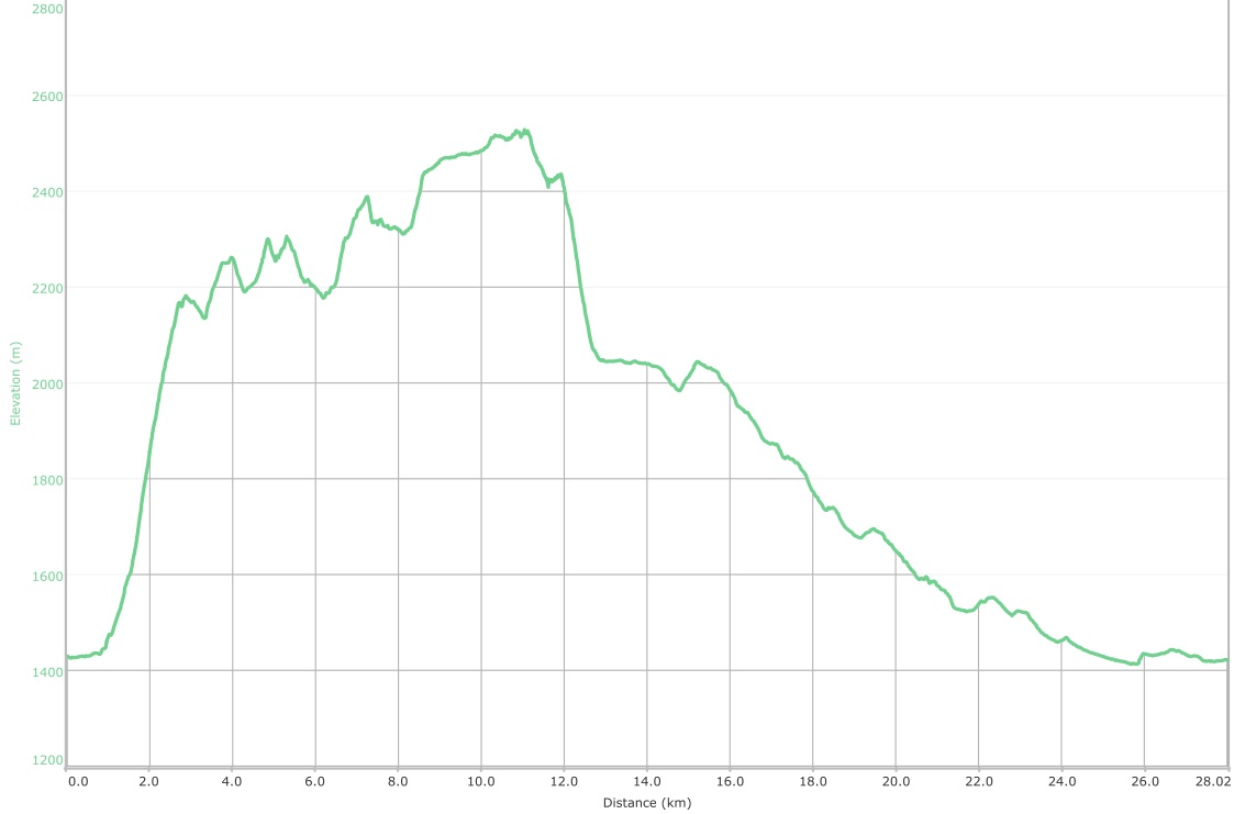
The view down the boulder field from the 3/4 mark. There are some huge larches on this mountain.

Jollin and Andrew approach a massive boulder near the crest.

To provide some scale as to how huge this boulder was, Jollin volunteered to stand at the base.

Jollin is a technical climber and after ascending for about 1.5m, he determined that its face would make a good technical climb.

Jollin and Andrew ascended climber’s left of the boulder while I went climber’s right. My way proved a bit faster. Here, Jollin is standing triumphantly on top of the massive rock.

The cliff face was extremely colourful.
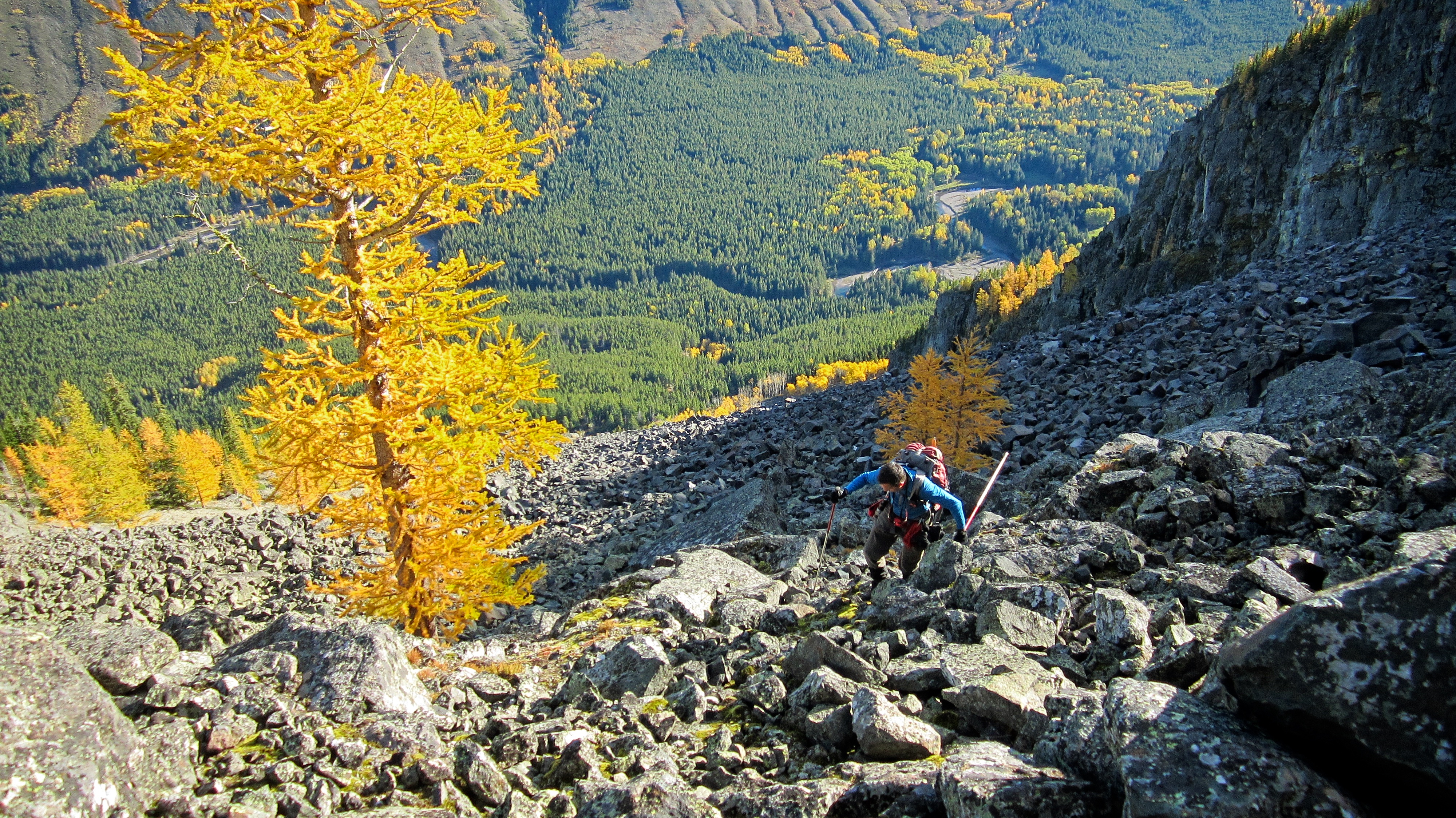
On the crest and looking west at Barnaby Ridge. The point in the centre is known locally as, ‘The Amoeba”.

The view north is highlighted by a snow-capped Centre Peak on the Livingstone Range. Hillcrest Mountiain, Maverick Hill, Poker Peak, and Carbondale Hill are in the centre. Byron Hill is on the right and in front of Centre Peak. Cherry Hill is a nondescript bump on the left.

A partial view to the south up the valley. Grizzly Lake is located in the basin in the centre. Edit 3 July 2017: After recently completing a traverse from Southfork Mountain to Grizzly Lake, I believe that a multi-day loop from Lys Ridge to Southfork Mountain is possible. Due to a scrambling section on the southern end of Barnaby Ridge, I would recommend starting with Lys Ridge as opposed to Southfork Mountain.

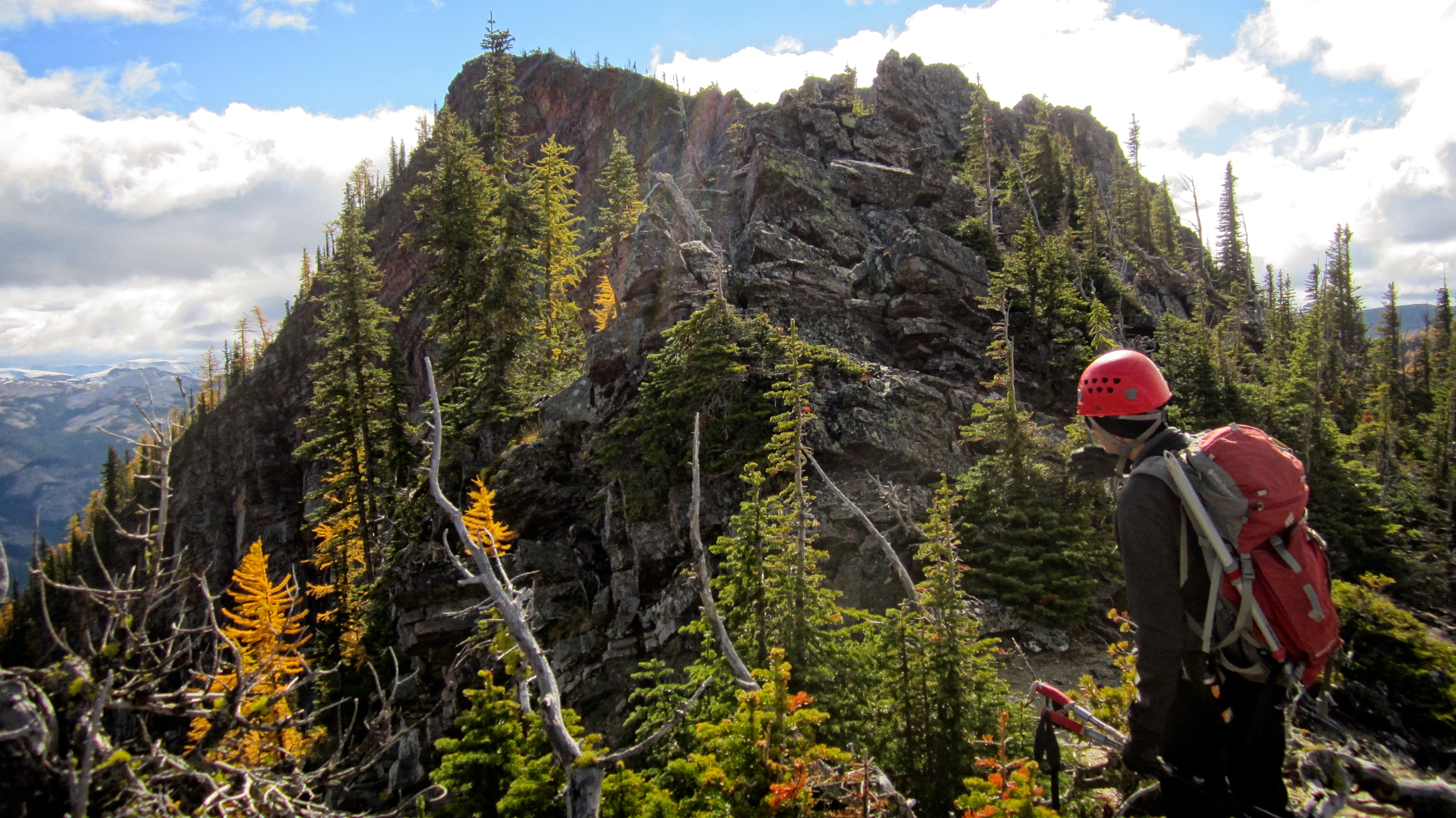
Some moderate scrambling was needed to get past the cliff band which guards the next section of ridge. We found two weaknesses that were located immediately to climber’s right.

Andrew chose to scramble up the weakness in the centre and Jollin and I went up the weakness on the far right.

Looking back at Jollin as he emerges from the weakness near the crest of the ridge.

Andrew casts a cool silhouette in the morning sun.
On the ridge crest and looking north. Barnaby Ridge is on the left.
Our initial view south along the ridge from near the top of the cliff band. Neither West Castle nor the summit of Lys Ridge can be seen from this vantage.

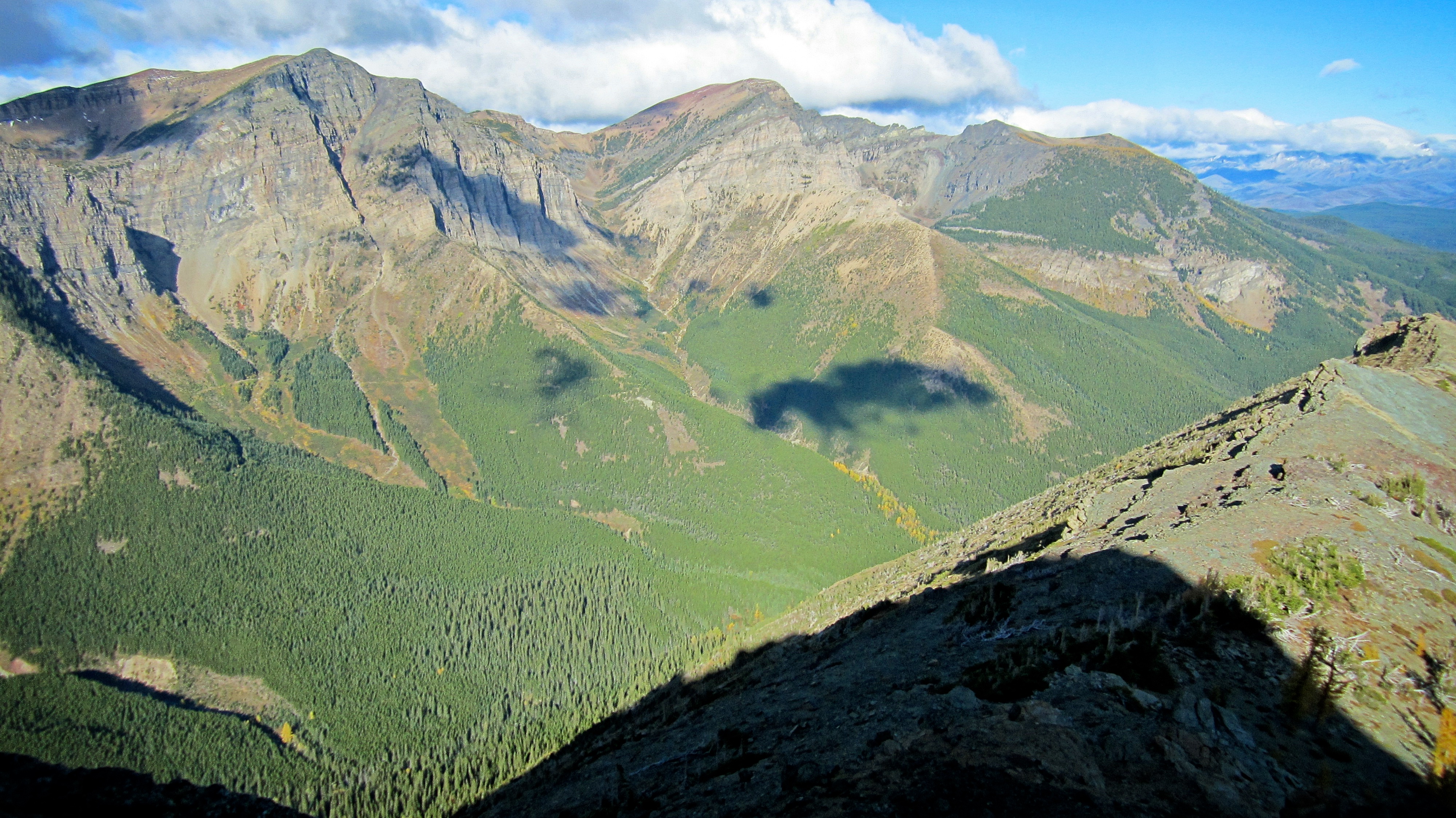
Castle Peak and Windsor Mountain provide a fine backdrop as Jollin and Andrew enjoy a break after our scramble up the boulder field and cliff band. Also note Andrew’s awesome Calgary Stampeders toque. You gotta love hiking with a guy who cheers for the right team!

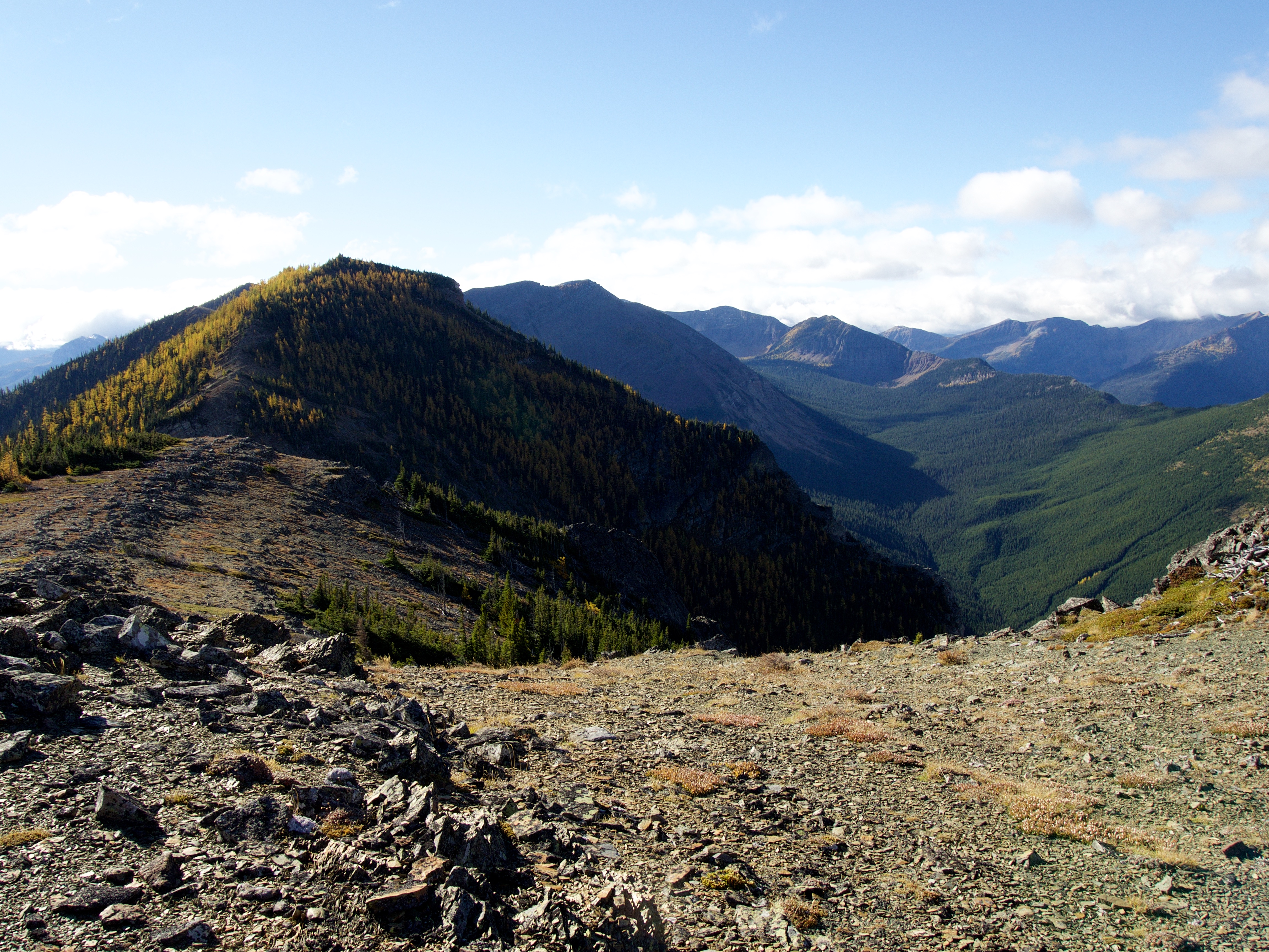
Heading towards West Castle which is the next high point on the ridge past this one.

Lys Ridge is all about colour. After ascending black igneous rock in the boulder field, we came across this large slab of brightly coloured yellow rock which ran for quite a ways down the northeast face. I think (actually my friend Jonathan thinks) this might be calcareous argillite based on its layered pattern – though it might also be limestone or dolomite.

The view north as Andrew hikes up the first high point on the ridge. The slab of yellow rock is behind him.

The rock changes to bright red argillite at the top of the first high point.

From the top of the first high point, West Castle can be seen directly in front of Jollin while its twin peak is on the left.
The view to the northeast is accentuated by red argillite and yellow larches. From left to right: the Whistler Fire Lookout, Whistler Mountain, ‘Table Top’, ‘Eagle Peak’, “Frankie Peak”, “Larry Mountain”, Mount Gladstone, and North Castle (far right).

A nice goat trail made it easy to reach the base of West Castle.

The goat trail let us bypass the small bump on the left.

Castle Peak and Windsor Mountain were a constant feature to the east.
A small cairn (perhaps left by Rick Collier) sits on top of West Castle (2316m).
It is called West Castle because it lines up directly to the west of Castle Peak.

Looking back at our route along the ridge. It is ~2km from the top of the cliff bands to the summit of West Castle.

At this point, it wasn’t clear on Andrew’s topo if this was the summit of West Castle, or if it was the peak just to the north – or if they both were… Since they were so close to each other, it made sense to us that if the second peak was higher, then it must be the summit.

Jollin uses an old trick to determine if the twin peak is higher while Andrew feigns a mugging.

Unsure if we were on the summit or not, we headed over to the twin peak which was located ~470m away.

Moderate scrambling was needed to reach its summit

Jollin picked our route up the rock.
Getting close, but further scrambling was required.

The northeast face of what I flagged on my GPS as “West Castle 2” is quite impressive. The final bit of moderate scrambling can be tackled head on or avoided by keeping climber’s right.

The true summit of West Castle can be seen behind me as I arrive on the summit of “West Castle 2”. (Photo by Andrew Nugara)

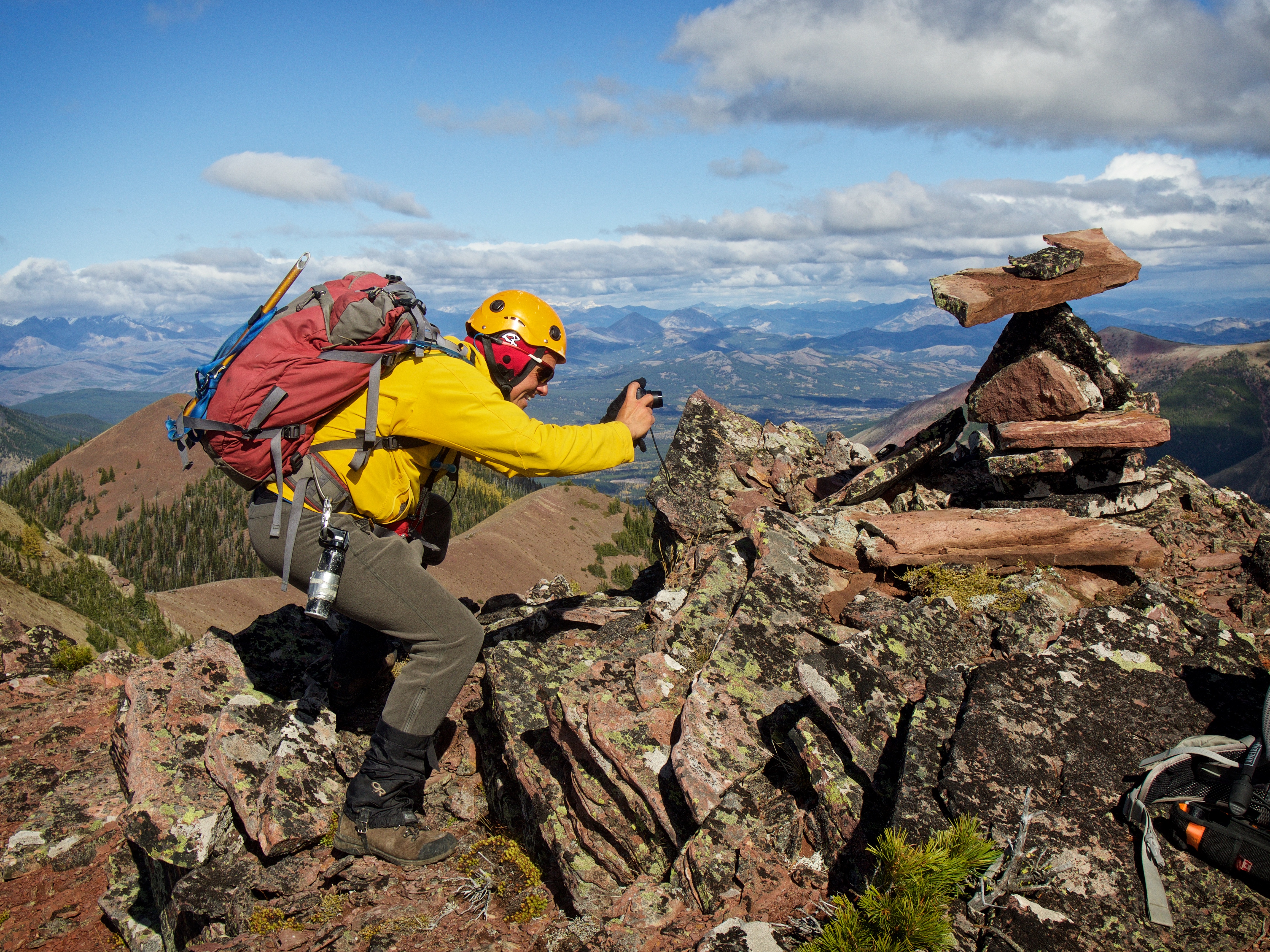
Even though our individual GPS readings were vastly different, we determined that “West Castle 2” was ~7m higher than West Castle. At this point, we still weren’t sure if this was the actual summit, so we celebrated like it was. Feel free to marvel at Jollin’s meticulously balanced cairn because it cost Andrew $20 after he bet that it couldn’t be done.

We eventually concluded that “West Castle 2” couldn’t be the summit because it doesn’t line up exactly to the west of Castle Peak. It does of course, offer an excellent view of said peak as well as Windsor Mountain. The summit of Victoria Peak can be seen to the left of Castle Peak while the high point of Victoria Ridge is on the far right. The front range mountains had much more snow on them after last week’s inclement weather.
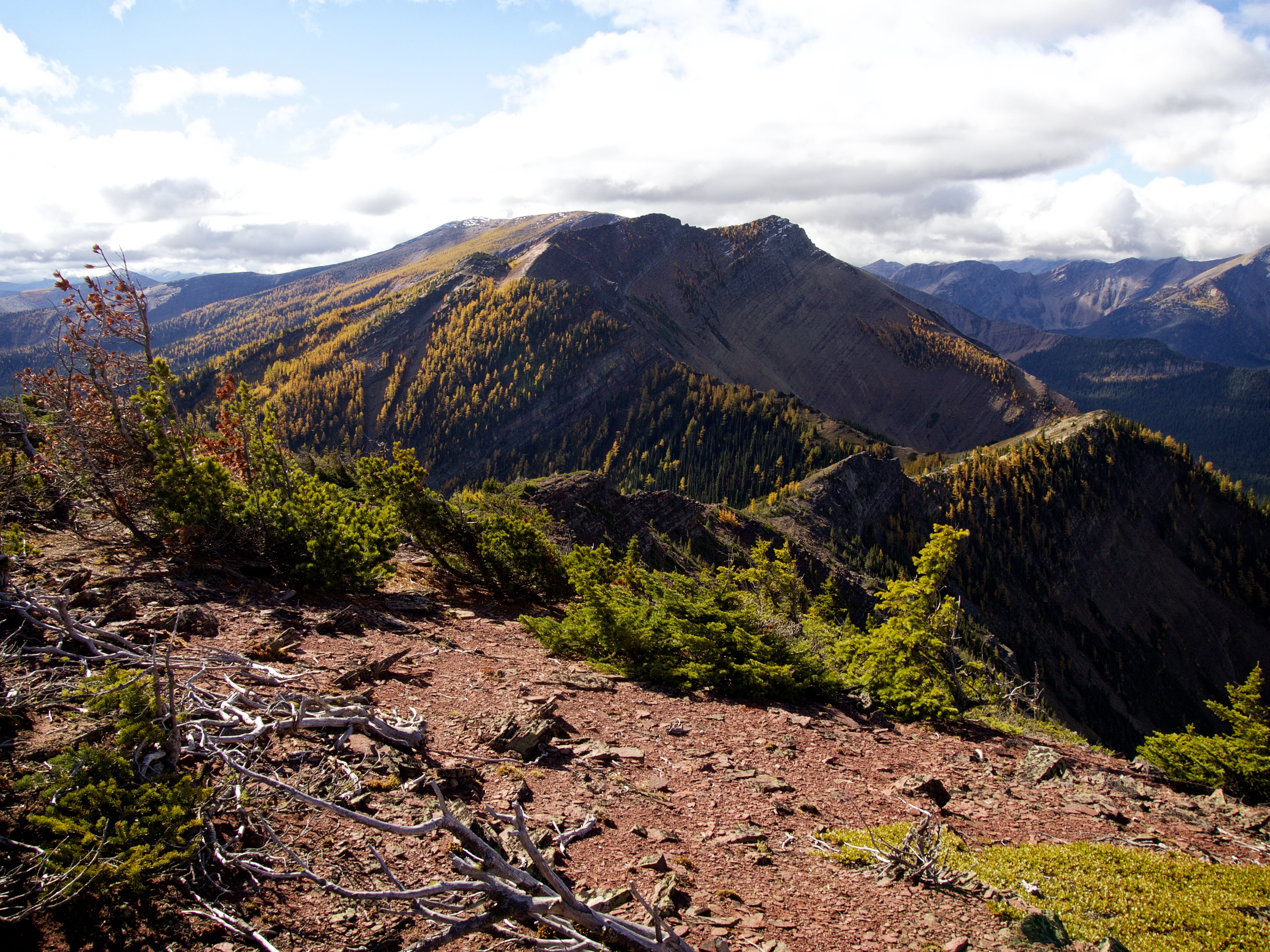
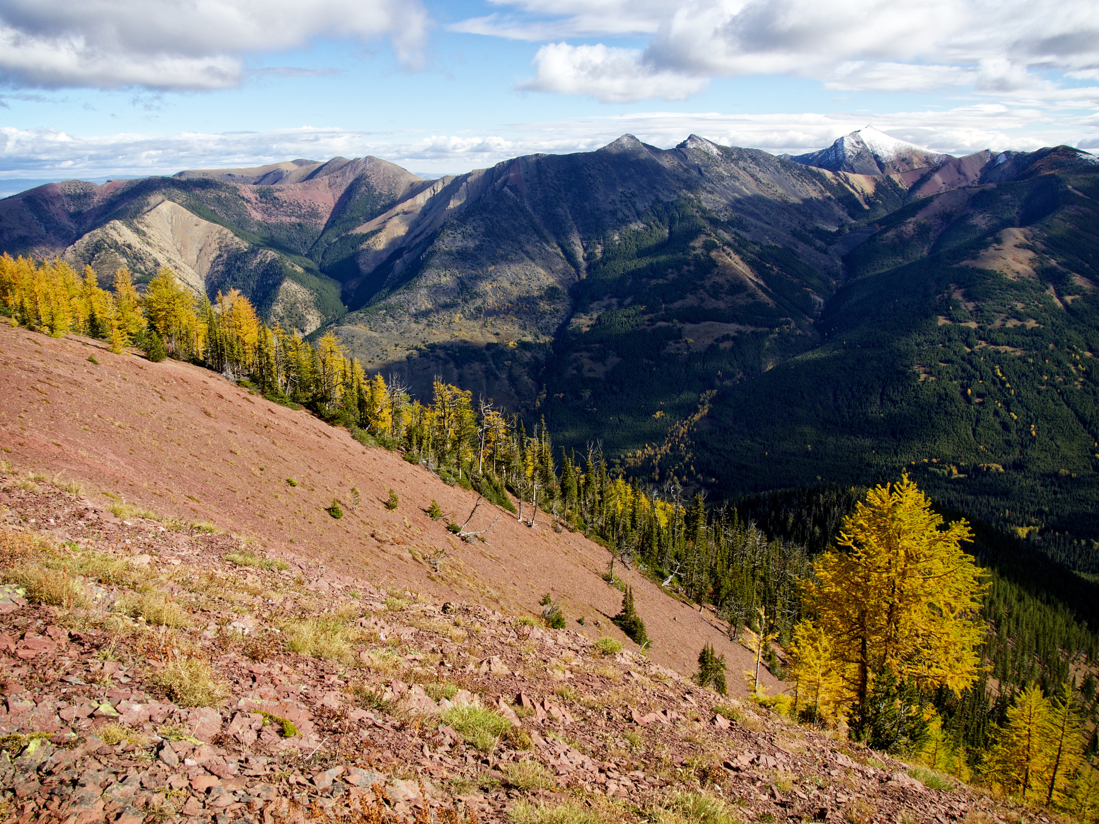
The view north along Lys Ridge. Our next destination for the day, the summit of Lys Ridge, can be seen in the far distance to the left of centre.
The view north at West Castle as well as our route along the ridge. So much colour!

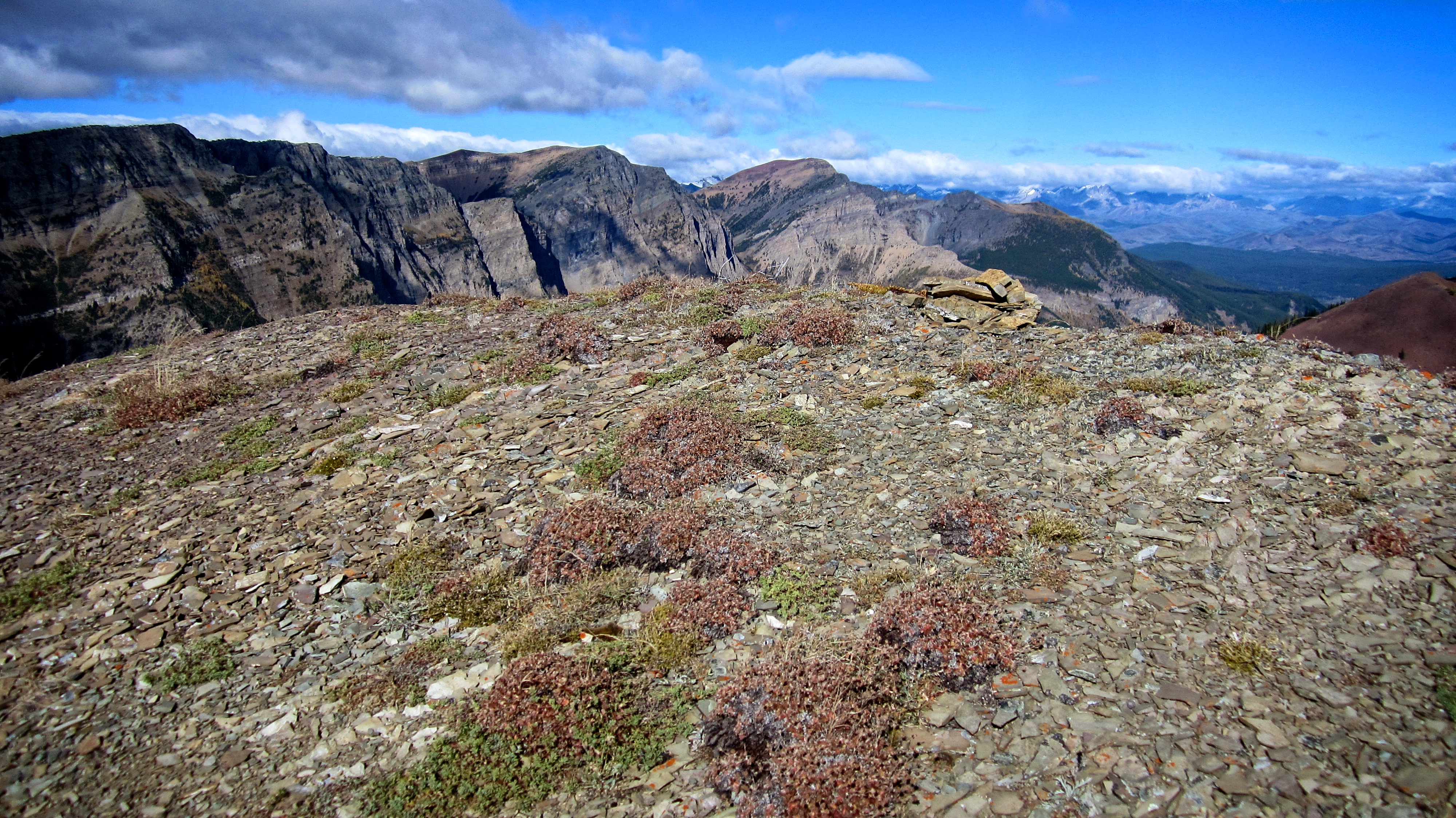
Looking northwest at Barnaby Ridge.

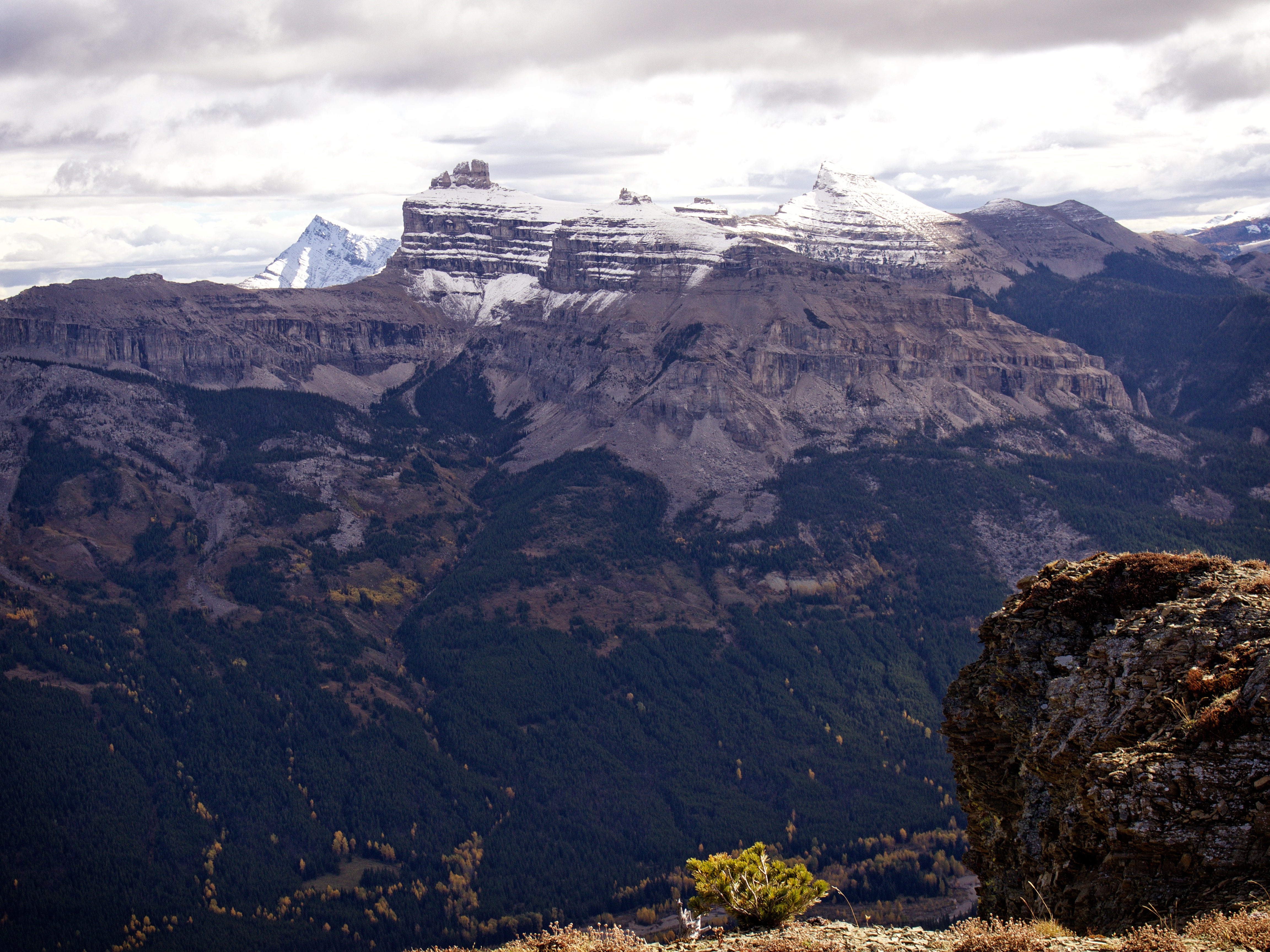
Tombstone Mountain (centre) and Mount Haig (right of centre) can be seen to the west.

The view to the southwest includes “Jake Smith Peak” (left), Rainy Ridge (centre), Three Lakes Ridge (centre), “Krowicki Peak”, “Mount Miles”, “Middle Kootenay Mountain”, and Tombstone Mountain (far right). “Mount Miles” was unofficially named by Andrew in honour of his good friend, Miles Krowicki, who passed away a few years ago. He also named a neighbouring peak as “Krowicki Peak”. You can read Andrew’s trip report for “Mount Miles” and “Krowicki Peak” here.

Since we didn’t get a summit picture on West Castle, this one will have to do…

One last view back to the north at the true summit of West Castle.
Andrew, the physics teacher, still can’t believe that Jollin was able to balance the rock on top.

We now set off on a ~5.7km traverse to the summit of Lys Ridge. Click here to continue to my Lys Ridge report.


Leave a Reply