

⚠️ Hiking and scrambling are inherently dangerous activities. Please read my Disclaimer. ⚠️
Back in January, Andrew and I got a taste of the scrumptious scrambling that can be found on the northeast end of Loaf Mountain, as we first sampled “The Muffin” and “The Croissant” before taking a good-sized bite out of “Bakery Peak”. That experience left us with the desire to return as soon as possible to reattempt “Bakery Peak” and finally put the icing on the cake. Whisk forward to today and we were back at the trailhead and ready to cook up another adventure on “Bakery Peak”.
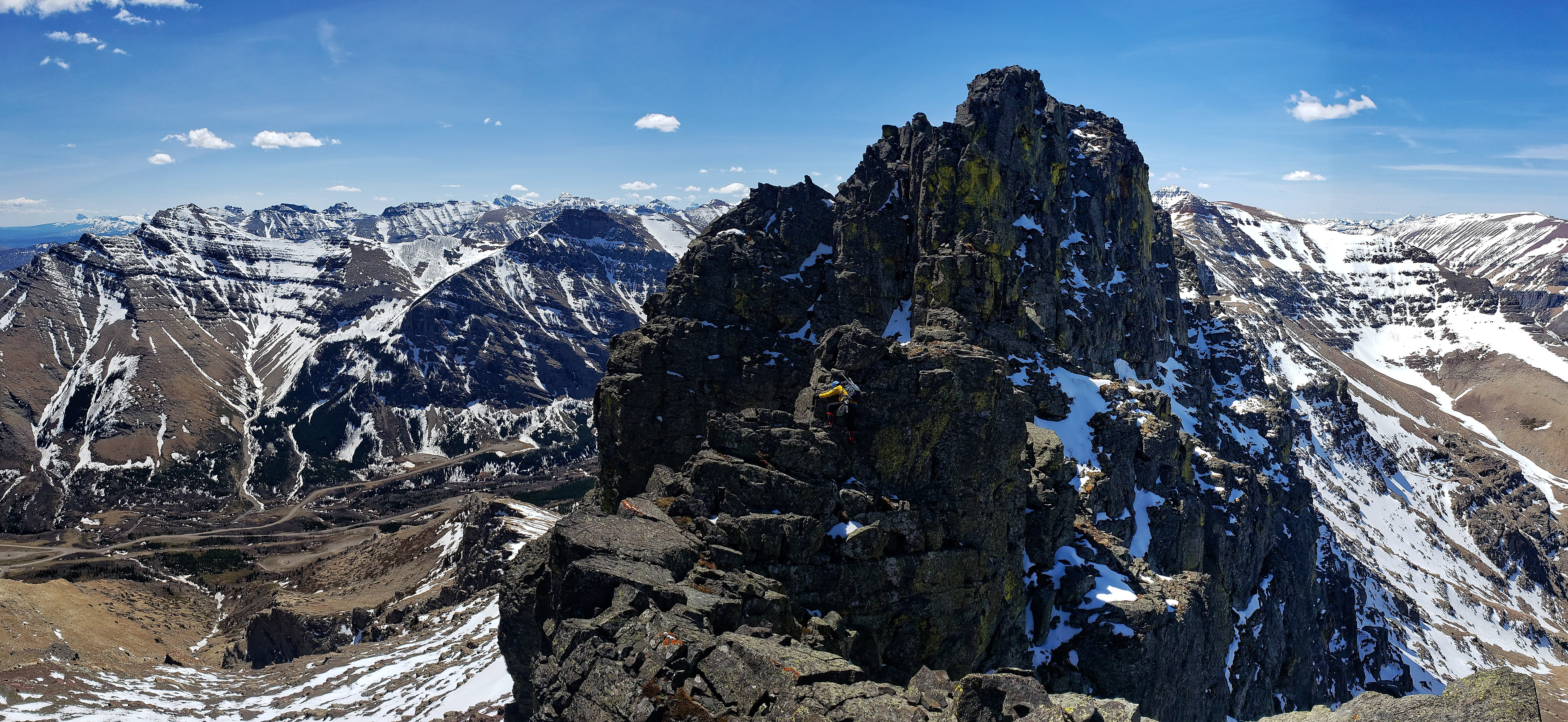
Puns aside, this was an excellent trip. Both Andrew and I agree that the scrambling along the ridge up to “Bakery Peak” is on par with some of the best scrambles in the Castle, with the summit itself being an impressive tower of igneous rock that rises dramatically from the surrounding argillite. Indeed, as we discovered, the actual summit is wholly inaccessible to scramblers without the use of technical gear. Though we traversed the entire southern perimeter of the summit block, we could not find a way up that we would be comfortable down-climbing without a rope. We tried several tempting couloirs and gullies, but they all ended with the universal comment, “Well I could climb it but wouldn’t want to down-climb it.” Yes, discretion is sometimes the better part of valour.
That being said, we did tag what I would call the ‘scrambler’s summit’ of “Bakery Peak” and by itself, it’s no small consolation. It sits less than 40m in distance from the technical summit and at ~2410m in elevation, it looks to be only ~20m or so lower. To reach it requires climbing (and down-climbing) a narrow couloir that is somewhat friendlier than it looks from afar. Once on top, you are separated from the technical summit by a narrow and highly exposed ridge that can only be traversed for a short distance before it suddenly becomes rope and harness territory. The views from the scrambler’s summit (and the quality of the overall trip) make it a worthwhile destination for anyone who loves to explore obscure Castle peaks.
I would also recommend traversing the southern perimeter of the summit block as there are some terrific pinnacles to visit and beautifully coloured rock to admire along the way. I look forward to once again returning to tag the unnamed middle summit of Loaf that I have taken to calling, “Pastry Peak”. As part of our trip, we also retagged the summit of “The Croissant” because one croissant is never enough. 😉 Finally, as awesome as the scrambling and scenery were, it would not be the same experience without great company, and so I am thankful to have spent yet another day with Andrew Nugara. His enthusiasm is contagious and it never fails to enrich my own sense of wonder about the world we live in.
Be sure to read Andrew’s trip report!
To get to the northeast end of Loaf, drive ~19.5 km south from Pincher Creek on Highway 6 until you reach the Shell Waterton Plant Road (Township Rd. 43A). Turn onto it and drive west for ~9.1 km until you come to a junction with a gravel road near to the entrance of the plant. Turn left and onto the gravel road and continue for ~3.9 km until you reach Butcher Lake. Turn left and onto another gravel road immediately prior to the Lake and follow this road for ~1.4 km until you come to the junction with another road on your left. Turn here and follow it for ~5 km until you arrive at a T-intersection. Turn left again and proceed for 700m until you see a hairpin curve on your right. Follow the curve and drive for ~3.5 km until you reach yet another T-intersection. Turn right and drive for ~800m until you reach a fork in the road. To the right is the gate for the road that leads up the Spionkop Valley. This is the trailhead.
From the gate we walked along the road for ~1.3 km until before coming to a drainage the crosses the road. After backtracking for a few metres to more open slopes, we then left the road and hiked up to look at a waterfall along the drainage. From the waterfall, we took two different routes to the summit of ‘The Croissant”, with Andrew continuing inside the drainage and myself, sticking to the ridge line. After a brief snack on the summit, we descended to the col with “Bakery Peak” and began the steep hike up to the ridge. The really fun route finding and scrambling begins approximately 700m from the col (230m elevation gain) where the grade eases somewhat.
Once on the ridge, the scrambling is excellent as you travel for ~730m along a series of large steps that can be tackled head-on or bypassed – usually by trending climber’s left. Once on the summit ridge, it was scenic ~320m hike to reach the couloir that leads up to the scrambler’s summit. After enjoying the views, we then descended to the southern side of the summit block and eventually followed it until we regained the main ridge that is located to the southwest of the summit. We then descended directly to the south down a drainage that ended up at the base of flare stack. From here, we followed the road for ~4.5km back to our vehicle.

This seems like a good time to do an update on the Garmin Fenix 5X that I purchased last February, as this is the longest trip that I’ve made with the device. I’ve recalibrated it a couple of times, but did not do so before this trip. As a result, I believe that it has not recorded an accurate reading of the summit elevations. I know this because the last topo line on the map for “Bakery Peak” is 2400m while my Fenix 5X registered the scrambler’s summit at only 2371m. The manual says it’s supposed to auto-calibrate when the GPS is activated, but this is not always optimal depending on location and environmental factors. The next time that I use it for scrambling, I may try the ‘mountaineering’ activity as opposed to the ‘hiking’ one as this may (or may not) prevent some of the false points that I have detected and cleaned. Regardless, I have made some adjustments within the menu/settings/activities & apps/hike/hike settings such as turning on Auto Pause, 3D Speed On, 3D Distance On, and GPS + Glonass. I’ll turn these on in the ‘mountaineering’ activity too. Finally, the battery was at 95% when we started and at the end of the day – a total of 9 hours and 25 minutes – the battery was at 17%. Thus, if I were going to take it on a multi-day trip, I would definitely need to bring a USB charging pack. I have been wearing the device in daily life almost 24/7 and have really enjoyed it. However, I’m still not convinced that it’s a major upgrade over my old 2012 Garmin Vista HCx when it comes to hiking, so I will keep giving updates as I go.
With that preamble as a qualifier, our total distance travelled was 18.9km with total elevation gains of 1165m. Our total time was 9 hours and 25 minutes.

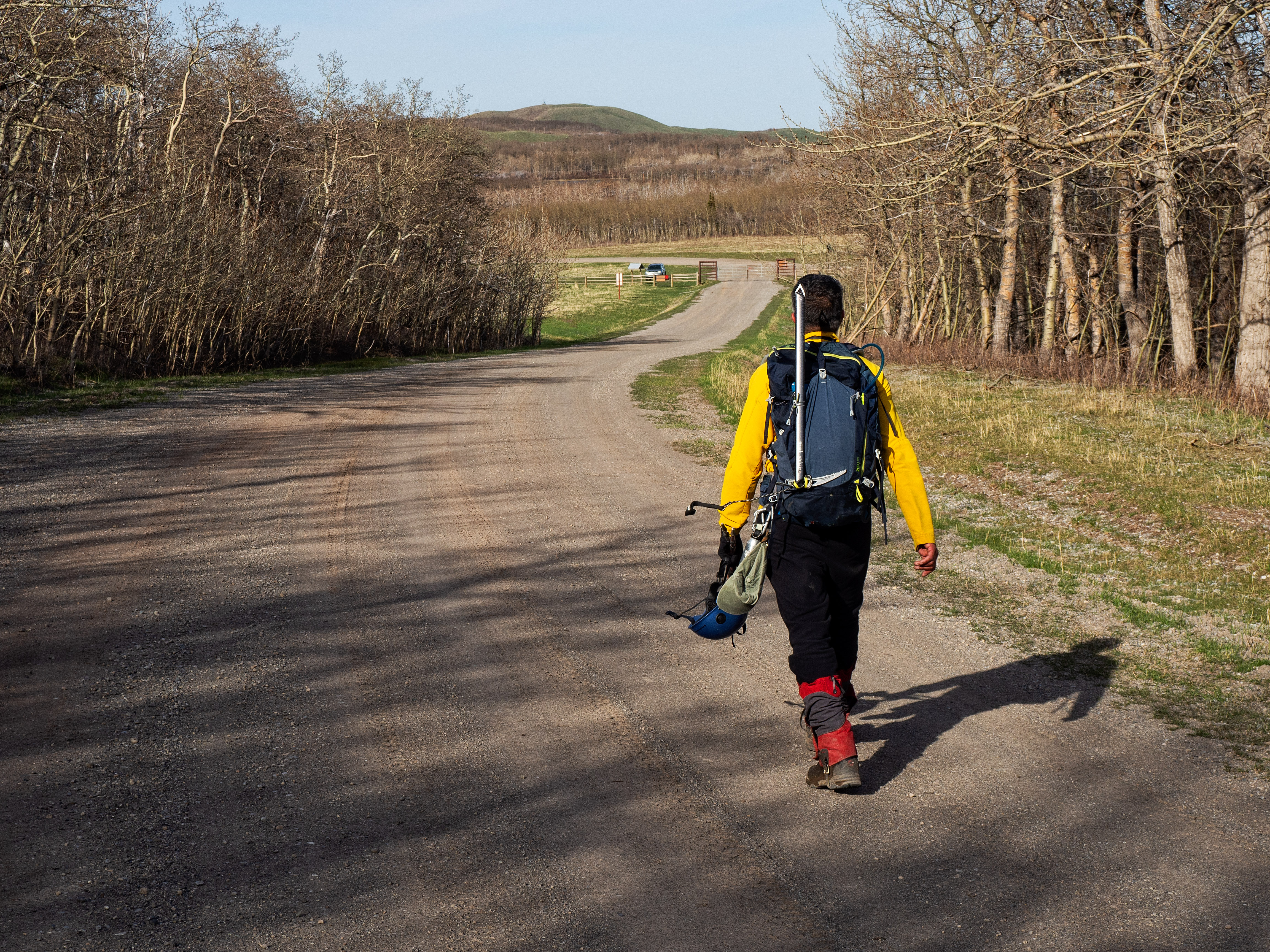
Gearing up at the trailhead on a gorgeous spring day! We were surprised that we saw only one other vehicle in the area all day, and it was just passing through. “The Muffin”, which we elected to bypass this time, is behind Andrew.

Enjoying an easy approach alongside Spionkop Creek. “The Eaglet” and “Raptor Peak” are the two foothills on the left while the summit of Spread Eagle Mountain is in the centre.

My new Outdoor Research ‘fig’-coloured sun cap (it was an awesome deal on clearance!) seemed to match many things on this trip. In this case, I coordinate well with all of the pipes in the background. 😉 (Photo by Andrew Nugara)

The last time we were here, this was an impressive frozen waterfall.

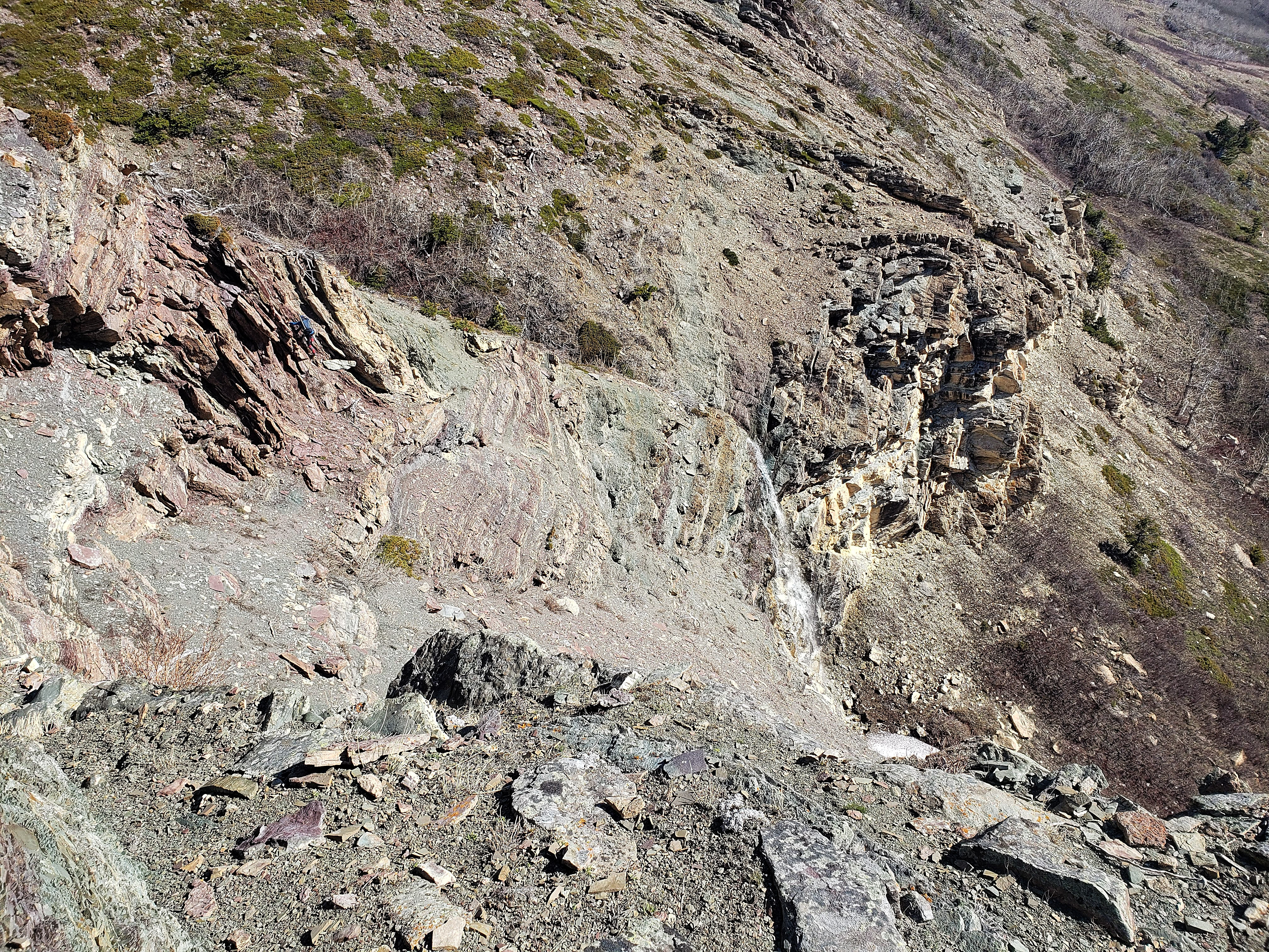
Leaving the road to check out the waterfall and the cool rock that surrounds it.

Andrew hikes past a lovely little crocus.

Arriving at the the interesting section of rock that we could see from the road.
I don’t think Andrew has ever come across a section of lichen-covered rock that he hasn’t liked! Here, he attempts a to use the Vulcan mind meld to become one with the lichen. 😉

The morning sun accentuates an impressive overhang.

Andrew gazes upwards from the base of the waterfall. Nearby, we found some cordelette that had been left behind by ice-climbers.

Starting up the slope that is located to climber’s left of the waterfall.

The view after gaining a bit of elevation.
Here is point where our paths would diverge. Andrew would head up and over the rock on the far right in order to follow the drainage, while I would head to the far left and onto the ridge.
Lots of options for scrambling.
If you look closely at the darker rock on the upper far left, you will see Andrew (in blue) scrambling up and over it.

A telephoto of me from Andrew’s location in the previous picture. As a fly fisherman, this pose is my natural response when someone says they want to take a picture of me. 😉 (Photo by Andrew Nugara)

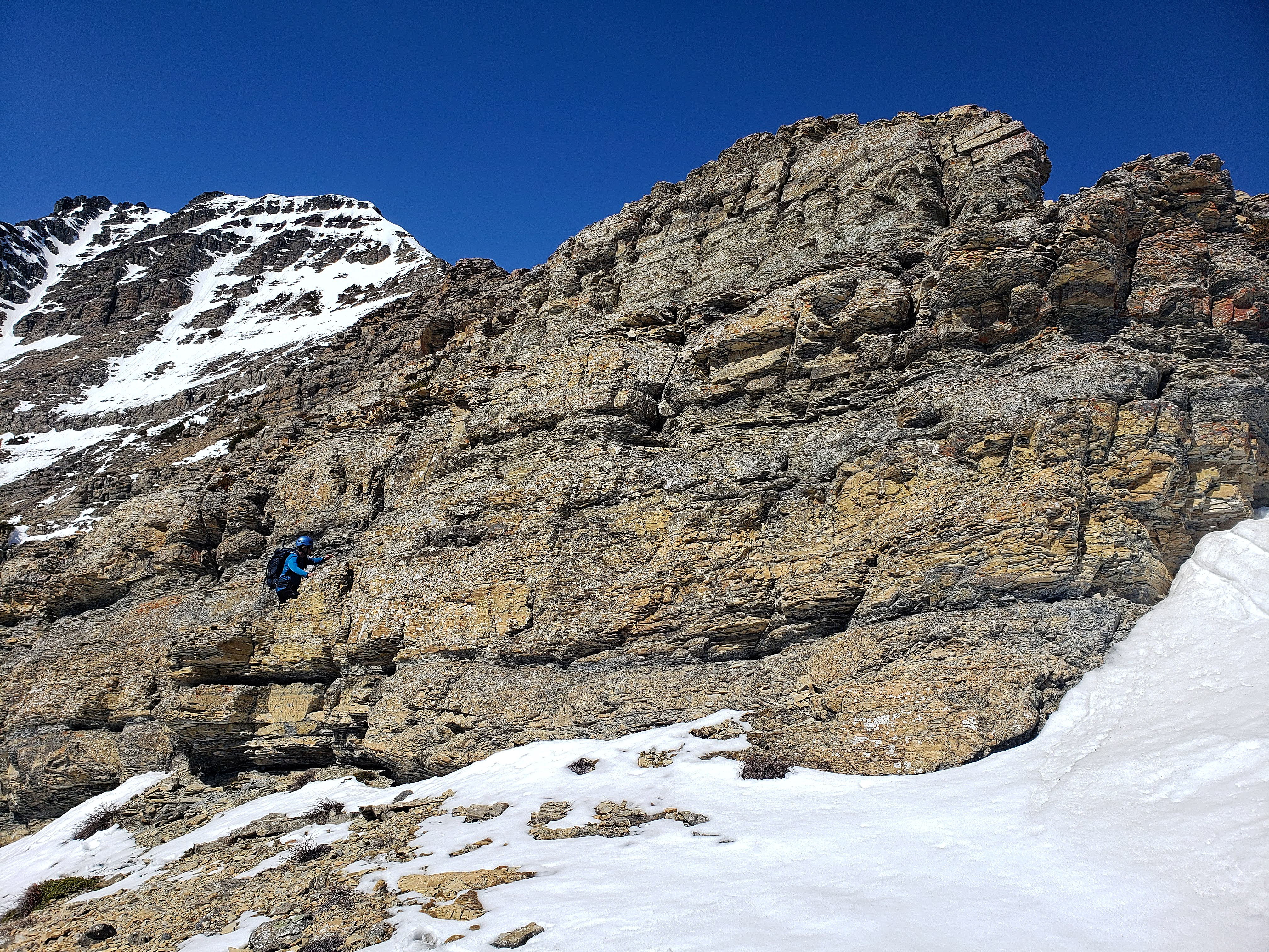
Further up, I found these amazing strips of green, red, and magenta argillite.

A closer look at the incredible colours.
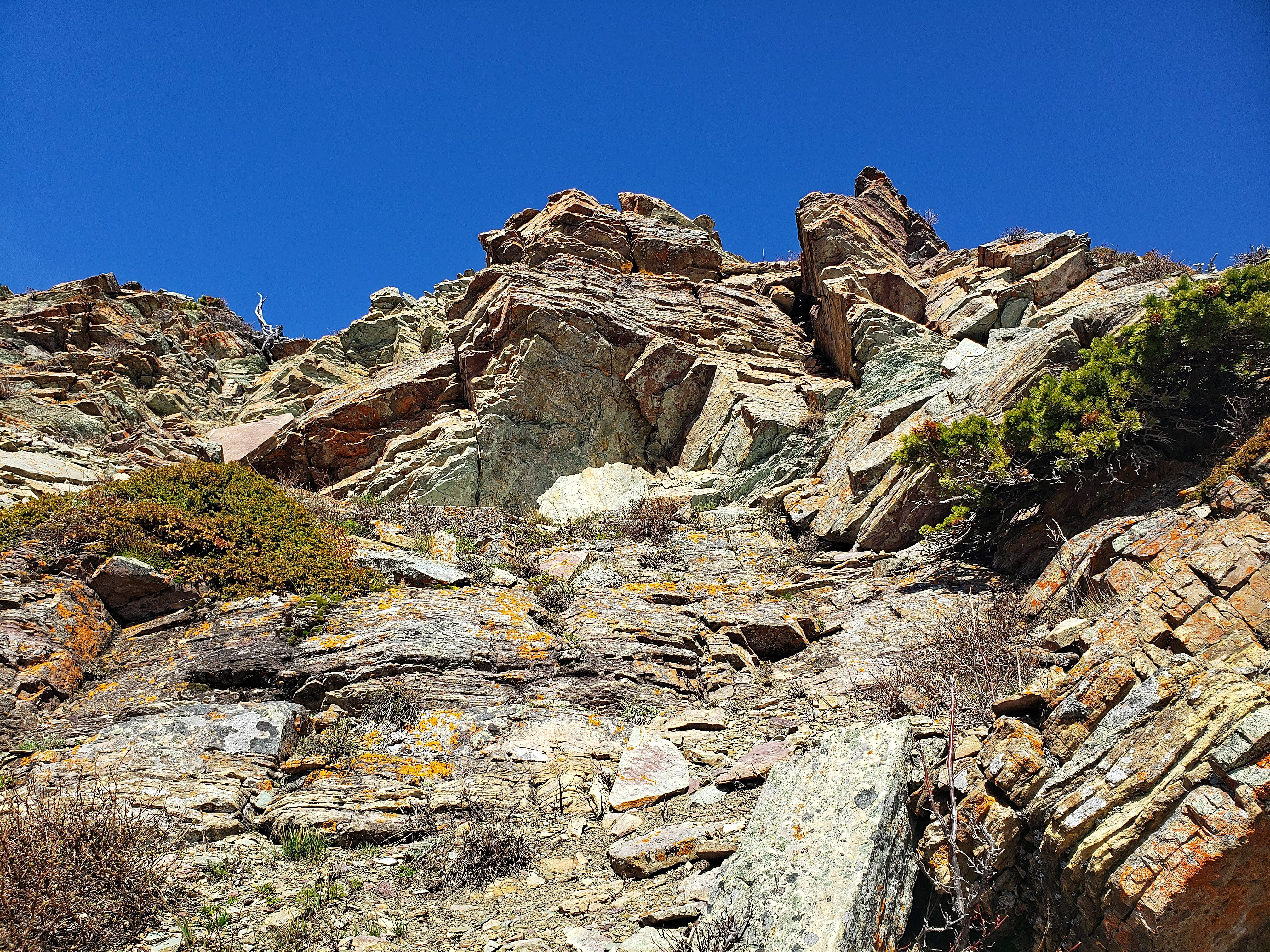
Encountering more interesting rock as I scramble upwards.

The view back at our approach route along the road.

Let’s play, “Where’s Andrew?”…

Ah ha! A telephoto of the previous picture shows him enjoying his trip up the drainage.

Here’s a quick look of what Andrew was experiencing in the drainage. (Photo by Andrew Nugara)

Another shot of what Andrew was experiencing inside the drainage. Now that’s some sweet argillite! Be sure to read Andrew’s trip report to see more. (Photo by Andrew Nugara)

Meanwhile, back to me on the ridge… The summit of “Bakery Peak” is on the left and the summit of “The Croissant” is on the right.

Looking down to Andrew (centre) as I close in on “The Croissant’s” summit. His route up the drainage is laid out nicely behind him. My route along the ridge is on the far right.

Arriving on the summit of “The Croissant” (2037m). In the background to the south are (from left to right): “The Eaglet”, “Raptor Peak”,and Spread Eagle Mountain.

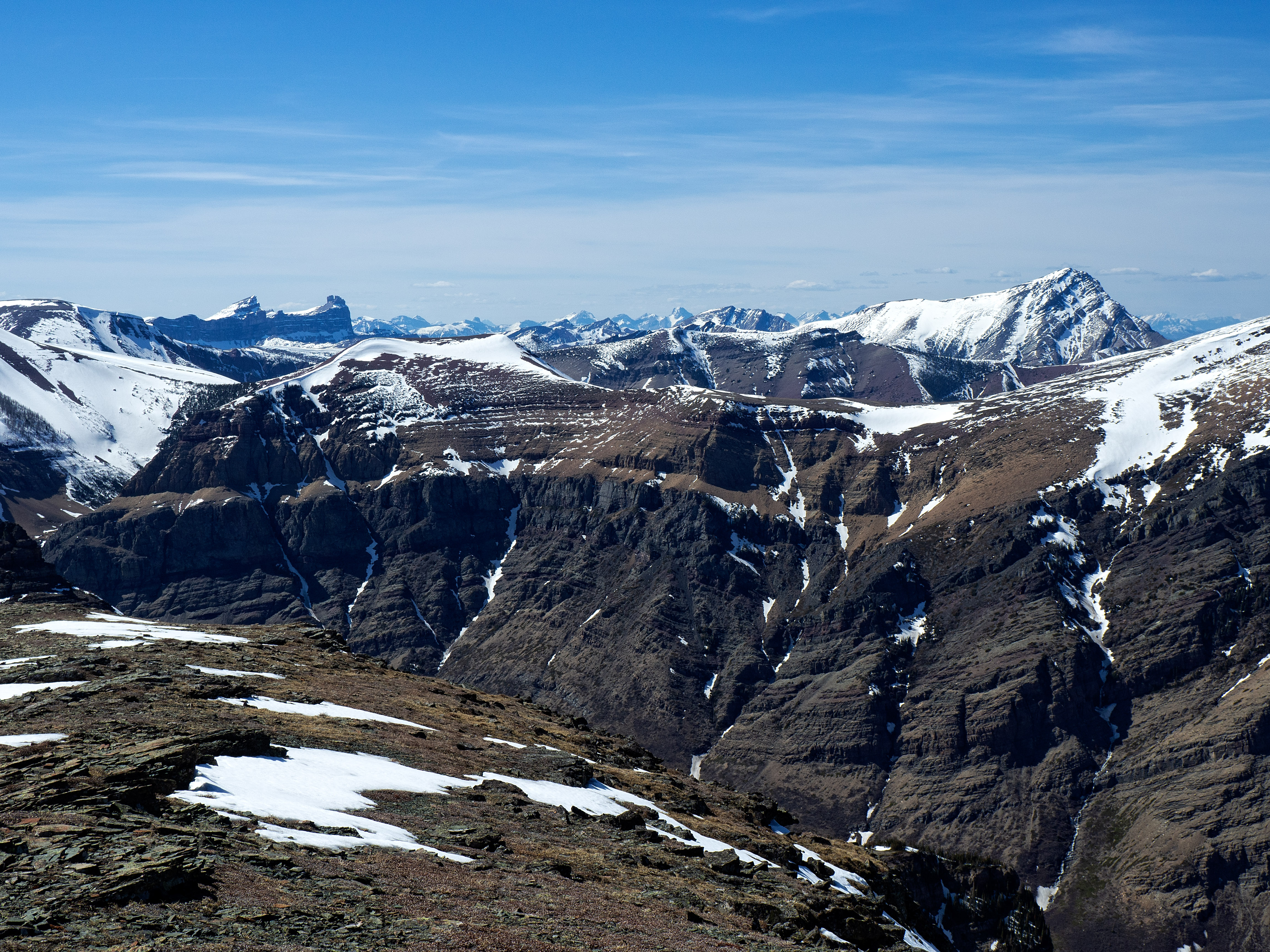
Looking southwest (from left to right) at “Bakery Peak”, the Southwest Summit of Drywood, and Drywood Mountain.

A closer look at Drywood Mountain with “Stumpy” and Prairie Bluff Mountain on the right.

Andrew creates a new recipe on the summit by adding an effervescent berry-flavoured Nun tablet to green apple Gatorade. He won’t sample it until later in the trip…

Heading down to the col between “The Croissant” and “Bakery Peak”. Without using hyperbole, the awesomely fun section of scrambling begins at the cliffs on the upper left and continues along the entirety of the ridge. Reaching this from the col requires an elevation gain of ~230m over a distance of ~700m.

Andrew found something else that I match! 😉 (Photo by Andrew Nugara)

A nice little trail leads up from the col.

Getting close to the fun part!

Ah, right where we found it back in January. ‘A’ for Andrew… or the Avengers!
A similar shot from the last time we were here, only this time under sunny skies.
Now on the ridge, I check out the first of many steps to scramble. (Photo by Andrew Nugara)
Andrew ascends it using the same hidden gully that we used last time. I’m glad it’s still there! 😉

Looking up the short gully.

Tackling the next step.

Andrew approaches the formidable third step. We would head climber’s right and use the same weakness as last time.

Traversing toward the weakness in the rock.

This is much easier than last time thanks to a lack of ice and snow.

And yet another step to tackle…

A nice shot to the east featuring yours truly. (Photo by Andrew Nugara)

It was such a gorgeous day with little to no wind and a temperature that hovered around 20c.

Andrew approaches the giant step that we avoided last time by heading climber’s left.

This time it was free of ice and we tackled it head-on.

Andrew’s view from the top as I scramble up. (Photo by Andrew Nugara)

The moment of truth! Much to our surprise, it was actually delicious. So there you go, just being on the northeast end of Loaf Mountain will inspire you to invent new recipes. Who knew that a physics teacher could also be a proficient chemist? 😉

I check out another large step. Last time we tackled this via a short, but exposed route that can be seen in front of me. Andrew would use this route again, while I would see what it was like to use the small gully that we had used on descent. It’s hidden to climber’s left. (Photo by Andrew Nugara)

Looking up the gully.

Andrew approaches the spot where we were previously forced to turned back.

A telephoto of Windsor Mountain and Castle Peak with the Southwest Summit of Drywood in the foreground on the left.

What was too sketchy to try in January, is now easily overcome.
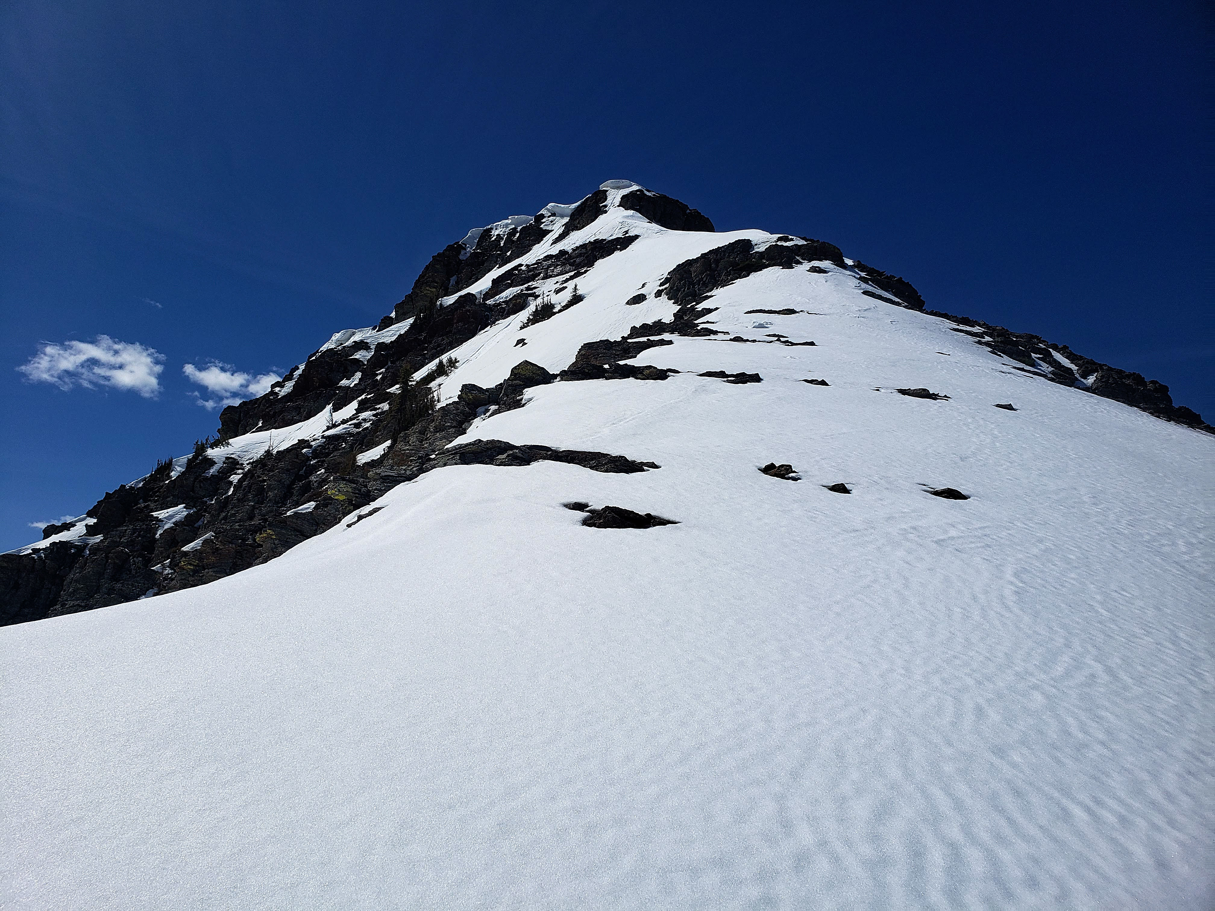
The final stretch before reaching the summit ridge. Those are some impressive cornices!

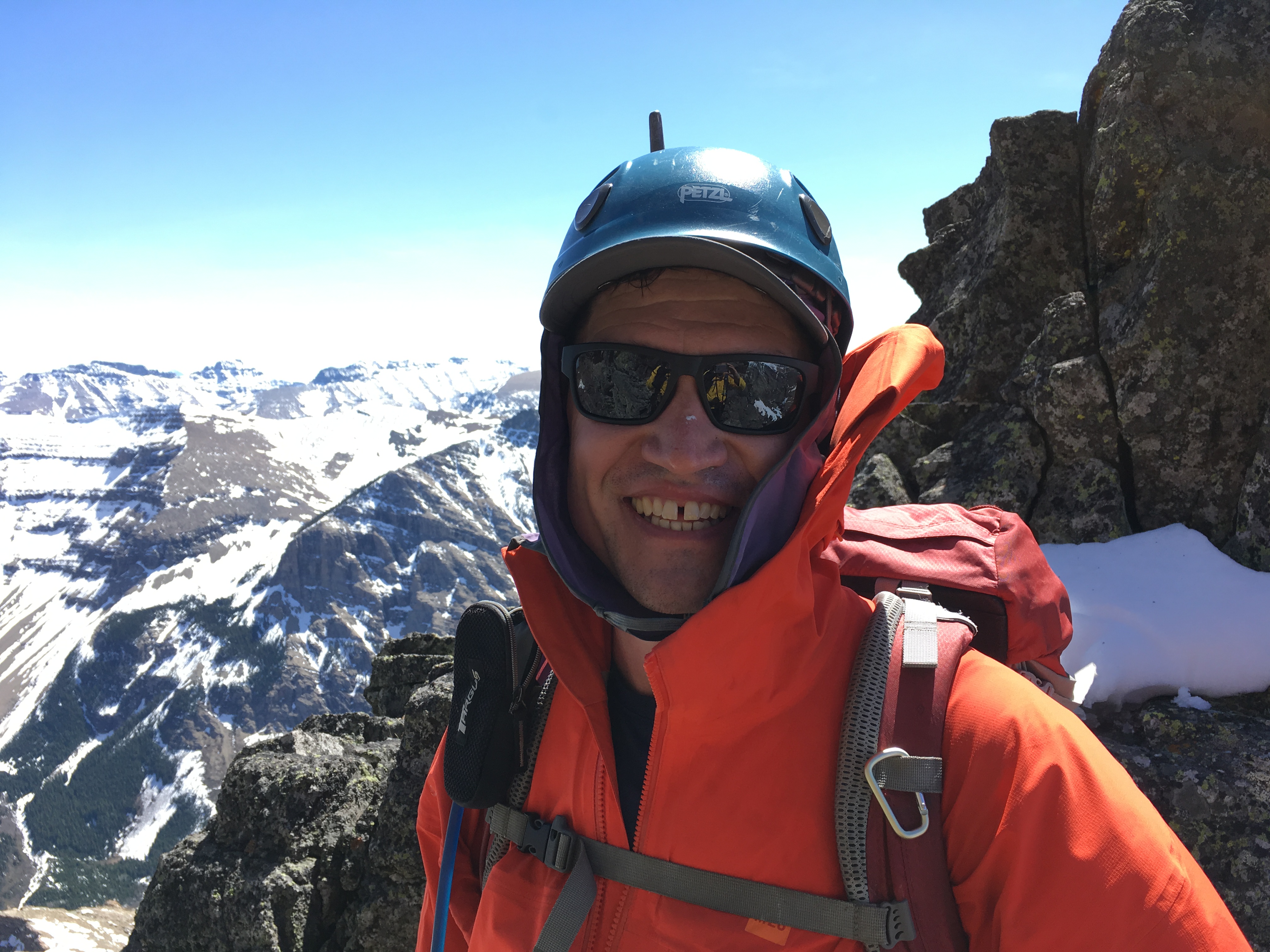
Invigorated from the scrambling and the gorgeous weather – and perhaps from his concoction of effervescent Nun berry tablets and green apple Gatorade – Andrew is all smiles.

The snow was perfect for travel. At this point, we weren’t sure if we would have to follow the base to climber’s right to find our way onto the ridge. Thankfully, it ended up only being a short scramble to the right of the cornice. (Photo by Andrew Nugara)

I encountered a tick on the summit ridge and quickly deployed Raff’s technique to scare it off. 😉 (Photo by Andrew Nugara)

The view back as Andrew follows my tracks. The terrain on either side is steeper than it looks.

Andrew scrambles onto the summit ridge. In the background are “The Croissant” and “The Muffin”.
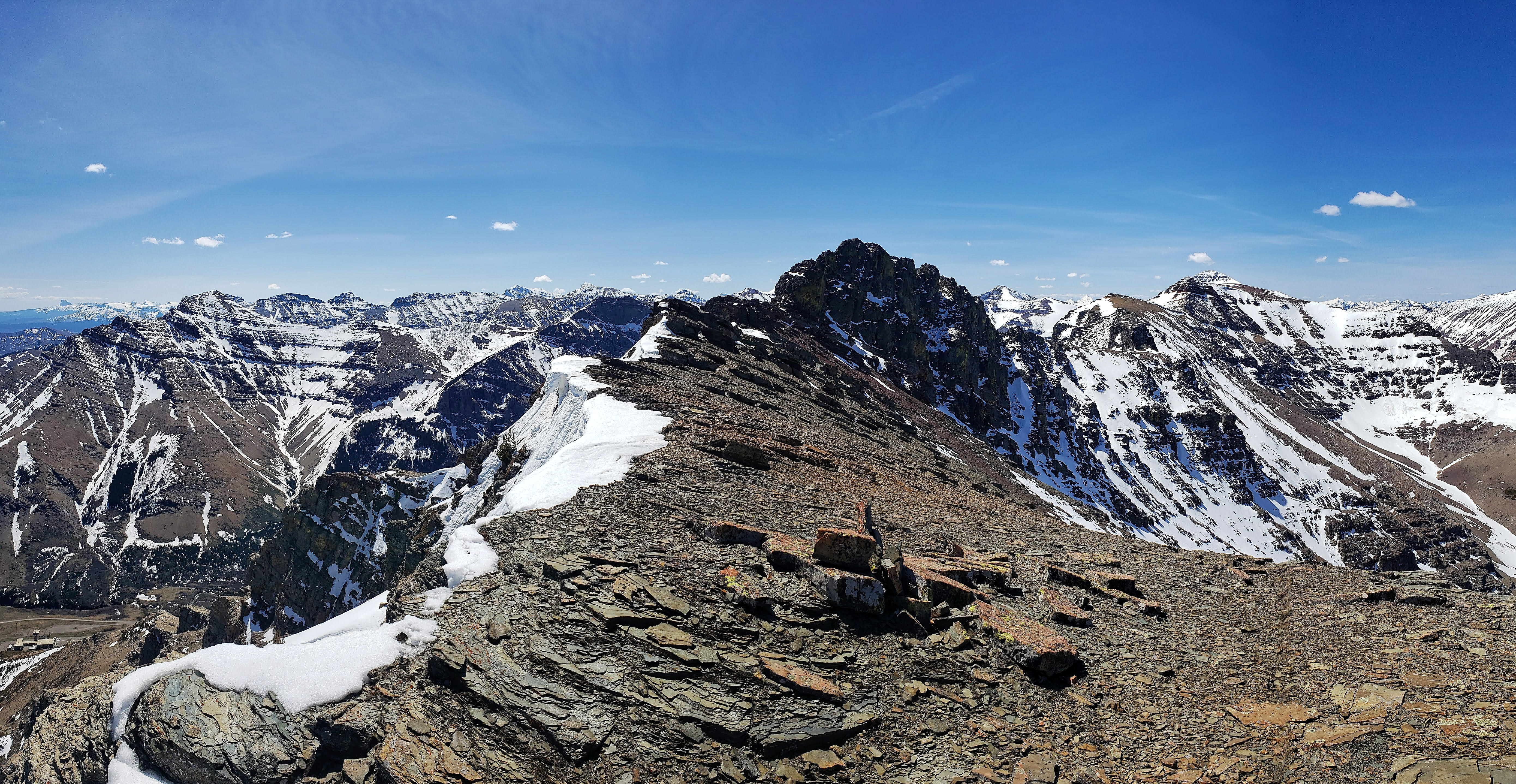
The very cool summit ridge!

The formidable summit block with “Pastry Peak” and the summit of Loaf Mountain on the far right.

Mooned by a mountain! The Castle can be such a cheeky place. 😉

Gazing back along the ridge.

The summit block still looks rather daunting…

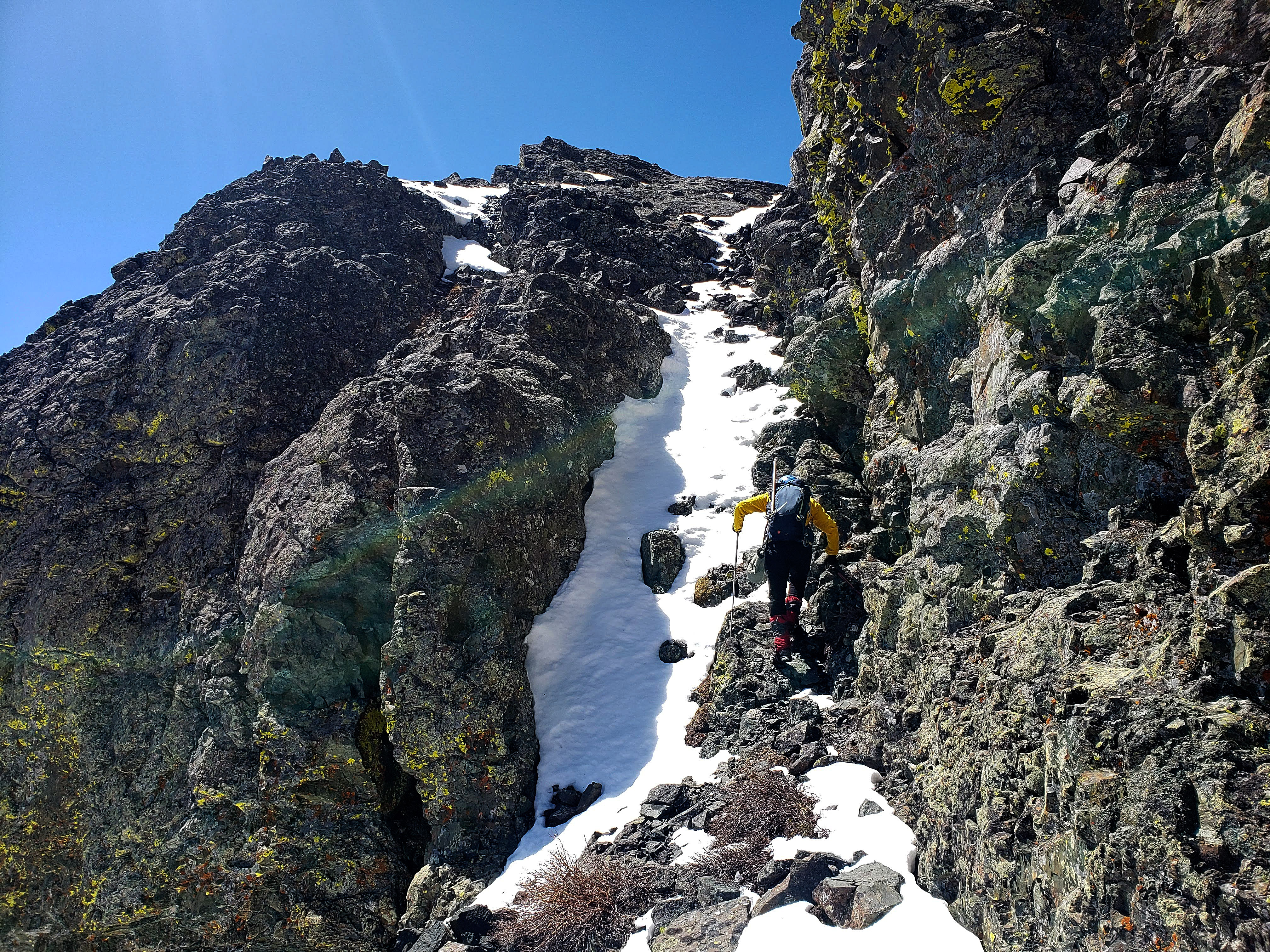
Fortunately, we could use the small couloir to the left of centre.
Arriving at the top of the scrambler’s summit. (Photo by Andrew Nugara)

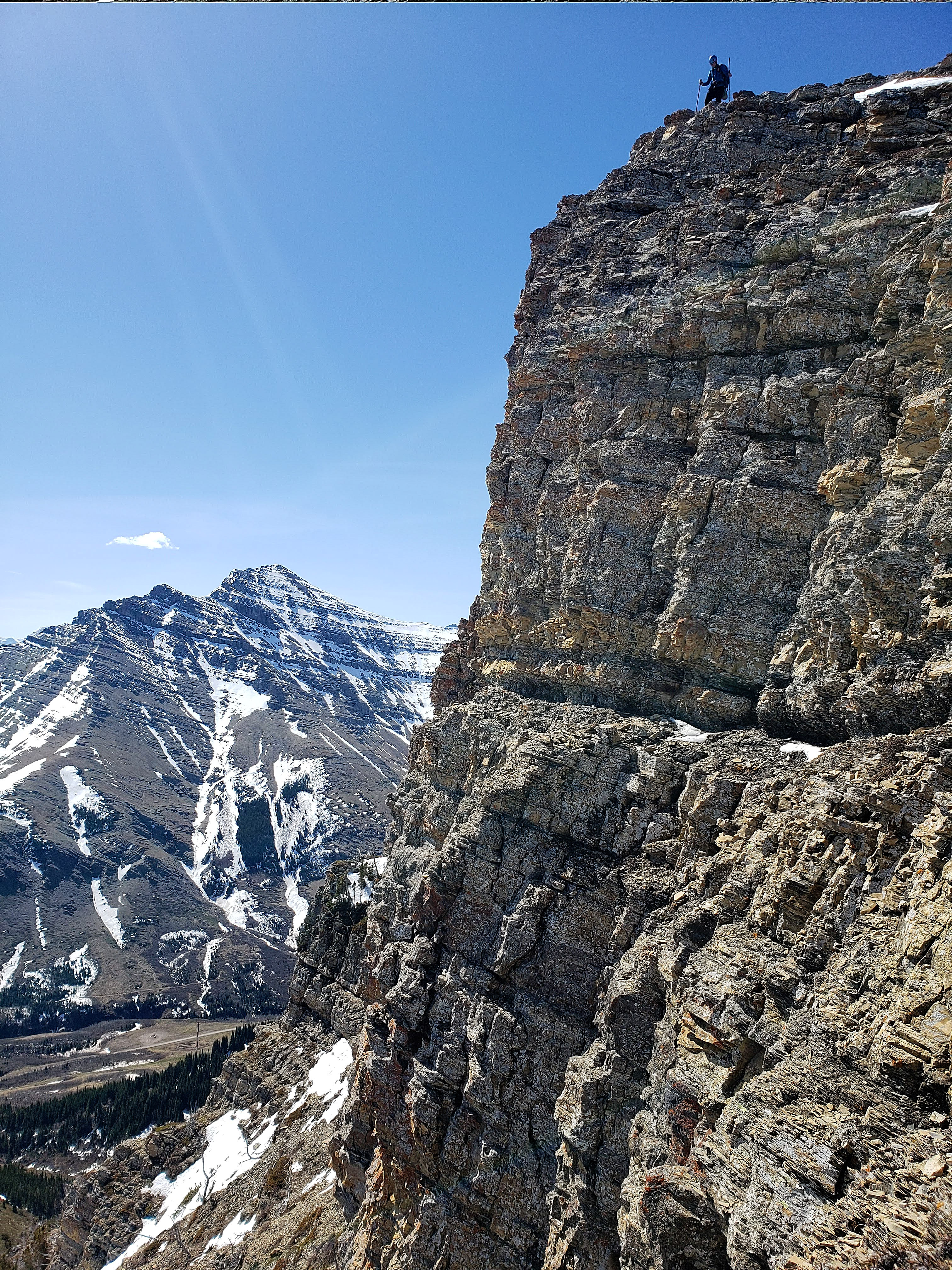
Andrew makes his way towards the actual summit via a narrow and highly exposed connecting ridge.

This is what the exposure from the narrow ridge (foreground right) looks like. The other side is about the same.

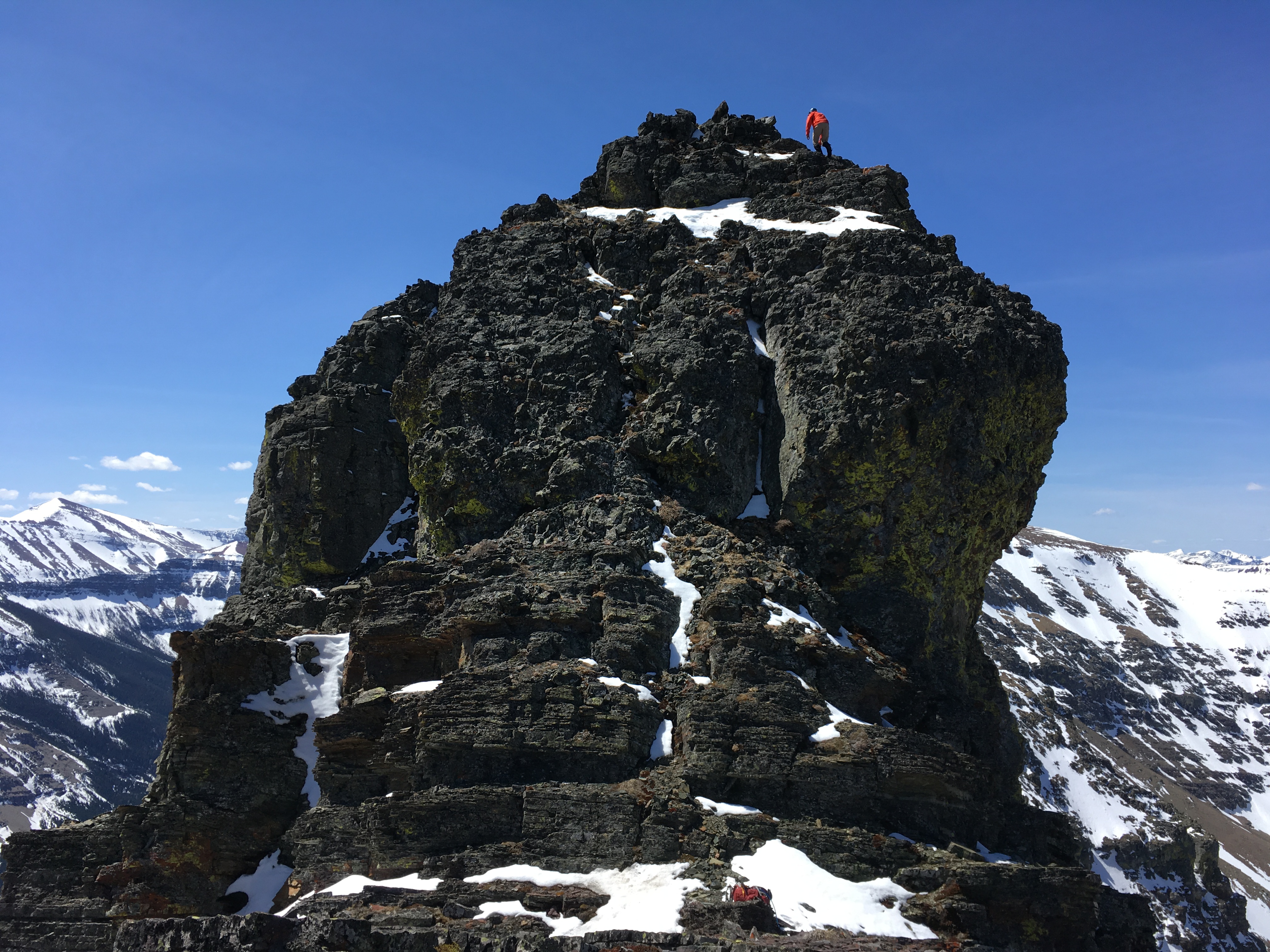
Andrew stands at the furthest point that can be reached without technical gear (at least in our minds). In 2006, he actually made it slightly further, but wasn’t about to try it again…
Andrew (centre) carefully down-climbs from the highest point on the connecting ridge.

Andrew’s view back to the scrambler’s summit of “Bakery Peak” (~2410m). (Photo by Andrew Nugara)

A pano to the southwest includes the summit of Loaf Mountain, the Southwest Summit of Drywood, and Drywood Mountain. The exposure on the other side of the ledge can also be seen.

Another telephoto of Windsor Mountain and Castle Peak.

A pano to the south with Spread Eagle Mountain to the left of centre.

Andrew snaps some pics while we chill on the summit.

This photo shows the difference in elevation between the scrambler’s summit and the technical summit. (Photo by Andrew Nugara)

Someone had made a couple of cairns along the summit ridge, but there wasn’t one on the scrambler’s summit, so I made one and named it, “Sven”, after the Swedish Chef on the Muppets.

Andrew down-climbs the from the summit using the same couloir that we had used for ascent. The red argillite on the summit ridge was quite striking.

We used a gully located near the summit block to reach the southern slopes.

Yellow lichen on red argillite: a classic Castle recipe. (Photo by Andrew Nugara)

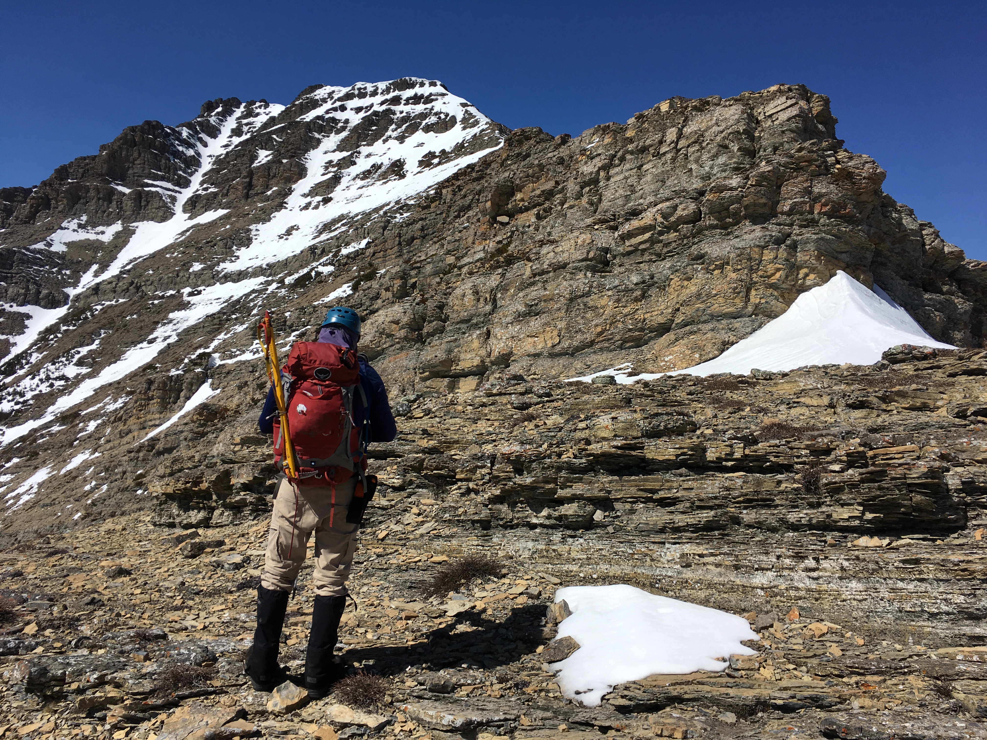
The technical summit is on the left and the scrambler’s summit is directly above me. Here is where we would begin traversing as we looked for an alternate way up. (Photo by Andrew Nugara)

The cliffs feature many impressive overhangs like the one on the left.

It wasn’t long before we came to a promising looking gully (centre).

I (far left) take advantage of the snow as I climb the narrow gully. (Photo by Andrew Nugara)

Andrew follows me up.

After rounding a sharp bend, we came to a wall. This was the first of many, “Well I could climb it but wouldn’t want to down-climb it” moments. (Photo by Andrew Nugara)

Trying another possible route to no avail. (Photo by Andrew Nugara)

Yee haw! I awkwardly ride a rock while I make my way onto a ledge. Once there, I realized that it didn’t lead anywhere that a sane person would want to go. So… I had to gingerly down-climb while concurrently hoping that I wouldn’t end up as a eunuch. 😉 (Photo by Andrew Nugara)

The very cool pinnacles that Andrew had explored in April. We would head up the snow-filled gully in the centre to reach them.
Andrew leads the way up.

This is such a cool place!

I keep searching for a way up. (Photo by Andrew Nugara)

Andrew looks for a possible way up from inside the small gap that separates the tallest pinnacle from the summit block.

This is what he sees…

Gazing up at the impressive pinnacle from inside the gap.

The other side of the gap features an unforgiving drop, so we decided against trying to make it onto the small shelves on the right. Later in the day, we could see that even if we had, it would not have led anywhere useful. In the distance, Victoria Peak can be seen behind Drywood Mountain.
A gap-toothed smile from inside the gap. 😉 (Photo by Andrew Nugara)

Andrew contemplates yet another, “Well I could climb it but wouldn’t want to down-climb it” moment.

I make a similar risk versus reward calculation from the top of a small ledge.

Golden eagles soar above (and below) us. (Photo by Andrew Nugara)

Deciding that discretion is the better part of valour, we make our way back onto the southern slopes to continue our traverse.

Dwarfed by the massive pinnacles, Andrew heads toward the snow-filled gully on the far left.

All your gullies belong to us! 😉

Running water and wet rocks complicated the ascent. While Andrew stuck to the gully, I would head climber’s left and onto more rocky terrain.

Andrew waits for me at the top.
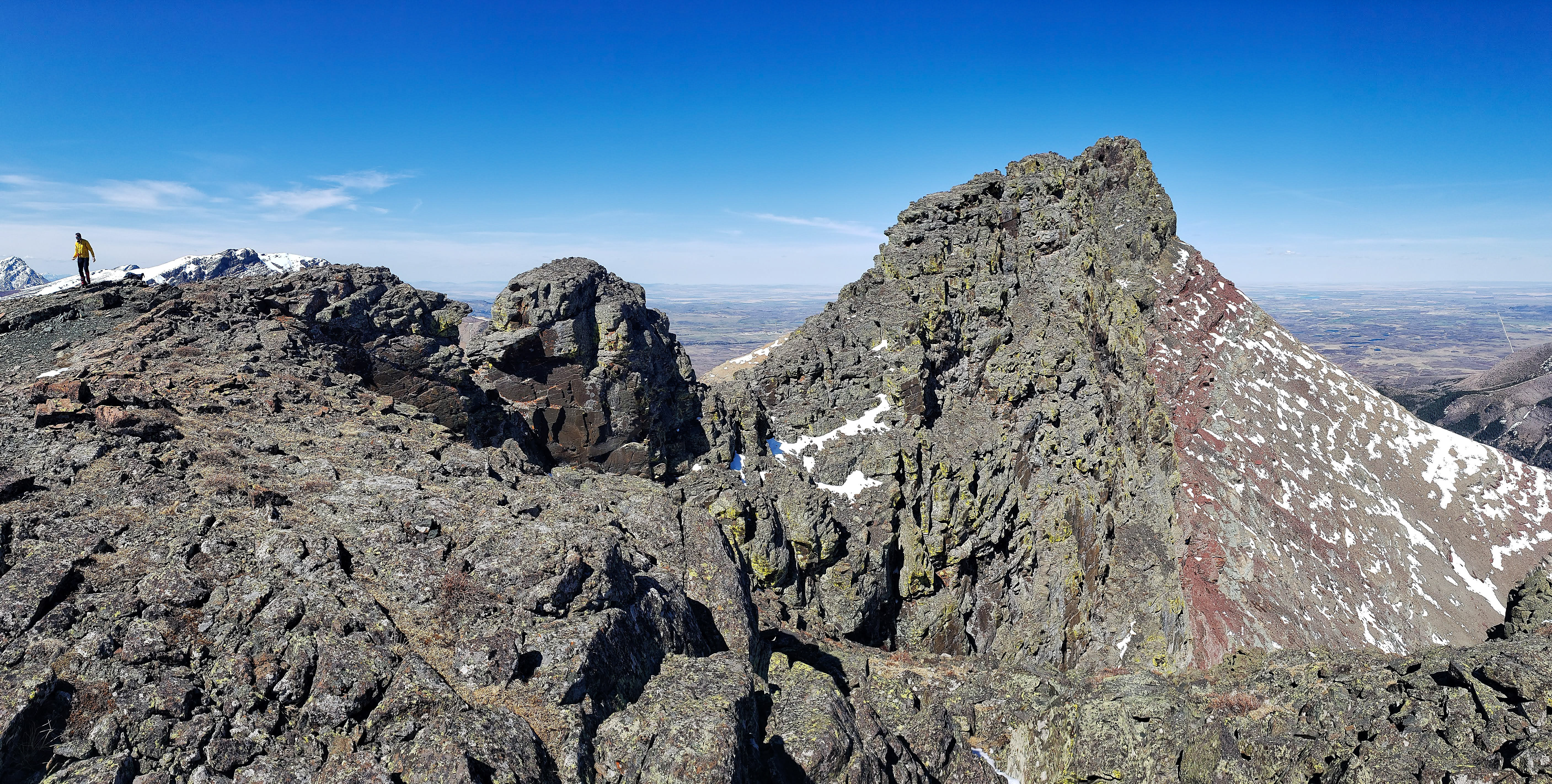
The view to the northeast from the ridge. The pinnacles and the technical summit are on the right.

Looking down the ridge towards “Pastry Peak” (far left).

A telephoto of the Southwest Summit of Drywood.
A telephoto to the northwest of Victoria Peak (right).

We headed down the ridge to see if it was possible to get beyond this high point and onto “Pastry Peak”.

A telephoto conveys some disheartening information…
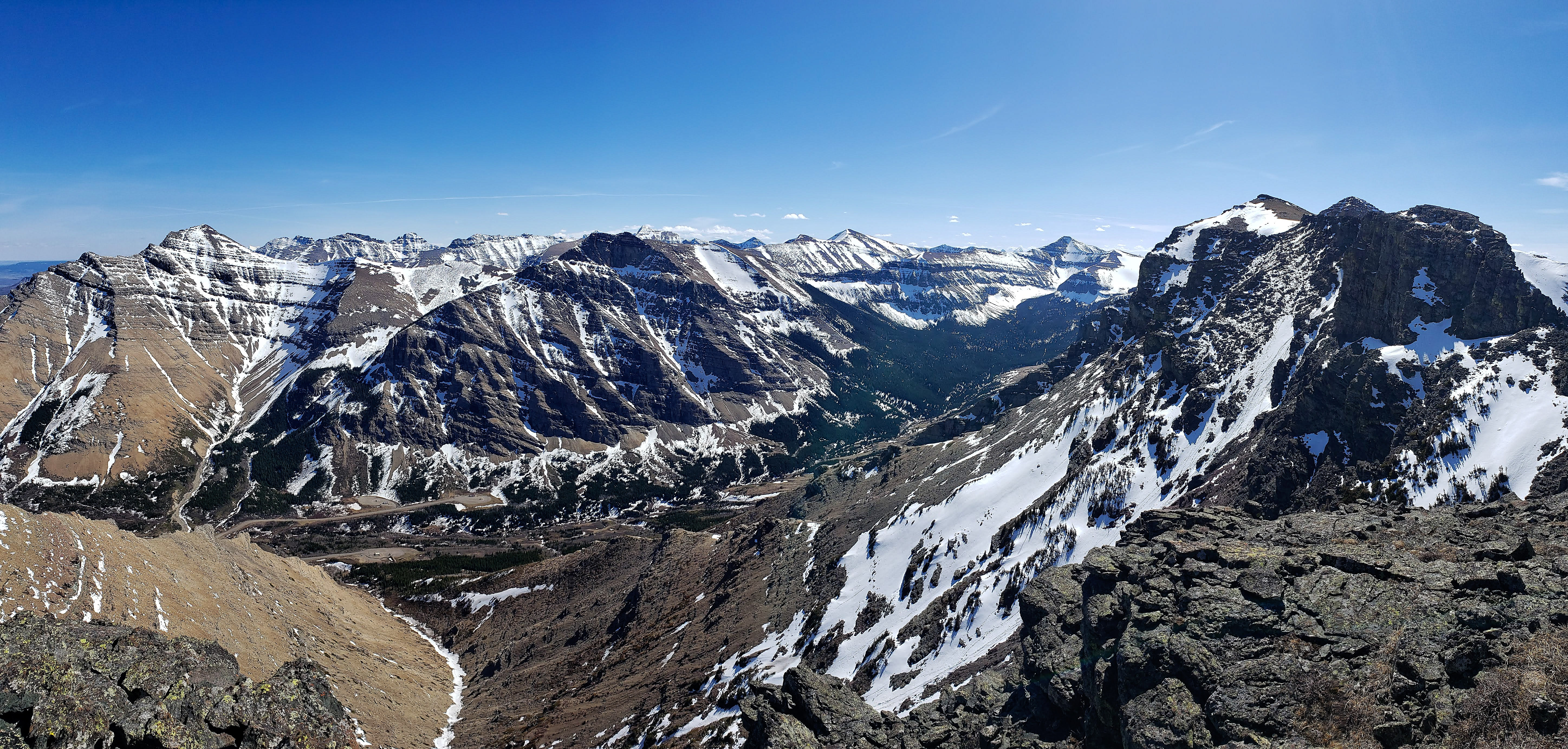
A pano to the south of Spionkop Ridge. The summit is the pointy peak in the distance to the right of centre.

The other side does not look passable either. Even if we traversed along the base, there is a drop off of unknown size just prior to the snow-covered slope on the far right.

The view back shows the awesomely cool summit of “Bakery Peak”. I thought it mildly resembled a chef’s hat.

The technical summit appears to be unassailable to scramblers from every direction. If you are a technical climber, you might really enjoy this peak! If you do happen to find a scramble route, please let me know!

Looking across the top of the pinnacles towards the summit. This is such a cool place!

A telephoto of Drywood Mountain.

A great day to be on a mountain!

All that monkeying around made me hungry for a banana. (Photo by Andrew Nugara)

Descending using my route to reach the gully. (Photo by Andrew Nugara)

Soft scree made for an easy descent into the drainage.

With the massive cliffs that comprise the pinnacles and summit behind him, Andrew crosses a small stream.

Checking out a large waterfall inside the drainage.

Despite water flowing underneath, the snow was still strong enough to support our weight.

Avoiding open sections of running water.

Closer to the bottom, we left the drainage and cut through the trees to reach this flare stack and the road. This is the view looking back along our descent route.

Another grizzly has dropped his or her phone. 😉 I now have quite the collection…

Yikes! I was feeling very sheepish after I discovered that it was actually their cell phone. Here ‘ewe’ go! 😉
Arriving back at my 4Runner after 18.9 km and 9 hours and 25 minutes. Quite simply, this was an awesome day! Though it is slightly smaller than the technical summit, the scrambler’s summit of “Bakery Peak” is well worth a visit if you are looking for an obscure destination that offers excellent scrambling, great views, and a unique looking summit. Throw in “The Muffin” and “The Croissant” and you’ll have cooked up quite the tasty pan of Castle goodness.


Leave a Reply