

⚠️ Hiking and scrambling are inherently dangerous activities. Please read my Disclaimer. ⚠️
Hey! Who’s up for a stroll through overlapping deadfall covered in metre-deep snow? 🤔
Just shy of one year ago, Brad and I attempted to snowshoe to the summit of “Hurtle Peak” after successfully knocking off a tiny little ridge that we nicknamed, “Sartoris Ridge”. Stymied by horrendous deadfall and deep snow, we ended up turning around after making it only halfway up the easternmost of “Hurtle’s” two north ridges. However, we did speculate that it might be possible to bypass the ridge – and the deadfall – by following “Hurtle’s” eastern valley to its col with Turtle Mountain, and from there, ascend through the trees to the summit.
Nicknamed, “Hurtle Peak”, by Sonny and Zosia due to its location at the end of Hastings Ridge and its proximity to Turtle Mountain, this small bump is also described by Jane Ross and William Tracy in, Hiking the Historic Crowsnest Pass. Brad had visited “Hurtle” many years before with his daughter, but for me it would be a new experience – and what an ‘experience’ it was! 😯
While I had suggested a route using an ATV road to gain the summit ridge, Brad was not about to let our previous speculation die without trying. So, as we were walking down the road from the Sartoris Staging Area with me thinking that we were headed to the ATV route, Brad stopped us at the trail we had used last year for descent, and made a convincing case for trying to reach the summit from the col. Not wanting to let such a valuable contribution to mountain research pass us by 😂 – and that Brad volunteered to do the bulk of trailblazing – I was immediately sold. So off we went, retracing last year’s descent route along the trail until we came to a point ~1.9 km from the parking lot where we left it to start up the valley.
All went according to plan until we reached the end of the valley. That’s where the deadfall began. If it had not been for Brad’s indomitable and absinthe-fuelled trailblazing, I’d have turned back. For the next few hours, we had to fight for every step we took as we made our way over, under, and across unending and often unseen deadfall. By the time we reached the cliff band beneath the summit, it had taken us 4.5 hours to travel 3.7 km.
After a very quick break, we climbed above the cliff and made our way towards the summit. However, the hidden deadfall and deep snow continued to make our lives miserable. After crossing the final topo line onto the summit, we concluded that we had successfully made the top even though we were ~150 m short of the actual apex. The effort and time to cover that distance for only a few extra metres in elevation was not worth it. It would’ve easily taken another 30 or 40 minutes to cover the ~150 m and we were already 5.5 hours into the day.
Though we had originally planned to keep following the summit ridge and use the ATV road for descent, we noted that it was still a kilometre away over the same miserable terrain. Therefore, we decided to retrace our route which meant fighting our way back and over nasty deadfall – but at least we could see some of what was coming. That didn’t mean it was easy, but that there were fewer surprises. As I’ve said many times before in regard to snowshoeing over deadfall, if the Sword of Damocles hangs above, then the Sword of Testocles waits below. 😂
Finally, after a total time on the mountain of 8 hours, we were back at Brad’s car – successful but exhausted. I doubt anyone would – or even should – repeat this route, but thanks to Brad’s tenacity and his trail blazing heroics, we did prove that it was possible. However, I would suspect that even in the summer, this route would still be difficult given the copious amount of deadfall.
Again, I have to give a massive thank you to Brad for his herculean efforts which made for yet another a fantastic day in the mountains! 🙂
To get to “Hurtle Peak” we drove west on Highway 3 until we reached Blairmore. We then turned left at the first entrance to the town past the bridge (20 Ave) and then took out first left (113 St). After crossing the tracks, we followed 113 St. for 3 blocks until we came to 17 Ave, where we turned right. One block away we turned left again on 132 St and followed it for one block until we came to 16 Ave, where we turned right and followed the street as it turned into 131 St. as it left town. We then followed 131 St. until it ended at the seasonal closure gate and the Sartoris Staging Area. This is where we parked.
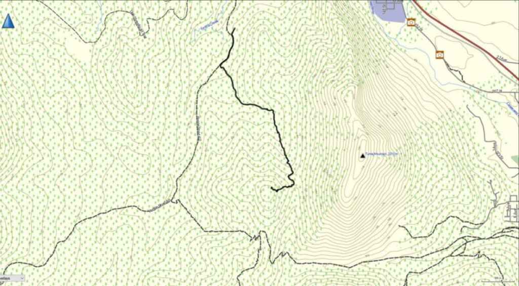
From Brad’s car in the parking lot, we walked for ~640 m along the main snowmobile road until we came to a secondary trail located on our left. We then followed this trail for 1.3 km before we left it to climber’s right. After leaving the trail, we paralleled the cutline for ~100 m to align ourselves with the centre of the valley. Once that was achieved, we then headed across the cutline and up the forested section of valley for 770 m until we came to end of the forest. This took us only 1 hour and 15 to reach.
After leaving the trees, the real work began with heavy deadfall coupled with deep snow. From the point where we left the forest to the “Hurtle” / Turtle col, it took us 2 hours to cover the 630 m distance. From the col to the cliff band it took us another 1 hour and 18 min to ascend the 340 m. In total, from the point where we left the forest to the cliff band it took us 3 hours and 18 minutes to cover the 970 m distance. Yikes!
We ascended to climber’s left of the cliff band and covered the remaining 180 m to the summit in 30 min. For reference, from the parking lot to the summit it was ~3.9 km over a total time of 5 hours and 20 minutes. We returned the way we came.
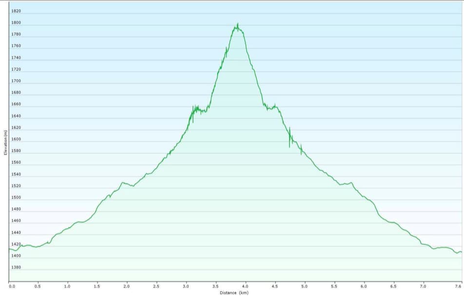 Our total roundtrip distance was 8.8 km and our total roundtrip time was 7 hours 55 min. Total elevation gains came in at 515 m.

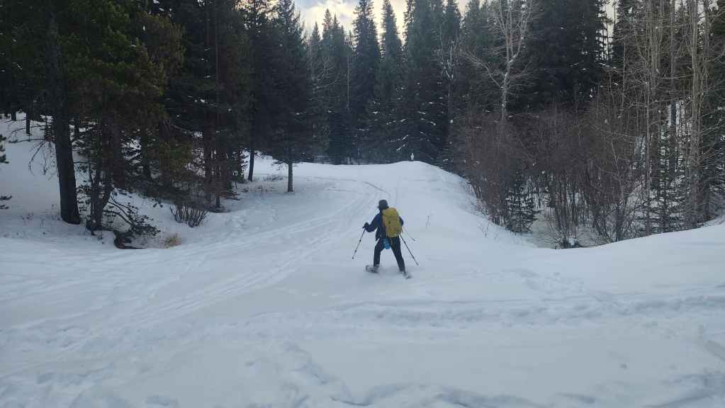
Gearing up at the Sartoris Staging Area.

Easy walking along the road. This is also the point where we left the road in March 2024 to head up “Sartoris Ridge”.

It’s always good to get a leg up on the day – unless the leg is yours. 😂

Approximately 640 m from the parking lot we left the main road (right) for the secondary trail (left).
A better look at the start of the secondary trail.
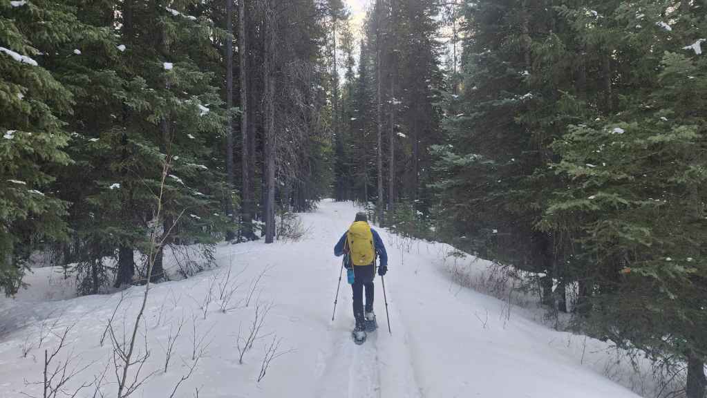
Enjoying the great little trail.

A good trail requires a good pipe.

More easy snowshoeing along the trail.

Approximately 1.9 km from the parking lot, we would leave the trail (left) and head towards the intervening valley between “Hurtle” and Turtle Mountain.

We followed alongside a large cutline for a short distance until we were sure that we were lined up with the centre of the valley.

Crossing the cutline. The summit of “Hurtle” is directly behind Brad.

Another view of the cutline.
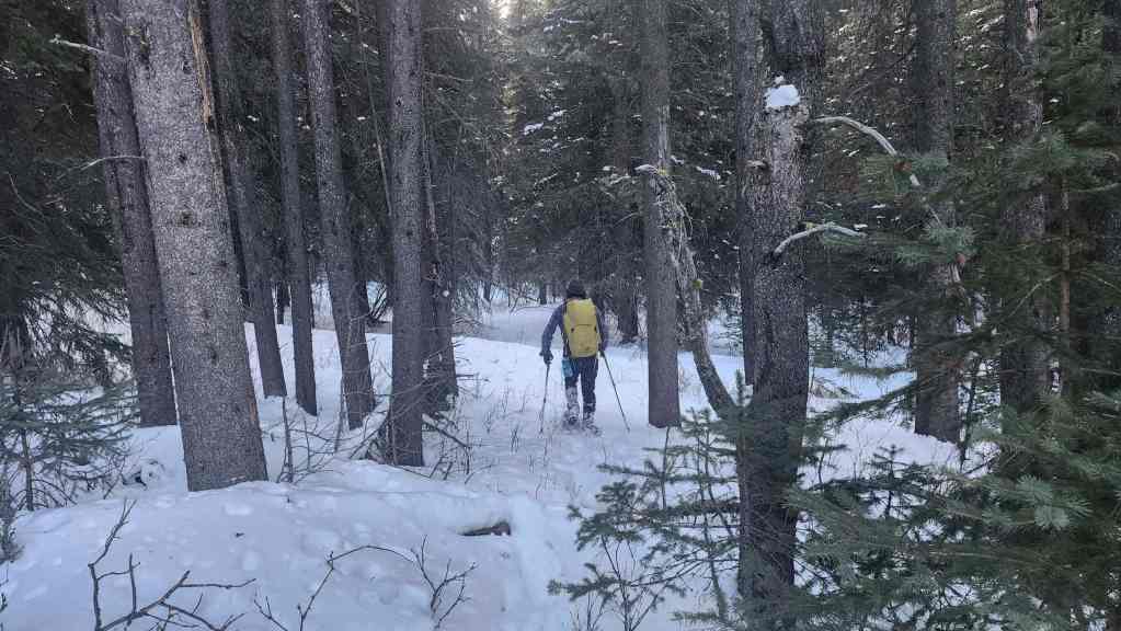
Back in the forest and enjoying more easy snowshoeing.
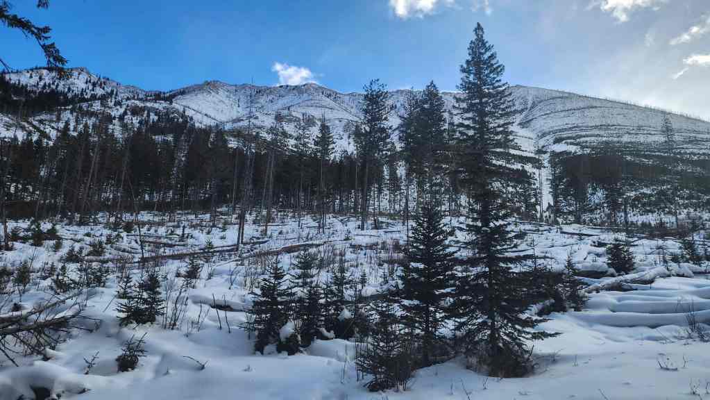
Emerging from the forest and gazing across to Turtle Mountain.

Looking over to Turtle’s false summit.
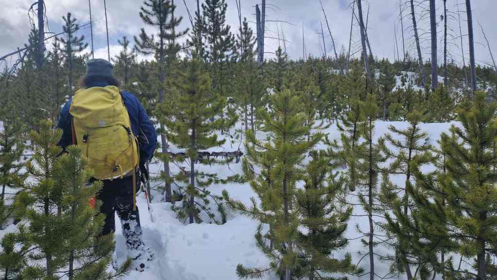
And so the fun begins.

Spindrift on the summit of Turtle. It was incredibly windy, but we would be largely sheltered throughout the day – which is good because otherwise it would’ve been really hard. 😂

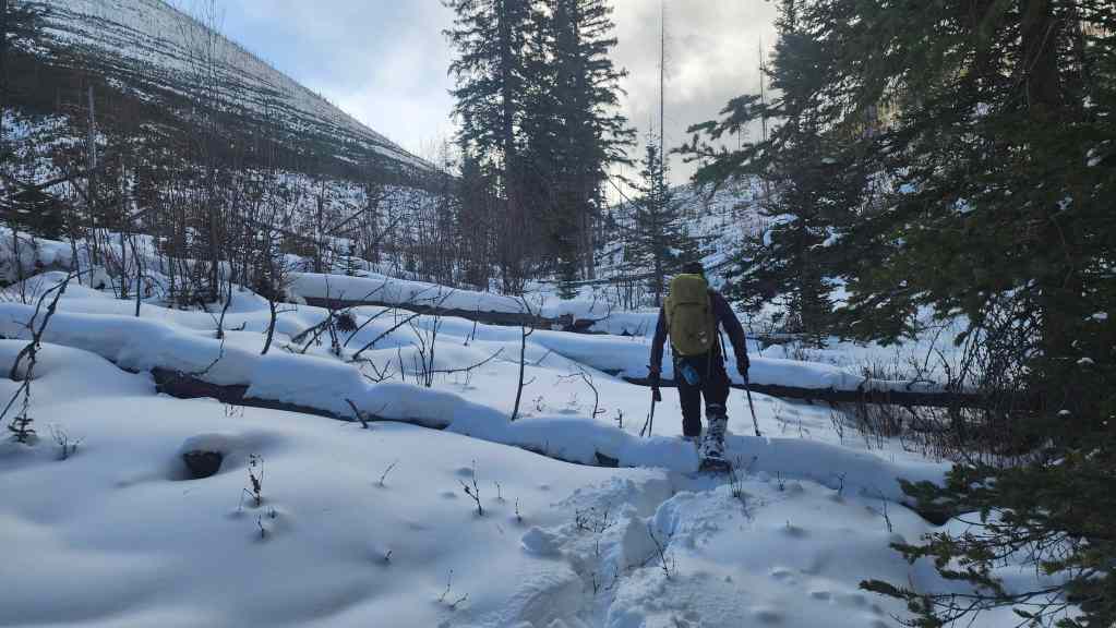
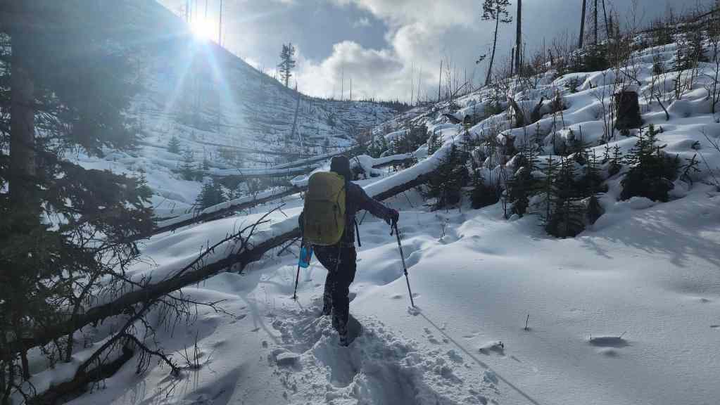
Stepping over minor deadfall as we follow the drainage towards the col.

Looking towards the summit (centre). To reach the trees and cliff band in the centre will take 3 hours and 18 minutes to cover the 970 m distance. 😯
At this point, we were still hopeful that our route would avoid the insane amount of deadfall that we encountered last year on the ridge.
Our first good look at the col (centre) between Turtle and “Hurtle”.

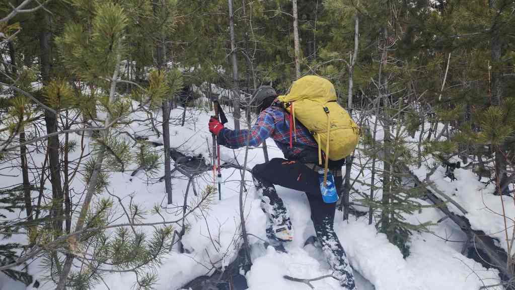
Brad crawls under a log.

Still following the drainage.
Looking back and along the valley.

Our time in the drainage will soon come to an end.

Brad crawls under more logs.

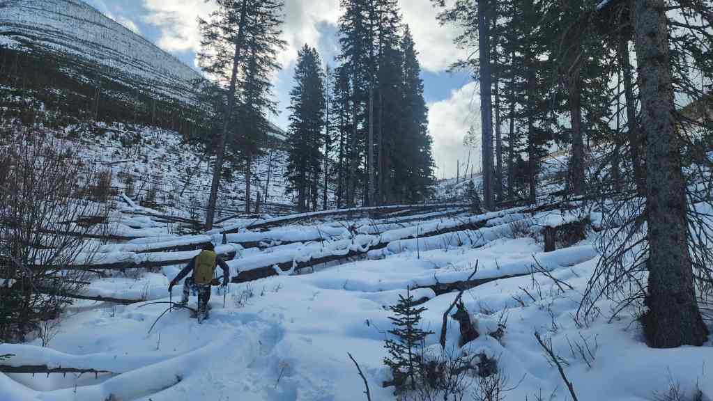
With progress in drainage finally thwarted by deadfall, we began the arduous task of leaving it.

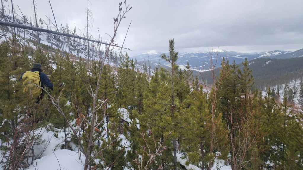
The summit is so close, but reaching it will require an insane amount of time and energy.

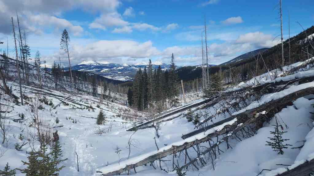
Another look back and along the valley. “Sartoris Ridge” is in the foreground to the right of centre.
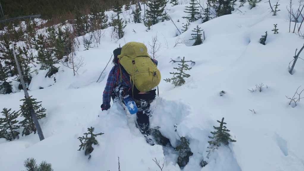
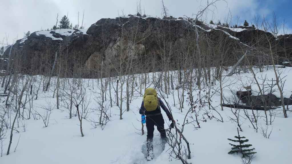
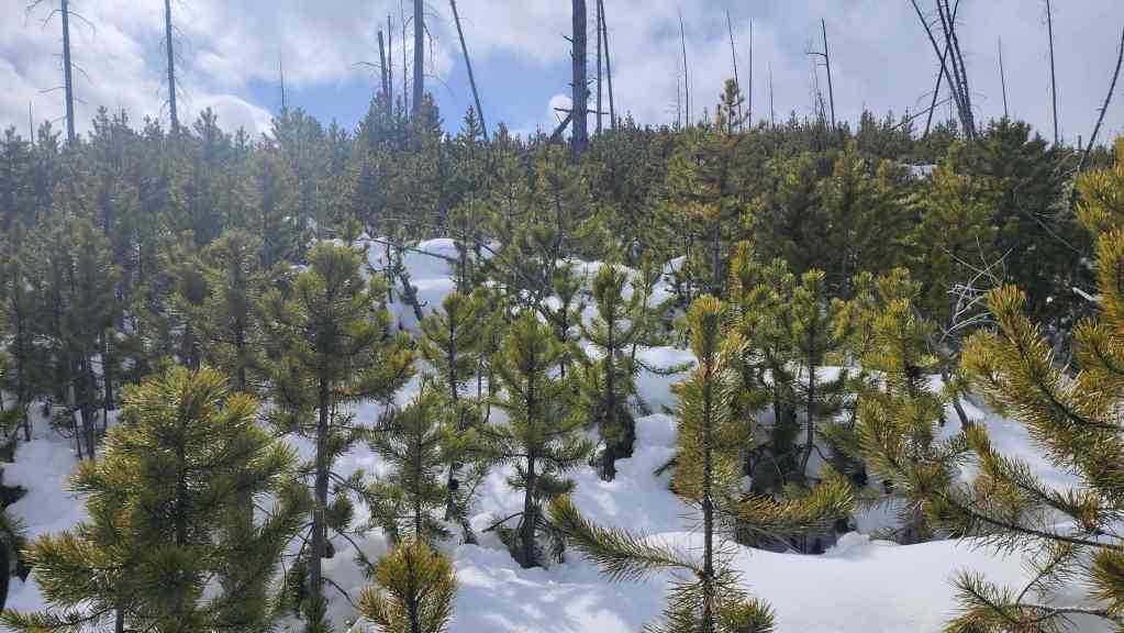
Welcome to how we would spend the next few hours. 😂

Beneath the snow is a tangled mess of deadfall where every step could either turn you into a eunuch or break your leg – or both! 😂

Slow progress but we’re almost at the trees near the col.

Crap! The deadfall continues inside the trees.
Slowly making our way up from the col to the cliff band.
Approximately 4.5 hours after leaving the parking lot, we arrived at the impressive cliff band beneath the summit.

Gazing to the southeast at Hillcrest Mountain (left) and Hearts Peak (centre).
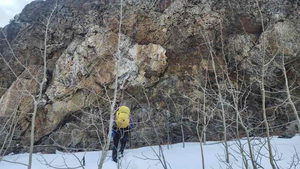
The cliff face is a very cool conglomerate overhang.
We stopped here for quick bite to eat because we (well, Brad) probably burned 4000 calories just getting to this point. 😂

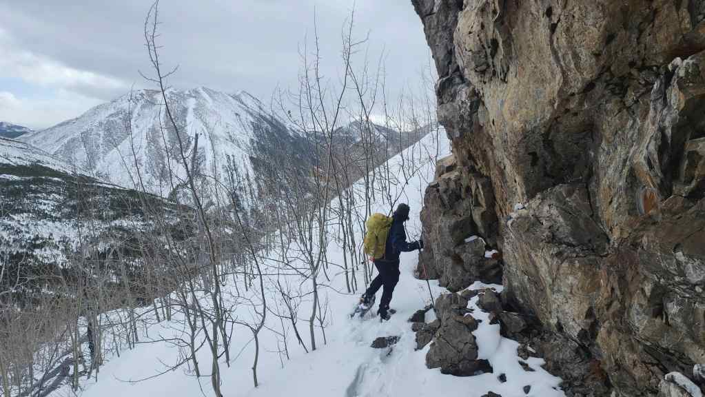
Now on the move again, we discovered a bypass to climber’s left of the cliff face.

This bypass led us to the top of the cliff face.
Brad carefully traverses the steep slope above the cliff face.

Once above the cliff band we were back into the trees and a never ending battle with deadfall.
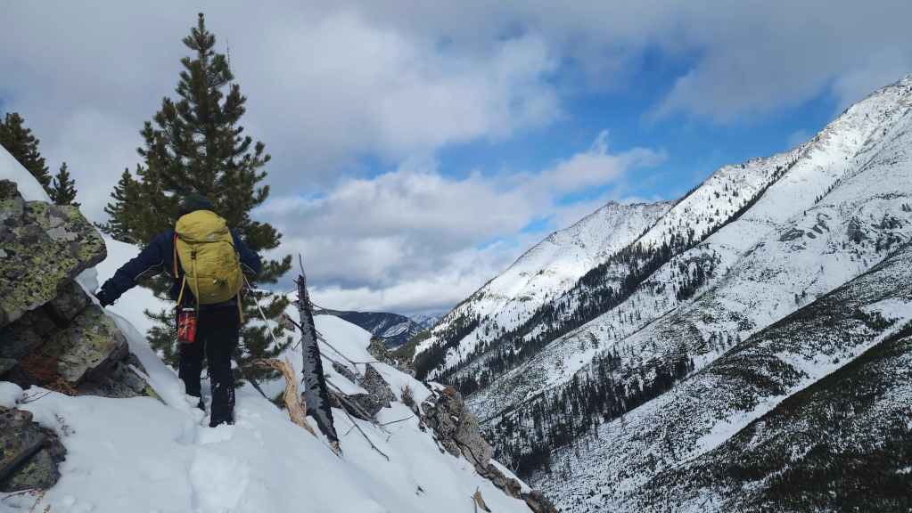
Slow progress as we make our way onto the summit.
The summit of “Hurtle Peak” (1797 m). The actual apex of the summit was only ~150 m away, but given the deadfall, it would easily have taken another 30 to 40 minutes to get there.

Looking east and across the valley at Turtle Mountain.

Looking north at Bluff Mountain (right of centre), Greenhill Ridge (centre), and “Sartoris Ridge” (foreground centre).

We realized that reaching the ATV road for descent would take forever, so we decided to retrace our steps.

Brad carefully traverses above the cliff band.

Going down would be quicker…

But it still wasn’t easy.

Brad begins a trapeze walk across a log.
Arriving back at the worst of the worst deadfall.

Even though we could follow our tracks, it was still a painfully slow process.

Back in the drainage.

And with much rejoicing, we arrived back into the forest in the valley. It would be smooth sailing from here on.
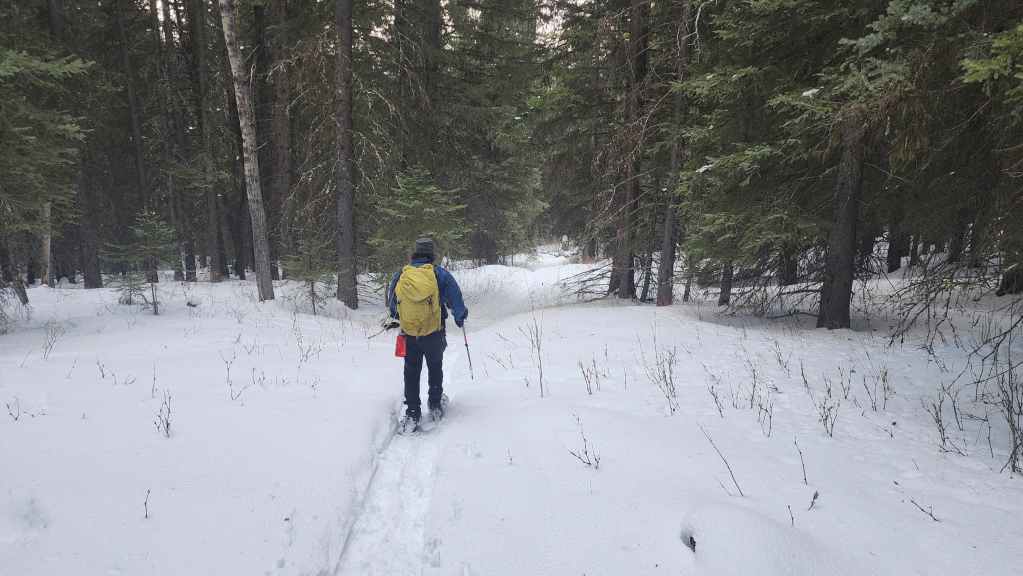
Back on the secondary trail and beginning the ~2 km walk back to the parking lot.

Arriving back at the main road.

Easy peasy walking.

Arriving back at the Sartoris Staging Area 7 hours and 55 minutes after starting. What’s crazy, is that we only covered a total distance of 7.8 km. Again, a HUGE thank you to Brad for his impressive trailblazing and fantastic company. I’m glad that we were able to clear the final “Hurtle” to make this a successful day. 😂