
⚠️ Hiking and scrambling are inherently dangerous activities. Please read my Disclaimer. ⚠️
The heavy losses endured by the Canadian Corps and the First Newfoundland Regiment during the Battle of the Somme from July to November 1916, led to several advancements in tactics and permissions that would ultimately serve in the Canadians favour. One of these advancements was the rolling or creeping barrage “which meant that the soldiers advanced at the same time as the bombardment.” (source) Thus, after a barrage, the artillery would move forward a set distance every few minutes, followed by the soldiers who secured the area before the Germans could reposition. A second advancement was the sharing of information and battle plans with the individual soldier. This allowed for initiative and improvisation by a soldier or unit should the commanding officer be killed or wounded. (source)
Utilizing these, along with other advancements, all four divisions of the Canadian Corps., fought together for the first time on Vimy Ridge in April 1917. Located north of the town of Arras in France, the assault on Vimy was devised as a way to secure the left flank of the British Third Army as it advanced towards Arras. (source) It also marked the beginning of the Arras Offensive that later became known as the Battle of Arras.
Of course, the Canadians’ success has been well documented, and several historians have posited that the victory on Vimy Ridge was crucial for Canada’s emergence as an independent nation. That Vimy Peak and Arras Peak on Vimy Ridge in Paahtómahksikimi (Waterton) were renamed in honour of this victory fits within a carefully constructed, post-war national narrative. However, long before these names were given, the Siksikaitsitapi (Blackfoot Confederacy) referred to Vimy Peak as Saakiimaapi, or the ‘One Who Sits Across the Water’, and thanks to the doctoral research of Ninna Piiksii (Dr. Mike Brusied Head), this name now sits alongside, Vimy Peak.
Further, in relation to both the Battle of Vimy Ridge and the contributions of Siksikaitsitapi soldiers during the Great War, Ninna Piiksii along with the Crow Chief family and Parks Canada officials, led a ceremony on Indigenous Day on 21 June 2023 to gift second name to the mountain. This new name is, Maisstooinastáko (Crow Chief Mountain), after Joe Crow Chief of the Kainai Nation for his bravery in single-handedly capturing a German trench during the Battle of Vimy Ridge. (source; source; source)
Moreover, this name encompasses the “entire Vimy Ridge Mountain including Vimy Peak”. (source) Thus, the national achievement for which the massif was given its colonial name, has been further localized in a very meaningful way. That it directly ties into both the Siksikaitsitapi belief that the mountain is sacred and that it reflects the heroism of a local Kainai soldier, is ever so fitting.
With this knowledge in the back of my mind, I was glad that it finally worked out to visit Maisstooinastáko (Arras Peak), which is the official high point on Maisstooinastáko (Vimy Ridge) – even though the unnamed peak further to the southeast is higher. Back in 2021, Brad and I made a spring trip to the summit of Saakiimaapi / Maisstooinastáko (Vimy Peak) but did not have time or the conditions to continue towards Arras. Thankfully Andy was game to make a repeat trip and join us today.
The other point of interest for all three of us, was a prominent little peak that sits surrounded by the larger peaks in the immediate area. Noticeable from both Highway 5 and the Chief Mountain Highway due to its sharp face, this peak comprises the northeast spur of Arras. Not sure of what to nickname it, ‘Vimy Minor’ came to mind. However, some great post-hike research by Brad, identified a section of Vimy Ridge in France that was called, Petit Vimy, on wartime maps. As this tied perfectly to both the theme of the massif and the size of the little peak, we all agreed on “Petit Vimy”. I have to say that the view down to the roaring lower section of Sullivan Falls made this quick excursion well worth it.
Thanks again to both Brad and Andrew for yet another awesome day in the mountains! Still fighting a bug from the previous weeks, I moved at a much slower pace than normal, but as usual, the ongoing banter was a great motivator. 🙂
Be sure to read Mr. E. Bikeman’s awesome trip report!

Routes up Saakiimaapi / Maisstooinastáko (Vimy Peak) and Maisstooinastáko (Arras Peak) are aptly described in Andrew Nugara’s, More Scrambles in the Canadian Rockies, and both the Wishbone and Vimy Peak trails are highlighted on Park maps. To get to Maisstooinastáko (Arras Peak), we biked the Wishbone trail for ~6.5 km to the junction with Vimy Peak trail. Note that there is an unbridged crossing of Sofa Creek ~4 km from the trailhead.
From the Vimy trailhead, we hiked for ~4.8 km until we came to the official end of the trail which is marked by a secondary trail that breaks off to climber’s left towards Maisstooinastáko (Vimy Ridge) and another trail that breaks to climber’s right and up Saakiimaapi / Maisstooinastáko (Vimy Peak). Following the trail to the base of a small shoulder ridge, we left the trail to ascend a small high point at the far northeast end of the shoulder. From the start of the secondary trail to the top of the high point, it was a ~683 m hike with a 179 m elevation gain. From here we hiked onto the main ridge then it was a ~2 km hike / scramble to the summit of Maisstooinastáko (Arras Peak). For reference, due to the nature of the terrain it took us almost 1 hour and 45 minutes to cover the 2 km.
After a leisurely time on the summit, we made the quick hike to the summit of Maisstooinastáko (“Petit Vimy”). This was a 1.1 km hike with a 200 m elevation loss to the col and then a 34 m gain to the summit. To get back, we returned to the col and made the 2 km traverse back to the shoulder that we used to gain the main ridge earlier in the day. For reference this was much quick than following ridge, taking us just over an hour to complete. From the shoulder we followed the trail back to our bikes and then rode back to the Wishbone trailhead.

I forgot to turn on my GPS until we arrived at the Vimy Peak trailhead, so another 6.5 km needs to be added to the total along with another 30 m of elevation and 34 minutes of time. So, adding this additional data would make our total roundtrip distance 31 km with a total elevation gain of 1473 m. Our total roundtrip time was 9 hours and 30 minutes.
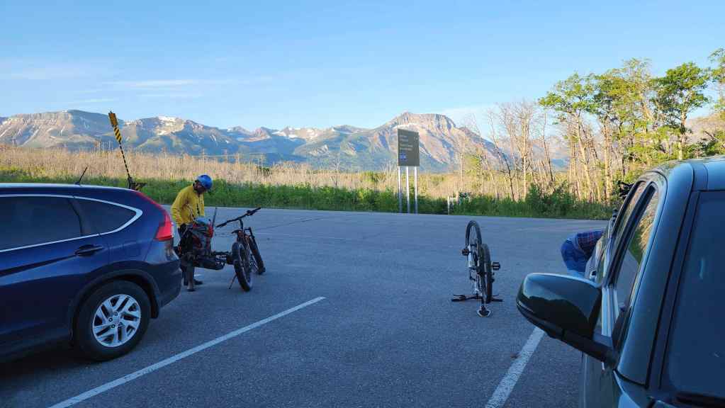
Gearing up at the Wishbone Trailhead which is located on the Chief Mountain Highway approximately 488 m from the junction with Highway 5.

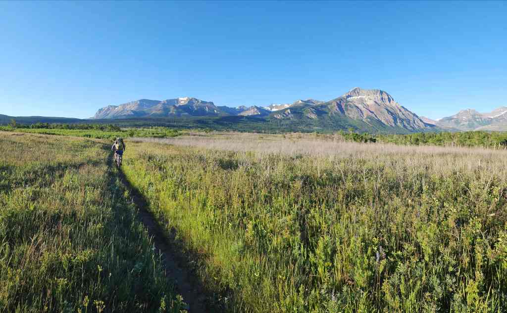
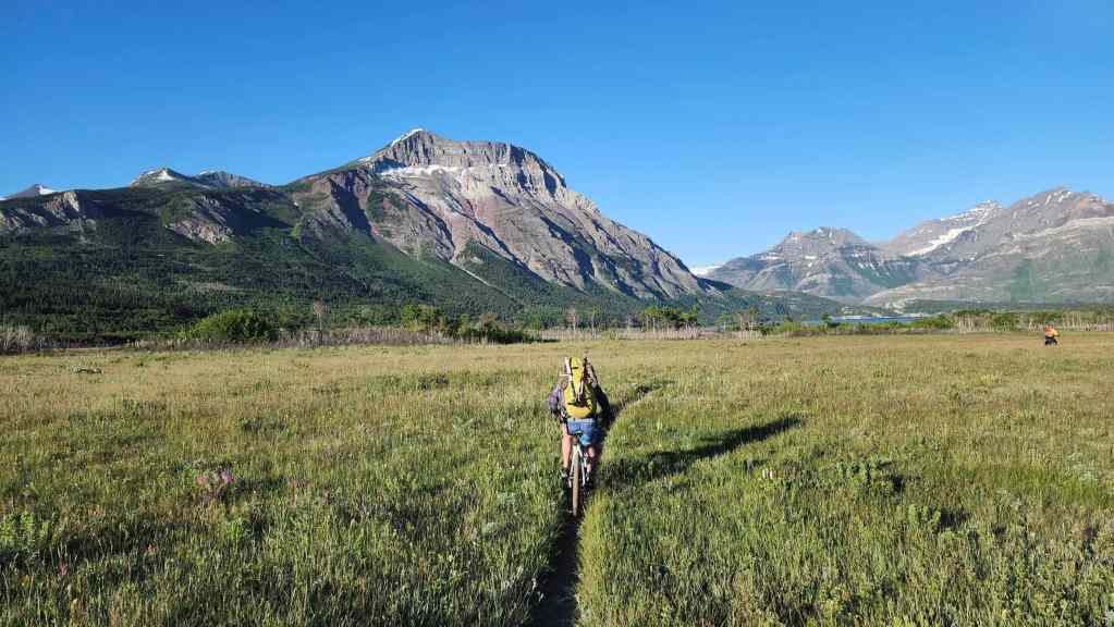
Starting off. From here it will be a ~30 minute ride over ~6.5 km to reach the Vimy Peak trailhead.

It was a gorgeous morning to be in the mountains! Maisstooinastáko (Arras Peak) and Maisstooinastáko (“Petit Vimy”) are in the centre of the photo. (Photo by Andrew Nugara)
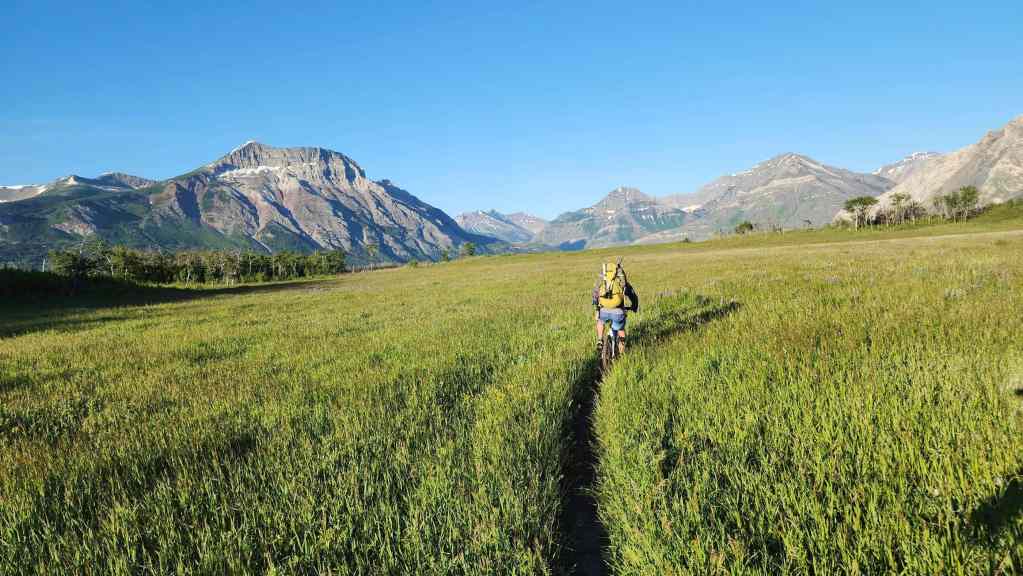
Easy riding with only a ~30 m elevation gain and loss to the trailhead.
Maisstooinastáko (“Petit Vimy”) is in the centre; surrounded by much larger peaks.

Akiiohtaikiistakoo (Bertha Peak) (right) provides a nice backdrop. (Photo by Andrew Nugara)

Crossing Sofa Creek approximately 4 km from the trailhead. From here, we could get an even better look at Maisstooinastáko (“Petit Vimy”) (far left).
Saakiihmabii / Maisstooinastáko (Vimy Peak) is directly ahead.

At the trailhead.
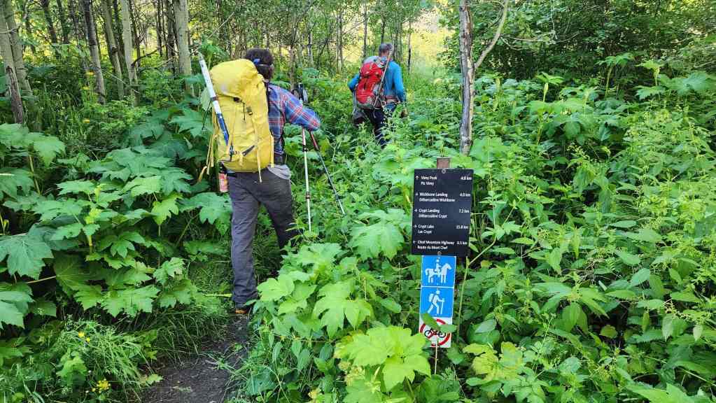
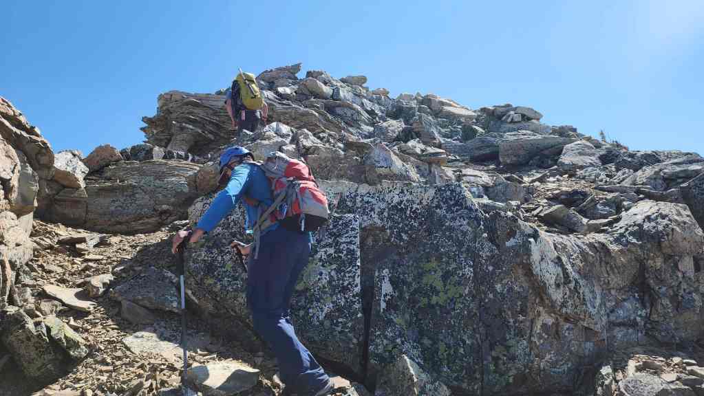
Setting off on foot through some very wet undergrowth.

Oomhkataiyoo (Lion’s Head) (left of centre) and Saakiihmabii / Maisstooinastáko (Vimy Peak) (right). Oomhkataiyoo means ‘cougar’ in Blackfoot.

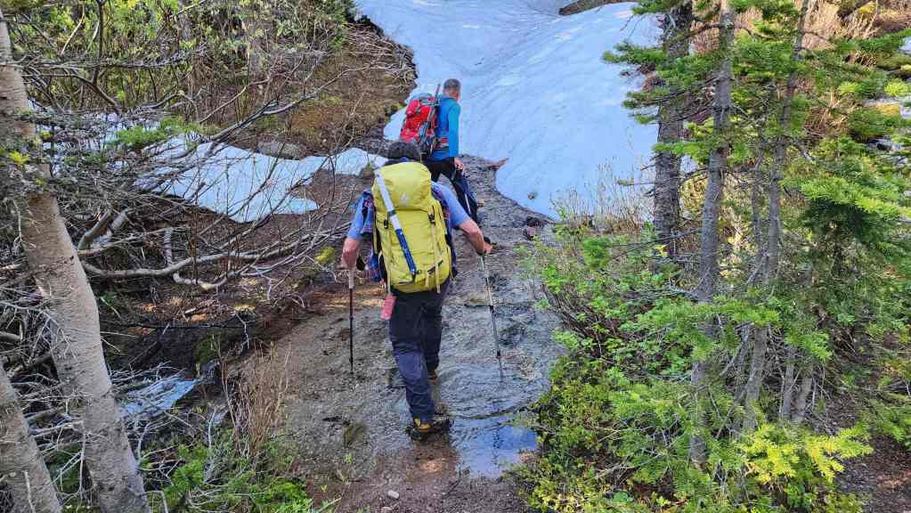
We got absolutely soaked on the lower section of the trail.

Finally breaking free from the wet undergrowth.

A closer look at Oomhkataiyoo (Lion’s Head) with the summit of Saakiihmabii / Maisstooinastáko (Vimy Peak) in the background. (Photo by Brad Wolcott)

More wet stuff… (Photo by Andrew Nugara)
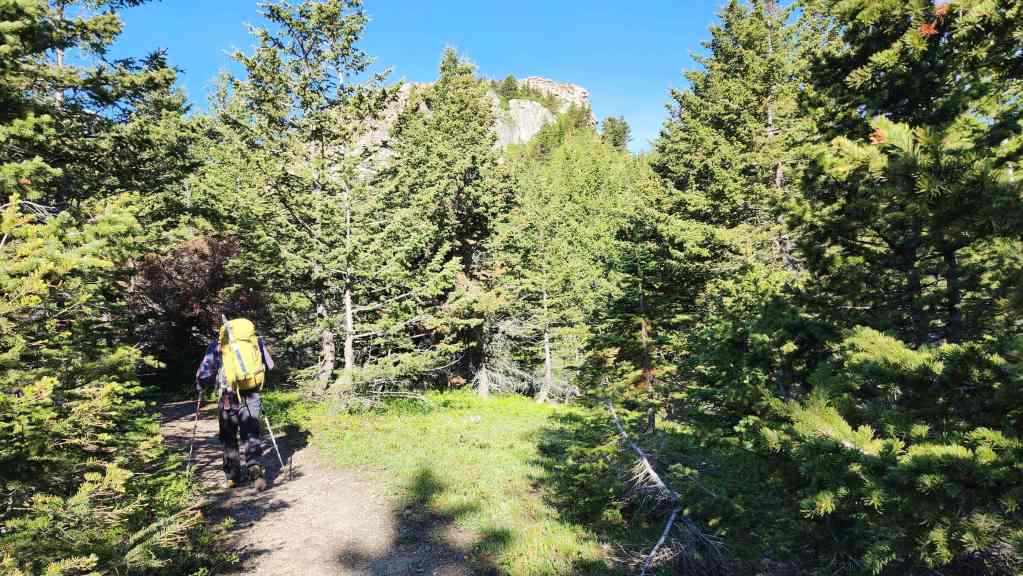
Approximately 3.1 km from the trailhead, we passed the secondary trail that leads to Oomhkataiyoo (Lion’s Head).
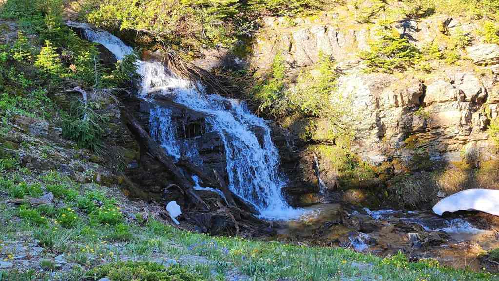
One of many waterfalls we would pass along the trail.

The first creek crossing…
Followed by the second.
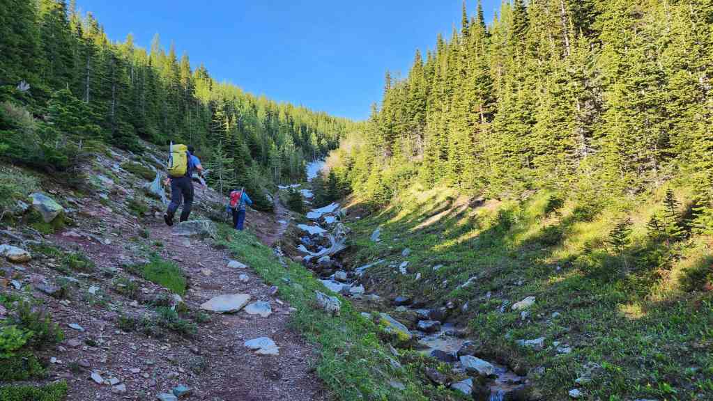
The trail continues alongside the creek.

Nearing the upper section of the trail.

Looking back.

Though the sign at the trailhead says ‘Vimy Peak 4.8 km’ it is really referring to this point where it emerges into Vimy Basin. The trail on the right is what has been created over the years by people continuing up to Saakiihmabii / Maisstooinastáko (Vimy Peak). As we were focussed on Maisstooinastáko (Arras Peak), we would follow another unofficial trail that headed to climber’s left from this point.

‘Following’ the secondary trail. (Photo by Andrew Nugara)

After a short hike, we emerged from the trees.

This is where the views really began to pop.

The basin is full of larches and would be very colourful in the fall. 🙂 (Photo by Brad Wolcott)

I pause to take a photo of the impressive wall. (Photo by Andrew Nugara)
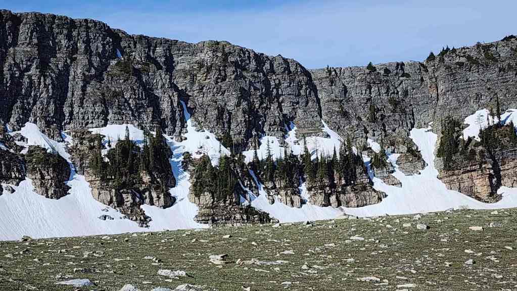
And this is the photo I took. The trees growing directly out of the rock were striking.
We decided to head directly for the high point on the left.

The view back. Note the unofficial trail heading up the side of Saakiihmabii / Maisstooinastáko (Vimy Peak). (Photo by Andy Nugara)

Brad scrambles up a short section of rock.
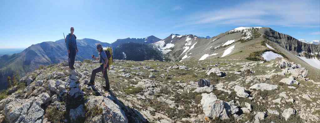
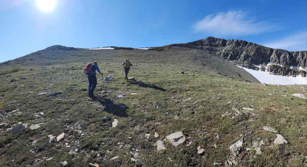
On top of the high point. We will follow this shoulder onto the main ridge (right).
The view over to Saakiihmabii / Maisstooinastáko (Vimy Peak) (right).

Looking to the north.

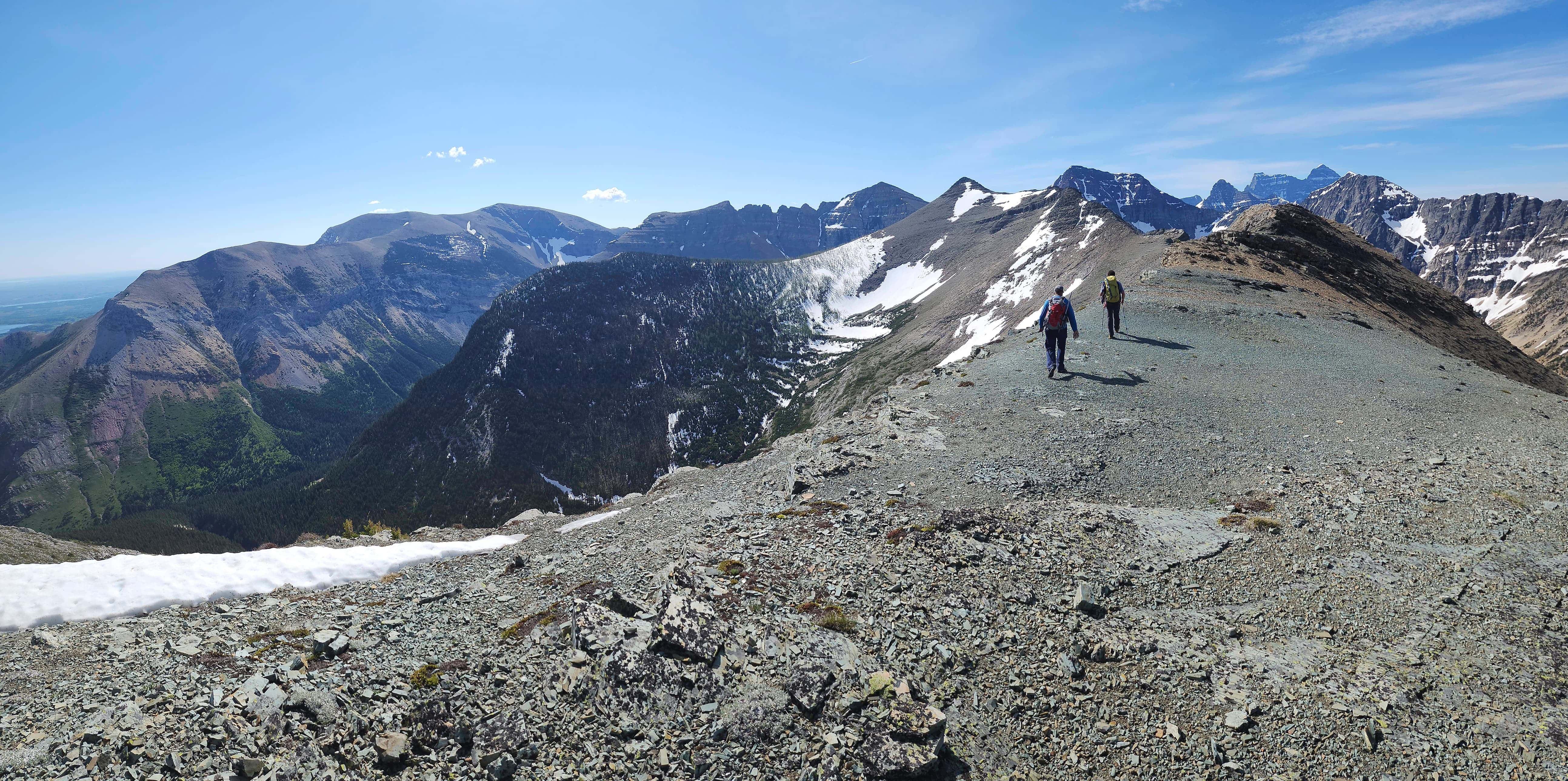
The route to Maisstooinastáko (Arras Peak) is straightforward from here.
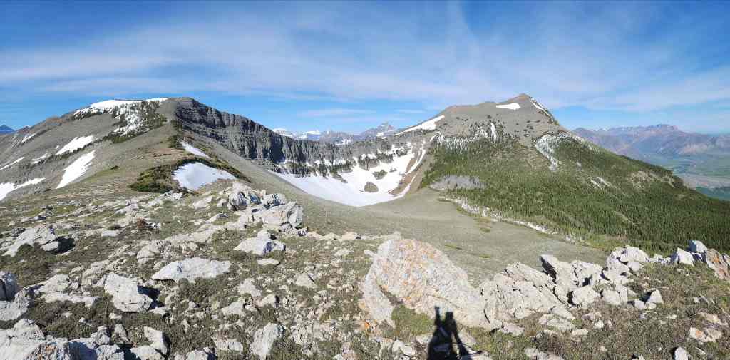
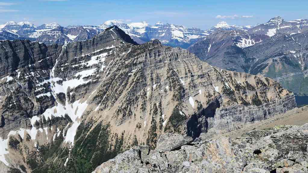
Maisstooinastáko (Arras Peak) on the right with Maisstooinastáko (“Petit Vimy”) to the left of centre

Heading onto the main ridge. (Photo by Drew Nugara)

I was sucking air on this trip due to a lingering virus and often fell well behind Brad and Andy.

Mr. Nug’s view back from the previous photo with Istiikoiistakoo (Sofa Mountain) on the right. (Photo by Mr. Nugs)

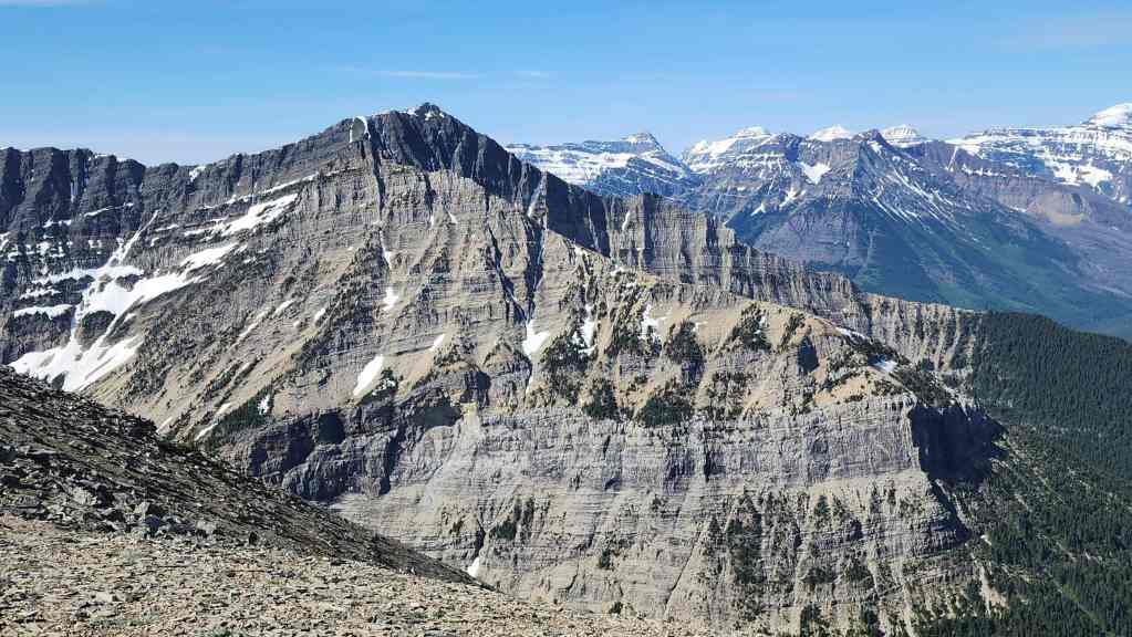
On the main section of Maisstooinastáko (Vimy Ridge) and looking over to Saakiihmabii / Maisstooinastáko (Vimy Peak).

A pano in the same direction.

Andrew and Brad discuss tactics.

Looking west at Upper Waterton Lake, Mount Richards (right of centre) and Mount Alderson (far right).
Mount Boswell is one of the last official peaks that I have yet to visit in Paahtómahksikimi (Waterton). Hopefully I can get to it this summer. 🙂 Edit: Done!

Brad leads as we head along the ridge.

Not only was it a gorgeous day, but there was just enough of a breeze to cool us off.

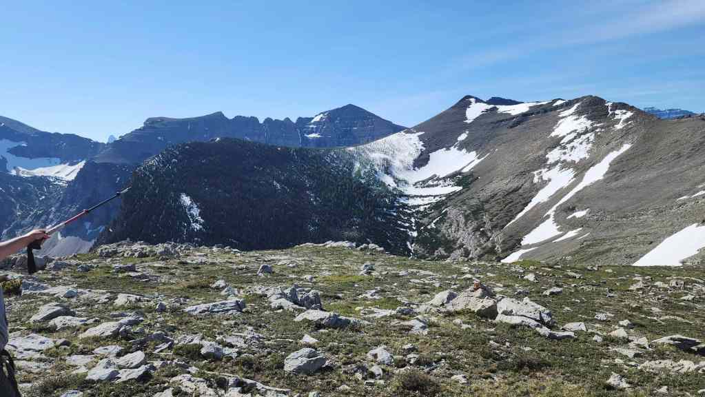
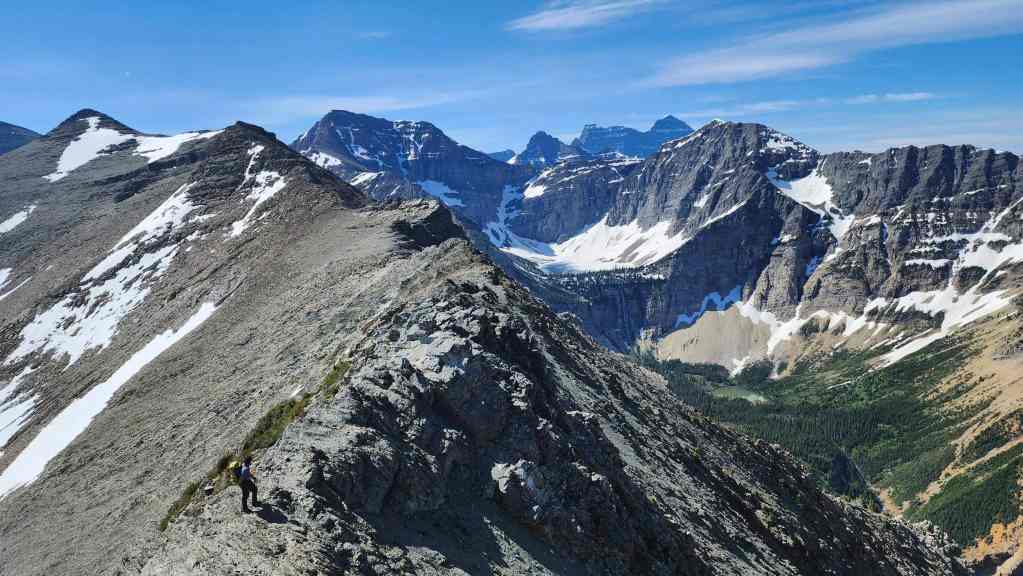
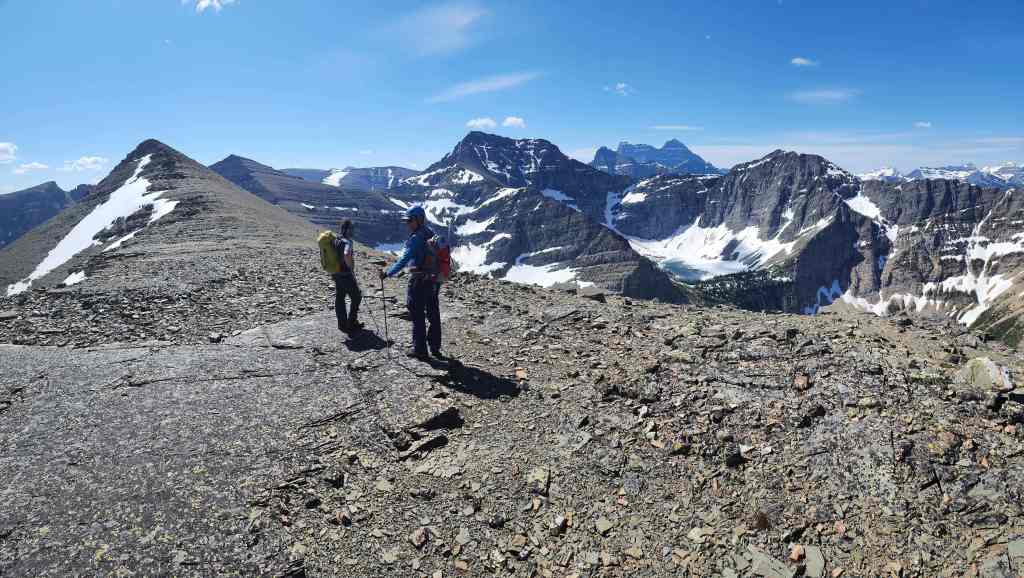
The route to Maisstooinastáko (Arras Peak) and Maisstooinastáko (“Petit Vimy”) is crystal clear.

A closer look at Maisstooinastáko (“Petit Vimy”) (foreground right of centre) with Istiikoiistakoo (Sofa Mountain) behind it.
Another pano to the west.
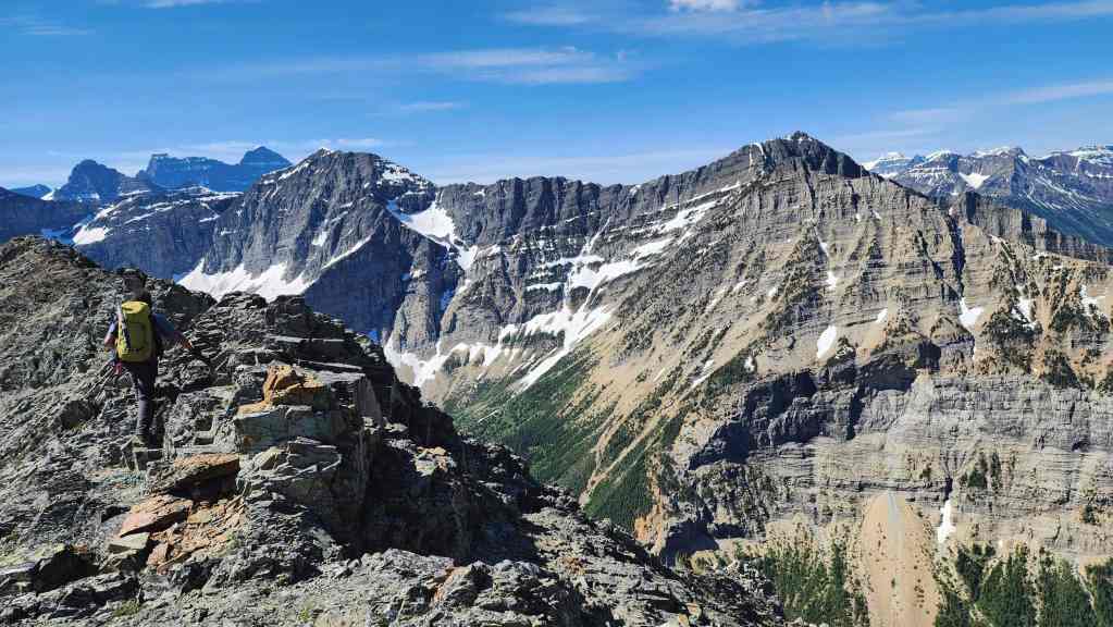
Brad tackles the first of several sections of scrambling. None of it is too difficult, but it does slow progress and it would take us almost 2 hours to make the ~2 km trip.

My view back to Andy from the previous photo.

A short break before the next section of scrambling begins. (Photo by Mr. E. Bikeman)

Brad pauses to take in the outstanding view.

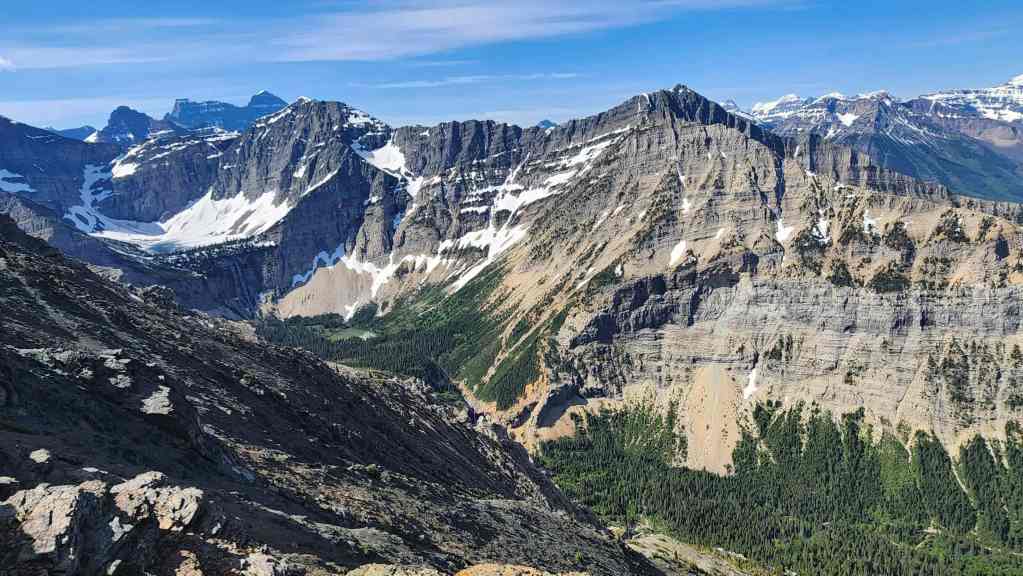
Looking along the ridge towards Crypt Lake (centre).

A closer look at Crypt Lake…

And then Crypt Falls.

The tarn that sits above Burnt Rock Falls.
Another pano with Boswell on the right.

Approaching a narrow section of ridge. (Photo by Andrew Nugara).
Brad (lower left) waits for us as we complete the short scramble down.

Brad’s view back to us from the previous photo. (Photo by Brad Wolcott)

Andy picks his way through the rock.
Continuing along the ridge after rejoining Brad.

Yet another pano to the west. Coincidently, at the same time we were were here, somewhere down on Boundary Bay on Upper Waterton Lake, was my oldest son, Joel. 🙂
My view back to Andrew.

Continuing to admire the views.

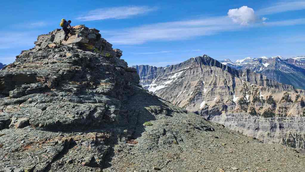
Brad leads the way towards the top of another high point. This was completely avoidable, but why not? 🙂 (Photo by Andrew Nugara)

Brad waves from the top. (Photo by Mr. Nugs)

One benefit of making the diversion to the top of the high point, was a great view of Hell Roaring Creek as it pours over the cliffs at Burnt Rock Falls. Note the Crypt Lake trail on the left.
Heading up the final high point before the summit.

Andrew makes the easy scramble.

The view back and along the ridge.

The summit (left) is not far off…
And it’s an easy hike to reach it.

Another view back as Patient Zero catches up. (Photo by Drew Nugara)

Gazing down at the Crypt Lake trail and group of hikers (centre) who are about to enter the tunnel.
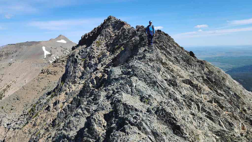
Climbing up to the summit.
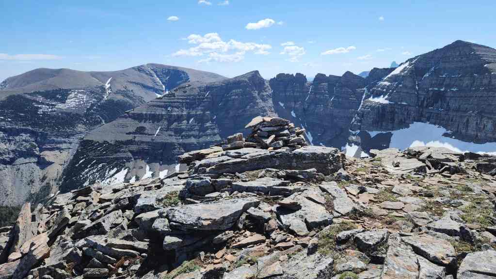
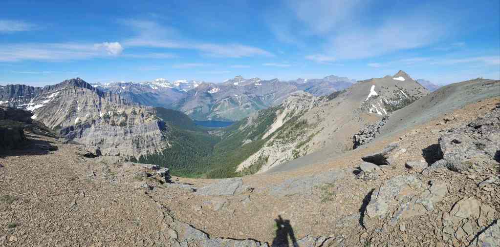
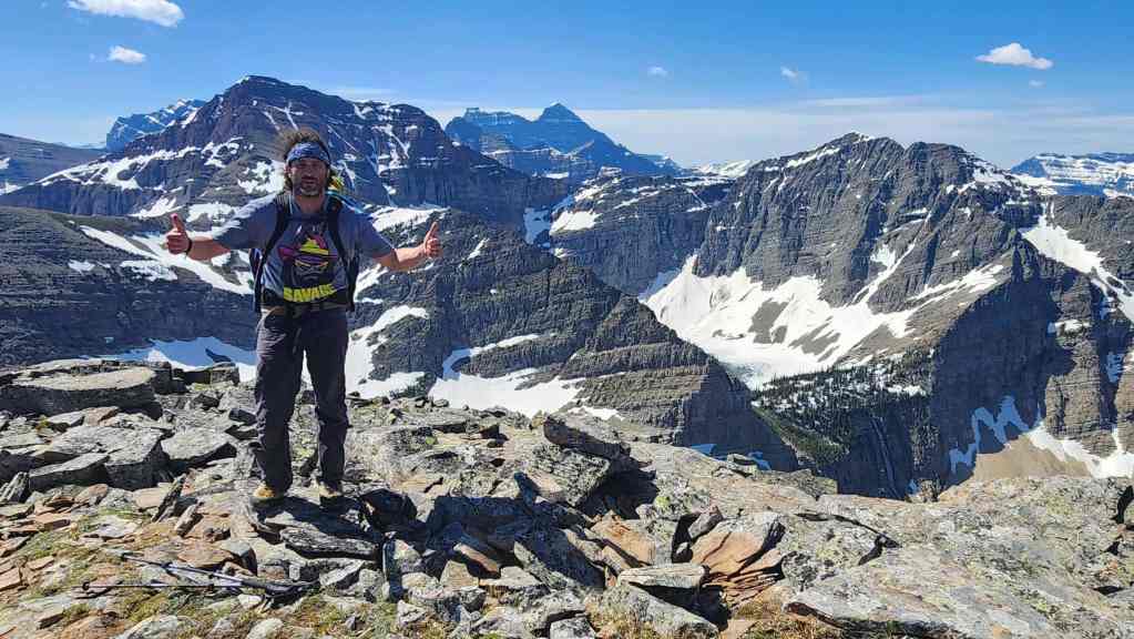
The summit of Maisstooinastáko (Arras Peak) (2430 m).
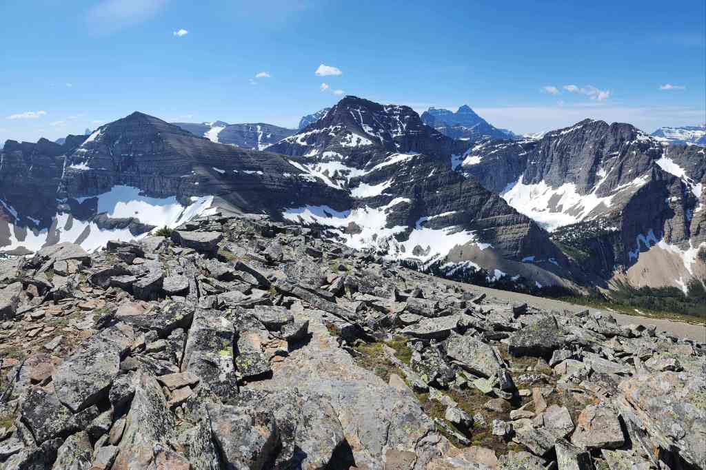
A pano to the south…
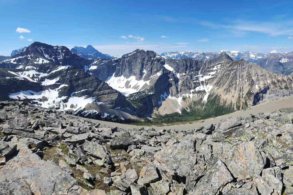
And then one to the southwest.

Looking west…

And now north.

Finally, the view to the east.
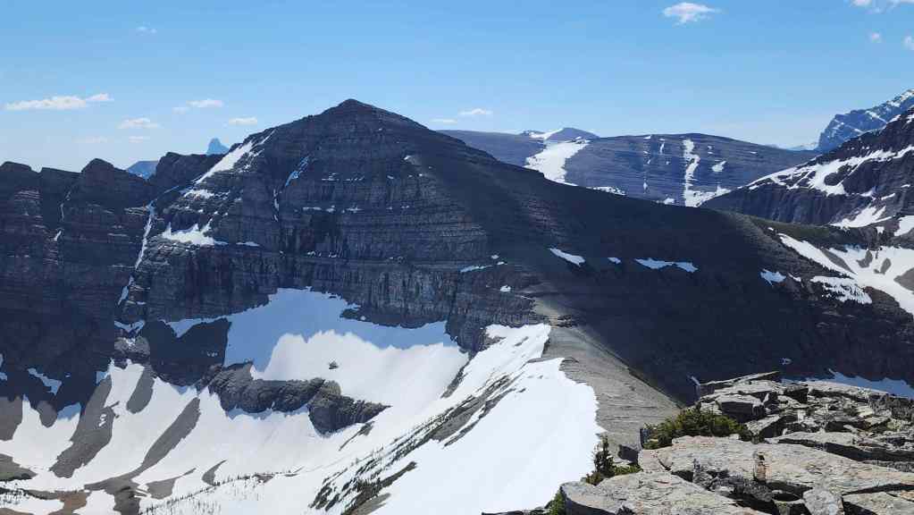
The elephant in the room. This unnamed peak immediately to the southeast has been called the unofficial summit of Maisstooinastáko (Vimy Ridge) – and that would make sense. However, Arras is the official high point, so I’m guessing that the map makers decided that the large col between the two, eliminated the unnamed peak from contention. That, or they just thought, ‘Nah, I’m too tired to keep going.” 😂 Personally, I think a good nickname for this peak is Maisstooinastáko (“Hill 145”) which was the highest point on the actual Vimy Ridge in France and is where the Canadian Vimy Ridge Memorial is located.

The other elephant in the room is “Crypt Peak”, which is the highest peak in the immediate area but also does not have an official name. Andy has two great trip reports for it: one from 2018 and one from 2021.
Looking past “Crypt Peak” to Niitaaspiitaa (Mount Cleveland).
Cornelius Rott calls this unnamed peak located between “Crypt Peak” and Mount Boswell, “Wilson Ridge”.
I will be back for Mount Boswell in the near future. 🙂 Edit: Done! Didn’t I just mention that… 🙂

Zooming in on Crypt Lake.
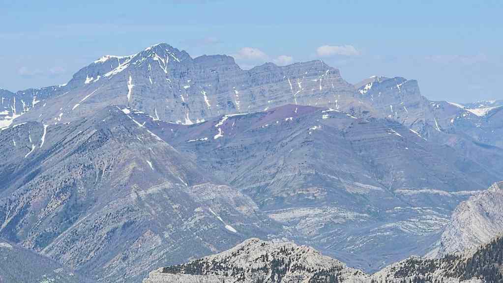
Mount Alderson (left of centre) and Mount Carthew (right of centre).

Gazing across to Akiiohtaikiistakoo (Bertha Peak) (foreground centre) with Mount Rowe (left of centre) and Mount Lineham (far right) behind it.
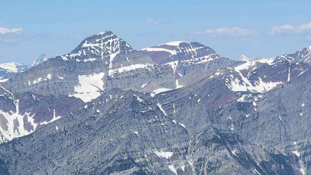
Piinaquiium / Ahkoinimahstakoo (Mount Blakiston) (left of centre) and Anderson Peak (right). In front of them sits Ruby Ridge.
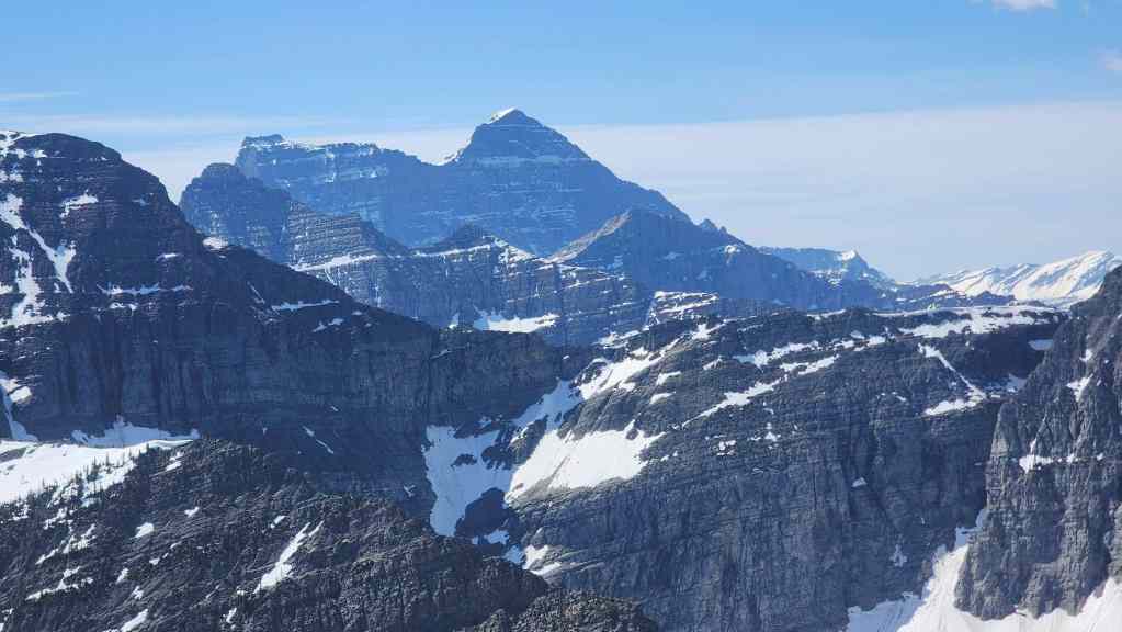
The view back to Saakiihmabii / Maisstooinastáko (Vimy Peak).
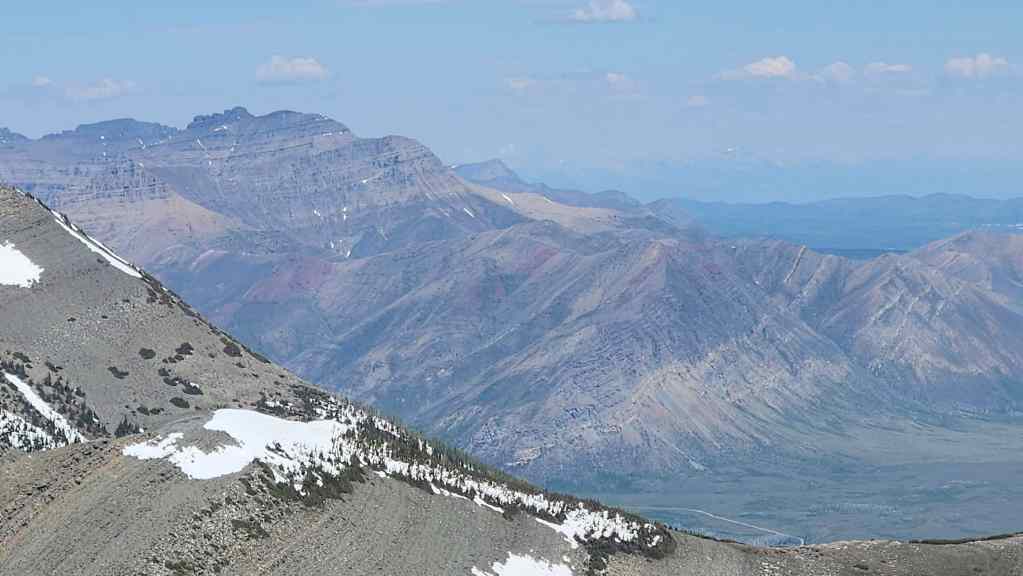
Looking towards Mount Galwey (far left), Mount Dungarvan (left), “Rogan Peak” (left of centre), and Bellevue Hill (centre).

The three peaks that comprise Lakeview Ridge.

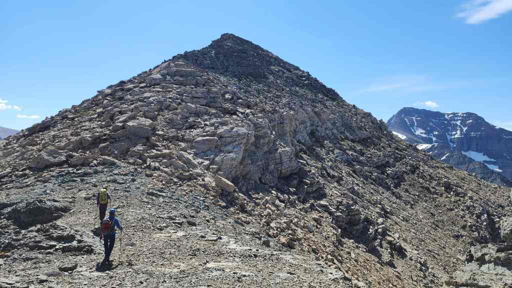
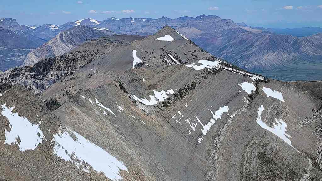
Our next objective for the day, Maisstooinastáko (“Petit Vimy”).

To the east sits “Slide Out Mountain” or Istiikoiistakoo (Sofa Mountain).

Finally, one more look at the unnamed peak to the south and the expansive bowl beneath it.

There were three registers on the summit. The green one is a Blackfoot smudging kit.
Brad “Macho Man” Wolcott.

The man with many names… 😂
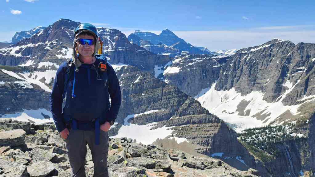
And finally, Patient Zero.

Enjoying a leisurely lunch on the summit.


Leave a Reply