⚠️ Hiking and scrambling are inherently dangerous activities. Please read my Disclaimer. ⚠️
(Edit: Our successful return trip to Mount Backus is here)
Mount Backus was Plan B. Or maybe it was Plan C, or even Plan D. I’m not exactly sure at this point. When we left Lethbridge in the morning, we knew that the weather forecast had changed significantly over the past few days and that a weather system from BC was bringing snow to the mountains. I’d been planning a winter hike up Whistler Mountain in the Castle Crown for well over a month and I was hoping that this might be the day, but knowing the weather would be sketchy, we left Lethbridge with no particular mountain set in our sights. Just before Pincher Creek, the sun disappeared and the snow began falling and we could see that the west was looking darker and darker, so we decided to stay as close to the front ranges as possible. Opting for the Castle Crown over the Crowsnest Pass (Bluff Mountain was considered briefly), we arrived in Beaver Mines under increasingly snowy conditions. You know it’s socked in when you can’t even see the mountains from Beaver Mines (let alone any of the other surrounding ‘bumps’ and hills). We drove down Highway 774 and turned towards Whistler Mountain just to check things out, but when we arrived at Beaver Mines Lake (after plowing through a foot of fresh snow all the way up) and couldn’t even see the base of Table Mountain or Whistler Mountain, we knew that Whistler was a no go. Looking further to the west, the sky was even darker, so I suggested that we try little Mount Backus which is located just inside the Castle Crown Wilderness Region off of Highway 774 (actually the western half is in the Castle Crown and the eastern and northern sections are on private land). At 1827m, it is similar in height to Carbondale Hill and seemed doable given the circumstances at the time.

I’ve never found a trip report on Mount Backus but I’m sure one exists somewhere. I’ve studied it on a map several times and knew that it was possible to approach it from the southwest section off of Highway 774 on Crown land. Since the weather prevented us from even seeing the actual mountain from the road, I had to rely on the topo map on my GPS and my memories of what the terrain looked like on a clear day. As per usual with my hikes, there was no trail to follow and this would be an excursion of pure exploration – which is my favorite kind! Unfortunately, we only made it to the base of the mountain because Jeff was having an incredibly difficult time postholing through waist deep snow and over the copious amounts of deadfall. I had snowshoes but Jeff didn’t and if you’ve ever wondered if snowshoes really make a difference, see the pictures below where Jeff is frequently up to his waist in snow. Even then, at the base of the mountain, we couldn’t see more than 100 metres in front of us because of the heavy snowfall and clouds, so if we had made the summit, we’d have had absolutely no view. The winter landscape that we did encounter was still enjoyable and the low cloud and fresh snow provided some great atmospherics within the forested sections. I hope to return later this winter and finish this hike – hopefully with Jeff and hopefully with him having snowshoes 😉
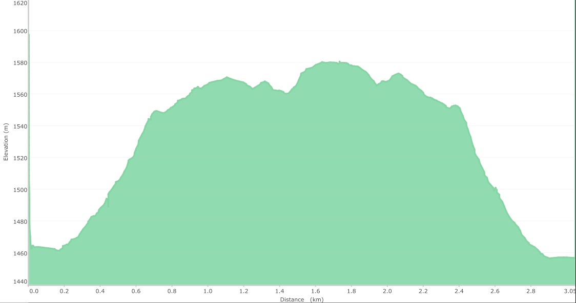
Our little exploratory hike was short and without much elevation gain. The summit of Mount Backus sits at 1827m so we had another 247m of elevation left to gain. In total, this hike was a mere 3km.
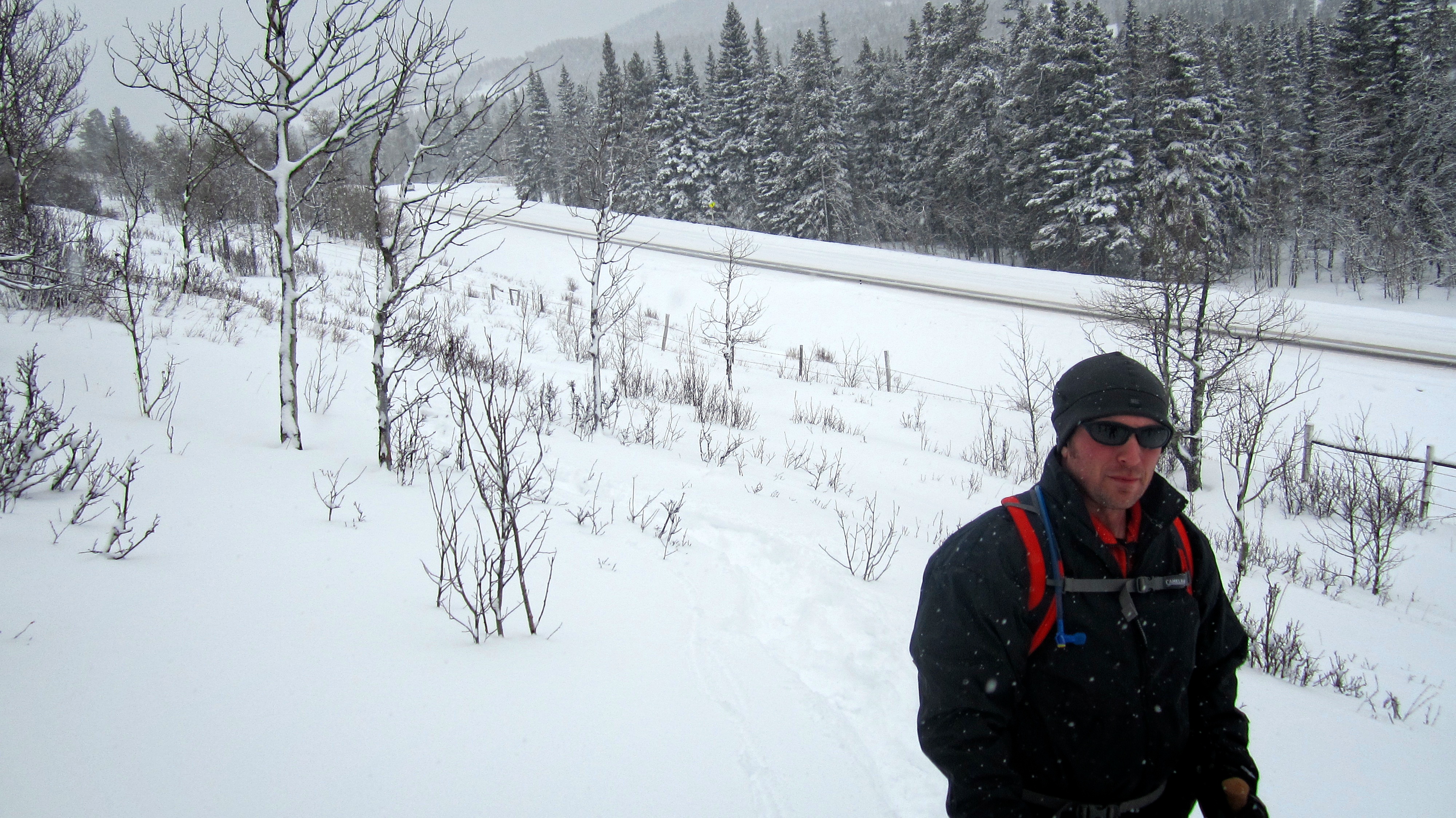
The snow wasn’t too deep as we started up the slopes from the highway.

The initial section north of the highway takes you through a series of aspens.

I had snowshoes and had an easy time of it…

But Jeff didn’t. Here is the first section of deep snow that we encountered as we left the aspens and headed into the evergreens.
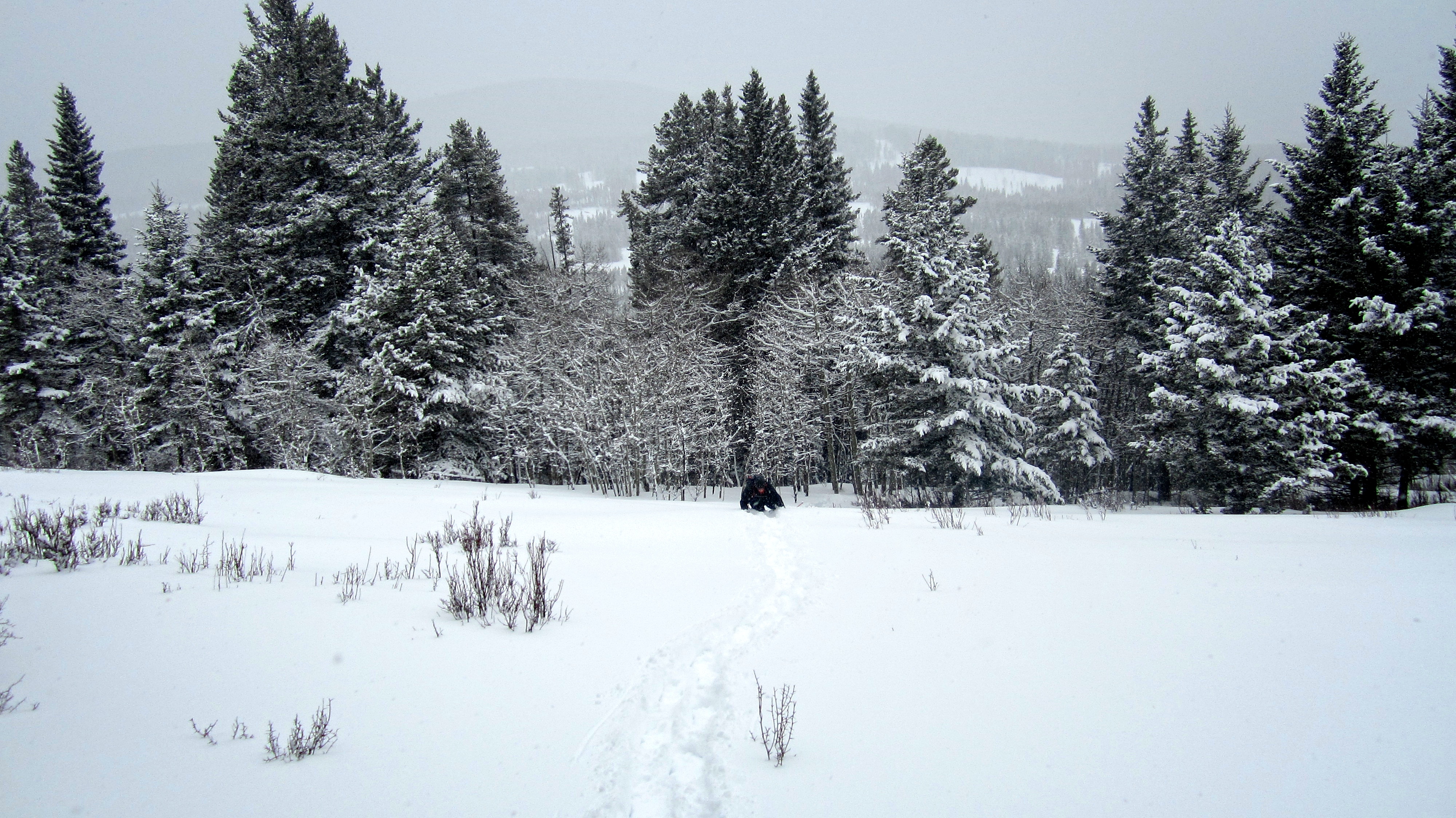
Looking back at Jeff as he crawls (yes crawls) over a snow drift. The grey, overcast sky greatly limited our visibility.

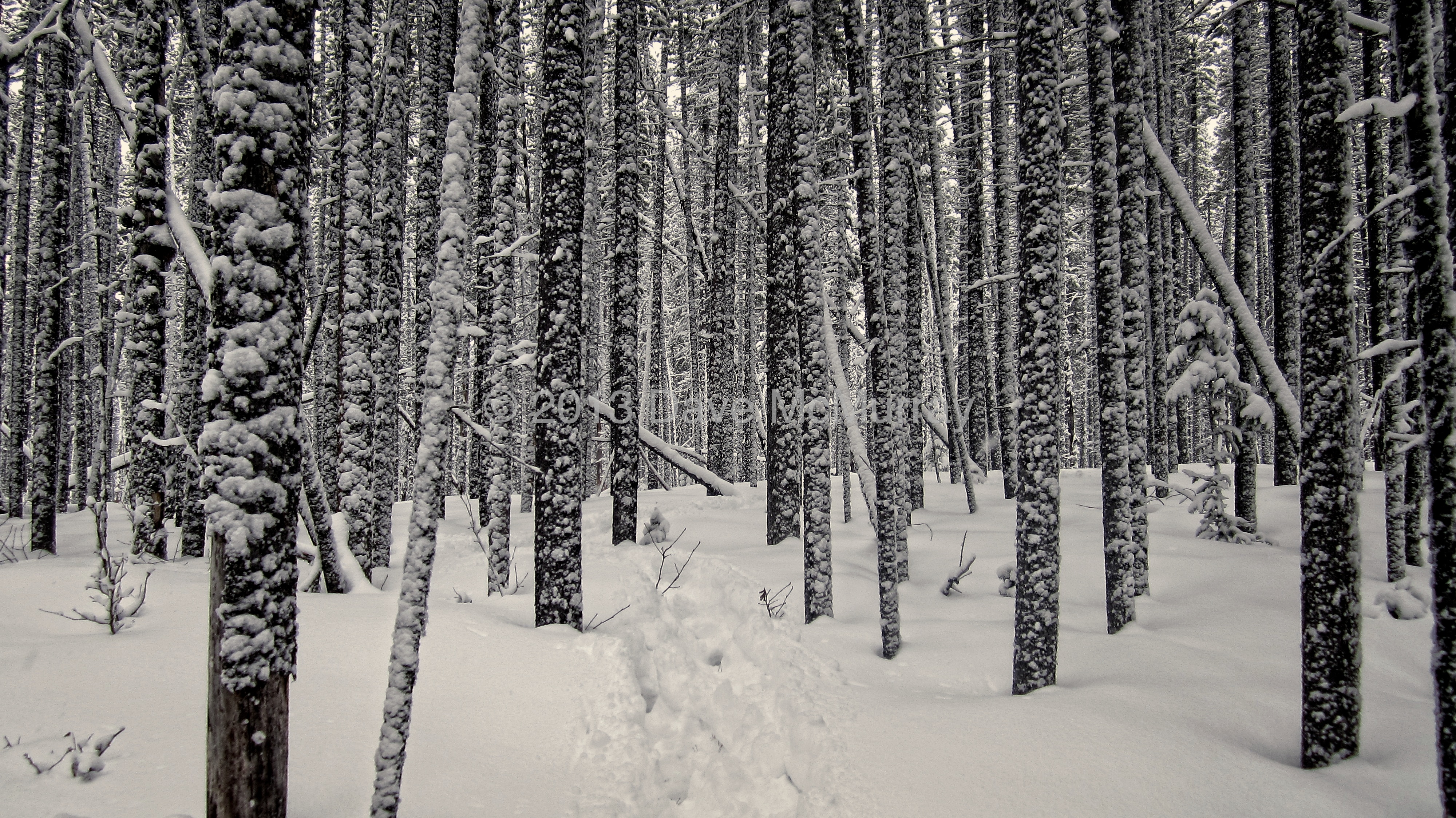
The first of many beautiful winter scenes.

The higher we went, the deeper the snow. This section of Mount Backus is sheltered from the prevailing winds, so the snow is able to accumulate and does not become packed down.

Even though he was following directly in my snowshoe tracks, Jeff was still working hard at postholing.

Another beautiful scene. The fence posts indicate the depth of the snow.

Here is Jeff standing in the same spot from where I took the previous picture. I was up to my knees with snowshoes in that spot and well, you can see where Jeff was without them.

Sometimes gloomy weather provides just the right atmosphere for intriguing beauty. As we neared the base of Mount Backus, we entered a section of forest where the lack of wind combined with the moderate snowfall, made for an amazing stroll through the trees – at least for me, but probably not for Jeff who was still postholing and working 5x harder than me for every metre gained.

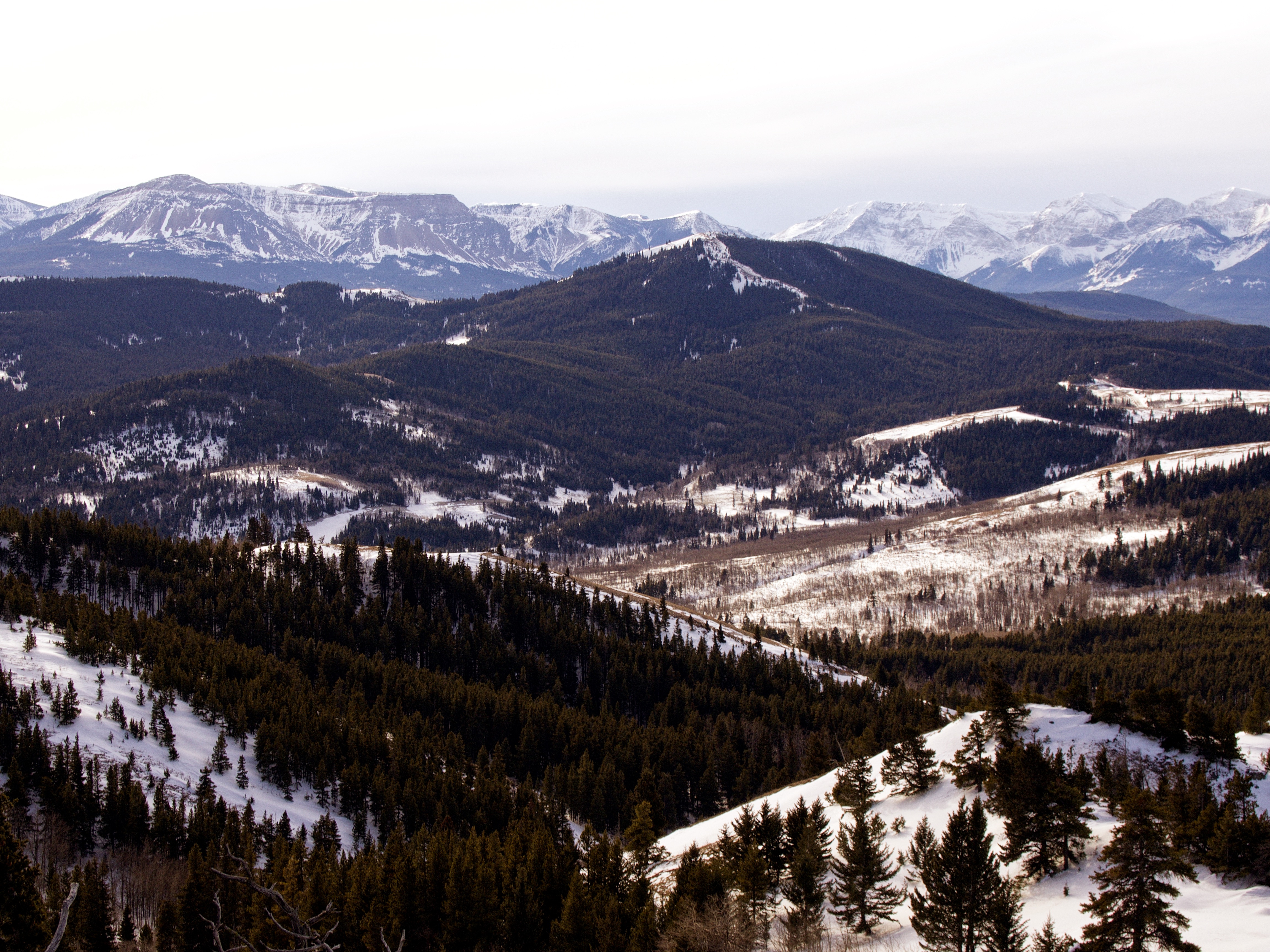
We should have been able to see the upper section of Mount Backus in this picture because the ascent slopes were only 300m away.

If you have ever wondered whether snowshoes actually make a difference, this should be proof that they do. You can see my snowshoe tracks in the foreground and how much further Jeff sank even as he tried to follow them. Poor little guy…

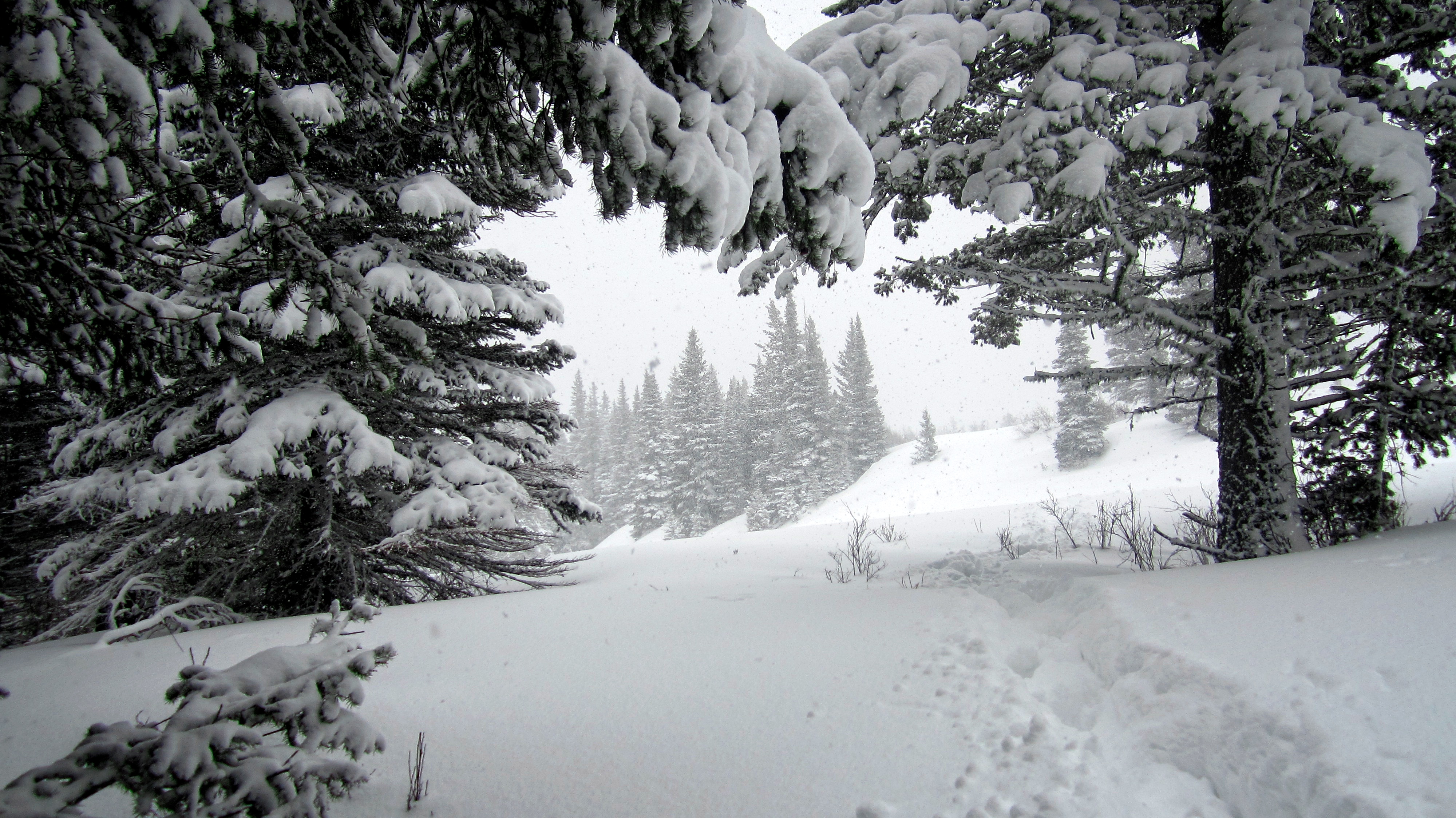
More forest magic. This is why I love exploring new places even if I don’t achieve my summit goal. I will come back to finish what I started, but I doubt I will see this section of forest in this condition again. In this picture, I’m far in front of Jeff and I’m looking back at my tracks. He is somewhere out there in the trees…

Another camera angle in the same section of forest.

Exploring the woods on a winter day with only the topo map and the compass on my GPS to guide us was downright fun – and peaceful – though probably not for Jeff who by this time was getting tired of postholing up to his waist through deadfall (which can be quite hazardous to certain parts of the body). For me, it was like being a kid again when I would spend hours exploring the forest around my home.
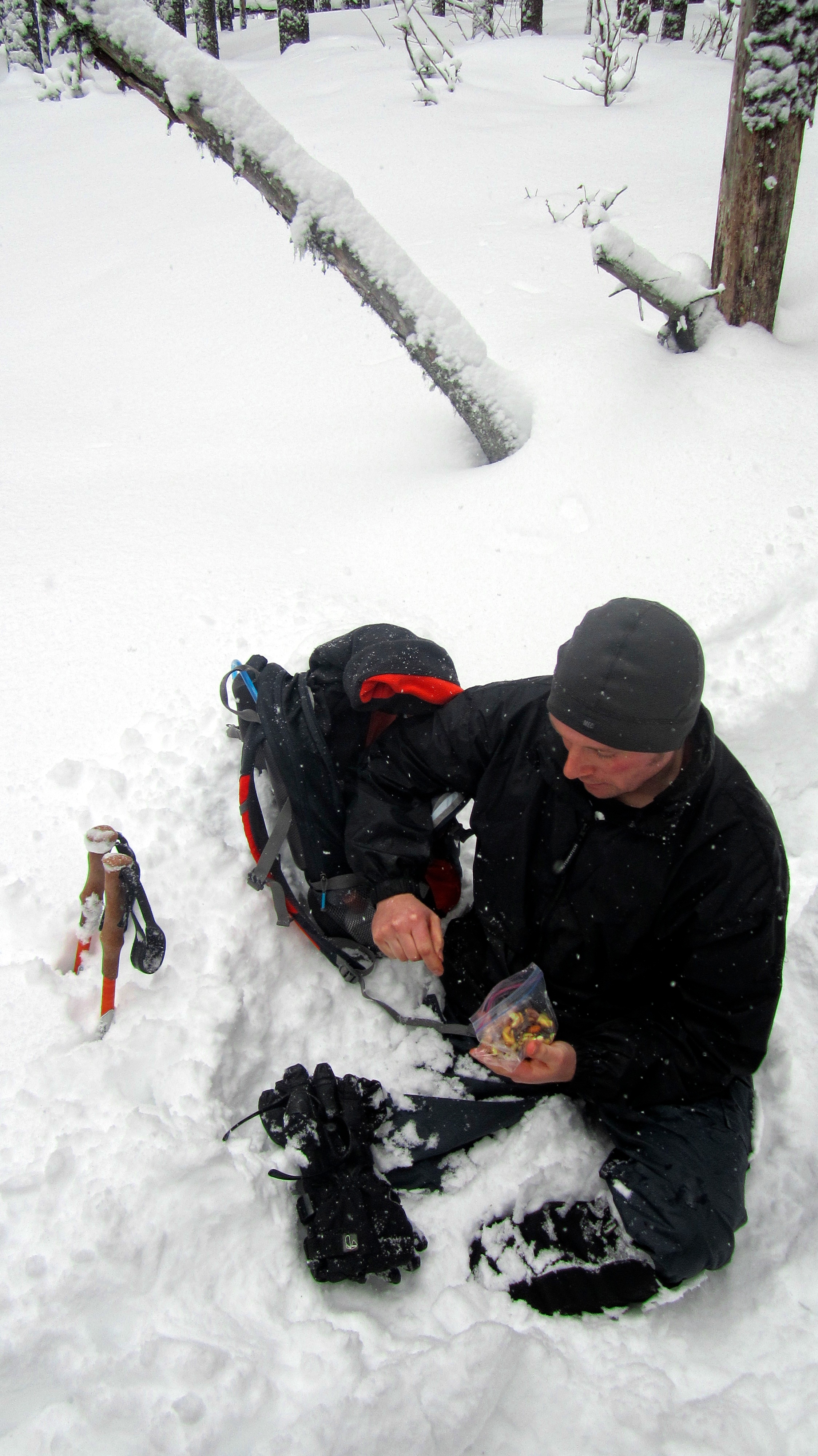
200m from the main slopes of Mount Backus, we decided to stop for lunch and here we made the decsion to turn around because to get to the point of actually climbing, we had to negotiate a slight elevation loss combined with a thick smattering of deadfall. Jeff, who had probably burned 2000 more calories than myself at this point, was a trooper, but I didn’t want to torture him by making him posthole any longer. Besides, the possibility of returning as a eunuch due to postholing over more deadfall wasn’t an appealing notion to Jeff.
The snow keeps falling as we follow our tracks back to the vehicle.

Again, I felt sorry for the guy. I guess I could’ve let him wear my snowshoes on the way back, but perhaps I’m really not that nice of an uncle. 😉 Anyways, we will definitely return to Mount Backus to complete this as a winter hike and Jeff will definitely have snowshoes. As I’ve said in other posts, I love all the little bumps like Mount Backus that adorn the Castle Crown and the Crowsnest Pass. I’d probably never consider them as destinations in the summer and fall when there are ‘real’ mountains to climb, but for a winter excursion, they are a fun way to (hopefully) gain a summit and not have to worry about avalanches. Besides, exploring off-trail in the winter adds an extra dimension of beauty to the landscape – even when the weather is less than ideal. (Edit: I returned on 15 April 2014 and finally ‘conquered’ Mount Backus)