

⚠️ Hiking and scrambling are inherently dangerous activities. Please read my Disclaimer. ⚠️
I’ve been saving little Wedge Mountain for a winter’s day just like today – a bluebird where I could quickly solo hike/snowshoe to the summit and enjoy the views of the Crowsnest Pass – and it didn’t disappoint! I keep a number of other ‘little’ winter destinations like this in my backpocket, and each time I pull one out, I’m always amazed at how much fun they are. Located just north of Coleman, Alberta, Wedge Mountain has sometimes been called, ‘the poor man’s Crowsnest Mountain’ because of its diminutive size and close proximity to Crowsnest Mountain. It is another example of the volcanic formations which dot the landscape in the Pass (ie: Willoughby Ridge) and though it isn’t tall, it offers some great views, particularly of the aforementioned, Crowsnest Mountain.

To get to Wedge Mountain, I turned right onto 61st St. on the western end of Coleman and followed 23rd Ave to the base of the mountain. There is ample parking and on this day, there were truckloads of snowmobilers marshalling on the side of the road. Once you park, simply follow the cutline to the south end of Wedge Mountain and pick a place to go up. I crossed the bridge over the creek and immediately went up a clearing on my left hand side. The first section to climb is the steepest and the rock is quite loose.

Wedge Mountain is not only short in stature, but it is also a short distance to the summit which sits at 1870m. The total elevation gain was 474m with a total round-trip distance of 3.8km. I didn’t have time for a long outing today and Wedge fit the bill. From my car to the summit and back again, it only took me 2 hours and 37 minutes. I would imagine that in the summer, this time would be considerably shorter.

Approaching Wedge Mountain from the south along 23 Ave. The previous day’s snowfall made for a scenic day.

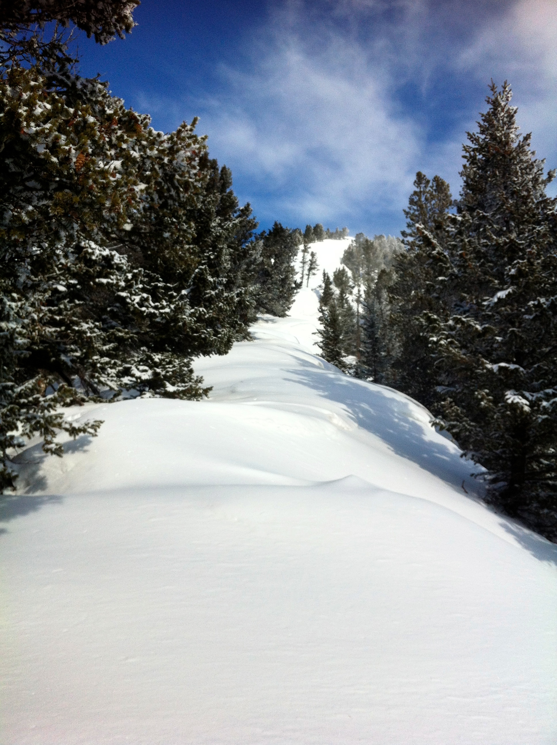
Looking up the south slope of Wedge Mountain shortly after leaving the cutline. As I mentioned before, the rock here is quite loose and when covered in snow, is slippery as well.

A nice view of Mount Tecumseh appears shortly after gaining some elevation. “Shooting Star Peak” is on the right.

Once I gained the ridge, the snow drifts were deep enough that it was time to put on the snowshoes.

And this is why you climb Wedge Mountain – for these kinds of views of Crowsnest Mountain. The forecast called for 15km winds from the west, but I’m sure they were hitting 30-40km at times and I was worried that the increasing cloud cover would obscure my views from the summit. I started just about mid-day and the temperature was -12c.

Looking back at Turtle Mountain and the towns of Coleman and Blairmore. Burmis Mountain is visible on the left and part of Hillcrest Mountain is visible on the right.

Looking towards the summit from a little cairn along the ridge.
The route to the summit is really obvious. (iPhone 4 pic)

Getting closer to the summit. I’m glad I had snowshoes but I should have also packed my skis to come down on. It wouldn’t have been a long run, but it might have been fun.

And another view of Crowsnest Mountain.

The same view as above, but with something now detracting from the natural beauty. Hey, it’s my first selfie of 2014!

The summit of Wedge Mountain. I thought the cross on the summit was a nice touch by whoever put it there. My only regret was that I was unable to bring back a summit rock to add to my collection because everything was burried under a metre or so of snow.

Looking south from the summit toward the Flathead Range. Mount McLaren and The Saddle are in the centre and Willoughby Ridge is on the left. Mount Coulthard is to the left of McLaren, and Andy Good Peak, Mount Parrish, and Chinook Peak are immediately to the right of McLaren.

It was a beautiful scene at the top. These little summit destinations might not appear to be as impressive as the big guys, but add some snow and presto!

Looking east from the summit. The South Peak of the Livingstone Range and Morin Peak are in the distance on the right and Centre Peak is, well, in the centre. Bluff Mountain is on the far right and Saskatoon Mountain is in the foreground.

Looking southeast from the summit towards the towns of Coleman and Blairmore. Turtle Mountain, Hillcrest Mountain, and Hearts Peak are on the left and Willoughby Ridge is in the centre. Mount Coulthard, Mount McLaren, and The Saddle are on the right.

Looking north from the summit. This would be a cool place to winter camp for a night.

My second selfie of 2014. Unintentionally, this picture captures two very important aspects of my life through symbolism: my faith and my love of the mountains.

Looking to the northeast at some beautiful snow covered trees.

One final summit shot looking to the west before it was time to head home. “Deadman Peak” is the mountain obscured by cloud to the left of Crowsnest Mountain.
An interesting geological note: the rocks at the top of Crowsnest Mountain are older (Paleozoic) than the rocks at the bottom (Mesozoic). Apparently the layer of rock at the top was once “connected with the rocks forming the High Rock Range to the west. The sheet was pushed upward and eastward, riding over the younger rocks that now form the base of the mountain. Beneath the cliffs is the Lewis Thrust Fault which is nearly horizontal, sloping west beneath the cliffs of the High Rock Range. Long after the limestones were pushed eastward on the fault, the streams cut down through it to make the mountains we see today. They cut away around all side of Crowsnest Mountain and left the peak isolated, an island of old rocks sitting on younger rocks. The island of rocks above the thrust fault made Crowsnest Mountain a geologic feature called a klippe.” (Peaks of the Canadian Rockies http://www.peakfinder.com/peakfinder.asp?Peakname=Crowsnest+Mountain)

Some of the drifts near the summit were a little deep.

Looking back down at my ascent route from near the summit. (iPhone 4 pic) Yup, skis would have been fun…

The point where it was time to ditch the snowshoes. You can see the cutline that I followed to get to the base of the mountain.

Looking down at my vehicle. For some reason, whenever I see my vehicle from a mountain, I always wonder what I’d do if I saw someone get in it and drive away. Anyway, this is the section with the loose rock. Chinook Peak and Sentry Mountain are in the background. Island Ridge and Loop Ridge are visible on the far right.

Looking back at Wedge Mountain at the end of a great day. The summit is in the distance and the initial ascent slope is in the foreground. I’d highly recommend Wedge Mountain for a winter outing, especially if you are pressed for time. I’d also recommend it as a summertime entry level mountain for adults or kids.


Leave a Reply