

⚠️ Hiking and scrambling are inherently dangerous activities. Please read my Disclaimer. ⚠️
This was another, “unfinished business” trip. Back in June 2017, I joined a group from the ACC to attempt a multi-day, Great Divide Trail (GDT) trip from Southfork Mountain to Paahtómahksikimi (Waterton). We had planned to tag La Coulotte Peak, La Coulotte Ridge, Jutland Mountain, Mount Matkin, and Font Mountain. Unfortunately, that trip took a different turn than we were expecting and ever since, I’ve maintained good intentions to one day visit these peaks.
In fact, Jutland has always been of interest, not because of the peak – though that came later – but because of South Scarpe Lake (sometimes called East Scarpe Lake). Growing up with an obsession for fly fishing, my awareness of this area first came when I was sixteen and the fly shop where I hung out – Fishing Sports for all you 1980s Calgary folks – was a fantastic place for knowledge transfer. I remember one of Jim Gauld’s guides talking about a recent trip to Tatsiki-Miistáki (Castle) and regaling us with stories of elusive golden trout and eager cutthroats. I distinctly remember him mentioning South Scarpe Lake and its seemingly non-stop action, and this memory, whether accurate or not (I’m old now), has persisted. Later, Joey Ambrosi’s Fishing the Canadian Rockies and Hiking Alberta’s Southwest, further cemented South Scarpe into my fishing brain.
Thankfully, there have been a number of ascents of Jutland in recent years and online knowledge of the mountain and the surrounding area has been well documented. Of course the late, great Rick Collier left a trip report; however, there are more current reports by Cornelius Rott and Jonathan Alston and perhaps not surprisingly, many of my born-and-raised Lethbridge fishing friends have fished South Scarpe – though strangely, almost all of them note that the last time they visited the lake was at least thirty years ago. 😂
So, you would think that I’d bring my fly rod on my first trip to Jutland? Well, I didn’t. As this was a day trip over a long distance and with a lot of ground to cover, fishing was not in the cards. However, I will report that I saw lots of cuts cruising the shoreline and some decent rises, particularly in the afternoon after the temperature warmed. There was also a nice school of small cuts in the pool near to where we crossed the South Castle River.
Outside of the lake and the fish, what made this trip unique, was a chance meeting with Brandon Boulier at the trailhead. Brandon had just completed his 1000th summit and was setting off on a solo, two-day trip to Jutland, Matkin, Font, and Sage. Andrew and I then had the pleasure to travel with Brandon to the summit of Jutland before parting ways. That he would also summit Matkin the same day and then Font and Sage the following day is herculean. I’m always amazed at how many gifted hikers and scramblers there are. In fact, the older I get, the more I appreciate their achievements. Thanks Brandon, for the company and the inspiration.
Now that Jutland is done, my next trip into the area will have to include at least Matkin and Font, and if possible Sage, though Cornelius’s report did not make it sound as inviting. Oh well! 😁 Edit: Done, done, and done! 🙂

To get to Jutland, we headed south from the hamlet of Beaver Mines along Highway 774 until we came to the turnoff for Beaver Mines Lake. Here we turned left and followed the gravel road for ~3.7 km until we came to the South Castle Road, which was located on our right. We followed the road for ~600 m before arriving at a couple of information signs for Castle Wildlands Provincial Park. Also in the immediate vicinity were numerous random camping spots.
Here is where things get interesting and unless you have a 4×4 or some type of high clearance vehicle, you will need to park your car and get out your bike. Fortunately, I had my trusty Taco so we followed the road across the dry creek bed and proceeded another ~5 km down what at times, was a rough road, until we came to a set of concrete barriers marking the trailhead. This was our starting point.
From the trailhead, we then biked for ~12.1 km (~1 hour) along the South Castle Valley Trail until we came to the Scarpe Creek trail that leads into the valley between Jutland and Lys Ridge.
After stashing our bikes, we then followed the trail for ~3.6 km until we came to the trail leading to South Scarpe Lake. We were thankful that it was mid-September, because the water level in the South Castle River was very low and crossing was not an issue.

We initially missed the South Scarpe Lake trail and had to double back. We then noted that a well-placed log marked the start of the trail. The trail was in excellent condition and though steep at times, the ~2 km (310 m elevation gain) hike was almost entirely in the trees.
From the lake we then chose 3 different routes up the west-facing slope of Jutland’s northeast ridge. As his pack was heavy with overnight gear, Brandon stuck to the grass slopes, while Andrew and I scrambled up a gully that I eventually left in favour of angled approach onto the ridge near the summit.
After saying farewell to Brandon, we then followed Jutland’s northwest ridge before descending back to the lake and the trail via the east slopes. We then retraced our route back to our vehicles.

Our total roundtrip distance was 42 km with a total elevation gain of 1287 m. Our total roundtrip time came in at an even 9 hours.

We started off the day by coming across a dead cinnamon black bear on the South Castle road.

The young male had either been shot or killed by a grizzly – but more than likely shot. It had been dead for a while, but on our way out, we encountered a sheep hunter who had come in two days prior, and the bear was not there, so my guess is that it had been dead for about 24 hours. When we drove out at the end of the day, the carcass had been removed, but I still phoned Fish and Wildlife once I was in cell range. Poor thing.

You can tell it’s a black bear because of where its ‘pinky’ or smallest digit sits on the front paw. It is lower than the others and if you draw a straight line across the top of the foot pad, it would be almost below the line.

Leaving from the South Castle Valley trailhead. It was super cool to meet Brandon while we were gearing up and I’m glad that we could travel together.

Passing our starting point for West Castle and Lys Ridge.

Looking at our 2016 ascent route onto Lys Ridge.

Trying not to get tazed as we cross an electric fence. 😂

Our first look at Castle Peak from the trail…

with an even better view coming a short time later.

Avoiding a water trap. (Photo by Andrew Nugara)

Getting our first view of Jutland (left of centre) along with the summit of Lys Ridge (right).

Zooming in on the previous photo at the summit of Jutland (centre).

The first stream crossing…

And now the second. While Andrew opted to rock hop due to the weight of his e-bike, Brandon and I carried our bikes over the bridge. Score one for the human-powered cyclists! 😂

Carrying my bike across the same makeshift bridge. From this point on the trail, the junction with the Scarpe Creek trail is still ~2.5 km away. (Photo by Andrew Nugara)

Continuing along the main trail.

Approximately 1 hour and 12.1 km from the trailhead, we came to the start of the Scarpe Creek trail. From here, it will be a ~3.6 km hike to reach the trail leading to South Scarpe Lake.

The initial section of trail is blocked by deadfall.

Andrew secures the bikes because one can never trust the wildlife. 😂

Once past the deadfall, the trail is surprisingly good.

A short hike brought us to the South Castle River where I could see a nice school of small cuts. 😁 The trail continues immediately on the other side to the right of Scarpe Creek. (Photo by Andrew Nugara)

As it was almost mid-September, crossing the river was easy. However, it may be a different story earlier in the year.

Back on the trail after crossing the river.

Again, we were shocked at how good the trail was.

Further on however, we began to encounter more sections of overgrowth. Still, these posed little difficulty and did not impede our progress.

A black bear track along the trail.

Back on a super good section…

Before entering another section of alders.

Anyone missing a John Deere hoodie? 😂

Brandon’s bright blue, 50 litre multi-day pack ensured that I never got lost in the overgrowth. 😂

Arriving at a dry stream bed.

The trail continues in the stream bed for a short distance, before continuing on the other side.

Back on the trail and passing through a small drainage.

Approximately 3.6 km from the trailhead, we came to the start of the trail heading to the lake. We initially missed it – well Andrew and Brandon did 😂 – but we soon realized our mistake and doubled back. The tree stump in front of us marks the trailhead. A special thanks to Cornelius and the information provided in his excellent report. We knew from his experience, that we didn’t want to miss this trail.

Andrew starts up the trail.

At first it’s fairly flat…

But it soon gets steep. Still, it was surprisingly in excellent condition.

Very old saw cuts…

And some that are very recent. This shows the trail is used regularly.

Despite his heavy pack, Brandon is enjoying the relatively easy elevation gain.

Another look back as we get higher.

Glancing back and towards Lys Ridge.

The lake is not far from here. Our ascent slope is in front of us.

The final section in the trees…

Before arriving a well-developed campsite.

Someone was here recently – eating onions! 😂

Heading to the lake.

Andrew inspects a well-built lean-to.

Next to the lean-to was another hearth and some neatly folded tarps for the lean-to. This is definitely a frequented spot…

And here’s why! 😁

Looking at the east-facing slopes of the northwest ridge that Andrew and I used on descent. There is a good scramble route up a gully on the other side of the buttress. (Photo by Andrew Nugara)

Someone had made a log raft. (Photo by Andrew Nugara)

Another view of the lake which Joey Ambrosi aptly describes as emerald green. (Photo by Andrew Nugara)

Following Andrew along the east end of the lake. As Brandon had a heavy pack, he wisely wanted to ascend via the grassy – and more gradual slopes off the northeast ridge.

Another look at the summit of Lys Ridge (right).

This is such a sweet location! I can see why there is a campsite. (Photo by Andrew Nugara)

We would end up taking 3 different routes: Brandon would trend left, while Andrew and I would follow a gully on the far right, before I eventually left it to angle towards the summit.

Andrew checks out Jutland’s version of Stonehenge.

Heading from the lake and onto the northeast ridge.

The first of many photos of the lake. 😊

Following a gully.

Passing over a small trickle inside the gully.

Arriving at the start of the scrambling…

While Brandon heads over to more favourable slopes.

I told you there’d be more shots of the lake!

Andrew in his natural argillite environment. 😂

I tackle our first obstacle head-on. (Photo by Andrew Nugara)

Looking back to Andrew from the top.

More interesting terrain that we would avoid by ascending through some trees located to climber’s left.

Andrew follows me onto a ledge above the trees.

Heading back towards the gully.

We would scramble to climber’s right of the gully

The final steep section before the terrain softened. Again, we would stick to climber’s right.

Andrew follows me onto a more moderate section.

The gully continued into a cool-looking canyon that would lead onto the ridge.

While Andrew decided to remain in the canyon, I chose to stick to the ridge. (Photo by Andrew Nugara)

Another view of me on the ridge. (Photo by Andrew Nugara)

My view down to Andrew as he enters the canyon.

Fun terrain to scramble along the ridge.

Andrew’s view towards me before I would head further off to climber’s right. (Photo by Andrew Nugara)

My view from the previous photo. By this point, Brandon had already gained the northeast ridge (top).

After leaving the edge of the canyon, I kept scrambling – and angling – closer towards the summit. By doing so, I was able to get partial views of the lake.

I had no difficulties tackling this section.

And yet another view down to the lake.

Brandon arrives on the summit ridge above me.

Another view of the previous photo, but this time with the summit on the right. I probably could have kept circling and eventually scrambled up close to the summit. The north face of Jutland isn’t as brutal as it looks.

Joining Brandon on the ridge just before the summit.

The views from the ridge are great.

A closer look at the northeast ridge. The canyon / gully that Andrew stayed in breaks onto the ridge near the centre right.

Andrew’s view from where the gully intersects with the ridge. (Photo by Andrew Nugara)

After leaving the gully, Andrew soon joins us on the ridge. Behind him is Mount Matkin which Brandon will ascend later in the day.

Looking northeast at “Frankie Peak” and “Larry Mountain” (left), North Castle and Mount Gladstone (centre), and Castle Peak (right).

A better look at Castle Peak and Windsor Mountain (right).

A telephoto of Victoria Peak (left) and Pincher Ridge (right).

A fresh dusting of snow on Loaf Mountain.

Looking towards Spionkop Ridge (left), Newman Peak (centre), and “Newman Senior” (right).

The view across to Matkin (left) and Font Mountain (right of centre).

A closer look at Font, and beyond it, a snow-covered Piinaquiium / Ahkoinimahstakoo (Mount Blakiston).

Making the short hike to the summit.

We lucked out to be in an area where there was so little wildfire smoke. We could see layers of it to the north and to the south.

Brandon arrives on the summit.

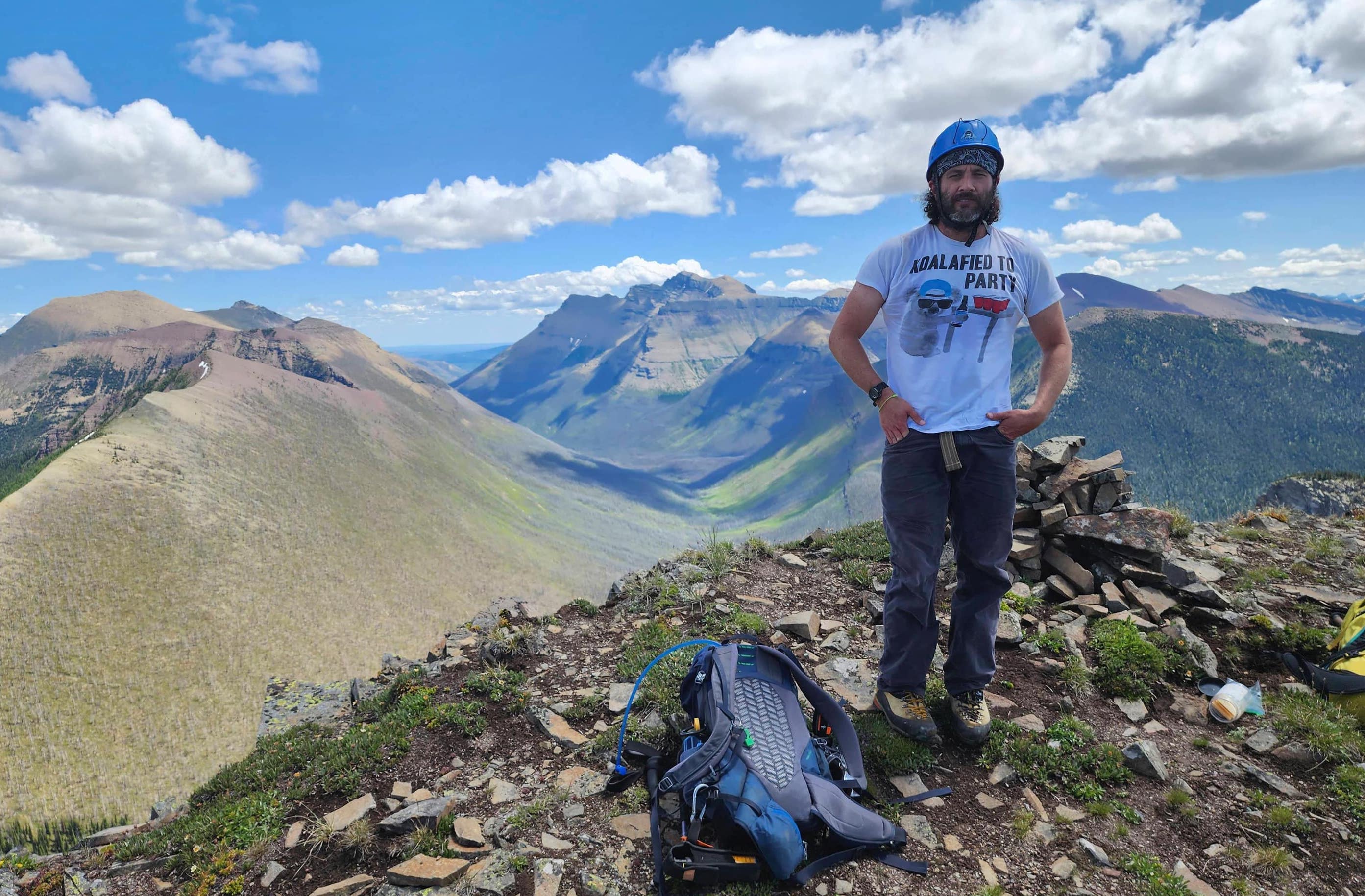
The summit of Jutland Mountain (2397 m).

A pano to the southwest…

And to the northwest.

Gazing north…

And now to the northeast.

Finally, a pano to the southeast.

A closer look at Mount Matkin – Brandon’s next stop for the day.

The following day, Brandon would go on to summit Font Mountain (right of centre) and then Sage Mountain, thus completing 4 peaks in two days, covering over 66 km with a total elevation gain of 3300 m. 😳 My body is sore just thinking about this! 😂

Gazing beyond Font to Piinaquiium / Ahkoinimahstakoo (Mount Blakiston).

Glancing across to Victoria Peak and Pincher Ridge.

Jutland provides a great view of Castle Peak (left) and Windsor Mountain (right).

Zeroing in on North Castle and Mount Gladstone.

Another look at “Frankie Peak” and “Larry Mountain”. I still have to return one day and tag Larry.

The yellow summit of West Castle (centre) is visible at the far end of Lys Ridge.

The weather / repeater station on the summit of Lys Ridge is hard to miss. North Scarpe Lake is located in the bowl beneath the summit.

Looking across to La Coulotte Peak (left) with Scarpe Mountain (centre) and “Jake Smith Peak” (right of centre) behind it.

West Scarpe Lake is nestled beneath La Coulotte.

Looking west at Commerce Peak (centre).

Immediately across the valley sits La Coulotte Ridge with Sunkist Mountain (centre) behind it.

Zooming past La Coulotte Ridge to Langemarck Mountain (right of centre).

Even with the smoke, Starvation Peak (centre) is hard to miss. However, diminutive Mount Yarrell (centre) might be. It sits directly in front of Starvation and you might say, it’s rather ‘starved’ for attention. 😂

Good looking peaks to the south include Long Knife and Kinnerly.

Brandon and Andrew on the summit…

Followed by Andrew and myself. (Photo by Brandon Boulier)

The always interesting summit registers left by Ephraim. I’m sometimes afraid to open them… 😂

Giving the unicorn its first rays of sunlight since the last party was here in 2021.

The new register left by Ephraim.

The original one left by Rick Collier.

I love that Rick almost always included an introductory note on the history of the mountain.

After chatting for a bit and taking a bunch of photos, it was time for Brandon to continue on towards Mount Matkin.

Live long and prosper Brandon!

Instead of returning the way we came, Andrew and I decided to make a loop and return to the lake via the northwest ridge.

We discovered that while you can’t see the lake from the summit, a short trip down the ridge offers plenty of opportunity. 😁

More of the same.

Amazing colour!

That moment when you know you’ve made a wise choice.

Looking back to Andrew and the north face of Jutland.

Arriving onto some red and green argillite. (Photo by Andrew Nugara)

Another pano from along the ridge. (Photo by Andrew Nugara)

I lead the way. (Photo by Andrew Nugara)

Looking over to our routes up the northeast ridge.

Glancing along the Scarpe Creek trail towards its junction with the South Castle Valley trail.

Andrew enjoying the views.

We opted not to descend via this gully, but concluded that it would make a great scramble route in a reverse loop.

We trended to skier’s left to avoid some cliffs…

Before traversing back towards the northwest ridge. (Photo by Andrew Nugara)

My view from the previous photo.

Standing at the bottom of the gully that we saw from the top.

The view back to Andrew and La Coulotte Peak.

Another look up at the overhanging buttress beside the gully.

Back on the northwest ridge with a view to the lake. The gully that Andrew and I used to ascend is to the right of centre.

Andrew leads us along the ridge.

Yet another look back.

Descending from the ridge.

This was the trickiest part because it was covered in slippery grass. (Photo by Andrew Nugara)

However, once we were back in the trees, our descent became easier.

We emerged right beside the hearth with all the onions.

We then made sure to spend a bit more time at the lake.😁

Our ascent gully and the canyon are really noticeable from here.

In the morning I didn’t see many cruising or rising fish, but in the afternoon the lake had come alive. (Photo by Andrew Nugara)

Heading down from the lake…

And arriving back on the Scarpe Creek trail.

Setting off on the ~3.6 km hike back to our bikes.

I’ll say it again – we were really surprised at how good the trail was.

Andrew crosses the South Castle River.

The trail went underneath this fallen tree.

Arriving back at our bikes.

A closer look at the entrance to the Scarpe Creek trail. Besides the John Deere hoodie we found, someone had left a camo jacket on the gate. Maybe it’s a nudist-only trail? 😂

Ahhh, back on the bikes – well at least for Andrew and his e-bike. 😂

Arriving at the creek crossing with the makeshift bridge. An outlier of Windsor Mountain is in the background. (Photo by Andrew Nugara)

On the way out, we encountered a solo sheep hunter on a mountain bike, and then this group on horseback. Neither party had been successful.

Enjoying a downhill section.

Arriving back at the trailhead after 9 hours and 42 km. Visiting South Scarpe Lake and subsequently, Jutland Mountain, after all these years was fulfilling. I really do think I will return one day to camp and fish now that I’ve seen both the lake and the campsite. Also, despite the long distance, a bike combined with good trails made things manageable. A huge thanks to both Brandon and Andrew for the company and a great day. I’m now looking forward to visiting Matkin, Font, and Sage. 😁


Leave a Reply