


⚠️ Hiking and scrambling are inherently dangerous activities. Please read my Disclaimer. ⚠️
“Frankie Peak” and its twin, “Larry Mountain” are prominent peaks that are located south of Table Mountain in the Castle Wilderness. I had my first good look at them in May 2014 while hiking what I call, “The Whistler Loop”, a collection of unnamed peaks on the connecting ridge between Table Mountain and Whistler Mountain. Later, I learned that my friend, Brad Wolcott, had ascended them as part of an enjoyable trip from Whistler Mountain to Mount Gladstone. In September 2016, my curiosity was renewed while hiking Lys Ridge with Andrew Nugara and Jollin Charest. Andrew told me that he had unofficially named them, “Frankie Peak” and “Larry Mountain” in honour of his mother and step-father. He had first ascended “Frankie” in May 2009 via Whistler Mountain, and then returned one month later using the same approach to summit “Larry” and then North Castle.
Therefore, with Andrew’s trip reports as my guide, I began to plan my own trip. The major variation that I wanted to make from both Andrew’s trips and Brad’s trip, was to save distance by avoiding Whistler Mountain on my approach. Like Andrew, I wanted to summit “Frankie”, “Larry”, and then North Castle, but I thought that I could make a more compact loop by ascending a ridge that led up from the South Castle Road on the western side of the mountain. This would save quite a bit of walking distance back to my vehicle after descending North Castle.
Joining me for this trip was my middle son, Nathan, who had celebrated his 20th birthday the day before, and was anxious to try out the new backpack that he had received as a gift. Also with us, was Nathan’s (and my other son, Joel’s) friend Keagan, who last joined us on our hike up Morin Peak in the Crowsnest Pass. Keegan basically lives at our house, so I will also count him as one of my mine too. 🙂 I love hiking with my kids!
At first, everything went according to plan, especially the ascent which all three of us agreed was a blast. However, after summiting “Frankie”, we discovered that the exposed ramp that Andrew had used to descend the cliff band on the east side of the mountain was covered in ice. To make matters worse, we had to battle extreme wind gusts which made for miserable conditions. So we quickly changed our plans and made a new loop by heading north where we tagged the summits of “Eagle Peak” (“Whistable II”) and Whistler Mountain before descending back to the road – basically doing everything that I wanted to avoid. Nevertheless, neither Nathan nor Keegan had been to these peaks before and I was happy that they still had the opportunity to record their first ever, three peak day. I will definitely return when conditions allow for a successful descent between “Frankie” and “Larry”.

Our starting point was identical to that of our Lys Ridge trip. To get here, we headed south from the hamlet of Beaver Mines along Highway 774 until we came to the turnoff for Beaver Mines Lake. Here we turned left and followed the gravel road for ~3.7km until we came to the South Castle Road, which was located on our right. We followed the road for ~600m before arriving at a couple of information signs for the Castle Special Management Area. Also in the immediate vicinity were numerous random camping spots.
Here is where things get interesting and unless you have a 4×4 or some type of high clearance vehicle, you will need to park your car and get out your bike. Fortunately, I had my trusty 4Runner so we followed the road across the dry creek bed and proceeded another 6.9km down what at times, was a rough road, until we came to a washed out section just beyond a well marked camping site next to the Castle River. We parked across the road from the campsite. As a side note, almost all of the mud holes that you have to drive through on the road are not too deep, except for the last one immediately prior to the parking area. This is the deepest one (1/2 way up my wheels) and I’ve found that it is the shallowest on the east side – just don’t stop once you’ve started going through!

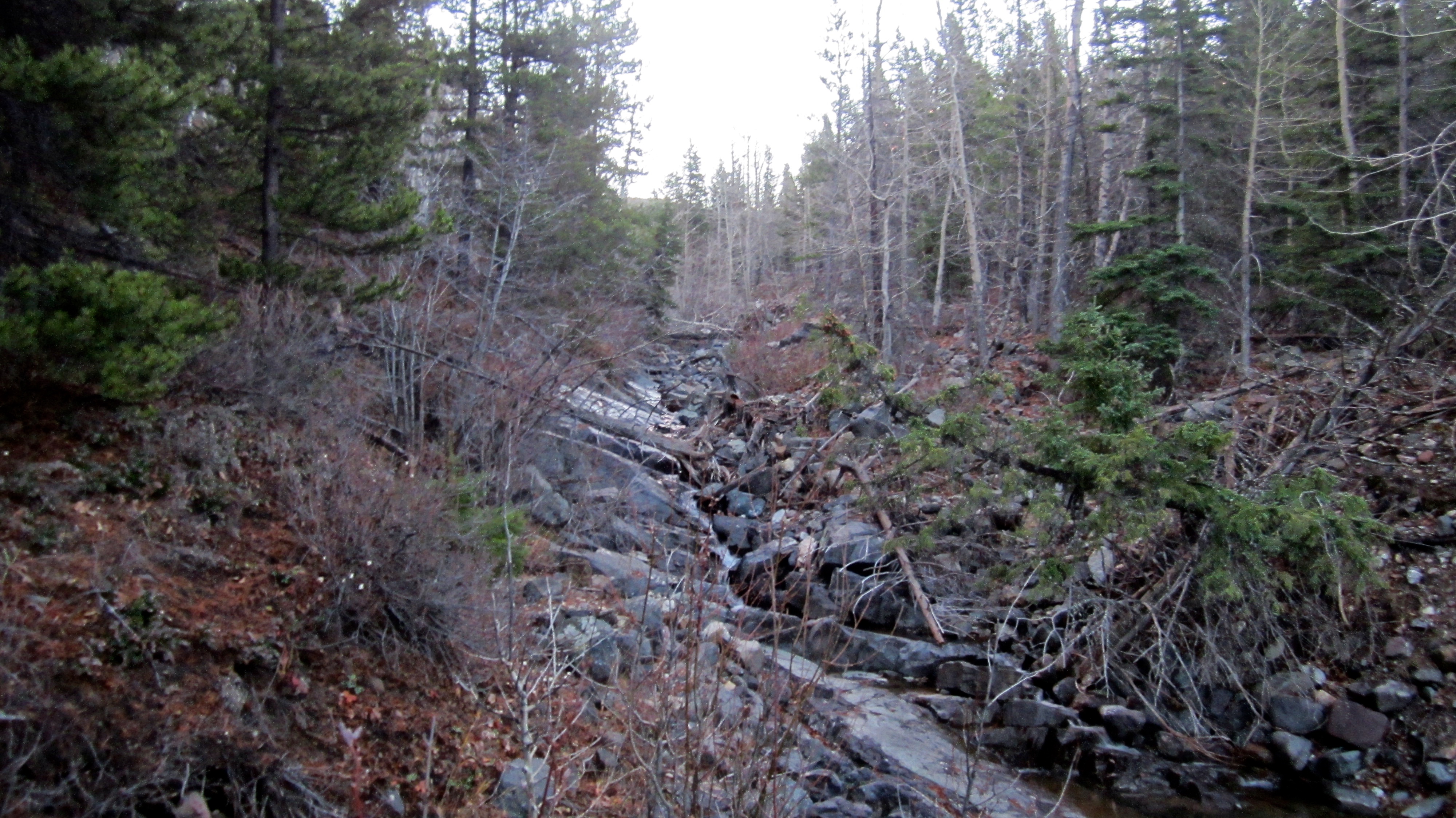
From our parking spot we walked ~100m further to the south along the road until we came to the washout itself. Here we left the road and followed the creek bed east and then southeast for ~550m until we reached the base of our ascent route. We found it was easier to follow the numerous game trails located on the east side of the creek rather than staying inside the bed. When we reached the base, we crossed the creek using a game trail and a couple of well-positioned boulders.
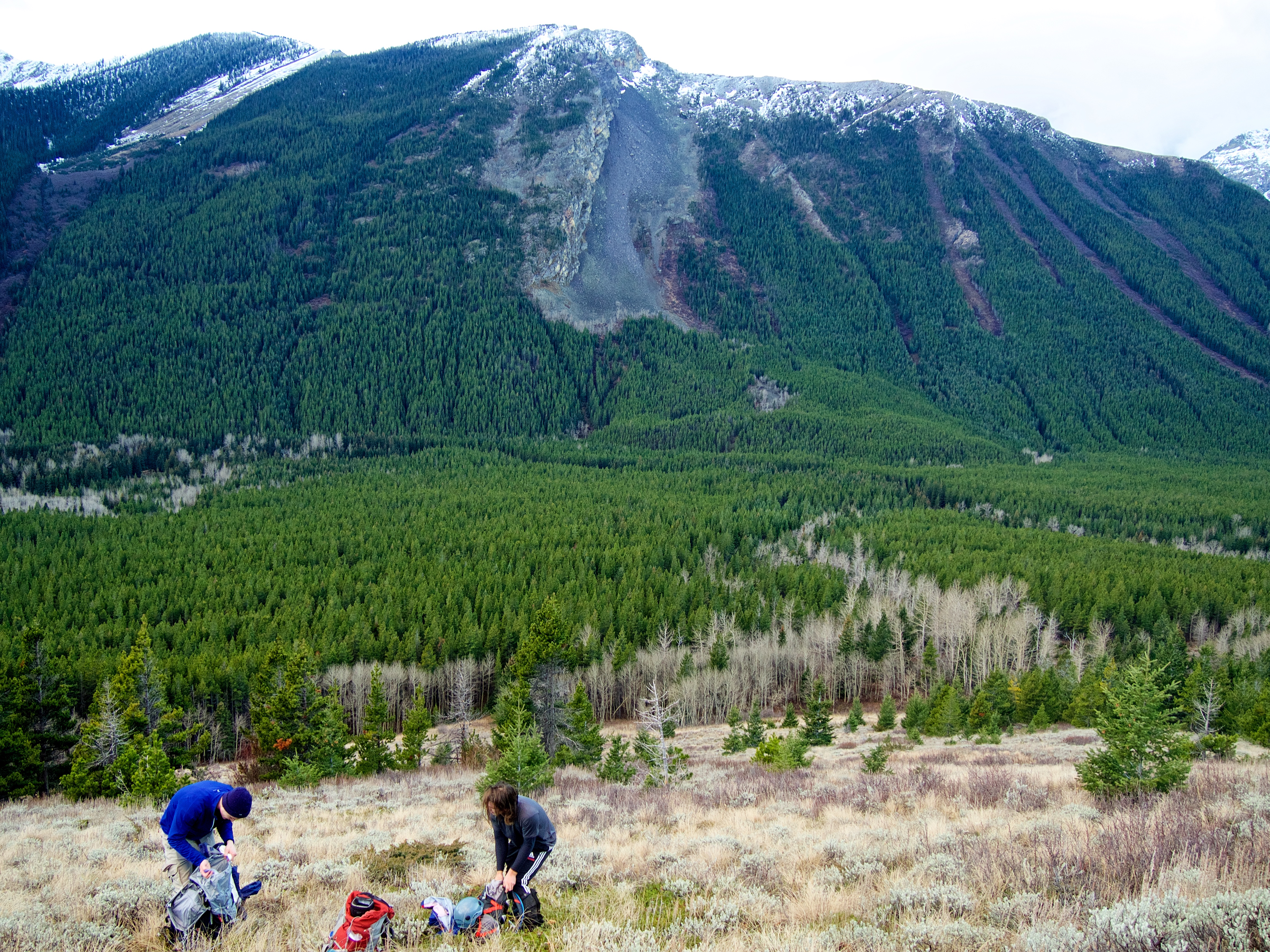
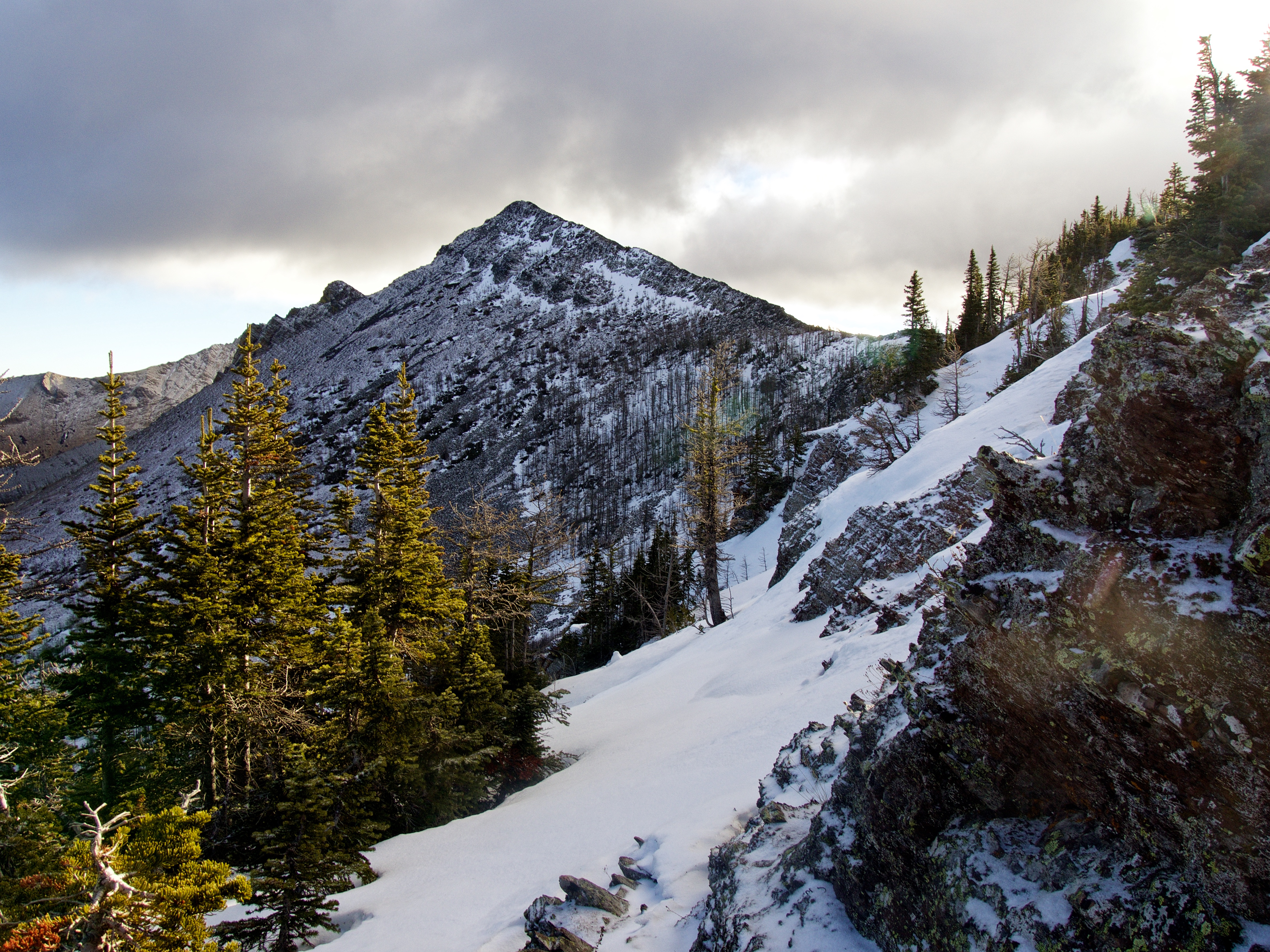
From the creek, the initial slope is wide open and grassy. Once we reached the first shoulder, the route narrowed into a ridge and became increasingly rocky and treed. From the first shoulder to the second shoulder, we encountered thicker forest cover and frequent bands of rock – which required lots of route finding. Here we donned our helmets as some sections required hands-on scrambling. The ridge walk along the second shoulder to where it abuts against the main ridge to “Frankie” involved some light to moderate scrambling with most obstacles avoided by sticking to climber’s right. However, just prior to the abutment we encountered a small cliff that would prove to be the crux. I found an exposed ledge to climber’s right, but we found an even safer route by retracing our steps and descending to climber’s left which allowed us to bypass it completely. From here it was an easy hike up a packed argillite slope to the main ridge.
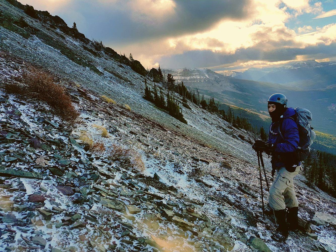
The ridge walk to “Frankie” would have been really enjoyable if it weren’t for the extreme wind gusts. To make matters worse, the light dusting of snow on the south side of the mountain had undergone a quick thaw/freeze cycle that made for some slick conditions – nothing that hampered our ascent, but definitely something that we did not want to attempt an exposed downclimb in.
From the summit we descended towards “Larry” and found Andrew’s exposed ramp, which in dry conditions would have been great, but not on this day. We could see that to bypass the cliff band, we would have to lose a significant amount of elevation over icy rocks while enduring extreme wind gusts – not fun! So we nixed our original plan and decided to knock off “Eagle Peak” and Whistler Mountain instead. To avoid the wind along the ridge, we descended the northwest face of Frankie and cut across a hanging valley to the col beneath “Eagle Peak”. The ever-increasing wind ensured that we had a miserable ascent to the summit. From here we had an easy but windy hike to Whistler Mountain before descending down the trail to the South Castle Road and then walking ~1.6km back to our vehicle.

We loved our ascent route to “Frankie Peak” and I will readily use it again when I return. Be aware though, that at some point in the future, this road will be permanently closed to motorized vehicles as part of the new Castle Wildland Provincial Park. There may also be an overnight option, where a party could knock off every summit from Table Mountain to Mount Gladstone and then North Castle. Indeed, the hanging valley between “Eagle Peak” and “Frankie” would be a very nice spot to camp!

Our total distance ended up being 12.5km with total elevation gains of 1323m. From our vehicle to the summit of “Frankie” it was 4.2km. Our total time came in at 6 hours and 41 minutes.
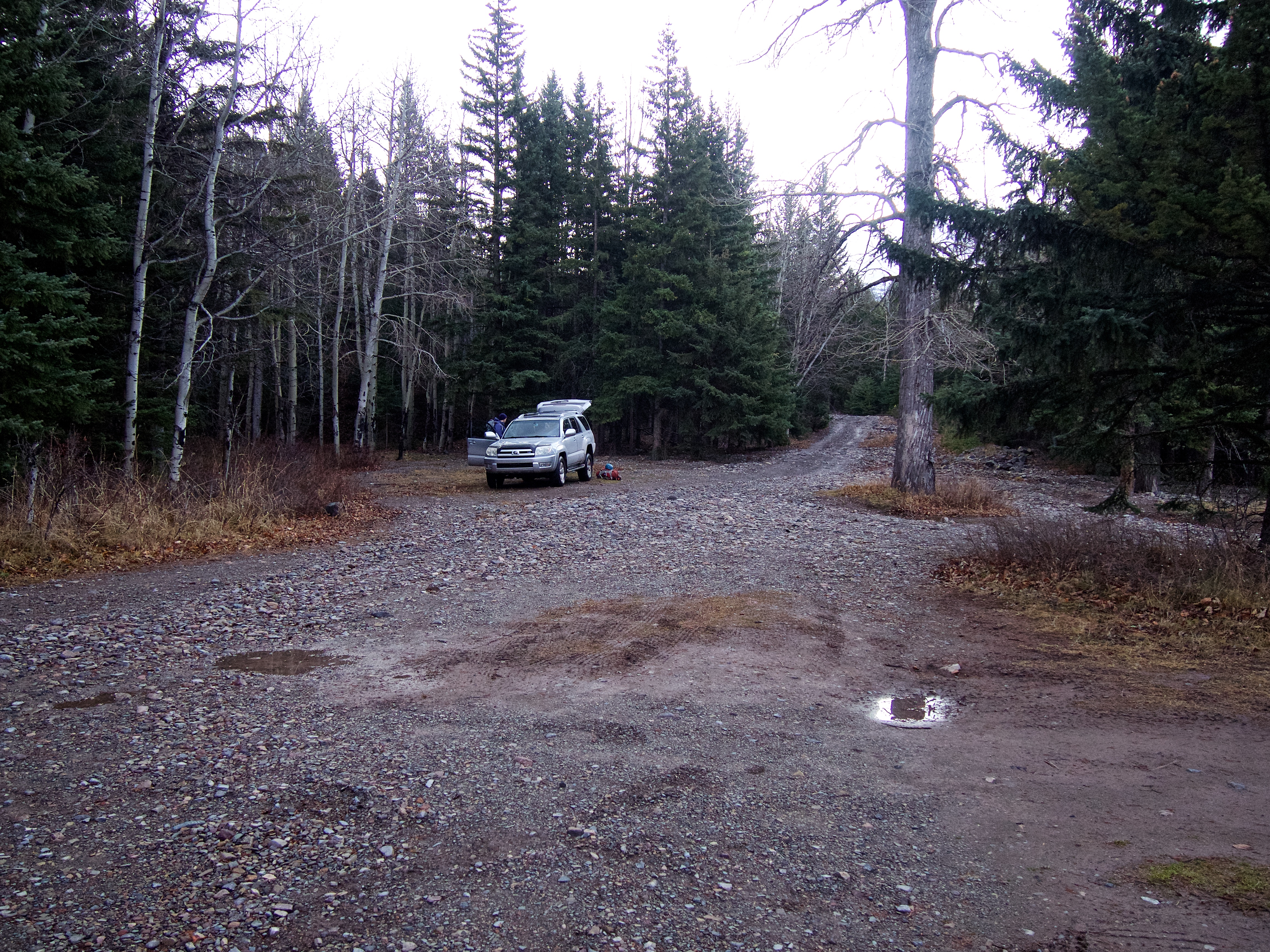
Our parking spot on the east side of the road across from the campsite next to the Castle River. I had turned the vehicle around so that it was facing northwest – or the direction we came from. The washout is located just ~100m further down the road behind my vehicle. This was also the same starting point for our Lys Ridge trip.

Approximately ~100m south of my vehicle, we came to a washed out section of the South Castle Road. Here we would leave the road and follow the creek bed to the left.

Looking down the creek bed from the middle of the road. The first shoulder on our ascent route as well as the main ridge that leads to ‘Frankie”, can be seen in the distance to the right of centre.
We found it was easier to stay on the east side (climber’s left) of the creek bed. Here the bushwhacking was relatively light and we could utilize intermittent game trails.

A few of the game trails wanted to leave the creek bed too early. We followed this one until it began to head up the western slope beneath Whistler Mountain. It did however, give us our first clear view of the lower section of our ascent route.

After following the east side of the creek for ~550m, we crossed it using a game trail and some well-positioned boulders (at this point in the year the creek was quite narrow). We then emerged onto grassy slopes at the base of our ascent route. Here, we were gifted with some incredible views of the sunrise. (Photo by Keegan Thiessen)

Sunrise on Castle Peak.

A telephoto of the previous picture. The Castle is such an amazing place!

Looking south down the valley towards Sage Mountain (centre) and Mount Matkin (right).
Looking west at our Lys Ridge ascent route.

The view to the northwest at “The Amoeba” on Barnaby Ridge (left) and Southfork Mountain (centre).

The terrain became rockier as we gained elevation.

My newly minted twenty-year-old!

The hiking is pretty straightforward between the base and the first shoulder.

Keegan and Nathan stop to take in the early morning views.

After reaching the first shoulder, we began to encounter frequent rock bands (mostly Finnish death metal groups who had become lost during album cover photo shoots 😉 ) and heavier forest cover.

I couldn’t resist including another shot of the morning sunlight hitting Barnaby Ridge and Southfork Mountain.
We had a blast with all of the route finding on this ascent!

One of many obstacles that we encountered on the way up.
Nathan and I head up a small section of rock. (Photo by Keegan Thiessen)

The reverse angle of the previous picture.

The forest had enough openings that we could still enjoy some impressive views of the surrounding landscape. (Photo by Keegan Thiessen)

Morning sunlight spotlights Mount Matkin and the slopes of Lys Ridge. Castle Peak is on the far left.

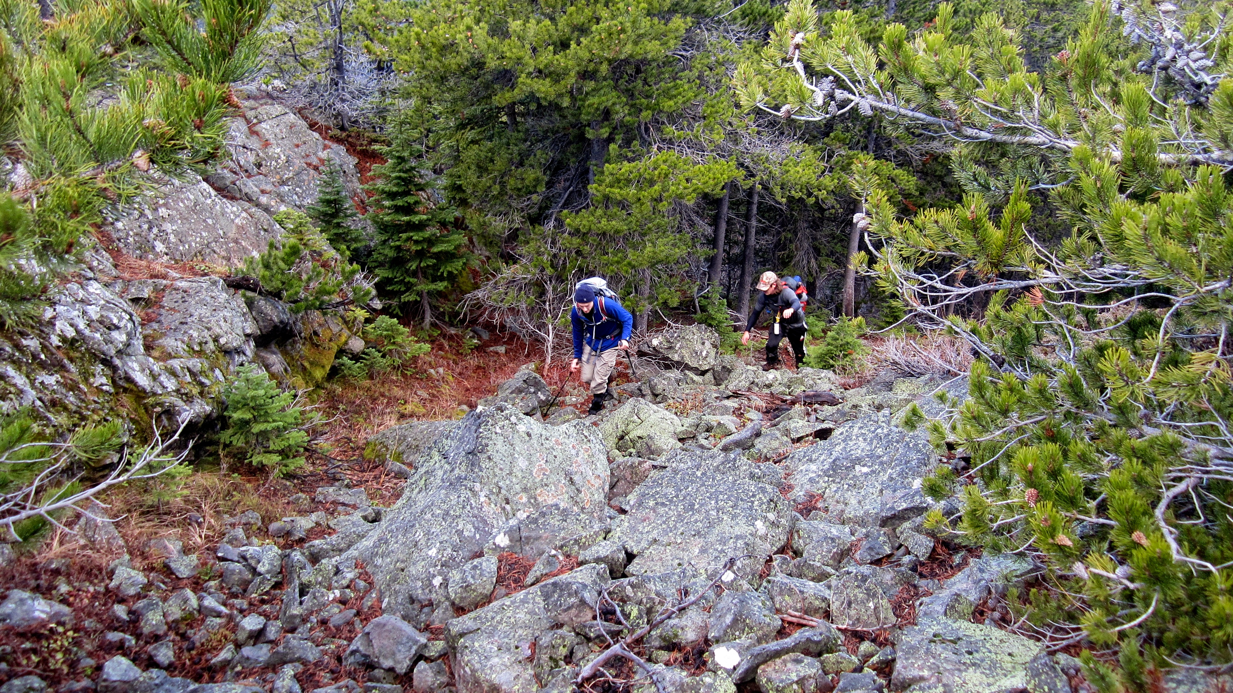
Typical terrain before reaching the second shoulder. There were many possible routes and we seemed to solve any doubts by trending climber’s right.

Nathan and Keegan enjoy a welcome break from the wind just below the second shoulder.

After reaching the second shoulder we could finally see where it joined the main ridge. The summit of “Frankie” is not yet visible.

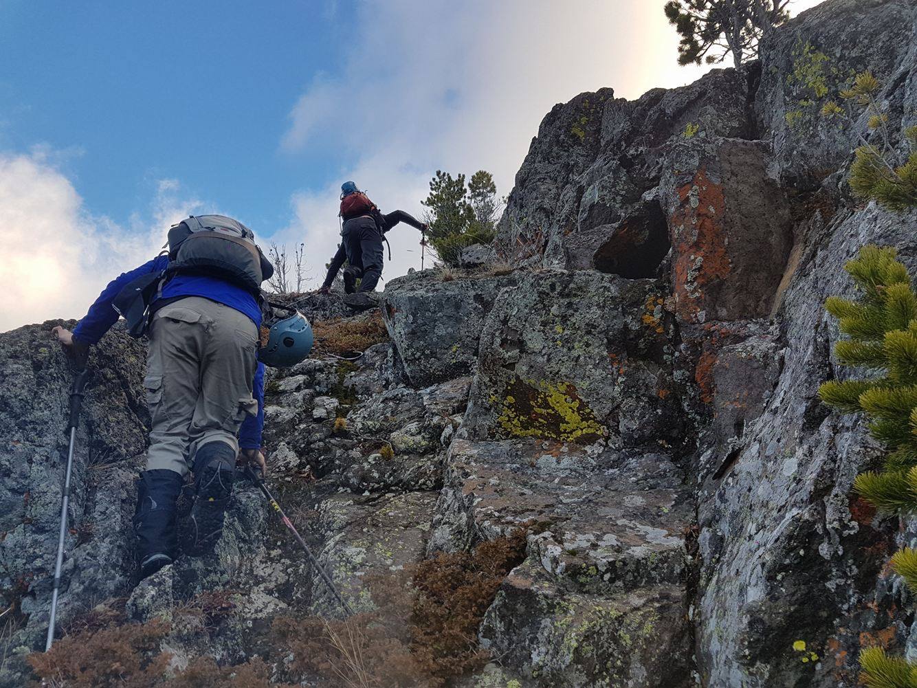
The ridge walk along the second shoulder presented easy to moderate options for scrambling. Due to extreme wind gusts, we avoided getting too close to the crest.
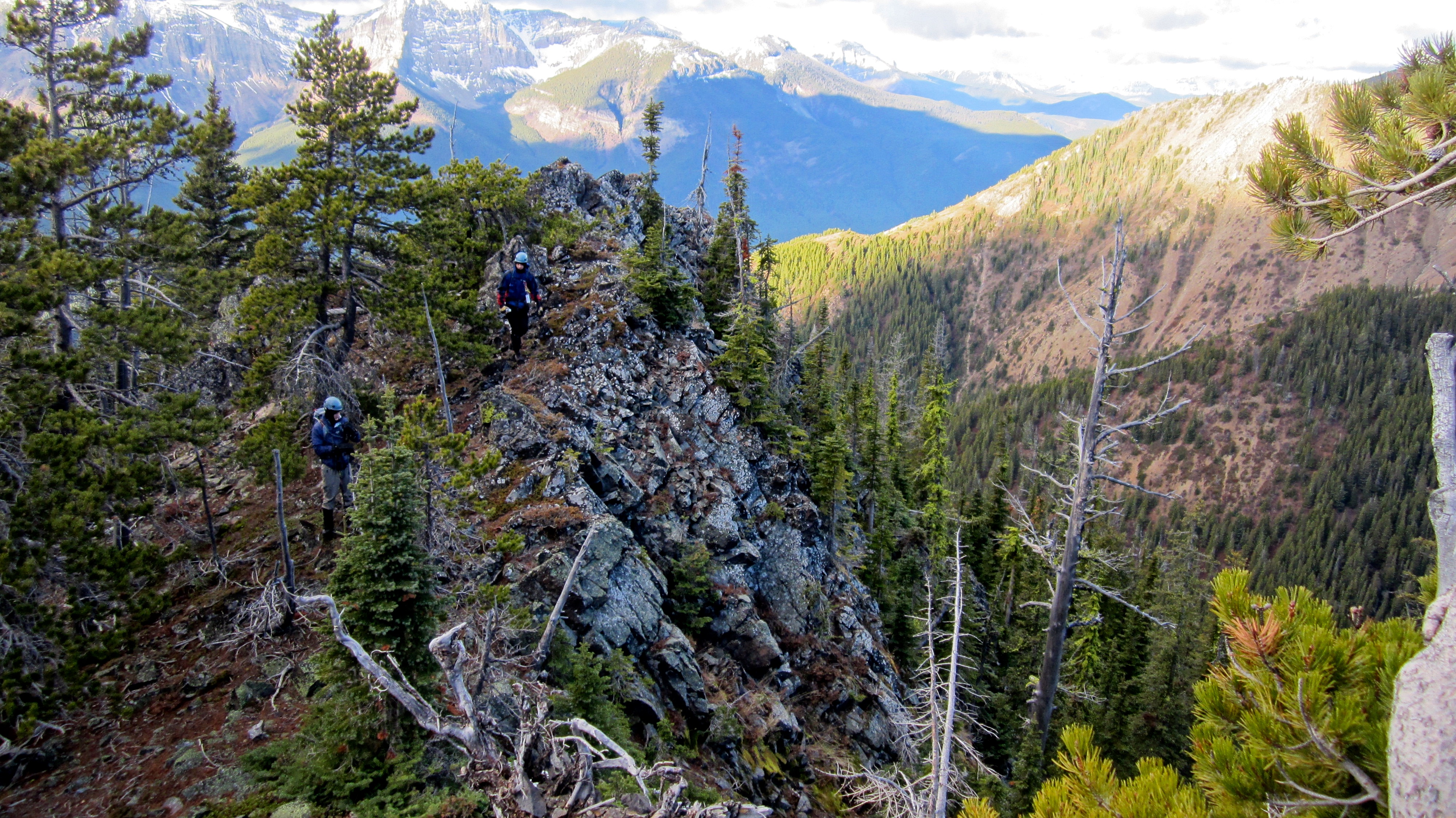
Nathan and Keegan make their way along the gorgeous little ridge.
By sticking to climber’s right, we could avoid anything that we didn’t want to tackle head-on…

…except for the crux. It doesn’t look like much from this angle, but it presented us with a small cliff face that halted our progress.

I found an exposed ledge to climber’s right, but by backtracking we found an even safer route by descending to climber’s left. Here we could circumvent the crux without too much difficulty.

Another look back at the crux. The exposed ledge that I rejected is the vegetated patch on the left.

Looking north at “Eagle Peak” from the abutment. I called it “Eagle Peak” because an eagle was soaring directly overhead when we ascended it in May 2014. However, Vern Dewit has recently coined it, and its twin peak to the north, the “Whistable Peaks” (a combination of Table Mountain and Whister Mountain). I think this is a much better name and I should probably change it in my posts. However, and I kid you not, while we were ascending it later in the day, we watched as a large bird of prey soared directly above it. That’s two for two now, so I’m slightly hesitant to give up the name. Maybe it should be “Whistable Eagle” or “Whistable Feathers”? 😉

A more comprehensive view to the north. The Whistler Firelookout is on the far left and “Eagle Peak” (“Whistable II”) is on the right.

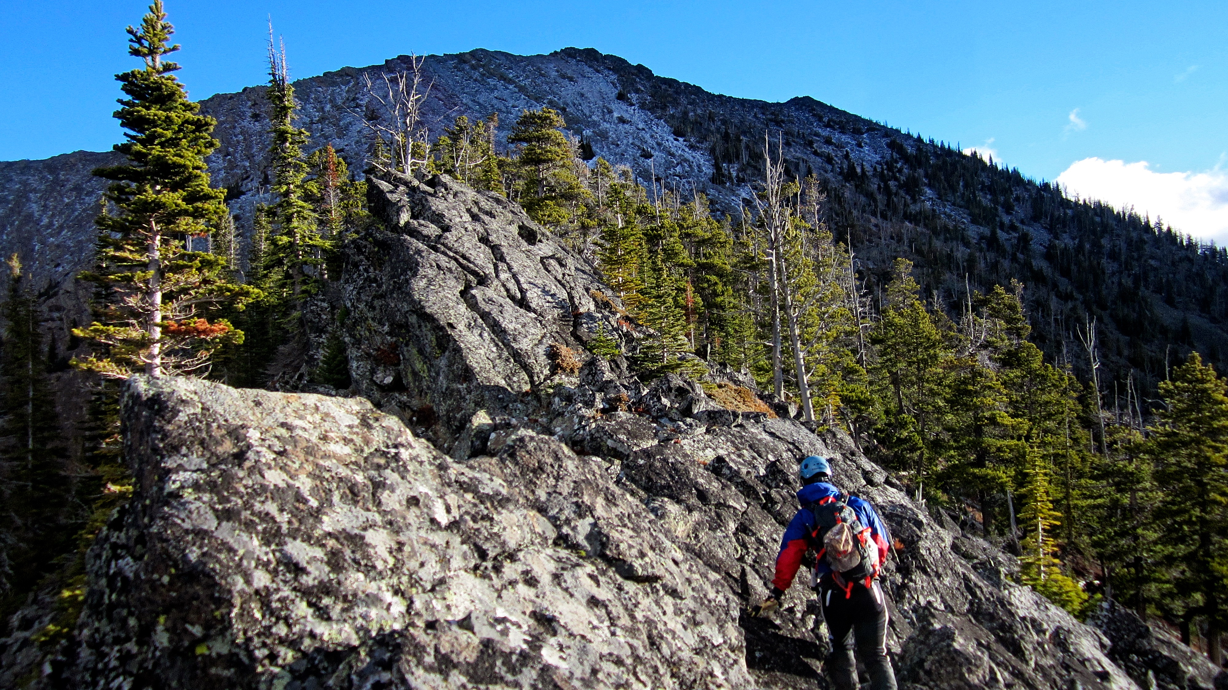
The hike from the abutment to the main ridge was over packed argillite and presented no difficulties.
A fantastic shot by Keegan! (Photo by Keegan Thiessen)

Looking back from the crest of the main ridge as Nathan and Keegan make their approach (lower centre). Our vehicle is parked next to the bend in the river that can be seen in the centre.
Once on the main ridge we could finally see the summit of “Frankie Peak”. The summit of “Larry Mountain” is to the left.

Nathan and Keegan begin an extremely windy ridge walk to the summit of Frankie.

Nathan may have turned twenty the day before, but I still lead the way! 😉 (Photo by Keegan Thiessen)

If we had chosen a less windy day, this would’ve been a fun ridge walk.

Taking shelter from the wind to consume some calories and put on more layers.

Watching Keegan eat peanut butter using his replica, “Crocodile Dundee” knife was amusing. Listening to Keegan try and talk without a tongue was even more entertaining. 😉

Many of the rocks on the south side of the mountain were coated in clear ice.

Nathan and Keegan slowly and carefully pick their way up to the summit.

The summit of “Frankie Peak”. My GPS read 2370m and Andrew Nugara’s read 2375m.

Nathan arrives on his first summit of his twentieth year. Keegan is just behind him.

My GPS readings on the summit.

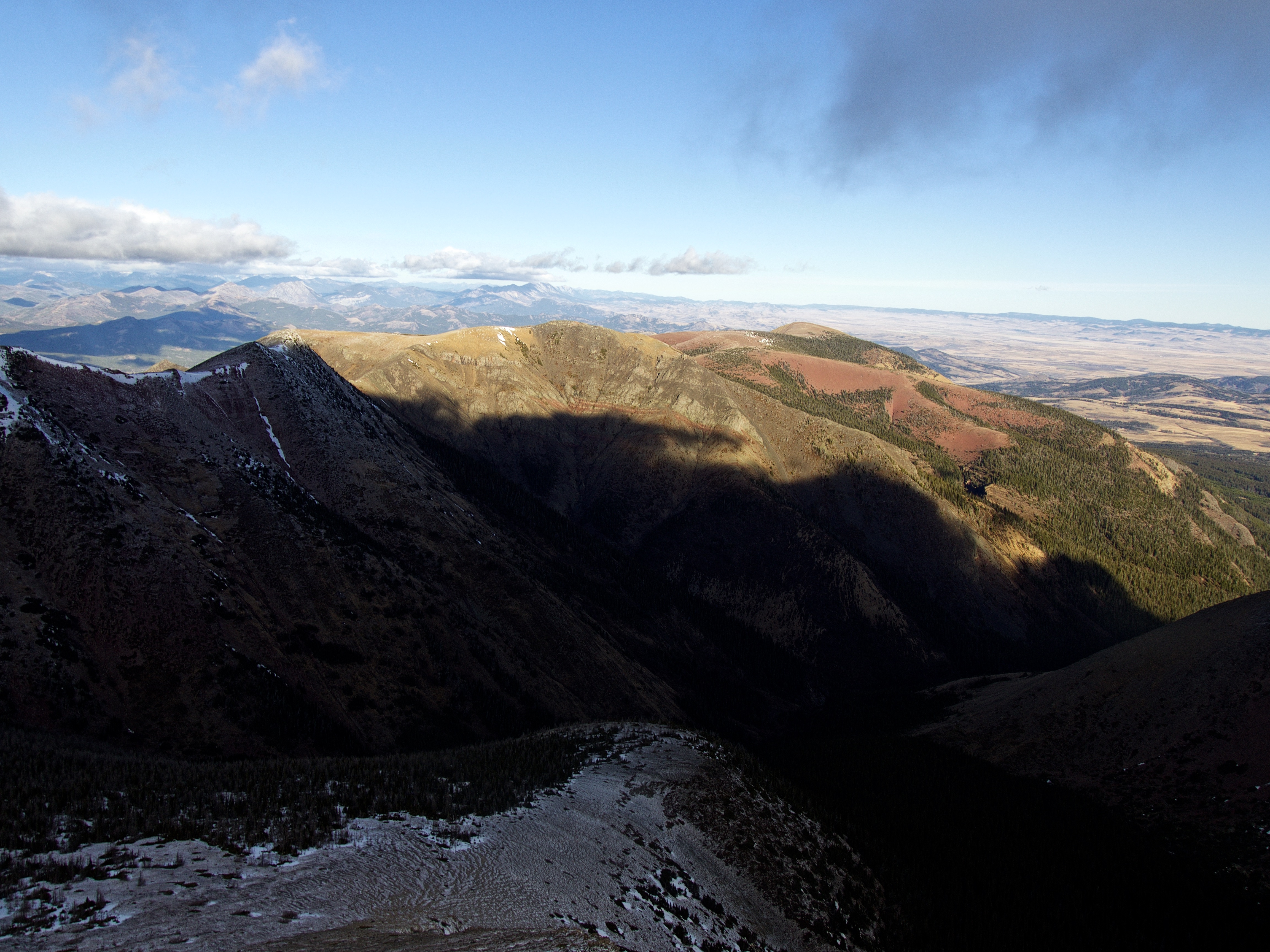
The summit offered gorgeous views! This is the view to the east. In the foreground is “Larry Mountain” and behind it is Mount Gladstone. In the distance is Victoria Peak and foreground right is North Castle. “Whitney Creek Mountain” is on the far left.

The view to the northwest. The Whistler Fire Lookout is on the far left, followed by Whistler Mountain and then the “Whistable Peaks” with “Eagle Peak” (“Whistable II”) in the centre.
The view north at “Table Top” (foreground) and Table Mountain (right of centre).

The view south at a beclouded Castle Peak and Windsor Mountain. North Castle is in the foreground. Our originally planned loop for the day included “Larry Mountain” and North Castle.

Looking southwest at Lys Ridge. The summit of Lys Ridge is on the far left and West Castle is to the left of centre. Lys Ridge was one of the best ridge walks that I’ve ever done! In the background is Barnaby Ridge.
At roughly the same time that we were on the summit of “Frankie”, a party of 6 hikers had to be rescued off of Mount Haig which is located directly to the west, behind Barnaby Ridge. One of the hikers had been seriously injured and because of the weather (notice the clouds), a helicopter rescue was impossible. While the other 5 made it down the mountain, the injured person was forced to spend the night on the mountain under the care of a public safety officer from Waterton Parks. A huge thanks to all of the people who work in Search & Rescue and to all of the First Responders. Hopefully the injured person will be okay.
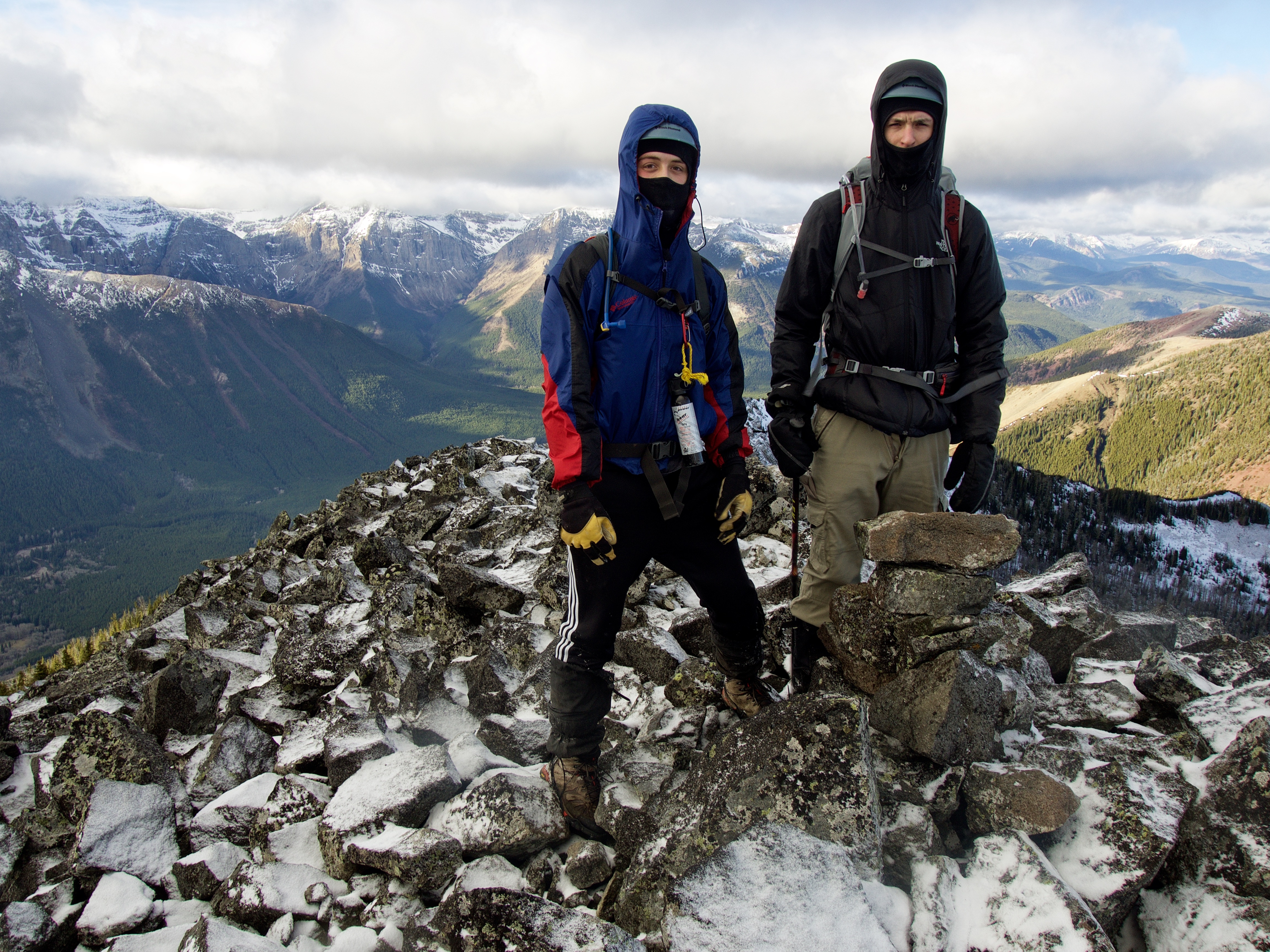
Keegan and Nathan on the summit of “Frankie Peak”.

Always great to stand on a summit with your kids! Happy 20th birthday Nathan!

The wind ruined any thought of a lengthy summit stay, so we began to descend towards the col between “Frankie” and “Larry Mountain”.
The north face of “Frankie” is really steep!
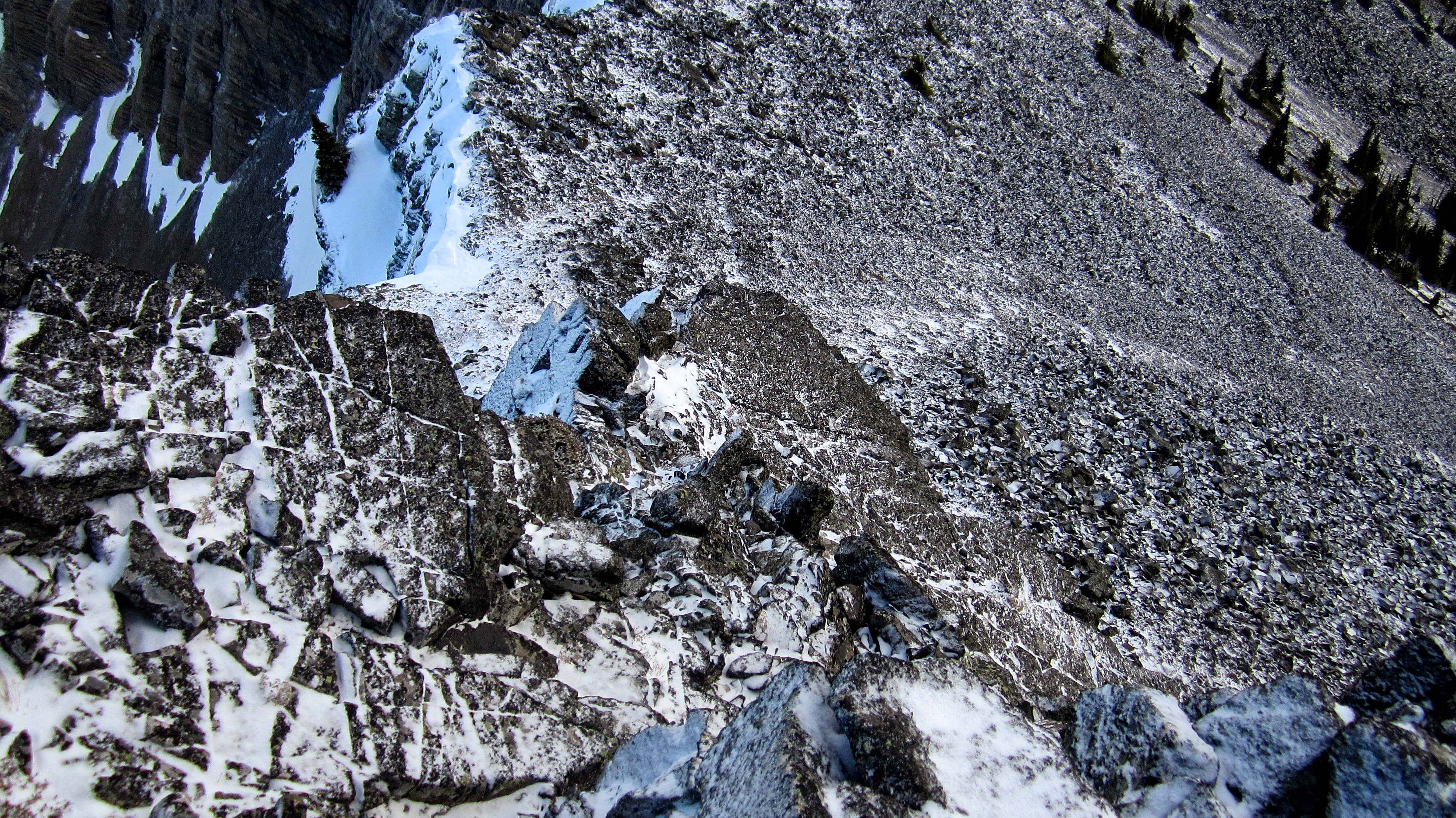
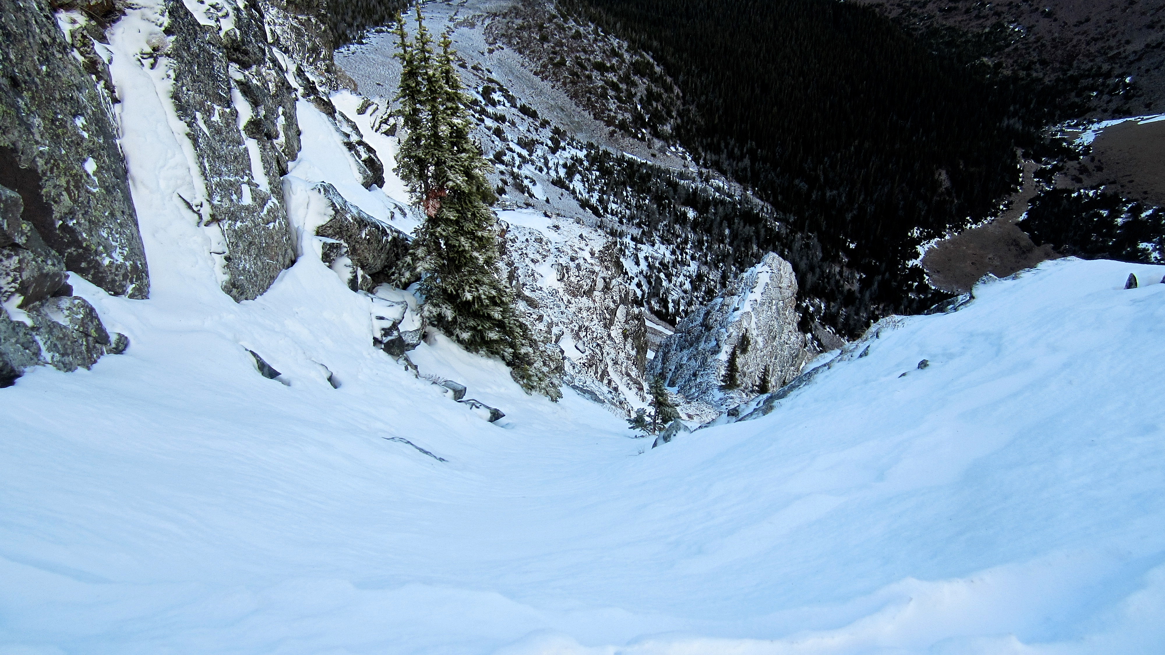
The beginning of the exposed ramp that Andrew Nugara used to descend off of “Frankie”. Unfortunately, there was too much ice to attempt it safely. I reminded the boys of the saying, “There are bold climbers and there are old climbers, but there are no old bold climbers.”

Bypassing the cliff further to the south required a significant detour over slippery rocks – all while hiking into the wind. This is where we changed our plans.

Heading back to the summit of “Frankie” to attempt our alternate loop.

Looking from the upper northwest slopes of “Frankie Peak” to “Eagle Peak”(right) and Whistler Mountain (centre) – our alternate loop for the day. To get out of the wind and avoid a slow descent along the ridge, we descended the northwest face of “Frankie” and cut across this hanging valley to the col beneath “Eagle Peak” (“Whistable II”). Click to continue to our “Eagle Peak II” trip report.


Leave a Reply