

⚠️ Hiking and scrambling are inherently dangerous activities. Please read my Disclaimer. ⚠️
This was a significant trip for me. Eight weeks ago I had my thyroid removed after being diagnosed with papillary carcinoma last October. In a strange coincidence, I found out that I had cancer thirty-six years to the day that my own father died from esophageal cancer. However, it was because of my father’s cancer that I found mine, and this provides me with solace and some meaning when I think back to the suffering he endured.
How did I find my cancer? For several months, perhaps even years prior, I would now and again feel something cold touching my esophagus. It wasn’t a constant thing, but if my glands became swollen or I was fighting off some kind of bug, the sensation became more pronounced. I go for regular scopes of my esophagus based on my family history and I pay particular attention to anything unusual. However, because it was an intermittent sensation, and I could go months without experiencing it, I didn’t think it was worth making an appointment for. Late last spring I happened to be going through a time when I could feel it, and it was while seeing my family doctor for another issue, that I brought it up to him almost in passing. Thankfully he did not dismiss it and booked me in for an ultrasound. Here, a ‘suspicious nodule’ was found growing on the right side of my thyroid and a subsequent fine needle biopsy revealed it to be cancer.
On January 6th, I had my thyroid removed and the pathology stated that it although the cancer was still stage 1 (had I been over 55 it may be considered later stage), it was a T4, meaning it was sticking further out from the thyroid than first thought. This protrusion was touching my esophagus and this is what was giving me the sensation of coldness. Thankfully, I had an amazing surgeon in Lethbridge and my recovery has gone extremely well. Immediately after my surgery, I was put on synthetic hormones and I wasn’t allowed to participate in strenuous exercise for 6 weeks. Boy, was I thankful when that date came around and I could start getting back to the gym. Those new synthetic chimp hormones make pull-ups so easy, though I’m slowly losing the use of my thumbs… 😉
In short order, I should be going to the Tom Baker Cancer Centre in Calgary to find out if I require any follow-up treatment and I am told they will also adjust my hormone levels if need be, as I no longer produce my own. I’m not sure what the next chapter of this journey holds for me but at least the first section has ended well. Let me also say that I am SO thankful for universal health care. I have had amazing doctors and nurses, quick response times, and I will walk away from this without having to worry about whether or not I afford it.
Now, if a guy is going to do his first post-cancer surgery hike, who better to do it with than great friends? 🙂 Joining me today were some of my favourite people: Andrew, Brad, and Aaron. What made the day even more interesting, was that none of us had explored this front range valley of the Castle before. Indeed, Brad and I had been talking about “Whitney Ridge” ever since we ascended “Whitney Creek Mountain” back in January 2018. When I reascended “Gladstone’s Toe” with Andrew last December, I showed it to him and he agreed with us that it looked like an interesting destination.
A distinctive aspect of Victoria Peak’s long northwest ridge, “Whitney Ridge” like its neighbour, “Whitney Creek Mountain” are nicknamed for their proximity to Whitney Creek. As per my usual disclaimer, this is only a nickname and if you know of an Indigenous or local name, let me know. Perhaps the most important thing to take away is that “Whitney Ridge” makes for a fun snowshoe or hike. Though we only visited the most southerly of the twin peaks due to weather, the approach is easy and the views are great. All of us agreed that we should return in the summer to complete the entire ridge including “Whitney Creek Mountain” as a loop. The Castle never fails to disappoint!
Be sure to read Andrew’s trip report! [link coming so just hold your horses 🙂 ]

This was a cool trip even even if it was just to get into the valley that sits immediately beneath the north face of Victoria Peak! I still can’t believe that in all these years, none of us have ever set foot in this easily accessible area. The above map shows “Whitney Ridge” in relation to Prairie Bluff for reference.
To get to “Whitney Ridge” from Lethbridge, follow Highway 507 west of Pincher Creek to the Gladstone Valley Road which is located on the left side of the highway, ~1.4 km past the bridge over Mill Creek. After turning onto the road, keep left at all major junctions, and you will eventually cross two bridges over Mill Creek. Approximately 16.3 km from Hwy 507 or ~3.5 km from the 2nd bridge, you will come to a hairpin curve that also serves as a junction for a gated gas road. This is the starting point. There are several ways to get onto the ridge, but I believe the route we used today may be the easiest.
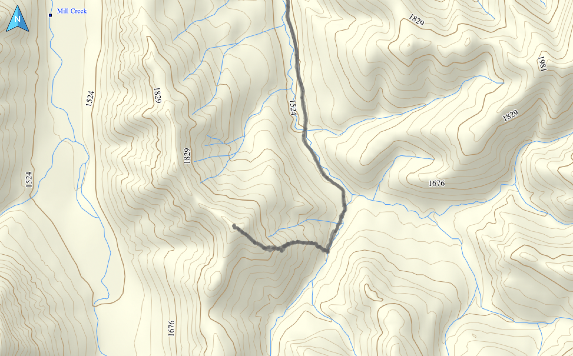
Follow the gas road (an easy hike or bike) from the gate for ~3.65 km until you come to the second bridge (the first is at the ~2.8 km mark). Don’t cross it, but rather enter into the woods on your right and follow alongside the small creek. The bushwhacking is light and we came across what looked to be a trapline trail. We had originally planned to follow the creek all the way up the valley, but after snowshoeing for ~650m, we came to inviting slopes that we then ascended for ~1.9 km (~431m elevation gain) to the summit of the southern peak (2004m my GPS). Reaching the second summit would not be hard, as it sits only ~718m away. However, due to insane wind conditions, we decided not to tag the northern summit, but instead, returned the way we came.

Our total roundtrip distance was 11.9 km with total elevations gains of 589m. Our total time was 4 hours and 46 minutes.

My battle scar from thyroid cancer. I’m thinking of auditioning for the role of, “captured drug informant #2” in the next Steven Seagal movie… and now that I no longer produce my own hormones, I’m looking forward to seeing how my new synthetic chimp formulation helps with scrambling. 😉 What else can I say? The whole ordeal has been a slice! 😉 Okay, I can’t resist… one more – does this now mean that I’m a cut above the rest? 😉
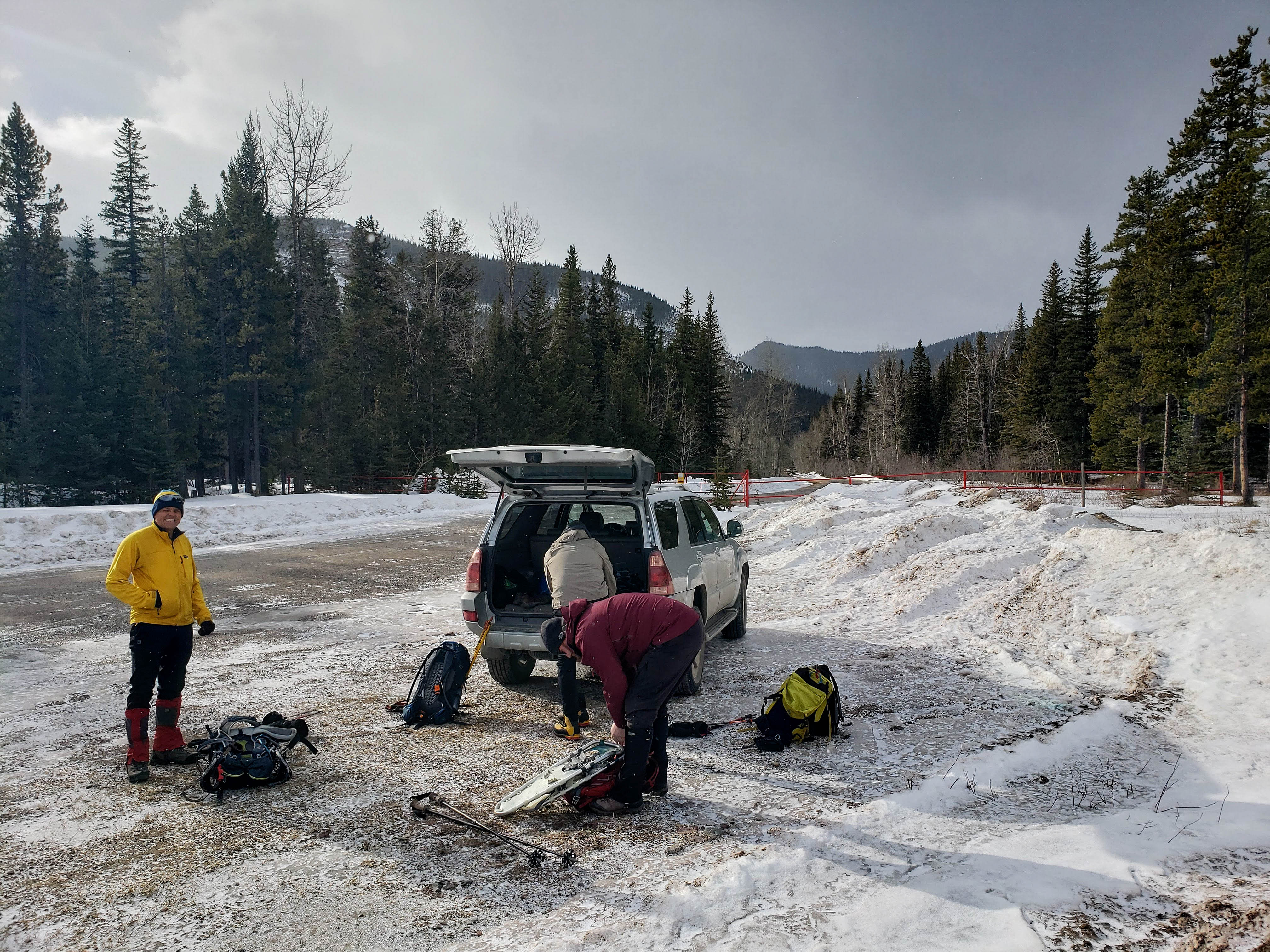
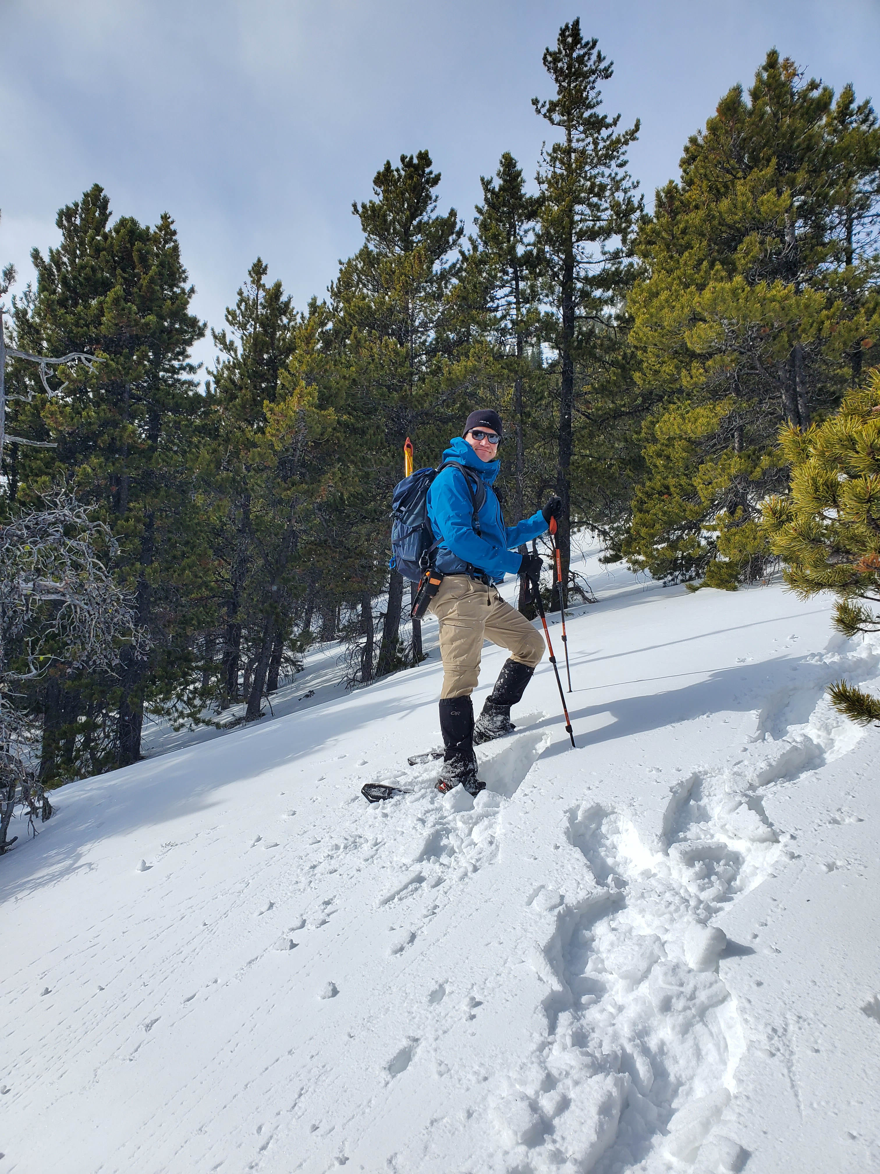
Gearing up in the parking area next to gated gas gas road. The southern summit of “Whitney Ridge” is in the distant centre.

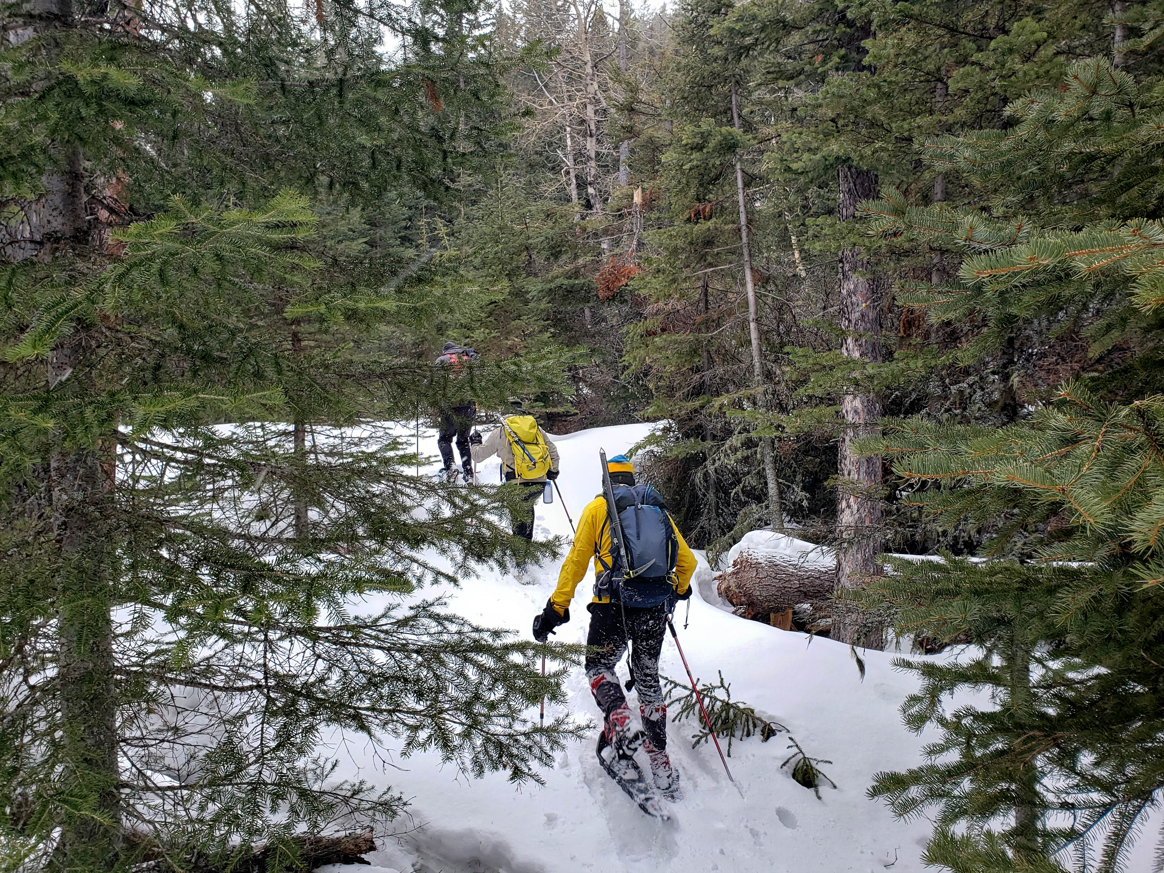
Aaron, Andrew, and Brad begin the easy hike down the road. Bikes would make quick work of this.

Given the extreme winds today, we were thankful for a relatively sheltered approach.

Brad glances over at “Whitney Creek Mountain” which the two of us completed as a snowshoe in January 2018.

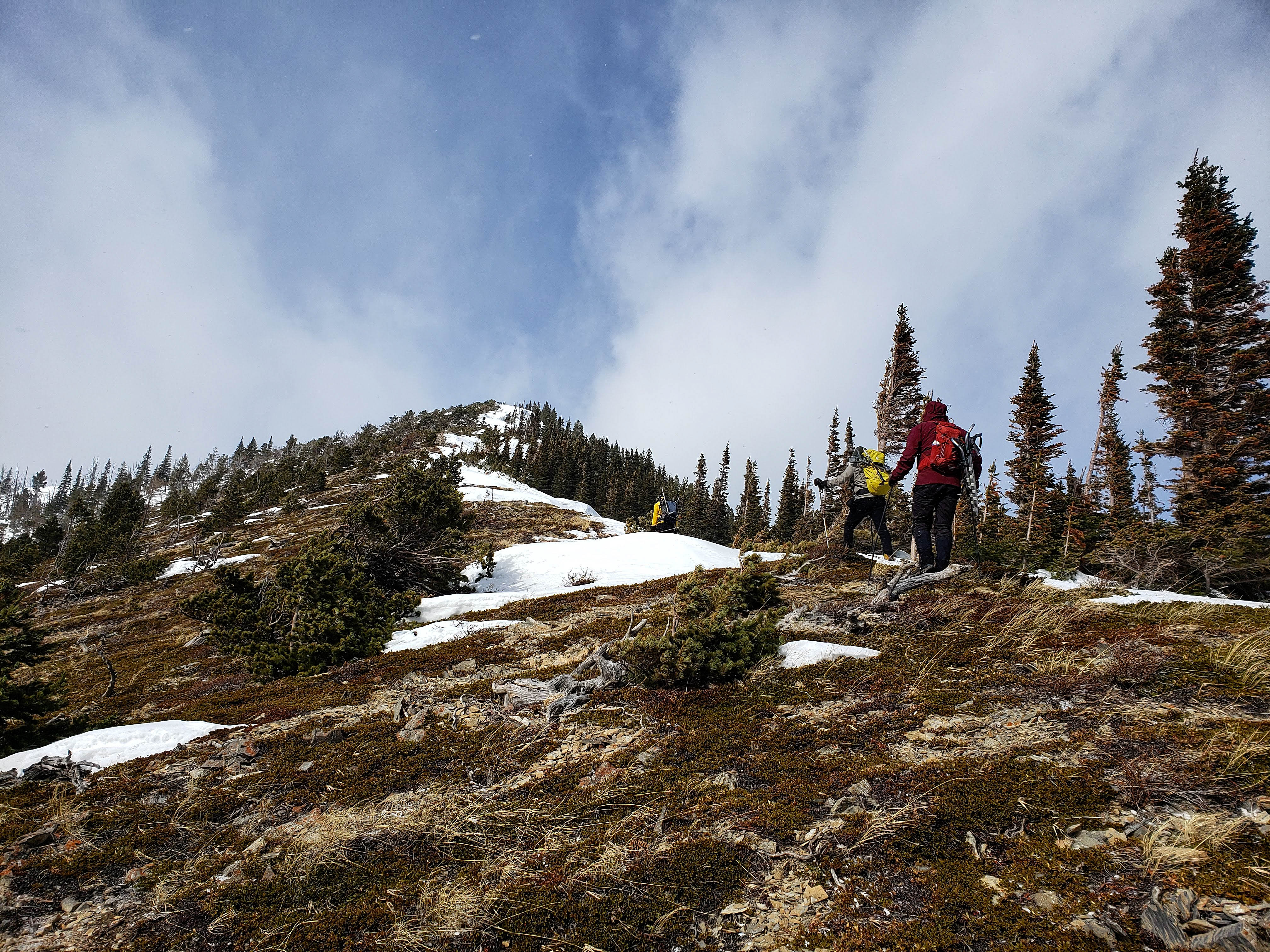
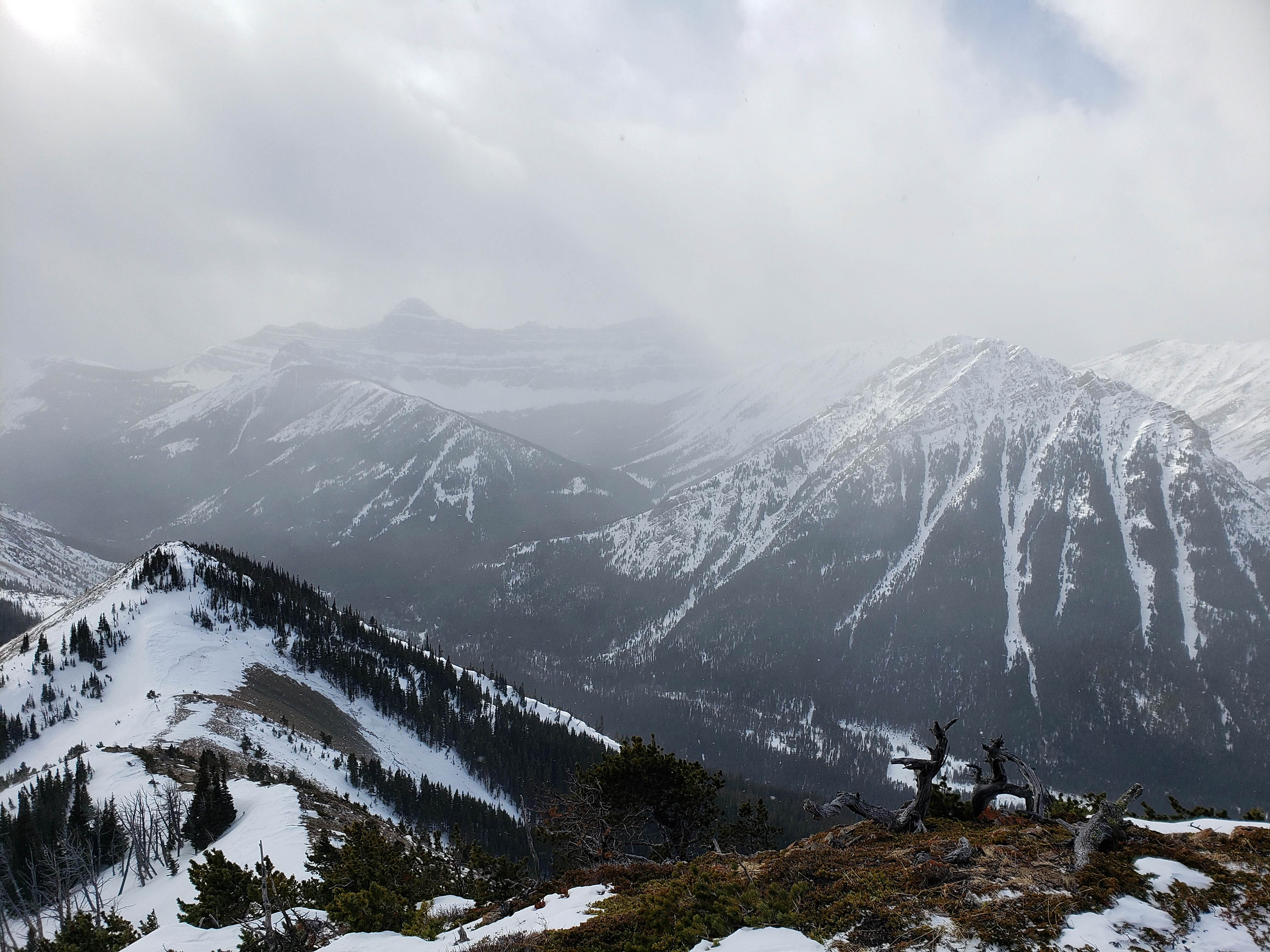
Both of “Whitney Ridge’s” summits are now visible. From this vantage, none of us were expecting much of a view… Boy were we wrong!

Gazing down at a wintry, Whitney Creek from the first bridge.

Approximately 3.6 km from the gate, we arrived at the second bridge (left). Instead of crossing the bridge, we headed into the trees in the centre and began to follow a small creek up the adjacent valley. I still can’t believe that this was our first time back here!

With the southern summit as the background, I (look closely to find me) head into the woods to check things out. (Photo by Andrew Nugara)
I discover that the bushwhacking was fairly light alongside the creek.

After post-holing for a short distance, it was time to put on our snowshoes.
Aaron breaks trail for the rest of us.

It wasn’t long before we came to what looked like a trail. This was confirmed when we found some blue flagging tape and a wire with fur attached to the end of it (foreground centre). My developing chimp instincts told me that this was someone’s trapline and that the poles on the left may be used for placing martin traps.

“Brad. He’s so hot right now.” – Mugatu 😉

Our plan was to follow the creek to the end of the valley, but ~650m from the bridge, inviting slopes coaxed us up.

Aaron, who is the Instagram influencer known as ”Big Bearded Adventures”, continues to blaze a trail for us. Unfortunately, his snowshoes lacked side crampons and heel lifts which meant that he would soon be working twice as hard to ascend. 🙁

More light bushwhacking through the trees. (Photo by Aaron Eyjolfson)
When they removed my thyroid, my usual bright orange jacket turned blue! 😉 (Photo by Big Bearded Adventures)

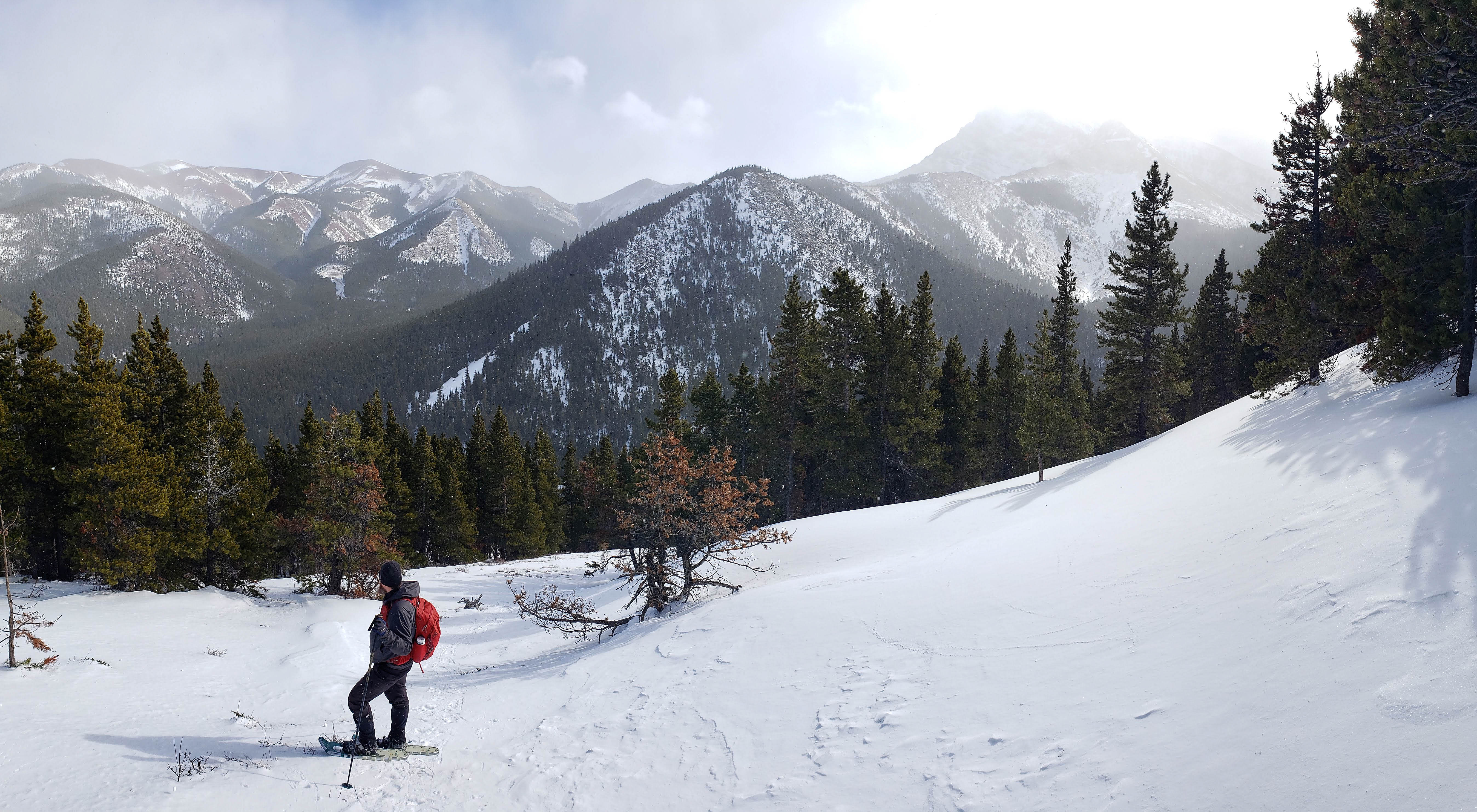
Arriving on more open slopes as the ridge rises in front of us.

Victoria Peak appears through the clouds.
Aaron pauses to take in the view.

Brad tackles a particularly steep section head-on… (Photo by Andrew Nugara)

While Andrew follows him up. (Photo by Brad ‘one good pic a trip’ Wolcott)

My view of the previous picture.

Synthetic Thyroid Man opts to zig zag the same section. (Photo by Andrew Nugara)

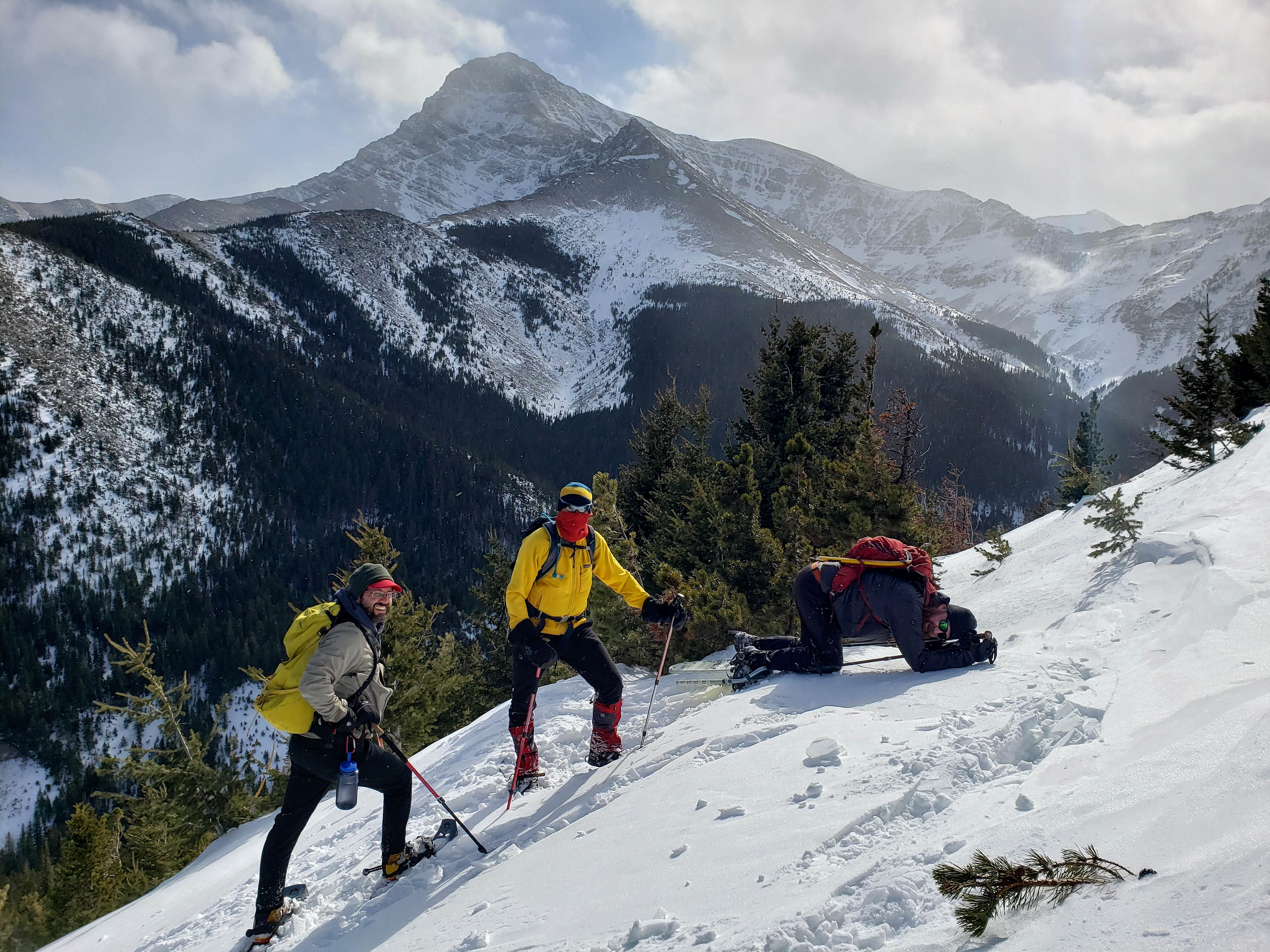
Remember when I said that Aaron’s snowshoes did not have crampons on the edges? Making his way up this short but steep section became a Herculean task for him. Here, he is trying to ascend sans snowshoes just to see if this led to a better outcome. It didn’t. In the background on the right is Prairie Bluff.

While Aaron struggled to climb the slope and catch up, Brad and Andrew relax in front of Victoria Peak. I’ve wanted to introduce these guys to each other for a long time as there is a TON of mountain knowledge and experience between them!
Exhausted, Big Bearded Adventures finally conquers the slope! 😉
Just to emphasize the difference that mountain snowshoes with heel lifts can make, this is me with my lifts engaged. While the additional crampons along the sides grip the snow, the heel lifts save your calf muscles from undue strain. (Photo by Andrew Nugara)

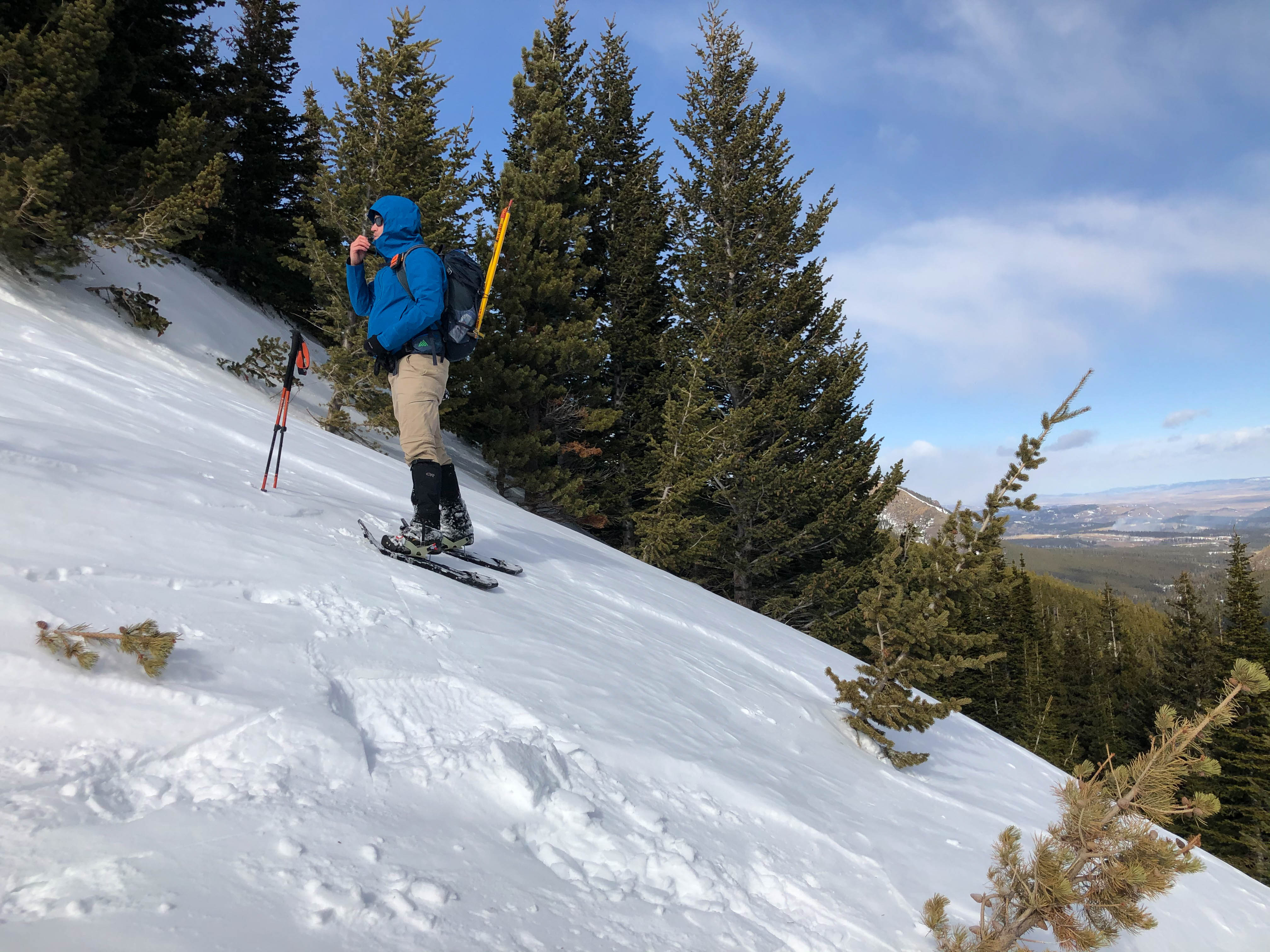
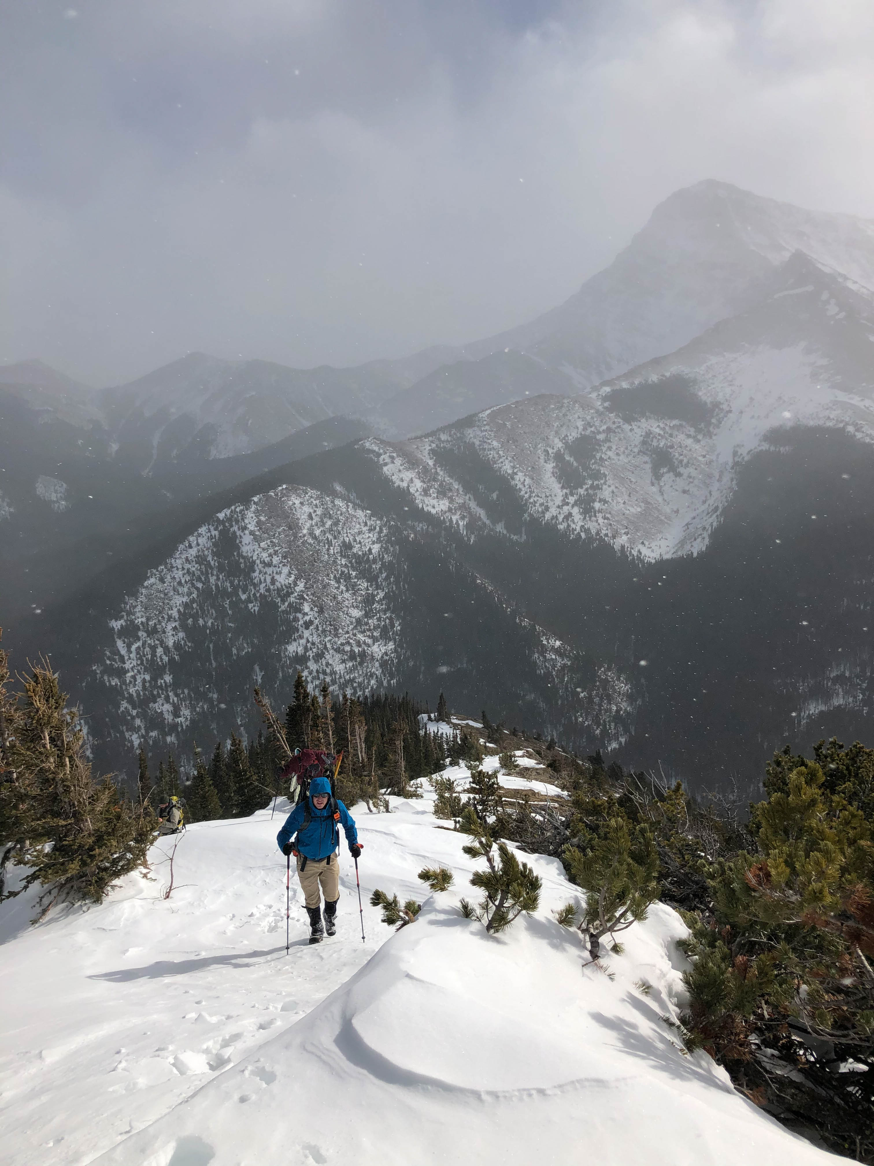
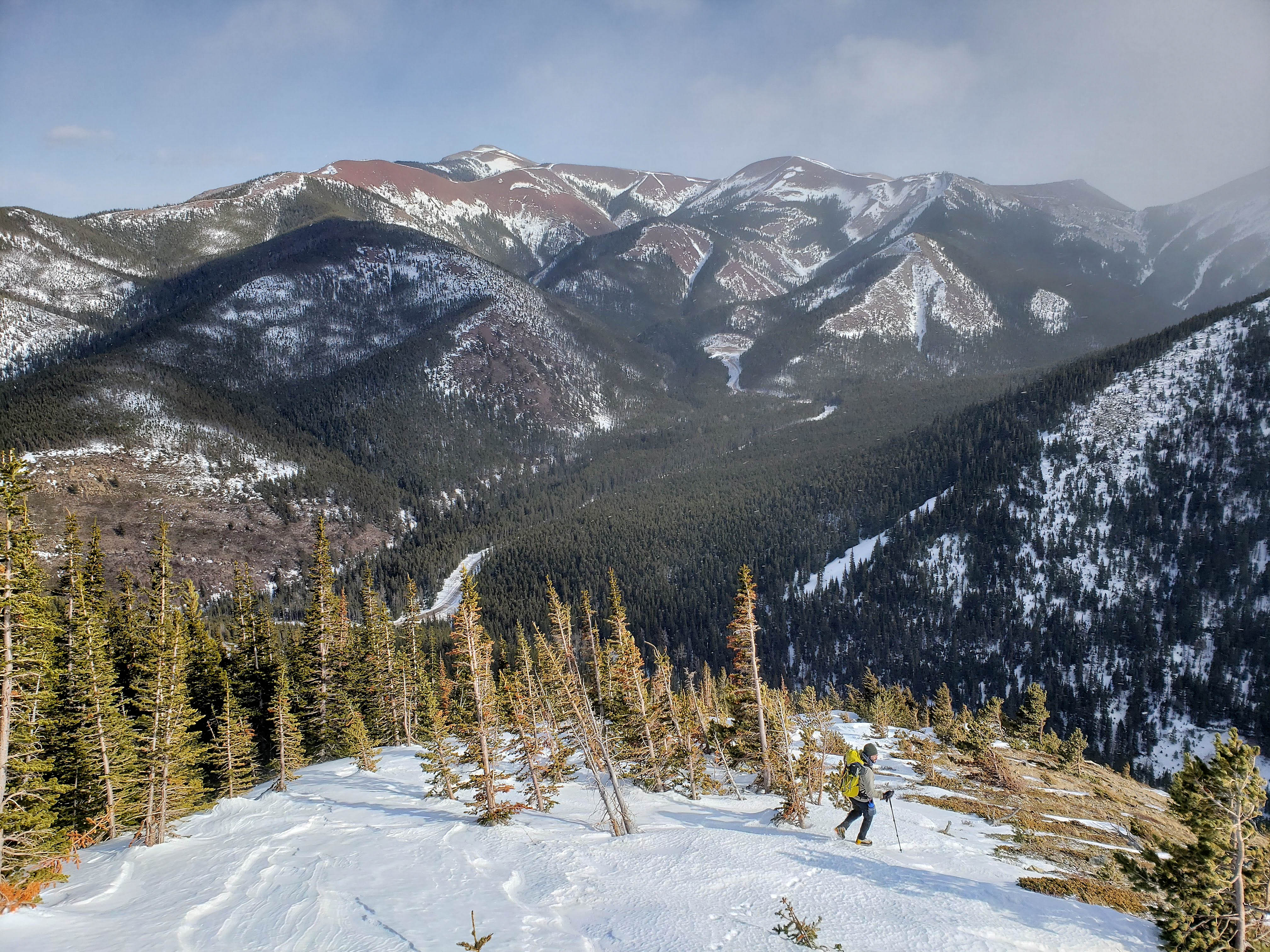
As we drew closer to the top, the snow disappeared and it became a straightforward hike.

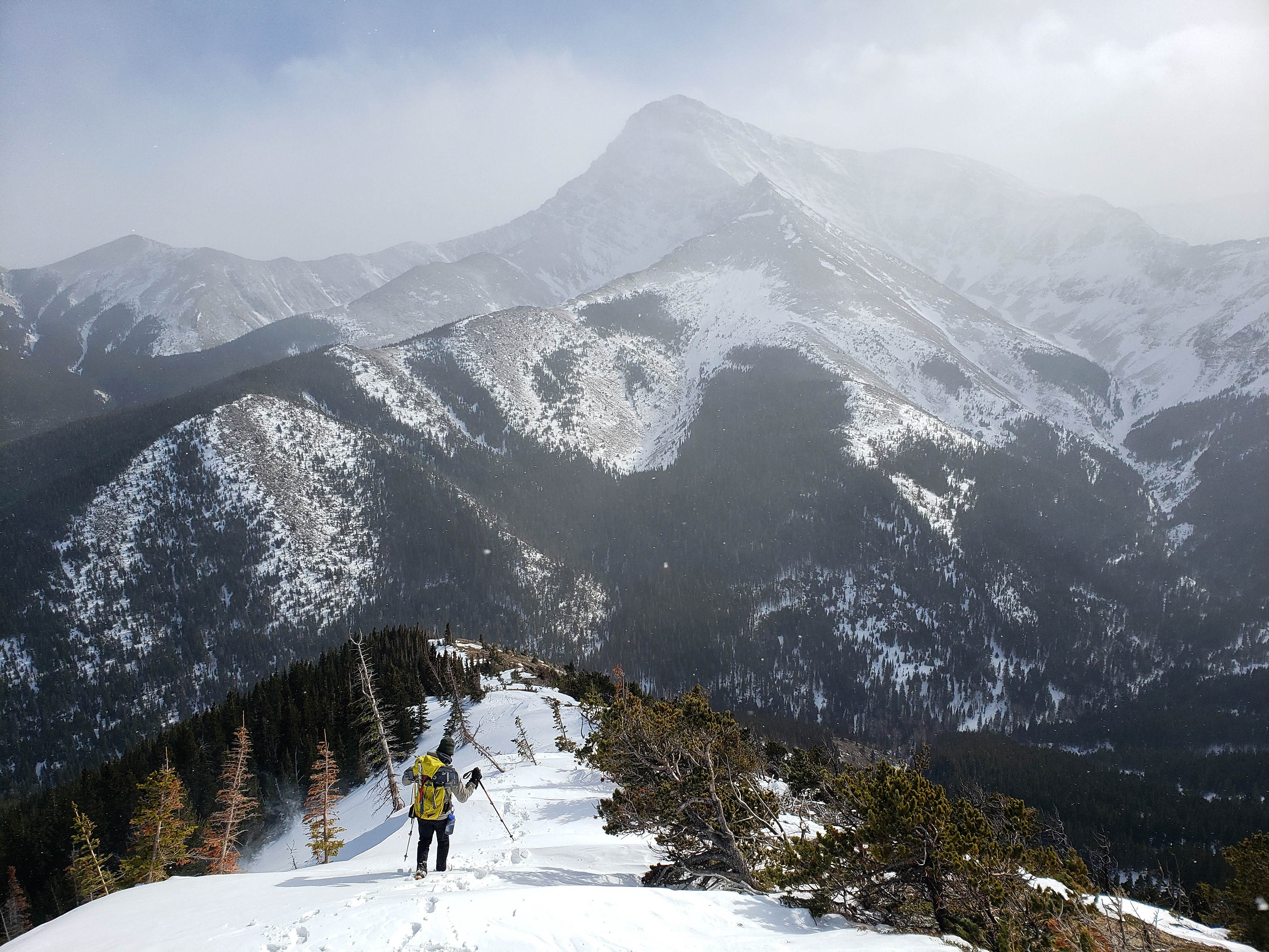
Windsor Mountain appears over a col on the ridge. My original plan was to follow the valley all the way to the smaller slope in the centre, use it to gain the ridge, and then follow the ridge to the summit. Though in the end, our way worked just as well. I will definitely come back and do more exploring more this summer as it would be cool to see what the highest point on the ridge (left) is like and whether you could keep going to Victoria Peak. Edit: You can!

Andrew follows me up the ridge and against the driving wind. In the background are all the member of the Prairie Bluff family: Prairie Bluff (left); “Prairie Fire” (centre); “Prairie Sky” (right of centre); and “Prairie Storm” (right)
A quick video of the weather conditions that we were battling. This is why we decided to forego tagging the northern summit.
Getting closer!

Andrew takes the lead…
While I follow. (Photo by Andrew Nugara)

I ended up taking a shortcut across drier slopes to the summit, but Brad, Aaron, and Andrew remained on the ridge. (Photo by Andrew Nugara)

The southern summit of “Whitney Ridge” (2004m my GPS).
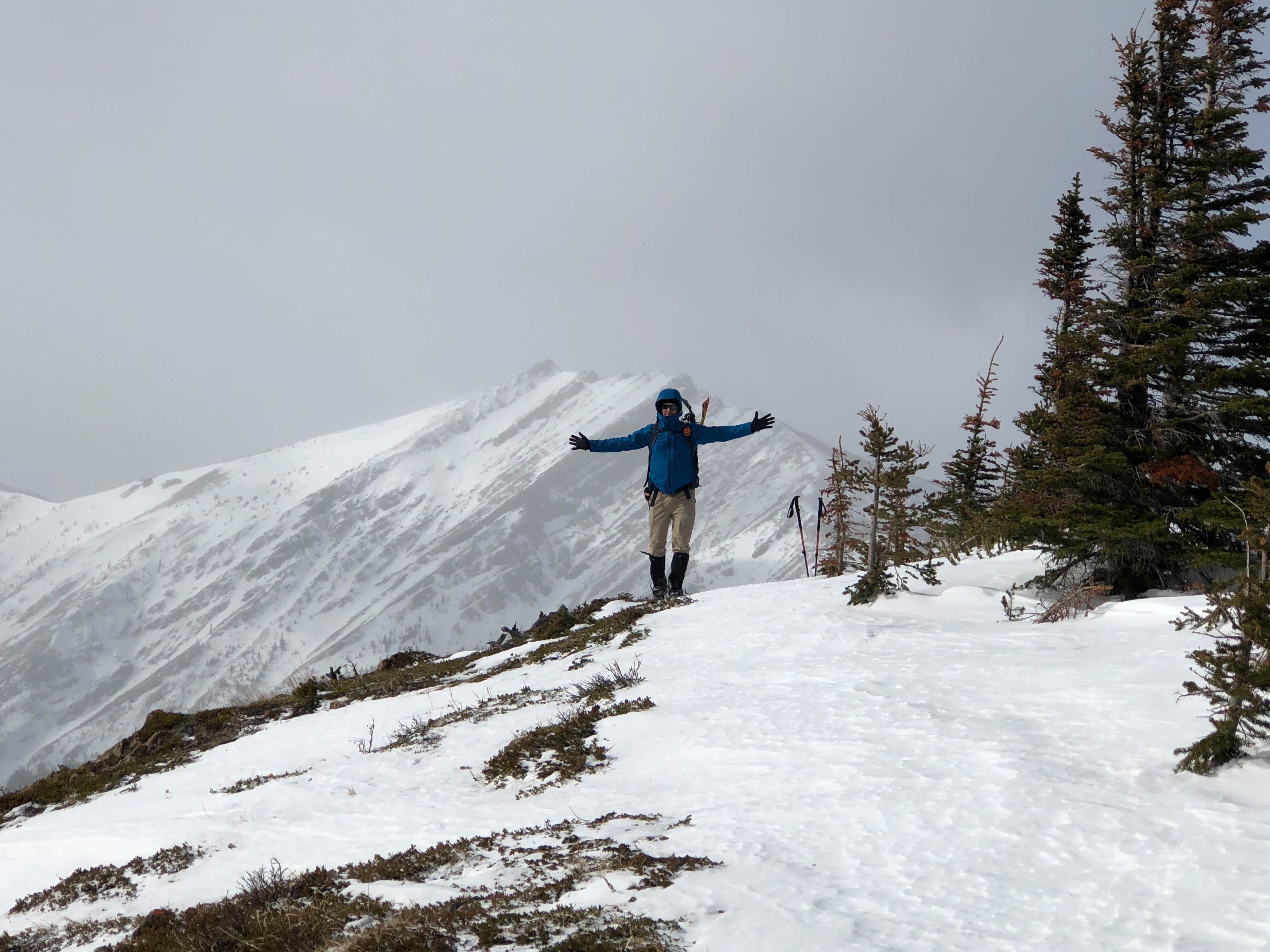
Though it was a small destination, this was a huge milestone for me – my first post-cancer surgery peak. It was awesome to know that despite missing a thyroid, two parathyroid glands, and being on a generic dosage of synthetic hormones, I could still feel great doing what I love! (Photo by Andrew Nugara)

Andrew, Brad, and Big Bearded Adventures join me on the summit.
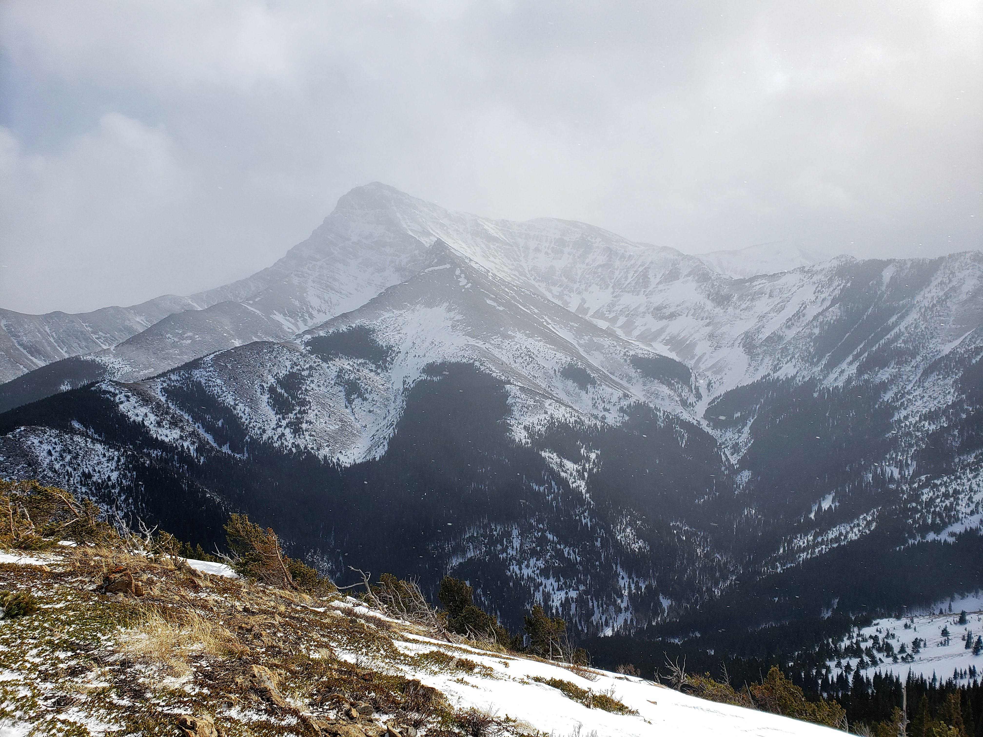
On a clear day the views of Victoria Peak would be stellar. As Andrew observed, it may be possible to ascend using that ridge in the foreground… Edit: it is!
Again, it is too bad the weather was uncooperative as the view to the southwest would also be amazing. In the background are Windsor Mountain (left) and Castle Peak (centre). In the foreground on the right is “Mill Creek Peak”.

Gazing west at “Mill Creek Peak” (left) and Mount Gladstone.

The view slightly more to the northwest includes Mount Gladstone (far right), Table Mountain, “Gladstone’s Toe”, and in the foreground, the northern summit of “Whitney Ridge”.

A closer look at the northern summit which sits ~920 m away. EDIT: I returned in 2021 and visited the north summit.

“Whitney Creek Mountain” occupies the far end of the ridge.

A telephoto of “Prairie Sky” (left) and “Prairie Storm” (centre).

I’m blessed to have such awesome friends!

I compensate for my own inability to grow facial hair by befriending those who can! Perhaps my new dosage of synthetic chimp hormones will make me more swarthy? 😉 (Photo by Andrew Nugara)

Andrew, Brad, and I discuss the merits of tagging the northern summit. (Photo by Big Bearded Adventures)

Desperate to get out of the wind, we found refuge by dropping onto the other side of the ridge. (Photo by Andrew Nugara)

Lunchtime!

Contemplating using our original ascent route (lower right) for descent. I can’t wait to explore this ridge more in the summer! (Photo by Aaron Eyjolfson)

With the weather forcing us to forego the northern summit, it was time to head home… wait, what just happened?

Aaron post-holes one leg up to his waist and destroys yet another pair of Arcteryx pants. 😉

The view down the valley towards Beauvais Lake Provincial Park and Mount Albert (left). (Photo by Big Crotchless Adventures)
Brad leads the way down…

While Andrew lingers behind for the perfect shot. (Photo by Andrew Nugara)
The terminus of the gas road can be seen above Brad in the centre.

Enjoying an easy descent through the trees.

Back at the trail beside the creek. (Photo by Aaron Eyjolfson)

Even easier travel back to the road.

Arriving at the second bridge.

Though bikes would’ve made the ~3.6 km trip back my 4Runner super quick, the hike was not a big deal.

Arriving at the first bridge on the way back. “Whitney Creek Mountain” is on the left.

The end to a very important day in the mountains. Though I’m not sure what follow-up treatment(s) I still have to go through, being able to be back hiking so soon after surgery was a gift. Even more so, was that I could spend it with such good friends!! I still find it hard to believe that none of us have ever travelled into this valley before, and so I’m looking forward to exploring “Whitney Ridge” and the surrounding landscape later this spring and summer. Once again, the Castle comes through!


Leave a Reply