
⚠️ Hiking and scrambling are inherently dangerous activities. Please read my Disclaimer. ⚠️
Another day and another forecast for extreme wind in southern Alberta. With confirmed gusts of 150 km per hour already taking place, Brad, Lance, and I headed to the Castle in search of an objective where we wouldn’t be launched into the stratosphere upon reaching the summit. After a brief discussion, we decided on a repeat visit to “Whitney Ridge”, where Brad and I had some unfinished business after our initial snowshoe trip in February 2020. Specifically, we were keen on reaching the slightly lower north peak and then traversing the remainder of the ridge towards “Whitney Creek Mountain” – or as we also like to call it, “Victoria’s Secret”. 😉
“Whitney Ridge” is the middle section of the much larger northwest ridge of Victoria Peak – with the fun ridge scramble, “Whitney Peak” located at the south end and standalone, “Whitney Creek Mountain” located at the far north end. Though it looks entirely treed from the road, “Whitney Ridge” is a largely open ridge walk that offers great views to the south, west, and north. Indeed, now that I’ve visited almost all of Victoria’s northwest ridge, the only thing left to do is string it all together into one long ~ 6 km traverse. 😁
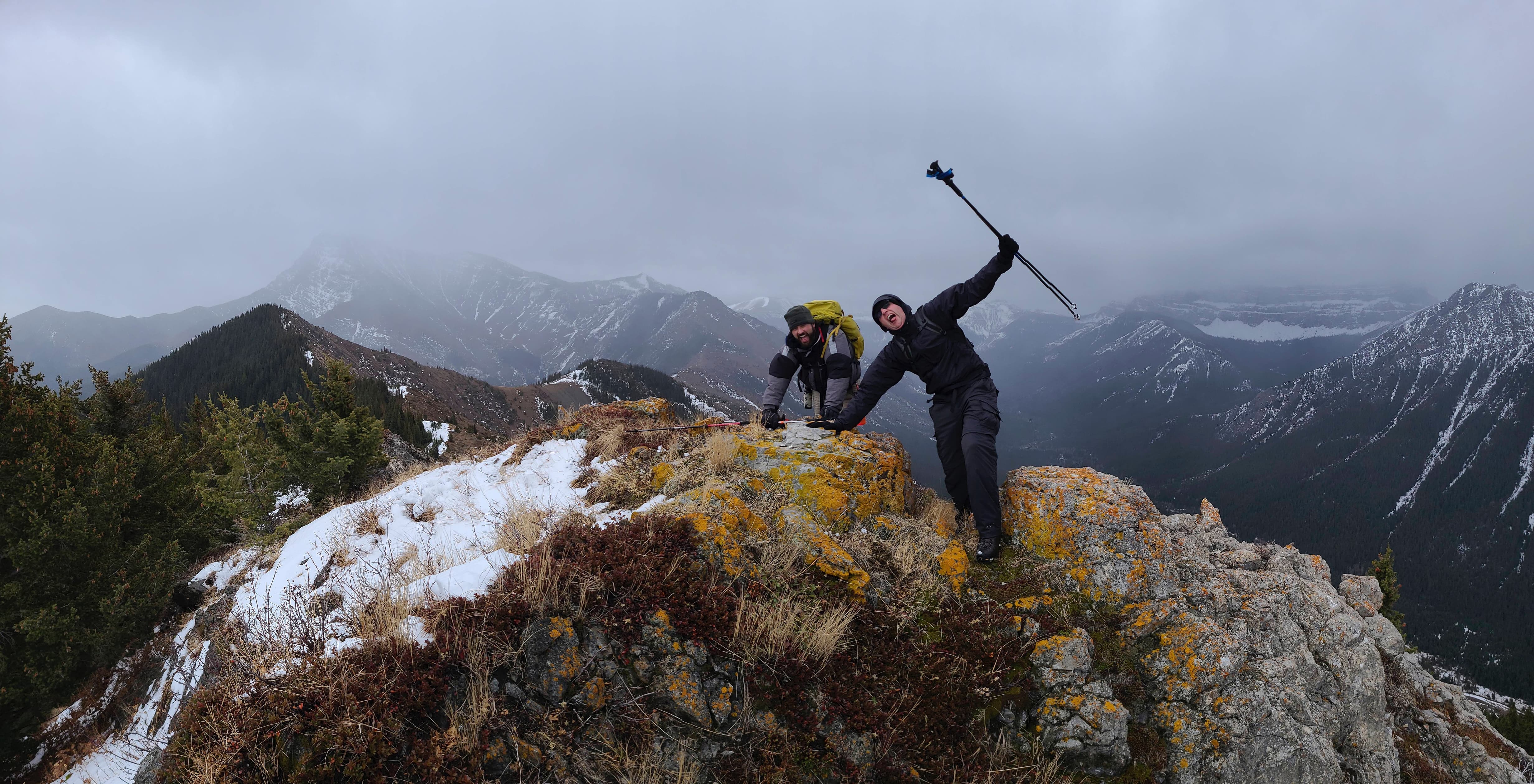
Though not hard to reach, battling the extreme wind combined with sheets of rain and driving snow, made “Whitney Ridge” seem bigger than it is. Our rationale for choosing “Whitney Ridge” centred on its somewhat sheltered approach and the allure of being able to stick close to the trees for shelter. We figured that doing the ridge walk from south to north would offset a wind that was charging in from the southwest – and to a large extent our strategy worked, though with wind gusts consistently over 120 km per hour, there was little reprieve. More than once, I was staggered and almost knocked down and this time, my flask of Drambuie was not to blame. 😂
Despite this, our traverse from the south peak to the north peak and then beyond, was enjoyable. Once we reached the end of the ridge and the start of the large col with “Whitney Creek Mountain”, we bailed into the trees and enjoyed a relatively windless descent amidst light bushwhacking and small deadfall. We rejoined the road approximately 2.3 km from the trailhead, though because Lance and I took a slightly different route over the final few hundred metres, we ended up losing Brad, who unbeknownst to us, had arrived back on the road before us and thought we had already started walking back to the trailhead.
After waiting for a quite some time, Lance and I headed back to the trailhead to eliminate it as a possible location for Brad. On the way, Lance and I discussed strategies for how we would pay tribute to the sasquatch clan that had surely abducted Brad. However, before our minds had gone too far down the rabbit hole, we saw Brad walking towards us from the direction of the trailhead. Sure enough, he had gone back to his car and was starting back along the road again to find us. Case solved. We then finished off the day with a fun game of ice axe golf. All in all, it was another fun day in the mountains spent with great friends. 😁

To get to “Whitney Ridge” from Lethbridge, we followed follow Highway 507 west of Pincher Creek to the Gladstone Valley Road which is located on the left side of the highway, ~1.4 km past the bridge over Mill Creek. After turning onto the road, we kept to our left at all major junctions, until we eventually crossed two bridges over Mill Creek. Approximately 16.3 km from Hwy 507 or ~3.5 km from the 2nd bridge, we came to a hairpin curve that also serves as a junction for a gated gas road. This was our starting point. There are several ways to get onto the ridge, but I believe the route we used may be the easiest.
We followed the gas road from the gate for ~3.6 km until we came to the second bridge (the first is at the ~2.8 km mark). We did not cross it, but instead entered into the woods on our right where we followed an old trail alongside a small creek. The old trail is faded but still distinctive and easy to hike. We followed it for ~650 m until we came to inviting slopes that we then ascended for ~1.9 km (~431m elevation gain) to the summit of the south peak (2004 m my GPS). From the south peak, we then followed the open ridge north for ~920 m until we reach the summit of the north peak (1983 m my GPS). We then kept following the ridge for another ~2 km until we came to the start of the large col with “Whitney Creek Mountain”. Here is where we descended through the trees back to the road, which we then followed for ~2.3 km back to the trailhead.

Our total round trip distance was 12.8 km and our total roundtrip time was 5 hours even. Total elevation gains were 537 m.

The wind warning issued by Environment Canada. Welcome to southern Alberta! 😂

Our parking spot at the locked gate. From here it would be a ~3.65 km hike to reach the second bridge and the trail that will lead us to the base of the south peak.

Shortly after starting, we could see the south peak (centre) of “Whitney Ridge”. We nicknamed it “Whitney” a few years ago after nearby Whitney Creek and have used this for “Whitney Peak” and of course, “Whitney Creek Mountain” which was our first trip onto the ridge back in 2018.

Our first good look at the north peak of “Whitney Ridge”. It is impossible to tell from the road, but the entire ridge is an open ridge walk.

Walking past “Whitney Creek Mountain”.

We could now see both the south peak (left) and the north peak (right). We will ascend the south peak first.
We chose “Whitney Ridge” because of its somewhat sheltered approach… 😂😂

Despite the weather, Lance is still smiling.

A pano of the ridge with the south peak on the right, north peak in the centre, and on the far right, “Whitney Creek Mountain”.

Victoria Peak (left) was in and out of the clouds all day.

Approximately 3.6 km from the trailhead, we arrive at the second bridge. The trail that leads to the base of the south peak, begins in the clearing just to the right of centre.

Brad leads the way as we start along the little-used trail.

I doubt this trail sees much traffic even though it leads into the quaint valley between Victoria Peak and “Whitney Ridge”.

X marks the spot! A convenient positioning of deadfall that likely doubles as an inter-dimensional portal. 😂

We came across this old set of martin poles back in 2020. This trail was most likely a trapline at some point in the past.

Approximately 650 m from the road and ~4.3 km from the locked gate at the trailhead, we left the trail to head up the east side of the south peak. This is almost identical to the route we used on our 2020 snowshoe trip.

After a short stint of easy bushwhacking, we arrive in a clearing.

A pano from a little higher up. The small peak in the foreground is part of a smaller northwest ridge on Victoria Peak.

Easy hiking (outside of the wind and rain) as we make our way through a short section of forest.
A small taste of the fun. Note the sheets of rain / ice pellets. 😂

A closer look at the twin summits of “Whitney Peak”, which sits at the far south end of the north ridge of Victoria. This remains one of my favourite ridge scrambles in the Castle.

Gazing up the slope towards the summit.

Looking back at “Prairie Storm” (far left) with Victoria Peak in the centre.

Another view back to Brad as we seek shelter below the crest.

The summit of the south peak of “Whitney Ridge” (2004 m my GPS).

The view to the east.

A pano to the south…

And then one to the west.
A quick summit video.

A closer look at Prairie Bluff (left) with “Prairie Oyster” and “Prairie Fire” on the right.

The views of Victoria Peak are fantastic and the northwest ridge (foreground) route to the summit makes for a great trip.

A shoddy telephoto of Victoria Ridge.

Unfortunately, Castle Peak and Windsor Mountain would not reveal themselves today.

Ah, two of my favourite little peaks in the Castle: “Mill Creek Peak” (foreground) with “Mill Creek Mountain” behind it. I’ve visited “Mill Creek Peak” twice now, and I would definitely be up for a third trip. 😁

Looking northwest at North Castle (far left) and Mount Gladstone (centre).

The view to the north includes Table Mountain (left of centre) and “Gladstone’s Toe” – which I’ve also visited twice before.

Zooming in on the north peak (foreground) – our next objective for the day.

Brad and Lance on the summit of the south peak.

Leaving the summit for the north peak which sits ~920 m away. You would not expect it to be this open if you were just looking at it from the road.

The view back to the south peak.
And just in case we’d forgotten about the wind… 😂

A pano from somewhere near the halfway point.

Closing in on the north peak.

Elevated open sections were brutal for encountering wind gusts.

The north summit is slightly more rugged than its neighbour.

Almost there…

The summit of the north peak of “Whitney Ridge” (1984 m on my GPS).

The view across to “Mill Creek Peak”…

And to Mount Gladstone.

All four high points on “Gladstone’s Toe” are visible from the summit. On our first visit to the Toe, dense cloud-cover kept us from visiting the northernmost point (right); however, on my second visit, I was able to enjoy the views from the top. 😁

Trying not to be launched into the stratosphere! 😂

Lance and I discuss his obsession with Geddy Lee. 😂 (Photo by Brad Wolcott)

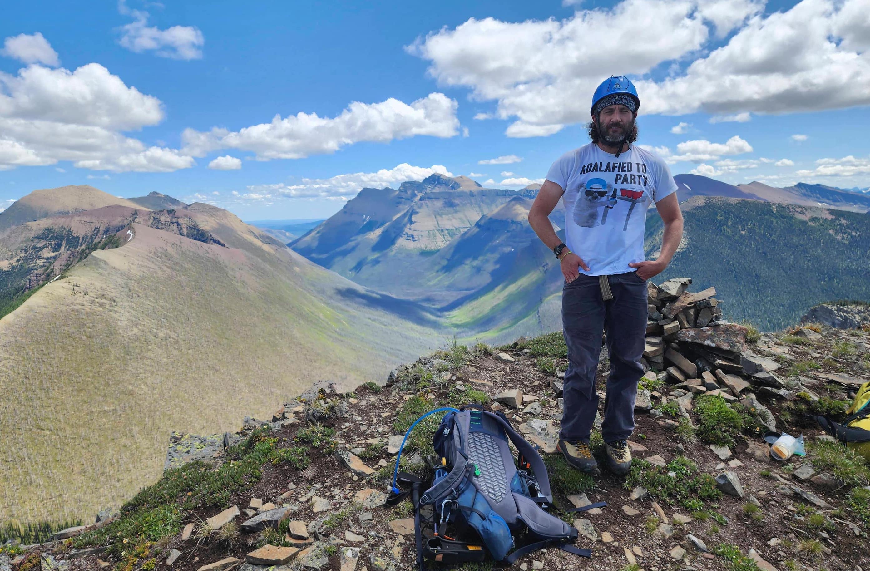
Brad stands next to the small cairn I made. I named it Bradley. 😂

Setting off to explore the remainder of the ridge.

“Whitney Creek Mountain” sits directly to the north.

The ridge continues to be an interesting hike.

The wind necessitated some careful balancing.

Nearing the top of a high point.

Entering a short section of trees on the other side of the high point.

Back on the open ridge after some moderate bushwhacking.

Nearing the start of the col with “Whitney Creek Mountain”.

Looking back to the high point we came from.

The end of “Whitney Ridge” and the start of the col with “Whitney Creek Mountain” – though it looks like there is still an intervening high point, so maybe it’s not the col after all…? 🤔 At any rate, this is where we would start heading back to the road. For reference it was ~2 km from the north peak.

Heading into the trees.

An interesting piece of deadfall.

A closer look at the lichen-covered log.

We were worried this would end up like our descent off, “Gladstone’s Toe”, but it was surprisingly easy.

It was nice to see sections of new growth.

Entering a very cool section of small trees.

Navigating through what felt like a miniature world. Personally, I think I stepped on half-a-dozen Smurfs… 😂

Lance is happy this was no repeat of the Toe.

This was the worst it got for deadfall.

Arriving back at the power pole cutline alongside the road.

Lance crosses Whitney Creek.

Whitney Creek showing off those Castle colours.

We arrived back on the road ~2.3 km from the trailhead, but we couldn’t see Brad anywhere. 🤔

Brad! Brad! Where art thou?

Ah, there he is! He had gone back to the car and had come back to find us.

After battling the wind and the rain all day, it cleared up enough for us to enjoy a nice round of ice axe golf.

Brad prepares to take his famous flip shot as we approach the first hole – which he birdied. 👏 Despite the weather, it was great to traverse more of “Whitney Ridge” and visit the north peak. I think a fun summer trip would be to start off on “Whitney Creek Mountain” and traverse the entire ridge to “Whitney Peak”, a distance of ~6 km. Thanks again Lance and Brad for a ‘fantastic’ day in the mountains!


Leave a Reply