

⚠️ Hiking and scrambling are inherently dangerous activities. Please read my Disclaimer. ⚠️
Last weekend we celebrated another wedding in our family. Our oldest son, Joel, married his fiancée, Taylor, in a beautiful outdoor wedding in Lethbridge. This means that all three of our kids are now married to wonderful partners (3 weddings in 4 years) and Melanie and I no longer have to be involved in wedding financing and planning. Whew! 😁 Seriously though, having all our kids married while also becoming grandparents is one of those, “Where did the time go?” moments that every older generation warns the next generation about. As it’s also our 30th anniversary this month, I’m further struck by how our perception of time works. It really doesn’t seem like it was three decades ago that we were in the same place as Joel and Taylor, but it was – wow! That said, a HUGE congratulations to Joel and Taylor and may you have a lifetime of happiness together!
Speaking of time flying by, it was back in August 2016 when Marc and I took a ‘wrong’ turn while ascending Chinook Peak and ended up 22 vertical metres from the summit along the southeast ridge. Even though our instincts told us to head for the notch to climber’s left, we opted to avoid slogging through scree by going climber’s right. It was after chatting with Andrew a month later that I found out he and Raff had made the summit by heading towards the notch, thus confirming our initial instincts were correct. Had I only checked his 2014 trip report, all would’ve been good. 😁 In 2017, Andrew included Chinook Peak in the third edition of More Scrambles and I’ve lived with an asterisk next to my 2016 trip report ever since.
As of today, I’m happy to say that I can now remove that asterisk. 😁 At Brad’s suggestion and with an excellent forecast in hand, we set off early in the morning for Chinook Peak. After an enjoyable bike ride that included nine crisp creek crossings and a startled black bear, we ditched our bikes near the creepy forest habitation that we found a couple years ago, and started on foot to the base of Chinook.
Getting to the notch was not difficult, but the higher we went, the treadmill scree became increasingly annoying and I soon remembered why Marc and I opted to go climber’s right and not left. The tricky part of Chinook comes once you reach the notch and are faced with the crappy, down sloping rock along the summit ridge. This is why Andrew included a difficult rating for Chinook in More Scrambles. Good route finding and scrambling skills are a must, otherwise, things could go very bad, very quickly.
Once on the summit, Brad and I enjoyed great views and a leisurely lunch; noting from the register, that we were the first visitors to the peak since July 2021. Brad was also able to show me where he and his friend, Dave, had tried an ascent of Mount Ptolemy last month using a snow couloir up the north face. Unfortunately, they ran into terrible rock 2/3 of the way to the top and had to abort. As bad as the rock was on Chinook, he said the rock on the north face of Ptolemy was much worse.
After a month and a half away from the mountains, it was great to be back on a summit. That it was on the crappy Flathead rock, was a good skills refresher as I’ve become too comfortable with the more favourable rock in Paahtómahksikimi (Waterton) and Tatsiki-Miistáki (Castle). Now that I have a bit more time with the wedding over, I will continue my slow but steady exploration of the Flatheads. 😁 Thanks again Brad for yet another fantastic trip!

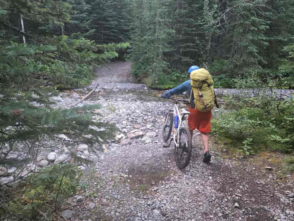
To get to Chinook Peak, we followed Highway 3 past Coleman towards the BC border. After driving 1.3 km beyond the rest area at the far west end of Crowsnest Lake, we turned left onto Coal Road. From here we drove ~3.2 km to our parking spot at the Ptolemy Creek / Valley of the Seven Bridges trailhead. We then biked ~5 km until we reached a very large clearing/camping area. Despite the fact that we gained over ~200 m in elevation over this distance and had to cross the creek 9 times, the ride seemed to go by quickly as the trail was in excellent condition. On our way back, we covered this distance in ~40 minutes.
At the large clearing/camping area, the trail bifurcates, presenting the option to continue going straight – which will take you to the Promised Land – or to turn left, which will take you to Chinook Peak and Andy Good Peak. We biked down the left trail for ~190 m until we came to a viewpoint. Here is where we stashed our bikes because the trail drops into a sometimes-dry creek bed (the 10th creek crossing) before climbing steeply for ~1 km towards the avalanche slope at the base of Chinook, which served as our starting point.
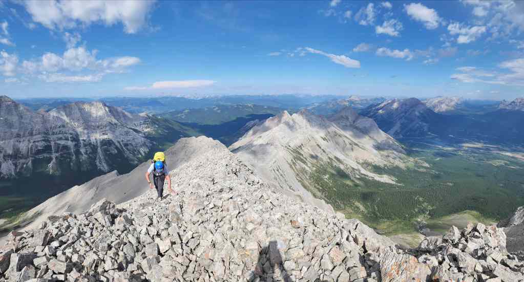
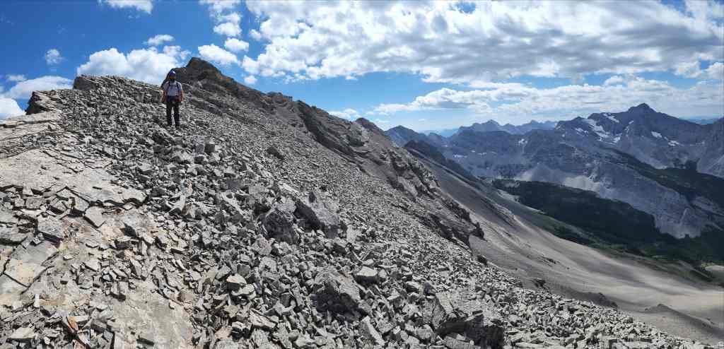
Upon leaving the trail we climbed increasingly steep slopes until we reach a bowl beneath the summit. This whole area is deceptively steep and the higher we went, the more treadmill scree we encountered. This is why Marc and I went climber’s right in 2016 and ended just below the summit on the southeast ridge.
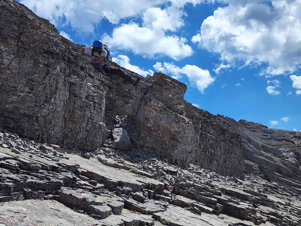
We continued to aim for the notch to climber’s left and ~3 km (~765 m elevation gain) after leaving the trail, we finally reached it. Once on the summit ridge, things got tricky fairly quickly. We initially climbed onto the crest and immediately realized that the crappy rock would make the exposure not worth the risk. Fortunately, there was a bypass and we soon found ourselves directly beneath the summit.
A series of small, awkwardly angled scree-covered steps proved to be the crux due to the down-climb. However, we’ve learned to bring a rope on all our trips to the Flatheads and even though we didn’t need it, we set it up just in case.
Once back in the notch, we descended straight down and into the bowl before following our ascent route back to the trail. We then returned to our bikes and enjoyed a relatively quick ride back to the trailhead.

Our total roundtrip distance was ~19.4 km with a total elevation gain of 1340 m. Our roundtrip time came in a 8 hours and 40 minutes.
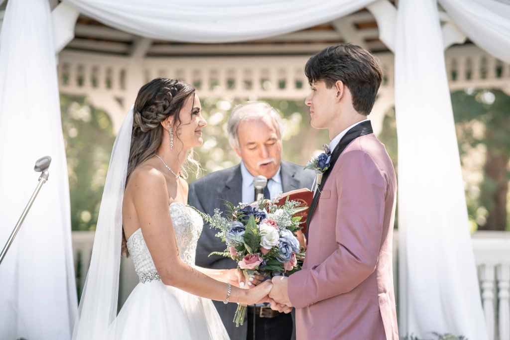
Before I get to the trip, here are some photos of our son’s wedding last weekend. Our oldest, Joel, was our last kid to get married. A huge congratulations to both he and Taylor as they start their lives together – and special thanks to our brother-in-law, Dale, for officiating. 😊 (Photo by Kella Ramberg Photography)
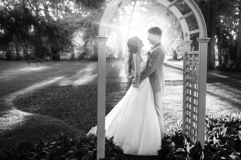
The happy couple. (Photo by Kella Ramberg Photography)

Joel’s smiling because he just got married. Melanie and I are smiling because we no longer have to help plan and pay for weddings. 😂 Yup, we’ve had 3 in 4 years! (Photo by Kella Ramberg Photography)

Our ever-growing family 😊 (Photo by Kella Ramberg Photography)
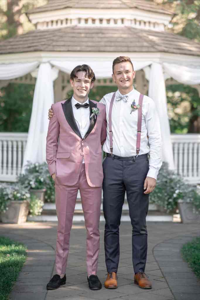
Joel with his best man and brother, Nathan. (Photo by Kella Ramberg Photography)

Joel and his sister, Janelle. (Photo by Kella Ramberg Photography)

Ring bearer extraordinaire – our grandson, Oliver. 😊 (Photo by Kella Ramberg Photography)

There was a dinosaur theme to the wedding – from the cake topper through to the material composition of the rings. Guess who’s in the costume? I may just have found a replacement for my gorilla suit! 😂 (Photo by Kella Ramberg Photography)

Now back to Chinook Peak, where we’re all geared up and ready to go. As I’ve written about the trip along the trail multiple times before, I’ll just stick to highlighting the creek crossings…
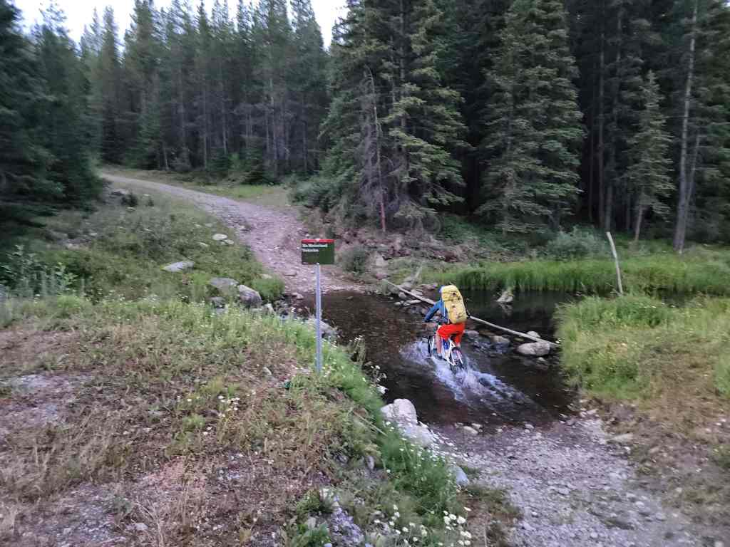
Creek crossing #1 occurs right at the trailhead.

Crossing #2.
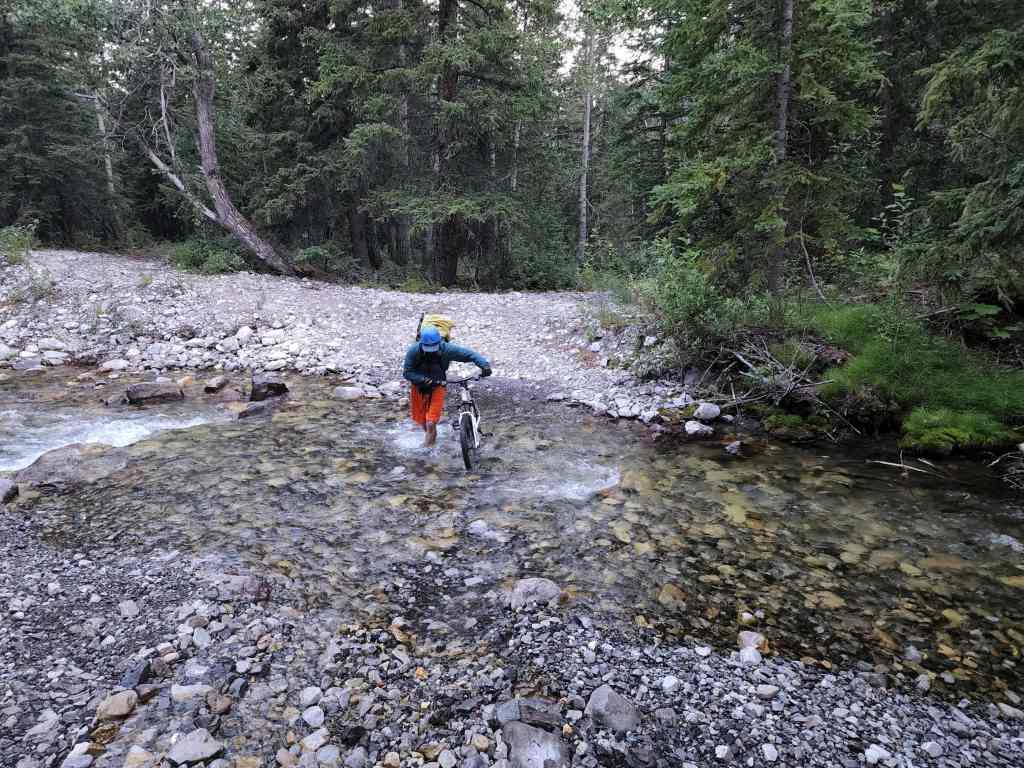
Crossing #3. Note, there is a bypass trail that allows you to avoid crossings #3 and #4. We used this on the way back.
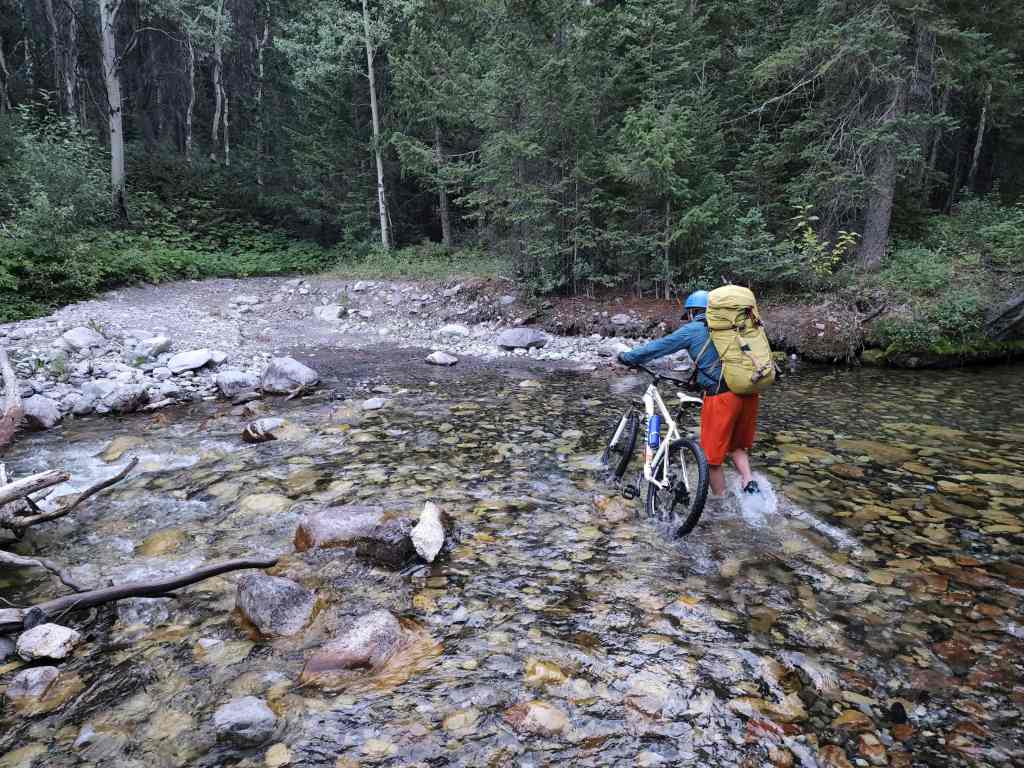
Crossing #4.

Crossing #5.
Crossing #6.
Between the crossings, it was generally a smooth ride. The only excitement was watching a large black bear take off through the bush when he heard us coming.

Crossing #7.
Crossing #8.

Crossing #9.
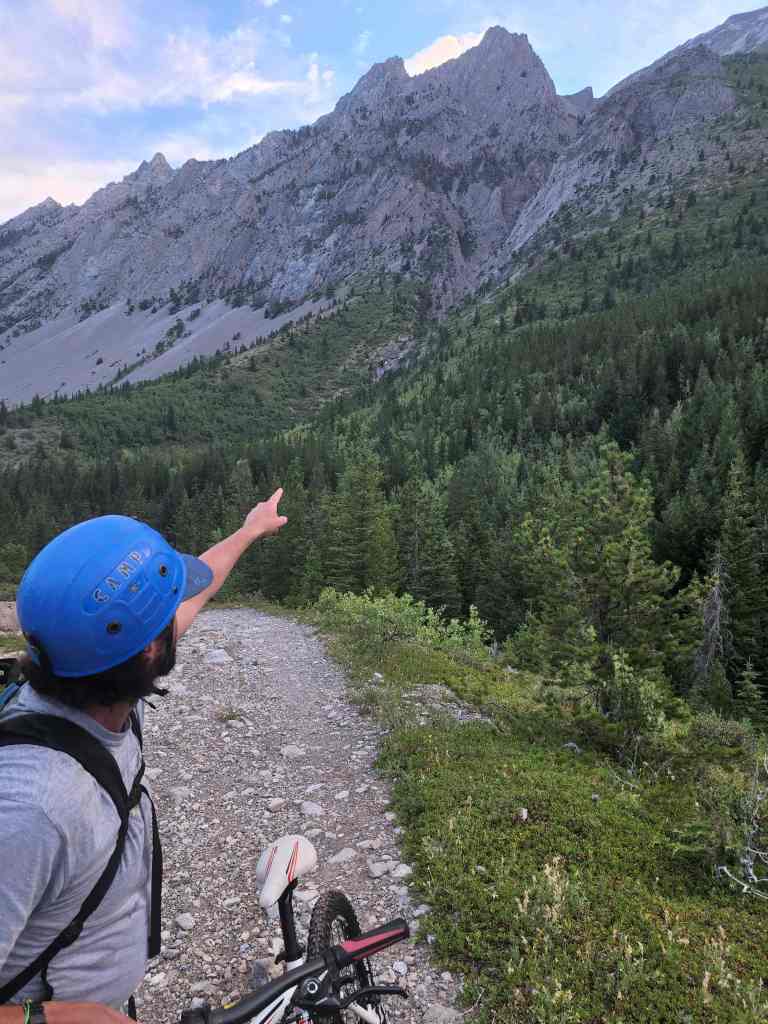
Brad points out the technical route he and his friend, Dave (great name), used to climb an unnamed peak along the ridge.

Early morning views.
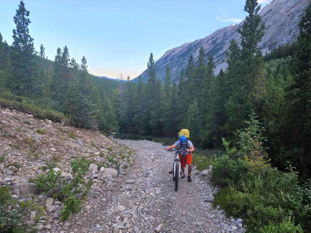
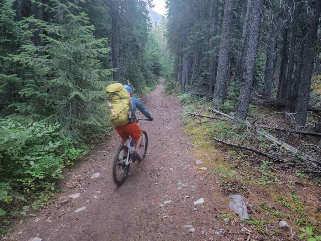
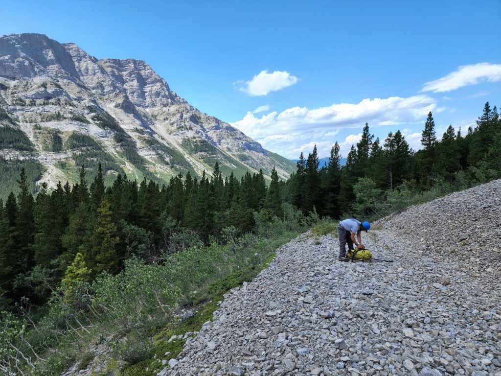
Brad pushes his bike up the steepest section of the trail.
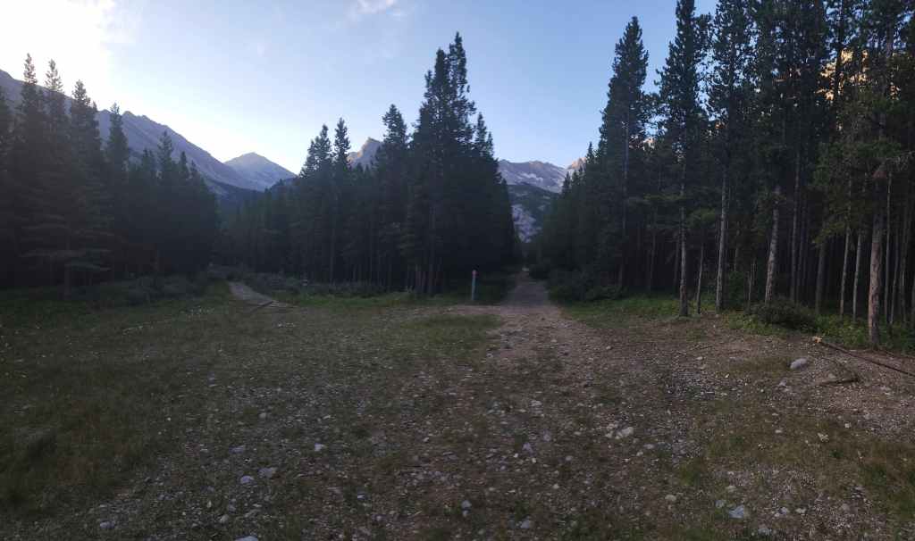
Approximately 5 km after starting, we came to the clearing / campground where the trail bifurcates. We will take the left fork.
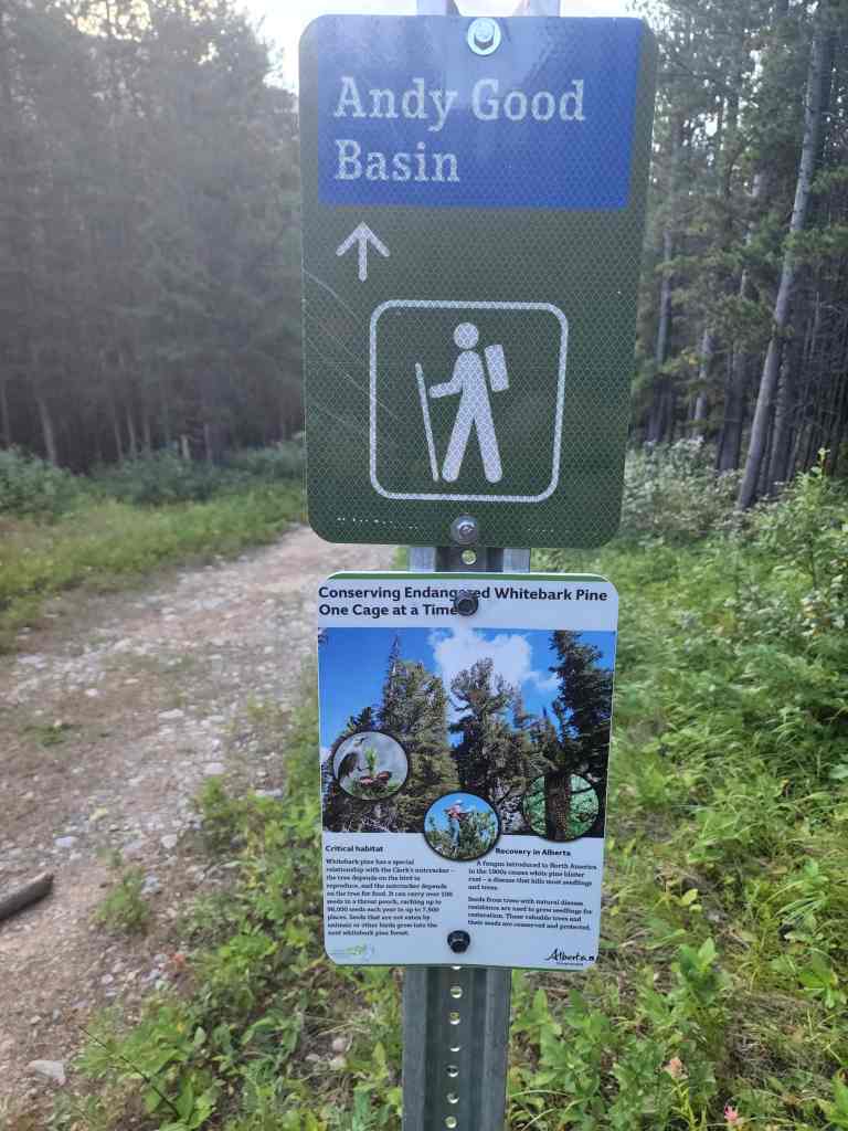
The sign marking the left fork. If someone could make a floating backpack like the one on the sign, they’d be a billionaire. 😂

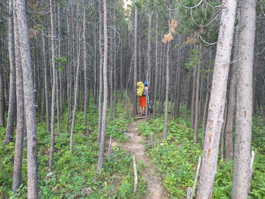
It won’t be long before we’ll ditch our bikes.
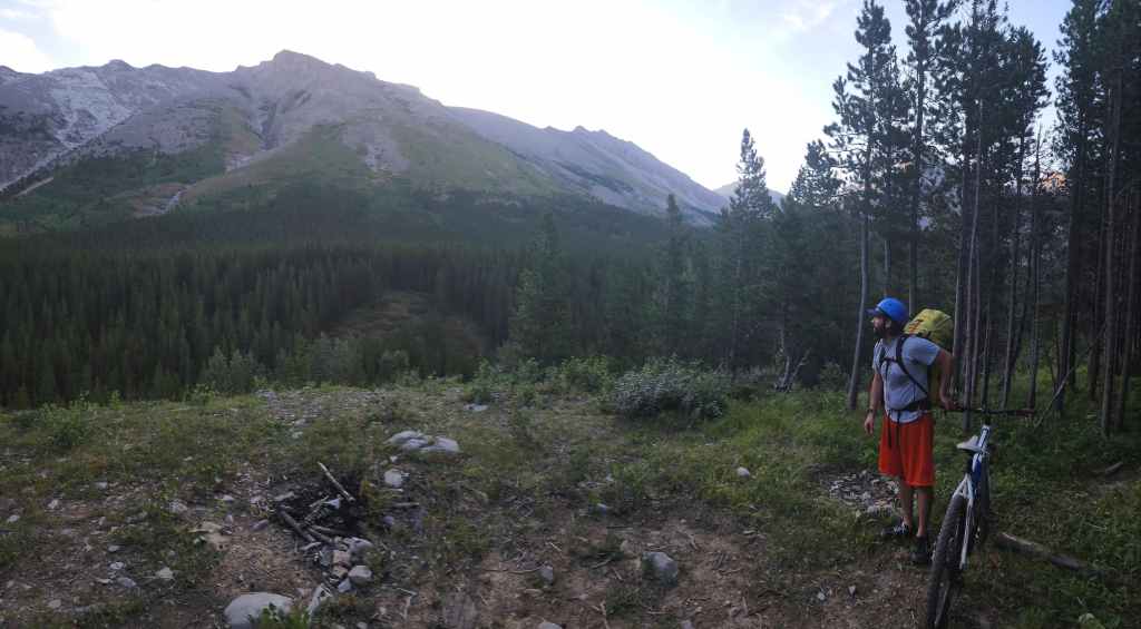
Getting our first good look at Chinook Peak from the viewpoint ~190 m after starting down the left fork. Here’s where we’ll leave our bikes.
On our Andy Good Peak trip in 2020, we wandered along a path from the viewpoint where we discovered a weird forest habitation. We decided to see if it was still there… [cue the creepy music].

Yup, it was…

Cautiously approaching the structure. [cue the ‘Jason’, ‘Jason’, ‘Jason’ background from Friday the 13th] 😂

Brad stabs at a guy in a clown suit. 😱😂

Looking inside…
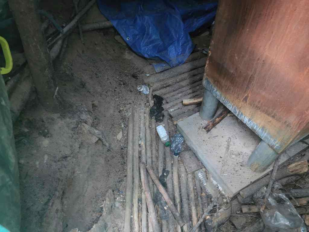
A lot of work went into building this.
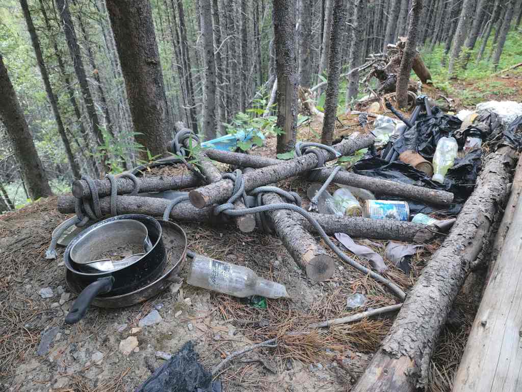
Garbage and old camping equipment litter the area.

After checking out the habitation, we set off on foot to the base of Chinook (left).
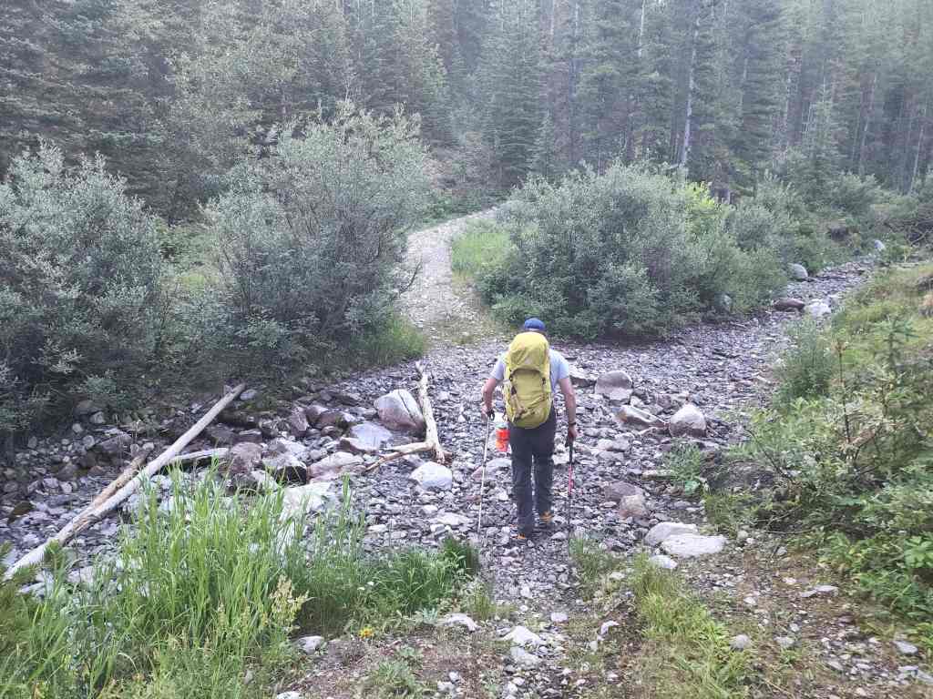
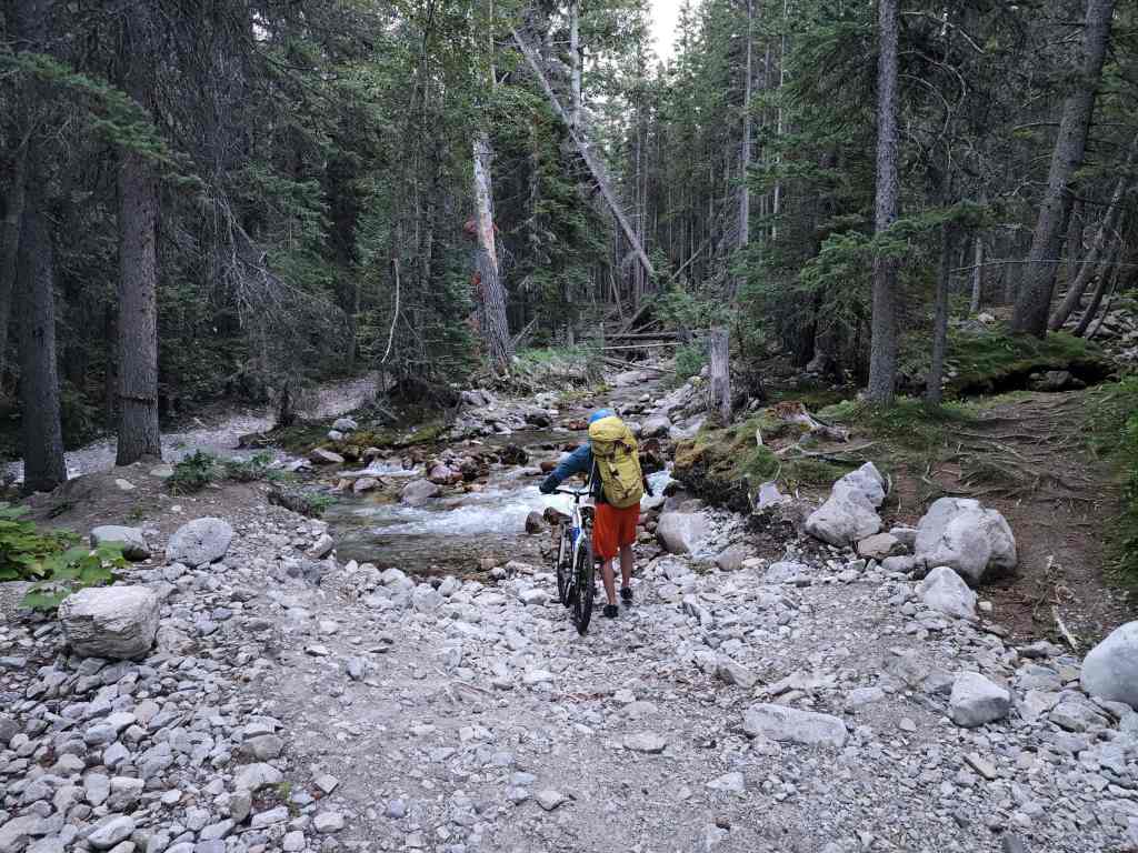
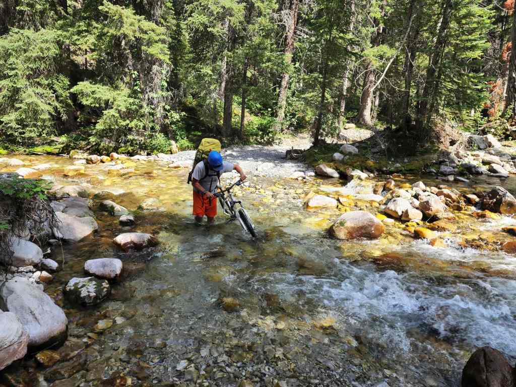
Creek crossing #10. From here on, it’s all uphill until the summit.

Easy hiking.

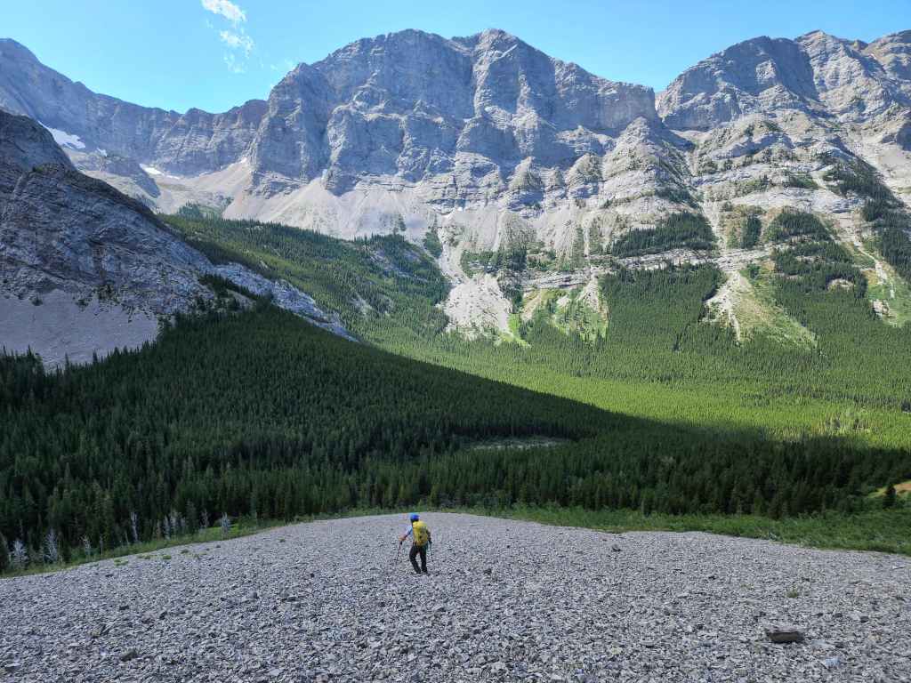
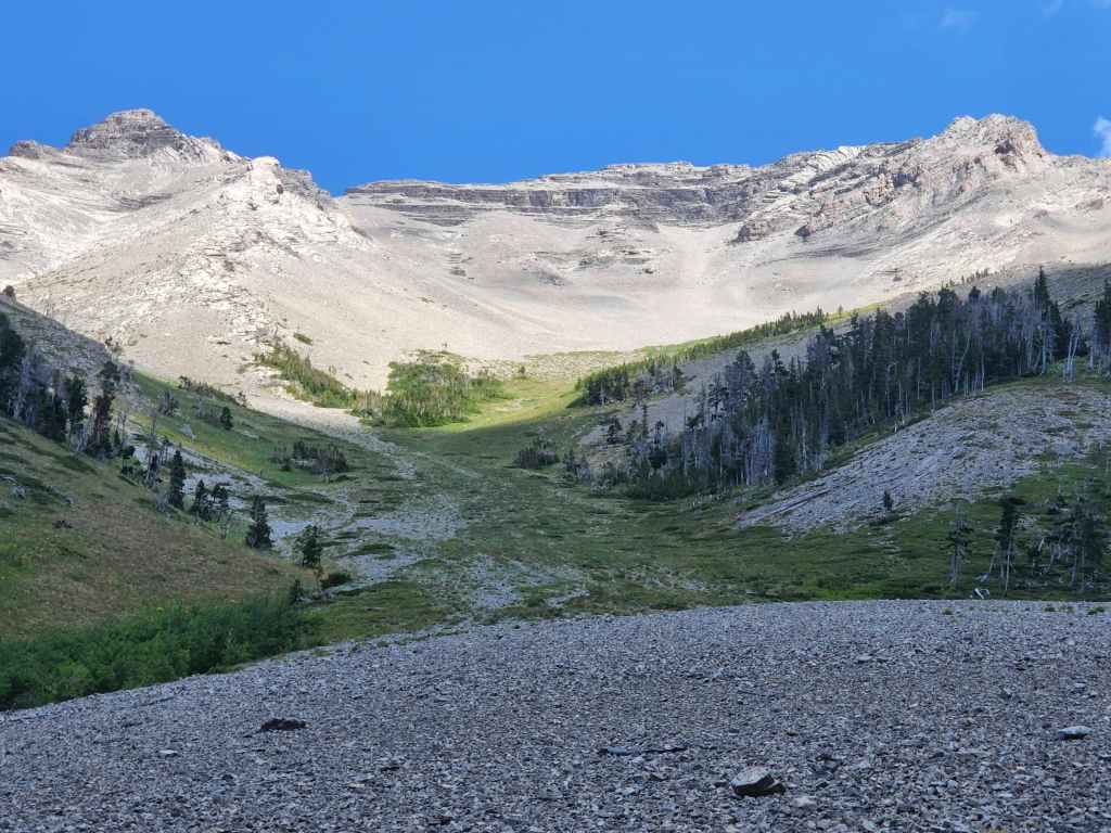
Approximately 1 km after crossing the dry creek bed, we break out from the trees as we arrive at the base of Chinook. Andy Good Peak is on the far left.
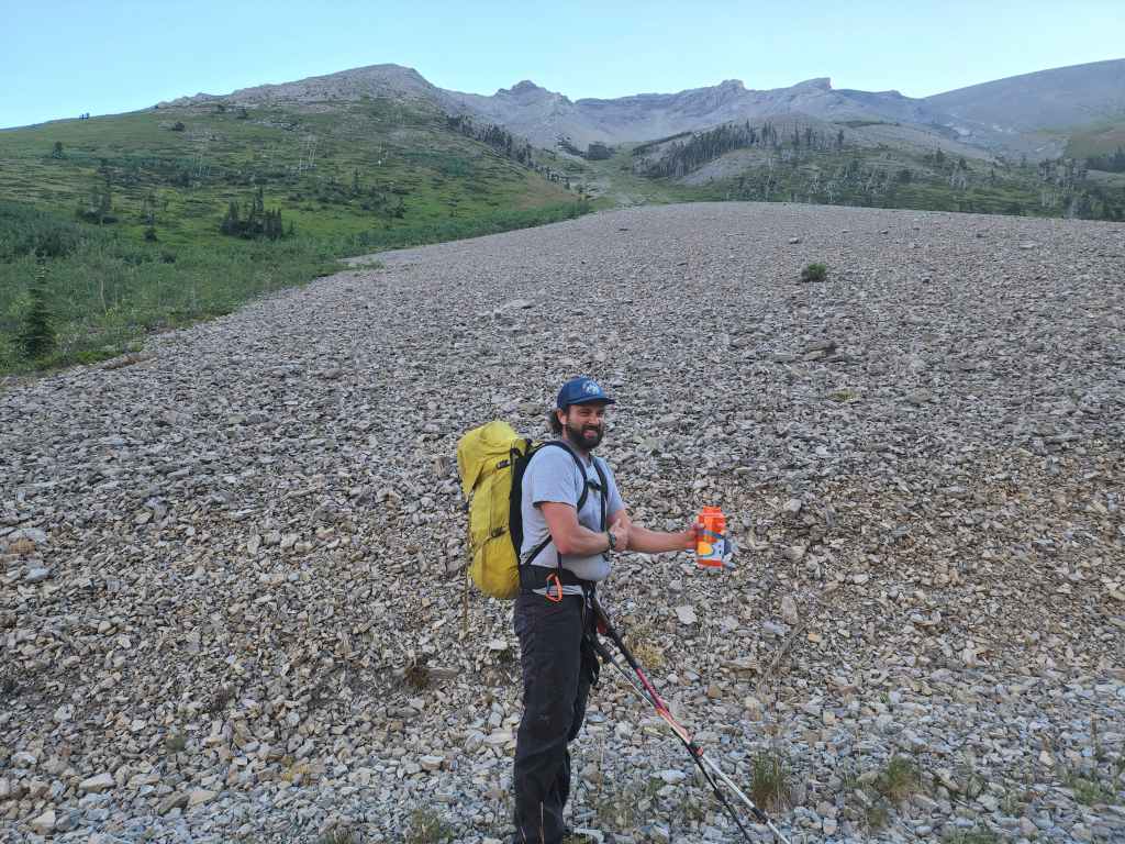
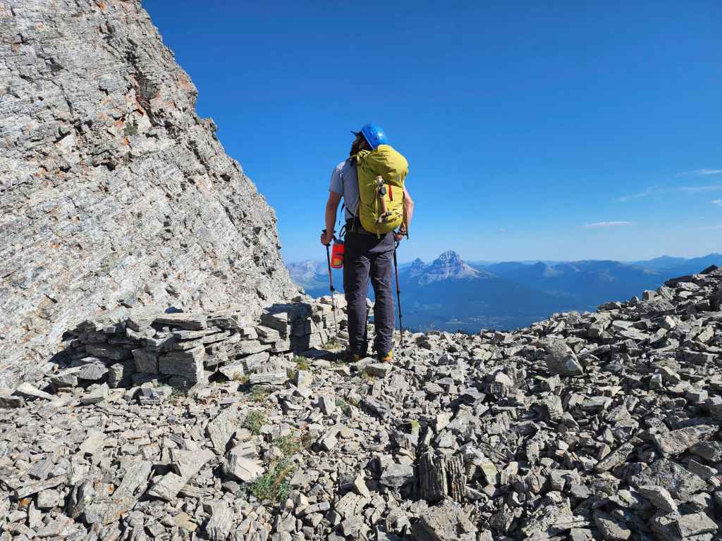
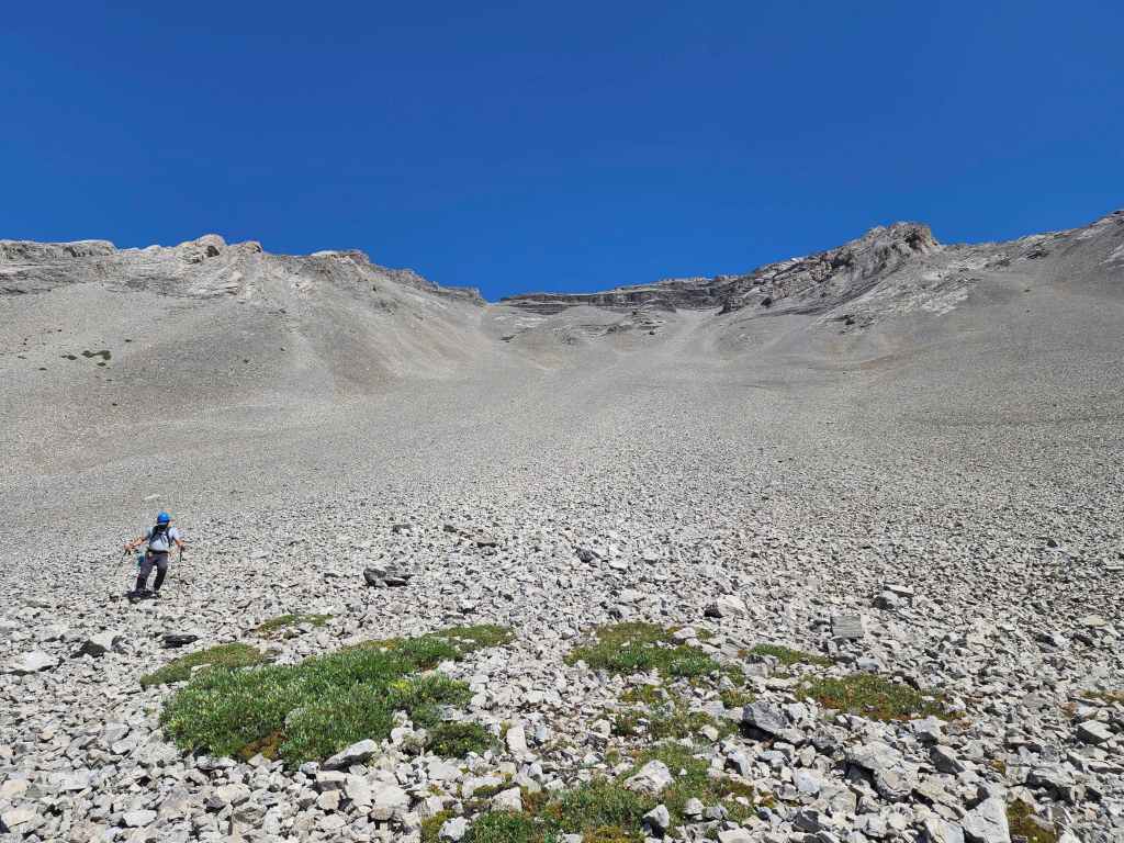
Staring up at Chinook Peak from the trail. From here to the summit ridge, it will be a 3 km slog with an elevation gain of ~765 m.

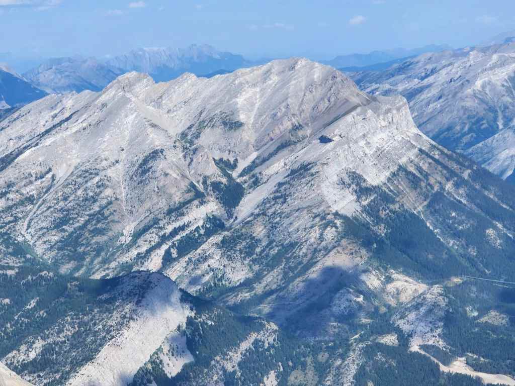
The summit is not any of the peaks you can see. Instead, it is located in the middle of the ridge directly above Brad’s head.

The start of the vegetation is where the slope begins to steepen.

We will keep to climber’s right of the krummholz.
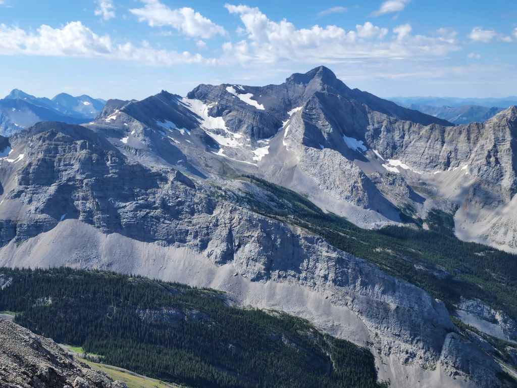
Gazing over to three super fun peaks – “Pharaoh’s Peak” (left), “Anubis Peak” (right of centre) and “Mummy Mountain” on the Northwest Ridge of Ptolemy. At 2622 m, “Pharaoh’s Peak” is higher than Chinook.

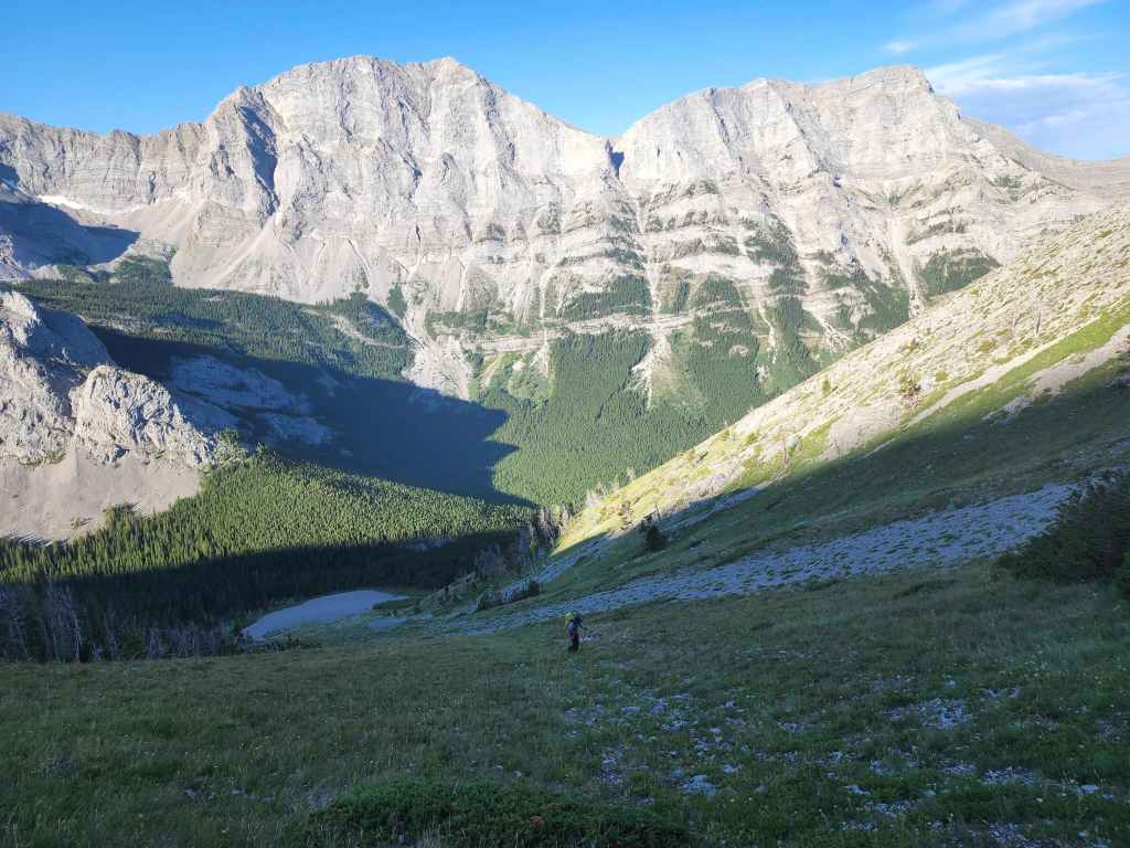
Arriving in the bowl beneath the summit ridge. In 2016, Marc and I tried to avoid the scree by heading to climber’s right, even though our instincts told us to head for the notch in the centre. Had I checked Andrew’s 2014 trip report beforehand, I would’ve known to follow our instinct. Oh, well. That trip still ended up being a success. 😁

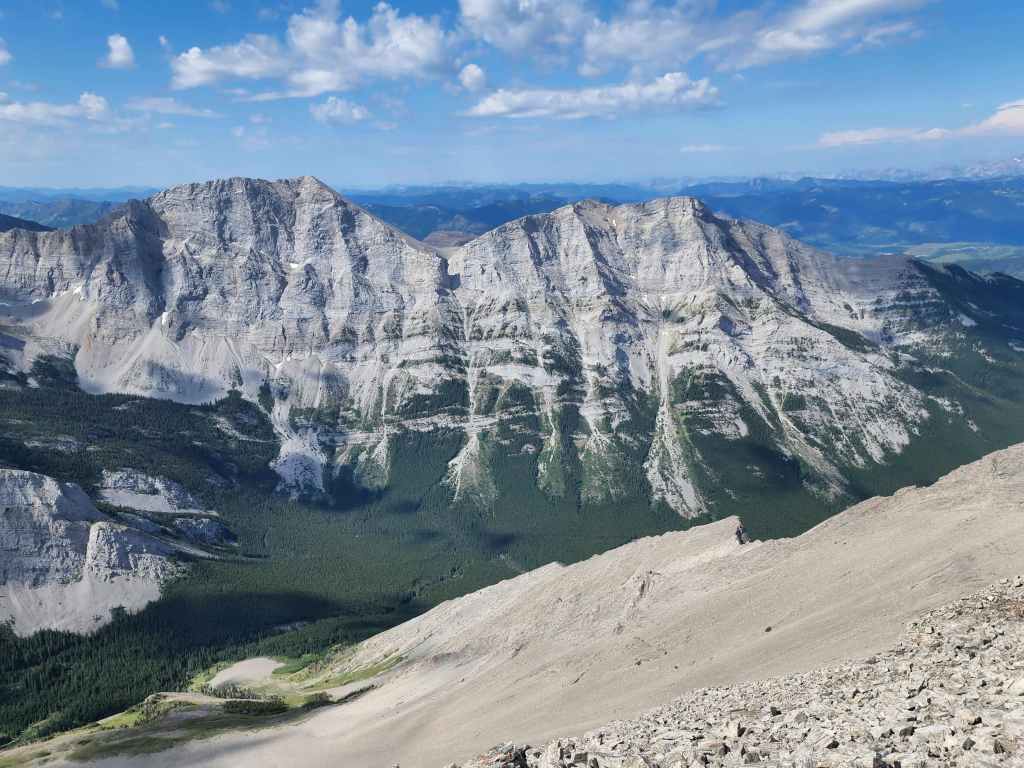
Morning sunlight highlights Mount Ptolemy, which is the highest peak in the area.

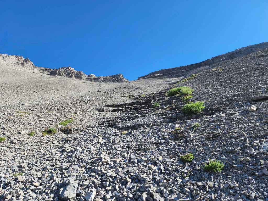
Continuing to head towards the notch (centre).
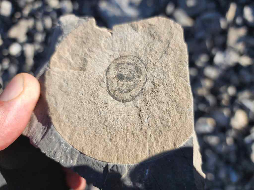
A cool example of petrified wood.
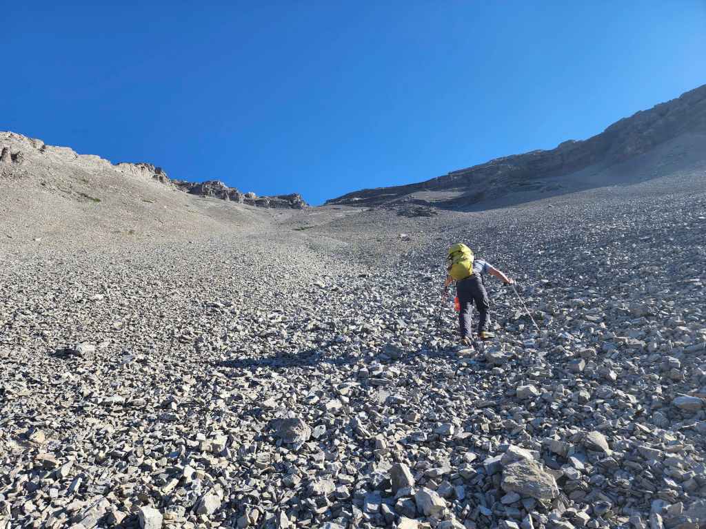
Getting higher, but at a markedly slower pace.

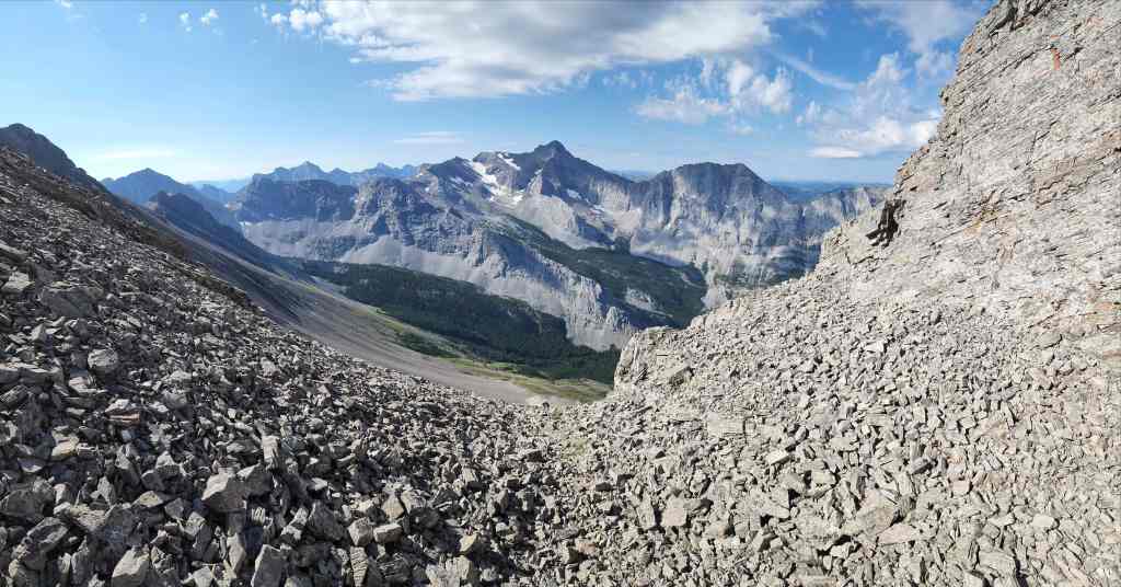
A pano looking back.
This short section of exposed rock was a gift.

Brad follows me up the scree-covered steps…
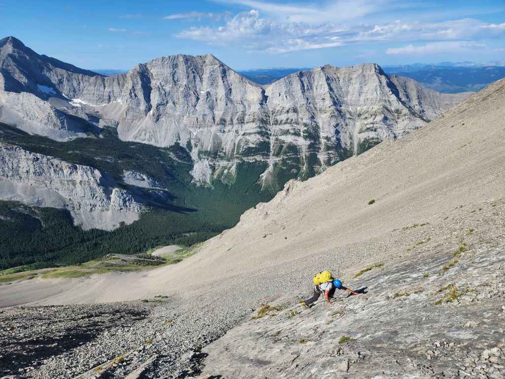
Before deviating onto a slab.

Arriving at the notch.
Brad inspects a bivy site inside the notch. Given all the loose rock above, sheltering here outside of an emergency would be a dangerous affair.

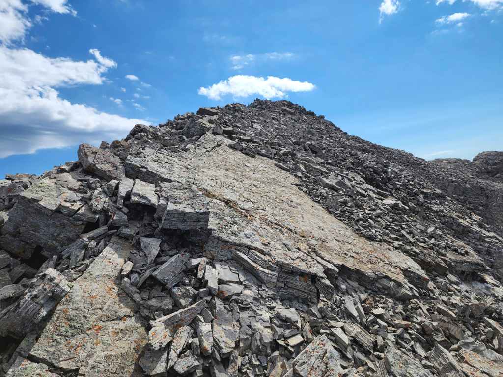
The start of the summit ridge.
A pano back from inside the notch.
Brad with Omahkai’stoo (Crowsnest Mountain) in the background.
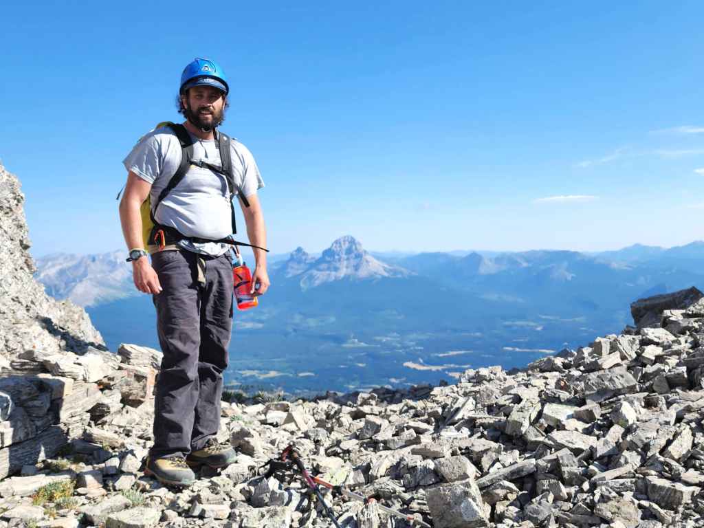
Me with Mount Ptolemy as the backdrop. (Photo by Brad Wolcott)

My view into the notch as I start onto the ridge.
Brad follows close behind.

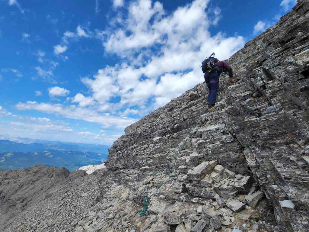
The initial section of ridge is narrow and exposed. If the rock wasn’t crap, we might’ve have tried it… but it was loose and wholly untrustworthy, so we backed off.

Retreating from the crest.

Thankfully, there’s a nice bypass directly below the crest.

Bypassing the initial section of the ridge. That down sloping – and crumbly – Flathead rock always makes things tricky.

Back on the crest and looking at the section we avoided.

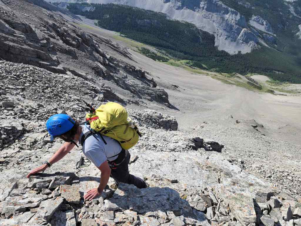
The remaining portion before the summit. We would stay to climber’s right while we searched for a way up.

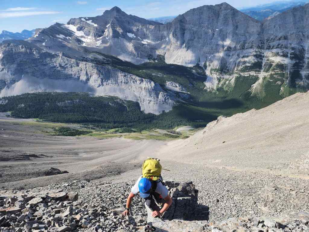
Looking down at Brad after scrambling up a series of small, scree-covered ledges. While not bad to ascend, down-climbing proved to be tricky. This would end up being the crux.

Brad carefully navigates loose scree at the top of the crux.

Above the crux and climbing back onto the ridge.
We had no issues reaching the summit from here.
Looking back as we make our way towards the summit.
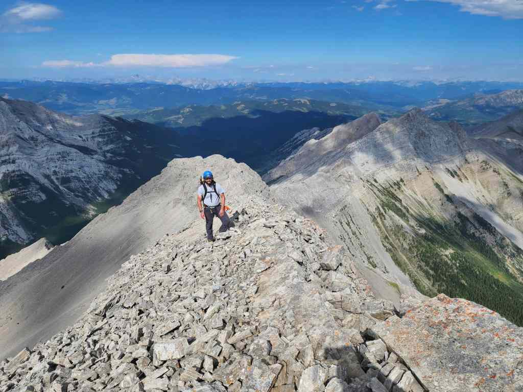
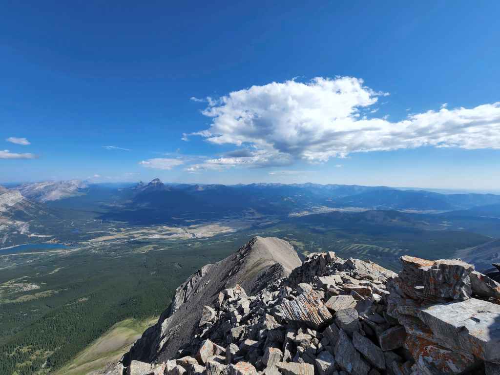
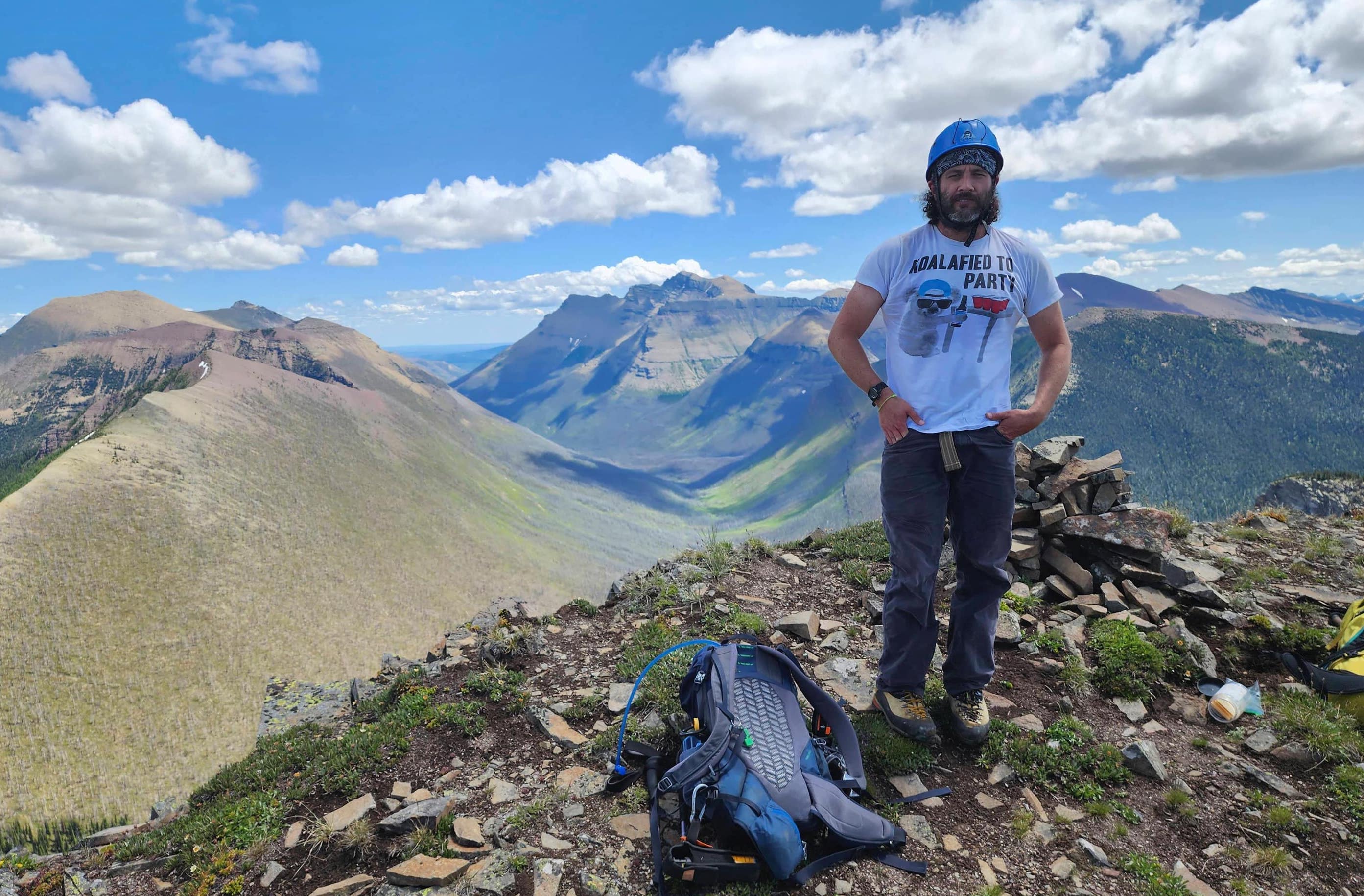
The summit of Chinook Peak (2606 m).
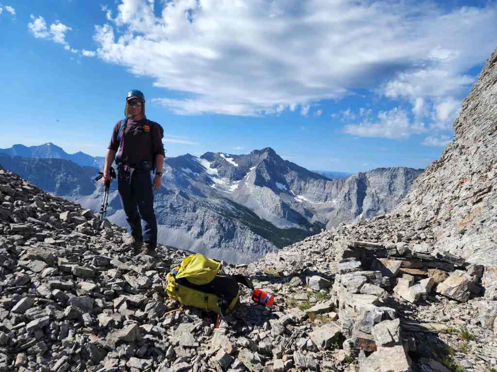
Brad joins me on top.

A pano to the southeast…

And then one a little more to the south.

Completely looking south…

And now to the west.
Gazing to the north…

And then one more to the south.

Finally, one more to the north. What a gorgeous day!
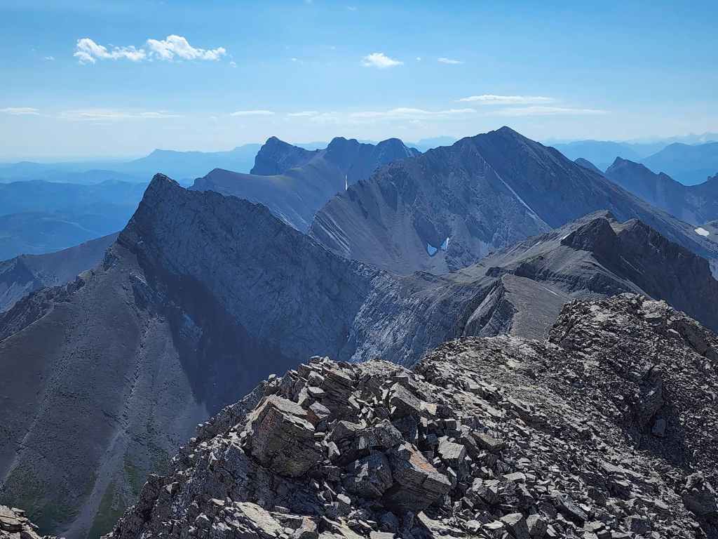
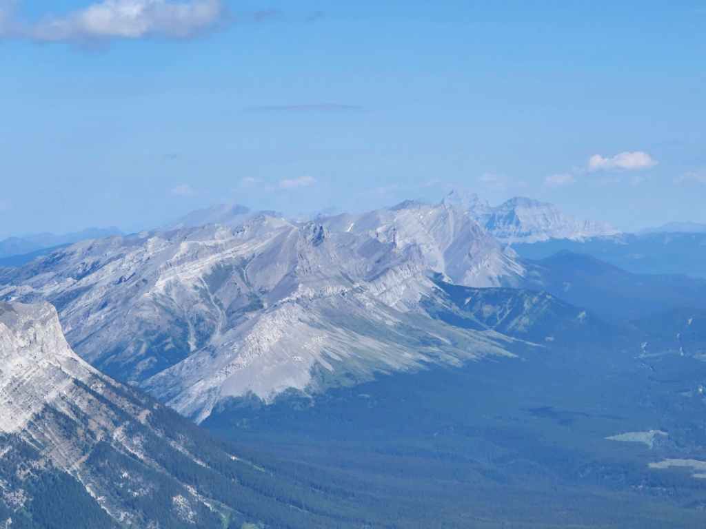
In 2016, we ended up 22 vertical metres below the summit on the southeast ridge. This view continues along that ridge towards Mount Parrish (left), Mount Coulthard (left of centre), and Andy Good Peak (right of centre).
Zooming in on more Flathead peaks: Ptolemy SE5 (left), Mount McGladrey (left of centre), Mount Pengelly (right of centre), Mount Darrah (right of centre), and Darrah S2 (right).
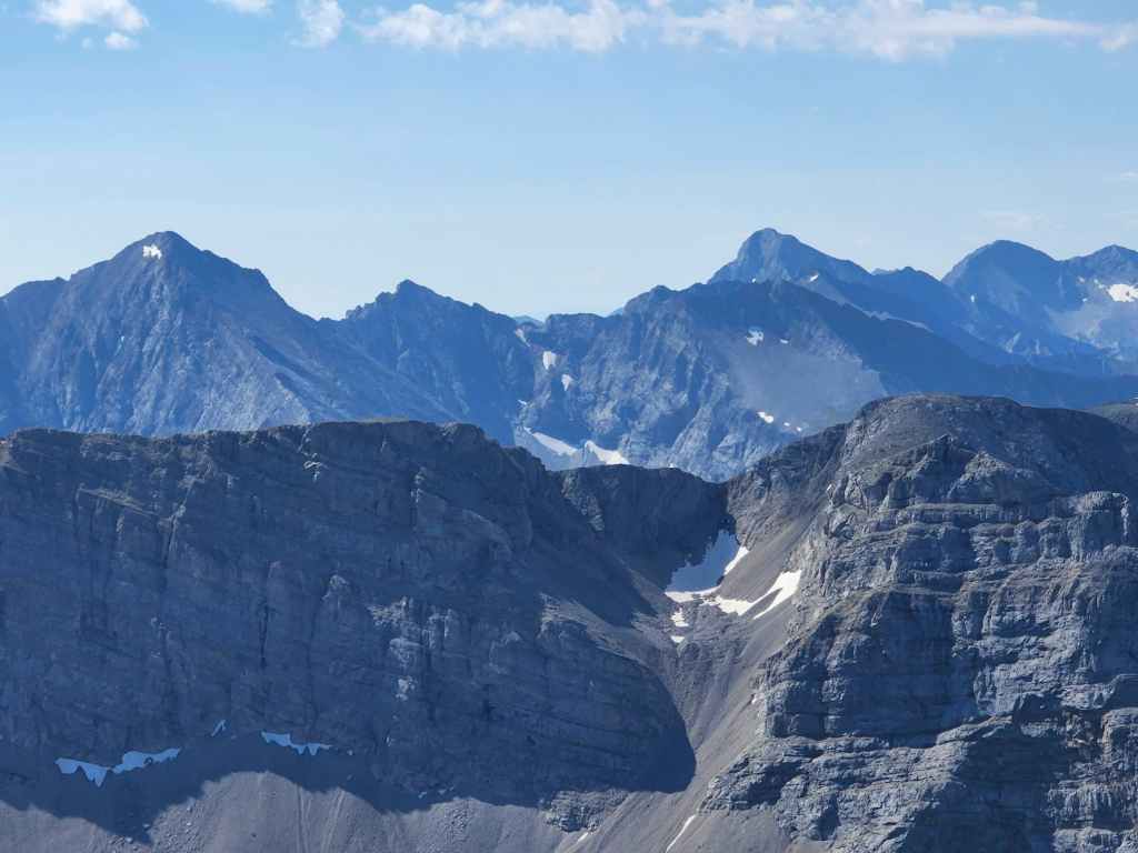
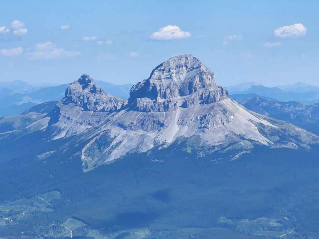
High on my list is beautiful Mount Ptolemy. It’s such a cool looking peak. EDIT: Done! 😁

A closer look at Mount Ptolemy. Early in July when there was still plenty of snow, Brad and his friend, Dave, attempted a technical ascent of the north face using the large gully and couloir in the centre. They made it 2/3 of the way to the summit, but were stymied by terrible, overhanging loose rock that prevented them from placing anchors.
The Northwest Ridge of Ptolemy.
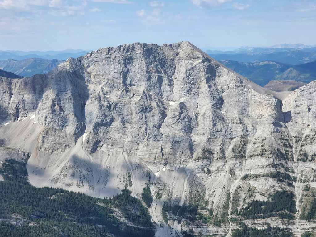
A closer look at “Pharaoh’s Peak” on the Northwest Ridge of Ptolemy. Back in 2016 when Brad and I traversed this ridge, we discovered that from the 1870s to 1914, Mount Ptolemy was referred to as Mummy Mountain because it resembled a recumbent Pharaoh when viewed from the west. In 1914, the Boundary Commission changed the name to Mount Ptolemy (after the ancient Greek astronomer) because there were Pharaoh peaks elsewhere in the Rockies. Therefore, as a tribute to the history of the mountain, Brad and I gave the three peaks on the ridge, Egyptian-themed nicknames.
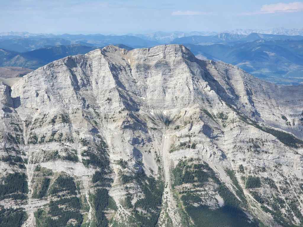
Still on the Northwest Ridge of Ptolemy and now looking at “Anubis Peak” (left) and “Mummy Mountain” (right). “Anubis” has a giant cairn on top that was undoubtedly left by the Boundary Commission at the turn of the 20th century.

Looking northwest at “Ostracized Peak” (left) and Sentry Mountain (centre).

Gazing past Sentry to Mount Erickson.

A good look at Mount Washburn. (Photo by Brad Wolcott)

Chinook offers nice views of the Crowsnest Pass.
Zooming in on Phillipps Peak (left) and Mount Tecumseh (centre).
Looking a little further to the north at “Deadman Peak” (centre) and Allison Peak (right of centre). Gould Dome is on the right.
Of course, what views of the Pass would not include the Seven Sisters (left) and Omahkai’stoo (Crowsnest Mountain)? 😊

Glancing over at “Vicary Creek Ridge” (left), Ma Butte (left of centre), “Pa Butte” (centre) and McGillivray Ridge (centre).

A nice line of sight towards the Livingstone Range.

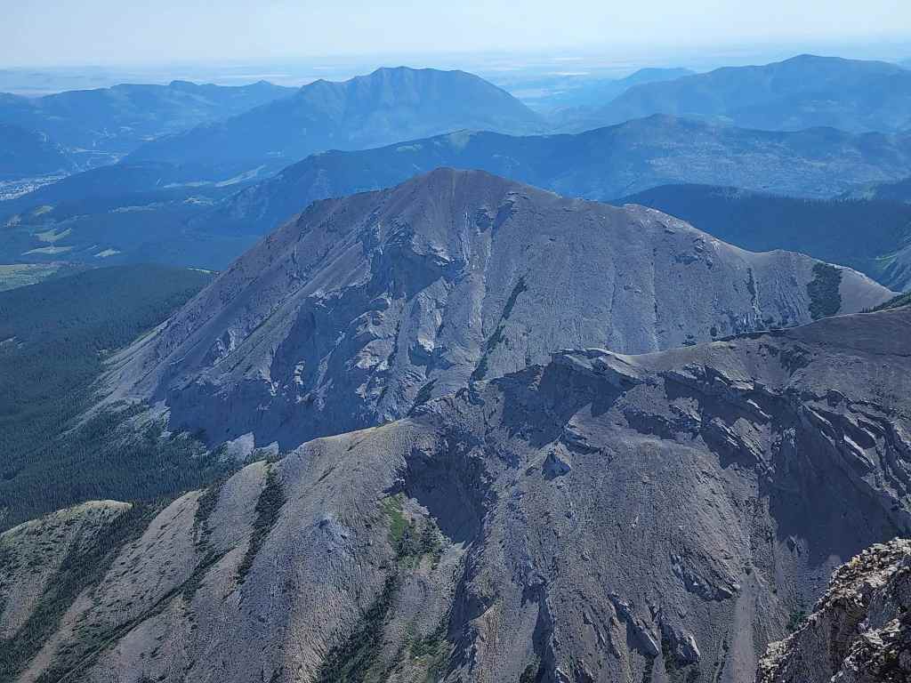
Bluff Mountain (centre) has a huge footprint. Behind it is Morin Peak and the South Peak of the Livingstone. In the foreground is “The Saddle”.
There’s quite a lot to look at in this photo. In the distance on the left are Robertson Peak and Tallon Peak with Turtle Mountain in the centre and Burmis Mountain and Hillcrest Mountain on the right. Willoughby Ridge and the Ironstone Fire Lookout are middle distance and in the foreground, is Mount McLaren.
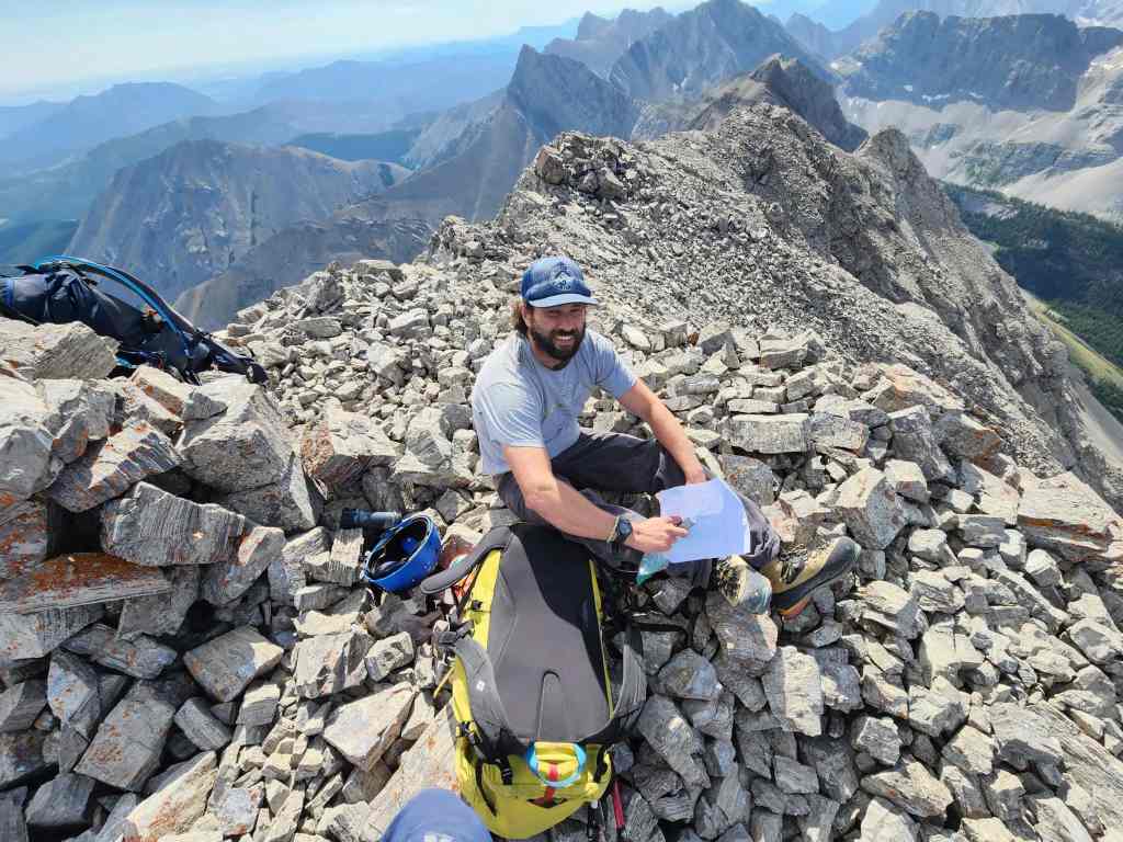
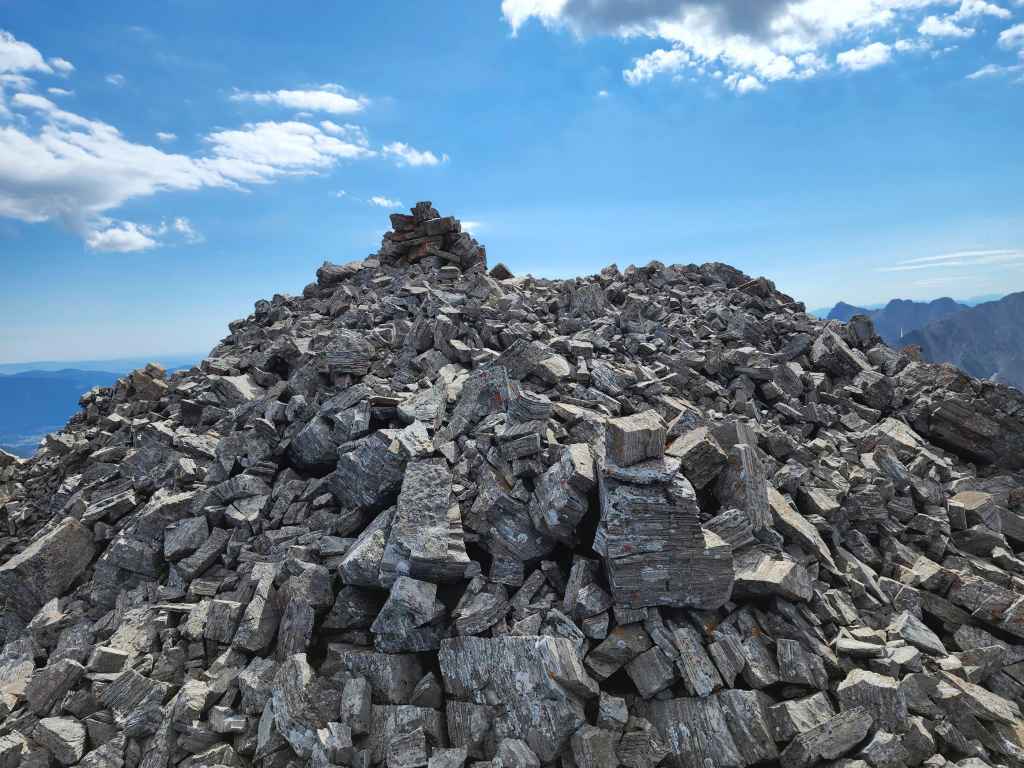
The original register had disappeared, but a previous party from July 2021 had left a makeshift replacement. Their entry was the only one before ours.

It was easy to see our starting point from the trail.

The weather was so good, we hung out on top for almost 45 minutes. (Photo by Brad Wolcott)

Another Flathead summit for Brad. 😁

Heading back.
Approaching the crux.
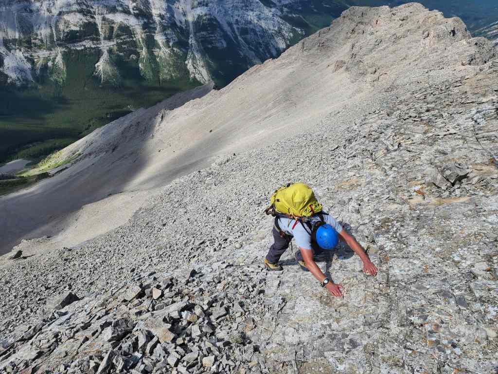
Down-climbing the crux.

As we’ve taken to doing for all of our Flathead trips, we brought a short rope just in case. We set it up, but didn’t need it. However, just as women’s slacks turned Maurice Moss into a confident man, so the rope did for us. 😂
My turn to down-climb the crux. You can see the awkward angle of the rock where everything you grab, requires double and triple checking. (Photo by Brad Wolcott)
Past the crux and back on the crest.
Brad demonstrates the little-known, but highly effective, Chuck Norris Stem Move. 😂

Arriving back in the notch.

From the notch, it was a straight shot down to the bowl.

Back in the bowl.
The view back to the summit (centre).

Descending the lower section.
On the last section of scree before the trail.
Thankful to be back on the trail!

Gazing back to the summit.
A closer look at our route and the summit. (Photo by Brad Wolcott)

Enjoying the easy hike back to our bikes.

Crossing the dry stream bed.

One last look at Chinook (left) from the viewpoint. Andy Good is on the far right.

Making quick progress back to the trailhead.

A tranquil section of trail.

Crossing #6 under afternoon sunlight.
Brad wades across #6. I think this ended up being the deepest crossing.

Brad leads us on a bypass of crossings #4 and #3.

Crossing #2 means we’re almost back.

Arriving back at the trailhead 8 hours and 40 minutes after starting. With Joel and Taylor’s wedding taking up much of our free time over the past month, it was absolutely wonderful to see them so happy on their big day. It’s also nice to have it in the rearview mirror and get back to the mountains. 😁 Indeed, six years after standing just below the summit of Chinook Peak, it feels good to finally remove that asterisk from my record. That I could complete it with my good friend Brad – who also happens to be Marc’s brother-in-law – helped make the day. Thanks Brad! You can now hold bragging rights over Marc. 😂


Leave a Reply