
⚠️ Hiking and scrambling are inherently dangerous activities. Please read my Disclaimer. ⚠️
With the heavy work for the day now behind us, we began making our descent from Bennett Pass back to Wall Lake. As we descended the trail, it was hard not to notice, “Wall Mountain”, which is a small, but prominent peak that sits immediately to the west of Wall Lake. Standing all by itself, it definitely looked like it could be the cherry on top for an already successful day in the mountains.
Having read Andrew’s 2022 trip report, I knew that it provided an excellent view down to Wall Lake along with some colourful rock. That we would pass by the side of it which entailed the least amount of elevation gain, made it even more tempting. First however, we needed to stop for some food to regain our energy – well, I did at least. While making the short hike up to the trail from Bennett Pass, I suddenly became very hungry and with that, my energy levels plummeted. A short stop at the base of “Wall Mountain” allowed all of us, but me in particular, to take in some food to regain my energy levels. It worked liked a charm.
After hiking a little further down the trail, we decided we were at the optimal spot to leave our packs and begin to make our way up the south ridge of “Wall Mountain”. What ensued was a fun trip that was highlighted by a scramble up a couloir and great views of Wall Lake. It was the perfect way to cap off the day, so I will give a huge shoutout to Andy for his suggestion and trip report. 🙂
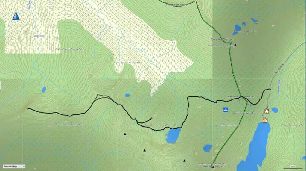
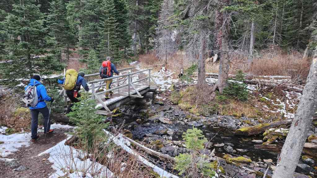
To get to Mount Ashman we started from the Akamina Pass trailhead in Paahtómahksikimi (Waterton National Park) and followed the signed and easy trail for 1 hour and 18 minutes (5.5 km with a 193 m elevation gain) to its junction with the Bennett Pass trail at Wall Lake. From the lake we then followed the trail for 1 hour and 15 minutes (~2.7 km with a 505 m elevation gain) until we were standing on the trail above Bennett Pass.
From here, we descended to the Pass (64 m elevation loss) before starting to hike up and towards “Bennett Peak”. However, we decided to bypass “Bennett Peak” in favour of heading straight to Mount Ashman by following a trail beneath Bennett that led through the trees and onto Ashman Ridge. Soon, we were standing above the col before the first high point on the ridge. A 65 m elevation loss and followed by a 150 m gain, brought us onto the top of the first high point (2379 m). The trip from here to the summit of Mount Ashman (2421 m) involved another ~1.7 km of hiking. For reference, from the main trail above Bennett Pass to the summit of Mount Ashman, it was ~3.9 km. Our total time from the Akamina trailhead to Mount Ashman was 4 hours and 48 minutes over ~12.1 km with a total elevation gain of 1146 m.
With the wind now at our backs, we set off for the summit of “Bennett Peak” (2434) which involved retracing our steps until we were on the easy slopes beneath the summit where we had previously joined the ridge. From here it was a short distance to reach the summit. For reference, it was a ~3.1 km trip from the summit of Mount Ashman to the summit of “Bennett Peak”. Further, from the ridge above the col with the first high point, it was a ~933 m hike (146 m elevation gain) over gradual slopes to reach the summit.
From “Bennett Peak” we then descended to Bennett Pass (~717 m with a 220 m elevation loss) before heading up to the main trail to Wall Lake. Once on the trail, we retraced our steps for ~1.2 km until we were at the base of “Wall Lake Mountain”. Here, we left our packs beside the trail and made the ~684 m (153 m elevation gain) scramble to the summit of “Wall Mountain” (2189 m). For reference, it took us 27 minutes from the trail to the summit and about an equal amount of time to get back to the trail.
Once on the trail it was a ~1.5 km hike (222 m elevation loss) back to Wall Lake and then from Wall Lake, it was another 5.5 km to reach the Akamina Pass trailhead.
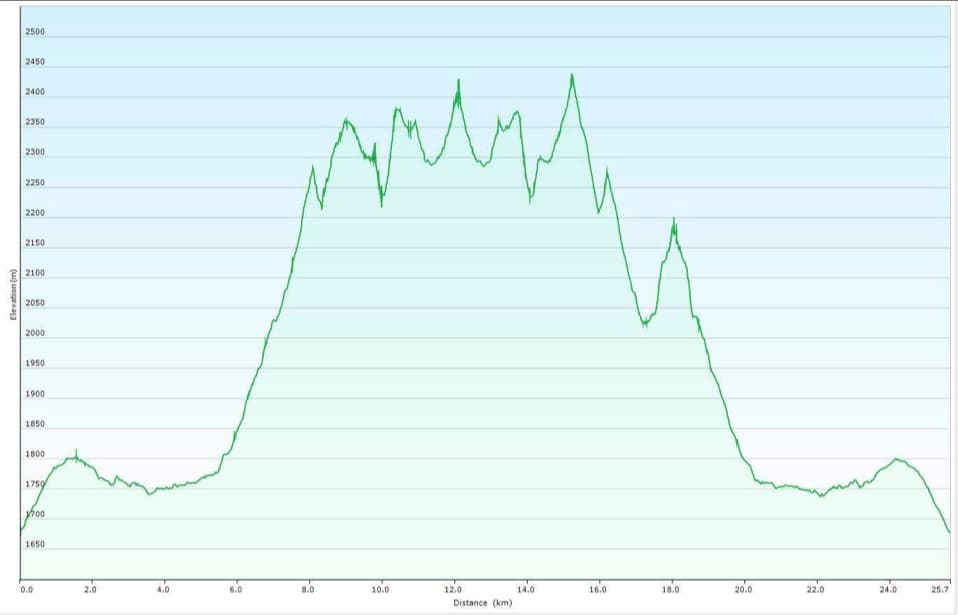
Our total roundtrip distance was 25.7 km with total elevation gains of 2155 m. Our total roundtrip time was 10 hours and 16 minutes.

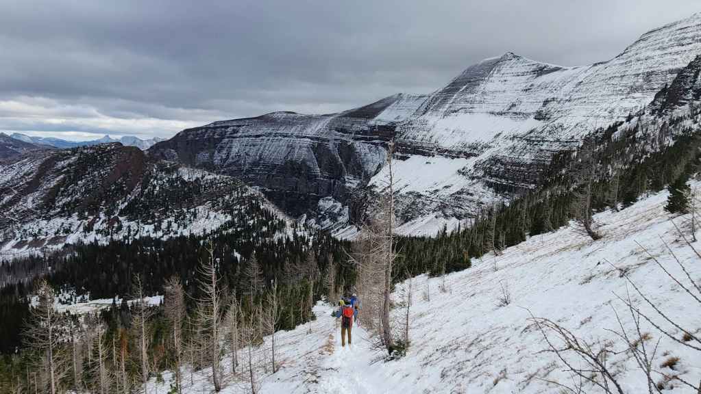
Descending to Bennett Pass from “Bennett Peak”.
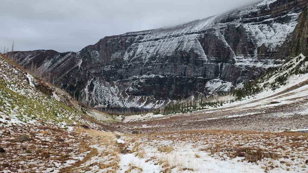
One more look at the tarn beneath Bennett Pass.
Arriving at Bennett Pass.

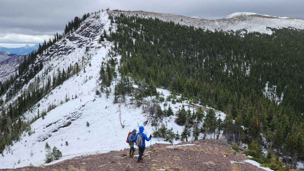
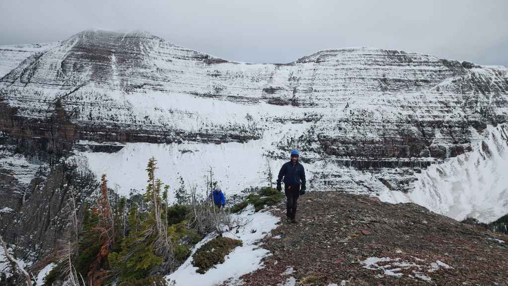
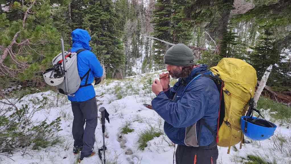
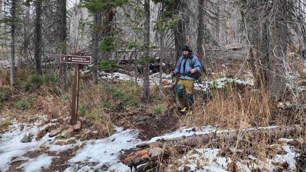
Ascending to the trail from Bennett Pass. It was at this point that my body suddenly said, “Hey, did you know that you’re really hungry and as a consequence, I’m going to turn off your energy switch?” 😂

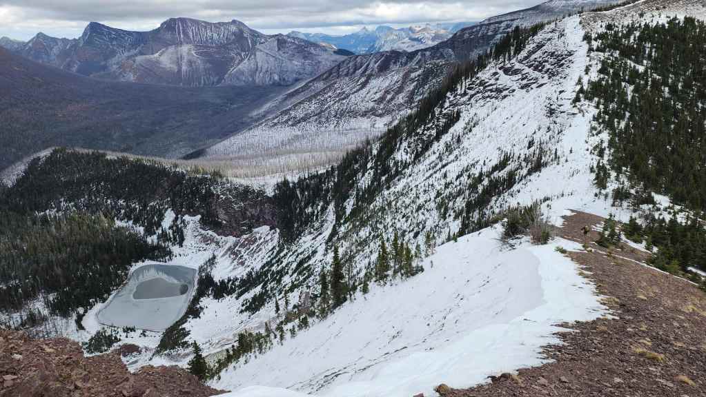
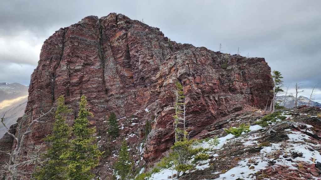
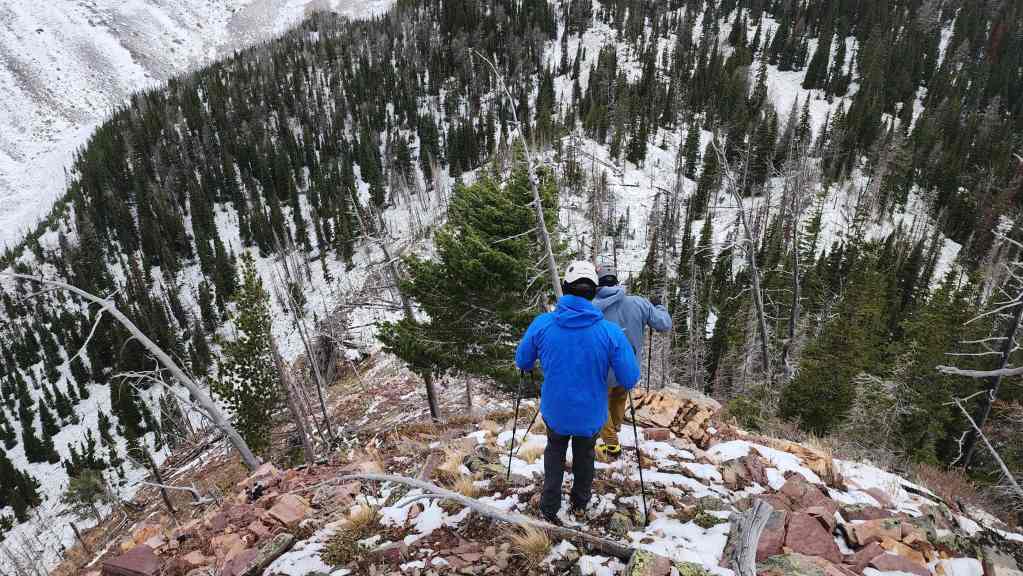
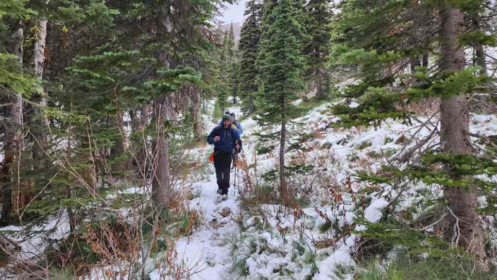
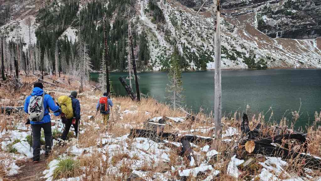
Getting a great look at “Wall Mountain” (left) as we descend along the trail.
By this point, I think we were all in agreement that we should include “Wall Mountain” as part of our day.

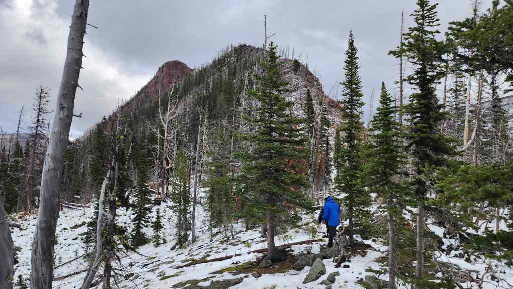
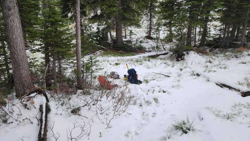
Arriving back at the meadow just prior to “Wall Mountain”. It was here that we took a 15 minute break to refuel.

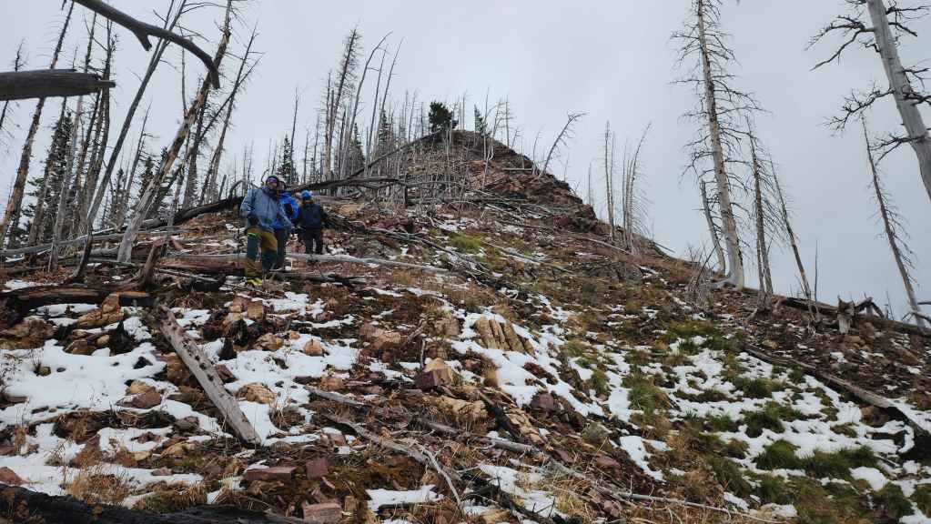
Feeling rejuvenated, we left our packs beside the trail and began to head towards the south ridge of “Wall Mountain”.
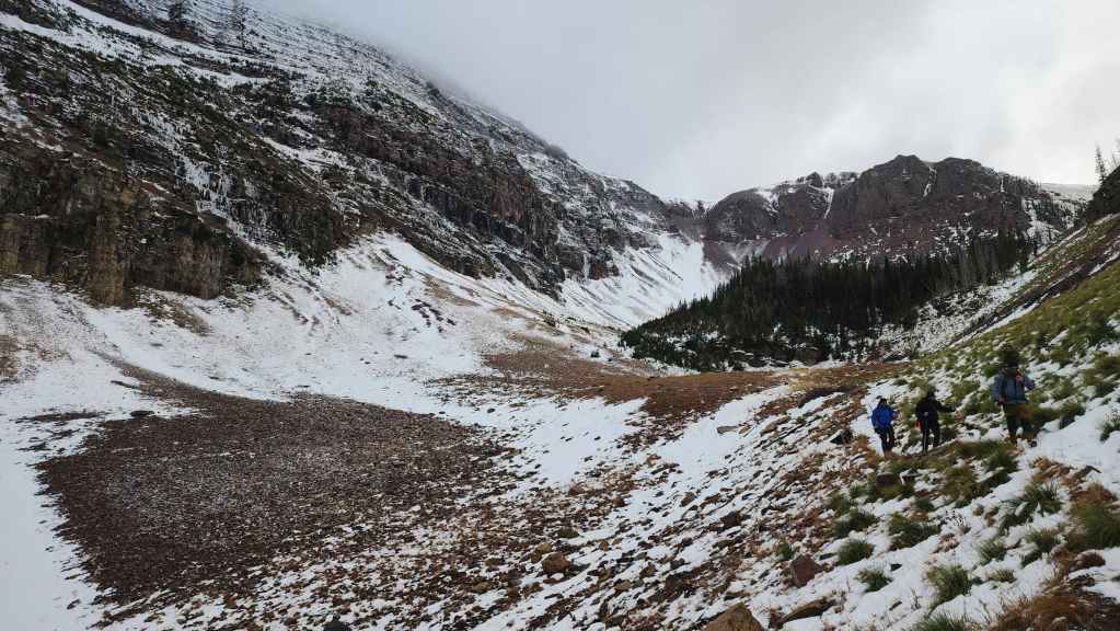
Approaching the south ridge.
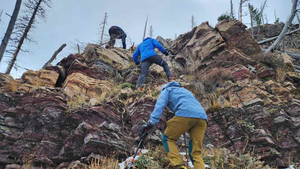
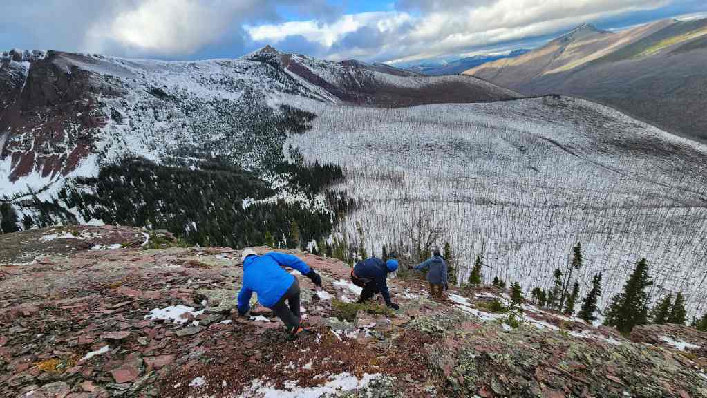
Enjoying some scrambling.

The scrambling continues.

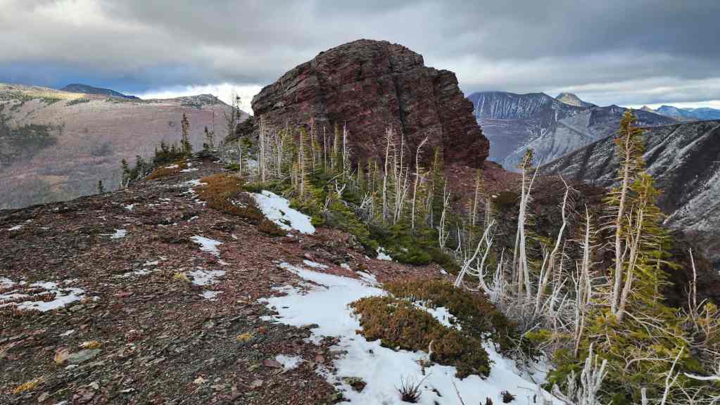
On top of the south ridge and heading towards the summit block.

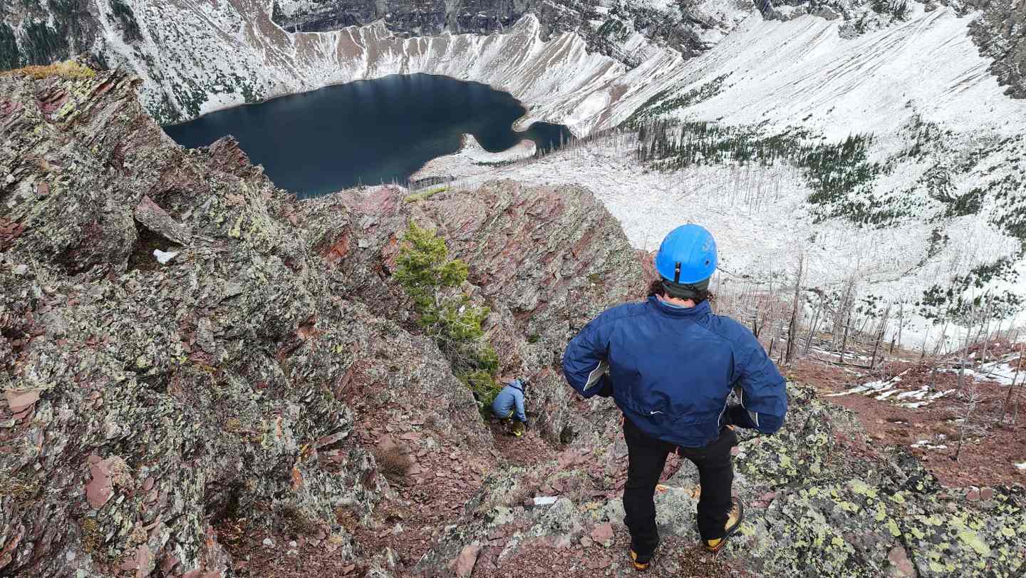
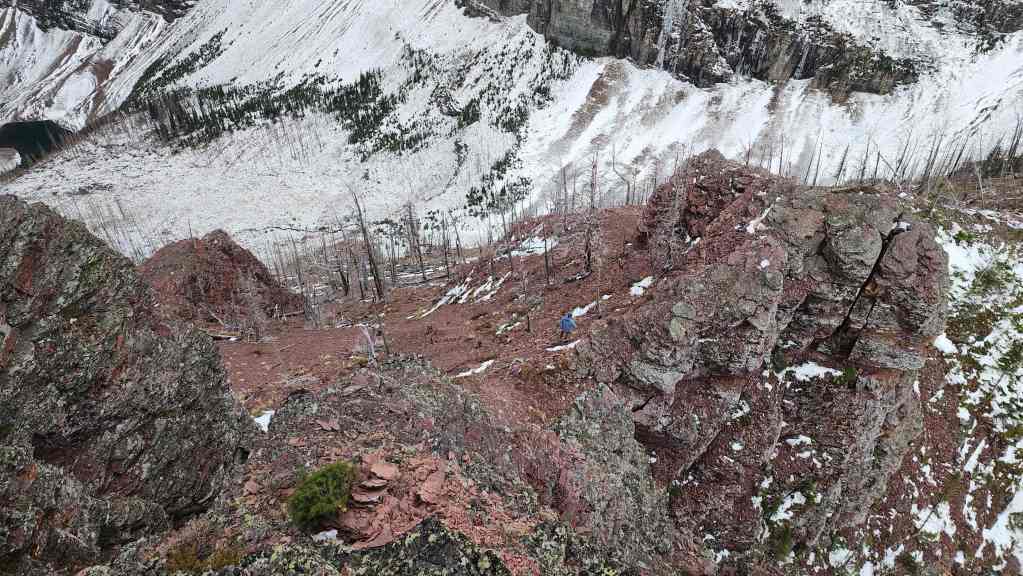
Looking down at Wall Lake as we make our way long the ridge.
Hmmmm…. this might be an interesting obstacle.
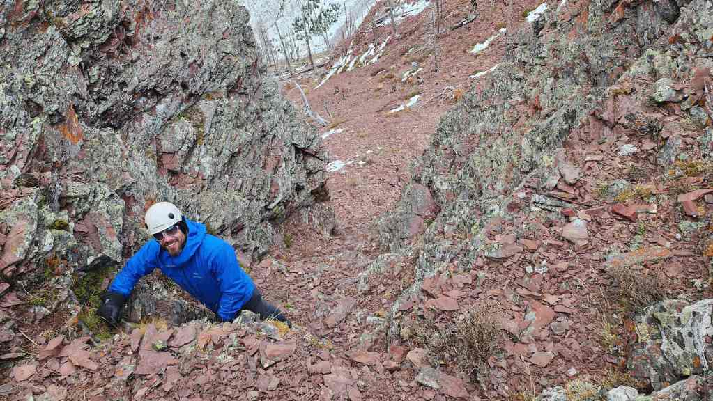
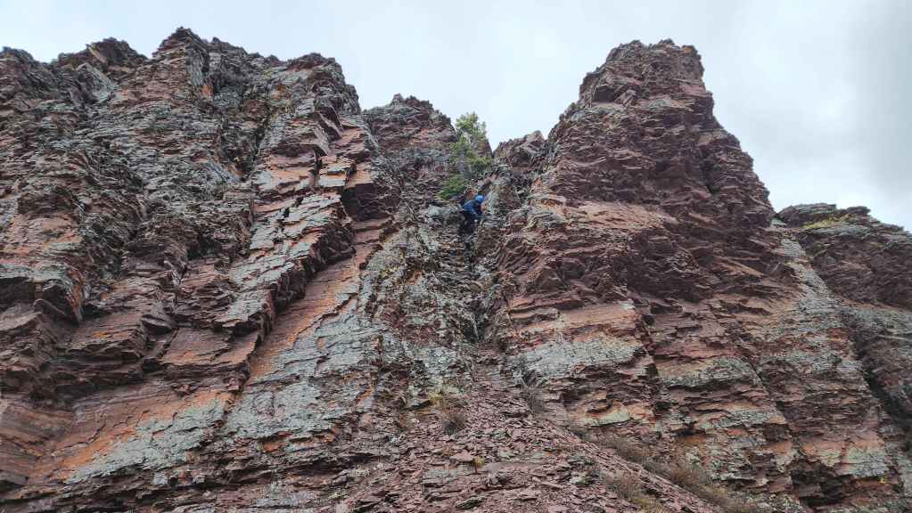
Thankfully there was a nice couloir (right of centre) to use. This was what Andy had used to descend from the summit.

Looking up from the base of the couloir. Fortunately, there were lots of ledges to take advantage of.
James follows me up.
Once above the couloir, the summit wasn’t far off.
Brad, James, and Dave emerge onto the ridge above the couloir.
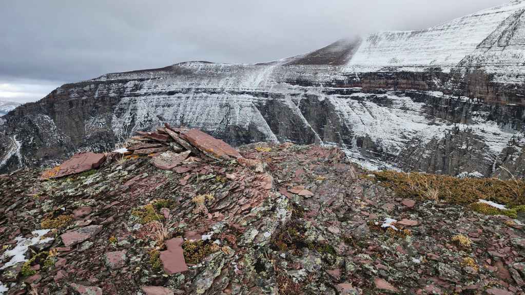
The summit of “Wall Mountain” (2189 m). For reference, it took us 27 minutes over a distance of ~684 m (153 m elevation gain) to reach the summit from the trail.
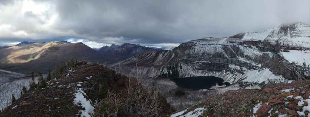
A pano to the east…

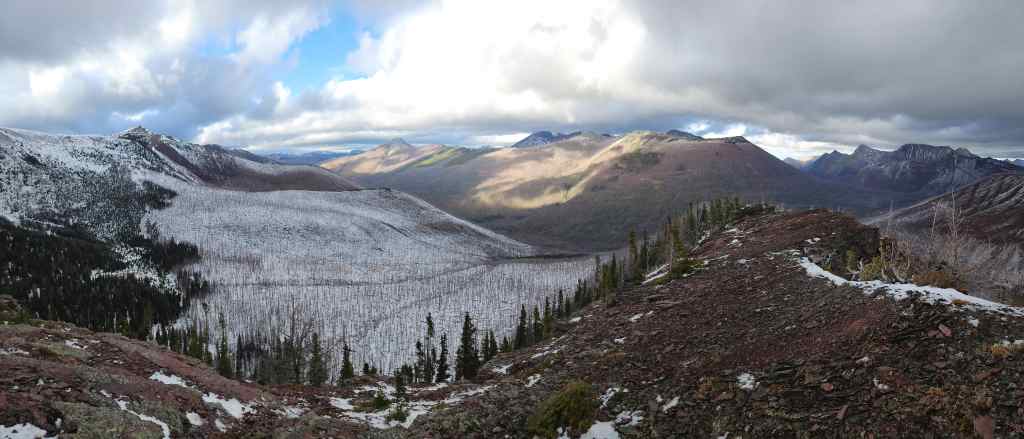
And then one to the south.
Finally, a pano to the northwest.
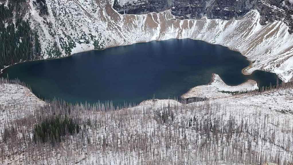
The view down to Wall Lake.
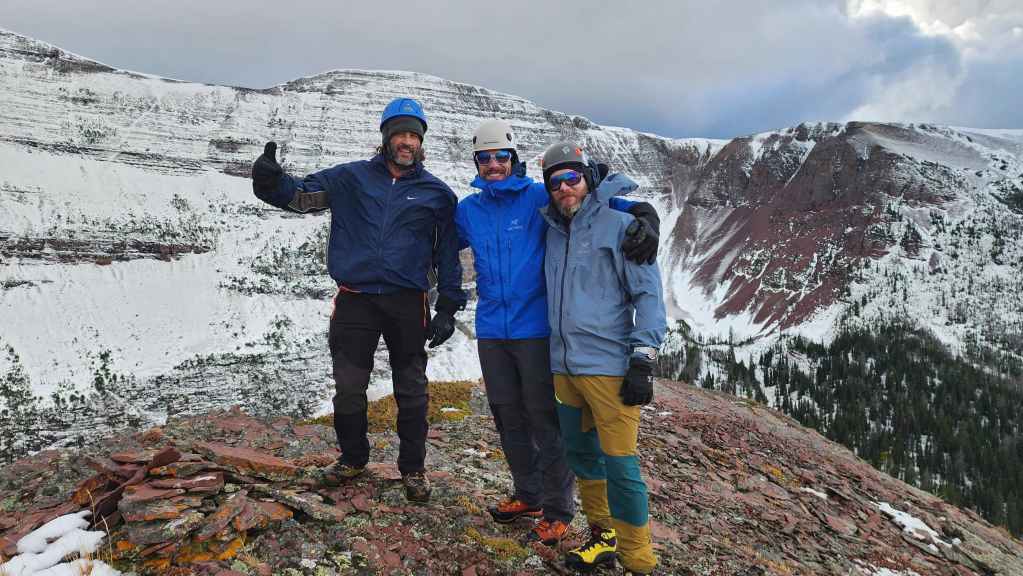
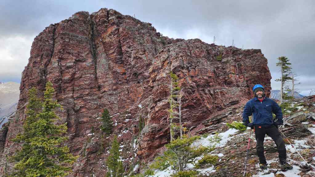
Third peak of the day! 🙂
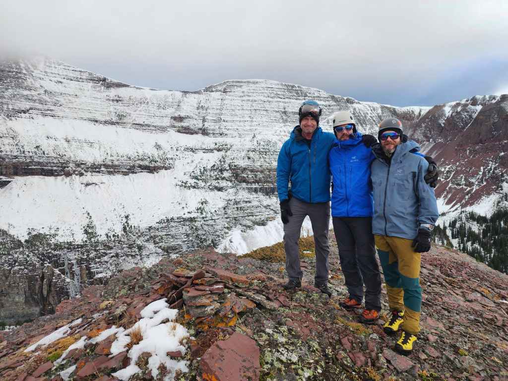
The same as the previous photo, but now with the gapped-toothed wonder as a substitute for Brad. 😂
Descending from the summit.

Nearing the top of the couloir.

Brad and James watch Dave enter the couloir. Because of the loose rock, we descended one person at at time.

Dave continues his descent.
Now clear of the base, Dave (centre) waits for James to come down.
Brad nears the bottom of the couloir.
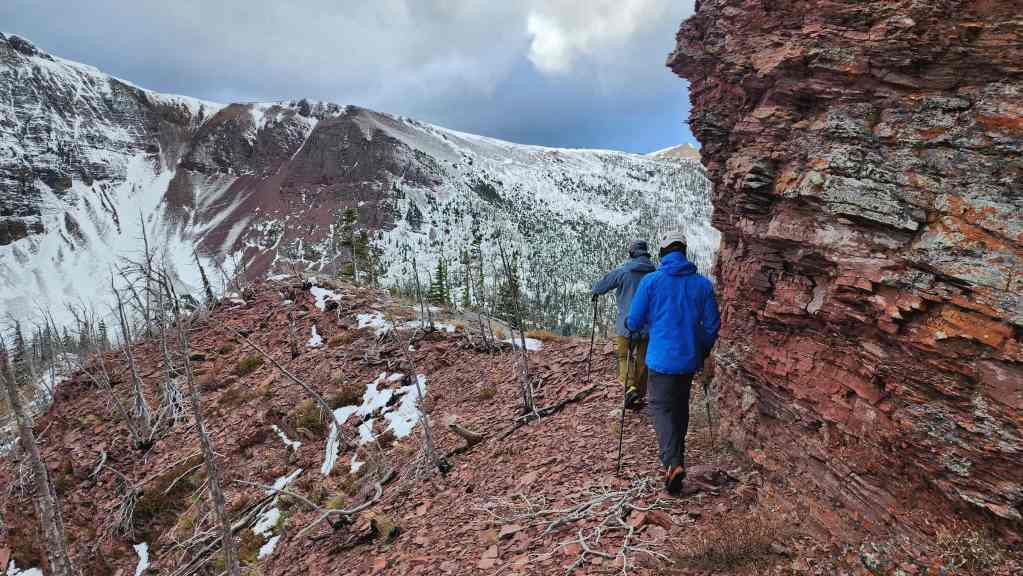
Heading back and along the south ridge.
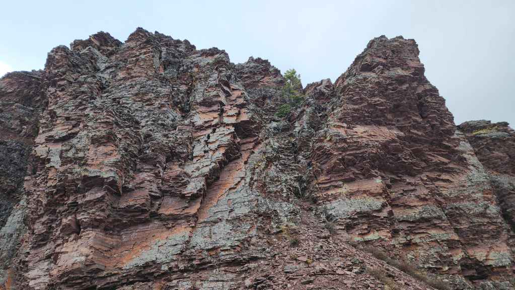
Brad stands in front of “Wall Mountain’s” impressive cliffs.

Heading down…

Carefully descending the other sections of scrambling.
Almost at the bottom.
Looking back.
Making our way back to the trail.
Arriving back at the trail. From here, it will be a ~1.5 km hike (222 m elevation loss) back to Wall Lake.
Brad loves it when a plan comes together. 😂
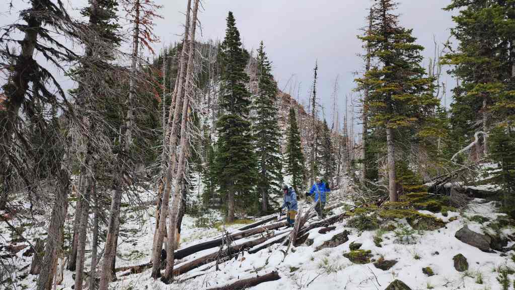
Hiking back to Wall Lake.

Back in the upper bowl.
Looking ahead and towards Wall Lake.

A quick look back…
Followed by one more. 🙂
Arriving back at the junction with the Wall Lake trail.
Passing beside the lake.
A good look at “Wall Mountain” from beside the lake.
Only 5.5 km to go.
Leaving Wall Lake.
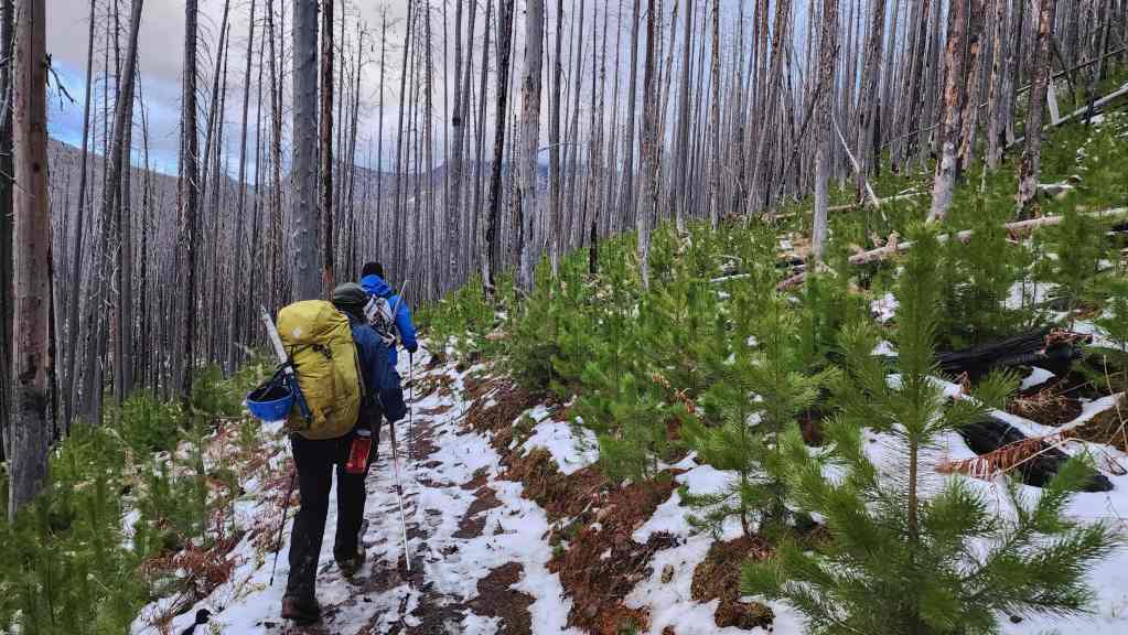
The new growth following the 2017 Kenow Wildfire is coming along nicely.
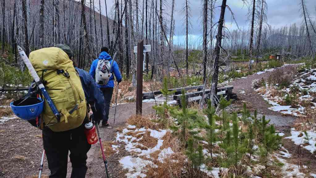
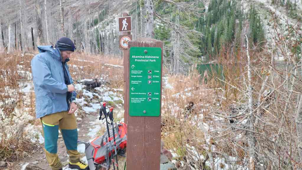
Arriving at the junction with the Akamina Pass trail.
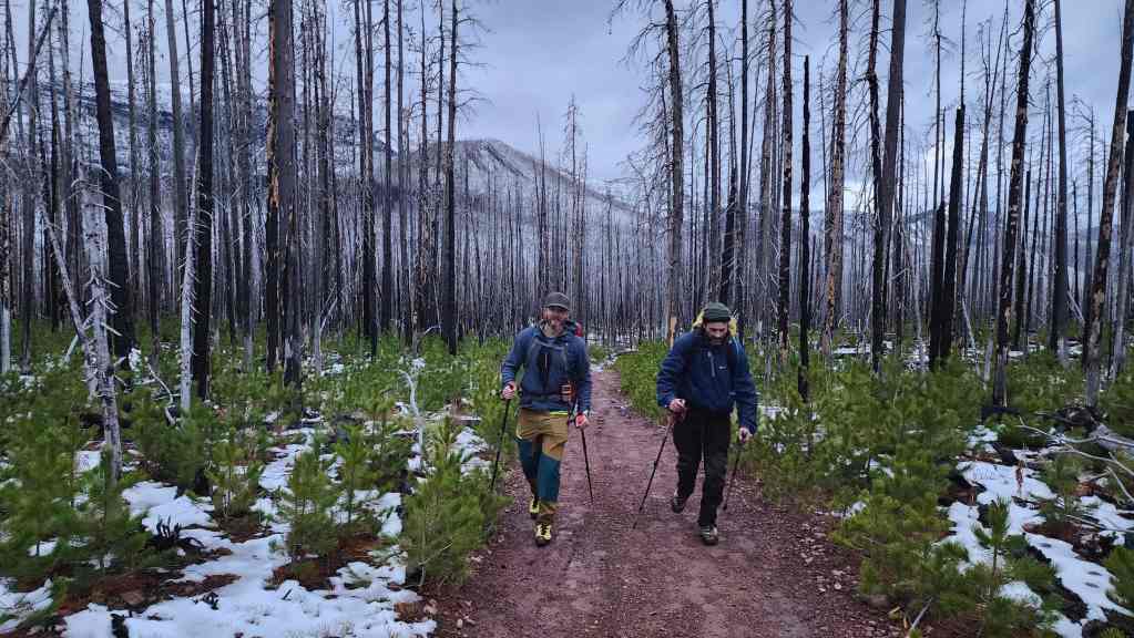
“Wall Mountain” is directly behind Dave and Brad.
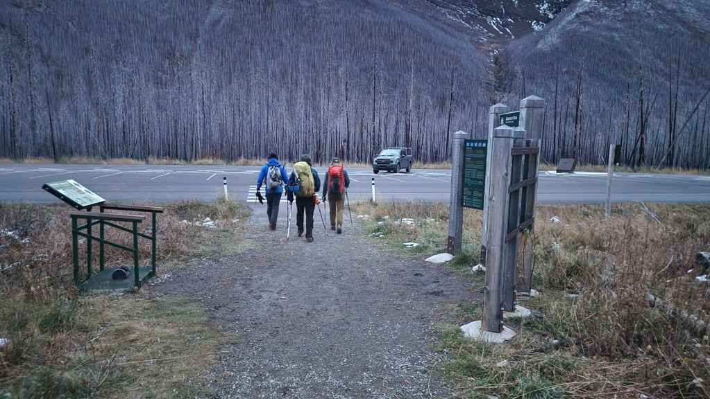
Arriving back at the Akamina Pass trailhead 10 hours and 16 minutes after starting. This includes a roundtrip distance of 25.7 km with a total elevation gain of 2155 m. Whew! What a great day in the mountains with three awesome friends! 🙂 I honestly wasn’t expecting to get to Mount Ashman until next year, but given the weather, it was the perfect choice for the day.