
⚠️ Hiking and scrambling are inherently dangerous activities. Please read my Disclaimer. ⚠️
After summiting Mount Ashman, we turned our attention to “Bennett Peak” as the second of our three peaks for the day. We had bypassed it on our way to Mount Ashman to avoid fighting the strong gusts that were coming at us from the northwest, but now the wind was at our backs and our ascent would be less aggravating.
As noted before, I had visited “Bennett Peak” in 2023 as a tag on to our Akamina Ridge trip. At the time, we only knew about Mike Potter’s trip outlined in his 2009, Ridgewalks in the Canadian Rockies (Second Edition) and then Andrew’s 2011 trip that followed Potter’s route description. However, it was Sonny and Zosia’s 2016 trip that seemed to produce – at least online – the current name, “Bennett Peak” which is more than fitting, given its proximity above Bennett Pass. It is also worth noting that “Bennett Peak” (2430 m) is the highest point on Ashman Ridge including Mount Ashman (2421 m).
However, unlike Mount Ashman, I haven’t been able to discover who Bennett Pass is named for. I think I’ll have to keep my eye out for some local histories in used book stores and antique shops, as these often provide valuable clues. Unfortunately, as time moves on, what was once common knowledge tends to disappear as previous generations begin to pass away.
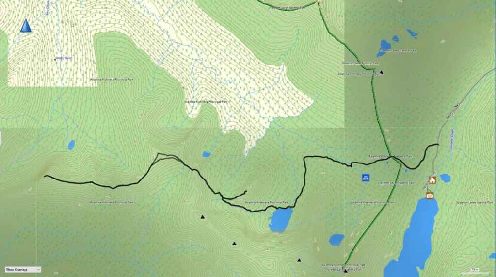
To get to Mount Ashman we started from the Akamina Pass trailhead in Paahtómahksikimi (Waterton National Park) and followed the signed and easy trail for 1 hour and 18 minutes (5.5 km with a 193 m elevation gain) to its junction with the Bennett Pass trail at Wall Lake. From the lake we then followed the trail for 1 hour and 15 minutes (~2.7 km with a 505 m elevation gain) until we were standing on the trail above Bennett Pass.
From here, we descended to the Pass (64 m elevation loss) before starting to hike up and towards “Bennett Peak”. However, we decided to bypass “Bennett Peak” in favour of heading straight to Mount Ashman by following a trail beneath Bennett that led through the trees and onto Ashman Ridge. Soon, we were standing above the col before the first high point on the ridge. A 65 m elevation loss and followed by a 150 m gain, brought us onto the top of the first high point (2379 m). The trip from here to the summit of Mount Ashman (2421 m) involved another ~1.7 km of hiking. For reference, from the main trail above Bennett Pass to the summit of Mount Ashman, it was ~3.9 km. Our total time from the Akamina trailhead to Mount Ashman was 4 hours and 48 minutes over ~12.1 km with a total elevation gain of 1146 m.
With the wind now at our backs, we set off for the summit of “Bennett Peak” (2434) which involved retracing our steps until we were on the easy slopes beneath the summit where we had previously joined the ridge. From here it was a short distance to reach the summit. For reference, it was a ~3.1 km trip from the summit of Mount Ashman to the summit of “Bennett Peak”. Further, from the ridge above the col with the first high point, it was a ~933 m hike (146 m elevation gain) over gradual slopes to reach the summit.
From “Bennett Peak” we then descended to Bennett Pass (~717 m with a 220 m elevation loss) before heading up to the main trail to Wall Lake. Once on the trail, we retraced our steps for ~1.2 km until we were at the base of “Wall Mountain”. Here, we left our packs beside the trail and made the ~684 m (153 m elevation gain) scramble to the summit of “Wall Mountain” (2189 m). For reference, it took us 27 minutes from the trail to the summit and about an equal amount of time to get back to the trail.
Once on the trail it was a ~1.5 km hike (222 m elevation loss) back to Wall Lake and then from Wall Lake, it was another 5.5 km to reach the Akamina Pass trailhead.
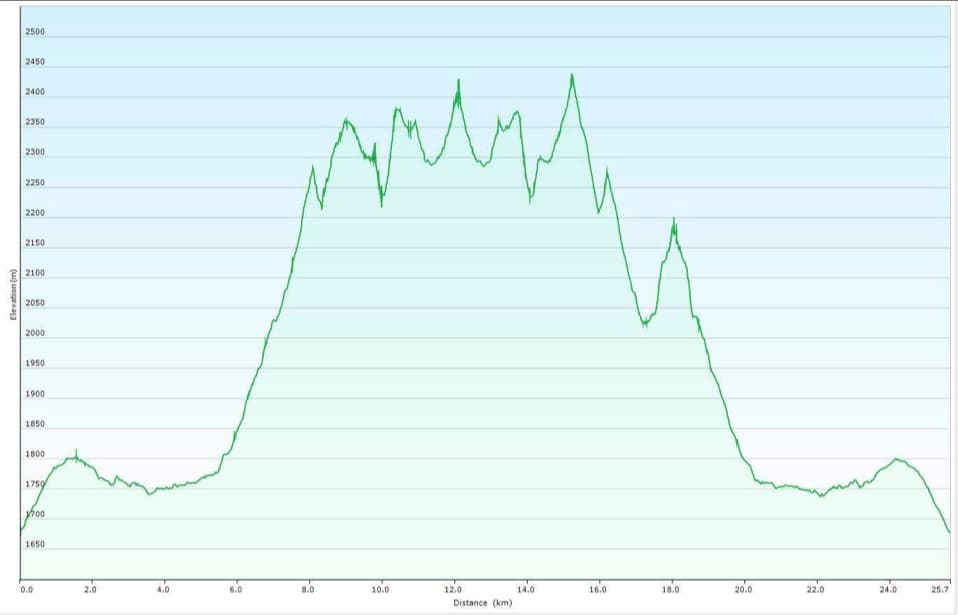
Our total roundtrip distance was 25.7 km with total elevation gains of 2155 m. Our total roundtrip time was 10 hours and 16 minutes.

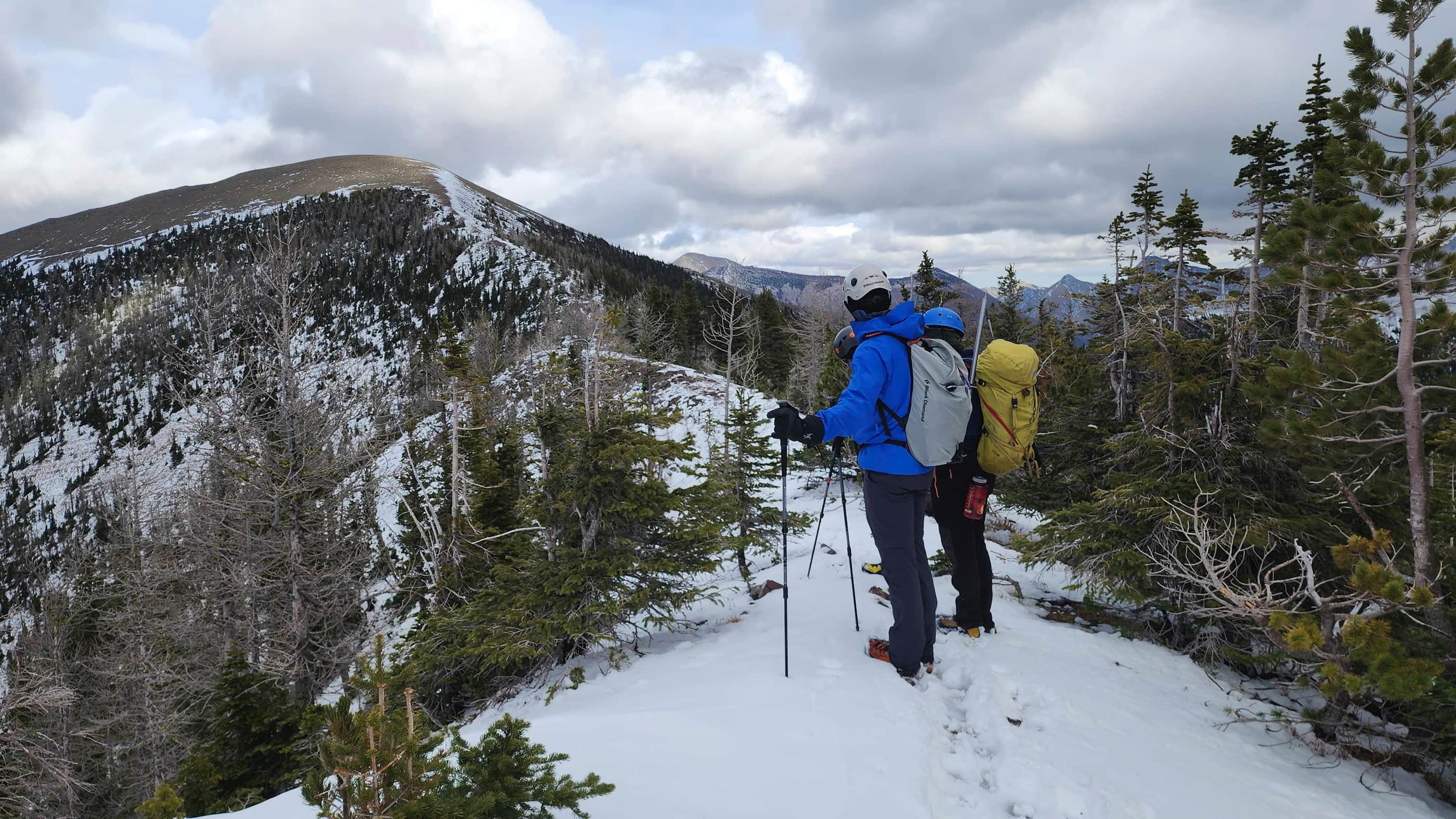
Leaving the summit of Mount Ashman and heading towards “Bennett Peak” (left). From the summit of Ashman, this will be a ~3.1 km hike.

Nearing the top of the first and tallest high point along the ridge.

Gazing back to the summit of Mount Ashman.

On top of the first high point (2397 m) with Akamina Ridge in the background.

Descending to the col. The snow made things a bit trickier, but for the most part, it was straightforward.

The view from a little closer to the col.

Glancing back at one of the obstacles we avoided.

On the col and heading towards the next section.

Getting back onto the ridge was not difficult.

Another look back.

With the wind squarely at our backs, the remaining section of ridge would be easy peasy.

Passing the point where we joined the ridge earlier in the day after bypassing “Bennett Peak”.

Yet another look back.

Approaching the summit as the gusts grow in intensity.

My second time of the summit of “Bennett Peak” (2430 m). 🙂

A pano to the northeast…

And then one to the west.

Finally, one to the east.

As it was insanely windy and since this was my second time on the summit, I only snapped this photo of Festubert Mountain.

A quick pose on the summit…

Before making a hasty retreat down to Bennett Pass. For reference, it was a 220 m elevation loss over ~717 m. Click to follow us to “Wall Mountain”.


Leave a Reply