
⚠️ Hiking and scrambling are inherently dangerous activities. Please read my Disclaimer. ⚠️
I first ascended “Blue Mountain” in January 2017 and since then, it has remained my favourite foothill destination in the Castle. Why is it called “Blue Mountain”? Well, when I was researching a route for my initial trip, I phoned the leaseholder to check on access permissions. He said that the area ranchers call it, “Blue Mountain”, but he wasn’t sure why, other than to speculate that it might have something to do with the blue spruce found on its slopes. I’ve kept this local name, and even though this was my third time up the mountain, this little summit has never disappointed. In fact, this was my first non-winter ascent and the number of wildflowers was incredible! We even extended the trip into a loop that included a slightly lower ridge to the west that I’ve nicknamed, “Screwdriver Ridge”, after I downed an entire Nalgene filled with vodka and orange juice on the summit! 😂 😂 I kid. I kid. I really named it after nearby Screwdriver Creek, but the first story is way more interesting.
The reason why I picked “Blue Mountain” for today’s trip was because it would be my first hike in the mountains since undergoing radioactive iodine (RAI) treatment for thyroid cancer. This treatment ended just two days ago and yesterday, my endocrinologist called me some great news, saying that he was pleased with the outcome and that it all looks good. I have to keep going in to be checked every six months, but for my wife and I, this was a huge weight lifted off our shoulders. Again, as I’ve said before, I am extremely proud to have a universal health care system that provided me with fast and amazing care all the way from my family doctor, to my surgeon, to my endocrinologist, and from all the nurses and technicians in between. All of the scans that I underwent, did however, reinforce to me why I prefer the open air of the mountains and not spelunking – I definitely do not like confined spaces! 😳
Coming out of my RAI treatment, I thankfully did not experience many side effects, but my joints were stiff and I felt like I’d lost some stamina, so “Blue Mountain” would be the perfect test. Moreover, who better to accompany me on this COVID-19 physical distance / post-RAI treatment hike, then Brad Wolcott? One of my favourite people to spend time with! Surprisingly, Brad had never ascended “Blue Mountain” and so it was great to finally share this obscure little gem with him.

To get to Blue Mountain, we drove west from Pincher Creek on Highway 507 to the hamlet of Beaver Mines. At the T-intersection on the edge of town, we turned right (north) and continued on Highway 507 for ~1.1km until we came to Township Road 6-2A. We then turned left (west) and followed the gravel road for ~2.8km until we came to a side road on the right that led to a Shell gas well. Here we parked on the side of the road just prior to an obvious cutline. This was our starting point.
The cutline demarcates private land and leased public land. All the land to the north of the cutline is leased public land and the leaseholder does not require contact prior to access if you are on foot. Nevertheless, this land is the livelihood of the leaseholder and so a high level of respect is required. A barbed wire fence runs up the middle of the cutline and I stayed on the north side of it until I reached the SE ridge. From here, we enjoyed the fun walk along the ridge until we came to where it intersects with the south ridge. The summit lies ~400m to the north.
After spending a relaxing time on the summit, we decided to venture over to “Screwdriver Ridge” (1691 m), a slightly lower foothill located ~2.1 km as the crow flies to the west of “Blue Mountain”. Back in 2017, I had thought about making the two destinations into a loop, and today we decided to give it a go, though in a slightly different route than what I had originally envisioned. Be warned though, “Screwdriver Ridge” appears much closer to Blue Mountain than it is. It took us ~3.5 km of hiking to reach its summit.
From the summit of “Blue Mountain” we made the ~783 m trip to the top of an intervening ridge that Brad dubbed, “Meadow Mountain” because of the immense meadow on its west slope. We then descended another ~934 m to the valley floor, before beginning a relatively easy combination of bushwhacking and intermittent trail following for ~1.8 km towards the summit of ‘Screwdriver Ridge”. The final ~100 m or so up the south side to the summit was quite steep but otherwise, was not difficult terrain.
From the broad summit of “Screwdriver” we then descended to its col with a small highpoint to the northwest where we then proceeded to descend. After ~3 km, we connected with a well-trodden trail that led up a drainage for ~950 m to the south ridge of “Blue Mountain”. Here, we admired ‘Baboon Rock’ and the interesting conglomerate, before descending down the ridge and intersecting with another trail that led ~2.3 km across the valley between the two ridges, and back to the road and our vehicles.

Our total distance travelled was 13 km with total elevation gains of 922 m. Using the southeast ridge and the cutline, it was ~2.3 km from our vehicles to the summit of “Blue Mountain” with a ~314 m elevation gain. The entire loop took us 6 hours and 21 minutes.
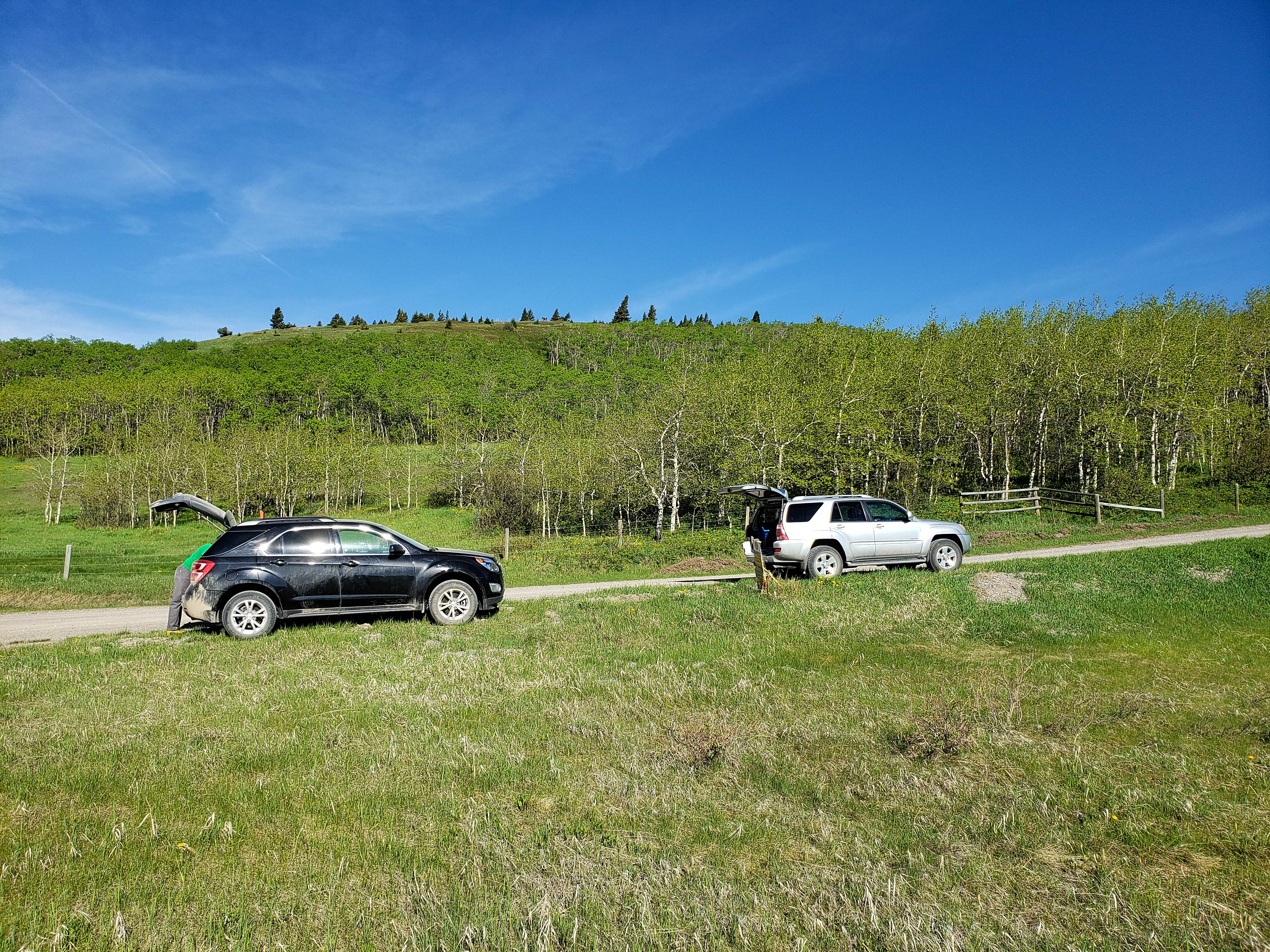
We even physically distanced our vehicles! 😏 Gearing up at the start of the short gas road.

The last two times that I’ve been here, this cutline was buried under snow. Today, we could follow a small path along the fence to the top of the ridge. The south side (hiker’s left) of this fence is on private land. As an alternate, if you venture up the gas road from the cutline for another ~400 m, you will come to three signs on the left side of the road. Behind them, a really good trail starts in the woods that leads to the southeast ridge.
Easy travel up the cutline.
What a gorgeous day to celebrate being free of thyroid cancer!

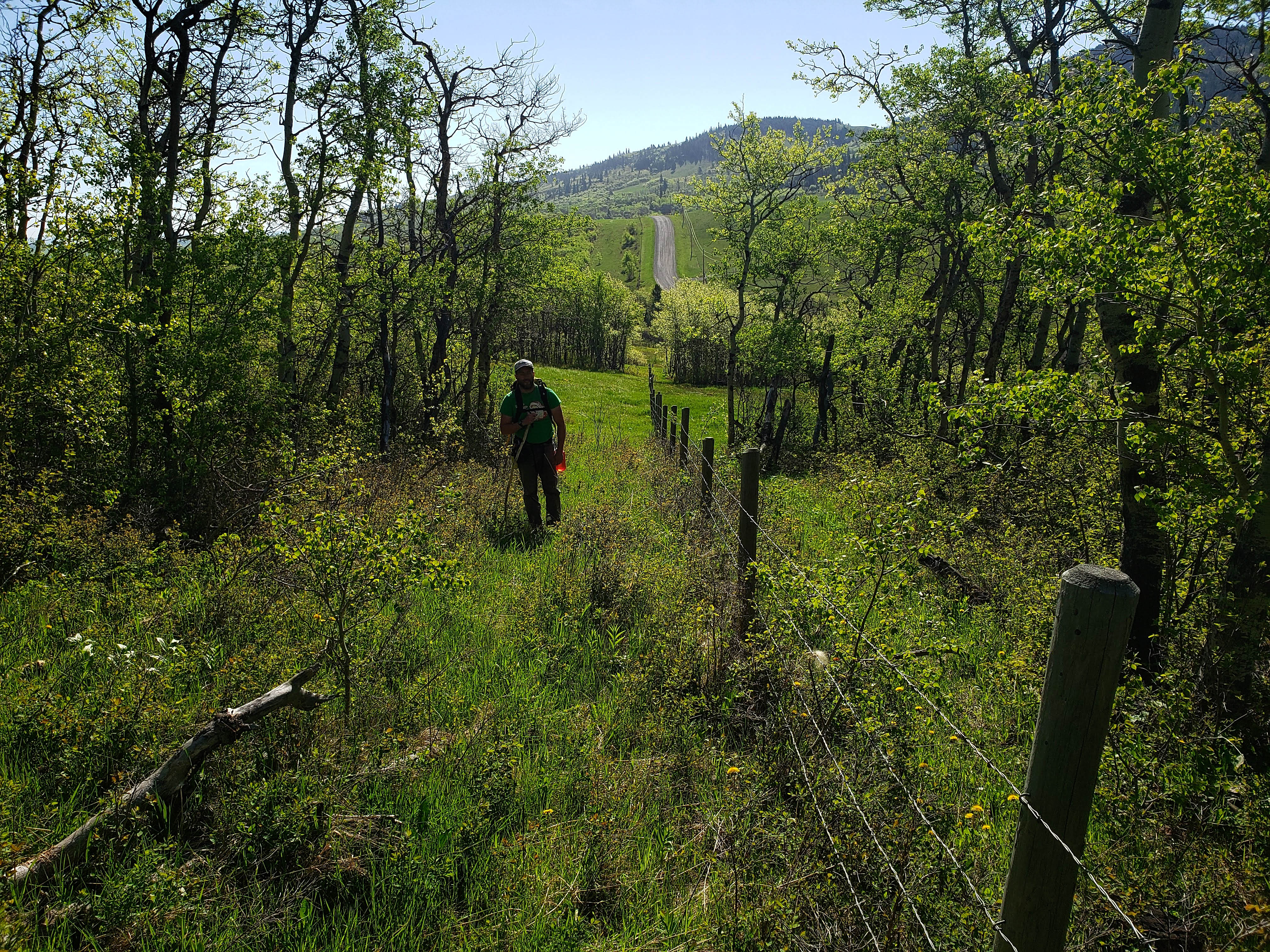
Looking back at our vehicles after reaching the ridge.
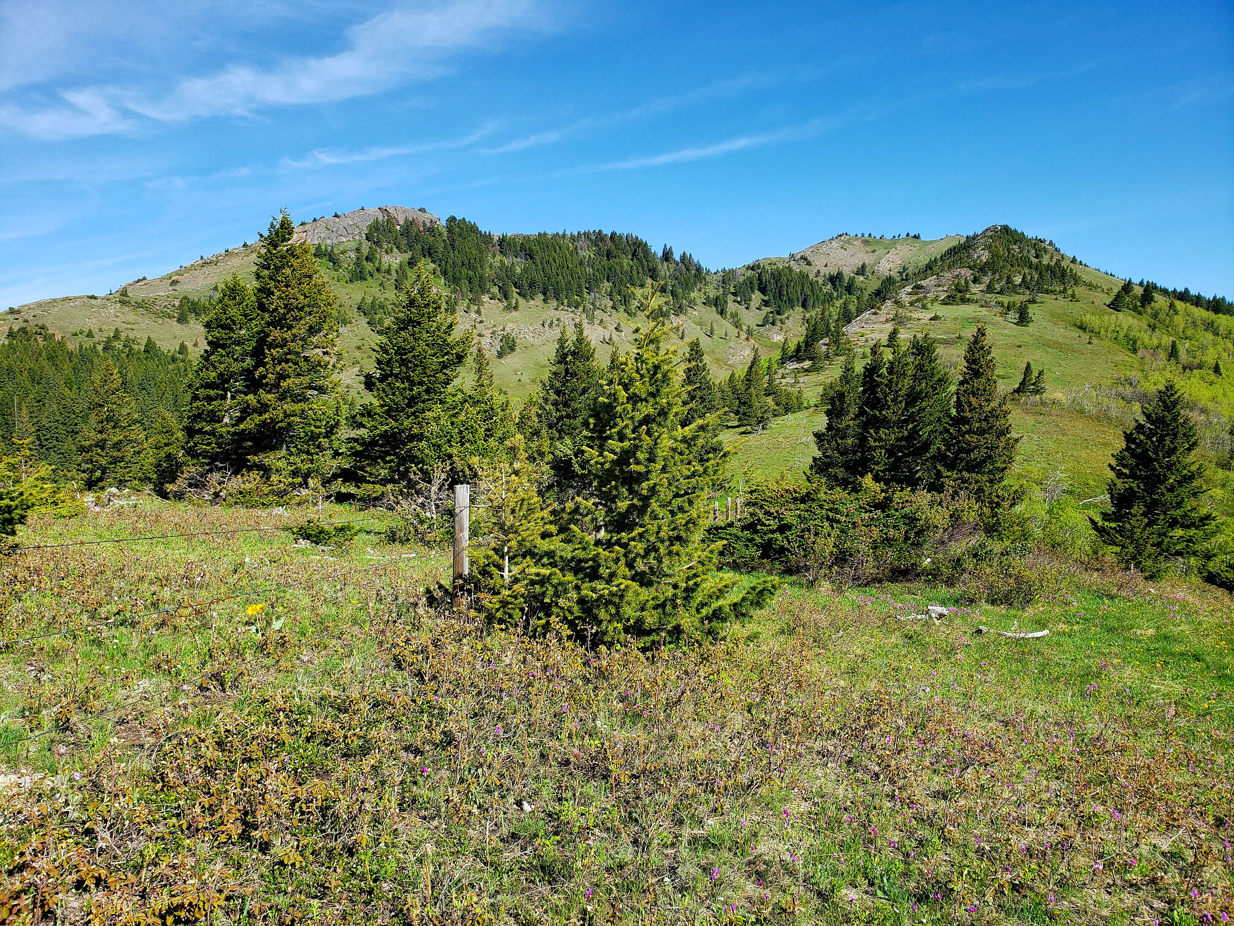
The south (left) and southeast ridges of “Blue Mountain”. I would recommend going up the southeast and then using the south to descend.

Looking over to the impressive conglomerate rock on the south ridge. I was looking forward to heading over there later in the day and finally seeing, ‘Baboon Rock’, that Andrew Nugara found on his 2018 trip.

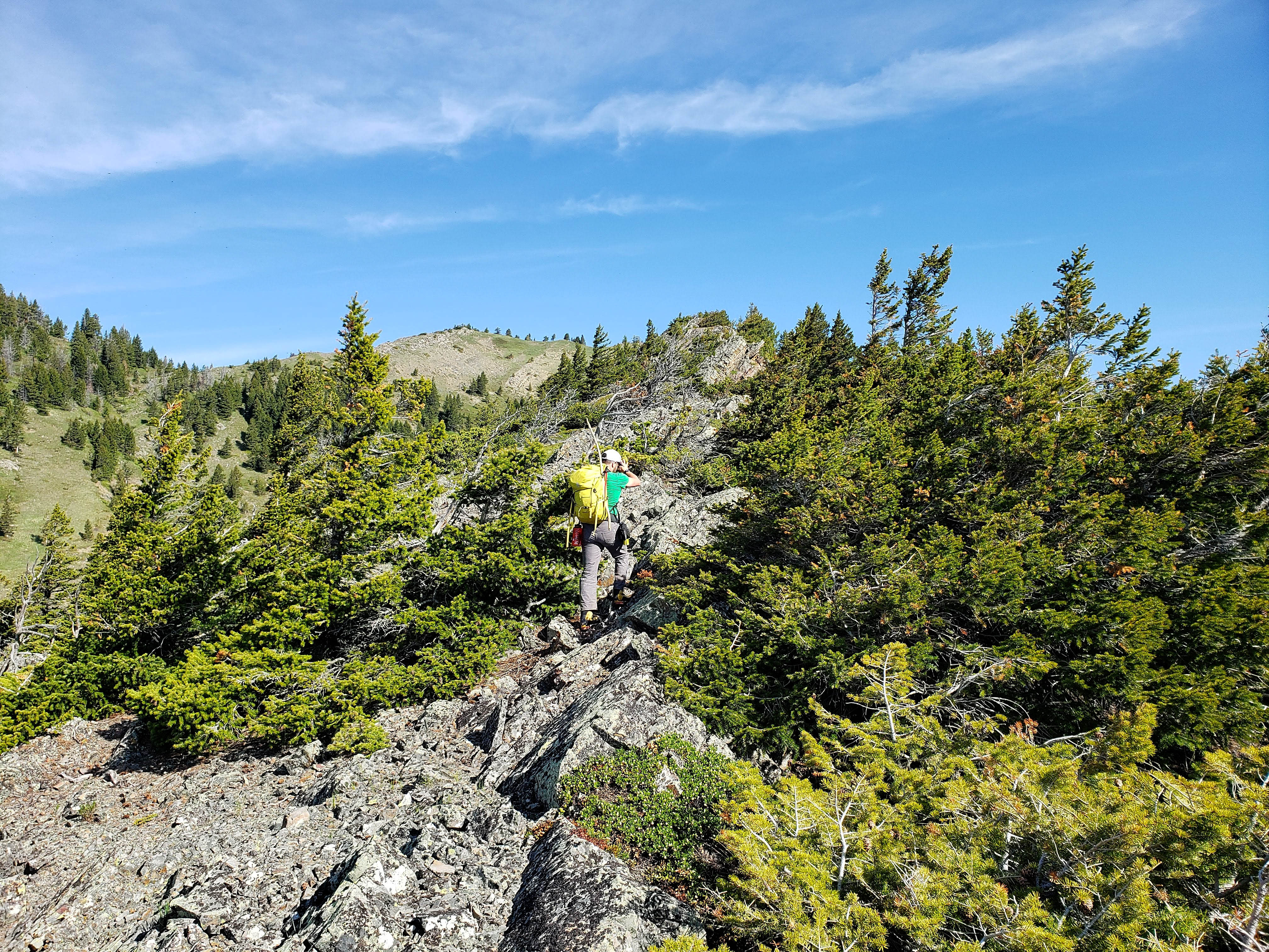
Starting up the southeast ridge. All of the ridge walking can be avoided, but why would you? 😊

Brad leads the way.
If you only looked at “Blue Mountain” from the road, you would never know that there was a cool ~900 m ridge walk.

Brad tackles a narrow section of the ridge. Again, this can all be avoided if you want.

I follow behind – but always at 2 metres or more. (Photo by Brad Wolcott)
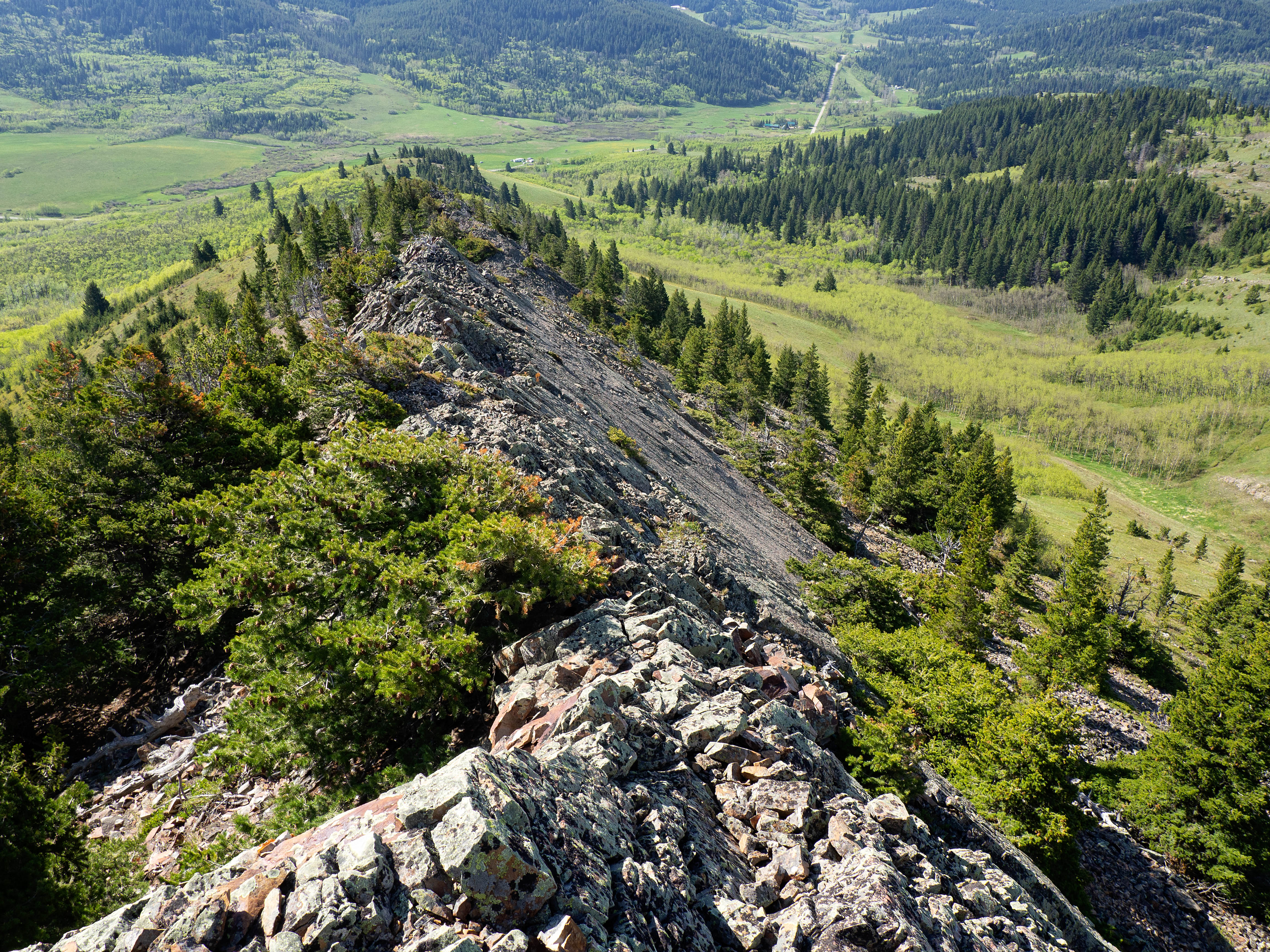
Gazing back along the ridge.

Nearing the top of the ridge.

The view back down the valley with Mount Backus on the far right.
Arriving at the top of the southeast ridge.

The summit of “Blue Mountain” from the top of the southeast ridge.

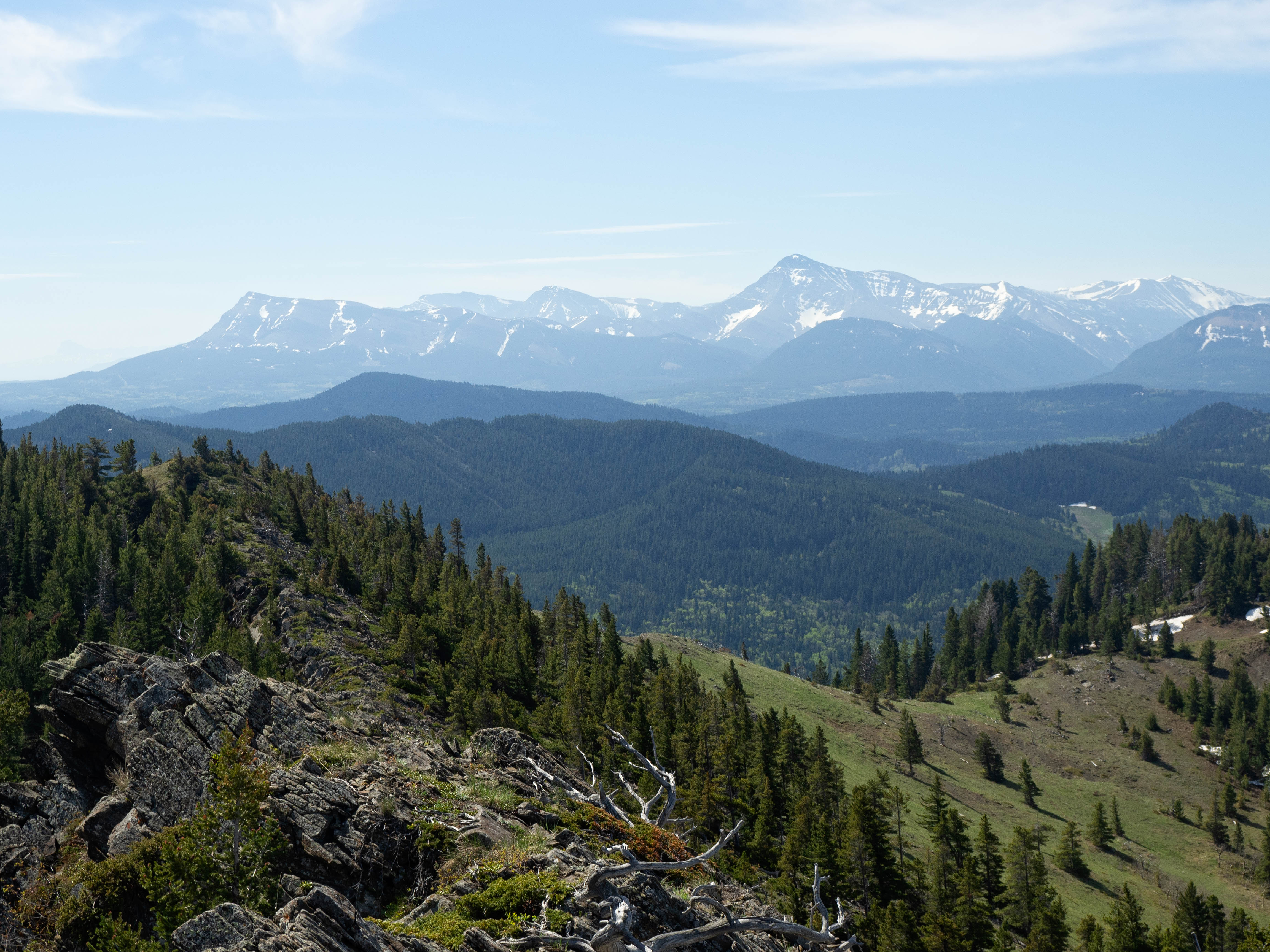
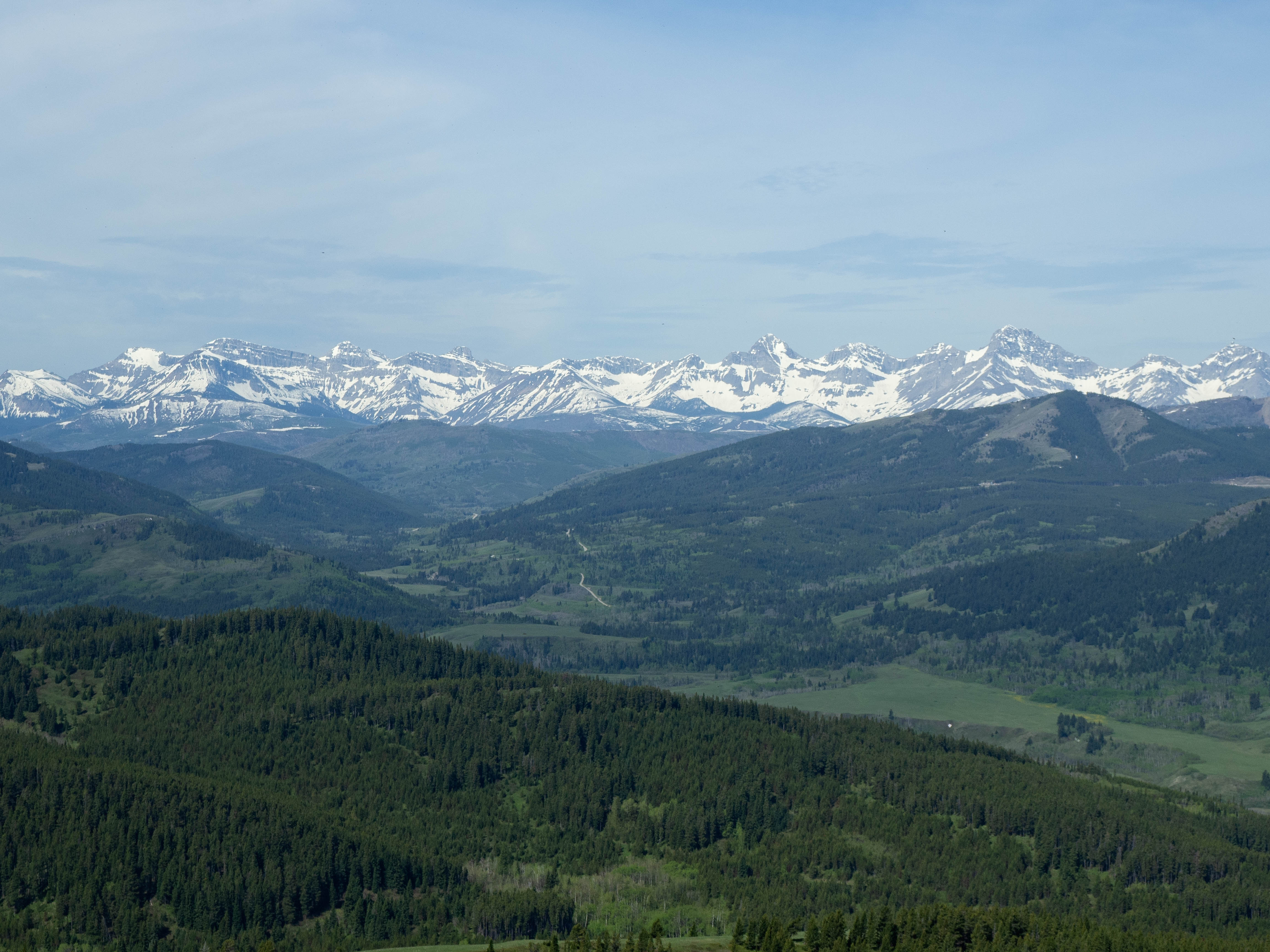
Gazing to the north at Burmis Mountain.

A telephoto of Bluff Mountain (centre) with Crowsnest Mountain on the far left and Morin Peak on the far right. (Photo by Brad Wolcott)
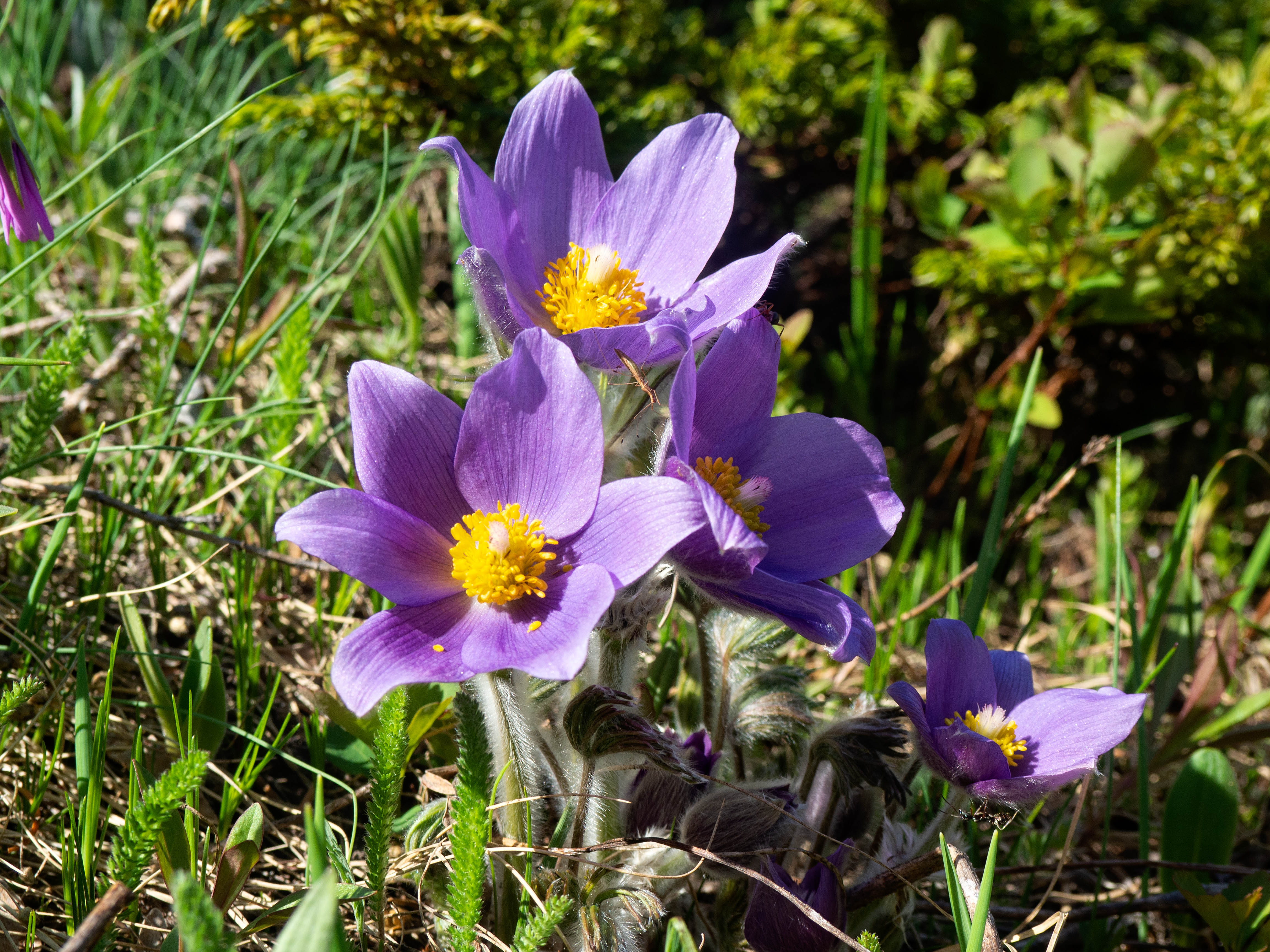
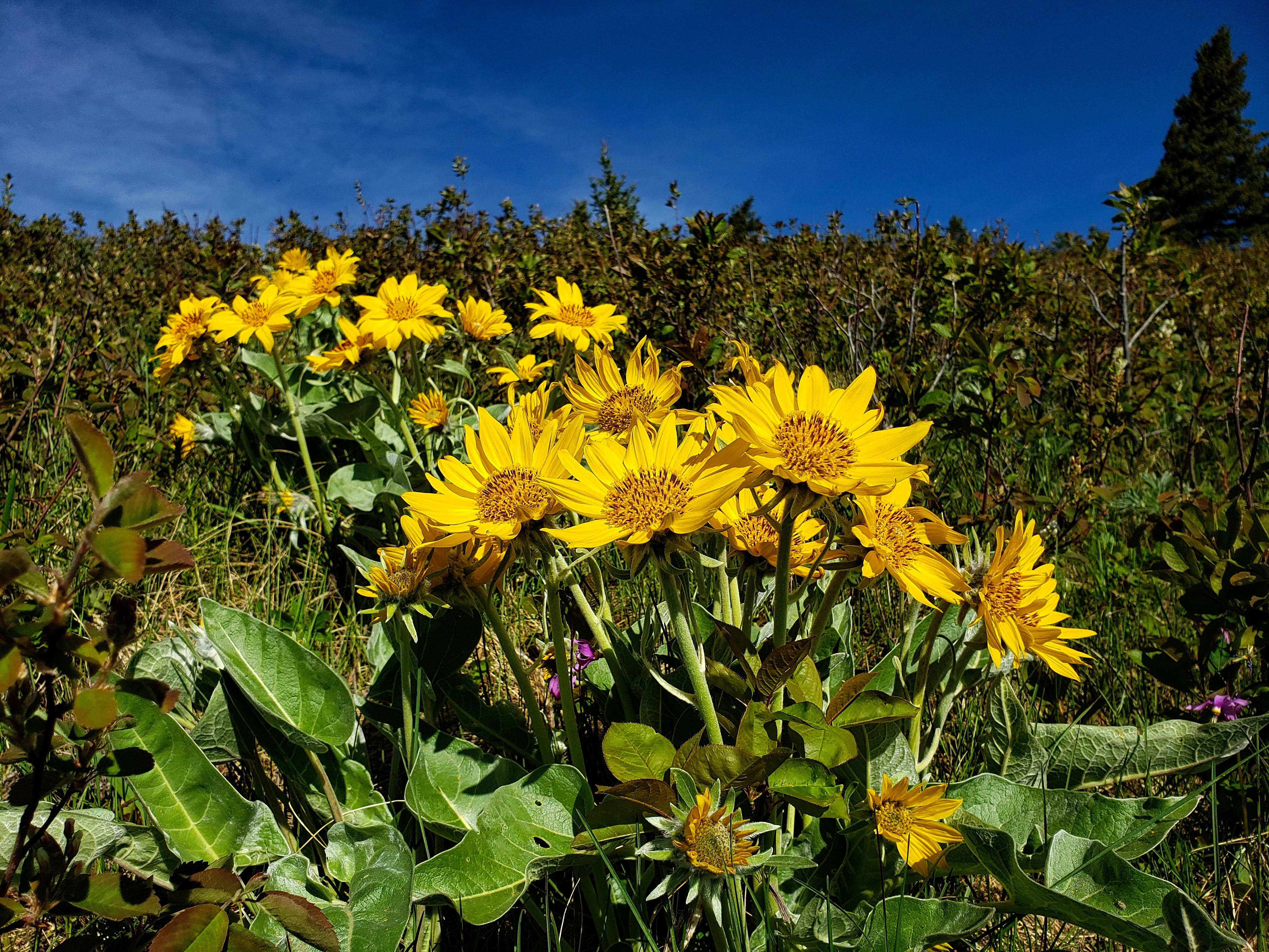
A gorgeous alpine crocus.
Another beautiful crocus.
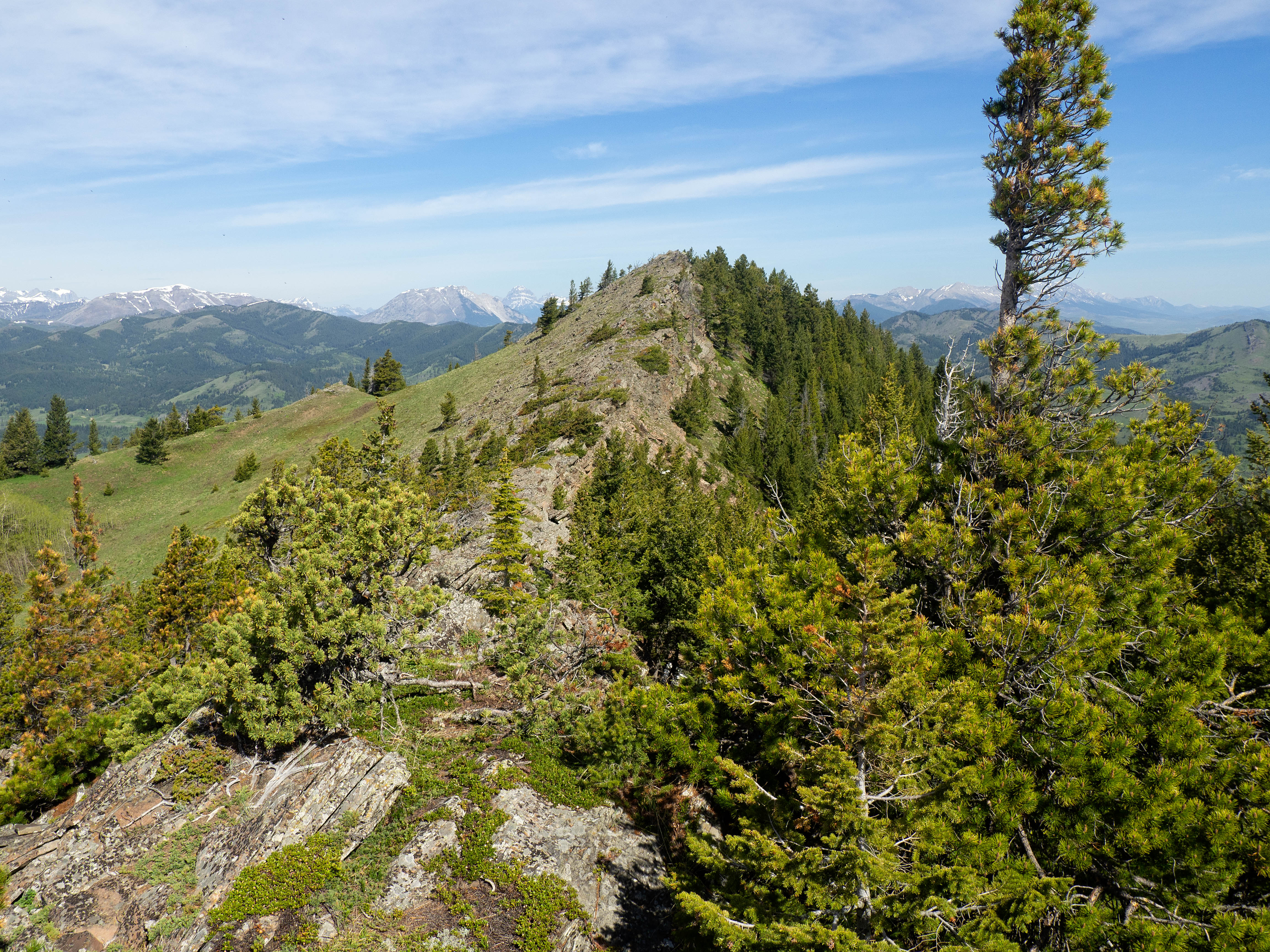
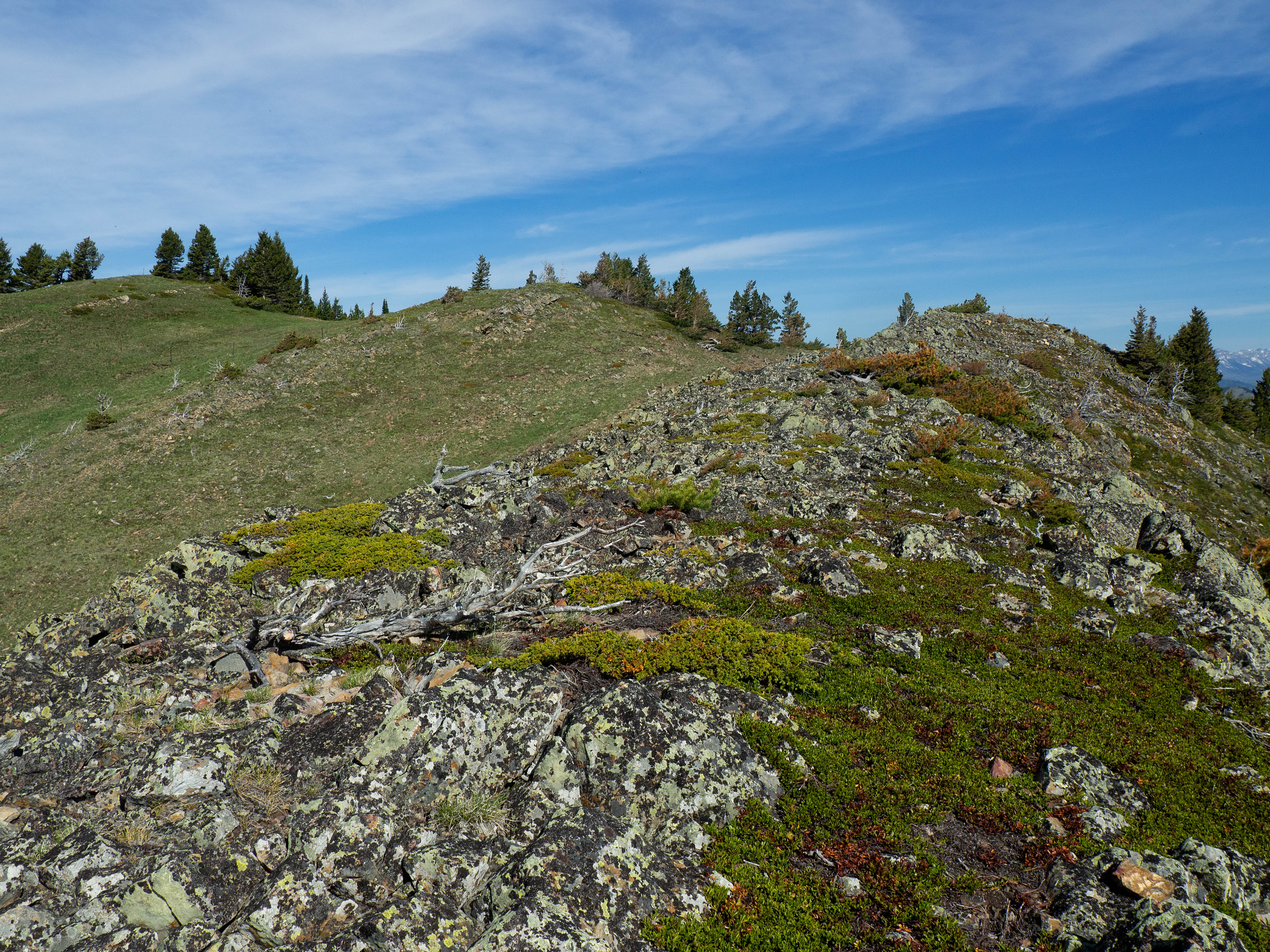
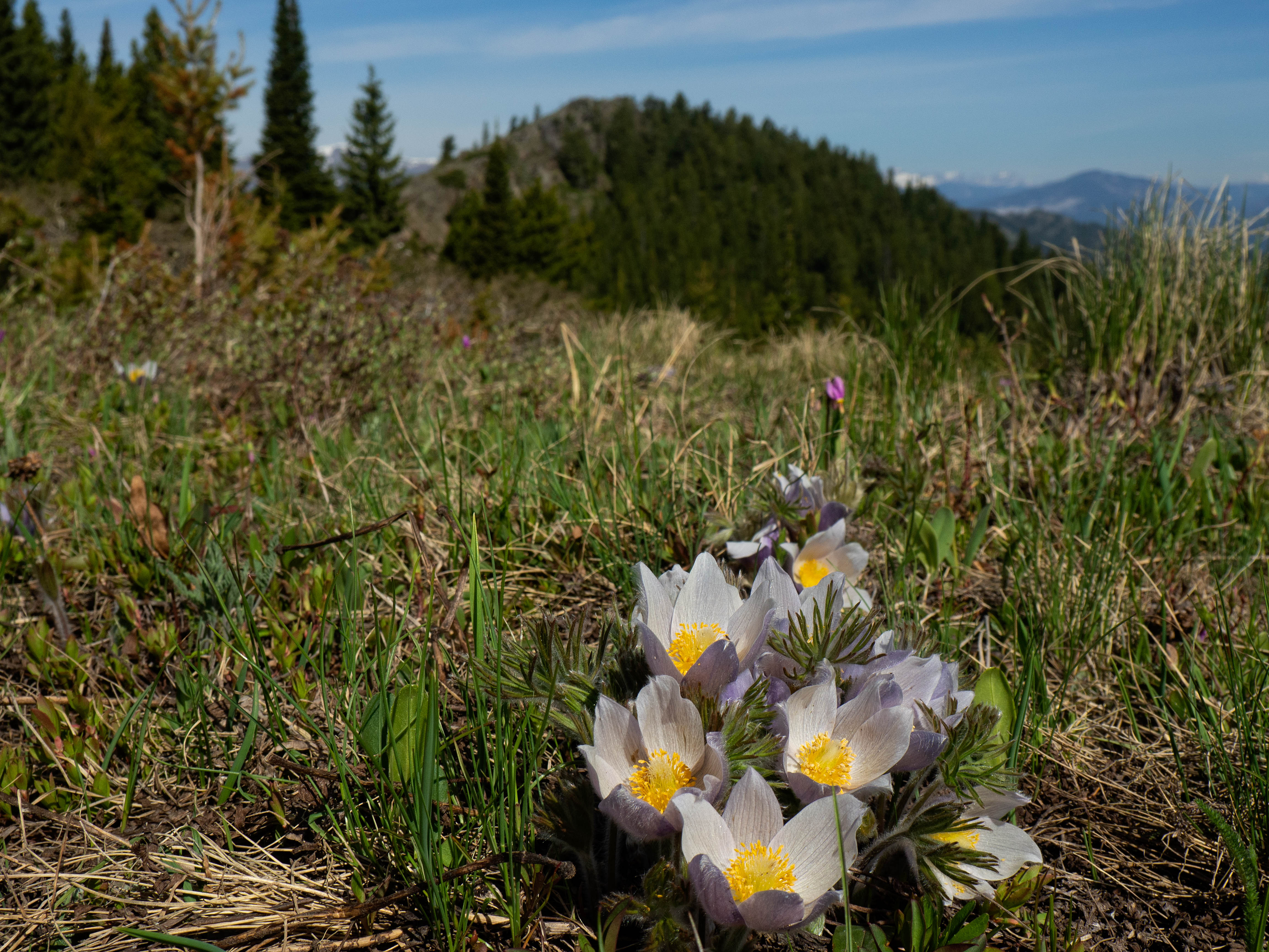
There is more ridge walking fun all the way to the summit.

Glancing back as we enjoy our walk to the summit.
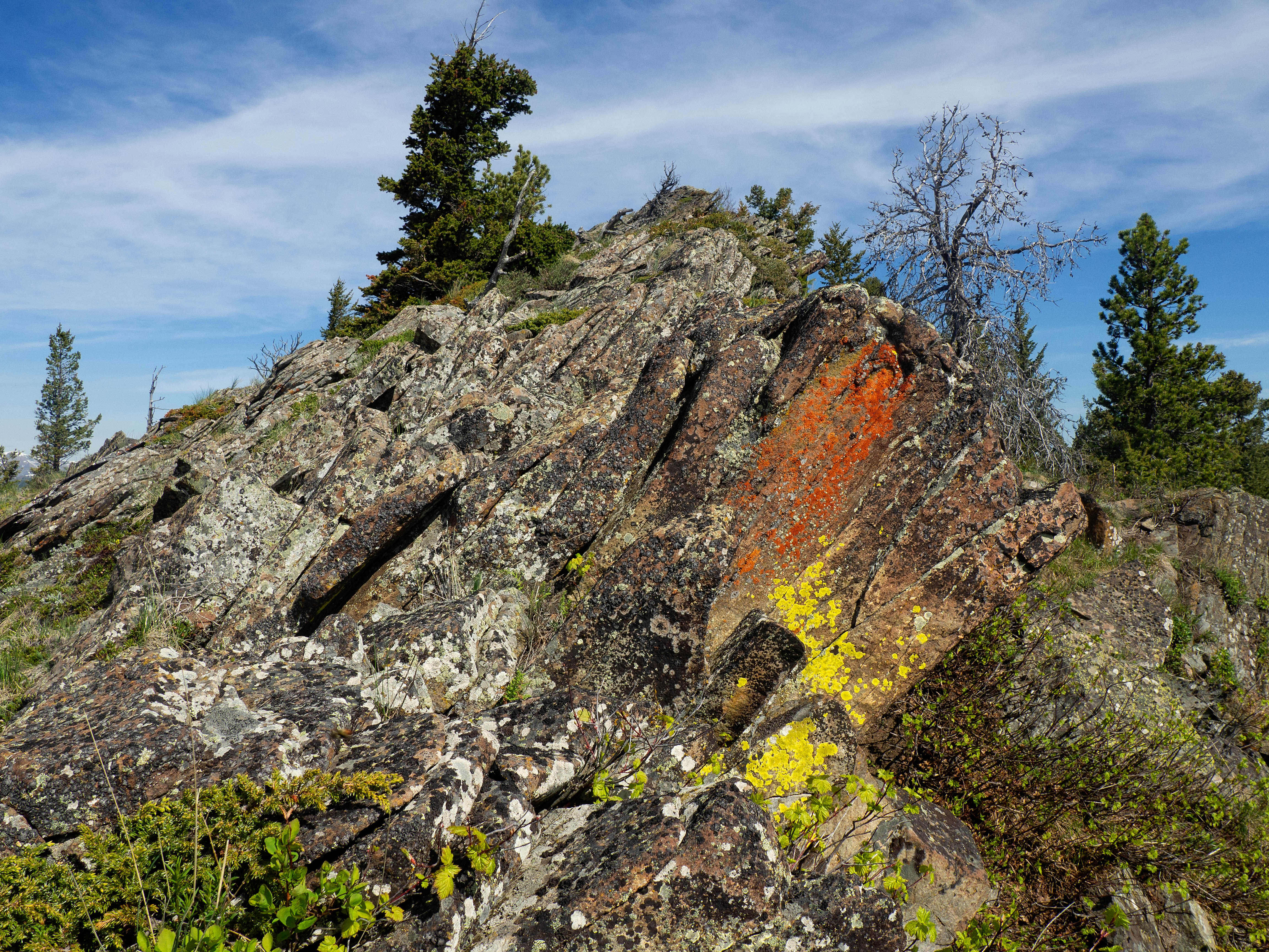
A healthy splash of orange and yellow lichen.

Brad arrives on the summit of “Blue Mountain” (1715 m). ‘Steve’, the mighty cairn that I made in January 2017, still graces the top.
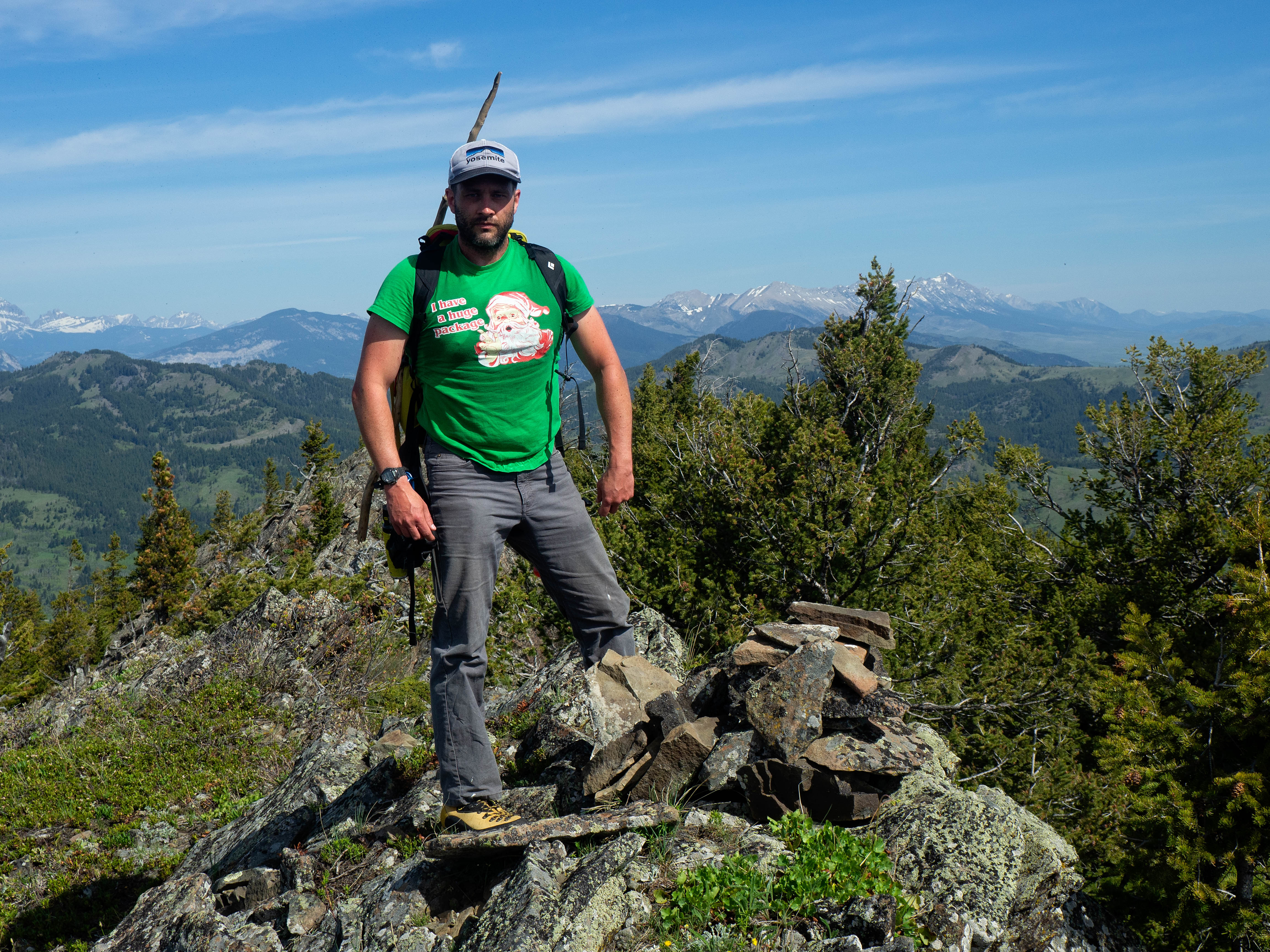
Brad really, really wants you to admire his shirt. 😂

I haven’t had a haircut in 6 months, I no longer have a thyroid, and I’m probably slightly radioactive, but I don’t care. It may not be a big peak, but I love this foothill and I can’t think of a better place to be!

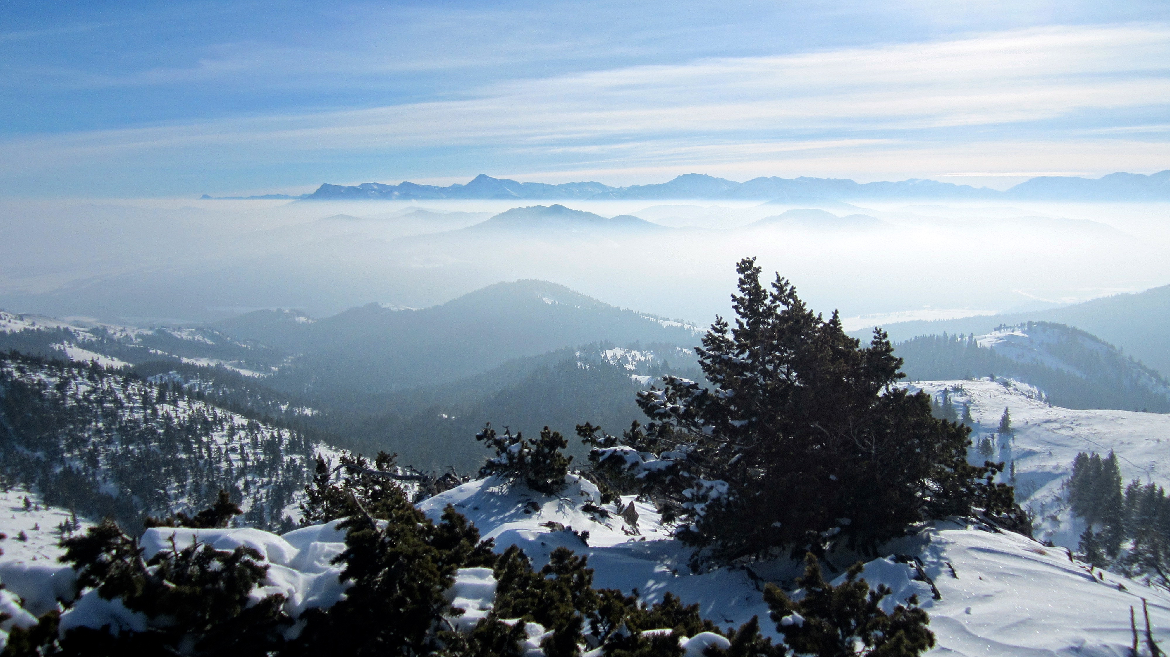
A pano to the south.

A pano to the west.

The view out to the east and the prairies.
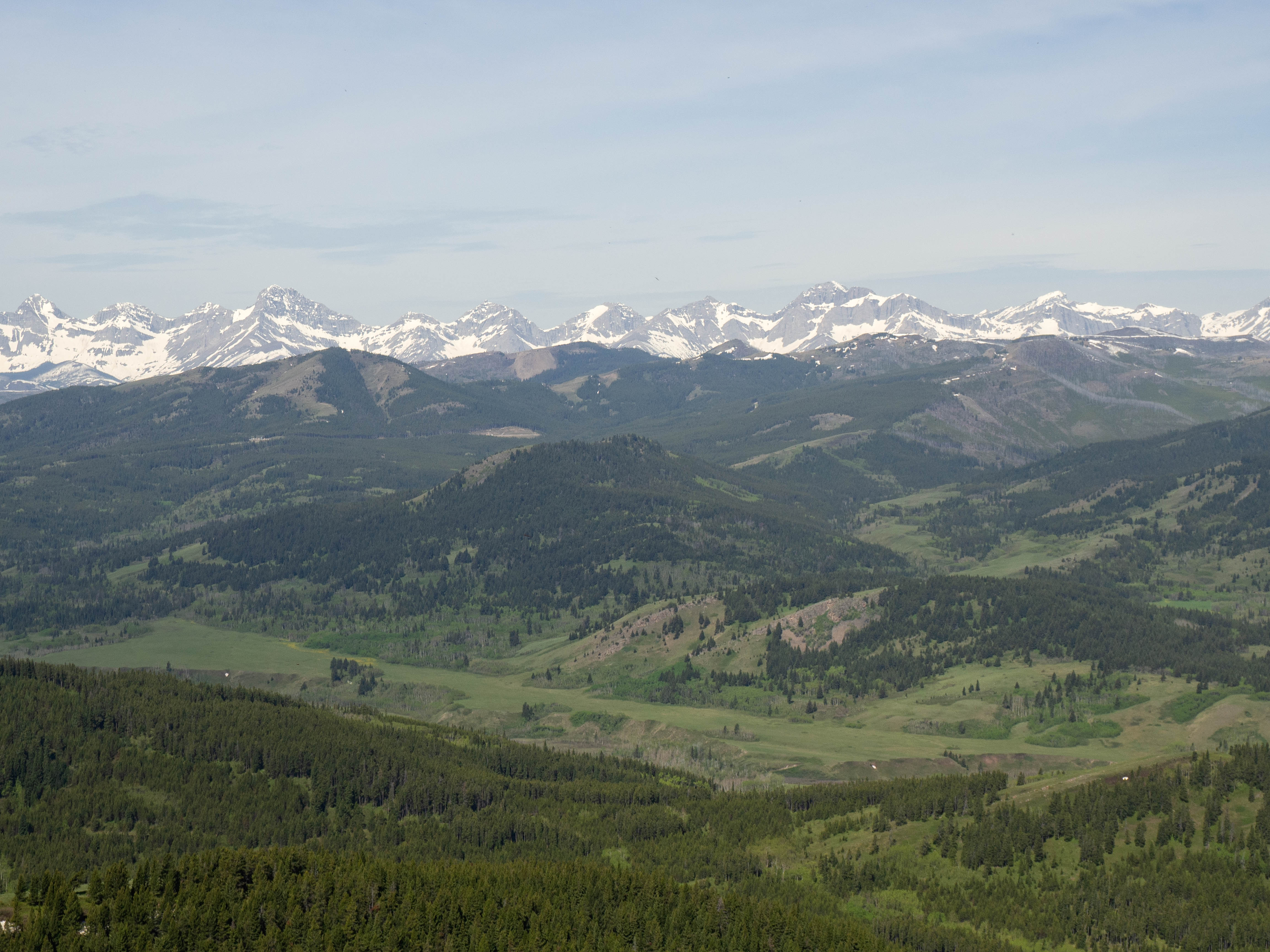
A telephoto of Prairie Bluff (far left), Drywood Mountain, Pincher Ridge, Victoria Peak, and Victoria Ridge. In front of Victoria Peak are “Whitney Creek Mountain” and “Whitney Ridge”.

A telephoto of “Gladstone’s Toe” (far left), Mount Gladstone, and Table Mountain.
Mount Backus sits in the foreground to the south.

A telephoto of Barnaby Ridge, Southfork Mountain, Mount Haig, and Gravenstafel Ridge.

Our next destination for the day, “Screwdriver Ridge” is in the foreground, while behind it are the three peaks of Mount Syncline.
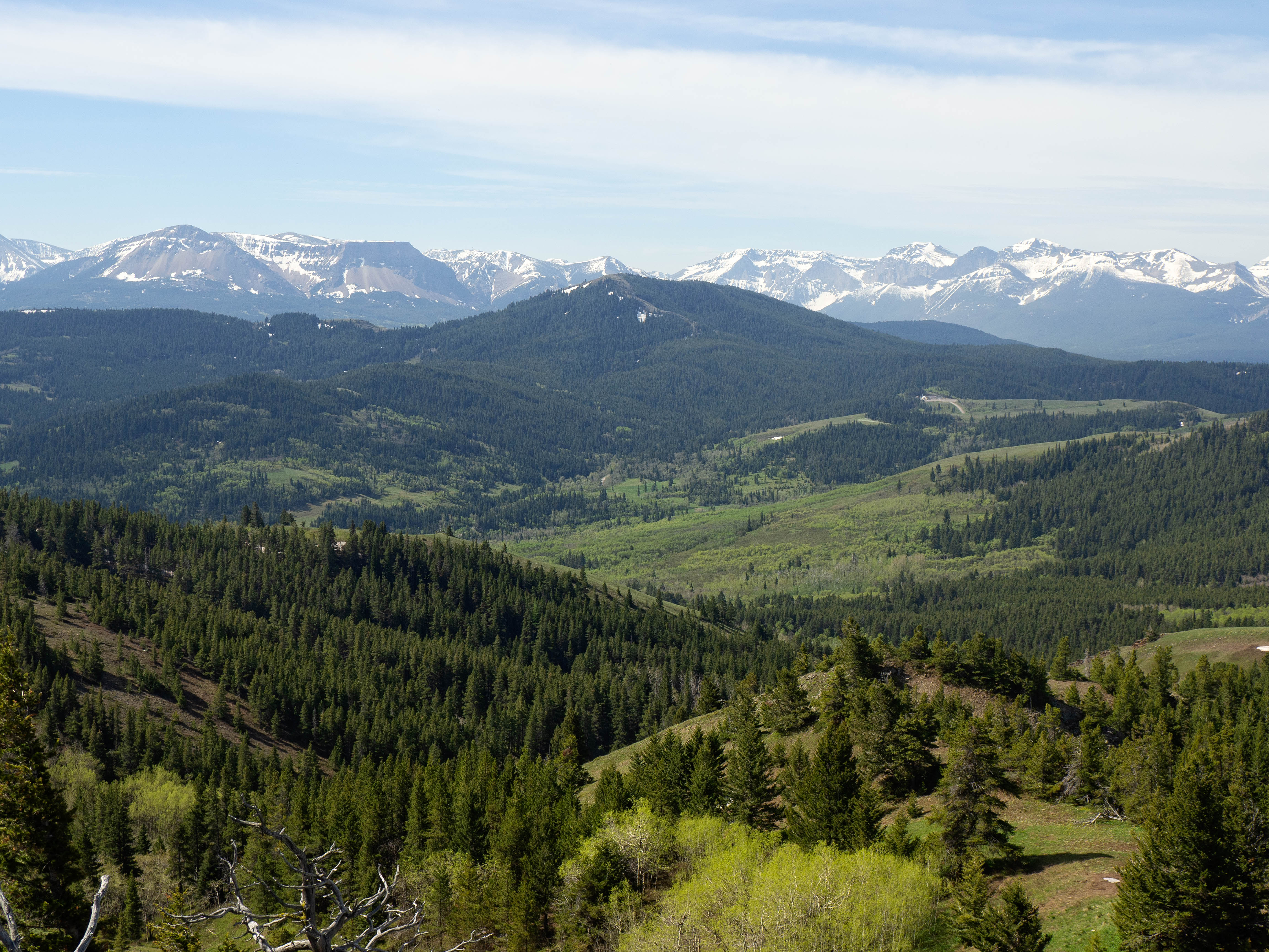
In the foreground on the left is Carbondale Hill. Behind it are Mount McCarty, Hollebeke Mountain, and Centre Mountain (far right)

A telephoto to the west with Centre Mountain… in the centre. In the foreground centre is little Cherry Hill.
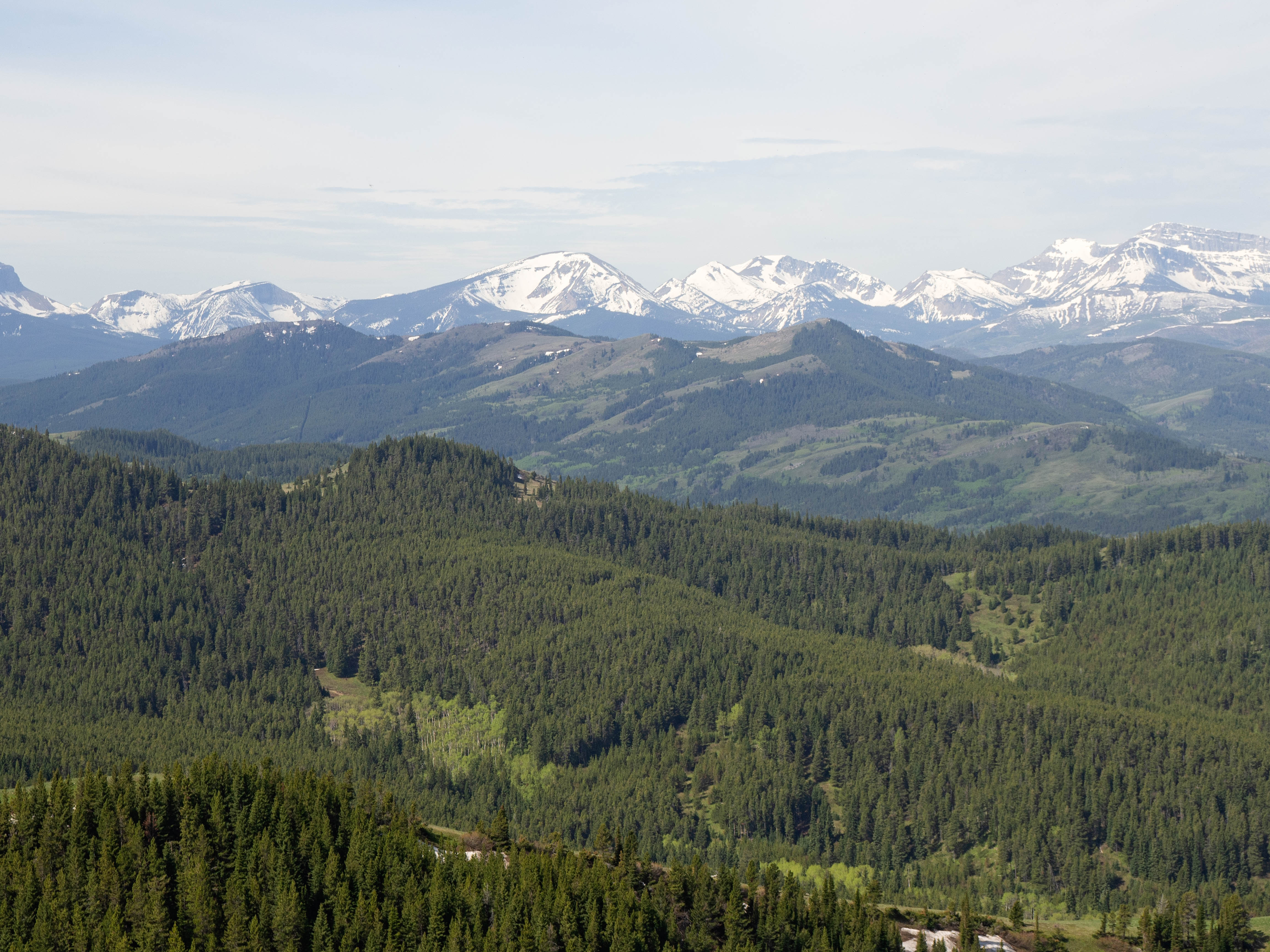
Another view to the west with Mount Darrah (far right) rising up from behind Maverick Hill. Just to the right of centre is Darrah S2, one of the higher, unnamed peaks on the Flathead Range. A much smaller, Darrah S3 sits immediately to its left.
Tiny Ginger Hill is in the foreground centre with Maverick Hill to its left and Poker Peak to its right. In the distant centre are Mount Pengelly and Mount McGladrey.

Brad checks out the view to the northwest, with Byron Hill in the foreground and Hillcrest Mountain and Turtle Mountain behind it.

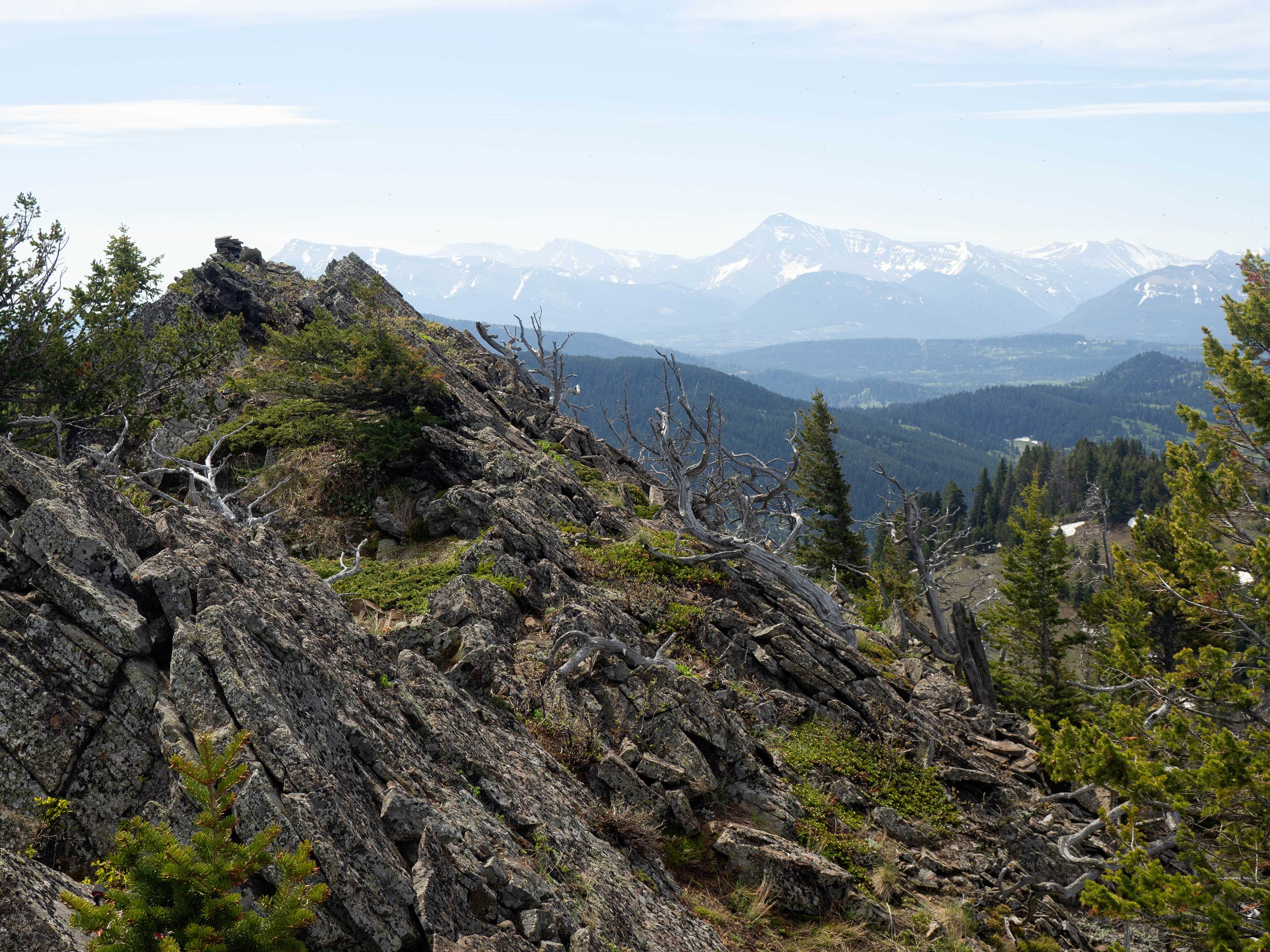
It is well worth it to keep going past the summit by following the narrow ridge.

More views open up towards the end of the mountain, including Turtle Mountain, Crowsnest Mountain, and Bluff Mountain.
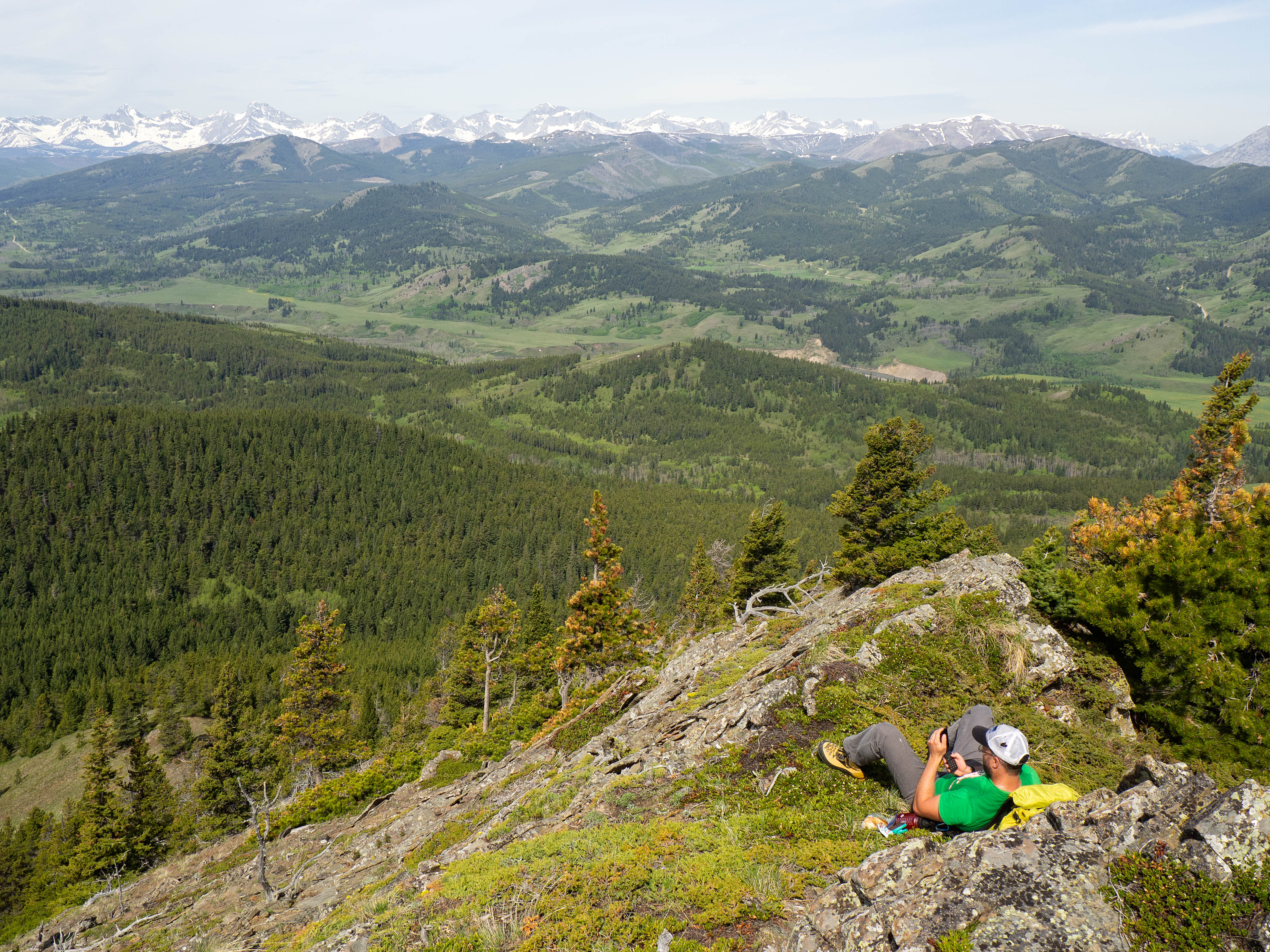
Brad relaxes by chatting to his family on his early 2000s-style, Coolpad Snap flip phone. 😭
Heading back to the summit (left).

Looking across the valley at “Screwdriver Ridge”, our next destination for the day. Click to continue to my “Screwdriver Ridge” report.


Leave a Reply