

⚠️ Hiking and scrambling are inherently dangerous activities. Please read my Disclaimer. ⚠️
Mount McLaren lies just south of Coleman, AB along the North York Creek Trail. Part of the Flathead Range, it is a smaller peak (2319m) that is overshadowed by the larger peaks of Mount Coulthard, Andy Good Peak, and Mount Parrish. Even though it is somewhat diminutive, its east face offers some good scrambling opportunities and an impressive summit view. Named after Peter McLaren who was the owner of a lumber company in the Crowsnest Pass during the 19th century, it is also located near the site where, in the winter of 1946, an RCAF Dakota DC-3 that was travelling from Comox, BC to Greenwood, NS, crashed after hitting a nearby peak. All 7 crew members were killed. The wreckage has become a popular place to visit and it is not stretching reality to suggest that the North York Creek Trail is a super highway for ATV’s, as we encountered more than 20 off-road vehicles of various shapes and sizes.
I was really glad to join Brad and Dave for this trip. Both are experienced climbers and mountaineers as well as great guys to spend a day with. Together we encountered some of the strongest gusts of wind that any of us had ever experienced. We knew it was going to be a blustery day as the wind was already quite strong when we rolled into the Pass just after 7:30 am. We picked McLaren because we could climb the east face which would give us shelter from the wind. However, once we hit the top of the mountain, the wind was ripping. While we had to brace ourselves to stand on the summit, it was coming down the south ridge where the wind gusts became so severe, that we could no longer stand upright and in several places we were knocked to the ground. If I were to guess, I would estimate the wind gusts were in excess of 140km/hr. In one instance, I watched the wind pick Dave up and off of his feet and move him 3 feet away, where his cat-like reflexes allowed him to land on both feet and continue walking. 😉 I also watched Brad try to run down the south ridge while leaning into the wind. This was the first time that I’d ever seen anyone run while their body was at a 45 degree angle. The intense wind forced us to change our original descent plan and retreat back down the east face – but not before we spent time taking turns trying to stand up against the wind (click for video). We were still laughing about this hours later.

Our route followed the North York Creek Trail to the base of Mount McLaren. From there, we scrambled up the east face until we reached the north ridge just below the summit. Our original plan was to follow the ridge south from the summit until we reached the slopes below Mount Parrish, where we would then drop back to the trail close to the site of the plane crash. However, once we emerged from the shelter of the east face and onto the ridge, we were blasted by an intense wind. After a short and blustery stay at the summit we began to descend down the south ridge before changing our plans and descending back down the east face to the trail. After a leisurely lunch at the base of McLaren, we then hiked up the remainder of the trail (while constantly dodging ATV’s) to the plane crash site.

It took us just over 3 hours to get from our vehicle to the summit of Mount McLaren. The total time for our hike was 7 hours and 50 minutes with a total distance of 19.7 km. Total elevation gains were 1444 m.

Brad and Dave enjoy a ‘Hemingway Moment’ along the trail. I must say that I do like hiking with guys who bring along the Scotch.

After hiking for about 30 minutes, Mount McLaren (right) finally came into view. As you can see, the North York Creek Trail allows for an easy approach. Biking this trail would definitely cut down the time needed for the approach, though it only took us an hour to get to the base of McLaren. Besides, as Buster Bluth would say, the trail was a ‘hot mess’ of mud and snow and biking would have been difficult in sections. Mount Parrish is just left of McLaren and Andy Good Peak is to the left of Parrish.

Looking back down the trail toward the chinook skies above Bluff Mountain.

At the base of Mount McLaren, Brad and Dave discuss possible ascent routes. Unfortunately, our time on the mountain was spent under cloudy skies. Mount Coulthard is on the left and Andy Good Peak is on the right.

The lower east slope of Mount McLaren is full of interesting scrambling terrain that includes several caves. Our route followed the scree gully in the foreground to the base of a rock band that was located next to a cave. We would then trend left toward the large outcropping of rock in the centre of the picture.

At the top of the gully, Brad sets out to investigate the cave. We would scramble up the rock band in the middle of the picture.

A closer look at the entrance to the cave. Dave and I let Brad go first just in case the cave was inhabited 😉 all while quoting from Monty Python and the Holy Grail, “Look at the bones!!”

Looking at Mount Coulthard from inside the cave. I forgot my point & shoot camera at home and for much of this trip, I had to leave my DSLR in my pack because of the wind. That means I used my iPhone 4 to take most of the pictures and I’m not sure about your iPhone, but my 4 is hit and miss for focusing properly. Though it might also have had something to do with the Scotch….

Brad scrambles up a fun section of rock.

Dave looks toward Mount Coulthard as he ascends the east slope of Mount McLaren.

Behind Dave and I is the snow-filled gully that we would follow to the top of the north ridge.

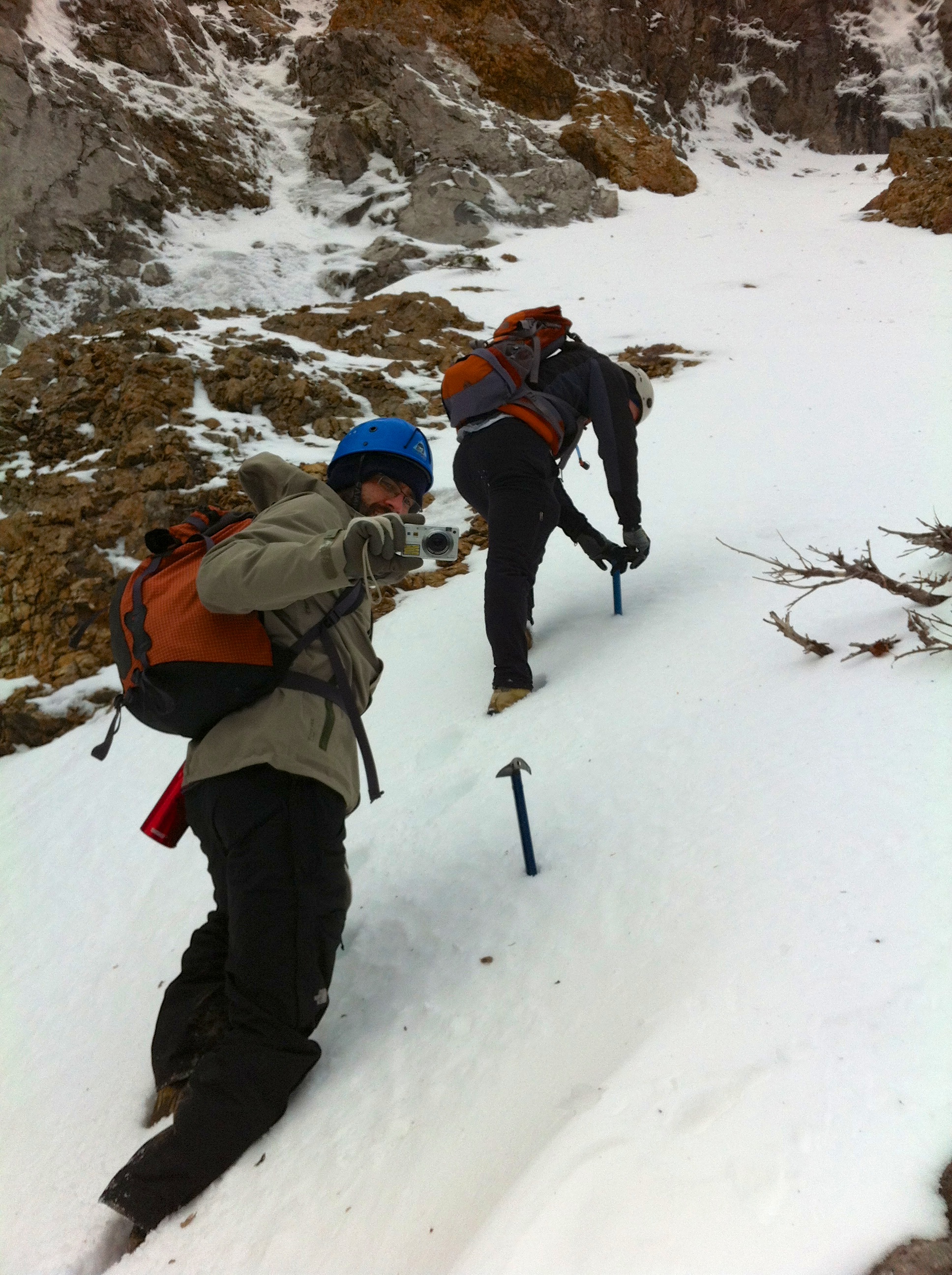
Ice axes in hand (and in sync), Brad and Dave work their way up the gully.

Sections of the gully were quite steep but the snow was in good shape for ascending.
Say cheese!

A small ice fall marks the top of the gully. We followed the base of the cliff to the right where we encountered another snow slope that took us up the short distance to the ridge.

Finally on the north ridge, Brad shows his joy of being greeted by an intense blast of wind. The summit cairn can be seen poking over the false summit in the background.

Dave is also unimpressed with the wind. From here it was only a couple of minutes to the summit.

The summit cairn of Mount McLaren. It was so windy that we didn’t risk trying to open the register.

Brad and Dave brace themselves against the wind on the summit. Mount Coulthard is on the left and Andy Good Peak is on the right.

I had to crouch to maintain my balance. Mount Parrish is behind me.

Looking southeast from the summit. Left to right: Mount Coulthard, Andy Good Peak, and Mount Parrish.

Looking southwest from the summit. From left to right: Andy Good Peak, Mount Parrish, and Chinook Peak.

Looking east from the summit. In the foreground to the right is Willoughby Ridge and immediately behind it are Hillcrest Mountain, and Turtle Mountain. In the foreground to the left is Saskatoon Mountain and, The Saddle, and in the distant centre is Robertson Peak and Tallon Peak. Bluff Mountain and the South Peak of the Livingstone Range are on the left. The North York Creek Trail is visible as the large cutline through the trees.

Looking from the summit to the northwest. From left to right: Sentry Mountain, Mount Erickson, Phillipps Peak, Mount Tecumseh, “Deadman Peak”, Mount Ward, and Crowsnest Mountain.

A telephoto of Willoughby Ridge, Turtle Mountain (left) and Hillcrest Mountain. It looks like it could be a great winter hike to the Ironstone Fire Lookout at the top of Willoughby Ridge (edit: or even to just the NW end). Tallon Peak and Robertson Peak are poking out just to the left of Turtle.

In the distance, cloud covers the summit of Crowsnest Mountain, while Dave and Brad are buffeted by the wind. Ma Butte can be seen just to the left of Dave’s pack.

Dave walks along a snow covered ridge as we leave the summit. Behind him are Andy Good Peak and Mount Parrish. Another fuzzy iPhone pic…

Not far from the summit, we are hit by incredibly intense wind gusts. Here, Brad is struck by a gust that drops him to his knees. I took these photos while I was laying on the ground. Here is some video as well.

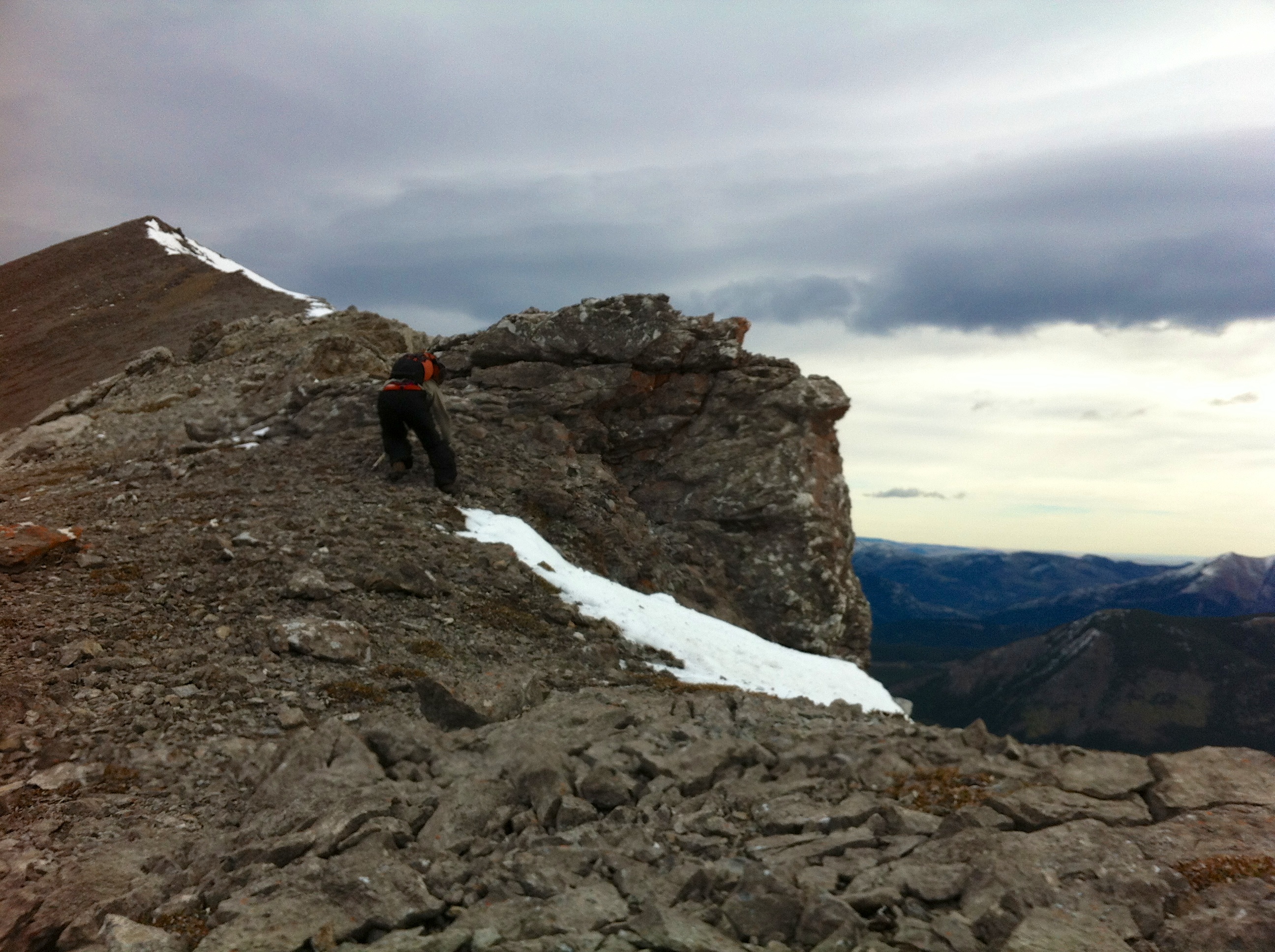
After retreating off of the south ridge, Dave and Brad search for a new route down the east slope.

Brad downclimbs a section of rock as we make our way off of the mountain.

Glad to finally be out of the wind, Dave relaxes beside the trail during our lunch break.

After hiking up the remainder of the trail and gaining more elevation, we came to the plane crash site. I think the sign may be wrong about what mountain the plane hit because Ptolemy seems a little too far away for the plane to have made it into this valley.

Crosses surround the tail section of the plane.

Another view of the tail section.

A battered wing lies in the snow as Mount Parrish looms in the distance.

Torn apart on impact, an engine sits on the other side of the creek bed.

Landing gear.

On our way back to the vehicle, Dave found a fossilized ammonite. Or maybe the ammonite found him…
One last look toward Mount McLaren. I wish we had these skies when we were on top of the mountain!


Leave a Reply