
⚠️ Hiking and scrambling are inherently dangerous activities. Please read my Disclaimer. ⚠️
I’m not sure how Ma Butte got its name, but it’s kind of fun to come up with creative stories while making the trek over from McGillivray Ridge. Peakery says that it is the 945th highest mountain in Alberta and the 2974th highest mountain in Canada. It is not difficult to ascend and any scrambling beneath the summit block can be avoided by following a route to the northwestern slopes. However, the short scramble up to the summit is a fun break from the otherwise straightforward walk from the summit of McGillivray Ridge.

After summiting McGillivray Ridge, we then walked 1.88km to the summit of Ma Butte. The only challenge is the 166m elevation loss to the base of Ma Butte and then the 177m hike to the summit. We returned the same way we came, except we didn’t want to down climb the cliffs along the Ridge, so we dipped below the summit of McGillivray and followed the slopes beneath the cliff bands to our ascent drainage. We then stuck to the north side of the drainage (what we should have done on the way up) and followed this back to the forestry clearing and then to our vehicle.

Jeff heads towards Ma Butte (foreground) from the summit of McGillivray Ridge.
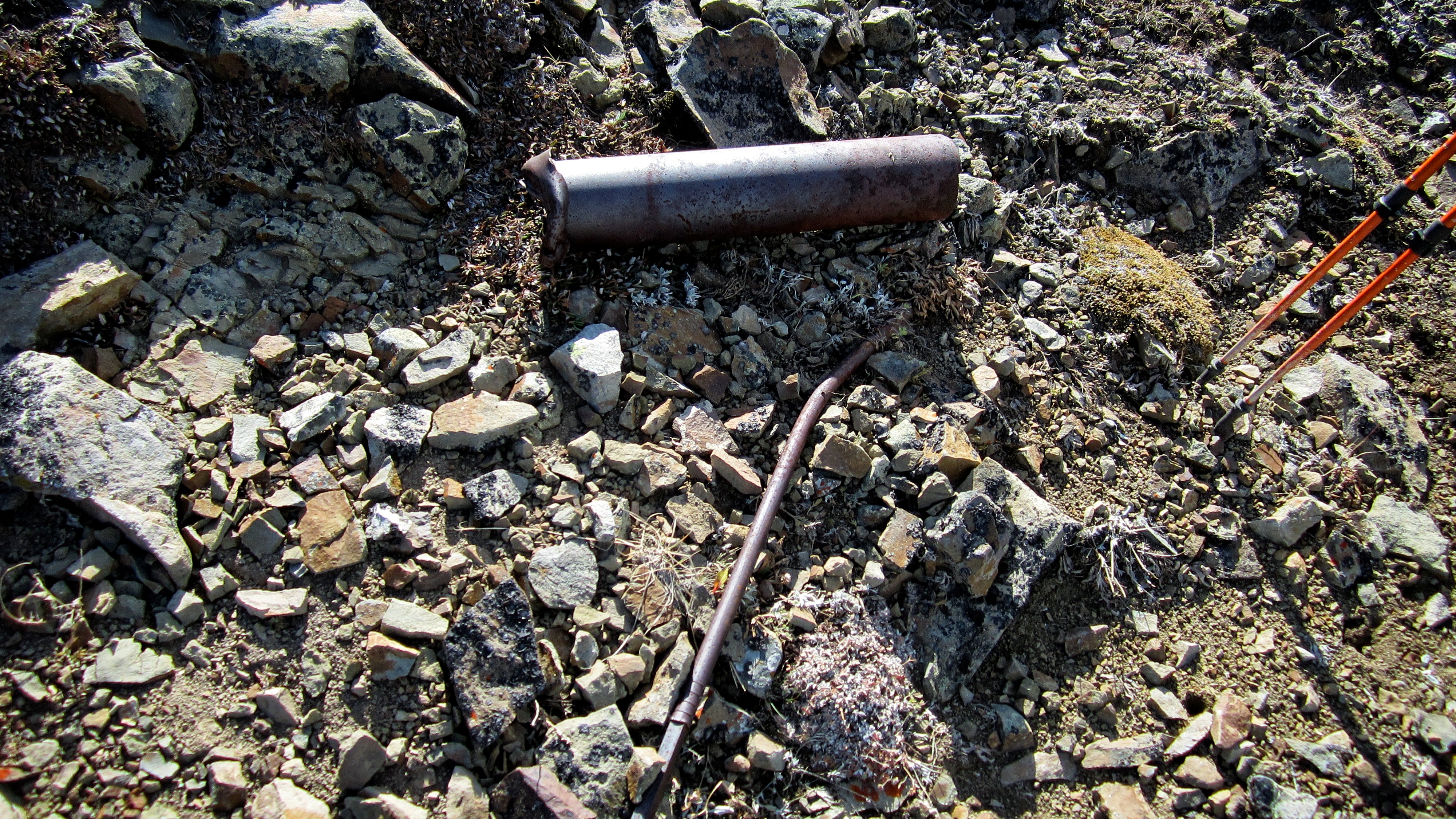
Along the way we found some interesting pieces of debris.

The biggest elevation loss occurs on the other side of the high point between the two summits.

Looking back at the summit of McGillivray Ridge from the high point.

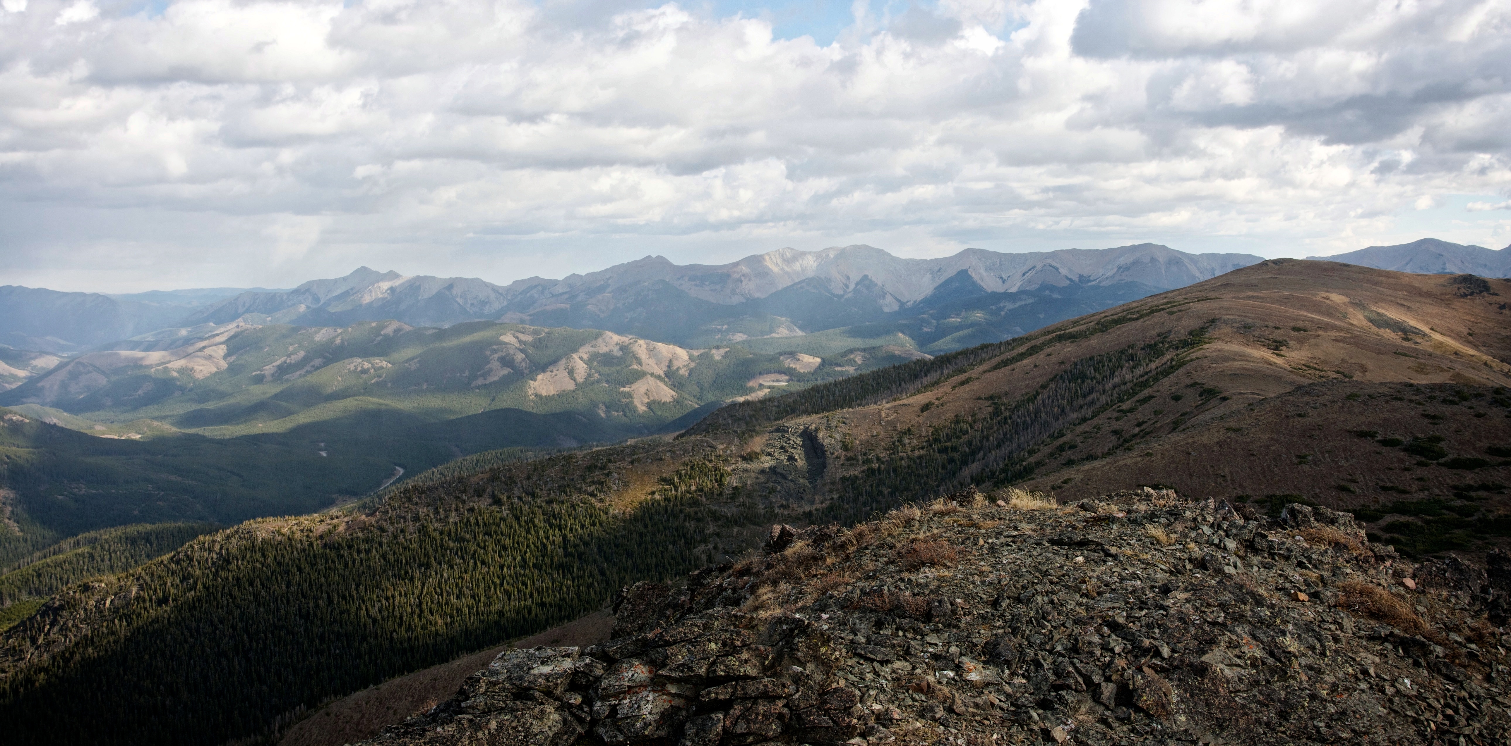
A view of the entirety of McGillivray Ridge from the high point. Turtle Mountain and Hillcrest Mountain are on the far right.
To avoid fighting through the krummholz, we trended southward as we dropped down to the col beneath Ma Butte.

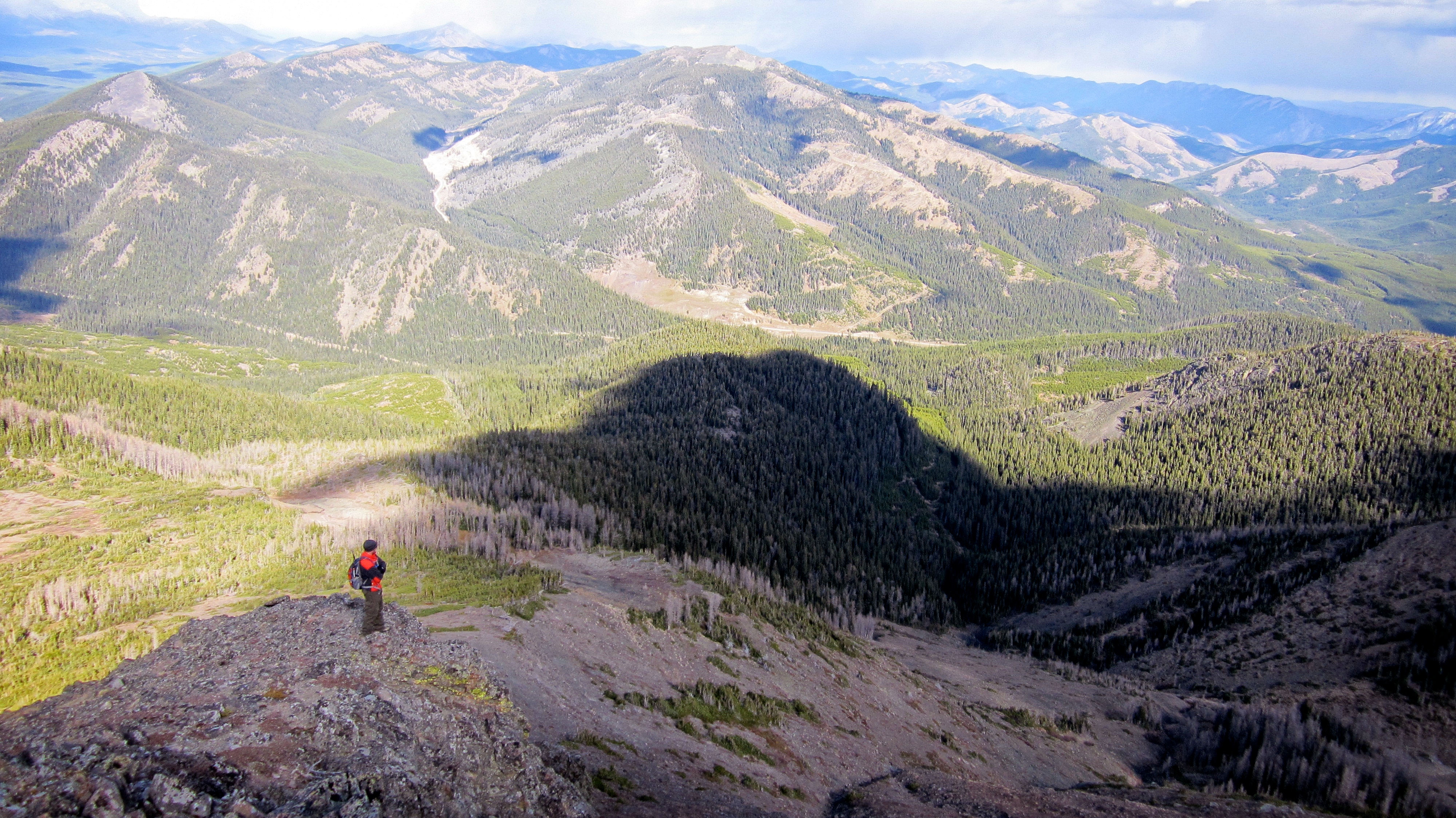
Jeff checks out the views from the high point. The summit of McGillivray Ridge is in the background.

Our path down to the col from the high point is clearly noted by the areas free of krummholz.

The terrain in the col was very moonlike. This was the view looking to the north at “Vicary Creek Ridge”.

And this was the view looking south towards “Pa Butte”.

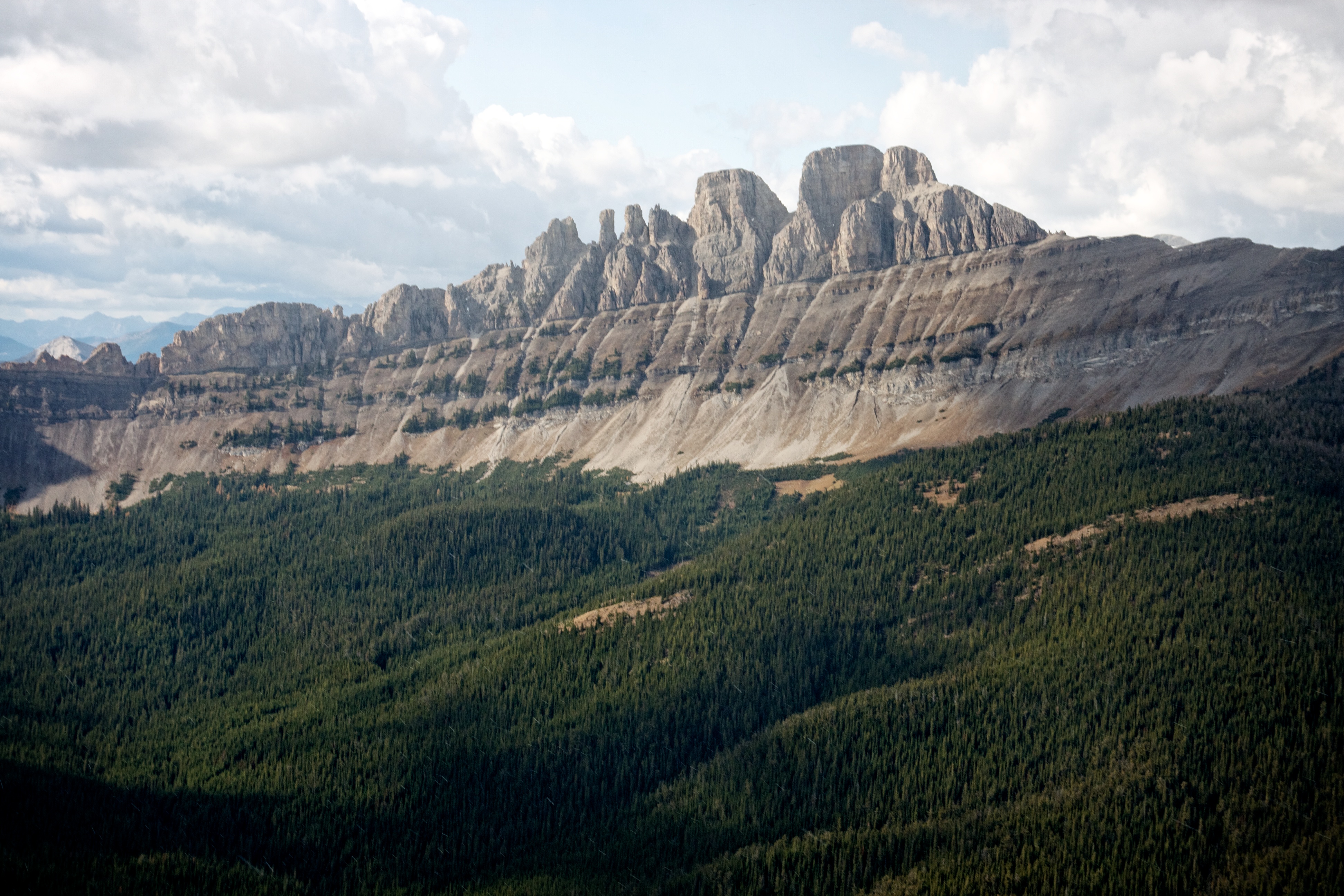
Looking up at the summit block of Ma Butte from the col.

We tackled some of the lower cliff bands head on and then followed the summit block a short distance to the west where we then found a small section that we could scramble up to the summit. To avoid all real scrambling, you could keep following the summit block to the western face and then head up from there.

Heading over a small section of rock.

Nature’s graffiti.

Tackling the summit block from this angle would be tricky.

This is the small section beneath the summit that we scrambled up.

An action shot of Jeff.

After a short reprieve from the wind while scrambling, Jeff faces it again as he reaches the summit cairn.

My GPS reading from the summit. Ma Butte is not much higher than McGillivray Ridge, but it’s much more impressive in appearance.

The summit provides a stunning view of Crowsnest Mountain and the Seven Sisters.

The view to the west from left to right: Allison Peak, Window Mountain, Mount Ward, and Racehorse Mountain.

Looking to the northwest as snow squalls begin to sweep across the valley. The weather would begin to deteriorate from this point on. Racehorse Mountain is on the left.

The view north. The little mountain in the foreground is “Vicary Creek Ridge”. Thrift Peak and Thunder Mountain are on the right.
Looking east at the Livingstone Range. Thunder Mountain is on the left and “Lightning Peak” is in the centre. The summit of McGillivray Ridge is in the foreground.

The entire length of McGillivray Ridge is visible in this picture, as are Centre Peak and the South Peak of the Livingstone Range.

The view to the southeast. Bluff Mountain, Turtle Mountain, Hillcrest Mountain, Willoughby Ridge, “Pa Butte”, Wedge Mountain, Saskatoon Mountain, Mount Coulthard, Mount McLaren, Andy Good Peak, Mount Parrish, and Chinook Peak are visible.

A more southward view of the previous picture. It is also possible to ascend Ma Butte by following the southern ridge pictured in the foreground. To do this, I think you would have to follow the ATV trail that leads from the base of Wedge Mountain.

Jeff stands on the scenic summit of Ma Butte.

Thankfully, the wind gusts didn’t knock my camera off of the rock it was sitting on.

A telephoto of Crowsnest Mountain from the east. This view is not seen by as many people as the views from the west and the south.
The Seven Sisters from the summit.

Since the wind was so intense, we had to duck below the summit for some shelter while we ate lunch.

Here comes the snow…

Jeff looks for a summit register but finds only…

…somebody’s old boot. Somewhere out there, is someone with a very interesting tale to tell and a foot full of callouses. Perhaps this was the scene of an old fashioned butte kicking? Or maybe someone needed a kick in the butte to get off of the mountain? Maybe Ma had something to do with this? 😉

Looking to the southeast at Bluff Mountain as the sky grows dark.

One last view of Crownest Mountain and the Seven Sisters before it was time to head home.
Jeff takes in the views to the north from just below the summit.

From the same location, Jeff snapped this cool shot of me on the summit. The short section we scrambled up is in the centre but on our way down we skirted around it by using more gradual slopes to the northwest. (Photo by Jeff Lang)

After a sound butte kicking, Jeff makes his way off of the mountain.

Heading back to the summit of McGillivray Ridge from Ma Butte.

Tagging the summit of McGillivray Ridge for the second time that day.

We returned the same way we came, except we didn’t want to down climb the cliffs along the Ridge, so we dipped below the summit of McGillivray and followed the slopes beneath the cliff bands to our ascent drainage. We then stuck to the north side of the drainage (what we should have done on the way up) and followed this back to the forestry clearing and then to our vehicle.

For some portions of the trip back, we ventured into the drainage itself…

… however, travel was much easier along the north bank.

There is a well used animal trail that crosses the creek near the bottom right hand corner of this picture. We took this and followed it a short distance through the trees until we reached the forestry clearing that can be seen in the centre of the picture.

Travel across the clearing was not difficult.

Despite looking intently for several hours and even using a makeshift blind, we could find no sign of any Smurfs. 😉

Looking back at McGillivray Ridge from the entrance to the clearing as dark skies rapidly begin to move in from the northwest.

Just as we reached our vehicle, the rain started pouring down. Talk about impeccable timing! Had we stuck with our original destination for the day, I’m not sure we would have escaped the rapid weather change. McGillivray Ridge and Ma Butte are fun destinations that provide stellar views of Crownest Mountain and the Seven Sisters. On a non-windy day, walking the entire length of McGillivray Ridge would definitely be a fun adventure, however, I’m glad that we chose this alternate route which minimized both time and distance – not to mention exposure to the wind.


Leave a Reply