
⚠️ Hiking and scrambling are inherently dangerous activities. Please read my Disclaimer. ⚠️
After summiting Mount Haig and enjoying its panoramic views, it was time to make the ~3.16 km trip over to the summit of Gravenstafel Ridge. This pyramid-shaped mountain is named after the first of four battles which comprised the Second Battle of Ypres in WW1. On April 22 & 23, 1915, the untested First Canadian Division experienced its first major engagement as it fought to stop a rapid German advance through French lines near the town of Ypres in Belgium. The Germans had gained their advantage through the use of a deadly new weapon – chlorine gas . The horrifying result was the decimation of thousands of French troops through asphyxiation. The Canadians, who were positioned to the right of the French, moved in to fill the gap, and despite undergoing repeated gas attacks and artillery bombardments, staged an obstinate defence despite suffering heavy casualties. The Canadians were able to hold out long enough to allow British reinforcements to arrive and save the town of Ypres, and ultimately, protect French ports on the English Channel. The Second Battle of Ypres forged a reputation for the Canadians as a brave and tenacious fighting force. It also inspired Lt. Colonel, John McRae, of the First Canadian Division, to pen the poem, ‘In Flanders Fields’ based on his experiences during combat at Ypres, in particular, the death of his close friend.

From the summit of Mount Haig we retraced our route to the col (~1.8 km). From here, we hiked and scrambled ~300 m up the southern end of Gravenstafel Ridge to the summit. Since we were conscious of the time, we descended in as direct a line as possible, first following the Red Chair and then the Blue Chair to the base of the mountain.

The summit of Gravenstafel lies ~3.16 km from the summit of Mount Haig. The distance from the col to the summit is ~1.4 km which we were able to do in 45 minutes.

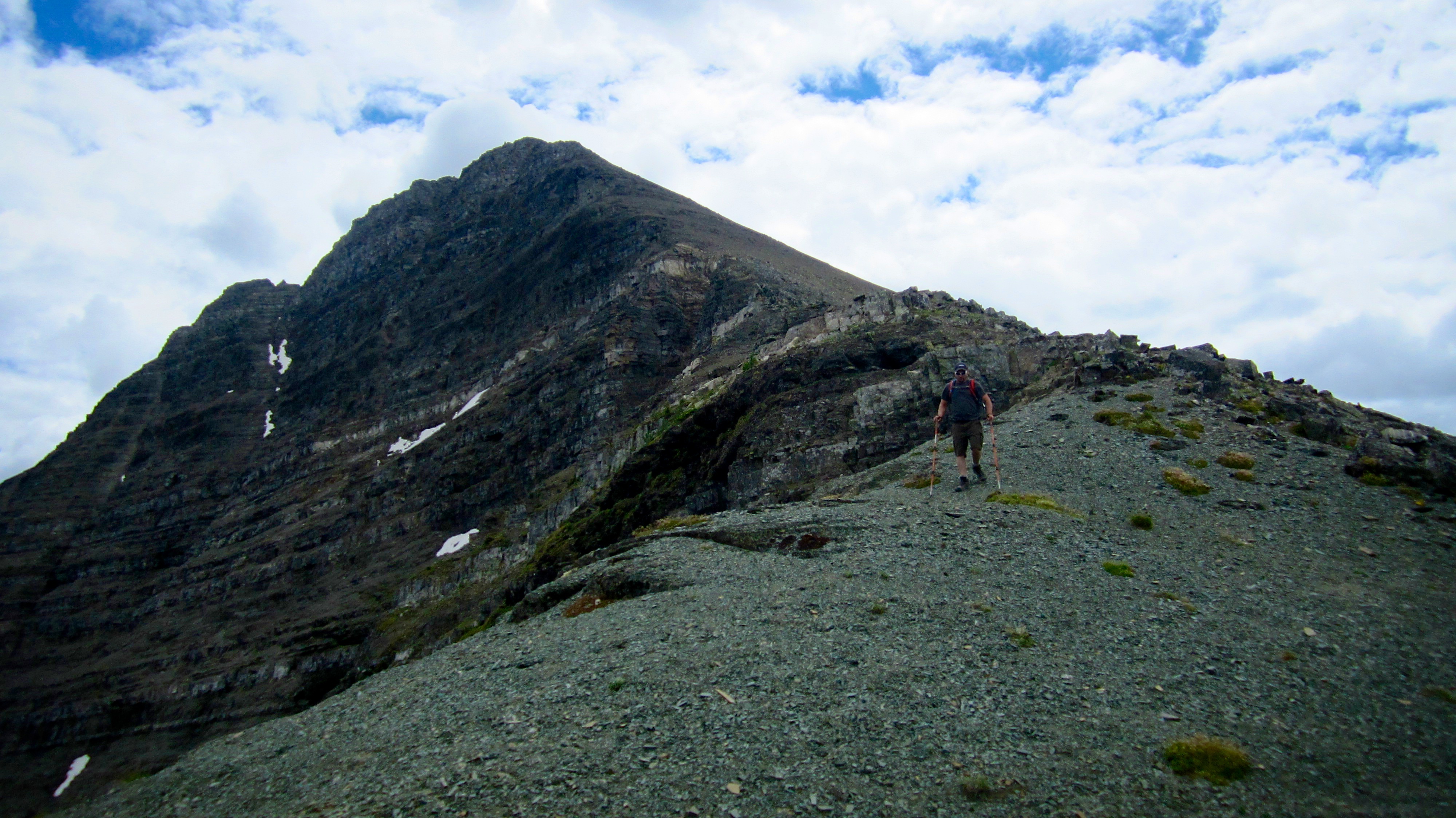
On the way from Mount Haig to Gravenstafel Ridge.

Looking down at Haig Lake from our vantage point along the ridge. Even from this angle, it still reminded me of a laughing skull.
Our descent off of Haig was quick and within 30 minutes we were nearing the end of the ridge.

The ski hill may have closed early this year, but that didn’t stop us from trying to get in one last run. (Photo by Jeff Lang)
 Looking north from the top of the ridge towards Gravenstafel Ridge (right) and the 1st and 2nd peaks of Syncline Mountain.

Looking westward at St. Eloi and the Syncline Brook Valley as we descend back to the col.

We carefully made our way down. It was a loss of ~188 m from the ridge to the col. (Photo by Jeff Lang)

Looking back to the ridge on Mount Haig from the col.
 Looking up at Gravenstafel Ridge from the col. Reaching the summit required gaining another ~300 m in elevation.

Despite the elevation loss and gain, Jeff and I enjoyed the frequent opportunities to scramble. (Photo by Jeff Lang)

Looking south towards Mount Haig from the slopes of Gravenstafel Ridge.

I thought that this might be the summit…
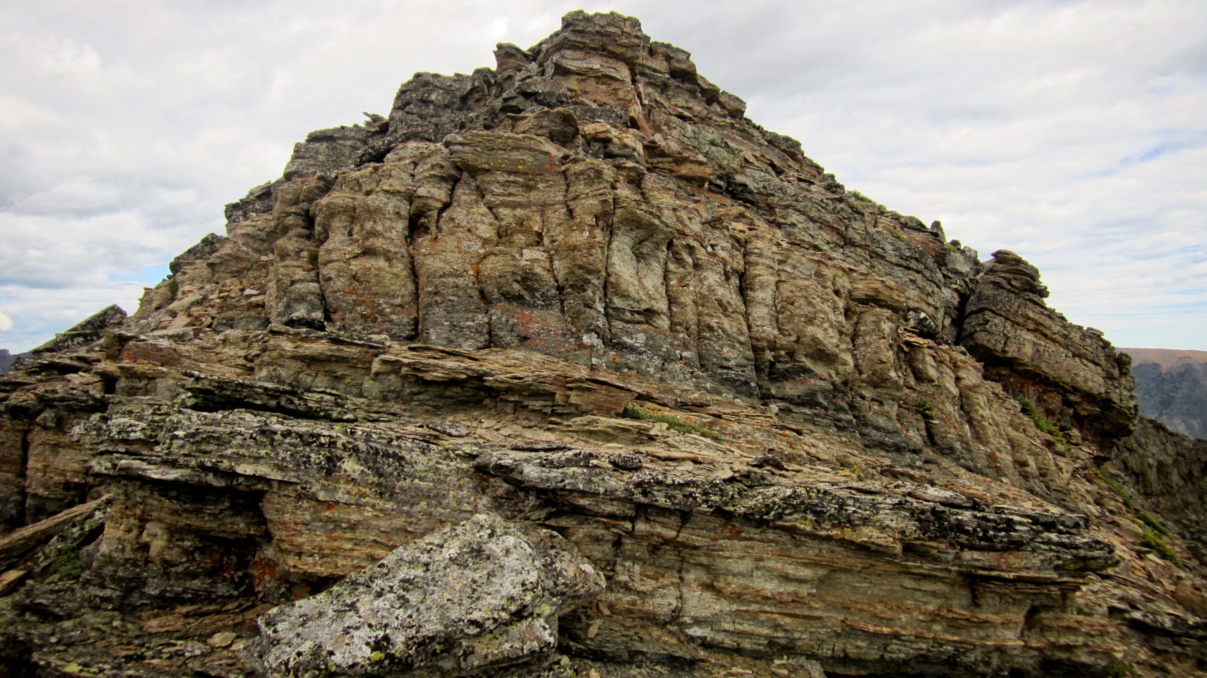
…but it was only a false summit. It did however, provide some us with some fun.

After reaching the top of the false summit, the true summit was only a short walk away.

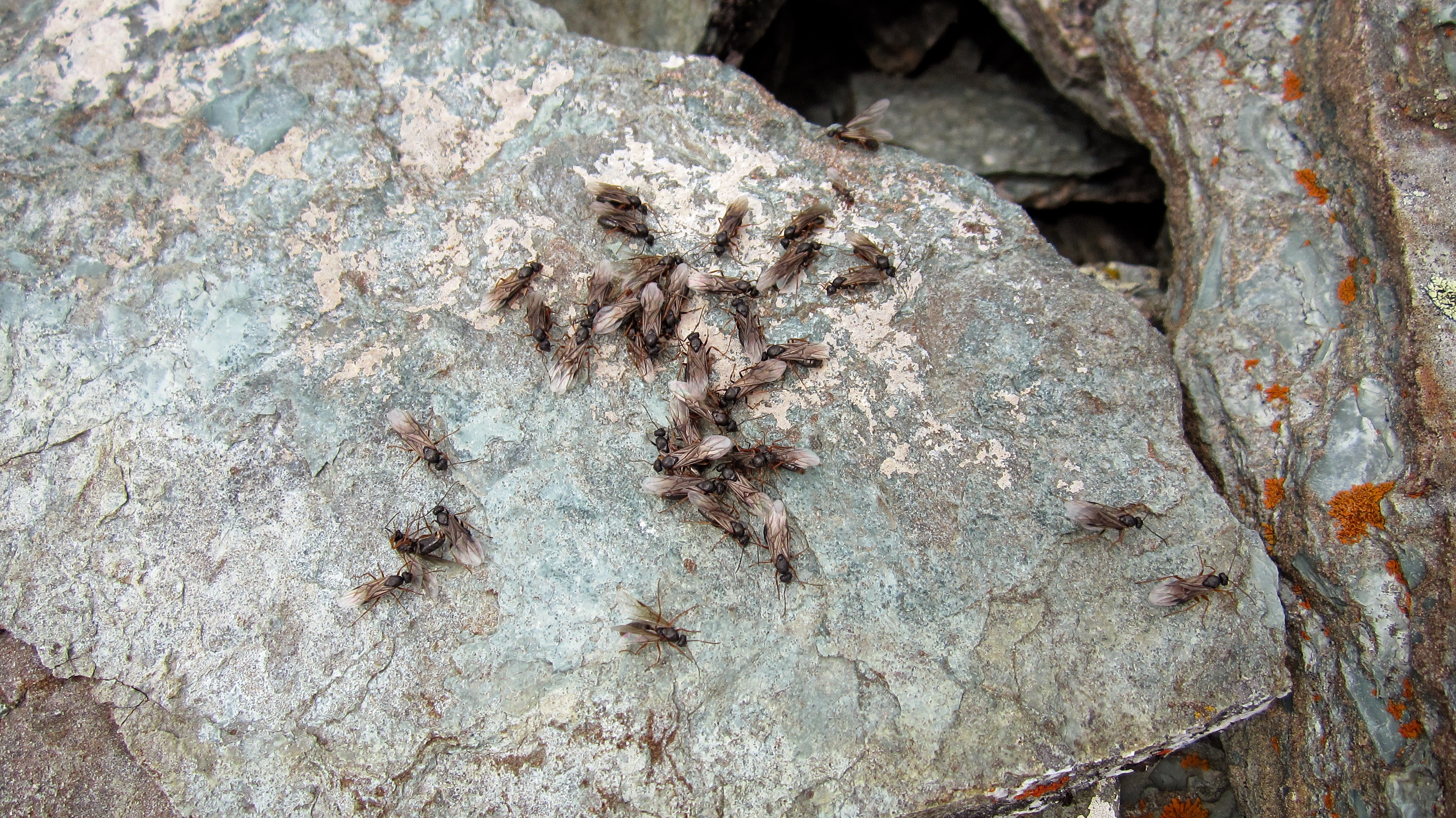
Curiously, the summit of Gravenstafel is also marked by twin cairns, though they are rather small compared to the structures on Mount Haig. What was even more bizarre was that the summits of both Mount Haig and Gravenstafel Ridge were home to hundreds of flying ants who only seemed to live inside the cairns and nowhere else. Gravenstafel in particular, hosted a rather large and bothersome swarm.

Looking east at Southfork Mountain and Barnaby Ridge from the summit.
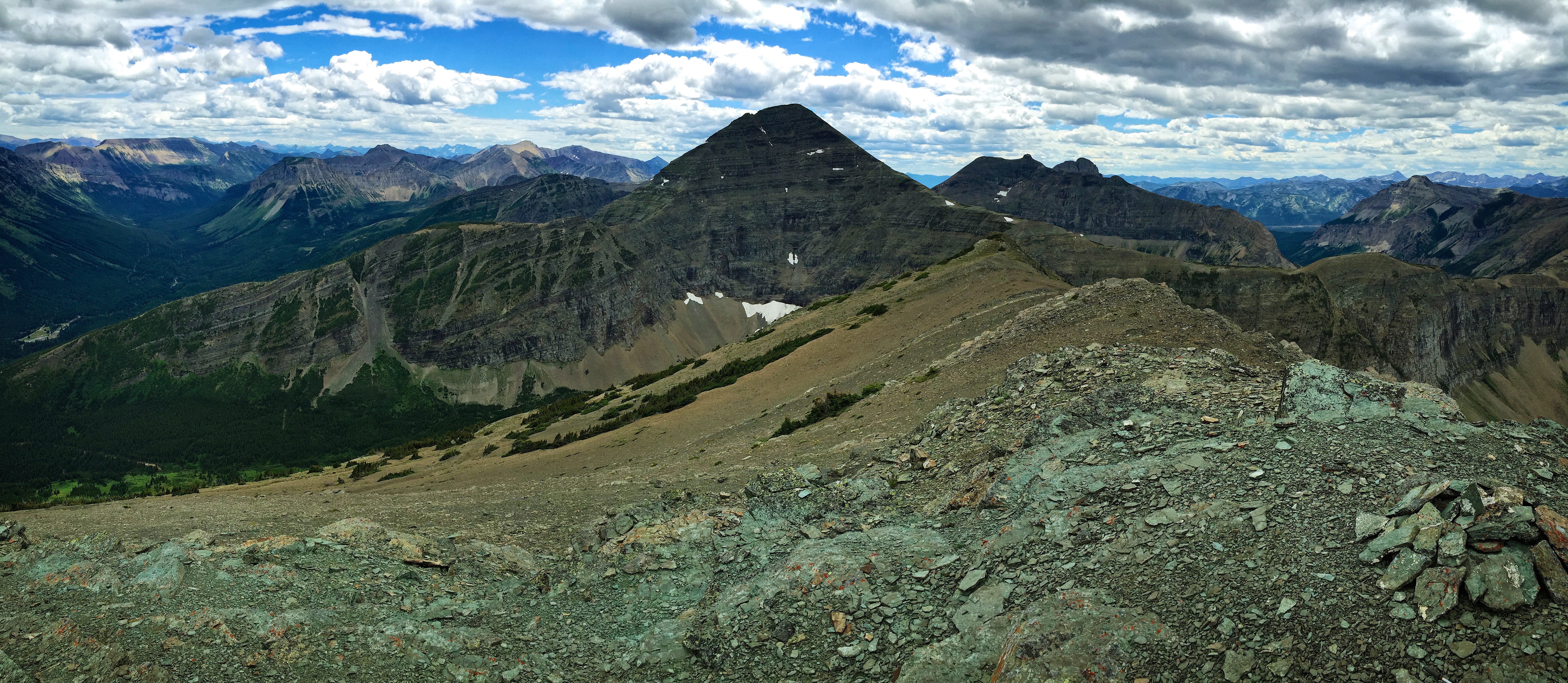
The view to the south is dominated by Mount Haig. To the left of Haig is Lys Ridge, Rainy Ridge, Three Lakes Ridge, and Scarpe Mountain. Visible to the right of Haig is the summit of Tombstone Mountain.

Looking west across the Syncline Brook Valley at St. Eloi – which is also named after a WW1 battle (1916).

Looking NW at the 1st and 2nd peaks of Syncline Mountain. The summit of Mount McCarty can also be seen to the left of centre.

The view to the north, where in the distance, Carbondale Hill, Maverick Hill and Mount Backus can be seen.

Jeff tolerates the flying ants only long enough to have his picture taken. I’m hoping the one which went inside his ear didn’t lay any eggs…

On the summit of Gravenstafel Ridge (2391 m).
“I for one, welcome our new ant overlords.” – Kent Brockman, The Simpsons. Maybe they were excited that Ant Man was a hit at the box office?

I wasn’t kidding when I said that Jeff only tolerated the flying ants long enough to have his picture taken. He booked it off the summit in record time.

Heading down from the summit to the top of the Red Chair.

I asked the lift operator to be a deer and let us ride down, but she refused.

Since we were descending beneath the chair lift, we kept a sharp eye out for any treasures that may have been lost during the ski season. However, the only thing of interest that we found was a working lighter.

Looking back at the summit of Gravenstafel Ridge.

After reaching the bottom of the Red Chair, we then headed over to the Blue Chair.

The final stretch to the bottom. It’s extremely hard to see (I mean get the magnifying glass out), but there is a small black face poking up from the patch of huckleberrys about half way down on the left side. It wasn’t long after we had reached the first blue pole in the picture, that we scared a young black bear away from his dinner of berries. Sorry Mr. Bear and sorry to the group of people at the bottom who told us that they had been watching the bear through their binoculars – until we scared it off.

Not long after we scared the bear away from his dinner, a grouse turned the tables on us and tried to scare us away from her chicks.

The main lodge at Castle Ski Resort.
 After a roundtrip time of exactly 7 hours and 12.3 km, we arrived back at my snappy 4th generation 4Runner. This was a great trip to two destinations that were long past due for a visit.


Leave a Reply