

⚠️ Hiking and scrambling are inherently dangerous activities. Please read my Disclaimer. ⚠️
I feel like I should have hiked Saint Eloi years ago, but for some reason, it had dropped off my radar until Andy and I made a trip to “Sapper Peak” and Saint Eloi SW1 in 2023. Since then, Saint Eloi has felt like the missing piece to a puzzle; though it still wasn’t at the top of my list for new ascents. If the opportunity arose, I’d gladly take it, but since most of my friends had already tagged it, I’d resigned myself to the reality that Saint Eloi would be a solo trip.
However, as luck would have it, when Andy and I were trying to decide on a trip for today, I threw in Saint Eloi as a Hail Mary suggestion – fully expecting Andy to graciously decline. After all, he’d hiked it back in 2006 and further outlined the route in, More Scrambles in the Canadian Rockies 3rd Edition (pages 148-149). Yet to my pleasant surprise, Andy was enthusiastic about the opportunity. For him, this would be a great chance to update his information should the much anticipated, 4th Edition of More Scrambles, come to fruition. 🙂
It was unseasonably warm as we set off along the Syncline Brook trail towards Saint Eloi. We’d brought along ice axes and crampons just in case there was lingering snow, but none of it was needed. In short, there’s nothing difficult about Saint Eloi; it is however, a long slog that’s made worse by how foreshortened the terrain is. Once you leave the drainage to gain the connecting ridge between Peak 2 of Syncline Mountain and Saint Eloi, the elevation gain is unrelenting – especially under the hot sun. Once on the ridge, there is an elevation loss then gain to a high point, followed by an 80 m elevation loss to reach the col with the summit. The ~820 m (300 m elevation gain) grind to the summit is soul-sucking and weirdly, whenever the grade looks like it might ease, it actually gets steeper.
Aside from More Scrambles, perhaps the most valuable information on Saint Eloi comes from Bob Spirko’s 2007 trip, where he and Dinah documented the hellish experience they had after descending via a second drainage that is located on the southeast slope of the col beneath the summit. Now that I know what I’m talking about, the thought of having to regain elevation back and along the ridge after the grind up to the summit makes this drainage look EXTREMELY tempting to use for descent – and by this, I mean that it beckons you with all the power of a siren’s call.
However, thanks to Bob’s information and then the subsequent experiences of Vern Dewit (2008), So Nakagawa (2013), Sonny Bou (2018), and finally, All Stone Adventures (2018), both Andy I knew that despite how tempting it was to drop into the drainage, it was not worth the adventure that followed. I’ll say it again, the drainage is alluring when you’re in the moment and the mere thought of trudging up the high point is demoralizing, but don’t give in. We were REALLY, REALLY tempted to use it despite knowing the peril, and the only reason we were able to resist was the recent memory of our descent off Darrah SE4.
Instead, we’d follow Par Boora’s lead and retrace our approach along the ridge, and like Par, avoid regaining the high points by traversing around them. Surprisingly, this saved a pile of time and energy; allowing us to have a relatively quick egress off the mountain. In fact the minimal elevation gain required to traverse around the entirety of the high point is remarkably easy for tired legs. Bypassing the next high point is also quick and easy, so don’t be deceived by the Valley of the Sirens…
Finally – and I’ll borrow this from my “Sapper Peak” report – I’ll note that the mountain’s name centres on the 1916 Battle of Saint Eloi Craters where an unprepared 2nd Canadian Division received their first combat experience and where both the Allies and Germans began optimizing the use of sappers to tunnel under enemy trenches to detonate mines. The Saint Eloi actions began after British sappers detonated six mines under the German trenches in a massive explosion that was said to be heard in England. (source) The resulting craters deeply pitted the landscape and is where the ensuing battle took place, first between the British and the Germans, and then with Canadians in relief of the British. These craters were up to 15 metres deep and filled with mud and water. In short, it was a nightmare scenario where the inexperienced Canadians found themselves exposed to both small arms fire and constant shelling. In the end, the Germans remained in control of the battlefield while the Canadians suffered 1373 casualties. (source)
Private Donald Fraser of Calgary related the following experience of being shelled while holding a defensive position inside a crater: “When day broke, the sights that met our gaze were so horrible and ghastly that they beggar description. Heads, arms and legs were protruding from the mud at every heard and dear knows how many bodies the earth swallowed. Thirty corpses were at least showing in the crater and beneath its clayey waters other victims must be lying killed or drowned. A young, tall, slim English lieutenant lay stretched in death with a pleasant, peaceful look on his boyish face. Some mother’s son, gone to glory.” (source)
A huge thanks to Andy for repeating yet another trip on my behalf and also to my fellow hikers who freely documented their experiences. Thanks for taking one for the team! 🙂
Be sure to read Andy’s excellent trip report!
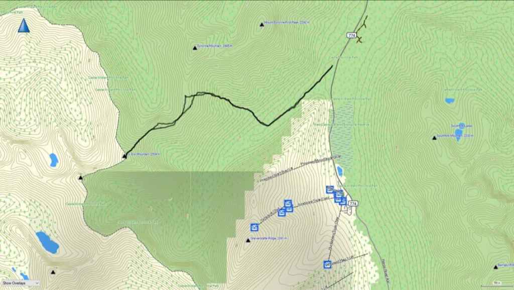
To get to Saint Eloi, we drove south from the hamlet of Beaver Mines on Highway 774 for ~21 km until we came to the parking lot for Syncline Brook on our right. This was our starting point.
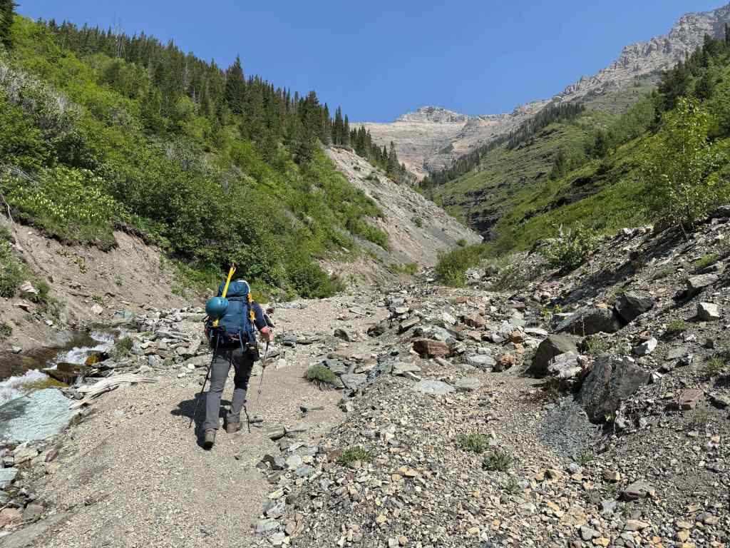
From the parking lot, we followed Syncline Brook trail for ~1.9 km until we came to an old bridge at the start of a large drainage. When then followed the drainage west and towards the connecting ridge with Saint Eloi for ~1.2 km until we could see an overgrown gully on our left.
Instead of entering the gully itself, we ascended the ridge located to climber’s right of the gully as this looked to offer relatively little bushwhacking compared to the drainage. After leaving the drainage, we gained the ridge and proceeded to follow its mostly open slopes until we reached the connecting ridge. For reference, from the drainage to the ridge it was ~1.2 km with an elevation gain of 530 m. In total, from the trailhead to the ridge, it took us 2 hours and 30 minutes.
Once on the ridge, the ~2 km route to the summit of Saint Eloi was straightforward. However, there were two elevation losses to overcome. The first was a 65 m elevation loss from the ridge to the col with the first high point. Then, after gaining 100 m to the top of the high point, we had to lose 80 m to reach the col with the summit.
From the col, it was a ~820 m (300 m elevation gain) slog to the summit. We returned the way we came except we traversed around the south side of the high point to avoid ascending it. We then avoided reascending the initial loss in elevation by again traversing beneath the ridge. From here, we rejoined our ascent route and retraced our steps back to the trailhead.
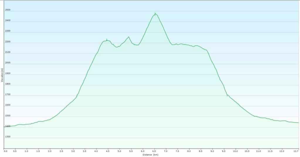
Our total roundtrip distance was 13 km with a total elevation gain of 1274 m and a total roundtrip time of 7 hours and 40 minutes. For reference, it took us 2 hours and 30 minutes to reach the connecting ridge from the trailhead and 4 hours and 40 minutes (1232 m elevation gain) to reach the summit from the trailhead.
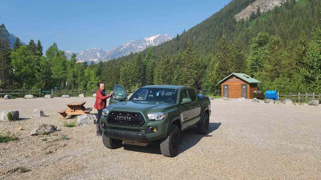
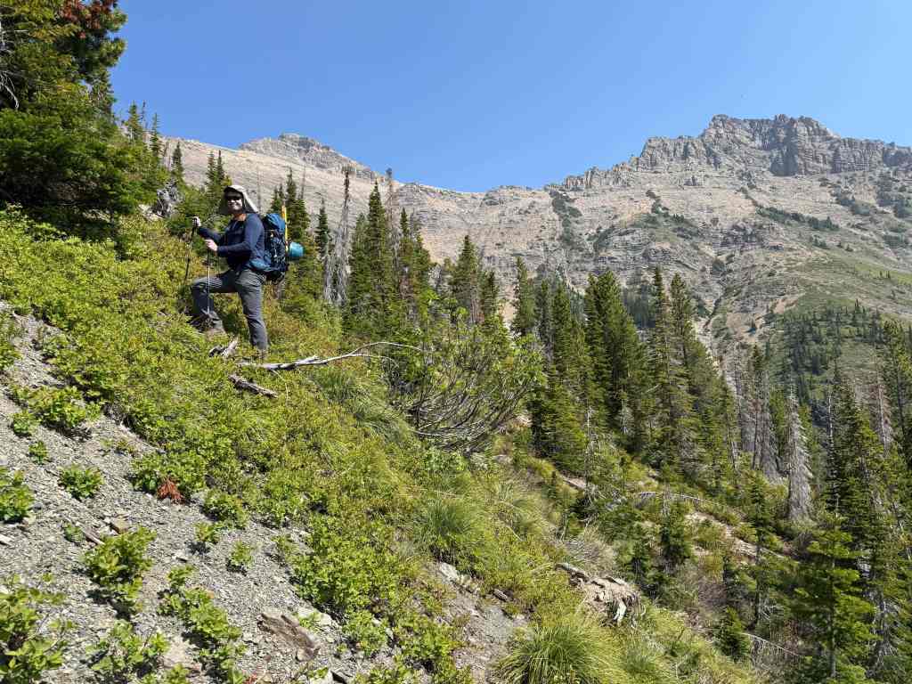
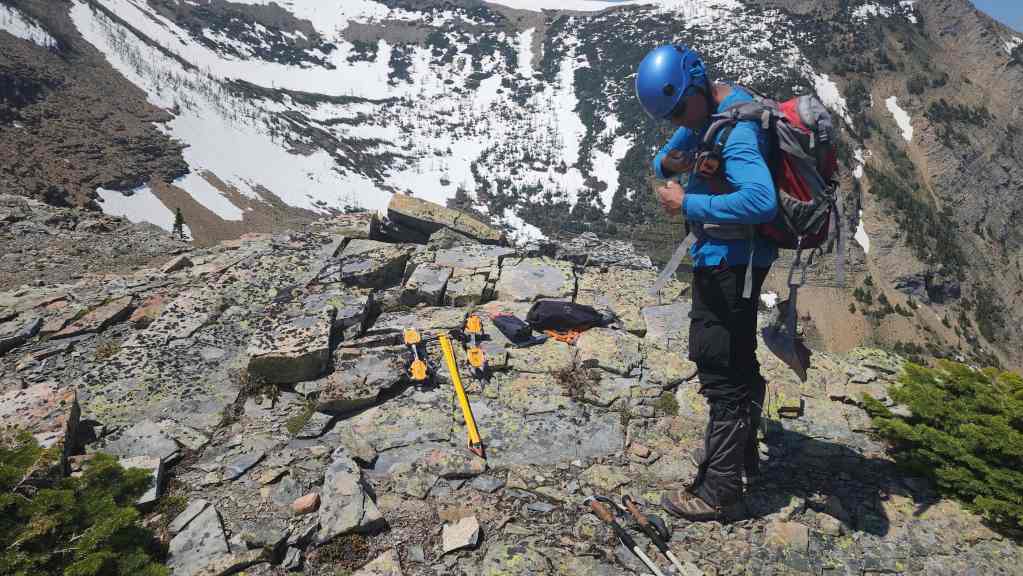
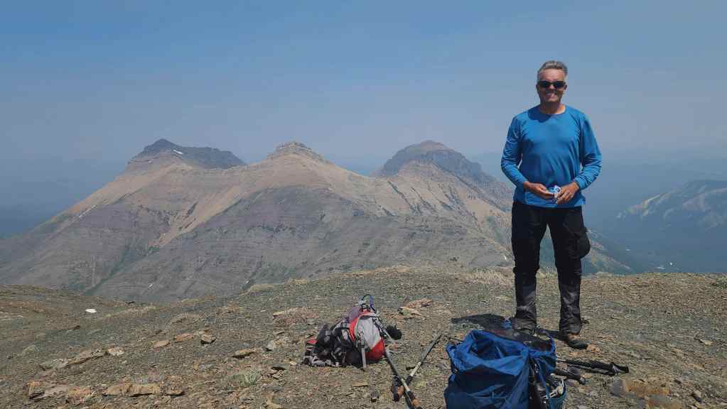
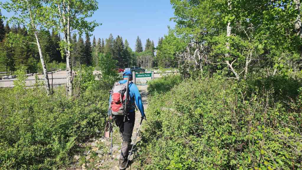
Gearing up in the Syncline Brook parking lot. The summit of Saint Eloi is in the distant centre.

The last time I used the Syncline Brook trail, the surrounding area wasn’t designated as a provincial park, so I was curious to see what improvements had been made. The gate was a certainly a fancy addition.

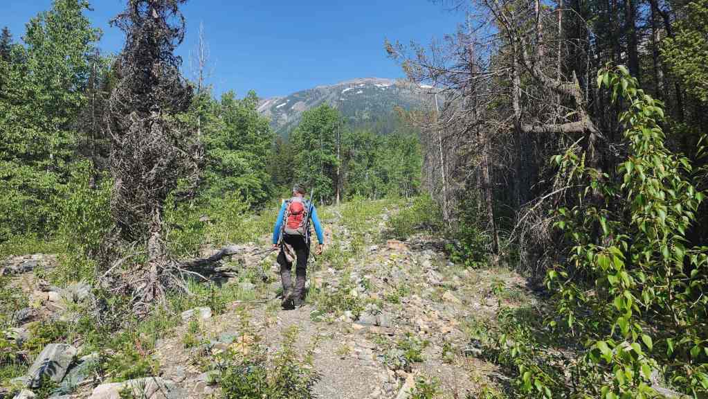
Starting down the trail.

Weirdly, the trail actually improved once it left the Park boundary…
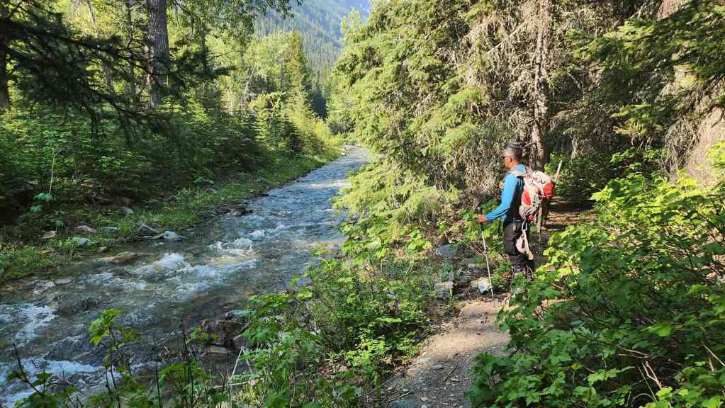
Andy pauses alongside Syncline Brook.

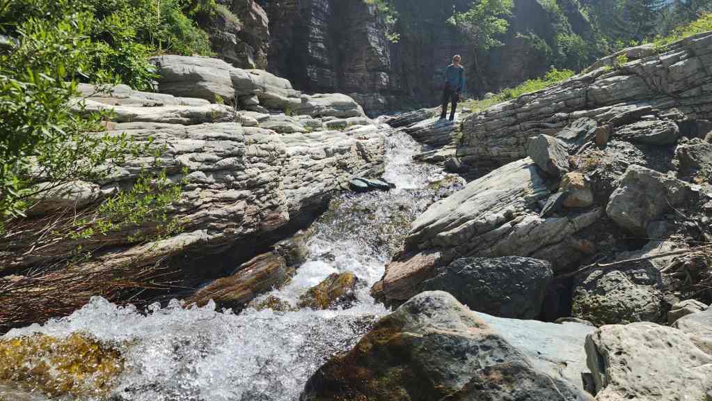
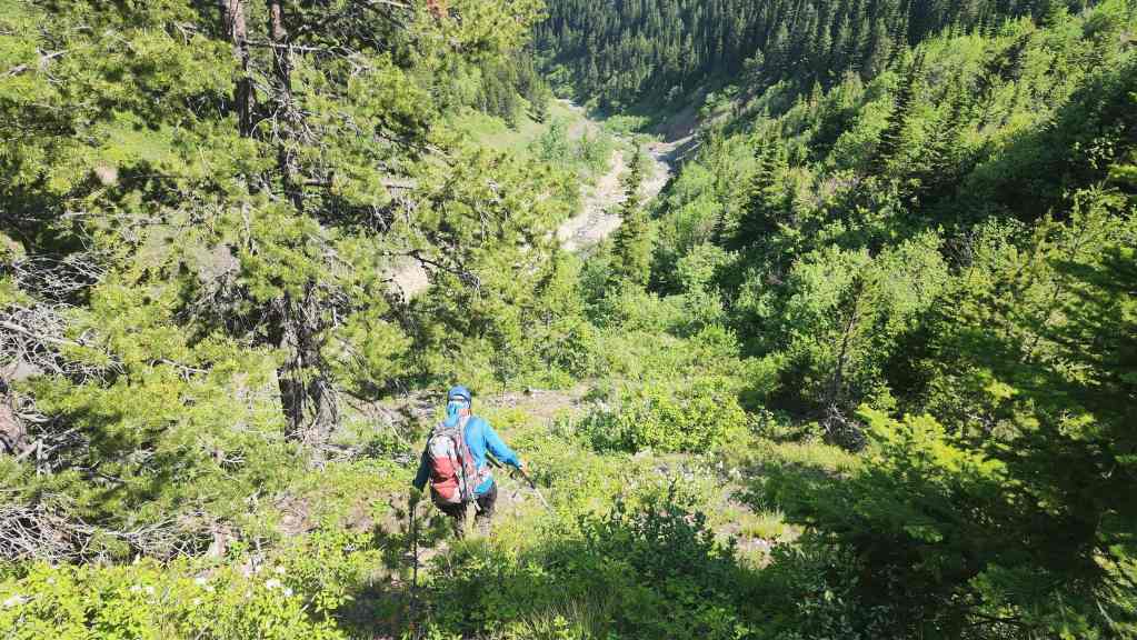
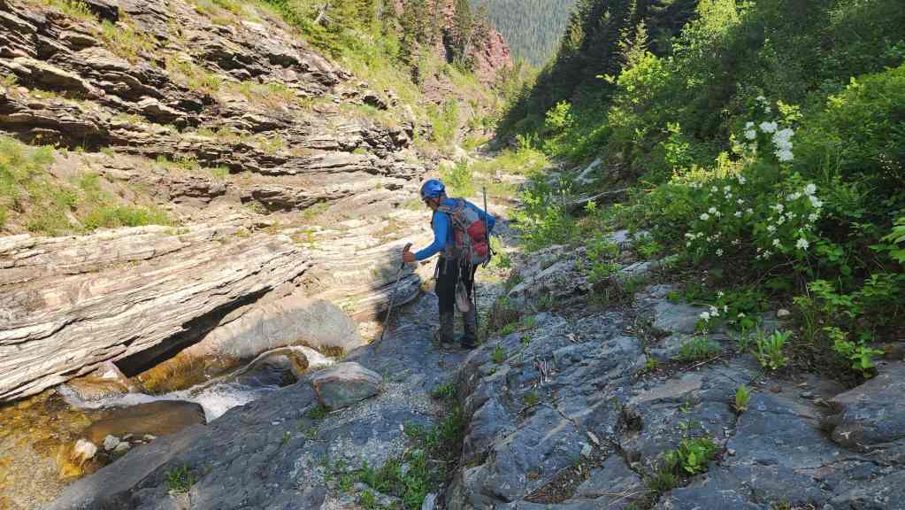
Approximately 1.9 km from the trailhead, we came to the drainage that we’d use to access the connecting ridge between Peak 2 of Syncline Mountain and Saint Eloi.
Andy leads the way as we start up the drainage. The connecting ridge is directly in front of us.

This was the same drainage that we used in 2014 to descend from Peak 2 of Syncline (centre). (Photo by Andrew Nugara)
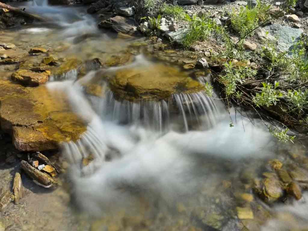
The first of several excellent – and pastoral – waterfall photos by Andy. (Photo by Andrew Nugara)

The drainage soon narrowed. One thing that I remembered from 2014, was coming across black fossil-like rock, so I kept an eye out for it.
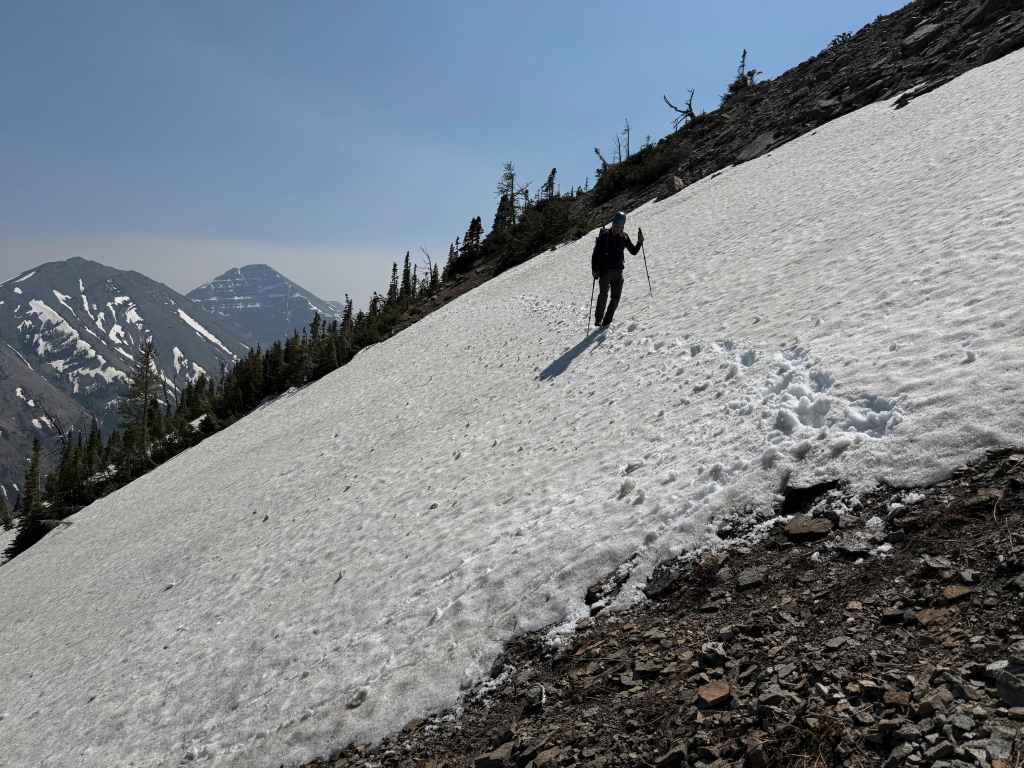
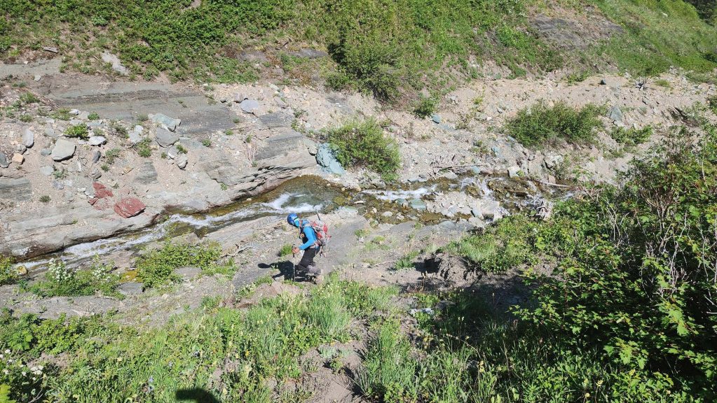
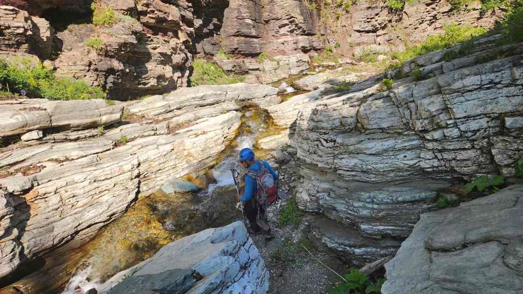
We ended up having to cross the creek several times, but the water volume was low enough that we could easily step across. We also weren’t sure how much lingering snow there was in either the drainage or on the mountain, so we were also packing ice axes and crampons. Who doesn’t like carrying needless weight up a mountain. 😂 (Photo by Andrew Nugara)
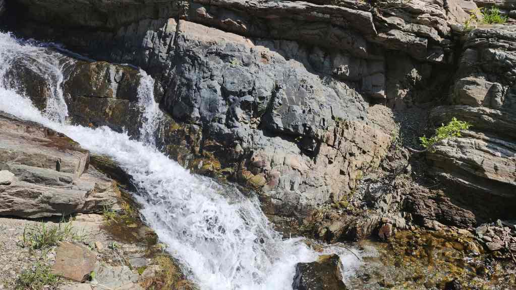
Another cool waterfall. (Photo by Andrew Nugara)
My view back from the previous photo.
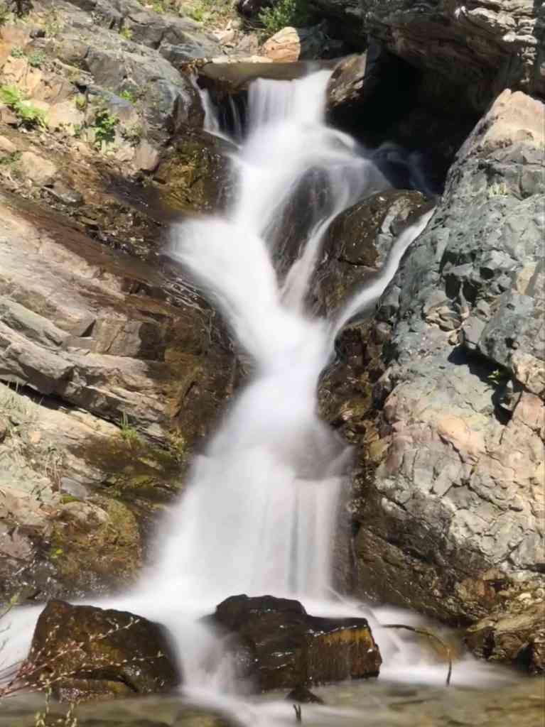
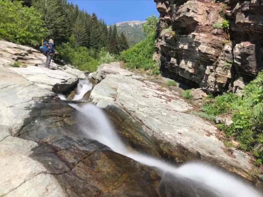
This was the most impressive waterfall. (Photo by Andrew Nugara)
Ah ha! There’s the fossil-like rock!
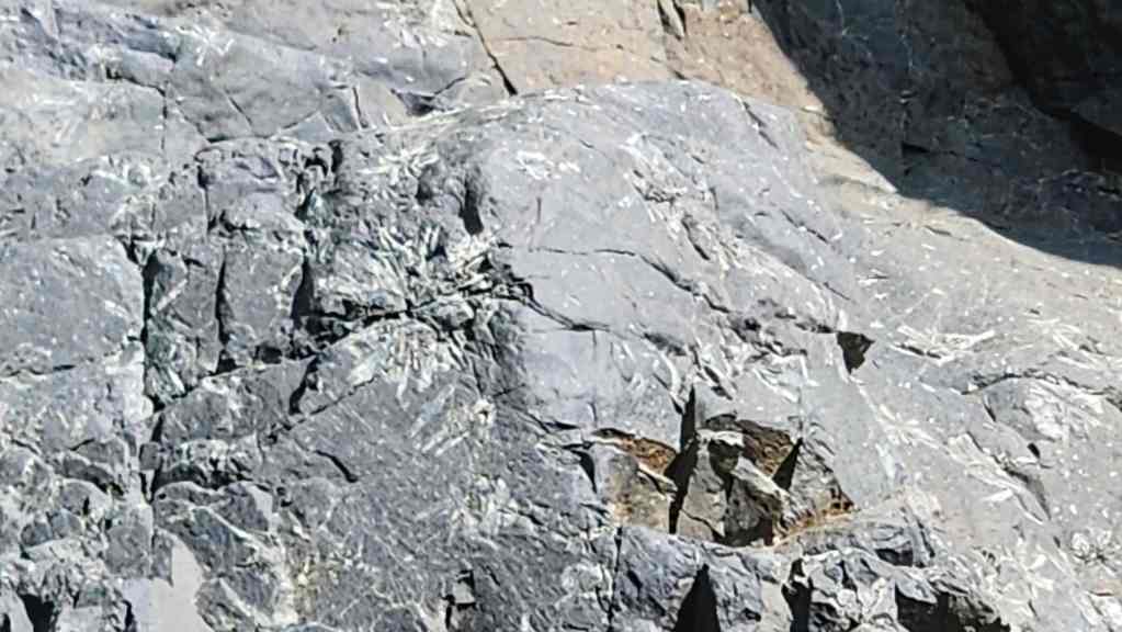
It was on the opposite bank…
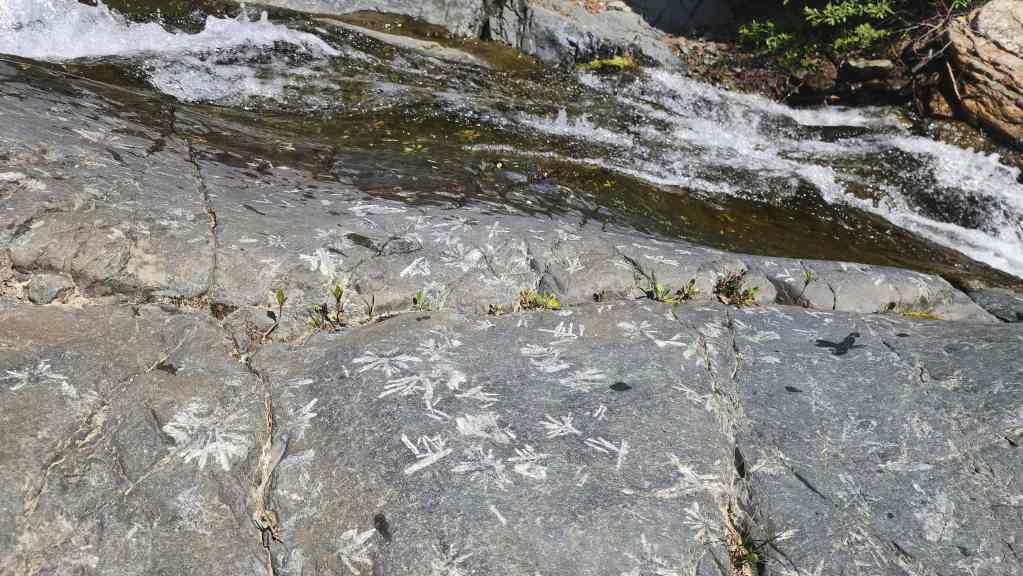
And also under my feet. I believe this rock is called, snowflake porphyry, which is a form of basalt that features feldspar crystals in a snowflake pattern. It’s also called, ‘flowerstone’.
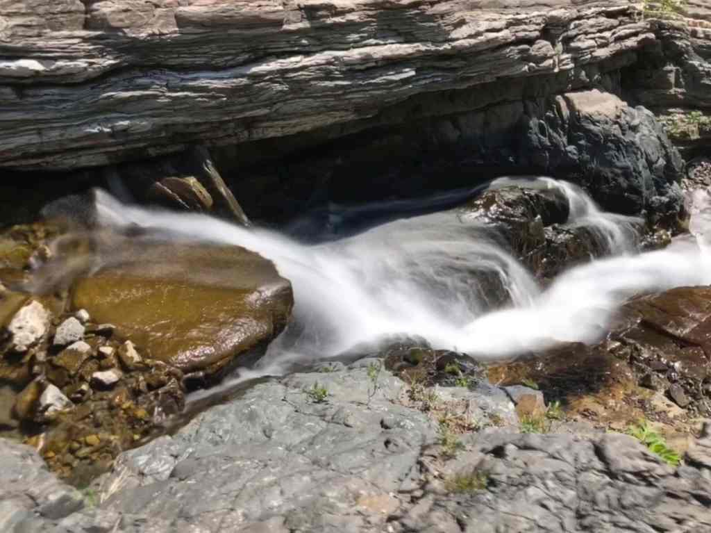
More pastoral waters. (Photo by Andrew Nugara)
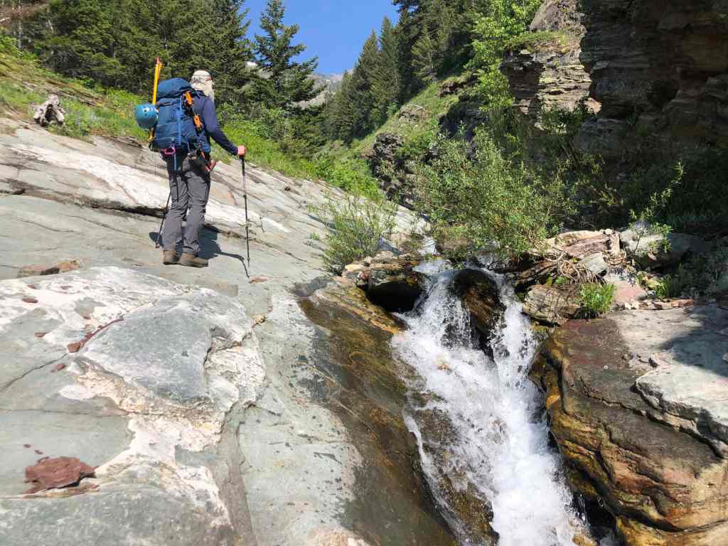
In 2014, we descended along the length of the entire drainage; however, for Saint Eloi, we decided to leave the creek and ascend the small bluff in the centre. This leads onto the ridge which forms the bank of the overgrown gully that is to my left in this photo. (Photo by Andrew Nugara)

Following a crude trail up from the creek.
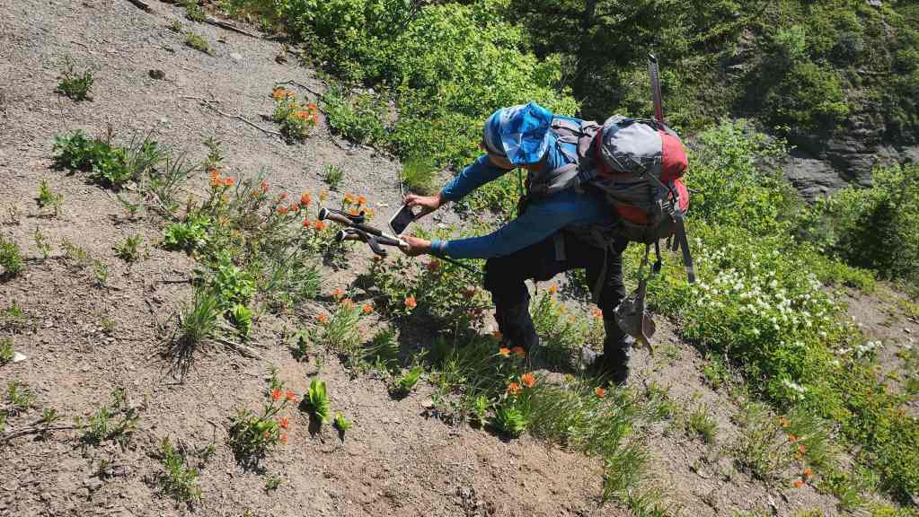
Andy stops to take a flower photo…
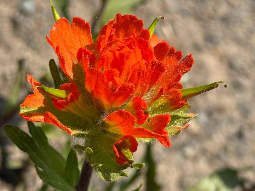
And here’s what he photographed. I believe it’s a paintbrush. (Photo by Andrew Nugara)
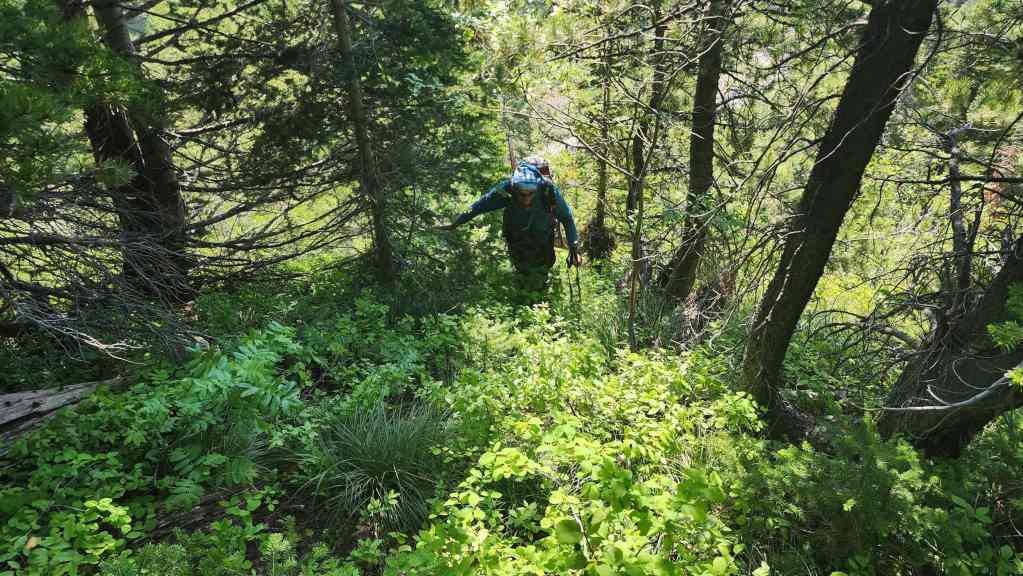
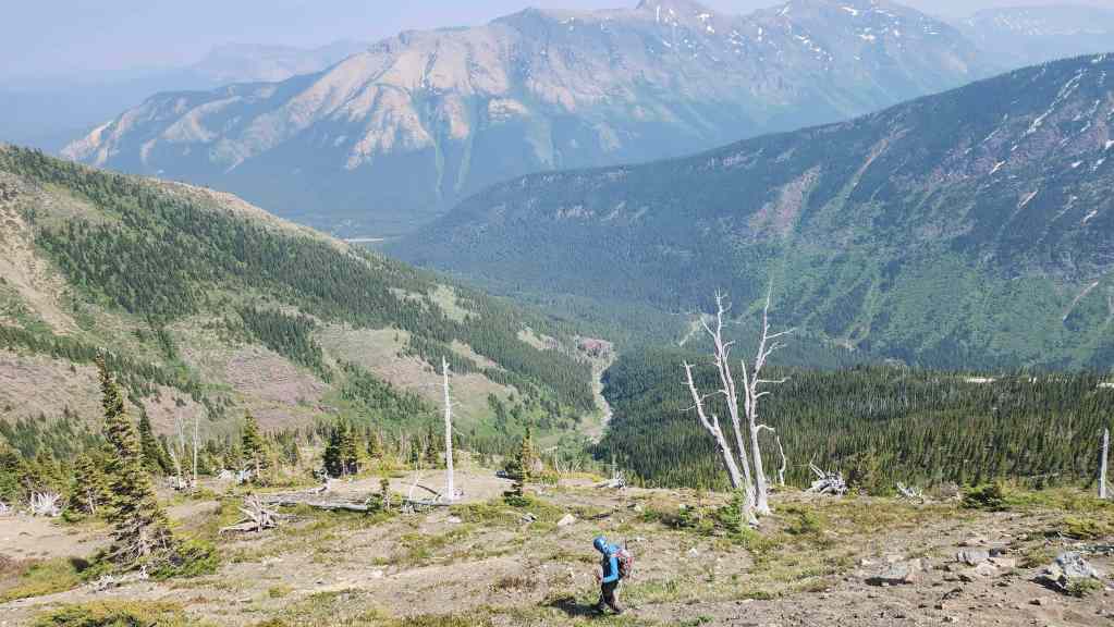
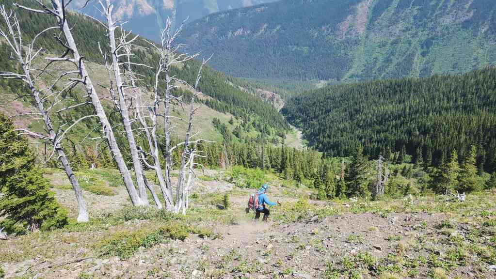
Our short ascent through the trees saw minimal bushwhacking.
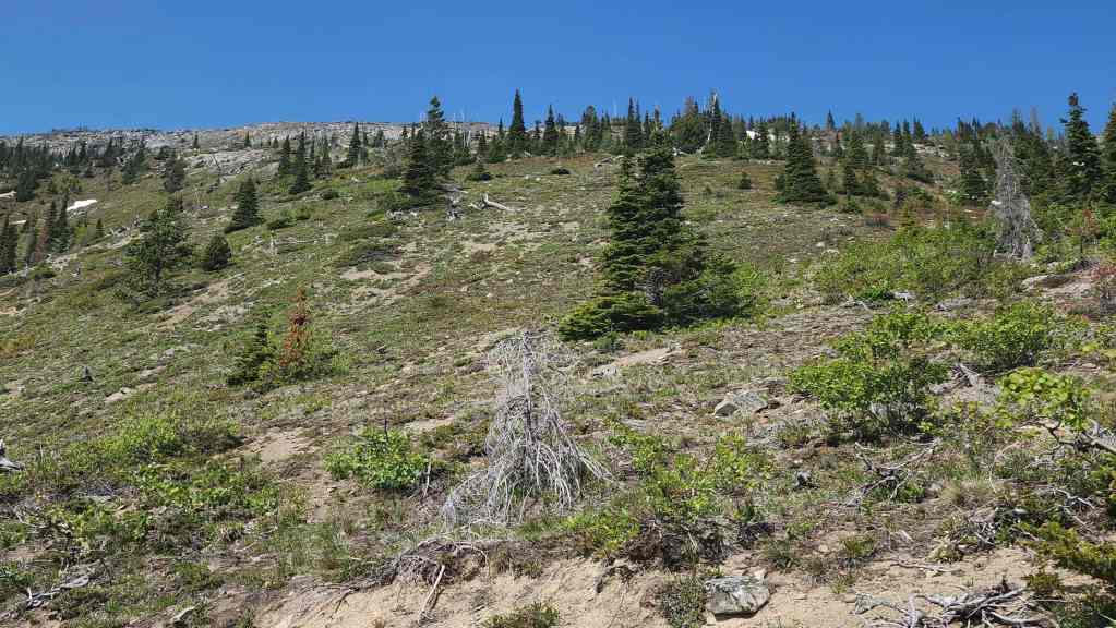
Once through the trees, everything opened up.
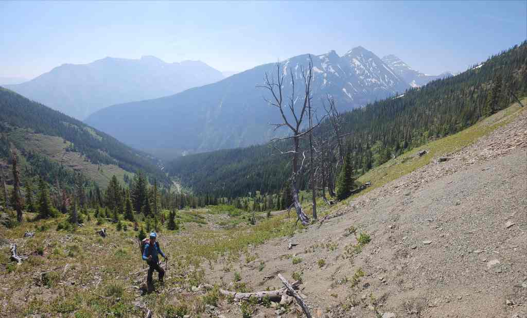
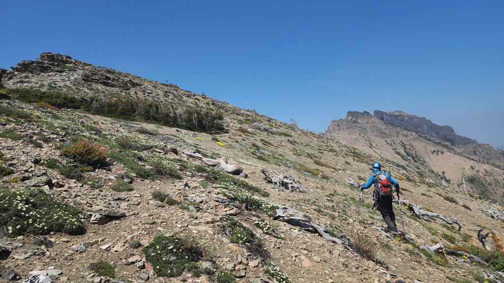
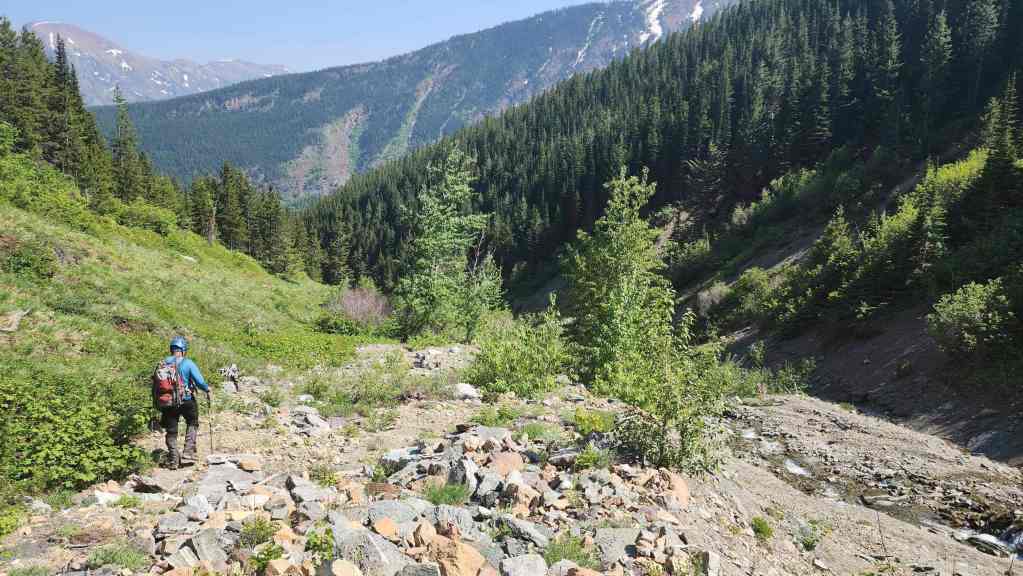
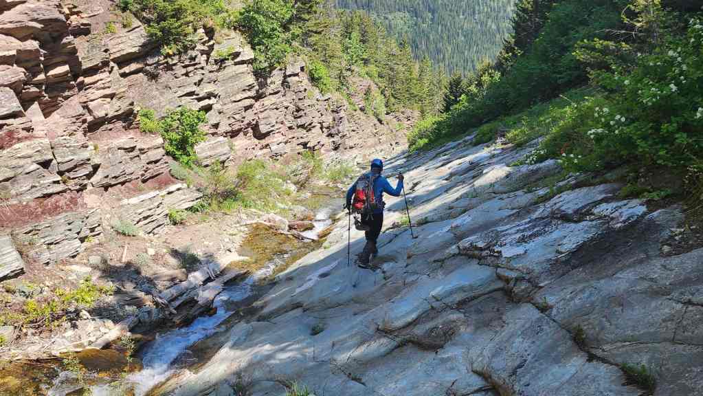
Okay, so here’s where things become foreshortened. Every time that it looked like we were close or that the terrain mellowed – it didn’t. This was a definitely a slog. (Photo by Andrew Nugara)
This photo more accurately shows the angle of the slope. (Photo by Andrew Nugara)

Enjoying a quick break. (Photo by Andrew Nugara)

While Andy decided to head across the snow patch from the previous photo…
I kept heading straight up.
My view over to Andy (lower centre) as he navigates his way closer towards Peak 2 of Syncline (upper left).
Meanwhile, I kept going up.
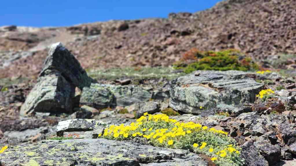
Alpine buttercup.
Andy’s view of Peak 2 from his vantage… (Photo by Andrew Nugara)
And then his view of the impressive high point that sits between Peak 1 of Syncline and Peak 2. (Photo by Andrew Nugara)
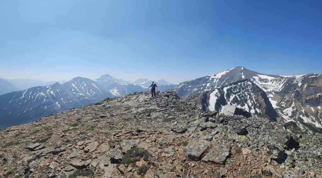
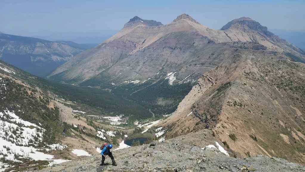
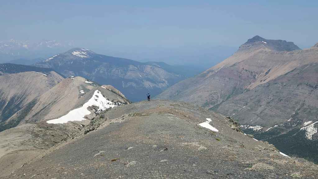
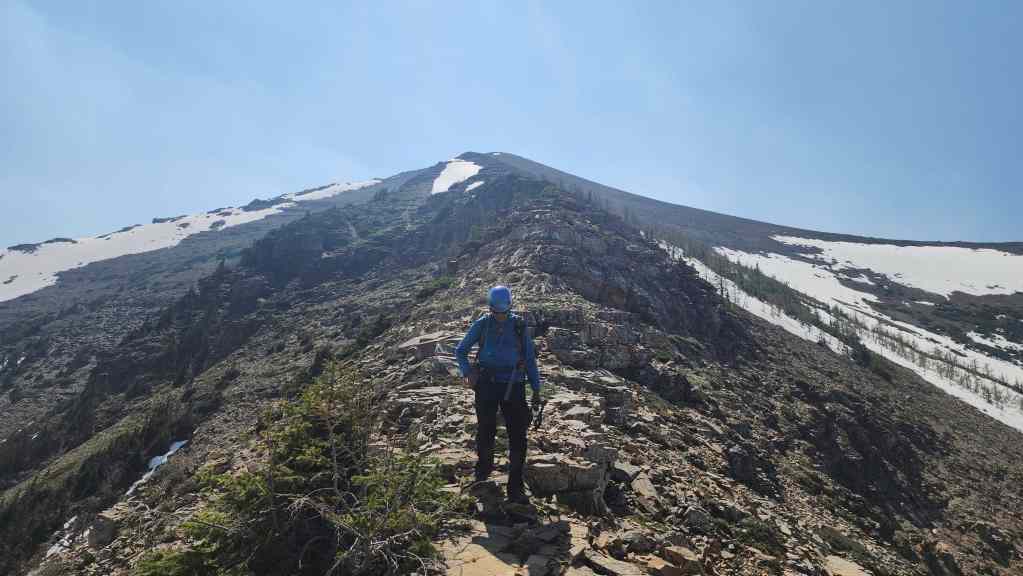
Andy (far left) joins me on the ridge. For reference, it took us old guys, 2 hours and 30 minutes to reach this point from the trailhead.

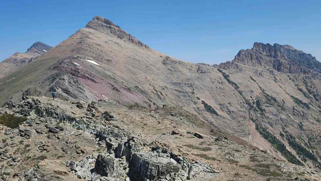
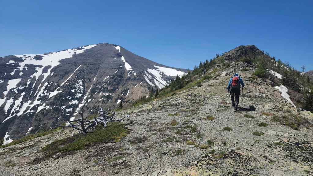
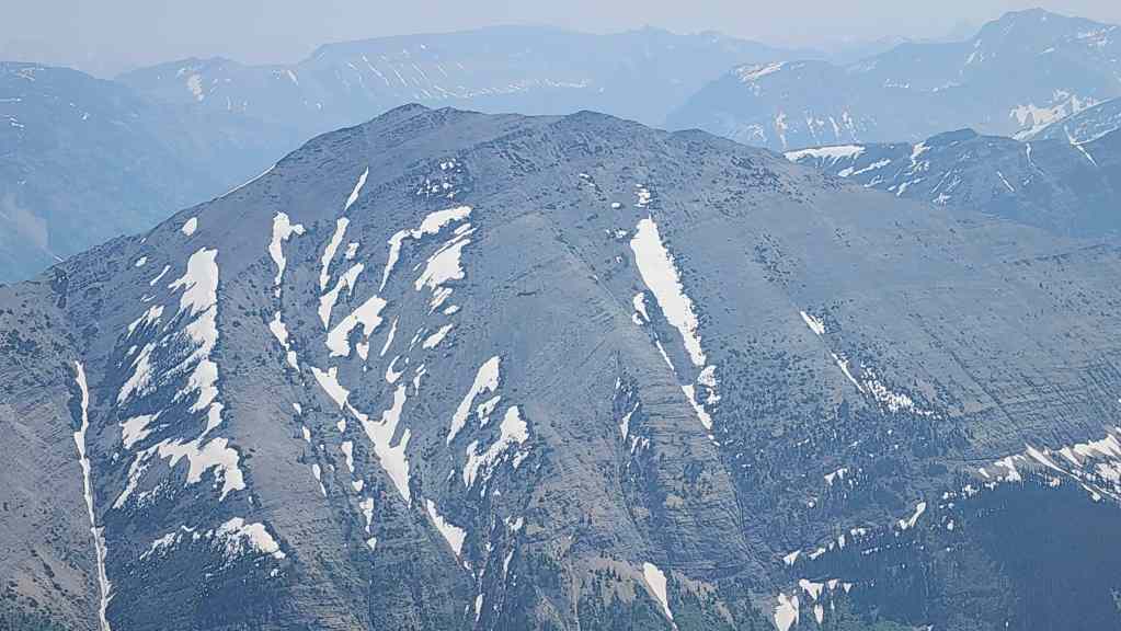
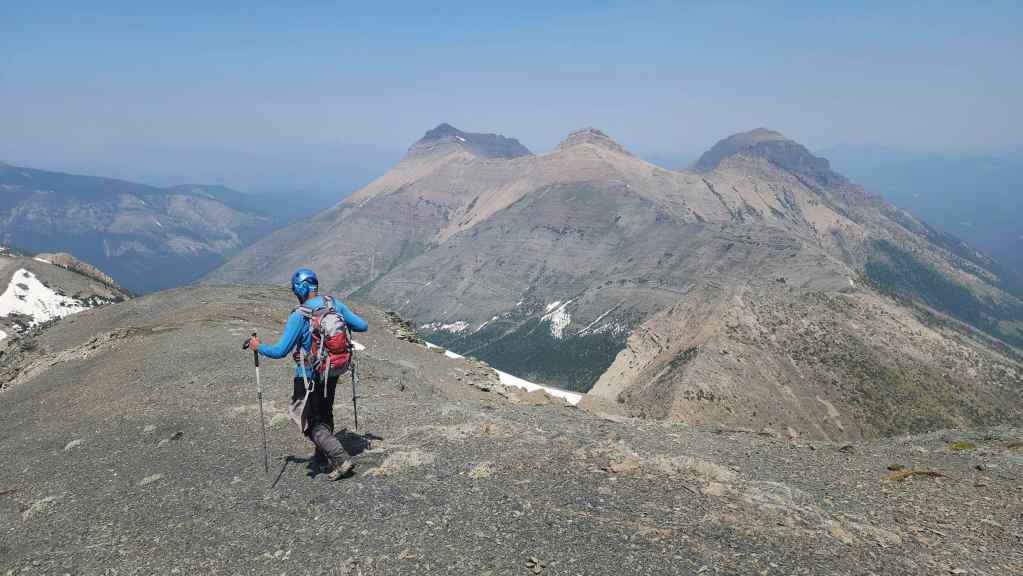
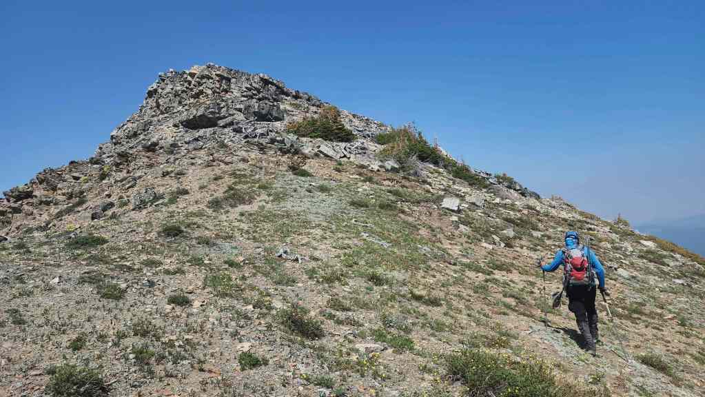
The view over to Saint Eloi (left of centre) with the high point in the foreground.

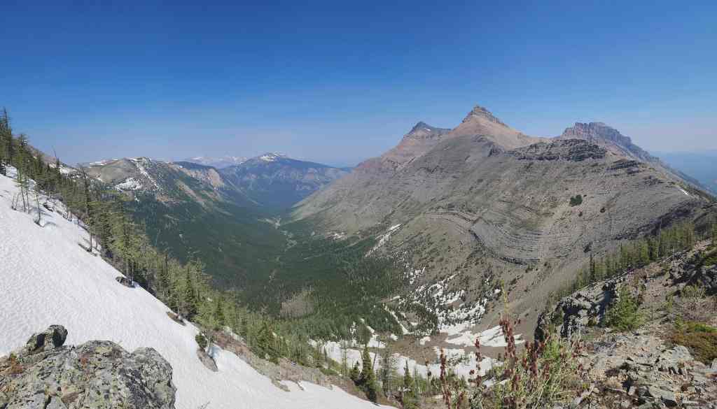
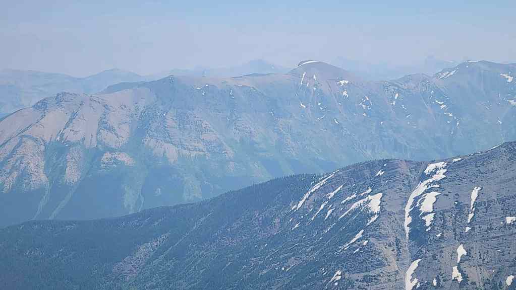
Looking down the valley toward Mount McCarty (centre).
After a ~30 minute break, it was time to get moving.
Unfortunately, wildfire smoke had moved in overnight and so most of our views were hazy.
Andy view back from the previous photo. Peak 3 of Syncline (far left) is now visible.
Descending (65 m elevation loss) to the col with the high point.

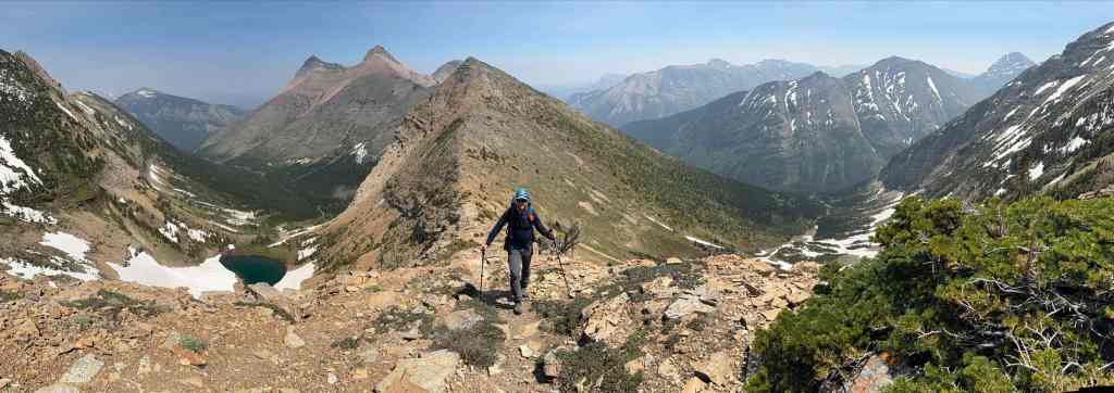
A pano as we near the col.
Heading up the high point. From the lowest point of the col, it’s a 100 m elevation gain.
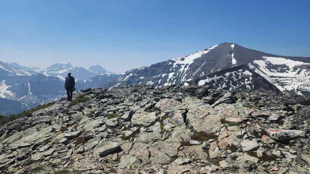
Looking back to where we joined the connecting ridge (right). Though Peak 3 (right of centre) and Peak 2 (right) of Syncline are visible, Peak 1 isn’t.
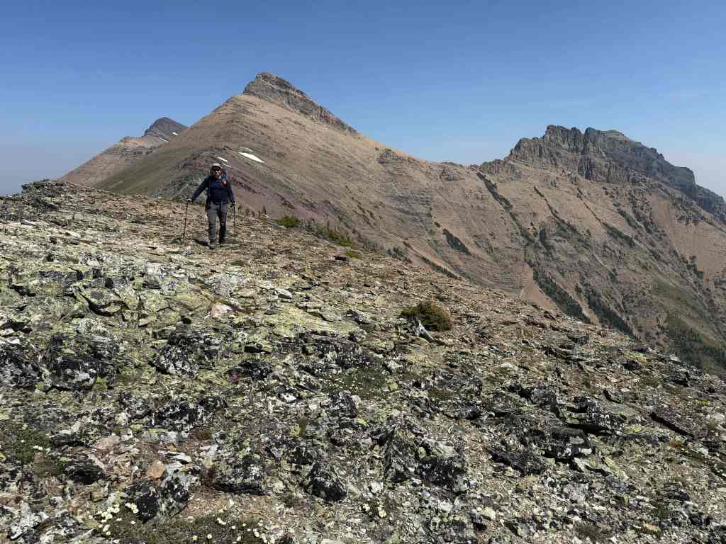
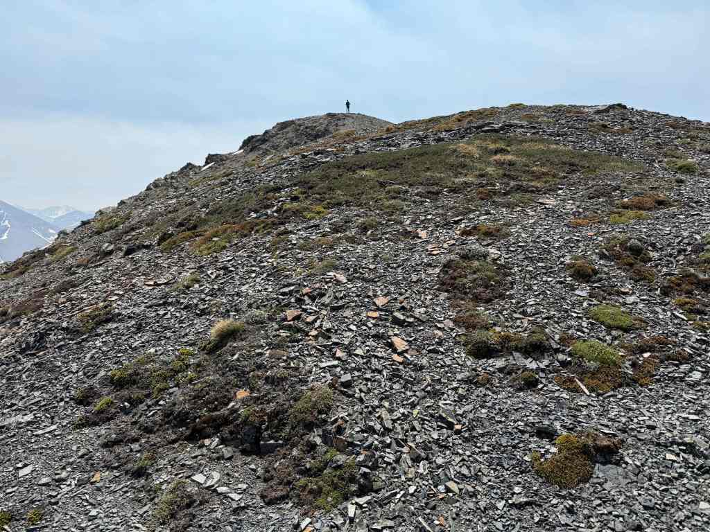
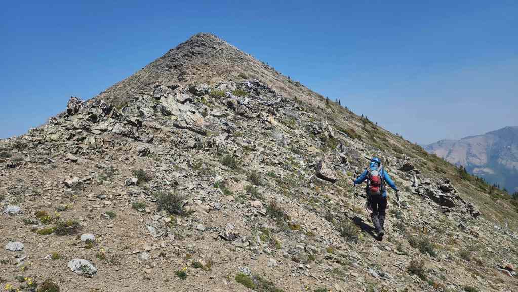
Arriving on top of the high point.

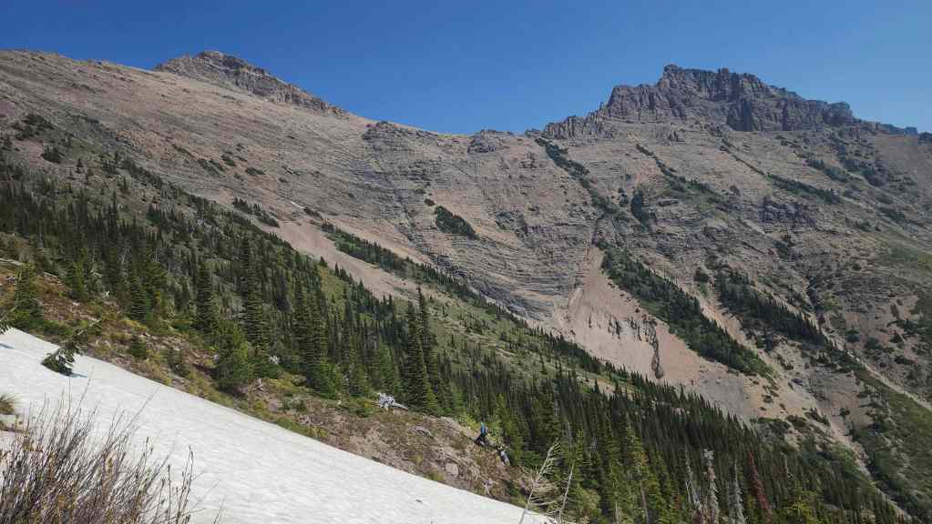
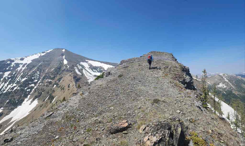
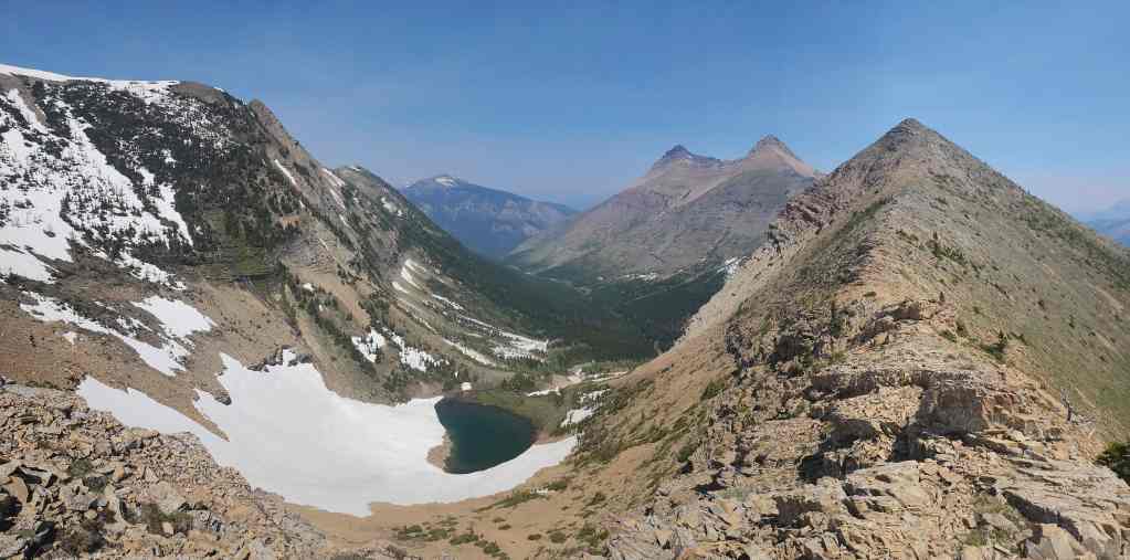
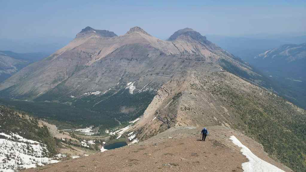
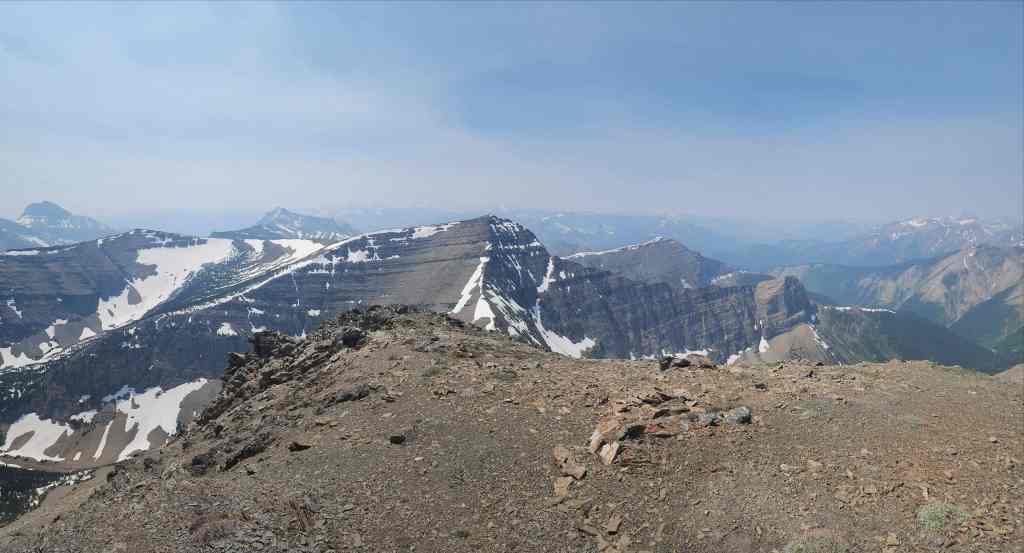
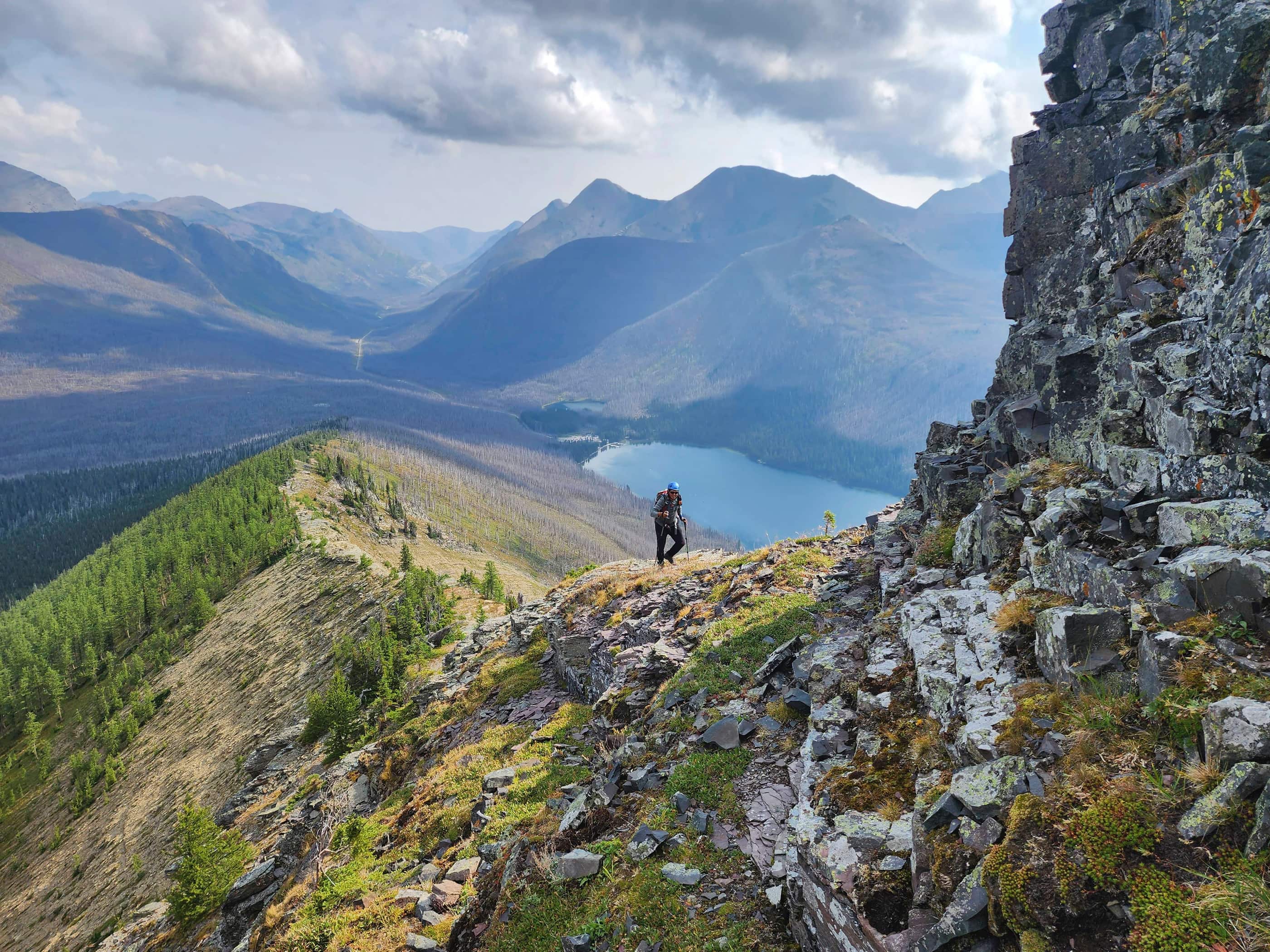
The view from the high point to Saint Eloi.
Another view after starting our descent to the col.
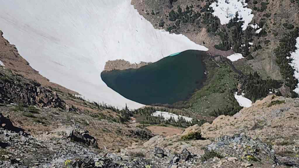
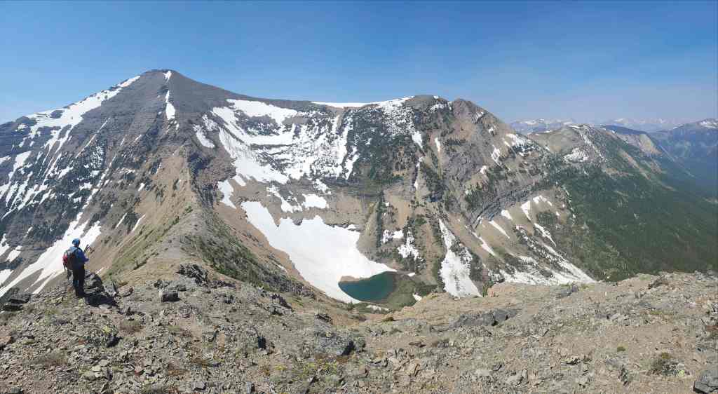
A closer look at the tarn beneath Saint Eloi.

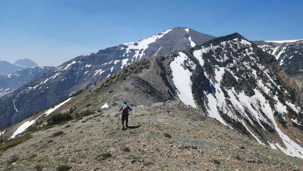
It’s an 80 m loss in elevation from the high point to the col. (Photo by Andrew Nugara)
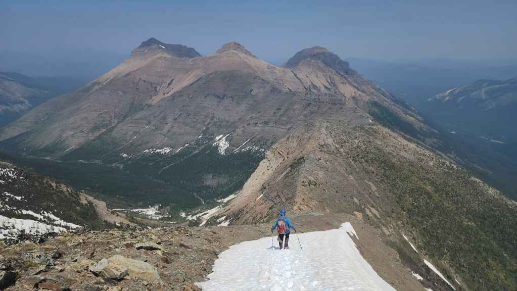
We ditched our ice axes and crampons in the col to lighten our packs. From here, it will be an ~820 m (300 m elevation gain) hike to reach the summit.
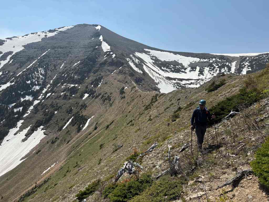
The view back as we start up from the col.
Andy’s view from a little further up.

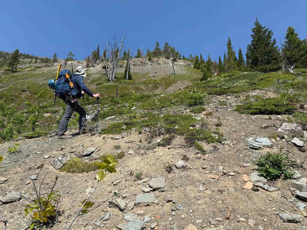
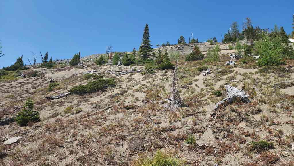
There is nothing technical, but man, is it ever a slog to reach the top.
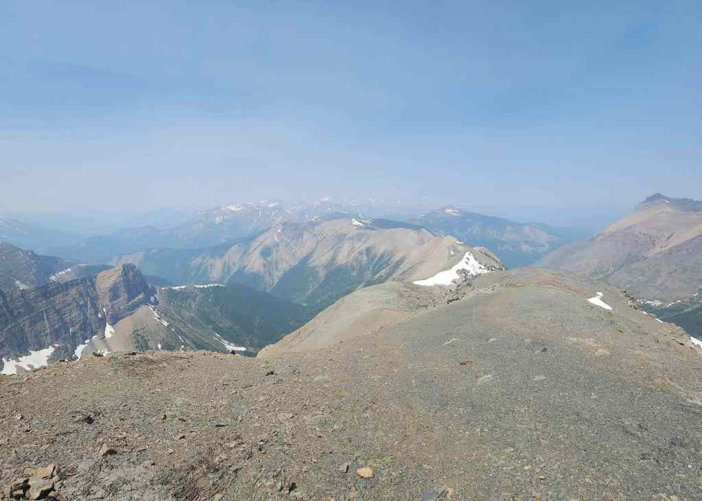
My view back. The summit of Peak 1 of Syncline is now visible on the right.
Same view, but now with a better view of the tarn.

Not only was it foreshortened, but whenever the terrain looked like it would lay back, it only got steeper. (Photo by Andrew Nugara)
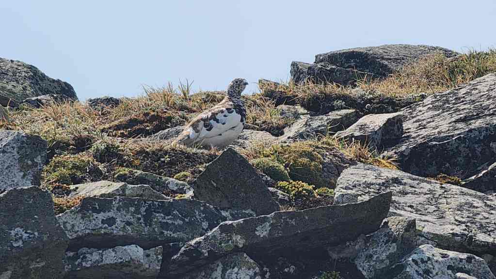
A ptarmigan offered some words of encouragement and wisdom as we passed by. “Beware the drainage!” is the last thing he said…

The summit is finally in sight…
And I arrive shortly before Andy. (Photo by Andrew Nugara)

The summit of Saint Eloi (2500 m). For reference, it was a distance of 6.5 km from the trailhead with an elevation gain of 1232 m. Including stop time, it took us 4 hours and 40 minutes. In contrast, it only took us 2 hours and 30 minutes to make the trip back to the trailhead.
Looking back as Andy joins me on the summit. Whew! It was a scorcher of a day.

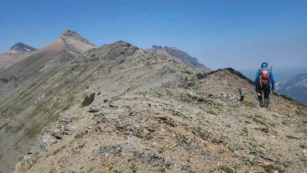
A hazy pano to the southeast…
Followed by a pano to the southwest.
Looking to the northwest…

And finally, to the northeast.
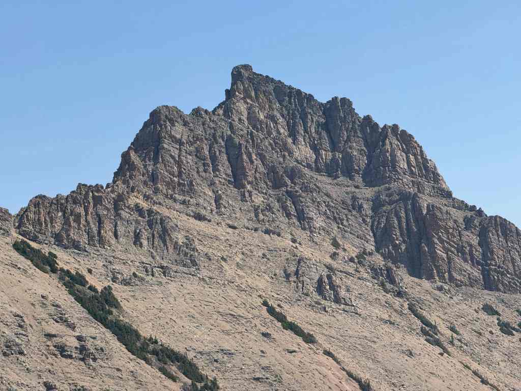
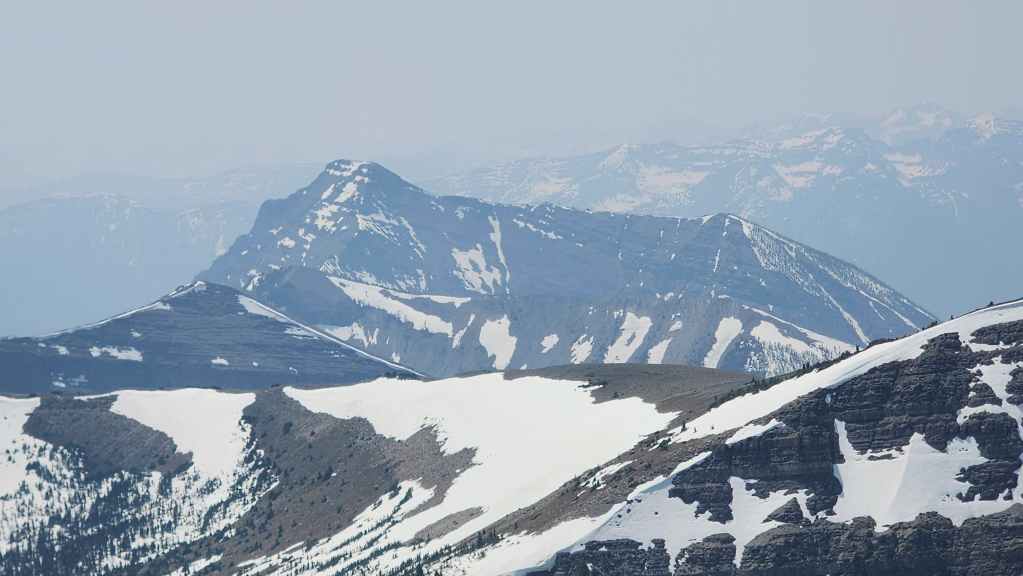
Looking across at Saint Eloi SW1. This was a fun trip back in 2023. 🙂
It doesn’t look as impressive from this angle, but “Sapper Peak” (centre) was also fun to explore.
A closer look at Packhorse Peak…

And then at Tombstone Mountain (centre). My hope is to get to both these peaks in the near future…

The aptly named, “Boot Hill” (centre).

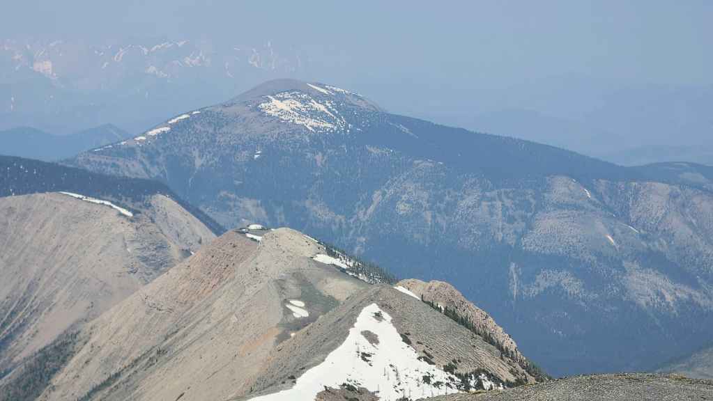
Another missing piece of my puzzle: “Middle Kootenay Mountain” (centre).
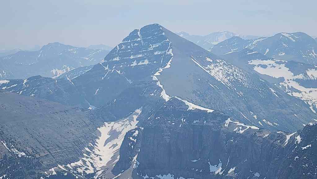
Mount Haig looks impressive!
Gazing past Haig to Rainy Ridge (centre).

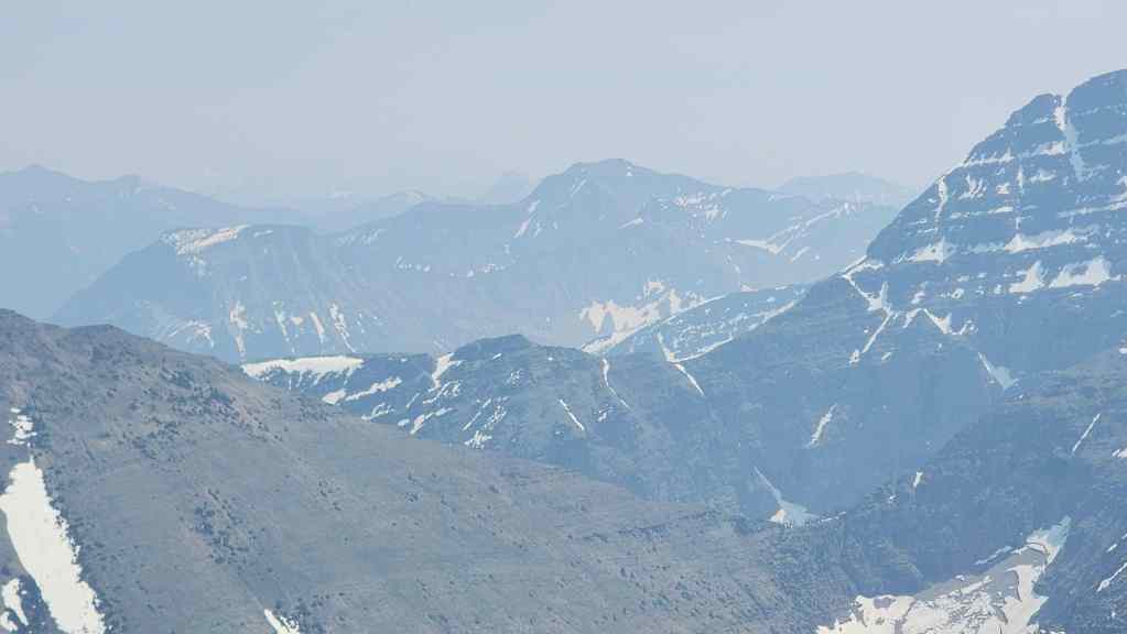
Looking past the summit of Gravenstafel Ridge (foreground) to Lys Ridge (distant centre).
A better look at Gravenstafel Ridge.
The view over to Southfork Mountain (left of centre), “The Amoeba” (right of centre), and Barnaby Ridge (far right).
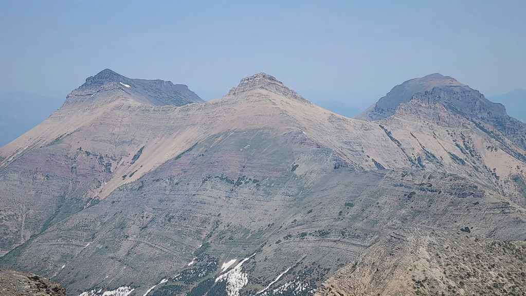
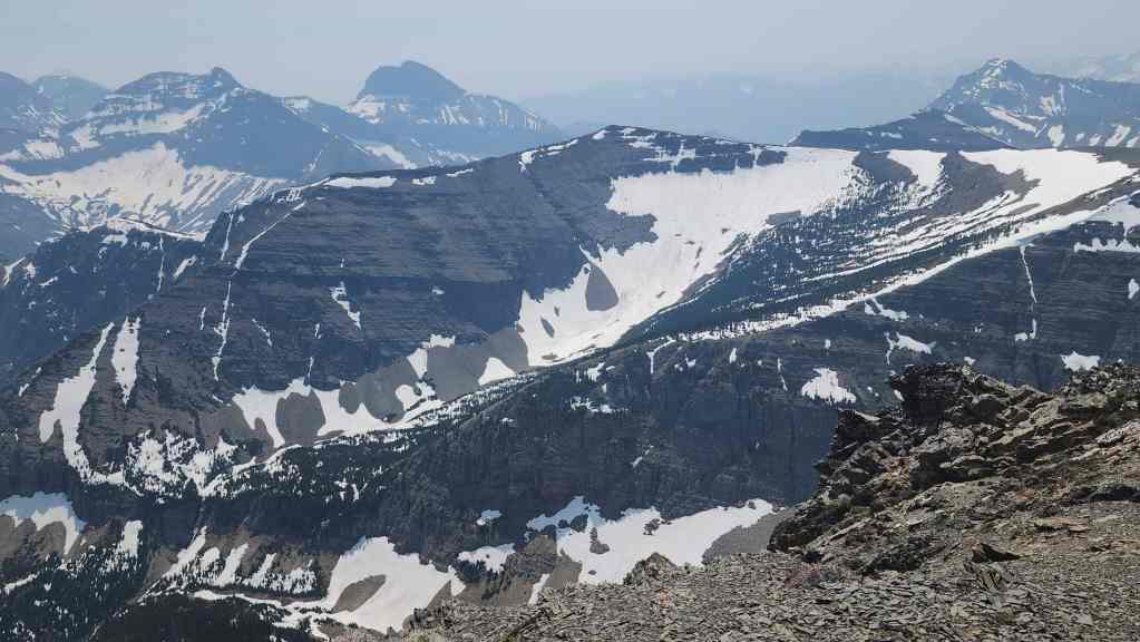
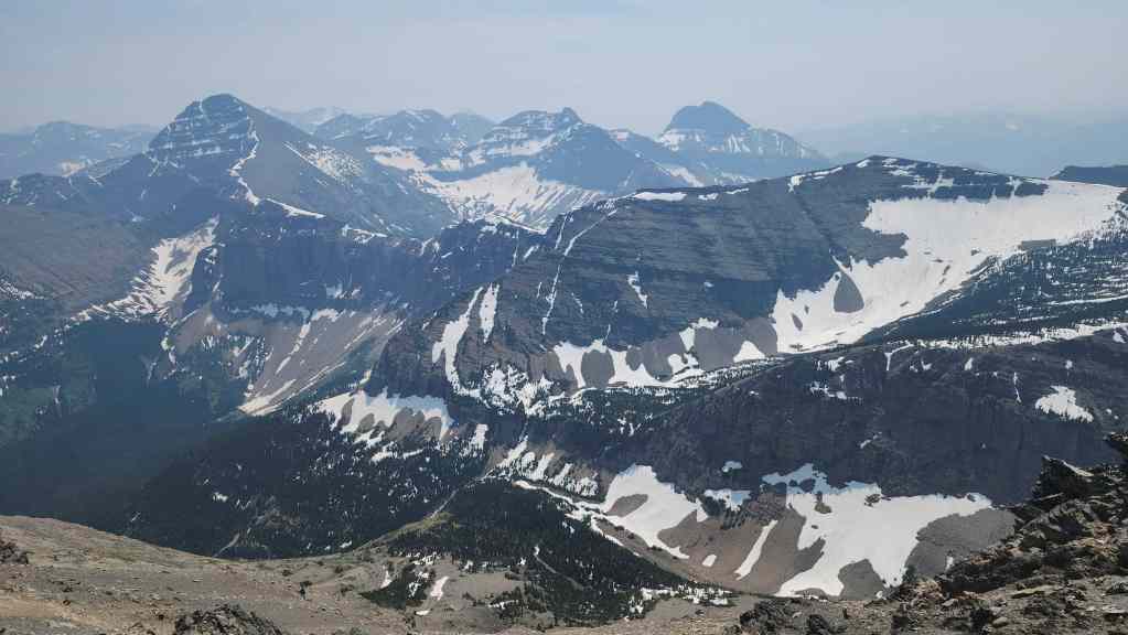
All three peaks of Syncline Mountain.
My 2014 trip to Mount McCarty was definitely memorable.
Another view to the southeast.

Zooming in on an impressive waterfall beneath “Sapper Peak”.
Andy last stood here in 2006 .

Me on the summit. (Photo by Andrew Nugara)
After a good 30 minutes or so of relaxing, it was time to head back.
Using snow to quicken our descent. Even without the snow, it only took us 30 minutes to make it back to the col.

Almost at the col.
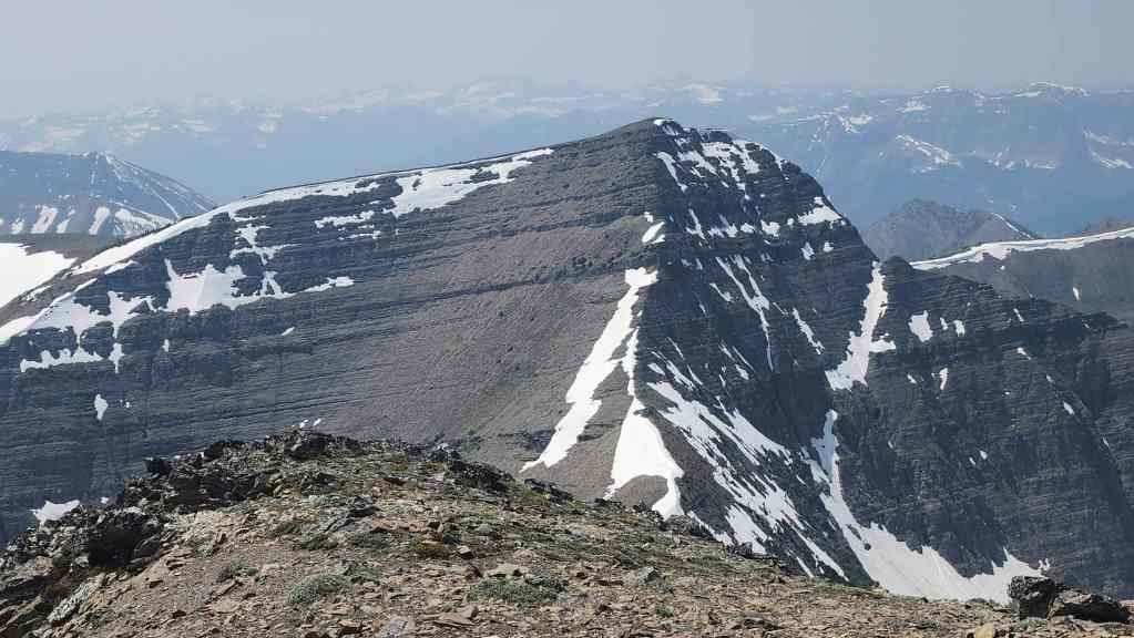
Looking back to the summit.

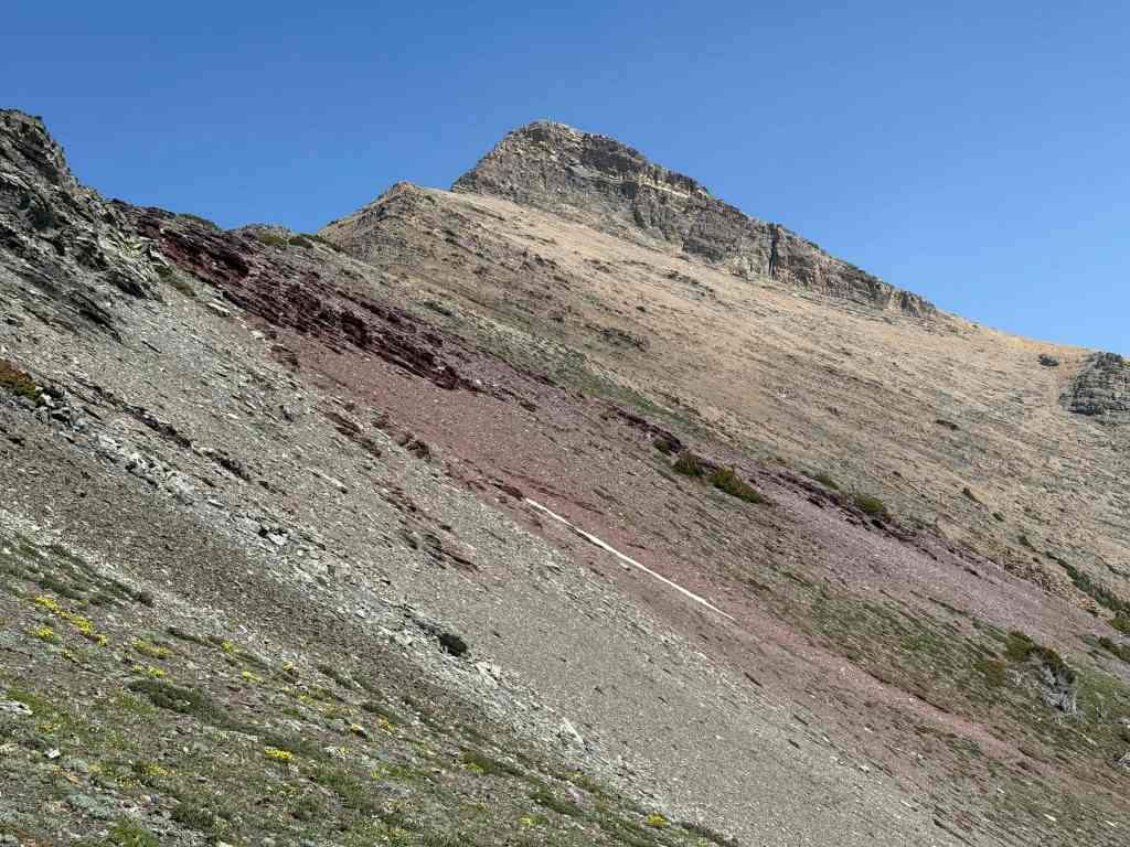
There it is… the Valley of the Sirens. 😬 Even though we knew better, we were still REALLY tempted to use it for descent.
Remembering the wise words of the ptarmigan – and also Par’s practical example – we avoided the elevation gain by traversing to climber’s right from the col.
The view back as we start our traverse. (Photo by Andrew Nugara)

By simply maintaining our current elevation…

We would emerge onto the col before the high point. Noice! 😀
Then, to avoid regaining elevation onto the remainder of the ridge, we made another traverse to climber’s right.
Starting the traverse…
For tired legs, this was just the ticket.

Andy crosses a small snow slope.
His view back from the previous photo. You’d think after hauling up axes and crampons that we’d actually pull out an axe just to say we used it. 😂 (Photo by Andrew Nugara)
From here, it was merely a matter of retracing our steps back to the drainage.
Patches of soft dirt allowed us to descend quickly.
Nearing the drainage.
Back in the drainage…
And starting the hike back to the trail. We were so hot that we spent several minutes cooling off in the creek.

Looking back at the connecting ridge.
Inspecting the snowflake porphyry.

A closer look at the snowflake porphyry or “flowerstone”.
Making our way through the drainage.
The red argillite really stood out now that the sun was shining on it.

One final look back. (Photo by Andrew Nugara)
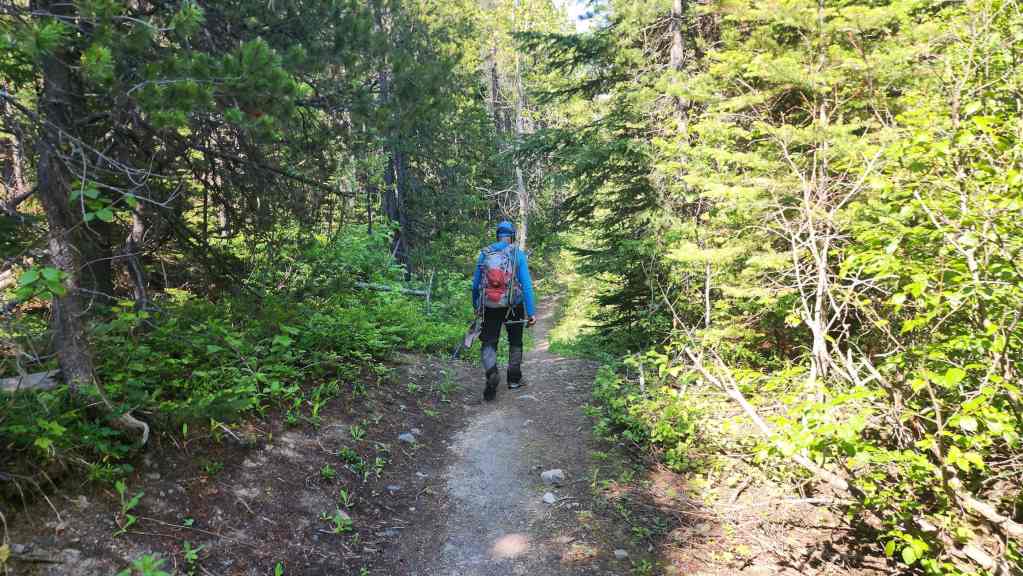
Back on the trail and looking forward to the easy – and mostly shaded – 1.9 km hike back to the trailhead.
Arriving back at the trailhead 13 km and 7 hours and 40 minutes after starting. The temperature in the parking lot was a sweltering 29 C and even after going through 4 L of water, I was still parched. I’m glad that I’ve finally been able to fit this piece of the puzzle and I definitely have to thank Andy for once again repeating a trip. 🙂


Leave a Reply