

⚠️ Hiking and scrambling are inherently dangerous activities. Please read my Disclaimer. ⚠️
Situated in the Flathead Range south of the Crowsnest Pass, Mount McGladrey is a bit of an enigma. For starters, why did A.O. Wheeler’s Interprovincial Boundary Survey choose to give it an official name but neglect the higher peak (2761m) immediately to the north? More broadly, why did they leave many of the other peaks in the area also unnamed? Not that McGladrey and its neighbour to the south, Mount Pengelly (2586m), don’t deserve to have official names, but why these two and not others? Perhaps it had something to do with Wheeler’s surveying practices and the location of their triangulation and camera stations? I’m also curious who McGladrey is named for. A cursory online search reveals little, other than it was named in 1914. While Jay Sherwood notes in, Surveying the Great Divide: The Alberta/BC Boundary Survey, 1913-1917, that Wheeler named Pengelly after the maiden name of his assistant, A.J. Campbell’s wife (162), what was the relation to McGladrey? As Wheeler sometimes used a specific theme when naming (Sherwood, 157) and given their proximity to one another, it is possible that McGladrey may be another maiden name. Regardless, what Sherwood rightly concludes, is “the geographical names that came from the Alberta-BC boundary survey are generally considered to be a negative aspect of the project. It is unfortunate that the geographic names for the Rocky Mountains do not better reflect the natural and human history of this spectacular feature of the Canadian landscape.” (162)
While the origins of the name are unknown, the mountain itself also exists in obscurity. Case in point, as Brad and I were driving in along the Lyons Creek Road, we encountered an older gentleman out for a walk. Being the extrovert that I am, I stopped the car and the three of us chatted for a while. We learned that he had lived his whole life in the Pass and that every day, no matter the weather, he does a 3 to 5 km loop using the road and various trails. He shared several hiking stories with us including peaks he’d climbed and even a harrowing encounter with a grizzly. When we told him that we were going to climb Mount McGladrey, he said that he was not familiar with that peak at all. EDIT: In the summer of 2021, I was contacted by Roger McGladrey, whose great uncle, Adam McGladrey, homesteaded in the Pincher Creek area around 1900. Roger notes that when Adam passed, “he was buried at the foot of an unnamed (at that time) mountain. Later locals referred to it as McGladrey’s Mountain as that is where he was laid to rest.” Thus, a HUGE thank you to Roger for reaching out and providing this information. Knowing this fills in a missing piece of history and makes our ascent all the more meaningful.
Long on both my radar as well as Brad’s, my first introduction to Mount McGladrey was Rick Collier’s 1993 trip report followed by Andrew Nugara’s 2009 report. Outside of these online reports and Robert Kershaw’s North Goat Creek trail report (160) in Exploring the Castle: Discovering the Backbone of the World in Southern Alberta, there aren’t many others. Indeed, the current summit register that was placed in August 2017 by the intrepid outdoor leadership team from Crowsnest Lake Bible Camp (CLBC), shows that we were only the fourth party to visit the mountain since it was placed – and of these parties, we were the only one not affiliated with CLBC. At this point, I have to give a huge shout out to James McKinnon of CLBC, because according to the register, he has he led groups of teenagers up this mountain three times! Not only must this be the record for the most ascents of McGladrey, but he must really love his calling to have subjected himself to making the miserable slog from the bowl to the summit more than once! Seriously though, if you want to connect young people to nature, camps that offer out-trips as part of their programming such as CLBC and Pioneer Ranch Camps, are invaluable.
As for my overall thoughts on the trip, what can I say? I have yet to meet a mountain that I didn’t like and when this is shared with a good friend like Brad, then it can be nothing less than a great day! McGladrey offers a straightforward and pleasant approach that is coupled with an expansive summit view. The major downside is the aforementioned soul-sucking trek over loose talus once you leave the upper bowl. We were fortunate to have been able to take advantage of a snow-filled gully, as this lessened the tedium, but without it, I’d have tried to gain the ridge much sooner. All in all though, I thought this was a really interesting area to visit and I’m already making plans to return to explore Mount Pengelly. Edit: We returned on 26 June 2019 and enjoyed a wonderful ascent of Pengelly using the southeast slope.

To get to Mount McGladrey from Lethbridge, drive west on Highway 3 until you reach the first turnoff for Blairmore (20 Ave). Drive west along 20 Ave for a short distance and then take your first left (133 St.) and cross the railroad tracks. Immediately on the other side of the tracks, take your first right (19 Ave) then your first left (132 St.). Follow 132 St. for a short distance and turn right onto 16 Ave. Follow 16 Ave as it curves south and turns into Lyons Creek Road (131 St.). From the end of the pavement on the edge of Blairmore, drive ~14 km until you come to the turnoff for Goat Creek Road. If you have a 4 x 4 or a high clearance vehicle, proceed down Goat Creek Road. If you don’t, it’s time to get out the bikes. From the junction with Lyons Creek Road, follow Goat Creek Road for ~2.6 km until you cross a small bridge and come to a fork in the road. The trail starts a short ways down the left fork, so park your vehicle here.
From the parking area, cross the black ATV bridge and follow the trail (keeping left at all junctions) for ~2.2 km until you come to a red ATV bridge that crosses Goat Creek. Proceed across the bridge and immediately on the other side, look for an old, vegetation-covered logging road located on the righthand side. Follow the old road keeping left at all junctions. We ended up ditching our bikes at about the ~1.5 km mark when we encountered recurring deadfall. Approximately ~2.3km from the bridge we came to a junction that was partially hidden by deadfall just prior to a small clearing. On our way in we followed the trail past the clearing for a short distance before leaving it to bushwhack towards the open slopes and the ascent drainage on the other side of the valley. On our way back, we followed the drainage directly from the bowl between Mount Pengelly and McGladrey down to the creek and then onto the partially overgrown trail that we found just prior to the small clearing. It was a short walk back to find the main trail. Whatever way will work.
Once at the drainage, follow it upwards for ~1.7 km (~383 m elevation gain) to reach the bowl between Mount Pengelly and Mount McGladrey. There are a couple options from this point, but the goal is to minimize the time on the loose talus and reach the ridge. We followed a small snow-filled gully upwards before gaining the ridge just before the summit. If there wasn’t snow, I’d have been tempted to try and reach the ridge closer to the col with Pengelly. Regardless, from the bowl it is roughly a 1.5 km hike up deceptively steep slopes (~453 m elevation gain) to reach the summit. After reaching the summit, you can return the same way.

Our total distance travelled was 17.6 km with a total elevation gain of 1052 metres. Our total roundtrip time was 6 hours and 51 minutes.

The unmarked junction between Lyons Creek Road (left) and Goat Creek Road. If you don’t have a 4×4 or a high clearance vehicle, this is where you’ll want to park and get out the bikes.

Our first view of Mount McGladrey (centre) from the Goat Creek Road. It was a gorgeous morning!

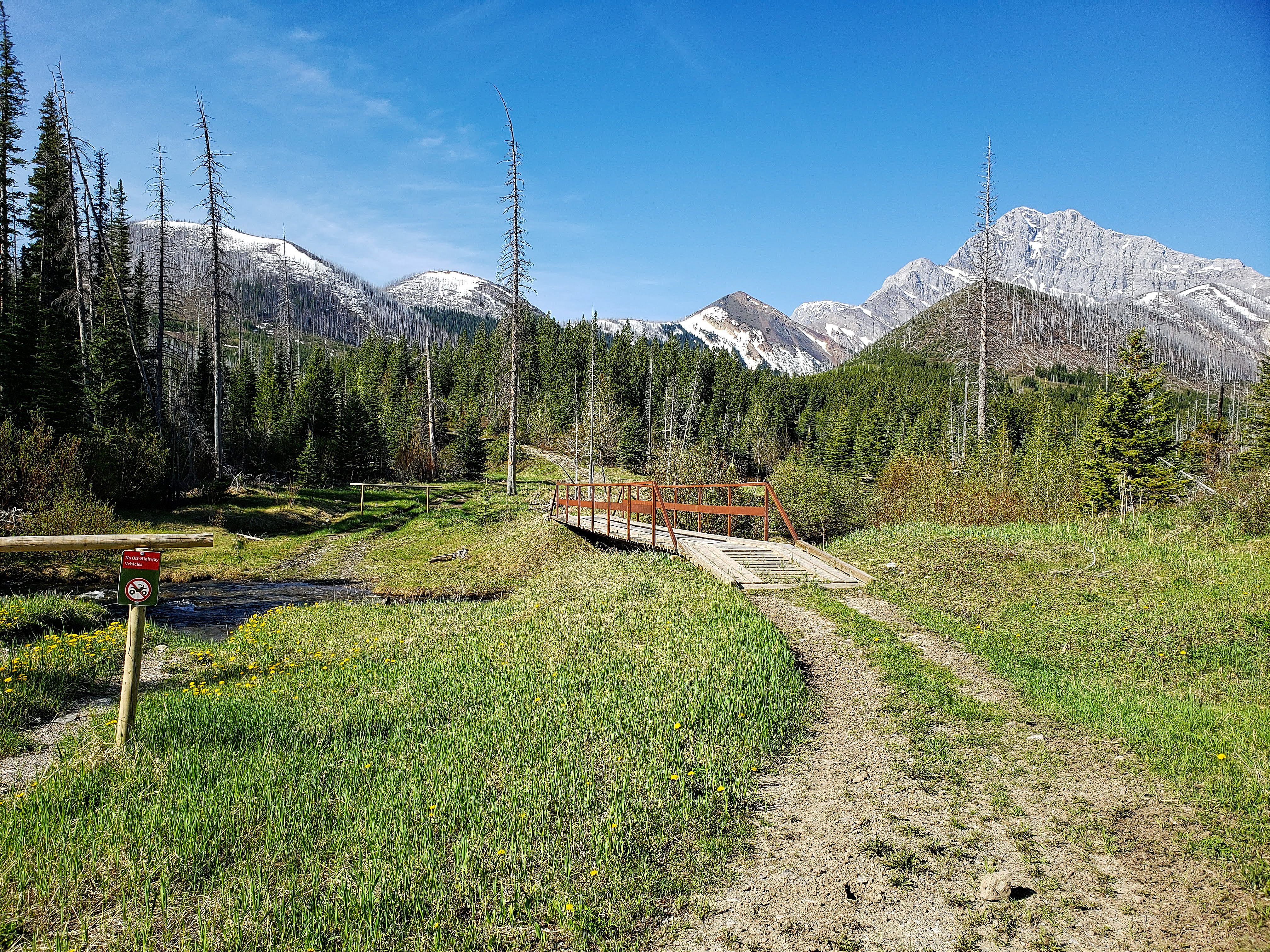
About ~2.6 km from the junction with Lyons Creek Road, we came to this fork immediately after crossing a small bridge. The trail begins a short distance down the left branch. Mount McGladrey is in the background.
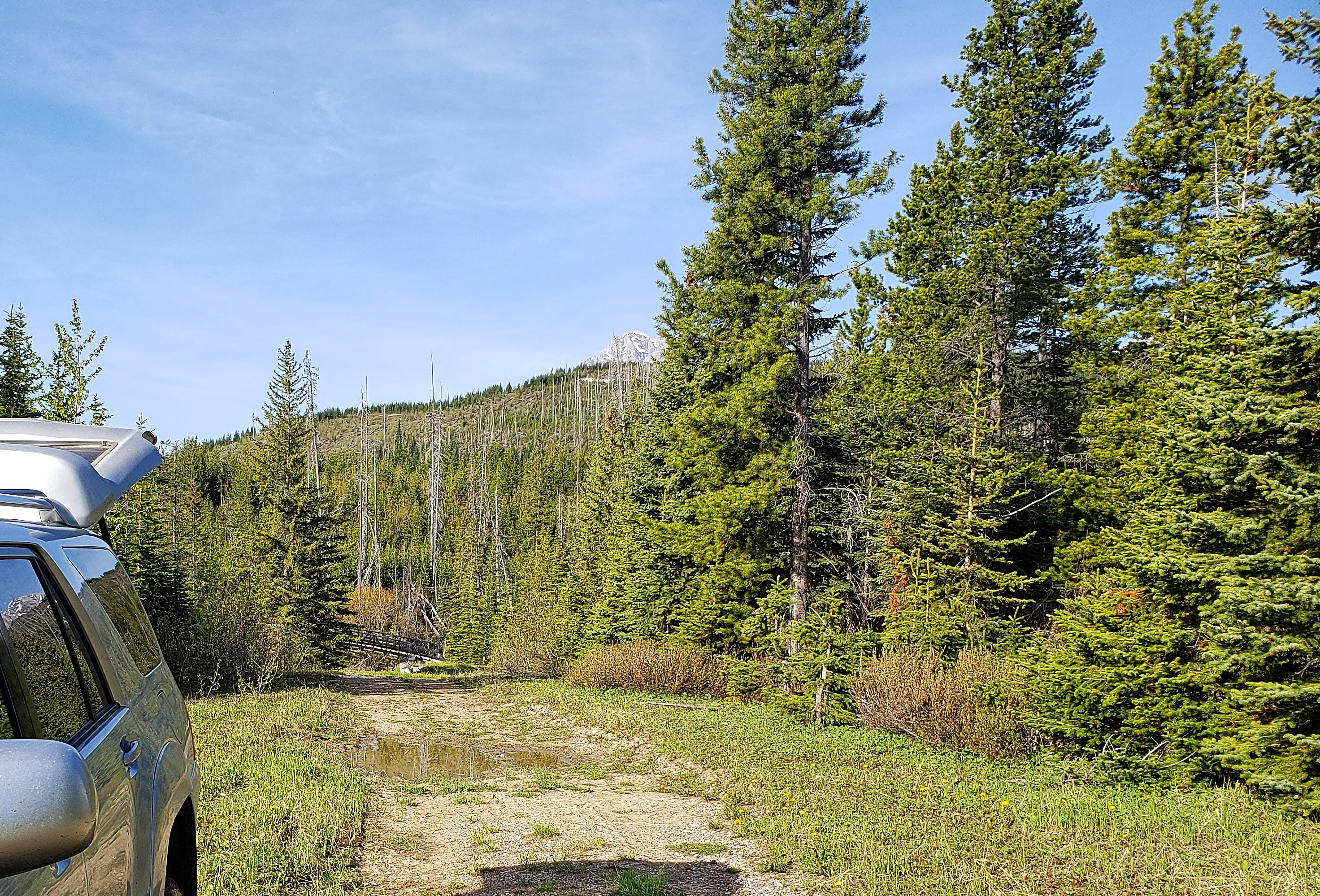
Gearing up after turning my 4Runner around and parking near the fork. The black ATV bridge that marks the beginning of the trail is in the background.

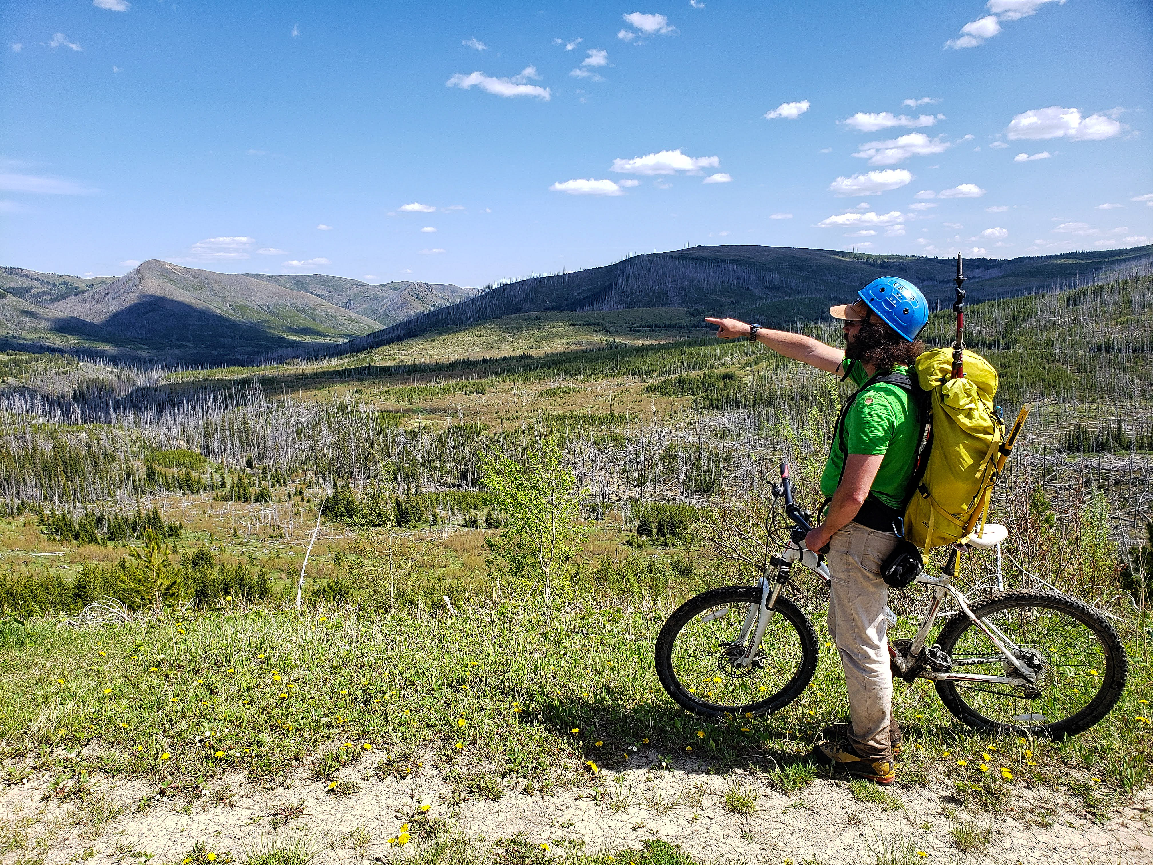
Mount Darrah looms in the distance as Brad bikes in along the trail.

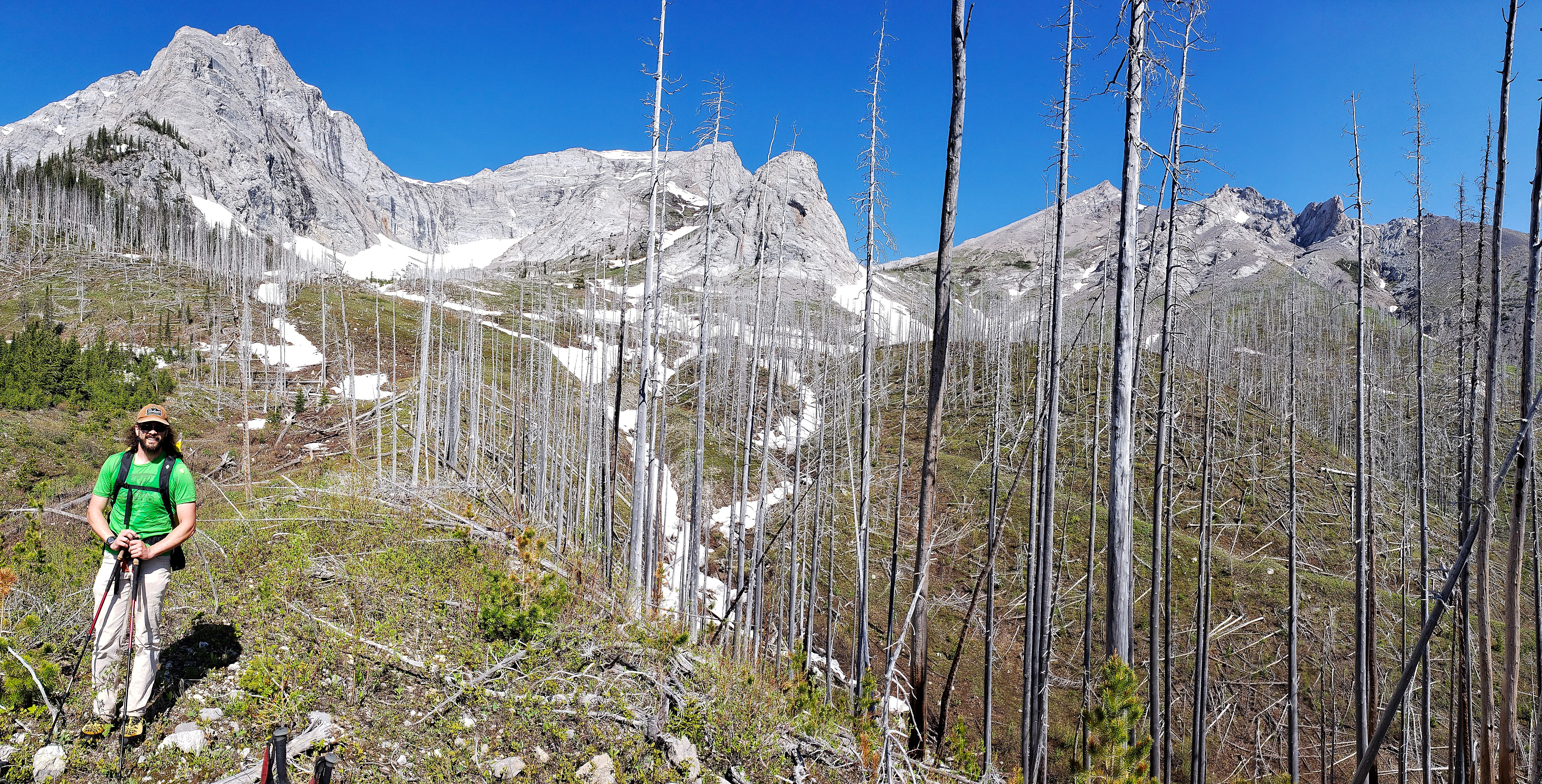
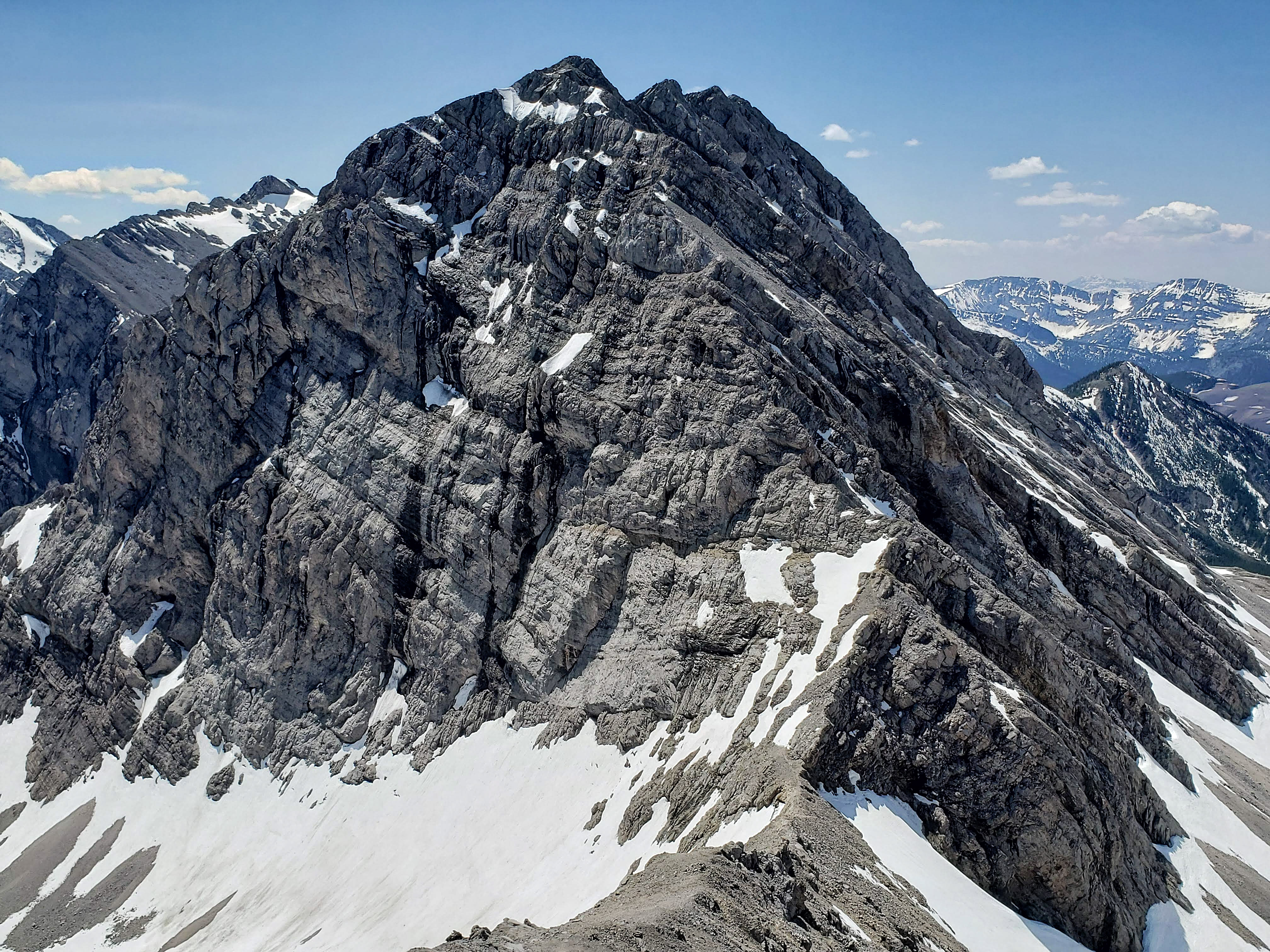
Mount Pengelly is to the right of centre and an unnamed peak is in the centre. The summit of McGladrey is hidden by its southeast ridge (far right).
After an enjoyable ~2.2 km ride from the black ATV bridge, we came to this red bridge. The old logging road that leads to Pengelly and McGladrey begins on the other side.

Brad stands at the beginning of the old logging road.
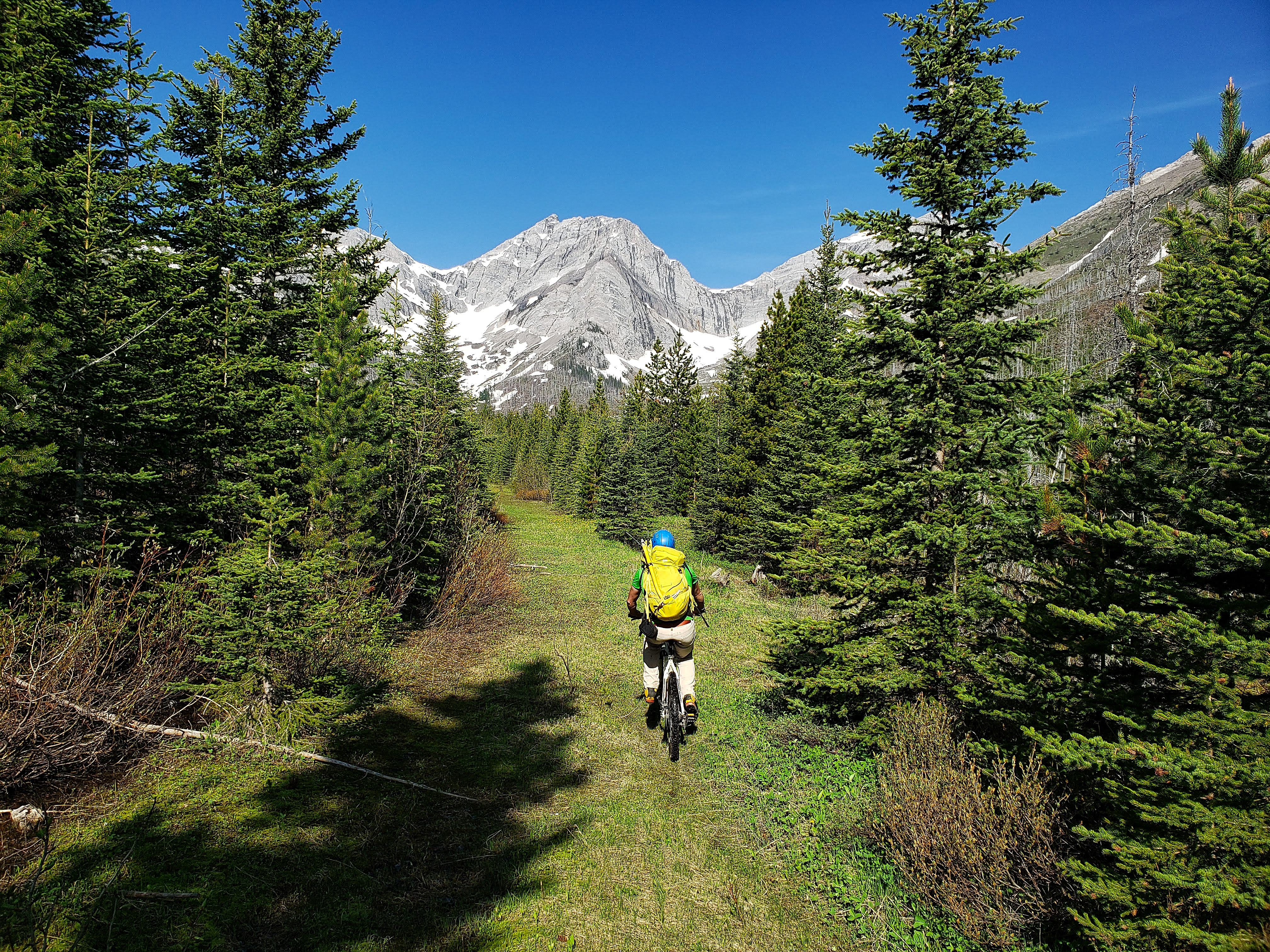
The old road / trail proved to be an enjoyable and easy ride.

Brad stops at a fork in the trail. We would keep to the left.

Close to ~1.5 km from the red bridge, we ditched our bikes when we came to a short section of deadfall strewn across the trail. This is the view looking down the trail a short distance beyond the deadfall. Mount Pengelly is to the right of centre while the summit of McGladrey remains hidden behind its southeast ridge (far right).

Approximately 2.3 km point from the red bridge we came to a junction where the right fork was partially hidden by deadfall (pictured). We would keep left; however, on our way back, we followed the drainage directly from the bowl between Mount Pengelly and McGladrey (pictured in the background) down to the creek and then onto the partially overgrown right fork. It was then a short walk back to the junction. This route could also be used for ascent.
From the small junction, we kept left and entered a small clearing. We followed the trail across it, but left it shortly afterwards to begin bushwhacking (pictured) our way over to the drainage.
After a short stretch of bushwhacking, we arrived on open slopes.

Heading towards the drainage.
Brad takes advantage of the snow as he ascends next to the drainage. This snow slope would offer some great glissading at the end of the day.
The view back from part way up the drainage.

An impressive volume of water was being forced through a very narrow section of rock.

Arriving at the entrance to the upper bowl.

Brad checks out the massive east face of Mount Pengelly.

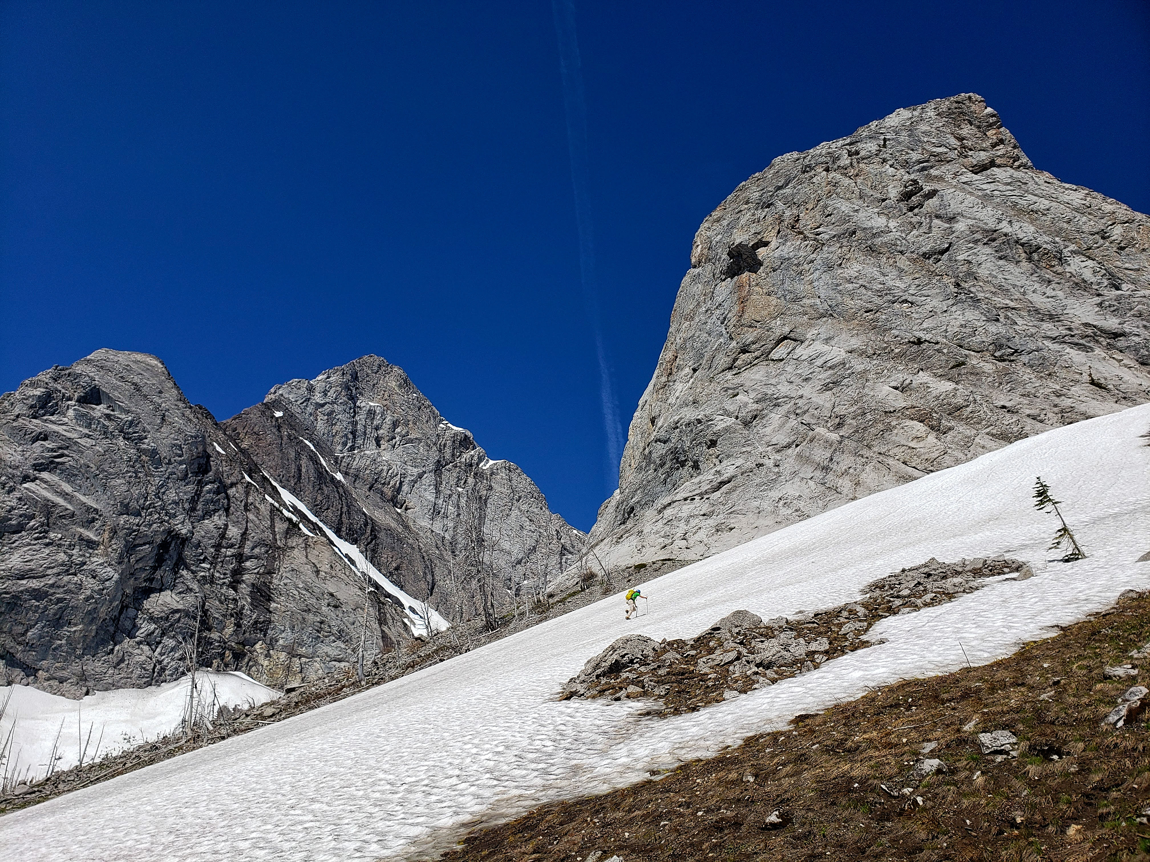
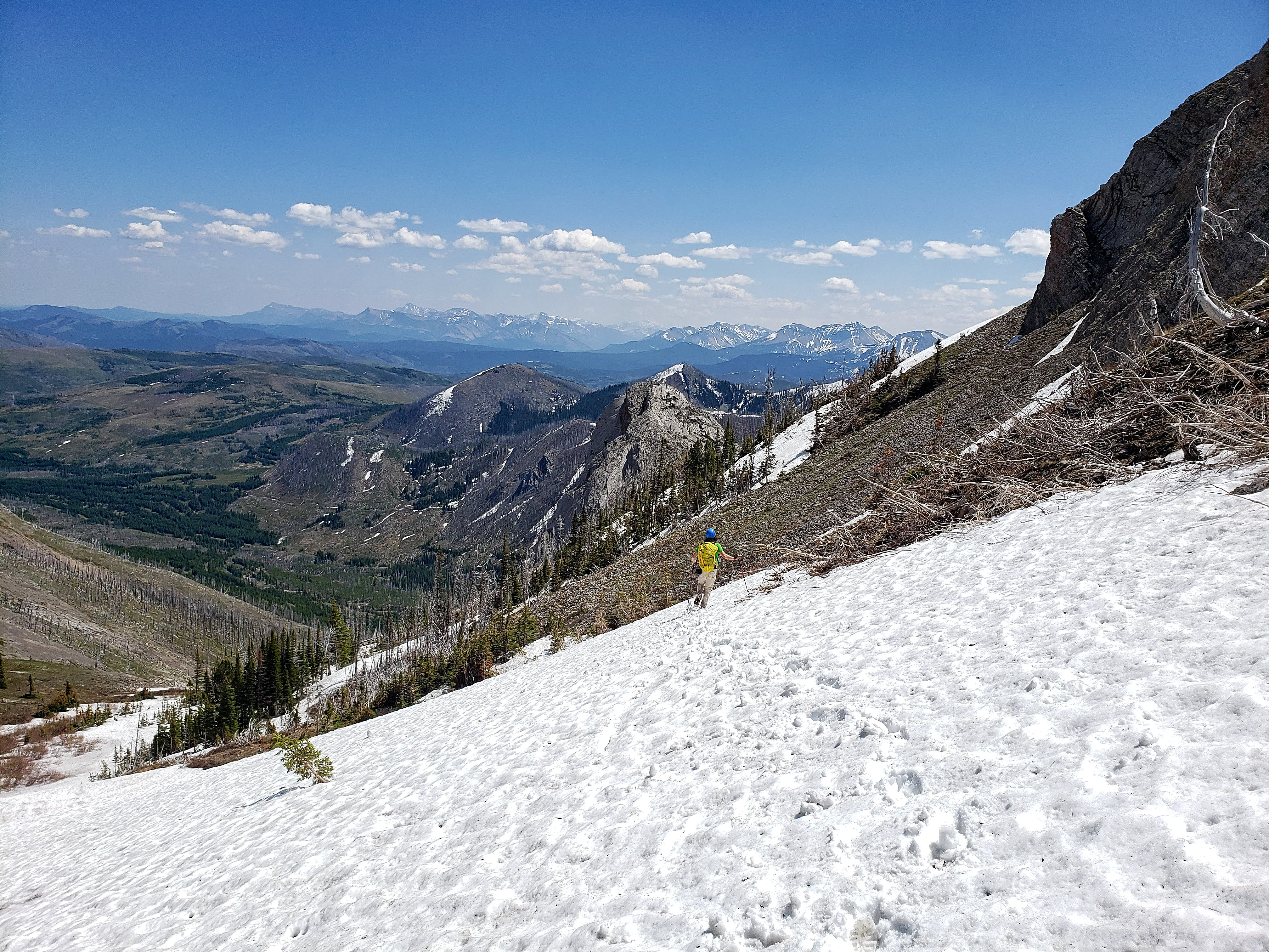
The summit of McGladrey (centre right) is less than impressive when viewed from the bowl. We would ascend using the snow-filled gully in the centre. The good news from this point, was that the gully was closer than it appeared. The bad news was that the entire slope was much steeper than it looked.

Starting up the nasty talus and scree.
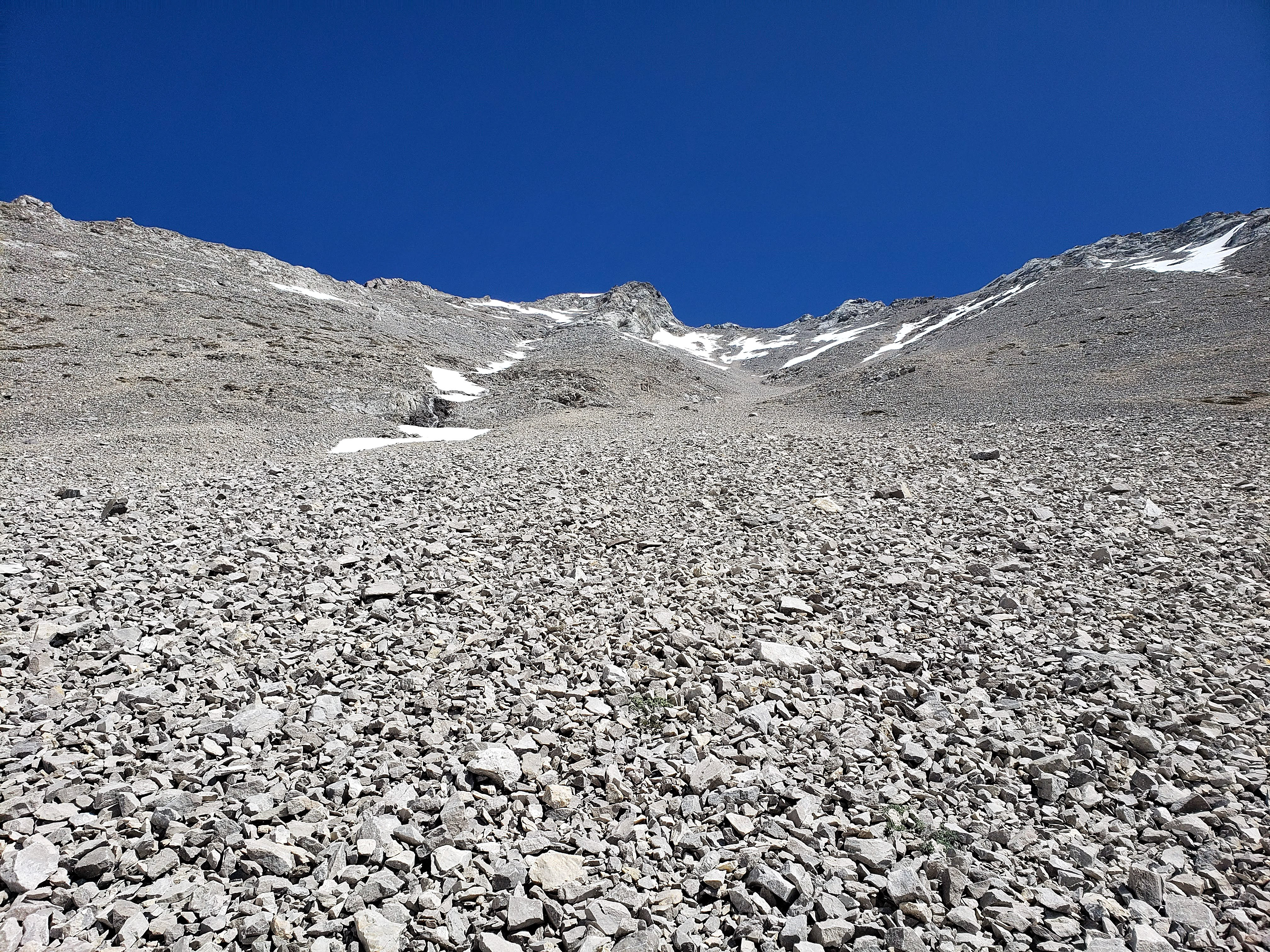
Did I mention that it’s steeper than it looks?
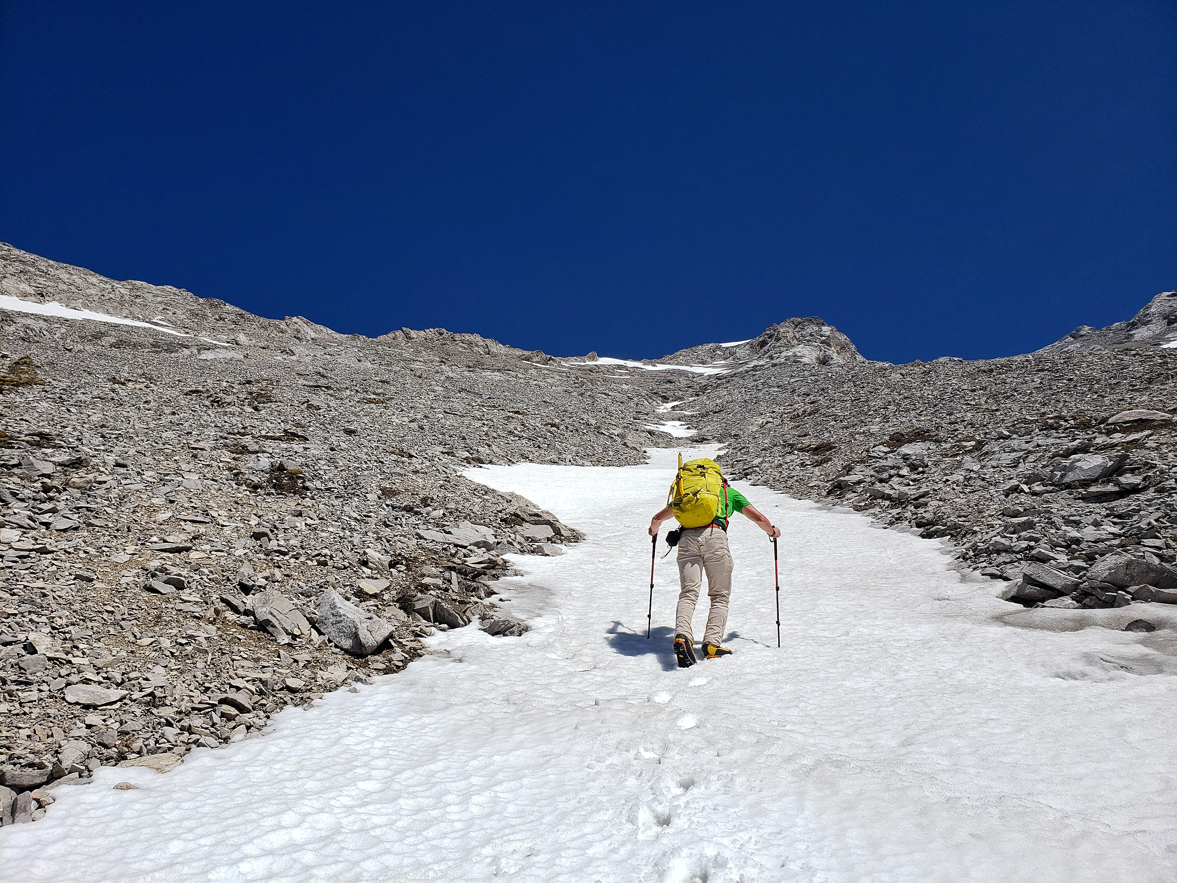
Thankfully, the snow in the gully made our ascent easier. If there wasn’t snow, I’d have been tempted to try and gain the ridge much sooner.

Looking back to Brad as we ascend the gully. The views of Mount Darrah (centre left) and Mount Pengelly definitely provided motivation.
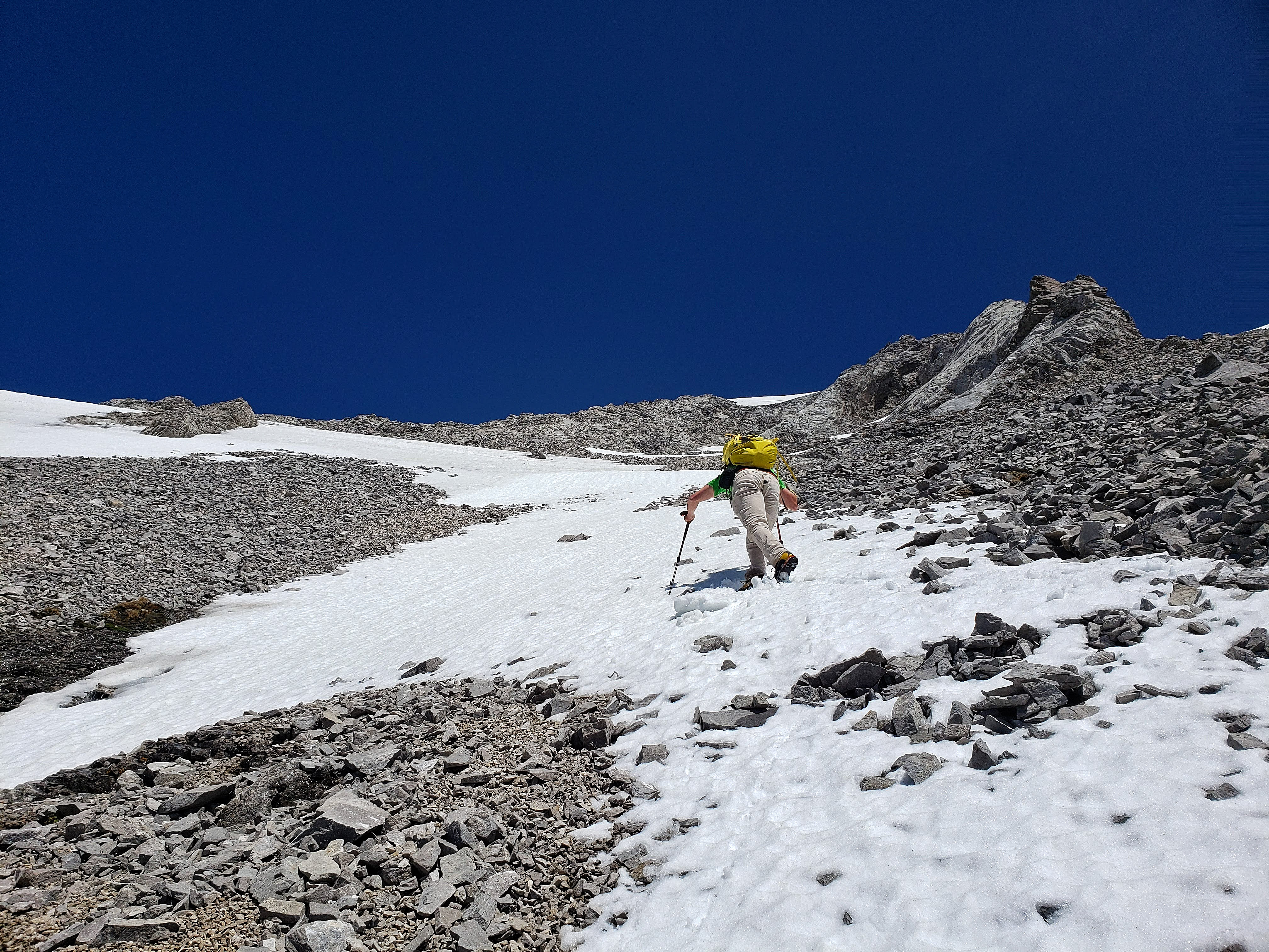
Following the snow to the ridge.

Finally on the ridge beneath the summit.

Looking to the northwest from the ridge. I thought the rock formation on the right looked like the head of a lion.
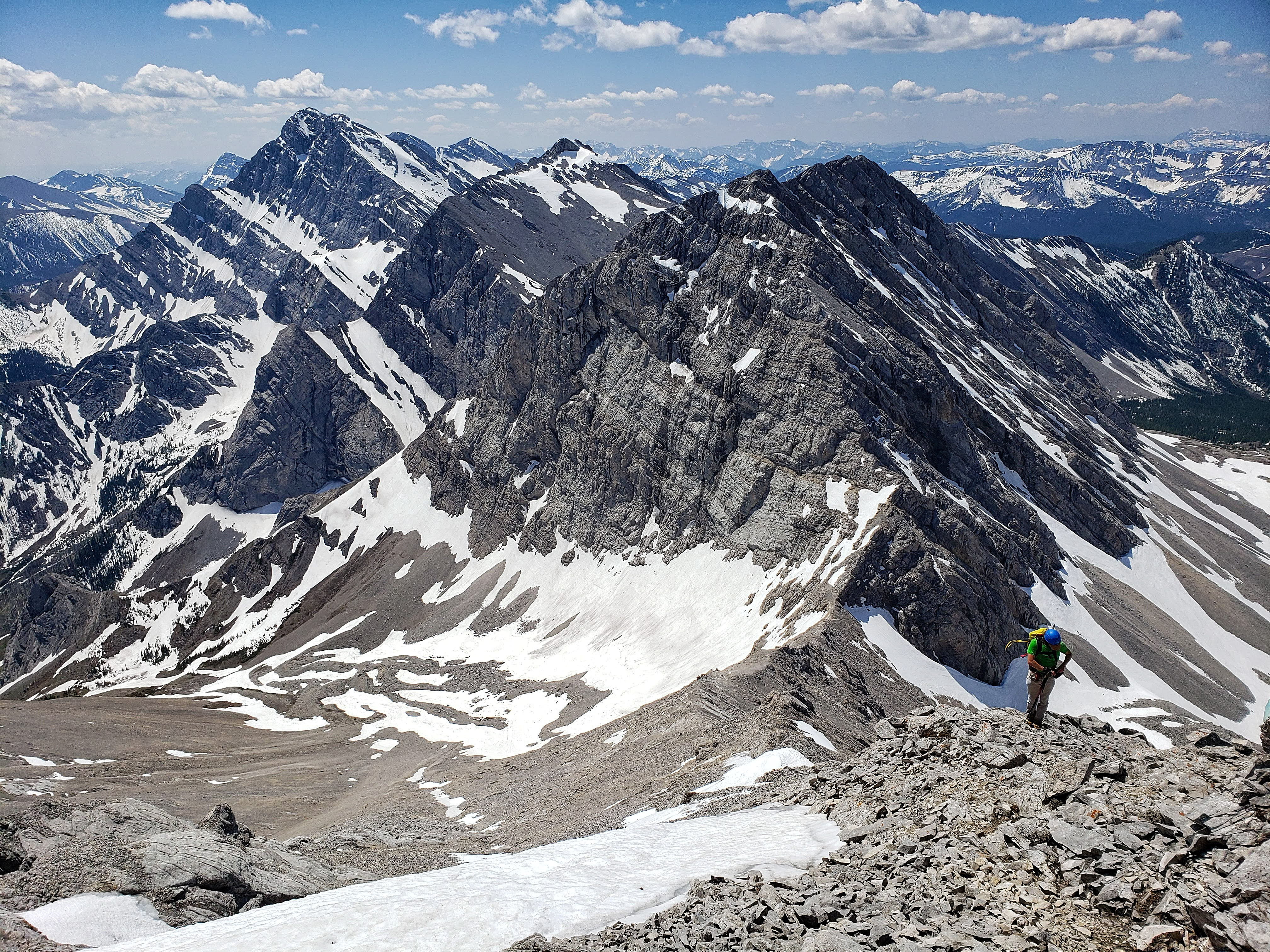
The view back along the ridge just prior to reaching the summit.

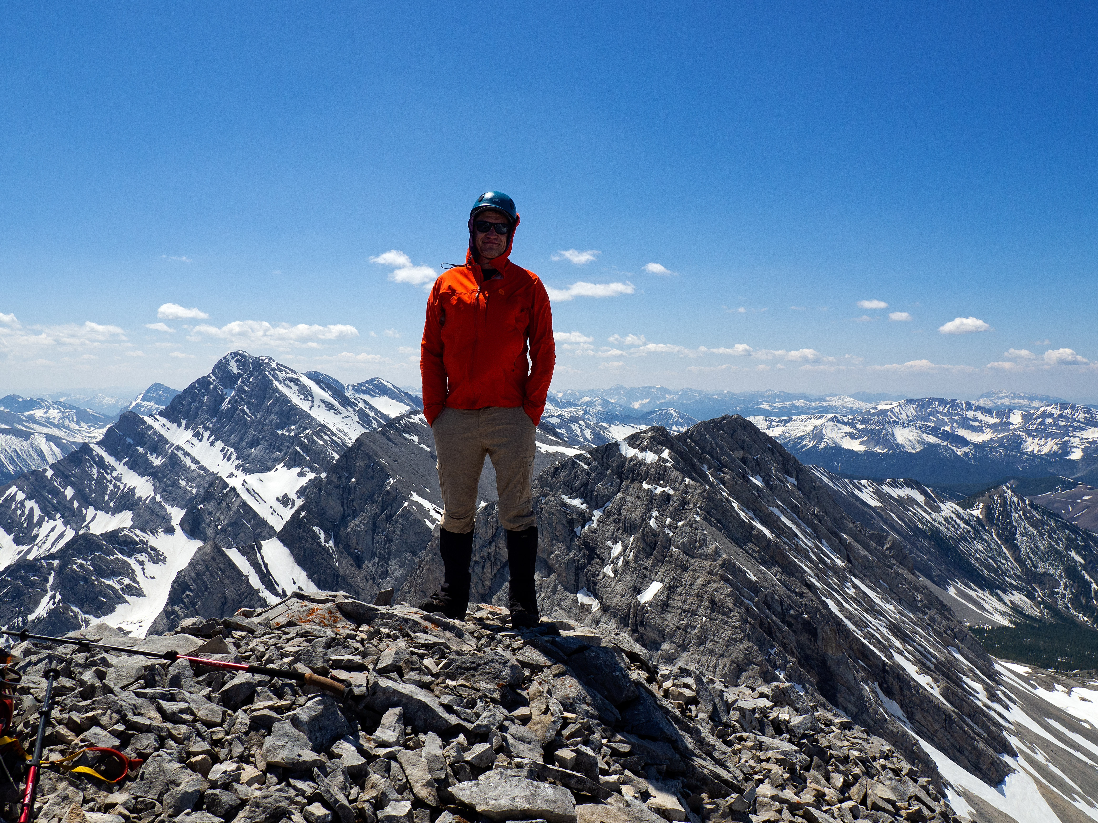
The summit of Mount McGladrey (2638m).
The summit offers expansive views in almost all directions. This is a pano to the west.

A pano to the north.
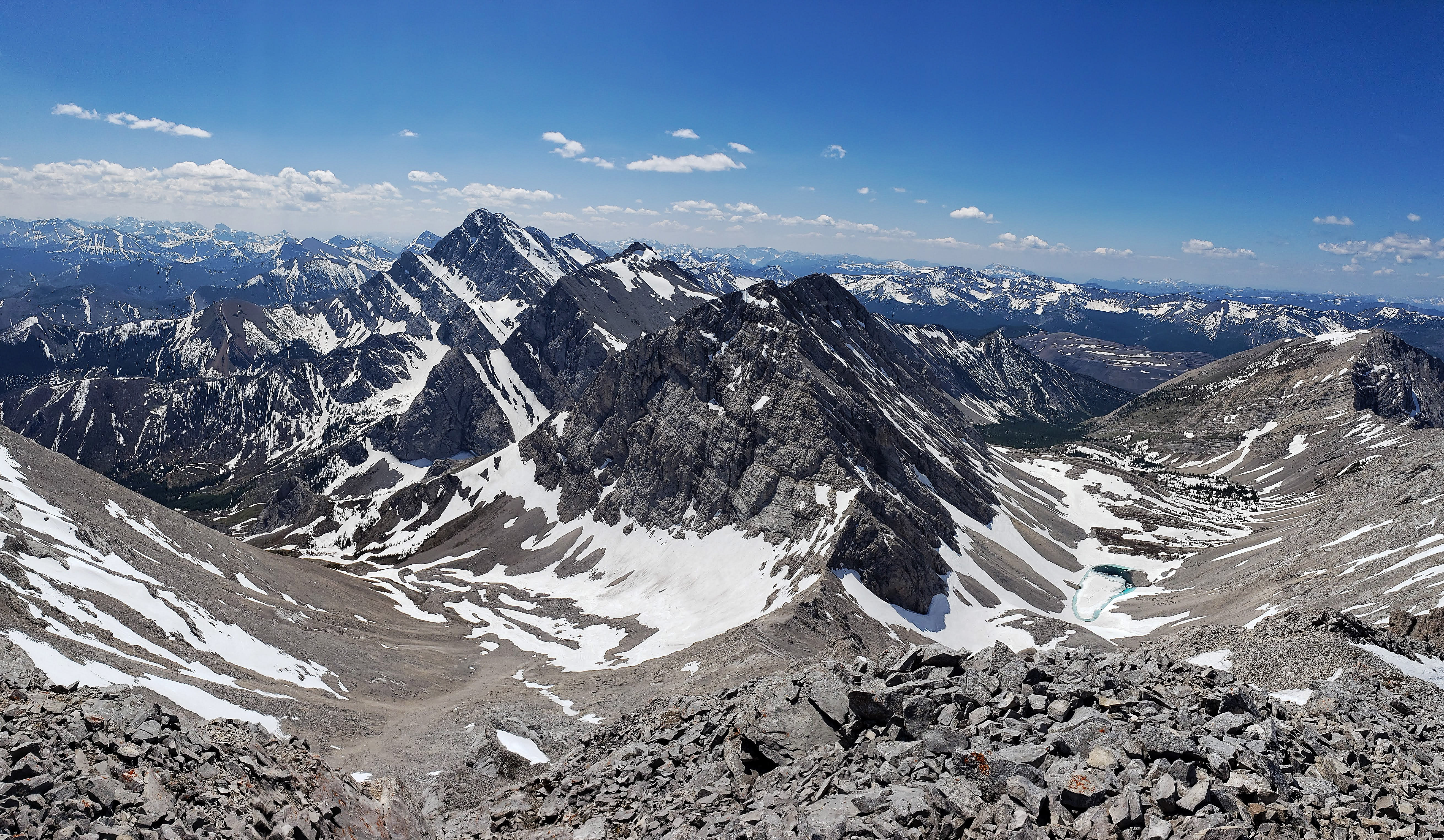
A pano to the south.

One of my favourite people to hike with!
It was a gorgeous day to be on a mountain! (Photo by Brad Wolcott)

A telephoto to the northwest of Mount Ptolemy.

A telephoto to the north of the Andy Good Plateau and Andy Good Peak (right). Chinook Peak is in the background to the left of centre.
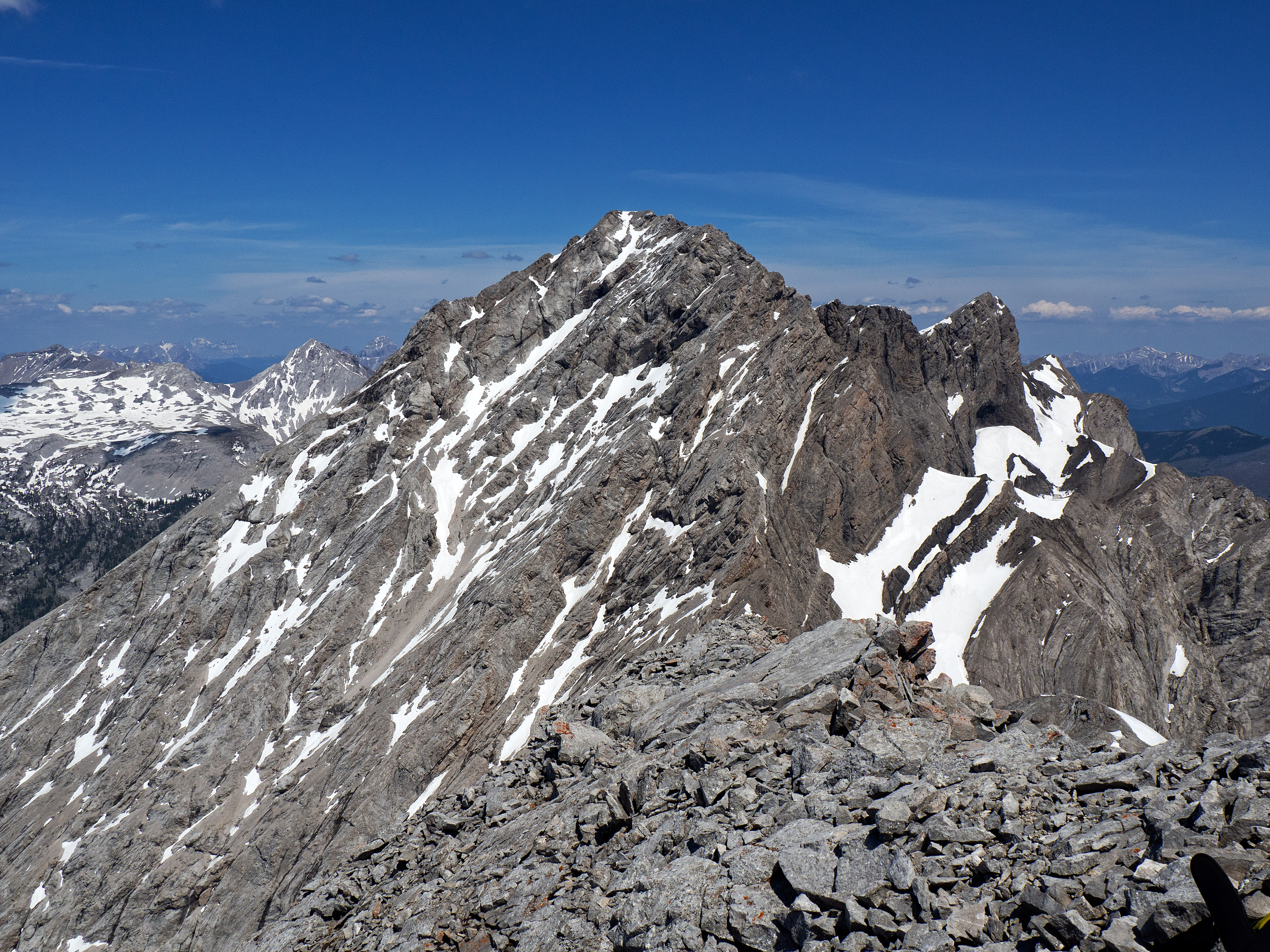
Looking north at the higher, unnamed summit Ptolemy SE5 (2761m) that sits next to Mount McGladrey. Why this peak doesn’t have an official name is baffling.

A telephoto to the northeast of Turtle Mountain (left) and Hillcrest Mountain (right). Lyons Creek Road cuts across the centre.

The view to the southeast was hazy but Prairie Bluff and Victoria Peak can still be seen in the centre while little Cherry Hill (mid-distance centre) is almost indistinguishable.

A closer look at McGladrey’s southeast ridge. It may be possible to use this as an ascent route, but there are a couple of big sections of rock that you would have to either find a weakness in, or lose and regain a significant amount of elevation to avoid.

Gazing down to the bowl and our approach route.
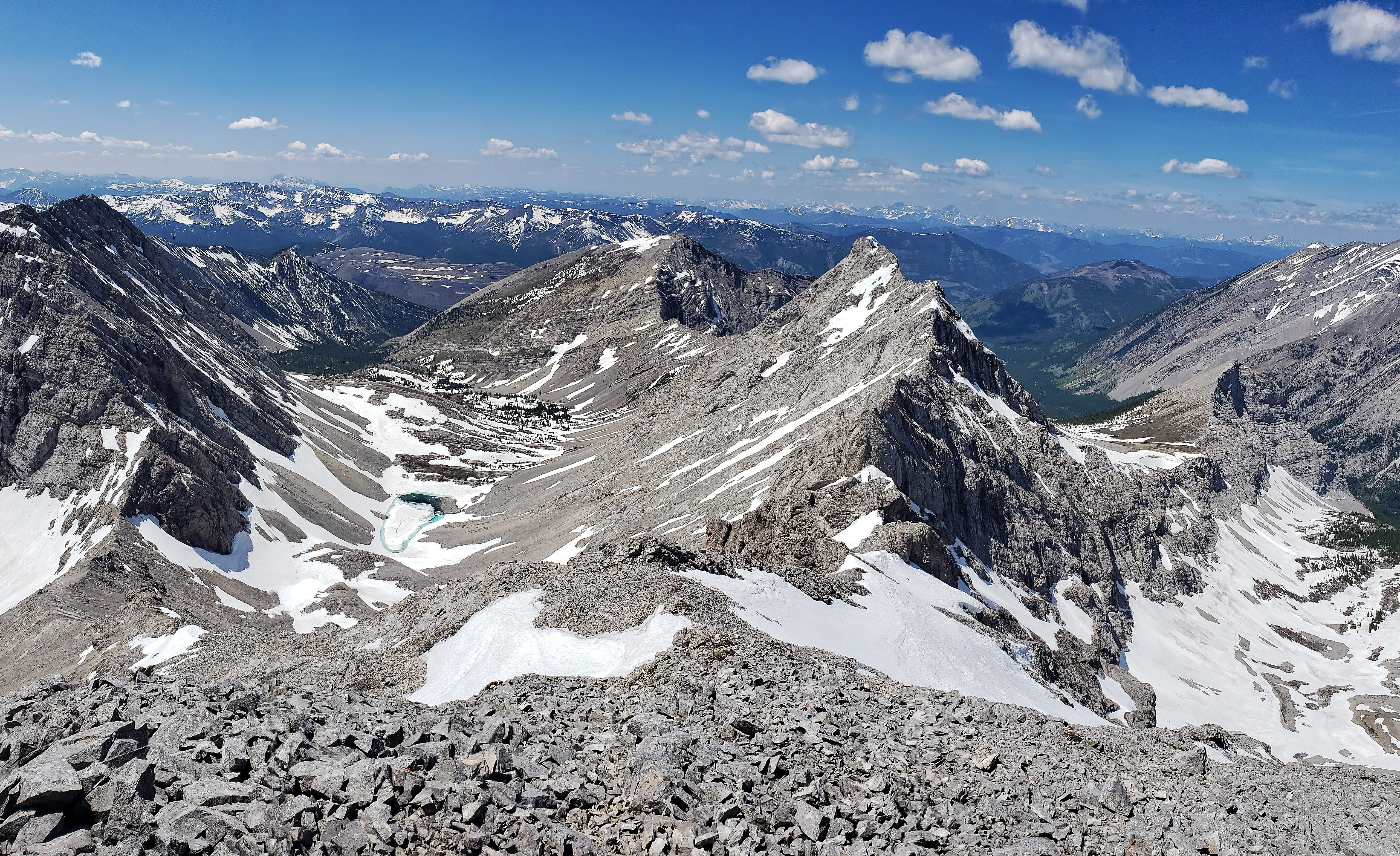
Mount Darrah (left; 2758m) and the smaller, Mount Pengelly (2586m) comprise a very scenic view to the south. The peak (2620m) in between them is unnamed.

Looking to the southwest at Barnes Peak (left of centre) and in the distant centre is Mount Broadwood.

A telephoto to the west of Mount Taylor (centre) and Tent Mountain (right).

Brad signs the summit register that was placed in 2017 by an out-trip party from Crowsnest Lake Bible Camp (CLBC). Including this entry, Brad and I were only the fourth party to visit the summit since. The other two parties were also from CLBC. A huge tip of the hat to James McKinnon who was a leader on all three CLBC trips and who must now hold the record for most ascents of McGladrey. There must be something about McGladrey that draws McKinnon’s and McMurray’s to it… 😉

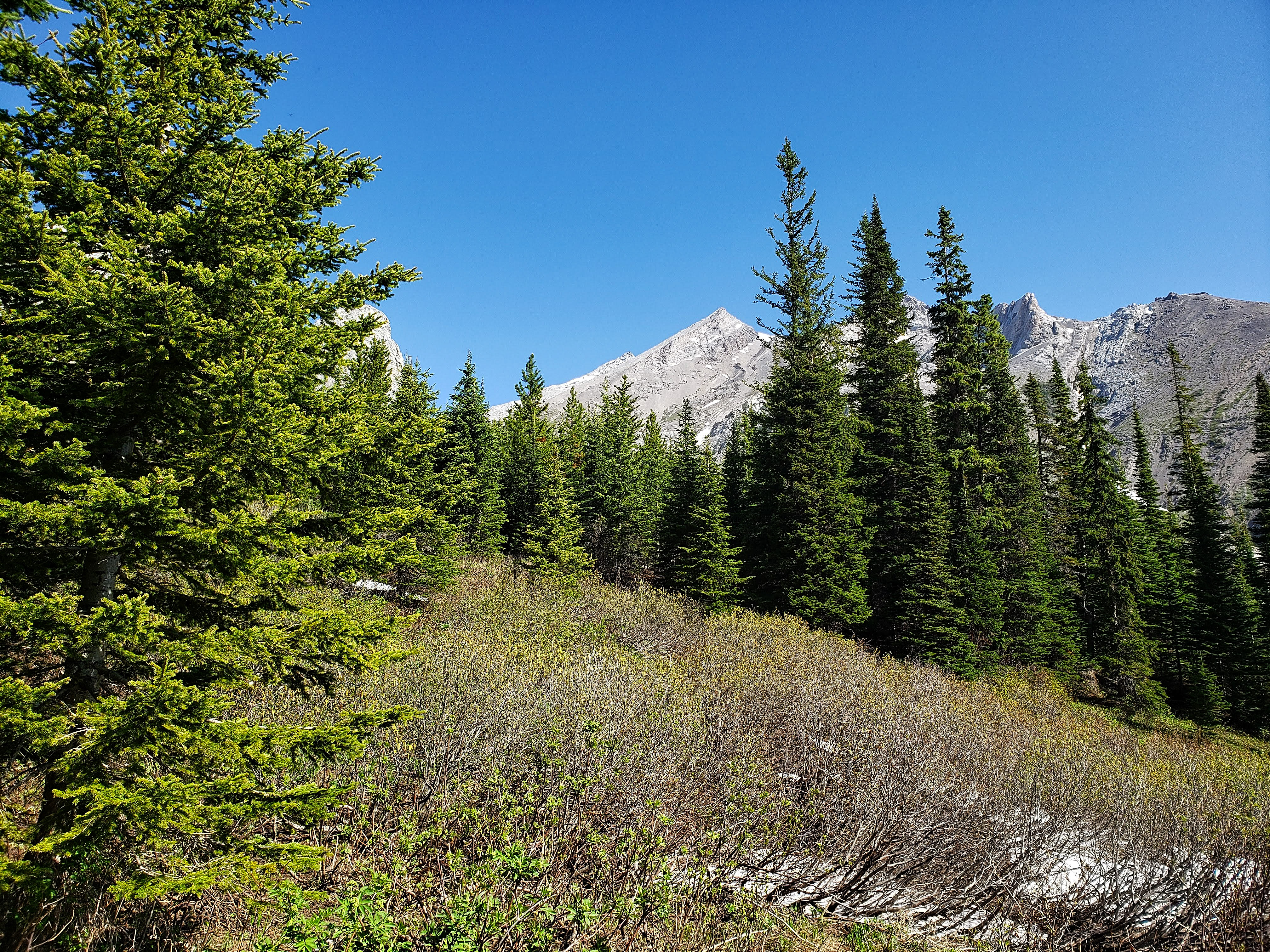
Brad, who has made a few technical attempts at Mount Ptolemy, checks out its south face. Our 2016 traverse of the Northwest Ridge of Ptolemy remains one of my all-time favourite trips in the Pass.

Time to head home. We would follow the ridge until we could descend into the easier, lower section of the gully.
A closer look at the col between Pengelly and McGladrey. There are sections on the ridge leading up to Pengelly that I have no idea how Rick Collier was able to climb over, let alone down-climb on his 1993 ascent. On our way down, Brad and I scoped out a possible route up Pengelly’s southeast slope.

The snow made for a very quick descent.
Before descending the drainage, we decided to try and climb the little outlier on the ridge between Pengelly and McGladrey. It can be seen directly in front of Brad.
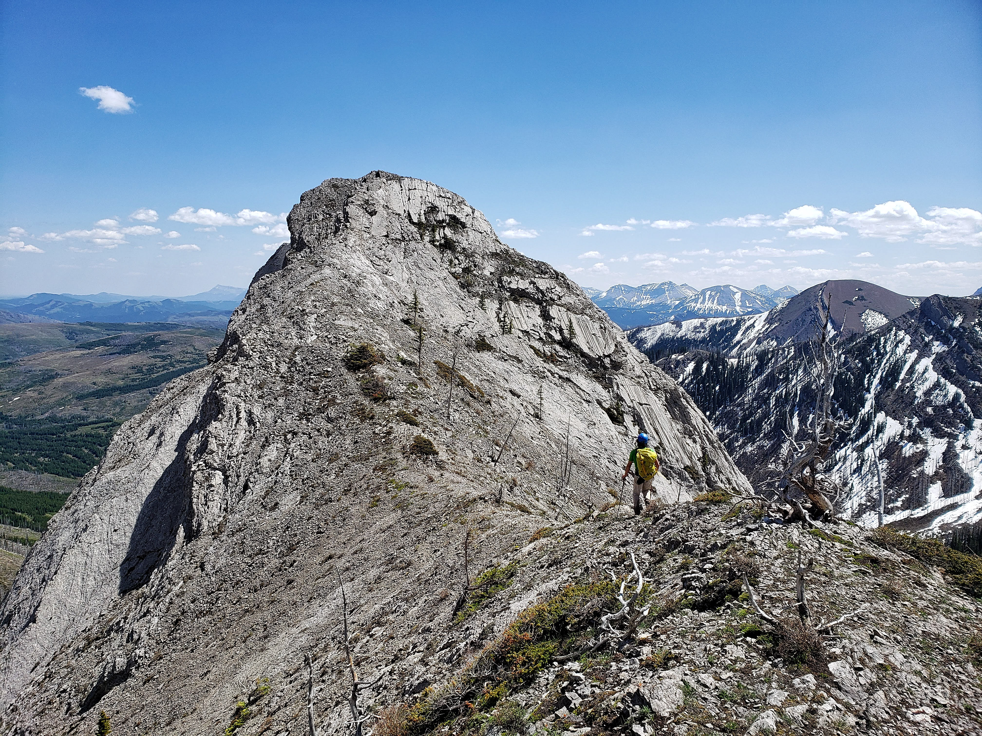
Brad approaches the outlier.

Unfortunately, getting to the top was not worth the risk.

The view from the ridge towards the unnamed peak (left) and the southeast slopes of Pengelly. There may be a way to continue up the ridge we are on and then onto the southeast slope where the snow patch is. Brad and I want to return and try this route. Edit 26 June 2019: We returned today and made a successful attempt of Pengelly using this route. It was more or less, a steep hike with a bit of moderate scrambling to reach each of the twin summits.

The view from the ridge to the bowl between Pengelly (left) and McGladrey.

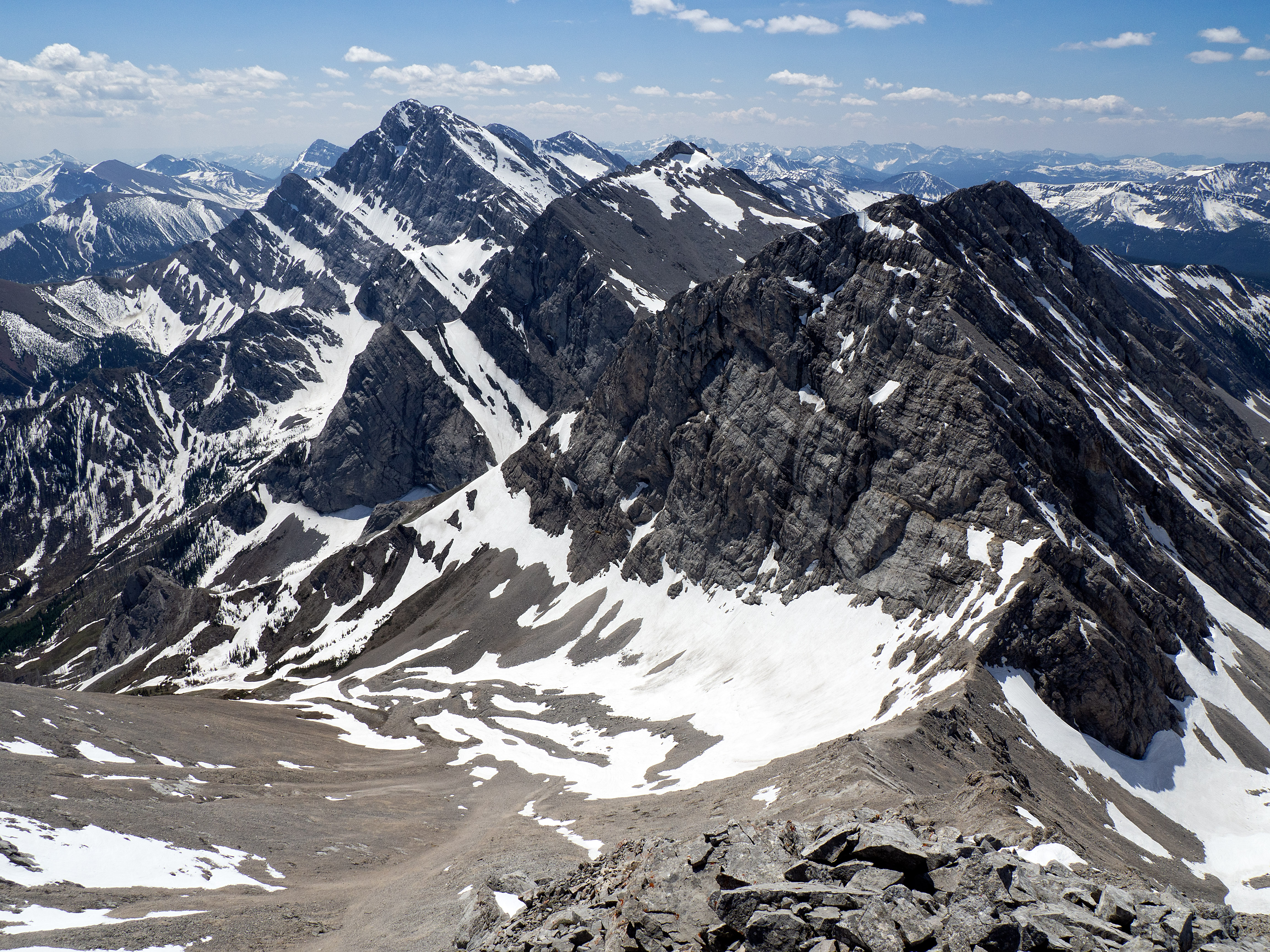
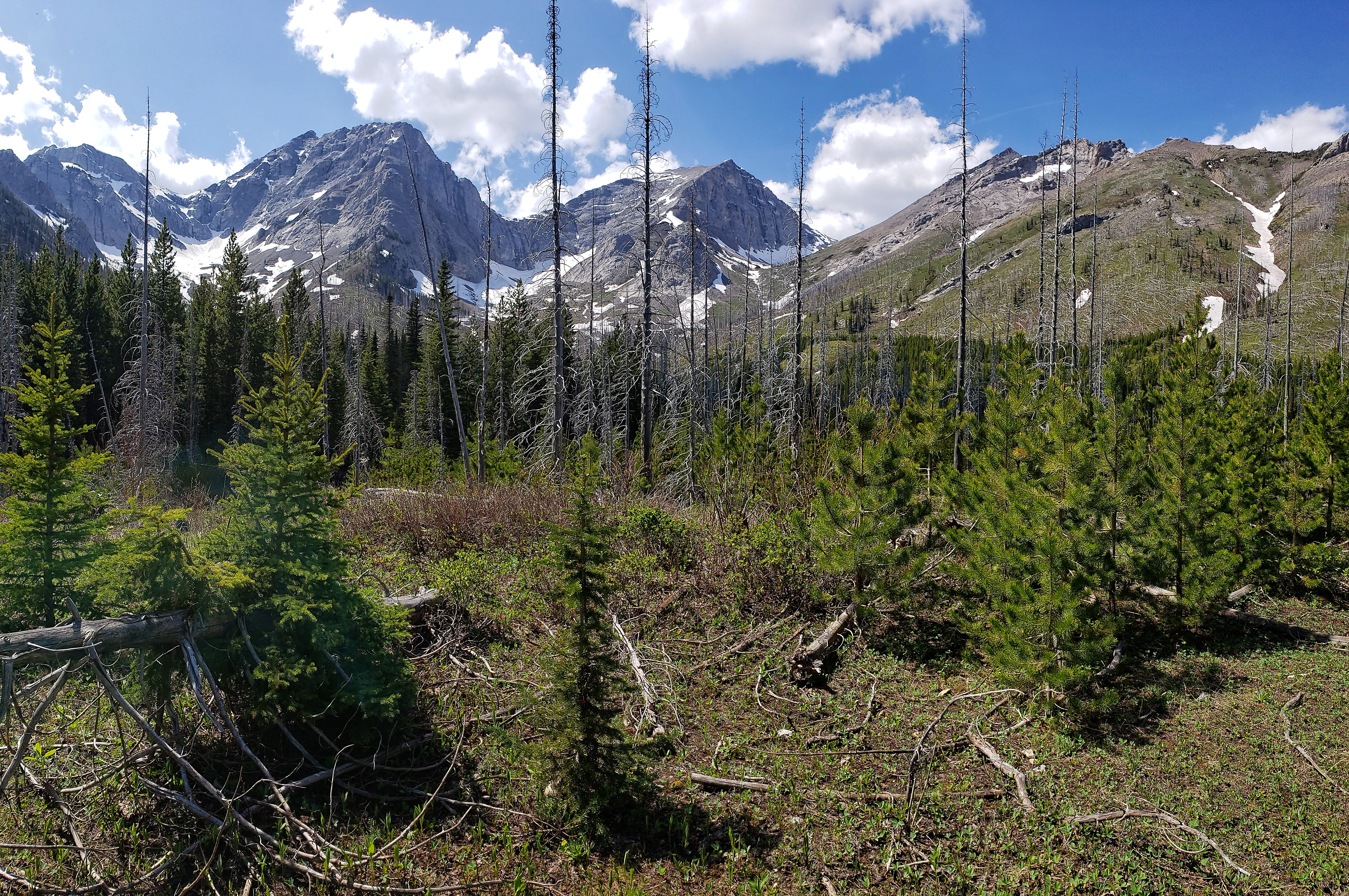
A pano of Mount Darrah (far left), the unnamed peak (left), Pengelly (centre), and McGladrey (far right).

Brad glissades down the snow…

…and he makes it a long, long way without stopping!

Looking back at my attempt to boot-ski that eventually ended up as a glissade.

Instead of following our original route through the trees and back to the trail, we descended directly down the drainage to the creek.

After crossing the creek, we followed the small trail that we had come across just before reaching the clearing. It is recognizable from the creek as a distinctive cutline.

Back on the trail and enjoying the easy hike.
Looking back to the unnamed peak (left of centre) and Mount Pengelly (centre).

We had left our bikes in the middle of the trail and once we were on them, it was an easy cruise back to the red bridge.
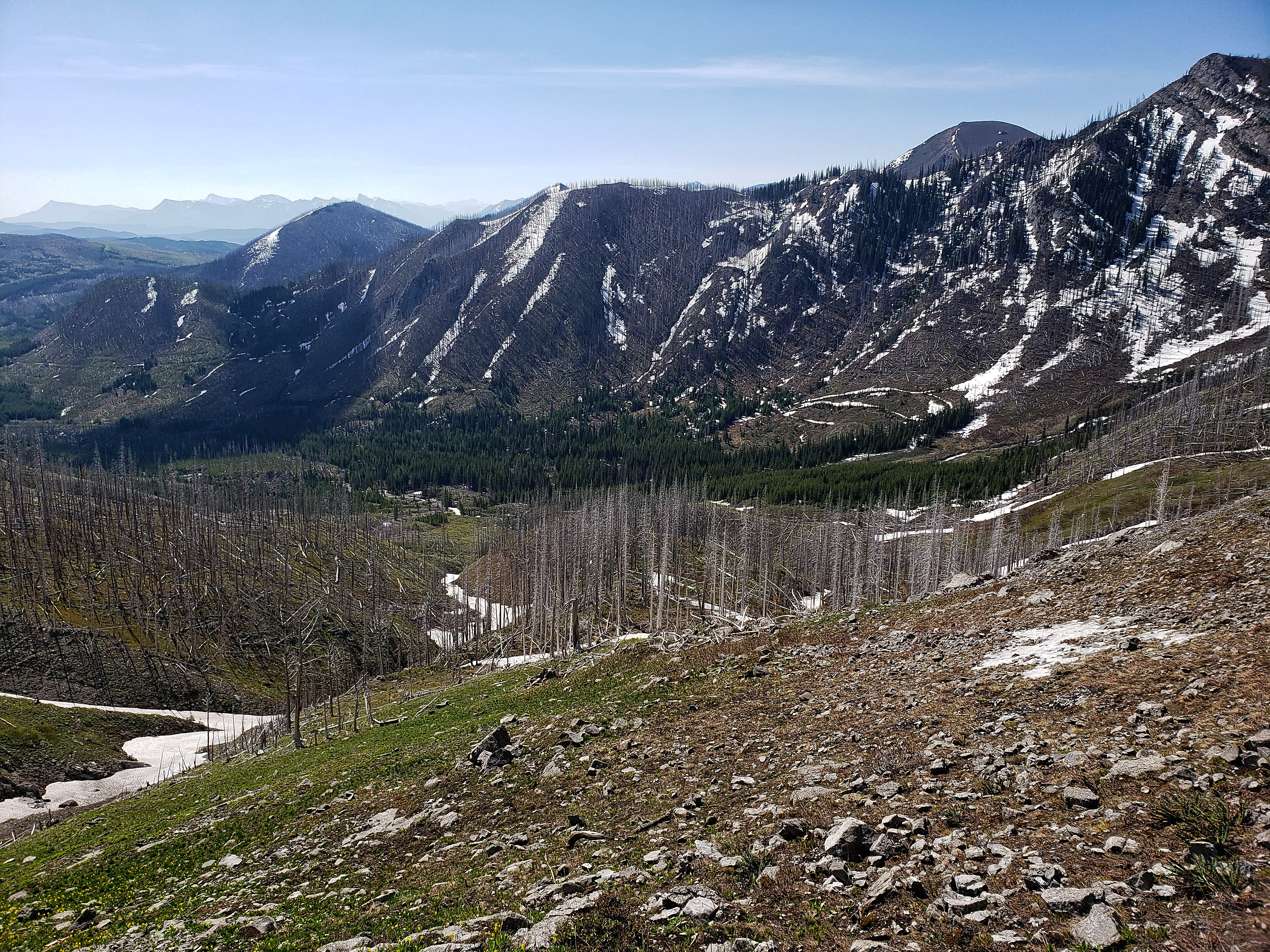
Brad checks out some of the surrounding foothills from the main trail.

Arriving back at my 4Runner – which rolled 394,000 km on this trip – after a total roundtrip time of 6 hours and 51 minutes.

One last look at Mount McGladrey (left) as we drive out along the Goat Creek Road. I can’t say that McGladrey is a great scramble because the trip from the bowl to the summit is miserable. However, everything else lines up nicely: it has a straightforward and pleasant approach; it is in a very interesting and seldom visited area; and the summit views are expansive. Even if you wanted to just hike to the upper bowl, it would be a very nice trip. I’d recommend doing this trip when there is still some snow to take advantage of, as this definitely helped us both on the way up and on the way down. The glissading was fantastic! Finally, and it goes without saying, that it was awesome to be able to get out again with Brad.
Hi Dave,
Love the report, but where are my pictures? I sent them to you via Dropbox. Are my pictures not good enough? 🙂
Hahaha… No, they actually sucked. 😉 Totally missed my good side and the one where I fight off the swarm of marmots failed to capture my six pack after my shirt was torn to shreds. You also only caught a portion of my boots in the air rather than the entire backflip that I performed while boot-skiing. I did include one of your pics, it just wasn’t with your own camera…