
⚠️ Hiking and scrambling are inherently dangerous activities. Please read my Disclaimer. ⚠️
I think I’ve tried to climb the northeast peak of Buchanan Ridge four separate times – and each time I’ve had to find a new, last-minute destination because the weather was crappy. Today was no exception. Despite a somewhat optimistic forecast, intense wind and driving rain greeted Andrew and I at the Crandell Lake parking lot, putting to rest any thought of hiking in the area. In fact, the only places that seemed to be free from rain were Lakeview Ridge, Sofa Mountain, and perhaps the easiest hike of all, the Chief Mountain Highway Fire Lookout.
According to Mike Potter in Fire Lookout Hikes in the Canadian Rockies (2nd edition), the Chief Mountain Highway Lookout was operational between 1958 and 1973, after which it was decommissioned and the site slowly reclaimed, with the last building removed in 1994. (21) Located only 700 m from the highway of the same name (Highway 6), Potter notes the lookout itself was a “steel tower with [a] cupola on top” that was “removed in the mid-1980s”. (21)
Perhaps the most surprising thing about the lookout, is its obscurity – and for good reason. There is little to see at the site unless you like trees. Fortunately, it only takes 10 to 15 minutes to hike to the top, so the minimal investment of energy mitigates any disappointment one might feel. Besides, neither Andrew or I had been here before – and it wasn’t raining cats and dogs, which was a major bonus. 😁
All in all, despite this being the easiest hike that I’ve ever done – easier than even Clubs Peak in the Crowsnest Pass – the Chief Mountain Highway Lookout is an interesting part of Waterton’s forest management history that ironically, was spared by the 2017 Kenow wildfire. It also saved us from returning empty-handed from the mountains; even buying time for the weather to clear enough so that we could further salvage our day with a scramble up the East Peak of Lakeview Ridge. 😁

To get to the Chief Mountain Highway Lookout, we drove ~6.4 km south on Highway 6 from its junction with Highway 5, until we reached a viewpoint and rest stop on our right. This is where we parked.
From the parking lot, we walked for 200 m further to the south along the highway, until we could see the start of the lookout’s old access road in the trees to our left. The entrance is barred by some deadfall, but once beyond it, the old road is still obvious even as the forest tries to reclaim it.
From the start of the old road to the clearing at the top, it is only a 700 m hike with an elevation gain of ~50 m. We ventured further into the woods from the old lookout site just to see if there was anything else of interest, but there wasn’t. We then returned to the site and then back down the trail to our vehicles.

Our total distance travelled including our foray into the trees and then walking around the site, was 2 km. Our roundtrip time was 44 minutes simply because we spent a long time looking around. Total elevation gains were 78 m which takes into account the short trip from the parking lot and our time wandering around the top.

Our parking spot at the viewpoint along Highway 6 – approximately 6.4 km from its junction with Highway 5 near the Waterton Park gates.

The crux was trying not to fall while crossing the icy parking lot. 😂

Scanning for the trailhead while hiking south along the highway.

Approximately 200 m from the viewpoint, we came to the trailhead (centre).

Andrew crosses the deadfall that guards the entrance to the old road.

The road is slowly being reclaimed by the forest.

Avoiding more deadfall across the trail.

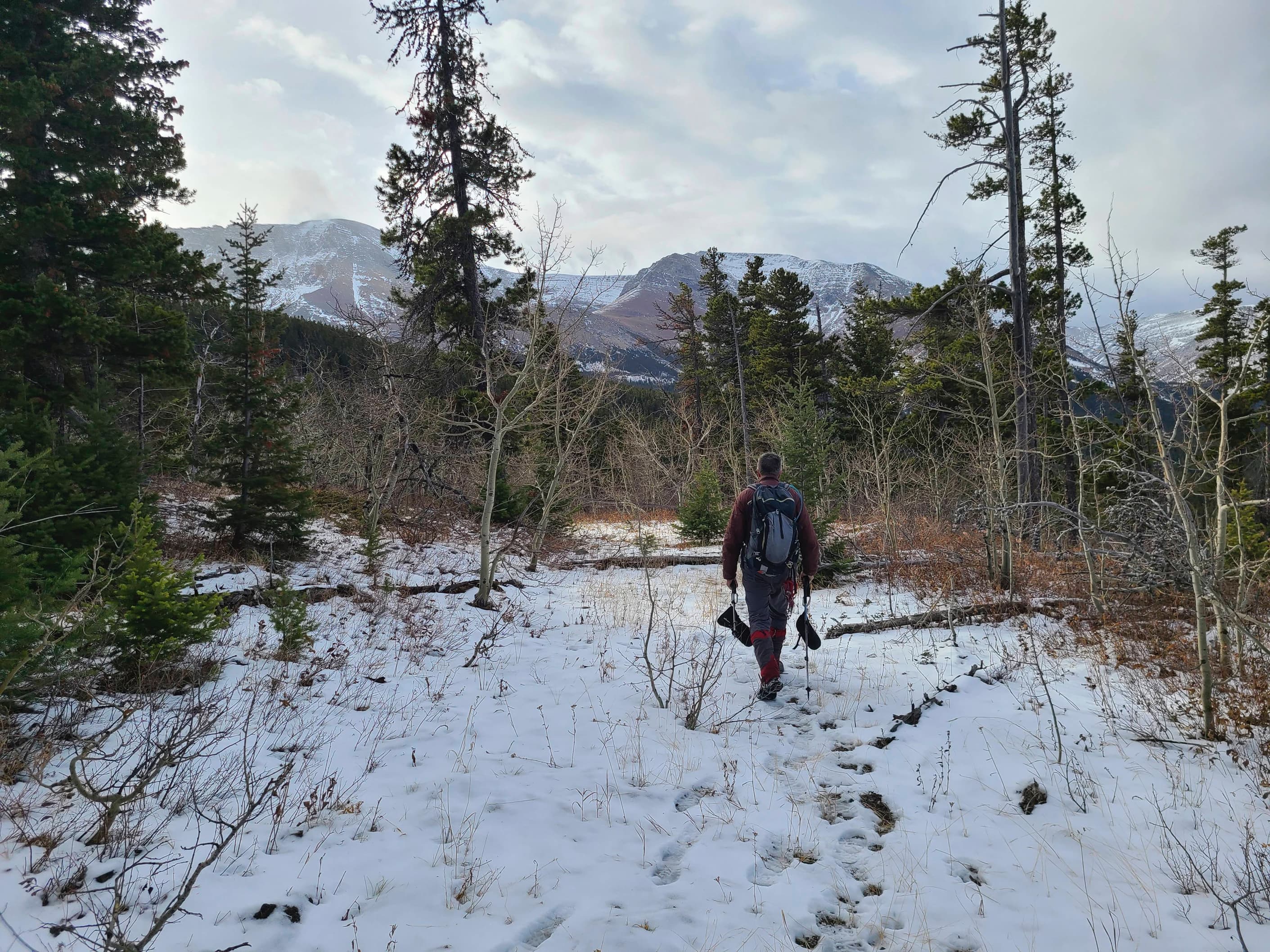
This was a super quick hike.

Arriving at the clearing that marks the site of the former fire lookout. This has to be the easiest hike in all of Waterton.

A pano looking to the west and across the clearing.

There wasn’t a whole lot to see, outside of what looked to be a small mound at the far west side of the clearing.

Thinking there might be something more to see, or perhaps a higher point to reach, we headed off into the trees.

However, there was nothing to see here either.

I stand on the highest point we reached. 😂 (Photo by Andrew Nugara)

There are limited views of Sofa Mountain.

The mysterious mound. With the wind that this area experiences, being up in a fire tower on a day like today, must have been quite the experience. 😳

Andrew triumphantly celebrates our arduous journey from the top of the mound. 😂

The clouds clear for a fleeting glimpse of Vimy Peak.

Another view across the clearing and towards Sofa Mountain as we prepare to leave.

A better view of Vimy from the trail.

This deadfall was the only obstacle we faced.

It was somewhat sheltered from the wind and it wasn’t raining, so we were happy to be here. 😊

Arriving back at the highway.

Heading back to the viewpoint.

A pano of the mighty summit. 😂

Though pretty, this would not be the coolest rainbow that we would see…

Arriving back at the viewpoint after our leisurely stroll in the woods. From here, we could see that the East Peak of Lakeview Ridge was free from cloud-cover, so we decided to try our luck there as well. Though one could hardly classify the Chief Mountain Highway Lookout as a real hike, visiting the site is still a worthwhile endeavour for those interested in seeing a part of Waterton’s past. A huge thanks to Mike Potter for highlighting all of the current and former lookout sites for not only hikers, but historians as well. 😁 Click to follow us over to the East Peak of Lakeview Ridge.


Leave a Reply