⚠️ Hiking and scrambling are inherently dangerous activities. Please read my Disclaimer. ⚠️
The summer that wasn’t. That’s how Melanie and I will remember July and August. The craziness related to selling and buying a home coupled with a serious family medical issue, meant that we had little time for rest and relaxation. On the positive side, the birth of a new granddaughter put everything into perspective and as I’ve said before, we’re fortunate that all of our kids and grandkids live in Lethbridge. 🙂
Moving forward, it was nice to finally have window where I could get back to the mountains and enjoy the rejuvenation that only nature can provide. The invitation from Andy, Geoff, and Brad to join them on a Labor Day loop of “Promised Land Peak” and “Gargantua Peak” was just what the doctor ordered.
Located above the Andy Good Plateau and the Promised Land (Ptolemy Plateau) in the Crowsnest Pass, these two unofficial peaks are ascended several times a year by backcountry campers and day hikers; though the real attraction is the network of caves, most notably Gargantua and Cleft. While “Promised Land Peak” and “Gargantua Peak”, look gnarly from both the Andy Good Basin and the Promised Land, they are relatively easy to ascend which is why they see regular traffic. In fact, this was Brad’s second time on “Gargantua Peak”, with his first ascent occurring over thirty years ago alongside his dad. For me, it was roughly that same length of time since I last visited the Andy Good Plateau, but sadly, I did not visit either peak, so both summits were new terrain for me.
This trip also marked my introduction to Geoff Hardy, who besides being an accomplished, Calgary-based scrambler, is also a terrific guy to spend the day with. 🙂 As Geoff had not yet ascended Andy Good Peak, we chose to follow a variation of Vern’s route that reached the Andy Good Plateau from Andy Good Peak’s southwest col. While Geoff made a solo venture up to the summit of Andy Good Peak, the rest of us enjoyed a relaxing time watching his efforts from the col.
While Geoff was on his way down and past the crux, we began the easy traverse over to the Andy Good Plateau and the base of “Promise Land Peak”, where we waited for him. From here, we went our separate ways for a short time – exploring and sightseeing – before rendezvousing on the summit of “Promised Land Peak”. We then set off for “Gargantua Peak” followed by its sub-peak which is located immediately to the north.
To return, we followed the trail from the “Gargantua Peak” / Andy Good Plateau col back to its junction with the trail to Andy Good Basin. From here it was a quick bike back to our vehicles. After reaching our vehicles, I turned on my phone and promptly received a photo from my son letting me know that our three-year-old grandson had tagged Poker Peak – his first of hopefully many summits to come. Also notable, was that this was my daughter-in-law’s first peak, so a huge congrats to both Ollie and Chantelle! 👏
Finally, a HUGE thank you to Geoff, Brad, and Andy – holy cow! Are there are a lot of Andys in this report! – for a fantastic day in the mountains. 🙂
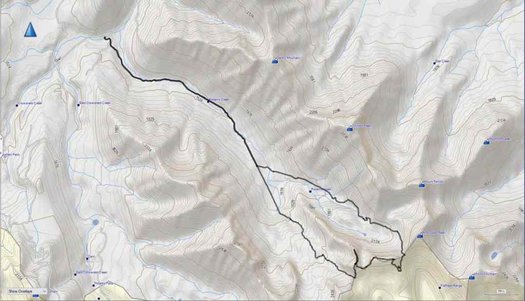
To get to “Promised Land Peak” and “Gargantua Peak”, we followed Highway 3 past Coleman towards the B.C. border. After driving 1.3 km beyond the rest area at the far west end of Crowsnest Lake, we turned left onto Coal Road. From here we drove ~3.2 km to our parking spot at the Ptolemy Creek trailhead. After wading across the stream at the trailhead (the first of many unbridged crossings), we then biked ~5 km (1 hour with a ~200 m elevation gain) until we reached a very large clearing/camping area.
Here is where the trail bifurcates, presenting the option to continue going straight – which will take you to the Promised Land – or to turn left, which will take you to Chinook Peak, Andy Good Peak, and Mount Parrish. As we were going to do a clockwise loop so that Geoff could ascend Andy Good Peak, we stashed our bikes next to the fire pit in the clearing and set off on foot for the Andy Good Basin. For reference, from the Ptolemy Creek trailhead it took us a total of ~8.8 km over a time of 2 hours and 24 minutes.
From the base of Andy Good, we followed a trail to its southwest col with “Promised Land Peak”. This is where Geoff left us to ascend Andy Good, while we waited at the col. For reference, from the trailhead to the col, it was a distance of 9.5 km (968 m elevation gain) over 3 hours and 10 minutes.
Once Geoff was on his way down, we made the easy ~300 m traverse over to the Andy Good Plateau. After Geoff joined us, it was a simple matter of following the base of “Promised Land Peak” to the west until we found an easy scramble route to the top.
The trip from “Promised Land Peak” to “Gargantua Peak” involved following the connecting ridge for ~1.1 km. A small elevation loss to the col was followed by an easy hike to the summit. We then left our packs on the summit and make the ~375 m trip to the “Gargantua’s” sub-peak (2503 m). This involved a 56 m elevation loss to the col and then a 40 m elevation gain to the summit.
We returned to “Gargantua’s” summit the way we came, and then made the short hike (~360 m ; 117 m elevation loss) to its col with Mount Ptolemy. From here, we hiked the Promised Land trail for ~3.7 km back to our bikes and from there, rode the remaining ~5 km of the trail back to our vehicles.
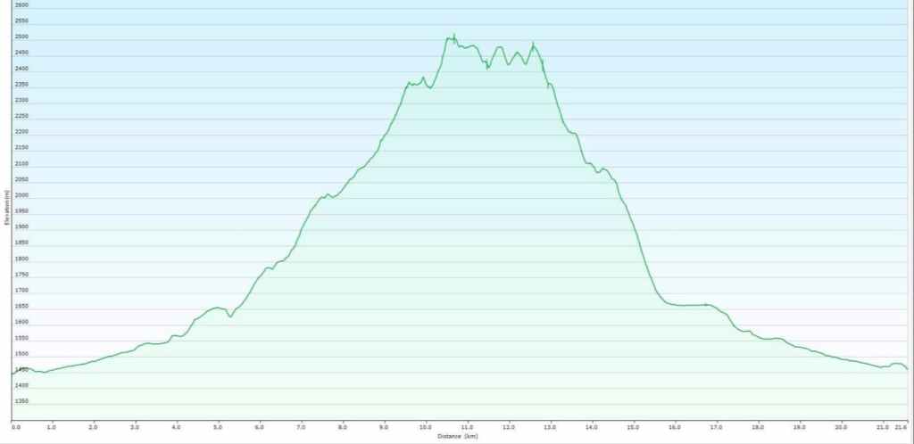
Our total roundtrip distance was 22 km with a total time of 8.5 hours. Total elevation gains (not including Geoff’s ascent of Andy Good Peak) came in at 1404 m.
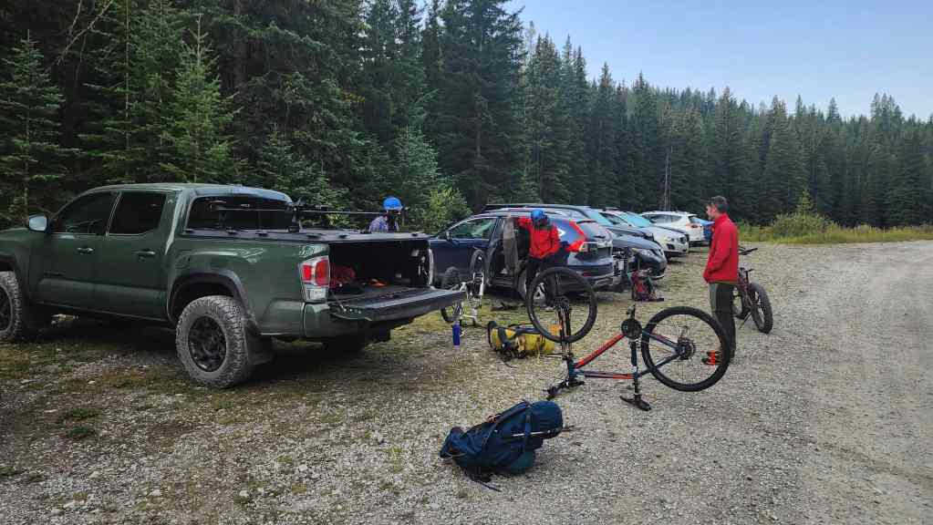
Gearing up at the trailhead.
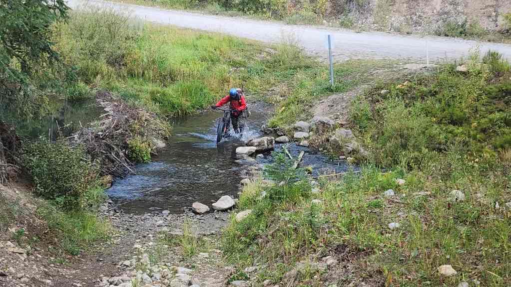
Andy walks his bike across Crowsnest Creek.
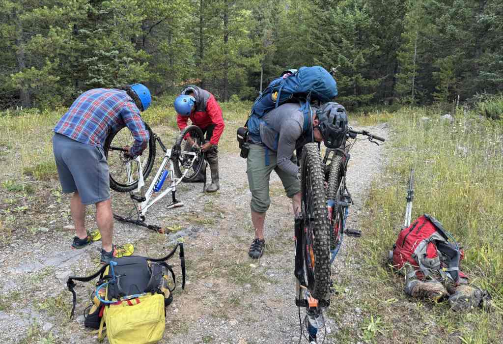
Shortly after starting, Brad and I realized that our tires needed more air. After so little exercise this summer, it was a good thing that I had a spare tire around my waist that I could use. 😂 (Photo by Geoff Hardy)
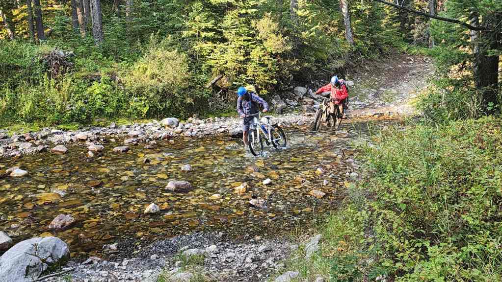
Ptolemy Creek was much lower than it was for our Mount Parrish trip.

Geoff points toward “Gargantua Peak” (far left) as we make our way along the trail. The Northwest Ridge of Ptolemy is directly in front of us.

Looking back from the same vantage as the previous photo.

Arriving at the junction with the Andy Good Basin trail which is where we’d leave our bikes. For reference, it took us exactly 1 hour to cover the ~5 km from the trailhead to this point.

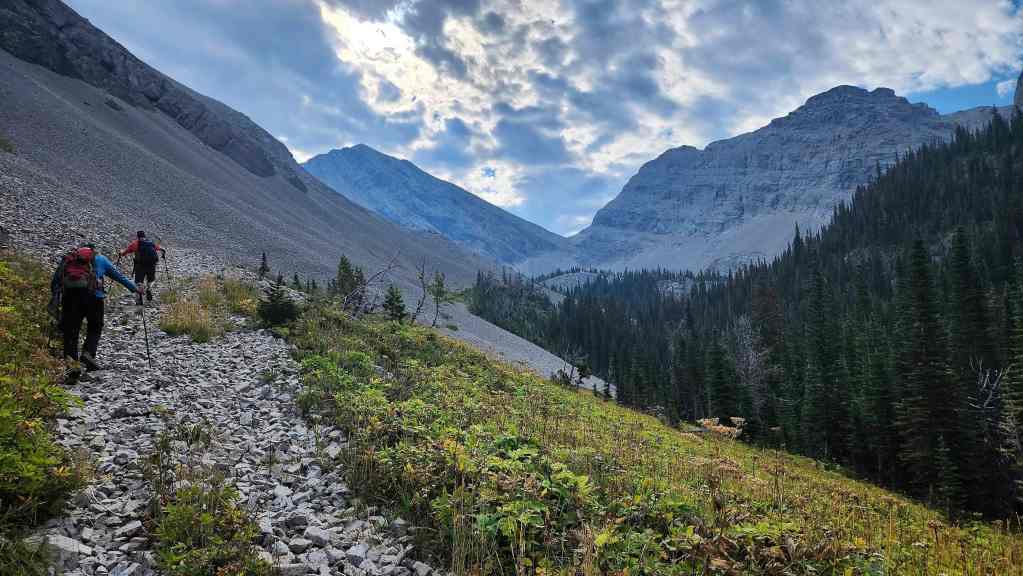
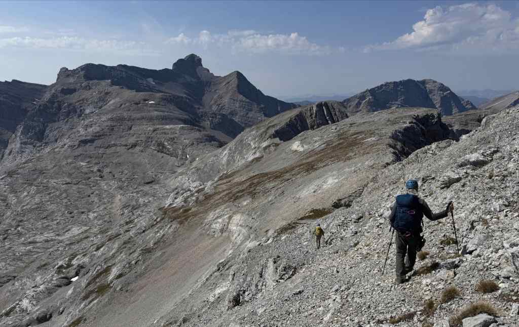
Starting off along the Andy Good Basin trail.

Another glorious morning in the mountains!
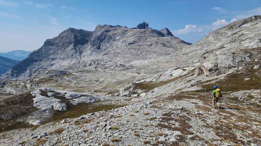
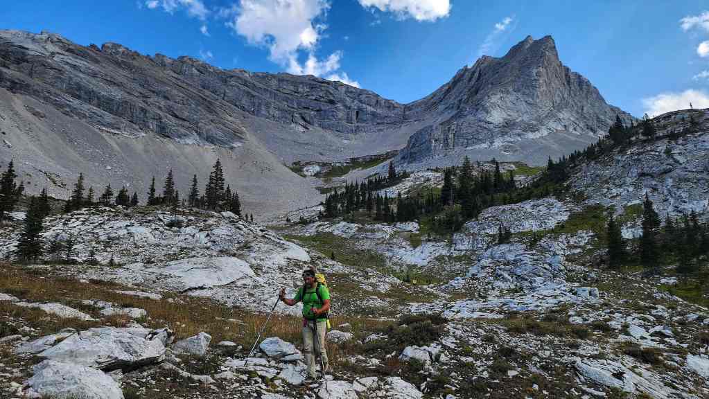
Getting closer to Geoff’s primary objective: Andy Good Peak (left of centre). “Promised Land Peak” (right) would be our first combined destination for the day.
Another look back.

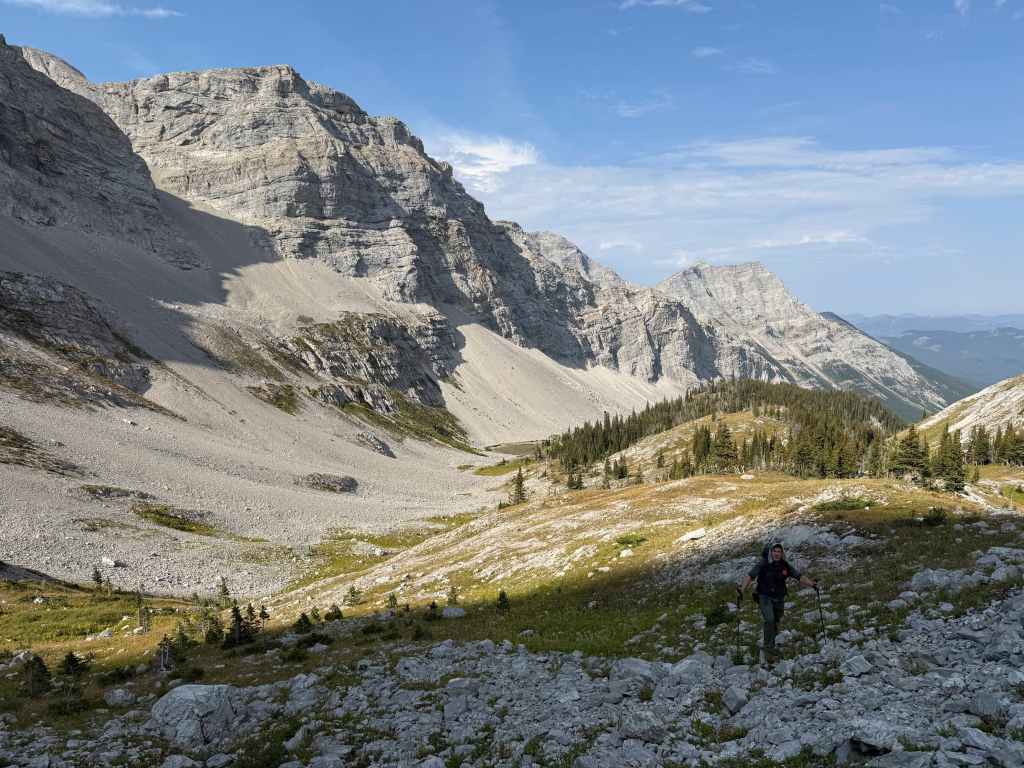
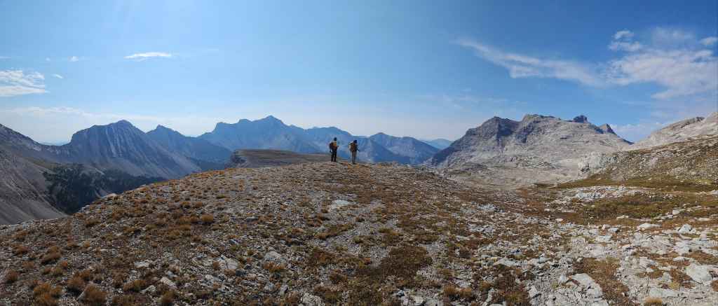
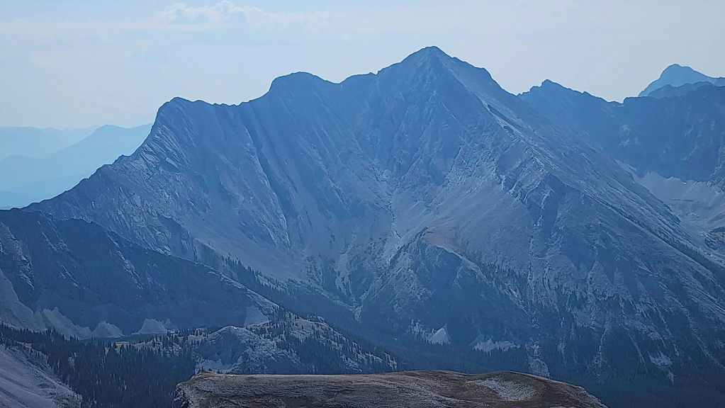
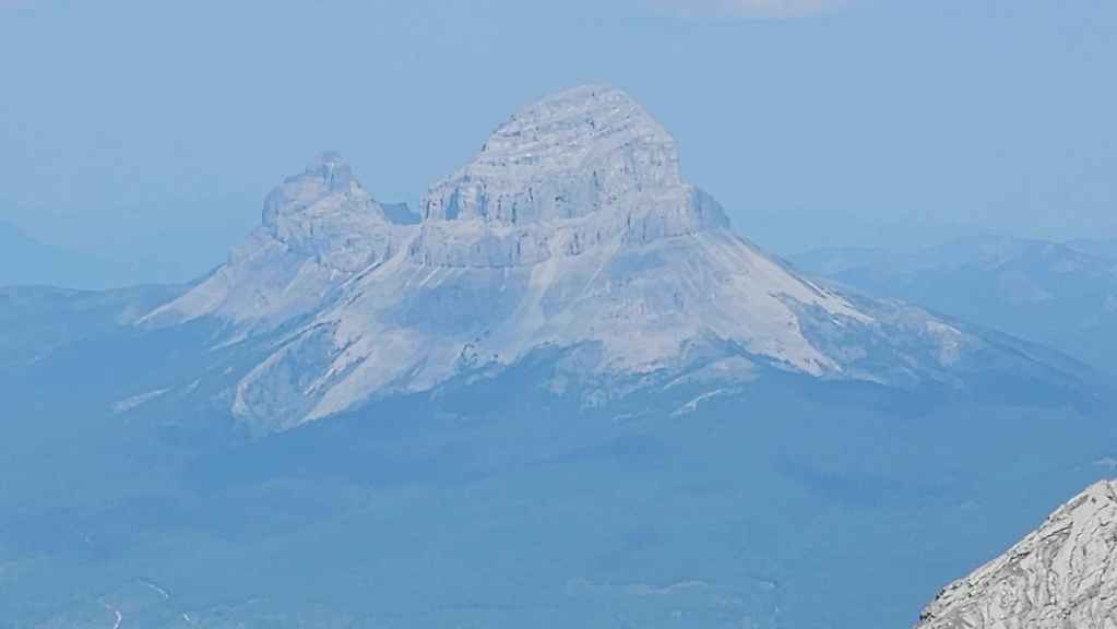
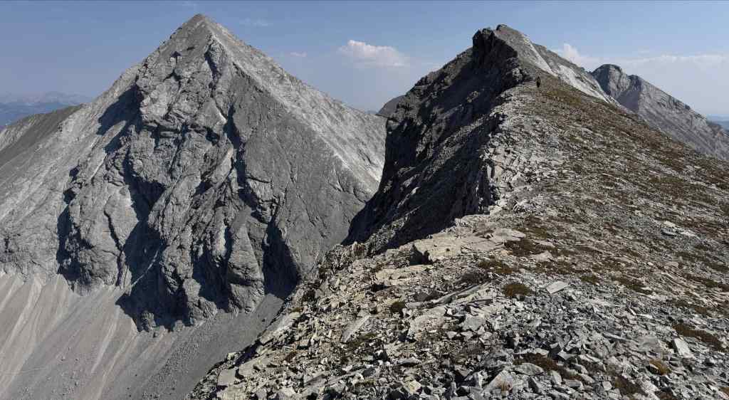
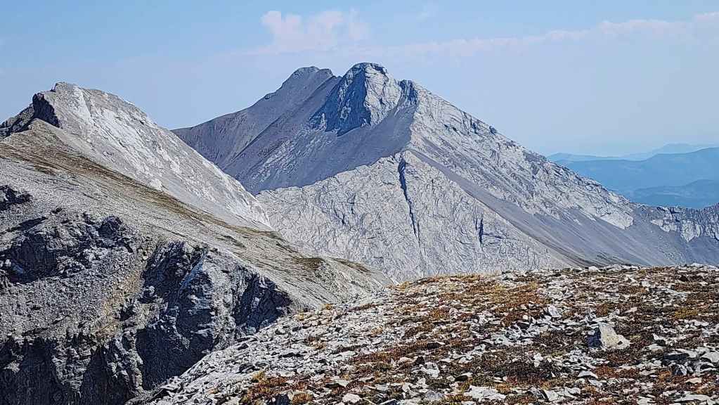
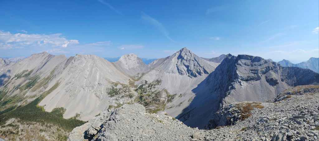
“Promised Land Peak” is on the left with “Gargantua Peak” on the right. They definitely look impressive from the trail.

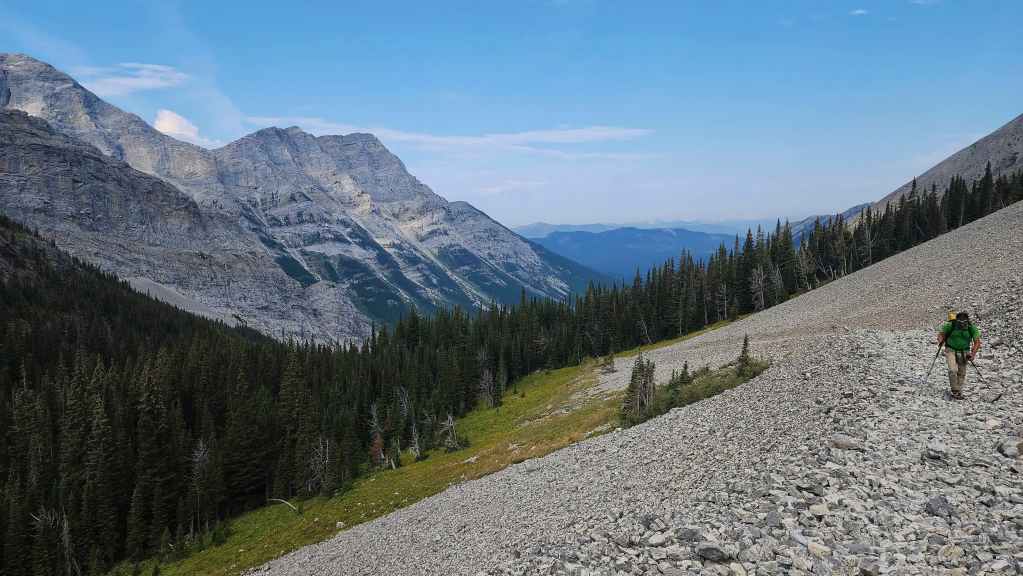
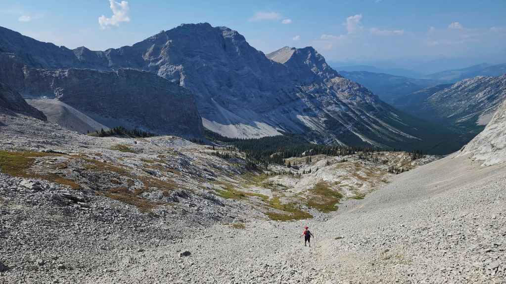
Arriving in the Andy Good Basin. For reference it took us 1 hour and 24 minutes over ~3.8 km from where we left our bikes. From the trailhead this equated to 2 hours and 24 minutes over ~8.8 km.
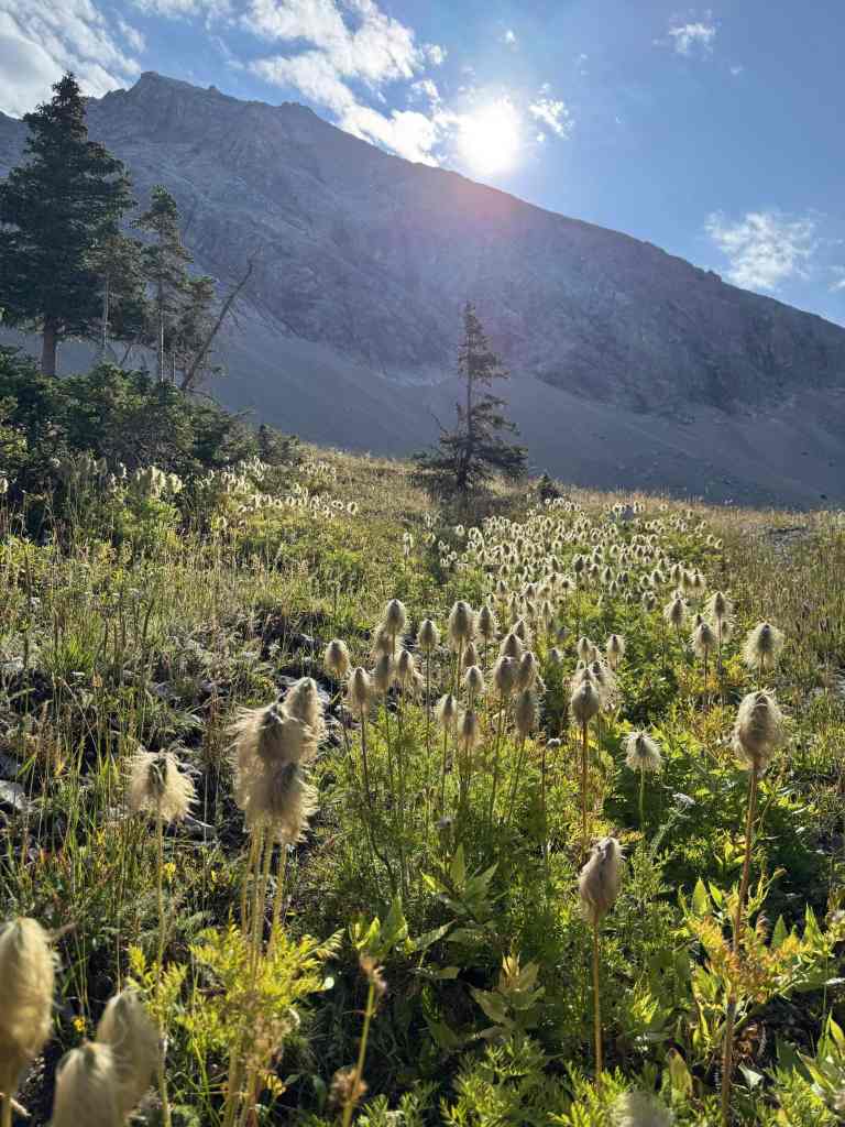
Morning sunlight accentuates a runway of bear grass. (Photo by Geoff Hardy)
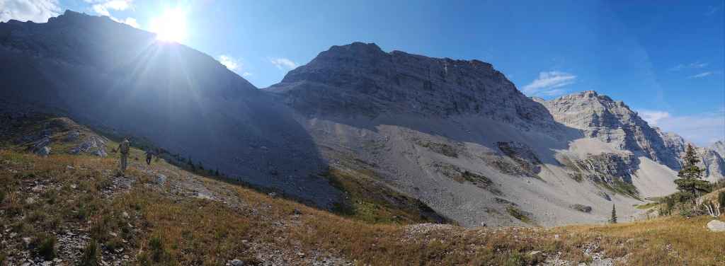
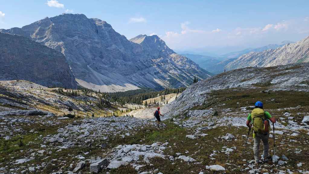
Heading towards Andy Good’s southwest col (left of centre) with “Promised Land Peak” (centre).
Looking back as we start up the trail to the col. “Gargantua Peak” is on the left. (Photo by Andrew Nugara)

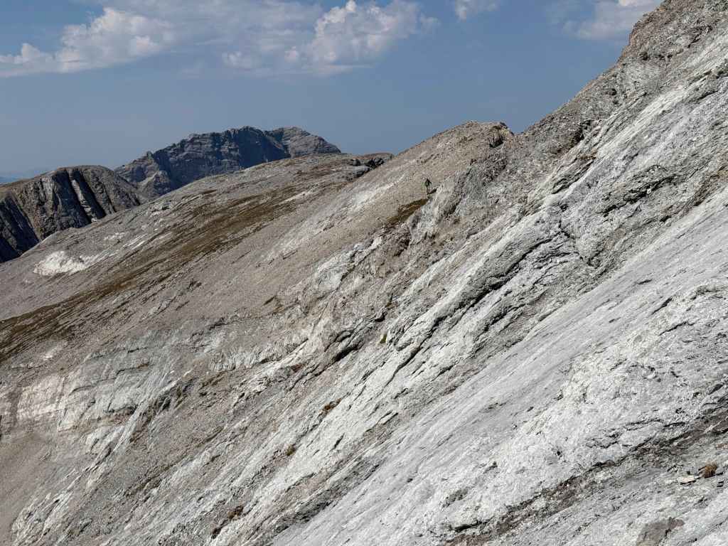
Geoff (centre) makes a speedy ascent towards the col, while the rest of us enjoy a more leisurely pace.
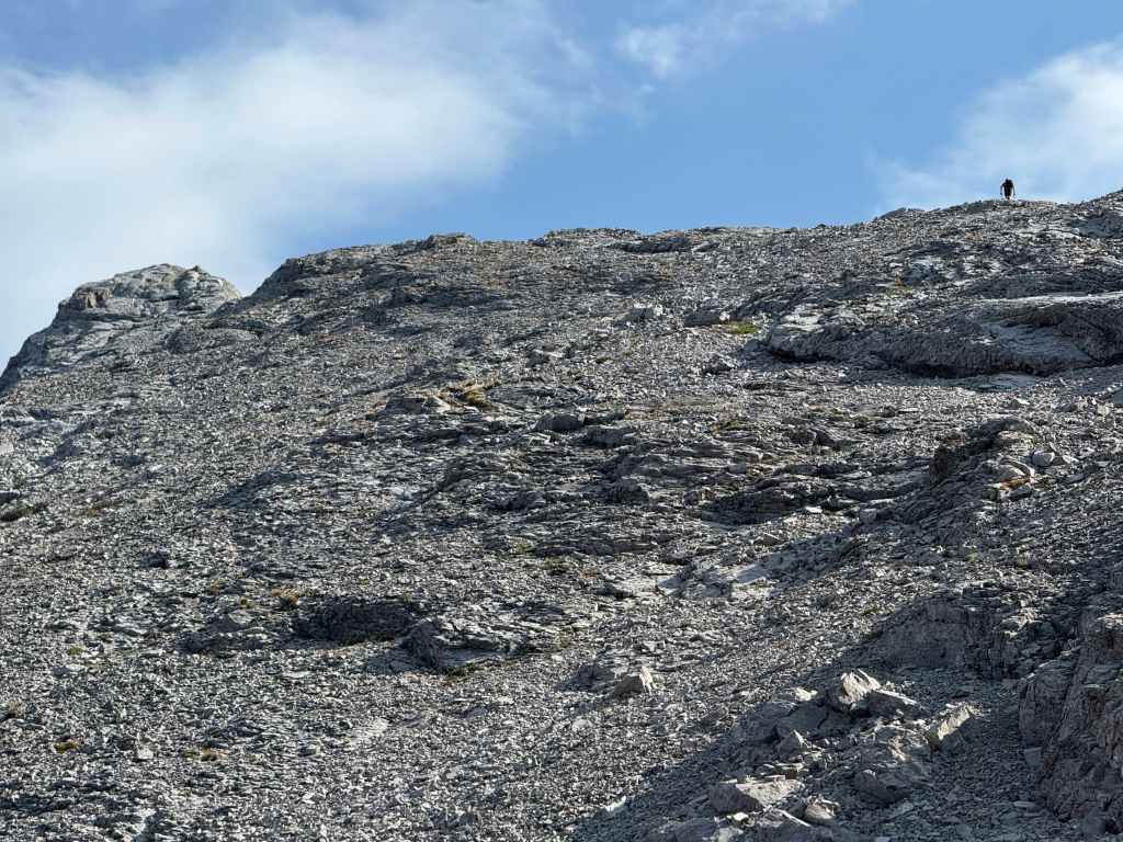
There he goes! Geoff begins his ascent of Andy Good before we even reach the col. (Photo by Andrew Nugara)
On the col and looking to the southeast at Sunglass Mountain (left), Peak 34 (left), and Ptolemy SE5 (right). For reference, from the trailhead to the col, it was a distance of 9.5 km (968 m elevation gain) over 3 hours and 10 minutes.
A foreshortened view of Geoff on the summit of Andy Good Peak.

Geoff’s view from the previous photo. Brad, Andy, and I are hanging out in the col on the bottom left. “Promised Land Peak” is in the foreground with “Gargantua Peak” to its left. In the background is Mount Ptolemy (centre) and “Pharaoh’s Peak” (right) on the Northwest Ridge of Ptolemy. (Photo by Geoff Hardy)
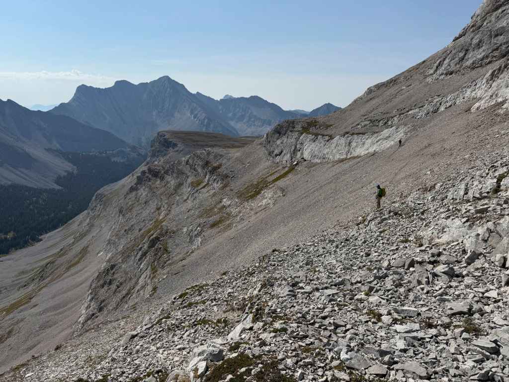
With Geoff on his way down, we decided to begin the easy ~300 m traverse over to the Andy Good Plateau. (Photo by Andrew Nugara)
My view back from the previous photo.

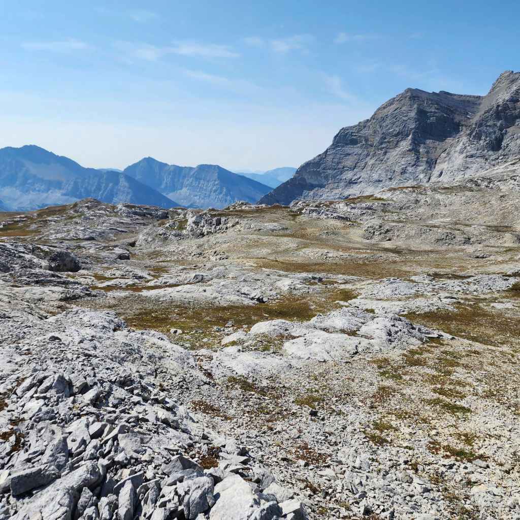
Arriving on the Andy Good Plateau.
Gazing up at “Promised Land Peak”.
One of many Plateau photos to come. 🙂 I was last here roughly thirty years ago, but I never ventured this far to the east.

A closer look at Sunglass Mountain (centre) and Peak 34 (right of centre).

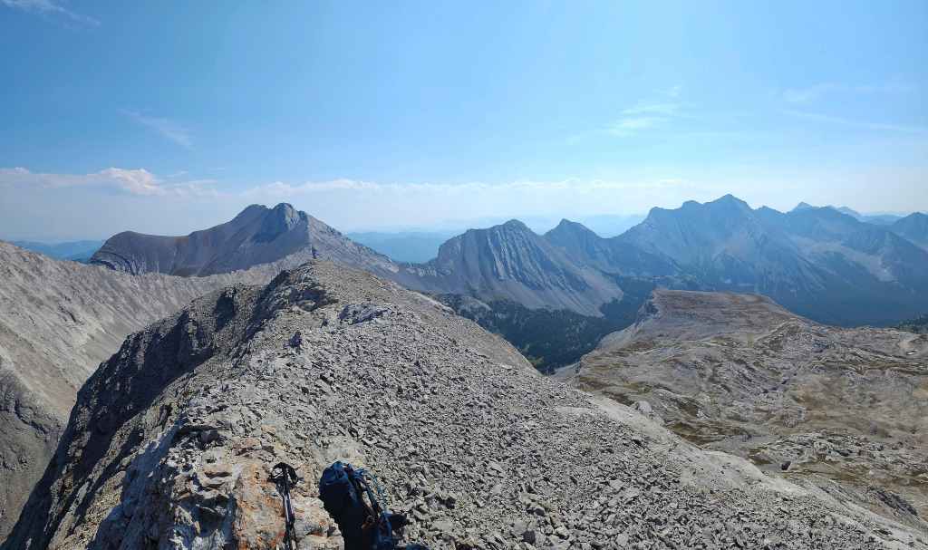
Brad and Andy check out the scenery with Ptolemy SE5 in the background.
A wider view of the previous photo with Mount Ptolemy on the right.
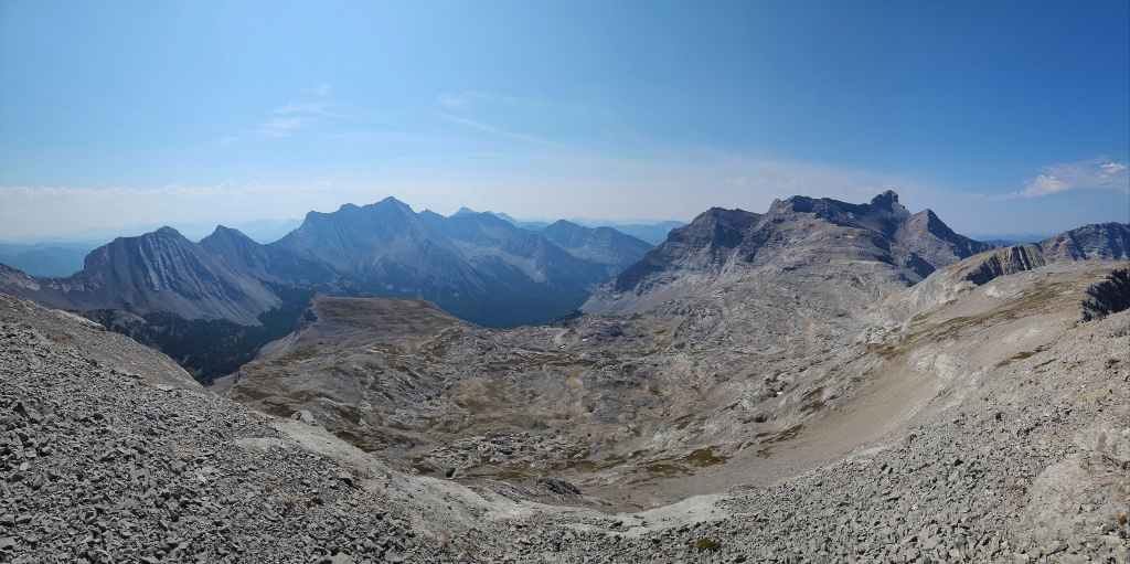
More of the same.

Another pano this time with Andy Good Peak (far left) and Mount Coulthard (left) included.
Watching Geoff continue his descent.
Geoff joins us on the Plateau. (Photo by Andrew Nugara)
Brad decides to take time and explore the terrain.
Brad’s view as he makes his way across the Plateau. (Photo by Brad Wolcott)
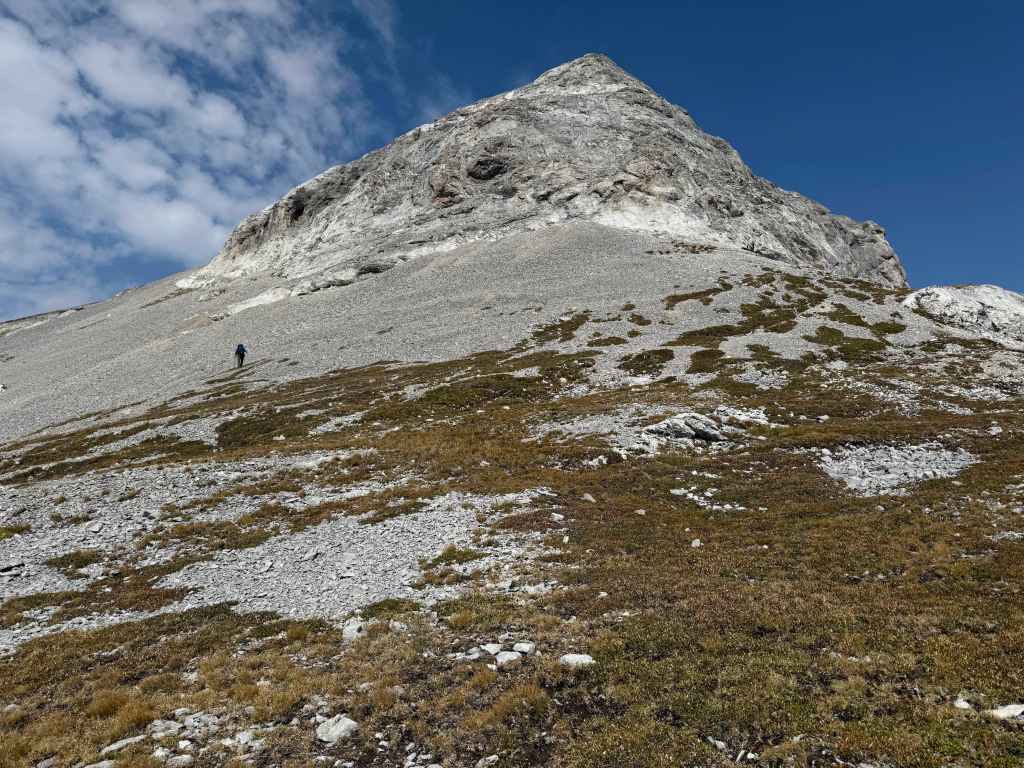
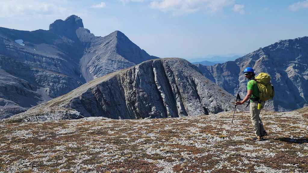
While Brad explored the Plateau, I decided to head up “Promised Land Peak”. (Photo by Andrew Nugara)
Circling the base of “Promised Land Peak” to find an easy route to the top.
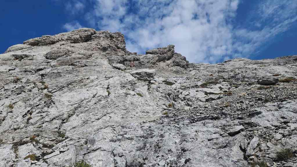
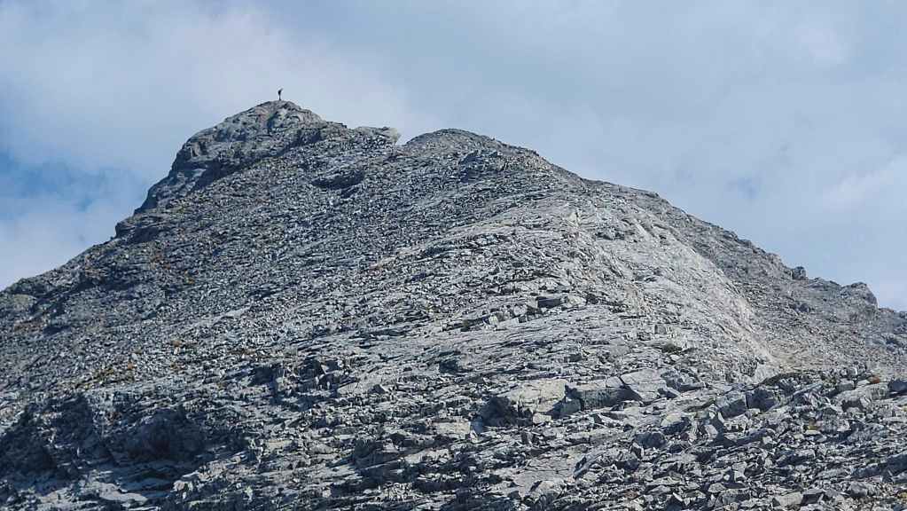
Found one! It was an easy scramble (~76 m elevation gain) from here.
My view down to Andy and Geoff after reaching the top.
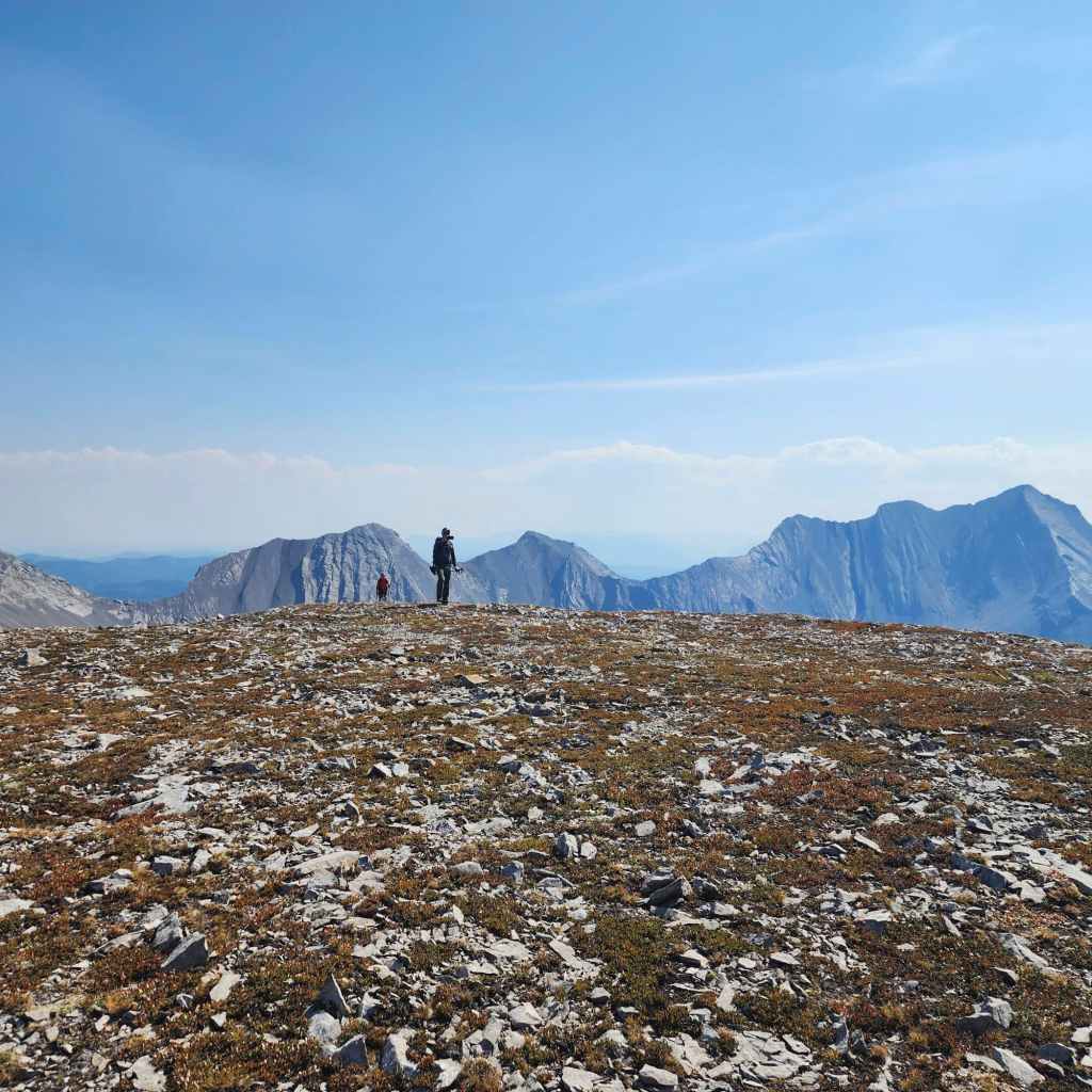
The summit of “Promised Land Peak” (2552 m).
The view to the northwest…
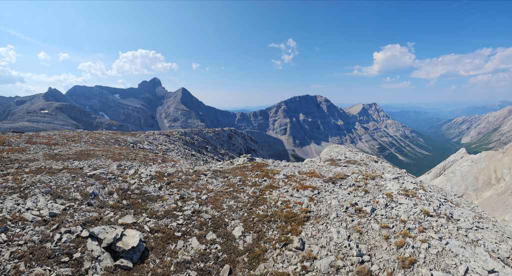
Followed by a pano to the southeast.
Gazing south…

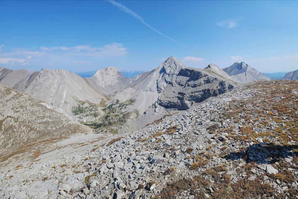
And finally to the west.

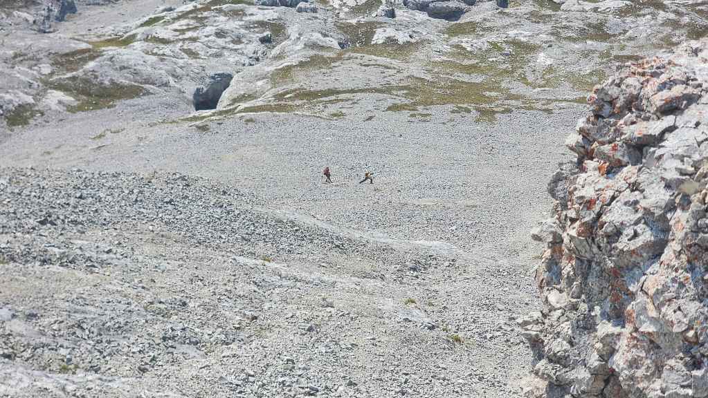
Andy and Geoff begin their ascent.
Meanwhile, Brad chooses a different line to the top after exploring the Plateau.

A closer look at Chinook Peak.

Mount Parrish was an exhilarating trip.
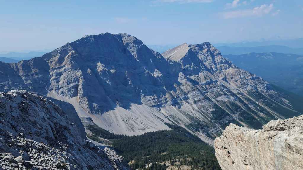
The classic mountain form of Andy Good Peak.

To me, Mount Coulthard looks like the head of a hippo. But then again, I’m pretty sure that I don’t play with a full deck of cards. 😂

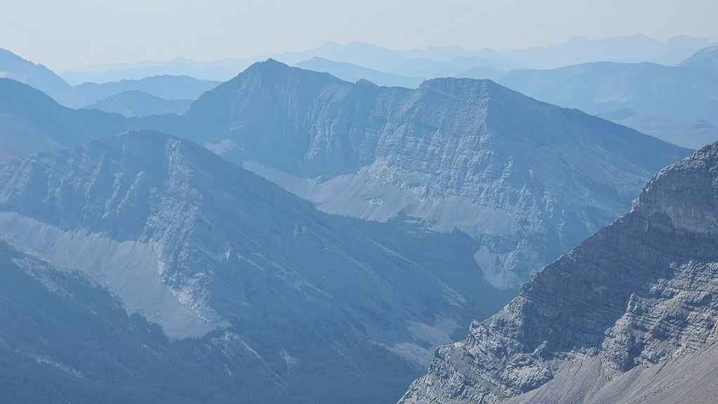
Sunglass Mountain (left) and Peak 34 (centre). The lake (far right) beneath these two peaks is a ‘must visit’ if you’re in the area.
Ptolemy SE5 – I keep trying to get to this peak. One day soon hopefully…
We tried to get up “Scrubby Peak” (centre) back in May, but the water level in Andy Good creek was too high to cross.
Mount Ptolemy was a fun trip, but like Parrish, it required navigating some serious terrain.

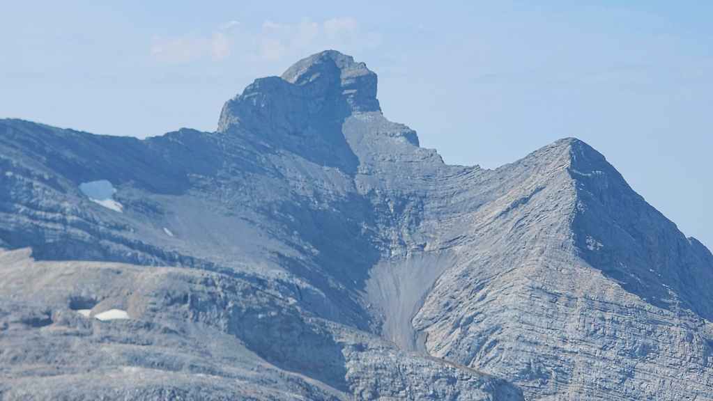
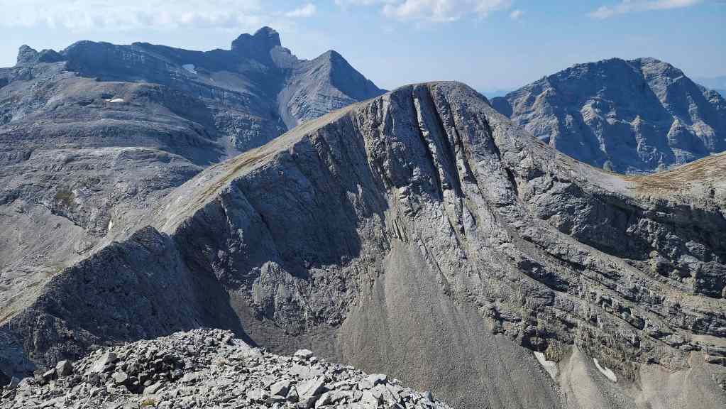
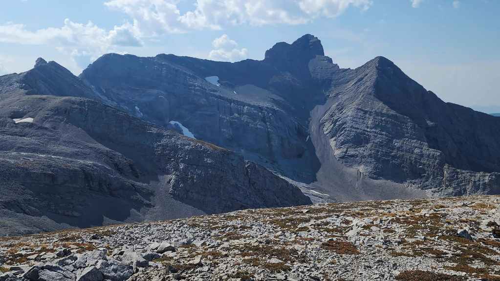
At 2622 m, “Pharaoh’s Peak” on the Northwest Ridge of Ptolemy is one of the higher peaks in the area. In the foreground is the summit of “Gargantua Peak”.
A better look at ‘Gargantua Peak” (centre).
The Seven Sisters (left of centre) and Omahkai’stoo (Crowsnest Mountain).
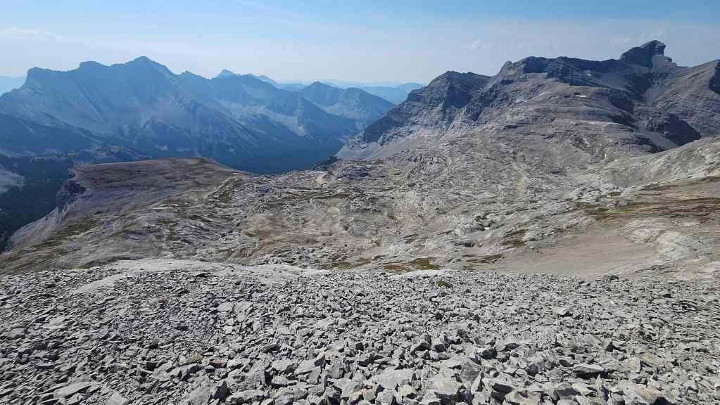
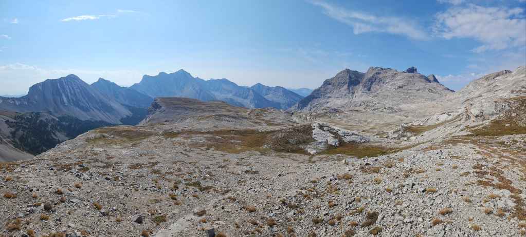
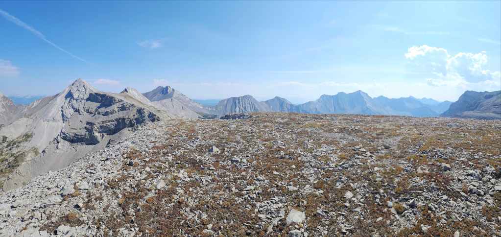
Another look at the Andy Good Plateau.
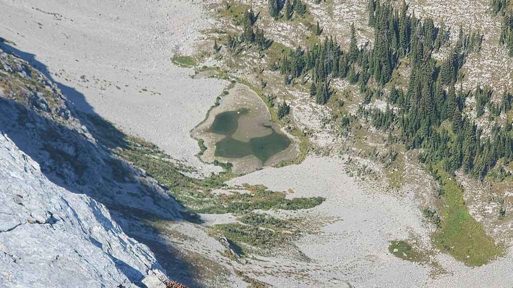
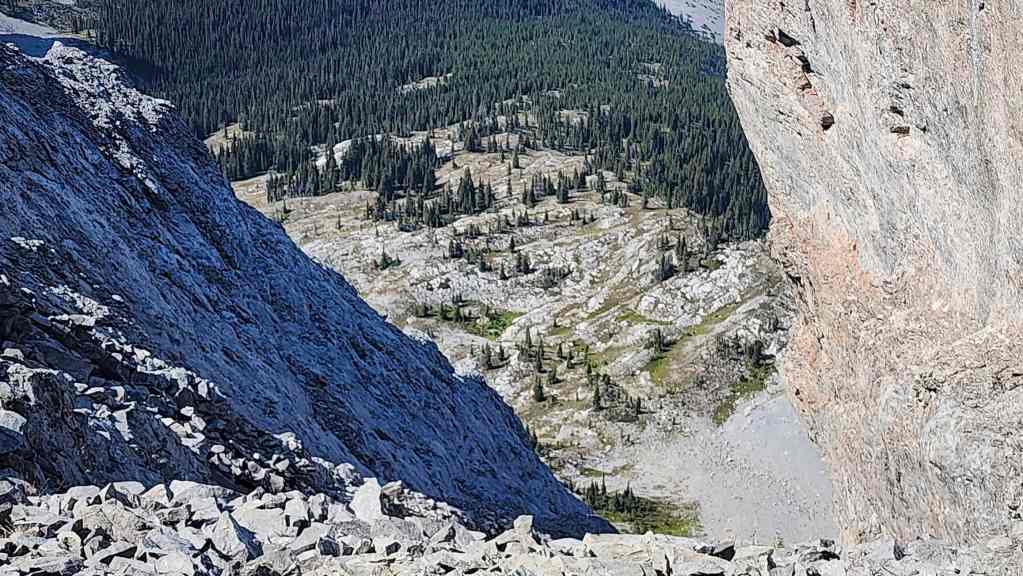
Glancing down at the tarn that sits in the Andy Good Basin.

Brad approaches the summit from the west…

While Andy and Geoff ascend from the south.
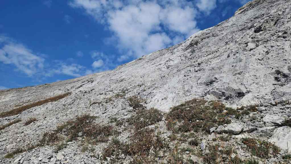
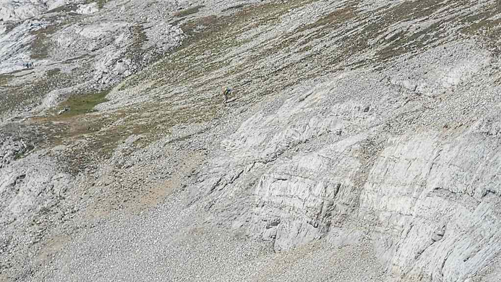
Staying off the scree and sticking to solid rock is the key. (Photo by Andrew Nugara)
Geoff and Andy’s view over to Brad from the previous photo. (Photo by Andrew Nugara)

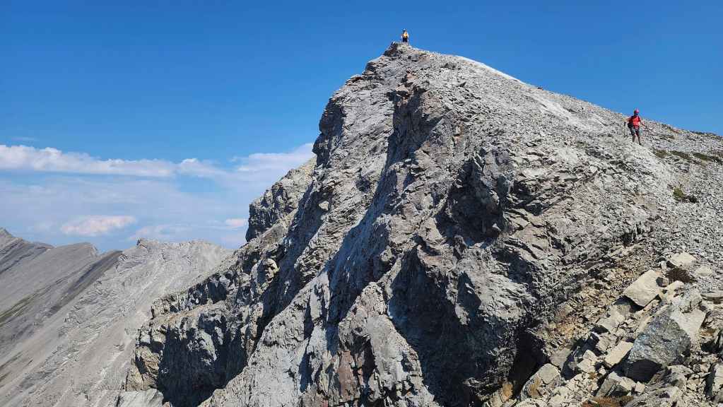
Brad arrives on the summit…
At almost the same time as Andy and Geoff.
A great pano by Andy from his vantage in the previous photo. (Photo by Andrew Nugara)

Brad brought an interesting choice for lunch. 😂 To be fair, he did share it with the rest of us and I will say, that it was delicious.

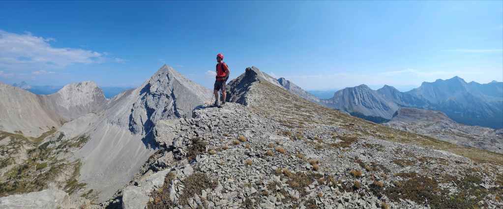
Chillin’ on “Promised Land Peak”.
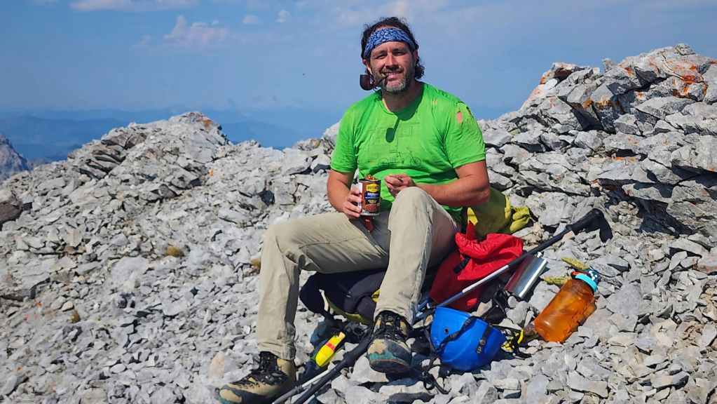
A mountain summit, a good pipe, a can of beans, and a flask full of whiskey: what more does a man need? 😂
Heading over to “Gargantua Peak” (centre). (Photo by Geoff Hardy)

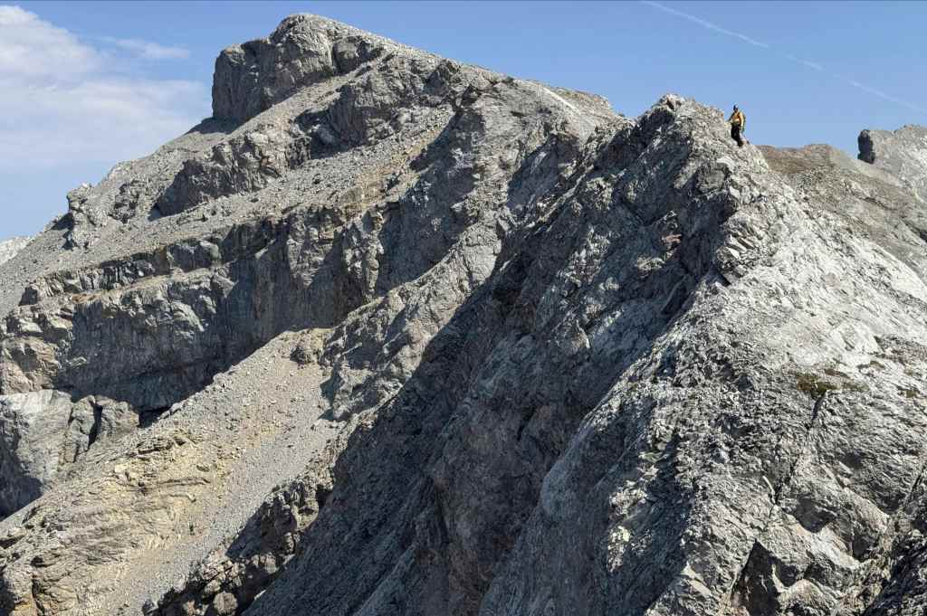
Geoff pauses to check out the interesting rock as we leave the summit.
Looking back to the summit of “Promised Land Peak” (right). (Photo by Geoff Hardy)
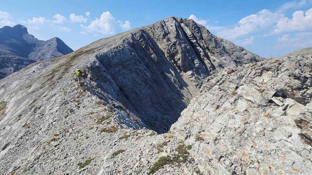
The ridge walk between the two peaks is quite scenic…

Take this for example. (Photo by Geoff Hardy)
Brad’s view back from the previous photo. (Photo by Brad Wolcott)
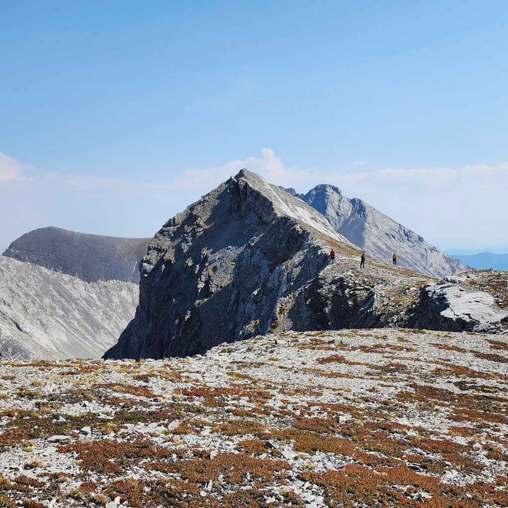
Closing in on “Gargantua Peak”.
Geoff and Andy continue to admire the views.
Another look back at the summit of “Promised Land Peak”.
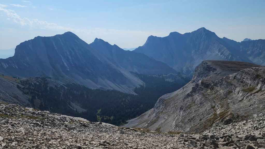
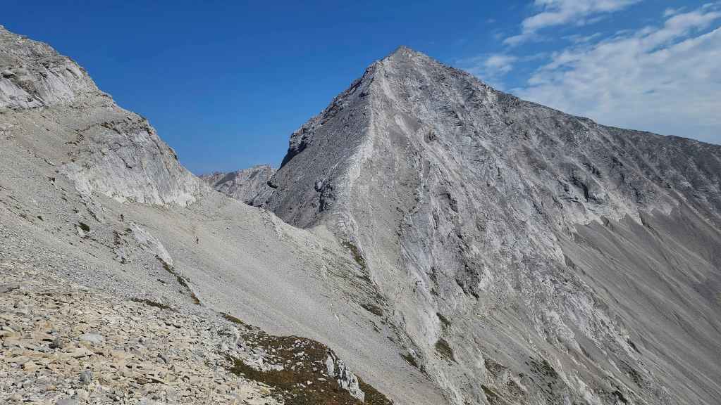
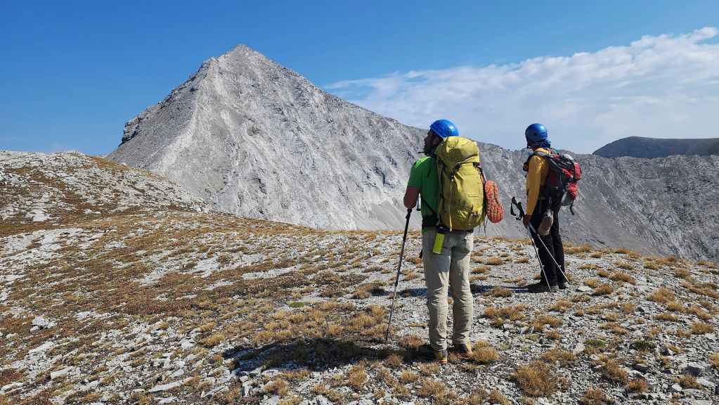
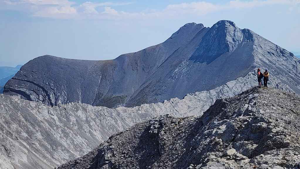
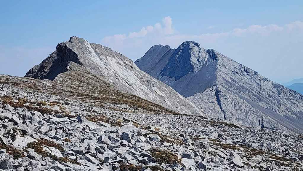
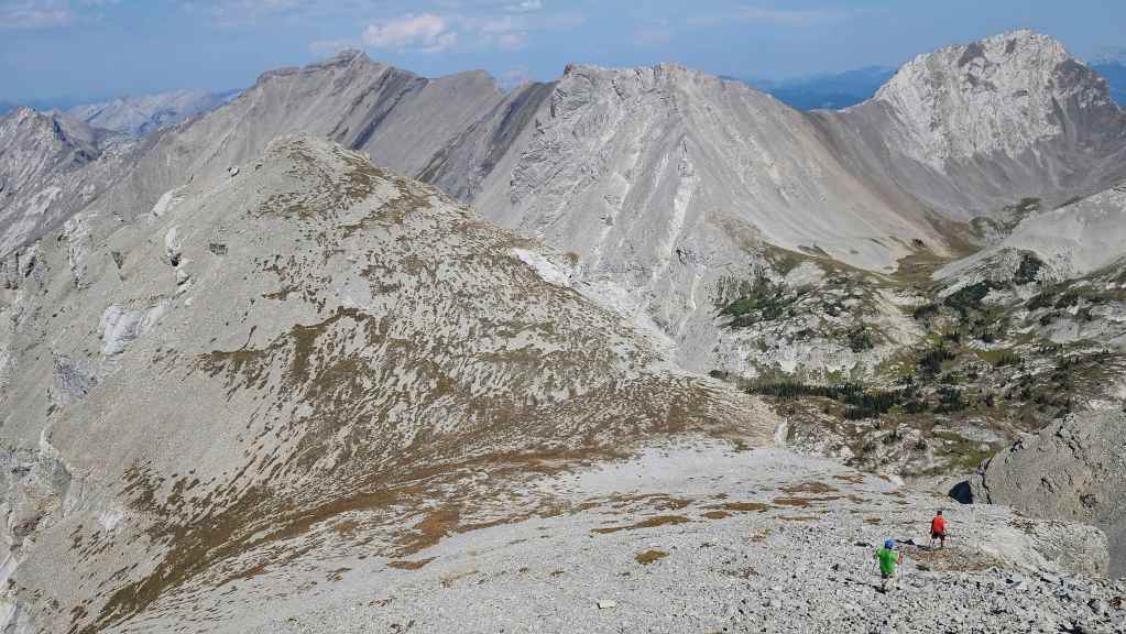
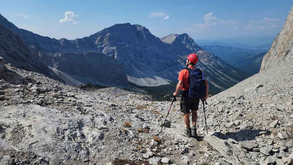
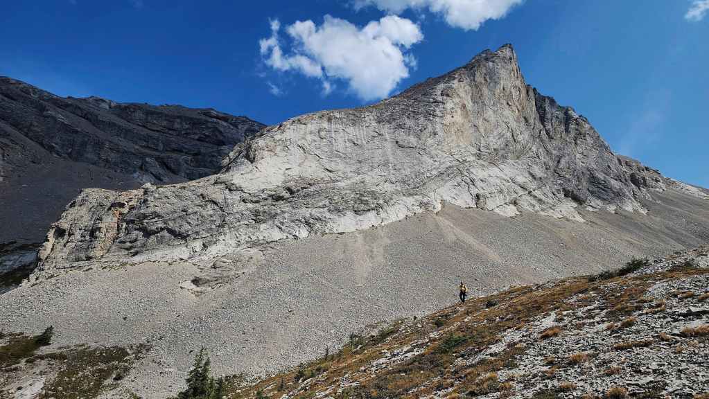
To get to “Gargantua Peak” we’ll have to descend to its col (far left) with “Promised Land Peak”.
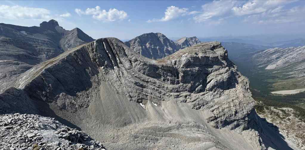
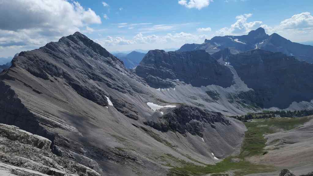
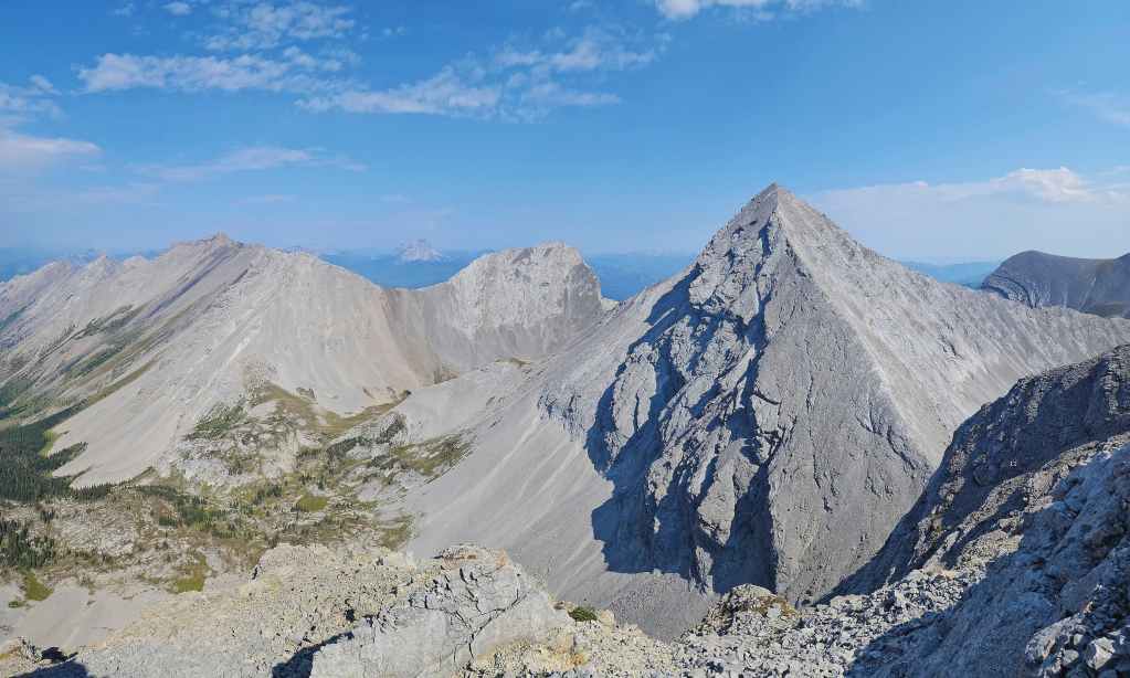
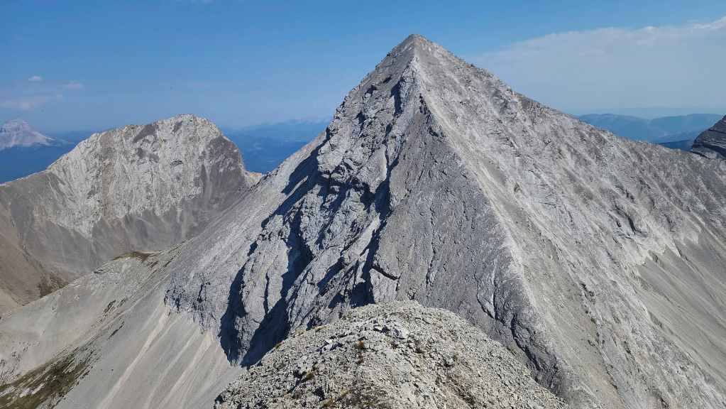
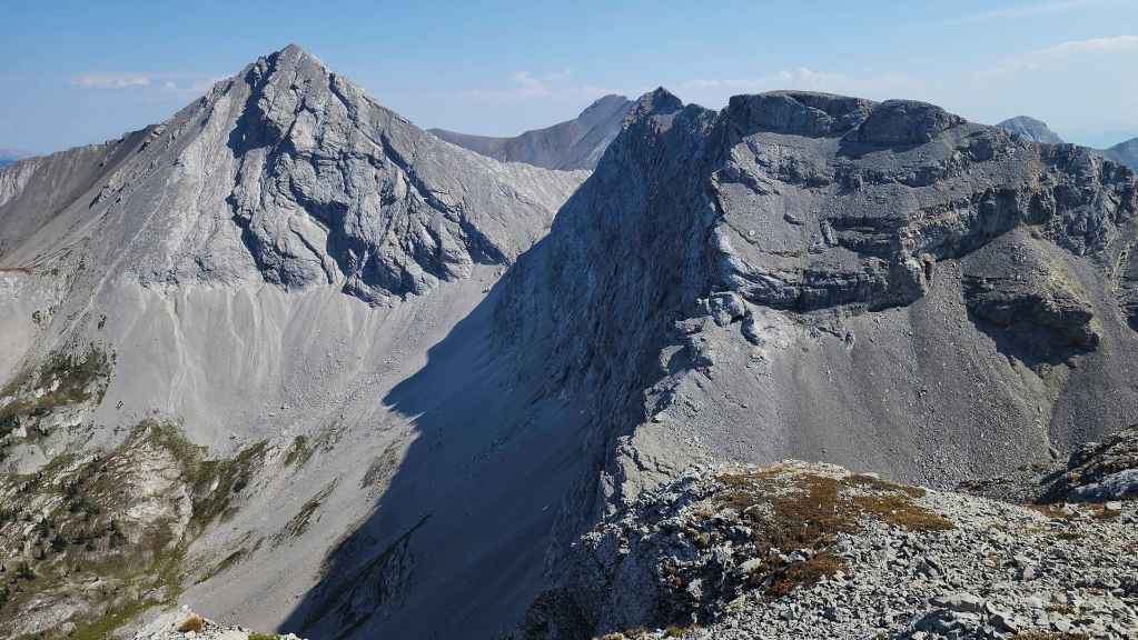
A more comprehensive view of “Gargantua Peak” (2520 m). Though the peak on the left is the actual summit, we also made the short hike over to the slightly lower, sub-peak (2503 m) on the right. (Photo by Geoff Hardy)
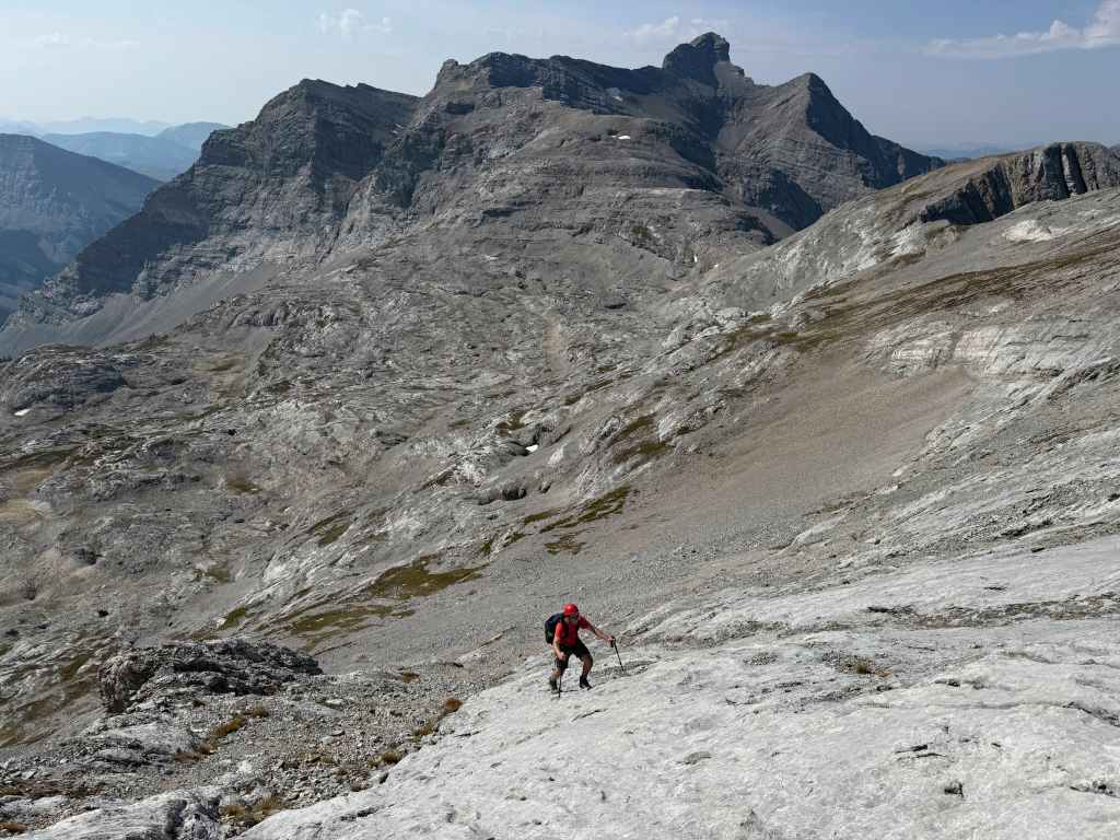
Descending to the col.

A tent on the Andy Good Plateau.
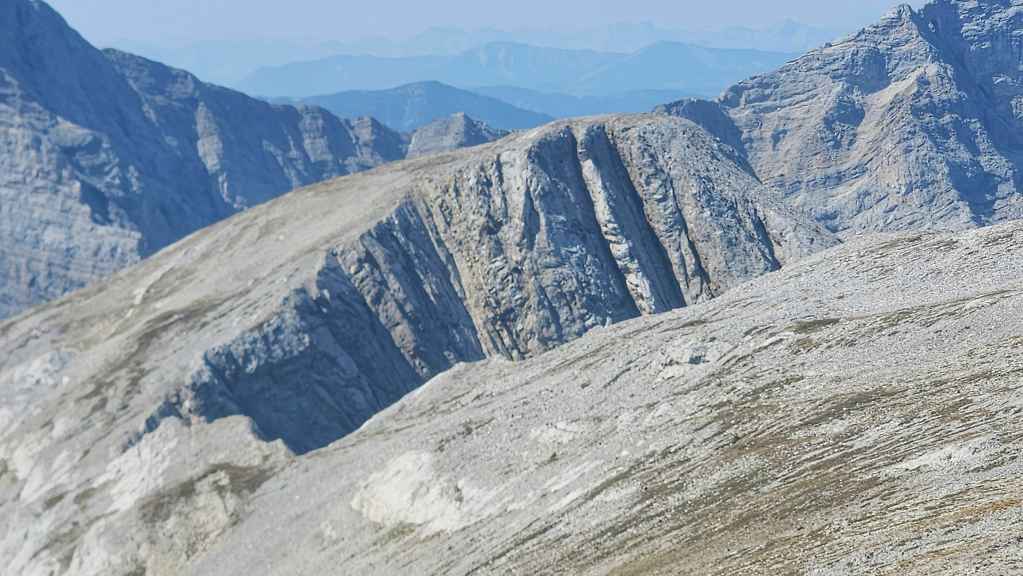
The col has no shortage of impressive rock. (Photo by Geoff Hardy)
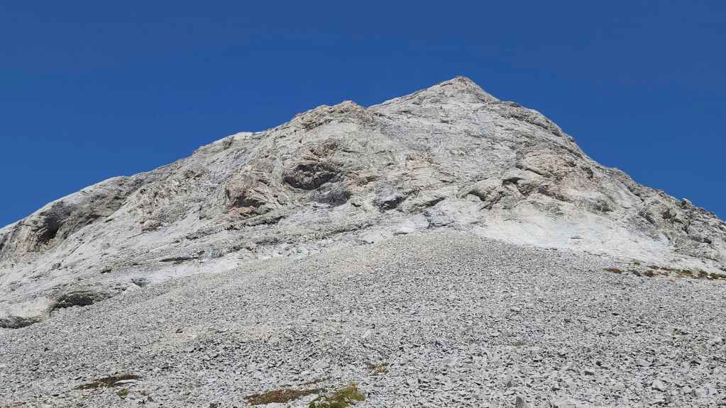
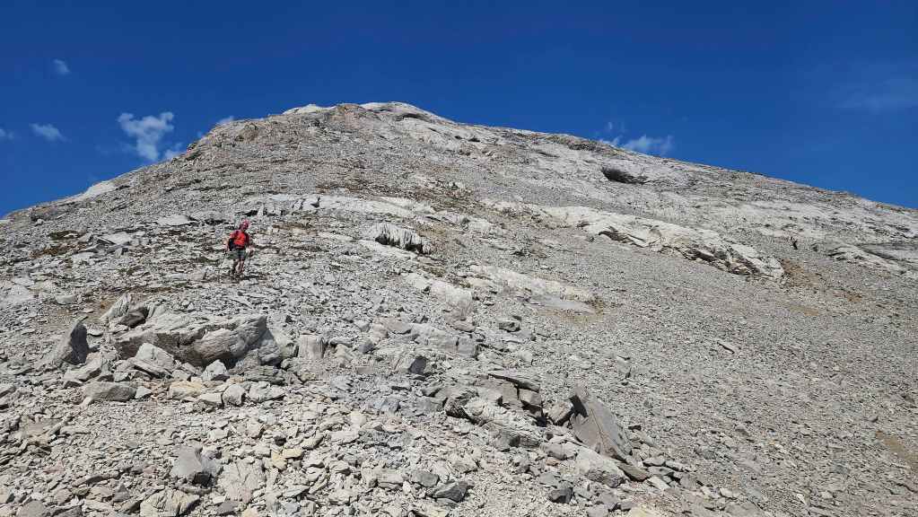
It will be an easy hike to the summit from here.

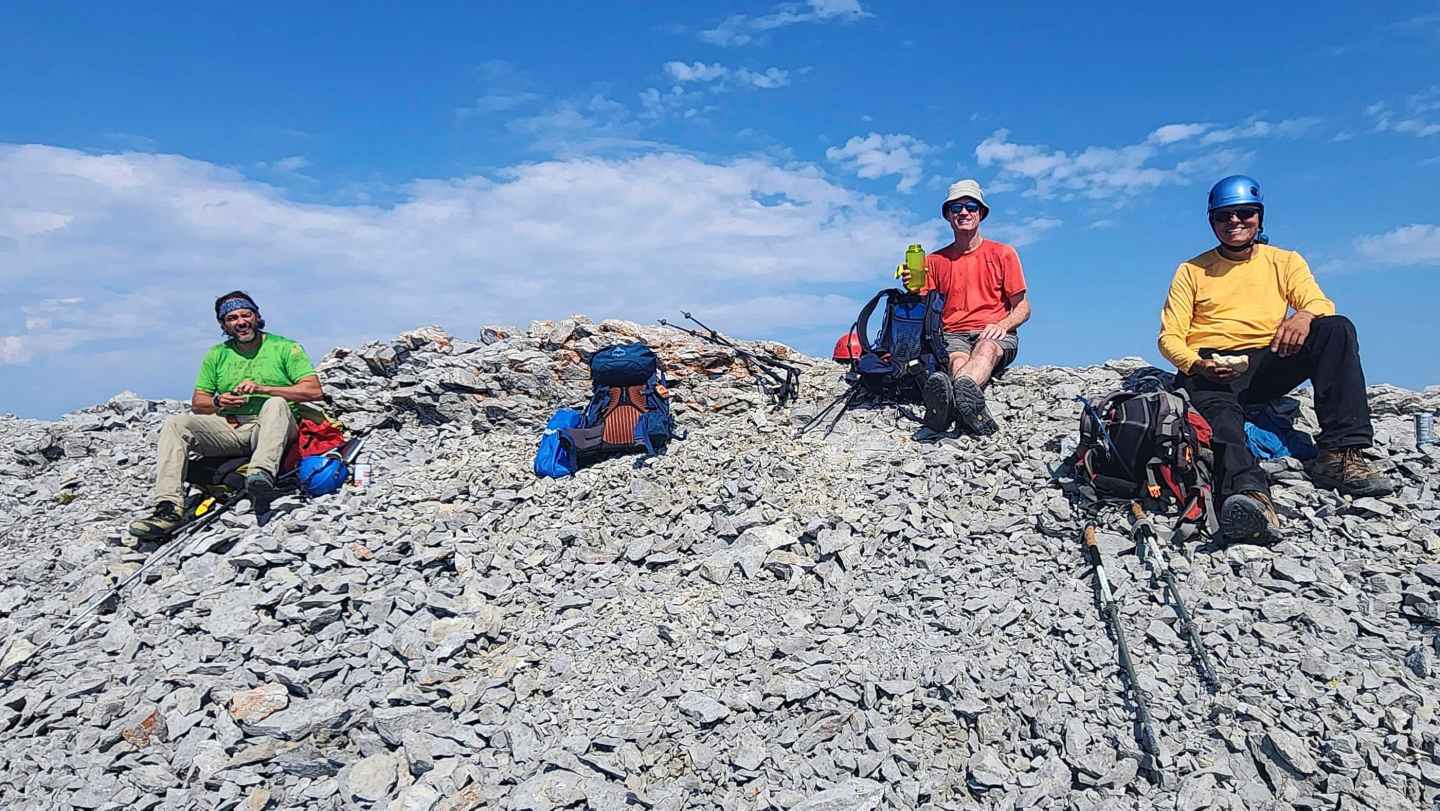
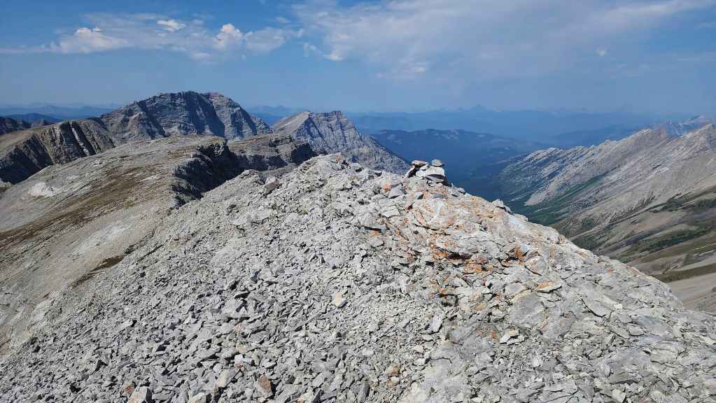
Brad arrives on the summit of “Gargantua Peak’ (2520 m). This was Brad’s second time on “Gargantua” with his first ascent occurring thirty years ago when he was with his dad.
Brad’s view back as the rest of us join him. (Photo by Brad Wolcott)
Looking to the west…

And then to the north.
The view to the east…
And finally to the southeast.
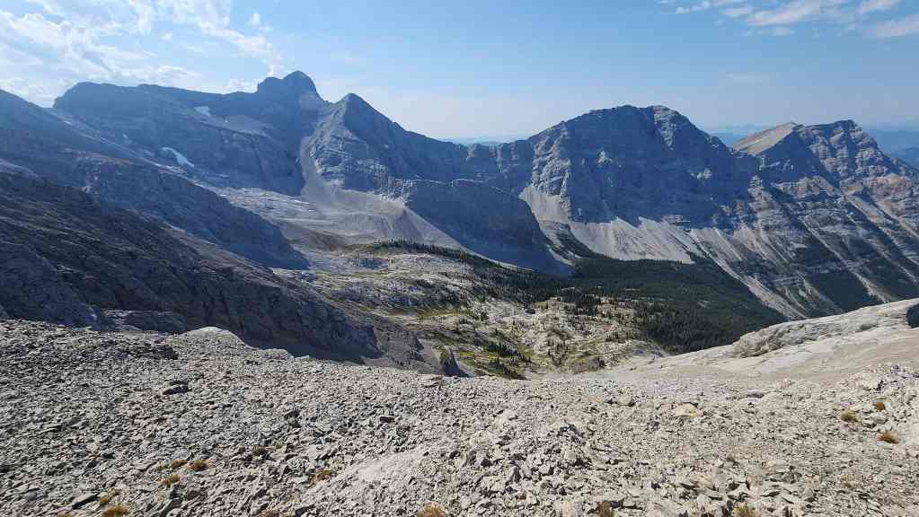
Looking down to the Promised Land (Ptolemy Plateau).
All three peaks on the Northwest Ridge of Ptolemy.
Mount Ptolemy is the highest peak in the area.
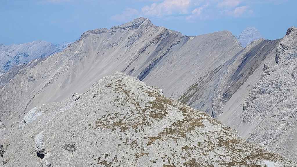
Gazing to the north at Chinook Peak (centre) with “Gargantua’s” sub-peak in the foreground.

I don’t think there’s an angle where Mount Parrish doesn’t look intimidating.

Andy Good Peak (centre) and “Promised Land Peak” (foreground right).
“Promised Land Peak” (foreground left) and Mount Coulthard (centre).

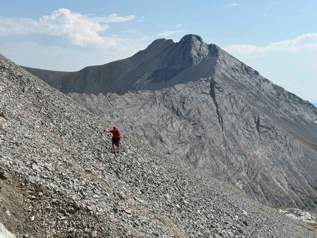
Heading over to the sub-peak.
The elevation loss to the col was surprising.

Once on the col, it is an easy hike to the summit.

Brad and Geoff on the summit (2503 m).
The view to the west.
You get a much better view of the Promised Land from the sub-peak than from the actual summit.
You also get a pretty cool view of the Andy Good Basin.
A closer look at Andy Good Peak (left) and “Promised Land Peak” (right).

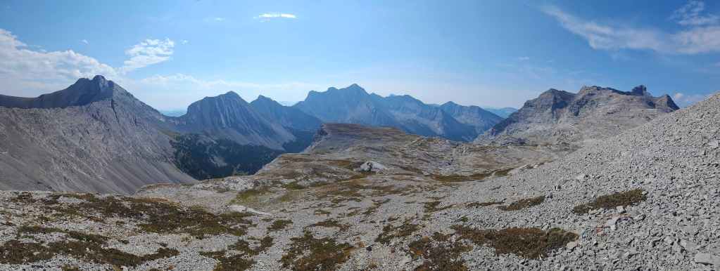
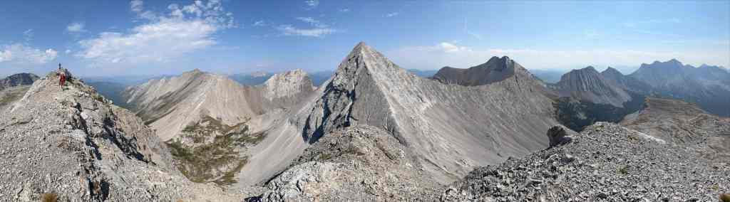
A pano to the south.

Heading back to the summit of “Gargantua Peak”.

From the 1870s to 1914, Mount Ptolemy was unofficially referred to as Mummy Mountain because it and its Northwest Ridge resemble a recumbent Pharaoh when viewed from the west – with Ptolemy being the head and the Northwest Ridge his folded arms. In 1914, the Interprovincial Boundary Commission changed the name to Mount Ptolemy (after the ancient Greek astronomer) because there were Pharaoh peaks elsewhere in the Rockies. (source)

Leaving the summit for the col with Mount Ptolemy.

Looking east and across the Andy Good Plateau from the col.
Geoff, Andy, and Brad soon join me.
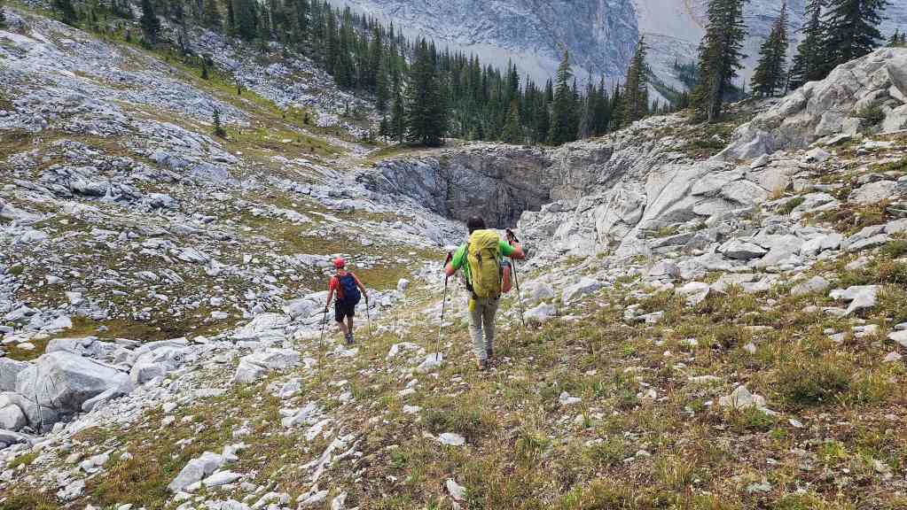
Starting our descent to the Promised Land (Ptolemy Plateau).
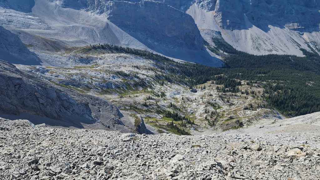
I’d forgotten what a cool area this is.

The view back to the col.
Arriving in the Promised Land.
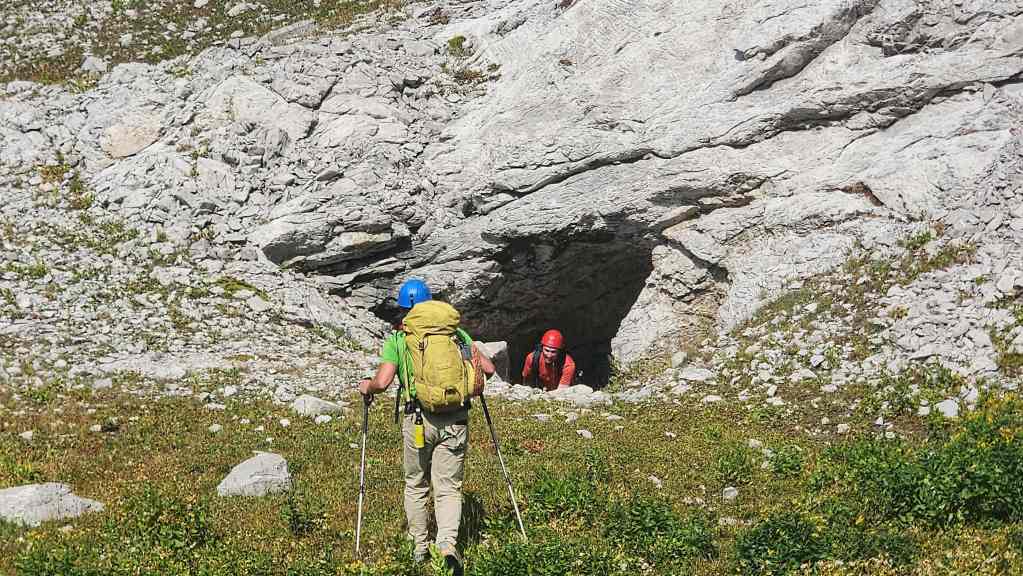
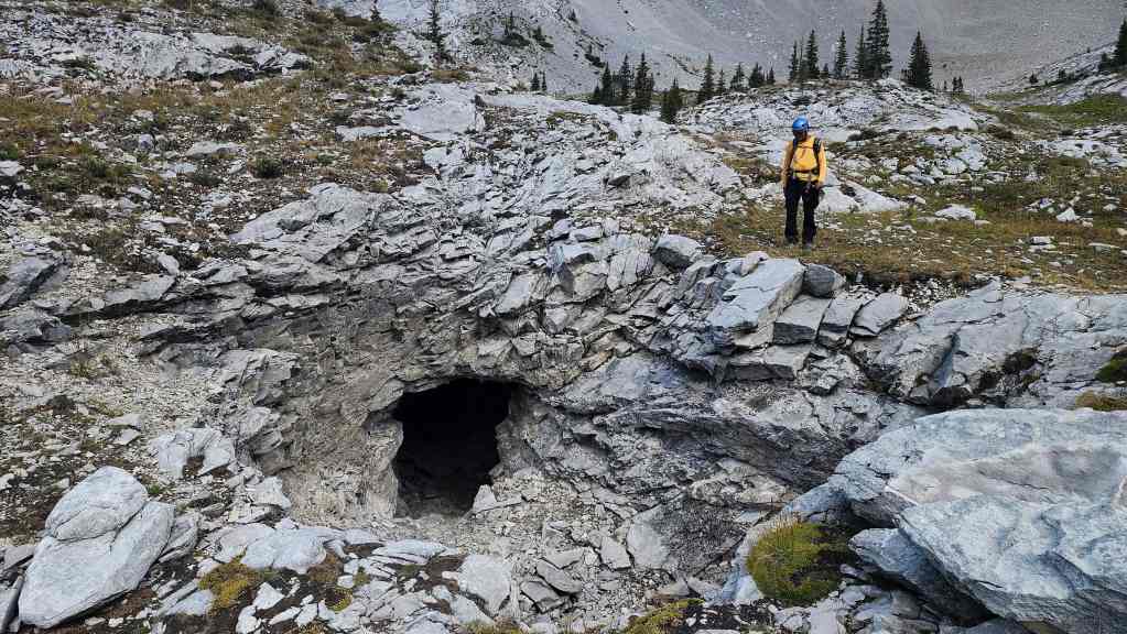
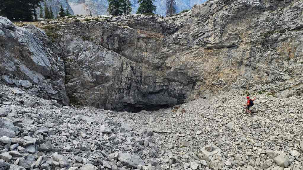
Geoff explores the entrance to a cave.
The view back to “Gargantua Peak”.
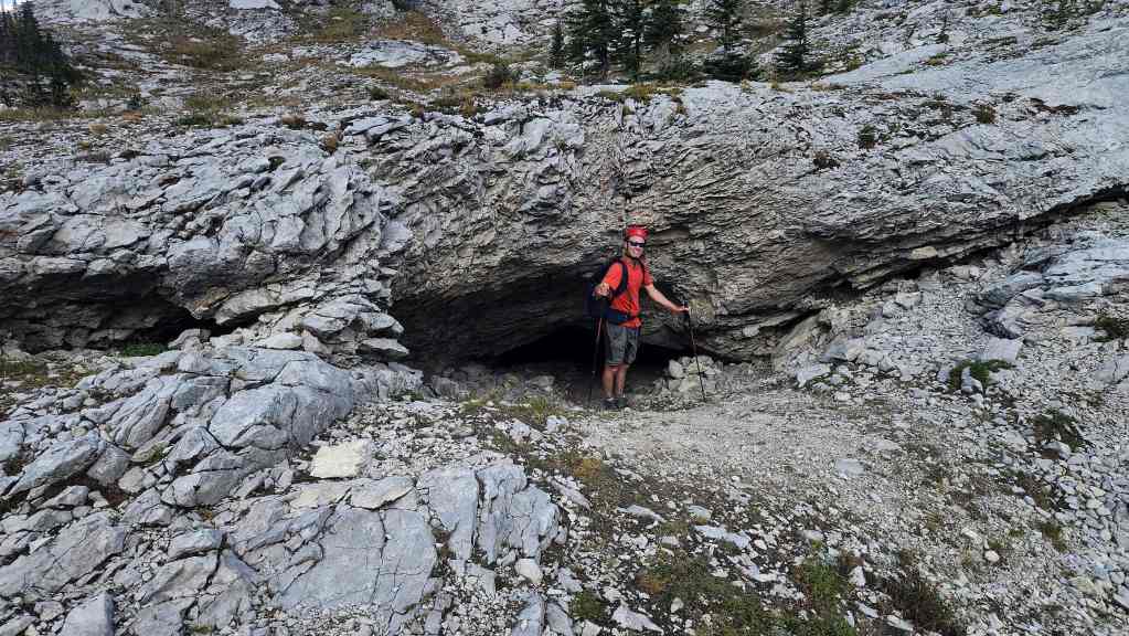
Geoff stands at the entrance to a different cave. There was no shortage to choose from.
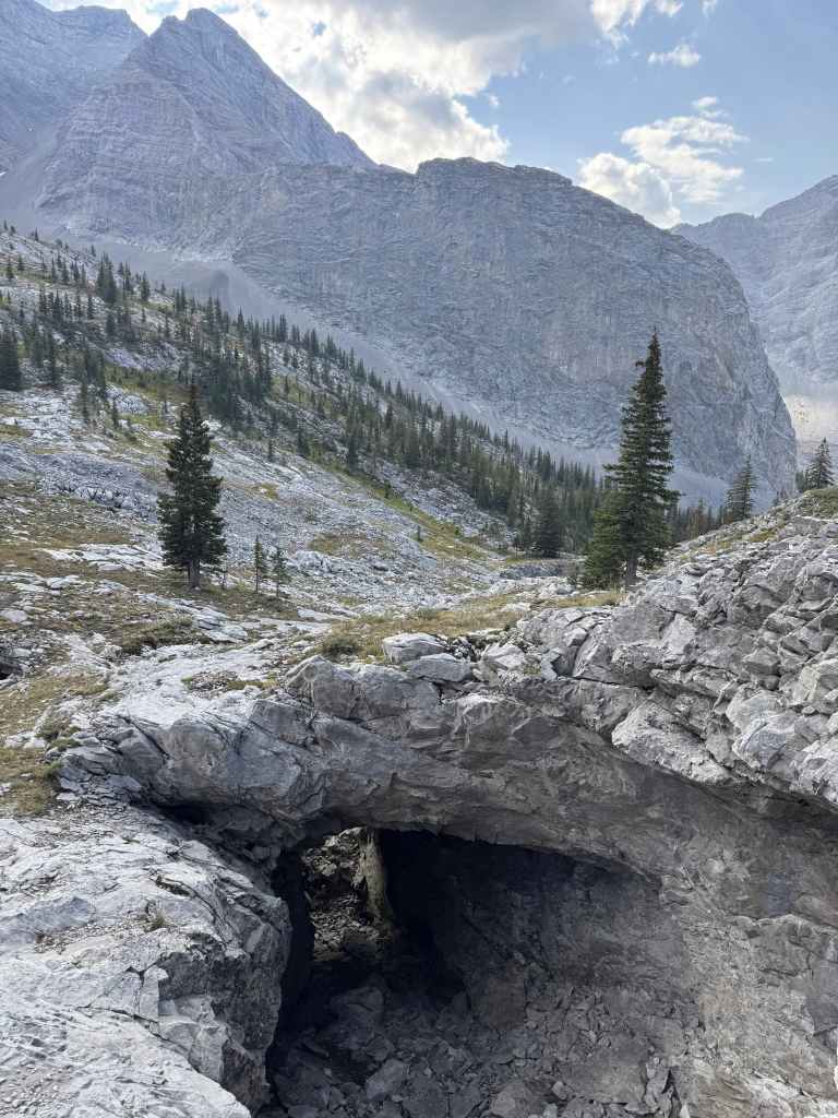
Cleft Cave is the vertical cave that can be seen in the background centre, near the skyline ridge.
Looking through a large cave. (Photo by Geoff Hardy)

This was part of the same cave in the previous photo.
This is also the same cave.
Heading back to the trail…
But first, Geoff will make a detour to see if this was another cave.
Heading back.

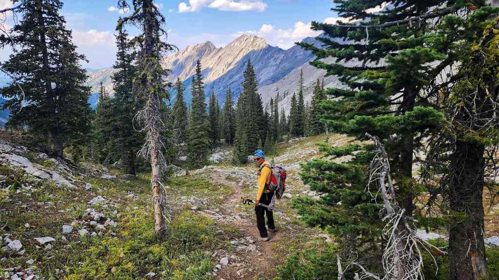
Nearing the bottom of the steep section of trail.

Back on the wide trail. In days gone by, people used to drive their old beater vehicles up here.
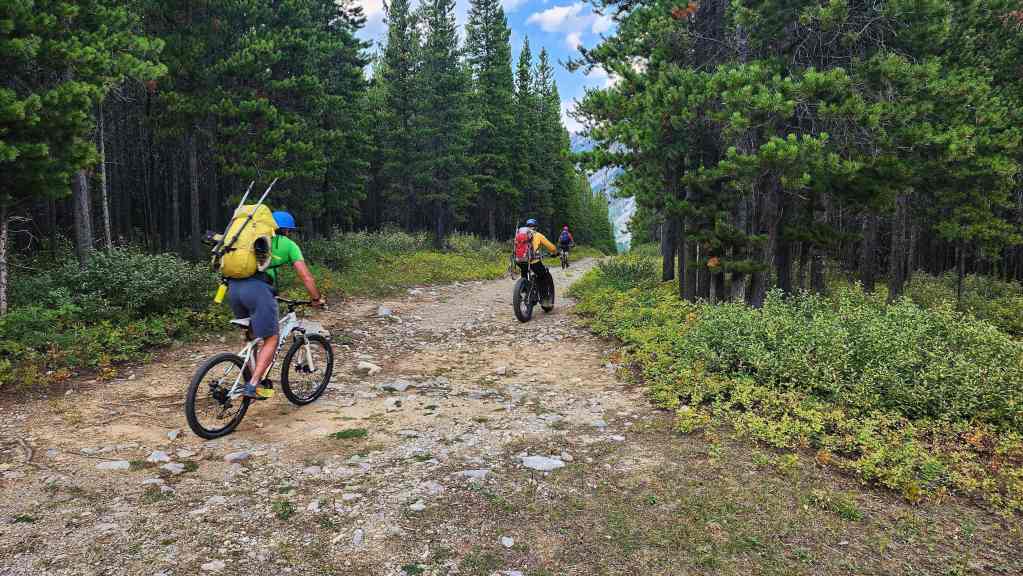
Back on our bikes. It will be a quick ~30 minute ridge back to the trailhead from here.

A cool pastoral shot of Ptolemy Creek. (Photo by Geoff Hardy)

Arriving back at our vehicles after 22 km over 8.5 hours. This was a fun trip after so much time away from the mountains. A HUGE thanks to Andy, Geoff, and Brad for the great conversations and all the laughter. 🙂