


⚠️ Hiking and scrambling are inherently dangerous activities. Please read my Disclaimer. ⚠️
Saskatoon Mountain was a quick little excursion after I had spent the morning exploring access roads and potential summit routes along the BC/AB border. The unseasonal weather had melted the snow from several backcountry roads which are normally not maintained during the winter and as a result, I was able to scout out some new fishing and hiking locations for the summer. Originally, I had decided to try and climb the south face of Crowsnest Ridge beneath the radio tower, but ‘No Trespassing’ signs and private roads thwarted this plan. I could have parked at the Visitor’s Centre on the BC side of Phillips Pass and walked in that way, but I didn’t feel like making such a long approach. I also drove to the hamlet of Sentinel and considered walking along the shore of Crowsnest Lake until I reached the east end of Crowsnest Ridge, but this too, would have taken longer than I would have preferred, so instead, I picked popular little Saskatoon Mountain.
Saskatoon Mountain is fun hike and can be done fairly quickly, though curiously, the actual summit (1825m my GPS) is not marked with a cairn while two lower viewpoints are. This is perhaps because the true summit is not visible until you come to it after passing through several sections of trees, while the location of the cairns are on visible highpoints and resemble terminus points. Regardless, Saskatoon Mountain is another one of those fun bumps that I love to do in the winter.

The route for Saskatoon Mountain begins in the Town of Coleman in Centennial Park. If coming from the east on Highway 3, drive past the 7-11 and take your first right after the Esso station (look for signs that say ‘Miner’s Path’). As soon as you turn off of the highway, turn right immediately again and follow 76 St. for about 100m until it turns to go under the highway. Here is where you turn left into Centennial Park (keep following the signs that say ‘Miner’s Path’). After parking, follow Miner’s Path along scenic Nez Perce Creek until you come to a waterfall. Here, the path will ascend a set of stairs up the bank on your right. Follow the path until you come to the first fork in the trail and take the right fork. Follow this path until you come to another fork in the road. Here you will have a clear view of the ridge you will need to gain. To follow the beaten path up Saskatoon Mountain, take the left fork. On my way up, I took a little bit of a different approach and went to the right and ascended the ridge through the trees behind the water storage tank. On my way down, I followed the path.
Once you reach the first cairn (1697m my GPS), you then head through a grove of aspen trees and come to a beaten up fence that can be crossed by stepping over it. Curiously, there is a ‘No Trespassing’ sign here which seems to indicate that you have have been on private land up until this point and are now about to cross onto public land. However, there is not a single ‘No Trespassing’ sign anywhere along the trail or on the fence at the beginning of the trip (there is even a special modification to the fence on the trail to accommodate hikers). From the fence and the sign, the path to the summit leads through several treed sections and meadows. The summit is recognizable by a lone dead tree but no cairn. My GPS reading at this point indicated it was 1825m. It was on my way back that I noticed a large second cairn on a viewpoint that overlooks the first cairn. I crossed the meadow and took a GPS reading at this point just in case I was mistaken about the actual summit – but I wasn’t. My GPS reading at the second cairn was 1788m, so it was not the summit. I followed my ascent route back but after the first cairn, I stuck to the path and eventually ran into several other hikers coming up the trail. They were CNP locals and were only planning to go to the first cairn. When I asked them about the ‘No Trespassing’ sign, they said that it was news to them and that this was the way everyone goes up Saskatoon Mountain.

This was a quick and pleasant little trip. From my car to the summit it was 4.3km which took me 1 hour and 39 minutes. Total elevation gains were 578m with a total distance of 8.56km. The total trip took me 2 hours and 50 minutes.

If coming from the east along Highway 3, look for these signs as soon as you pass the Esso station and follow them to the parking area.

My parking location in Centennial Park in Coleman, AB. This is the beginning of Miner’s Path.

Something tells me that this piggy bank would need more than a hammer to break it.

Miner’s Path is a pretty trail that runs alongside Nez Perce Creek.

I kept to my right as I followed Miner’s Path. This bridge leads to a set of stairs up the west bank and you don’t want to go up these.

I had to pass through a quaint little gate along the trail.

Miner’s Path eventually comes to a little waterfall. From here I proceeded up the set of stairs on my right.

Shortly after reaching the top of the stairs, I came to a fork in the trail. I took the path on the right.

After a few minutes, I came to another fork in the trail which offered a clear view of the ridge. Take a left to reach the trail up Saskatoon Mountain (part of the trail is visible in the bare patch on the right-hand side of the ridge).

The path on the right leads to a water storage tank. To ascend, I went through the trees behind the storage tank and on my descent, I followed the traditional path. To be fair though, there were so many trails through the trees that I never really was bushwhacking.

I encountered this cool mountain biking setup in the trees behind the water storage tank. Definitely not for the faint of heart!

Once I hit the open slopes, I could see Willoughby Ridge (centre left), The Saddle (centre right), Mount Coulthard, and Mount McLaren.

Looking up the slope to the rock outcropping on the ridge.

For fun, I scrambled up the rocks.
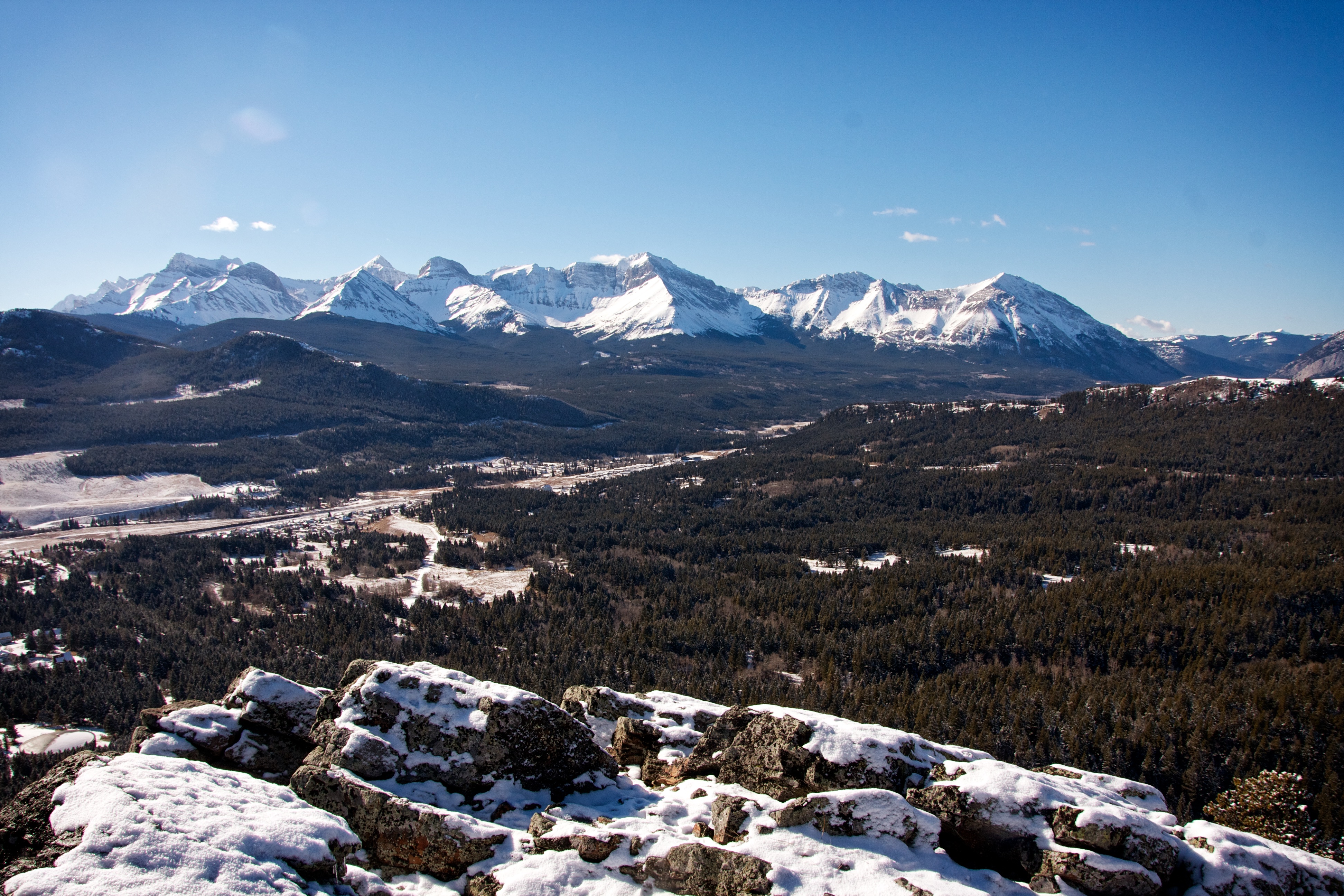
The view of the Flathead Range from the top of the rocks. From left to right: Mount Coulthard, Mount McLaren, Andy Good Peak, Mount Parrish, Chinook Peak, and Sentry Mountain.

Looking down at the towns of Coleman and Blairmore from the rocks. From left to right: Burmis Mountain, Turtle Mountain, Hillcrest Mountain, Hearts Peak, and Willoughby Ridge.

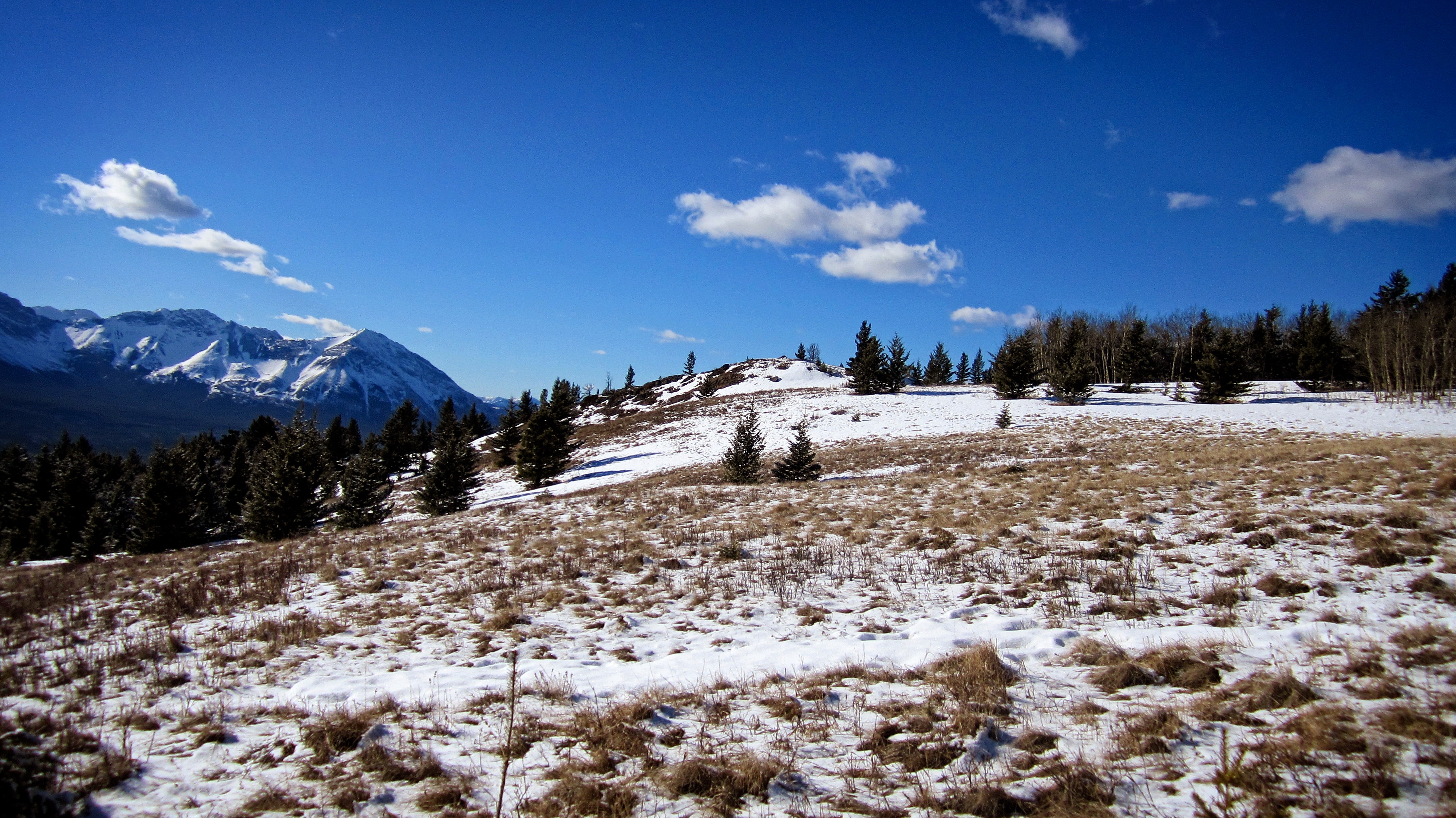
The trail up Saskatoon Mountain is made obvious thanks to a dusting of snow.
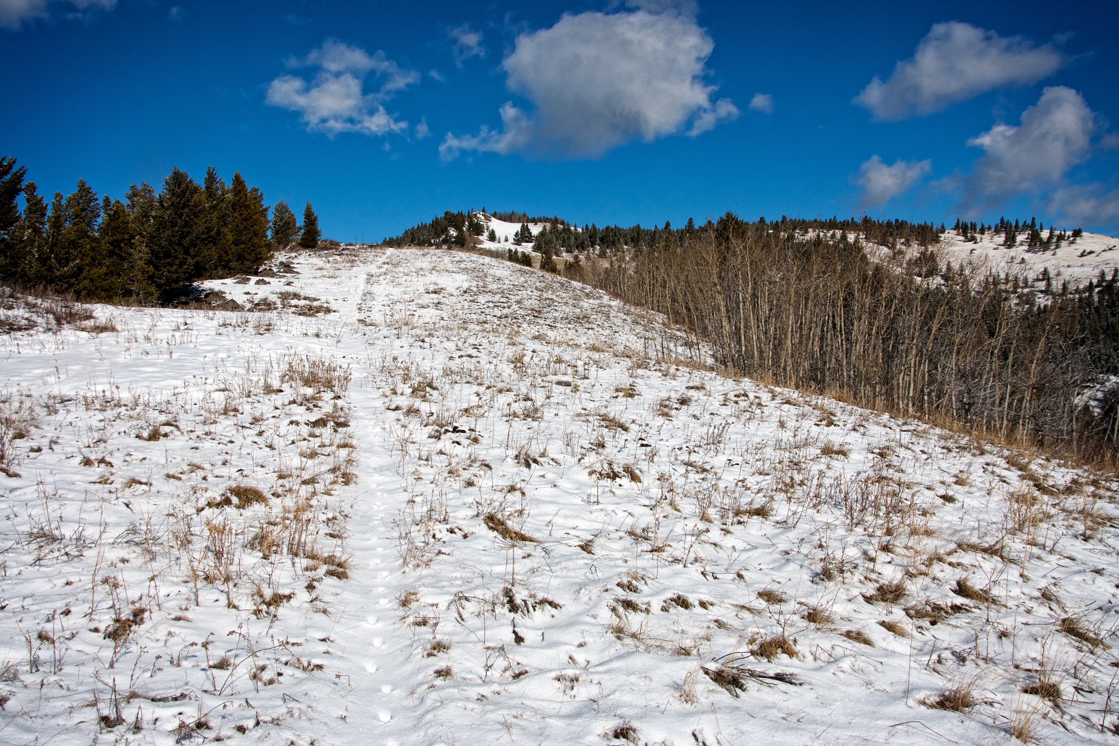
Following the trail to the first cairn (just behind the trees on the left). The second cairn is located on the highpoint in the distance (centre) but the summit is not visible.

Looking at Phillipps Peak, Mount Tecumseh, “Shooting Star Peak”, “Alexander Creek Mountain”, “Deadman Peak”, Wedge Mountain, and Crowsnest Mountain (right) from the first cairn (1697m my GPS).

Looking north at “Pa Butte” (left) and Ma Butte (centre) from the first cairn.

A telephoto of Mount Tecumseh and Phillipps Peak. “Shooting Star Peak” is on the right.

Crowsnest Mountain and the Seven Sisters poke over the summit of Wedge Mountain.

Fortunately, a moose had tracked through beforehand, saving me from me from having to post-hole my way through a section of deep snow. This is looking back through the trees at the first cairn.

After the first cairn, the trail continues toward the summit (not visible). The second cairn is located on the highpoint on the left.

The trail comes to a beaten up fence with a small gate, though I could easily step over the broken fence. Before crossing, I noticed that there was sign on the other side of the fence, and after I had crossed, this is what I saw. It would appear to indicate that the trail I had followed to this point (and which everybody else follows) had crossed over private land. Nowhere at the start did I ever see a similar sign and the CNP locals who I encountered on my way back, had no idea about it either. This might be something to check into because I don’t want to advocate trespassing.

I was being watched…

Just in case anyone had doubts about the wind in southern Alberta…

The trail continued through several sections of trees and meadows until the summit finally came into view.

The summit is marked by a lone, dead tree.

Looking west at Crowsnest Mountain and the Seven Sisters from the summit. “Deadman Peak” can be seen on the far left and “Pa Butte” is on the far right.

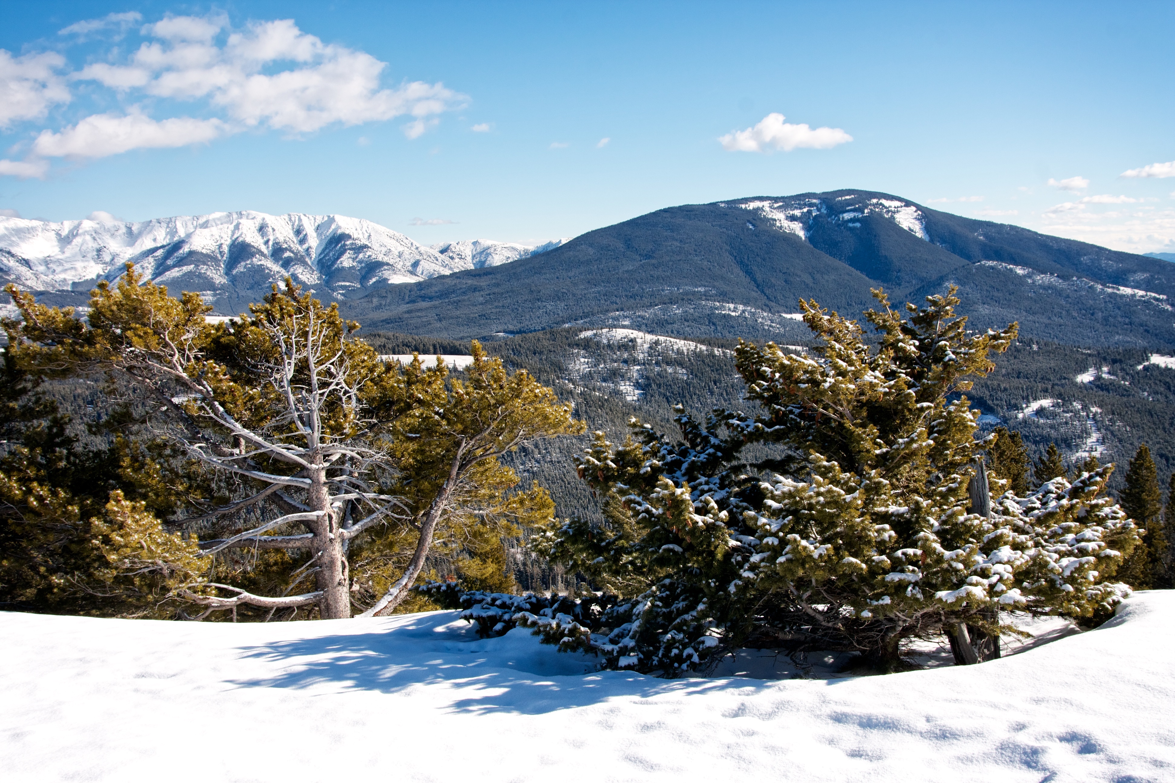
Another view to the west that includes Mount Tecumseh and Wedge Mountain.

Looking south from the summit at Turtle Mountain, Hillcrest Mountain, Hearts Peak, and Willoughby Ridge.

Looking south at the Flathead Range. From left to right: Mount Coulthard, Mount McLaren, Andy Good Peak, Mount Parrish, Chinook Peak, and Sentry Mountain.

A telephoto of Crowsnest Ridge (left), Loop Ridge, Phillipps Peak, and Mount Tecumseh.

Looking east at Centre Peak (left) and Caudron Peak (right) on the Livingstone Range. Grassy Mountain is in the foreground.
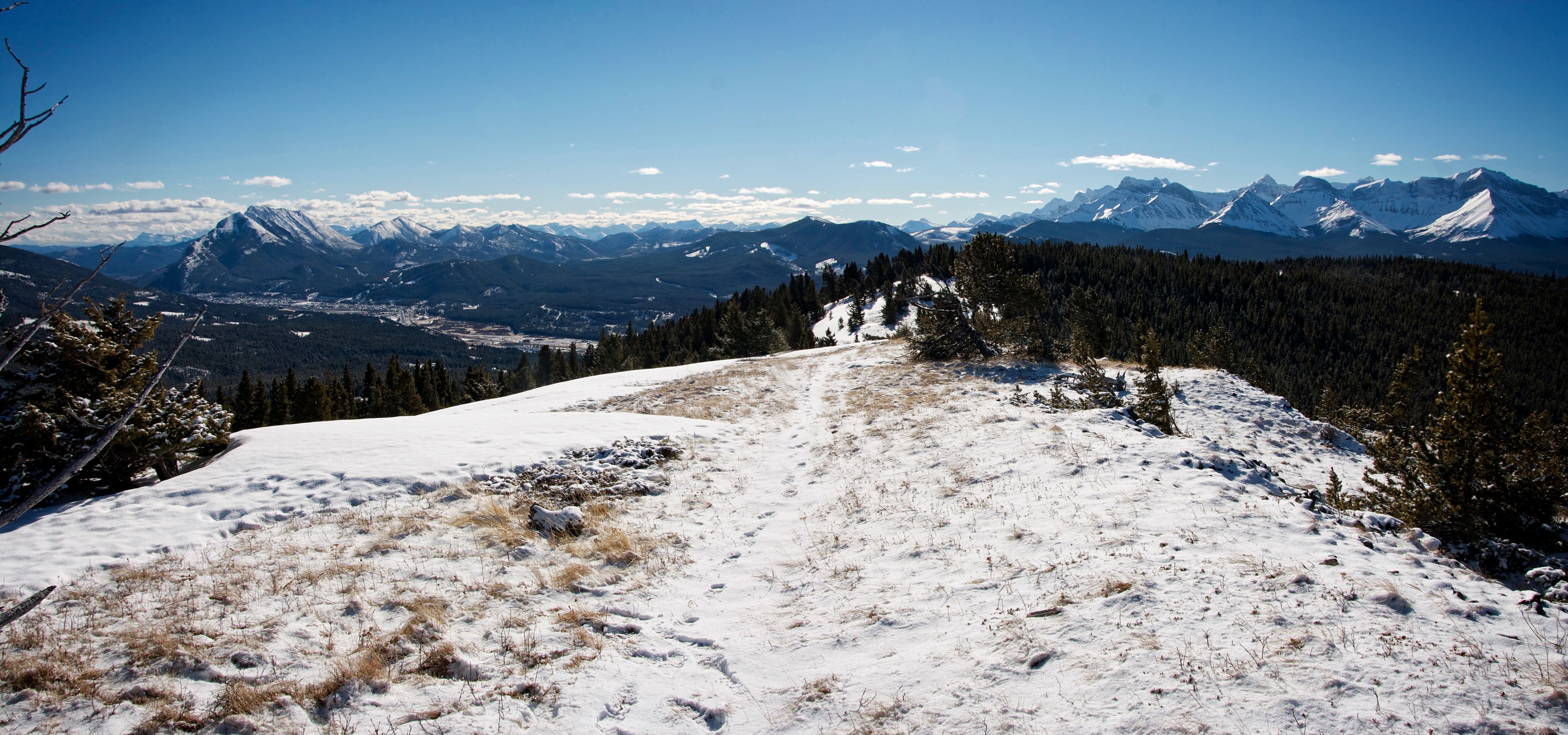
The summit offers good views of the Crowsnest Pass.

The old tree was quite beautiful, so I thought I’d give it a little screen time.

Crowsnest Mountain as framed by the tree. It was a beautiful day with temperatures well above freezing and little to no wind.

Looking northwest at “Pa Butte”, Ma Butte and McGillivray Ridge.

Saskatoon Mountain was a fun little solo hike, though I did lose my sunglasses somewhere on the way up.
On my way back, I could see a large cairn on the top of a rocky outcrop.

I cut across the meadow to investigate. Again, a cooperative ungulate had post-holed a track for me.

The second cairn sits at 1788m (my GPS) and is not the summit. However, because the true summit is not visible at all from this location, I bet that many people turn back after reaching this point.

The view from the second cairn is impressive and overlooks the first cairn (bare patch on the middle right).

Looking south at Mount Coulthard from the second cairn.

Barring sections of deep snow, the trail remained obvious throughout the trip.

That’s not a thin little tree either…

On the way back I stuck entirely to the trail. When I reached the fence near the bottom, the trail went through a special opening in the fence – obviously made to accommodate hikers. Again, not a single ‘No Trespassing’ sign was visible anywhere.

The warm weather and melting snow had turned sections of the trail into mud.

After 8.56km and 2 hours and 50 minutes, I arrived back at my vehicle. If time is limited or you have a younger family, Saskatoon Mountain is great little destination. I suspect that many people with younger kids (like a family that I met on the trail), make the first cairn their objective, while others continue on to the higher second cairn. Since the summit does not have a cairn, I’m left to wonder if it sees as many visitors.