⚠️ Hiking and scrambling are inherently dangerous activities. Please read my Disclaimer. ⚠️
Merry Christmas! After a busy end to the semester followed by a wonderful Christmas spent with family and friends, it was time to move the holiday fun outside. A couple weeks of -20c weather had recently been replaced by a chinook that raised temperatures into the -3c range, but which had also brought with it some intense wind gusts. Normally in these conditions, I look for a sheltered approach up the eastern side of a mountain, however, I really wanted to complete Crowsnest Ridge as a snowshoe because it’s one of those small, but prominent landmarks in the CNP that I had yet to stand on top of.
Joining me on this mid-week excursion was my friend, Aaron Eyjolfson, who was also anxious to get out and play in the snow. As we made the windy drive from Lethbridge to the CNP, we discussed a few possible destinations that would keep us out of the wind as long as possible. However, once we rolled into Blairemore, I suggested that we keep going to see what the wind was like near Crowsnest Ridge. Even though the Ridge is orientated west to east, my hope was that the wind was coming from the SW, which would allow us to be sheltered as we snowshoed up the access road that is etched onto the north face of the mountain – and it was! In fact, we enjoyed a relatively wind-free day until we reached the summit.
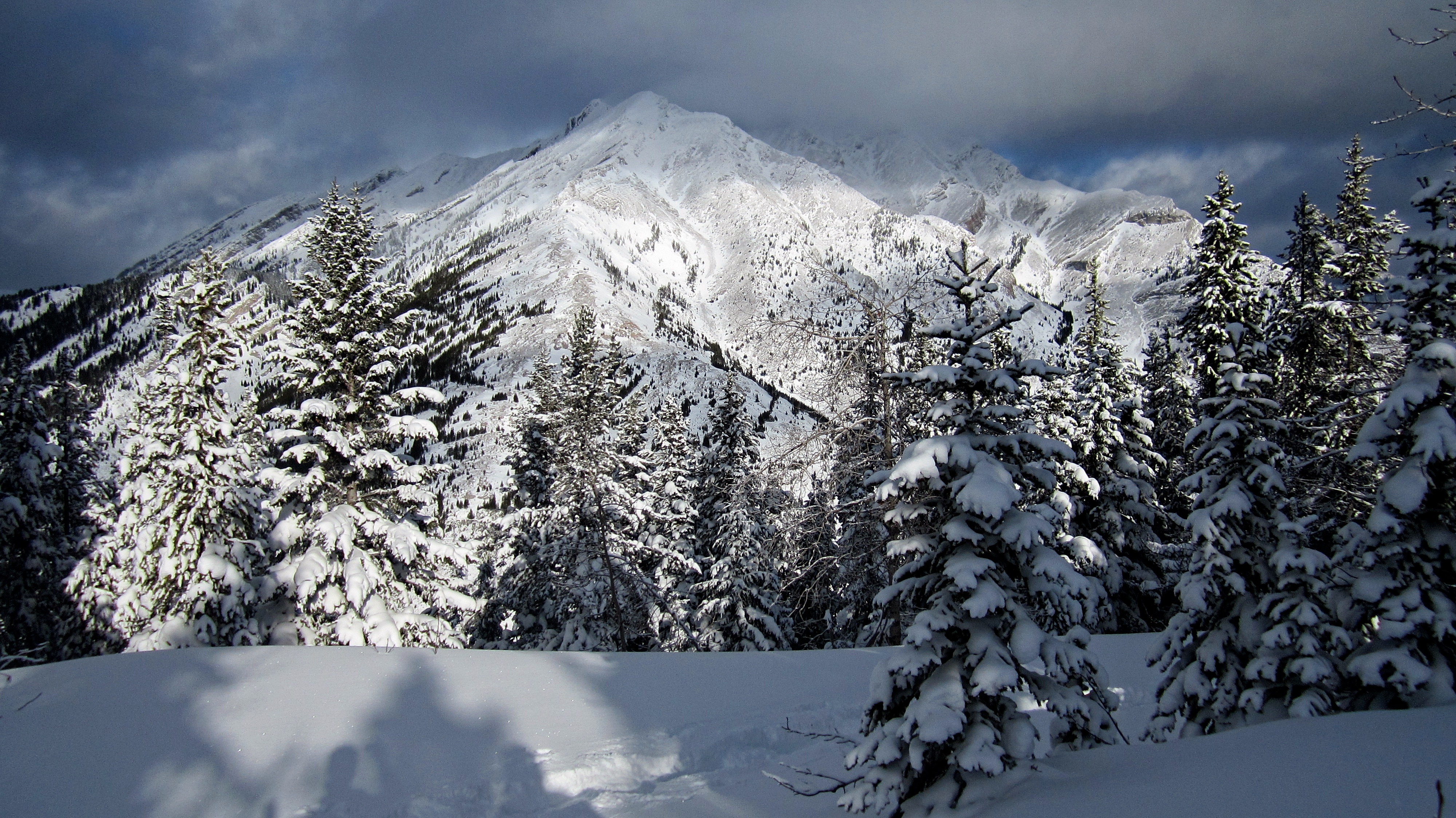
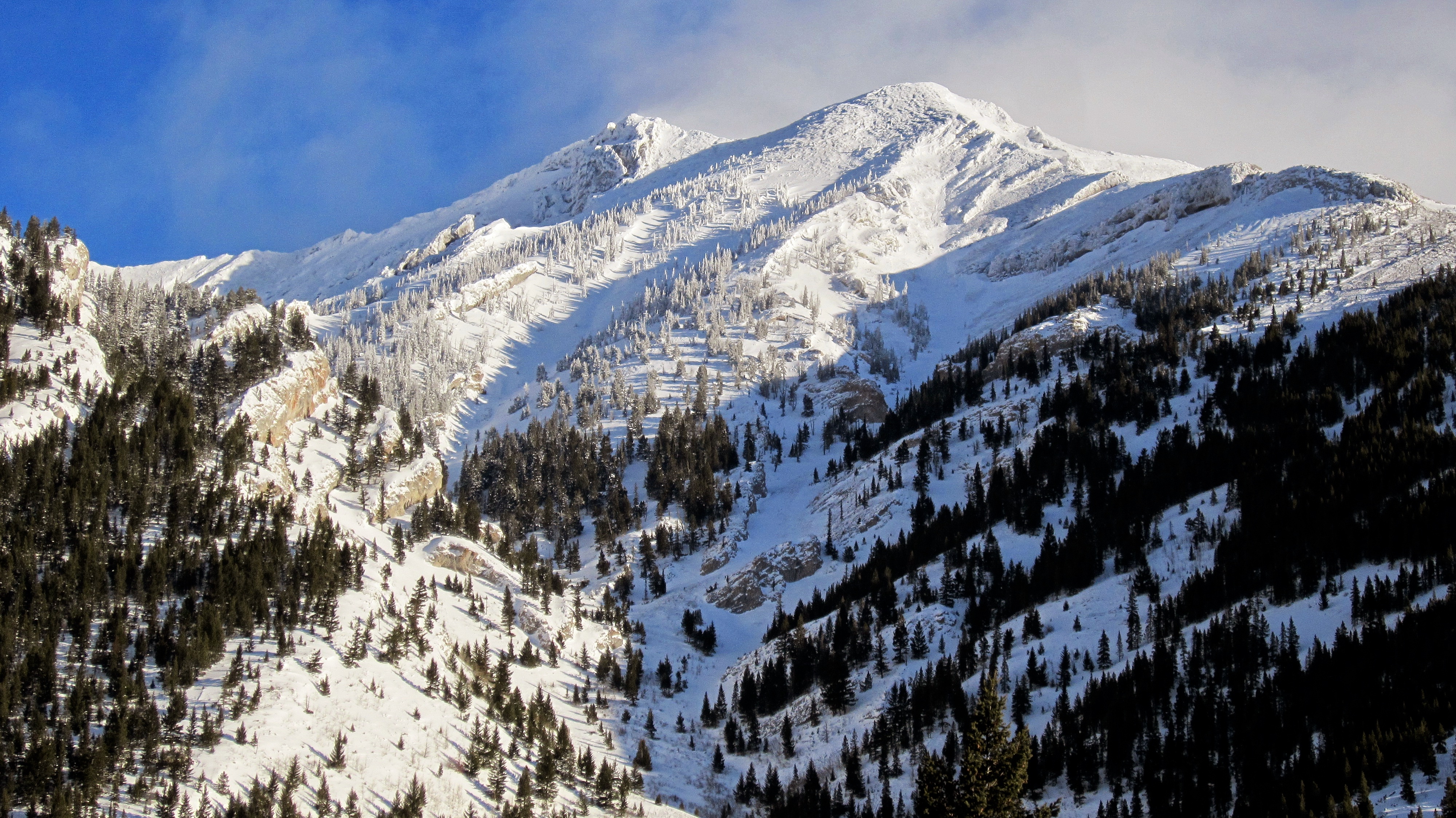
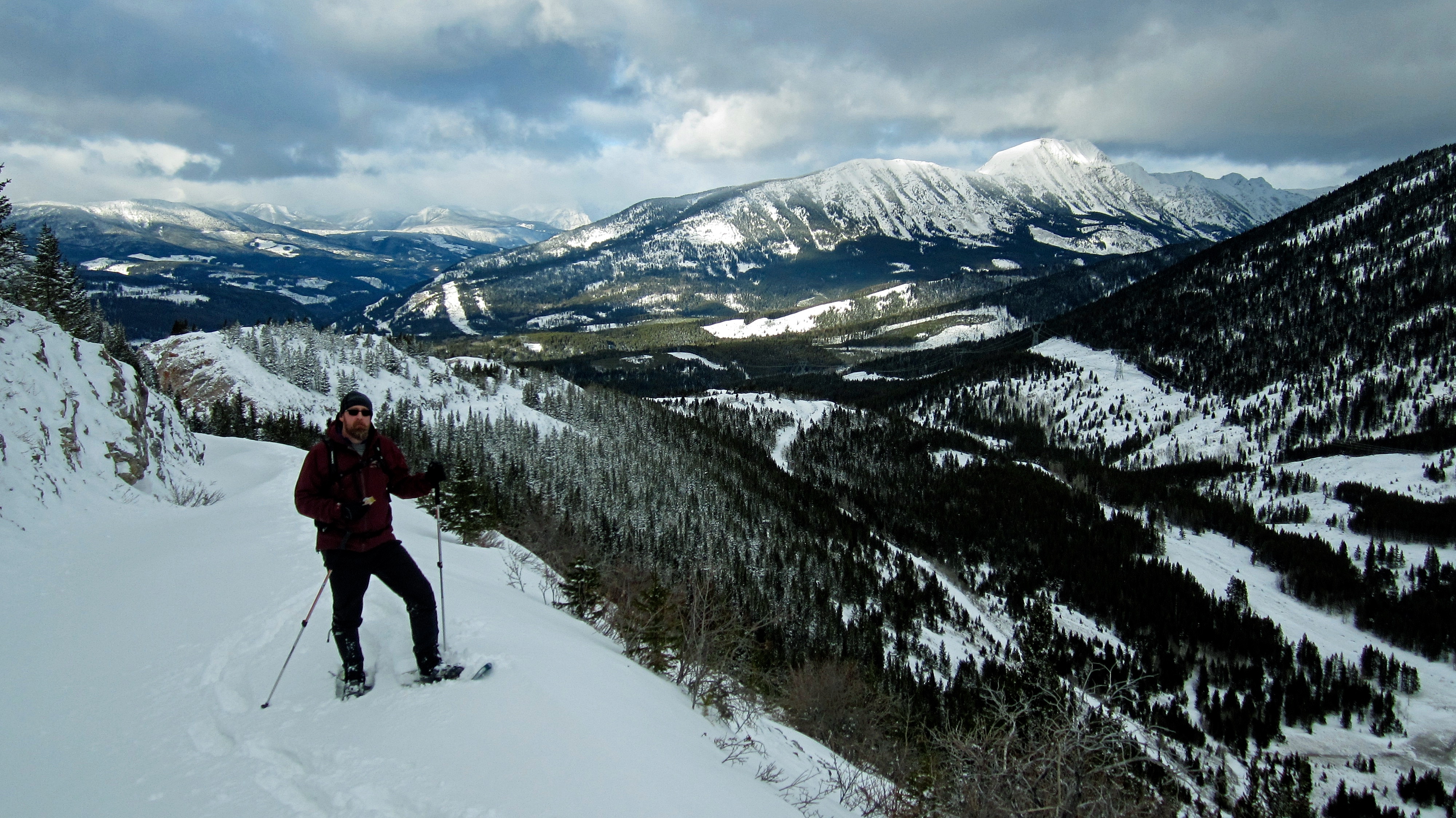
Though deep snow along the access road forced us to work hard, Crowsnest Ridge ended up being a great snowshoe. Despite the rather unappealing summit, which is cluttered with various buildings and a large communication tower, the winter scenery along the road was pretty and once on the summit, we had good views of the entire CNP. Of particular note were the views of Phillipps Peak and Mount Tecumseh to the north and Crowsnest Lake and Sentry Mountain to the south.

Thanks to Bob Spirko and Sonny Bou, who snowshoed this route in February 2014, I knew what to expect as we followed in their steps. We started our trip from the BC side of Phillipps Pass which we reached by driving west along Highway 3 until we came to the BC/Alberta border at Summit Lake. A short distance beyond Summit Lake (~300m) we turned right off of the highway and into the entrance of a rest area at Crowsnest Provincial Park. The rest area itself is closed for the season, however, there was enough parking in front of the locked gate to keep us well back from the highway.
From the rest area we followed a small cutline NE for ~320m until we came to the road that leads to Phillipps Pass. We then followed the road east for ~1.2km to the base of a large cutline that extends up the western end of Crowsnest Ridge. Here is where we left the road and followed the cutline for ~560m until we reached the crest. We then followed the crest south through the trees for ~190m until we came to the access road. From here it was a ~1.98km snowshoe along the road to the summit. We returned the same way.

A topo map of Crowsnest Ridge. Although there are other routes up Crowsnest Ridge, the route that we used is probably the best one for snowshoeing.

Our total roundtrip distance was 8.46 km with total elevation gains of 524m. It took us exactly 4 hours to complete this trip.
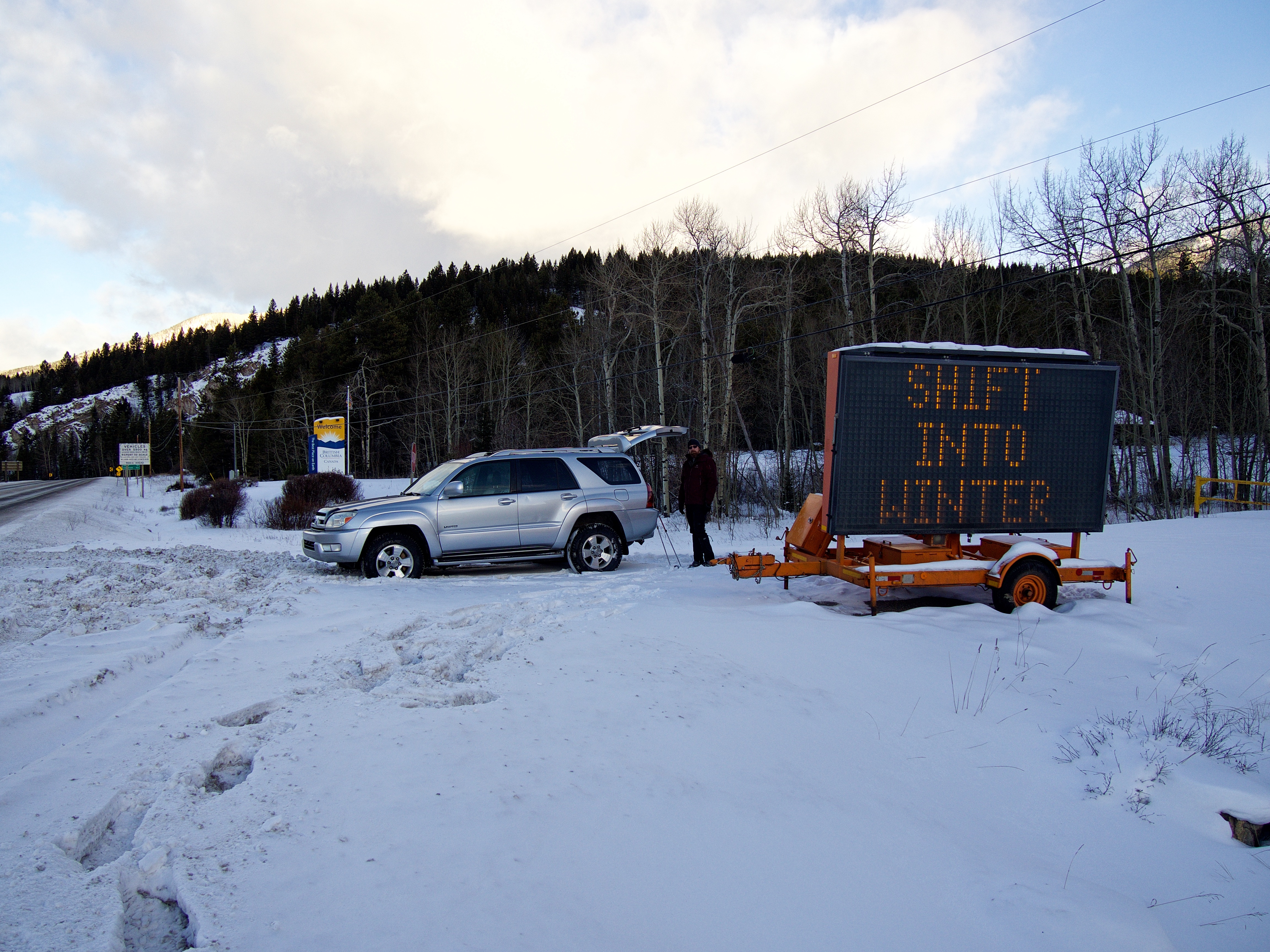
Our parking spot at the entrance to the rest area at Crowsnest Provincial Park. I think the message on the digital sign was fitting for our first snowshoe of the season!

Aaron walks along the cutline that leads from Highway 3 to the Phillipps Pass road.

After snowshoeing north along the cutline for ~320m, we came to the road (pictured). Here we would turn right (east) and follow the road for 1.2km until we came to another cutline. In the background is Phillipps Peak.

Aaron stands next to the Crowsnest Provincial Park boundary sign. In the background is Crowsnest Ridge.

Looking back at the south end of Mount Erickson.

Approximately 1km from our vehicle, we got our first clear look at the west end of Crowsnest Ridge. The cutline that we would follow to the crest of the Ridge is on the left.

After snowshoeing along the road for 1.2km, we came to base of the cutline.
Morning sunlight awakens the landscape to the west as we gaze back from the cutline.
We were gifted with a gorgeous view of Phillipps Peak from the top of the cutline.
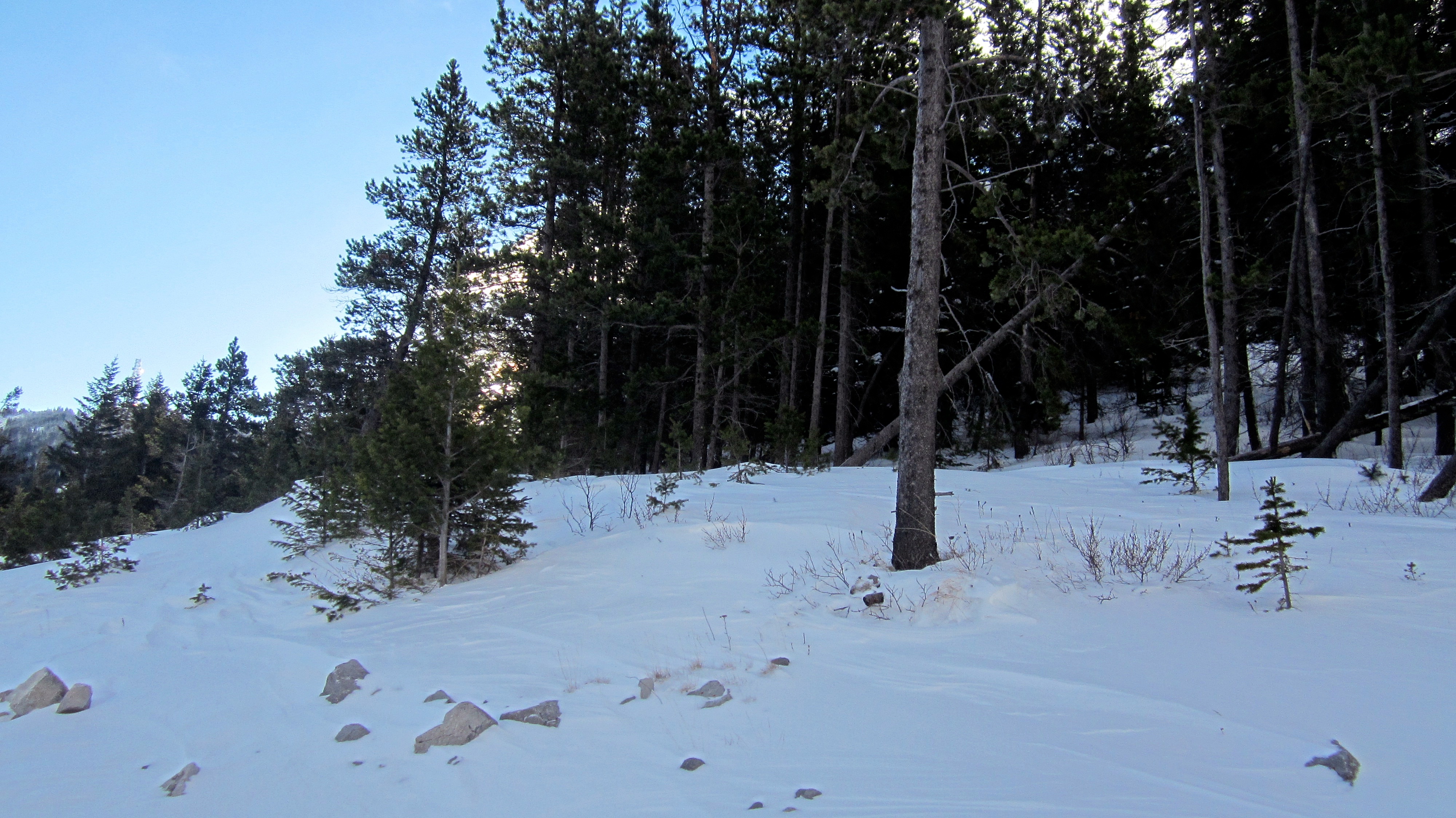
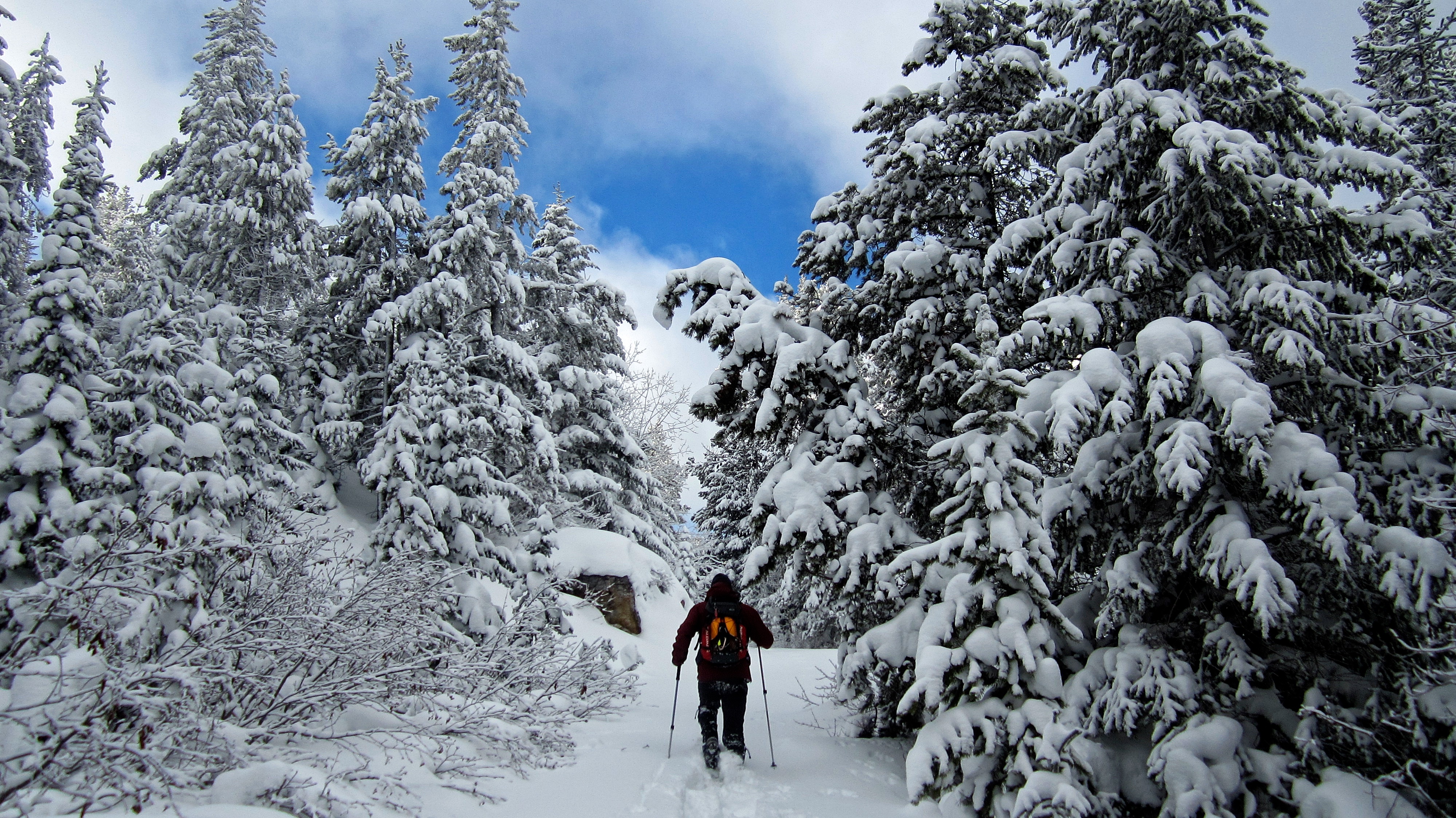
From the top we then followed the crest of the ridge south and into the trees (pictured).

There’s something magical about making the first tracks through fresh, deep snow. However, that feeling soon wears off… 😉
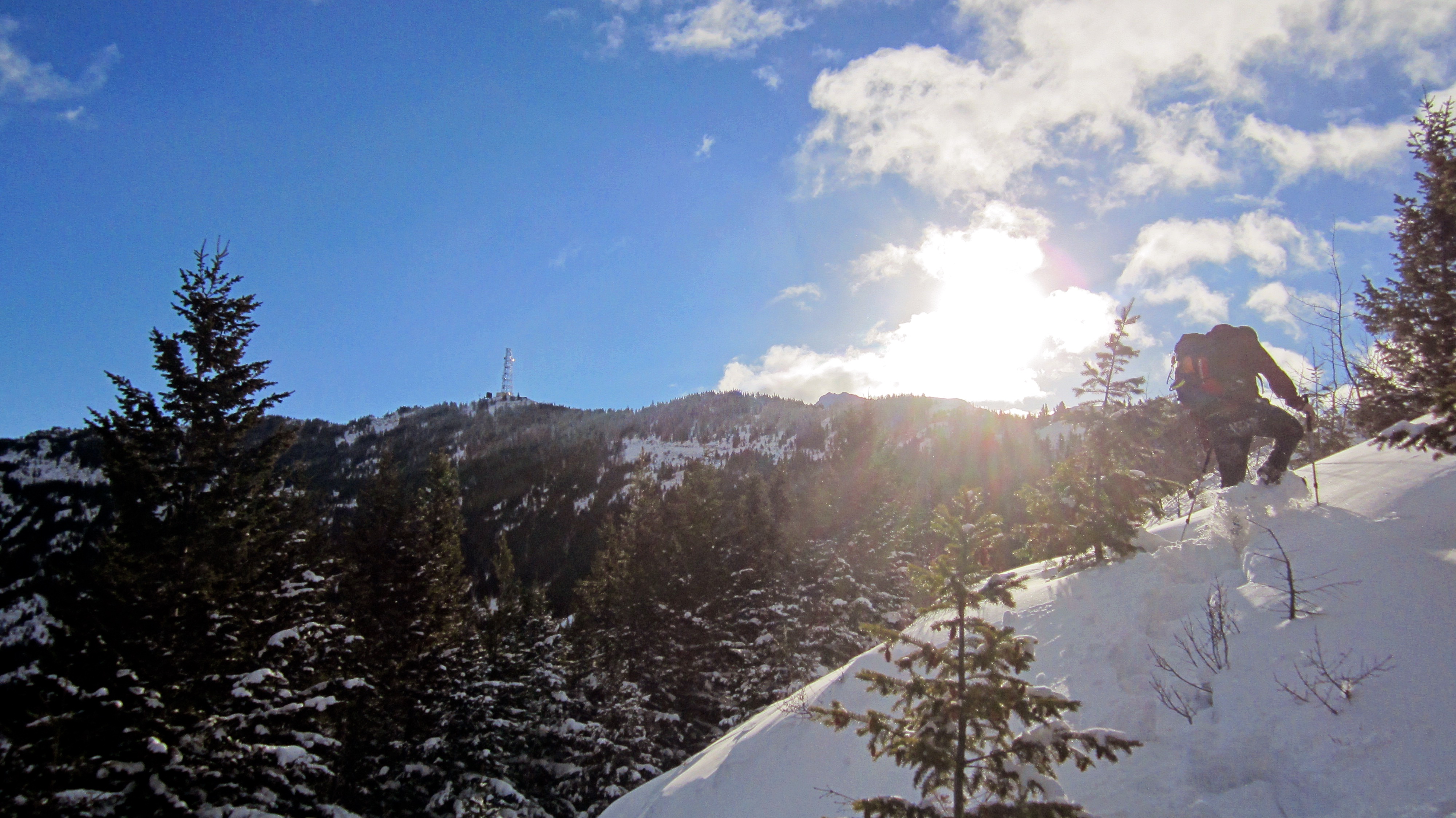
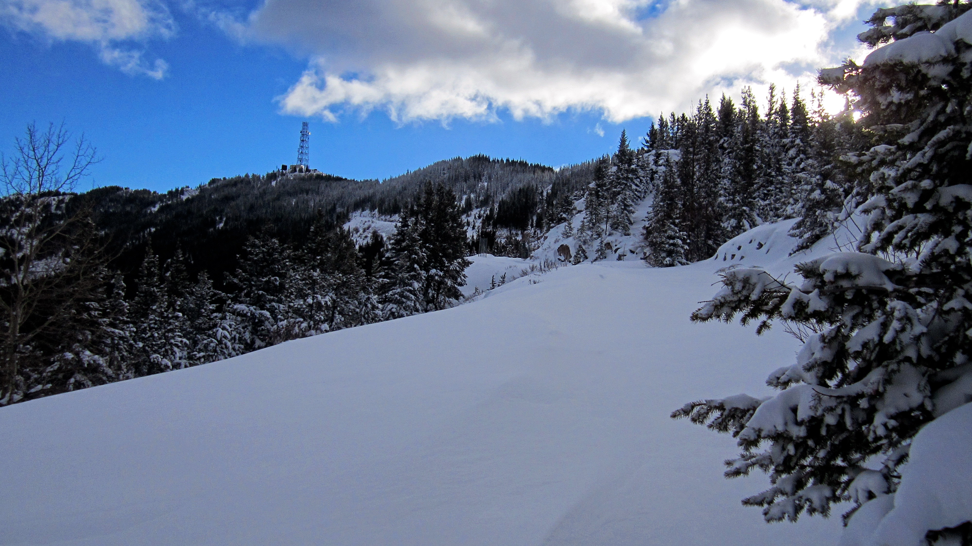
The summit of Crowsnest Ridge is easily identified by the presence of a large communications tower.

Approximately ~190m from the cutline, we came to the access road that leads to the summit.

Aaron stands on top of a large cornice located next to the road. In the background is Phillipps Peak.

All snowshoeing and no play, makes for a dull day! Aaron launches himself off of the cornice and into a deep drift on top of the road. As you can see from the existing depression, this was not his first attempt.

I’m awarding him a 9.8 for good form. 😉

We were able to avoid slogging through deep drifts along the initial section of road by sticking to the wind-swept crest that was located just to the west. However, we could only do this for the first ~290m or so before the terrain became less conducive to snowshoeing. This is looking back along the road at the drifts we were able to avoid. From this point on we had to follow the road.

Aaron takes a turn breaking trail along the road while I pause to break wind. 😉 We would alternate our trail blazing efforts every 50 to 100m.
There was plenty of deep snow to get through before reaching the summit.

The depth of the snow ensured that we would quickly burn off all of those wonderful Christmas calories!

Along the way, we garnered the curiosity of a lone sheep (left). Apparently I still have my sheep whispering skills! 😉

After slogging through soft, deep snow, we were thankful to encounter a short section of hard-packed drifts.
Aaron Eyjolfson stops to look at Mount Erickson. I’m sensing the emergence of a Scandinavian theme…

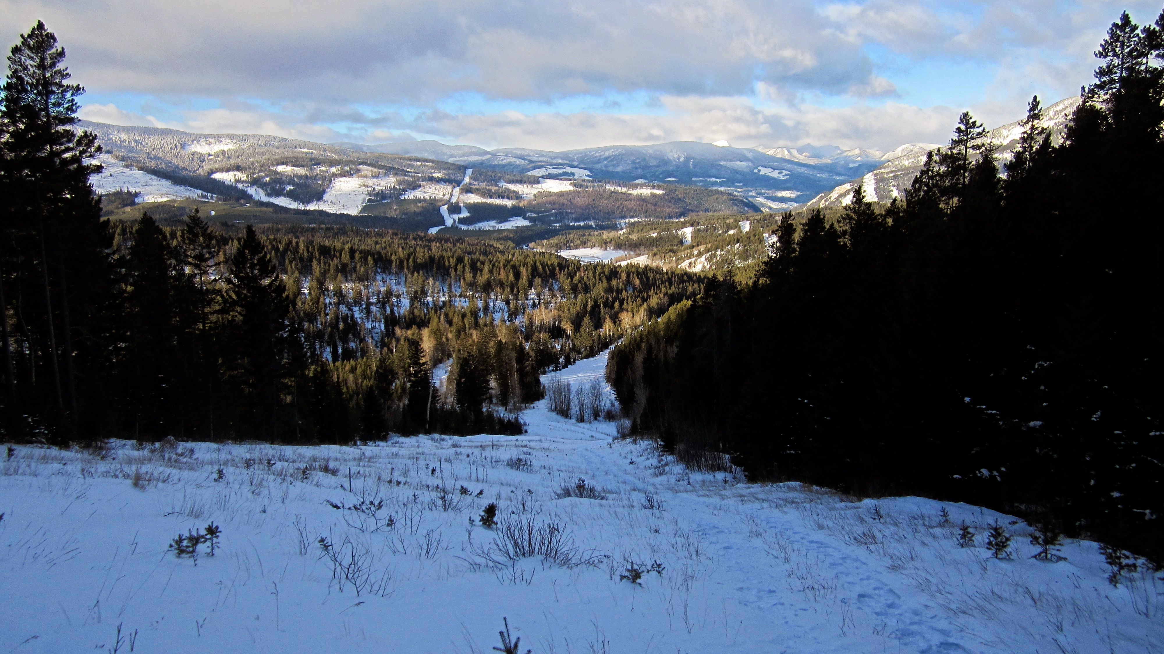
Phillipps Lake looks delicate in the winter.

Channeling his inner Edward Scissorhands, Aaron created a cartoon-like snowman on the side of the road. To me, it looked like one of the long lost McDonaldland characters. (Photo by Aaron Eyjolfson)

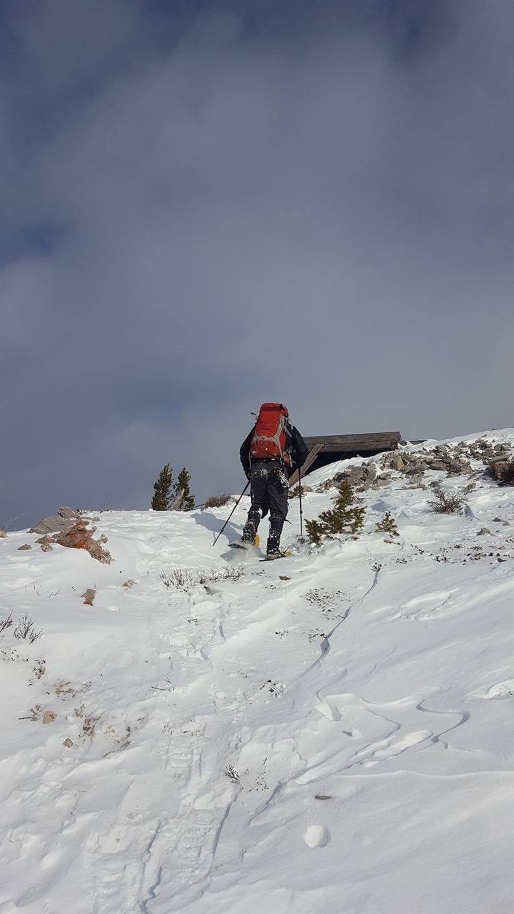
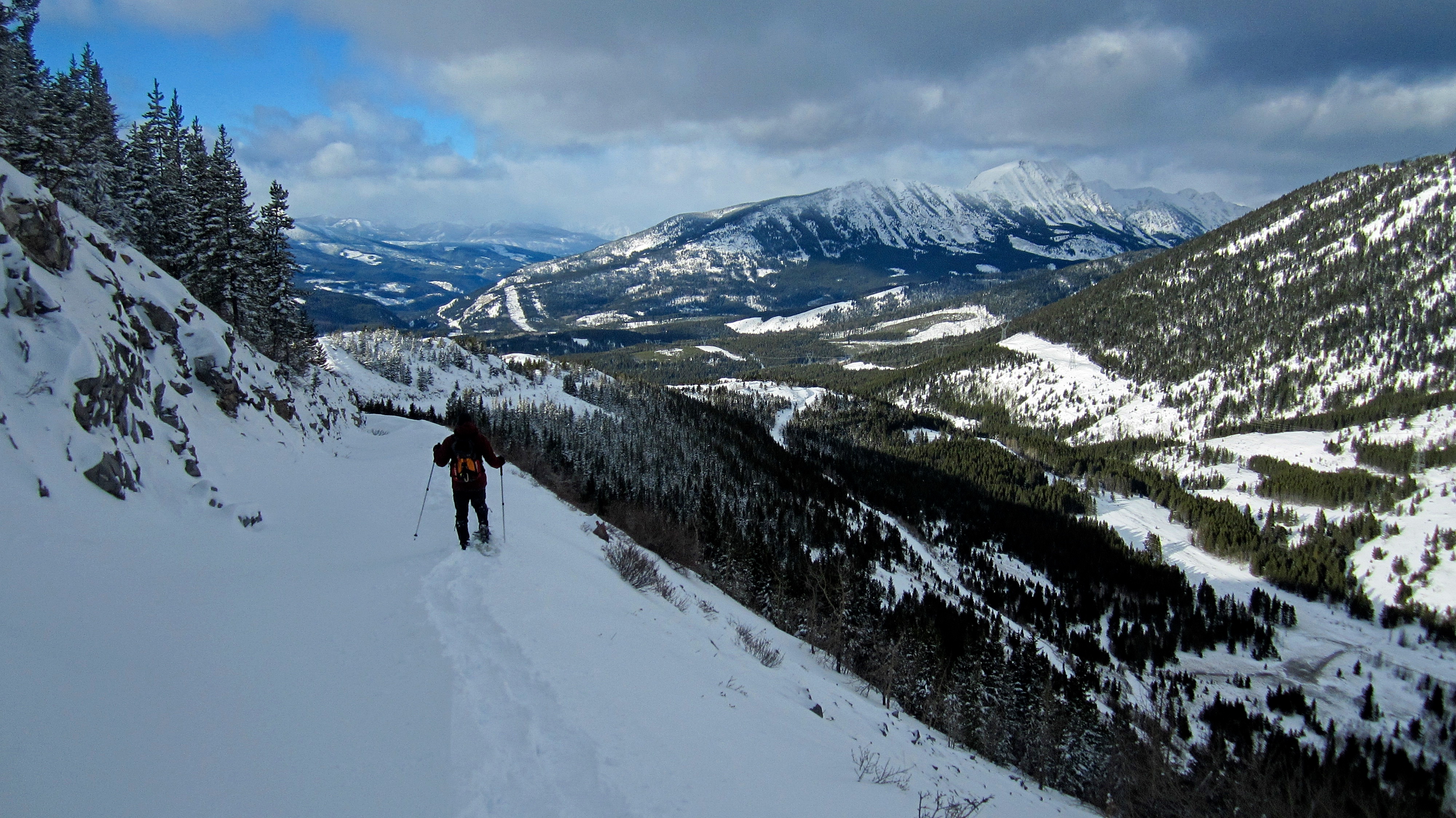
Before reaching the summit, the road makes three switchbacks. Here is where I thought that the winter scenery really began to pop.

Getting closer… (Photo by Aaron Eyjolfson)

A break in clouds allowed us to get our first glimpse of Crowsnest Mountain.
Aaron makes his way through an awesome winter landscape.

The road narrows in places as it gets closer to the summit.

Rounding the second switchback. (Photo by Aaron Eyjolfson)

The last section of road before the summit. Thankfully, some very kind ungulates had broken trail for us – even marking the way with yellow snow! 😉
After rounding the third and final switchback, I take the final steps up to the small helicopter pad that is located on the summit. (Photo by Aaron Eyjolfson)

The summit of Crowsnest Ridge (1903m) is not very inspiring…

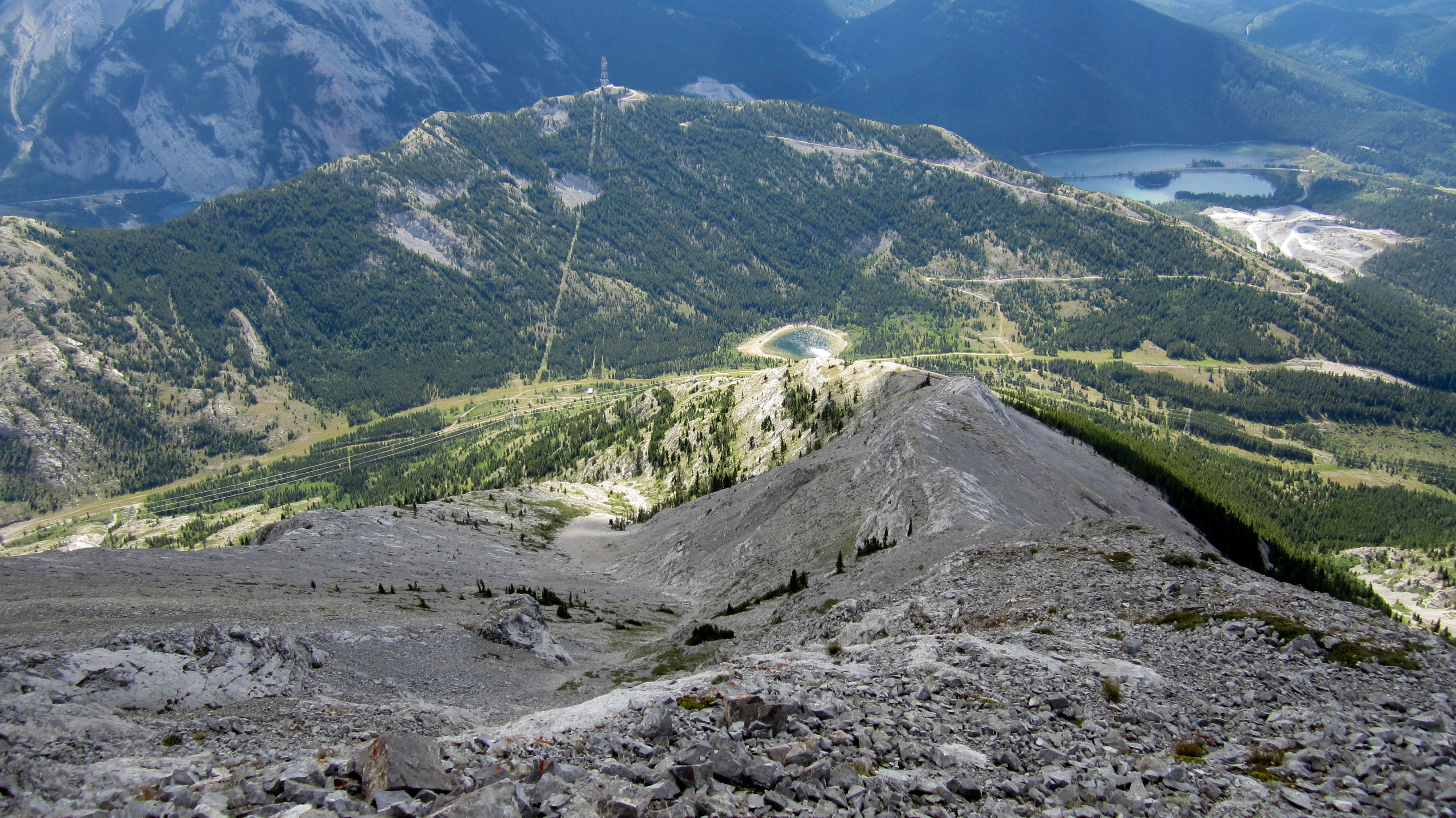
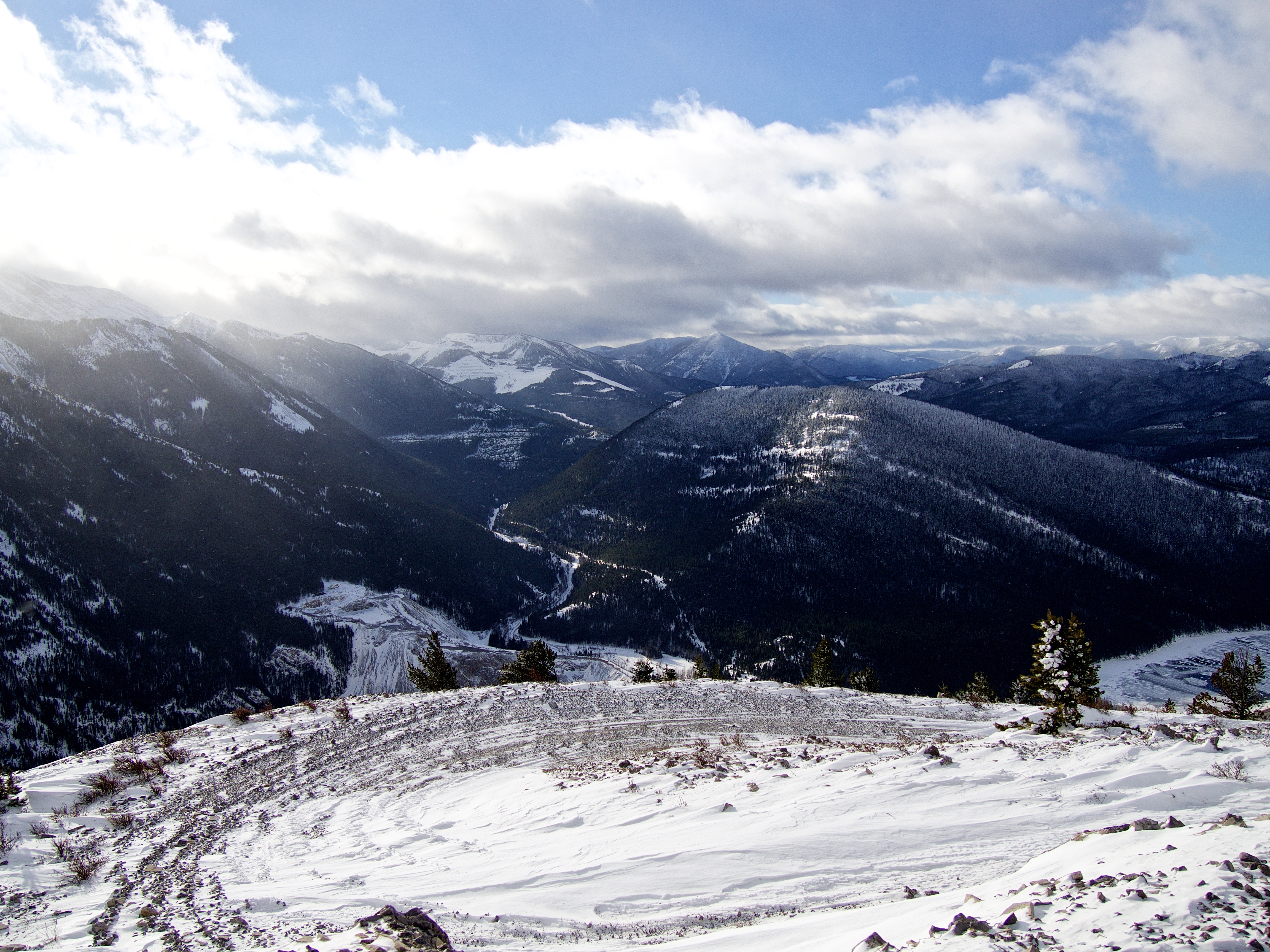
…however, by moving around to the different sides of the structures, you can take in some great views. This is the view looking west. On the left is the old Natal Fire Lookout which was located on the summit of Sparwood Ridge.

Looking slightly to the southwest at the summit of Loop Ridge.

A telephoto of Mount Erickson which is located to the northwest.

Looking north at the beclouded summits of Phillipps Peak and Mount Tecumseh.
The view to the southwest includes, Tent Mountain, Mount Taylor, and in the foreground, Island Ridge.
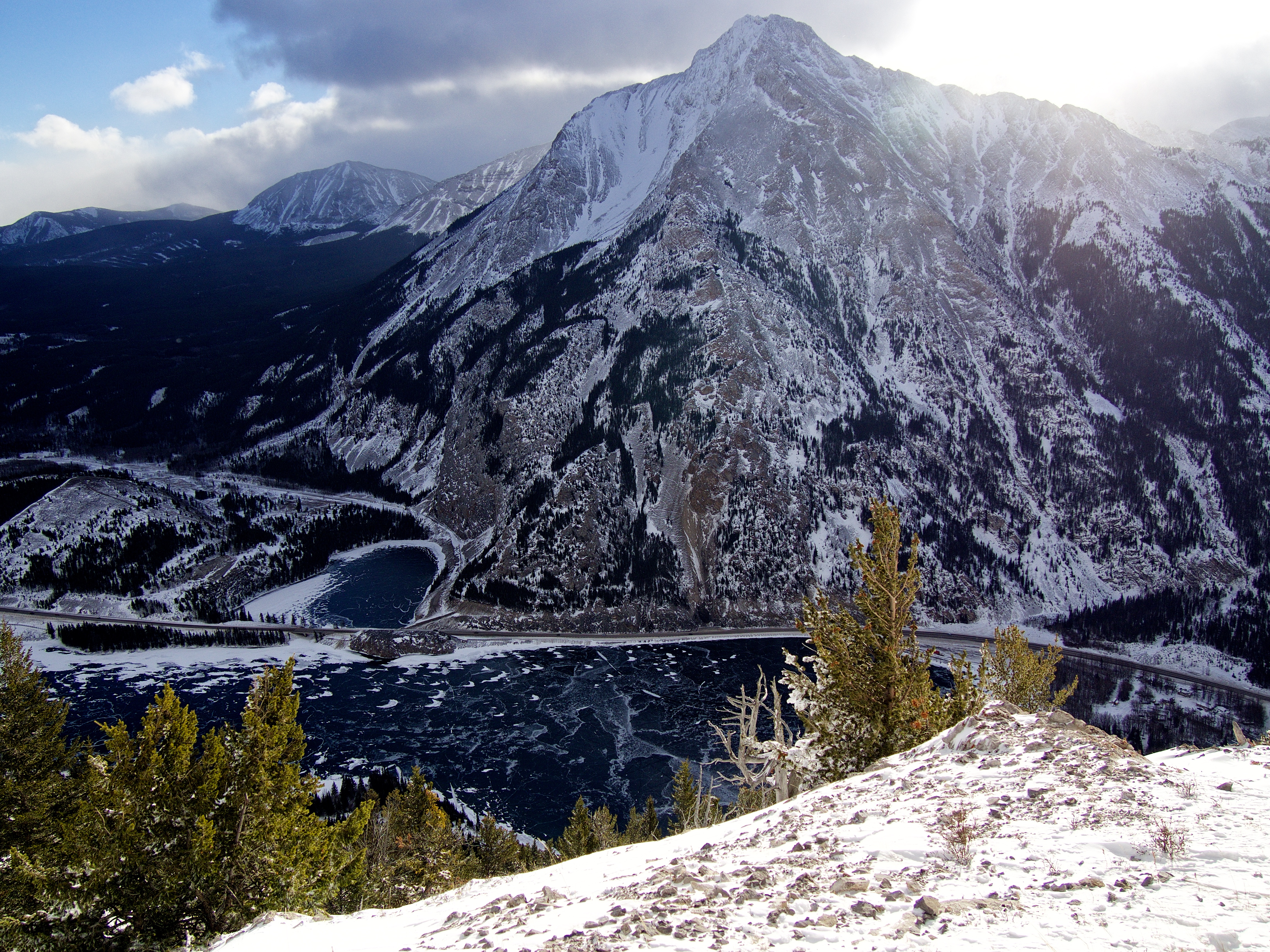
The view south is captivated by Sentry Mountain. Thanks to the wind, the snow on both Crowsnest Lake and Emerald Lake had been blown off, revealing a beautiful glass-like covering of ice. In the background on the left is Mount McLaren.

Looking east towards Morin Peak (left of centre) and Bluff Mountain (centre). On the right is, “The Saddle”, Turtle Mountain, and Willoughby Ridge.

Crowsnest Ridge continues to the east for another ~2.5km. Centre Peak is in the distance to the left of centre. In the foreground centre is Wedge Mountain and Saskatoon Mountain.

A telephoto of Crowsnest Mountain which is located to the northeast.

At one point, this building was the top of a lift system that connected the summit to Phillipps Pass. The circular concrete covering in the foreground was etched with names of several workers and sheltered by a small roof. To me it looked like the entrance to some kind of tunnel.

I imitated Sonny Bou’s picture of the tower because it was so cool. There is a significant amount of Teck cable fastened to the structure.

Aaron stands on the summit of Crowsnest Ridge.

Me on the summit.

After eating a quick lunch on the sheltered side of the largest building, we set off for home. However, I couldn’t resist just one more shot of Phillipps Peak and Mount Tecumseh.
Heading back along our tracks was quick and relatively easy.

I tried to provide some perspective to show how deep the drifts were.

I found this flagging tape in a tree along the access road at the base of Crowsnest Ridge. Like the digital sign that we parked next to at the beginning of the trip, I think this nicely summarizes the point of being outdoors.

After snowshoeing for a total distance of 8.46km in a tidy time of 4 hours even, we arrived back at my 4Runner. While the summit of Crowsnest Ridge is cluttered with buildings and a massive radio tower, it still provides some great views of the CNP. I really enjoyed the snowshoe up to the summit and even more so, I really enjoyed the chance to get to know Aaron. What an awesome guy to spend a day with!

Leave a Reply