
⚠️ Hiking and scrambling are inherently dangerous activities. Please read my Disclaimer. ⚠️
With most of my family out of town for a few days, I decided to head to Waterton National Park for a solo scramble up Mount Crandell. Since I spend more time hiking in the Crowsnest Pass and the Castle than I do in Waterton, I looked forward to reacquainting myself with the area’s mountains. In fact, it had been almost 11 months since Jeff and I endured blizzard-like conditions during our Labour Day ascent of nearby Mount Carthew. Yet on this particularly hot and muggy day, my weather-related concern was not snow, but a forecast for severe late afternoon thunderstorms.
However, when all was said and done, the crux of the trip was not the weather, but rather, my struggle to find a weakness in the cliff band that I encountered just beyond Bear’s Hump. Eventually I found a route up and arrived at the “airy cockscomb” described by Kane. I had read some trip reports that had tackled it head on and others which had avoided it. My initial response was to avoid it, but after passing the last of its downclimbs, I scrambled up the cockscomb to complete the remaining portion – which I’m glad I did. In hindsight, after my initial scramble up the cliff band, the cockscomb didn’t seem as intimidating as I thought it would be and if I were to do it again, I’d try the whole thing.
After tagging the summit, I found little relief from the heat during my descent along Crandell’s southeast slopes. Once in the drainage, I ended up sticking my entire head in the first pool of cold water that I came to – which felt oh, so good! All in all, the Bear’s Hump approach lived up to its route finding reputation but the reward was worth it, with spectacular views of the Waterton townsite and lakes.

The Bear’s Hump approach is best described by Alan Kane in, Scrambles in the Canadian Rockies, but I will concur that its rating as ‘difficult’ is well deserved.
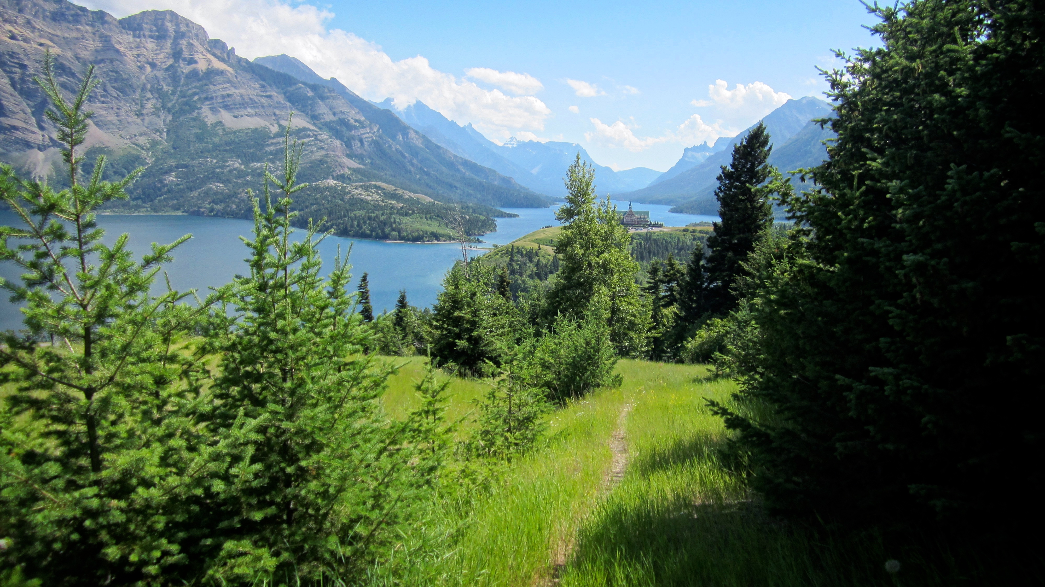
After arriving in Waterton, I parked at the Visitor Information Centre and followed the popular hiking trail up Bear’s Hump, reaching the top in just under 20 minutes. The looks that I received when I was gearing up in the parking lot and on the trail were quite comical. One couple couldn’t stop giggling at the sight of my pack with its attached climbing helmet. They must have thought I was a little over-prepared for Bear’s Hump. Another couple looked worried, probably thinking that Bear’s Hump was more a more serious endeavour than they had perhaps thought. At any rate, once I left the scores of people behind on Bear’s Hump, I had the entire mountain to myself.
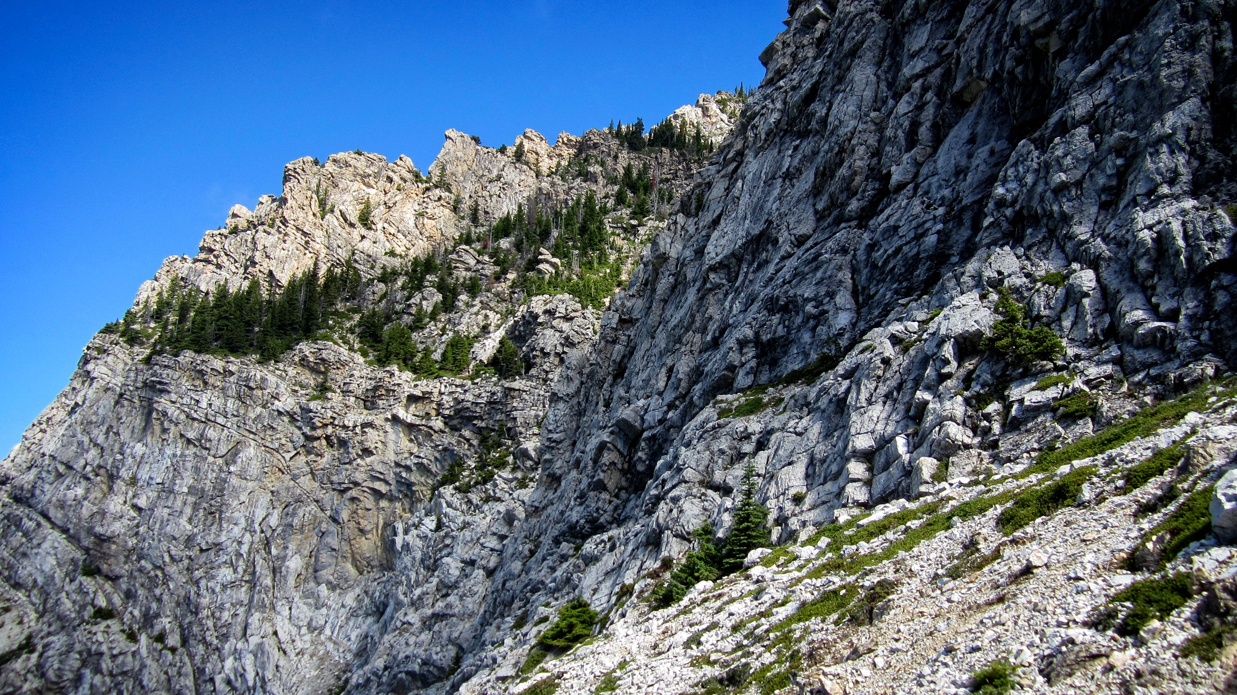
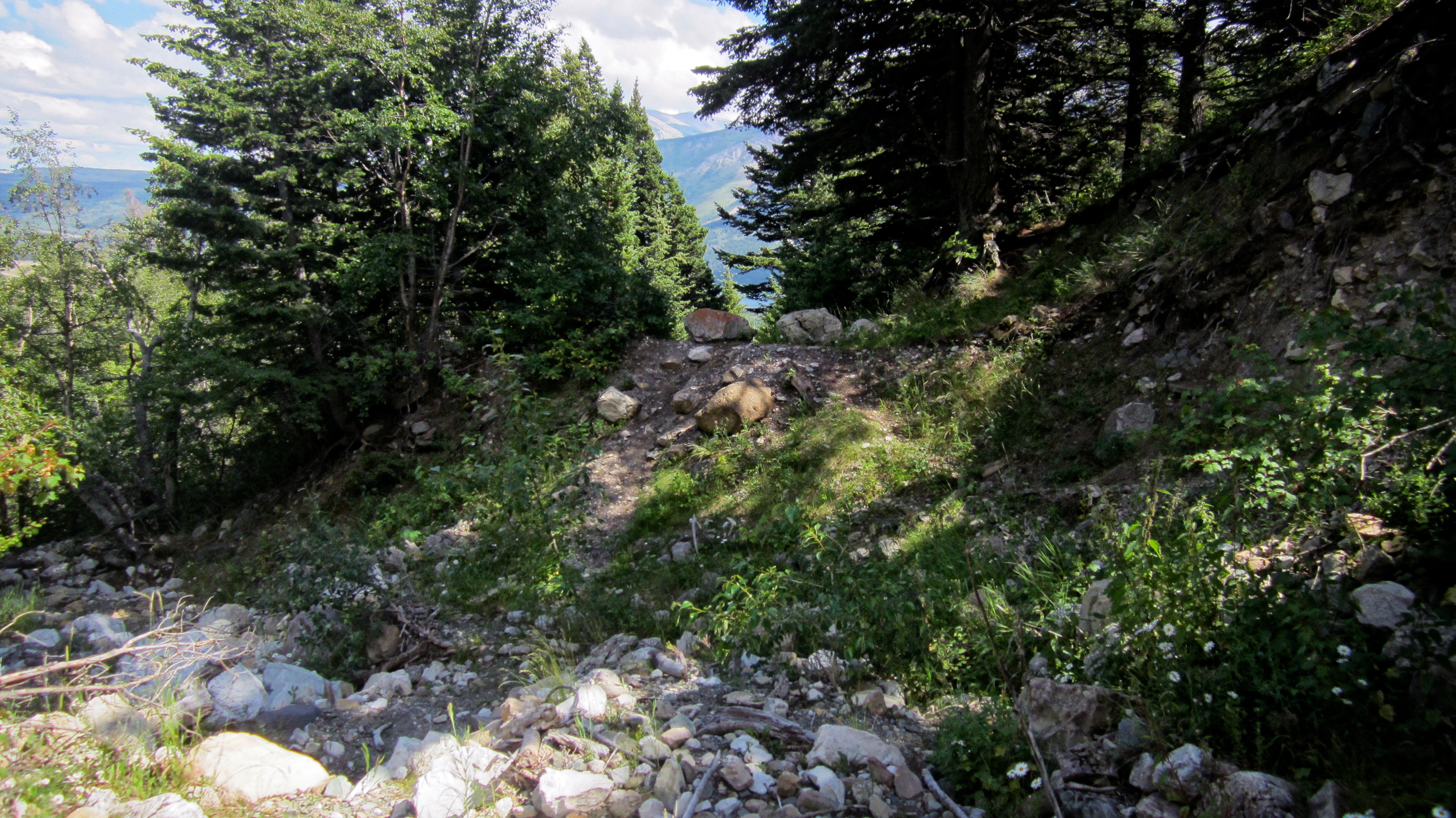
It was a good thing that my short hike up Bear’s Hump was quick because I would take close to an hour trying to find an ascent route up the first “steep wall”. I had not planned on it taking this long, but I had Kane’s, “work your way left” going through my mind, so I followed the base of Crandell’s west cliff face for quite some time, searching for a way up. I tried 3 or 4 routes, but turned back when the pitch became quite steep. There was one route that I probably could have/should have done, but I turned back after I thought that there must be an even easier way. There wasn’t. I eventually turned around when I reached a gully after hiking for ~500m and failing to locate a suitable route. The route that I ended up using probably had the least amount of exposure of any that I saw, but it still had its moments.
Once I reached the ridge crest I was privy to a beautiful view of the Waterton townsite and lakes. From here, I made the hike to the junction point of Bear’s Hump Ridge and Tick Ridge – Kane’s moderate ascent route. The “airy cockscomb” as described by Kane is found at the northwest of end this ridge. Past the cockscomb, I finally received my first view of the summit and the antenna station that sits on it. There was a short section of exposure on the ridge immediately beyond the cockscomb, but it didn’t slow me down and I had little difficulty in reaching the false summit, and then the true summit.
I followed Kane’s descent route via the southeast slopes, following the ridge as far as I could before descending past the “jutting promontory”. I had to endure some tedious downclimbing shortly before reaching the gully which was made worse by the heat and humidity. Travelling the ~250m along the gully involved navigating over boulders until I came to an old trail which took me back to the road.

My total distance travelled was 11.1km with total elevation gains of 1215m. My total time was 6 hours and 32 minutes. The plateau between kilometres 2 and 3 reflects my search along the cliff base for an ascent route. Had I been more astute in this regard, I would’ve been able to shave off a good chunk of time.

A topo of Mount Crandell highlights the steepness of the west face. It also indicates that the headquarters for CONTROL is located somewhere on the summit. I’m assuming that KAOS also has a base nearby, though no messages came in through my shoe-phone to warn me, nor did Maxwell Smart or Agent 99 show up to lend a hand. Perhaps they were in the Cone of Silence… (my apologies to those who are too young to understand this reference).
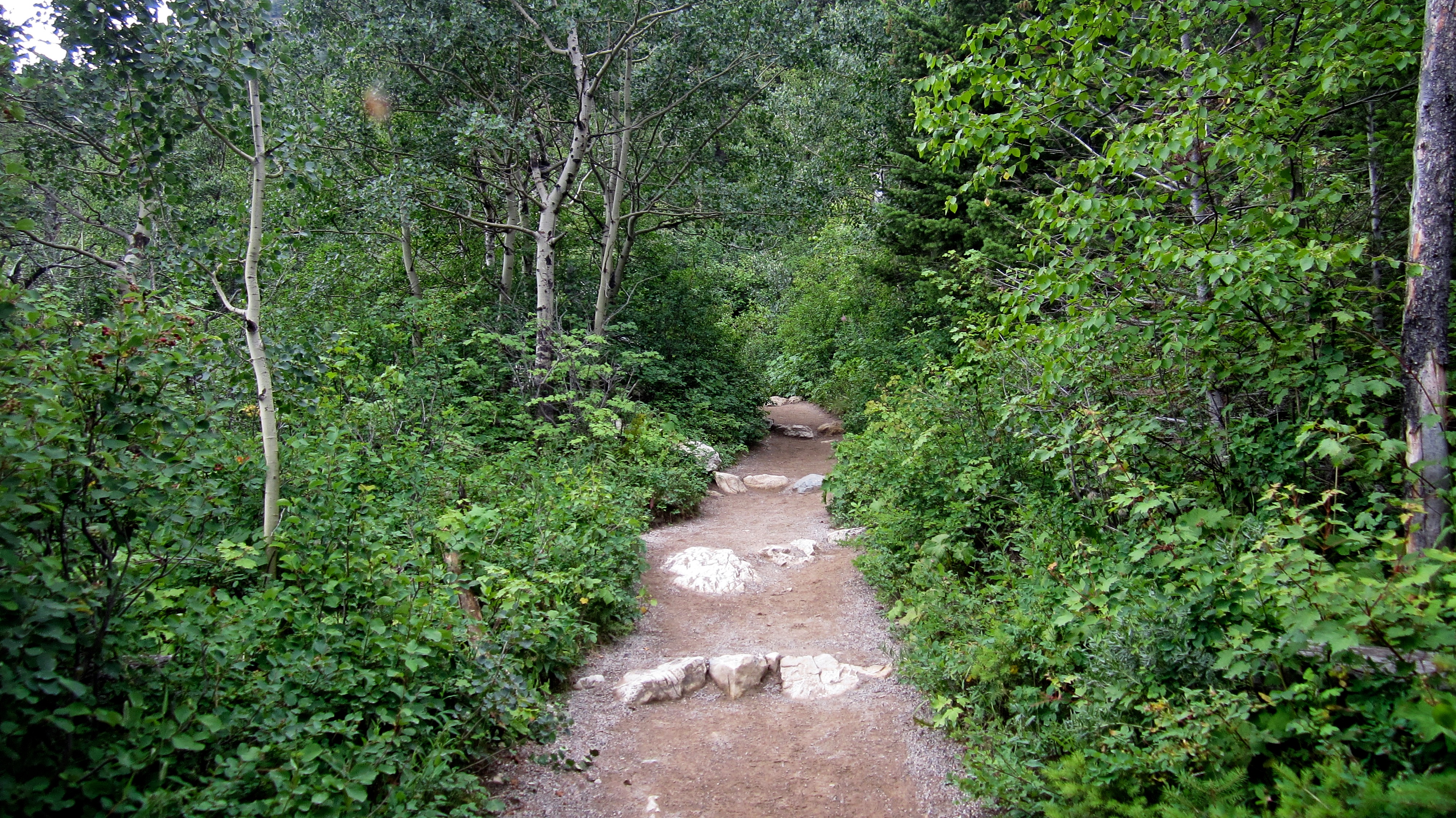
The trail up to Bear’s Hump is located just behind the Visitor Information Centre. I made it to the top in just under 20 minutes – which is a fair bit faster than when we used to hike it when our kids were little.

The view of Upper Waterton Lake and the Waterton townsite from Bear’s Hump. This is understandably one of the most popular places in Waterton to take photographs.

Middle Waterton Lake from Bear’s Hump. The day started off fairly cloudy but it would clear considerably as the day progressed.

A pano of the view from Bear’s Hump.

Looking at my initial route up the ridge from Bear’s Hump.

The view back to Bear’s Hump (lower left) from further up the ridge.

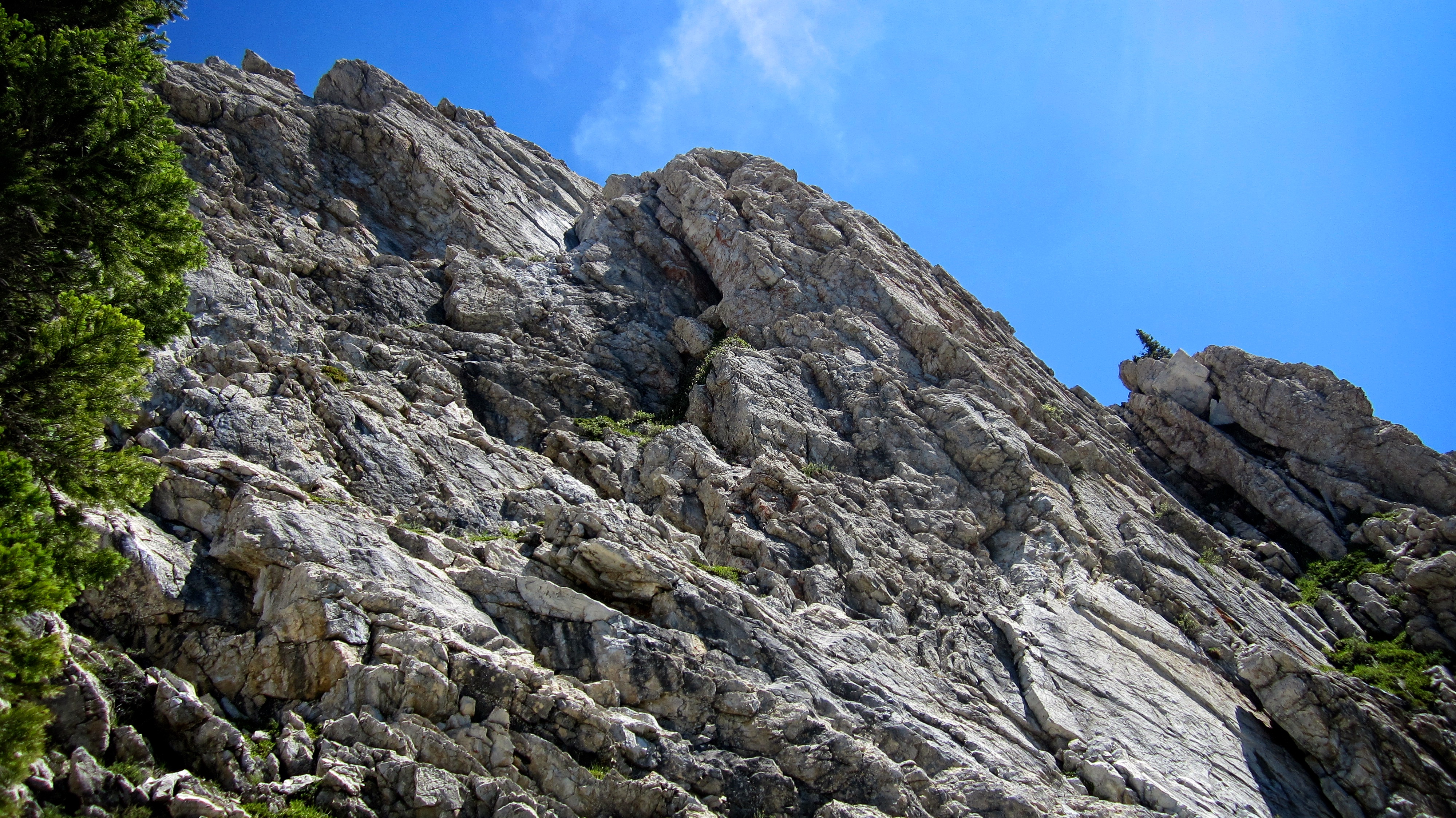
I didn’t encounter anything too difficult until I reached the cliff band in the upper portion of the picture.

A closer look at the cliff band. Here is where I began to head climber’s left looking for a way up.

On the west side of Crandell and looking for a way up. I initially found a decent line up in the centre of the picture, but turned back after thinking that there had to be an easier way. I had one tricky move to make that would’ve taken me to more moderate ground, but I knew I couldn’t downclimb once I had committed. My eventual route would go up the sparsely vegetated section of cliff on the far left.

Searching for a route… but not this one.

I had one tricky move to make before reaching this more moderate section, but I turned around in the hopes of finding a better route. In hindsight, I probably should’ve just gone for it.
I walked along the base for ~500m until I came to a drainage. Here is where I turned around and backtracked.

Nope, not going to go up this…

While backtracking along the base, I discovered an ascent route which starts near the centre of the picture and heads to the upper left. I had missed it when I walked by the first time, but by this point, I was pretty convinced that I had missed the normal route anyways.
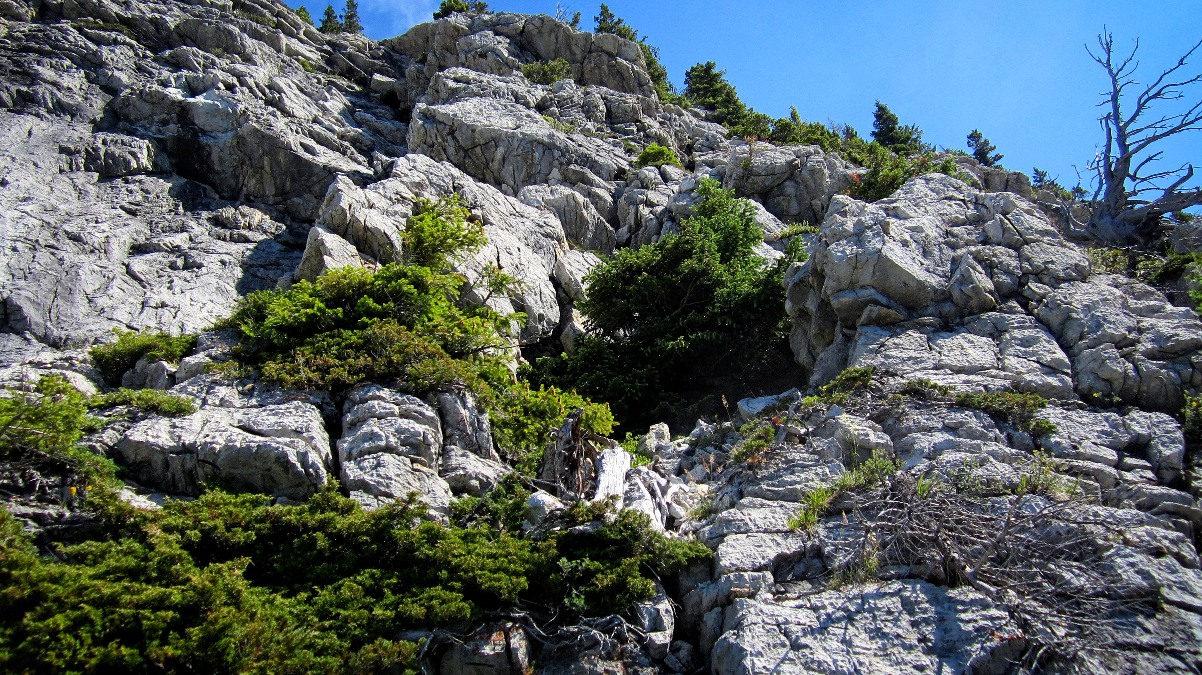
My ascent route trended to climber’s right. There were a couple sections with exposure, but nothing that wasn’t manageable.

After the initial section of scrambling, the terrain became more subdued, though more scrambling was needed to reach the ridge crest.

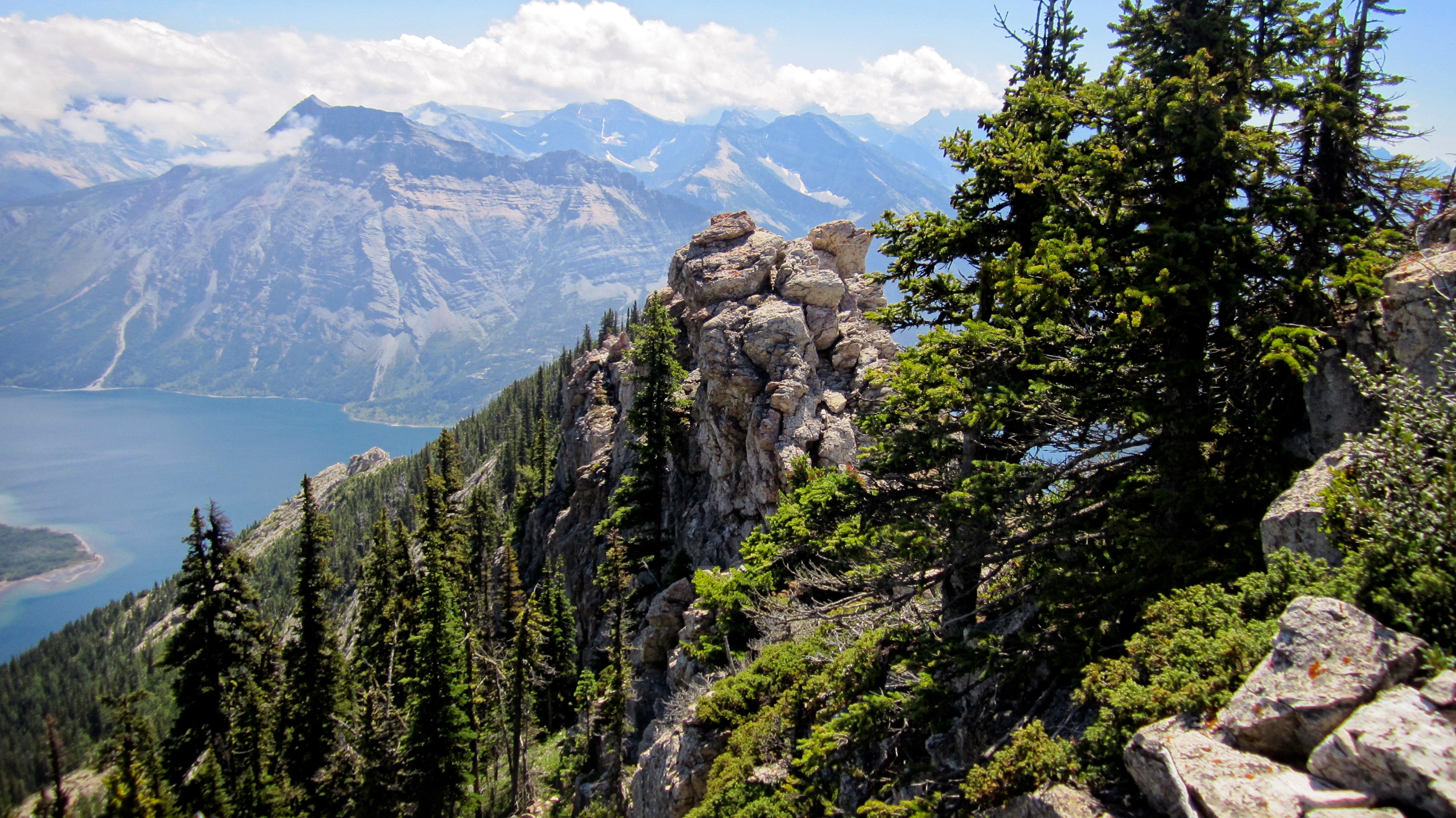
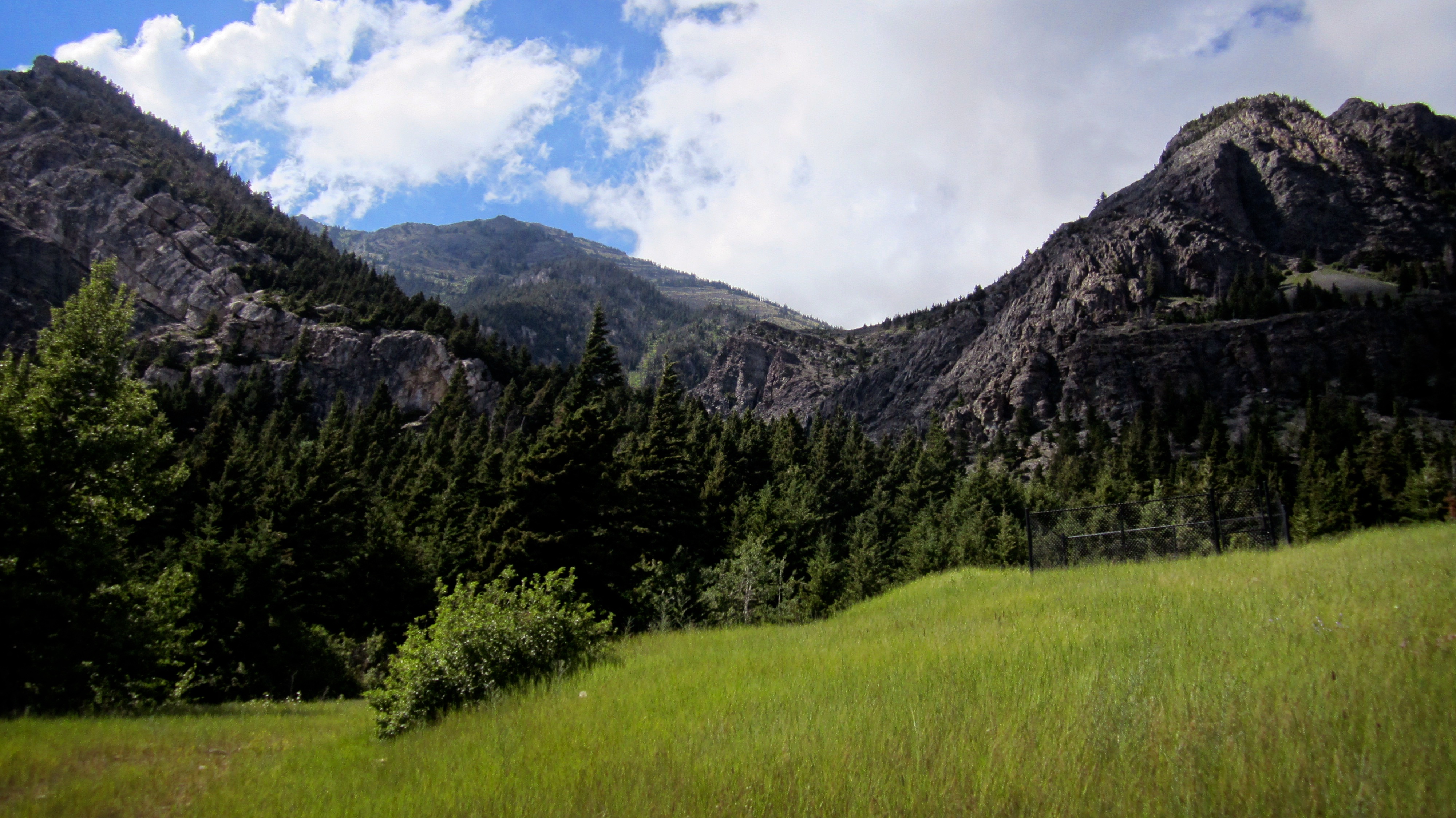
All that work to reach the crest was rewarded with a gorgeous view! From left to right: Sofa Mountain (just poking through the clouds), Vimy Peak (centre), Mount Boswell, and Mount Cleveland.

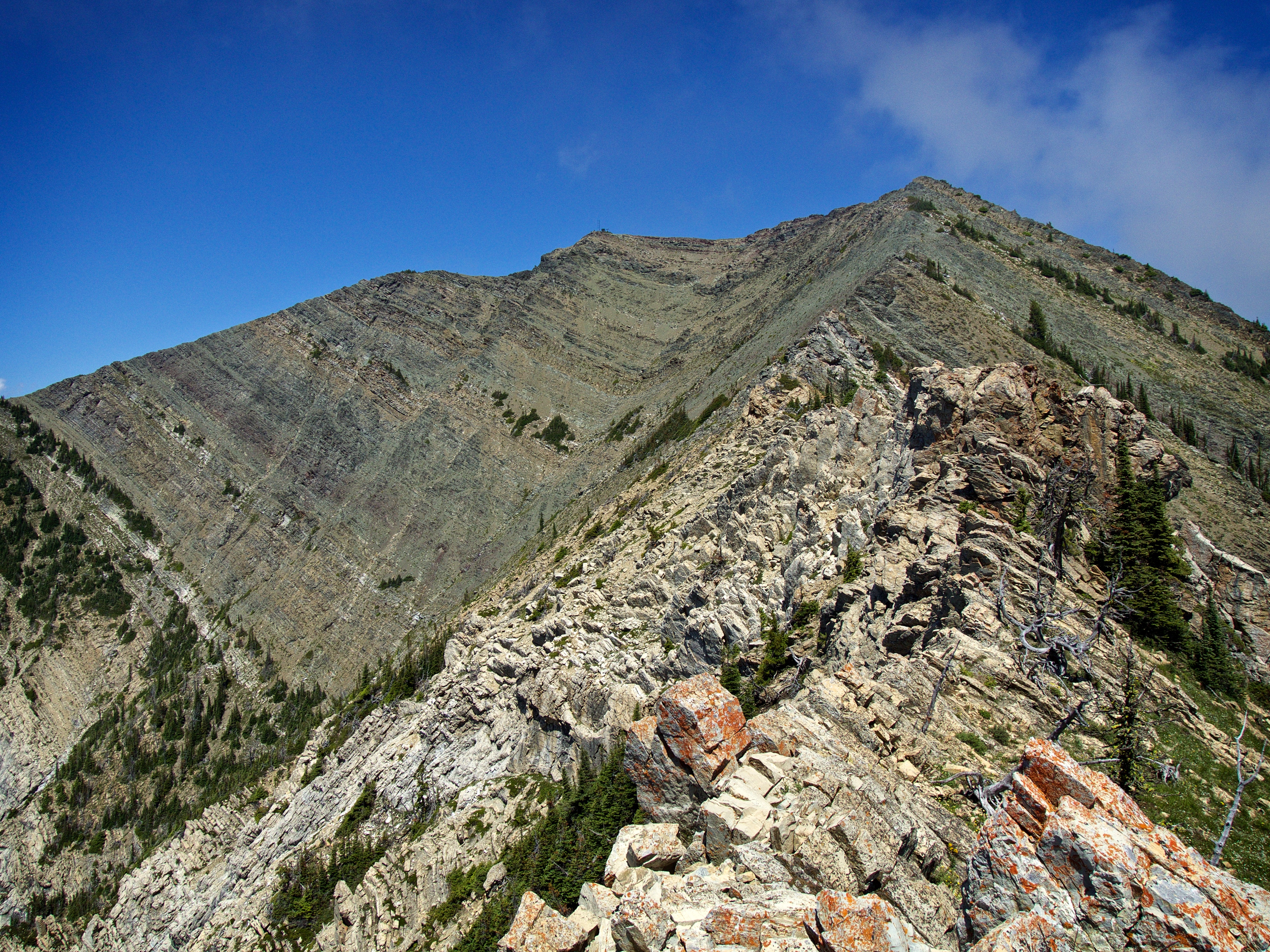
Looking up to the skyline ridge which marks the intersection of Tick Ridge (right) and Bear’s Hump Ridge. The heat and humidity would make this feel like a long slog.

These sheep didn’t seem to like my singing.

Looking back after reaching the crest of the intersection.

The false summit finally appears in the distance… and so does the cockscomb (left).

A closer look at what Kane describes as an “airy cockscomb”. I would bypass the two big downclimbs by skirting to climber’s left, but I would soon scramble up to regain the cockscomb.
Looking up at the cockscomb. I would continue along its base shortly past this point before doubling back along a ledge and scrambling up the weakness in the centre.
I topped out on the cockscomb just beyond the final downclimb (centre).

The remaining half of the cockscomb was a fun endeavour.

Looking back from near the top of the cockscomb.

A cool arch formation can be seen on the left just beneath the end of the cockscomb.

Looking back from the top. The point where I gained the cockscomb can be seen near the centre.

With clouds forming and rolling in and out. I figured I’d better snap a few landscape pictures in case I didn’t get a chance from the summit. This is view looking west at (left to right): Bertha Peak, Mount Alderson, Mount Carthew, Buchanan Peak, and Buchanan Ridge.

The view to the south. Mount Cleveland and the Stoney Indian Peaks are on the distant left. Bertha Peak is in the foreground and behind it, Mount Richards.

Looking northwest at Buchanan Northeast (left), Mount Lineham (centre left), Mount Hawkins (centre), Piinaquiium / Ahkoinimahstakoo (Mount Blakiston) (right of centre), and Ruby Ridge (foreground right of centre).

Just beyond the cockscomb I had to navigate across a short section of exposed terrain.
From this point on, I had a clear view of the summit (centre left).
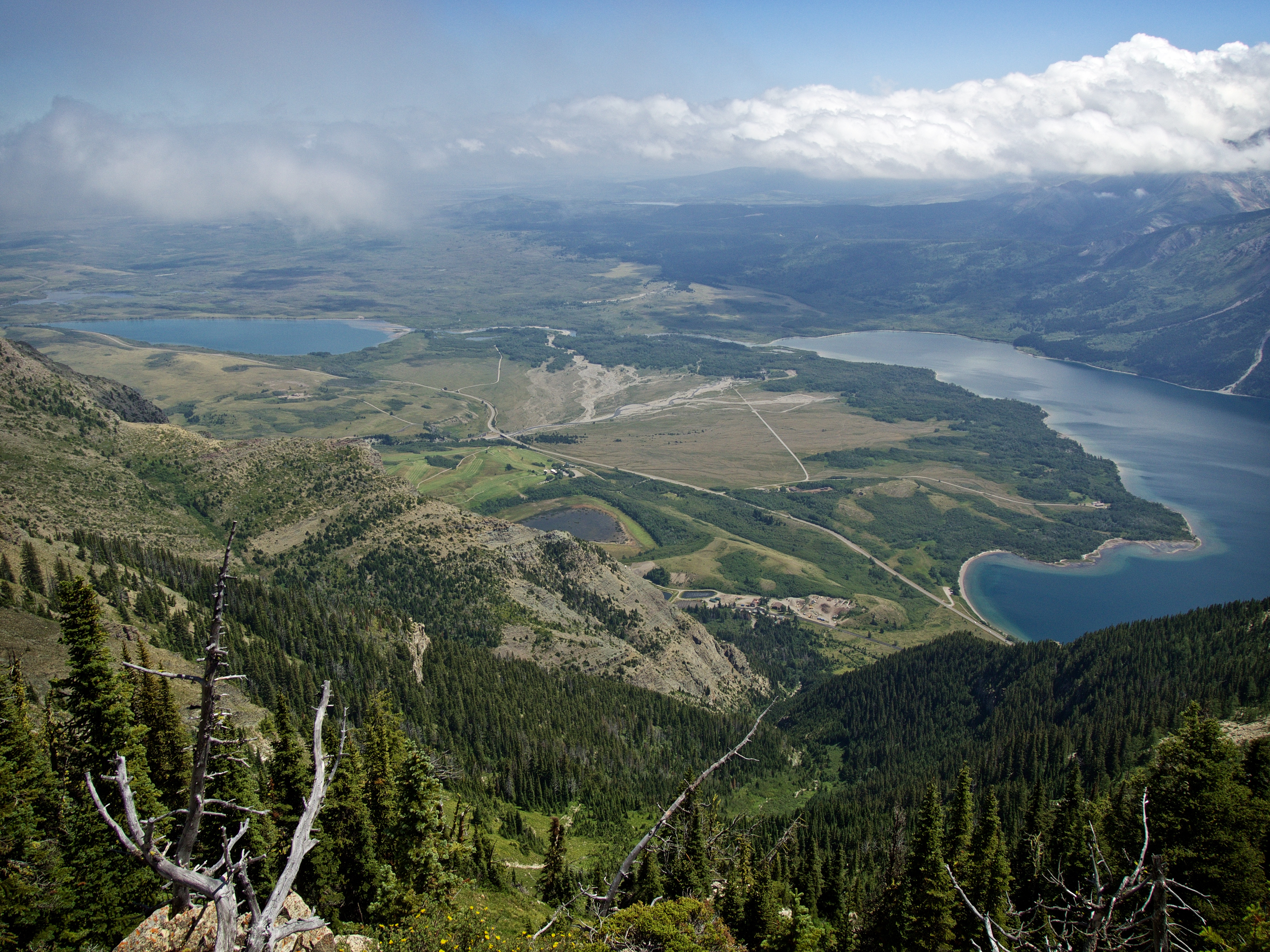
The view to the southeast of Middle and Lower Waterton Lakes. In the foreground is the southeast ridge that I would use to descend.
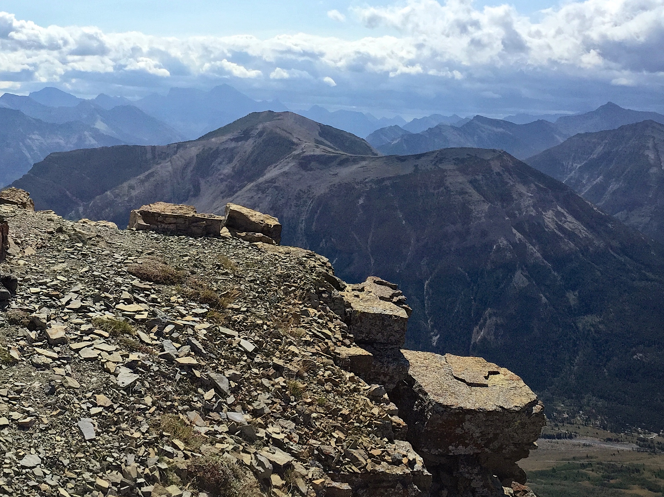
Once I reached the false summit it was an easy walk to reach the true summit.
The summit is marked by an antenna station – or as the topo map calls it, ‘Control’.

A small cairn can be found on the other side of the antenna station.
The view west. From left to right: Bertha Peak, Mount Alderson, Mount Carthew, Buchanan Ridsge, Buchanan Northeast, Mount Lineham, Mount Hawkins, Piinaquiium / Ahkoinimahstakoo (Mount Blakiston), and Ruby Ridge.

The view to the northwest. A small helicopter pad is situated a short distance from the summit. I hiked over to the point in the centre for a better view.

The view south. Any views to the southeast were obfuscated by clouds.

One final look at the cairn and the antenna station as I prepare to leave.

The view east was also beclouded. My descent route would skirt the vegetation just to the left of centre.

I would follow the southeast ridge as far as I could before descending into the drainage.

This would end up being the best view of Mount Galwey (left) and Bellevue Hill (right) that I would have.

The views during descent were a welcome distraction from the heat and humidity.

The “jutting promontory” which Kane recommends descending overtop of, is on the lower right.

The end of the southeast ridge offers up a nice view of the Prince of Wales Hotel and the Waterton townsite.
Looking west at Tick Ridge (foreground) and behind it, the Bear’s Hump approach.

Some downclimbing was required in the section just before the drainage.

Travel through the drainage was not difficult but did require some nimble boulder stepping. I was so hot by the time I reached this point, that I stopped for several minutes to stick my head in the stream and cool off.
After hiking for ~250m through the drainage, I reached a trail that would take me back to the road.
The easy walk along the trail was a welcome relief.
Looking back at my descent route. The promontory is in the centre.

Arriving back at the Visitor Information Centre after 6 hours and 32 minutes and not a thunderstorm in sight, at least not yet…

That evening, as I was having dinner with my 19 year-old son at the water tower restaurant in Lethbridge (everyone else in the family was out of town), we watched a large storm roll over the mountains near Waterton and head northeast towards Lethbridge. A tornado watch was also issued for most of southwestern Alberta including Waterton and Lethbridge, but thankfully nothing came of it.
All in all, Mount Crandell was a great day. The route up from Bear’s Hump was initially tricky but after again looking at other people’s trip reports, I figure I must have missed something when I came to the first cliff band – but then again, maybe not…


Leave a Reply