

⚠️ Hiking and scrambling are inherently dangerous activities. Please read my Disclaimer. ⚠️
I’m not sure what the circumstances were when the Interprovincial Boundary Survey named this peak, but they sure didn’t go full out when it came to creativity. Considering nearby Rainy Ridge, commemorative Scarpe Mountain, and prominent Mount Haig, the name seems like a bit of a let down, which is too bad because Three Lakes Ridge is wonderful destination.
I had first read about the Middlepass (or Burl) Lakes and Three Lakes Ridge in Joey Ambrosi’s, Hiking the Southern Rockies; followed by two online trip reports by Andrew Nugara from 2010 (trip 1 / trip 2). Nugara would later include Three Lakes Ridge in the second edition of, More Scrambles in the Canadian Rockies – which by the way, is now in its third edition – and if he keeps adding more peaks, More Scrambles will become so heavy that it will be akin to packing up an unabridged copy of War and Peace. 😉
With my interest in Three Lakes and Rainy Ridge renewed following my traverse from Southfork Lakes to Grizzly Lake, I was game to try what Andrew had described to me as a fantastic section of slab scrambling. Also very interested was my friend, Brad Wolcott, who had previously hiked to the Middlepass Lakes, but had never summited Rainy Ridge or Three Lakes Ridge. So, with a forecast calling for an afternoon temperature hovering around 30 C, Brad and I set off early in the morning with the plan of summiting Three Lakes and Rainy Ridge in one big loop. While we had an absolute blast with Three Lakes, we soon realized that heat would prevent us from making our way over to the summit of Rainy. No worries though! Another visit or two to this area will do me just fine!

We followed the route described by Andrew Nugara in the second edition of, More Scrambles in the Canadian Rockies, so I don’t think that I need to elaborate much more – other than to say that it was bang on – though I will make one recommendation that I will get to in a minute.
We brought our bikes and were able to make excellent time from the parking lot of Castle Mountain Ski Resort to the start of the first gnarly section of road up to Middle Kootenay Pass, which for the sake of reference, begins approximately ~2.8 km from the junction with the West Castle River Road. We then pushed our bikes up the remaining ~2.3 km to the top of the Pass before ditching them alongside the road. We then hiked east on an excellent trail towards the Middlepass Lakes for ~1.5 km before arriving at the base of Three Lakes’ north ridge.

Here is where I would recommend a slight variation to Nugara’s route description. We chose to reach the slabs by ascending the north ridge as opposed to Andrew’s route that utilizes the scree and rubble slope that leads up from the lower lake. We used the latter on descent and found it tedious and deceptively foreshortened. Both of us enjoyed the north ridge and considered it to be much easier to travel on than the scree and rubble – with only a minor down-climb or two to navigate near the top. We also wished we that we had used it to descend, because we probably would’ve reached the first lake a whole lot sooner.
Upon reaching the slabs, we chose to follow Nugara’s ‘difficult’ rated route which turned out to be an absolute blast! The angle of the slabs are such that few more degrees of pitch would make them impossible without a rope. However, the angle at which they are seated, combined with good rock and numerous ledges and cracks, meant that we were able to walk upright in quite a few places. At no point did I feel uneasy about the situation, but when I stopped to look back, it seemed to me that I ought to be concerned – but I wasn’t. It was an interesting experiment in perception versus reality. To be honest, I actually thought that the short scramble up the gully to reach the summit was the most difficult thing that we did.
After spending close to an hour on the the summit, we returned as Nugara recommends, down the easier ascent route. From the base of the slabs, we continued down the scree and rubble slope to the shore of the first lake before making the short hike up the trail to the second and third lakes. We returned to our vehicle the same way.

A topo of the area shows the location of the three Middlepass (or Burl) Lakes as well as the Rainy Lakes – which are not to be confused with Rainy Ridge Lake which is located to the northeast of Rainy Ridge and can be seen on the far upper right portion of the topo map.

The total roundtrip distance of this fun bike n’ hike was 24 km with total elevation gains of 1325 m. Including very leisurely stays on both the summit and the Middlepass lakes, our total time came in at 8 hours and 43 minutes.

Gearing up in the parking lot of Castle Mountain Ski Resort at 5:45 am. The forecast called for mid-afternoon temperatures around 30 C, so we needed to beat the heat. Besides, both Brad and I prefer really early starts.

Brad enjoys a morning cycle along the West Castle River Road.

Approximately ~ 2.3 km from the parking lot the road bifurcates with the right fork leading to Middle Kootenay Pass and the main road or left fork leading to South Kootenay Pass. Rainy Ridge’s unnamed northern outlier can seen in the distance.

Shortly after the fork, we crossed a bridge over the West Castle River (not pictured). For the next ~ 2.6 km, we found that we could cycle the road without too much difficulty. Once we reached the point where the lower snowmobile route begins (pictured), the grade steepened considerably and we ended up having to push our bikes up much of the remaining ~ 2.3 km to the top of the Pass. (Photo by Brad Wolcott)

Brad pushes his bike up the road. At the end of the day however, the bikes definitely paid off as we made it from the top of the Pass to the parking lot in under an hour – though there were tons of baby heads to watch out for.
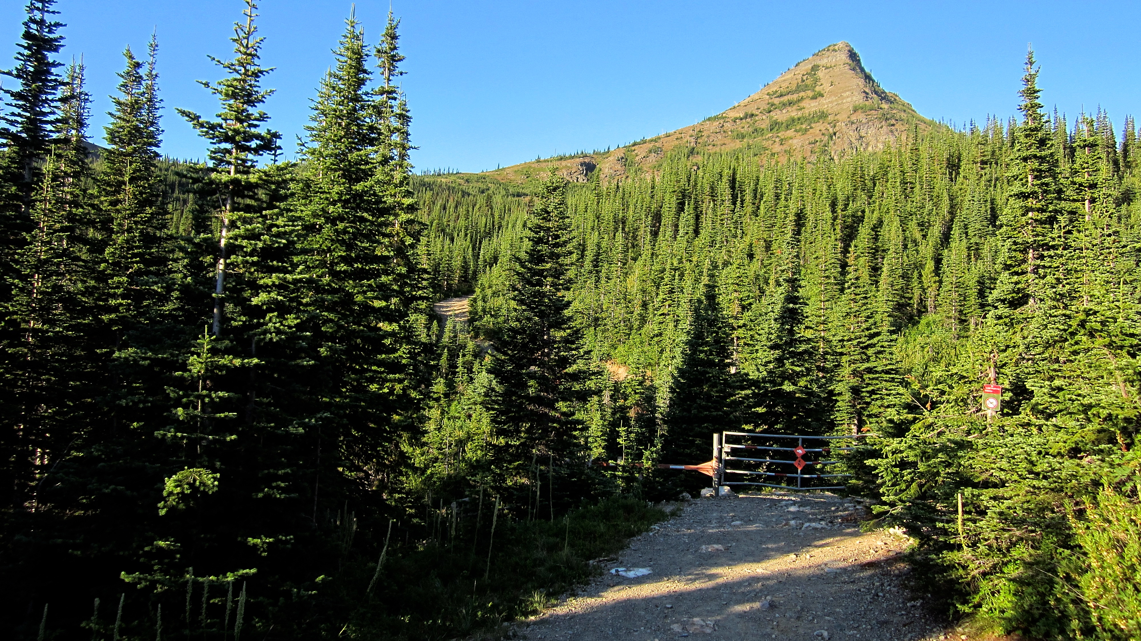
The grade moderates as the road draws closer to Middle Kootenay Pass. A kilometre or so before the top, a sign and a closed gate (pictured) prohibit motorized vehicle access.

The Government of Alberta has implemented new security measures in an effort to prevent unauthorized personnel from opening the gate. Nothing says ‘Don’t Touch’ like a metal box full of yellow jackets! 😉

Immediately beyond the gate we crossed a small creek. We then had to cross another, more scenic creek a little further up the road (pictured).

Arriving at Middle Kootenay Pass. The summit of Three Lakes Ridge is on the left.

After stashing our bikes at the top of the Pass, we kept walking south for an additional ~150 m until we reached the Middlepass Lakes trailhead. We had no trouble finding it because it was clearly marked by a cairn built on top of a log. This is the view east shortly after starting down the trail. Three Lakes Ridge is on the right. (Photo by Brad Wolcott)
Morning sunlight highlights a series of unofficially named peaks to the northwest of Three Lakes Ridge. Andrew Nugara named the two peaks to the left of centre, “Mount Miles” and “Krowicky Peak” (furthest left) in honour of his good friend and fellow bandmate, Miles Krowicki. You can read the story behind this here. The summit of “Middle Kootenay Mountain,” aptly named by James Yearous, is on the far right.

From Middle Kootenay Pass, it’s an enjoyable ~1.7 km hike to reach the first Middlepass Lake or ~1.5 km to reach the base of the north ridge (centre).

Brad steps across Middlepass Creek as we begin our ascent of the north ridge.

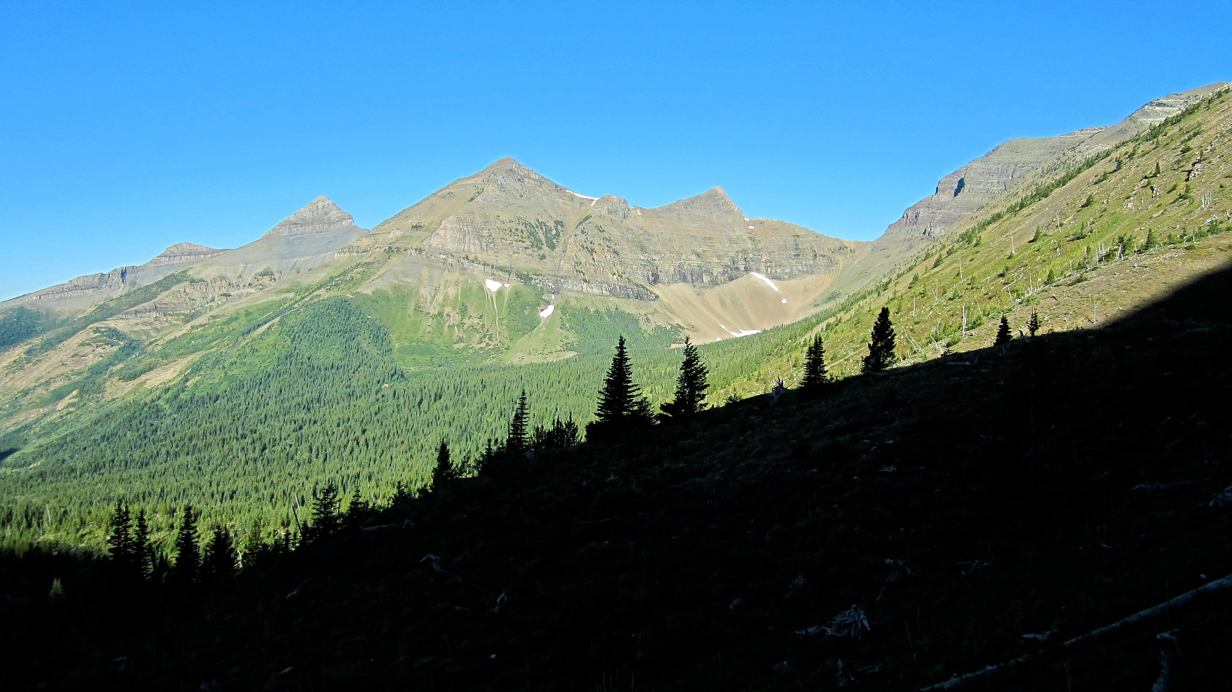
Looking towards the summit from the lower slopes of the ridge.

Our first glimpse of the first lake. Even from here I could see that it was boiling with rising cutthroats.

Brad makes his way along the crest of the ridge. I would definitely advocate using the north ridge to reach the slabs versus the scree and rubble slope that leads up from the first lake. There are a couple of minor down-climbs near the top, but otherwise it’s a straightforward hike over interesting terrain. In hindsight, I would also recommend using it to descend to the lake and trail.
Brad checks out the slabs from the near the top of the ridge. Our route would go up the longest section next to the cliff face in the centre. The easier route follows alongside the smaller diagonal cliff band that stretches from the scree up to the summit ridge. We would use this route to descend.

Arriving at the base of the slabs. To reach Nugara’s difficult route, we had to traverse south or climber’s left for another ~ 160 m.

A brain-like pattern was etched onto some of the slabs.

Looking up to the top from the base of the slabs. Let the fun begin!

The angle of the slabs, combined with good rock and numerous ledges, meant that we could walk upright in quite a few places.

Taking a break on a conveniently situated ledge.

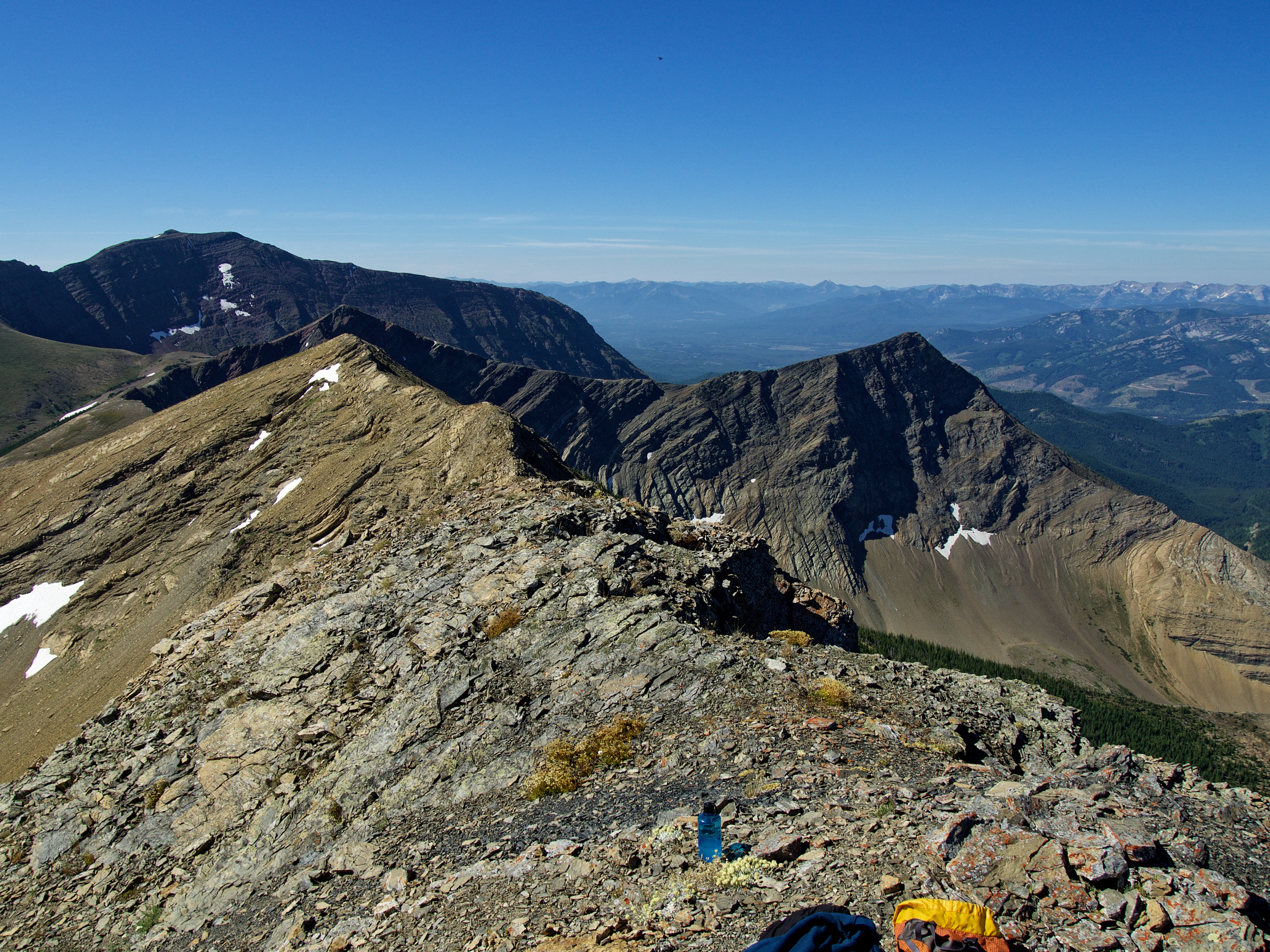
Looking back from the halfway point. The Middlepass Lakes and Rainy Ridge are in the background.

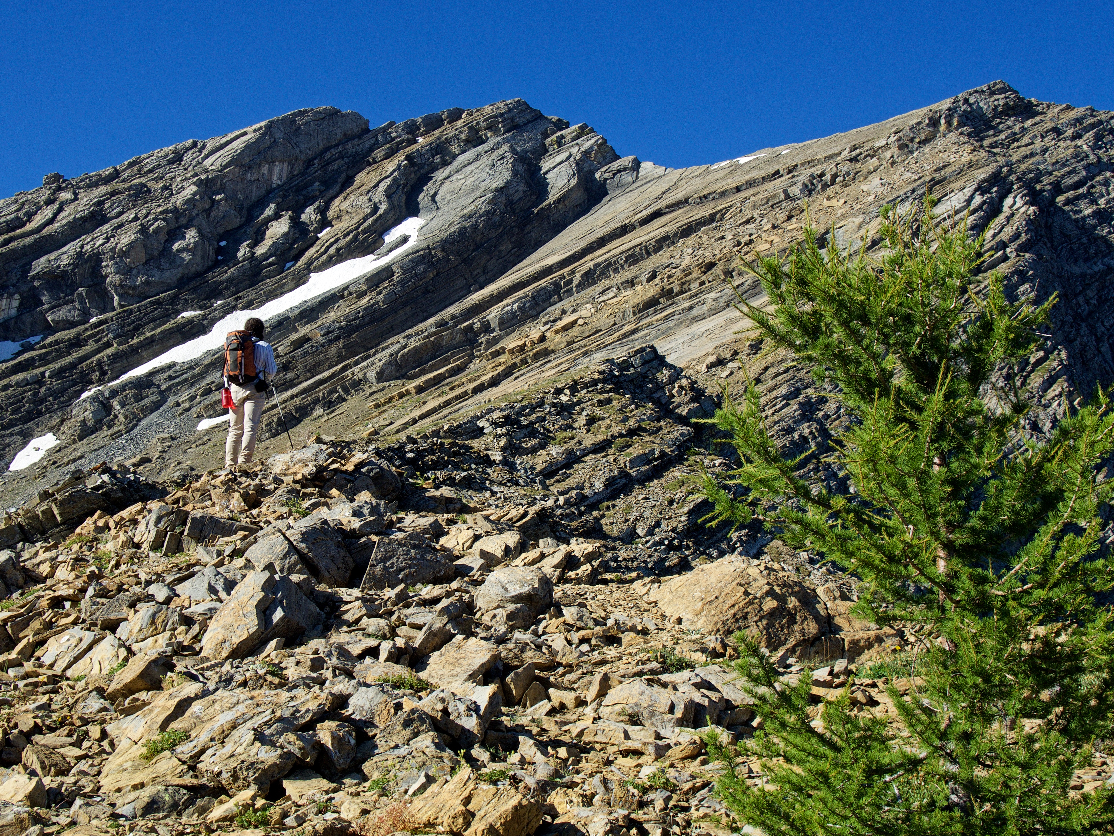
Nugara cautions scramblers to beware of fissures because debris sits loosely over the holes and could collapse under weight. This was the deepest fissure that we encountered and this was as close as I wanted to get.

The pitch increased as we drew closer to the top, but our boots had no problem gripping the rock plus there were multiple ledges and cracks to use. However, I would never attempt this route if the slabs were wet as it could become one giant slip n’ slide into the afterlife. (Photo by Brad Wolcott)

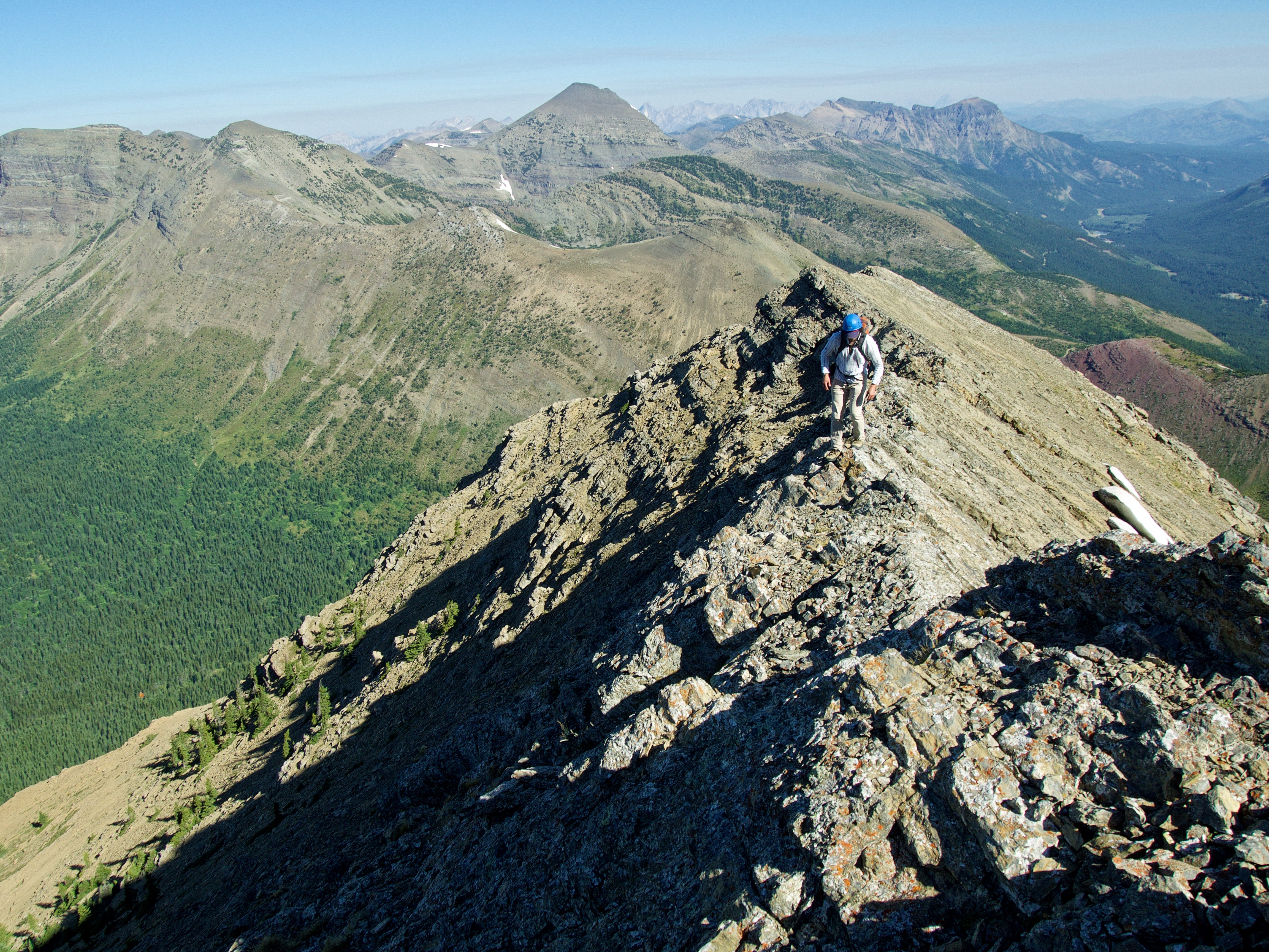
On the crest and heading towards the summit. (Photo by Brad Wolcott)

Looking back at our ~220 m route up the slabs. The north ridge that we used to reach it is on the left.
Brad makes his way along the short summit ridge. In the background are Mount Haig, Gravenstafel Ridge, and Syncline Mountain.

To reach the summit and avoid exposure, we followed Nugara’s advice and traversed a short distance (~40 m) along the west face until we came to an obvious gully.

Brad scrambles up the gully.

Halfway up the gully, it makes an abrupt turn to climber’s right as it heads toward the summit. This is where we encountered some mild exposure. (Photo by Brad Wolcott)

Brad makes his way up the final section of gully. The slabs and summit ridge are in the background.

The summit of Three Lakes Ridge (2492 m) sits along the Continental Divide. There are two cairns with the southwestern one (pictured) being slightly higher than the northeastern one.

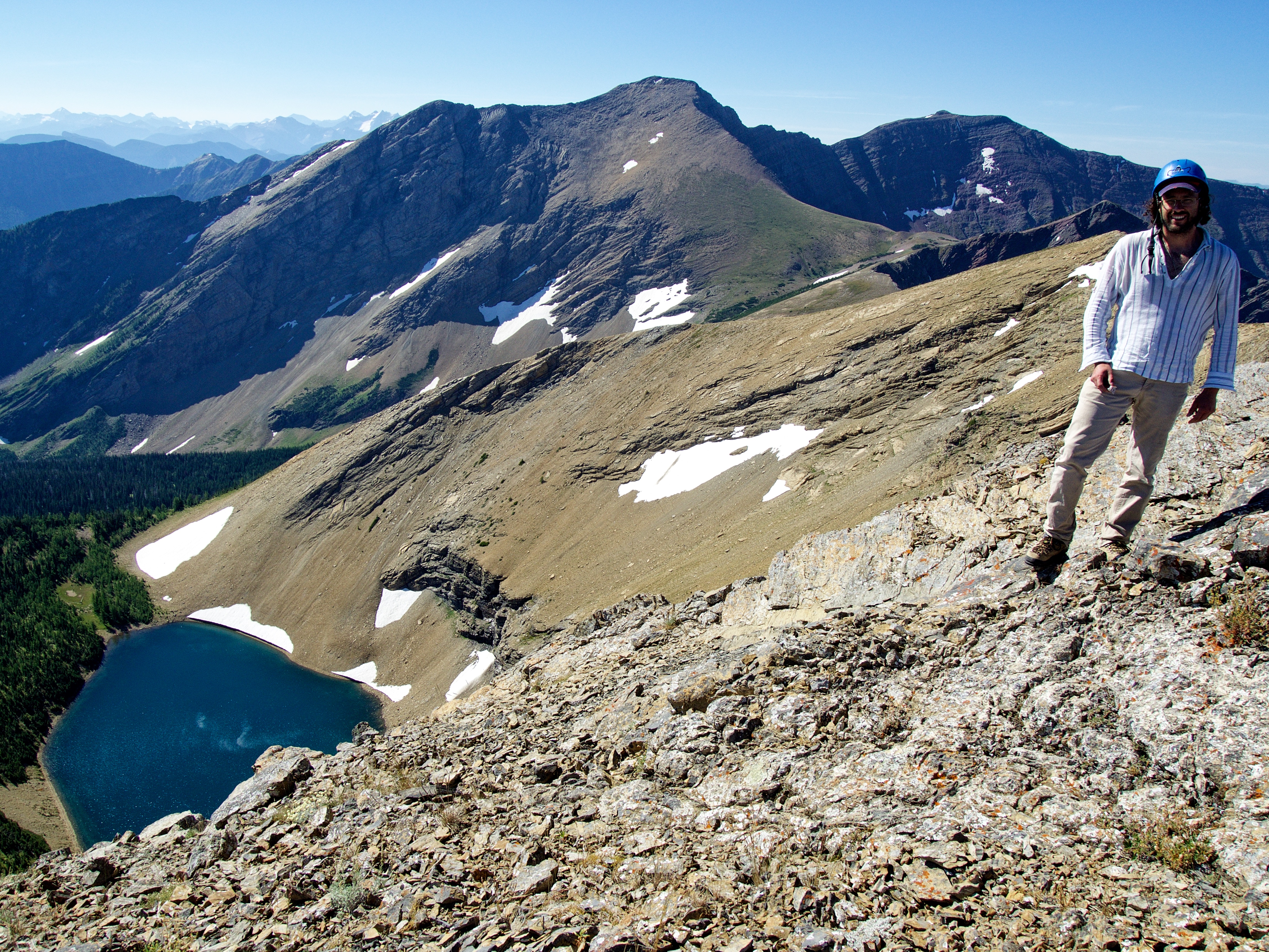
A gorgeous view to the south of “Jake Smith Peak” (centre) and Scarpe Mountain (right). The northernmost Rainy Lake sits beneath the summit.

Looking slightly northeast at Rainy Ridge and the three Middlepass (or Burl) Lakes.

The view north shows our route in from Castle Mountain Ski Resort along with Middle Kootenay Pass (centre). From left to right: Mount Haig, Gravenstafel Ridge, Syncline Mountain, Southfork Mountain, and Barnaby Ridge.

Looking northwest from left to right at Tombstone Mountain, “Middle Kootenay Mountain”, and Mount Haig.

A more direct view to the northwest includes “Mount Miles” on the left.

A telephoto to the west shows “Krowicki Peak” in the foreground. In the background from left to right are: Inverted Peak, Mount Doupe, Piaysoo Peak, Mount Swope, and Overfold Mountain.
Scarpe Mountain fills most of the view to the southwest. Nugara calls the pointy little peak in front of Scarpe, “Red Argillite Peak” or “RA Peak” for short.

Gazing southeast at Jutland Mountain (middle distance left) and La Coulotte Peak (foreground centre).
The northernmost Rainy Lake is gorgeous! Don’t confuse this with Rainy Ridge Lake which is located on the northeast side of Rainy Ridge.

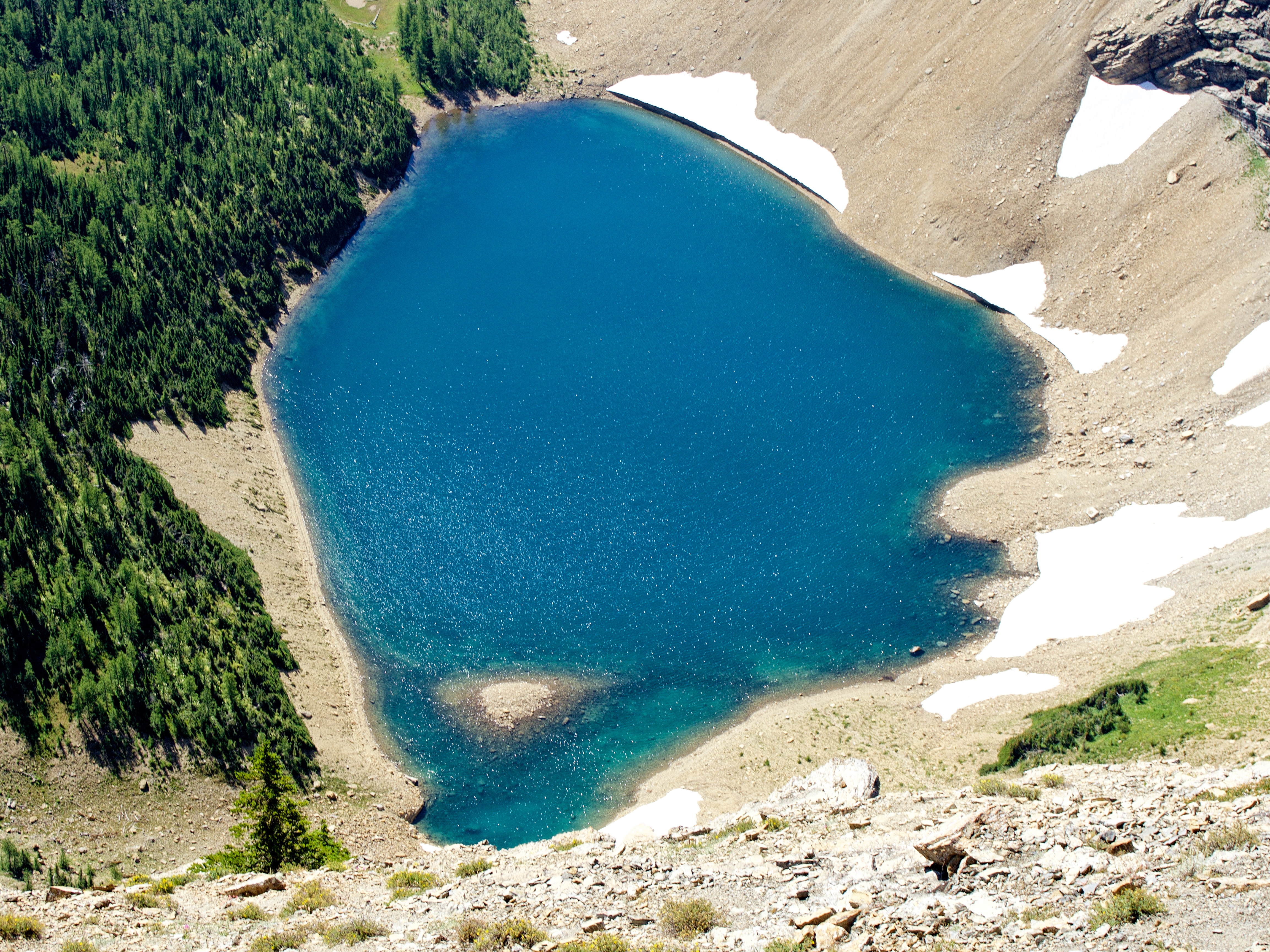
A telephoto of the first Middlepass Lake.

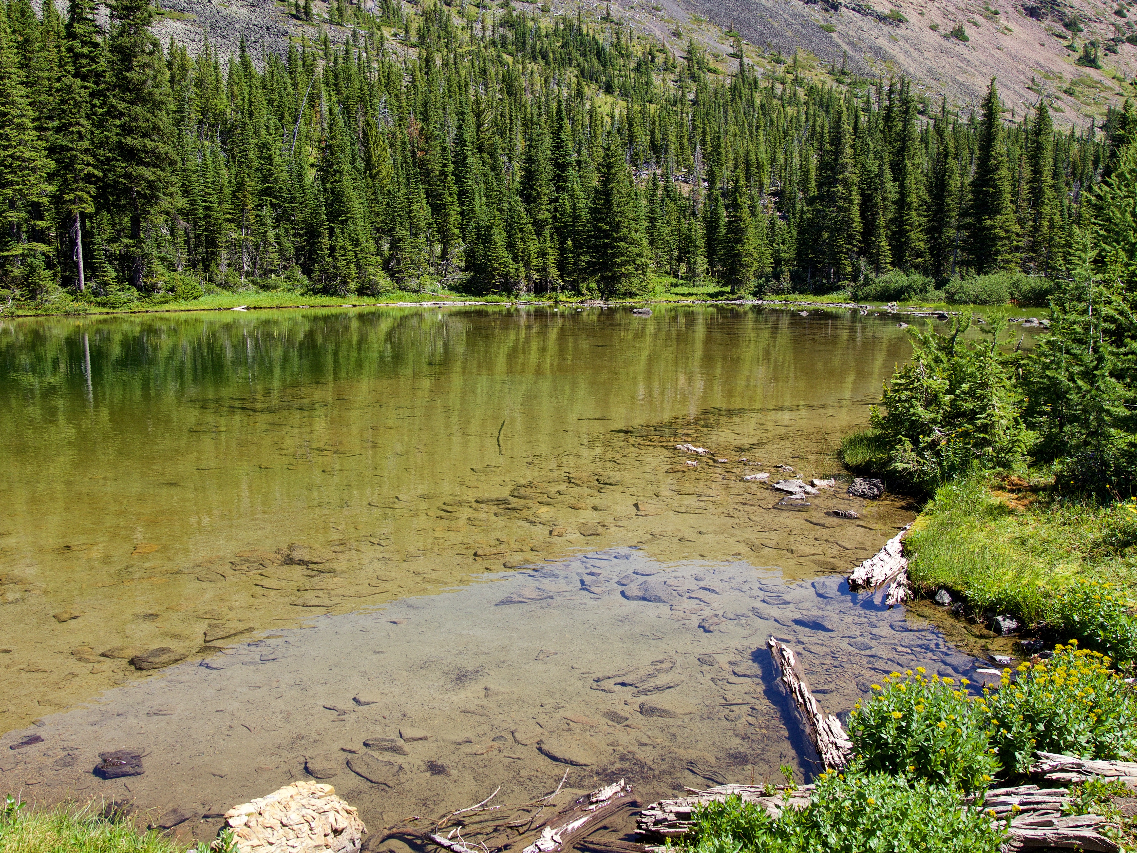
The second Middlepass Lake is really just a small pond.

A telephoto of the third and largest Middlepass lake. There is a nice backcountry campground beside the lake.

A telephoto of Rainy Ridge. In the background from left to right are: “Frankie Peak”, “Larry Mountain”, Mount Gladstone, West Castle, North Castle, Castle Peak, Victoria Peak, and Windsor Mountain.

A telephoto of Southfork Mountain and Barnaby Ridge.

Evel Knievel would’ve appreciated the ramp-like profile of Tombstone Mountain.

A telephoto of Lys Ridge.

Me on the summit. Gotta admit that I’m no longer capable of non-awkward summit pics. 😉
Armed with a flask of La Fée Verte, Brad ensures that summit stays are never boring. 😂 In the centre is “Jake Smith Peak”.

Leaving the summit. We had originally intended to continue on to Rainy Ridge, but the thought of a massive elevation loss and gain under an increasingly hot sun, deep-sixed this plan in a hurry.

Brad down-climbs the gully. I honestly found the gully to be more challenging than the slabs.

We followed Nugara’s recommended descent route which is just the easier ascent route in reverse. It would also be possible to descend the mountain’s western slopes and end up on Middle Kootenay Pass road, but this would mean bypassing the lakes altogether.

I made a failed attempt at trying to sit on this shelf. 😉 (Photo by Brad Wolcott)

We quickly came to the conclusion that this route would not be as fun or efficient to ascend as the full-on slab route.

Nearing the end/start of the easy route up the slabs. In hindsight, we should have retraced our steps back to the north ridge which would have made reaching the first lake that much quicker. Instead, we embarked on the tedious process of picking our way down the deceptively foreshortened slope of scree and rubble.

Arriving at the first lake.

I’m doing a poor job lately of packing my fly rod up to alpine lakes. I should’ve brought it and stashed it in the bushes while we climbed the mountain because things were happening fish-wise. FYI, a B.C. fishing license is required for these lakes.

The trail to the second lake follows the upper section of Middlepass Creek.
The second lake is really just a shallow pond. I looked, but couldn’t see any trout that had migrated from the third lake during runoff. That’s not a bad thing because it would be too shallow for them to survive the winter.

Looking back at the summit from the second lake. This is a really pretty locale!

Arriving at the third lake which is nestled beneath the summit of Rainy Ridge.

While we were descending from Three Lakes, we could see a large group of high school-aged kids ascending Rainy’s northeastern outlier – very similar to when Andrew Nugara met a group of students on the same peak back in 2010. This meant that no one was around when we arrived at the campground. If they had been, I might have gently suggested that they raise their bear bags a bit…

The campground is quite nice with plenty of tenting spots and a large fire pit.

Just like the first lake, there were cruising 6 to 8 inch cuts everywhere – and surprisingly they weren’t very skittish.

Slurpalicious!

I’m looking forward to a return visit to complete Rainy Ridge.
Three Lakes Ridge from the third lake. Our route up the slabs is just to the right of centre.

Looking at our ascent route along north ridge.

Looking towards Middle Kootenay Pass from the trail.
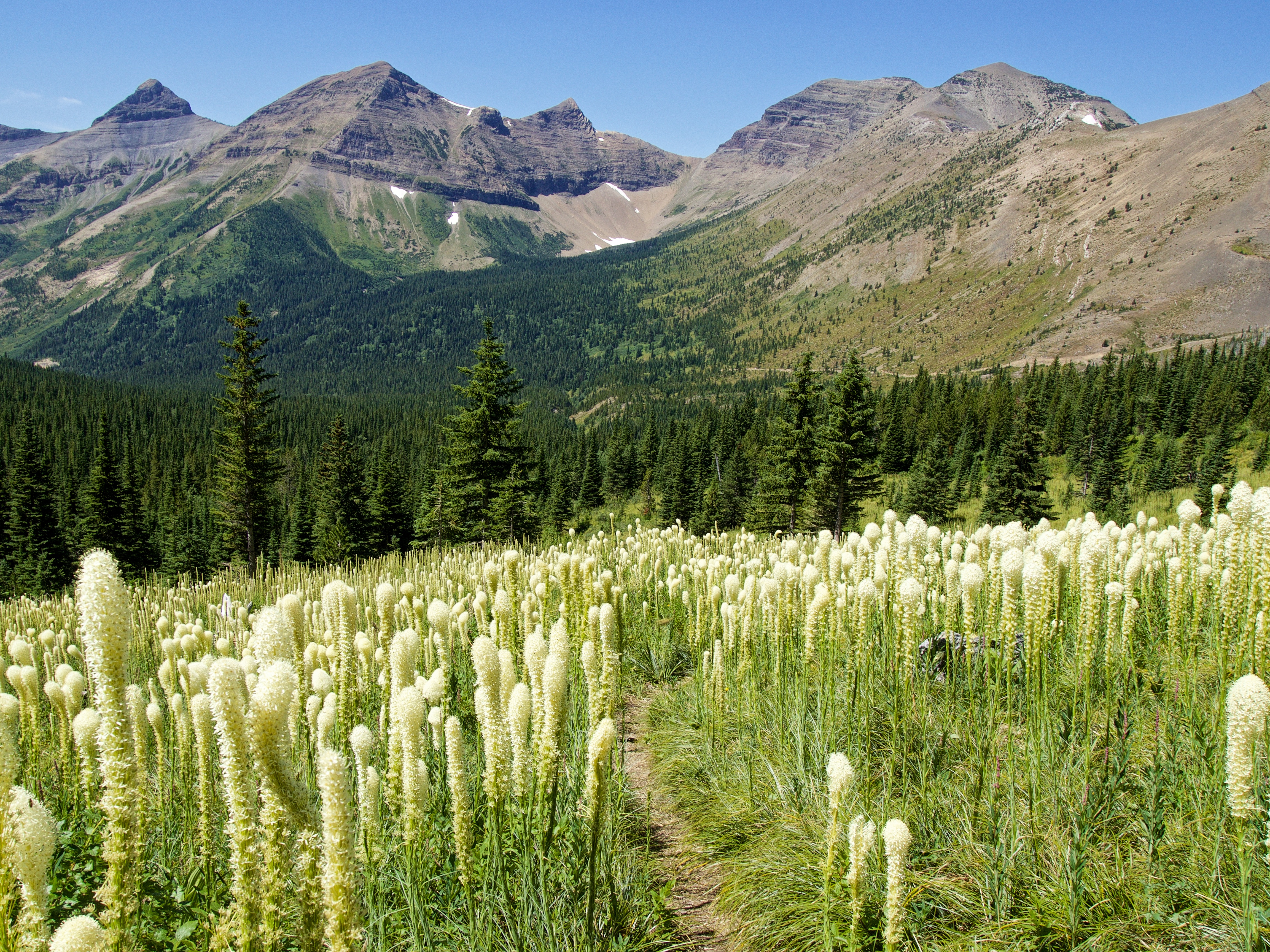
Blossoming bear grass along the trail.

Dare I say that we found a ‘bear nipple’? 😉

“Mount Miles” and “Krowicki Peak” (left of centre).

One last look back at Three Lakes Ridge from the trailhead junction.

Arriving back in Alberta to cheering crowds.

It took less than an hour to reach my 4Runner from the top of the Pass.

Looking down the pretty stream that crosses the road.

Brad checks to see if the wasp alarm has been set to ‘sting’.

The only wildlife that we encountered was this grouse and her three chicks who were busy feeding on the trail.

Mom and two of her offspring slowly meandered off to the side as we approached…

…but this little gaffer didn’t seemed too concerned.

Arriving back at my 4Runner after a roundtrip distance of 24 km and a time of 8 hours and 43 minutes. Thanks to Andrew Nugara’s trip reports on Three Lakes Ridge and its subsequent inclusion in, More Scrambles, I never would have thought that ascending the slabs would be so much fun – let alone even possible. Indeed, the entire Middlepass area was well worth exploring and I know for sure that I will be heading back to fish the lakes and summit more peaks. Finally, and as always, hiking with Brad means a great day spent in laughter and engaging conversation – superheated absinthe and all. 😉


Leave a Reply