
⚠️ Hiking and scrambling are inherently dangerous activities. Please read my Disclaimer. ⚠️
This trip was more of a ‘winter warm-up’ than an actual destination-driven ascent – though it didn’t start out that way. As with numerous times before, it began at the base of the northeast end of Buchanan Ridge in Paahtómahksikimi (Waterton National Park), where my goal was to finally get to the top of the unassuming and unnamed NE Peak. However, like all those times before, the weather was not cooperative with the wind turning a relatively pleasant -6 C forecast into a not-so-nice -20 C soul-sucker. Oh well, one day… one day.
Fleeing the Park in search of something else to try, we turned north and made our way to the front range of Tatsiki-Miistáki (Castle) to see what our old friends had to offer. As it was late in the morning and I was scheduled to be back in Lethbridge for a family dinner, we settled on ‘Bridle Peak’ which is the taller of two high points (the other being ‘Cinch Hill’) on the far northeast end of Pincher Ridge. These little destinations are perfect winter escapes for quick exercise such as snowshoeing or hiking. That they offer multiple ways to the top, also means they never get boring. 😁
Remarkably, as soon as we got out of our vehicles, we were greeted by amazing weather with little to no wind and a perfect temperature of -4 C. Nice! As ‘Bridle’ would be a repeat for both of us, we decided to try a new route that utilized a prominent gully on the east side of the mountain. This gully was located next to another gully that Andrew had previously used, so the plan was to follow the new gully until we reached the point where we could traverse over to Andrew’s gully, and then up and onto ‘Bridle Peak’.
However, for some unknown reason – fun maybe 😁 – we failed to leave the gully when we were supposed to, and we ended up on one of a series of large steps immediately beneath the summit of Pincher Ridge. Realizing that we were now high above ‘Bridle Peak’ and that reaching it would require significant elevation loss and gain, we promptly proclaimed our location as “The Stirrup” (2150 m) in keeping with the horse tack theme of Pincher Ridge, and called it a day.
Though we weren’t planning to go where we ended up, the whole trip was a worthwhile alternative to our original plan as it got us excited for winter. After such a warm Fall, the recent blast of winter was an abrupt reminder that it’s time to start carrying more gear and change up our tactics. Of course, snow can also make things easier and I had forgotten how fun it is to ascend and descend a snow gully when the conditions are right. The added scenery of a snowy landscape complete with frozen waterfalls always makes me happy. 😁
Above all, a trip like today’s was a reminder of how important exploring for the sake of exploring is to me. After a busy month where I spent many weekends in the office finishing projects, getting out and following a gully simply because it was there, was absolutely rejuvenating. Thanks Andrew for another awesome day in the mountains! 😊

To get to the northeast end of Pincher Ridge, we drove north on Highway 6 from Paahtómahksikimi (Waterton National Park) until we reached the Shell Waterton Complex Road (Township Rd. 43A). We then turned onto the road and drove west for ~9.1 km until we came to a junction with a gravel road near to the entrance of the plant. Here, we turned left and onto the gravel road where we continued for ~3.9 km until we reached Butcher Lake. We then turned left and onto another gravel road immediately prior to the Lake, following this road for ~1.4 km until we came to a junction where we could either turn left or keep going straight. We kept going straight for another ~610 m and arrived at a locked gate and a parking area. This is the trailhead for North Drywood Falls and our starting point.
From the trailhead, we hiked ~1.5 km along the trail until we could clearly see both gullies on the east side of Pincher Ridge. Following an open pipeline path from the trail, we crossed North Drywood Creek and started up the gully further to the south (climber’s left). We followed in or alongside this gully for ~600 m until we reached an obvious fork. From the fork, we followed the gully located to climber’s right for another ~700 m to the top of “The Stirrup”. We then returned the same way until we reached the ridge located between Andrew’s original gully and today’s gully. Here, we left the gully and followed the ridge back to the creek and then the trail.

Our total roundtrip distance was 8.7 km and our total time was 5 hours even. Total elevation gains came in at 826 m.

Our starting point at the North Drywood Creek trailhead. “Bridle Peak” is in the centre.

Following the trail.

Unlike what we experienced earlier in the day, the short drive north brought us into some amazing weather.

After ~1.5 km of hiking along the trail, we could clearly see both gullies. Our plan was to follow the gully on the left to the small patch of trees located between it and the gully on the right – which is the gully Andrew had previously used to ascend ‘Bridle Peak’. From there, we would traverse over to ‘Bridle’ and descend directly back to our vehicles. However, we just kept going and forgot to leave the gully. 😂

Looking over to Drywood Mountain from the same vantage as the previous photo. We briefly considered an ascent of one of Drywood’s outliers as a secondary option.

Following the pipeline clearing to the creek. The gully is very obvious, as is the fork leading to “The Stirrup” (far right). I would like to return some day and try to follow the main branch towards the summit of Pincher Ridge.

Approaching the creek…

Fortunately, it was easy to cross. (Photo by Andrew Nugara)

Andrew’s turn.

That moment when you regret your decision to leave your snowshoes back in the car. 😂

Nearing the start of the gully with “The Stirrup” directly above me. (Photo by Andrew Nugara)

Andrew enters the gully.

Inside the lower portion of the gully and discovering that there was running water underneath the soft snow. 😂 We would make a hasty retreat onto the slope above.

Approaching a sizeable rock band. (Photo by Andrew Nugara)

A more comprehensive view of the rock band. (Photo by Andrew Nugara)

Standing beneath a frozen waterfall. (Photo by Andrew Nugara)

My view from the previous photo.

I head up a gap between the rocks…

Only to discover that there was free flowing water underneath a thin layer of ice. (Photo by Andrew Nugara)

Another week or two of sub-zero temperatures and this will be an easy obstacle to overcome. However, the ice was still too thin to support us. (Photo by Andrew Nugara)

A wider view of the previous photo. Note the narrow ledge off to my right. (Photo by Andrew Nugara)

Attempting to find a route by following the ledge. I didn’t find one. (Photo by Andrew Nugara)

After several attempts to get past the waterfall, we began to search for another route.

Unleashing the full power of the Plumber’s Crack, I head up a small couloir. 😂 (Photo by Andrew Nugara)

Nearing the top… (Photo by Andrew Nugara)

Made it! (Photo by Andrew Nugara)

This photo highlights how icy the rock band was. (Photo by Andrew Nugara)

With our bypass taking us out of the gully, we now found ourselves high above it.

The main section of the gully looks like it leads onto – or close to – Pincher’s south ridge. 🤔

A wider view of the previous photo.

Entering a secondary branch of the gully near to where it joins the main section. (Photo by Andrew Nugara)

Following the new gully. (Photo by Andrew Nugara)

Looking back at the fork with the main gully.

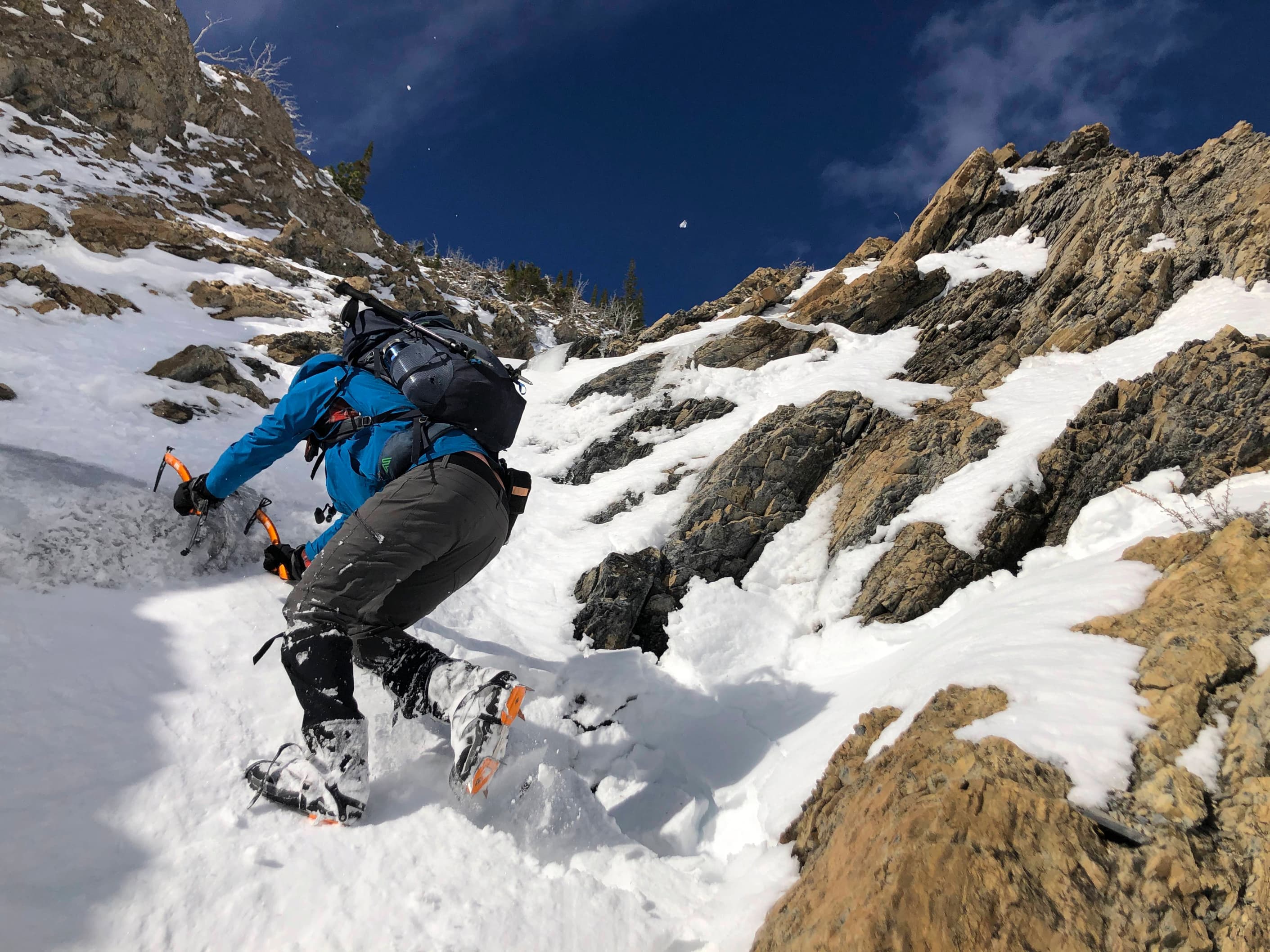
Tackling a short, but steep section. (Photo by Andrew Nugara)

Andrew follows me up.

The condition of the snow and ice improved the higher we went.

Making our way along the gully. It was steeper than it looked! (Photo by Andrew Nugara)

Looking back to Andrew.

Passing a small section of ice. (Photo by Andrew Nugara)

My view from the previous photo. This was the point where we should have left the gully to traverse over to ‘Bridle Peak’.

Andrew’s turn to lead.

Drawing close to the top of the ridge.

While our ascent was slow, descending the upper portion of the gully would be quick. (Photo by Andrew Nugara)

Another look back. (Photo by Andrew Nugara)

Ice would make this section trickier than it normally would be.

Andrew carefully scrambles the ice-covered rock.

Another look back.

Arriving on the ridge.

A pano to the north…

And then to the southeast.

Looking to the northeast at ‘Bridle Peak’ and ‘Cinch Hill’. There was no way to reach them without considerable elevation loss and gain. Oh well! As a consolation, I proclaimed this small peak as, “The Stirrup”. 😂😂

Another look to the northwest that includes: Victoria Peak (far left), “Prairie Storm” (centre), “Prairie Sky” (right of centre), “Prairie Fire” (right), “Prairie Oyster” (right), and Prairie Bluff (far right). (Photo by Andrew Nugara)

A closer look at Victoria Peak.

A better look at “Prairie Sky” (left), “Prairie Fire” (centre), “Prairie Oyster” (left), and Prairie Bluff (right).

A summit that I visited in 2021, but have never written a trip report for: Christie Mine Ridge.

Gazing across to Drywood Mountain. The little shoulder on the far left is “The Knot” – another winter destination similar to “The Stirrup”.

Looking south at “Pastry Peak” (left of centre) and the summit of Loaf Mountain (right).

Despite the miscalculation, the views were still great. 😊 (Photo by Andrew Nugara)

Another cool pano that shows “The Stirrup”. (Photo by Andrew Nugara)

Carefully down-climbing our way off the ridge.

Back on easy terrain.

Descending our ascent gully. Good snow ensured that it would only take us 15 minutes to reach the 1/2 way point on the way back. (Photo by Andrew Nugara)

At approximately the halfway point, we left the gully to follow the ridge located between the two main gullies.

Glancing back to “The Stirrup” (centre) from the small ridge. Our ascent/descent gully is on the left.

From here, it was an easy hike to reach the trail.

Almost back at the creek.

Arriving back at the creek. (Photo by Andrew Nugara)

Back on the North Drywood Creek trail.

One last look at our route, with the main gully on the left and “The Stirrup” just to the right of centre.

A ram crosses the trail in front of us.

I guess this signals the ‘end’ of the trip? 😂

Arriving back at the trailhead five hours after starting. Despite the change in plans and then getting sidetracked by the fun of climbing a gully, this trip was far from pointless. It was a fantastic day of exploring and exercise in the mountains – and a reminder as to how much fun winter can be. 😁


Leave a Reply