
 Hiking and scrambling are inherently dangerous activities. Please read my Disclaimer.
Facing yet another day of raging chinook winds, Brad and I turned our attention to an old friend: Prairie Bluff Mountain. Despite having multiple ascents using multiple routes between us, the northeast face is by far our favourite aspect – especially when it comes to quick and accessible winter climbs. I was introduced to the joys of a northeast winter ascent by Brad in November 2022 when we repeated a route that Brad and Dave Fuller had pioneered several years prior. It was so much fun, that we introduced Andy Nugara to this route in January 2025 and it was during this trip, that we became intrigued by a second couloir located a few hundred metres to the north.
So, in need of finding a trip that was sheltered from the 100+ km winds, we decided to attempt this second couloir to see if it would go. We had no idea if we’d eventually be cliffed-out or if the snow would be conducive to an ascent, but we were determined to try. After all, when the wind is ripping like it was, you’re pretty limited in your options, so you may as well use it to explore. 🙂
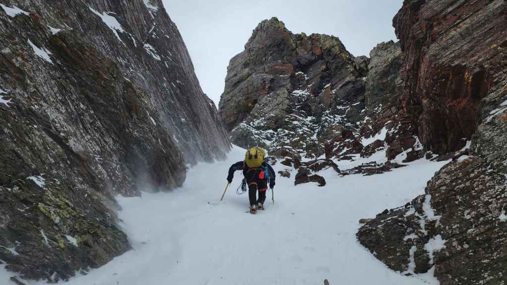
Parking further to the north than our previous northeast ascents, we made quick time getting to the base of the mountain and the start of the couloir. Even in the relative shelter of the base, the wind was strong and spindrift flowed like a waterfall over the rocks toward us. On the way up, I joked that I should start nicknaming objectives after certain popular princess characters so that my granddaughters will grow up with a strong desire to climb mountains, and after seeing the spindrift swirl around the castle-like spires at the entrance to the couloir, I chose, “Frozen Princess” as the moniker. Besides, we needed a way to distinguish this couloir from the one further to the south. 🙂
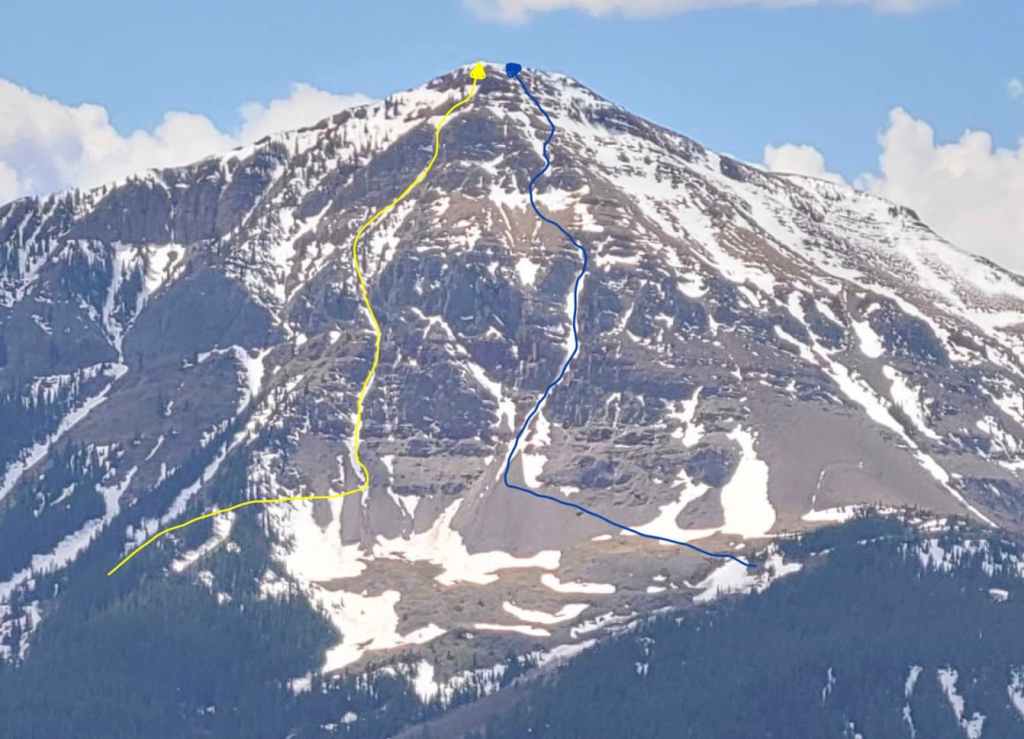
Not knowing what to expect, we had brought technical gear just in case, but outside of our axes and crampons, we didn’t need to pull out the rope as the entire route worked beautifully. Indeed, the first couloir was amazing and outside of a small crux near the top, it was a fantastic ascent as we worked our way upwards between the steep canyon walls. The snow was perfect and when combined with Brad’s masterful lead, the steep terrain was a non-issue and we could enjoy our colourful surroundings.
With the first couloir taking us halfway up the mountain, we emerged onto a scree slope at the base of a cliff band. Here, Brad once again used his expertise to find a second couloir that took us to the top. The only crux was a short but exposed climb up a steep slope near the top. Once we were past this, we found ourselves standing beneath the summit. It looked like a simple scramble to the top, but the rock was steeper than it appeared and it took us a bit longer than we were expecting to reach the cornice guarding the summit.
Blasted by wind as soon as we climbed over the cornice and onto the summit, we made a hasty retreat towards the north ridge of Prairie Bluff. This was a route that I had used for ascent and descent in 2020 and 2022, so I knew it would be an easy way off. However, instead of the following the north ridge, we found a wonderful snow gully next to it that we could easily and enjoyably descend back to the base. From here it was a quick hike back to the road and my truck.
All in all, despite not having any idea if this route would work for a winter ascent, “Frozen Princess” ended up being a happily ever after. In fact, outside of the two minor cruxes, the only real antagonist was the wind – and like any good twist in the narrative, it was the antagonist that led us to choose this route in the first place. 🙂
Finally, for my eighth time up Prairie Bluff using my fifth different route, I have to once again say, that this little peak never ceases to amaze me. It always has something more to offer, especially when it comes to the shortened days of winter. Again, a massive thanks to Brad for his terrific lead and for another super fun day in the mountains!
To get to “Frozen Princess”, we drove south on Highway 6 from Pincher Creek until we reached the Shell Waterton Complex Road (Township Rd. 43A). We then turned onto this road and drove west for ~9.1 km until we came to a junction with a gravel road near to the entrance of the plant. Here, we turned left and onto the gravel road where we continued straight for ~3.9 km until we came to Butcher Lake. We continued straight for another ~1.5 km, until we arrived a Shell pumping house which is the original Windsor Ridge trailhead. We kept following the road as it curved to the right, continuing along it for another ~3.8 km until we arrived at a small radio tower located on the left side of the road. A further drive of approximately 1 km brought us to where some power lines cross the road. This was our parking spot and our starting point.
From my truck we headed into the forest and towards Prairie Bluff. Approximately 35 minutes (~720 m distance; 186 m elevation gain) of light bushwhacking up a surprisingly steep slopes, brought us onto a ridge overlooking the base of the northeast face. A further ~350 m of hiking brought us to the actual base of the mountain and the start of our ascent route.
After making our way up the initial apron, we came to a fork with the entrance to “Frozen Princess” located on the right. A delightful ascent of the ~327 m long (213 m elevation gain) couloir brought us onto a small scree slope approximately halfway up the mountain. Angling to climber’s left, we were able to locate a short couloir (~114 m long; 52 m elevation gain) that took us up and back towards the north. The top of the couloir joined a short but exposed slope that required care and patience to ascend.
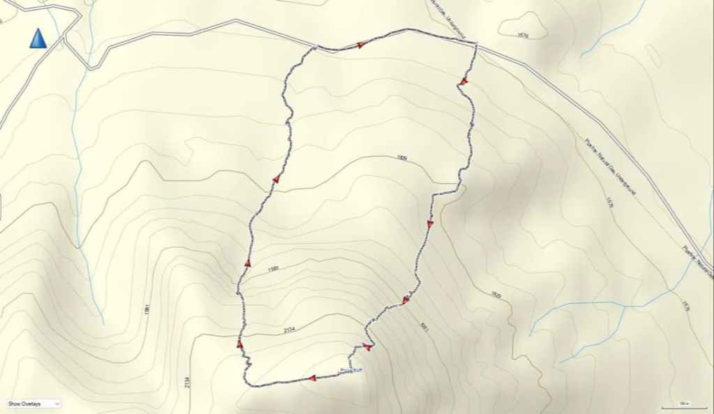
Once above the this slope, we found ourselves directly beneath the summit where a short scramble brought us to the top. To descend, we followed the west ridge for ~710 m until we arrived at the point where the north ridge joins. From here, instead of following the north ridge down, we descended into the drainage just to the east of it (skier’s right). This ended up being a wonderful ~300 m snow gully to navigate through the cliff bands. Once at the bottom, we continued to follow the gully for ~600 m back to the road where we then made the easy ~570 m downhill walk back to my truck.
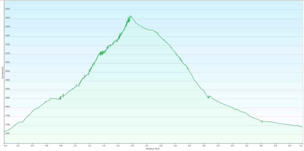
Our total roundtrip distance was 4.9 km and our total roundtrip time was 5 hours and 40 minutes. Total elevations gains came in at 651 m. In total, it was ~1.7 km from my truck to the summit with an elevation gain of 632 m.
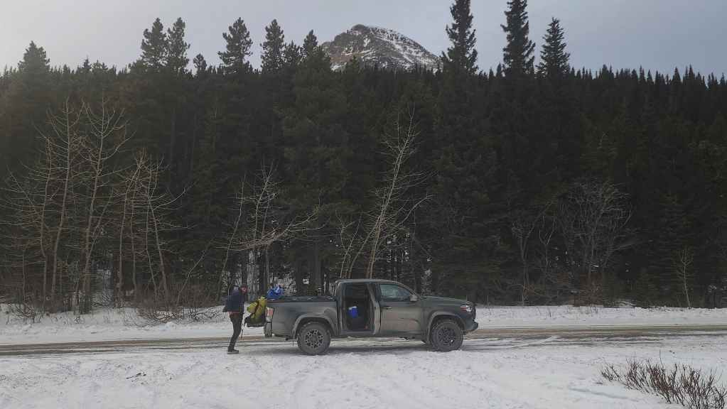
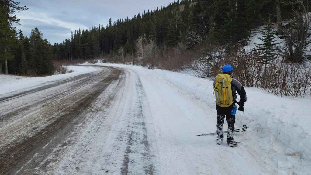
Gearing up on the side of the road with the summit of Prairie Bluff in the background.
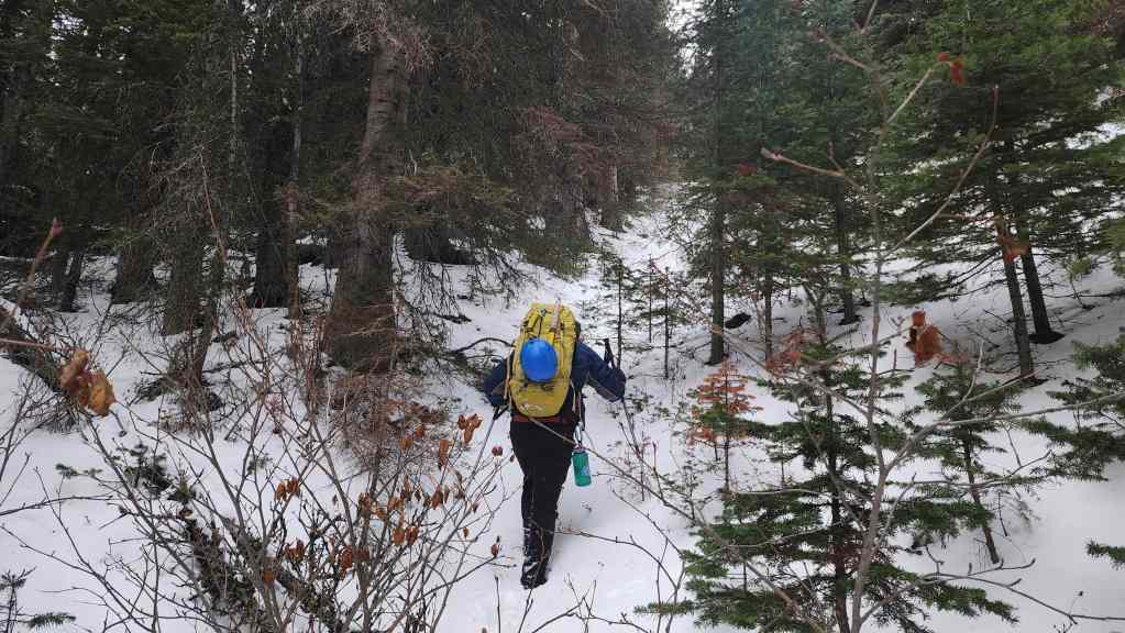
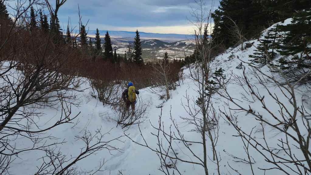
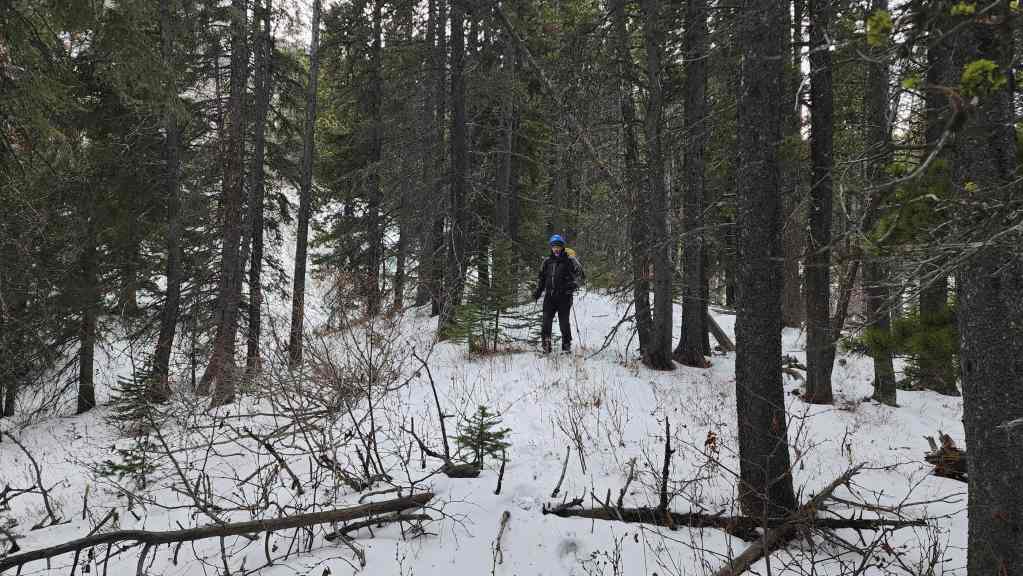
We trended slightly to climber’s left once we were in the trees, but it was more or less a straight line to the top of the ridge. The bushwhacking was light but the slope was surprisingly steep.

Approximately 35 minutes after starting (~720 m distance), we arrived on an open section of ridge with a clear view to the start (centre) of the “Frozen Princess”. However, the main couloir itself is not visible from this vantage.
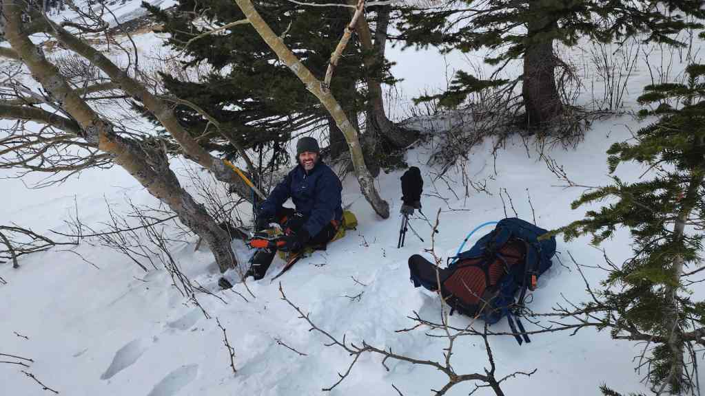
Taking shelter in the trees while we put on our harnesses and crampons.
Making the trip towards the base while being blasted by the wind. Both of us were staggered more than once and it was not from the black rum that Brad had in his pack. 😂
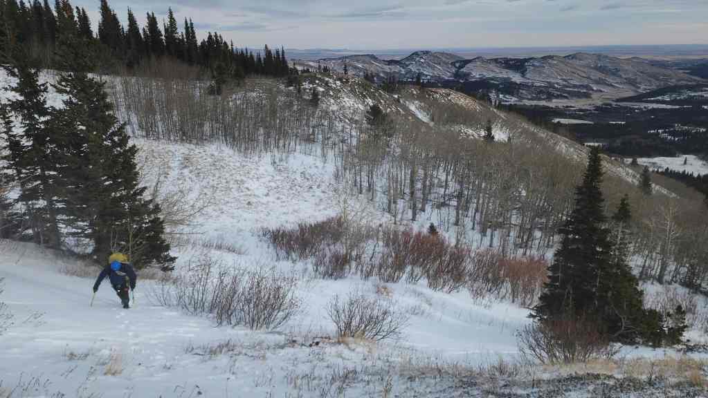
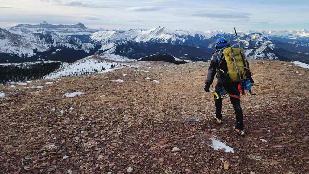
Looking back to the open section of ridge (centre) where we emerged from the trees on our way up.

The base wasn’t as sheltered as we thought it would be!

Spindrift flows like water over the rocks.
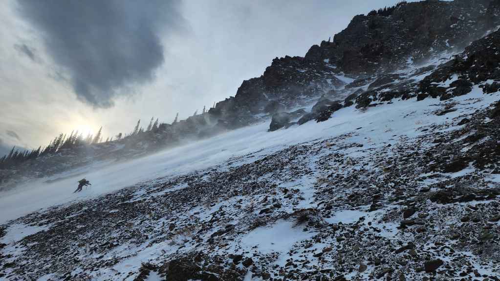
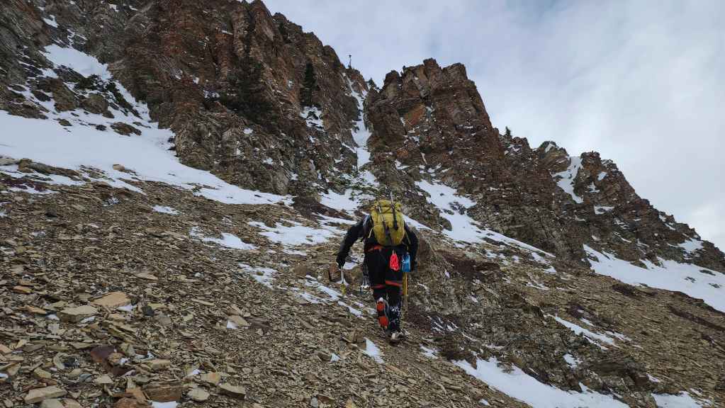
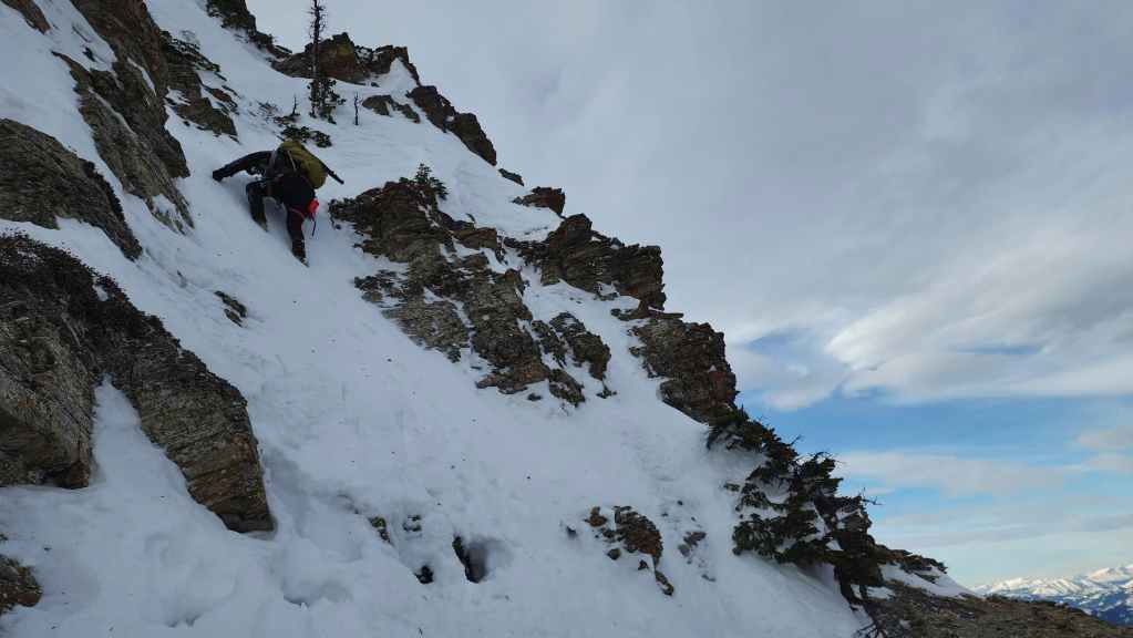
Brad leans into the wind as we start our ascent.
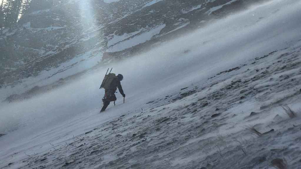
A closer look at Brad and the river of spindrift.

Nearing the start of “Frozen Princess”. On the way up, I joked that I should start nicknaming objectives after certain popular princess characters so that my granddaughters will grow up with a strong desire to climb mountains. After seeing the spindrift swirl around the castle-like spires at the entrance to the couloir, I chose, “Frozen Princess” as the moniker. Besides, we needed a way to distinguish this couloir from the one further to the south and given the conditions, this one seemed to fit. 🙂

Brad’s view back from the previous photo. (Photo by Brad Wolcott)
Brad skirts across a hard-packed section of snow.

Arriving at the entrance (centre) to “Frozen Princess”.

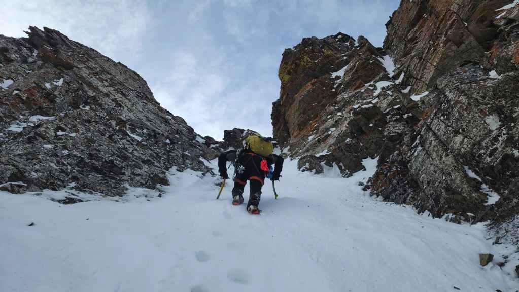
Starting up. We had no idea if this route would work.
One of the few times that I took the lead. (Photo by Brad Wolcott)

Approaching the point where the couloir begins to narrow. (Photo by Brad Wolcott)

My view back to Brad from the previous photo.
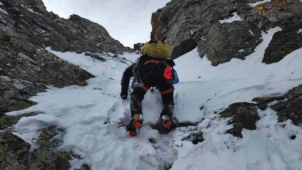
Back in the lead, Brad continues our climb…

Just as the terrain begins to steepen.
A quick look back at the entrance to “Frozen Princess”.
The couloir continued to narrow and steepen.
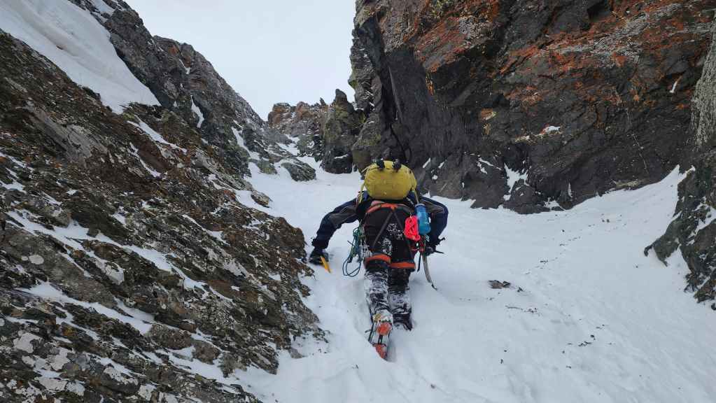
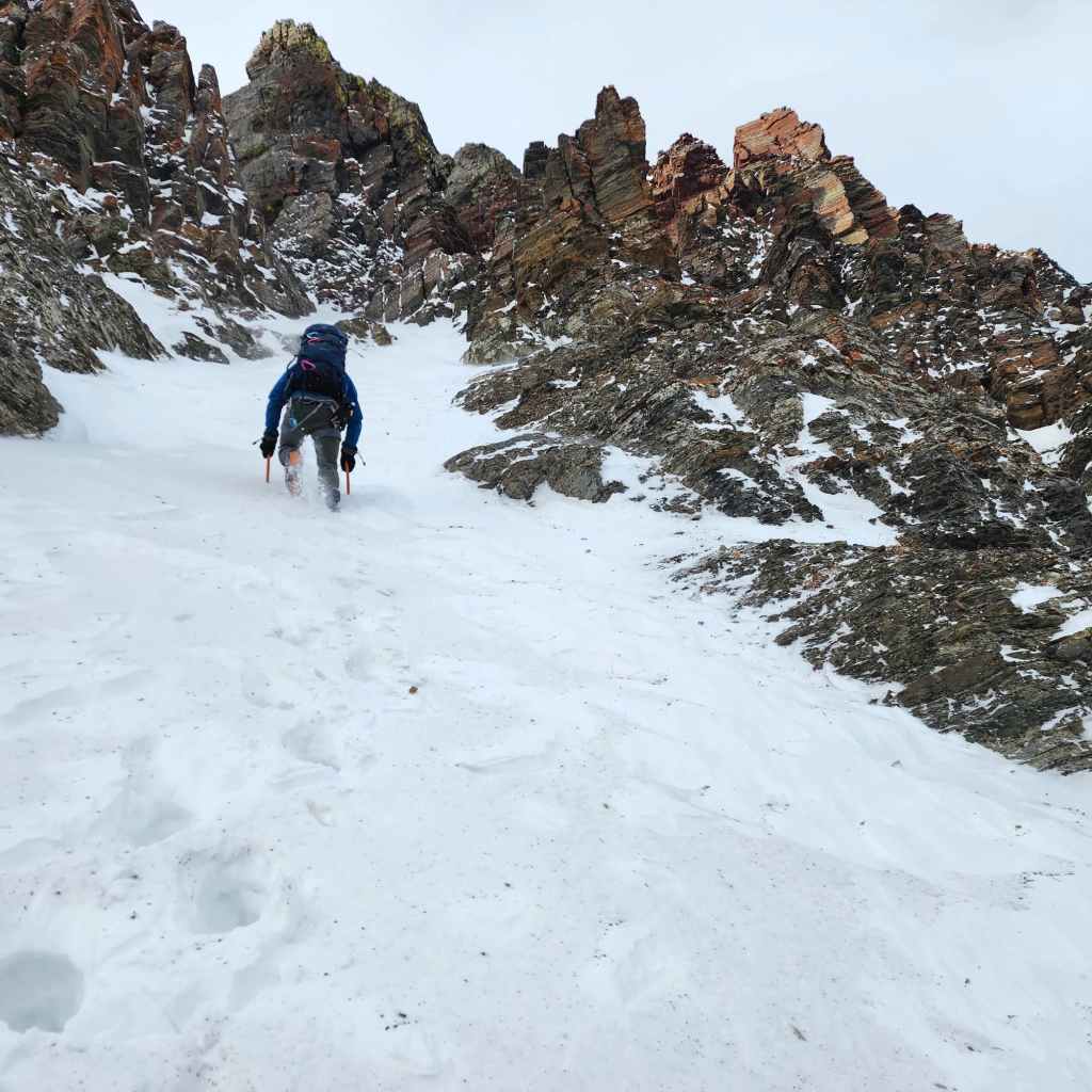
We soon found ourselves surrounded by colourful red argillite.

More of the same.
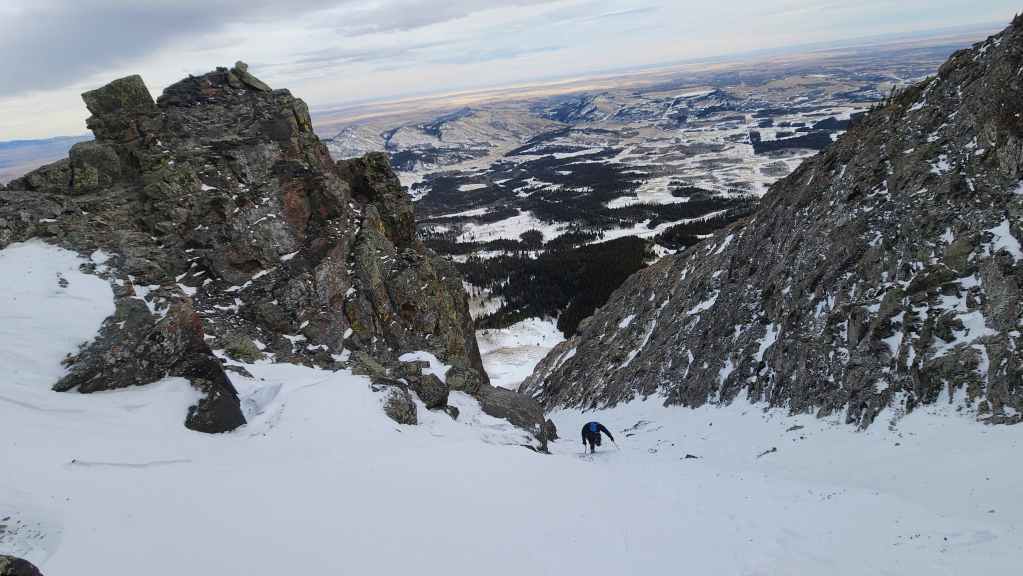
Looking back from approximately halfway up the couloir. So far, so good! 🙂
Brad checks out a particularly colourful section of rock.

Continuing to make our way up.
We’ll stop for a break in the shelter of the large rock just to the right of Brad. The innocuous-looking patch of rock on the left is actually the crux of this couloir; though we didn’t know it yet.
Break time!

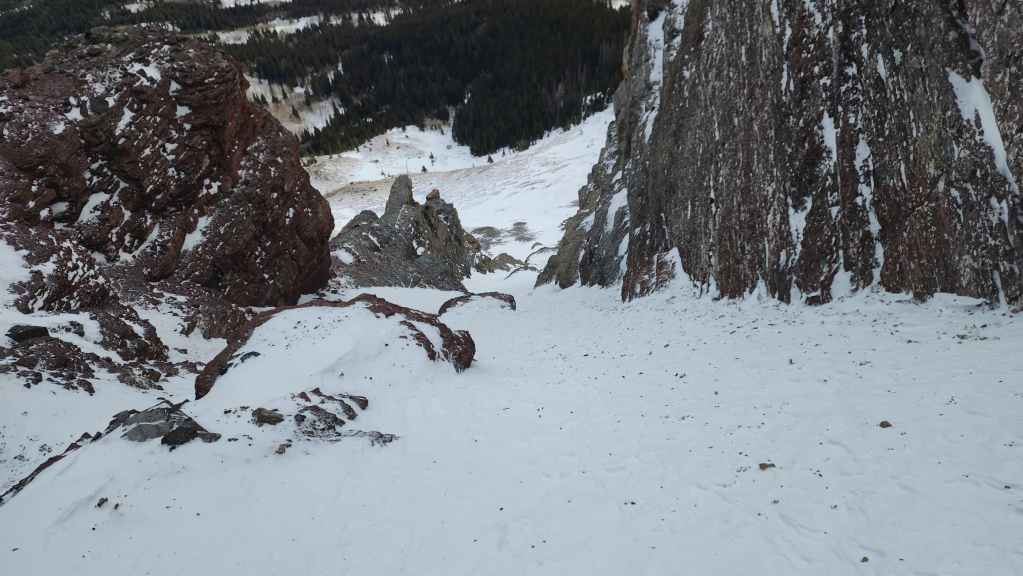
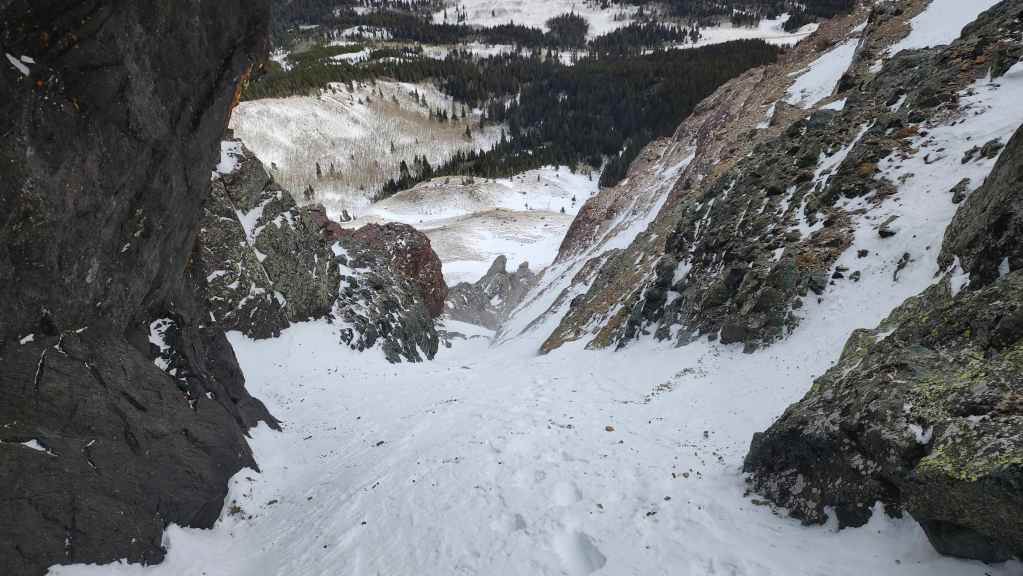
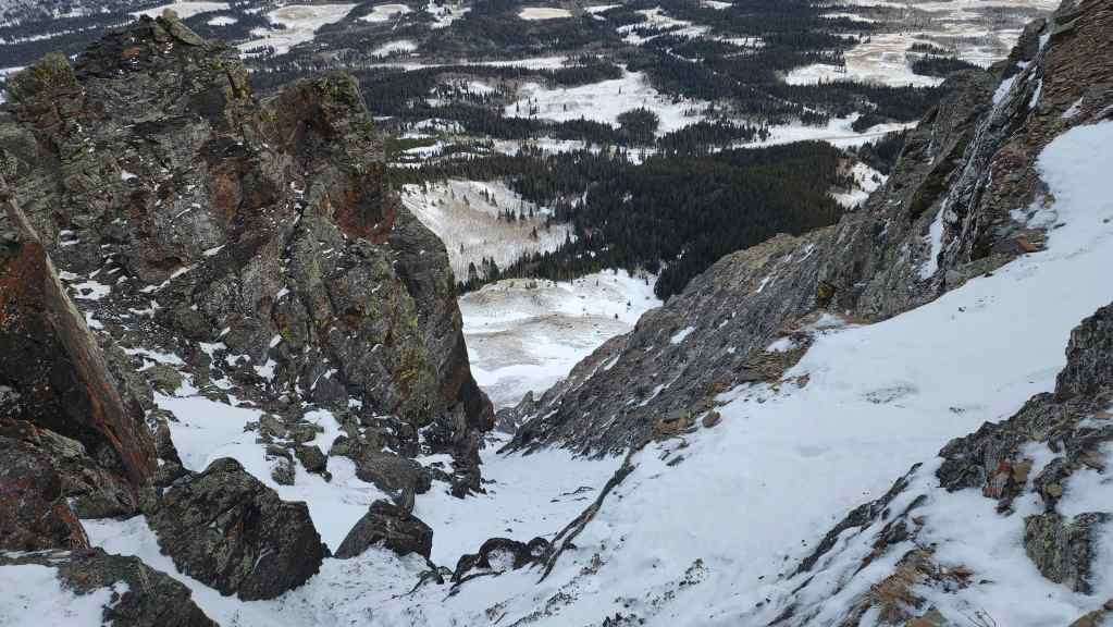
Brad accidentally dropped some webbing and had to climb down from our lunch spot to retrieve it. While this sucked, it also gave me time to snap a couple of photos looking down the couloir.
Brad’s on his way back after retrieving the webbing.

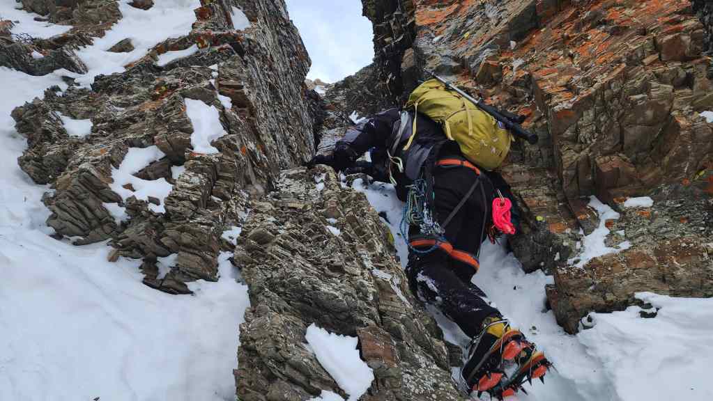
Starting up the innocuous-looking crux…

While trying to climb over the crux, Brad suddenly sunk in the snow, opening a hollow cavern that was deeper than the height of either of us. Falling beneath the snow here would not have been good, so we had to make a quick bypass to climber’s right. In the summer, this opening may be part of a sizeable step.
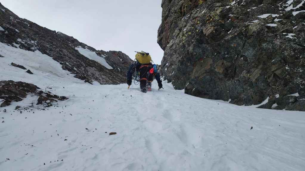
Nearing the upper part of the couloir after bypassing the crux.
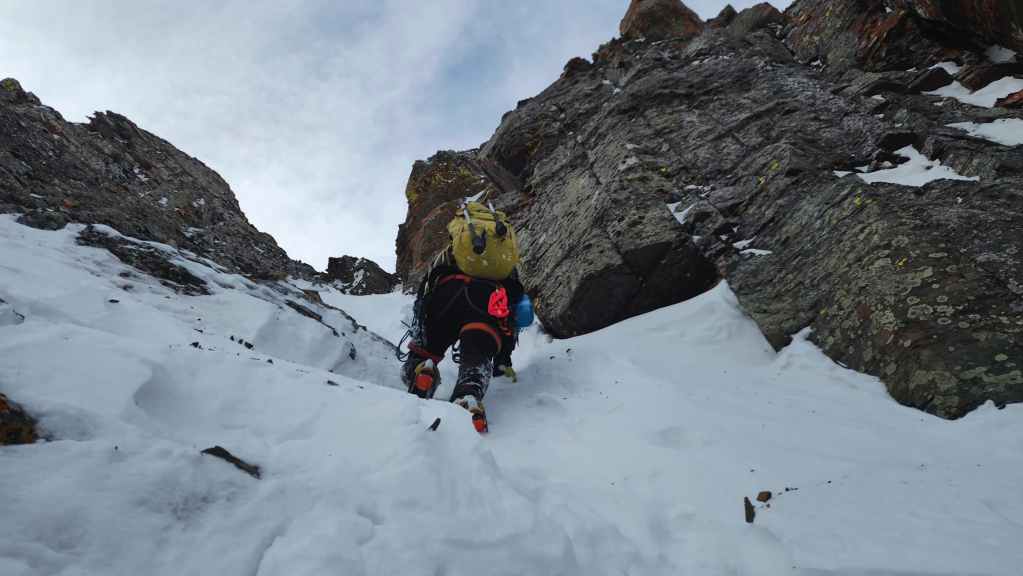
The terrain continues to steepen.

Brad’s view back to me with the crux in the centre. (Photo by Brad Wolcott)
My view back from the previous photo.
Arriving at the top of the first couloir…

Followed by another look back. (Photo by Brad Wolcott)
Brad uses a small chimney to climb out of the couloir.

Brad’s view back and through the chimney. (Photo by Brad Wolcott)
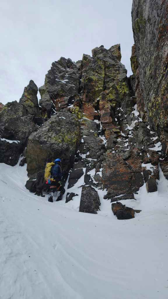
Brad emerges from the chimney and scopes out the upcoming cliff band. With the first couloir now behind us, we were feeling pretty optimistic.
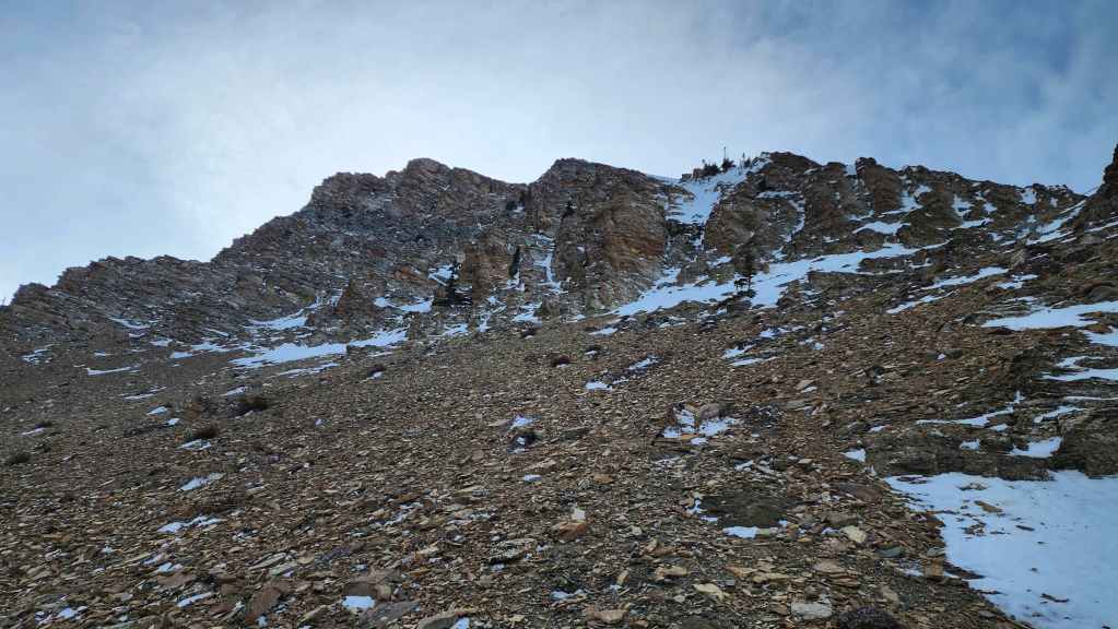
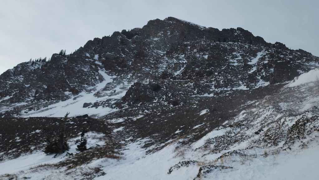
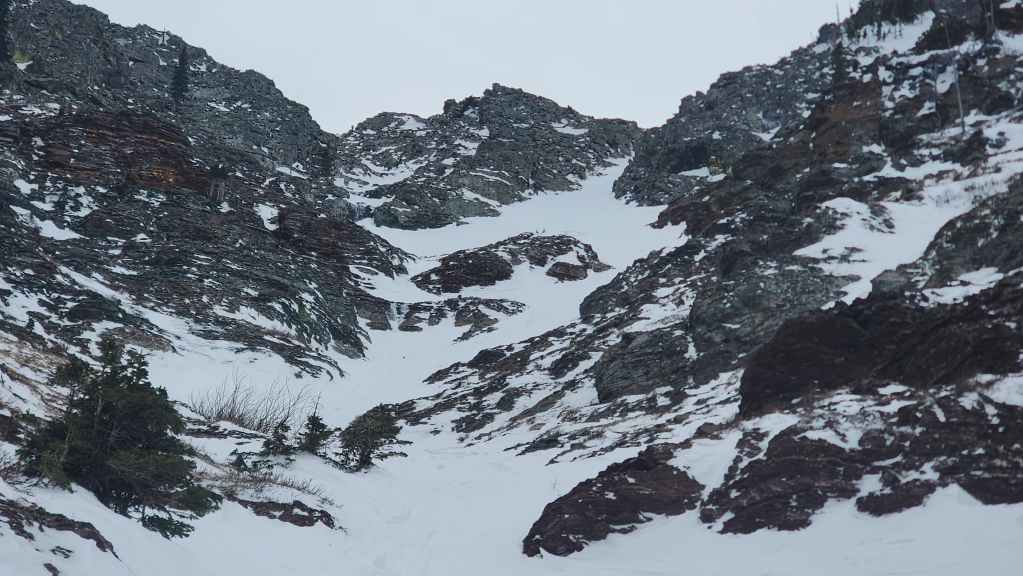
What Brad was looking at in the previous photo: a short section of scree followed by a set of cliffs.
Brad heads toward a small couloir (centre) that he hopes will take us above the cliff band.
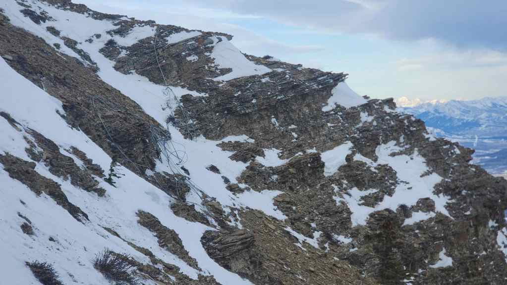
A pile of cable litters the slope.

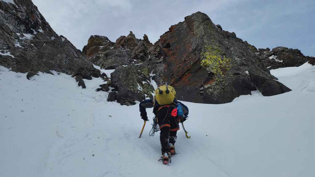
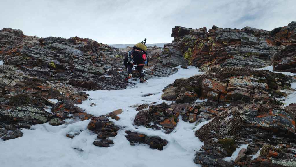
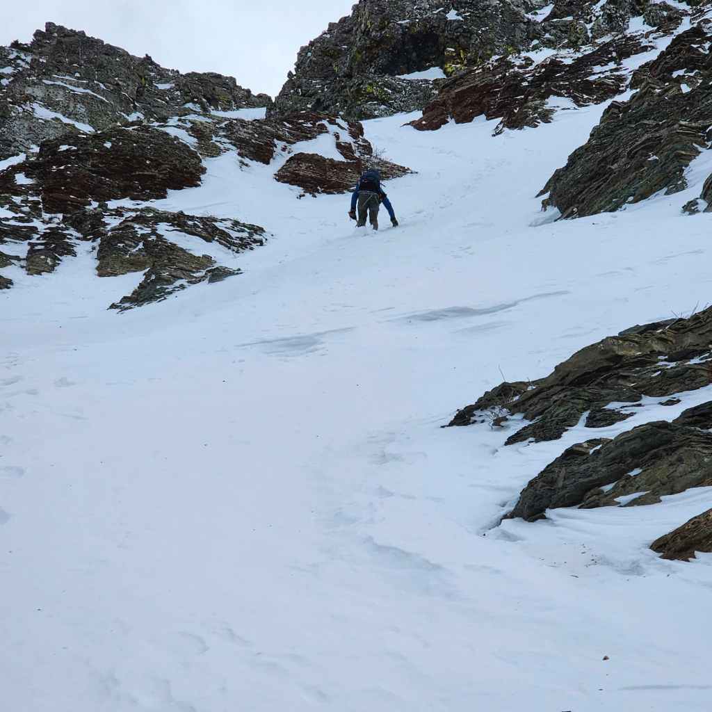
Brad starts up the small couloir.
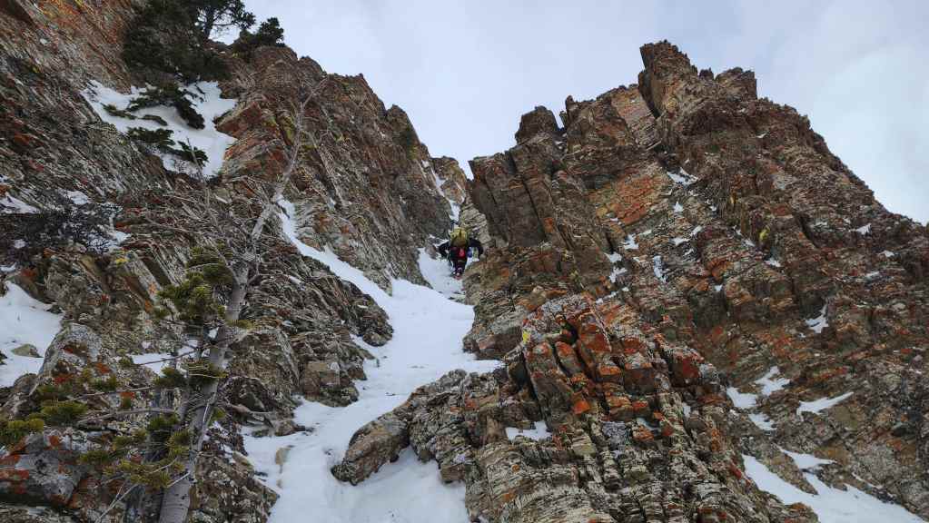
It looks like it will work! So of course, I follow him up. 😂

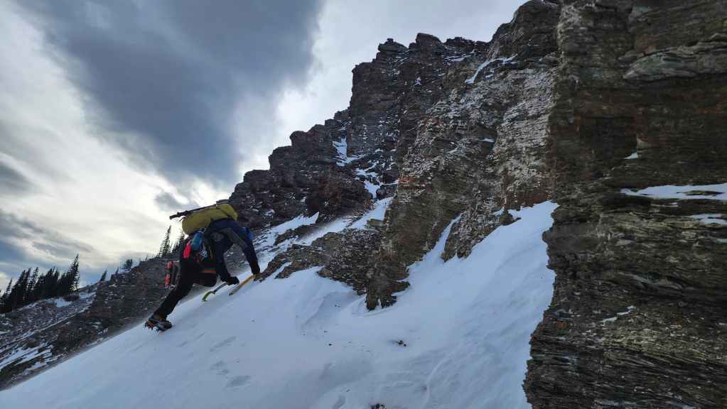
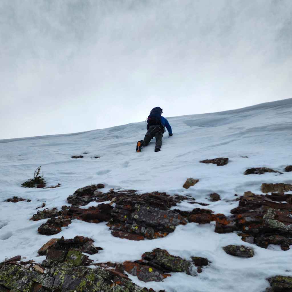
The couloir led onto an exposed slope which would prove to be the most difficult obstacle of the day.
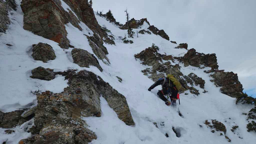
It wasn’t a huge distance to cover, but we needed to exercise a level of patience and caution.
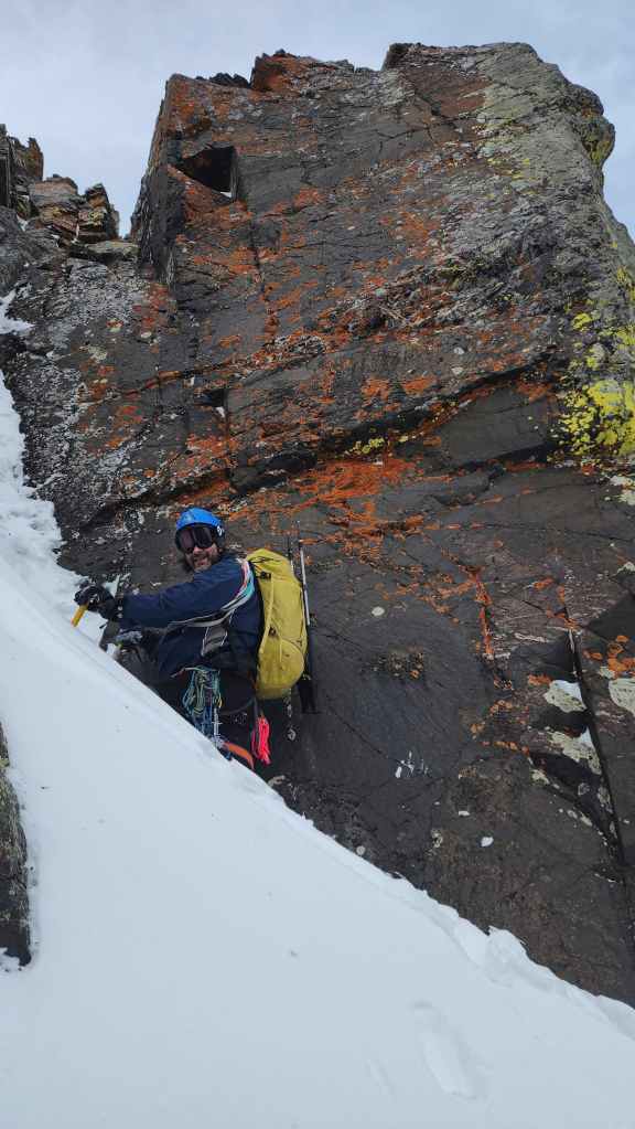
Brad tackles the trickiest section.
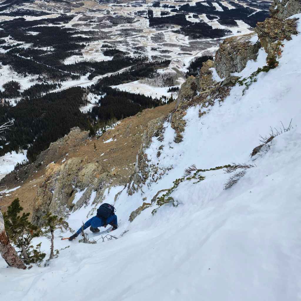
Brad’s view down to me after successfully navigating the crux. From this vantage, you can see how steep the terrain really is. (Photo by Brad Wolcott)
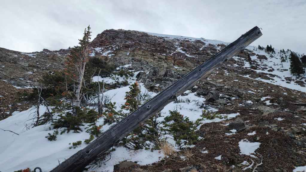
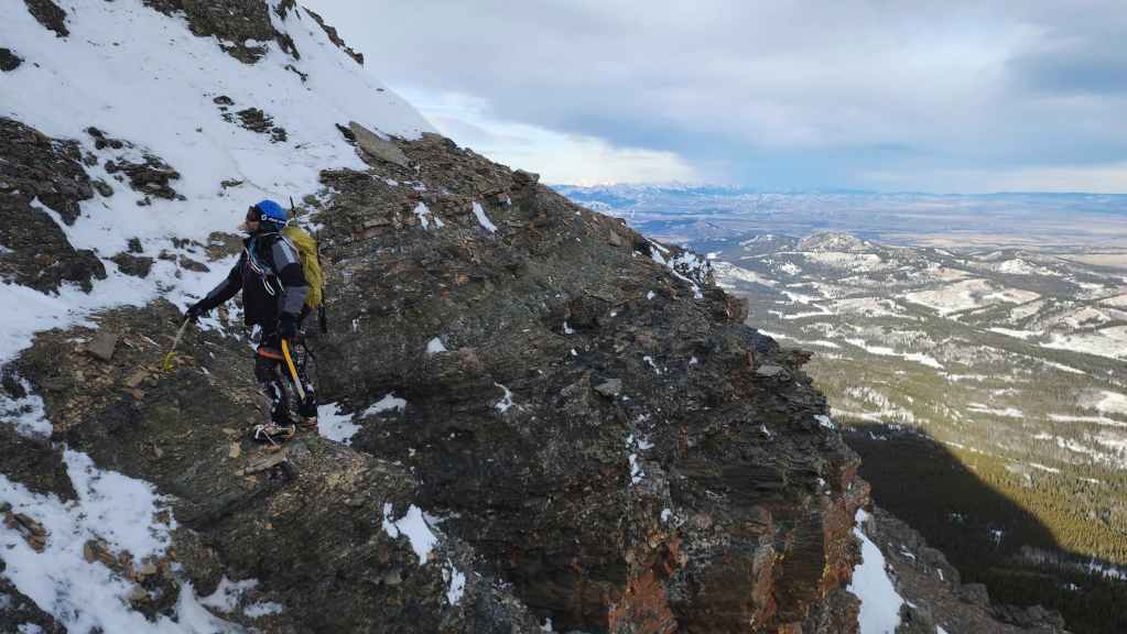
Now above the cliff band, and directly below the summit (centre). In front of me is an old pole and a bunch of discarded cabling.

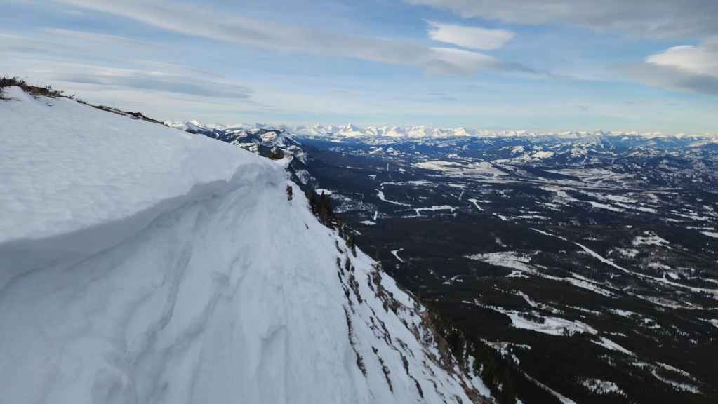
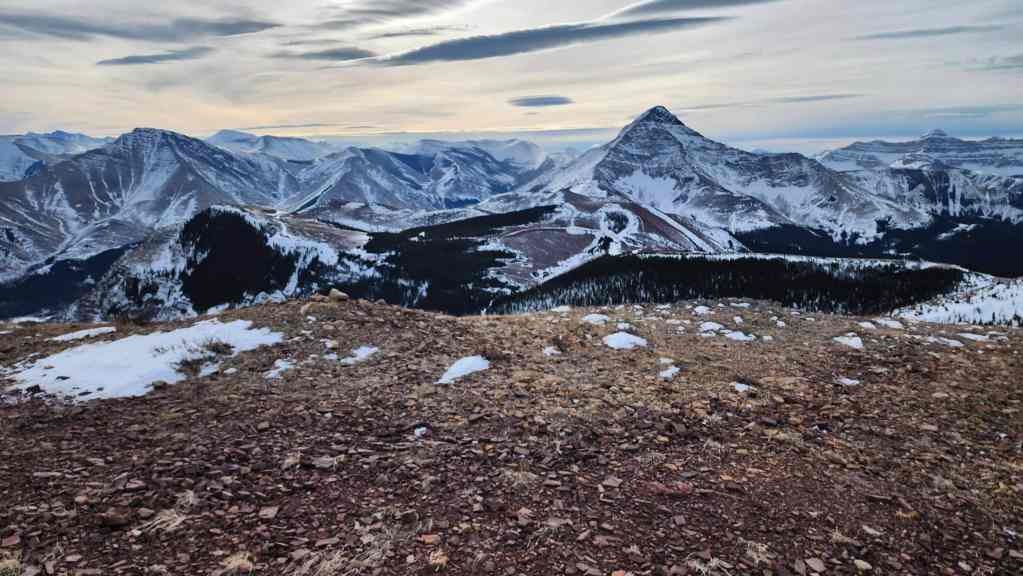
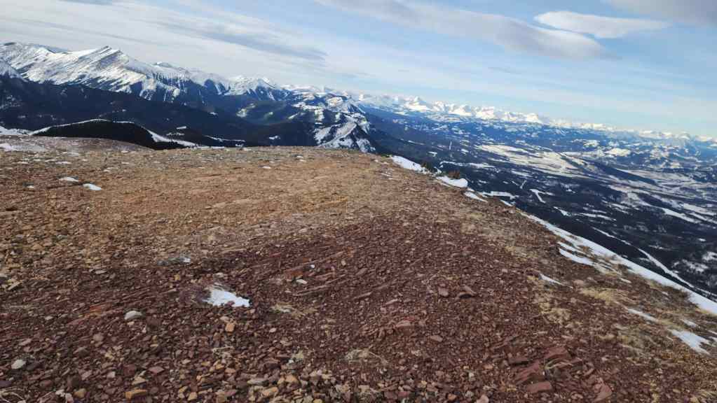
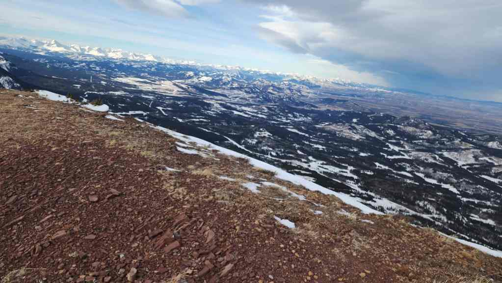
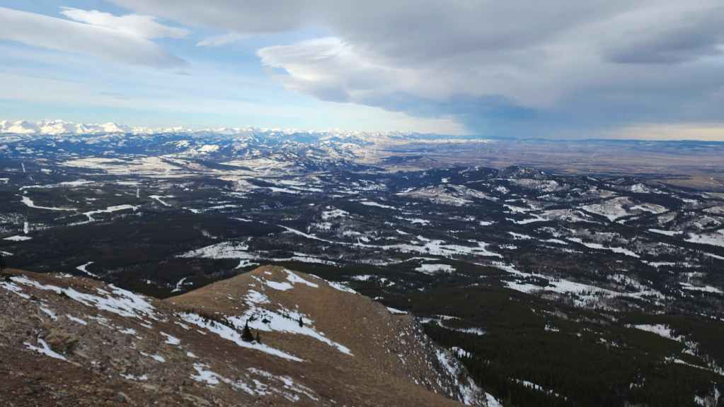
A quick look to the west while still sheltered from the brunt of the wind.
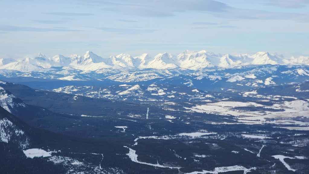
A closer look at the southern section of the Flatheads…

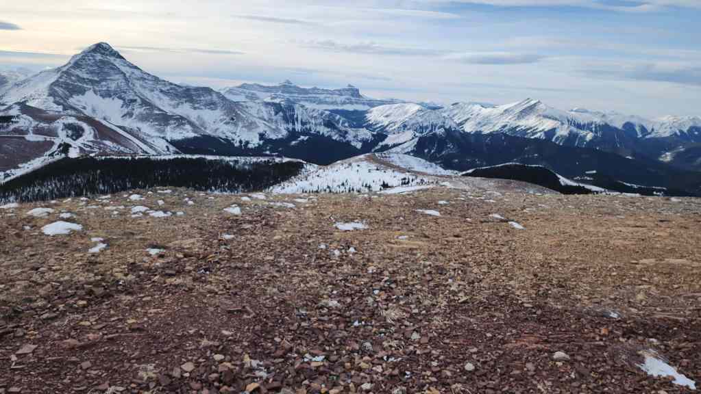
Followed by the northern section.
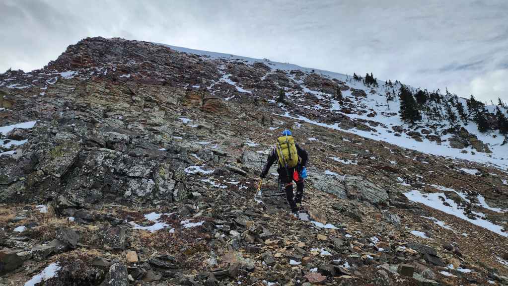
Heading up to the summit. This next section looked like a cakewalk, but it was deceptively steep.
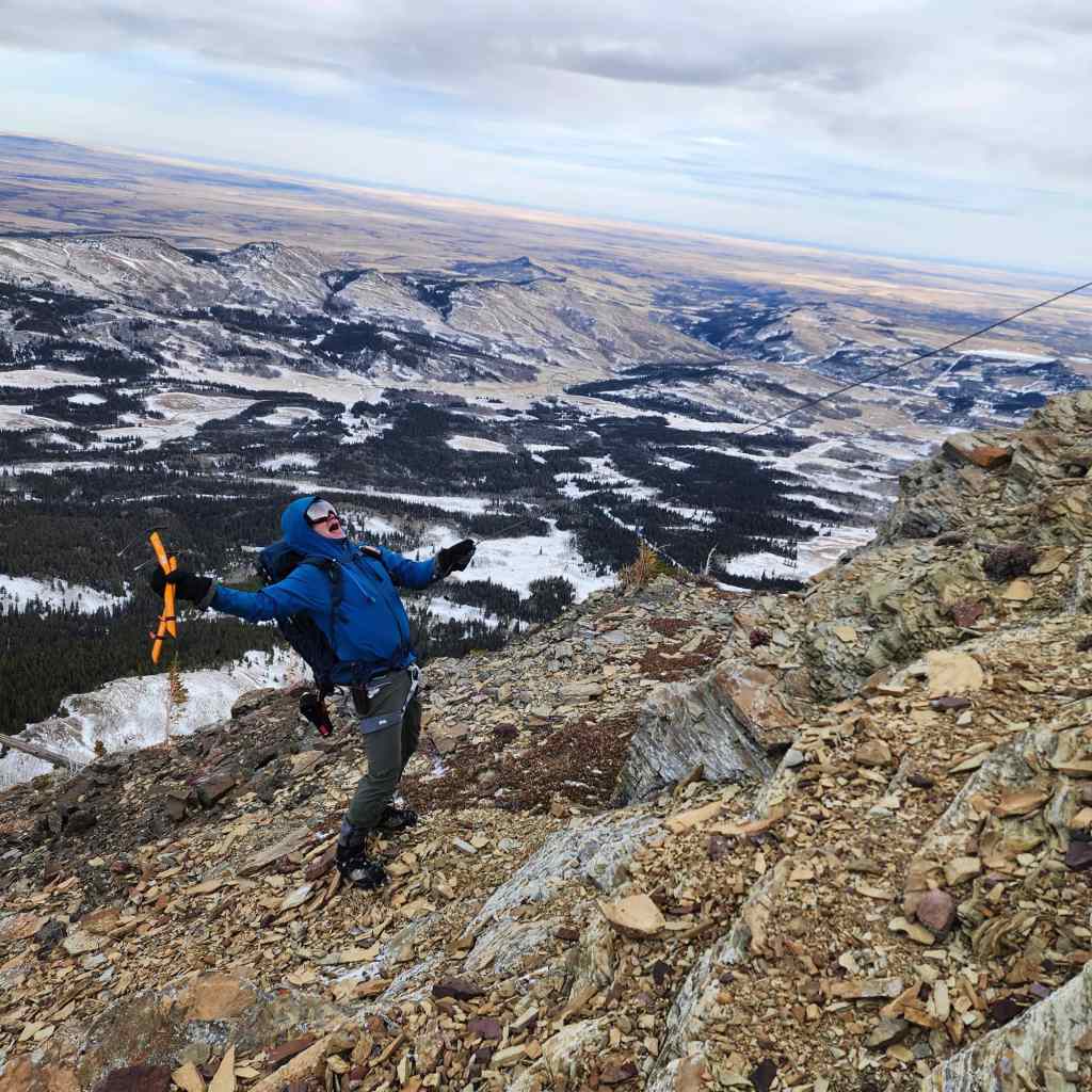
I feign electrocution after grabbing onto one of the many cables that were laying about. Such antics should not ‘shock’ anyone who knows me. 😂
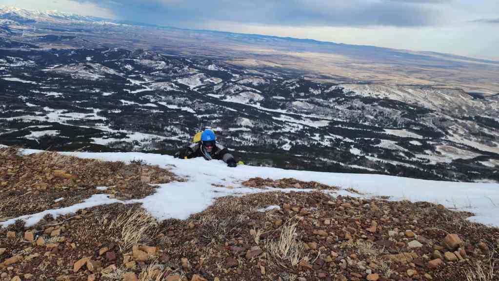
Heading up to the summit.
Brad being the great guy that he is and after leading for most of the day, said that I should be the first to climb onto the summit. What a great friend – or maybe, just maybe, he wanted to see if the wind was strong enough to decapitate me when I reached the top. 😂 (Photo by Brad Wolcott)
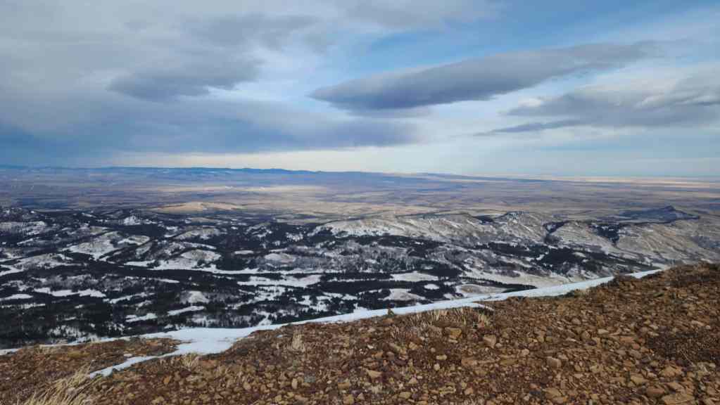
Looking to the west before decapitation…

And then over at the summit cairn.
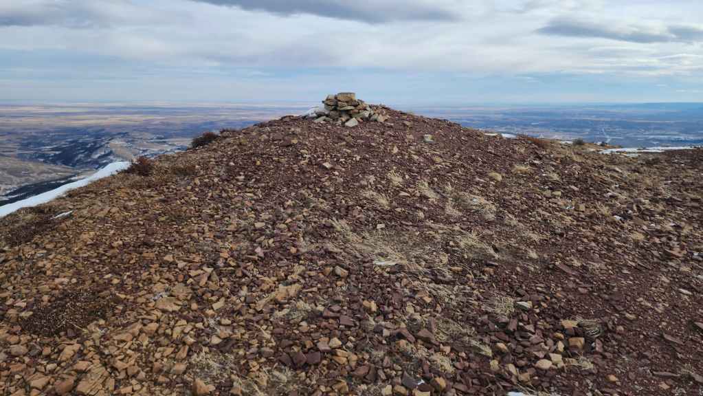
The summit of Prairie Bluff (2258 m). This was my eighth time on the summit using my fifth different route – and holy crap was it windy!!

I had to kneel to keep steady. Here’s the view to the south…
Then to the southwest.
Facing into the wind and looking west…
Then being blown over while looking northwest…
and north.
Finally, the view from my knees to the northeast.
After seeing my head remain attached, Brad tries his luck with the wind.

The spindrift from his climb over the cornice shows how windy it was.
We essentially emerged onto the summit and then made a hasty trip against the wind as we walked towards the north ridge. We were knocked and staggered more than a few times. It was brutal. In fact the wind over the past month has been extra spicy, with my friend, Mark, who lives near the base of Spread Eagle Mountain, telling me that the Shell plant clocked wind speeds in excess of 160 km/h a couple of weeks ago, while his neighbour’s anemometer recorded 155 km/h. Yikes!

Dropping down next to the north ridge.

Before heading onto the north ridge, we decided to see if there was a way out through the drainage located just to the east.
A look at the chinook arch above Prairie Bluff’s north ridge.
Entering the drainage.

Great success! There was an easy snow gully we could descend. (Photo by Brad Wolcott)
While singing the theme song from Spiderman, Brad sailed past me on the way down. 😂 (Photo by Brad Wolcott).
Brad glissades down a short section.
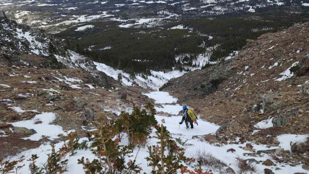
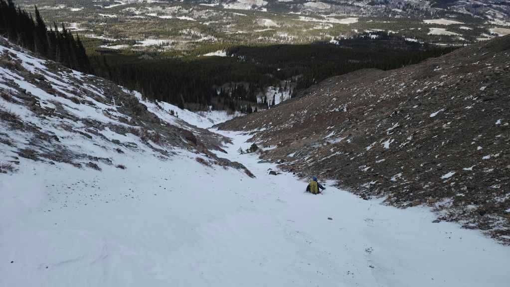
Looking back at the top section of the snow gully. This was the ideal descent route.

Brad enjoys a Colt and some rum while he waits for me at the bottom of the gully.
Following the drainage back to the road.

A final look at our awesome descent gully.

On the way out, we only encountered a few sections of deep snow.
Otherwise, it was a very quick trip off the mountain.
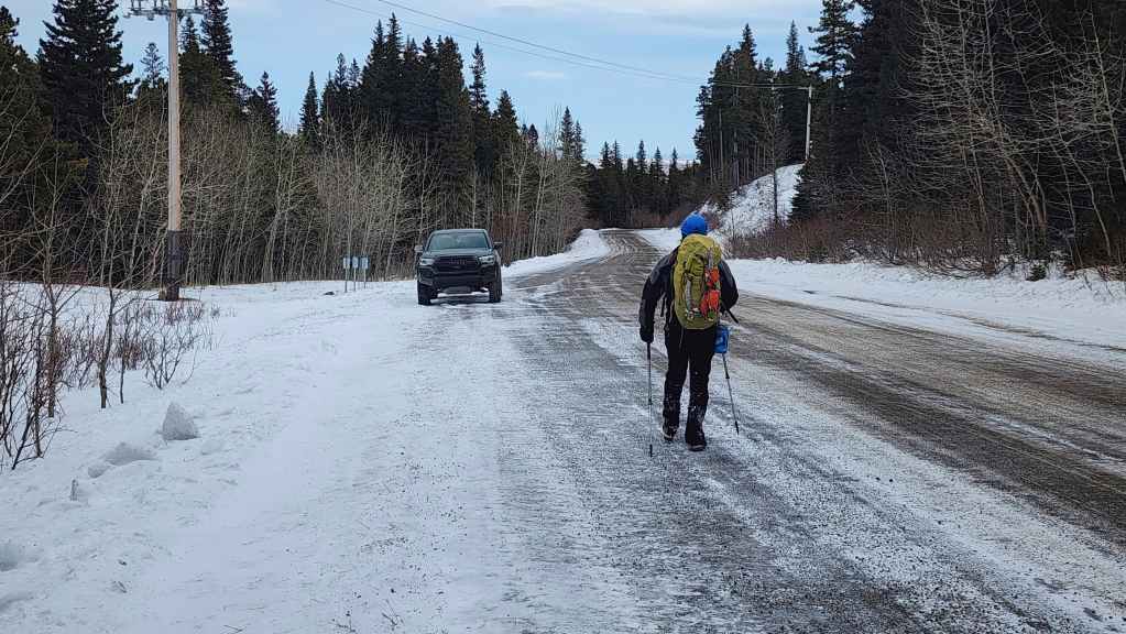
Back on the road and preparing to make the easy ~570 m downhill walk back to my truck.
Arriving back at my truck after ~4.9 km and 5 hours and 40 minutes. This ended up being a fantastic day of exploration on one of the most accessible and versatile little peaks in the Castle. Again, huge thanks to Brad for his lead – and his humour. 🙂